Protecting Western Australia's Big Blue Backyard - The Pew ...
Protecting Western Australia's Big Blue Backyard - The Pew ...
Protecting Western Australia's Big Blue Backyard - The Pew ...
- No tags were found...

Create successful ePaper yourself
Turn your PDF publications into a flip-book with our unique Google optimized e-Paper software.
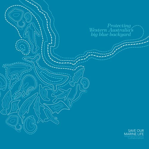
<strong>Protecting</strong><strong>Western</strong> Australia sbig blue backyardSAVE OURMARINE LIFECollaboration
SAVE OUR MARINE LIFEWWW.SAVEOURMARINELIFE.ORG.AU<strong>The</strong> Save our Marine Life Collaboration of global,national and state-based environment organisationsis built around a common vision to conserve Australia’sunique marine life through working with localcommunities, governments, industry stakeholdersand Traditional Owners to secure a network of largeno-take reserves in Australia’s marine environment.Save our Marine Life collaborators<strong>The</strong> <strong>Pew</strong> Environment Group is the conservation armof the <strong>Pew</strong> Charitable Trusts. <strong>The</strong> mission of the<strong>Pew</strong> Environment Group is to strengthen environmentalpolicy through targeted initiatives aimed at producingconcrete and measurable conservation gains in bothterrestrial and marine systems worldwide. <strong>Pew</strong> worksthrough partnerships to secure policy reforms andon-ground outcomes that curb global warming, protectocean life and preserve wilderness. <strong>Pew</strong> has joined with<strong>The</strong> Nature Conservancy to establish the Wild Australiaprogram, a joint three-year program that seeks toconserve large natural areas in Australia, both onland and sea.<strong>The</strong> Nature Conservancy (TNC) is a leadingconservation organisation working around the worldto protect ecologically important lands and waters fornature and people. TNC has been working in Australiafor 10 years. Working with partners, TNC’s Australiaprogram has impacted more than 48 million hectaresthrough conservation action planning and has supportedthe protection and management of more than3.6 million hectares.For over 40 years the Australian Conservation Foundation(ACF) has been a strong voice for the environment,promoting solutions through research, consultation,education and partnerships. ACF works with thecommunity, business and government to protect,restore and sustain Australia’s environment.Since 1967 the Conservation Council of <strong>Western</strong> Australia(CCWA) has been the state’s peak non-governmentenvironment organisation. CCWA informs the publicand governments on key environmental issues andparticipates in government and community processesthat seek to restore and protect the natural environment.<strong>The</strong> Wilderness Society (TWS) is a national,community-based environmental advocacy organisationformed in 1976 whose mission is protecting, promotingand restoring wilderness and natural processes acrossAustralia’s lands and seas for the survival and ongoingevolution of life on Earth.WWF-Australia is part of the WWF International Network,the world’s largest and most experienced independentconservation organisation. Its mission is to stop thedegradation of the planet’s natural environment andto build a future in which humans live in harmony withnature, by conserving the world’s biological diversity;ensuring that the use of renewable natural resourcesis sustainable; and promoting the reduction of pollutionand wasteful consumption. With active projects inAustralia and the Oceania region, WWF works toconserve Australia’s plants and animals, by ending landclearing, addressing climate change, and preservingand protecting our fresh water, marine andland environments.<strong>The</strong> Australian Marine Conservation Society is anot-for-profit charity, dedicated to creating marinenational parks, making fisheries sustainable andprotecting and recovering ocean wildlife. It is anindependent scientifically based charity that has beendefending <strong>Australia's</strong> oceans for over 40 years.<strong>The</strong> Society was formed in 1965 to legally contestand successfully defeat an application to mine coralon the Great Barrier Reef. This victory was followedby <strong>Australia's</strong> largest sea-based campaign whichculminated in the formation of the Great Barrier ReefMarine Park World Heritage Area.Prepared for the Save our Marine Life Collaborationby the Australian Conservation Foundation© 2009 Australian Conservation FoundationAll rights reserved.Text and production: Chris SmythAustralian Conservation FoundationEditor: Cathy CooteDesign: Jon Chuo, Carla Hackettwww.jonchuo.comPre Press: Spitting ImagePrinter: Egoprintwww.egoprint.comMap illustrations: Tracey Gradywww.traceygrady.comISBN 978-0-9805237-2-0Distribution of ‘as is’ copies of this reportfor non-commercial purposes is permitted.Executive summary<strong>Western</strong> Australia’sbig blue backyard:unique and unprotectedRising to the challenge<strong>Protecting</strong> <strong>Western</strong> Australia’sthreatened marine lifestyleMaintaining <strong>Australia's</strong> internationalreputation in marine protection<strong>The</strong> many benefits of marine protectionWhat’s so special about<strong>Western</strong> Australia’sbig blue backyard?Current affairsTaking the tropics southCreating a unique marine regionBuilding a connection between peopleand the region’s marine world<strong>Western</strong> Australians connectingwith their marine environmentCrustaceans and molluscs ruleContents2471010141515162122<strong>The</strong> Houtman hotspot for marine life27<strong>The</strong> Leeuwin, larvae and lobsters27Life on the shelf28Trouble for the big reef fish28Down the continental slope28Diving deep into the grand Perth Canyon35Perth’s playground, penguins and the ‘porsche’35<strong>The</strong> pollution connection between land and sea36Sheltering seagrasses, sharks and seals45Fractures, rifts and plateaus46SAVE OURMARINE LIFECollaborationSeek and we shall findCooler and stormier waters with granite reefsCanyon country, whales and orange roughy105 islands and a pirate<strong>The</strong> Leeuwin Current’s long and important journey4651515252How to protect<strong>Western</strong> Australia’sbig blue backyard<strong>Protecting</strong> <strong>Western</strong> Australia’sbig blue backyard62References,Photographers andAcknowledgements651
2EXECUTIVE SUMMARY<strong>Protecting</strong> <strong>Western</strong> Australia’s big blue backyardis the first report by Save our Marine Life,a new collaboration of global, national andstate-based environment organisations thatis built around a common vision to conserveAustralia’s unique marine life through workingwith local communities, governments, industrystakeholders and Traditional Owners to securea Comprehensive, Adequate and Representative(CAR) network of large no-take reserves inAustralia’s marine environment.A Comprehensive conservation reserve networkis one in which all major bioregions havereserves within them. Adequate refers to thenumber, size, configuration and levelof protection of the reserves within a bioregion.<strong>The</strong> reserves also need to be Representativeof the ecosystems within the bioregions.<strong>The</strong> Conservation Council of <strong>Western</strong> Australia,the Australian Conservation Foundation,<strong>The</strong> Wilderness Society, WWF-Australia,the Australian Marine Conservation Society,<strong>The</strong> Nature Conservancy and the <strong>Pew</strong>Environment Group have established theSave our Marine Life Collaboration.<strong>The</strong> area of focus for the Collaboration’s firstreport, <strong>Protecting</strong> <strong>Western</strong> Australia’s bigblue backyard, is the southern half of <strong>Western</strong>Australia’s immense coastline, from Kalbarri toEucla. This is the <strong>Western</strong> Australian componentof the South-west Marine Region currently beingconsidered for protection by the AustralianGovernment under its National RepresentativeSystem of Marine Protected Areas.<strong>The</strong> marine environment from Kalbarri to Euclais globally significant for its unique and threatenedspecies, underwater features and ecosystemsincluding:– globally high levels of unique marine species(70–90 per cent found nowhere else on Earth)as a result of geological isolation, an unusualmajor southerly current bringing temperateand tropical species together, and a historyfree of major environmental disturbance ingeological time– a series of hotspots for marine life including theHoutman-Abrolhos Islands, the Perth Canyon,Geographe Bay, Cape Mentelle, the NaturalistePlateau, the Diamantina Fracture Zone, theAlbany Canyons and the Recherche Archipelago– critical habitat for a range of significant speciesincluding the world’s largest animal, theendangered blue whale. Perth Canyon is one ofonly two blue whale feeding grounds known inAustralia. It is a key to the survival and recoveryof blue whales– one of the world’s largest sharks, the threatenedwhite shark; and the world’s largest marine turtle,the endangered leatherback turtle– a greater southerly range for major tropical coralreefs than anywhere else in the Indian Ocean– an unusual collection of fish life and habitatsas a result of low nutrients, clear water due tolimited river runoff, and waters warmer than arenormally found so far south– geologically and ecologically significantsubsea features including the deepest pointin Australia’s oceans, an island under thesea—a large submerged fragment of continentalshelf—Australia’s highest underwater mountainrange, and Australia’s largest marine canyon.A highly unusual and globally significant currentis the life force of this region. At 5500 kilometresin length, the Leeuwin Current is the world’slongest continuous coastal current, and its journeyalong the <strong>Western</strong> Australian coast connectsand supports the key elements of the protectionblueprint outlined in this report.With less than five per cent of the region’s marineenvironment explored, the region is in the midstof an exciting new phase of scientific discovery,with vast numbers of new species being foundwith each research voyage.<strong>The</strong> region’s unusual ecological characteristicsmake it both vulnerable to climate changeand important as a potential source of refugiafor species. <strong>The</strong>se include tropical corals andassociated marine life with ranges that may shiftsouth in the face of climate change that warmstheir existing habitats to the north.Of all Australian states, <strong>Western</strong> Australiais particularly dependent on its vast marineenvironment. <strong>The</strong> marine life of the Kalbarrito Eucla region has underpinned the State’ssocial, cultural and economic development andwill continue to be relied upon into the future.Marine-based recreation, tourism and tradeare significant economic drivers. Australia’s mostlucrative fishery, the western rock lobster fishery,is found in this region, and the oil and gasindustry appears to be on the cusp of asignificant expansion.With 90 per cent of the world’s large predatory fishalready gone, no nation can be complacent aboutits use of living marine resources. Commercialand recreational fishing in this region is placingenormous pressure on popular fish species.Monitoring in many no-take areas around theworld has shown fish abundance is higher inno-take reserves than in areas that continue tobe fished. Research by the Australian Instituteof Marine Science and James Cook Universityconfirmed this for the Great Barrier Reef MarinePark in 2008. <strong>The</strong> coral trout, for example,has been found to be twice as abundant insome of the no-take zones as it is in fished areas.Despite the critical importance of the region to<strong>Western</strong> Australia and the nation, its unique andrelatively intact nature, and the increasing impactsand threats from use, levels of protection areinadequate. Less than one per cent of the regionis secured in any type of marine protected area.This is in contrast to the protection afforded theeastern seaboard of Australia and Australia’sglobal commitment to manage and conserve thehuge marine environment in its care.Australia values highly its international leadershipposition in the conservation of marine life andhabitats. This is demonstrated by our commitmentto the Convention on Biological Diversity andother important international conventions.In order to maintain that standing, Australia’schallenge is to implement the expert internationalrecommendation that all nations establishnetworks of no-take areas covering at least20–30 per cent of each marine habitat. As littleas four per cent of Australia’s marine environmentis afforded no-take protection.Recent polling shows that <strong>Western</strong> Australiansview marine protection as highly important.Of those polled, 73 per cent saw marine protectionas very important, 75 per cent felt there was notenough marine protection in WA, and almost50 per cent called for protection to cover at least30 per cent of the marine environment.<strong>Protecting</strong> <strong>Western</strong> Australia’s big blue backyardconcludes that a CAR network of large no-takemarine reserves is needed now to secure the futureof marine life, industries and people in the Kalbarrito Eucla region. Non-extractive uses of these areassuch as diving, scientific exploration, ecotourism,education, shipping and sailing will continue andbenefit from improved marine health.<strong>The</strong> prime responsibility to act sits with theAustralian Government, which is responsiblefor managing almost all of Australia’s marineenvironment including that off the coast of<strong>Western</strong> Australia.<strong>Protecting</strong> <strong>Western</strong> Australia’s big blue backyardputs the case for the Australian Government toexercise leadership, maintain its internationalreputation in marine conservation and protectAustralia’s unique marine life by creating a CARnetwork of large no-take marine reserves. <strong>Western</strong>Australia’s big blue backyard is where it can start.<strong>Western</strong> Australia’sbig blue backyard:unique andunprotected<strong>Western</strong> Australia’sbig blue backyard:unique and unprotected
RISING TO THE CHALLENGEAustralia’s marine environment is one of the mostimportant on Earth. As a nation, we are responsiblefor almost 16 million square kilometres of theworld’s oceans—twice the area of our land.Australia has the largest area of coral reefs inthe world as well as the largest single coral reef,the Great Barrier Reef. Our 4000 fish speciesrepresent 20 per cent of the Earth’s total. Six ofthe world’s seven marine turtles are found here,along with 45 of the 78 known species of whales,dolphins and porpoises. No other nation has 30of the globe’s 58 species of seagrass.Despite its global, national and regional valuesof significance, and our international commitmentto sound marine management, less than four percent of Australia’s marine environment is highlyprotected from extractive uses including fishingand mining. Moreover, the no-take protection ismostly in one place—on the Great Barrier Reef.This is well below today’s international standardsthat have been set by the recent establishmentof large no-take areas in the Hawaiian Islands,Mariana Trench and Kiribati.Many of the special qualities of Australia’s marineenvironment reside in the marine waters off<strong>Western</strong> Australia.Australia’s marine environment spans five climatezones, <strong>Western</strong> Australia’s crosses three. Of the12,000 islands in Australian waters, 3747 are foundin <strong>Western</strong> Australia’s state waters alone.Australia’s marine waters have a vast depth rangebut the deepest waters, the largest marine canyon,the highest undersea mountain range and largestsubsea plateau are off the south-west corner of<strong>Western</strong> Australia between Kalbarri and Eucla.Three oceans come together in Australia’s marineenvironment, two of these, the Indian and theSouthern, merge in that same south-west cornerof the continent.<strong>The</strong> Kalbarri to Eucla region has important tropicalcoral reefs, and internationally significant seagrassmeadows and sheltered inshore lagoons.Multi-coloured ‘old-growth’ sponge gardens,rocky reefs and a unique mix of tropical andtemperate species are found here.Threatened whales, sharks, turtles, seals andseabirds make the Kalbarri to Eucla region theirhome. <strong>The</strong> region also contains Australia’s mostlucrative fishery, the western rock lobster fishery,as well as the Perth Canyon’s critical feeding areafor the Earth’s largest animal, the endangeredblue whale. It is one of only two known blue whalefeeding areas in Australia.<strong>The</strong> region is a big part of Australia’s southernwaters where a world-record 70–90 per cent offish, seaweeds, molluscs and other marine life areendemic, found nowhere else on Earth. Moreover,significant finds of species new to science continueto be made.<strong>The</strong> Kalbarri to Eucla region is internationallysignificant and critically important to Australia.It is also of vital importance to the future of<strong>Western</strong> Australians, with their way of life relianton the good health of the region’s marineenvironment.But less than one per cent of the marine watersfrom Kalbarri to Eucla is protected, a level that isthe worst off any state in Australia. Most of thisarea is under Australian Government control.<strong>Protecting</strong> <strong>Western</strong> Australia’s big blue backyarddemonstrates the importance of the Kalbarri toEucla region—and the current and future threatsto its superlative values—by following the routeof the unique Leeuwin Current as it flows throughthe region on its 5500-kilometre journey fromIndonesia to Tasmania. <strong>The</strong> Leeuwin Current hasa profound influence on local climate, marine lifeand people and is the main reason for the region’sglobal significance.This report from the Save our Marine LifeCollaboration visits a number of hotspots formarine life as it follows the Leeuwin Current’sjourney. <strong>The</strong>se include the Houtman-AbrolhosIslands, the Perth Canyon, Geographe Bay, CapeMentelle, the Naturaliste Plateau, the DiamantinaFracture Zone, the Albany Canyons and theRecherche Archipelago.Each of these areas is of great significance andworthy of protection in its own right. But together,and combined with other important marine values,make the case for protection of the region’s marineenvironment even stronger.In <strong>Protecting</strong> <strong>Western</strong> Australia’s big blue backyardthe Save our Marine Life Collaboration is urgingthe Australian Government to secure with certaintythe important marine values of the Kalbarri toEucla region. It can do this by establishing aComprehensive, Adequate and Representative(CAR) network of large no-take marine reserves.A Comprehensive network is one in which allmajor bioregions have reserves within them.Adequate refers to the number, size, configurationand level of protection of the reserves withina bioregion. <strong>The</strong> reserves also need to beRepresentative of the ecosystems withinthe bioregions.This report outlines the many environmental,social and economic benefits that will flow froma CAR network of large no-take marine reservesin <strong>Western</strong> Australia’s big blue backyard.4Australia’s marineenvironment is one of themost important on EarthThreatened southern right whales areslowly recovering from whaling. A motherand her calf bask in south-coast waterswarmed by the Leeuwin CurrentAndrew Halsall Photography / © DEWHA
<strong>The</strong> endangered leatherback turtle, the world’slargest marine turtle, drifts with the LeeuwinCurrent feeding on jellyfish© Michael Patrick O’Neill / OceanwideImages.com<strong>The</strong> continuing goodhealth of the marinewaters from Kalbarrito Eucla is integralto the lives of <strong>Western</strong>AustraliansPROTECTING WESTERN AUSTRALIA’STHREATENED MARINE LIFESTYLELifestyle, culture and economy come togetherin <strong>Western</strong> Australia’s big blue backyard.Consider these images of life in the West:– piling the kids and spouse in a fully loadedwagon and heading to the beach—a typicalsummer holiday for the family– rock lobsters for Christmas dinner, prawns onthe barbie out back and deep-fried scallopsfrom the fish and chip shop—all locally caught– lying on the Cottesloe Beach turningrotisserie-like for an even tan, surfing thebreak at Margaret River, sailing along oneof the windiest coasts in the world atGeraldton—are just part of the lifestyle– feet up in the tinnie waiting for a fish to bite,leaning over the charter boat’s handrail watchingfor humpback whales off Fremantle, divingamong a school of western blue groper—peopleand marine life strongly connect in<strong>Western</strong> Australia– miners from Kalgoorlie and farmers nearNorseman cleansing themselves of dust anddung at Esperance Beach, stuck in a bicycletraffic jam on ‘Rotto’, driving through forestsand wineries followed by a sunset walk along anempty south-coast beach—great holiday snaps– setting commercial lobster pots off theHoutman-Abrolhos Islands, hauling anchor atFremantle Port to send a load of alumina aroundthe world, exploring the prospects for oil—eachconnects industry and the marine environment.<strong>The</strong> connection between <strong>Western</strong> Australians andtheir marine environment is arguably stronger thananywhere else in the nation.Eighty-five per cent of Australians live within50 kilometres of the coast, which is a very highfigure internationally. But in <strong>Western</strong> Australianearly 90 per cent of its two million people live injust eight of the population centres found alongthe 2500 kilometres of coast between Kalbarriand Eucla. <strong>The</strong>se centres are Geraldton, Perth,Fremantle, Bunbury, Busselton, Mandurah,Albany and Esperance.In a state that has a population growing faster thanany other in Australia, increasing by nearly 1000people each week, it is the Kalbarri to Eucla regionthat will continue to be the focus of the <strong>Western</strong>Australian marine lifestyle.<strong>The</strong> marine environment from Kalbarrito Eucla—one million square kilometres inarea—is remarkable and its marine life globallyunique courtesy of the Leeuwin Current.As well as its special natural values, each yearthe region’s marine environment deliverssignificant social and economic benefits.Commercial fisheries annually harvest around25,000 tonnes of seafood, including the catch ofthe western rock lobster fishery, Australia’s mostlucrative fishery. <strong>The</strong> region also has a significantshare of the state’s $3 billion tourism industry andthe $45 million whale-watching industry, while thePort of Fremantle handles $15 billion of trade.<strong>The</strong> future of <strong>Western</strong> Australia is inextricablylinked to the health of the marine environmentfrom Kalbarri to Eucla. Despite this, the region’smarine environment faces considerable threatsand lacks any marine protected areas. <strong>The</strong> socialand economic benefits it provides are increasinglyat risk, and the <strong>Western</strong> Australian marine lifestyleis under threat.This has not gone unnoticed by <strong>Western</strong>Australians who have begun to recognise the signsthat all is not well in their big blue backyard.<strong>The</strong>re is a high level of community awarenessin <strong>Western</strong> Australia about commercial andrecreational overfishing of the big reef fish speciesknown as the ‘Vulnerable 5’. <strong>Western</strong> Australianshave also observed the decline of water quality,marine life and habitats in the Swan River,Cockburn Sound and the Peel Harvey Inlet.Algal blooms, fish kills, the loss of seagrass nurseryareas for fish, and even respiratory ailments foryoung people, are some of the results.With strong links existing between the life inestuaries, inshore and offshore waters, thesecoastal impacts could become a region-wideproblem as the population grows, coastal housingspreads and the petroleum and shipping industriesexpand. This will put further pressure on therelationship that <strong>Western</strong> Australians have withtheir big blue backyard.<strong>The</strong>n there is the factor of climate change.Rising global temperatures could alter theinfluence of ocean currents like the LeeuwinCurrent, with major implications for marine lifeas well as <strong>Western</strong> Australia’s fisheries. Climatechange could also increase the acidity of marinewaters to a level that dissolves the shells of manymarine animals. A predicted rise in sea level ofclose to one metre this century would flood theregion’s beaches and rock pools that are so mucha part of local seaside life.<strong>The</strong> continuing good health of the marine watersfrom Kalbarri to Eucla is integral to the livesof <strong>Western</strong> Australians. Recent polling by the<strong>Pew</strong> Environment Group showed that <strong>Western</strong>Australians view marine protection as highlyimportant and want their big blue backyardprotected, both from current threats and impactsand those looming on the horizon.Of those polled, 73 per cent said that marineprotection was very important to them.According to 75 per cent of respondents, therewas not enough marine protection, and almost50 per cent called for protection to cover at least30 per cent of the marine environment.<strong>The</strong> Conservation Council of <strong>Western</strong> Australia,the Australian Conservation Foundation,<strong>The</strong> Wilderness Society, WWF-Australia,the Australian Marine Conservation Society,<strong>The</strong> Nature Conservancy and the <strong>Pew</strong> EnvironmentGroup are bringing community, science and goodpublic policy together to assist the AustralianGovernment in establishing a CAR network oflarge no-take marine reserves to protect themarine life in <strong>Western</strong> Australia’s bigblue backyard.7
HMASSydney IISharkBayHoutman-AbrolhosIslandsKalbarriGeraldtonDongaraJurien<strong>Western</strong>Australia’sbig bluebackyardWHAT’S MISSING FROM THE MAP OFMARINE PROTECTION IN AUSTRALIA?<strong>The</strong> marine environment of Australia’s ExclusiveEconomic Zone (EEZ) is unique but just four percent of it has been given sufficient protectionfrom extractive activities.<strong>The</strong> map below shows the location of marineprotection in our EEZ. <strong>The</strong> shaded areas (nineper cent of EEZ) include marine protectedareas that prohibit extractive activities andothers where these are allowed to continue.Most of Australia’s marine protection is onthe Great Barrier Reef and around Tasmaniaand the sub-Antarctica Heard, McDonald andMacquarie islands.Compared with other states, the waters off<strong>Western</strong> Australia are clearly the least protected,with not even one per cent covered by no-takeprotection. And within that area, the watersbetween Kalbarri and Eucla have next to noprotection of any kind despite being home to somany globally unique and threatened species.A CAR network of large no-take marine reservesas proposed here in <strong>Protecting</strong> <strong>Western</strong>Australia’s big blue backyard will contributesignificantly to meeting Australia’s internationalobligations to establish comprehensive,adequate and representative marine protection.CervantesIndianOceanRottnest ShelfPerthCanyonRottnestIslandLancelinGardenIslandPerthSwanRiverMandurahEuclaExclusiveEconomic Zone(EEZ) LimitNaturalistePlateauCapeNaturalisteCapeMentelleGeographeBayCapeLeeuwinBunburyBusseltonYallingupMargaret RiverAugustaWalpoleAlbanyDenmarkAlbany CanyonsEsperanceRecherche ArchipelagoAntarcticaExisting marineprotected areaDiamantina Fracture ZoneSouthernOceanExclusiveEconomic ZoneEddiesKeyLeeuwin CurrentScale0 100 200 300 400 500 600 700 800 Km80 100 200 300 400 500 MiSource of bathymetric image: Geoscience Australia
MAINTAINING AUSTRALIA'S INTERNATIONALREPUTATION IN MARINE PROTECTIONWhen the Australian Government signed theUnited Nations Convention on the Law of the Sea,which came into force in 1994, Australia was giventhe right to use the Exclusive Economic Zone(out to 200 nautical miles) for social and economicbenefits. With that right came the formalresponsibility for the huge area of the world’smarine environment entrusted to our care.This responsibility, Australia’s commitmentsunder the international Convention on BiologicalDiversity and our participation in IUCN’s programpromoting the establishment of a globalrepresentative system of marine protected areas,saw Australian governments agree on a planof action in 1998 for the National RepresentativeSystem of Marine Protected Areas (NRSMPA).Since that time the NRSMPA has been indevelopment across Australia. All types ofmarine protected areas within it now covermore than nine per cent of Australia’s marineenvironment. Just over four per cent is coveredby no-take protection.Looking after a marine environment as largeas <strong>Western</strong> Australia’s big blue backyard isan enormous responsibility, but Australia iswell-placed to do so. We have a stablegovernment system, a history of internationalleadership in marine protection, the necessaryscientific expertise and a community that isseeking action.By establishing a CAR network of large no-takemarine reserves, the Australian Government wouldput in place the critical foundation necessaryto secure the health of the region’s unique andimportant species and ecosystems, and <strong>Western</strong>Australia’s social and economic future.In time, the next step will be to ensure thatall industries using Australian waters are trulysustainable, operating within the constraintsof the marine ecosystems that support them.<strong>The</strong> starting point is to lay the cornerstone ofmarine protection: large no-take marine reserves.Creating effective and credible marine protectedareas is a big challenge. <strong>The</strong> marine environmentis immense, complex and interconnected.Marine reserves cannot be effective unless theyare of a size and protection level that matchesthe ecosystems and the geographical ranges ofspecies they seek to protect.This was recognised by the US Governmentwhich established two of the world’s three largestno-take marine protected areas in US waters.In 2006 the US Government created thePapahãnaumokuãkea Marine National Monumentin the north-western Hawaiian Islands covering365,000 square kilometres. This was followed withmarine national monument protection given to500,000 square kilometres in the Mariana Trench,the northern Mariana Islands, the Rose Atoll anda chain of Central Pacific islands in early 2009.Prior to the declaration of these large, ecologicallyvaluable and diverse marine protected areas, thelargest marine reserve was in the marine watersof the tiny Pacific nation of Kiribati, with no-takeprotection covering 410,000 square kilometres.Australia is seen as a leader in protection of themarine environment, largely due to protection ofthe Great Barrier Reef, as well as Heard, McDonaldand Macquarie islands in our sub-Antarctic waters.<strong>The</strong> 2003 rezoning of the Great Barrier Reef MarinePark, with its expansion of the no-take green zonesto cover one third of the marine park, receivedinternational acclaim.However, this reputation should not be takenfor granted. A recent analysis by WWF-Australiarevealed that the marine environment in theSouth-east Marine Region was not adequatelyprotected by the Commonwealth network ofmarine reserves established there in late 2007.Creating a CAR network of large no-take marinereserves in <strong>Western</strong> Australia’s big blue backyardis vital to maintaining our international reputationin marine protection.<strong>Western</strong> Australia has always been largerthan life, politically, economically, socially andenvironmentally. Its marine environment is nodifferent. <strong>Big</strong> values need big protection.THE MANY BENEFITS OFMARINE PROTECTIONWe can protect the big values of <strong>Western</strong>Australia’s big blue backyard by establishing aCAR network of large no-take marine reservesbetween Kalbarri and Eucla. <strong>The</strong>se will protectthe habitats and feeding, breeding, nursery andresting areas of the region’s marine life.Allowing marine life to survive and thrive in theKalbarri to Eucla region will help commercialand recreational fishers keep putting fish on thetable, so we will still see ‘gone fishing’ signs inwindows. Jobs in <strong>Western</strong> Australia will continueto grow in the marine-based industries of thefuture, including whale watching and the dive andecotourism sectors, at the same time as many ofthe great natural values elsewhere in the world’soceans disappear.By reducing or eliminating threats, marineprotection can give marine life greater resistanceto climate change. More abundant marine life andundisturbed sea floor sediments can also help fightthat change by storing carbon.<strong>The</strong> creation of a CAR network of large no-takemarine reserves is the most effective way to protectthe threatened whales, sharks, tuna and other fish,seals and seabirds of the region. Ranging acrosslarge areas, each relies on very specific places atdifferent times in their life cycle in order to feed,take shelter, find mates, breed and grow.<strong>The</strong> movement of water, nutrients and marine lifecreates strong connections between estuaries,inshore and offshore waters and from the sea floorto the surface. Many animals living on the bottomrely on the nutrients that rain down from thesurface, while fish that grow up in estuaries oftenspend their adult lives in open waters. Largeno-take marine reserves can help protect theseand many other ecological connections andnatural life cycles across the region.Large no-take marine reserves will also protectthe vital role of the biggest connector of all inthe region, the Leeuwin Current. In large reservesthe marine life will increase in abundance and theLeeuwin Current will carry that benefit along theregion. But if we allow the region’s marine life todecline, then the Current will have fewer larvae,fish, coral polyps and other marine life to transport,causing the region to suffer.<strong>The</strong> creation of a CAR network of large no-takemarine reserves will also send a message that weas a nation highly value our marine life. This willencourage improved marine management andbetter catchment management, reducing thethreats to those marine reserves that have linksto inshore waters and estuaries.Weedy seadragons are endemic tosouthern Australia’s cooler waterswhere they are threatened byharvesting for the aquarium trade andaccidental catch in fishing nets© Gary Bell / OceanwideImages.comLarge no-take marine reserves are not ‘no-go’areas. Non-extractive uses such as diving, scientificresearch, ecotourism and education will continue,benefiting from improved marine health. Shippingand sailing will continue as before.<strong>The</strong> Australian Government can now bestow thesebenefits to <strong>Western</strong> Australia’s big blue backyardby establishing a CAR network of large no-takemarine reserves that will again see our nation atthe forefront of international efforts to protectthe world’s oceans.10
What’s so special about<strong>Western</strong> Australia’sbig blue backyard?<strong>The</strong> Houtman-Abrolhos Islandsare the most southerly majortropical coral reefs in the IndianOcean, thanks to the LeeuwinCurrent’s delivery of warm waterand tropical species© Glen CowansWhat is special about<strong>Western</strong> Australia’s bigblue backyard?
CURRENT AFFAIRSOcean waters are never still. <strong>The</strong> rise and fall ofwaves, the ebb and flood of tides, the ups anddowns of canyon waters, the spirals in eddies andthe streaming of currents—ocean water is alwayson the move and marine life goes with the flow.In the world of ocean currents there is nothingquite like the Leeuwin Current. It is the only majorcurrent in the world that flows south along theeastern side of an ocean basin—all othersflow north.By heading south, the Leeuwin Current has createda marine and coastal environment in <strong>Western</strong>Australia that is very different to that provided bythe cool and northerly currents off the west coastsof Africa and South America. <strong>The</strong> Leeuwin Currentmakes <strong>Western</strong> Australia’s marine environment avery special place in the world.Currents like the Leeuwin transport marine lifearound the oceans of the world. <strong>The</strong>y form inresponse to the effects of solar heating, wind,gravity and the Earth’s rotation, and are influencedby variations in atmospheric pressure, watertemperature, salinity and sea floor shape.Coastal climates are affected by oceancurrents—warm currents, such as the LeeuwinCurrent, lead to increased evaporation and higherrainfall along nearby coasts, while evaporation andrainfall are lower on coasts bordered bycold currents.Fisheries can be enhanced by ocean currents.Equator-bound, west-coast currents such as theBenguela off Africa and the Humboldt off SouthAmerica bring upwellings of cool, nutrient-richwater to the surface. This drives marine plantproduction and attracts enormous amounts ofsurface-dwelling fish that are targeted by someof the world’s major fisheries. In contrast, withno major northerly flowing surface currents andnutrient-poor marine waters, Australia ranks fiftiethin world fisheries production even though we havethe third-largest marine area in our care.<strong>The</strong>re are six main currents in the Kalbarri toEucla region—the Leeuwin Current, the LeeuwinUndercurrent, the <strong>Western</strong> Australian Current, theFlinders Current and the seasonal and inshoreCapes and Creswell currents. <strong>The</strong>y flow in differentdirections and with varying strengths, but each hasits own special influence on the region’s marineenvironment and marine life. By far the mostimportant of these is the Leeuwin Current.<strong>The</strong> Leeuwin Current is like the southbound lanesof a freeway and marine life is like the traffic.<strong>The</strong> lower deck is the Leeuwin Undercurrent, whilebreakaway eddies are the exits and on-ramps.During summer the northbound traffic of theCapes Current is driven by south-east winds offcapes Leeuwin and Naturaliste. Once aroundCape Leeuwin, the Leeuwin freeway is eastbound,while the cooler Flinders Current carrieswestbound traffic.TAKING THE TROPICS SOUTH<strong>The</strong> Leeuwin Current begins its long and importantjourney in the tropical waters surrounding theIndonesian islands. <strong>The</strong> warm waters around theislands are less dense and lower in salinity than thecooler waters of southern Australia. <strong>The</strong> result is asea level around the islands that is 50 centimetreshigher than in the south. In response, the LeeuwinCurrent does what water normally does—it flows‘downhill’.<strong>The</strong> strength of the Leeuwin Current in the IndianOcean is variable from year to year and season toseason—it is at its strongest in autumn and winter.<strong>The</strong> current’s variations in strength are related tomajor ocean processes in the Pacific Ocean, whichare linked to the Indian Ocean through TorresStrait and the waters across northern Australia.During what are called El Niño events, differencesin atmospheric pressure push sea level higher onthe eastern side of the Pacific and reduce sea levelaround the Indonesian islands. At these times thesea level gradient along the west coast is reducedand the Leeuwin Current is weaker.With La Niña events, sea level is relatively higheron the western side of the Pacific and also aroundthe Indonesian islands. When this occurs thesea level gradient is steeper and the LeeuwinCurrent stronger.From Indonesia the Leeuwin Current carries warmand clear tropical water down the west coast of<strong>Western</strong> Australia, around Cape Leeuwin, alongthe state’s south coast, across the Great Australian<strong>Big</strong>ht, finally ending on the western shores ofTasmania. At 5500 kilometres, it is the world’slongest continuous coastal current.Tropical fish larvae and coral polyps, whales,tuna and other marine life are either taken orgo along for the ride. <strong>The</strong> world’s largest marineturtle, the endangered leatherback turtle, driftswith the current while surface-feeding on jellyfish.It can also swim away from the current and diveto depths of 1200 metres on the continental slope.As water temperatures rise with climate change,the Leeuwin Current could bring more tropicalcoral species into the region and carry them evenfurther south. This is the conclusion of a scientificstudy of fossil evidence by the ARC Centre ofExcellence for Coral Reef Studies. According tothe analysis, tropical coral species could movesouth to avoid coral bleaching and coral diseasesassociated with warmer water in the tropics.<strong>The</strong>re are suitable areas of shallow and clear wateroff the west coast of <strong>Western</strong> Australia wherethese climate refugees could re-establishthemselves as southern waters also warm withclimate change. <strong>The</strong> Centre of Excellencebelieves these areas need to be protected andwell managed to provide a sanctuary for thesetravelling coral species.CREATING A UNIQUE MARINE REGIONAs it rounds Shark Bay the Leeuwin Current entersthe Kalbarri to Eucla region. About 200 kilometresto the west are the recently discovered wrecksof HMAS Sydney II and the German cruiser, theKormoran, both sunk in battle with one anotherin 1941.On passing Kalbarri, the Leeuwin Current is lessthan 100 kilometres wide, barely 300 metres deepand travelling at about two kilometres per hour.From here its journey will have a profound effecton the region’s marine life, climate and people.<strong>The</strong> Leeuwin Current’s warm waters moderatewinter temperatures and encourage higher annualrainfalls than would normally occur here. It bringstropical species south where they are shaken andstirred with subtropical and temperate species ina remarkable cocktail of marine life. <strong>Blue</strong> whalesand southern right whales from cooler waters sharethe region’s ocean with tropical short-finned pilotwhales, and striped and spinner dolphins.<strong>The</strong> Leeuwin Current’s influence, the region’sisolation and a history free of major environmentaldisturbance over geological time have createda marine environment unlike any other. Marineplants and animals have evolved here in theirown ways, making the best of a unique westcoast environment. Most of them are not foundanywhere else in the world, making this regionglobally unique.<strong>The</strong> Current’s southerly movement preventsupwellings of nutrients from the sea floor.This suppresses blooms of phytoplankton (tinyplants) and zooplankton (tiny animals). In turn,this limits the abundance of surface-dwelling fishthat target the plankton for food.With only a few small river discharges, nutrientlevels are very low and the warm waters crystalclear. Seaweeds and seagrasses thrive in depthsmuch greater than usual—extensive seagrassbeds on the west coast are found in water atleast 30 metres deep. <strong>The</strong>se are critical feedingand nursery areas for marine species targeted bycommercial and recreational fishers.<strong>The</strong> low level of nutrients in surface waters andthe water column also means that marine speciesliving on or near the sea floor are more numerousand most are invertebrates, not fish. As a result,the region’s commercial fisheries largely targetbottom-dwelling crustaceans and molluscs:western rock lobster, deep sea crabs, prawns,abalone and scallops.Upward and downward spirals of water breakoff the Leeuwin Current at the Abrolhos Islands,Jurien Bay, Rottnest Island and Cape Naturalisteand assist the region’s upwellings. <strong>The</strong>se eddiescan also carry marine life off the continental shelf,out into the Indian Ocean and possibly back again,fuelling food supplies for open-ocean species.Where localised upwellings of nutrients do occur,usually at the heads of submerged canyons etchedin the edge of the continental shelf, they becomeoases for larger marine life. Between these oases,marine animals and plants have adapted to anenvironment low in nutrients but with deeplight penetration.<strong>The</strong> nutrients raised by the upwellings are amixture of materials from marine animals andplants that have died and sunk to the seabed,and plants, nitrogen, phosphorous and silicaflowing from rivers.Nutrients are just what phytoplankton andzooplankton need for growth, and smallsurface-dwelling fish such as pilchards, herring,sprat, anchovies, red bait and jack mackerel gatherin vast numbers to feast on them. In turn theyare eaten by southern bluefin tuna and spanishmackerel. <strong>The</strong>se large and mobile predatorssurvive on limited food resources while travellingbetween upwellings.<strong>The</strong>re is still much scientists do not know aboutthe Leeuwin Current or the impact climate changemight have on its nature and strength.However, there is no doubt that the LeeuwinCurrent has brought together a unique andinternationally significant mix of marine lifein <strong>Western</strong> Australia’s big blue backyard.14<strong>The</strong> Leeuwin Currentmakes <strong>Western</strong> Australia’smarine environment a veryspecial place in the world15
BUILDING A CONNECTION BETWEEN PEOPLEAND THE REGION’S MARINE WORLDIt is more than 40,000 years since the ancestorsof the Noongar and Yamatji people arrived inthe Kalbarri to Eucla region, staying to build along, continuous and intimate social, cultural andspiritual connection with their Sea Country.Passed down through the generations inIndigenous communities are stories of how theregion’s land and seascapes were created.One tells of the carving of Perth’s Swan Riverby Waakal, the Rainbow Serpent.Shell middens at former coastal camp sitesshow that the Noongar and Yamatji people usedmarine resources extensively over millennia. <strong>The</strong>beaching of a whale would have been cause forspontaneous feasting and celebration, while fishtraps in estuaries such as the Peel Harvey Inlet atMandurah provided a more regular marine-basedfood supply.Today, the connection of Indigenous Australianswith their Sea Country in the Kalbarri to Euclaregion remains strong.Europeans came across the ocean muchlater to find safer trade routes, new knowledgeand resources, to chase marine life and totransport goods.<strong>The</strong> waters of the region were on the Dutch EastIndia Company’s spice-trade route to Batavia(now Jakarta, Indonesia) established in 1610.Dutch mariners had the region largely tothemselves until the 18th century when a rivalrydeveloped with the French and the English overclaims to the ‘Great Southern Land’. <strong>The</strong> Kalbarrito Eucla region was caught up in the contest untilthe English won by establishing Albany in 1826and the Swan River Colony (now Perth) in 1829.In the early days of exploration and trade,Europeans made contact with Indigenouspeople living along the coast, especially wherethe survivors of shipwrecks reached land. Littleis known of these early interactions. However,the push by European settlers away from thelimits of small coastal ports to establish pastoral,agricultural and mining interests, led to the unjusttreatment, death and displacement of many of theregion’s Indigenous people.After Major Edmund Lockyer founded a militarybase at Albany in 1826 he rescued Indigenouswomen who had been kidnapped by sealers forsexual slavery. He sent the kidnappers east for trialand the local Minang people held a corroboreein his honour. Nevertheless, injustice continued,including the kidnap of Indigenous men forforced labour in the pearling and shore-basedwhaling industries.<strong>The</strong> early European explorers were moreinterested in discovering and claiming theland than the sea. But when sealing and whalingbegan—a whaling ship came out with the FirstFleet in 1788—the exploitation of marine resourcesbegan in earnest. By the 1830s many shore-basedwhaling stations operated along the region’s southcoast, and 300 whaling vessels were working offthe west coast in 1840.Stormy weather and rough seas made whaling adangerous business. Wrecks were frequent.<strong>The</strong> North America and Samuel Wright were bothwrecked in Koombana Bay in 1840, while in 1844the US-based Cervantes was wrecked off what isnow the town of Cervantes near Jurien. Salvageof the wrecks was usually carried out by locals andthey gradually took over the whaling industry fromthe Americans.For a time whaling and sealing were importantto the region’s economy, but by the mid-1800swhale numbers had declined and the expandingproduction and trade of wool, wheat, sandalwood,meat and minerals were the mainstays of theeconomy. Geraldton and Albany became large,bustling ports to meet the demand. Albanymaintained its premier port status until rocks atthe mouth of the Swan River were blasted awayto build the new port of Fremantle in 1897.Shipping was critical to overseas and domestictrade as land-based routes were rough ornon-existent.Until the 20th century, fishing was usually carriedout with other marine-based activities—cargotransport, whaling and sealing—or simply as ameans to vary the local diet. <strong>The</strong> commercialfishing industry grew slowly and fish cannerieswere established in the early 1900s, including arock lobster cannery on West Wallabi Island in theHoutman-Abrolhos Islands. <strong>The</strong> introduction oftrawling gear, refrigeration and motorised steelboats allowed fishers to go further offshore, to stayaway from port longer and to sell their productsacross Australia and overseas.Through the development of its internationaltrade, the Kalbarri to Eucla region and its marineenvironment are now well connected with the restof the world.16By the 1830s manyshore-based whalingstations operated alongthe region’s south coast,and 300 whaling vesselswere working off thewest coast in 1840Perth’s iconic Cottesloe Beach is partof <strong>Western</strong> Australia’s marine lifestylebut is under threat from predicted sealevel rises caused by climate change© Nico Kenderessy
Surfing is growing in popularitybecause <strong>Western</strong> Australia isblessed with many fine surf breaks,including this world-famousone at Margaret River© jamiescottimages.com
Strong winds, currents and reefs alongthe <strong>Western</strong> Australian coast havecaused many shipwrecks that are nowa major focus for dive ecotourism© Jürgen FreundWESTERN AUSTRALIANS CONNECTINGWITH THEIR MARINE ENVIRONMENT<strong>The</strong> population of the Kalbarri to Eucla regionis growing, continuing the strong connectionbetween people and <strong>Western</strong> Australia’s bigblue backyard. Perth and the commuter suburbsand coastal towns directly to its north and southare the scene of most of this population growth.<strong>The</strong> ports of Geraldton, Fremantle, Bunbury,Albany and Esperance have expanded tomeet trade demand from a strong mining andagricultural sector, as well as major industrialdevelopment in the Kwinana and Bunbury areas.Surfing, diving and ecotourism have grown inpopularity in recent decades and along with othertourism and recreational activities have becomeessential to the economies of coastal communitiessuch as Esperance and Busselton.World-famous surf breaks are found at MargaretRiver and Yallingup on the south-west coast, whilethose at Dongara and Point Moore near Geraldtonare becoming increasingly popular. Being one ofthe windiest coasts in the world, the west coast isinternationally recognised as ideal for windsurfing.Increasing leisure time, mobility and affluence arefuelling tourism growth, as well as the community’sincreasing awareness of the region’s natural marinevalues. <strong>The</strong>se include the Houtman-AbrolhosIslands, whales and dolphins, coral and rocky reefs,seals and seabirds.Whale watching is a booming industry, sealwatching is becoming very popular on thesouth coast near Esperance, and Bunbury andRockingham are focal points for dolphin watching.<strong>The</strong> charter boat sector has grown in response tothis as well as the growth in recreational fishing.Private boat ownership has doubled to 100,000 inthe past decade, and there is growth in and furtherpressure for marina developments. Although jobsin commercial fishing have dropped, around 30Commonwealth and state-managed commercialfisheries operate in the region.One of the Royal Australian Navy’s most importantdefence facilities is the Stirling Base on GardenIsland near Perth.Marine-based production of oil and gas is limitedto the operation of a small oil field at Cliff Headabout 20 kilometres south of Dongara, but severalgas discoveries in the same basin are yet to beexploited. <strong>The</strong> search for oil and gas goes onand the area of exploration is expanding.It now includes waters near the Houtman-AbrolhosIslands, the Perth Canyon and Esperance.Increasing leisure time,mobility and affluenceare fuelling tourismgrowth, as well as thecommunity’s increasingawareness of the region’snatural marine values21
CRUSTACEANS AND MOLLUSCS RULEHigh-value crustaceans are king of the fisheries in<strong>Western</strong> Australia. According to the most recentstatus reports for <strong>Western</strong> Australia’s fisheries, thecatches of western rock lobster, blue swimmercrabs, deep sea crabs and prawns were worth$335 million in 2007.Molluscs are next in dollar-value importance,with the pearl oyster industry in the state’s northproviding another $122 million. <strong>The</strong> annualharvest of Roe’s, greenlip and brownlip abalonewas valued at $12 million. Sharks, goldbandand pink snapper, spanish mackerel, baldchingroper, pilchards, Australian salmon and other fishcontributed more than $40 million to the <strong>Western</strong>Australian economy.State-managed commercial fisheries on thewest coast of the Kalbarri to Eucla region aredominated by the western rock lobster. Line fishingfor West Australian dhufish and pink snapper isalso significant but the fish stocks are in decline.Commercial fishing for these and other species hasnow been banned within the Perth metropolitanarea as a first response to help reduce pressureon them.Roe’s abalone grazes the inshore reefs in shallowwaters and is prised from the rocks by localabalone divers. Crab fishers set pots for deepsea crabs—king, champagne and crystal—on theupper continental slope.Smaller state-managed fisheries target bait,pilchards, squid, blue swimmer crabs, saucerscallops and estuary fish. Concerns have beenexpressed about the impact that saucer scalloptrawling has on sponges and corals and theaccidental catch of sea snakes, turtles and sharks.On the south coast the most valuable fishery is forgreenlip and brownlip abalone, which are collectedfrom algae-covered reefs. <strong>The</strong>se reefs provide fewhabitats for rock lobsters and crabs compared withwest coast reefs and, as a result, the south coastcrustacean fishery is tiny in comparison to that onthe west coast.<strong>The</strong> harvest of fish is relatively more important onthe south coast than the west coast due to coolerwaters, the presence of temperate species and theaffects of canyon upwellings along the continentalslope. <strong>The</strong> shark and finfish fishery is second invalue to the abalone fishery, and the pilchardfishery third. Small fisheries also exist for Australiansalmon, herring and estuarine species.Of the Commonwealth-managed fisheries inthe region, longline fishing in the Indian Oceantargets skipjack, albacore, yellowfin and bigeyetuna, striped marlin and swordfish. Trawl nets aredragged across the fragile sea floor communitiesof the west coast’s continental slope seeking bugs,ruby snapper and orange roughy. Pilchards, orangeroughy, deepwater flathead and bight redfish arethe main species taken in Commonwealth fisherieson the south coast.22When assessing commercial fisheries operatingwithin Commonwealth waters for its profileof the South-west Marine Region, the federalenvironment department found that in the Kalbarrito Eucla region there are targeted species that are‘overfished’ in two fisheries, ‘fully fished’ in threefisheries and ‘uncertain’ in two fisheries.Four fisheries had not been assessed.<strong>The</strong> number of recreational fishers is growing inthe region, and they now have more fishing timeavailable because of retirement, semi-retirementor the fly-in/fly-out shift arrangements for workersin the mining boom.Recreational fishers target similar species tocommercial fishers on the west and east coasts.Each year anglers use lobster pots to catch 500,000western rock lobsters. For some species, such asWest Australian dhufish, baldchin groper and thebreaksea cod, anglers catch more than commercialfishers. In Cockburn Sound anglers take 80 percent of the total fish catch. In estuaries theirharvests are from 30–70 per cent of the commercialcatch, for blue swimmer crabs it is 60 per cent,while for Roe’s abalone it can be up to one third.Most of the recreational fishing activity in theKalbarri to Eucla region is focused on the westcoast. However, recreational fishing is increasingon the south coast, despite the area’s stormy seas,as the population grows, leisure time increases,boats get bigger and stocks decline on thewest coast.Like its commercial counterpart, recreationalfishing can remove significant quantities offish from the marine environment. This mustbe factored in to management and protectionmeasures if there are to be fish for anglers inthe future.<strong>The</strong> Kalbarri to Eucla region’s commercial fisheriesare worth hundreds of millions of dollars each year.Recreational fishing is important in the lifestyleof many <strong>Western</strong> Australians. But the fish speciesthat both of these fishing sectors rely upon areunder serious fishing pressure. Establishing a CARnetwork of large no-take marine reserves is aneffective way to ensure the future of the region’scommercial and recreational fisheries.Establishing a CAR networkof large no-take marinereserves is an effective wayto ensure the future of theregion’s commercial andrecreational fisheriesThis school of rough bullseyes swirlingamong plate coral off the coast ofCape Naturaliste is able to find foodand shelter in sea floor communities© Glen Cowans
Wedge-tailed shearwaters living on theHoutman-Abrolhos Islands find foodby diving into schools of small surfacefish such as these anchovies© Gary Bell / OceanwideImages.com
THE HOUTMAN HOTSPOT FOR MARINE LIFELying in the Leeuwin Current’s path, bathed in itswarm tropical waters, are the globally significantHoutman-Abrolhos Islands.It was Dutch sea captain Frederik de Houtman whoso modestly named the Houtman-Abrolhos Islandsin 1619. This glittering archipelago of 122 islandslies 70 kilometres off the Geraldton coast.Ten years after Houtman’s visit, the islands becamethe scene of human tragedy with the wreck of theDutch East India Company’s treasure-laden shipthe Batavia. It is a dark and infamous story, one ofmutiny, murder and mayhem among the survivorsas they waited nine months for rescue.<strong>The</strong> wreck of the Batavia is also well known for whatit revealed about the early exploration and use ofAustralia’s oceans by the Dutch, well before thearrival of French and English explorers. After thewreck’s discovery in the 1960s, Australian historyhad to be rewritten.<strong>The</strong> Batavia’s hapless survivors, who would havemade extensive use of marine life on and aroundthe islands, could never have known of its globalsignificance.As warm waters flow among the Houtman-Abrolhos Islands, the larvae, eggs and polyps oftropical species settle on the fringing coral reefs.Thanks to the Leeuwin Current, which keeps thewaters warmer than they would otherwise be,this is the most southerly location for tropicalreef-building coral in the entire Indian Ocean.<strong>The</strong> tropical marine life brought to the islands,reefs and lagoons mixes with subtropical andtemperate algae, fish and invertebrates.<strong>The</strong>re are more than 400 species of fish and atleast 184 species of coral, 492 of mollusc, 110 ofsponge, 172 of echinoderm such as seastars andsea cucumbers, and 234 of benthic algae(which include seaweeds).With an abundance of small surface-dwelling fish inthe surrounding shallow waters forming tantalising‘bait balls’, the islands are internationally importantbreeding colonies for seabirds including thesooty tern and bridled tern. Nowadays more thanone million pairs of wedge-tailed shearwatersand 68,000 pairs of the threatened lesser noddylive and breed here—the only known Australianbreeding site for this species.But the significance of these remarkable birdcolonies was not always recognised. On islandslike Rat Island, the guano formed by the build upof the birds’ droppings was mined from the 1890sfor use as fertiliser on <strong>Western</strong> Australian farms.Before mining began an estimated 1.5 millionbrown noddy and sooty terns lived on the islands.By the time mining ended in the 1940s, and afteregg collectors, rats and cats had taken their toll,the brown noddies and sooty terns were gone.Fortunately, the sooty terns have returned to theHoutman-Abrolhos Islands and are now extendingtheir range south. Along with bridled terns, roseateterns and brown noddies, they have settled onLancelin Island, the most southerly point for anyof their colonies. <strong>The</strong> extension to their rangecould be connected to a southerly shift by theirfood fish as the region’s waters warm with climatechange. No-take marine reserves can provide vitalprotection for the food species needed bythese birds.<strong>The</strong> Houtman-Abrolhos Islands are a hotspot formarine life and this has made them an increasinglypopular destination for ecotourists, recreationalfishers and divers—20 of Australia’s 132 divewrecks are found here. Unfortunately, greaterpressure on fish stocks, and damage to delicatecorals from fishing gear and anchors, are someof the results of this growing interest.THE LEEUWIN, LARVAE AND LOBSTERSBefore leaving the Houtman-Abrolhos Islands,the Leeuwin Current plays a pivotal role in thelife cycle of the western rock lobster, which isonly found off <strong>Western</strong> Australia. <strong>The</strong> region’swestern rock lobster fishery is Australia’s mostlucrative fishery.When lobster larvae emerge from their mother’seggs, they spend ten months drifting as planktonoffshore. Those that avoid being eaten by smallfish turn into puerulus, which is the life stagewhen they begin to look like lobsters. Westerlywinds help the puerulus drift inshore where theysettle on shallow reefs and among seagrassmeadows nurtured by the clear warm watersof the Leeuwin Current.When the Leeuwin Current is strong, watertemperatures are higher and a greater numberof puerulus are able to survive. More settle,grow up as rock lobsters and then move en masseto deeper water four years later. <strong>The</strong> currentalso carries rock lobster larvae from theHoutman-Abrolhos Islands to southern waterswhere they make up half of the puerulussettlement each year.<strong>The</strong> life of a western rock lobster is critical tomany other lives in the region’s marine waters.As it grows, so too does the size of its predators.Lobster larvae are food for small pelagic fish.At the puerulus stage it is eaten by wrasse ortrumpeter, and as an adult a rock lobster is on themenu for seals, baldchin groper, West Australiandhufish, octopuses and wobbegongs. <strong>The</strong> lobsteris a voracious predator in its own right, feeding onsnails, crabs and urchins.For the past two years there have been very lownumbers of puerulus settling in the shallows alongthe region’s west coast. <strong>The</strong>re are concerns thiscould mean many fewer lobsters reach adulthood,further worsening recent poor catches.<strong>The</strong> variable strengths of the Leeuwin Currentalso lead to ups and downs in the commercialcatches for other species such as prawns, scallops,Australian salmon, herring, pink snapper, whitebaitand tailor. <strong>The</strong> links between the Leeuwin Currentand these commercially significant species are yetto be fully understood.Scientists from the Commonwealth Scientific andIndustrial Research Organisation (CSIRO) recentlysuggested that climate change could weakenthe Leeuwin Current and lead to cooler watertemperatures in the region. This could, however,be offset by the rising water temperaturesgenerally associated with climate change. Withwater temperatures influencing the distributionand productivity of many marine species, anylong-term increases or decreases within the regioncould have significant implications for the region’smarine life.<strong>Western</strong> rock lobsters, found onlyin <strong>Western</strong> Australian waters,underpin Australia’s most lucrativefishery, but commercial catches arenow in decline© marinethemes.com / Clay Bryce27
LIFE ON THE SHELFBeyond the Houtman-Abrolhos Islands, theLeeuwin Current passes by inshore lagoons,rippled sands, coral reefs, seagrass meadowsand beds of kelp on the Rottnest Shelf.Stretching from Kalbarri to Cape Leeuwin,the Rottnest Shelf’s shallow and shelteredwaters—only 50 metres at their deepest—areprotected by submerged limestone ridges andreefs and influenced by the Leeuwin Current.<strong>The</strong>y are now recognised as a globally uniquesubtropical ecosystem.Here the low-nutrient waters are clear, lightpenetrates further and seagrass and kelp cangrow at greater depths than usual. West Australiandhufish, pink snapper, breaksea cod, baldchingroper and the western blue groper use theseareas to feed, breed and grow. <strong>Western</strong> bluegroper can live in these waters for up to 70 years.Regular visitors to the inshore lagoons of theShelf include herring, garfish, tailor and Australiansalmon. <strong>The</strong>y feed on small surface-dwelling fishand squid and in turn provide food for mulloway,snapper, samson fish, spanish mackerel and duskywhaler sharks. Species such as pink snapper livethe early part of their lives in coastal bays and latermove to the shelf edge and over the shelf break.<strong>The</strong>re, wave energy and water circulation is higherand food is more abundant.<strong>The</strong> creation of large no-take marine reserveswould protect the strong connections betweenlife on and off the Rottnest Shelf.TROUBLE FOR THE BIG REEF FISHOverfishing by commercial and recreational fishersin the Kalbarri to Eucla region is placing enormouspressure on popular fish species.<strong>The</strong> West Australian dhufish, pink snapper,baldchin groper, breaksea cod and redsnapper (also known as bight redfish) have beendubbed <strong>Western</strong> Australia’s ‘Vulnerable 5’.<strong>The</strong>ir populations have plummeted and are nowat risk. Other species with the potential to beadded to this ‘at-risk’ list include queen snapper,western blue groper and red emperor.<strong>The</strong>ir large size makes these reef fish easy targetsfor fishers, while their slow growth and latematuring give their populations no time to recover.<strong>The</strong> drop in numbers of the ‘Vulnerable 5’ specieshas been greatest in the Perth area. Fishers fromPerth are now travelling further north and southto find them.With improved fish-finding technology and gear,an increasing human population and boomingboat ownership, few areas of the region are nowout of the reach of fishers. <strong>The</strong>re are fewer placesfor fish to hide.<strong>The</strong> number of eggs produced by one98-centimetre female dhufish is equivalent tothat produced by 11 females of 60 centimetresin length. <strong>Big</strong>, fat and old females also producestronger larvae than younger females, dramaticallyincreasing their reproductive success. It istherefore critical to the future of the species thatthe larger females are left to spawn. Unfortunately,the dhufish summer spawning time occurs whenrecreational fisher numbers are at their highest.Although catch and release fishing is on theincrease, most big reef fish are unlikely to survivethis practice. <strong>The</strong> fish, like divers, suffer the bendsduring rapid changes in pressure as they are pulledto the surface.<strong>The</strong> establishment of a CAR network of largeno-take marine reserves can help the ‘Vulnerable5’ survive.DOWN THE CONTINENTAL SLOPEWashed off the Rottnest Shelf are the brokenblades of seagrass and seaweed and the remainsof dead animals. This is food for life on thecontinental slope that begins at a depth of about200 metres.Bryozoans (colonies of small animals called zooids),ascidians (sea squirts), sponges and algae attachthemselves to the sea floor of the continentalslope and provide shelter and food for molluscs,crystal crabs and sea spiders which are eatenby blue grenadiers, dogfish and cucumber fish.Species diversity is high with 480 fish speciesidentified for the area, of which 31 are foundnowhere else on Earth.In the deeper waters above the slope a six-metremegamouth shark might be seen moving towardsthe surface to filter feed on shrimp and jellyfish.<strong>The</strong>se sharks are extremely rare, with only sixspecimens ever collected. One of these was foundbeached at Mandurah, south of Fremantle,in August 1988.A visitor to the continental slope might alsofind a toothless Gray’s beaked whale sucking updeep sea fish and squid, and possibly seastarsand urchins. Little is known about the world’s 21species of deep-diving beaked whales, but we doknow that half of those species are found in theKalbarri to Eucla region.Down below, on the sea floor of the continentalslope, sponges filter food from the water andalso provide shelter for crustaceans, fish andseastars, as well as homes for zoanthids and foodfor cowries. Scientists believe that sponges couldbe the oldest living animal on Earth, with onespecimen thought to be older than 2300 yearsof age. Sponges in <strong>Western</strong> Australia are the‘old-growth forests’ of the sea.Large sponges have become rare on Australia’scontinental shelf and slope. In some areas theyare completely absent due to trawling. Harrison’sdogfish and other small deepwater sharks thatlive and are caught on the continental slopehave also been seriously affected because theyare long-lived and produce few young. Sea floorcommunities and bottom-dwelling fish need theprotection from bottom trawling that large no-takemarine reserves provide.<strong>The</strong> endemic West Australiandhufish is one of a number of bigreef fish species under threat fromoverfishing by commercial andrecreational fishers© Glen Cowans<strong>The</strong> continental slope ends at the abyssal plain.This huge and mysterious plain covers much ofthe region’s sea floor. What weird and wonderfulcreatures have adapted to life in the dark, atdepths of more than 5000 metres and with animmense weight of water upon them? Scientificdiscoveries elsewhere provide clues, indicatingthat they could include giant sea spiders, deep seaanglerfish, viperfish, prickly dogfish, frilled sharks,tripod fish or giant isopods (related to shrimpsand crabs).Unless we act to protect the continental slopeand abyssal plain, we may never find out whatmysteries lie deep below the waves.28
Overfished sharks, such as this duskywhaler shark, require large no-take marinereserves to ensure their survival© Gary Bell / OceanwideImages.com
Large no-take marine reserves willprotect sea floor habitats and marinelife in the water column and increasethe abundance of fish© Andrew Halsall Photography
Carnac and Garden islands nearPerth are the most northerly coloniesfor little penguins that rely on ahealthy marine environment for theirfood of small surface fish© marinethemes.com / Kelvin Aitken<strong>The</strong> escape of the virus led tofish-kills that were perhapsthe worst ever caused byhumans, breaking the link inthe food chain and affectingother animals, including littlepenguins and sealsDIVING DEEP INTO THE GRANDPERTH CANYON<strong>The</strong> Perth Canyon marks the end of the line forsome of the tropical sponges, corals and crabsthe Leeuwin Current has supported beyond theirnormal range. It is Australia’s largest marine canyonand was cut deeply into the edge of the RottnestShelf by the ancient course of the Swan River.Deeper than the US Grand Canyon, it meandersfor 100 kilometres down to a depth of 4000 metreswhere it meets the abyssal plain.In summer, south-easterly winds drive the CapesCurrent north, creating upwellings in the PerthCanyon and off Cape Naturaliste and CapeLeeuwin. Huge balls of krill and swarms of squidrise with cold water and nutrients until they arestopped by the warm Leeuwin Current about300 metres below the surface. Southern bluefintuna, and sperm, fin, beaked, minke, humpback,southern right, blue and pygmy blue whales alldive into this deep blue food feast.<strong>The</strong> Perth Canyon is of interest to Australia’smarine-based oil and gas industry, presentingpotential risks to marine species and ecosystems.Seismic testing for oil and gas prospects can addto marine noise pollution, and waste water, oilspills and blowouts can cause chemical pollution.Other factors can include the ongoing disturbanceof marine life by oil rigs, pipelines, floatingfacilities, tankers, ships and helicopters. Uniqueand rare species, of which there are many in<strong>Western</strong> Australia’s big blue backyard, are the mostat risk due to their limited numbers and range.Nothing else as big as the blue whale has everlived on the Earth. At close to 30 metres it is aslong as a large passenger jet and can weigh up to180 tonnes. <strong>Blue</strong> whales once ruled the oceans buttheir populations are now less than one per cent ofwhat they were before commercial whaling began.Sadly, unlike a number of the other great whalesthat were the target of whaling, their numbers arenot recovering. More needs to be done to bringthem back from the brink.Every year blue whales come to <strong>Western</strong> Australia’sbig blue backyard to feed. <strong>The</strong> Perth Canyonis one of only two blue whale feeding groundsknown in Australia. It is a key to the survival andrecovery of this critically endangered animal.But these ocean giants are under increasingpressure from a number of sources. <strong>Blue</strong> whalesare highly sensitive to noise. <strong>The</strong> waters off Perthare noisier than ever before due to shipping,oil and gas exploration and defense training.<strong>The</strong> Perth Canyon is within the <strong>Western</strong> AustralianExercise Area where training activities includegunnery and military flying, bombing practice fromaircraft, firing from ships, deepwater exercises andsubmarine diving.Increasing noise pollution or ship strikes couldcause blue whales to avoid this critical feedingarea, affecting the species’ recovery.Strategically placed and large no-take marinereserves can help ensure the survival ofendangered blue whales by providing a safe placefor them to feed and by minimising other threatsin and around their critical habitats.PERTH’S PLAYGROUND, PENGUINSAND ‘PORSCHE’Rottnest Island is also in the path of the LeeuwinCurrent and is home to tropical fish, molluscs andhard corals in a significant marine-life mixture withtemperate species. Each year close to 500,000people visit ‘Rotto’, Perth’s island playground.Carnac and Garden islands near Perth are the mostnortherly colonies for the little penguin. With 1200birds, Penguin Island, 40 kilometres south ofPerth is the region’s largest colony for this species.Little penguins can travel up to 200 kilometresfrom the islands in search of food, but whenbreeding often take much shorter trips of around20 kilometres to find whitebait to feed to theirchicks. Healthy stocks of small surface-dwelling fishare crucial to their survival. <strong>The</strong>re are concerns thestate’s beach bait fishery could harm thisfood supply.Further offshore there are large migratory fishalso in search of small fish near the surface.<strong>The</strong> southern blue fin tuna is a powerful fish builtfor speed – it can swim in bursts at 70 kilometresper hour – and travel over long distances. It hasbeen dubbed the ‘porsche’ of the ocean.Each year schools of southern bluefin tuna leavetheir spawning grounds in waters near Indonesiaand head south along the west coast of Australia.It is in the south-west corner of the Kalbarri toEucla region where they must choose either toswim west towards Africa or east to thePacific Ocean.During their annual migration southern bluefintuna rely on upwellings along the region’s southand west coasts. <strong>The</strong> small fish that the tuna feedon are a critical link in the marine food chainbetween plankton and larger animals suchas sharks, little penguins, shearwaters, sealsand whales.Although fast and powerful, the southern bluefintuna has been unable to escape commercial fishersand is critically endangered. Even though theirnumbers are less than 15 per cent of what theywere in 1960, they continue to be commerciallyfished in Australian waters off South Australia andNew South Wales during their migration.Ironically, the pilchards they chase are caught andfed to harvested tuna being fattened for export incages off South Australia’s Port Lincoln. <strong>The</strong>re havebeen proposals for similar cages in the Kalbarri toEucla region.<strong>The</strong> feeding of virus-infected meal to cagedtuna is the probable cause of enormous pilchardkills that occurred in the 1990s across southernAustralia. <strong>The</strong>se fish-kills were perhaps the worstever caused by humans, breaking the link in thefood chain and affecting other animals includinglittle penguins and seals. <strong>The</strong> virus still persists inpilchard populations, and their numbers are onlynow beginning to recover, although they remaina target of commercial fishers.35
THE POLLUTION CONNECTIONBETWEEN LAND AND SEA<strong>The</strong> health of our marine environment is affectedby what happens on land. <strong>The</strong> connectionsbetween catchment health, marine health andcommunity health are clearly demonstrated bydisturbing stories from Cockburn Sound and thePeel Harvey Inlet.Cockburn Sound off Fremantle has for many yearsbeen a very important area for commercial fishingand angling, as well as swimming, boating andother recreational activities.From the 1950s the Cockburn Sound catchmentand coastline experienced major industrialand urban development with refineries, portdevelopment, chemical plants, horticultureand housing.<strong>The</strong> amount of pollutants such as nutrients,herbicides, hydrocarbons, fertilisers and sewagefinding their way into Cockburn Sound hasincreased fourfold in the past 50 years, carriedthere by surface runoff and groundwater flows.<strong>The</strong> ability of the Sound to flush naturally wasreduced by 40 per cent with the constructionof the causeway between the mainland andGarden Island.Since the 1950s, the seagrass meadows ofCockburn Sound have declined by 80–90 per cent.<strong>The</strong>se critical feeding and nursery areas for marinelife have been lost to pollution and shell-sandmining. <strong>The</strong> loss could be permanent becauseseagrasses recolonise very slowly. <strong>The</strong> blueswimmer crab fishery, which is reliant on healthyseagrass habitat, has collapsed. Cockburn Soundis now closed to the recreational and commercialfishing of the crabs.<strong>The</strong> future continues to look grim for CockburnSound. <strong>The</strong> human population of its catchment isexpected to triple over the next 20 years, the portsare to be further developed and a desalinationplant is now extracting water and marine life fromthe Sound and returning hyper-saline brine.South from Cockburn Sound, the Peel Harvey Inletat Mandurah became badly polluted by agriculturaland urban runoff—massive algal blooms werethe result. As well as impacting on fisheries andtourism, a community health study revealed thatthe rate of respiratory illnesses had doubled, andchildren from 11 to 15 years of age were mostat risk.In the late 1990s a canal costing $50 million wasdug to flush the Peel Harvey Inlet. But algal bloomsstill occur and dead zones exist in some places.Newly flooded areas have attracted mosquitoesand increased the incidence of the Ross River virus.Many estuaries along the west coast have beenimpacted by urban and industrial development,resulting in marked declines in fish catchesas habitats have disappeared. Fortunatelythe estuaries along the south coast are lessaffected because population growth and coastaldevelopment is limited to a number of relativelysmall centres. However, the problems on the westcoast should not be ignored by state and localauthorities when planning the management andprotection of the connected catchments, estuariesand offshore waters along the south coast.Light penetrates more deeply inthe region’s clear waters, allowingextensive and globally significantseagrass meadows to grow atdepths greater than usual© Glen Cowans36Many estuaries alongthe west coast have beenimpacted by urban andindustrial development,resulting in markeddeclines in fish catches ashabitats have disappeared
<strong>The</strong> critically endangered bluewhale is the largest animal to haveever lived and one of its key feedingareas is the Perth Canyon© Doc White / www.naturepl.com
Large balls of krill are swepttowards the surface in the PerthCanyon, making it a feeding oasis forendangered blue whales and tuna© Rudie Kuiter / OceanwideImages.comComb jellies are zooplankton thatfeed on blooms of phytoplanktonat upwellings and in turn areeaten by marine turtles, jellyfish,seabirds and mackerel© Glen Cowans
FRACTURES, RIFTS AND PLATEAUSTo the west and south of Cape Leeuwin, andbeyond the influence of the Leeuwin Current,deep and rugged sea floors and mysteriousmarine life worthy of a Jules Verne novel awaitscientific discovery.<strong>The</strong> remarkable scientific voyages of France’sCaptain Nicolas Baudin, and the exploratoryefforts of an old Australian Navy warship arehonoured in the deepest waters of <strong>Western</strong>Australia’s big blue backyard.From 1800-01 Nicolas Baudin and JacquesHamelin travelled through the region on theirgreat voyage of scientific discovery during theAge of Enlightenment. By the time their shipsthe Naturaliste and Geographe returned toFrance they were loaded with 200,000 specimens,including 30 live animals. <strong>The</strong>se animals causedsuch a stir in Paris that Napoleon Bonaparte’swife, Josephine, had a private zoo built for emus,kangaroos, swans and other birds.<strong>The</strong> Baudin voyage resulted in more than200 French names being given to landmarksalong the region’s coast including CapeLeschenault, Breton Bay, Lancelin Island andJurien Bay.<strong>The</strong> Leeuwin Current flows between the capesof the south-west corner of <strong>Western</strong> Australia andsome of the most imposing and significant seafloor features in the world which are likely to hostglobally important marine life.At 2000-5000 metres in depth, the NaturalistePlateau is the deepest marine plateau off theAustralian continent and covers 90,000 squarekilometres. It is a piece of the continent’s crustthat was uplifted millions of years ago and thensubjected to volcanic eruptions. Some scientistsbelieve it could be a continent in its own right.Today it is relatively flat, rectangular in shape,incised with canyons and with cliffs of 1000 metresin height.In the past only about two-thirds of the NaturalistePlateau was in Australia’s care, but in 2008 theUnited Nations extended our responsibility to theremaining third of the feature, which stretches westinto the Indian Ocean.Off the coast between Cape Leeuwin and Albanyis the deepest part of both the Indian Ocean andAustralia’s marine environment. It was discoveredin 1960 by a team aboard a retired Australian Navyfrigate that hosted the surrender of Japaneseforces at Nauru and Ocean Island in September1945. <strong>The</strong> frigate was later recommissioned as anoceanographic survey vessel.A deep trench of 7390 metres was discovered.It could be deeper still but the equipment usedwas incapable of measuring a greater depth.<strong>The</strong> trench, also known as a fracture zone or riftvalley, was formed as Australia separated fromAntarctica more than 50 million years ago.<strong>The</strong> frigate was HMAS Diamantina and the 100,000square kilometres of rugged sea floor is now calledthe Diamantina Fracture Zone, Australia’s highestyet completely submerged mountain range.Little is known of the marine life in the DiamantinaFracture Zone or the Naturaliste Plateau. However,scientists believe it is likely to be diverse andcontain many endemic species given its long anduninterrupted geological isolation. Large andcomplex sea floors like these provide plenty ofhabitats for marine life, and the mixing of majorocean currents increases food supplies.<strong>The</strong> Naturaliste Plateau is also the only place inAustralia’s marine environment influenced by thecool and nutrient-rich waters of the SubtropicalConvergence Zone, a major oceanic zone wherewarm and cool waters collide.Most importantly, the Diamantina FractureZone and the Naturaliste Plateau have been freeof human disturbance and the declaration ofa CAR network of large no-take marine reserveswill help secure their unique evolutionary potential.SEEK AND WE SHALL FINDFollowing the grand tradition of maritimeexploration set by Baudin, Flinders and Darwin,in 2005 scientists from CSIRO embarked on theirown voyage of discovery in the region.<strong>The</strong> Southern Surveyor, CSIRO’s research vessel,sailed along the path of the Leeuwin Currentbetween Shark Bay and the Great Australian <strong>Big</strong>ht,stopping at 12 locations for scientists to collectsamples and photos (see opposite) of sea floormarine life. <strong>The</strong> region’s continental slope, shelfand shelf break were sampled at various depthsfrom 100 to 1000 metres off places such as Kalbarri,the Houtman-Abrolhos Islands, Perth Canyon,Bunbury, Cape Mentelle and Albany.At each location the scientists discovered speciesnew to science, and many more that had not beenpreviously recorded in <strong>Western</strong> Australian or evenAustralian waters.Off Albany there were 224 species collected,29 of which were new to science, 39 previously hadnot been seen in Australia and 77 not in <strong>Western</strong>Australia. <strong>The</strong> sea floor off the Houtman-AbrolhosIslands yielded 185 species, with 22 new toscience, 31 to Australian waters and 47 to <strong>Western</strong>Australian waters.Brought to the surface was a remarkable array ofsponges, bryozoans, corals, brittle stars, snails,shrimps, prawns, sea cucumbers, molluscs, seapens, sea whips, bristle worms, decapods, crabs,hydroids, sea urchins, worms, ascidians andsea spiders.Rocks from the shelf and shelf break were in manyplaces covered in colourful sponges, bryozoans,corals, ascidians and hydroids, while the softsediments of the slope were riddled with thefeeding pits and burrows of worms, crabs andother burrowing species.<strong>The</strong>re were so many sponge species collected thatscientists at the <strong>Western</strong> Australian Museum arestill working on their identification and descriptionalmost four years on.Less than five per cent of Australia’s marineenvironment has been explored. Too often wehave had to rely on the records of centuries-oldexplorations or chance encounters with creaturesrarely seen or new to science caught in fishing netsor washed onto beaches.Australia’s marine world remains largely unknown,and due to a range of threatening processes wemay be losing species that we will never knowexisted. Voyages of scientific discovery like thatof the Southern Surveyor are going to places newto science, extending our knowledge and theeffectiveness of marine protection efforts in thefuture. A precautionary approach which protectsthese areas is particularly important.1New Australian snakestarspecies (Asteromorphakoehleri) in 100 metreson outer shelf off PointD’Entrecasteaux3Dumpling squid(Sepiolina sp.) in 500metres on slope offCape Mentelle2Polychaete worm(Amphinomidae sp2) in400 metres on slopeoff Lancelin Island4Possibly new basket star(Astroboa sp.) in 180 metreson shelf break nearHoutman-Abrolhos Islands5New Australian crab species(Quadrella reticulate) in100 metres on outer shelfoff Kalbarri1 2 36476Tam o’Shanter sea urchin(Phormosoma sp.) on fine mudin 700 metres off Albany7New species of hump-backedshrimp (Lebbeus n. sp.) in 400metres on slope off Bald Island58468Ghost shark(Family Chimaeridae)in 400 metres on slope offPoint D’Entrecasteaux9Lush sponge garden withascidians and bryozoans in 200metres on slope off Albany10Redfish and morwong in160 metres and above sponges,octocorals, bryozoans, hydroidsand colonial ascidians offBald Island9 10 Images fromCSIRO Wealth fromOceans Flagship
Sponges could be the oldest livinganimals on Earth. This orangecolouredone is home for a colonyof zoanthids which are bottomdwellingplankton feeders© Glen Cowans<strong>Blue</strong> throated ascidians or sea squirtsare filter feeders that form colonies insea floor communities, providing foodand shelter for other marine species© Glen Cowans
In supporting an endto whaling, <strong>Western</strong>Australians made a majorcontribution to the causeof protecting the world’smarine life taking refugein their watersCOOLER AND STORMIER WATERS WITHGRANITE REEFS<strong>The</strong> turbulent mixing of water at Cape Leeuwinsaps the Leeuwin Current of some of its energyas it turns to head east along the south coast.From here it leaves behind the limestone coastand flows into the stormier waters of the southcoast and a very different marine environment.Along the region’s south coast there is littleprotection from fierce southerly swells and inshorelagoons are absent. <strong>The</strong> Leeuwin Current is alsoin competition with the cooler Flinders Currentfrom the east carrying the larvae and fish eggsof cool-water species.<strong>The</strong> south coast’s cliffs and reefs are carved fromhard granite, a rock that erodes very slowly,even on coastlines like this where the energy ofthe waves can be felt at a depth of 100 metres.With little erosion, the reefs here have far fewermicrohabitats than the west coast’s myriadof caves and crevices etched in soft limestone.As a result, there are lower numbers of bottomdwellingspecies such as crabs and rock lobsters.Kelp beds and sponge communities cover thesouth coast’s reefs which are generally in deeperwater than those of the west coast. <strong>The</strong> clearwaters allow light to penetrate deeply and kelpto grow at depths of up to 120 metres.Leafy and weedy seadragons gently hover amongthe swaying kelp blades. <strong>The</strong>se beautiful andfragile creatures are only found in Australia’ssouthern waters and are threatened by harvestingfor the aquarium trade and as accidental catch infishing nets.In these cooler south-coast waters the compositionof marine species changes. <strong>Western</strong> rock lobsterare replaced by the southern rock lobster, and theWest Australian dhufish and baldchin groper giveway to mulloway, harlequin cod and bight redfish.Greenlip abalone, not found on the west coast,occurs here in relatively large numbers.Compared with the limestone coast of the west,there is a greater proportion of bottom-dwellingfinfish relative to crustaceans. Surface-dwellingfish numbers are higher on the south coast’scontinental slope.<strong>The</strong> creation of large no-take marine reserves canensure the protection of the various habitats foundalong the west and south coasts, in offshore andnearshore waters and on the sea floor.CANYON COUNTRY, WHALES ANDORANGE ROUGHYNear Albany the Leeuwin Current encounterswhat the locals call the Albany Hills, even thoughthere is nothing small about the Albany Canyons.Here 32 canyons spread along 700 kilometres ofthe continental slope from Albany to the east ofEsperance. Offshore eddies and upwellings spurplankton production and feeding frenzies by smalland large surface-dwelling fish.Deep sea orange roughy gather in the AlbanyCanyons to spawn, possibly along with bluegrenadier and gemfish. Until 2005, commercialfishers were allowed to target the orange roughy,but by 2007 only bycatch was permitted, set at fiveper cent of previous allowable catches. Here andthroughout Australia the stocks of orange roughyhave been overfished and their deep sea habitatsseverely damaged by bottom trawling. <strong>The</strong> speciesis now listed as ‘of conservation concern’ underfederal environmental law.Every summer the southern right whales of<strong>Western</strong> Australia go to the sub-Antarctic tofeed. In winter they return to calve in the LeeuwinCurrent’s warm waters between the AlbanyCanyons and the coast. <strong>The</strong> sheltered PrincessRoyal Harbour at Albany is a favoured location forthese rare whales, much to the delight of whalewatchers and whale tour operators.Only a few hundred southern right whales livealong the Australian coast. <strong>The</strong>y are still recoveringfrom the days of commercial whaling when 26,000were killed in Australian and New Zealand watersbefore whaling was banned.Sperm whales are also known from the canyonsof this area where they might swoop down theslope in pursuit of a giant squid. In 1978 two giantsquid were found in the stomach of a sperm whalecaught in the final days of the Cheynes BeachWhaling Company station at Albany. Sperm whaleshad become the target of the station after whalingfor humpbacks was banned in 1963.On 20 November 1978, the company caughta sperm whale that was to be the last whale tobe killed in Australian waters. <strong>The</strong> next day thestation, the last in Australia, closed. In April of1979 the Australian Government bannedcommercial whaling in Australian waters.In supporting an end to whaling, <strong>Western</strong>Australians made a major contribution to thecause of protecting the world’s marine life takingrefuge in their waters. Since then Australia hasbecome a global champion for whales. And theban on whaling is now reaping huge rewards backhome with the rapidly growing whale-watchingindustry fuelling jobs and tourism in <strong>Western</strong>Australia and beyond. <strong>Protecting</strong> marine life canprovide long-term economic benefits and is furtherreason to establish a CAR network of large no-takemarine reserves in the Kalbarri to Eucla region.Deep-diving sperm whales wereharvested in Australian watersuntil 1978 when the Albanywhaling station – the last inAustralia – was closed© marinethemes.com / Tony Wu51
105 ISLANDS AND A PIRATE<strong>The</strong> Leeuwin Current has lost some of its heatand strength by the time it reaches Esperance,but at 20°C in summer it is still warmer than thesurrounding waters.It is now on its way to the Great Australian <strong>Big</strong>ht,but the islands that were home to Australia’sonly pirate, Black Jack Anderson, are in its path.In the early 19th century Black Jack lived on MiddleIsland in the Recherche Archipelago and attackedpassing ships.<strong>The</strong> warm water and marine life transported bythe Leeuwin Current, and the shelter providedby the many islands and reefs of the RechercheArchipelago, support a wonderful mix of temperateand subtropical species. To the south of theislands, eddies and upwellings attract life to thesurface waters of the upper continental slope andits canyons.<strong>The</strong> archipelago is another significant hotspot formarine life in the region and contains the region’smost extensive area of reef. At the last count therewere at least 263 fish species, 347 mollusc speciesand 242 algae species. Almost 30 per cent of<strong>Western</strong> Australia’s endemic fish are found here,and the archipelago provides important rookeriesfor protected shearwaters and terns and nestingareas for white-bellied sea-eagles.<strong>The</strong> sheltered islands are a great place fortravelling marine animals to rest or breed. Southernright whales calve here and there is a significantAustralian sea lion breeding colony. <strong>The</strong>se sea lionscan only be found in Australia’s southern watersliving on scattered islands.Scientists believe the separate sea lion coloniesstagger their breeding seasons to ensure thereis plenty of food to go around. Australian sealion populations are only slowly recovering fromthe decimation of 19th century sealing. Nowentanglement in fishing nets and competition withfishers for fish are their main threats.When rhodoliths, sponges, bryozoans, barnacles,crabs and seastars die, the calcium carbonate intheir bodies breaks down and forms carbonatesands that blanket the sea floor and help cyclenutrients. Most of the region’s sea floor is coveredby sand which is washed off the shelf, down theslope, into the canyons and then out on to theabyssal plain.<strong>The</strong> shelf that extends to the east of the RechercheArchipelago and across the Great Australian <strong>Big</strong>htis now recognised as the world’s largest area ofcool-water carbonate sediments.<strong>The</strong>se sandy and muddy sediments provide softhabitats for burrowing animals like the giant crab,worms and microscopic animals that live belowthe surface of the sea floor. Little is known of thesecreatures, although it is thought there could bemore than 100 million species worldwide—mostlymicroscopic animals. Many of these animals rely onoxygen trapped between the sand grains and foodthat sinks to the sea floor. In one study, more than800 species were found in just 10 square metres.Scientists suspect that the creatures living in themud and sand of the sea floor could be highlyvulnerable to disturbance. Drilling in a petroleumfield near Portland in Victoria caused the numbersof some species to drop by nearly 90 per cent forseveral months. <strong>The</strong> oil and gas industry is likely toexpand in the Kalbarri to Eucla region.<strong>The</strong> sea floor communities on the continental shelf,shelf break and slope are the foundations of manyfood chains in the region’s marine environment andcritical to its good health. But they are also fragileand in need of strong protection.THE LEEUWIN CURRENT’S LONGAND IMPORTANT JOURNEYAfter the Recherche Archipelago the LeeuwinCurrent leaves the Kalbarri to Eucla region andcontinues east across the Great Australian <strong>Big</strong>htto its end on the west coast of Tasmania.On its long and important journey through<strong>Western</strong> Australia’s big blue backyard, theLeeuwin current connects and influences themarine life and people of the region. <strong>The</strong> currentis integral to the global uniqueness of the Kalbarrito Eucla region’s marine life.<strong>The</strong> Leeuwin Current brings the region clear,warm and low-salinity water and mixes theeggs and larvae of tropical marine life withsubtropical and temperate species. It passes themost southerly tropical coral reefs in the IndianOcean, internationally significant inshore lagoons,the largest Australian canyon, the deepestpoint in Australia’s oceans, the nation’s highestunderwater mountain range and the feeding areaof the world’s largest and one of the world’s rarestanimals.It also witnesses many of the threats now facingthe region’s marine environment includingoverfishing, bycatch, coastal development andwater pollution and is itself under threat fromclimate change.People living along the Kalbarri to Eucla coasthave developed a strong connection with andreliance on the region’s marine environment.<strong>The</strong>ir futures are inextricably linked.<strong>The</strong> western wobbegong is unique to<strong>Western</strong> Australia. Seven of the world’sten wobbegong species are found in thewaters off south-west Australia© marinethemes.com / Ray DelamareRecently a team of scientists found 450 species ofsponges, extensive beds of rhodoliths (corallinealgae) and a wide range of soft corals in theRecherche Archipelago. <strong>The</strong> discovery of therhodoliths was a first for the area and some havebeen dated at 720 years of age.Rhodoliths are free-living algae that secrete acoralline skeleton, sometimes resemble golf ballsand can grow up to five centimetres across. Withsponges and soft corals they provide shelter,nursery and feeding areas for marine spiders,snails, worms and juvenile scallops. <strong>The</strong>y are rare inAustralia and highly vulnerable to bottom trawling.52
Populations of New Zealand furseals are slowly recovering afterbeing all but wiped out in theregion by 19th century sealing© Gary Bell / OceanwideImages.com
A growing number of whale watcherssee threatened humpback whalesreturning to their Kimberley homefrom sub-Antarctic feeding grounds© Doug Perrine / www.naturepl.com
<strong>The</strong> multi-coloured soft corals andsponge communities that cover graniterocks off the south coast are importanthabitats for fish, crabs and shellfish© Andrew Halsall Photography<strong>The</strong> ecotourism sector is growing in theregion and no-take marine protectioncan provide a further economic boost© Andrew Halsall Photography
Bryozoans are colonies of tiny marineanimals that attach themselves to thesea floor, providing shelter and food forbottom-dwelling marine life© Glen CowansHow to protect<strong>Western</strong> Australia’sHowbigto protectblue<strong>Western</strong>backyardAustralia’sbig blue backyard
PROTECTING WESTERN AUSTRALIA’SBIG BLUE BACKYARD<strong>The</strong> marine life from Kalbarri to Eucla isastonishing in its breadth and distinctivenessand is unique on a global scale. But it remainsunprotected. <strong>The</strong> delivery of a CAR network oflarge no-take marine reserves offers the best hopefor maintaining viable populations of the region’smarine species.Leading scientists from around the worldhave strongly advocated the creation of suchareas in their writings and public commentary.<strong>The</strong> prestigious American Academy for theAdvancement of Science and the AustralianMarine Sciences Association both support theestablishment of no-take areas. In 2003 theWorld Parks Congress in Durban urged all nationsto establish networks of no-take areas coveringat least 20–30 per cent of each marine habitatby 2012. Most recently some of Australia’s topscientists have added their support to theproposal to create the world’s largest no-take areain the Coral Sea covering an area of one millionsquare kilometres.Monitoring in many no-take areas around theworld has shown fish abundance is higher inno-take reserves than in areas that continue tobe fished. <strong>The</strong> increase in the number and size offish and other marine species within large no-takemarine reserves, and their potential spillover acrossreserve boundaries, could create opportunities forrecruitment outside the reserves.<strong>The</strong> eggs, larvae, juveniles and adults of manyspecies are carried along the region by theLeeuwin Current. This transport from marinereserves and the protection of nursery andspawning areas will give greater fish stock securityfor commercial and recreational fishers alike.Protection will also allow overfished stocks of the‘Vulnerable 5’ (West Australian dhufish, baldchingroper, breaksea cod, pink snapper and redsnapper), orange roughy and sharks to rebuild.It will also support the recovery of blue whales,leatherback turtles and other threatened species,and enhance the food supply of Australian sealions and New Zealand fur seals.<strong>The</strong> dispersal of larvae, which is critical to thefuture of the western rock lobster, as well asnutrient cycling and pollutant breakdown, couldbe encouraged by large no-take marine reserves.<strong>The</strong> reserves will also provide opportunitiesfor research into the carbon storage potentialof protected sea floor communities, seagrassmeadows and undisturbed sediments that couldsupport the global fight against climate change.Large no-take marine reserves protecting uniquelocal marine life and features can strengthen theregional tourism brand and help protect localeconomies from contractions of tourism marketsduring financial crises.<strong>The</strong>y can also broaden the economic profile ofa region and reduce the dependence of traditionalmarine-based industries such as fisheries now indecline due to rising costs and overexploitationof fish stocks. And the government declarationprocess for no-take marine reserves can alsohelp put those fisheries on a more viable footingthrough the strategic application of structuraladjustment schemes.<strong>The</strong> growing whale watching, diving andecotourism sectors in the region will be givena huge boost and will in turn support coastaleconomies adjusting to changes in fisheriesmanagement.Large no-take marine reserves can also becomelong-term monitoring sites for scientists. <strong>The</strong>se willenable scientists to better understand the marineenvironment, examine the effects of fishing andimprove the way we use and manage it. By publiclycommunicating that improved understanding, thecommunity will become increasingly awareof marine conservation needs.In order to secure what is unique, importantand threatened in <strong>Western</strong> Australia’s bigblue backyard the Save our Marine LifeCollaboration of the Conservation Councilof <strong>Western</strong> Australia, the Australian ConservationFoundation, <strong>The</strong> Wilderness Society,WWF-Australia, the Australian MarineConservation Society, <strong>The</strong> Nature Conservancyand the <strong>Pew</strong> Environment Group has been formed.It is working with scientists, the Australian and<strong>Western</strong> Australian governments and those whowork and play in the marine environment to ensurethese significant benefits are realised throughestablishing a CAR network of large no-takemarine reserves from Kalbarri to Eucla.Such protection should be extended to habitatsthat are critical to the survival of marine speciesand their key feeding, breeding, nursery andresting areas. <strong>The</strong> ecological links betweenoffshore and inshore, between sea floor and seasurface, and between the abyssal plain, slopeand shelf should be maintained. It is insufficientto protect a species without protecting the watercolumn and sea floor it relies upon.<strong>The</strong> world has vested responsibility for the region’smarine life and its habitats with the Australianpeople. Unlike many other areas of the globe,Australia still has the opportunity and the capacityto act in advance of the rising tide of humanpressure on our oceans. But time is short as marinepollution, habitat damage and exploitation areincreasingly taking their toll.A 2008 global survey by the World ResourcesInstitute identified 415 dead zones in the world’soceans, a tripling of the number found in the1990s. Dead zones are places that are starved ofoxygen because land-based sources of pollutionhave encouraged blooms of algae. <strong>The</strong> algaeeventually die and are broken down by bacteriathat consume oxygen.Four of the dead zones identified by thesurvey are located off Sydney, Hobart,in the Gippsland Lakes and south of Perth.Six of 15 ‘areas of concern’ identified for Australiawere along the west coast of the Kalbarri to Euclaregion, while another was on the south coast.<strong>The</strong> survey’s findings clearly demonstrate thecritical links between the health of catchments,coasts and marine waters, and the need forintegrated protection and management.<strong>The</strong> establishment of a CAR network of largeno-take marine reserves from Kalbarri to Eucla willlay the foundation necessary to maintain the healthof the region’s precious marine life, and preservethe culture, heritage, traditions, economies andlifestyle of <strong>Western</strong> Australians and their bigblue backyard.62<strong>The</strong> region is a turning point formigrating southern bluefin tuna.<strong>The</strong>y choose to either go east to thePacific Ocean or west towards Africa© Valerie and Ron Taylor / www.ardea.com
<strong>The</strong> region’s clear, light-filledwaters encourage kelp to growin greater depths than usual,providing food and shelter forlocal marine life© Glen CowansREFERENCESARC Centre of Excellence Coral Reef Studies,2008, Corals may head south to beat the heat,James Cook University, Townsville.Beaver, D. In Prep., Performance analysis of theCommonwealth network of marine protected areasfor the South-East Planning Region, WWF-Australia.<strong>Blue</strong> Office Productions and MIRG Australia 2006,Going with the flow: tracking the Leeuwin Current, DVD.Bureau of Rural Sciences 2008, Fishery status reports2007: Status of fish stocks managed by the AustralianGovernment, Department of Agriculture, Fisheries andForestry, Canberra.Clifton, J., Olejnik, M., Boruff, B. and Tonts, M. 2007,Patterns of future development in the South-westMarine Region. Institute for Regional Development,Perth, December 2007.CSIRO 2008, Implications of climate change forAustralian fisheries and aquaculture: a preliminaryassessment, Hobart.Davies, A., Tonts, M., Pelusey, H. and Niedzwiadek,M. 2008, Securing <strong>Western</strong> Australia’s marine futures:How we use and understand the marine environment,University of <strong>Western</strong> Australia, Perth.Department of Environment and Water Resources2006, Characterisation of the marine environmentof the South-west Marine Region: A summary of anexpert workshop convened in Perth, <strong>Western</strong> Australia,September 2006, Canberra.Department of the Environment and Heritage, <strong>Blue</strong>,fin and sei whale recovery plan 2005-2010, Canberra.Department of the Environment and Water Resources2006, <strong>The</strong> South-west Marine Region: Ecosystems andkey species groups, Canberra.Department of the Environment and Water Resources2007, <strong>The</strong> South-west Marine Bioregional Marine Plan:Bioregional profile, National Oceans Office Branch,Kingston, Tasmania.Essential Media Communications 2008, WA EnvironmentPoll, Australia.Fletcher, W. and Santoro, K. (eds) 2007, State of thefisheries report 2006/07, Department of Fisheries,<strong>Western</strong> Australia.Gardner, S., Tonts, M. and Elrick, C. 2006,A Socio-economic analysis and description of the marineindustries of Australia’s South-west Marine Region,Prepared for the Department of theEnvironment and Water Resources, Canberra.MacArthur, L., Hyndes, G. and Babcock R. 2007, <strong>Western</strong>rock lobster in ecosystem processes of south-westernAustralia, Final report to Department of Environment,Water, Heritage and the Arts, Canberra, September 2007.Morrison, S. and Storrie, A. 1999, Wonders ofwestern waters: the marine life of south-westernAustralia, Department of Conservation and LandManagement, Perth.Pattiaratchi, C. 2007, Understanding areas of highproductivity within the South-west Marine Region,School of Environmental Systems Engineering,University of <strong>Western</strong> Australia. Report prepared forthe Department of the Environment, Water, Heritageand the Arts, September 2007.Potter, A., Southby, C. and Heap, A. 2006,Sedimentology and geomorphology of the SouthWest Planning Region of Australia: A spatial analysis,Geoscience Australia, Canberra.Richardson, L., Mathews, M. and Heap, A. 2005,Geomorphology and sedimentology of the South<strong>Western</strong> Planning Area of Australia: Review and synthesisof relevant literature in support of regional marineplanning, Geoscience Australia, Canberra.Russ, G. et al 2008, ‘Rapid increase in fish numbersfollows creation of world’s largest marine reservenetwork’, Current Biology, vol. 18, no. 12.Ward, T. and Butler, A. 2006, Coasts and oceans, <strong>The</strong>mecommentary prepared for the 2006 Australia State of theEnvironment Committee, Department of Environmentand Heritage, Canberra, http://www.environment.gov.au/soe/2006/publications/commentaries/coasts/index.htmlWorsley P., Worsley, J. and Totty, D. 2008, A windsweptcoast: <strong>Western</strong> Australia’s maritime heritage between theMoore River and the Zuytdorp Cliffs, Australian NationalCentre of Excellence for Maritime Archaeology, SpecialPublication No. 11.<strong>Western</strong> Australia Department of Fisheries 2008,State of the Fisheries Report 2006/07, Perth.Zethoven, I. 2008, An Australian Coral Sea Heritage Park,<strong>Pew</strong> Charitable Trusts, Australia.PHOTOGRAPHERSGlen Cowans: Glen’s work focuses on limited editionprints of the ocean’s beauty and can be seen on hiswebsite at www.glencowans.comAndrew Halsall: Andrew’s underwater photos off<strong>Western</strong> Australia’s south coast can be viewed atwww.halsall.com.auGary Bell: Gary’s marine images and those ofLin Sutherland, Rudie Kuiter, Mark Carwardineand Michael Patrick O’Neill can be found atwww.oceanwideimages.comJurgen Freund: Jurgen’s marine photographyis located at www.jurgenfreund.comKelvin Aitken: Kelvin’s marine photo library can beviewed at www.marinethemes.com, along with thephotos of Clay Bryce, Ray Delamare and Tony WuJamie Scott: Jamie’s surfing and landscape photoscan be seen at www.jamiescottimages.com<strong>The</strong> photos of Doug Perrine and Doc White arelocated at www.naturepl.comSome of Valerie and Ron Taylor’s photo cataloguecan be seen at www.ardea.comNico Kenderessy: Some of Nico’s photos canbe found on www.flickr.comACKNOWLEDGEMENTSFor assistance with the preparation of this report,thanks must go to Franzis Althaus, John Bannister,Hank Cauley, Nic Dunlop, James Fitzsimons, MichelleGrady, Andrew Heap, Jill St John, David Mackenzie,Josh Meadows, Jessica Meeuwig, Anna Potter, BarryTraill, Alan Williams, Renae Williams, Felicity Wishartand Peter and Jill Worsley.PAPER AND PRINTINGThis report is printed on recycled paper using soya-basedinks. <strong>The</strong> cover stock is Conqueror Smooth FSC RecycledWove. <strong>The</strong> photo and text pages are printed on Re-Printand Re-Art respectively, both of which are chlorine-freeand made from 100 per cent recycled paper with at least90 per cent sourced from post-consumer waste.65
SAVE OURMARINE LIFECollaborationwww.saveourmarinelife.org.au