Regional Permit Program - Chicago District - U.S. Army
Regional Permit Program - Chicago District - U.S. Army
Regional Permit Program - Chicago District - U.S. Army

Create successful ePaper yourself
Turn your PDF publications into a flip-book with our unique Google optimized e-Paper software.
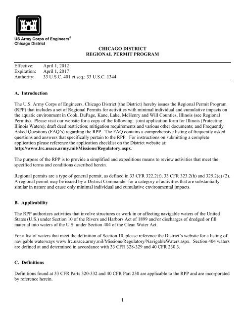
US <strong>Army</strong> Corps of Engineers ®<strong>Chicago</strong> <strong>District</strong>CHICAGO DISTRICTREGIONAL PERMIT PROGRAMEffective: April 1, 2012Expiration: April 1, 2017Authority: 33 U.S.C. 401 et seq.; 33 U.S.C. 1344A. IntroductionThe U.S. <strong>Army</strong> Corps of Engineers, <strong>Chicago</strong> <strong>District</strong> (the <strong>District</strong>) hereby issues the <strong>Regional</strong> <strong>Permit</strong> <strong>Program</strong>(RPP) that includes a set of <strong>Regional</strong> <strong>Permit</strong>s for activities with minimal individual and cumulative impacts onthe aquatic environment in Cook, DuPage, Kane, Lake, McHenry and Will Counties, Illinois (see <strong>Regional</strong><strong>Permit</strong>s). Please visit our website for a copy of the following: joint application form for Illinois (ProtectingIllinois Waters); draft deed restriction; mitigation requirements and various other documents; and FrequentlyAsked Questions (FAQ’s) regarding the RPP. The FAQ contains a comprehensive listing of frequently askedquestions and answers that specifically pertain to the RPP. For instructions on submitting a completeapplication please reference the application checklist on the <strong>District</strong> website at:http://www.lrc.usace.army.mil/Missions/Regulatory.aspx.The purpose of the RPP is to provide a simplified and expeditious means to review activities that meet thespecified terms and conditions described herein.<strong>Regional</strong> permits are a type of general permit, as defined in 33 CFR 322.2(f), 33 CFR 323.2(h) and 325.2(e) (2).A regional permit may be issued by a <strong>District</strong> Commander for a category of activities that are substantiallysimilar in nature and cause only minimal individual and cumulative environmental impacts.B. ApplicabilityThe RPP authorizes activities that involve structures or work in or affecting navigable waters of the UnitedStates (U.S.) under Section 10 of the Rivers and Harbors Act of 1899 and/or discharges of dredged or fillmaterial into waters of the U.S. under Section 404 of the Clean Water Act.For a list of waters that meet the definition of Section 10, please reference the <strong>District</strong>’s website for a listing ofnavigable waterways www.lrc.usace.army.mil/Missions/Regulatory/NavigableWaters.aspx. Section 404 watersare defined at and determined in accordance with 33 CFR 328-329 and 40 CFR 230.3.C. DefinitionsDefinitions found at 33 CFR Parts 320-332 and 40 CFR Part 230 are applicable to the RPP and are incorporatedby reference herein.1
Agency Request for Comments (ARC) is the notice provided to Federal and State agencies which requestscomments concerning a proposed “Category II” activity.Applicant is the individual, organization or company requesting authorization under the RPP. Applicant shallbe owner of the property in question as required in the joint application form.Authorization is written verification by the <strong>District</strong> that an activity qualifies for, and may proceed under, theRPP provided the terms and conditions of the program are followed. Authorization under the RPP is valid for aperiod of three (3) years.Best Management Practices (BMPs) are policies, practices, procedures or structures implemented to mitigatethe direct and indirect degradation of surface water quality from an activity. BMPs include non-structuralelements such as the preservation of existing natural areas and drainageways, and structural elements such asvegetated swales, filter strips and infiltration trenches which are designed to remove pollutants, reduce runoffrates and velocity and protect aquatic resources.Buffer is a protective strip of land along the edge of waters of the U.S., including wetlands, that is maintained innative vegetation. Buffers protect shorelines and banks from erosion, provide wildlife habitat, filter pollutantsfrom the water, and protect environmentally sensitive areas from potential effects of development.Compensatory wetland mitigation is the creation, restoration, enhancement, or in exceptional circumstances,preservation of wetlands and/or other aquatic resources for the purpose of compensating for unavoidableimpacts which remain after all appropriate and practicable avoidance and minimization has been achieved.Complete application is all required notification materials submitted by the applicant to the <strong>District</strong>. If allmaterials are not submitted, the application is considered incomplete and cannot be processed under the RPP.Conservation area is any national park or forest, natural heritage landmark, State nature preserve orconservation area, Illinois Natural Area Inventory site (including proposed sites), county forest preserve, or landmanaged by a local government or organization for conservation purposes.Currently serviceable means that a structure or fill is useable as is, or with some maintenance, but not sodegraded as to require reconstruction.High-quality aquatic resources (HQARs) are aquatic areas considered to be regionally critical due to theiruniqueness, scarcity, and/or value, and other wetlands considered to perform functions important to the publicinterest, as defined in 33 CFR Part 320.4(b)(2). These resources include Advanced Identification (ADID) sites,bogs, ephemeral pools, fens, forested wetlands, sedge meadows, wet meadows, seeps, streams rated A or B forDiversity or Integrity or mapped as Biologically Significant as described in the Integrating Multiple Taxa in aBiological Stream Rating System published by the Illinois Department of Natural Resources, wet prairies,wetlands supporting Federal or Illinois endangered or threatened species, and wetlands with a floristic qualityindex of 20 or greater or mean C value of 3.5 or greater. These areas are generally considered unsuitable fordredge or fill activities. Descriptions of high-quality aquatic resources are provided in APPENDIX A.Impact is the direct and indirect loss of waters of the U.S., including wetlands, which results fromimplementation of a proposed activity. This includes waters of the U.S. that are adversely affected by filling,flooding, dredging, excavation, or drainage as a result of the activity.Notification is the submission of materials by the applicant to the <strong>District</strong>.2
D. <strong>Permit</strong> ExpirationThe <strong>Regional</strong> <strong>Permit</strong> <strong>Program</strong> (RPP) is valid for a period of five (5) years from the date of issuance (orreissuance). The <strong>District</strong> will periodically review the RPP and their conditions and will decide to modify,reissue, or revoke the permits with opportunity for public comment. If the RPP is not modified or reissuedwithin five years of its effective date, it automatically expires and becomes null and void. Activities completedunder the authorization of the RPP which was in effect at the time the activity was completed continue to beauthorized by the RPP.A verification letter from the <strong>District</strong> is valid for a period of three years unless the RPP is modified, suspended,or revoked. A verification letter will remain valid if the RPP authorization is reissued without modification orthe activity complies with any subsequent modification of the RPP authorization.E. Activity CategoriesActivities to be covered under the RPP will fall under one of two categories:Category I: Activities with minimal impacts requiring review by the <strong>District</strong>. Authorization may includespecial conditions to ensure compliance with the RPP. The <strong>District</strong> has the discretion to process aCategory I activity under Category II when it has concerns for aquatic resources under the Section404(b)(1) Guidelines or for any factor of the public interest.Category II: Activities with minimal impacts requiring more rigorous review by the <strong>District</strong> andcoordination with resource agencies. Authorization may include special conditions to ensurecompliance with the RPP.Activities that do not fall into one of the above categories, by definition, have more than minimal impacts andare therefore subject to the Individual <strong>Permit</strong> review process.F. Discretionary AuthorityThe <strong>District</strong> has the discretion to suspend, modify, or revoke authorizations under this RPP. This discretionaryauthority may be used by the <strong>District</strong> to further condition or restrict the applicability of the <strong>Regional</strong> <strong>Permit</strong>s forcases when it has concerns for aquatic resources under the Clean Water Act Section 404(b)(1) Guidelines or forany factor of the public interest. Because of the nature of most Category I activities, the <strong>District</strong> anticipates thatit will not exert discretionary authority, except in extraordinary cases. For Category II activities, the <strong>District</strong>will evaluate each proposed activity before issuing authorization. Should the <strong>District</strong> determine that a proposedactivity may have more than minimal individual or cumulative adverse impacts to aquatic resources orotherwise be contrary to the public interest, the <strong>District</strong> will notify the applicant that the proposed activity is notauthorized by the RPP and provide instructions on how to seek authorization under an Individual <strong>Permit</strong>. The<strong>District</strong> may restore authorization under the RPP at anytime it determines that the reason for assertingdiscretionary authority has been resolved or satisfied by a condition, project modification, or new information.The <strong>District</strong> may also use its discretionary authority to modify, suspend, or revoke a <strong>Regional</strong> <strong>Permit</strong> for anyspecific geographic area, class of activities, or class of waters within the <strong>District</strong>’s boundaries or individualauthorizations when an activity is not in compliance with the RPP.4
G. AuthorizationApplicants seeking authorization under the RPP shall notify the <strong>District</strong> in accordance with the RPP GeneralCondition 22, prior to commencing a proposed activity. If the <strong>District</strong> determines that an activity does notcomply with the RPP, it will notify the applicant in writing within sixty (60) calendar days and provideinstructions on the procedures to seek authorization under an Individual <strong>Permit</strong>. If the <strong>District</strong> determines that aproposed activity complies with the terms and conditions of the RPP, it will notify the applicant within 60calendar days of receipt of a complete application. If the <strong>District</strong> determines that an unauthorized activitycomplies with the terms and conditions of the RPP, it will notify the applicant upon a determination that it issatisfied that the violation has been resolved.If the <strong>District</strong> does not provide a written response to the applicant within 60 calendar days following receipt of acomplete application, the applicant may presume the proposed activity qualifies for the requested <strong>Regional</strong><strong>Permit</strong>(s), provided the activity complies with the terms and conditions of the RPP.The <strong>District</strong> may add special conditions to an authorization to ensure that the activity complies with the termsand conditions of the RPP, and/or the adverse impacts on the aquatic environment or other aspects of the publicinterest are individually and cumulatively minimal.Multiple <strong>Regional</strong> <strong>Permit</strong>s may be combined to authorize a proposed single and complete project, except asindicated under specific <strong>Regional</strong> <strong>Permit</strong>s. If multiple <strong>Regional</strong> <strong>Permit</strong>s are used, the total impact may notexceed the maximum allowed by the <strong>Regional</strong> <strong>Permit</strong> with the greatest impact threshold. To use multiple<strong>Regional</strong> <strong>Permit</strong>s, the applicant shall submit notification under General Condition 22 and indicate which<strong>Regional</strong> <strong>Permit</strong>s are to be used for the project.Any activity authorized by the <strong>District</strong> under the RPP shall be completed within three (3) years of the date it isauthorized. The authorization date of a <strong>Regional</strong> <strong>Permit</strong> (RP) is the date the <strong>District</strong> confirms in writing that theactivity meets the terms and conditions of the RPP. A request for a time extensions will be considered on a caseby case basis by the <strong>District</strong>.H. Unauthorized ActivitiesThe <strong>District</strong> evaluates unauthorized activities for enforcement action under 33 CFR Part 326. After consideringwhether a violation was knowing or intentional, and consideration of the need for a penalty and/or restoration,the <strong>District</strong> can suspend enforcement proceedings and allow the submittal of an application for an after the factauthorization under the RPP. An after-the-fact application will not be accepted until signature of the “TollingAgreement” has been received by the <strong>District</strong>. Any after the fact RPP authorization will be consistent with the<strong>Army</strong>/EPA Memorandum of Agreement on Enforcement.I. General ConditionsThe permittee shall comply with the terms and conditions of the <strong>Regional</strong> <strong>Permit</strong>s and the following generalconditions for all activities authorized under the RPP:1. State 401 Water Quality Certification - Water quality certification under Section 401 of the Clean Water Actmay be required from the Illinois Environmental Protection Agency (IEPA). The <strong>District</strong> may consider waterquality, among other factors, in determining whether to exercise discretionary authority and require anIndividual <strong>Permit</strong>. Please note that Section 401 Water Quality Certification is a requirement for projects carried5
out in accordance with Section 404 of the Clean Water Act. Projects carried out in accordance with Section 10of the Rivers and Harbors Act of 1899 do not require Section 401 Water Quality CertificationOn March 2, 2012, the IEPA granted Section 401 certification, with conditions, for all <strong>Regional</strong> <strong>Permit</strong>s, exceptfor activities in certain waterways noted under RPs 4 and 8. The following conditions of the certification arehereby made conditions of the RPP:1. The applicant shall not cause:a) a violation of applicable water quality standards of the Illinois Pollution Control Board Title 35,Subtitle C: Water Pollution Rules and Regulations;b) water pollution defined and prohibited by the Illinois Environmental Protection Act;c) interference with water use practices near public recreation areas or water supply intakes;d) a violation of applicable provisions of the Illinois Environmental Protection Act.2. The applicant shall provide adequate planning and supervision during the project construction period forimplementing construction methods, processes and cleanup procedures necessary to prevent waterpollution and control erosion.3. Except as allowed under condition 9, any spoil material excavated, dredged or otherwise produced mustnot be returned to the waterway but must be deposited in a self-contained area in compliance with allState statutes, regulations and permit requirements with no discharge to waters of the State unless apermit has been issued by the Illinois EPA. Any backfilling must be done with clean material placed ina manner to prevent violation of applicable water quality standards.4. All areas affected by construction shall be mulched and seeded as soon after construction as possible.The applicant shall undertake necessary measures and procedures to reduce erosion during construction.Interim measures to prevent soil erosion during construction shall be taken and may include theinstallation of sedimentation basins and temporary mulching. All construction within the waterway shallbe conducted during zero or low flow conditions. The applicant shall be responsible for obtaining aNPDES Stormwater <strong>Permit</strong> prior to initiating construction if the construction activity associated with theproject will result in the disturbance of (1) one or more acres, total land area. A NPDES Stormwater<strong>Permit</strong> may be obtained by submitting a properly completed Notice of Intent (NOI) form by certifiedmail to the Illinois EPA’s Division of Water Pollution Control, <strong>Permit</strong> Section.5. The applicant shall implement erosion control measures consistent with the Illinois Urban Manual(IEPA/USDA, NRCS; 2011, http://aiswcd.org/IUM/index.html).6. The applicant is advised that the following permits(s) must be obtained from the Illinois EPA: Theapplicant must obtain permits to construct sanitary sewers, water mains, and related facilities prior toconstruction.7. Backfill used in the stream-crossing trench shall be predominantly sand or larger size material, with lessthan 20% passing a #230 U.S. sieve.8. Any channel relocation shall be constructed under dry conditions and stabilized to prevent erosion priorto the diversion of flow.9. Backfill used within trenches passing through surface waters of the State, except wetland areas, shall beclean course aggregate, gravel or other material which will not cause siltation, pipe damage duringplacement, or chemical corrosion in place. Excavated material may be used only if:6
a) particle size analysis is conducted and demonstrates the material to be at least 80% sand or largersize material, using #230 U.S. sieve; orb) excavation and backfilling are done under dry conditions.10. Backfill used within trenches passing through wetland areas shall consist of clean material which willnot cause siltation, pipe damage during placement, or chemical corrosion in place. Excavated materialshall be used to the extent practicable, with the upper six (6) to twelve (12) inches backfilled with thetopsoil obtained during trench excavation.11. Any applicant proposing activities in a mined area or previously mined area shall provide to the IEPA awritten determination regarding the sediment and materials used which are considered “acid-producingmaterial” as defined in 35 Il. Adm. Code, Subtitle D. If considered “acid-producing material,” theapplicant shall obtain a permit to construct pursuant to 35 Il. Adm. Code 404.101.12. Asphalt, bituminous material and concrete with protruding material such as reinforcing bar or mesh shallnot be 1) used for backfill, 2) placed on shorelines/stream banks, or 3) placed in waters of the State.13. Applicants that use site dewatering techniques in order to perform work in waterways for constructionactivities approved under <strong>Regional</strong> <strong>Permit</strong>s 1 (Residential, Commercial and Institutional Developments),2 (Recreation Projects), 3 (Transportation Projects), 7 (Temporary Construction Activities), 9(Maintenance) or 12 (Bridge Scour Protection) shall maintain flow in the stream during suchconstruction activity by utilizing dam and pumping, fluming, culverts or other such techniques.14. In addition to any action required of the <strong>Regional</strong> <strong>Permit</strong> 13 (Cleanup of Toxic and Hazardous MaterialsProjects) applicant with respect to the “Notification” General Condition 22, the applicant shall notify theIllinois EPA Bureau of Water, of the specific activity. This notification shall include informationconcerning the orders and approvals that have been or will be obtained from the Illinois EPA Bureau ofLand (BOL) for all cleanup activities under BOL jurisdiction, or for which authorization or approval issought from BOL for no further remediation. This <strong>Regional</strong> <strong>Permit</strong> is not valid for activities that do notrequire or will not receive authorization or approval from the BOL.2. Threatened and Endangered Species - If the <strong>District</strong> determines that the activity may affect Federally listedspecies or critical habitat, the <strong>District</strong> will initiate section 7 consultation with the U.S. Fish and Wildlife Service(USFWS) in accordance with the Endangered Species Act of 1973, as amended (Act). Applicants shall provideadditional information that would enable the <strong>District</strong> to conclude that the proposed action will have no effect onfederally listed species.The application packet shall indicate whether resources (species, their suitable habitats, or critical habitat) listedor designated under the Act, may be present within areas affected (directly or indirectly) by the proposedproject. Applicants shall provide a section 7 species list for the action area using the on-line process at theUSFWS website. You can access "U.S. Fish and Wildlife Service Endangered Species <strong>Program</strong> of the UpperMidwest" website at www.fws.gov/midwest/Endangered. Click on the section 7 Technical Assistance greenshaded box in the lower right portion of the screen and follow the instructions to completion. Review alldocumentation pertaining to the species list, provide the rationale for your effects determination for eachspecies, and send the information to this office for review.If no species, their suitable habitats, or critical habitat are listed, then a “no effect” determination can be made,and section 7 consultation is not warranted. If species or critical habitat appear on the list or suitable habitat ispresent within the action area, then a biological assessment or biological evaluation will need to be completed todetermine if the proposed action will have “no effect” or “may effect” the species or suitable habitat. The<strong>District</strong> will request initiation of section 7 consultation with the USFWS upon agreement with the applicant onthe effect determinations in the biological assessment or biological evaluation.7
If the issues are not resolved, the analysis of the situation is complicated, or impacts to listed species or criticalhabitat are found to be greater than minimal, the <strong>District</strong> will consider reviewing the project under theIndividual <strong>Permit</strong> process.Projects in Will, DuPage, or Cook Counties that are located in the recharge zones for Hine’s emerald dragonflycritical habitat units may be reviewed under the RPP, with careful consideration due to the potential impacts tothe species. All projects reviewed that are located within 3.25 miles of a critical habitat unit will be reviewedunder Category II of the RPP. Please visit the following website for the locations of the Hine’s emeralddragonfly critical habitat units in Illinois.http://www.fws.gov/midwest/endangered/insects/hed/FRHinesFinalRevisedCH.html3. Historic Properties - In cases where the <strong>District</strong> determines that the activity may affect properties listed, oreligible for listing, in the National Register of Historic Places, the activity may require an Individual <strong>Permit</strong>. Adetermination of whether the activity may be authorized under the RPP instead of an Individual <strong>Permit</strong> will notbe made until the requirements of Section 106 of the National Historic Preservation Act (NHPA) have beensatisfied.Federal permittees should follow their own procedures for complying with the requirements of Section 106 ofthe National Historic Preservation Act. Federal permittees must provide the <strong>District</strong> with the appropriatedocumentation to demonstrate compliance with those requirements.Non-Federal permittees must include notification to the <strong>District</strong> if the authorized activity may have the potentialto cause effects to any historic properties listed, determined to be eligible for listing on, or potentially eligiblefor listing on the National Register of Historic Places, including previously unidentified properties. For suchactivities, the permit application must state which historic properties may be affected by the proposed work orinclude a vicinity map indicating the location of the historic properties or the potential for the presence ofhistoric properties. Assistance regarding information on the location of or potential for the presence of historicresources can be sought from the State Historic Preservation Officer or Tribal Historic Preservation Officer, asappropriate, and the National Register of Historic Places (see 33 CFR 330.4(g)). When reviewing permitsubmittals, the <strong>District</strong> will comply with the current procedures for addressing the requirements of Section 106of the National Historic Preservation Act. Based on the information submitted and these efforts, the <strong>District</strong>shall determine whether the proposed activity has the potential to cause an effect on the historic properties.Where the non-Federal applicant has identified historic properties which the activity may have the potential tocause effects and so notified the <strong>District</strong>, the non-Federal applicant shall not begin the activity until notified bythe <strong>District</strong> either that the activity has no potential to cause effects or that consultation under Section 106 of theNHPA has been completed.The <strong>District</strong> will take into account the effects on such properties in accordance with 33 CFR Part 325, AppendixC, and 36 CFR 800. If all issues pertaining to historic properties have been resolved through the consultationprocess to the satisfaction of the <strong>District</strong>, Illinois Historic Preservation Agency (IHPA) and Advisory Councilon Historic Preservation, the <strong>District</strong> may, at its discretion, authorize the activity under the RPP instead of anIndividual <strong>Permit</strong>.Applicants are encouraged to obtain information on historic properties from the IHPA and the National Registerof Historic Places at the earliest stages of project planning. For information, contact:Illinois Historic Preservation Agency1 Old State Capitol PlazaSpringfield, IL 62701-1507(217) 782-4836www.illinoishistory.gov8
If you discover any previously unknown historic, cultural or archeological remains and artifacts whileaccomplishing the activity, you must immediately notify this office of what you have found, and to themaximum extent practicable, stop activities that would adversely affect those remains and artifacts until therequired coordination has been completed. We will initiate the Federal, Tribal and State coordination requiredto determine if the items or remains warrant a recovery effort or if the site is eligible for listing in the NationalRegister of Historic Places.4. Soil Erosion and Sediment Control - Measures shall be taken to control soil erosion and sedimentation at theproject site to ensure that sediment is not transported to waters of the U.S. during construction. Soil erosion andsediment control measures shall be implemented before initiating any clearing, grading, excavating or fillingactivities. All temporary and permanent soil erosion and sediment control measures shall be maintainedthroughout the construction period and until the site is stabilized. All exposed soil and other fills, and any workbelow the ordinary high water mark shall be permanently stabilized at the earliest practicable date.Applicants are required to prepare a soil erosion and sediment control (SESC) plan including temporary BMPs.The plan shall be designed in accordance with the Illinois Urban Manual, 2011(http://aiswcd.org/IUM/index.html). Practice standards and specifications for measures outlined in the soilerosion and sediment control plans will follow the latest edition of the “Illinois Urban Manual: A TechnicalManual Designed for Urban Ecosystem Protection and Enhancement.” Additional Soil Erosion and SedimentControl (SESC) measures not identified in the Illinois Urban Manual may also be utilized upon <strong>District</strong>approval.At the <strong>District</strong>’s discretion, an applicant may be required to submit the SESC plan to the local Soil and WaterConservation <strong>District</strong> (SWCD), or the Lake County Stormwater Management Commission (SMC) for review.When the <strong>District</strong> requires submission of an SESC plan, the following applies: An activity may not commenceuntil the SESC plan for the project site has been approved; The SWCD/SMC will review the plan and provide awritten evaluation of its adequacy; A SESC plan is considered acceptable when the SWCD/SMC has found thatit meets technical standards. Once a determination has been made, the authorized work may commence unlessthe SWCD/SMC has requested that they be notified prior to commencement of the approved plans. TheSWCD/SMC may attend pre-construction meetings with the permittee and conduct inspections duringconstruction to determine compliance with the plans. Applicants are encouraged to begin coordinating with theappropriate SWCD/SMC office at the earliest stages of project planning. For information, contact:Kane-DuPage SWCDMcHenry-Lake County SWCD2315 Dean Street, Suite 100 1648 South Eastwood Dr.St. Charles, IL 60174 Woodstock, IL 60098(630) 584-7961 ext.3 (815) 338-0099 ext.3www.kanedupageswcd.orgwww.mchenryswcd.orgNorth Cook SWCDLake County SMC899 Jay Street 500 W. Winchester Rd, Suite 201Elgin, IL 60120 Libertyville, IL 60048(847) 468-0071 (847) 377-7700www.northcookswcd.orgwww.lakecountyil.gov/stormwater5. Total Maximum Daily Load - For projects that include a discharge of pollutant(s) to waters for which thereis an approved Total Maximum Daily Load (TMDL) allocation for any parameter, the applicant shall developplans and BMPs that are consistent with the assumptions and requirements in the approved TMDL. Theapplicant must incorporate into their plans and BMPs any conditions applicable to their discharges necessary forconsistency with the assumptions and requirements of the TMDL within any timeframes established in theTMDL. The applicant must carefully document the justifications for all BMPs and plans, and install,9
implement and maintain practices and BMPs that are consistent with all relevant TMDL allocations and with allrelevant conditions in an implementation plan. Information regarding the TMDL program, including approvedTMDL allocations, can be found at the following website: www.epa.state.il.us/water/tmdl/6. Floodplain - Discharges of dredged or fill material into waters of the United States within the 100-yearfloodplain (as defined by the Federal Emergency Management Agency) resulting in permanent above-grade fillsshall be avoided and minimized to the maximum extent practicable. When such an above-grade fill wouldoccur, the applicant may need to obtain approval from the Illinois Department of Natural Resources, Office ofWater Resources, (IDNR-OWR) which regulates activities affecting the floodway and the local governingagency (e.g., Village or County) with jurisdiction over activities in the floodplain. Compensatory storage maybe required for fill within the floodplain. Applicants are encouraged to obtain information from the IDNR-OWR and the local governing agency with jurisdiction at the earliest stages of project planning. Forinformation on floodway construction, contact:IDNR/OWR2050 Stearns RoadBartlett, IL 60103(847) 608-3100http://dnr.state.il.us/owr/For information on floodplain construction, please contact the local government and/or the Federal EmergencyManagement Agency. Pursuant to 33 CFR 320.4(j), the <strong>District</strong> will consider the likelihood of the applicantobtaining approval for above-ground permanent fills in floodplains in determining whether to issueauthorization under the RPP.7. Navigation - No activity may cause more than a minimal adverse effect on navigation. Any safety lights andsignals prescribed by the U.S. Coast Guard, through regulations or otherwise, must be installed and maintainedat the permittee’s expense on authorized facilities in navigable waters of the United States. The permitteeunderstands and agrees that, if future operations by the United States require the removal, relocation, or otheralteration, of the structure or work herein authorized, or if, in the opinion of the Secretary of the <strong>Army</strong> or hisauthorized representative, said structure or work shall cause unreasonable obstruction to the free navigation ofthe navigable waters, the permittee will be required, upon due notice from the Corps of Engineers, to remove,relocate, or alter the structural work or obstructions caused thereby, without expense to the United States. Noclaim shall be made against the United States on account of any such removal or alteration.8. Proper Maintenance - Any authorized structure or fill shall be properly maintained, including that necessaryto ensure public safety.9. Aquatic Life Movements - No activity may substantially disrupt the movement of those species of aquaticlife indigenous to the waterbody, including species that normally migrate through the area, unless the activity’sprimary purpose is to impound water.10. Equipment - Soil disturbance and compaction shall be minimized through the use of matting for heavyequipment, low ground pressure equipment, or other measures as approved by the <strong>District</strong>.11. Wild and Scenic Rivers - No activity may occur in a component of the National Wild and Scenic RiverSystem or in a river officially designated by Congress as a “study river” for possible inclusion in the system,while the river is in an official study status. Information on Wild and Scenic Rivers may be obtained from theappropriate land management agency in the area, such as the National Park Service and the U.S. Forest Service.10
12. Tribal Rights - No activity or its operation may impair reserved tribal rights, such as reserved water rights,treaty fishing and hunting rights.13. Water Supply Intakes - No discharge of dredged or fill material may occur in the proximity of a publicwater supply intake except where the discharge is for repair of the public water supply intake structures oradjacent bank stabilization.14. Shellfish Production - No discharge of dredged or fill material may occur in areas of concentrated shellfishproduction.15. Suitable Material - No discharge of dredged or fill material may consist of unsuitable material and materialdischarged shall be free from toxic pollutants in toxic amounts (see Section 307 of the Clean Water Act).Unsuitable material includes trash, debris, car bodies, asphalt, and creosote treated wood.16. Spawning Areas - Discharges in spawning areas during spawning seasons shall be avoided to the maximumextent practicable.17. Obstruction of High Flows - Discharges shall not permanently restrict or impede the passage of normal orexpected high flows. All crossings shall be culverted, bridged or otherwise designed to prevent the restrictionof expected high water flows, and shall be designed so as not to impede low water flows or the movement ofaquatic organisms.18. Impacts From Impoundments - If the discharge creates an impoundment of water, adverse impacts onaquatic resources caused by the accelerated passage of water and/or the restriction of its flow shall be avoided tothe maximum extent practicable.19. Waterfowl Breeding Areas - Discharges into breeding areas for migratory waterfowl shall be avoided to themaximum extent practicable.20. Removal of Temporary Fills - Any temporary fill material shall be removed in its entirety and the affectedarea returned to its pre-existing condition.21. Mitigation - All appropriate and practicable steps must first be taken to avoid and minimize impacts toaquatic resources. For unavoidable impacts, compensatory mitigation is required to replace the loss of wetland,stream, and/or other aquatic resource functions (33 CFR 332). The proposed compensatory mitigation shallutilize a watershed approach and fully consider the ecological needs of the watershed. Where an appropriatewatershed plan is available, mitigation site selection should consider recommendations in the plan. Theapplicant shall describe in detail how the mitigation site was chosen and will be developed, based on thespecific resource need of the impacted watershed. <strong>Permit</strong> applicants are responsible for proposing anappropriate compensatory mitigation option to offset unavoidable impacts. However, the <strong>District</strong> is responsiblefor determining the appropriate form and amount of compensatory mitigation required when evaluatingcompensatory mitigation options, and determining the type of mitigation that would be environmentallypreferable. In making this determination, the <strong>District</strong> will assess the likelihood for ecological success andsustainability, the location of the compensation site relative to the impact site and their significance within thewatershed. Methods of providing compensatory mitigation include aquatic resource restoration, establishment,enhancement, and in certain circumstances, preservation. Compensatory mitigation will be accomplished byestablishing a minimum ratio of 1.5 acres of mitigation for every 1.0 acre of impact to waters of the U.S.Furthermore, the <strong>District</strong> has the discretion to require additional mitigation to ensure that the impacts are nomore than minimal. Further information is available atwww.lrc.usace.army.mil/Missions/Regulatory/Illinois/Mitigation.aspx11
22. Notification - The applicant shall provide written notification (i.e., a complete application) for a proposedactivity to be authorized under the RPP prior to commencing a proposed activity. The <strong>District</strong>’s receipt of thecomplete application is the date when the <strong>District</strong> receives all required notification information from theapplicant (see below). If the <strong>District</strong> informs the applicant within 60 calendar days that the notification isincomplete (i.e., not a complete application), the applicant shall submit to the <strong>District</strong>, in writing, the requestedinformation to be considered for review under the <strong>Regional</strong> <strong>Permit</strong> <strong>Program</strong>. A new 60 day review period willcommence when the <strong>District</strong> receives the requested information. Applications that involve unauthorizedactivities that are completed or partially completed by the applicant are not subject to the 60-day review period.For all activities, notification shall include:a. A cover letter providing a detailed narrative of the proposed activity describing all work to beperformed, a clear project purpose and need statement, the <strong>Regional</strong> <strong>Permit</strong>(s) to be used for the activity,the area (in acres) of waters of the U.S. to be impacted (be sure to specify if the impact is permanent ortemporary, and identify which area it affects), and a statement that the terms and conditions of the RPPwill be followed.b. A completed joint application form for Illinois signed by the applicant or agent. The application form isavailable at www.lrc.usace.army.mil/36/docs/regulatory/forms/appform.pdf. If the applicant does notsign the joint application form, notification shall include a signed, written statement from the applicantdesignating the agent as their representative.c. A delineation of waters of the U.S., including wetlands, for the project area, and for areas adjacent to theproject site (off-site wetlands shall be identified through the use of reference materials including reviewof local wetland inventories, soil surveys and the most recent available aerial photography), shall beprepared in accordance with the current U.S. <strong>Army</strong> Corps of Engineers methodology(www.usace.army.mil/Missions/CivilWorks/Regulatory<strong>Program</strong>and<strong>Permit</strong>s/reg_supp.aspx) andgenerally conducted during the growing season. * Our wetland delineation standards are available atwww.lrc.usace.army.mil/Portals/36/docs/regulatory/pdf/Delineations.pdf. For sites supporting wetlands,the delineation shall include a Floristic Quality Assessment (Swink and Wilhelm. 1994, latest edition,Plants of the <strong>Chicago</strong> Region). The delineation shall also include information on the occurrence of anyhigh-quality aquatic resources (see Appendix A), and a listing of waterfowl, reptile and amphibianspecies observed while at the project area. The <strong>District</strong> reserves the right to exercise judgment whenreviewing submitted wetland delineations. Flexibility of the requirements may be determined by the<strong>District</strong> on a case-by-case basis only.d. A street map showing the location of the project area.e. Latitude and longitude for the project in decimal degrees format (i.e. 41.88377N, -87.63960W).f. Preliminary engineering drawings sized 11” by 17” (full-sized may be requested by the project managerand you may also submit plans in PDF format on a disc) showing all aspects of the proposed activity andthe location of waters of the U.S. to be impacted and not impacted. The plans shall include gradingcontours, proposed and existing structures such as buildings footprints, roadways, road crossings,stormwater management facilities, utilities, construction access areas and details of water conveyancestructures. The plans shall also depict buffer areas, outlots or open space designations, best managementpractices, deed restricted areas and restoration areas, if required under the specific RP.* If a wetland delineation is conducted outside of the growing season, the <strong>District</strong> will determine on a case-by-case basiswhether sufficient evidence is available to make an accurate determination. If the <strong>District</strong> finds that the delineation lackssufficient evidence, the application will not be considered complete until the information is provided. This may involvere-delineating the project site during the growing season.12
g. Submittal of soil erosion and sediment control (SESC) plans that identify all SESC measures to beutilized during construction of the project.h. The application packet shall indicate whether resources (species, their suitable habitats, or criticalhabitat) listed or designated under the Endangered Species Act of 1973, as amended, may be presentwithin areas affected (directly or indirectly) by the proposed project. Applicants shall provide a section7 species list for the action area using the on-line process at the USFWS website. You can access “U.S.Fish and Wildlife Service Endangered Species <strong>Program</strong> of the Upper Midwest” website atwww.fws.gov/midwest/Endangered. Click on the section 7 Technical Assistance green shaded box inthe lower right portion of the screen and follow the instructions to completion. Print all documentationpertaining to the species list, include the rationale for your effects determination for each species, andforward the information to this office for review.In the event there are no species, their suitable habitats, or critical habitat, then a “no effect”determination can be made and section 7 consultation is not warranted. If species or critical habitatappear on the list, or suitable habitat is present within the action area, then a biological assessment orbiological evaluation will need to be completed to determine if the proposed action will have “no effect”or “may effect” on the species or suitable habitat. The <strong>District</strong> will request initiation of section 7consultation with the USFWS upon agreement with the applicant on the effect determinations in thebiological assessment or biological evaluation. If the issues are not resolved, the analysis of thesituation is complicated, or impacts to listed species or critical habitat are found to be greater thanminimal, the <strong>District</strong> will consider reviewing the project under the Individual <strong>Permit</strong> process.i. A determination of the presence or absence of any State threatened or endangered species. Pleasecontact the Illinois Department of Natural Resources (IDNR) to determine if any State threatened andendangered species could be in the project area. You can access the IDNR’s Ecological ComplianceAssessment Tool (EcoCAT) at the following website: http://dnrecocat.state.il.us/ecopublic/. Once youcomplete the EcoCAT and consultation process, forward all resulting information to this office forconsideration. The report shall also include recommended methods as required by the IDNR forminimizing potential adverse effects of the project.j. A statement about the knowledge of the presence or absence of Historic Properties, which includesproperties listed, or properties eligible to be listed in the National Register of Historic Places. A letterfrom the Illinois Historic Preservation Agency (IHPA) can be obtained indicating whether your projectis in compliance with Section 106 of the National Historic Preservation Act of 1966, as amended. Thepermittee shall provide all pertinent correspondence with the IHPA documenting compliance. TheIHPA has a checklist of documentation required for their review located here:www.illinoishistory.gov/PS/rcdocument.htm .k. Where an appropriate watershed plan is available, the applicant shall address in writing how theproposed activity is aligned with the relevant water quality, hydrologic, and aquatic resource protectionrecommendations in the watershed plan.l. A discussion of measures taken to avoid and/or minimize impacts to aquatic resources on the projectsite.m. A compensatory mitigation plan for all impacts to waters of the U.S. (if compensatory mitigation isrequired under the specific RP).n. A written narrative addressing all items listed under the specific RP.For Category II activities, the <strong>District</strong> will provide an Agency Request for Comments (ARC) which describesthe proposed activity. The ARC will be sent to the following agencies: United States Fish & Wildlife Service13
(USFWS), United States Environmental Protection Agency (USEPA), Illinois Department of Natural Resources(IDNR), Illinois Department of Natural Resources/Office of Water Resources (IDNR/OWR), IllinoisEnvironmental Protection Agency (IEPA), Illinois Historic Preservation Agency (IHPA), Illinois NaturePreserves Commission (INPC) and U.S. Coast Guard (Section 10 activities only). Additional entities may alsobe notified as needed. These agencies have ten (10) calendar days from the date of the ARC to contact the<strong>District</strong> and either provide comments or request an extension not to exceed fifteen (15) calendar days. The<strong>District</strong> will fully consider agency comments received within the specified time frame. If the <strong>District</strong>determines the activity complies with the terms and conditions of the RPP and impacts on aquatic resources areminimal, the <strong>District</strong> will notify the applicant in writing and include special conditions if deemed necessary. Ifthe <strong>District</strong> determines that the impacts of the proposed activity are more than minimal, the <strong>District</strong> will notifythe applicant that the project does not qualify for authorization under the RPP and instruct the applicant on theprocedures to seek authorization under an Individual <strong>Permit</strong>.23. Compliance Certification - Any permittee who has received authorization under the RPP from the <strong>District</strong>shall submit a signed certification regarding the completed work and any required mitigation. The certificationwill be forwarded by the <strong>District</strong> with the authorization letter and will include: a) a statement that theauthorized work was done in accordance with the <strong>District</strong>’s authorization, including any general or specificconditions; b) a statement that any required mitigation was completed in accordance with the permit conditionsand; c) the signature of the permittee certifying the completion of the work and mitigation.24. Multiple use of <strong>Regional</strong> <strong>Permit</strong>s - In any case where a <strong>Regional</strong> <strong>Permit</strong> is combined with any other<strong>Regional</strong> <strong>Permit</strong> to cover a single and complete project (except where prohibited under specific <strong>Regional</strong><strong>Permit</strong>s), the applicant shall notify the <strong>District</strong> in accordance with General Condition 22. If multiple <strong>Regional</strong><strong>Permit</strong>s are used, the total impact may not exceed the maximum allowed by the <strong>Regional</strong> <strong>Permit</strong> with thegreatest impact threshold.25. Other Restrictions - Authorization under the RPP does not obviate the need to obtain other Federal, State orlocal permits, approvals, or authorizations required by law nor does it grant any property rights or exclusiveprivileges, authorize any injury to the property or rights of others or authorize interference with any existing orproposed Federal project.Approved by://ORIGINAL SIGNED// February 24, 2012______________________________________________Frederic A. Drummond, Jr.DateColonel, U.S. <strong>Army</strong><strong>District</strong> Commander14
REGIONAL PERMITS1. RESIDENTIAL, COMMERCIAL AND INSTITUTIONAL DEVELOPMENTSRP1 authorizes the construction of residential, commercial and institutional developments and associatedinfrastructure, such as roads, utilities, detention areas, and recreation areas. Authorization under RP1 is subjectto the following requirements which shall be addressed in writing and submitted with the notification:a. The impact to waters of the U.S. shall not exceed 1.0 acre. For projects that impact over 0.10 acres ofwaters of the U.S., the permittee is required to provide compensatory mitigation.b. Projects that impact no more than 0.5 acres of waters of the U.S., and do not impact any high-qualityaquatic resources, will be processed under Category I.c. Projects that impact over 0.5 acres up to 1.0 acre of waters of the U.S., or impacts high-quality aquaticresources, will be processed under Category II.d. The permittee shall establish and/or enhance an upland buffer of native plants (or other appropriatevegetation approved by the <strong>District</strong>) adjacent to all created, restored, enhanced or preserved waters ofthe U.S., including wetlands. Created buffers should be established on 6:1 (horizontal: vertical) orgentler slopes. The following buffer widths are required:1) For any waters of the U.S. determined to be a high-quality aquatic resource, the buffer shall be aminimum of 100 feet.2) For any waters of the U.S. that do not qualify as wetland (e.g. lakes, rivers, ponds, etc.), the buffershall be a minimum of 50 feet from the Ordinary High Water Mark (OHWM).3) For any jurisdictional wetland from 0.25 acres up to 0.50 acres in size, the buffer shall be aminimum of 30 feet.4) For any jurisdictional wetland over 0.50 acres in size, the buffer shall be a minimum of 50 feet.The <strong>District</strong> may allow buffer widths below the above-required minimums on a case by case basis.However, it is the responsibility of the applicant to provide supporting documentation as to why thebuffer requirement could not be met.Stormwater retention/detention facilities and nature trails may be located within the outer 50% of thebuffer. The <strong>District</strong> may allow Best Management Practices, small boat launches and piers/docks to belocated in buffers.e. All remaining, created, restored or enhanced waters of the U.S. and adjacent buffers on the project siteshall be protected through a deed restriction or through a conservation easement. A draft deedrestriction or conservation easement shall be provided with notification. This requirement may bewaived at the discretion of the <strong>District</strong> if there are long term protections already in place for the onsitenatural resources.f. No lot lines shall occur in created, restored, enhanced or preserved waters of the U.S. and adjacentbuffer areas on the project site. The <strong>District</strong> may consider a request by the applicant to allow for lotlines to be in these areas provided there is a demonstrated conflict between the lot line restriction andlocal ordinance and/or State law. The <strong>District</strong> may accept physical measures such as the installation ofsplit-rail fencing or other means of separating the protected area, posting of signs marking the limits of15
the protected areas, and establishing a party responsible for the long-term management of the protectedareas in lieu of recording such areas as separate outlot property deeds.g. The project shall employ permanent Best Management Practices (BMPs) to protect water quality,preserve natural hydrology and minimize the overall impacts of development on aquatic resources.BMPs shall be considered at the earliest planning stages of the project.The applicant shall design the project to include the preservation of natural resource features such asfloodplains, streams, lakes, steep slopes, significant wildlife areas, wetlands, natural depressions anddrainageways, prairies, woodlands, sensitive aquifers and their recharge areas and native soils. Inaddition, the design elements utilized by the applicant shall include an appropriate combination of thoseprovided on the list below:1) Minimize mass grading and disturbance of soils.2) Lay out streets and lots to conform to the natural topography of the site.3) Minimize new impervious surfaces by clustering of neighborhoods and homes, minimizing streetwidths and parking lots and reducing lot sizes and building setbacks.4) Preserve and create natural landscaping, buffers and filter strips.5) Utilize permeable areas to maximize infiltration of runoff into the ground through the use ofbiofilters, filter strips, bioswales, infiltration trenches, permeable pavement and native vegetatedopen spaces.6) Direct runoff to permeable areas and/or utilize stormwater for reuse by:a. Directing roof runoff towards permeable surfaces, drywells, French drains, vegetated swales, orother BMPs instead of driveways or other non-permeable surfaces.b. Grading impervious surfaces to direct runoff to permeable areas, utilizing level spreaders orother methods to distribute the runoff onto pervious surfaces.c. Using cisterns, retention structures or rooftops to store precipitation or runoff for reuse.d. Removing berms and designing pavement edges (e.g., curb cuts) in order to direct water topermeable landscaped areas.7) Improve water quality of stormwater leaving the site through the use of a naturalized detention basindesigned to maximize the removal and transformation of runoff pollutants. The design shouldinclude:a. Emergent vegetation in the bottoms of the wetland basins and along the periphery of wet bottombasins and side slopes vegetated in native prairie (traditional dry bottom basins are not approvedBMPs).b. Stilling basins at detention basin inlets and maximizing the distance between inlets and the basinoutlet.c. Installation of pre-settling systems such as forebays, mechanical stormwater treatment units, orother similar structures, prior to discharge of stormwater into detention/retention facilities.d. Detention/retention facilities should be designed so that discharges from outlet structures aredirected to level spreaders prior to entering adjacent/downstream aquatic resources.16
A written narrative shall be included with the notification which describes how the BMP hierarchyabove was used in determining the water quality protection practices selected for the project site.BMP(s) may be located in upland buffers adjacent to wetlands and other waters of the U.S. Thenarrative shall thoroughly describe the BMPs that will be utilized and permanently maintained andthe entity responsible for maintenance of the BMPs. A management and monitoring plan will berequired for all approved BMPs. The plan shall be designed on a case-by-case basis and shallinclude performance standards such as the BMPs ability to function as designed, percent coverage ofvegetation, stabilized soils, and corrective measures to bring areas into compliance, etc. Each BMPselected shall be part of a coordinated system (“treatment train”), which provides multiple layers oftreatment.h. Stormwater management facilities shall not be constructed in a linear body of water such as a river, orperennial, intermittent or ephemeral stream or creek, unless there is substantial evidence that the projectwill provide a benefit to the aquatic system.i. The project shall be designed such that stormwater does not directly discharge into waters of the U.S.All stormwater shall be either infiltrated or detained and treated prior to discharging into waters of theU.S. In addition, stormwater shall be discharged using methods that promote infiltration and waterquality treatment, such as level spreaders, infiltration trenches and vegetated swales.j. This permit does not authorize the underground piping of a linear waterbody, with the exception ofculverted transportation crossings.k. For a project site adjacent to a conservation area, the permittee shall request correspondence from theorganization responsible for management of the area. The correspondence should identifyrecommended measures to protect the area from impacts that may occur as a result of the development.A copy of the request and any response received from the organization shall be submitted to the <strong>District</strong>with the notification.l. The project shall be a single and complete project. For example, if construction of a residentialdevelopment involves phasing, the sum of all impacted areas would be the basis for deciding whether ornot the project will be covered under the <strong>Regional</strong> <strong>Permit</strong> <strong>Program</strong>.m. Items e through p of <strong>Regional</strong> <strong>Permit</strong> 3 (Transportation Projects) shall be addressed in writing andsubmitted with the notification.n. Items d through s of <strong>Regional</strong> <strong>Permit</strong> 8 (Utility Line Projects) shall be addressed in writing andsubmitted with the notification. Utility Line Projects are subject to individual water quality certificationunder Section 401 of the Clean Water Act for certain water bodies as listed under RP8 condition d.o. All temporary construction activities shall adhere to the requirements of items c through i of <strong>Regional</strong><strong>Permit</strong> 7 (Temporary Construction Activities) and shall be addressed in writing and submitted with thenotification.17
2. RECREATION PROJECTSRP2 authorizes the construction of recreation projects, including golf courses, sports fields, playgrounds, parksand multi-use trails, and associated infrastructure, such as roads, utilities, and detention areas. Authorizationunder RP2 is subject to the following requirements which shall be addressed in writing and submitted with thenotification:a. The impact to waters of the U.S. shall not exceed 1.0 acre. For projects that impact over 0.10 acres ofwaters of the U.S., the permittee is required to provide compensatory mitigation.b. Projects that impact no more than 0.5 acres of waters of the U.S., and do not impact any high-qualityaquatic resources, will be processed under Category I.c. Projects that impact over 0.5 acres up to 1.0 acre of waters of the U.S., or impacts high-quality aquaticresources, will be processed under Category II.d. The permittee shall establish and/or enhance an upland buffer of native plants (or other appropriatevegetation approved by the <strong>District</strong>) adjacent to all created, restored, enhanced or preserved waters ofthe U.S., including wetlands. Created buffers should be established on 6:1 (horizontal: vertical) orgentler slopes. The following buffer widths are required:1) For any waters of the U.S. determined to be a high-quality aquatic resource, the buffer shall be aminimum of 100 feet.2) For any waters of the U.S. that do not qualify as wetland (e.g. lakes, rivers, ponds, etc.), the buffershall be a minimum of 50 feet from the Ordinary High Water Mark (OHWM).3) For any jurisdictional wetland from 0.25 acres up to 0.50 acres in size, the buffer shall be aminimum of 30 feet.4) For any jurisdictional wetland over 0.50 acres in size, the buffer shall be a minimum of 50 feet.The <strong>District</strong> may allow buffer widths below the above-required minimums on a case by case basis.However, it is the responsibility of the applicant to provide supporting documentation as to why thebuffer requirement could not be met.Stormwater retention/detention facilities and nature trails may be located within the outer 50% of thebuffer. The <strong>District</strong> may allow Best Management Practices, small boat launches and piers/docks tobe located in buffers.e. All remaining, created, restored or enhanced waters of the U.S. and adjacent buffers on the project siteshall be protected through a deed restriction or through a conservation easement. A draft deedrestriction or conservation easement shall be provided with notification.f. No lot lines shall occur in created, restored, enhanced or preserved waters of the U.S. and adjacentbuffer areas on the project site. The <strong>District</strong> may consider a request by the applicant to allow for lotlines to be in these areas provided there is a demonstrated conflict between the lot line restriction and/orlocal ordinance or State law. The <strong>District</strong> may accept physical measures such as the installation of splitrailfencing or other means of separating the protected area, posting of signs marking the limits of theprotected areas, and establishing a party responsible for the long-term management of the protectedareas in lieu of recording such areas as separate outlot property deeds.18
g. The project shall employ permanent Best Management Practices (BMPs) to protect water quality,preserve natural hydrology and minimize the overall impacts of development on aquatic resources.BMPs shall be considered at the earliest planning stages of the project.The applicant shall design the project to include the preservation of natural resource features such asfloodplains, streams, lakes, steep slopes, significant wildlife areas, wetlands, natural depressions anddrainageways, prairies, woodlands, sensitive aquifers and their recharge areas and native soils. Inaddition, the design elements utilized by the applicant shall include an appropriate combination of thoseprovided on the list below:1) Minimize mass grading and disturbance of soils.2) Lay out streets and lots to conform to the natural topography of the site.3) Minimize new impervious surfaces by clustering of facilities, minimizing street widths and parkinglots and reducing lot sizes and building setbacks.4) Preserve and create natural landscaping, buffers and filter strips.5) Utilize permeable areas to maximize infiltration of runoff into the ground through the use ofbiofilters, filter strips, bioswales, infiltration trenches, permeable pavement and native vegetatedopen spaces.6) Direct runoff to permeable areas and/or utilize stormwater for reuse by:a. Directing roof runoff towards permeable surfaces, drywells, French drains, vegetated swales, orother BMPs instead of driveways or other non-permeable surfaces.b. Grading impervious surfaces to direct runoff to permeable areas, utilizing level spreaders orother methods to distribute the runoff onto pervious surfaces.c. Using cisterns, retention structures or rooftops to store precipitation or runoff for reuse.d. Removing berms and designing pavement edges (e.g., curb cuts) in order to direct water topermeable landscaped areas.7) Improve water quality of stormwater leaving the site through the use of a naturalized detention basindesigned to maximize the removal and transformation of runoff pollutants. The design shouldinclude:a. Emergent vegetation in the bottoms of the wetland basins and along the periphery of wet bottombasins and side slopes vegetated in native prairie (traditional dry bottom basins are not approvedBMPs).b. Stilling basins at detention basin inlets and maximizing the distance between inlets and the basinoutlet.c. Installation of pre-settling systems such as forebays, mechanical stormwater treatment units, orsimilar structures, prior to discharge of stormwater into detention/retention facilities.d. Detention/retention facilities should be designed so that discharges from outlet structures aredirected to level spreaders prior to entering adjacent/downstream aquatic resources.A written narrative shall be included with the notification which describes how the BMP hierarchyabove was used in determining the water quality protection practices selected for the project site.19
BMP(s) may be located in upland buffers adjacent to wetlands and other waters of the U.S. Thenarrative shall thoroughly describe the BMPs that will be utilized and permanently maintained andthe entity responsible for maintenance of the BMPs. A management and monitoring plan will berequired for all approved BMPs. The plan shall be designed on a case-by-case basis and shallinclude performance standards such as the BMPs ability to function as designed, percent coverage ofvegetation, stabilized soils, and corrective measures to bring areas into compliance, etc. Each BMPselected shall be part of a coordinated system (“treatment train”), which provides multiple layers oftreatment.h. Stormwater management facilities shall not be constructed in a linear body of water such as a river, orperennial, intermittent or ephemeral stream or creek, unless there is substantial evidence that the projectwill provide a benefit to the aquatic system.i. The project shall be designed such that stormwater does not directly discharge into waters of the U.S.All water shall be either infiltrated or detained and treated prior to discharging into waters of the U.S. Inaddition, stormwater shall be discharged using methods that promote infiltration and water qualitytreatment, such as level spreaders, infiltration trenches and vegetated swales.j. This permit does not authorize the underground piping of a linear waterbody.k. For a project site adjacent to a conservation area, the permittee shall request a letter from theorganization responsible for management of the area. The response letter should identify recommendedmeasures to protect the area from impacts that may occur as a result of the development. A copy of therequest and any response received from the organization shall be submitted to the <strong>District</strong> with thenotification.l. The project shall be a single and complete project. For example, if construction of a golf courseinvolves phasing, the sum of all impacted areas would be the basis for deciding whether or not theproject will be covered under the <strong>Regional</strong> <strong>Permit</strong> <strong>Program</strong>.m. Items e through p of <strong>Regional</strong> <strong>Permit</strong> 3 (Transportation Projects) shall be addressed in writing andsubmitted with the notification.n. Items d through s of <strong>Regional</strong> <strong>Permit</strong> 8 (Utility Line Projects) shall be addressed in writing andsubmitted with the notification. Utility Line Projects are subject to individual water quality certificationunder Section 401 of the Clean Water Act for certain water bodies as listed under RP8 condition d.o. All temporary construction activities shall adhere to the requirements of items c through i of <strong>Regional</strong><strong>Permit</strong> 7 (Temporary Construction Activities) and shall be addressed in writing and submitted with thenotification.20
3. TRANSPORTATION PROJECTSRP3 authorizes the construction or replacement of public transportation projects, including roads, bridges,runways and taxiways, and railroads. Authorization under RP3 is subject to the following requirements whichshall be addressed in writing and submitted with the notification:a. The impact to waters of the U.S. shall not exceed 0.25 acres for any single crossing. For projects thatinvolve multiple crossings of waters of the U.S., the cumulative impact cannot exceed 1.0 acre. Forpurposes of this RP only, a single crossing is defined as an act or instance of crossing over, or an activitythat facilitates transportation from one side to the other.b. For projects that impact greater than 0.10 acres of waters of the U.S., the permittee is required to providecompensatory mitigation.c. Projects that impact no more than 0.5 acres of waters of the U.S. and do not impact high-quality aquaticresources will be processed under Category I.d. Projects that impact over 0.5 acres up to 1.0 acre of waters of the U.S., impact a high quality aquaticresource, or cross a Section 10 Waterway(www.lrc.usace.army.mil/Missions/Regulatory/NavigableWaters.aspx), will be processed underCategory II.e. The discharge shall be limited to the minimum width necessary to complete the authorized work.f. Crossings of waterways and/or wetlands shall be culverted, bridged or otherwise designed to prevent therestriction of expected high water flows. They shall be designed so as not to impede low water flows orthe safe passage of fish and aquatic organisms. Additional guidance for the planning and installation ofstream crossings can be found at: www.fws.gov/midwest/Fisheries/StreamCrossings/index.htm .Additional conditions may be required for streams determined to be a high quality fisheries resourcesuch as designing the bottom of the culvert to include “roughness” to reduce flow velocities.“Roughness” can include cemented-in stone, baffles, or the placement of rock along the bottom of theculvert and/or along the culvert wall. Embedding the culvert to a depth of greater than 12 inches mayalso be required.1) An alternatives analysis shall be prepared for perennial stream crossings where a culvert is proposed.The analysis shall document why the use of an arch-span, bottomless culvert or bridging would notbe a practicable alternative. If use of a multi-barrel pipe culvert is proposed, document why a singlebox-culvert system cannot be used.2) For culverts, the upstream and downstream invert shall be embedded 6 to 12 inches below thestreambed elevation. This will allow the natural substrate to colonize the structure’s bottom,encourage fish movement and maintain the existing channel slope. Culvert slope should matchadjacent elevations. The width of the base flow culvert shall be approximately equal to the averagechannel width to promote the safe passage of fish and other aquatic organisms. Culvert(s) shall notpermanently widen /constrict the channel or reduce/increase stream depth. Multiple pipe culvertsmay not be used to receive base flows.g. The permittee shall clearly label the construction drawings to include existing and proposed gradingcontours, all structures associated with the installation of the crossing such as wing walls, rock andconcrete protection measures, existing and proposed utilities lines, outfalls and associated structures. Adetailed narrative shall accompany the construction plans and describe all work to be performed asindicated on the plans.21
h. All in-stream work, such as the installation of cofferdams or water diversion devices, the removal ofaccumulated sediments, and any demolition work, shall be clearly labeled on the construction drawingsand explained in detail in project narrative.i. If dewatering of the site is required in order to perform work in waterways, the site shall be dewateredfor work in the dry and dewatering shall be temporary only. No in-stream work will be authorizedunless soil erosion and sediment control measures are deemed acceptable by the <strong>District</strong>.j. All temporary construction activities shall adhere to the requirements of items c through i of <strong>Regional</strong><strong>Permit</strong> 7 (Temporary Construction Activities) and shall be addressed in writing and submitted with thenotification.k. This permit shall not be used to authorize structural bank stabilization methods such as retaining walls,gabion baskets, riprap, etc., other than those structures necessary to assure the integrity of the stream andstream bank immediately adjacent to the crossing.l. The permittee shall establish and maintain a protective upland buffer composed of native plants (or otherappropriate vegetation approved by the <strong>District</strong>) within the right-of-way adjacent to all waters of theU.S.m. The project shall employ permanent Best Management Practices (BMPs) to protect water quality,preserve natural hydrology and minimize the overall impacts of the project on aquatic resources. BMPsshall be considered at the earliest planning stages of the project.The applicant shall design the project to include the avoidance of natural resource features such asfloodplains, streams, lakes, significant wildlife areas, wetlands, and drainageways. To the greatest extentpossible, the activity should be designed such that surface water does not directly discharge into watersof the U.S.BMPs may be used independently or in concert to achieve the required water quality enhancement andresource protection. Water should be infiltrated or detained and treated prior to discharging into watersof the U.S. Possible BMPs include, but are not limited to: native vegetated swales, bioswales, raingardens, filter strips, infiltration trenches, naturalized detention basins, and permeable pavement.A written narrative shall be included with the notification which describes how the water qualityprotection practices were selected for the project site. The narrative shall thoroughly describe the BMPsthat will be utilized. A management and monitoring plan will be required on a case-by-case basis andshall include performance standards such as the BMPs ability to function as designed, percent coverageof vegetation, stabilization of soils, and corrective measures to bring areas into compliance.n. This permit specifically excludes discharges into jurisdictional areas for the construction associated withbuilding pads or equipment storage areas.o. For a project site adjacent to a conservation area, the permittee shall request a letter from theorganization responsible for management of the area. The response letter should identify recommendedmeasures to protect the area from impacts that may occur as a result of the development. A copy of therequest and any response received from the organization shall be submitted to the <strong>District</strong> with thenotification.p. This permit cannot be used to authorize the installation of road crossings associated with residential,commercial or institutional developments.22
4. MINOR DISCHARGES AND DREDGINGRP4 authorizations may consist of the following types of activities:1. Minor discharges of dredged or fill material into all waters of the United States. The quantity of dischargedmaterial or the volume of area excavated shall not exceed 25 cubic yards below the ordinary high watermark and shall not impact high-quality aquatic resources. The activity will be processed under Category 1.(Section 10/404)2. Minor dredging of no more than 25 cubic yards below the ordinary high water mark or the mean high watermark from navigable waters of the United States (Section 10 waters). This RP does not authorize the returnwater from a contained disposal area. The return water from a contained disposal area is administrativelydefined as a discharge of dredged material by 33 CFR 323.2(d), even though the disposal itself occurs on theupland and does not require a section 404 permit. The activity will be processed under Category 1. (Section10)3. Single Family Residence: The discharge of dredged or fill material for construction or expansion of asingle-family residence (including house, garage, driveway, etc.) provided the activity is a single andcomplete project. This RP is used only once per residence. Sufficient vegetated buffers shall be maintainedadjacent to all open water, streams and wetlands. An individual may use this RP for a single-family hometo be used as a personal residence only. The term “individual” refers to natural person or persons and doesnot include a corporation, partnership or similar entity.Projects that impact no more than 0.25 acres of waters of the U.S. and do not impact any high-qualityaquatic resources will be processed under Category I. Projects that impact no more than 0.25 acres ofwaters of the U.S. and impact high-quality aquatic resources will be processed under Category II andcompensatory mitigation will be required. There is no volumetric limitation for activities processed underthis item. (Section 404)Authorization under RP4 is subject to the following requirements which shall be addressed in writing andsubmitted with the notification:a. This RP does not authorize stream diversions or construction of new channels connected to navigablewaters.b. This RP does not authorize pile-supported structures used for houses, decks, buildings, parking lots orequipment.c. Septic fields may not be constructed in waters of the United States.d. This RP does not authorize residential, commercial and institutional developments.e. This permit does not authorize temporary construction activities.f. This RP shall not be used for the placement of fill in boat slips.g. Authorization under RP4 is subject to individual water quality certification under Section 401 of theClean Water Act only when there is a discharge of dredged and/or fill material, including return flowsfrom dredging operations, pursuant to Section 404 in the following waters:1) Fox River (including the Fox Chain of Lakes)2) Lake Michigan3) Pettibone Creek4) Kankakee River23
5. WETLAND AND STREAM RESTORATION AND ENHANCEMENTRP5 authorizes the restoration, creation and enhancement of wetlands and riparian areas, and the restoration andenhancement of rivers, creeks and streams, and open water areas on any public or private land. Wetland andstream restoration and enhancement activities include the removal of accumulated sediments; installation,removal and maintenance of small water control structures, dikes and berms; installation of current deflectors;enhancement, restoration, or creation of riffle and pool structures; placement of in-stream habitat structures;modifications of the stream bed and/or banks to restore or create stream meanders; backfilling of artificialchannels and drainage ditches; removal of existing drainage structures; construction of open water areas;activities needed to reestablish vegetation, including plowing or discing for seed bed preparation; mechanizedland-clearing to remove undesirable vegetation; and other related activities. This RP may be used to relocateaquatic habitat types on the project site, provided there are net gains in aquatic resource functions and values.Authorization under RP5 is subject to the following requirements which shall be addressed in writing andsubmitted with the notification:a. All projects will be processed under Category I.b. This permit does not authorize activities to relocate or channelize a linear waterway such as a river,stream, creek, etc.c. This permit cannot be used for the conversion of a stream or creek to another aquatic use, such as thecreation of an impoundment for waterfowl habitat.d. This permit cannot be used to authorize the conversion of natural wetlands to another aquatic use, suchas creation of waterfowl impoundments where a forested wetland previously existed, or the conversionof waterfowl impoundments and wildlife habitat areas.e. A management and monitoring plan shall be required for the restoration, creation or enhancement ofaquatic resources. Upon the <strong>District</strong>’s approval, the management and monitoring plan may be designedto be site specific, with the duration of the plan determined on a case-by-case basis.f. For a project site adjacent to a conservation area, forest preserve holdings, or village, city, municipal orcounty owned lands, the permittee shall request a letter from the organization responsible formanagement of the area. The response letter should identify recommended measures to protect the areafrom impacts that may occur as a result of the development. A copy of the request and any responsereceived from the organization shall be submitted to the <strong>District</strong> with the notification.g. For projects receiving State or Federal grants or funding sources, the permittee shall submit a copy ofthe document disclosing the expiration date for use of the funds and the expected calendar date forcommencement of the project in order to meet funding deadlines.24
6. COMPLETED ENFORCEMENT ACTIONSRP6 authorizes any structure, work or discharge of dredged or fill material, remaining in place, or undertakenfor mitigation, restoration or environmental benefit in compliance with:1. The terms of a final written non-judicial settlement agreement resolving a violation of Section 404 of theClean Water Act, Section 10 of the Rivers and Harbors Act, or the terms of an EPA 309(a) order or consentdecrees resolving a violation of Section 404 of the Clean Water Act. Projects will be processed underCategory I; or2. The terms of a final Federal court decision, consent decree, or settlement agreement resulting from anenforcement action brought by the United States under Section 404 of the Clean Water Act and/or Section10 of the Rivers and Harbors Act. Projects will be processed under Category I.7. TEMPORARY CONSTRUCTION ACTIVITIESRP7 authorizes temporary structures and discharges necessary for construction activities, access fills anddewatering of construction sites. Authorization under RP7 is subject to the following requirements which shallbe addressed in writing and submitted with the notification:a. All projects will be processed under Category I.b. The temporary impact to waters of the U.S. shall not exceed 0.25 acres.c. Fill shall be composed of non-erodible materials and be constructed to withstand expected high flows.d. Low ground-pressure equipment is recommended for work in wetlands. However, after carefulconsideration, if the <strong>District</strong> accepts a proposal to use heavy equipment to accomplish the work, theplacement of timber mats or other protective measures shall be utilized to minimize soil disturbance.e. All materials used for temporary construction activities shall be moved to an upland area immediatelyfollowing completion of the construction activity.f. The permittee is required to restore the construction area to pre-construction conditions includinggrading to original contours and revegetating disturbed areas with appropriate native vegetationimmediately upon completion of the project. A restoration plan shall be submitted with the notification.A 1-foot contour topographic map of the project area may be required on a case-by-case basis.g. This permit does not authorize the use of earthen cofferdams or other practices that would result in arelease of sediment into waters of the U.S. Cofferdams shall be constructed of non-erodible materialsonly. Acceptable practices include, but are not limited to: pre-fabricated rigid cofferdams, sheet piling,inflatable bladders, sandbags and fabric-lined basins.h. For projects that require installation and operation of a cofferdam, the cofferdam method and a detailedconstruction sequence shall be specified in the project narrative, and clearly labeled on the constructionplans. Please see our website at www.lrc.usace.army.mil/Portals/36/docs/regulatory/pdf/cofferdam.pdffor “Requirements for In-Stream Construction Activities”.i. The following requirements will be adhered to for any project requiring in-stream work and shall beincorporated into the soil erosion and sediment control plans for the project:1) Work in the waterway should be timed to take place during low or no-flow conditions. Low flowconditions are at or below the normal water elevation.25
2) Water shall be isolated from the in-stream work area using a cofferdam constructed of non-erodiblematerials (steel sheets, aqua barriers, rip rap and geotextile liner, etc.). Earthen cofferdams are notpermissible.3) The cofferdam must be constructed from the upland area and no equipment may enter the water atany time. If the installation of the cofferdam cannot be completed from shore and access is neededto reach the area to be coffered, other measures, such as the construction of a causeway, will benecessary to ensure that equipment does not enter the water. Once the cofferdam is in place and theisolated area is dewatered, equipment may enter the coffered area to perform the required work.4) If bypass pumping is necessary, the intake hose shall be placed on a stable surface or floated toprevent sediment from entering the hose. The bypass discharge shall be placed on a non-erodible,energy dissipating surface prior to rejoining the stream flow and shall not cause erosion. Filtering ofbypass water is not necessary unless the bypass water has become sediment-laden as a result of thecurrent construction activities.5) During dewatering of the coffered work area, all sediment-laden water must be filtered to removesediment. Possible options for sediment removal include baffle systems, anionic polymers systems,dewatering bags, or other appropriate methods. Water shall have sediment removed prior to beingre-introduced to the downstream waterway. A stabilized conveyance from the dewatering device tothe waterway must be identified in the plan. Discharge water shall not result in a visuallyidentifiable degradation of water clarity.6) The portion of the side slope that is above the observed water elevation shall be stabilized asspecified in the plans prior to accepting flows. The substrate and toe of slope that has been disturbeddue to construction activities shall be restored to proposed or pre-construction conditions and fullystabilized prior to accepting flows.8. UTILITY LINE PROJECTSRP8 authorizes the construction, maintenance and repair of utility line activities and associated facilities inwaters of the United States. This includes trenching and backfilling activities for utility lines and fill activitiesfor construction of substations and related appurtenances (temporary and permanent access roads, constructionpads, stormwater management facilities, fencing, parking lots, etc.), poles, pads, anchors, outfall structures, andfoundations for overhead utility line towers, utility lines under (e.g., through directional drilling) or overnavigable waters (regulated under Section 10 waters only), and outfalls and associated intakes which areauthorized, conditionally authorized, specifically exempted, or are otherwise in compliance with the NationalPollutant Discharge Elimination System program (Section 402 of the Clean Water Act).Authorization under RP8 is subject to the following requirements which shall be addressed in writing andsubmitted with the notification:a. Projects that impact no more than 0.5 acres of waters of the U.S., and do not impact a high-qualityaquatic resource, will be processed under Category I.b. Projects that impact over 0.5 acres and up to 1.0 acre of waters of the U.S., or impact a high-qualityaquatic resource, will be processed under Category II.c. The impact to waters of the U.S. shall not exceed 1.0 acre. For projects that impact over 0.10 acres ofwaters of the U.S., the permittee is required to provide compensatory mitigation.26
d. Authorization under RP8 pursuant to Section 404 of the Clean Water Act is subject to individual waterquality certification under Section 401 of the Clean Water Act when there is a discharge of dredgedand/or fill material to the waters listed below. Return flows from dredging operations to the waterslisted below are considered Section 404 discharges. However, as determined on a case-by-case basis bythe <strong>District</strong>, individual water quality certification may not be required for the installation of outfallstructures in these waters if there will be no more than minimal disturbance to the sediment andsubstrate during construction activities;1) <strong>Chicago</strong> Sanitary and Ship Canal2) Calumet-Sag Channel3) Little Calumet River4) Grand Calumet River5) Calumet River6) <strong>Chicago</strong> River (main stem)7) South Branch of the <strong>Chicago</strong> River (including South Fork)8) North Branch of the <strong>Chicago</strong> River (including East and West Forks and Skokie Lagoons)9) Lake Calumet10) Des Plaines River11) Fox River (including the Fox Chain of Lakes)12) Lake Michigan13) Pettibone Creek14) Kankakee Rivere. For the installation of outfall structures in waters as listed above, there shall be no more than minimaldisturbance to the sediment and substrate during construction activities. The implementation of soilerosion and sediment control measures prior to and during construction is required for any outfallinstallation.f. For a project site adjacent to a conservation area, the permittee shall request a letter from theorganization responsible for management of the area. The response letter should identify recommendedmeasures to protect the area from impacts that may occur as a result of the development. A copy of therequest and any response received from the organization shall be submitted to the <strong>District</strong> with thenotification.g. Stormwater management facilities shall not be constructed in a linear body of water such as a river, orperennial, intermittent or ephemeral stream or creek, unless there is substantial evidence that the projectwill provide a benefit to the aquatic system. Potential benefits could include water qualityimprovements at headwaters of the watershed, or promote wildlife habitat, feeding and breeding areas.h. The project should be designed such that stormwater does not directly discharge into waters of the U.S.All water shall be infiltrated or detained and treated prior to discharging into waters of the U.S. Inaddition, stormwater should be discharged using methods that promote infiltration and water qualitytreatment, such as level spreaders, infiltration trenches and vegetated swales.i. The permittee shall establish and/or enhance an upland buffer of appropriate native plants adjacent to allcreated, restored, enhanced or preserved waters of the U.S., including but not limited to: wetlands,rivers, streams, creeks, ponds and lakes. However, the construction or installation of the support towers,poles, footing, anchors and appurtenant structures for overhead and/or underground utility lines areexempt from this upland buffer requirement.j. No discharge of dredged or fill material may consist of unsuitable material. Material discharged shall befree from toxic pollutants in toxic amounts (see Section 307 of the Clean Water Act). Unsuitable27
materials include but are not limited to: trash, debris, asphalt, and creosote treated wood (i.e. for supportpoles and towers).k. The permittee is required to restore the construction area to pre-construction conditions, includinggrading the disturbed areas to the original contours and revegetating with appropriate native vegetationto all disturbed areas immediately upon completion of the project. The restoration plan, shall besubmitted with the notification. A 1-foot contour topographic map of the project area may be requiredon a case-by-case basis.l. The area of waters of the U.S. to be impacted shall be limited to the minimum necessary to construct theutility line.m. The construction zone for linear utility line projects shall be limited to a width of 50 feet. All designatedwork area(s), including construction staging areas, shall be drawn onto the submitted construction plansand clearly labeled. Equipment storage or staging areas shall not occur in wetlands or waters of the U.S.n. Mechanized clearing of vegetation in the utility corridor shall be conducted no more than seven (7)calendar days preceding installation of the utility line in that segment of the corridor. Vegetation shallnot be cleared along the entire corridor prior to installation of the utility line.o. For utility line projects, directional drilling (regulated in Section 10 waters only) or dry crossingtechniques, such as fluming, shall be used for utility line projects if the waterbody to be crossed containsperennial flow. The construction drawings and project narrative shall depict the location of allconstruction access areas, dewatering pits, jacking and receiving pits and shall discuss the potential needfor utility checks within the regulated area. Steps taken shall be taken for the removal and disposal ofbentonite slurry, a by-product of installation.p. Notification shall include a contingency plan if the project involves the use of directional drilling innavigable waters (Section 10 waters only). The contingency plan shall discuss actions to stabilize thework area (prior, during and post- construction), to employ alternative construction methods, and theprocess to obtain additional permits necessary to complete the project.q. Material resulting from trench excavation may be temporarily (up to 30 days) sidecast into wetlandsprovided that the material is contained using appropriate soil erosion and sediment control measures.Excavated materials shall not be temporarily sidecast in waterways. Revegetation of all disturbed areasis required.r. Utility lines shall not adversely alter the existing hydrology of waters of the U.S., including wetlands. Inwetland areas, utility line trenches shall be lined with clay or other impervious materials or structures(such as cut-off walls) to ensure that the utility trench does not alter the hydrology nor drain waters ofthe U.S. In order to prevent a french drain effect, gravel bedding cannot be used as backfill material inthe trench. The method chosen to prevent the draining of wetlands shall be drawn onto the constructionsplans and clearly labeled.s. In wetland areas, the trench shall be backfilled with topsoil excavated from the trench in the samestratification in which it was removed. For example, the upper horizon of the wetland soil shall beplaced back at the ground surface to allow for successful revegetation of wetland plants.t. All disturbed areas of the project (i.e. utility corridor, construction access and storage areas, disturbedslopes and streambanks, etc.) shall be stabilized (e.g., blanketed and seeded) immediately uponcompletion of construction activities in any one segment of the project. In no case shall soil stabilizationbe delayed until the project is completed.28
u. All temporary construction activities shall adhere to the requirements of items c through i of <strong>Regional</strong><strong>Permit</strong> 7 (Temporary Construction Activities) and shall be addressed in writing and submitted with thenotification.Note: Utility lines constructed in, over, or under Section 10 waters, and without a discharge of dredged orfill material, require a Section 10 permit if the proposed activity has the potential to affect the course,condition or capacity of navigation. Utility lines constructed through a Section 10 water with a discharge ofdredged or fill material requires a Section 404 permit in addition to a Section 10 permit.9. MAINTENANCERP9 authorizes:1. The repair or rehabilitation of any previously authorized, currently serviceable structure or fill, provided thatthe structure or fill is not to be put to uses differing from those uses specified or contemplated for it in theoriginal permit or the most recently authorized modification. Minor deviations in the structure'sconfiguration or footprint are permitted, provided the environmental impacts resulting from such repair orrehabilitation are minimal. This includes changes in materials, construction techniques, or currentconstruction codes or safety standards which are necessary to implement the repair or rehabilitation.2. This permit also authorizes the repair, rehabilitation, or replacement of those structures destroyed by storms,floods, fire or other discrete events, provided the repair or rehabilitation is commenced or under contract tocommence within three years of the date of their destruction or damage.3. The maintenance of existing flood control facilities, retention/detention basins, and channels that wereconstructed by the Corps and transferred to a local sponsor for operation and maintenance. Maintenance islimited to that approved in a maintenance baseline determination made by the <strong>District</strong>. This determinationwill be based on the approved plans, the facility actually constructed, maintenance history, present versusoriginal flood control needs, and presence of sensitive/unique functions and values of aquatic resources thatmay be adversely affected. Applicants are encouraged to meet with the <strong>District</strong> to establish the maintenancebaseline prior to notification.Authorization under RP9 is subject to the following requirements which shall be addressed in writing andsubmitted with the notification:a. All projects meeting RP9 requirements will be processed under Category I.b. All temporary construction activities shall adhere to the requirements of items c through i of <strong>Regional</strong><strong>Permit</strong> 7 (Temporary Construction Activities) and shall be addressed in writing and submitted with thenotification.c. In the event of rehabilitation of any previously authorized, currently serviceable structure or fill, youshall provide plan drawings disclosing that the work shall not be put to uses differing than thosespecified in the original permit or most recently authorized modification.d. In the event of repair, rehabilitation or replacement of those structures destroyed by storms, floods, fireor other discrete events, you shall provide written and photographic evidence that the structure(s) hasbeen affected by such events.e. No new fill activities shall be authorized under this regional permit.f. Projects along the Lake Michigan shoreline are not authorized under this regional permit.g. Maintenance dredging and beach restoration are not authorized by this regional permit.29
10. BANK STABILIZATIONRP10 authorizes bank stabilization activities in all waters of the U.S., except Lake Michigan, subject to thefollowing requirements which shall be addressed in writing and submitted with the notification:1. Projects that involve the use of vegetative and biotechnical practices will be processed under Category I andare not subject to length restrictions. Biotechnical practices are defined as bank stabilization practicesincorporating organic materials to produce functional structures, provide wildlife habitat, and provide areasfor revegetation. Examples of biotechnical practices include, but are not limited to: a) adequately sizedriprap or A-Jack structures keyed into the toe of the slope with native plantings on the banks above; b)vegetated geogrids; c) coconut fiber (coir) logs; d) live, woody vegetative cuttings, fascines or stumps; e)brush layering; and f) soil lifts.2. Projects that involve the use of structural bank stabilization practices, such as riprap, gabions, lunker boxes,steel sheet piling, or fabric-formed concrete will be processed under Category I and shall not exceed a totallength of 500 feet. Riprap materials shall not be placed at a steeper slope than 2:1 (2 horizontal to 1vertical) for dumped riprap, and 1.5:1 for hand placed riprap. Should broken concrete be used as riprap, allreinforcing rods shall be cut flush with the surface of the concrete.The following items apply to all authorizations under RP10:a. Projects that involve replacement of currently functional bank stabilization structures or practices will beprocessed under Category I, provided that the new practice includes only minor deviations in thestructure's configuration or footprint such as those due to changes in materials, construction techniques,or current construction codes or safety standards which are necessary to implement the repair.b. Structural and vegetative/biotechnical practices may be combined, but in no case shall structuralpractices exceed 500 feet in total length.c. Bioengineering practices may be constructed in HQARs under Category II.d. Structural practices are not authorized in HQARs under this <strong>Regional</strong> <strong>Permit</strong>.e. Bank stabilization shall conform to the existing shoreline and may not be used to reclaim land lost toerosion.f. No more than one (1) cubic yard per running foot of material shall be used as backfill behind structures.g. Temporary construction activities, including access roads and cofferdams, are not authorized under this<strong>Regional</strong> <strong>Permit</strong>.h. In-stream work to be performed below the toe of the slope beyond the minimum necessary is notauthorized under this <strong>Regional</strong> <strong>Permit</strong>, except in those instances where additional materials are requiredin order to maintain the structural integrity of the proposed design.i. This RP shall not be used to fill in boat slips.j. Projects along the shoreline of Lake Michigan, or within a ravine system tributary to Lake Michigan,will not be processed under this RP.30
11. MARINE STRUCTURES AND ACTIVITIESRP11 authorizes the installation, repair and modification of piers, boat docks (non-commercial only), boatramps, boat hoists and lifts (including roof coverings), navigational and mooring aids, and temporaryrecreational structures. This RP also authorizes temporary structures or minor discharges of dredged or fillmaterial necessary for the removal of vessels (wrecked, abandoned or disabled) or for the removal of man-madeobstructions to navigation and the installation, repair and modification of shore protection along Lake Michigan.Certain limitations exist for the use of this RP within the Fox River Chain of Lakes waterway system, inaccordance with the May 12, 2000 Fox River-Chain O’Lakes Boat Pier and Boat Ramp Application ReviewPolicy (www.lrc.usace.army.mil/Portals/36/docs/regulatory/pdf/pierpolicy.pdf).Authorization under RP11 is subject to the following requirements which shall be addressed in writing andsubmitted with the notification:a. All marine structures and activities, except for the installation of boat ramps and shore protection alongLake Michigan will be processed under Category I.b. The installation of boat ramps and shore protection along Lake Michigan will be processed underCategory II.c. Boat piers/docks shall be constructed in accordance with the following conditions and limitations:1) The pier/dock shall not project more the 50 feet into a waterway (up to 100 feet if located in ashallow water area of the Fox Chain-of-Lakes system). The pier/dock shall be the minimum lengthnecessary to reach suitable water depth. The boat pier/dock width shall not be greater than onequarter of the width of the waterway and shall not extend beyond the navigation limits established bythe Illinois Department of Natural Resources, Office of Water Resources (IDNR/OWR) and the<strong>District</strong>.2) The width of the pier/dock shall not be greater than 10 feet.3) For L-shaped or T-shaped piers/docks, the length of that portion parallel to the shoreline shall notexceed 50 percent of the landowner’s shoreline frontage, nor 50 feet.4) Piers/docks shall be aligned so as not to cross the projection of property lines into the waterway orcome within 10 feet of the projection of the property line.5) Pier/dock posts shall be marked with reflective devices. If the display of lights and signals on anystructure or work authorized herein is not otherwise provided for by law, such lights and signals asmay be prescribed by the U.S. Coast Guard shall be installed and maintained by and at the expenseof the permittee.6) The boat pier/dock shall be securely anchored to prevent its detachment during times of high water,winds, or ice movement.7) Boat mooring buoys and pier/dock flotation units shall be constructed of materials that are clean andfree of pollutants and will not become waterlogged or sink when punctured. Flotation units anddevices shall be composed of low-density, closed cell, rigid plastic foam. Foam bead flotation willnot be allowed unless commercially encapsulated and designed specifically for flotation purposes.Reconditioned plastic drums and metal barrels are allowed if they are first cleaned and filled with31
flotation foam. Barrel, drums or containers that previously contained pesticide, herbicide or otherhazardous substances are not allowed.8) Non-floating boat piers/docks shall be constructed in a manner which will minimize obstruction toflow.9) If at any future date the IDNR/OWR or <strong>District</strong> determines that the pier/dock facility obstructs orimpairs navigation, or in any way infringes on the rights or interests of the public or any individualparty, the permittee agrees to make necessary modification to the pier/dock, as determined byIDNR/OWR or the <strong>District</strong>.d. Boat ramps shall not exceed 60 feet in width and shall be made of crushed stone, concrete, gravel orother suitable material. Boat ramps constructed of asphalt are not authorized under this <strong>Regional</strong><strong>Permit</strong>. For projects that impact over 0.10 acres of waters of the U.S., the permittee is required toprovide compensatory mitigation.e. Shore protection in Lake Michigan includes seawalls, revetments, and bulkheads (constructed of wood,concrete, riprap, gabions, steel or fabric-formed concrete) constructed at the existing water line andparallel to the shoreline orientation. Shore protection projects will address the following requirements:1) Submittal of photographs representing the existing site conditions. The <strong>District</strong> may waive, on acase-by-case basis, the requirement to provide a complete wetland delineation.2) A detailed narrative defining a clear purpose and need for the proposed work.3) Baseline surveys of the existing shoreline.4) Plan views and cross-sections of all proposed work drawn to detail and provided on 8½” by 11”sheets.5) Ordinary High Water Mark (OHWM) clearly marked on the plans.6) The amount of fill (in cubic yards) to be placed below the Ordinary High Water Mark (OHWM is581.5’) of the Lake (International Great Lakes Datum 1985).7) Shoreline structures shall be designed to withstand the expected wave forces of the Lake.Steepening of stone structure faces that include a stone toe design may be allowed on a case-by-casebasis.8) Construction sequence describing how access to the site will be accomplished. Water-based accessis limited to the use of barges for the transport of heavy equipment and construction materials.9) A contingency plan with a written narrative for the temporary “dig-in” and displacement of Lakesubstrate for access to the work area by barge.Shore protection projects on Lake Michigan shall not:1) Exceed 300 feet in length and 10 feet in width below the OHWM except in those instances whereadditional materials are required in order to maintain the structural integrity of the proposed design.2) Occur within 200 feet of the mouth of any waterway that flows into or out of Lake Michigan.3) Be used to reclaim land lost to erosion.4) Extend further than existing structures on adjacent land, except in those instances where additionalmaterials are required in order to maintain the structural integrity of the proposed design.32
5) Involve dredging or filling beyond that required to install the shore protection.6) Impede public access to the shoreline.f. For repair and/or modification of a marine structure, provide the date the structure was originallyconstructed and a copy of the Department of the <strong>Army</strong> permit for the structure (if one was granted). Ifthe construction of the structure was not authorized by the <strong>District</strong>, an after-the-fact authorization shallbe sought.g. Temporary construction activities, including access roads and cofferdams, are not authorized under this<strong>Regional</strong> <strong>Permit</strong>.h. The construction of multi-user pier and docking facilities and related appurtenances within Section 10waters are not authorized under the RPP.12. BRIDGE SCOUR PROTECTIONRP12 authorizes the construction and installation of protective armoring at existing bridge foundations,abutments and/or around bridge piers of “Scour Critical Bridges” as designated by the Federal HighwayAdministration (FHWA). Authorization under RP12 is subject to the following requirements which shall beaddressed in writing and submitted with the notification:a. All projects will be processed under Category I.b. Protective armoring may include riprap, broken concrete, formed concrete pieces, concrete filled fabricmats, gabions, or other engineered designs consistent with reasonable engineering standards. Shouldbroken concrete be used, all reinforcing rods shall be cut flush with the surface of the concrete. Theprotective armoring may extend riverward of the adjacent shoreline or any adjacent existing seawalls,gabion structures, or riprap covered banks and may extend above the existing streambed up to theOrdinary High Water Mark (OHWM) of the River. Material excavated for the construction of theprotective armoring shall be disposed of in accordance with Federal, State and local laws andordinances, and shall not be placed in a floodway or in any waters of the U.S., including wetlands.c. Temporary construction access may be obtained over the side of the bridge, by use of temporary roadsor pads constructed of clean fill, by use of mats, or from barges or floating platforms. All material usedfor temporary access shall be removed from the site immediately upon completion of work in anysegment of the project. All portions of the site shall be restored to preconstruction conditions.d. All temporary construction activities shall adhere to the requirements of items c through i of <strong>Regional</strong><strong>Permit</strong> 7 (Temporary Construction Activities) and shall be addressed in writing and submitted with thenotification.e. Projects in special aquatic sites (e.g., wetlands, mud flats, vegetated shallows, and riffle and poolcomplexes, etc.) shall be conducted with no more than minimal adverse environmental effects.f. All designated work area(s) shall be drawn onto the submitted construction plans and clearly labeled.g. If, in the determination of the <strong>District</strong>, the protective armoring may constitute an undue hazard,obstruction to navigation, or if it is deemed that the project may not be in the public interest, anIndividual <strong>Permit</strong> may be required.33
13. CLEANUP OF TOXIC AND HAZARDOUS MATERIALSRP13 authorizes specific activities that effect the containment, stabilization or removal of toxic or hazardousmaterials or petroleum products that are performed, ordered, sponsored or approved by the Illinois EPA Bureauof Land (BOL). RP13 is subject to the following requirements which shall be addressed in writing andsubmitted with the notification:a. All projects will be processed under Category II.b. This permit does not authorize the establishment of new disposal sites or the expansion of existingdisposal sites.c. Activities undertaken entirely on a site by authority of CERCLA, as approved or required by the EPA,do not require authorization from the U.S. <strong>Army</strong> Corps of Engineers.d. Evidence that an activity is performed, ordered, sponsored or approved by the Illinois EPA BOL.e. Compensatory mitigation is required for any cleanup that adversely impacts more than 0.10 acres ofwaters of the U.S.f. Temporary construction activities, including access roads and cofferdams, are not authorized under this<strong>Regional</strong> <strong>Permit</strong>.g. Section 401 water quality certification is authorized for RP13 subject to the following condition:In addition to any action required of the <strong>Regional</strong> <strong>Permit</strong> 13 (Cleanup of Toxic and Hazardous MaterialsProjects) with respect to the “Notification” General Condition 22, the applicant shall notify the IllinoisEPA Bureau of Water of the specific activity. This notification shall include information concerning theorders and approvals that have been or will be obtained from the Illinois EPA Bureau of Land (BOL) forall cleanup activities under BOL jurisdiction, or for which authorization or approval is sought from BOLfor no further remediation. This <strong>Regional</strong> <strong>Permit</strong> is not valid for activities that do not require or will notreceive authorization or approval from the BOL.34
1. Residential,Commercial andInstitutionalDevelopmentsREGIONAL PERMIT PROGRAM ACTIVITY CATEGORIESCATEGORY I CATEGORY II *Activity impacts no more than 0.5 acres ofwaters of the U.S. and does not impact ahigh-quality aquatic resource.2. Recreation Projects Activity impacts no more than 0.5 acres ofwaters of the U.S. and does not impact ahigh-quality aquatic resource.3. TransportationProjects4. Minor Dischargesand Dredging5. Wetland andStream Restorationand Enhancement6. CompletedEnforcementActions7. TemporaryConstructionActivities8. Utility LineProjectsActivity impacts no more than 0.25 acresfor any single crossing. For projects thatinvolve multiple crossings of waters of theU.S., the cumulative impact cannot exceed0.5 acres of the U.S. and does not impact ahigh-quality aquatic resource.Activities including discharges and/ordredging shall not exceed 25 cubic yardsand impact no more than 0.25 acres ofwaters of the U.S. and does not impact ahigh-quality resource.All activities.All judicial and non-judicial settlements.All activities.Activities that impact no more than 0.5acres of waters of the U.S. and do notimpact a high-quality aquatic resource.Activity impacts over 0.5 and up to 1.0 acreof waters of the U.S. including impacts to ahigh-quality aquatic resource.Activity impacts over 0.5 and up to 1.0 acreof waters of the U.S. including impacts to ahigh-quality aquatic resource.Activity impacts no more than 0.25 acres forany single crossing, or impact a high-qualityresource. For projects that involve multiplecrossings of waters of the U.S., thecumulative impact cannot exceed 1.0 acre ofwaters of the U.S.Activity impacts no more than 0.25 acres ofwaters of the U.S. including impacts to ahigh-quality aquatic resource.N/AN/AN/AActivities that impact between 0.5 acres and1.0 acre of waters of the U.S., or impact ahigh-quality aquatic resource.9. Maintenance All activities N/A10. Bank Stabilization Activities in waters of the U.S. that are nothigh-quality aquatic resources.Activities in waters of the U.S. that are highqualityaquatic resources.11. Marine Structuresand ActivitiesAll activities except installation of boatramps and Lake Michigan shorelineInstallation of boat ramps and LakeMichigan shoreline protection.12. Bridge ScourProtection13. Cleanup of Toxicand HazardousMaterialsprotection.All activitiesN/AN/AAll activities* The <strong>District</strong> has the discretion to process any activity under Category II or under Individual <strong>Permit</strong> procedureswhere it has concerns for the aquatic resource.NOTE: THIS TABLE IS A SUMMARY, DO NOT RELY ON THIS TABLE ALONE, PLEASE REFER TOTHE FULL REGIONAL PERMIT PROGRAM DOCUMENT FOR DETAILED INFORMATION ON EACHREGIONAL PERMIT.35
APPENDIX A: HIGH-QUALITY AQUATIC RESOURCESThe following descriptions of high-quality aquatic resources apply to the Illinois portions of the <strong>Chicago</strong><strong>District</strong> only. This list is to be used as a guideline for identifying high quality resources in the six-countyregion, and is not all-inclusive.Advanced Identification (ADID) Sites: Aquatic sites that have been previously identified by the <strong>District</strong> andU.S. Environmental Protection Agency as areas generally unsuitable for disposal of dredged or fill material.ADID sites include various waters of the U.S., including wetlands, identified in Kane, Lake and McHenryCounties.Bog: A low nutrient peatland, usually in a glacial depression, that is acidic in the surface stratum. Bogs canhave non-flowering or very slow flowering water and their water levels fluctuate seasonally. Characteristic bogspecies include sphagnum (Sphagnum spp.), sundew (Drosera spp.), pitcher plant (Sarracenia purpurea),leatherleaf (Chamaedaphne calyculata), poison sumac (Rhus vernix), large cranberry (Vacciniummacrocarpon), dwarf birch (Betula pumila), and tamarack (Larix laricina).Ephemeral Wetlands: A seasonally inundated depression within a forest, savannah, or prairie usually locatedon a moraine, glacial outwash plain or in an area shallow to bedrock; also known locally as a “seasonal pond”or a “vernal pool.” These areas may not be permanently vegetated.Dune and Swale Complex: Areas usually oriented parallel to the Lake Michigan shoreline and typified bysandy, linear, upland ridges alternating with low-relief wetland created over time during changes in the LakeMichigan’s water levels. Black oak (Quercus velutina), paper birch (Betula papyrifera), jack pine (Pinusbanksiana), and prairie vegetation typically occur on the ridges and sedges, reeds, and marsh/aquatic vegetationare found in the swales. Dune and swale complexes are restricted to areas near Lake Michigan.Fen: An alkaline or calcareous, ground water-fed wetland. Fens are often a mosaic of grassy areas, sedgyareas, graminoid-shrub areas, and tall shrub areas. Typical plant species found within these mosaics include fenstar sedge (Carex sterilis), swamp thistle (Cirsium muticum), red-osier dogwood (Cornus stolonifera), brooklobelia (Lobelia kalmii), wild timothy (Muhlenbergia glomerata), grass of Parnassus (Parnassia glauca),shrubby cinquefoil (Potentilla fruticosa), and Ohio goldenrod (Solidago ohioensis). Fens can also be forested,with indicative tree species being eastern white cedar (Thuja occidentalis), yellow birch (Betula alleghaniensis),and black ash (Fraxinus nigra). Fens typically have a muck or peat substrate.Forested Wetland: A wetland dominated by at least one of the following native trees: red maple (Acerrubrum), kingnut hickory (Carya laciniosa), black ash (Fraxinus nigra), red ash (Fraxinus pennsylvanica),black gum (Nyssa sylvatica), white oak (Quercus alba), swamp white oak (Quercus bicolor), bur oak (Quercusmacrocarpa), pin oak (Quercus palustris), eastern white cedar (Thuja occidentalis), river birch (Betula nigra),yellow birch (Betula alleghaniensis), and slippery elm (Ulmus rubra).Sedge Meadow: An herbaceous wetland typically dominated by one or more of the following graminoidgenera, such as Calamagrostis, Cladium, Cyperus, Deschampsia, Eleocharis, Eriophorum, Juncus,Rhynchospora, Scleria, and Carex. Sedge meadows can be found along stream and lake margins or within riverfloodplains and upland depressions.Seep: A spring- or groundwater-fed herbaceous or thinly wooded wetland with saturated soil or inundationresulting from the diffuse flow of groundwater to the surface stratum. Often times seep wetlands are situated onor near the base of a slope. Characteristic seep wetland species include marsh marigold (Caltha palustris) andskunk cabbage (Symplocarpus foetidus).36
Streams rated A or B for Diversity or Integrity, or mapped as Biologically Significant: as described in theIntegrating Multiple Taxa in a Biological Stream Rating System published by the Illinois Department of NaturalResources.Wet Prairie: A wetland dominated by native graminoid species but with abundant forbs. Wet prairies oftenremain saturated throughout the growing season which is sometimes due to a high water table. Species found ina high quality wet prairie are dominated by at least one of the following species: big shining aster (Asterpuniceus firmus), bluejoint (Calamagrostis canadensis), tall coreopsis (Coreopsis tripteris), rattlesnake master(Eryngium yuccifolium), marsh blazing star (Liatris spicata), narrow-leaved loosestrife (Lysimachiaquadriflora), small sundrops (Oenothera perennis), prairie sundrops (Oenothera pilosella), cowbane (Oxpolisrigidior), marsh phlox (Phlox glaberrima var. interior), and prairie cord grass (Spartina pectinata).Wetlands Supporting Federal or Illinois Endangered or Threatened Species: For current State-listedspecies, reference Illinois Endangered Species Protection Board’s “Checklist of Endangered and ThreatenedAnimals and Plants of Illinois” (found at www.dnr.state.il.us/ESPB/) and/or contact the Illinois Department ofNatural Resources. For Federally-listed species, reference the U.S. Fish and Wildlife Service’s “Endangeredand Threatened Wildlife and Plants” list (latest edition, www.fws.gov/midwest/endangered/lists/illinoiscty.html)and/or contact the U.S. Fish and Wildlife Service.Wetlands with a Floristic Quality Index of 20 or greater or a Mean C-Value of 3.5 or greater: ReferencePlants of the <strong>Chicago</strong> Region (F. Swink and G. Wilhelm, 4th edition, Indianapolis: Indiana Academy ofScience, 1994).Further information on the areas described above can be found in the U.S. Environmental Protection Agency’sAdvanced Identification studies for Kane, Lake and McHenry Counties(www.lrc.usace.army.mil/Missions/Regulatory/Illinois/ADIDMaps.aspx), the <strong>Chicago</strong> Wilderness’ BiodiversityRecovery Plan (www.chicagowilderness.org/pdf/biodiversity_recovery_plan.pdf), Swink and Wilhelm’s Plantsof the <strong>Chicago</strong> Region, and the Integrating Multiple Taxa in a Biological Stream Rating System published byIDNR (www.dnr.state.il.us/ORC/BioStrmRatings/index.htm).37