Draft Hay Point Dalrymple Bay Coal Terminal - North Queensland ...
Draft Hay Point Dalrymple Bay Coal Terminal - North Queensland ...
Draft Hay Point Dalrymple Bay Coal Terminal - North Queensland ...

Create successful ePaper yourself
Turn your PDF publications into a flip-book with our unique Google optimized e-Paper software.
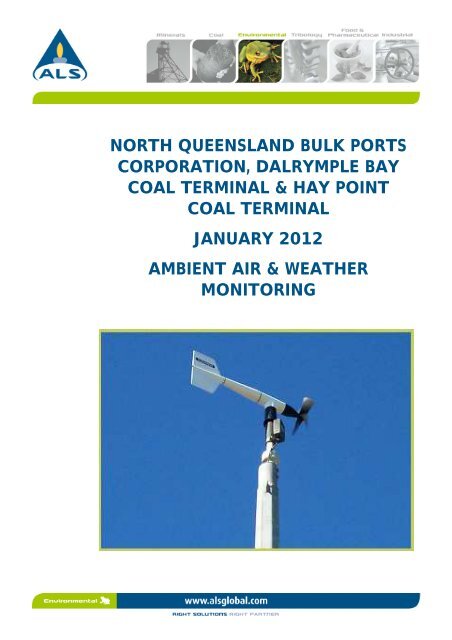
NORTH QUEENSLAND BULK PORTSCORPORATION, DALRYMPLE BAYCOAL TERMINAL & HAY POINTCOAL TERMINALJANUARY 2012AMBIENT AIR & WEATHERMONITORING
The ALS Water Sciences Group is part of the Environmental Division of ALS, one of the largest andmost geographically diverse environmental testing businesses in the world.CERTIFICATE OF APPROVAL FOR ISSUE OF DOCUMENTSClient:NORTH QUEENSLAND BULK PORTS CORPORATION, DALRYMPLE BAY COALTERMINAL & BMA HAY POINT COAL TERMINALProject Title:AMBIENT AIR, NOISE & WEATHER MONITORINGReport Title: January 2012Document No:Document Status:EE2012-015FinalDate of Issue: March 2012Comments:Position Name Signature DatePrepared by: Hydrographic Officer Scott Aulsebrook 06/03/12Internal review by:Administration/Technical SupportTina O’Neill 06/03/12Approved by: Operations Manager Tane Humphrey 06/03/12For further information on this report, contact:Name:Title:Address:Tane HumphreyOperations Manager, Measurement and Technical Services78 Harbour RdPO Box 2009Mackay, Qld, 4740Phone: 07 4944 0177Mobile: 0429 366 086E-mail:Tane.Humphrey@alsglobal.comDocument Revision ControlVersion Description of Revision Person Making Issue Date Approval1 Final Tane Humphrey 06/03/12© ALS Water Resources GroupThis document has been prepared for the Client named above and is to be used only for the purposesfor which it was commissioned. The document is subject to and issued in connection with theprovisions of the agreement between ALS Water Resources Group and the Client. No warranty isgiven as to its suitability for any other purpose.Ecowise Australia Pty Ltd trading as ALS Water Resources Group.ABN 94 105 060 320The photo on the front cover was taken on-site during ALS project work and is © ALS Water ResourcesGroup.EE2012-015<strong>Hay</strong> <strong>Point</strong> <strong>Coal</strong> <strong>Terminal</strong> & <strong>Dalrymple</strong> <strong>Bay</strong> <strong>Coal</strong> <strong>Terminal</strong>Final January 2012iii
TABLE OF CONTENTS1 Introduction 72 Monitoring Strategy 73 Sites 73.1 ALS Project Team ........................................................................................................ 93.1.1 Project Manager: Tane Humphrey ............................................................................................. 93.1.2 Project Officer - Field: David Turner .......................................................................................... 93.1.3 Project Officer - Reporting: Scott Aulsebrook ........................................................................... 93.1.4 Technical review and analysis of noise data - W Les Huson ...................................................... 9Monitoring Equipment and Methods ..................................................................................... 103.2 Ambient Air ............................................................................................................... 103.3 Dust Deposition ........................................................................................................ 103.4 Noise .......................................................................................................................... 103.5 Meteorological Conditions ....................................................................................... 104 Results 104.1 Meteorological Monitoring ....................................................................................... 104.1.1 Wind Speed and Direction........................................................................................................ 104.1.2 Rainfall ..................................................................................................................................... 124.1.3 Temperature and Relative Humidity ........................................................................................ 124.2 Dust Deposition ........................................................................................................ 124.2.1 Control Sites ............................................................................................................................ 124.2.2 Residential Sites ....................................................................................................................... 134.2.3 <strong>Terminal</strong> sites (DBCT & HPCT) ................................................................................................. 144.3 Airborne Dust ............................................................................................................ 154.4 Noise .......................................................................................................................... 164.5 Significant Events ...................................................................................................... 224.6 Data Recovery ........................................................................................................... 234.7 Complaints ................................................................................................................ 23APPENDIX A - MAP OF MONITORING SITES ............................................................................... A-1APPENDIX B - EQUIPMENT MAINTENANCE REGISTER ............................................................ B-1APPENDIX C - CALIBRATION CERTIFICATES .............................................................................. C-1APPENDIX D - FIELD SHEETS ........................................................................................................... D-1APPENDIX E - DUST DEPOSITIONAL DATA ................................................................................. E-1EE2012-015<strong>Hay</strong> <strong>Point</strong> <strong>Coal</strong> <strong>Terminal</strong> & <strong>Dalrymple</strong> <strong>Bay</strong> <strong>Coal</strong> <strong>Terminal</strong>Final January 2012iv
LIST OF FIGURESFigure 1: Wind Speed and Direction at P1 for January 2012 11Figure 2: Wind Speed and Direction at P2 for January 2012 11Figure 3: Wind Speed and Direction at P4 for January 2012. 12Figure 4: Dust deposition for Residential Sites – January 2012. 14Figure 5: Dust deposition for DBCT and HPCT Sites January 2012. 15Figure 6:TSP for residential sites P1, P2, and P4 measured in January2012. 16Figure 7: P1 sound pressure levels for the month of January 2012. 18Figure 8: P2 sound pressure levels for the month of January 2012. 19Figure 9: P3 sound pressure levels for the month of January 2012. 20Figure 10: P4 sound pressure levels for the month of January 2012. 21LIST OF TABLESTable 3-1: Location of Monitoring Sites (Refer to Appendix A) 8Table 4-1: Dust Deposition analysis for Control Site. 13Table 4-2: Dust Deposition analysis for Residential Sites 13Table 4-3:Dust Deposition analysis for <strong>Terminal</strong> Sites. Note: results arenot available for S16 as the site was removed during the HPSupgrade. 14Table 4-4: Significant events 22Table 4-5: Data Recovery from automated monitoring systems 23EE2012-015<strong>Hay</strong> <strong>Point</strong> <strong>Coal</strong> <strong>Terminal</strong> & <strong>Dalrymple</strong> <strong>Bay</strong> <strong>Coal</strong> <strong>Terminal</strong>Final January 2012v
Distribution of ReportMailed copies sent to each recipient:Gabrielle BreenNicola Stokes<strong>Dalrymple</strong> <strong>Bay</strong> <strong>Coal</strong> <strong>Terminal</strong><strong>North</strong> QLD Bulk Ports CorporationMail Services F283 PO Box 3340Mackay QLD 4740 <strong>North</strong> Mackay QLD 4740Mr Peter ConwaySharon JohnstonBMA <strong>Hay</strong> <strong>Point</strong> <strong>Coal</strong> <strong>Terminal</strong><strong>Dalrymple</strong> <strong>Bay</strong> <strong>Coal</strong> <strong>Terminal</strong>Mail Service 283Mail Services F283Mackay QLD 4740 Mackay QLD 4740Mr Peter FranksMr David WainwrightChief Executive OfficeDepartment of Environment andMackay City CouncilResource ManagementPO Box 41 PO Box 15155Mackay QLD 4740 City East QLD 4002Louisa Creek and <strong>Hay</strong> <strong>Point</strong>Mr Greg SmithProgress AssociationGeneral Manager OperationsMrs B Hobbs<strong>Dalrymple</strong> <strong>Bay</strong> <strong>Coal</strong> <strong>Terminal</strong>95 Edmunds Avenue ManagementLouisa CreekLevel 26 Waterfront PlaceMS F2831 Eagle Street PlaceMackay QLD 4740 Brisbane QLD 4001E-mailed copies sent to each recipient below:Cwes_mackay@derm.qld.gov.auMr Chris CashmanChris.cashman@dbct.com.auGabrielle BreenGabrielle.breen@dbct.com.auGloria RitchingsGloria.ritchings@dbct.com.auMr Mark SvaikauskusMark.svaikauskus@dbct.com.auNicola Stokesnstokes@nqbp.com.auMr Peter Conwaypeter.conway@bmacoal.comMr Andrew Garrettandrew.garrett@dbct.com.auThis report supersedes any previous report(s) with this reference. Results apply to thesample(s) submitted. All pages of this report have been checked and approved for release.All rights reserved. No section or element of this document may be removed from thisdocument, extracted or reproduced.All analytical results have been performed by a NATA certified laboratory, under theaccreditation for compliance with ISO/IEC 17025.EE2012-015<strong>Hay</strong> <strong>Point</strong> <strong>Coal</strong> <strong>Terminal</strong> & <strong>Dalrymple</strong> <strong>Bay</strong> <strong>Coal</strong> <strong>Terminal</strong>Final January 2012vi
1 IntroductionThis report is prepared by Australian Laboratory Services (ALS) for <strong>North</strong> <strong>Queensland</strong> BulkPorts Corporation (NQBP), <strong>Dalrymple</strong> <strong>Bay</strong> <strong>Coal</strong> <strong>Terminal</strong> (DBCT) and BMA <strong>Hay</strong> <strong>Point</strong> <strong>Coal</strong><strong>Terminal</strong> (HPCT). The report contains a summary of ambient air, noise and meteorologicalmonitoring results for the Port of <strong>Hay</strong> <strong>Point</strong> environmental monitoring program for theperiod of January 2012.2 Monitoring StrategyThis environmental monitoring program has been established to proactively monitorambient air, noise and meteorological conditions in the community surrounding the Portof <strong>Hay</strong> <strong>Point</strong>. Monitoring is carried out in accordance with manufacturer's specifications,Australian Standards (AS1055 (1997); AS3580 (2008)) and the DERM Noise MeasurementManual (2000). Calibration certificates for monitoring equipment are provided inAppendix C.3 SitesEnvironmental monitoring is conducted at sites within the <strong>Dalrymple</strong> <strong>Bay</strong> and <strong>Hay</strong> <strong>Point</strong><strong>Coal</strong> <strong>Terminal</strong>s as well as in the surrounding residential areas. Additionally, two sites aremonitored at Grasstree Beach to establish baseline (control) conditions for dust depositionin the local area. Table 3-1 outlines the location of the monitoring sites and the type ofmonitoring conducted at each. A map of the monitoring sites is presented in Appendix A.EE2012-015<strong>Hay</strong> <strong>Point</strong> <strong>Coal</strong> <strong>Terminal</strong> & <strong>Dalrymple</strong> <strong>Bay</strong> <strong>Coal</strong> <strong>Terminal</strong>Final January 20127
Table 3-1: Location of Monitoring Sites (Refer to Appendix A)Site Type Site Code Site Description Latitude Longitude Monitoring TypeControl C1 Grasstree Beach (South) 21.36482 149.30602 Dust Deposition (monthly)C2 Grasstree Beach (<strong>North</strong>) 21.37267 149.30863 Dust Deposition (monthly)Residential P1 Louisa Creek, EdmundAvenue (<strong>North</strong>)21.26648 149.26635 Dust Deposition (monthly)TSP (every 10 seconds)P2Louisa Creek, EdmundAvenue (South)Meteorological ConditionsNoise Conditions (continual)21.27420 149.26225 Dust Deposition (monthly)TSP (every 10 seconds)Meteorological ConditionsNoise Conditions (continual)P3 Half Tide Beach 21.29493 149.28910 Dust Deposition (monthly)TSP (every 10 seconds)Meteorological ConditionsNoise Conditions (continual)P4 Salonika Beach 21.30987 149.29167 Dust Deposition (monthly)TSP (continual)Meteorological Conditions(continual)Noise Conditions (continual)S1 Louisa Creek (<strong>North</strong>) 21.27818 149.26962 Dust Deposition (monthly)S2 Louisa Creek (South) 21.29407 149.28262 Dust Deposition (monthly)S3 Osborne’s Residence 21.29315 149.28585 Dust Deposition (monthly)S5 Salonika Beach 21.27992 149.28002 Dust Deposition (monthly)S6 Half Tide Beach 21.28078 149.28373 Dust Deposition (monthly)<strong>Dalrymple</strong><strong>Bay</strong> <strong>Coal</strong><strong>Terminal</strong>S4 DBCT Rail Loop 21.27890 149.28688 Dust Deposition (monthly)S7DBCT Western Fence Line(<strong>North</strong>)21.28265 149.29060 Dust Deposition (monthly)S8S9DBCT Western Fence Line(Centre)DBCT Western Fence Line(South)21.28283 149.29082 Dust Deposition (monthly)21.28072 149.28368 Dust Deposition (monthly)S10 DBCT Employees Car Park 21.28127 149.27377 Dust Deposition (monthly)S11 DBCT Storage Yard 21.29120 149.26857 Dust Deposition (monthly)S12 DBCT Surge Bin 21.29695 149.27547 Dust Deposition (monthly)S13 Substation 4 21.30480 149.29208 Dust Deposition (monthly)<strong>Hay</strong> <strong>Point</strong><strong>Coal</strong><strong>Terminal</strong>S14 BMA HPCT Storage Yard 21.30122 149.29060 Dust Deposition (monthly)S15 BMA HPCT Front Gate 21.28283 149.27667 Dust Deposition (monthly)S16S17BMA HPCT WesternStockpileDBCT Water Storage DamWall21.28702 149.27770 Dust Deposition (monthly)21.29025 149.27955 Dust Deposition (monthly)EE2012-015<strong>Hay</strong> <strong>Point</strong> <strong>Coal</strong> <strong>Terminal</strong> & <strong>Dalrymple</strong> <strong>Bay</strong> <strong>Coal</strong> <strong>Terminal</strong>Final January 20128
3.1 ALS Project Team3.1.1 Project Manager: Tane HumphreyCompany: ALSTitle: Operations Manager, Monitoring and Technical ServicesRole: Client liaison, supervision of field officers, communication with technical expertsQualifications: New Zealand Stage 3 Certificate of Civil EngineeringNew Zealand Hydrological Training ProgramYears Experience: 93.1.2 Project Officer - Field: David TurnerCompany: ALSTitle: Environmental Technician, Water Resources GroupRole: Operation, maintenance and reporting for a variety of instrumentation.Qualifications: The University of Manchester, UK 1994-1997, BSc (Hons)Geography/GeologyYears Experience: 93.1.3 Project Officer - Reporting: Scott AulsebrookCompany: ALSTitle: Hydrographic Officer, MATS – Mackay QLDRole: Compose monthly reportQualifications: Bachelor of Applied Science, Majoring in Natural Resource Management,Southern Cross University, Lismore NSWYears Experience: 33.1.4 Technical review and analysis of noise data - W Les HusonCompany: L Huson & Associates Pty LtdTitle: Principal ConsultantRole: Acoustic analysis and reportingQualifications: BSc(Hons) Applied Physics 1975; MSc Sound and Vibration Studies,Institute of Sound and Vibration Research, Southampton University 1978Years Experience: 36EE2012-015<strong>Hay</strong> <strong>Point</strong> <strong>Coal</strong> <strong>Terminal</strong> & <strong>Dalrymple</strong> <strong>Bay</strong> <strong>Coal</strong> <strong>Terminal</strong>Final January 20129
Monitoring Equipment and Methods3.2 Ambient AirContinuous monitoring of ambient air quality is carried out at sites P1, P2, P3 and P4 forTotal Suspended Particulates (TSP) using the TEOM 1405 TSP Ambient ParticulateMonitor. The TEOM passes a known volume of air through a filter, and records the mass ofparticulate matter collected by the filter. The concentration of TSP is then calculated bydividing the mass of particulate matter by the volume of air sampled.3.3 Dust DepositionDust deposition gauges are installed at all sites listed in Table 3-1 to examine the amountof dust deposition (fallout) that is occurring around the Port. Sample bottles are collectedon a monthly basis and analysed by an ALS NATA accredited laboratory for soluble solids,insoluble solids, combustible matter and approximate percentage of fine dark particles.3.4 NoiseFour Class 1 Bruel & Kjaer 2250 Sound Level Meters fitted with outdoor microphone kitsmonitor sound levels continuously at sites P1, P2, P3 and P4. Sound levels are monitoredover integration periods of 15 min, 1 hour and 24-hours for statistical values of LA90 , LA1,LA5, LA10, LA50, LA95, LA99. In addition, the LAeq , minLpA, maxLpA and Z-weighted one-thirdoctave band sound levels from 12.5 Hz to 20,000 Hz are also recorded.Data collected by this equipment is sent for technical review and analysis by PrincipalConsultant W Les Huson of L Huson & Associates Pty Ltd.3.5 Meteorological ConditionsMeteorological conditions are monitored on a continuous basis at sites P1, P2, P3 and P4using a Vaisala WXT520 Multisensor Weather Monitor. Conditions monitored include windspeed and direction, ambient temperature and relative humidity.The Equipment Maintenance Register in Appendix B indicates the maintenance that wascarried out on monitoring equipment by ALS staff in January 2012.4 Results4.1 Meteorological Monitoring4.1.1 Wind Speed and DirectionWind speed and direction from sites P1, P2, and P4 are outlined in Figures 1, 2 and 3below. The wind sensors at P3 were removed on 12 th March 2010 and moved to P4 due torust on the probes at P4. New probes have now been installed at P3 and Ergon Energy hasbeen approached to restore power to the site.EE2012-015<strong>Hay</strong> <strong>Point</strong> <strong>Coal</strong> <strong>Terminal</strong> & <strong>Dalrymple</strong> <strong>Bay</strong> <strong>Coal</strong> <strong>Terminal</strong>Final January 201210
Figures 1, 2 and 3 show winds in the Port of <strong>Hay</strong> <strong>Point</strong> and <strong>Dalrymple</strong> <strong>Bay</strong> originating froma predominantly East to South Easterly direction during the month of January 2012. P1saw an average wind speed of 2.48m/s with a maximum velocity of 7.44m/s beingrecorded during the month.Figure 1: Wind Speed and Direction at P1 for January 2012An average wind speed of 1.60m/s and a maximum of 6.33m/s were recorded at P2 thismonth.Figure 2: Wind Speed and Direction at P2 for January 2012EE2012-015<strong>Hay</strong> <strong>Point</strong> <strong>Coal</strong> <strong>Terminal</strong> & <strong>Dalrymple</strong> <strong>Bay</strong> <strong>Coal</strong> <strong>Terminal</strong>Final January 201211
The average wind speed experienced at P4 for the month of January 2012 was 4.26m/sgusts up to 13.63m/s recorded.Figure 3: Wind Speed and Direction at P4 for January 2012.4.1.2 RainfallTotal rainfall in the month of January was 589.5mm (BOM). This is above the Januaryaverage of 363.8mm (http://www.bom.gov.au/climate/data/). The highest daily rainfall of200.0mm was received on the 15 th January 2012.4.1.3 Temperature and Relative HumidityAn average temperature of 26.27°C was recorded for January 2012. The minimumtemperature of 19.8°C was recorded on the 5 th at P1, with a maximum of 30.9 °C recordedat P2 on the 29 th of the month.Mean relative humidity was recorded as 76.1% during January 2012. The minimum relativehumidity of 49.50% was recorded on the 2 nd at P2, with the maximum of 94.3% recorded atP4 on the 15 th .4.2 Dust Deposition4.2.1 Control SitesThe Management Objective Level for dust deposition is calculated as the average TotalInsoluble Solids for the control sites (C1 and C2) plus 60mg/m 2 /day (as per theDevelopment Approval conditions).Table 4-1 provides the results of dust deposition analysis for the control sites. The TotalInsoluble Solids component of the dust deposition measured at C1 and C2 was20.0mg/m 2 /day and 23.3mg/m 2 /day respectively.EE2012-015<strong>Hay</strong> <strong>Point</strong> <strong>Coal</strong> <strong>Terminal</strong> & <strong>Dalrymple</strong> <strong>Bay</strong> <strong>Coal</strong> <strong>Terminal</strong>Final January 201212
The Management Objective Level for the month of January 2012 is set at 81.7mg/m 2 /day.Table 4-1:Dust Deposition analysis for Control Site.SiteTotalInsolubleSolids(mg/m 2 /day)TotalSolubleSolids(mg/m 2 /day)AshResidue(mg/m 2 /day)CombustibleMatter (mg/m 2 /day)Fine DarkParticles(%)OrganicMatter(%)Sand/Clay(%)C1 20.0 90.0 10.0 10.0
mg/m 2 /day120.0110.0100.090.080.070.060.050.040.030.020.010.00.0Fine Dark Particles Organic Matter Mineral FractionManagement Objective Level:81.7mg/m 2 /dayP1 P2 P3 P4 S1 S2 S3 S5 S6Residential SitesFigure 4: Dust deposition for Residential Sites – January 2012.4.2.3 <strong>Terminal</strong> sites (DBCT & HPCT)Table 4-3:Dust Deposition analysis for <strong>Terminal</strong> Sites. Note: results are notavailable for S16 as the site was removed during the HPS upgrade.SiteTotalInsolubleSolids(mg/m 2 /day)TotalSolubleSolids(mg/m 2 /day)AshResidue(mg/m 2 /day)CombustibleMatter (mg/m 2 /day)FineDarkParticles(%)OrganicMatter(%)Sand/Clay(%)DBCT S4 26.7 3.3 23.3 3.3 10 to 20
Within the <strong>Dalrymple</strong> <strong>Bay</strong> <strong>Coal</strong> <strong>Terminal</strong>, Total Insoluble Solids ranged between13.3mg/m 2 /day at S9, and 246.7mg/m 2 /day at S12. January 2012 saw two sites within theDBCT exceed the months Management Objective Level of 81.7mg/m 2 /day (Figure 5).These sites were S11 (93.3mg/m 2 /day) and S12 with reading of 246.7mg/m 2 /day.Microscopic examination of these samples determined that S11 consisted of 30% to 40%Fine Dark Particles,
approached about reconnecting the power to this site and it is hoped power will berestored in the near future.TSP (ug/m3)P1 P2 P4 Management Objective110100908070605040302010028/12/112/1/127/1/1212/1/1217/1/1222/1/1227/1/126/2/121/2/12DateFigure 6: TSP for residential sites P1, P2, and P4 measured in January 2012.Note: high level of TSP data loss at P1 cause of gaps in the trace (see table 4-4).4.4 NoiseTable 6 summarises the LA90 values recorded at sites P1, P2, P3 and P4 in January 2012.The compliance levels are a 15 minute LA90 of 55 dBA in the period of the day from 7amto 7pm and 53 dBA L A90from 7pm to 7am.The average L A90sound pressure levels at all monitoring locations (including adverseweather and other extraneous sounds) was below the corresponding target noise levelsfor the Day and Night periods.Extraneous elevated noise levels were caused primarily by strong wind and rain eventsthat are evident throughout the month. The microphone cable at P4 was found to becorroded after the sound level meter would not calibrate correctly. A new microphonecable replacement has been installed.The sound level meter at P3 continues to shut down randomly. An alternative to the useof an inverter to power the sound level meter is being investigated. The area adjacent toP3 is now being used as an overnight truck stop. This is the probable cause of the uppersound levels in the reported sound level range.EE2012-015<strong>Hay</strong> <strong>Point</strong> <strong>Coal</strong> <strong>Terminal</strong> & <strong>Dalrymple</strong> <strong>Bay</strong> <strong>Coal</strong> <strong>Terminal</strong>Final January 201216
Table 3.4: LA90 values recorded at P1, P2, P3 and P4 during January 2012.SiteAverageLA90 dBStandardDeviationRangedBACommentsP1 Day 43 2.0 39 to 59 Higher sound levels in range causedby heavy rainP1 Night 43 2.3 39 to 62P2 Day 49 2.6 42 to 57 Higher sound levels in range causedby heavy rainP2 Night 50 2.7 43 to 62P3 Day 41 2.9 33 to 63 Higher sound levels in range causedby heavy rainP3 Night 43 3.1 36 to 62P4 Day 47 2.0 45 to 59 Microphone cable replacedP4 Night 48 1.8 45 to 53Note: The data above includes extraneous noise and adverse weather effects.Sound levels measured throughout the month of January for the LA90 and LA10 statisticsare shown in figures 7 to 10 for monitoring locations P1, P2, P3 and P4 respectively.EE2012-015<strong>Hay</strong> <strong>Point</strong> <strong>Coal</strong> <strong>Terminal</strong> & <strong>Dalrymple</strong> <strong>Bay</strong> <strong>Coal</strong> <strong>Terminal</strong>Final January 201217
Figure 7: P1 sound pressure levels for the month of January 2012.EE2012-015<strong>Hay</strong> <strong>Point</strong> <strong>Coal</strong> <strong>Terminal</strong> & <strong>Dalrymple</strong> <strong>Bay</strong> <strong>Coal</strong> <strong>Terminal</strong><strong>Draft</strong> January 201218
Figure 8: P2 sound pressure levels for the month of January 2012.EE2012-015<strong>Hay</strong> <strong>Point</strong> <strong>Coal</strong> <strong>Terminal</strong> & <strong>Dalrymple</strong> <strong>Bay</strong> <strong>Coal</strong> <strong>Terminal</strong><strong>Draft</strong> January 201219
Figure 9: P3 sound pressure levels for the month of January 2012.EE2012-015<strong>Hay</strong> <strong>Point</strong> <strong>Coal</strong> <strong>Terminal</strong> & <strong>Dalrymple</strong> <strong>Bay</strong> <strong>Coal</strong> <strong>Terminal</strong><strong>Draft</strong> January 201220
Figure 10: P4 sound pressure levels for the month of January 2012.EE2012-015<strong>Hay</strong> <strong>Point</strong> <strong>Coal</strong> <strong>Terminal</strong> & <strong>Dalrymple</strong> <strong>Bay</strong> <strong>Coal</strong> <strong>Terminal</strong><strong>Draft</strong> January 201221
4.5 Significant EventsSignificant events includes any issues that have arisen during the course of the month,such as; filters changes/ noise db check, missing data for a period of time, any errors ormalfunctions with the probes.Table 4-4:Significant eventsSite Parameter Date Problem and ActionP1TemperatureRelative HumidityWind DirectionWind VelocityJanuary2012Gap in data from:11:10_06/01/2012 to 07:40_10/01/2012,01:50_24/01/2012 to 08:25_24/01/2012,due to instrument/software malfunctions.Gap in data from:18:54_08/01/2012 to 07:35_10/01/2012,12:00_12/01/2012 to 15:25_18/01/2012,P1TSPJanuary201203:00_20/01/2012 to 09:10_23/01/2012,01:50_24/01/2012 to 07:55_24/01/2012,15:05_24/01/2012 to 14:25_25/01/2012,13:20_27/01/2012 to 08:05_31/01/2012,due to a instrument/software malfunction.P1NoiseJanuary2012Total of 2% data loss over the month.P2TemperatureRelative HumidityWind DirectionWind VelocityTSPJanuary2012Gap in data from:03:55_05/01/2012 to 07:25_05/01/2012,16:50_20/01/2012 to 08:20_23/01/2012,01:50_24/01/2012 to 07:55_24/01/2012,due to a instrument/software malfunction.P2NoiseJanuary2012Total of 9% data loss over the month.TemperatureP3Relative HumidityWind DirectionWind VelocityTSPJanuary2012No data available for month. Due todisconnection of mains power.P3NoiseJanuary2012Total of 38% data loss over the month.P4TSPJanuary2012Erroneous negative values totalling 4% ofthe months data not included in the dataset.P4NoiseJanuary2012Corroded microphone cable causing lossof noise data. Problem diagnosed andcable replaced on the 24 th .EE2012-015<strong>Hay</strong> <strong>Point</strong> <strong>Coal</strong> <strong>Terminal</strong> & <strong>Dalrymple</strong> <strong>Bay</strong> <strong>Coal</strong> <strong>Terminal</strong><strong>Draft</strong> January 201222
4.6 Data RecoveryThe data recovery is indicated as a percentage in Table 4-5 below for all monitoringsystems.Table 4-5:Data Recovery from automated monitoring systemsParameter P1 P2 P3 P4 Overall AverageTEOM 48% 90% 0% 96% 56%Wind Speed 87% 90% 0% 100% 69%Wind Direction 87% 90% 0% 100% 69%Temperature 87% 90% 0% 100% 69%Relative Humidity 87% 90% 0% 100% 69%Noise 98% 91% 62% 24% 69%OverallAverage82% 90% 10% 87% 67%4.7 ComplaintsNo complaints were registered for the month of January 2012.EE2012-015<strong>Hay</strong> <strong>Point</strong> <strong>Coal</strong> <strong>Terminal</strong> & <strong>Dalrymple</strong> <strong>Bay</strong> <strong>Coal</strong> <strong>Terminal</strong><strong>Draft</strong> January 201223
Appendix A - Map ofMonitoring SitesEE2012-015<strong>Hay</strong> <strong>Point</strong> <strong>Coal</strong> <strong>Terminal</strong> & <strong>Dalrymple</strong> <strong>Bay</strong> <strong>Coal</strong> <strong>Terminal</strong><strong>Draft</strong> January 2012A-1
Figure A–1:Map of Port of <strong>Hay</strong> <strong>Point</strong> Monitoring Location.EE2012-015<strong>Hay</strong> <strong>Point</strong> <strong>Coal</strong> <strong>Terminal</strong> & <strong>Dalrymple</strong> <strong>Bay</strong> <strong>Coal</strong> <strong>Terminal</strong><strong>Draft</strong> January 2012A-2
Appendix B - EquipmentMaintenance RegisterEE2012-015<strong>Hay</strong> <strong>Point</strong> <strong>Coal</strong> <strong>Terminal</strong> & <strong>Dalrymple</strong> <strong>Bay</strong> <strong>Coal</strong> <strong>Terminal</strong><strong>Draft</strong> January 2012B-1
Particulars Service Interval JanuaryReason for notservicingNoise logger @ P1-Exterior ServiceNoise logger @ P2-Exterior ServiceNoise logger @ P3-Exterior ServiceNoise logger @ P4-Exterior ServiceYearlyYearlyYearlyYearlyNoise logger calibration @ P1-P4 Monthly YesTEOM Filter Change P1TEOM Filter Change P2TEOM Filter Change P3TEOM Filter Change P4Filter load exceeds90%Filter load exceeds90%Filter load exceeds90%Filter load exceeds90%Filter load did notexceeds 90%Filter load did notexceeds 90%NAFilter load did notexceeds 90%Clean TEOM air inlet system Bi-Yearly P2Change TEOM inline filterChange TEOM fine particulate filtersTEOM leak testTEOM Analog CalibrationTEOM Mass CalibrationTEOM Flow ControllerTEOM Pump serviceBi-YearlyBi-YearlyBi-YearlyYearlyYearlyYearlyYearlyHut Maintenance Monthly YesMeteorological Tower Check Monthly YesWind Sensors exterior serviceYearlyDust Deposition Gauges Monthly YesNoise Calibrator-CalibrationYearlyEE2012-015<strong>Hay</strong> <strong>Point</strong> <strong>Coal</strong> <strong>Terminal</strong> & <strong>Dalrymple</strong> <strong>Bay</strong> <strong>Coal</strong> <strong>Terminal</strong><strong>Draft</strong> January 2012B-2
Appendix C - CalibrationCertificatesEE2012-015<strong>Hay</strong> <strong>Point</strong> <strong>Coal</strong> <strong>Terminal</strong> & <strong>Dalrymple</strong> <strong>Bay</strong> <strong>Coal</strong> <strong>Terminal</strong><strong>Draft</strong> January 2012C-1
EE2012-015<strong>Hay</strong> <strong>Point</strong> <strong>Coal</strong> <strong>Terminal</strong> & <strong>Dalrymple</strong> <strong>Bay</strong> <strong>Coal</strong> <strong>Terminal</strong><strong>Draft</strong> January 2012C-2
EE2012-015<strong>Hay</strong> <strong>Point</strong> <strong>Coal</strong> <strong>Terminal</strong> & <strong>Dalrymple</strong> <strong>Bay</strong> <strong>Coal</strong> <strong>Terminal</strong><strong>Draft</strong> January 2012C-3
EE2012-015<strong>Hay</strong> <strong>Point</strong> <strong>Coal</strong> <strong>Terminal</strong> & <strong>Dalrymple</strong> <strong>Bay</strong> <strong>Coal</strong> <strong>Terminal</strong><strong>Draft</strong> January 2012C-4
EE2012-015<strong>Hay</strong> <strong>Point</strong> <strong>Coal</strong> <strong>Terminal</strong> & <strong>Dalrymple</strong> <strong>Bay</strong> <strong>Coal</strong> <strong>Terminal</strong><strong>Draft</strong> January 2012C-5
EE2012-015<strong>Hay</strong> <strong>Point</strong> <strong>Coal</strong> <strong>Terminal</strong> & <strong>Dalrymple</strong> <strong>Bay</strong> <strong>Coal</strong> <strong>Terminal</strong><strong>Draft</strong> January 2012C-6
EE2012-015<strong>Hay</strong> <strong>Point</strong> <strong>Coal</strong> <strong>Terminal</strong> & <strong>Dalrymple</strong> <strong>Bay</strong> <strong>Coal</strong> <strong>Terminal</strong><strong>Draft</strong> January 2012C-7
EE2012-015<strong>Hay</strong> <strong>Point</strong> <strong>Coal</strong> <strong>Terminal</strong> & <strong>Dalrymple</strong> <strong>Bay</strong> <strong>Coal</strong> <strong>Terminal</strong><strong>Draft</strong> January 2012C-8
EE2012-015<strong>Hay</strong> <strong>Point</strong> <strong>Coal</strong> <strong>Terminal</strong> & <strong>Dalrymple</strong> <strong>Bay</strong> <strong>Coal</strong> <strong>Terminal</strong><strong>Draft</strong> January 2012C-9
EE2012-015<strong>Hay</strong> <strong>Point</strong> <strong>Coal</strong> <strong>Terminal</strong> & <strong>Dalrymple</strong> <strong>Bay</strong> <strong>Coal</strong> <strong>Terminal</strong><strong>Draft</strong> January 2012C-10
EE2012-015<strong>Hay</strong> <strong>Point</strong> <strong>Coal</strong> <strong>Terminal</strong> & <strong>Dalrymple</strong> <strong>Bay</strong> <strong>Coal</strong> <strong>Terminal</strong><strong>Draft</strong> January 2012C-11
EE2012-015<strong>Hay</strong> <strong>Point</strong> <strong>Coal</strong> <strong>Terminal</strong> & <strong>Dalrymple</strong> <strong>Bay</strong> <strong>Coal</strong> <strong>Terminal</strong><strong>Draft</strong> January 2012C-12
EE2012-015<strong>Hay</strong> <strong>Point</strong> <strong>Coal</strong> <strong>Terminal</strong> & <strong>Dalrymple</strong> <strong>Bay</strong> <strong>Coal</strong> <strong>Terminal</strong><strong>Draft</strong> January 2012C-13
EE2012-015<strong>Hay</strong> <strong>Point</strong> <strong>Coal</strong> <strong>Terminal</strong> & <strong>Dalrymple</strong> <strong>Bay</strong> <strong>Coal</strong> <strong>Terminal</strong><strong>Draft</strong> January 2012C-14
EE2012-015<strong>Hay</strong> <strong>Point</strong> <strong>Coal</strong> <strong>Terminal</strong> & <strong>Dalrymple</strong> <strong>Bay</strong> <strong>Coal</strong> <strong>Terminal</strong><strong>Draft</strong> January 2012C-15
Appendix D - Field SheetsEE2012-015<strong>Hay</strong> <strong>Point</strong> <strong>Coal</strong> <strong>Terminal</strong> & <strong>Dalrymple</strong> <strong>Bay</strong> <strong>Coal</strong> <strong>Terminal</strong><strong>Draft</strong> January 2012D-1
EE2012-015<strong>Hay</strong> <strong>Point</strong> <strong>Coal</strong> <strong>Terminal</strong> & <strong>Dalrymple</strong> <strong>Bay</strong> <strong>Coal</strong> <strong>Terminal</strong><strong>Draft</strong> January 2012D-2
EE2012-015<strong>Hay</strong> <strong>Point</strong> <strong>Coal</strong> <strong>Terminal</strong> & <strong>Dalrymple</strong> <strong>Bay</strong> <strong>Coal</strong> <strong>Terminal</strong><strong>Draft</strong> January 2012D-3
EE2012-015<strong>Hay</strong> <strong>Point</strong> <strong>Coal</strong> <strong>Terminal</strong> & <strong>Dalrymple</strong> <strong>Bay</strong> <strong>Coal</strong> <strong>Terminal</strong><strong>Draft</strong> January 2012D-4
EE2012-015<strong>Hay</strong> <strong>Point</strong> <strong>Coal</strong> <strong>Terminal</strong> & <strong>Dalrymple</strong> <strong>Bay</strong> <strong>Coal</strong> <strong>Terminal</strong><strong>Draft</strong> January 2012D-5
EE2012-015<strong>Hay</strong> <strong>Point</strong> <strong>Coal</strong> <strong>Terminal</strong> & <strong>Dalrymple</strong> <strong>Bay</strong> <strong>Coal</strong> <strong>Terminal</strong><strong>Draft</strong> January 2012D-6
EE2012-015<strong>Hay</strong> <strong>Point</strong> <strong>Coal</strong> <strong>Terminal</strong> & <strong>Dalrymple</strong> <strong>Bay</strong> <strong>Coal</strong> <strong>Terminal</strong><strong>Draft</strong> January 2012D-1
Appendix E - DustDepositional DataEE2012-015<strong>Hay</strong> <strong>Point</strong> <strong>Coal</strong> <strong>Terminal</strong> & <strong>Dalrymple</strong> <strong>Bay</strong> <strong>Coal</strong> <strong>Terminal</strong><strong>Draft</strong> January 2012E-1
Raw Data – Depositional dustSiteTotal Solidsg/m2/mthTotal InsolubleMatterg/m2/mthTotal SolubleMatterg/m2/mthAshg/m2/mthCombustibleMatterg/m2/mthMicro_ Exam -Fine DarkParticles (%)Micro_ Exam -Organic Matter(%)Micro_ Exam -Sand / Clay(%) CommentsC1 3.3 0.6 2.7 0.3 0.3
SiteTotal Solidsg/m2/mthTotal InsolubleMatterg/m2/mthTotal SolubleMatterg/m2/mthAshg/m2/mthCombustibleMatterg/m2/mthMicro_ Exam -Fine DarkParticles (%)Micro_ Exam -Organic Matter(%)Micro_ Exam -Sand / Clay(%) CommentsS17 1 1