Surface Water Quality Threat Assessment Method - Conservation ...
Surface Water Quality Threat Assessment Method - Conservation ...
Surface Water Quality Threat Assessment Method - Conservation ...

Create successful ePaper yourself
Turn your PDF publications into a flip-book with our unique Google optimized e-Paper software.
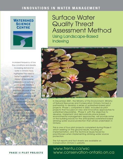
INNOVATIONS IN WATER MANAGEMENT<strong>Surface</strong> <strong>Water</strong><strong>Quality</strong> <strong>Threat</strong><strong>Assessment</strong> <strong>Method</strong>Using Landscape-BasedIndexingIncreased frequency of lowflow conditions and steadilyincreasing demand forwater in Ontario havehighlighted the need tobetter understand theimpact of decreasingstreamflow on surfacewater quality. Baseflowconditions are particularlyimportant because of thedecreased potential fordilution of contaminants atlower flows. This studyexamines methods andtools that can be integratedinto a water qualitysusceptibility index for thescreening of potentialthreats to surface waterconditions acrosswatersheds.In December 2001, the Ministry of the Environment, Ministryof Natural Resources and <strong>Conservation</strong> Ontario formed apartnership to develop a series of watershed-based pilotprojects. Phase I, completed in 2003, included six pilotprojects that focused on new and innovative approaches towatershed stewardship. Phase II, with the objective todevelop, implement and demonstrate place-basedenvironmental management approaches, will provide someof the building blocks for the anticipated watershed-baseddrinking water source protection that will be undertaken inOntario.This is one of four pilot projects completed during Phase IIwhich seeking on the ground results, focusing onimplementation, and the technical issues faced bypractitioners when implementing drinking water sourceprotection.The full reports and fact sheets are available on<strong>Conservation</strong> Ontario’s website.PHASE II PILOT PROJECTSwww.trentu.ca/wscwww.conservation-ontario.on.ca
The Projectat a Glance…This research project was conducted by the<strong>Water</strong>shed Science Centre at Trent University, inpartnership with the Ministry of Natural Resources(MNR). The focus of the study was the developmentof methods, data layers, models, and tools to predictbaseflow characteristics and potential nutrientloading at ungauged sites that could be integratedinto a water quality susceptibility index used forscreening potential threats to surface waterconditions across watersheds. Research objectiveswere:1. To develop a predictive model for estimatingbaseflow parameters at ungauged sites usinglandscape attributes.2. To evaluate the degree to which landscapefeatures at watershed scales influence nutrientloading in streams, and to develop a predictivemodel for identifying surface waters at greatestrisk of high levels of nutrient loading acrossregional scales.3. To use combined results of the baseflow andnutrient loading models to develop a susceptibilityindex for surface water quality that can be usedto identify potential threats across regional scales.The Importanceof BaseflowThe ability to assess potential threats to surfacewater quality across a watershed at ungaugedsites depends on the ability to both predictstreamflow conditions and to identify thesusceptibility to nutrient loading. Particularlyimportant is the estimation of baseflowconditions. Baseflow is the portion of totalstreamflow contributed by groundwater andlarger surface storages that sustains the riverineecosystem between hydrologic events such asspring melt and rainfall. It is often reported as theBaseflow Index (BFI), the proportion of baseflowto total streamflow. It has a different chemistrycompared to surface runoff, providing dilution forcontaminants traveling via surface pathwaysand is a source of contaminants fromgroundwater flow paths. Therefore, lesserbaseflow proportions may infer less capacity fordilution of point and non-point source pollution.Alternatively, greater baseflow contributions maybe related to increased loading of pollutantsdelivered through groundwater pathways.Both scenarios may possibly lead tounacceptable water quality levels. Thus, there isincreased interest in the transport of pollutants tostreams along both pathways, particularly fromnon-point sources (NPS) and in agriculturallyintense areas.The successful development of predictive models toinfer both baseflow characteristics andphosphorus/nitrate loading inungauged/unmonitored basins is important forassessing the regional variability of potential threats tosurface water quality. The results are encouraging,showing that predictive models for both parameters,based on strong observed relationships, can bedeveloped with minimum data while still beingphysically sound. In doing so, the approach providesscreening tools that are easily accessible to a varietyof jurisdictions largely independent of availableresources.
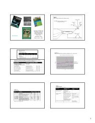
How the Model BasinsWere SelectedBasins with an historical streamflow record and ageographically-referenced digital drainage divide,providing the location and spatial extent of the basin,were considered for the analysis. Daily streamflowtime series were obtained from EnvironmentCanada's HYDAT database, an historical archive ofover 1,000 gauging stations in Ontario. Digitaldrainage divides have been delineated for 532 ofthese gauging stations by the <strong>Water</strong> ResourcesInformation Project (WRIP), led by the Ministry ofNatural Resources (MNR). These boundaries areconsidered to be the most accurate currentlyavailable and thus were used in the analysis.Secondary criteria for basin selection included: i) anatural flow regime; ii) 20 years or greater period ofrecords, iii) non-nested data (i.e. within the drainagearea of another model basin), to meet theindependence requirement for regression analysis;and iv) continuous flow measurement throughout theyear (i.e. not seasonal). Ninety gauging stations inOntario met these criteria with drainage areasranging between 30 km 2 and 8,510 km 2 .Below: Ninety HYDAT gauging stations used in thebaseflow analysis.Implications for<strong>Water</strong>shed ManagementBoth baseflow and non-point source contaminantloading from agriculture are a function oflandscape-scale processes. Strong linkages havebeen observed between landscape attributes(such as soil, geology, land use, land cover, andtopography of a watershed) and stream chemistry,allowing the development of predictive models ofsurface water quality. Working at the landscapescaleallows the development of methodologiesapplicable over wider areas, facilitatingmeaningful comparisons and the demonstration ofbroader environmental patterns. It is important torecognize that not only are physical processesscale-dependent but so too are managementdecisions. Thus, combined information on baseflowand land cover/land use patterns across regionalscales can be used to identify potential areassusceptible to surface water quality threats. Thiscan be strengthened by adding information onknown point sources for a subsequentclassification. The combined information is avaluable screening tool for identifying areas wheregreater attention should be focused, for bothunderstanding process and evaluatingsusceptibility to water contamination.
INNOVATIONS IN WATER MANAGEMENTConclusionsAssessing potential threats to surface water quality requires information on streamflow,particularly baseflow, and contaminant loading at sites that are neither gauged normonitored. This requires a novel approach based on observed relationships and knownprocesses that can be applied with limited data. This research has resulted in datalayers, models, and methods to elucidate both of these parameters in the developmentof a water quality susceptibility index that can be used in comparative analyses toassess potential threats to surface water conditions across watersheds.The transferability of the methods over larger regional scales provides a commonapproach for threats assessment. Although not appropriate for guiding site-specificmanagement actions within a watershed, the methods developed here show promiseas screening tools for assessing potential threats to surface water quality usinglandscape parameters. They also provide a systematic screening strategy accessible toall resource managers to prioritize areas for more intensive research, monitoring, andmanagement.This guide was made possible by the Government of Ontario and the <strong>Water</strong>shed Science Centre.FOR MORE INFORMATION:<strong>Water</strong>shed Science CentreTrent University, Symons Campus1600 West Bank DrivePeterborough, ON K9J 7B8Phone: (705) 748-1011 ext. 7049Fax: (705) 755-2276Email: wsc@trentu.cawww.trentu.ca/wsc