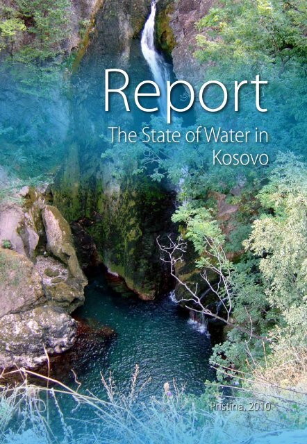
The State of Water in Kosovo, 2010
The State of Water in Kosovo, 2010
The State of Water in Kosovo, 2010
- No tags were found...

Create successful ePaper yourself
Turn your PDF publications into a flip-book with our unique Google optimized e-Paper software.
MINISTRY OF ENVIRONMENT AND SPATIAL PLANNINGKOSOVO ENVIRONMENTAL PROTECTION AGENCYReportTHE STATE OFWATER IN KOSOVOPrist<strong>in</strong>a, <strong>2010</strong>© Agjencia e Kosoves per Mbrojtjen e Mjedisit3120
RaportThis report was prepared by:M<strong>in</strong>istry <strong>of</strong> Environment and Spatial Plann<strong>in</strong>g<strong>Kosovo</strong> Environmental Protection AgencyKëshilli RedaktuesMSc. Tafë Veselaj- AMMKMSc. Afrim Berisha- AMMKMerita Mehmeti- AMMKAgron Shala- IHMKMr.sc. Bashkim Kastrati- IHMKFidaim Sahiti- DUFatlije Buza- DULektor:Tone Buzhala-GashiDizajni:Design houseU shtyp në shtypshkronjën:Design house4120 © Agjencia e Kosoves per Mbrojtjen e Mjedisit
RaportINDEX OF FIGURESFigure 1:Extent <strong>of</strong> <strong>Water</strong> Services (%) by the regional water companiesFigure 2: <strong>The</strong> Irrigated areas (ha) by Iber Lepenc for the period 2000-2008Figure 3:Figure 4:Figure 5:Figure 6:Figure 7:Figure 8:Figure 9:Figure 10:Figure 11:Figure 12:Figure 13:Figure 14:Figure 15:Figure 16:Figure 17:Figure 18:Figure 19:<strong>Water</strong> used for irrigation from the irrigation company Radoniqi<strong>The</strong> potential <strong>of</strong> hydropower plants by categories [kW]Dissolved oxygen <strong>in</strong> the river bas<strong>in</strong> <strong>of</strong> Dr<strong>in</strong>i i Bardhe<strong>The</strong> biochemical oxygen consumption <strong>in</strong> the river bas<strong>in</strong> <strong>of</strong> Dr<strong>in</strong>i i Bardhe<strong>Water</strong> conductivity <strong>in</strong> the river bas<strong>in</strong> <strong>of</strong> Dr<strong>in</strong>i i Bardhe<strong>The</strong> hydrogen ion concentration <strong>in</strong> the river bas<strong>in</strong> <strong>of</strong> Dr<strong>in</strong>i i BardheNitrites <strong>in</strong> the river bas<strong>in</strong> <strong>of</strong> Dr<strong>in</strong>i i BardheAmmonia <strong>in</strong> the river bas<strong>in</strong> <strong>of</strong> Dr<strong>in</strong>i i BardheSulphates <strong>in</strong> the river bas<strong>in</strong> <strong>of</strong> Dr<strong>in</strong>i i BardhePhosphates <strong>in</strong> the river bas<strong>in</strong> <strong>of</strong> Dr<strong>in</strong>i i BardheTotal Phosphorus (poly and ortho) <strong>in</strong> the river bas<strong>in</strong> <strong>of</strong> Dr<strong>in</strong>i i BardheTotal water hardness <strong>in</strong> the river bas<strong>in</strong> <strong>of</strong> Dr<strong>in</strong>i i BardheDissolved oxygen <strong>in</strong> the river bas<strong>in</strong> <strong>of</strong> Ibri<strong>The</strong> biochemical oxygen demand <strong>in</strong> the river bas<strong>in</strong> <strong>of</strong> Ibriwater conductivity <strong>in</strong> the river bas<strong>in</strong> <strong>of</strong> Ibri<strong>The</strong> hydrogen ion concentration <strong>in</strong> the river bas<strong>in</strong> <strong>of</strong> IbriNitrites <strong>in</strong> the river bas<strong>in</strong> <strong>of</strong> IbriFigure 20: Ammonia <strong>in</strong> the river bas<strong>in</strong> <strong>of</strong> IbriFigure 21:Sulphates <strong>in</strong> the river bas<strong>in</strong> <strong>of</strong> Ibri (lower value)Figure 22: Sulphates <strong>in</strong> the river bas<strong>in</strong> <strong>of</strong> Ibri (higher values)Figure 23: Phosphates <strong>in</strong> the river bas<strong>in</strong> <strong>of</strong> IbriFigure 24: Total Phosphorus (poly and ortho) <strong>in</strong> the river bas<strong>in</strong> <strong>of</strong> IbriFigure 25: <strong>The</strong> total water hardness <strong>of</strong> the river bas<strong>in</strong> <strong>of</strong> IbriFigure 26: Dissolved oxygen <strong>in</strong> the river bas<strong>in</strong> <strong>of</strong> Morava e B<strong>in</strong>çës and LepenciFigure 27: <strong>The</strong> biochemical oxygen demand <strong>in</strong> the river bas<strong>in</strong> <strong>of</strong> Morava e B<strong>in</strong>çës and LepenciFigure 28: <strong>Water</strong> conductivity <strong>in</strong> the river bas<strong>in</strong> <strong>of</strong> Morava e B<strong>in</strong>çës and LepenciFigure 29: Hydrogen ion concentration <strong>in</strong> the river bas<strong>in</strong> <strong>of</strong> Morava e B<strong>in</strong>çës and LepenciFigure 30: Nitrites <strong>in</strong> the river bas<strong>in</strong> <strong>of</strong> Morava e B<strong>in</strong>çës and LepenciFigure 31:Ammonia <strong>in</strong> the river bas<strong>in</strong> <strong>of</strong> Morava e B<strong>in</strong>çës and LepenciFigure 32: Sulphates <strong>in</strong> the river bas<strong>in</strong> <strong>of</strong> Morava e B<strong>in</strong>çës and LepenciFigure 33: Phosphates <strong>in</strong> the river bas<strong>in</strong> <strong>of</strong> Morava e B<strong>in</strong>çës and LepenciFigure 34: Total Phosphorus (poly and ortho) <strong>in</strong> the river bas<strong>in</strong> <strong>of</strong> Morava e B<strong>in</strong>çës And LepenciFigure 35: Total water hardness <strong>in</strong> the river bas<strong>in</strong> <strong>of</strong> Morava e B<strong>in</strong>çës and LepenciFigure 36: Heavy metals <strong>in</strong> the river bas<strong>in</strong> <strong>of</strong> Dr<strong>in</strong>i i BardheFigure 37: Heavy metals <strong>in</strong> the river bas<strong>in</strong> <strong>of</strong> IbriFigure 38: Heavy metals <strong>in</strong> the river bas<strong>in</strong> <strong>of</strong> Morava e B<strong>in</strong>çës and LepenciFigure 39: <strong>The</strong> rate <strong>of</strong> <strong>in</strong>fectious diseases <strong>in</strong> <strong>Kosovo</strong>Figure 40: Bacterial unsuitableness and values <strong>of</strong> residual chlor<strong>in</strong>e for dr<strong>in</strong>k<strong>in</strong>g <strong>Water</strong>, bycentral water supply systems <strong>in</strong> <strong>Kosovo</strong>Figure 41: Number <strong>of</strong> water permits and applications reviewed for the period 2005-200810120 © Agjencia e Kosoves per Mbrojtjen e Mjedisit
Gjendja e Ujërave në KosovëINDEX OF MAPSMap 1:Map 2:Map 3:Map 4:Map 5:Map 6:Map 7:Map 8:Map 9:Map 10:Map 11:Map 12:Map 13:Map 14:Map 15:Map 16:Map 17:Map 18:Map 19:Map 20:<strong>The</strong> <strong>Kosovo</strong> hydrography<strong>Kosovo</strong> bas<strong>in</strong>s and riversRiver bas<strong>in</strong>s and sub-bas<strong>in</strong>sMap <strong>of</strong> hydrometric stationsExist<strong>in</strong>g and planned water accumulationsGroundwater bodies <strong>in</strong> the river bas<strong>in</strong> <strong>of</strong> Dr<strong>in</strong>i i Bardhe<strong>Kosovo</strong> Hydro-geologySome thermal-m<strong>in</strong>eral water sourcesManual ra<strong>in</strong> gauges <strong>in</strong> the <strong>Kosovo</strong> territoryDistribution <strong>of</strong> ra<strong>in</strong>fall <strong>in</strong> <strong>Kosovo</strong>Service coverage <strong>of</strong> water supply from public water supply systems<strong>Water</strong> abstraction places by the regional water companiesLands with favourable position for irrigationPlanned hydropower plantsDegraded areas <strong>in</strong> the river bas<strong>in</strong> <strong>of</strong> Dr<strong>in</strong>i i BardheFish<strong>in</strong>g AreasErosive areasRehabilitation <strong>of</strong> riverbed and protection from erosionDischarge <strong>of</strong> <strong>in</strong>dustrial water <strong>in</strong> some locationsPhysical-chemical monitor<strong>in</strong>g <strong>of</strong> surface waters© Agjencia e Kosoves per Mbrojtjen e Mjedisit11120
Raport14 120 © Agjencia e Kosoves per Mbrojtjen e Mjedisit
Gjendja e Ujërave në Kosovë1. INTRODUCTION SECTION1.1. INTRODUCTIONReport<strong>in</strong>g on the state <strong>of</strong> the environment <strong>in</strong> <strong>Kosovo</strong>, <strong>in</strong>clud<strong>in</strong>g the state <strong>of</strong> environmentfor specific sectors (water, air, soil and biodiversity), is a responsibility and task <strong>of</strong> KEPA,based on the law <strong>of</strong> environmental protection.With<strong>in</strong> these tasks and responsibilities, <strong>in</strong> addition to the preparation <strong>of</strong> the general reporton the state <strong>of</strong> environmental, KEPA has to report on the state <strong>of</strong> certa<strong>in</strong> environmentalsectors.This report provides <strong>in</strong>formation on the state <strong>of</strong> water and water sector <strong>in</strong> general. <strong>The</strong>data for the preparation <strong>of</strong> the report were collected from the <strong>in</strong>stitutions that monitorwater quality, water management companies and other government and non governmentorganizations that deal with water sector. This report <strong>in</strong>cludes details about the laws andadm<strong>in</strong>istrative guidel<strong>in</strong>es for water, water strategic documents and data from projectsand donors <strong>in</strong> this area. Some data presented <strong>in</strong> this report are taken from variousrelevant publications and reports.<strong>The</strong> report is divided <strong>in</strong>to chapters and each chapter addresses a particular aspect. In thefirst (<strong>in</strong>troductory section), general data for <strong>Kosovo</strong> are presented. <strong>The</strong> second chapterpresents the situation with legal and <strong>in</strong>stitutional framework for water management. Inthe third chapter <strong>of</strong> the report are presented general <strong>in</strong>formation about water resourcesand ra<strong>in</strong>fall.<strong>The</strong> fourth chapter conta<strong>in</strong>s data on water use <strong>in</strong> various sectors such as households,agriculture, <strong>in</strong>dustry, energy, etc..<strong>The</strong> fifth chapter <strong>of</strong> this report addresses the problem <strong>of</strong> water pollution and wastewatertreatment, while <strong>in</strong> the chapter six are presented data on water quality monitor<strong>in</strong>g <strong>of</strong>surface water, groundwater and dr<strong>in</strong>k<strong>in</strong>g water. <strong>The</strong> report <strong>in</strong>cludes the chapter ongeneral aspects <strong>of</strong> water management as tariffs for services provided, projects and<strong>in</strong>vestments <strong>in</strong> water sector. In a separate chapter the report provides conclusions andrecommendations.<strong>The</strong> last chapter presents the references (sources) <strong>of</strong> data presented <strong>in</strong> this report.1.2. GENERAL INFORMATION FOR KOSOVO1.2.1. Geographical position<strong>Kosovo</strong> has a central geographical position <strong>in</strong> the Balkan Pen<strong>in</strong>sula. It lies between 41°50’58 “and 43° 51’42” <strong>of</strong> north geographical latitude and 20 ° 01’30” and 21°48’02” <strong>of</strong>east geographical longitude. <strong>Kosovo</strong>’s geographical position is considered <strong>of</strong> particularimportance <strong>in</strong> terms economic, cultural and political areas, related to the region and theworld.<strong>Kosovo</strong> has a total area <strong>of</strong> 10,887 km ², with about 2.1 million <strong>in</strong>habitants (1991 estimate)and the average density <strong>of</strong> 192 <strong>in</strong>habitants km². It is bordered with Albania (southwest),Macedonia (southeast), with Serbia (east, north and northeast) and Montenegro (west).<strong>The</strong> overall length <strong>of</strong> the border between <strong>Kosovo</strong> and neighbour<strong>in</strong>g countries is about700.7 km.© Agjencia e Kosoves per Mbrojtjen e Mjedisit15120
Raport1.2.2. Relief<strong>Kosovo</strong> is a mounta<strong>in</strong>ous country with lowlands, consist<strong>in</strong>g <strong>of</strong> <strong>Kosovo</strong> pla<strong>in</strong> (510-570 m <strong>in</strong>altitude) and Dukagj<strong>in</strong>i pla<strong>in</strong> (350-450 m altitude).By morphological aspect, <strong>Kosovo</strong> represents a true mosaic <strong>of</strong> hollow with differentdimensions, def<strong>in</strong>ed by mid-high mounta<strong>in</strong>s. In the relief morphology are dist<strong>in</strong>guishedmounta<strong>in</strong>ous areas, the construction <strong>of</strong> which is consisted by rocks <strong>of</strong> various geologicalages. <strong>The</strong> most present are Paleozoic (PZ) and Mesozoic (MZ), while the lower area <strong>of</strong> thefield dom<strong>in</strong>ate the new sediment Pliocene (PL), composed ma<strong>in</strong>ly <strong>of</strong> terrigenous rocks,clay, sand, conglomerate and less limestone.<strong>The</strong> Average altitude <strong>of</strong> <strong>Kosovo</strong> is 810 m, the lowest peak is 270 m and the highest peak is2656 m (Gjeravica). In hypsometric terms, area below 300m altitude covers only 4.16 km ²(0.2%). Up to 1000 m altitude <strong>in</strong>cludes 8754 km ² (80.7%). From 1000 to 2000 m 1872.3 km² (17%) and above 2000m altitude belong 250.6 km ² (2.3%) <strong>of</strong> <strong>Kosovo</strong> territory. <strong>The</strong> ma<strong>in</strong>forms <strong>of</strong> relief <strong>in</strong> <strong>Kosovo</strong> are: Mounta<strong>in</strong>s (63%) and hollow (37%).1.2.3. Climate<strong>The</strong> climate is medium-cont<strong>in</strong>ental climate with a dom<strong>in</strong>ant <strong>in</strong>fluence <strong>of</strong> Adriatic-Mediterranean climate <strong>in</strong> the Dukagj<strong>in</strong>it Pla<strong>in</strong>, (through the valley <strong>of</strong> the Dr<strong>in</strong>i i Bardhe),and with less impact <strong>of</strong> Aegean-Adriatic climate <strong>in</strong> the <strong>Kosovo</strong> pla<strong>in</strong>. <strong>The</strong> annual averagera<strong>in</strong> is 596 mm. <strong>The</strong> annual average temperature is 100C, (m<strong>in</strong>imal temperature -27 OCand maximal temperature 39 O C) 1 .Key climate macro-factors, which affect the climate <strong>in</strong> <strong>Kosovo</strong> are: its position toward earthland masses (Euro-Asia and Africa), water masses(Atlantic Ocean and MediterraneanSea), air masses (the tropics and the Arctic-maritime or cont<strong>in</strong>ental), the position <strong>of</strong> baricsystems (azures maximum and Iceland m<strong>in</strong>imum). <strong>The</strong> ma<strong>in</strong> local factors that affect theclimate <strong>in</strong> <strong>Kosovo</strong> are: relief, water, land and vegetation.1.2.4. Hydrography<strong>Kosovo</strong> has <strong>in</strong>sufficient water resources, and <strong>in</strong> the future it will be a limit<strong>in</strong>g factor foreconomic and social development <strong>of</strong> the country. It is estimated that <strong>Kosovo</strong> has only1600 m3/water/year per capita. In hydrographical terms, <strong>Kosovo</strong> is divided <strong>in</strong>to fourhydrographical river bas<strong>in</strong>s: the Dr<strong>in</strong>i i Bardhe, Ibri, Morava e B<strong>in</strong>çës and Lepeneci. <strong>The</strong>annual average <strong>of</strong> water flow from <strong>Kosovo</strong> is approximately 3.8 x 10⁹ or 121.2 m3 / sec.<strong>The</strong> ma<strong>in</strong> hydrological feature <strong>of</strong> <strong>Kosovo</strong> is the unequal water distribution and <strong>in</strong>sufficientwater resources <strong>in</strong> comparison to the needs. <strong>The</strong> potential <strong>of</strong> water for hydropower plantsis very low, and so far its use is quite modest.<strong>The</strong> ground water reserves are limited and are mostly located <strong>in</strong> the western part <strong>of</strong><strong>Kosovo</strong>, where the surface water reserves are greater, compared with the few reserves<strong>of</strong> eastern part, and with the south-eastern part where water needs are very large.<strong>Kosovo</strong> has a small number <strong>of</strong> natural lakes. Artificial lakes are: Batllava, Gazivoda,Radoniqi, Perlepnica and Badovci, and a small number <strong>of</strong> lakes for irrigation needs.<strong>Kosovo</strong> has important sources <strong>of</strong> thermal waters used for recreation and health purposes.Protection, preservation and development <strong>of</strong> water resources is very important and one<strong>of</strong> the greatest environmental challenges <strong>of</strong> <strong>Kosovo</strong>.1 KHMI, 200816120 © Agjencia e Kosoves per Mbrojtjen e Mjedisit
Gjendja e Ujërave në KosovëMap 1: <strong>The</strong> <strong>Kosovo</strong> hydro-graphy© Agjencia e Kosoves per Mbrojtjen e Mjedisit17120
Raport1.2.2. POPULATION STRUCTUREFor a long period <strong>of</strong> time (over 25 years) <strong>Kosovo</strong> faced a lack <strong>of</strong> statistical data on population,so the population growth numbers are ma<strong>in</strong>ly based on estimates and projections.Despite the numerous pressures (violent migration, political pressures etc), <strong>The</strong> totalnumber <strong>of</strong> <strong>Kosovo</strong>’s population is constantly <strong>in</strong>creased <strong>in</strong> the post World War II period.Dur<strong>in</strong>g 58 years (1948-2006) the <strong>Kosovo</strong> population growth is 188.5%.Table 1: Total population growth <strong>in</strong> <strong>Kosovo</strong> 1948-2006Year Number <strong>of</strong> <strong>in</strong>habitants Comments1948 727820 Registration1961 963988 Registration1971 1243693 Registration1981 1584440 Registration1991 1956196 Estimation2002 1985000 SOK Estimation2006 2100000 SOK Estimation<strong>Kosovo</strong>’s population is young. In 2006 the age group 0-19 years constituted 38% <strong>of</strong>population. <strong>The</strong> age group <strong>of</strong> 20-64 years 56%, while the age group <strong>of</strong> over 65 years oldwas 6% <strong>of</strong> the total population.Table 2: Population structure by the age <strong>in</strong> <strong>Kosovo</strong> 1981-2006 2 3 4Age group (years) 1981 1991 2001 20060-19 vjeç 52 48 41 3820-64 vjeç 43 47 54.1 56Over 65 5 5 5.9 62 Bullet<strong>in</strong> 17,SOK, 1991-20013 Trends and distribution <strong>of</strong> Albanian population <strong>in</strong> ex Yugoslavia ,Institute <strong>of</strong> Economics 19974 <strong>Kosovo</strong> <strong>in</strong> figures 2006, SOK, Prist<strong>in</strong>a 200718120 © Agjencia e Kosoves per Mbrojtjen e Mjedisit
Gjendja e Ujërave në KosovëBl<strong>in</strong>ajaBl<strong>in</strong>aja© Agjencia e Kosoves per Mbrojtjen e Mjedisit19120
Raport20 120 © Agjencia e Kosoves per Mbrojtjen e Mjedisit
Gjendja e Ujërave në Kosovë2. LEGAL AND INSTITUTIONAL FRAMEWORK2.1 LEGAL AND STRATEGIC FRAMEWORK2.1.1 LAWS AND ADMINISTRATIVE INSTUCTIONS IN THE WATER SECTOR<strong>The</strong> legal framework for water is almost completed and, it relatively meets the needs forthe management, development and susta<strong>in</strong>able utilization <strong>of</strong> water resources.Law Nr. 2004/24 on <strong>Kosovo</strong> water - <strong>The</strong> purpose <strong>of</strong> this law is:• To ensure susta<strong>in</strong>able development and utilization <strong>of</strong> water resources, whichare necessary for public health, environmental protection and socio-economicdevelopment <strong>of</strong> <strong>Kosovo</strong>;• To establish procedures and guid<strong>in</strong>g pr<strong>in</strong>ciples for optimal allocation <strong>of</strong> waterresources, based on the use and purpose;• Ensure protection <strong>of</strong> water resources from pollution, misuse and overuse• To establish the <strong>in</strong>stitutional framework for water resource management.Law no. 02 / l-79 on hydro-meteorological tasks. It is another important law <strong>in</strong> thewater sector, aimed to regulate meteorological works and the manner <strong>of</strong> theiraccomplishment.Law no. 02/L-78 on public Health-This law stipulates, <strong>in</strong>ter alia, <strong>in</strong>stitutions responsiblefor implementation <strong>of</strong> health policies, def<strong>in</strong>es the duties <strong>of</strong> the National Institute <strong>of</strong> PublicHealth <strong>of</strong> <strong>Kosovo</strong>, and among other establishes the responsibilities for dr<strong>in</strong>k<strong>in</strong>g waterquality monitor<strong>in</strong>g.Law Nr. 03/L-086 on providers <strong>of</strong> waste, water, and sewage services-is an important lawby which the WWRO is established, and established the legal framework for economicregulation <strong>of</strong> public companies which provide water and sewerage services;Law Nr. 02/L-9 on Irrigation <strong>of</strong> Agricultural Land-This Law regulates the organizationand management <strong>of</strong> irrigation and dra<strong>in</strong>age <strong>of</strong> agricultural land <strong>in</strong> <strong>Kosovo</strong>; it def<strong>in</strong>es thepowers and responsibilities <strong>of</strong> the entities for irrigation and dra<strong>in</strong>age. It def<strong>in</strong>es also theestablishment and registration <strong>of</strong>: irrigation companies, associations that use the waterfor irrigation, federations and their organization, irrigation, water fees, associations’bus<strong>in</strong>ess and other issues related to irrigation and dra<strong>in</strong>age.In the framework <strong>of</strong> the obligations aris<strong>in</strong>g from the <strong>Water</strong> law and Public Health Law,the adm<strong>in</strong>istrative <strong>in</strong>structions are issued 5 that regulate the follow<strong>in</strong>g issues:• <strong>Water</strong> permits• Structure <strong>of</strong> water charges• <strong>Water</strong> <strong>in</strong>frastructure• Test<strong>in</strong>g and implementation <strong>of</strong> m<strong>in</strong>imum standards for dr<strong>in</strong>k<strong>in</strong>g water qualitymonitor<strong>in</strong>g• Sanitary <strong>in</strong>spectors• Criteria for establishment <strong>of</strong> water protected areas for dr<strong>in</strong>k<strong>in</strong>g water sources;• Allowed limit values for effluent parameters which can be discharged <strong>in</strong>to the waterbody or public sewage network.5 <strong>Water</strong> Department, 2009© Agjencia e Kosoves per Mbrojtjen e Mjedisit21120
RaportAdm<strong>in</strong>istrative <strong>in</strong>struction under the draft<strong>in</strong>g procedure are:• Measures and actions for protection from erosion;• Use and ma<strong>in</strong>tenance <strong>of</strong> dams;• <strong>Water</strong> <strong>in</strong>formation system;• Content <strong>of</strong> the strategic plan for water resources management.• <strong>Water</strong> protocol2.1.2 KOSOVO ENVIRONMENT STRATEGY<strong>The</strong> environmental strategy is an important document <strong>of</strong> the overall long-termdevelopment <strong>of</strong> <strong>Kosovo</strong>. <strong>The</strong> development <strong>of</strong> the strategy is implemented through <strong>in</strong>term<strong>in</strong>isterialcooperation and assistance <strong>of</strong> other <strong>in</strong>stitutions. <strong>The</strong> strategy has the follow<strong>in</strong>gstrategic orientations for the water sector 6 :a) Development <strong>of</strong> plans for water resources management <strong>in</strong> the pr<strong>in</strong>ciples <strong>of</strong> waterbas<strong>in</strong>s, shar<strong>in</strong>g responsibilities at all levels and among all participants.b) Ensur<strong>in</strong>g the right to dr<strong>in</strong>k<strong>in</strong>g water for all residents.c) Long-term protection and conservation <strong>of</strong> water resources as national assets andtheir use by the pr<strong>in</strong>ciples <strong>of</strong> susta<strong>in</strong>able development.Strategic priorities for water sector are:Adoption <strong>of</strong> laws and regulations for water users and suppliers <strong>in</strong> harmonizationwith EU laws and regulations.Monitor<strong>in</strong>g <strong>of</strong> water quality and quantity.Development <strong>of</strong> river bas<strong>in</strong> management plans for water (<strong>in</strong>tegrated watermanagement).Protection <strong>of</strong> surface and ground waters from pollution.Approval <strong>of</strong> strategic plans for emergency actions.<strong>The</strong> extension <strong>of</strong> water supply and improvement <strong>of</strong> water supply to citizens.Extension <strong>of</strong> sewerage network <strong>in</strong> urban and rural areas.Development <strong>of</strong> national plan for the construction <strong>of</strong> urban and <strong>in</strong>dustrialwastewater treatment plants, and create suitable models for the treatment <strong>of</strong>wastewaters <strong>in</strong> urban and rural settlements.Awareness rais<strong>in</strong>g and education <strong>of</strong> population on rational use <strong>of</strong> water resources.2.1.3 KOSOVO WATER STRATEGIC PLAN<strong>Kosovo</strong> <strong>Water</strong> Law, Article 22, obliges the M<strong>in</strong>istry <strong>of</strong> Environment and Spatial Plann<strong>in</strong>g,that <strong>in</strong> cooperation with the competent authorities for economy, f<strong>in</strong>ances, agriculture,forestry, rural development, trade, <strong>in</strong>dustry, health, transport, communications, energy,enterprise for public services, environment, nature protection and other authorities todraft the <strong>Water</strong> Strategic Plan.<strong>Water</strong>s Strategic Plan has to cover a period <strong>of</strong> 20 years, with possibility <strong>of</strong> review by theGovernment every five years.<strong>The</strong> <strong>Water</strong> Strategic Plan sets policies which ensure 7 :• <strong>Water</strong> susta<strong>in</strong>able management by fill<strong>in</strong>g the needs <strong>of</strong> all users qualitatively andquantitatively;• <strong>Water</strong> protection from pollution;6 <strong>Kosovo</strong> Environment Strategy, MESP 20037 <strong>The</strong> Law No 2004/24 on <strong>Kosovo</strong> waters22120 © Agjencia e Kosoves per Mbrojtjen e Mjedisit
Gjendja e Ujërave në Kosovë• Protection and enhancement <strong>of</strong> ecosystems, and• Protection from harmful consequences <strong>of</strong> water.<strong>Water</strong>s Strategic Plan should <strong>in</strong>clude:• Assessment <strong>of</strong> the status <strong>of</strong> water management;• <strong>The</strong> objectives and guidel<strong>in</strong>es for the protection, regulation and susta<strong>in</strong>able use <strong>of</strong>water;• Priorities for achiev<strong>in</strong>g the objectives for water management;• Estimates <strong>of</strong> the budget needed to implement<strong>in</strong>g the plan and the deadl<strong>in</strong>e forachiev<strong>in</strong>g the objectives, and• Guidel<strong>in</strong>es for implementation <strong>of</strong> <strong>in</strong>ternational agreements concern<strong>in</strong>g watermanagement.2.1.4 KOSOVO ENVIRONMENTAL ACTION PLANIn the framework <strong>of</strong> the <strong>Kosovo</strong> Environmental Action Plan 2006-<strong>2010</strong>, the chapter onthe water objectives, def<strong>in</strong>es the measures, activities and priority projects for the period2006-<strong>2010</strong>.Table 3. Objectives, measures, activities and priority projects for water with<strong>in</strong> the KEAP 8ObjectivesMeasuresActivitiesTo provide the legal, technical, f<strong>in</strong>ancial and human capacities to establish policy basisfor <strong>in</strong>tegrated water management <strong>in</strong> <strong>Kosovo</strong> based on the pr<strong>in</strong>ciples <strong>of</strong> susta<strong>in</strong>abledevelopment Rehabilitation and construction <strong>of</strong> <strong>in</strong>frastructure (water supply and sewerage networks,wastewater treatment plants) <strong>in</strong> order to protect the environment and to meet the needs<strong>of</strong> the population. Adoption <strong>of</strong> needed secondary legislation <strong>in</strong> l<strong>in</strong>e with EU Directives Strengthen <strong>in</strong>stitutional capacitiesEstablishment <strong>of</strong> National Council for <strong>Water</strong>sDevelop the National Strategy and Action Plan for <strong>Water</strong>sHuman capacity build<strong>in</strong>g <strong>in</strong> the m<strong>in</strong>istry and other relevant <strong>in</strong>stitutionsDevelopment <strong>of</strong> strategy for water quality monitor<strong>in</strong>g andestablishment <strong>of</strong> monitor<strong>in</strong>g networkCompil<strong>in</strong>g <strong>of</strong> water cadastre and cadastre <strong>of</strong> water pollutantsHarmonization <strong>of</strong> national regulations with EU norms and standards.Action plan for construction <strong>of</strong> water treatment plants <strong>in</strong> urban areas with more than 10,000<strong>in</strong>habitantsCreation <strong>of</strong> economic <strong>in</strong>struments to reduce water pollutionHuman capacity build<strong>in</strong>g for <strong>in</strong>spection servicesNr: Project Budget (EUR)1. Compile cadastre data on water polluters 131,1102.<strong>The</strong> establishment and <strong>in</strong>stitutionalization <strong>of</strong> the network for waterquality monitor<strong>in</strong>g675,6003.Improve the management <strong>of</strong> water resources by regulat<strong>in</strong>g theconsumption, price and collection <strong>of</strong> the fees.99,480TOTAL 906,1908 <strong>Kosovo</strong> Environmental Action Plan 2006-<strong>2010</strong>, MESP/REC, 2006© Agjencia e Kosoves per Mbrojtjen e Mjedisit23120
Raport2.1.5 EUROPEAN UNION DIRECTIVES ON WATERAt the EU level, water management is regulated by several directives. <strong>The</strong> follow<strong>in</strong>g tableprovides <strong>in</strong>formation for the purpose <strong>of</strong> these directives, the year <strong>of</strong> ratification and therate <strong>of</strong> harmonisation at our national legislation.Table 4 : <strong>The</strong> EU Directives on water quality and level <strong>of</strong> transposition at <strong>Kosovo</strong> national legislation 9 .Nr.Name <strong>of</strong> thedirectiveYear <strong>of</strong>adoptionPurposeTransposedat nationallegislation (%)1<strong>Water</strong>frameworkdirective(2000/60/EC)23 October2000Ma<strong>in</strong>ta<strong>in</strong><strong>in</strong>g high status <strong>of</strong> water where itexists, prevent<strong>in</strong>g any deterioration <strong>in</strong> theexist<strong>in</strong>g status <strong>of</strong> waters and achiev<strong>in</strong>g at least“good status” <strong>in</strong> relation to all waters by 2015252Directive forurban wastewater treatment(91/271/EEC)21 May 1991Protection <strong>of</strong> waters from adverse effects fromdischarges <strong>of</strong> urban wastewater from certa<strong>in</strong><strong>in</strong>dustrial sectors273Dr<strong>in</strong>k<strong>in</strong>g waterdirective (98/83/EC)3 November1998To protect human health from adverse effects<strong>of</strong> any contam<strong>in</strong>ation <strong>of</strong> water <strong>in</strong>tended to beused for human consumption, ensur<strong>in</strong>g thedr<strong>in</strong>k<strong>in</strong>g water is healthy and clean474Nitratesdirective(91/676/EEC)12 December1991Prevent<strong>in</strong>g and reduc<strong>in</strong>g water pollutioncaused by Nitrates from agricultural sources162.2 INSTITUTIONAL FRAMEWORK2.2.1 MINISTRY OF ENVIRONMENT AND SPATIAL PLANNING / WATERDEPARTMENTAccord<strong>in</strong>g to the Law on <strong>Water</strong>s (no. 2004/24), the M<strong>in</strong>istry <strong>of</strong> Environment and SpatialPlann<strong>in</strong>g through the <strong>Water</strong> Department responsible for:• Determ<strong>in</strong>ation and implementation <strong>of</strong> policies for water development <strong>in</strong> <strong>Kosovo</strong>;• Achievement <strong>of</strong> the objectives <strong>of</strong> the program approved by the Government;• Management <strong>of</strong> water resources;• Development <strong>of</strong> water strategic plan and other plans for water management;• Perform<strong>in</strong>g <strong>of</strong> related adm<strong>in</strong>istrative and pr<strong>of</strong>essional tasks• Other organizational and development tasks pursuant to the provisions <strong>of</strong> the waterlaw.9 9Report on progress monitor<strong>in</strong>g, REC 2008, 200924120 © Agjencia e Kosoves per Mbrojtjen e Mjedisit
Gjendja e Ujërave në KosovëWith the aim <strong>of</strong> water management <strong>in</strong> the territory <strong>of</strong> certa<strong>in</strong> river bas<strong>in</strong>s, two riverbas<strong>in</strong>s districts are established:a. the River Bas<strong>in</strong> District <strong>of</strong> the Dr<strong>in</strong>i i Bardhë; andb. the River Bas<strong>in</strong> District <strong>of</strong> the Ibri, Morava e B<strong>in</strong>çës and Lepenci.<strong>The</strong> law establishes a River Bas<strong>in</strong> District Authority for each <strong>of</strong> the two river bas<strong>in</strong> districts2.2.2 WATER COUNCIL OF KOSOVO<strong>The</strong> <strong>Water</strong> Council <strong>of</strong> <strong>Kosovo</strong>, is an <strong>in</strong>dependent body, established by the <strong>Kosovo</strong> <strong>Water</strong> Law.<strong>The</strong> Council is an advisory body, which reviews systematic issues <strong>of</strong> <strong>Water</strong> Management,harmonizes needs and diverse <strong>in</strong>terests and proposes measures for the development,use and protection <strong>of</strong> resources and water system <strong>in</strong> <strong>Kosovo</strong>. <strong>The</strong> Council also has theduty to:• Reviews and give op<strong>in</strong>ions <strong>in</strong> regard to legislative proposals on <strong>Water</strong>Management;• Initiates up-to-date approaches for medium and long-term solutions, andglobal determ<strong>in</strong>ations <strong>in</strong> the field <strong>of</strong> water system development, ensure waterbalances, water management, f<strong>in</strong>anc<strong>in</strong>g, organization <strong>of</strong> water systems andpublic resource development policy;• Reviews other issues <strong>of</strong> <strong>in</strong>terest for the general and conceptual development <strong>of</strong><strong>Water</strong> Management and the development <strong>of</strong> water systems <strong>of</strong> <strong>in</strong>terest to <strong>Kosovo</strong>.In regard to issues that it reviews, the Council gives op<strong>in</strong>ions, conclusions andproposals for issu<strong>in</strong>g legal provisions and undertaken measures.2.2.3 KOSOVO ENVIRONMENTAL PROTECTION AGENCY<strong>The</strong> <strong>Kosovo</strong> Environmental Protection Agency is a central <strong>in</strong>stitution for the state <strong>of</strong>environment monitor<strong>in</strong>g. Duties and responsibilities <strong>of</strong> this <strong>in</strong>stitution <strong>in</strong> the watersector are:• Collects and processes data for surface and ground waters <strong>of</strong> <strong>Kosovo</strong>; storage,exchange and publication <strong>of</strong> these data;• <strong>The</strong> surface and ground water quality monitor<strong>in</strong>g based up on schedule andmethodology for operation with network <strong>of</strong> monitor<strong>in</strong>g stations;• Urban, agriculture and <strong>in</strong>dustrial waste water discharges monitor<strong>in</strong>g;• Prepares and compiles reports on the state <strong>of</strong> the waters; takes part <strong>in</strong> the review<strong>of</strong> various cases <strong>of</strong> EIA <strong>in</strong> the field <strong>of</strong> water (water and environmental permits, etc..)• Forecast<strong>in</strong>g and warn<strong>in</strong>g <strong>of</strong> potential or spontaneous risk for the loss <strong>of</strong> surface andground waters <strong>in</strong> terms <strong>of</strong> quality and quantity;• Coord<strong>in</strong>ates preparation <strong>of</strong> programs for municipal governance <strong>of</strong> water resourcesas accord<strong>in</strong>g to their competencies.© Agjencia e Kosoves per Mbrojtjen e Mjedisit25120
Raport2.2.4 KOSOVO HYDRO-METEOROLOGICAL INSTITUTE<strong>The</strong> KHMI is established <strong>in</strong> 2000. Accord<strong>in</strong>g to the law on Hydro-meteorological activitiesthe KHMIs responsibilities <strong>in</strong> the field <strong>of</strong> water are 10 :• Construction and ma<strong>in</strong>tenance <strong>of</strong> the basic network <strong>of</strong> hydrological andmeteorological stations,• Measurements and observations <strong>of</strong> the elements and occurrences: meteorological,hydrological, bio- meteorological, and hydro-biological,• Measurements and observations <strong>of</strong> the electricity <strong>in</strong> atmosphere and air, waterpollution and ra<strong>in</strong>falls, accord<strong>in</strong>g to the unique program and methodology that isvalid for essential network stations,• Study, elaboration, conservation, exchange and data’s annunciation <strong>of</strong> the hydrometeorologyand research<strong>in</strong>g results on the monitor<strong>in</strong>g network,• Organization, ma<strong>in</strong>tenance and calculat<strong>in</strong>g development, observation system <strong>of</strong> database and accomplish<strong>in</strong>g prognosis <strong>of</strong> the hydro-meteorological works,• Accomplish<strong>in</strong>g the systematic hydro-meteorological measurement and observationon the rivers <strong>in</strong> usual cases and <strong>in</strong> cases <strong>of</strong> environmental disturbances, ,• <strong>The</strong> systematically pursuit and ascerta<strong>in</strong>ment <strong>of</strong> air pollution, ra<strong>in</strong>falls,underground and surface waters <strong>of</strong> first resource and ground, also the hydrometeorologicalstudies and conditions prognosis <strong>of</strong> the environment protection,• Publish<strong>in</strong>g <strong>of</strong> the hydrological, meteorological analyses and short term specification<strong>of</strong> the: weather, water, ice on rivers, and weather impact on agricultural,• Premonition <strong>of</strong> any hydro-meteorological elementary fatality,• Given reports, foresight and premonition <strong>of</strong> central and local competent authoritieson hydro-meteorological occurrences with importance for protection from flood<strong>in</strong>g,ice, changes <strong>of</strong> water quality, as well as premonition regard<strong>in</strong>g to the destructionand other water presented pollutions,• Weather studies, climate studies, studies on ground and surface waters and theirimpact on the atmosphere,• Preparation <strong>of</strong> hydro-meteorological works and <strong>in</strong>clud<strong>in</strong>g <strong>of</strong> hydro-meteorologicalservices for flood protection,2.2.5 NATIONAL INSTITUTE OF PUBLIC HEALTH OF KOSOVO<strong>The</strong> National Institute <strong>of</strong> Public Health <strong>of</strong> <strong>Kosovo</strong> is a pr<strong>of</strong>essional and scientific <strong>in</strong>stitution<strong>of</strong> <strong>Kosovo</strong>. In the field <strong>of</strong> water, the NPHIK is the responsible authority that sets standardsfor dr<strong>in</strong>k<strong>in</strong>g water quality, to be met by providers. NPHIK also monitors the implementation<strong>of</strong> these standards. <strong>The</strong> legal basis for the authority and responsibilities <strong>of</strong> NPHIK arebased on the adm<strong>in</strong>istrative Instruction (AI nr.2/99), which regulates issues <strong>of</strong> waterquality. <strong>The</strong> mission <strong>of</strong> the NPHIK is to protect and improve the public health through themonitor<strong>in</strong>g <strong>of</strong> <strong>in</strong>dicators, prevention <strong>of</strong> the occurrence <strong>of</strong> diseases and promot<strong>in</strong>g publichealth.10 Law no. 02/l-79 on hydro-meteorological activities26120 © Agjencia e Kosoves per Mbrojtjen e Mjedisit
Gjendja e Ujërave në Kosovë2.2.6 WATER TASK FORCE<strong>Water</strong> Task Force (WTF) is a committee <strong>of</strong> relevant m<strong>in</strong>istries <strong>of</strong> the Government <strong>of</strong><strong>Kosovo</strong>, led by the Prime M<strong>in</strong>ister or Deputy Prime M<strong>in</strong>ister. WTF is responsible forimprov<strong>in</strong>g the situation <strong>in</strong> the water sector through development <strong>of</strong> sector policies andaction plans based on good practice.WTF serves as a forum for gather<strong>in</strong>g and evaluat<strong>in</strong>g the positive experiences <strong>in</strong> the watersector, but also it addresses barriers to implementation, communication and cooperation.Moreover, it provides a platform for the development <strong>of</strong> policies for reform<strong>in</strong>g the watersector, consider<strong>in</strong>g different perspectives, from water users to service providers. WTFalso will develop and adopt policies to ensure susta<strong>in</strong>ability <strong>of</strong> reforms and <strong>in</strong>vestments<strong>in</strong> the water sector.<strong>The</strong> <strong>Water</strong> Task Force consists <strong>of</strong> seven permanent members (five <strong>of</strong> whom have vot<strong>in</strong>grights):• Prime M<strong>in</strong>ister (Chairman);• M<strong>in</strong>ister <strong>of</strong> Environment and Spatial Plann<strong>in</strong>g (Deputy Chairman) (for waterresources);• M<strong>in</strong>ister <strong>of</strong> Economy and F<strong>in</strong>ances (for water companies and f<strong>in</strong>ances);• M<strong>in</strong>ister <strong>of</strong> Local Government Adm<strong>in</strong>istration(for local governments);• M<strong>in</strong>ister <strong>of</strong> Foreign Affairs (for transboundary waters);• Two members nom<strong>in</strong>ated by donor community (non-vot<strong>in</strong>g)Furthermore, the follow<strong>in</strong>g m<strong>in</strong>istries will contribute to the thematic cases that co<strong>in</strong>cidewith related issues to water management: the M<strong>in</strong>istry <strong>of</strong> Justice, M<strong>in</strong>istry <strong>of</strong> Energyand M<strong>in</strong>es, M<strong>in</strong>istry <strong>of</strong> Health, M<strong>in</strong>istry <strong>of</strong> Trade and Industry, M<strong>in</strong>istry <strong>of</strong> Agriculture,Forestry and Rural Development and M<strong>in</strong>istry <strong>of</strong> Internal Affairs.2.2.7 LOCAL GOVERNMENT- MUNICIPALITIESUnder Article 20 <strong>of</strong> the <strong>Water</strong> Law (no. 2004/24), duties and responsibilities <strong>of</strong> municipalities<strong>in</strong> water management are to manage sources for important water supply at local levelsuch as natural water spr<strong>in</strong>gs, public spr<strong>in</strong>gs, public wells and ditches.While, the Law on Local Self-Government <strong>in</strong> <strong>Kosovo</strong> (no. 03/L-040), municipalities areresponsible for provid<strong>in</strong>g public water supply. This competence <strong>in</strong> the case <strong>of</strong> water andsewerage services should be realized through Service Agreements that municipalitiesmake with respective regional companies that <strong>of</strong>fer their services <strong>in</strong> the municipalityconcerned.2.2.8 WASTE AND WATER REGULATORY OFFICEWaste and <strong>Water</strong> Regulatory Office (WWRO) is an <strong>in</strong>dependent economic regulator forwater and waste services <strong>in</strong> <strong>Kosovo</strong>.<strong>The</strong> WWRO role is to ensure non-discrim<strong>in</strong>ation and provision <strong>of</strong> qualitative, efficient, andreliable services at a fair and reasonable price for customers with respect for environmentand public health© Agjencia e Kosoves per Mbrojtjen e Mjedisit27120
RaportDuties and responsibilities <strong>of</strong> WWRO <strong>in</strong> the water sector are 11 :• Licens<strong>in</strong>g <strong>of</strong> public enterprises that provide water supply and sewerage services,• Sets up and approve service tariffs for regulated services, ensur<strong>in</strong>g that tariffs arefair and reasonable and enable f<strong>in</strong>ancial viability <strong>of</strong> service providers;• Monitors and enforces compliance with service standards for licensed serviceproviders;• Supervises and enforces Customers` Charter which conta<strong>in</strong>s all rights andobligations for both, service providers and customer;• Establishes and supports Customers` Consultative Committees <strong>in</strong> each service area- seven regions <strong>of</strong> <strong>Kosovo</strong>.2.2.9 PUBLIC ENTERPRISES / COMPANIESAccord<strong>in</strong>g to the Law on Public Enterprises (Law 03/L-087), public enterprises deal<strong>in</strong>gwith dr<strong>in</strong>k<strong>in</strong>g water and irrigation water are classified <strong>in</strong>to three groups: central publicenterprise, regional public enterprise and local public enterprise as follows 12 :• Central Public Enterpriseso Public Company Hydro-system Iber-Lepenc JSC;• Regional Irrigation Companieso Irrigation Company “Dr<strong>in</strong>i i Bardhe JSCo Irrigation Company “Radoniqi-Dukagj<strong>in</strong>i” JSC• Regional <strong>Water</strong> Companieso RWC “Prist<strong>in</strong>a” JSC,Prist<strong>in</strong>ao RWC “Hidrodr<strong>in</strong>i” JSC, Pejeo RWC “Hidroregjioni Jugor” JSC, Prizreno RWC “Mitrovica” JSC Mitroviceo RWC “Hidromorava” JSC, Gjilano RWC ”Radoniqi” JSC, Gjakova• Local Public EnterprisesO <strong>Water</strong> and Waste Company “Ibri”, Zub<strong>in</strong> Potoko <strong>Water</strong> and Waste Company “24 Nentori”, Leposaviqo <strong>Water</strong> Company “Bifurcation”JSC, Ferizaj / Kaçanik11 WWRO 200912 Law No. 03/L-087 on public enterprises28120 © Agjencia e Kosoves per Mbrojtjen e Mjedisit
Gjendja e Ujërave në Kosovë2.2.10 WATER SUPPLY AND SEWERAGE ASSOCIATION OF KOSOVO (SHUKOS)SHUKOS is a nongovernmental organization founded <strong>in</strong> order to establish an<strong>in</strong>terconnection between the members themselves, to promote their common <strong>in</strong>terestsand to advance the fundamental issues <strong>of</strong> their scope. SHUKOS’ primary members areall water supply and sewerage public enterprises <strong>in</strong> <strong>Kosovo</strong>. <strong>The</strong> highest association’sbody is the Assembly which elects the board <strong>of</strong> the Association. <strong>The</strong> Board consists <strong>of</strong>n<strong>in</strong>e members, seven directors <strong>of</strong> RWCs, one representative <strong>of</strong> the M<strong>in</strong>istry <strong>of</strong> Economyand F<strong>in</strong>ance and one representative <strong>of</strong> the M<strong>in</strong>istry responsible for water sector (M<strong>in</strong>istry<strong>of</strong> Environment and Spatial Plann<strong>in</strong>g, <strong>Water</strong> Department). SHUKOS has the Manag<strong>in</strong>gDirector who is responsible to the board 13 .Lumbardhi i Pejës13 www.shukos.org© Agjencia e Kosoves per Mbrojtjen e Mjedisit29120
Raport30 120 © Agjencia e Kosoves per Mbrojtjen e Mjedisit
Gjendja e Ujërave në Kosovë3. WATER RESOURCES3.1 SURFACE WATERS<strong>The</strong> annual average <strong>of</strong> water flow from <strong>Kosovo</strong> is approximately 3.8 x 10⁹ or 121.2 m3 /sec, while the total accumulated volume <strong>in</strong> exist<strong>in</strong>g accumulations is 569.69 million m3,which represents only 15.7% <strong>of</strong> the total average amount. Most <strong>of</strong> the rivers belong to theBlack Sea bas<strong>in</strong> 50.7%, the Adriatic Sea 43.5% and Aegean Sea 5.8%. Most <strong>of</strong> the riversare characterized by irregular seasonal flow. River flows are higher dur<strong>in</strong>g w<strong>in</strong>ter orearly spr<strong>in</strong>g.Accumulative surface topography <strong>of</strong> <strong>Kosovo</strong> is 11,645 km2, which means that only 758km2 or 6.5% is <strong>in</strong>consistent with its total area (10,887 km2).3.1.1 Rivers and River Bas<strong>in</strong>s<strong>The</strong> hydrography <strong>of</strong> water flows <strong>of</strong> <strong>Kosovo</strong> is split <strong>in</strong>to four river bas<strong>in</strong>s: the Dr<strong>in</strong>i i Bardhe,Ibri, Morava e B<strong>in</strong>çës and Lepenci.<strong>Kosovo</strong> river flows pour <strong>in</strong>to three sea bas<strong>in</strong>s: Black Sea, Adriatic Sea and Aegean Sea.<strong>The</strong> ma<strong>in</strong> rivers that belong to the Black Sea bas<strong>in</strong> are: Ibri, Sitnica with its branches(Llapi, Drenica); and Morava e B<strong>in</strong>çës. Rivers that belong to the Adriatic Sea is the Dr<strong>in</strong>ii Bardhe with its branches (Lumëbardhi i Pejes, Lumëbardhi i Decanit, Lumëbardhi iPrizrenit, Kl<strong>in</strong>a, Ereniku, Mirusha, Toplluha and Plava). <strong>The</strong> Lepenci river with its ma<strong>in</strong>branch (Nerodime) belongs to the Aegean Sea. <strong>Water</strong>shed l<strong>in</strong>es (river bas<strong>in</strong>s), flow <strong>in</strong>different directions. <strong>The</strong> flow ratio ranges from 3.93 l/sec/km2 (Morava e B<strong>in</strong>çës) to 42.46l/sec/km2 (Lumëbardhi i Decanit).<strong>The</strong> Dr<strong>in</strong>i i Bardhe river has the greatest length <strong>in</strong> kilometres with<strong>in</strong> the territory <strong>of</strong><strong>Kosovo</strong> with 122 km, while the Lumëbardhi i Prizrenit is shortest with 31 km. Data on thelength <strong>of</strong> ma<strong>in</strong> rivers with<strong>in</strong> the territory <strong>of</strong> <strong>Kosovo</strong> are presented <strong>in</strong> the tab. 5.Table 5 : Length <strong>in</strong> kilometres <strong>of</strong> ma<strong>in</strong> rivers <strong>in</strong> <strong>Kosovo</strong> 14Name Length <strong>in</strong> km with<strong>in</strong> <strong>Kosovo</strong> territory s Surface km 2Dr<strong>in</strong>i i Bardhë 122 4.622Sitnica 90 2.873Lumëbardhi i Pejës 62 424.9Morava e B<strong>in</strong>çës 60 1.552Lepenci 53 679.0Ereniku 51 510.3Ibri 42 1.155Lumëbardhi i Prizrenit 31 262.614 Facts on the environment, SOK, 2007© Agjencia e Kosoves per Mbrojtjen e Mjedisit31120
RaportHARTA E LUMEJVEMap 2: Rivers and bas<strong>in</strong>s <strong>of</strong> <strong>Kosovo</strong>Table 6 . River bas<strong>in</strong>s, surface, and water flow<strong>in</strong>g amount 15Nr. River bas<strong>in</strong> S[km 2 ]Length <strong>in</strong>km 2 Q[m 3 /s] q[l/s*km 2 ]Annual waterflow[million m 3 ]<strong>Water</strong>course1 Dr<strong>in</strong>i i Bardhë 4649 122 61.0 14.6 2.200 Detit Adriatik2 Ibri 4009 42 32.6 8.13 771 Deti i Zi3 Morava e B<strong>in</strong>çës 1564 60 6.1 4.35 330 Deti i Zi4 Lepenci 0.685 53 8.7 12.7 307 Deti Egje5 Plava 252 - 4.71 18. 6 - Detit Adriatik15 <strong>Water</strong> master plan 198332120 © Agjencia e Kosoves per Mbrojtjen e Mjedisit
Gjendja e Ujërave në KosovëHARTA E PELLGJEVE DHE NëNPELLGJEVE LUMOREmmph&departamenti i ujraveMap 3: River bas<strong>in</strong>s and sub-bas<strong>in</strong>s© Agjencia e Kosoves per Mbrojtjen e Mjedisit33120
RaportMap 4: Map <strong>of</strong> hydrometric stations<strong>The</strong> hydrometric network consists <strong>of</strong> a number <strong>of</strong> measur<strong>in</strong>g stations across the riverswhere cont<strong>in</strong>uous and coord<strong>in</strong>ated measurements on the water volume and physicalchemicalparameters are carried out.<strong>The</strong> network has started to function <strong>in</strong> 2003, by the implementation <strong>of</strong> the project for therehabilitation <strong>of</strong> <strong>Kosovo</strong> Hydro-Meteorological network, with a donation from EAR.With<strong>in</strong> this project 22 hydrometric stations are <strong>in</strong>stalled.At these measurement po<strong>in</strong>ts, are primarily located digital sensors that permanentlyrecord the level <strong>of</strong> water and some <strong>of</strong> other physical-chemical parameters. Dur<strong>in</strong>g2007 was implemented the project for overall rehabilitation <strong>of</strong> the <strong>Kosovo</strong> hydrometricnetwork, through which <strong>in</strong>itially are be<strong>in</strong>g monitored surface waters, while the groundwater monitor<strong>in</strong>g is expected to start function <strong>in</strong> the near future. In these stations aremeasured level, (h) and flow (Q). In the table 7 data on the maximal and m<strong>in</strong>imal values,and average annual flow for some stations are presented.Table 7: Maximal, m<strong>in</strong>imal and average annual values <strong>of</strong> water flow (Q = m3 / s) <strong>of</strong> hydrometric stations34120 © Agjencia e Kosoves per Mbrojtjen e Mjedisit
Gjendja e Ujërave në Kosovëaccord<strong>in</strong>g to river bas<strong>in</strong>s 16Nr. BASIN STATION RIVER Q m<strong>in</strong>Q mesQ max1Berkovë Istogut 0.48 3.75 1862 Drelaj Bistrica Pejës 0.32 4.20 83.503 Grykë Bistrica Pejës 0.46 5.95 1944 Kl<strong>in</strong>ë Kl<strong>in</strong>a 000 1.49 49.2056DRINIBARDHËMirushëDeçanMirushaBistrica e Deçanit0.020.601.214.2823.3058.007 Rakov<strong>in</strong>ë Dr<strong>in</strong>i Bardhë 0.80 24.64 3588 Gjakovë Ereniku 0.06 12.33 5429 Piranë Toplluha 0.04 3.47 55.4010 Gjonaj Dr<strong>in</strong>i Bardhë 0.10 48.8 111811 Prizren Bistrica Prizrenit 0.03 4.47 42412Drenas Drenica 0.02 1.52 32.8013 IBRILluzhan Llapi 0.90 5.01 63.8014 Nedakovc Sitnica 0.50 13.62 32815 Milloshevë Llapi 0.00 4.48 82.7016 Prelez Ibri 0.80 13.39 452.8017 Leposaviq Ibri 0.50 30.85 66718Konçul Morava B<strong>in</strong>çës 0.03 9.21 101219MORAVABINQËS Domarovc Kriva Reka 0.2 2.6 30.820 Viti Morava B<strong>in</strong>çës 0.05 1.06 18.7021 LEPENCI Kaçanik Nerodime 0.15 4.17 17.5022 Hani Elezit Lepenci 0.10 10.49 1843.1.1 SURFACE ACCUMULATIONSIn order to meet water needs for dr<strong>in</strong>k<strong>in</strong>g, irrigation, fish<strong>in</strong>g, tourism and electricityproduction, many countries have built dams to collect water streams and rivers, dur<strong>in</strong>gthe seasons with high flow rate and to use it dur<strong>in</strong>g seasons when ra<strong>in</strong>fall are very lowand demand is very high. <strong>The</strong> negative and positive environmental impacts <strong>of</strong> wateraccumulations are presented <strong>in</strong> the follow<strong>in</strong>g table.16 KHMI, 2008© Agjencia e Kosoves per Mbrojtjen e Mjedisit35120
RaportTable 8: Positive and negative environmental impacts from water accumulationsPositive impacts• Increased surface reserves and flood<strong>in</strong>gprevention• Increased opportunities for fish<strong>in</strong>g and watersports.• <strong>The</strong> dams created to prevent flood<strong>in</strong>g andirrigation may be used to produce electricitythrough the Hydro power plants.Negative impacts• flood<strong>in</strong>g <strong>of</strong> large land areas and populationdisplacement.• loss <strong>of</strong> abundant seasonal fields with nutritionalelements, due to river erosion.• Intense evaporation and <strong>in</strong>creased concentration<strong>of</strong> salt.• Land sal<strong>in</strong>ity, if used for irrigation.• Increase <strong>of</strong> diseases associated with harmfulmicrobes, which multiply <strong>in</strong> the <strong>in</strong>flow<strong>in</strong>g waters,as is the case <strong>of</strong> large reservoirs.• <strong>The</strong> risk <strong>of</strong> dam destruction.• Fill<strong>in</strong>g the reservoir with sediment, reduc<strong>in</strong>g itslifespanAccumulation lake <strong>in</strong> Batllava<strong>Kosovo</strong> has some surface water accumulations, otherwise known as artificial lakes(Batllava, Gazivoda, Radoniqi, Perlepnica and Badovci), as well as a number <strong>of</strong> smalllakes for irrigation.36120 © Agjencia e Kosoves per Mbrojtjen e Mjedisit
Gjendja e Ujërave në KosovëTable 9: Ma<strong>in</strong> water accumulation <strong>in</strong> <strong>Kosovo</strong>, surface, water flow and volu 17Name <strong>of</strong>accumulation<strong>Water</strong> flow(River)Area <strong>of</strong> bas<strong>in</strong>[km2]Average flow[m3/sec.]Volume <strong>of</strong> accumulationMillion [m 3 ]ShfrytëzuesGazivoda Ibër 1060 13.5 350 390Pridvorci Ibër - - 0.435 0.49Batllava Batllavë 226 1.06 25.1 30Badovci Graçankë 103 1.05 20 26.4Livoçi Livoç 53.6 - - -RadoniqiLumëbardhi iDeçanit130 0.16 102 113GjithsejTable 10: Volume <strong>of</strong> Badovc and Batllava lakes, expressed <strong>in</strong> million m3 by different levels 18Levelaccord<strong>in</strong>gto geodesyaltitude mBatllava LakeVolume (xmillion m 3 )Surface (km 2 )Levelaccord<strong>in</strong>gto geodesyaltitude mBadovc LakeVolume (xmillion m 3 )Surface (km 2 )Maximallevel635 38.00 2.25 650 26.400 0.89M<strong>in</strong>imaloperationlevel614 3.60 0.21 632 6.500 0.23Bottomlevel602 0.00 0.00 610 0.000 0.00Radoniqi gjatë thatësisë17 <strong>Water</strong> Department, 200818 RWC Prisht<strong>in</strong>a, 2008© Agjencia e Kosoves per Mbrojtjen e Mjedisit37120
RaportMap 5: Exist<strong>in</strong>g and planned water accumulationsAccord<strong>in</strong>g to <strong>Water</strong> Master Plan (1983), <strong>in</strong> the territory <strong>of</strong> <strong>Kosovo</strong> are supposed to bebuilt twenty additional surface water accumulations as well as a number <strong>of</strong> microaccumulations.In the follow<strong>in</strong>g table are presented some features <strong>of</strong> surface wateraccumulations planned for construction.38120 © Agjencia e Kosoves per Mbrojtjen e Mjedisit
Gjendja e Ujërave në KosovëTable 11: <strong>The</strong> ma<strong>in</strong> features <strong>of</strong> water accumulations planned for constructionNr Accumulation River/water flow Surface (km 2 )1234567891011121314151617181920DrelajKërstovcMovëMor<strong>in</strong>ëRipajReçanDragaç<strong>in</strong>KremenataB<strong>in</strong>çëKonqulFirajëShtimeCecelijaMakovcMajancVaganicMiraçëDobroshevcëPollataBistricaPejë-Bistrica e PejësLumi i B<strong>in</strong>çësLumi i Kl<strong>in</strong>ësLlabenicaLumi TravaLumi Bistrica e PrizrenitLumi Dragaç<strong>in</strong>Lumi KremenatëLumi i MadhëLumi Morava e B<strong>in</strong>çësLumi LepencLumi TopillëLumi i ZiLumi PrishtevkaLumi i KançandollitLumi LushtaLumi TërstenaLumi DrenicaLumi LlapLumi Bistricë e Prizrenit17311823926591553656721632229102472688463135111159Averagewater flow( m 3 /s)4.653.20 (2.16)1.2.2.25 (0.73)2.38 (1.35)4.550.25-0.636.865.340.660.410.190.680.230.201.381.231.40Annual waterflowmil m 3 /vit146.6100.96 (68.20)37.8070.78 ( 22.87)74.88 (42.65)143,327.9215.9019.49216.03168.3020.9112.926.0121.357.246.3043.438.6344.24Volumemillionm 384.540343836686.768.75112016.51132110308623.237.525Foto 3: Lumbardhi i Prizrenit, nearby Reçan© Agjencia e Kosoves per Mbrojtjen e Mjedisit39120
Raport3.2 GROUND WATERSGroundwater reserves <strong>in</strong> <strong>Kosovo</strong> are not researched enough. Groundwaters <strong>in</strong> <strong>Kosovo</strong> arelocated <strong>in</strong> rocks <strong>of</strong> different formations, from Paleozoic to Quaternary. <strong>The</strong>se reservesare important for dr<strong>in</strong>k<strong>in</strong>g water supply needs, <strong>in</strong>dustry, agriculture etc. Currently theuse <strong>of</strong> groundwater <strong>in</strong> <strong>Kosovo</strong> is made ma<strong>in</strong>ly through wells and sources. <strong>The</strong> follow<strong>in</strong>gtable shows data on groundwater accumulation <strong>in</strong> the Dr<strong>in</strong>i i Bardhe river bas<strong>in</strong>Table 12: Ground water accumulations, surface, volume and capacity <strong>in</strong> the area <strong>of</strong> Dr<strong>in</strong>i i Bardhe river bas<strong>in</strong>.Nr.GroundwaterBas<strong>in</strong> Useable volumeEstimated capacityaccumulation(km 2 )(m 3 )m 3 /sec Total (m 3 )12345678910IstogVrellëDr<strong>in</strong>i i BardhëLubizhdëPejëDeçanLloqanKrk BunarKorishëFusha e <strong>The</strong>randës762890423001443981185012x10 614x10 614x10 645x10 637,5x10 633x10 612x10 610x10 63,6x10 675x10 6 2,80,6003,234,2(150)4,0(150)3,5(150)1,2(150)1,60,38289x10 619x10 6102x10 655x10 652x10 645x10 615x10 650x10 612x10 663x10 6Total 998 271x10 6 511x10 6<strong>The</strong> complex geological and geo-tectonical conditions have <strong>in</strong>fluenced the way <strong>of</strong> thecreation, expansion, and movement <strong>of</strong> groundwater resources to be different <strong>in</strong> theterritory <strong>of</strong> <strong>Kosovo</strong>, due to the presence <strong>of</strong> water-non-penetrable rocks. <strong>The</strong> territory <strong>of</strong><strong>Kosovo</strong>, has a complex geological construction and it is characterised with terra<strong>in</strong>s withgranular and <strong>in</strong>ter-granular porous aquifers (Neogene’s and Pliocene’s alluviums andsediments); aquifers with rift porosity, carstic aquifers (limestone, marble) as well aswith <strong>in</strong>sulator and terra<strong>in</strong>s, flysch, schist 19 .<strong>The</strong> alluvium aquifers <strong>of</strong> gravel and sand are prevalent <strong>in</strong> all water flows. <strong>The</strong>ir dimensionscorrespond to the size <strong>of</strong> the river alluviums and cover the area <strong>of</strong> 2650 km2 or 24.3% <strong>of</strong>the <strong>Kosovo</strong> territory. A larger expansion have the alluviums <strong>of</strong>: Dr<strong>in</strong>i i Bardhe, Sitnica,Morava e B<strong>in</strong>çës, Lumëbardhi i Pejes, Lumëbardhi i Prizrenit, Lumëbardhit i Decanit,Drenica, Kl<strong>in</strong>a, etc.Alluvium <strong>of</strong> Sitnica-is represented by sand and gravel with <strong>in</strong>ter-granular porositythickness <strong>of</strong> 3-20 m and a flow <strong>of</strong> 3-15 l/sec.Alluvium <strong>of</strong> the Dr<strong>in</strong>i i Bardhe - has a thickness <strong>of</strong> 10-35 m, with thickness <strong>of</strong> waterhorizon 3-15 m and water flow <strong>of</strong> 50-20 l/sec. Groundwater level is at depth <strong>of</strong> 2.5-15.5 mAlluvium <strong>of</strong> <strong>The</strong> Morava e B<strong>in</strong>çës - has a thickness <strong>of</strong> 3-10 m, with a flow <strong>of</strong> up to8.0 l/sec and the depth <strong>of</strong> the water level up to 2.0 m.Alluvium <strong>of</strong> Llapi - thickness <strong>of</strong> up to 10 m, water level depth <strong>of</strong> 2-9 m and flow 3-10l/sec19 <strong>Kosovo</strong> hydro-geologic construction, Vilimirovic J,40120 © Agjencia e Kosoves per Mbrojtjen e Mjedisit
Gjendja e Ujërave në KosovëMap 6: Groundwater bodies <strong>in</strong> the Dr<strong>in</strong>i i Bardhë river bas<strong>in</strong> 2020 <strong>The</strong> project on <strong>in</strong>stitutional support for the MESP and River Bas<strong>in</strong>s Authority© Agjencia e Kosoves per Mbrojtjen e Mjedisit41120
RaportCarstic aquifers - <strong>The</strong> carstic terra<strong>in</strong>s are constructed from karstified limestone <strong>of</strong>Triassic and Cretasic age and marbles <strong>of</strong> Paleozoic. It covers an area <strong>of</strong> 1300 km2 or11.0% <strong>of</strong> <strong>Kosovo</strong> territory.<strong>The</strong> limestone build<strong>in</strong>g masses construct the western and south-western parts <strong>of</strong> <strong>Kosovo</strong>,west <strong>of</strong> Peja, Istog and Decan. Large limestone masses are present <strong>in</strong> Pashtrik andRahavec-Kl<strong>in</strong>a region, while small masses appear <strong>in</strong> Sharr, Lepenc Valley, near Gjilan,Novo Bërdë, Golesh, Stan-Tërgë etc. It is particularly important the complex limestone<strong>of</strong> Triassic groundwater who pour out through sources and large water flow rills as thesource <strong>of</strong> Dr<strong>in</strong> i Bardhe, Source <strong>of</strong> Istok, source <strong>of</strong> Vrellë, Banja etc. with maximum flow <strong>of</strong>0.15 to 10 m3/sec. Smaller karst spr<strong>in</strong>gs with a flow <strong>of</strong> 10-20 l/ sec appear to Novo Bërda,Stan Tërgu, Hoqa e Madhe, etc. Total exploitation reserves <strong>of</strong> all karst groundwater areassessed to be over 8.0 m3/sec.<strong>The</strong> Neogene aquifer bas<strong>in</strong>s- <strong>The</strong> Neogene sediments <strong>in</strong> the <strong>Kosovo</strong> territory <strong>in</strong>cludesthe area <strong>of</strong> 1.650 km2 , or 15.1% <strong>of</strong> the territory. Represented by clay, sand and gravel, withless content <strong>of</strong> sand, limestone and conglomerate with various thickness. Such areas arethe Besiana bas<strong>in</strong> with thickness <strong>of</strong> up to 300 m, the bas<strong>in</strong> <strong>of</strong> <strong>Kosovo</strong> pla<strong>in</strong> up to 1000 m,Drenica 300 m, the Morava e B<strong>in</strong>çës to 700 m and the Dukagj<strong>in</strong>i pla<strong>in</strong> up to 2000 m. <strong>The</strong>Neogene sediments are present with the sand and gravel aquifers with about 5-15 mthickness and a flow <strong>of</strong> 2-10 l/sec. In these sediments are found significant groundwaterreserves with pressure (Gjakova, Besiana, Drenica, Ferizaj, Vragoli, Vrellë etc).In the new region <strong>of</strong> Malesia e re (Suharekë, Prizren) the sediments <strong>in</strong> the depth <strong>of</strong> 50-120 m are presented with three layers with artesian water (pressure) with a flow <strong>of</strong> 5-10l/sec.42120 © Agjencia e Kosoves per Mbrojtjen e Mjedisit
Gjendja e Ujërave në KosovëMap 7: <strong>Kosovo</strong> Hydro-geology 2121 Modified by BIK-u and Independent Commission for M<strong>in</strong>es and M<strong>in</strong>erals, 2005© Agjencia e Kosoves per Mbrojtjen e Mjedisit43120
Raport3.3 THERMAL AND MINERAL WATES<strong>The</strong> territory <strong>of</strong> <strong>Kosovo</strong> is rich <strong>in</strong> thermal and m<strong>in</strong>eral water spr<strong>in</strong>gs. So far, there hasbeen little research to identify and study the values <strong>of</strong> these resources. Accord<strong>in</strong>g to thedata recorded so far, there are about 30 thermal and m<strong>in</strong>eral water sources <strong>in</strong> <strong>Kosovo</strong>.More detailed studies are conducted for the thermal sources <strong>of</strong> “Banja e Pejes”, “Banjae Kllokotit” and “Banjska”, which function as a heal<strong>in</strong>g thermal baths. Besides heal<strong>in</strong>gaspect, the <strong>Kosovo</strong> thermal waters can also be used for thermal power generation, butso far has not been any detailed study to analyze the production potential <strong>of</strong> these waters.In general, temperature <strong>of</strong> thermal and m<strong>in</strong>eral waters <strong>in</strong> <strong>Kosovo</strong> ranges between 17-540C, while the degree <strong>of</strong> m<strong>in</strong>eralization between 2-5 g/l. Sources <strong>of</strong> thermal and m<strong>in</strong>eralwaters <strong>in</strong> <strong>Kosovo</strong> conta<strong>in</strong> sulphates, hydrocarbons, calcium and magnesium. <strong>The</strong>table.13 shows physical and chemical characteristics <strong>of</strong> some thermal-m<strong>in</strong>eral sources<strong>of</strong> <strong>Kosovo</strong>.Në tab.13 janë prezantuar karakteristikat fiziko-kimike të disa burimeve termom<strong>in</strong>eraletë Kosovës.Table 13: Physical-chemical characteristics <strong>of</strong> some thermal-m<strong>in</strong>eral water sources <strong>of</strong> <strong>Kosovo</strong> 22NrLocalityQl/sect o CpHM<strong>in</strong>eralizationg/lSpecificcomponentsGas content1 Banja e Pejës 4,00 48.9 6.9 2.04 H 2SiO,Ra CO 22 Banja e Kllokotit 10,00 32.0 6.6 3.601 CO 2Ra,H 2CO 23 Banjska 2.50 50.0 6.7 1.356 H 2SiO 3CO 24 Banja e Runikut 15.00 24.8 7.1 0.598 CO 2-N 25Burimi i Nxehtë iRuniku5.00 23.0 7.2 0.61 Ra CO 2-N 26 Gojbula - 12.0 6.3 2.193 CO 2CO 27 Uji i Lluzhanit 0.01 14.0 6.3 1.144 Ra,H 2SiO 3CO 28 Studencia 1.0 25.0 7.1 0.670 - CO 2-N 29 Deçan 2.00 12.5 6.3 1.433 CO 2CO 210 Getnja e Sipërme 0.1 9.0 6.6 2.539 - CO 211 Poneshi 0.03 13.0 6.3 3.539 CO 2, Fe CO 212 Pokleku 1.00 13.0 6.3 3.52Fe,Ra,CO 2H 2SiO 3CO 213 Uglari 6.00 25.00 6.8 0.688 -- CO 2-N 214 Zhitija 0.3 20.0 6.5 5.126 Fe,CO 2CO 215 Dobërçani -- 26.8 6.4 -- -- CO 2, H 2SIn order to more rationally use the thermal and m<strong>in</strong>eral waters <strong>in</strong> <strong>Kosovo</strong>, <strong>in</strong> the futureshould be paid special attention to develop<strong>in</strong>g strategies for us<strong>in</strong>g these waters; regulation<strong>of</strong> <strong>in</strong>frastructure and urban plann<strong>in</strong>g, conduct detailed research on the physical-chemicalcharacteristics and quality <strong>of</strong> these water; and research on assessment for the potentialgeo-thermal energy productivity <strong>of</strong> these waters.22 <strong>Kosovo</strong> geo-thermal energy and its development perspective, Avdi Konjuhi et al44120 © Agjencia e Kosoves per Mbrojtjen e Mjedisit
Gjendja e Ujërave në Kosovë<strong>The</strong>rmal-m<strong>in</strong>eral source <strong>of</strong> “Banja e Pejës”Vendburimi i ujit termom<strong>in</strong>eral në Banjë të Skenderajt© Agjencia e Kosoves per Mbrojtjen e Mjedisit45120
RaportMap 8: Some thermal-m<strong>in</strong>eral water sources46120 © Agjencia e Kosoves per Mbrojtjen e Mjedisit
Gjendja e Ujërave në Kosovë3.4 Ra<strong>in</strong>fallsAll forms <strong>of</strong> atmospheric precipitation are present <strong>in</strong> <strong>Kosovo</strong>. A greater importance havera<strong>in</strong>falls <strong>in</strong> the form <strong>of</strong> ra<strong>in</strong> <strong>in</strong> the valleys and ra<strong>in</strong>fall <strong>of</strong> snow <strong>in</strong> high mounta<strong>in</strong> areas(Bjeshket e Nemuna and Sharr Mounta<strong>in</strong>s), where <strong>in</strong> the eastern part <strong>of</strong> <strong>Kosovo</strong>, dur<strong>in</strong>gthe year fall on average (600 mm), while <strong>in</strong> the west over (700 mm). Dur<strong>in</strong>g the year, thelargest amount <strong>of</strong> precipitation falls <strong>in</strong> the Bjeshket e Nemuna (1750 mm). <strong>The</strong> snowfallsare common <strong>in</strong> the w<strong>in</strong>ter season. In the lowlands <strong>of</strong> <strong>Kosovo</strong>, <strong>in</strong> average 26 days are withsnowfall, while <strong>in</strong> mounta<strong>in</strong> areas over 100 days.<strong>The</strong> first station to measure the ra<strong>in</strong>falls <strong>in</strong> the territory <strong>of</strong> <strong>Kosovo</strong> has started observations<strong>in</strong> 1925. After the war, by the establishment <strong>of</strong> state <strong>in</strong>stitutions, it is established theKHMI, which takes records <strong>of</strong> ra<strong>in</strong>fall through observation stations located <strong>in</strong> severallocations <strong>in</strong> <strong>Kosovo</strong>.<strong>The</strong> exist<strong>in</strong>g stations network <strong>of</strong> ra<strong>in</strong>fall is comprised <strong>of</strong> 13 automatic and 53 manual ra<strong>in</strong>gauges<strong>The</strong> ra<strong>in</strong>-gauge placed at KHMI’s garden© Agjencia e Kosoves per Mbrojtjen e Mjedisit47120
Raportshimatsit manuelMap 9: Manual ra<strong>in</strong>-gauges <strong>in</strong> the <strong>Kosovo</strong> territoryAccord<strong>in</strong>g to data recorded <strong>in</strong> the measurement stations, the annual average ra<strong>in</strong>falls <strong>in</strong><strong>Kosovo</strong> varies from 570 mm (Dardana) to 1408 mm (Junik). Data on annual average values<strong>of</strong> ra<strong>in</strong>fall for 37 locations <strong>in</strong> <strong>Kosovo</strong> are presented <strong>in</strong> the tab.14.48120 © Agjencia e Kosoves per Mbrojtjen e Mjedisit
Gjendja e Ujërave në KosovëTable 14: Average annual ra<strong>in</strong>fall values by months for the period 1948-1978 23Nr Location I II III IV V VI VII VIII IX X XI XII mes/vjet1 Bella Cërkv 60 55 60 58 71 63 51 37 67 69 90 78 7662 Bostane 54 51 48 62 84 74 55 48 53 82 84 61 7513 Budakovë 62 53 55 77 97 83 68 49 61 80 80 81 8484 Qyqev 69 68 63 71 84 80 73 57 61 80 101 91 8995 Çallapek 94 78 62 64 74 65 53 34 62 83 106 95 8706DevetJugoviq39 40 37 54 72 67 53 41 46 60 68 56 6347 Dollc 72 56 52 54 65 54 57 42 55 68 90 85 7488 Domorovc 43 44 52 46 67 63 49 33 49 51 63 57 6099Repish iPosh.101 80 64 62 68 50 45 36 60 86 118 103 87110 Duhël 44 48 44 66 71 64 50 37 54 67 80 68 69011 Gjakovë 108 90 78 74 75 47 52 43 75 90 123 127 98112 Gjurakocë 67 54 51 50 61 50 53 48 48 66 85 77 70613 Gllaviçicë 102 79 61 61 68 57 46 44 51 86 111 108 86514 Gllogjan 84 69 52 61 59 44 50 38 56 77 101 95 78615 Gjilan 39 36 36 45 73 63 47 41 43 55 64 51 59316 Janjevë 43 45 42 56 32 69 46 38 45 56 63 57 63217 Juniku 158 142 113 107 94 83 64 46 88 140 194 183 140818 Kijevë 54 47 39 50 79 54 49 40 57 60 81 70 68019 Korbuliq 71 73 58 81 114 86 59 50 69 79 83 80 90320 Dardanë 44 40 40 39 58 61 49 38 43 51 58 49 57021 Mitrovicë 42 40 40 46 60 68 48 41 44 54 67 58 60822 Leshan 42 43 42 46 73 65 55 41 46 50 56 52 61023 Lipjan 44 40 41 52 71 72 50 45 51 54 62 55 63324 Nedakovc 47 42 38 49 63 65 50 45 48 55 70 37 62825 Rahovec 59 58 53 58 69 65 54 40 67 68 84 77 75326 Orllan 42 45 50 57 76 66 51 38 61 63 77 62 68927 Pejë 97 71 71 64 76 63 53 42 53 85 114 101 88628 Besianë 39 42 37 51 70 68 52 40 49 56 67 51 63229 Ponoshec 105 112 95 82 85 51 58 42 82 115 168 146 114230 Prisht<strong>in</strong>ë 35 35 34 51 72 73 47 43 48 54 62 51 59831 Prizren 65 56 59 61 72 59 58 38 65 62 79 73 74732 Skenderaj 45 43 35 47 60 49 52 42 43 54 71 59 60033 Suharekë 49 47 50 57 76 66 48 41 59 59 67 65 68734 Ferizaj 49 45 49 52 80 71 62 49 52 60 68 55 68835 Vushtrri 45 41 35 45 61 62 50 48 48 65 67 57 61536 Jazhicë 87 72 81 85 114 93 81 53 75 78 97 91 100637 Kaçanik 80 66 69 68 94 70 63 43 59 77 90 79 85823 KHMI, 2008© Agjencia e Kosoves per Mbrojtjen e Mjedisit49120
RaportMap 10: Distribution <strong>of</strong> ra<strong>in</strong>falls <strong>in</strong> <strong>Kosovo</strong> 2424 IKHMI 200950120 © Agjencia e Kosoves per Mbrojtjen e Mjedisit
Gjendja e Ujërave në Kosovë<strong>The</strong> Radoniqi lake dur<strong>in</strong>g the dry season <strong>in</strong> 2007Dr<strong>in</strong>i i Bardhë© Agjencia e Kosoves per Mbrojtjen e Mjedisit51120
Raport52 120 © Agjencia e Kosoves per Mbrojtjen e Mjedisit
Gjendja e Ujërave në Kosovë4. WATER USE4.1 THE USE OF WATER FOR DRINKING AND HOUSEHOLD<strong>Water</strong> services <strong>in</strong> <strong>Kosovo</strong> are provided by seven licensed Regional <strong>Water</strong> Companies(RWC). <strong>The</strong> RWCs <strong>of</strong>fer services <strong>in</strong> 25 municipalities <strong>of</strong> <strong>Kosovo</strong>. Serb majority municipalities(Strpce, Novobërdë, Leposavic, Zub<strong>in</strong> Potok, Zvecan and the northern part <strong>of</strong> Mitrovica)are not provided with services by the RWCs. Apart from major cities, these companiesprovide their services <strong>in</strong> some <strong>of</strong> the villages located with<strong>in</strong> their service areas.Shtrirja e shërbimeve të ujit (%) në kompanite rajonaletë Kosovës - Viti 2007Prisht<strong>in</strong>a (Prisht<strong>in</strong>ë)Shtrirja e shërbimeve të ujit (%) në kompanitërajonale të Kosovës - Viti 2008Hidroregjioni Jugor(Prizren)Prisht<strong>in</strong>a (Prisht<strong>in</strong>ë)45%82%88%80%77%62%60%Hidrodr<strong>in</strong>i (Pejë)Mitrovica (Mitrovicë)Radoniqi (Gjakovë)Bifurkacioni (Ferizaj)95%42%33%55%77%65%49%Hidroregjioni Jugor(Prizren)Hidrodr<strong>in</strong>i (Pejë)Mitrovica (Mitrovicë)Radoniqi (Gjakovë)Bifurkacioni (Ferizaj)Hidromorava (Gjilanë)Hidromorava (Gjilanë)a) b)Figure 1:Extent <strong>of</strong> water services (%) by the RWCs 25For years a) 2007 and b) 2008Table 15: <strong>The</strong> RWCs performance for 200825RWCNumber <strong>of</strong>municipalitiescovered withservicesNumber <strong>of</strong>consumersNumber <strong>of</strong>populationcovered<strong>Water</strong> supplyextension %<strong>The</strong> sewerageextension %Prisht<strong>in</strong>a 7 82,443 445,432 77 66HidroregjioniJugor4 28,464 189,069 49 44Hidrodr<strong>in</strong>i 4 28,996 157,120 65 34Mitrovica 3 20,780 116,440 55 47Radoniqi 3 26,667 158,394 95 62Hidromorava 3 15,901 86,413 33 36Bifurkacioni 2 14,947 79,816 42 29Gjithsej 25 219,198 1,232,683 60 48Based on the number <strong>of</strong> household customers that are billed by RWCs, the WWRO hasestimated that the number <strong>of</strong> people who were <strong>of</strong>fered with water services is 1,232,683people (or 60% <strong>of</strong> total population), while with sewerage services are covered 987.130<strong>in</strong>habitants (or 48% <strong>of</strong> total population) 26 .Also, there is a considerable number (about 200) <strong>of</strong> rural water supply systems that arenot operated by RWC’s, but from communities such as villages and are not <strong>in</strong>cluded <strong>in</strong>this assessment. This figures must be added to water systems <strong>in</strong> municipalities with aSerb majority, which are not managed by RWC’s. Hav<strong>in</strong>g taken <strong>in</strong>to account the factors25 WWRO, 200826 Performance review <strong>of</strong> RWCs, report. WWRO 2008© Agjencia e Kosoves per Mbrojtjen e Mjedisit53120
Raportabove, it is estimated that the coverage <strong>of</strong> water supply services <strong>in</strong> <strong>Kosovo</strong> is about: 70%-75%, while the sewerage services: 50% - 55%11: Service coverage <strong>of</strong> water supply from public water supply systemsTotal production <strong>of</strong> water distributed by regional companies <strong>in</strong> 2008 was 127.3 millionm3. More than half <strong>of</strong> the water amount (55%), is obta<strong>in</strong>ed from surface sources(accumulations), while the rest (45%) from underground natural sources. <strong>The</strong> follow<strong>in</strong>gtable reflects the sources <strong>of</strong> water supply and quantity <strong>in</strong> m³ / day.54120 © Agjencia e Kosoves per Mbrojtjen e Mjedisit
Gjendja e Ujërave në KosovëTable 16 . Sources <strong>of</strong> dr<strong>in</strong>k<strong>in</strong>g water supply, daily and annual quantities (m³) 27Nr.Place <strong>of</strong> water abstractionAmount <strong>of</strong> used water[m³ / day]Amount <strong>of</strong> used water[m³ / year]Percentage[ % ]1 Natural sources 153.264 55.941.360 32.102 Reservoir 7.749 2.828.385 1.623 River 11.191 4.084.715 2.344 Lake (surface accumulation) 279.260 101.929.900 58.445 Wells 26.340 9.614.100 5.51Total 477.804 174.398.460 100<strong>The</strong> table shows that the largest amount <strong>of</strong> dr<strong>in</strong>k<strong>in</strong>g water is used by surfaceaccumulations.Of the total amount <strong>of</strong> water produced by regional companies, 55.7 million m3/year isbilled to customers, while another amount <strong>of</strong> 71.6 million m3 (or 56%) is (lost) waterthat is not billed because <strong>of</strong> technical and adm<strong>in</strong>istrative losses. <strong>The</strong> overall length <strong>of</strong>water supply network that is operated and ma<strong>in</strong>ta<strong>in</strong>ed by RWCs is 3.357 km, while thesewerage system <strong>of</strong> wastewater is 938 km. As a result <strong>of</strong> high losses from the system<strong>of</strong> water supply and because <strong>of</strong> <strong>in</strong>sufficient production capacity, most <strong>of</strong> the Regional<strong>Water</strong> Companies are unable to provide un<strong>in</strong>terrupted water supply to consumers.Thus, customers <strong>of</strong> the region <strong>of</strong> Mitrovica, Prist<strong>in</strong>a, Gjilan and Ferizaj, face regularwater supply cuts, which cuts are more prevalent dur<strong>in</strong>g summer months, when waterconsumption <strong>in</strong>creases significantly.Commercial losses are also high, as a result <strong>of</strong> illegal connections, which are <strong>of</strong>ten dueto technically <strong>in</strong>appropriate connection problems. It also decreases the dr<strong>in</strong>k<strong>in</strong>g waterquality.Other problems <strong>in</strong>clude: <strong>in</strong>adequate capacity to retrieve the water resources, nonrationalconsumption and large amount <strong>of</strong> losses <strong>in</strong> the network, old filter<strong>in</strong>g andlimited capacity stations, lack <strong>of</strong> adequate urbanisation <strong>in</strong> the settlements, expansion <strong>of</strong>water supply system even if the water capacity is limited, lack <strong>of</strong> stimulat<strong>in</strong>g actions fordr<strong>in</strong>k<strong>in</strong>g water sav<strong>in</strong>g, lack <strong>of</strong> pr<strong>of</strong>essional human resources for water management,etc.27 SHUKOS© Agjencia e Kosoves per Mbrojtjen e Mjedisit55120
Raport<strong>The</strong> spr<strong>in</strong>g <strong>of</strong> Dr<strong>in</strong>i i Bardhë, one <strong>of</strong> dr<strong>in</strong>k<strong>in</strong>g water sources56120 © Agjencia e Kosoves per Mbrojtjen e Mjedisit
Gjendja e Ujërave në KosovëTable 17. Sources <strong>of</strong> water supply from water supply companies and the annual amount (m³) 28RWC“HIDRODRINI”PEJËRWCHIDROSISTEMI“RADONIQI”GJAKOVËRWV “HIDROREGJIONIJUGOR “ PRIZRENRWV “PRISHTINA”PRISHTINËRWC“HIDROMORAVA”GJILANRWC“BIFURKACIONI”FERIZAJ“IBËRLEPENCI”<strong>Water</strong> sourcesNr. <strong>of</strong> sources13 1 3 4Annual amount38,302,370.00 13,311,185.00 2,680,560.00 1,458,175.00m 3LakesRiversReservoirsWellsNr. <strong>of</strong> lakes1 2 1 1Annual amountm 3 20,803,540.00 36,249,610.00 3,311,280.00 25,811,895.00Nr. <strong>of</strong> rivers1 3Annual amountm 3 732,920.00 3,352,560.00Nr. <strong>of</strong> reservoirs1 1Annual amountm 3 2,199,490.00 628,895.00Nr. <strong>of</strong> wells1 30 2Annual amountm 3 10,010.00 8,814,020.00 819,790.00Drill<strong>in</strong>gsNr. <strong>of</strong> drill<strong>in</strong>gs 1SAnnual amountm 3 434,715.00Total 40,601,870.00 20,803,540.0045,063,630.00 6,811,630.0025,811,895.0015,107,715.004,810,735.0028 <strong>Water</strong> Department, 2009© Agjencia e Kosoves per Mbrojtjen e Mjedisit57120
Gjendja e Ujërave në Kosovë4.2 THE USE OF WATER FOR IRRIGATIONAbout 400,000 ha <strong>of</strong> agricultural land <strong>in</strong> <strong>Kosovo</strong>, from total 1,088,000, are suitable forirrigation. Land areas along the major rivers are suitable for irrigation. About 50,000 ha<strong>of</strong> agricultural lands are very suitable for irrigation and about other 100000 ha could havebeen favourable, with some slight remedial measures. <strong>The</strong> largest portion <strong>of</strong> irrigatedland is <strong>in</strong> the Peja region with about 39.5% <strong>of</strong> the total area <strong>of</strong> cultivated agricultural land,while the smallest area is <strong>in</strong> Gjilan region with 4.8%. Irrigated land surfaces by regions <strong>in</strong><strong>Kosovo</strong> are presented <strong>in</strong> the follow<strong>in</strong>g table.Table 18: Irrigated areas by regions 29Region Irrigated area (ha)Total surface <strong>of</strong> cultivatedagricultural land (ha)% <strong>of</strong> irrigated landKosova 39.368,7 226.905 17.4Prisht<strong>in</strong>ë 5.926,4 56.984,9 10.3Mitrovicë 4.206,7 38.347,2 10.9Pejë 12.696,5 32.086,6 39.5Gjakovë 10.694,4 27.385,0 39.0Prizren 2.551,6 24.949,4 10.2Ferizaj 2.013,7 21.102,1 9.5Gjilan 1.276,4 26.049,7 4.8Currently, the irrigation system <strong>in</strong> <strong>Kosovo</strong> is adm<strong>in</strong>istered by the central publicenterprises: <strong>The</strong> Public Enterprise “Hidrosistemi Iber Lepenc” and two company forRegional Irrigation: “Dr<strong>in</strong>i i bardhe” and “Radoniqi-Dukagj<strong>in</strong>i 30 ”.<strong>The</strong> ma<strong>in</strong> characteristics <strong>of</strong> the irrigation schemes by the Irrigation Companies arepresented <strong>in</strong> the table below.Table 19: Characteristics <strong>of</strong> major schemes <strong>of</strong> <strong>of</strong>ficial irrigation <strong>in</strong> 31Scheme Type <strong>of</strong> irrigationEquippedsurface (ha)Irrigatedsurface (ha)Surfaces irrigated bypresent schemes and watersources dur<strong>in</strong>g seasonalpeak(ha)Ibër Lepenc Spr<strong>in</strong>kler irrigation 20.000 515 14.500 1Radoniqi Spr<strong>in</strong>kler irrigation 8.600 4.700 5.000Dukagj<strong>in</strong>iSurface and spr<strong>in</strong>klerirrigation5.000 800 2.500Dr<strong>in</strong>i BardhëPejëSurface irrigation 6.500 1.300 2.500Istog Surface irrigation 8.500 1.350 2.000Lumi Bardhë Surface irrigation 8.500 1650 3.000Total 57.100 10.315 29.50029 <strong>The</strong> seurvey <strong>of</strong> economic agricultural households, SOK 200730 <strong>The</strong> Law on Public Enterprises31 M<strong>in</strong>istry <strong>of</strong> Agriculture, Forestry and Rural Development© Agjencia e Kosoves per Mbrojtjen e Mjedisit59120
Raport<strong>The</strong> table 20 shows irrigated areas by Public Companies for the period 2008-2009, whilethe figure 2 shows the chronology <strong>of</strong> irrigated areas for the period 2000-2008Table 20: Irrigated areas by Public companies 2008-2009 32Irrigation Company Area irrigated/ha 2008 Area irrigated /ha 2009Iber-LepenciRadoniqi dheDukagj<strong>in</strong>iDr<strong>in</strong>i i Bardhë 1650Total 83221424 11325248 523410507416Figure 2: Irrigated areas (ha) by “Ibër Lepenc” for the period 2000-2008Shfrytëzimi i ujit për ujitje m3 (Kompania e Ujitjes- Radoniqi)50,000,00048,000,00046,000,00044,000,00042,000,00040,000,00038,000,00036,000,0002006 2007 2008Shfrytëzimi i ujit për ujitje m3 (Kompania e Ujitjes- Radoniqi)Figure 3: <strong>Water</strong> used for irrigation from the irrigation company Radoniqi32 M<strong>in</strong>istry <strong>of</strong> Agriculture, Forestry and Rural Development60120 © Agjencia e Kosoves per Mbrojtjen e Mjedisit
Gjendja e Ujërave në KosovëIn the figure 3, is presented the water amount used for irrigation from the IrrigationCompany “Radoniqi” for the period 2006-2008, where is <strong>in</strong>dicated an <strong>in</strong>crease <strong>of</strong> waterconsumption <strong>in</strong> this sector.Based on a survey conducted by the Department <strong>of</strong> Irrigation <strong>in</strong> MAFRD, it is proved that<strong>in</strong> 2005 the area under <strong>in</strong>formal irrigation (out <strong>of</strong> Irrigation Company) was about equal tothe area irrigated by the Irrigation Companies.Table 21: Different types <strong>of</strong> <strong>in</strong>formal irrigation <strong>in</strong> 2005 33Types <strong>of</strong> irrigationModern schemes / improved irrigation under Irrigation CompaniesTraditional irrigation schemes under Irrigation CompaniesTotal <strong>in</strong>formal irrigationInformal Irrigation us<strong>in</strong>g river water by gravitySpr<strong>in</strong>kler irrigation with private pumpsInformal Irrigation with River water us<strong>in</strong>g pumpsIrrigation us<strong>in</strong>g water spr<strong>in</strong>gsIrrigation with ground water from wellsTotal <strong>in</strong>formal irrigationArea (ha)7,0631,5818,6445,2086415421,7009848,225Liqeni i Badovcit33 M<strong>in</strong>istry <strong>of</strong> Agriculture, Forestry and Rural Development (MAFRD)© Agjencia e Kosoves per Mbrojtjen e Mjedisit61120
RaportMap 13: Lands with favourable position for irrigation62120 © Agjencia e Kosoves per Mbrojtjen e Mjedisit
Gjendja e Ujërave në Kosovë4.3 THE USE OF WATER FOR INDUSTRIAL NEEDSIndustry is considered as the largest sector <strong>of</strong> water consumption. <strong>The</strong> largest <strong>in</strong>dustrialwater consumers <strong>in</strong> <strong>Kosovo</strong> are large <strong>in</strong>dustrial enterprises as KEK, New Co Feronikeli,Sharcem etc.Most <strong>in</strong>dustrial enterprises are supplied with surface water from accumulative lakes. Data<strong>in</strong>dicate that the large <strong>in</strong>dustrial enterprises (for technological, processes, cool<strong>in</strong>g, andsanitary needs, etc..) consume more than 30% <strong>of</strong> the total water amount consumption.Table 22: <strong>Water</strong> consumption for the years 2007/2008 by large <strong>in</strong>dustrial enterprises<strong>Water</strong> consumptionConsumers YearsTCATCBKEKMonthlyconsumption (m 3 )Specificconsumption(m 3 /MWh)Monthlyconsumption(m 3 )Specificconsumption(m 3 /MWh)SharrcemNew COFeronikeli2007 6955000 5.23 871300 2.9872008 8274000 mes=6.12 9330057 mes=2.60Σ Annual(m 3 )Condition<strong>in</strong>g <strong>of</strong>furnace’s gasses(m 3 )Cool<strong>in</strong>g <strong>of</strong>equipments(m 3 )Sanitaryneeds (m 3 )Special cases(m 3 )113,661 29,565 43,800 18,396 21,900Data accord<strong>in</strong>g bill<strong>in</strong>g system from the hydro system Ibër- Lepenc (m 3 )2007 12324662008 3604560<strong>The</strong> amount <strong>of</strong> water use <strong>in</strong> the <strong>in</strong>dustry exceeds the amount <strong>of</strong> water use foragriculture and household.<strong>The</strong> majority <strong>of</strong> small <strong>in</strong>dustrial enterprises use the water from public water supplynetworks, while very few <strong>of</strong> them have their own water supply system (wells). <strong>The</strong>follow<strong>in</strong>g table show data on <strong>in</strong>dustrial water consumption <strong>in</strong> some <strong>of</strong> <strong>Kosovo</strong>municipalities.Table 23: <strong>Water</strong> amount consumption by <strong>in</strong>dustrial enterprises <strong>in</strong> several municipalities <strong>of</strong> <strong>Kosovo</strong> and theirsources <strong>of</strong> supply 34Amount <strong>of</strong> water consumption m³/ yearMunicipalityOwn ground water sources(wells) and from the water supply Public water supply systemsystemDeçan - 1000Gjakovë - 158000Burim 190000 -Kl<strong>in</strong>ë 22000 -Rahovec - 54000Pejë 10000 122000Prizren 4000 163000<strong>The</strong>randë - 809000Gjithsej: 226000 130700034 <strong>Water</strong> Department, 2008© Agjencia e Kosoves per Mbrojtjen e Mjedisit63120
RaportHav<strong>in</strong>g <strong>in</strong>to consideration that <strong>Kosovo</strong> is a develop<strong>in</strong>g country, it is expected that <strong>in</strong> thefuture the water use demands will be <strong>in</strong>creased, which could further worsen the supplysituation <strong>of</strong> the population with dr<strong>in</strong>k<strong>in</strong>g water, especially <strong>in</strong> accumulative bas<strong>in</strong>s that areused for both dr<strong>in</strong>k<strong>in</strong>g and <strong>in</strong>dustrial purposes.4.4 THE USE OF WATER FOR HYDRO-ENERGETICSOn contrary to the electricity produced by the thermal power, the electricity produced byhydro power plants is gas free.<strong>The</strong> usability <strong>of</strong> hydro energetic resources is cont<strong>in</strong>gent upon geological and topographicconditions for dam construction and especially the topographic conditions. It requireshigh <strong>in</strong>itial development and operational <strong>in</strong>vestments, actions to mitigate the flood<strong>in</strong>gconsequences and to mitigate the ecosystem changes due to the large area coveragewith water (<strong>Water</strong> accumulation). It <strong>in</strong>cludes also the population resettlements.Construction <strong>of</strong> new dams creates major problems between rural areas near the river,and affects the energy companies, tourist companies and water supply companies,because each <strong>of</strong> these seek to defend its <strong>in</strong>terests that are almost diametrically opposedto each other.<strong>The</strong> greatest benefit from the use <strong>of</strong> water power may be realized through construction<strong>of</strong> small hydropower stations. At first, the construction <strong>of</strong> these hydropower stations hasbeen designed for electricity supply to remote areas, but later on, all hydro power plantswere connected to the <strong>in</strong>tegrated electricity networks. <strong>The</strong>se plants belong mostly to thederivation type and use the water resources near the areas where located. Lifespan <strong>of</strong>these hydropower plants is 25 years.Development <strong>of</strong> the programme for activation <strong>of</strong> these hydropower plants is part <strong>of</strong> theenergy policy <strong>in</strong> the Energy Strategy <strong>of</strong> <strong>Kosovo</strong> and it is expected these power plants tostart function as soon as possible.In <strong>Kosovo</strong> currently is operat<strong>in</strong>g the Ujmani Hydropower plant, which has the powerproduction capacity <strong>of</strong> 2 x 17 MW, and five other small hydropower plants <strong>in</strong> the distributionnetwork with a capacity <strong>of</strong> 11.82 MW. Other small hydropower plants are: Dikanci, Burimiand Prizreni. In <strong>Kosovo</strong> operates also the Kozhnjeri hydropower plant, which is given byconcession, and generates a very small amount <strong>of</strong> electricity.Table 24: Production <strong>of</strong> electricity from exist<strong>in</strong>g hydropower plantsHydropower plants Power MW Energy GWhExist<strong>in</strong>g hydropower plant <strong>in</strong> the distribution network 11.82 38Hydropower plant <strong>of</strong> Ujmani 35.0 101Total 36.82 139<strong>Kosovo</strong> is characterized by rivers and water streams with a hydro-energetic potential,which can be considered to be used for electricity production. <strong>The</strong> Dr<strong>in</strong>i i Bardhe River<strong>in</strong> the western part <strong>of</strong> <strong>Kosovo</strong>, represent almost the half <strong>of</strong> the total hydro energeticpotential <strong>in</strong> <strong>Kosovo</strong>. <strong>The</strong> total usable hydropower potential <strong>in</strong> <strong>Kosovo</strong> is about 0.7 TWh/year. <strong>The</strong> most important hydropower plant that can be built <strong>in</strong> <strong>Kosovo</strong> is the Hydropowerplant <strong>in</strong> Zhur, <strong>in</strong> the course <strong>of</strong> the Dr<strong>in</strong>i i Bardhe, with a potential <strong>of</strong> 0.377 TWh/year. <strong>The</strong>water flows <strong>of</strong> rivers Dr<strong>in</strong>i i Bardhe, Ibri, Morava, Lepenci, Llapi, are characterized by asignificant potential for electricity production.<strong>The</strong> table 25 shows the hydropower potential <strong>of</strong> rivers <strong>in</strong> <strong>Kosovo</strong>64120 © Agjencia e Kosoves per Mbrojtjen e Mjedisit
Gjendja e Ujërave në KosovëTable 25: Hydro-energetic potential <strong>of</strong> <strong>Kosovo</strong>’s rivers 35Hydro-energetic potentialRivertechnically usableHydro-energetic economically usableNr. GWh/vit GWh/vit1 Dr<strong>in</strong>i i Bardhë 554.00 554.002 Ibri 103.27 102.173 Morava e B<strong>in</strong>çës 8.75 8.754 Lepenci 23.80 16.53Total 689.64 681.27H E C -etek zis tues qedo terehabilito hen/fuqizo hen,3520, 4.7%H E C -etek zis tues qepuno jne,8000, 10.6%H E C -et er<strong>in</strong>je qe dotenderto hen,63700,84.7%Figure 4: <strong>The</strong> potential <strong>of</strong> Hydropower plant by categories [kW]Table 26: New HPPs to be built <strong>in</strong> <strong>Kosovo</strong> 36NamePower[kW]Energy [MillionkWh]<strong>Water</strong>flow m 3 /secSlope[m]River1: Kuqishta 3900 17 6 802: Drelaj 6200 27 6.5 120 Lumëbardhi i Pejës3: Shtupeq 7600 35 8 1204: Bellajë 5200 25 5 1305: Deçan 8300 39 6.5 160Lumëbardhi i Deçanit6: Lloçan 3100 14 1.5 250 Lumëbardhi i Lloçanit7: Mal 4000 18 2.4 2008: Erenik 2000 9 2.4 100 Erenik9: Jasiq 1900 9.7 2.6 9010: Dragash 2200 10 5 5511: Orçush 5600 25.6 7 100Plavë12: Reçan 1500 6.7 2.6 70 Lumëbardhi i Prizrenit13: Brezovicë 2100 10 4.5 6014: Lepenci 3500 16 7.6 60Lepenc35 Report <strong>of</strong> prefeasibility study on identification <strong>of</strong> water resources for small HPPs <strong>in</strong> <strong>Kosovo</strong>, MEM & AAEESD,200636 Report <strong>of</strong> prefeasibility study on identification <strong>of</strong> water resources for small HPPs <strong>in</strong> <strong>Kosovo</strong>, MEM & AAEESD,2006© Agjencia e Kosoves per Mbrojtjen e Mjedisit65120
Raport15: Banjska 300 1.4 0.5 85 Banjskë16: Batare 1100 5.8 2.3 60 Bistrica (Batare)17: Majanc 600 2.9 1.5 50 Kaçandoll18: Mirusha 4600 22 45 15 Dr<strong>in</strong>i i Bardhë dhe L. DeçanitTotal 63700 294.1Lumëbardhi i Deçanit, a location planned for a HPP66120 © Agjencia e Kosoves per Mbrojtjen e Mjedisit
Gjendja e Ujërave në KosovëMap 14: Planned Hydropower plants© Agjencia e Kosoves per Mbrojtjen e Mjedisit67120
Raport4.5 THE USE OF INERT FROM RIVER BEDS<strong>The</strong> <strong>Kosovo</strong>’s rivers are degraded ma<strong>in</strong>ly by uncontrolled use <strong>of</strong> <strong>in</strong>ert from river bedsby the activities <strong>of</strong> operators that extract the gravel <strong>in</strong> and around the rivers. <strong>The</strong> mostdamaged rivers are those <strong>in</strong> the Dr<strong>in</strong>i i Bardhe river bas<strong>in</strong> area. Includ<strong>in</strong>g the River Dr<strong>in</strong>i iBardhe itself along the areas from Kramovik to Gjonaj. <strong>The</strong> River Erenik is also damaged,<strong>in</strong> particular along the area between Korenice and Ura e Tabakut (next to Gjakova 37 ).Among damaged rivers due to uncontrolled use <strong>of</strong> <strong>in</strong>ert is the Lumbardhi i Pejes River.In all the above mentioned sectors the use <strong>of</strong> <strong>in</strong>ert is <strong>in</strong>appropriate either <strong>in</strong> terms <strong>of</strong>sav<strong>in</strong>g water regime, either <strong>in</strong> terms <strong>of</strong> exploitation <strong>of</strong> m<strong>in</strong>eral raw materials. Chang<strong>in</strong>gthe water regime, affects the surround<strong>in</strong>g agricultural lands and agriculture activities asthis area is well known for agriculture production.Ravel exploitation from Dr<strong>in</strong>i i Bardhë <strong>in</strong> LukiRavel exploitation from Dr<strong>in</strong>i i Bardhë <strong>in</strong> Krushë e Madhe37 <strong>Water</strong> Department 2008.68120 © Agjencia e Kosoves per Mbrojtjen e Mjedisit
Gjendja e Ujërave në KosovëMap 15: Degraded areas <strong>in</strong> the river bas<strong>in</strong> <strong>of</strong> Dr<strong>in</strong>i i Bardhë© Agjencia e Kosoves per Mbrojtjen e Mjedisit69120
Raport4.6 THE USE OF WATER FOR FISHING AND AQUACULTUREIn most <strong>of</strong> freshwaters <strong>in</strong> <strong>Kosovo</strong>, fish<strong>in</strong>g and recreational activities are evident butwithout any economical benefit.Conditions that provide rivers, lakes and fish<strong>in</strong>g accumulations are not satisfactory.<strong>Water</strong> pollution, damage from river beds due to sand extraction and construction <strong>of</strong>gravel separators over the river course, has significantly affected the river fish<strong>in</strong>g.Currently, the fish<strong>in</strong>g sector has considerable lacks <strong>in</strong> development, due to lack <strong>of</strong> astrategy for the management <strong>of</strong> fish resources, at both national and local level.Fish resources are national assets, which if used correctly will br<strong>in</strong>g <strong>in</strong>creased revenue,and ma<strong>in</strong>ta<strong>in</strong> balance between the fish<strong>in</strong>g and fish resources <strong>in</strong> one hand and environmenton the other hand.Fish cultivation <strong>in</strong>to the water accumulations can be made with fish species that do notrequire to be fed by man and which guarantee the <strong>in</strong>crease <strong>of</strong> fish<strong>in</strong>g quantity.<strong>The</strong> lack <strong>of</strong> a full <strong>in</strong>ventory and assessment <strong>of</strong> the fish fauna, is an obstacle to fisheriesmanagement, plann<strong>in</strong>g and <strong>in</strong>tensity <strong>of</strong> fish<strong>in</strong>g, fisheries management and development,protection <strong>of</strong> endangered and rare fish species etc.. As the most common fish speciesthat are found <strong>in</strong> our waters are: luce, catfish, trout, perch, roach, sneep, etc.Aquaculture development <strong>in</strong> <strong>Kosovo</strong> has started at early 60-es. <strong>The</strong> quantity <strong>of</strong> fishproduction <strong>in</strong> the bas<strong>in</strong>s is m<strong>in</strong>imal, about 300 tonnes / year. Trout produced <strong>in</strong> <strong>Kosovo</strong>is ma<strong>in</strong>ly consumed by the hotels, but very few is available <strong>in</strong> the market.Accord<strong>in</strong>g to analysis made by MAFRD, consider<strong>in</strong>g local production <strong>of</strong> fish <strong>in</strong> the exist<strong>in</strong>gfishpond, and imported fresh and frozen fish, the total fish consumption <strong>in</strong> <strong>Kosovo</strong> is 0.8kg / capita, that is below the fish consumption average <strong>of</strong> the region.<strong>The</strong> potential rivers for trout cultivation <strong>in</strong> <strong>Kosovo</strong> are: Dr<strong>in</strong>i i Bardhe, Lumbardhi i Pejes,Reqani, Lepenci, Morava e B<strong>in</strong>çës, Brodi and Restelica <strong>in</strong> Dragash etc. Apart from therivers fish production is possible <strong>in</strong> the lakes by apply<strong>in</strong>g the fish cultivation <strong>in</strong> cages.Consider<strong>in</strong>g the water resources and market demand, with improved technology andproduction cost reduction, development <strong>of</strong> aquaculture has good perspective <strong>in</strong> <strong>Kosovo</strong>.70120 © Agjencia e Kosoves per Mbrojtjen e Mjedisit
Gjendja e Ujërave në KosovëMap 16: Fish<strong>in</strong>g areas© Agjencia e Kosoves per Mbrojtjen e Mjedisit71120
Raport72 120 © Agjencia e Kosoves per Mbrojtjen e Mjedisit
Gjendja e Ujërave në Kosovë5. EROSION AND FLOODING5.1 EROSIONI AND TORRENTSErosion and torrents <strong>in</strong> the territory <strong>of</strong> <strong>Kosovo</strong> threaten the nature, state and privateassets that are created and planned by the people. Erosion causes the degradation<strong>of</strong> agricultural and forest lands, road and rail networks, as well as construction andsettlement facilities. Current status <strong>of</strong> erosion is presented <strong>in</strong> the follow<strong>in</strong>g table.Table 27: Categories <strong>of</strong> erosion <strong>in</strong> <strong>Kosovo</strong>, area <strong>in</strong> km2 and the share <strong>in</strong> % by categories 38Category e Erosion Surface km 2 %Category I, II and IICategory IV (low erosion)Category V (very low erosion)5.973 km²3.680 km²1.097 km²55.6 %34.2 %10.2 %Total 10.750 km 2 100 %Thus, the erosion <strong>of</strong> categories I, II, III and IV <strong>in</strong>clude the area <strong>of</strong> 9653 km² or 89.8% <strong>of</strong>total erosive area.<strong>The</strong> more significant erosive activities are identified <strong>in</strong> the upstream <strong>of</strong> the Ibri River(anti-erosive measures should be undertaken). Also, areas <strong>of</strong> Lepenci River bas<strong>in</strong> areendangered by erosion as well as the river bas<strong>in</strong>s <strong>of</strong> Dr<strong>in</strong>i i Bardhe and Morava e B<strong>in</strong>çës.Lower erosion activities are noted <strong>in</strong> Sitnica River bas<strong>in</strong>.<strong>The</strong> erosive areas <strong>in</strong> the <strong>Kosovo</strong> territory are showed <strong>in</strong> the map 17.In the river bas<strong>in</strong> <strong>of</strong> the Dr<strong>in</strong>i i Bardhe have been identified torrents that cause erosion.Data for torrents <strong>in</strong> the Dr<strong>in</strong>i i Bardhe river bas<strong>in</strong> by locations are presented <strong>in</strong> tab. 28.Table 28: Torrents <strong>in</strong> the river bas<strong>in</strong> <strong>of</strong> Dr<strong>in</strong>i i Bardhe by municipalities and localities 39Municipality Locality TorrentIstogLubozhdëCërcCërcVrellëVrellëStudenicëKaliqanDragiqitSuhodolitPerl<strong>in</strong>aLugu i madhLugu i keq i GërdhecitPërroi i LeskovikutPërroi i livadhit38 <strong>Water</strong> Department, 200939 <strong>Water</strong> Department, 2008© Agjencia e Kosoves per Mbrojtjen e Mjedisit73120
RaportBellopojëPërroi i BellopojësPejëPejëPërroi i ÇokolicësBrestovikSushicëSigëSushicëHulajLumbardhi i DeçanitDeçanSrellc i epërmPërroi i BehovcitStrellc i epërmPërroi i DurakitDeçanLumbardhi i DeçanitPrizrenKorishëPërroi i KabashitLugishtëOsojnicaRahovec Cel<strong>in</strong>ë Vija e teheveVraniqPërroi i VraniqitSuharekëDvoranPërroi i DvoranitGj<strong>in</strong>ocPërroi i thatëPopovlanPërroi i PopovlanitSitnica gjatë vërshimeve74120 © Agjencia e Kosoves per Mbrojtjen e Mjedisit
Gjendja e Ujërave në KosovëMap 17: Erosive areas5.2 FLOODSProtection from the flood and water regime regulation requires serious and long-termapproach. Among the ma<strong>in</strong> factors lead<strong>in</strong>g to the flood<strong>in</strong>g are:• Unregulated river beds;• Damage <strong>of</strong> river beds by <strong>in</strong>appropriate exploitation <strong>of</strong> sand and gravel;© Agjencia e Kosoves per Mbrojtjen e Mjedisit75120
Raport• Construction <strong>of</strong> houses, roads and bridges <strong>in</strong> places that are threatened byfloods;• Dump<strong>in</strong>g <strong>of</strong> waste <strong>in</strong>to or around the rivers;• Cutt<strong>in</strong>g <strong>of</strong> forest near flood<strong>in</strong>g areas;• Poor ma<strong>in</strong>tenance <strong>of</strong> flood protection facilities;Accord<strong>in</strong>g to the assessments carried out so far( <strong>Water</strong> Master Plan 1983), the damagesfrom flood<strong>in</strong>g may be calculated if taken <strong>in</strong>to account the occurrence <strong>of</strong> floods once <strong>in</strong> 100years. Accord<strong>in</strong>g to this k<strong>in</strong>d <strong>of</strong> estimation, damages from flood<strong>in</strong>g <strong>in</strong> the Dr<strong>in</strong>i i BardhëRiver bas<strong>in</strong> would be 50%, <strong>in</strong> the Ibri River bas<strong>in</strong> <strong>of</strong> the 24%, <strong>in</strong> Lepenci Bas<strong>in</strong> 20% and <strong>in</strong>the Morava e B<strong>in</strong>çës bas<strong>in</strong> 6%. In order to prevent<strong>in</strong>g the floods, projects for river bedsrehabilitation are developed.Accord<strong>in</strong>g to previous observations, the length <strong>of</strong> rivers threatened by flood<strong>in</strong>g <strong>in</strong> <strong>Kosovo</strong> isabout 491 km. So far, have been regulated only 140 km, or 28% <strong>of</strong> total planned length forregulation 40 .In the follow<strong>in</strong>g table are presented data on the length <strong>of</strong> the river beds to be regulated andriver beds already regulated, by river bas<strong>in</strong>s.Table 29: Length <strong>of</strong> rehabilitated river beds and those planed for rehabilitation, by river bas<strong>in</strong>sNr.rn.<strong>Water</strong> streamLength planed forrehabilitation [km]Length regulated[km][%]1 Morava e B<strong>in</strong>çës 30.35 22.15 73.00Branches <strong>of</strong> Morava së B<strong>in</strong>çës 56.45 24.10 42.69Total 86.80 46.25 52.282 Sitnica 62.37 43.00 68.94Branches <strong>of</strong> Sitnica 141.73 16.70 18.83Total 203.10 59.70 29.393 Ibri 7.70 4.50 58.44Branches (Lushta) 2.60 0.85 32.69Total 10.30 5.35 51.944 Dr<strong>in</strong>i i Bardhë 76.56 13.40 17.50Branches <strong>of</strong> Dr<strong>in</strong>i i Bardhë 97.07 12.92 13.39Total 168.63 26.32 15.605 Lepenci 5.0 - 00.00Branches <strong>of</strong> Lepenci 17.50 2.80 16.00Total 22.50 2.80 12.44Σ Total 492.33 140.92 28.6240 <strong>Water</strong> Department, 200976120 © Agjencia e Kosoves per Mbrojtjen e Mjedisit
Gjendja e Ujërave në KosovëMap 18: Rehabilitation <strong>of</strong> river beds and protection from erosion© Agjencia e Kosoves per Mbrojtjen e Mjedisit77120
RaportImpianti për trajtim<strong>in</strong> e ujërave në Skenderaj78120 © Agjencia e Kosoves per Mbrojtjen e Mjedisit
Gjendja e Ujërave në Kosovë6. WATER POLLUTION AND WATER TREATMENT6.1 DISCHARGE OF URBAN WASTEWATERS<strong>The</strong>re is no urban waste water monitor<strong>in</strong>g <strong>in</strong> <strong>Kosovo</strong>. Management <strong>of</strong> sewerage systemsis carried out by seven regional water companies. About 50% <strong>of</strong> <strong>Kosovo</strong> population hasaccess to public sewerage systems 41 .Wastewater discharges represent the ma<strong>in</strong> source <strong>of</strong> pollution <strong>of</strong> natural waters, becausethey conta<strong>in</strong> lot <strong>of</strong> substances that consume dissolved oxygen, soluble compounds <strong>of</strong>phosphorus and nitrogen (eutrophication), pathogenic bacteria and viruses, and othermatters that affect the water quality.<strong>The</strong>re are no wastewater treatment plants <strong>in</strong> <strong>Kosovo</strong>. In Skenderaj, it is constructed awastewater treatment plant, but it is not operat<strong>in</strong>g yet.In 2004, MESP <strong>in</strong> cooperation with the F<strong>in</strong>nish government has drafted the study for thestrategy for wastewater treatment.In terms <strong>of</strong> wastewater management, <strong>Kosovo</strong> will face major challenges, especially <strong>in</strong>relation to the implementation <strong>of</strong> EU directives (Directive 91/271/EEC on urban wastewatertreatment) and the fulfilment <strong>of</strong> <strong>in</strong>ternational obligations. It becomes more important,given the fact that <strong>Kosovo</strong>’s rivers pass through neighbour<strong>in</strong>g countries. However,<strong>Kosovo</strong> still does not have a strategy for wastewater management and for establish<strong>in</strong>goperational mechanisms to f<strong>in</strong>ance wastewater treatment.6.2 DISCHARGE OF INDUSTRIAL WASTEWATERSIndustrial waters are among the ma<strong>in</strong> pollutants <strong>of</strong> surface and ground waters. <strong>The</strong><strong>in</strong>dustry needs for water are 150 million m³ per year, approximately 30% <strong>of</strong> total waterconsumption. <strong>The</strong> largest polluters are KEK, Ferronikeli, Sharrcemi, Trepca m<strong>in</strong>es,Kizhnica, Artana and other m<strong>in</strong>es.41 AAV – <strong>The</strong> annual average values are calculated by monthly serial data© Agjencia e Kosoves per Mbrojtjen e Mjedisit79120
RaportMap 19: Discharge <strong>of</strong> <strong>in</strong>dustrial waters <strong>in</strong> some locations80120 © Agjencia e Kosoves per Mbrojtjen e Mjedisit
Gjendja e Ujërave në Kosovë6.3 WASTEWATER TREATMENT<strong>Kosovo</strong> has no facilities for wastewater treatment. <strong>The</strong> construction <strong>of</strong> the wastewatertreatment plant <strong>in</strong> Skenderaj is completed, but it has not yet been put <strong>in</strong>to operation 42 .Except some septic tanks for limited resident areas, or natural Lagunas that are createdat the discharg<strong>in</strong>g po<strong>in</strong>ts <strong>of</strong> wastewater collection systems, there is no wastewatertreatment plant <strong>in</strong> <strong>Kosovo</strong>. Some camps <strong>of</strong> KFOR forces and the Prist<strong>in</strong>a Hospitalsmanaged to have biological treatment plants.Photo 12: A view from Klysyr river next to the Gadime’s Cave42 <strong>Water</strong> Department, 2009© Agjencia e Kosoves per Mbrojtjen e Mjedisit81120
Raport82120 Dr<strong>in</strong>i © i Bardhë Agjencia e Kosoves per Mbrojtjen e Mjedisit
Gjendja e Ujërave në Kosovë7. WATER QUALITY MONITORING7.1 MONITORING OF SURFACE WATERS7.1.1 THE DRINI I BARDHË RIVER BASINThis river bas<strong>in</strong> is the largest among other country river bas<strong>in</strong>s. Monitor<strong>in</strong>g network <strong>of</strong>this bas<strong>in</strong> <strong>in</strong>cludes 24 monitor<strong>in</strong>g stations that measures physical-chemical parameters.Three <strong>of</strong> these stations are based on the Dr<strong>in</strong>i i Bardhe river itself, start<strong>in</strong>g from itssource <strong>in</strong> Radavc on top hill <strong>of</strong> Peja. <strong>The</strong> next monitor<strong>in</strong>g station is based at the contiguitypo<strong>in</strong>t <strong>of</strong> the rivers Burim and Kl<strong>in</strong>a and the third station is based after the contiguity<strong>of</strong> rivers Lumëbardhi i Pejes, Lumëbardhi i Decanit, Mirusha, Ereniku, Rimniku andToplluhë. More accurately, the third station is placed next to the bridge above the river <strong>in</strong>Gjonaj i Hasit. <strong>The</strong> quality <strong>of</strong> water along its flow varies from station to station. <strong>Water</strong> atthe source is to a good quality (as the first monitor<strong>in</strong>g station shows) and the two otherstations show for significant pollution that comes from urban wastewater discharged atabove mentioned rivers.In all river spr<strong>in</strong>gs the water quality is very good. <strong>The</strong> data <strong>of</strong> physical-chemical analysisfor the last two years <strong>in</strong>dicate that these waters belong to class I. <strong>The</strong> situation beg<strong>in</strong>s tochange on around settlements, due to urban and <strong>in</strong>dustrial wastewater discharge overthe course <strong>of</strong> this river bas<strong>in</strong>. Also, Rivers are polluted by waste disposal sites, mostlylocated near bridges or other locations near rivers.Up to the contiguity po<strong>in</strong>t with the Burimi River, the water quality is ma<strong>in</strong>ly good. Drasticchanges appear <strong>in</strong> the area Ruhot-Zllakuqan and Zllakuqan-Kl<strong>in</strong>e. At the contiguity po<strong>in</strong>t<strong>of</strong> the Dr<strong>in</strong>i iI Bardhe and Kl<strong>in</strong>a rivers, the situation becomes miserable because theresults show for the category IV <strong>of</strong> water quality.Hence, the water <strong>of</strong> Dr<strong>in</strong>i i Bardhe River bas<strong>in</strong> is polluted by discharges <strong>of</strong> sub- bas<strong>in</strong>sthere<strong>in</strong>, which sub-bas<strong>in</strong>s previously where impacted by urban and <strong>in</strong>dustrial wastewaters.This situation cont<strong>in</strong>ues up to the Lumëbardhi i Prizrenit river discharge <strong>in</strong> Vllashnje.General comments on sub-bas<strong>in</strong>s <strong>of</strong> the Dr<strong>in</strong>i i Bardhe river bas<strong>in</strong>.Burimi (Istog) - It beg<strong>in</strong> at the mounta<strong>in</strong> above the city <strong>of</strong> Istog, with great purity, and verygood quality <strong>in</strong> comparison to other rivers. In terms <strong>of</strong> water quality, this river does notundergo any major changes up to the contiguity po<strong>in</strong>t with Dr<strong>in</strong>i i Bardhe. Monitor<strong>in</strong>g dataso far, show the Istog River is known as the most clean river <strong>in</strong> <strong>Kosovo</strong>.Lumëbardhi i Pejës (Bistrica e Pejës) – It is formed by some sources along RugovaGorge. <strong>The</strong> first monitor<strong>in</strong>g station <strong>in</strong> Kuqishtë shows for good water quality <strong>in</strong> terms <strong>of</strong>physical-chemical parameters, while at the next station after the discharge <strong>of</strong> urban and<strong>in</strong>dustrial wastewater shows that the water quality is decreased. This river, dur<strong>in</strong>g thesummer season (and/or irrigation season) runs out <strong>of</strong> water for a period <strong>of</strong> approximatelytwo months. <strong>The</strong> third monitor<strong>in</strong>g station is near Kl<strong>in</strong>a before contiguity po<strong>in</strong>t with theDr<strong>in</strong>i i Bardhe River. This station show for poor water quality.© Agjencia e Kosoves per Mbrojtjen e Mjedisit83120
Raport<strong>The</strong> Kl<strong>in</strong>a River - <strong>The</strong>re are located two monitor<strong>in</strong>g stations (the first one is located<strong>in</strong> Siqevë). <strong>The</strong> water quality is quite poor (showed at both monitor<strong>in</strong>g stations), whichis <strong>in</strong>dicated by the results <strong>of</strong> laboratory tests listed later at this publication by thegraphics.<strong>The</strong> Mirusha River - It is formed <strong>in</strong> the hills above the Bllace village (KK <strong>The</strong>randa) bymany small water sources. At the Banja e Malisheves village, it takes the shape <strong>of</strong> a realriver, by merg<strong>in</strong>g with the strong water source known as “Uligja e Banjes”. This river ismonitored by only one station, located at Volljak, several meters before the contiguitypo<strong>in</strong>t with the Dr<strong>in</strong>i i Bardhe River. Its water quality is characterized by small turbidity,the quantity <strong>of</strong> dissolved oxygen ranges between 12-13 mg / l, conductivity between 500-600 μS/cm. <strong>The</strong>refore, the river water may be considered as medium/high water qualityriver.Lumëbardhi i Deçanit - <strong>The</strong> first monitor<strong>in</strong>g station <strong>in</strong> this river is located at the the 3rdkm <strong>of</strong> the town <strong>of</strong> Decani, above the church, where the water quality is shown to be verygood. <strong>The</strong> second monitor<strong>in</strong>g station is located 10 m before the contiguity po<strong>in</strong>t with theDr<strong>in</strong>i i Bardhe River, at Kralan village <strong>of</strong> Gjakova municipality. <strong>The</strong> water quality <strong>in</strong> thislocation is not so alarm<strong>in</strong>g, but <strong>in</strong> comparison with the first station there are <strong>in</strong>dicated<strong>in</strong>creased values <strong>of</strong> parameters. In this water stream is appeared a significant waterturbidity due to extraction <strong>of</strong> gravel from the riverbed by private companies. It is occurredonly a few tens <strong>of</strong> meters above the monitor<strong>in</strong>g station <strong>of</strong> this river.Ereniku - <strong>The</strong> first water quality monitor<strong>in</strong>g station <strong>in</strong> this river is located <strong>in</strong> the mounta<strong>in</strong>sabove the village Jasiq <strong>of</strong> Junik Municipality, where no <strong>in</strong>fluence from human activitiesis <strong>in</strong>dicated, and the water quality is very good. <strong>The</strong> second station is located near to thecontiguity po<strong>in</strong>t with the Dr<strong>in</strong>i i bardhe River, near the “Terzisë” bridge <strong>in</strong> Gjakova. <strong>The</strong>quality <strong>of</strong> the river at this station is poor. By the analysis, it is evidenced the presence <strong>of</strong>detergents. <strong>The</strong> river has always froths over the surface, which is the result <strong>of</strong> any activityfor textile wash<strong>in</strong>g (cloth<strong>in</strong>g), car wash<strong>in</strong>g or any use <strong>of</strong> detergents from other <strong>in</strong>dustriesoperat<strong>in</strong>g <strong>in</strong> the region and that discharge their waters without proper treatment.Rimniku – monitor<strong>in</strong>g <strong>of</strong> this river starts at a place called Zhdrellë, not far from itssource. It is recognized as a source <strong>of</strong> higher conductivity than all other sources andcontent <strong>of</strong> significant amounts <strong>of</strong> heavy metals. <strong>The</strong> next station is a few meters beforethe contiguity po<strong>in</strong>t with the Dr<strong>in</strong>i i Bardhe River, <strong>in</strong> Xerxe, where are <strong>in</strong>dicated smallamounts <strong>of</strong> oxygen and large amount <strong>of</strong> ammonium ion, phosphates, etc..Toplluha - the first monitor<strong>in</strong>g station <strong>in</strong> this river is located at a place called Buqallë,above the tourist complex “Solid”, Municipality <strong>of</strong> Suhareka. <strong>The</strong> river water is to a goodquality <strong>in</strong> all parameters measured. While the second station is located <strong>in</strong> the villagePiranë, before the contiguity po<strong>in</strong>t with the Dr<strong>in</strong>i i Bardhe River, where the water qualityis poor. This river is known as river with permanent high turbidity due to the extraction<strong>of</strong> gravel from its bed.Lumëbardhi i Prizrenit - <strong>The</strong> first monitor<strong>in</strong>g station is located at the gorge <strong>of</strong> Prevalla,that shows for very good water quality. Second station is <strong>in</strong> the Vlashjne village, 3.5km before contiguity po<strong>in</strong>t with the Dr<strong>in</strong>i i Bardhe River. <strong>The</strong> second station show forthe poor water quality, due to the wastewater discharges along the river course.84120 © Agjencia e Kosoves per Mbrojtjen e Mjedisit
Gjendja e Ujërave në KosovëMap 20: Physical-chemical monitor<strong>in</strong>g <strong>of</strong> surface waters© Agjencia e Kosoves per Mbrojtjen e Mjedisit85120
RaportInterpretation <strong>of</strong> resultsTo assess the state <strong>of</strong> Dr<strong>in</strong>i i Bardhe river sub-bas<strong>in</strong>s, it is considered the samemethodology by analys<strong>in</strong>g the monitor<strong>in</strong>g (analyses) data from the beg<strong>in</strong>n<strong>in</strong>g to the end<strong>of</strong> water stream. In the rest <strong>of</strong> this report, an <strong>in</strong>terpretation <strong>of</strong> Annual Average Values 43(AAV) will be presented as graphs, for each parameter, and each river <strong>of</strong> the Dr<strong>in</strong>i i Bardhebas<strong>in</strong>.<strong>The</strong> dissolved oxygen (O2 dissolved) – It consistently stands <strong>in</strong> considerable values alongthis river course (bas<strong>in</strong>) where the values have varied from 6.55 mg/l to 13.12 mg/l <strong>in</strong> 2007.<strong>The</strong> values <strong>in</strong> 2008 were from 5.8 mg/l to 14.64 mg/L. <strong>The</strong> year 2009 shows a shift <strong>in</strong> themaximum value for dissolved oxygen that is 12.69 mg/L16141210mg/l86420BurimZllakuqanRadavcKl<strong>in</strong>eGjonajVermiceSiqeveKl<strong>in</strong>eG.RugovesDalje teqytetitKralanDeçanJasiqUra eterziveVolljakXerxeZhdrellaBuqallPiarnePrevallVllashnjeBurim Dr<strong>in</strong>i i Bardhe Kl<strong>in</strong>a Lumbardhi iPejesLumbardhi iDeçanitEreniku Mirusha Rimnik Toplluha Lumbardhi IPrizrenitViti 2007 Viti 2008 Viti 2009Figure 5: Dissolved oxygen <strong>in</strong> the Dr<strong>in</strong>i i Bardhë river bas<strong>in</strong><strong>The</strong> biochemical oxygen demand (BOD5) – <strong>in</strong> the measur<strong>in</strong>g station <strong>in</strong> Vllashnje –Lumëbardhi i Prizrenit, the highest registered values are 6.74 mg/l for 2007, while <strong>in</strong>2008 the maximum value reaches 7.22 mg/l <strong>in</strong> Xerxe (Rimnik river). <strong>The</strong> same situationis registered <strong>in</strong> 2009.If we compare the annual average values with serial values, the BOD5 is found <strong>in</strong> muchhigher values.8765mg/l43210BurimZllakuqanRadavcKl<strong>in</strong>eGjonajVermiceSiqeveKl<strong>in</strong>eG.RugovesDalje teqytetitKralanDeçanJasiqUra eterziveVolljakXerxeZhdrellaBuqallPiarnePrevallVllashnjeBurim Dr<strong>in</strong>i i Bardhe Kl<strong>in</strong>a Lumbardhi iPejesLumbardhi iDeçanitEreniku Mirusha Rimnik Toplluha Lumbardhi IPrizrenitViti 2007 Viti 2008 Viti 2009Figure 6: Biochemical oxygen consumption <strong>in</strong> the Dr<strong>in</strong>i i Bardhë river bas<strong>in</strong>As for the quality, we can say there is no significant pollution registered by any <strong>of</strong> themonitor<strong>in</strong>g stations.<strong>The</strong> <strong>Water</strong> conductivity – <strong>in</strong> years 2007, 2008 and 2009 the lowest conductivity values areshowed <strong>in</strong> the Lumëbardhi i Prizrenit River (at Prevallë) 165 μs/cm, 151 μs/cm and 120 μs/cm,43 AAV – <strong>The</strong> annual average values are calculated by monthly serial data86120 © Agjencia e Kosoves per Mbrojtjen e Mjedisit
Gjendja e Ujërave në Kosovëwhile for 2007, the highest value is registered <strong>in</strong> the Kl<strong>in</strong>a River (at Siqevë) 850 μs/cm.900800700600µs/cm5004003002001000BurimZllakuqanRadavcKl<strong>in</strong>eGjonajVermiceSiqeveKl<strong>in</strong>eG.RugovesDalje teqytetitDeçanKralanJasiqUra eterziveVolljakXerxeZhdrellaBuqallPiarnePrevallVllashnjeBurim Dr<strong>in</strong>i i Bardhe Kl<strong>in</strong>a Lumbardhi iPejesLumbardhi iDeçanitEreniku Mirusha Rimnik Toplluha Lumbardhi IPrizrenitViti 2007 Viti 2008 Viti 2009Figure 7: <strong>Water</strong> conductivity <strong>in</strong> the Dr<strong>in</strong>i i Bardhë river bas<strong>in</strong>In 2008, the highest values are registered <strong>in</strong> the Rimnik River (at Xerxe) 681 μs/cm, while <strong>in</strong>2009 the maximum value is recorded <strong>in</strong> the same river Rimnik, (but at Zhdrellë sampl<strong>in</strong>gpo<strong>in</strong>t) 665 μs/cm.Hydrogen ion concentration (pH) - Generally <strong>in</strong> 2007 is registered a slight alkal<strong>in</strong>e value,between the lowest value 7.71 to highest value <strong>of</strong> 8.5, compared with 2008 when valueswhere about neutral. <strong>The</strong> lowest values is registered <strong>in</strong> the Burimi river (at river spr<strong>in</strong>g)with 7.57 and the highest values is recorded <strong>in</strong> the Rimnik River (at Zhdrellë).8.68.48.287.87.67.47.276.8BurimZllakuqanRadavcKl<strong>in</strong>eGjonajVermiceSiqeveKl<strong>in</strong>eG.RugovesDalje teqytetitDeçanKralanJasiqUra eterziveVolljakXerxeZhdrellaBuqallPiarnePrevallVllashnjeBurim Dr<strong>in</strong>i i Bardhe Kl<strong>in</strong>a Lumbardhi iPejesLumbardhi iDeçanitEreniku Mirusha Rimnik Toplluha Lumbardhi IPrizrenitViti 2007 Viti 2008 Viti 2009Figure 8: Hydrogen ion concentration <strong>in</strong> the Dr<strong>in</strong>i i Bardhë river bas<strong>in</strong>Similar values are registered <strong>in</strong> 2009, with a m<strong>in</strong>imum <strong>of</strong> 7.49 Kl<strong>in</strong>a river (Siqevë) andmaximum value 8:31 <strong>in</strong> Lumëbardhi i Pejes River.Nitrites (NO2-). In 2007, the annual maximum values <strong>of</strong> this parameter are registered<strong>in</strong> the Dr<strong>in</strong>i i Bardhe River (Location Gjonaj) and <strong>in</strong> Rimnik River (location Xerxe) with~0.15 mg/L, while <strong>in</strong> 2008 the annual maximum values are registered <strong>in</strong> the Erenik River(location to the Terzive Bridge). Dur<strong>in</strong>g the serial measurements maximal value <strong>of</strong> thisparameter was 0.94 mg/L <strong>in</strong> Erenik River (location to the Terzive Bridge) <strong>in</strong> August. Inthis case, the water amount was m<strong>in</strong>imal <strong>in</strong> comparison with previous annual period. <strong>The</strong>years 2009 and 2008 show a sharp <strong>in</strong>crease <strong>of</strong> this parameter <strong>in</strong> comparison with 2007,where at the Rimnik River (samples taken <strong>in</strong> Xerxe), results with a maximum annualvalue <strong>of</strong> 0633 mg/L, which is simultaneously the highest average value recorded <strong>in</strong> thisbas<strong>in</strong> for these three years.© Agjencia e Kosoves per Mbrojtjen e Mjedisit87120
Raport0.70.60.50.4mg/l0.30.20.10BurimZllakuqanRadavcKl<strong>in</strong>eGjonajVermiceSiqeveKl<strong>in</strong>eG.RugovesDalje teqytetitDeçanKralanJasiqUra eterziveVolljakXerxeZhdrellaBuqallPiarnePrevallVllashnjeBurim Dr<strong>in</strong>i i Bardhe Kl<strong>in</strong>a Lumbardhi iPejesLumbardhi iDeçanitEreniku Mirusha Rimnik Toplluha Lumbardhi IPrizrenitViti 2007 Viti 2008 Viti 2009Figure 9: Nitrites <strong>in</strong> the Dr<strong>in</strong>i i Bardhe River bas<strong>in</strong>Maximum allowed values for nitrites should not exceed the value <strong>of</strong> 0.01mg/L as it isthe case at the water spr<strong>in</strong>gs, but accord<strong>in</strong>g to diagram, the values obta<strong>in</strong>ed dur<strong>in</strong>gmonitor<strong>in</strong>g <strong>in</strong> some <strong>of</strong> these stations exceed the maximum allowed values, show<strong>in</strong>g forthe poor water quality.Ammonia (NH4 +) – <strong>The</strong> monitor<strong>in</strong>g station at Rimnik River (<strong>in</strong> Xerxe) shows for highconcentration <strong>of</strong> this parameter for 2007, 2008 and 2009 with the value <strong>of</strong> 6.38 mg/L, 4.84 mg/L and a slight decrease <strong>of</strong> 3.76 mg/L for 2009. This results, because theriver lies through agricultural lands, but without neglect<strong>in</strong>g the all discharges <strong>of</strong> urbanwastewaters <strong>of</strong> Rahovec town and surround<strong>in</strong>g villages that as untreated water, flows<strong>in</strong>to the river stream.76543210BurimZllakuqanRadavcKl<strong>in</strong>eGjonajmg/lVermiceSiqeveKl<strong>in</strong>eG.RugovesDalje teqytetitKralanDeçanJasiqUra eterziveVolljakXerxeZhdrellaBuqallPiarnePrevallVllashnjeBurim Dr<strong>in</strong>i i Bardhe Kl<strong>in</strong>a Lumbardhi iPejesLumbardhi iDeçanitEreniku Mirusha Rimnik Toplluha Lumbardhi IPrizrenitViti 2007 Viti 2008 Viti 2009Figure 10: Ammonia <strong>in</strong> the Dr<strong>in</strong>i i Bardhe River bas<strong>in</strong>Based on the allowed values which must not be higher than 1.5 mg/L, it is noted that exceptat the water spr<strong>in</strong>gs where the quality <strong>of</strong> water is good, at other monitor<strong>in</strong>g stations, thewater quality is to a mid-high level.88120 © Agjencia e Kosoves per Mbrojtjen e Mjedisit
Gjendja e Ujërave në KosovëSulphates (SO42-) – In the Kl<strong>in</strong>a, Toplluha, and Rimnik rivers sulphates are shown to bemuch highly present than <strong>in</strong> all other rivers. <strong>The</strong> values for the year 2007 vary between5.5 mg/l <strong>in</strong> Lumëbardhi i Pejes River (at the Rugova Gorge) and 45.15 mg/l <strong>in</strong> Kl<strong>in</strong>a River-Siqevë. In 2008 Sulphates ions varied between 1.8 mg/l <strong>in</strong> Erenik River (at Jasiq) and 31.4mg/l <strong>in</strong> Rimnik River (atXerxe), while <strong>in</strong> 2009 the Rimnik River (at Xerxe), shows aga<strong>in</strong>annual maximum value <strong>of</strong> 52.2 mg/l and same time this is the maximal value for twoprevious years.605040mg/l30<strong>2010</strong>0BurimZllakuqanRadavcKl<strong>in</strong>eGjonajVermiceSiqeveKl<strong>in</strong>eG.RugovesDalje teqytetitKralanDeçanJasiqUra eterziveVolljakXerxeZhdrellaBuqallPiarnePrevallVllashnjeBurim Dr<strong>in</strong>i i Bardhe Kl<strong>in</strong>a Lumbardhi iPejesLumbardhi iDeçanitEreniku Mirusha Rimnik Toplluha Lumbardhi IPrizrenitViti 2007 Viti 2008 Viti 2009Figure 11: Sulphates <strong>in</strong> the Dr<strong>in</strong>i i Bardhe River bas<strong>in</strong>Accord<strong>in</strong>g to the results presented <strong>in</strong> the diagrams the value <strong>of</strong> sulphates is with<strong>in</strong> theallowed limit values for surface waters, because the limit value <strong>of</strong> sulphate ion <strong>in</strong> dr<strong>in</strong>k<strong>in</strong>gwater is 200 mg/l.Phosphates (PO43-) - In 2007 the phosphate ion values are ranged between 0.014 mg/l<strong>in</strong> the Lumëbardhi i Decanit River (Monitor<strong>in</strong>g station near the church) and 2.05 mg/l<strong>in</strong> Rimnik River (at Xerxe po<strong>in</strong>t), while <strong>in</strong> 2008 the Kl<strong>in</strong>a River, (<strong>in</strong> Kl<strong>in</strong>a), showed highervalues than other rivers with 2.09 mg/l. <strong>The</strong> lowest value this year is measured <strong>in</strong> ErenikRiver (at Jasiq)
Raportmg/l10.90.80.70.60.50.40.30.20.10BurimZllakuqanRadavcKl<strong>in</strong>eGjonajVermiceSiqeveKl<strong>in</strong>eG.RugovesDalje teqytetitKralanDeçanJasiqUra eterziveVolljakXerxeZhdrellaBuqallPiarnePrevallVllashnjeBurim Dr<strong>in</strong>i i Bardhe Kl<strong>in</strong>a Lumbardhi iPejesLumbardhi iDeçanitEreniku Mirusha Rimnik Toplluha Lumbardhi IPrizrenitViti 2007 Viti 2008 Viti 2009Figure 13: <strong>The</strong> total phosphorous (poly and ortho) <strong>in</strong> the Dr<strong>in</strong>i i Bardhe River bas<strong>in</strong>If compared to the Directive 152/99, it is <strong>in</strong>dicated that the Rimniku River is <strong>of</strong> poor quality,while other monitor<strong>in</strong>g stations <strong>of</strong> these rivers showed good water quality.Total Hardness – <strong>The</strong> total water hardness is monitored at water spr<strong>in</strong>gs only, becausemost <strong>of</strong> them are directly used for dr<strong>in</strong>k<strong>in</strong>g water without any prior chemical and/orphysical treatment. Based on laboratory analyses obta<strong>in</strong>ed, the water quality meetsthe WHO standard, that is
Gjendja e Ujërave në Kosovë7.1.2 IBRI RIVER BASIN<strong>The</strong> Ibri River bas<strong>in</strong> has a total <strong>of</strong> 17 monitor<strong>in</strong>g stations. Three <strong>of</strong> them belong to theIbri River. <strong>The</strong> first station is located at Kushtovë and it shows for a satisfactory waterquality. <strong>The</strong> next monitor<strong>in</strong>g station is located at the outskirts <strong>of</strong> town after all urban andother wastewater discharges that affect the water quality. This monitor<strong>in</strong>g station showsfor poor water quality. <strong>The</strong> third station is located <strong>in</strong> Kelmend after contiguity po<strong>in</strong>t withSitnica River, which <strong>in</strong>cludes water from other sub-bas<strong>in</strong>s <strong>of</strong> this river bas<strong>in</strong>. Dur<strong>in</strong>g themonitor<strong>in</strong>g period is not observed any case to be alarmed, s<strong>in</strong>ce at all monitor<strong>in</strong>g po<strong>in</strong>tsthe results are with<strong>in</strong> the limits values under the category II.General comments on Ibri river bas<strong>in</strong>Sitnica river - Along its stream from Ferizaj to Mitrovica, it represents the most pollutedriver <strong>in</strong> <strong>Kosovo</strong>. Regard<strong>in</strong>g the physical parameters such as suspended substances arepresent and exceed the maximum allowed values. This comes from the fact that <strong>in</strong> thisriver, are flowed one branch <strong>of</strong> the Nerodime River as well as rivers: Graqanka, Prist<strong>in</strong>a,Drenica, Llapi, Trepca and other smaller water streams, where all these rivers convergeSitnica River and conta<strong>in</strong> urban and <strong>in</strong>dustrial wastewater discharged. <strong>The</strong> measuredchemical parameters such as COD and BOD5 <strong>in</strong>dicate also for the permanent riverpollution.Graqanka - as the result <strong>of</strong> water pump<strong>in</strong>g <strong>of</strong> Kishnica and Artana m<strong>in</strong>es <strong>in</strong>to the GraqankaRiver, the water <strong>of</strong> this river is cont<strong>in</strong>ually polluted. <strong>The</strong>re are evidenced high values <strong>of</strong>heavy metals such as z<strong>in</strong>c, nickel and lead. Also, there are registered high values <strong>of</strong>water conductivity and sulphate ion. It has to be mentioned that dur<strong>in</strong>g the hot summerseason this river runs out <strong>of</strong> water.Prisht<strong>in</strong>a - monitor<strong>in</strong>g <strong>of</strong> the river is made <strong>in</strong> Bresje <strong>of</strong> Fushë Kosova, before to its flow<strong>in</strong>to the Sitnica River. Actually, it can not be named as a river, because it is rather a waterstream that collects all urban wastewater discharged by Prist<strong>in</strong>a town. In this situation ithas exceeded quantity <strong>of</strong> nitrites, suspended materials, COD and CBO5, lack <strong>of</strong> dissolvedoxygen, detergents, etc..Llapi – This river is monitored s<strong>in</strong>ce its river spr<strong>in</strong>g above the Reçica village, and cont<strong>in</strong>ues<strong>in</strong> outskirts <strong>of</strong> Podujeva town. <strong>The</strong> last (third) monitor<strong>in</strong>g station is located <strong>in</strong> Millosevëbefore the contiguity with the Sitnica River. This river has no exceed <strong>of</strong> the MAV.Drenica – monitor<strong>in</strong>g <strong>of</strong> the river starts from Komoran to the contiguity po<strong>in</strong>t with Sitnica<strong>in</strong> Vragoli. Dur<strong>in</strong>g the spr<strong>in</strong>g season it is showed a better quality at the first monitor<strong>in</strong>gstation, while the second station <strong>in</strong> Vragoli shows for significant changes, such as theconductivity is <strong>in</strong>creased for several hundred units, as a result <strong>of</strong> wastewater dischargesfrom surface m<strong>in</strong>es <strong>of</strong> KEK.Shtime - <strong>The</strong>re are two monitor<strong>in</strong>g stations, one at the part where no external <strong>in</strong>fluencefrom human activity is identified and where the water quality is very good and the secondstation is located after the discharge <strong>of</strong> all urban wastewater from all surround<strong>in</strong>gvillages and the Shtime city itself, where the water quality <strong>of</strong> the river belong to a verypoor category.© Agjencia e Kosoves per Mbrojtjen e Mjedisit91120
RaportInterpretation <strong>of</strong> resultsThrough the annual average values presented <strong>in</strong> the graphics will be <strong>in</strong>terpreted the state<strong>of</strong> waters <strong>in</strong> the Ibri River bas<strong>in</strong>, by provid<strong>in</strong>g annual average values for each parameter<strong>of</strong> each river <strong>of</strong> this bas<strong>in</strong>.<strong>The</strong> dissolved oxygen (O2 dissolved) – it varies from one station to the other. But it maybe concluded that <strong>in</strong> all water streams <strong>of</strong> this bas<strong>in</strong> has O2 dissolved except <strong>in</strong> Prist<strong>in</strong>aRiver at Bresje, where lower quantity is registered.If we compare the values <strong>of</strong> 2007 with those <strong>of</strong> 2008, it is not <strong>in</strong>dicated a huge difference.<strong>The</strong> highest O2 value is measured <strong>in</strong> the Drenica River (at Krojmir) <strong>of</strong> 13.8 mg/L, whilethe m<strong>in</strong>imum value <strong>in</strong> 2007 is registered <strong>in</strong> the Prisht<strong>in</strong>a River (at Bresje). It has to beconsidered that these are annual average values. <strong>The</strong>re have been cases dur<strong>in</strong>g monthlymonitor<strong>in</strong>g dynamics <strong>in</strong> this monitor<strong>in</strong>g station (Bresje) no dissolved O2 is registered.<strong>The</strong> same situation is registered for the years 2008 and 2009.1614121086420ReqiceMillosheveBablakmg/lLipjanVragoliPlemet<strong>in</strong>MitroviceKushtovPodujevedaljeMitrovicedaljeKelmendBresjeVragoliKrojmireVragoliPetroveDavidovceLlapi Sitnica Ibri Prisht<strong>in</strong>a Graqanka Drenica ShtimjaViti 2007 Viti 2008 Viti 2009Figure 15: Dissolved oxygen <strong>in</strong> the Ibri River bas<strong>in</strong>Biochemical Oxygen Demand (BOD5) – Among all measur<strong>in</strong>g stations, the highest values for2007 and 2008 are registered <strong>in</strong> the Prisht<strong>in</strong>a River (at Bresje) where regularly are <strong>in</strong>dicatedhigher values than <strong>in</strong> all other stations <strong>of</strong> the network for surface water quality monitor<strong>in</strong>g <strong>in</strong><strong>Kosovo</strong>. While compar<strong>in</strong>g data between the registered values for 2007, 2008 and 2009, onlym<strong>in</strong>or changes are <strong>in</strong>dicated, that means the water quality <strong>in</strong> this bas<strong>in</strong> cont<strong>in</strong>uously is at thesame condition. <strong>The</strong> maximum value <strong>of</strong> BOD5 is registered <strong>in</strong> Prist<strong>in</strong>a River (at Bresje station)with an annual average <strong>of</strong> 19.8 mg/l for 2007 and 18.43 mg/l for 2008, while for 2009 this valuewas 15.1 mg/l. <strong>The</strong> lowest values are showed by measurements on river water spr<strong>in</strong>gs.92120 © Agjencia e Kosoves per Mbrojtjen e Mjedisit
Gjendja e Ujërave në Kosovëmg/l2520151050ReqiceMillosheveBablakLipjanVragoliPlemet<strong>in</strong>MitroviceKushtovPodujevedaljeMitrovicedaljeKelmendBresjeVragoliKrojmireVragoliPetroveDavidovceLlapi Sitnica Ibri Prisht<strong>in</strong>a Graqanka DrenicaShtimjaViti 2007 Viti 2008 Viti 2009Figure 16: Biochemical Oxygen Demand <strong>in</strong> the Ibri River bas<strong>in</strong>Conductivity - <strong>in</strong> 2007, the lowest value is registered <strong>in</strong> the Llap River (at Reqicë) 257μs/cm, while the highest value is registered <strong>in</strong> Graqanka River (at Vragoli) 1512 μs/cm.µs/cm180016001400120010008006004002000ReqiceMillosheveBablakLipjanVragoliPlemet<strong>in</strong>MitroviceKushtovPodujevedaljeMitrovicedaljeKelmendBresjeVragoliKrojmireVragoliPetroveDavidovceLlapi Sitnica Ibri Prisht<strong>in</strong>Graqan Drenica ShtimjaViti 2007 Viti 2008 Viti 2009Figure 17: <strong>Water</strong> conductivity <strong>in</strong> the Ibri River bas<strong>in</strong>In 2008, the values range from the lowest <strong>in</strong> the Shtime River (at Petrove) 304 μs/cm tothe highest value <strong>in</strong> Graqanka River (at Vragoli) 1426 μs/cm.<strong>The</strong> lowest recorded value <strong>in</strong> 2009 is registered <strong>in</strong> the Sitnica River (at Bablak), while thehighest annual average values is registered at the same sampl<strong>in</strong>g po<strong>in</strong>t the GraqankaRiver (at Vragoli) 1621 μs/cm.Hydrogen ion concentration (pH) – <strong>The</strong> pH values usually range between 7.74 to 8.49values for 2007, while <strong>in</strong> 2008 these values were between 7.45 to 8.18. For 2009 the valuesrange from 7.34 to 8.23. Generally, these waters belong to a poor alkal<strong>in</strong>e environment.© Agjencia e Kosoves per Mbrojtjen e Mjedisit93120
Raport8.68.48.287.87.67.47.276.86.6ReqiceMillosheveBablakLipjanVragoliPlemet<strong>in</strong>MitroviceKushtovPodujevedaljeMitrovicedaljeKelmendBresjeVragoliKrojmireVragoliPetroveDavidovceLlapi Sitnica Ibri Prisht<strong>in</strong>Graqan Drenica ShtimjaViti 2007 Viti 2008 Viti 2009Figure 18: Hydrogen ion concentration <strong>in</strong> the Ibri River bas<strong>in</strong>Nitrites (NO2-) - Values <strong>of</strong> this parameter are <strong>in</strong>creased <strong>in</strong> 2008 compared with those <strong>of</strong>2007. It shows that the amount <strong>of</strong> flow was lower <strong>in</strong> 2008 and resulted with the <strong>in</strong>crease <strong>of</strong>values <strong>in</strong> some <strong>of</strong> the monitor<strong>in</strong>g stations for this parameter <strong>in</strong> about 0.1 mg/l. In SitnicaRiver (at Mitrovica), the value reaches 0.685 mg/l, and <strong>in</strong> Vragoli also it is <strong>in</strong>dicated an<strong>in</strong>creased value <strong>of</strong> 0.575 mg/l. It <strong>in</strong>dicates for the poor water quality <strong>of</strong> this river. In 2009, an<strong>in</strong>creased values is registered at Sitnica River (at Mitrovica) with 0.548 mg/l, while the lowervalue measured as annual average is registered <strong>in</strong> Llapi River (at Reqicë) 0.046 mg/l.0.80.70.60.50.40.30.20.10Reqicemg/lMillosheveBablakLipjanVragoliPlemet<strong>in</strong>MitroviceKushtovPodujevedaljeMitrovicedaljeKelmendBresjeVragoliKrojmireVragoliPetroveDavidovceLlapi Sitnica Ibri Prisht<strong>in</strong>a Graqanka Drenica ShtimjaViti 2007 Viti 2008 Viti 2009Figure 19: Nitrites <strong>in</strong> the Ibri River bas<strong>in</strong>Ammonia (NH4+) – <strong>The</strong> monitor<strong>in</strong>g station at Bresje <strong>in</strong> the Prisht<strong>in</strong>a River, showed highervalues than other stations <strong>of</strong> the river bas<strong>in</strong>. In 2007, these values ranged between 0.1mg/l <strong>in</strong> the Shtimja River (at Petrovë), to the highest value 13.5 mg/l <strong>in</strong> the Prisht<strong>in</strong>aRiver (at Bresje). <strong>The</strong>re are not differences <strong>in</strong> 2009. Highest values are registered <strong>in</strong> thePrisht<strong>in</strong>a River (at Bresje) 8.582 mg/l and the m<strong>in</strong>imum value is registered <strong>in</strong> the IbriRiver (at Kushtovë) 0.455 mg/l.94120 © Agjencia e Kosoves per Mbrojtjen e Mjedisit
Gjendja e Ujërave në Kosovëmg/l2520151050ReqiceMillosheveBablakLipjanVragoliPlemet<strong>in</strong>MitroviceKushtovPodujevedaljeMitrovicedaljeKelmendBresjeVragoliKrojmireVragoliPetroveDavidovceLlapi Sitnica Ibri Prisht<strong>in</strong>a Graqanka Drenica ShtimjaViti 2007 Viti 2008 Viti 2009Figure 20: Ammonia <strong>in</strong> the Ibri River bas<strong>in</strong>Sulphates (SO42-) – <strong>The</strong> graph where the rivers <strong>of</strong> Llap, Sitnica, Iber, Drenica and Shtimjeare <strong>in</strong>cluded, the sulphate values for 2007 ranged between 5.28 to 23.82 mg/l. In 2008 thevalued ranged between 2.7-27.5 mg/l, while for 2009 values ranged between 2.5 and 40mg/l. This values do not show great variability from year to year.45403530mg/L2520151050ReqicëPodujev-DaljeMilloshevë Bablak Lipjan Kushtovë Klemend Krojmir Petrovë DavidovcLlapi Sitnica Ibri Drenica Shtimja2007 2008 2009Figure 21: Sulphates <strong>in</strong> the Ibri River bas<strong>in</strong> (lower values)This parameter is divided <strong>in</strong>to two diagrams due to the fact that <strong>in</strong> some stations, its valueis tens <strong>of</strong> times larger than at the stations listed <strong>in</strong> the first diagram.In this graph are presented sampl<strong>in</strong>g po<strong>in</strong>ts that showed higher values for SO42-where<strong>in</strong> the three <strong>of</strong> years dom<strong>in</strong>ates the Graqanka River.mg/l10009008007006005004003002001000Vragoli Plemet<strong>in</strong> Mitrovice Bresje Vragoli Vragoli KelmendSitnica Prisht<strong>in</strong>a Graqanka Drenica IbriViti 2007 Viti 2008 Viti 2009Figure 22: Sulphates <strong>in</strong> the Ibri River bas<strong>in</strong> (higher values)Phosphates (PO43-) - In 2007, the lowest values for this parameter are registered <strong>in</strong>the Ibri River (at Kushtovë) 0.053 mg/l, while the highest value <strong>in</strong> the Prisht<strong>in</strong>a River (at© Agjencia e Kosoves per Mbrojtjen e Mjedisit95120
RaportBresje) 2.44 mg/l. In 2008 the lowest value <strong>of</strong> phosphate ion is registered <strong>in</strong> the ShtimjeRiver (at Petrove) 0.014 mg/l, while the Sitnica and Drenica rivers (at Vragoli) reaches thehighest phosphate ion value with ~ 4.8 mg/l.In 2009, the Shtime River (at Petrove) resulted with m<strong>in</strong>imal value 0.027 mg/l, whilemaximal value is registered <strong>in</strong> the Prist<strong>in</strong>a River (at Bresje) 2.629 mg/l.654mg/l3210ReqiceMillosheveBablakLipjanVragoliPlemet<strong>in</strong>MitroviceKushtovPodujevedaljeMitrovicedaljeKelmendBresjeVragoliKrojmireVragoliPetroveDavidovceLlapi Sitnica Ibri Prisht<strong>in</strong>aGraqanka Drenica ShtimjaViti 2007 Viti 2008 Viti 2009Figure 23: Phosphates <strong>in</strong> the Ibri River bas<strong>in</strong>Total phosphorus (poly and ortho) – <strong>The</strong> presence <strong>of</strong> total phosphorus <strong>in</strong> 2007 rangedfrom 0.013 mg/l <strong>in</strong> the Ibri River (at Kushtovë) and 1.23 mg/l <strong>in</strong> the Prisht<strong>in</strong>a River (atBresje). In 2008, the rivers Llap (at Recica), and Shtimje (at Petrovë) show maximumvalues <strong>of</strong> the phosphate ion
Gjendja e Ujërave në Kosovë18161412d0H1086420Reqice Bablak Krojmir Kushtov PetroveLlapi Sitnica Drenica Ibri ShtimjaViti 2007 Viti 2008 Viti 2009Figure 25: Total water hardness <strong>in</strong> the Ibri River bas<strong>in</strong>7.1.3 LEPENCI AND MORAVA E BINÇËS RIVER BASINsGeneral comments on the Morava e B<strong>in</strong>çës River bas<strong>in</strong>Lepenci River - This river has two sources, one <strong>in</strong> the Prevalla mounta<strong>in</strong>, and the other<strong>in</strong> the Brezovica mounta<strong>in</strong>. Both have very good water quality. This situation cont<strong>in</strong>ues upto the water discharge <strong>of</strong> the company “Silkapor” where time by time waters dischargedby this company significantly impacts the water quality <strong>of</strong> the river. This phenomenoncont<strong>in</strong>ues for several kilometres and it is <strong>in</strong>dicated <strong>in</strong> the second monitor<strong>in</strong>g station <strong>of</strong>the river, which is located before the river contiguity po<strong>in</strong>t with the Nerodime River <strong>in</strong>Kaçanik.After converg<strong>in</strong>g with the Nerodime River, the measurements are made at the thirdstation at Hani i Elezit, that is positioned at cross border with Macedonia. <strong>The</strong> waterquality at this po<strong>in</strong>t is with<strong>in</strong> the tolerable limits.Nerodime River -<strong>The</strong> river beg<strong>in</strong>s <strong>in</strong> the Jezerc mounta<strong>in</strong>s (where the first monitor<strong>in</strong>gstation is located) <strong>of</strong> Ferizaj municipality with a high water quality, while the secondstation is located after the discharge <strong>of</strong> urban and <strong>in</strong>dustrial wastewater <strong>of</strong> Ferizaj. <strong>The</strong>water quality <strong>of</strong> this river get decreased along the river flow, up to the next station thatis located before the contiguity po<strong>in</strong>t with the Lepenci River.Morava e B<strong>in</strong>çës River – Monitor<strong>in</strong>g takes place by start<strong>in</strong>g at the Morava e B<strong>in</strong>çës, andthen Kllokot, Ugljare and on the border with Serbia <strong>in</strong> Domorovc. This river jo<strong>in</strong>s theDardana River. This river collects the urban and <strong>in</strong>dustrial wastewaters <strong>of</strong> Vitia, Gjilanand Dardana.<strong>The</strong> Curved River - This river <strong>in</strong>cludes two separate streams, where water at the firstmonitor<strong>in</strong>g po<strong>in</strong>t resulted with high quality, while at the second monitor<strong>in</strong>g station <strong>in</strong>Domorovc, it is <strong>in</strong>dicated a decrease <strong>of</strong> the water quality. <strong>The</strong> parameters that resulted <strong>in</strong>higher pollution are: turbidity, ammonia and nitrites.© Agjencia e Kosoves per Mbrojtjen e Mjedisit97120
RaportInterpretation <strong>of</strong> resultsInterpretation <strong>of</strong> the state <strong>of</strong> the Morava e B<strong>in</strong>çës and Lepenci river sub-bas<strong>in</strong>s will bepresented by graphs with annual average values for each parameter for each <strong>of</strong> the rivers<strong>of</strong> these river bas<strong>in</strong>s.<strong>The</strong> dissolved oxygen (O2 dissolved) - <strong>The</strong> chart shows the trend <strong>of</strong> the reduction <strong>of</strong>dissolved oxygen values at stations after discharges <strong>of</strong> urban wastewater collectors. Inthe rivers’ upstream, the waters are clean and rich <strong>in</strong> oxygen. <strong>The</strong> decrease <strong>of</strong> the oxygendownstream the rivr is as a result <strong>of</strong> the wastewater discharges that conta<strong>in</strong> organicmatters.141210mg/l86420Brezovica Kaçaniku Hani iElezitJezerci Gerlice Kaçaniku B<strong>in</strong>çe Kllokot Uglare Ajnovc DomorovcLepenci Nerodimja Morava e B<strong>in</strong>çes Lumi i LakuarViti 2007 Viti 2008 Viti 2009Figure 26: Dissolved oxygen <strong>in</strong> the Lepenci and Morava e B<strong>in</strong>çës river bas<strong>in</strong>s<strong>The</strong> water <strong>of</strong> Nerodime and Morava e B<strong>in</strong>çës, <strong>in</strong> the last three years resulted with smallquantity <strong>of</strong> dissolved oxygen. This is as a consequence <strong>of</strong> urban and <strong>in</strong>dustrial wastewaterdischarges without any previous treatment. But, still the m<strong>in</strong>imum threshold <strong>of</strong> 3 mg/l isnot exceeded.Biochemical Oxygen Demand (BOD5) - In 2007, the lowest BOD5 value is registered <strong>in</strong>the Morava e B<strong>in</strong>çës River (at B<strong>in</strong>çë) 1.35 mg/l; and the highest value <strong>in</strong> the NerodimeRiver (at Gërlicë) 15.67 mg/l. In 2008, the m<strong>in</strong>imum values are recorded <strong>in</strong> the Morava eB<strong>in</strong>çës River (at B<strong>in</strong>çë) 1.04 mg/l and maximum annual average values are registered <strong>in</strong>Nerodime River (at Gërlicë) 11.97 mg/l.mg/l181614121086420Brezovica Kaçaniku Hani iElezitJezerci Gerlice Kaçaniku B<strong>in</strong>çe Kllokot Uglare Ajnovc DomorovcLepenci Nerodimja Morava e B<strong>in</strong>çes Lumi i LakuarViti 2007 Viti 2008 Viti 2009Figure 27: Biochemical Oxygen Demand <strong>in</strong> the Lepenci and Morava e B<strong>in</strong>çës River bas<strong>in</strong>s98120 © Agjencia e Kosoves per Mbrojtjen e Mjedisit
Gjendja e Ujërave në KosovëIn 2009, the m<strong>in</strong>imal annual average value <strong>in</strong> the Lepenci River (at kaçanik) was 2.9 mg/l, while the maximal annual value is register <strong>in</strong> the Nerodime River (at Kacanik) at 6.8mg/l.Conductivity - In 2007, the lowest value is registered <strong>in</strong> the Lepenc River (at Brezovica)120 μs/cm, while the highest value is registered <strong>in</strong> the “Curved” River (at Domorovc) 685μs/cm.In 2008, the values range from the lowest <strong>in</strong> the Nerodime River (at Jezerc) 138 μs/cm tothe highest value <strong>in</strong> the Morava e B<strong>in</strong>çës River (at Ugljare) 624 μs/cm.8007006005004003002001000BrezovicaKaçanikuHani iElezitJezerciGerliceKaçanikuB<strong>in</strong>çeKllokotUglareAjnovcµs/cmDomorovcLepenci Nerodimja Morava e B<strong>in</strong>çes Lumi i LakuarViti 2007 Viti 2008 Viti 2009Figure 28: Conductivity <strong>in</strong> the Lepenci and Morava e B<strong>in</strong>çës River bas<strong>in</strong>sIn 2009, the lowest value is registered <strong>in</strong> the Lepenc River (at Brezovice), while annualaverage maximum value is measured <strong>in</strong> the Curved River (at Domorovc 628 mg/l.Hydrogen ion concentration (pH) – <strong>in</strong> 2007, the pH values usually ranged between 7.82to 8.63. In 2008 these values were between 7.61-8.14, while <strong>in</strong> 2009 the pH values rangedfrom 7.6-8.27. Generally the water <strong>in</strong> these bas<strong>in</strong>s belong to a poor middle alkal<strong>in</strong>eenvironment.8.88.68.48.287.87.67.47.27Brezovica Kaçaniku Hani i Elezit Jezerci Gerlice Kaçaniku B<strong>in</strong>çe Kllokot Uglare Ajnovc DomorovcLepenci Nerodimja Morava e B<strong>in</strong>çes Lumi i LakuarViti 2007 Viti 2008 Viti 2009Figura 29: Përqendrimi i jonit hidrogjen në pellgun e Lepencit dhe Morava e B<strong>in</strong>çësFigure 29: Hydrogen ionconcentration <strong>in</strong> the Lepenci and Morava e B<strong>in</strong>çës River bas<strong>in</strong>sNitrites (NO2-) - For 2007, the parameter <strong>in</strong>dicates its m<strong>in</strong>imum <strong>in</strong> the Morava e B<strong>in</strong>çësRiver (at B<strong>in</strong>çë) 0.001 mg/l, while the maximum annual average is recorded <strong>in</strong> the Nerodime© Agjencia e Kosoves per Mbrojtjen e Mjedisit99120
RaportRiver, (at Kaçanik) <strong>of</strong> 0.774 mg/l. In 2008, at the same sampl<strong>in</strong>g po<strong>in</strong>t, is <strong>in</strong>dicated thevalue <strong>of</strong> 1.085 mg/l, while <strong>in</strong> 2009 is registered an extreme value <strong>of</strong> 7.35 mg/l, the samecase as <strong>in</strong> the Curved River (at Domorovc) that reaches the highest value <strong>of</strong> 5.63 mg/l.8765mg/l43210BrezovicaKaqanikuHani iElezitJezerciGerliceKaçanikB<strong>in</strong>çeKllokotUglareAjnovcDomorovcLepenci Nerodimja Morava e B<strong>in</strong>çes Lumi i LakuarViti 2007 Viti 2008 Viti 2009Figure 30: Nitrites <strong>in</strong> the Lepenci and Morava e B<strong>in</strong>çës River bas<strong>in</strong>sAmmonia (NH4+) - As a pollut<strong>in</strong>g element, its presence is evidenced <strong>in</strong> large quantities,especially after the discharge <strong>of</strong> urban and rural wastewater collectors. <strong>The</strong> ammoniaunder alkal<strong>in</strong>e pH> 10 has damag<strong>in</strong>g effects <strong>of</strong> the environment and the water fauna. Itspresence <strong>in</strong> the water reflects with unpleasant odour.302520mg/l151050BrezovicaKaqanikuHani iElezitJezerciGerliceKaçanikB<strong>in</strong>çeKllokotUglareAjnovcDomorovcLepenci Nerodimja Morava e B<strong>in</strong>çes Lumi i LakuarViti 2007 Viti 2008 Viti 2009Figure 31: Ammonia <strong>in</strong> the Lepenci and Morava e B<strong>in</strong>çës river bas<strong>in</strong>s<strong>The</strong> lowest values <strong>of</strong> ammonia <strong>in</strong> the Morava e B<strong>in</strong>çës River (at B<strong>in</strong>çë) are registered <strong>in</strong>2007 with 0.47 mg/l, while the highest values are appeared <strong>in</strong> the Nerodime River (atGërlicë) 9.32 mg/l. <strong>The</strong> m<strong>in</strong>imal annual average values <strong>in</strong> 2008 is recorded <strong>in</strong> the NerodimeRiver (at Jezerc)
Gjendja e Ujërave në Kosovëmg/l, and the highest value <strong>in</strong> the Curved River (at Domorovc) with 147.2 mg/l.250200mg/l150100500Brezovica Kaqaniku Hani iElezitJezerci Gerlice Kaçanik B<strong>in</strong>çe Kllokot Uglare Ajnovc DomorovcLepenci Nerodimja Morava e B<strong>in</strong>çes Lumi i LakuarViti 2007 Viti 2008 Viti 2009Figura 32: Sulfatet në pellgun e Lepencit dhe Morava e B<strong>in</strong>çësFigure 32: Sulphates <strong>in</strong> the Lepenci andMorava e B<strong>in</strong>çës River bas<strong>in</strong>sIn the Nerodime River (at Jezerc), the m<strong>in</strong>imum annual average for 2009 was 3.47 mg/land the maximum value is registered <strong>in</strong> the Curved River with 137.9 mg/l.Phosphates (PO43-) - In 2007 the m<strong>in</strong>imum value <strong>of</strong> phosphates is registered <strong>in</strong> theCurved River with 0.005 mg/l, while the maximum value is recorded <strong>in</strong> the NerodimeRiver (at Gërlicë) with 1.278 mg/l. In 2008 the lowest values were recorded <strong>in</strong> the LepencRiver (at Brezovica) 0.015 mg/l and highest values <strong>in</strong> the Nerodime River (at Gërlicë) 2.288mg/l.In 2009, <strong>in</strong> the Nerodime River (at Jezerc) the m<strong>in</strong>imum annual values were 0.008 mg/l,and the same river <strong>in</strong> the sampl<strong>in</strong>g po<strong>in</strong>t at Gërlicë reached the maximum annual value<strong>of</strong> 1.79 mg/l.By the results we come to the conclusion that the parameter <strong>of</strong> phosphate <strong>in</strong> last threeyears <strong>of</strong> monitor<strong>in</strong>g has a maximum value at the monitor<strong>in</strong>g station <strong>in</strong> Nerodime -Gërlicë.2.52mg/l1.510.50Brezovica Kaqaniku Hani iElezitJezerci Gerlice Kaçanik B<strong>in</strong>çe Kllokot Uglare Ajnovc DomorovcLepenci Nerodimja Morava e B<strong>in</strong>çes Lumi i LakuarViti 2007 Viti 2008 Viti 2009Figure 33: Phosphates <strong>in</strong> the Lepenci and Morava e B<strong>in</strong>çës River bas<strong>in</strong>s<strong>The</strong> <strong>in</strong>creased phosphate ion values are appeared ma<strong>in</strong>ly at those monitor<strong>in</strong>g stationslocated after the urban and <strong>in</strong>dustrial wastewater discharges.© Agjencia e Kosoves per Mbrojtjen e Mjedisit101120
RaportTotal phosphorus (poly and ortho) – This parameter has also low values at river waterspr<strong>in</strong>gs. In 2007, the lowest value is recorded <strong>in</strong> the Curved River (at Domorovc) 0.02 mg/land the highest value <strong>in</strong> the Nerodime River (at Kaçanik) 0.64 mg/l. In 2008, lowest valueshave been registered <strong>in</strong> the Lepenci River (at Brezovica) and Nerodime River (at Jezerc)with
Gjendja e Ujërave në KosovëTable 30: Maximal allowed values (MAV) for some <strong>of</strong> heavy metals accord<strong>in</strong>g to the EU directive 152/1999 44Nr Heavy metals Symbol Unit MAV1 Chrome Cr 3+/6+ mg/L 0.22 Cadmium Cd 2+ mg/L 0.023 Nickel Ni 2+ mg/L 2.04 Z<strong>in</strong>c Zn 2+ mg/L 0.55 Manganese Mn 2+ mg/L 2.06 Cooper Cu 2+ mg/L 0.17 Iron Fe 2+ mg/L 2.08 Lead Pb 2+ mg/L 0.2<strong>The</strong> Dr<strong>in</strong>i i Bardhe River bas<strong>in</strong> – Based on monitor<strong>in</strong>g results, the values <strong>of</strong> Chrome areexceeded (as <strong>of</strong> EU Directive 152/1999) <strong>in</strong> the Rimnik and Erenik rivers as well as <strong>in</strong> theLumëbardhi i Prizrenit River at two monitor<strong>in</strong>g stations.0.50.40.30.20.10BurimZllakoqanSiqevëmg/lKl<strong>in</strong>ëKuqishtëPejëKl<strong>in</strong>ëDeçanKrelanVolljakJasiqUra eterez.ZhdrellaRadavcKl<strong>in</strong>ëGjonajPrevallëVllashnjeBuqallPiranBurim Kl<strong>in</strong>ë Lumbardhi I Pejës Lumb. iDeqanitMirushë Ereniku Rimnik Dr<strong>in</strong>i I Bardhë Lumb. iPrizrenitToplluhaKromi Kadmium Nikeli Z<strong>in</strong>ku Mangani Bakri Hekuri PlumbiFigure 36: Heavy metals <strong>in</strong> the Dr<strong>in</strong>i i Bardhë River bas<strong>in</strong><strong>The</strong> Ibri River bas<strong>in</strong> – <strong>in</strong> this river bas<strong>in</strong> is evidenced the presence <strong>of</strong> heavy metals suchas chromium (Cr3+), <strong>in</strong> both water quality monitor<strong>in</strong>g stations <strong>of</strong> Shtime River, and <strong>in</strong> theSitnica River at Plemet<strong>in</strong> station. It is <strong>in</strong>dicated as well the <strong>in</strong>fluence <strong>of</strong> cadmium (Cd2+).<strong>The</strong> graphic shows that <strong>in</strong> Graqanka River (at its monitor<strong>in</strong>g station <strong>in</strong> Vragoli) has adifference compared to other monitor<strong>in</strong>g stations. <strong>The</strong> Z<strong>in</strong>c (Zn2+) that comes from thepumped waters <strong>of</strong> Kishnica m<strong>in</strong>e, is with<strong>in</strong> the allowed limit values with respect to the EUdirective EU 152/19990.60.50.40.30.20.10ReqiceMilloshevemg/lBablakLipjanVragoliPlemet<strong>in</strong>MitroviceKushtovPodujevedaljeMitrovicedaljeKelmendBresjeVragoliVragoliPetroveDavidovceLlapi Sitnica Ibri Prisht<strong>in</strong>a Graqanka ShtimjaKromi Kadmium Nikeli Z<strong>in</strong>ku Mangani Bakri Hekuri PlumbiFigure 37: Heavy metals <strong>in</strong> the Ibri River bas<strong>in</strong>44 “Legislative decree <strong>of</strong> 11 MAJ 1999,NR. 152”, Provisions for water protection from pollution, Directive 91/271/EEC on urban wastewater treatment.© Agjencia e Kosoves per Mbrojtjen e Mjedisit103120
Raport<strong>The</strong> Lepenci and Morava e B<strong>in</strong>çës river bas<strong>in</strong>s - In both these two bas<strong>in</strong>s it is <strong>in</strong>dicatedthe exceed <strong>of</strong> chrome (Cr3+/6+), while the quantity <strong>of</strong> other metals is found to be with<strong>in</strong>the MAV.0.50.40.30.20.10BrezovicKaçanikHani iElezitJezercGërlicKaqanikB<strong>in</strong>çëKllokotUlgaremg/lDomorovcDardanëDomorovcLepenc Nerodime Morava e B<strong>in</strong>qës Lumi i LakuarKromi Kadmium Nikeli Z<strong>in</strong>ku Mangani Bakri Hekuri PlumbiFigure 38: Heavy metals <strong>in</strong> the Lepenci and Morava e B<strong>in</strong>çës river bas<strong>in</strong>s7.2 DRINKING WATER QUALITY MONITORING<strong>The</strong> surface and ground waters are not protected from contam<strong>in</strong>ation and the designedsanitary zones are not followed. <strong>The</strong> water quality <strong>of</strong> supply systems differs by a regionto another. <strong>The</strong> content <strong>of</strong> surface waters depends on the soil m<strong>in</strong>eral composition wherethe water flows, and from the structure <strong>of</strong> aquifers. This is a serious problem, given thatstandards are not respected for sanitary areas. Also, regular water quality and quantitymonitor<strong>in</strong>g is not performed.<strong>Water</strong> quality monitor<strong>in</strong>g <strong>in</strong> public water supply systems is the responsibility <strong>of</strong> NPHIK,which follows on, performs analysis and makes reports on the adequacy <strong>of</strong> waterquality.Most <strong>of</strong> bacteria are located <strong>in</strong> water supply systems <strong>of</strong> small cities / rural areas (usuallywells or spr<strong>in</strong>gs), but there are reported cases for non-suitability <strong>of</strong> dr<strong>in</strong>k<strong>in</strong>g water quality(ma<strong>in</strong>ly bacteriological residues) <strong>in</strong> public water supply systems.About 70% <strong>of</strong> the population are connected to the water supply system, 65% <strong>of</strong> ruralpopulation dr<strong>in</strong>k the water from wells, where most <strong>of</strong> them are not hygienic, while about40% <strong>of</strong> the population have access to the sewerage network.<strong>The</strong> NPHIK regularly undertakes activities aimed at establish<strong>in</strong>g control over the dr<strong>in</strong>k<strong>in</strong>gwater quality.Accord<strong>in</strong>g to the data from the monitor<strong>in</strong>g <strong>of</strong> dr<strong>in</strong>k<strong>in</strong>g water sources from this <strong>in</strong>stitution,it is found that pollution <strong>of</strong> dr<strong>in</strong>k<strong>in</strong>g water is highly characterised with bacteriologicalcontam<strong>in</strong>ation than from chemical contam<strong>in</strong>ation. Accord<strong>in</strong>g to NPHIK, 74% -90% <strong>of</strong>wells are contam<strong>in</strong>ated with faeces 45 .S<strong>in</strong>ce the post-war period until today, the cases <strong>of</strong> <strong>in</strong>fectious and parasitic diseases havebeen decreased significantly.45 National Institute <strong>of</strong> Public Health <strong>of</strong> <strong>Kosovo</strong> (NIPHK)104120 © Agjencia e Kosoves per Mbrojtjen e Mjedisit
Gjendja e Ujërave në KosovëTable 31:Report <strong>of</strong> <strong>in</strong>fectious diseases <strong>in</strong> <strong>Kosovo</strong> from January to June 2009, NPHKMunicipalityITPR- Diarrhoea Varicella Suspicion <strong>in</strong> TotalPneumonia acute<strong>in</strong>fluenceDEÇAN 7 169 14 371 561SHARR 84 164 43 317 608FERIZAJI 777 724 221 920 2642FUSHË KOSOVË 165 385 73 141 764GJAKOVË 9 316 85 410 820GJILANI 306 573 80 513 1472DRENAS 96 321 85 465 967BURIM 28 135 7 473 643KACANIK 41 135 38 4 218DARDANË 227 297 52 708 1284KLINË 245 669 69 64 1047LIPJAN 184 418 62 454 1118MALISHEVË 208 496 117 1880 2701MITROVICË 787 1908 145 765 3605ARTANË 1 1KASTRIOT 144 213 55 190 602PEJË 482 752 124 269 1627JUNIK 1 56 7 49 113PODUJEVË 618 763 91 717 2189PRISHTINË 1270 2697 375 1877 6219PRIZREN 927 1313 394 2333 4967RAHOVEC 965 283 68 1038 2354SHTIME 123 73 13 351 560SKENDERAJ 18 467 71 229 785THERANDË 250 203 40 390 883VITI 18 478 64 657 1217VUSHTRRI 119 484 110 359 1072TOTAL 8099 14493 2503 15944 41039Përq<strong>in</strong>dja e rasteve të disa sëmundjeve ngjitëse në Kosovë , 2007(të dhënat e agreguara)Përq<strong>in</strong>dja e rasteve të disa sëmundjeve ngjitëse në Kosovë , janar - qershor, 2009(të dhënat e agreguara)Varicela6%LRI - pneumonia13%Variqela6% ITPR/pneumonia20%Inlfuenza35%Influenca39%Infek paraz. Intest0%Acute diarea46%Diarea akute35%A) B)Figure 39: <strong>The</strong> rate <strong>of</strong> <strong>in</strong>fectious diseases <strong>in</strong> <strong>Kosovo</strong>, A) <strong>in</strong> 2007 and B)January-June 2009 (aggregated data)© Agjencia e Kosoves per Mbrojtjen e Mjedisit105120
Raport<strong>The</strong> NPHIK report for the period January - December 2009 for dr<strong>in</strong>k<strong>in</strong>g water quality,determ<strong>in</strong>es that:• In the first half <strong>of</strong> 2009 total 41,039 cases <strong>of</strong> <strong>in</strong>fectious diseases are reported.• <strong>The</strong> number <strong>of</strong> diseases is lower compared with the same period <strong>of</strong> 2008 (69,460).• <strong>The</strong> water Diarrhoea with 14,493 cases (about 688.5 / 100.000 <strong>in</strong>habitants), reported<strong>in</strong> fairly large numbers. This number can be related to poor economic and hygieneconditions, water supply, lack <strong>of</strong> sewerage, waste disposal, etc.. that are evident <strong>in</strong><strong>Kosovo</strong>.• <strong>The</strong> aggregated group <strong>of</strong> diseases such as acute diarrhoea is reported with 35% <strong>of</strong> thetotal.• Still large number <strong>of</strong> cases <strong>of</strong> Hepatitis A reported. It is an <strong>in</strong>dicator that show for thelow level <strong>of</strong> personal and family hygiene, and use <strong>of</strong> dr<strong>in</strong>k<strong>in</strong>g water from contam<strong>in</strong>atedwells,• <strong>The</strong> dr<strong>in</strong>k<strong>in</strong>g water quality is still not reliable.• Dis<strong>in</strong>fection <strong>of</strong> dr<strong>in</strong>k<strong>in</strong>g water is not susta<strong>in</strong>able.• <strong>The</strong> protection areas <strong>of</strong> water sources are miss<strong>in</strong>g <strong>in</strong> many cases.Lepenci106120 © Agjencia e Kosoves per Mbrojtjen e Mjedisit
Gjendja e Ujërave në Kosovë100.00.400.35%0.300.2510.00.200.150.100.051.00.00Prist<strong>in</strong>ëPodujevëObiliçLypjanDrenasShtimeMitrovicëSkenderajVucitrnPejëDeçanIstokKl<strong>in</strong>ëJunikGjakovëPrizren<strong>The</strong>randëDragashRahovacMalishevaGjilanDardanaVitiArtanaFerizajKaçanikuShtërpceH.Elezit% kontam<strong>in</strong>imi bakteror klori rezidualA)100.010.020.037.535.024.012.518.50.3553.10.3021.0 0.250.200.150.100.051.0Prisht<strong>in</strong>aPodujevaObiliqiLipjaniDrenasiShtimeMitrovicëSkenderajVushtriPejëDeçanBurimKl<strong>in</strong>ëJunikGjakovëPrizreni% Cl2<strong>The</strong>randaDragashiRahovecMalishevëGjilaniDardanaVitiArtanaFerizaj*KaçanikuShtërpceH.Elezit0.00B)Figure 40: Bacterial unsuitableness and values <strong>of</strong> residual chlor<strong>in</strong>e for dr<strong>in</strong>k<strong>in</strong>g water by central water supplysystems <strong>in</strong> <strong>Kosovo</strong>: A) 2007 and B) January-June 2009<strong>The</strong> NPHIK also f<strong>in</strong>ds that the correlation between % bacterial contam<strong>in</strong>ation anddis<strong>in</strong>fection is evident.© Agjencia e Kosoves per Mbrojtjen e Mjedisit107120
Raport108 120 © Agjencia e Kosoves per Mbrojtjen e Mjedisit
Gjendja e Ujërave në Kosovë8. GENERAL ASPECTS ON WATERMANAGEMENT8.1 WATER PERMITS• Under the <strong>Water</strong> Law, the <strong>Water</strong> Permit is required for:• water abstraction;• wastewater discharge;• construction, reconstruction or demolition <strong>of</strong> structures if such affect waterregime;• m<strong>in</strong><strong>in</strong>g activities and geological works which affect the water regime;• extraction <strong>of</strong> sand, gravel, stones and clay: and• other activities that may affect the water regime.<strong>Water</strong> permit is not required for:• Us<strong>in</strong>g the wells (exclud<strong>in</strong>g artery wells), spr<strong>in</strong>gs, cisterns and familiar facilitiesfor the supply <strong>of</strong> one household with dr<strong>in</strong>k<strong>in</strong>g water;• Fire ext<strong>in</strong>guish<strong>in</strong>g and undertak<strong>in</strong>g <strong>of</strong> urgent sanitary measures or othermeasures <strong>in</strong> general emergency cases.<strong>Water</strong> Permits are issued depend<strong>in</strong>g on the requirements <strong>of</strong> the M<strong>in</strong>istry <strong>of</strong> Environmentand Spatial Plann<strong>in</strong>g and the relevant municipality.<strong>The</strong> MESP issues permits for water facilities, plants and works for 46 :o Objects <strong>in</strong> which the technological process use or create radioactive substances;o Hydropower plants, thermal power plants, heat<strong>in</strong>g with <strong>in</strong>stalled power <strong>of</strong> higherthan 5 MGW;o water system facilities which are adm<strong>in</strong>istered by the Government <strong>of</strong> <strong>Kosovo</strong> <strong>in</strong>coord<strong>in</strong>ation with other authorities;o Construction <strong>of</strong> facilities for water protection, sewerage and water treatment plantsfor two or more municipalities;o Construction <strong>of</strong> oil pipel<strong>in</strong>es, gas pipel<strong>in</strong>es, and other conductivity systems thatcross <strong>Kosovo</strong>’s border or the region <strong>of</strong> the river bas<strong>in</strong>;o Construction <strong>of</strong> water accumulations <strong>in</strong> two or more municipalities andaccumulations affect<strong>in</strong>g the territory <strong>of</strong> another country;o Construction <strong>of</strong> facilities for <strong>in</strong>terstates water stream transfer, or from a river bas<strong>in</strong>to another;o Construction <strong>of</strong> water protection facilities <strong>in</strong> <strong>in</strong>terstates water streams;o Construction <strong>of</strong> facilities for the use <strong>of</strong> surface or underground m<strong>in</strong>eral resources <strong>in</strong>the territory <strong>of</strong> two or more municipalities, respectively near the <strong>in</strong>terstate rivers;o Construction <strong>of</strong> facilities for disposal <strong>of</strong> solid, liquid and sterile wastes and <strong>of</strong>46 <strong>The</strong> Adm<strong>in</strong>istrative Instruction on content, form, conditions and the procedure <strong>of</strong> issu<strong>in</strong>g and ma<strong>in</strong>ta<strong>in</strong><strong>in</strong>g thewater permit© Agjencia e Kosoves per Mbrojtjen e Mjedisit109120
Raportoooosanitary landfills;Construction <strong>of</strong> economic facilities and other facilities, that may produce waste thataffect the regime <strong>of</strong> <strong>in</strong>terstate water stream and the dr<strong>in</strong>k<strong>in</strong>g water supply,Construction <strong>of</strong> fishpond that use the water from Interstate water stream;Construction <strong>of</strong> roads and rails, which extend beyond the border <strong>of</strong> <strong>Kosovo</strong>, or thatcross the territory <strong>of</strong> two or more municipalities;Extraction <strong>of</strong> gravel which serve to regulate the water stream;While the municipality issues the water permits for:o <strong>Water</strong> abstraction from the sources that are used for public water supply up to 5000people;o <strong>Water</strong> supply through public water sources;o Open<strong>in</strong>g <strong>of</strong> <strong>in</strong>dividual or public wells;o Irrigation <strong>of</strong> the land area up to 100 ha, ando <strong>Water</strong> abstraction from sources <strong>of</strong> local importance.Over the period 2005-2008, the M<strong>in</strong>istry <strong>of</strong> Environment and Spatial Plann<strong>in</strong>g has issued91 water permits, <strong>of</strong> which 78 are issued <strong>in</strong> 2007 only. Dur<strong>in</strong>g this period, 146 applications(requests for permit) were reviewed, the majority <strong>of</strong> them <strong>in</strong> 2007.More detailed data for water permits issued are presented <strong>in</strong> Fig. 42200851020079678200629520053110 50 100 150 200Numëri i kërkesave për leje ujoreNumëri i lejeve ujore të lëshuaraFigure 41: Number <strong>of</strong> water permits issued and <strong>of</strong> applications reviewed for the period 2005-20088.2 TARIFFS FOR WATER USE<strong>The</strong> amount <strong>of</strong> compensation for the use <strong>of</strong> water, compensation for removal <strong>of</strong> wastewater(pollution) and compensation to extract gravel from the river beds and banks is regulatedwith adm<strong>in</strong>istrative <strong>in</strong>struction on the structure <strong>of</strong> water payment.<strong>The</strong> follow<strong>in</strong>g table provides <strong>in</strong>formation on the amount <strong>of</strong> compensation for the use <strong>of</strong>surface water, groundwater and m<strong>in</strong>eral water under this Adm<strong>in</strong>istrative Instruction.110120 © Agjencia e Kosoves per Mbrojtjen e Mjedisit
Gjendja e Ujërave në KosovëTable 32: <strong>The</strong> amount <strong>of</strong> compensation for the use <strong>of</strong> surface water, ground water and m<strong>in</strong>eral water 47Type <strong>of</strong> water use<strong>The</strong> amount <strong>of</strong> compensationUntreated waters, taken directly 0.001 € për 1m 3<strong>Water</strong>s that are dr<strong>in</strong>k<strong>in</strong>g water quality and usedfor sale<strong>Water</strong>s that are dr<strong>in</strong>k<strong>in</strong>g water quality and usedfor personal needsManufacturers who bottle m<strong>in</strong>eral waters andnatural watersIrrigation <strong>of</strong> agricultural lands with water fromartificial lakesIrrigation <strong>of</strong> agricultural lands with water fromnatural sources or water flowsFish pondsElectricity producersLegal persons 0.003 € and citizens 0.0015 € m 30.003 €0.009 € për një litër ujë të shitur10 € / ha5 € / ha0.15 € for every kilogram <strong>of</strong> fish sold2.5% <strong>of</strong> the sell<strong>in</strong>g price for each kilowatt-hourproduced <strong>in</strong> the plant and1.7% <strong>of</strong> the sell<strong>in</strong>g price for each kilowatt-hourproduced at plants with closed cool<strong>in</strong>g systemWhile data on the amount <strong>of</strong> compensation for wastewater discharge are presented <strong>in</strong>the follow<strong>in</strong>g tableTable 33: <strong>The</strong> amount <strong>of</strong> compensation for used water 48Type <strong>of</strong> water use<strong>Water</strong> used <strong>in</strong> the technical and technological process forcirculation and process<strong>in</strong>g <strong>of</strong>: oil and oil derivatives, blackmetallurgy, the textile <strong>in</strong>dustry, paper <strong>in</strong>dustry, leather, farms,abattoirs and meat <strong>in</strong>dustry, vehicles and vehicle services<strong>The</strong> amount <strong>of</strong> compensation0.03 € / 1 m 3 ;<strong>Water</strong> from other <strong>in</strong>dustries not mentioned above 0.02 € / 1 m 3 ;Urban waters that are collected <strong>in</strong> sewerage systems 0.001 € / 1 m 3 ;Other types <strong>of</strong> used water 0.010 € / 1 m 3 ;<strong>Water</strong> for cool<strong>in</strong>g <strong>in</strong> power plants with open cool<strong>in</strong>g system 1.5% € / 1 m 38.3. TARIFFS FOR WATER AND SEWERAGE SERVICES<strong>The</strong> tariffs for water and sewerage services are determ<strong>in</strong>ed by WWRO, based onpr<strong>in</strong>ciples, criteria and procedures set forth by the regulatory legal framework. Fees forthese services are determ<strong>in</strong>ed on the basis <strong>of</strong> applications made by regional water supplyand sewerage companies and are based on the pr<strong>in</strong>ciple <strong>of</strong> cover<strong>in</strong>g the operational andcapital costs needed to provide services. A special attention is paid to <strong>in</strong>creas<strong>in</strong>g theefficiency and level <strong>of</strong> services, so that WWRO sets performance targets which must bemet by regional water and sewerage companies. <strong>The</strong> table no. 35 shows an overview <strong>of</strong>tariffs for water and sewerage services which are applicable <strong>in</strong> <strong>Kosovo</strong>.47 Adm<strong>in</strong>istrative <strong>in</strong>struction on the structure <strong>of</strong> water payments.48 Adm<strong>in</strong>istrative <strong>in</strong>struction on the structure <strong>of</strong> water payments.© Agjencia e Kosoves per Mbrojtjen e Mjedisit111120
RaportTable 34 . Tariffs for water supply and sewerage services for 2007/08 and plans for <strong>in</strong>crease <strong>of</strong> tariffs <strong>in</strong> 2009-2011 49Type <strong>of</strong> tariffsUnitHousehold tariffsNon-household tariffs2007/08 2009 <strong>2010</strong> 2011 2007/08 2009 <strong>2010</strong> 2011RWC “Prisht<strong>in</strong>a” Sh. A. Prisht<strong>in</strong>ëFixed €/month 1.00 1.00 1.00 1.00 3.00 3.00 3.00 3.00<strong>Water</strong> - volume €/m 3 0.25 0.30 0.32 0.34 0.60 0.72 0.76 0.81Sewerage €/m 3 0.05 0.03 0.04 0.04 0.05 0.07 0.09 0.10AveragevolumetrictariffsIncrease <strong>of</strong>tariffs / years€/m 3 0.30 0.33 0.36 0.38 0.65 0.79 0.85 0.91% 10.00% 9.09% 5.56% 21.54% 7.59% 7.06%RWC “Radoniqi” Sh. A. GjakovëFixed €/month 1.00 1.00 1.00 1.00 3.00 3.00 3.00 3.00<strong>Water</strong> - volume €/m 3 0.25 0.27 0.28 0.29 0.55 0.57 0.62 0.64Sewerage €/m 3 0.05 0.05 0.05 0.05 0.05 0.11 0.11 0.11AveragevolumetrictariffsIncrease <strong>of</strong>tariffs / years€/m 3 0.30 0.32 0.33 0.34 0.60 0.68 0.73 0.75% 6.67% 3.13% 3.03% 13.33% 7.35% 2.74%RWC “Hidrodr<strong>in</strong>i” Sh. A. PejëFixed €/month 1.00 1.00 1.00 1.00 2.00 3.00 3.00 3.00<strong>Water</strong> - volume €/m 3 0.16 0.17 0.18 0.19 0.41 0.41 0.42 0.43Sewerage €/m 3 0.05 0.05 0.05 0.05 0.05 0.07 0.08 0.09AveragevolumetrictariffsIncrease <strong>of</strong>tariffs / years€/m 3 0.21 0.22 0.23 0.24 0.46 0.48 0.50 0.52% 4.76% 4.55% 4.35% 4.35% 4.17% 4.00%RWC “Mitrovica” Sh. A. MitrovicëFixed €/month 1.00 1.00 1.00 1.00 3.00 3.00 3.00 3.00<strong>Water</strong> - volume €/m 3 0.26 0.28 0.29 0.29 0.65 0.70 0.72 0.73Sewerage €/m 3 0.05 0.05 0.05 0.06 0.05 0.13 0.13 0.15AveragevolumetrictariffsIncrease <strong>of</strong>tariffs / years€/m 3 0.31 0.33 0.34 0.35 0.70 0.83 0.85 0.88% 6.45% 3.03% 2.94% 18.57% 2.41% 3.53%RWC “Hidroregjioni - Jugor” Sh. A. PrizrenFixed €/noth 1.00 1.00 1.00 1.00 2.00 3.00 3.00 3.00<strong>Water</strong> -volume€/m 3 0.19 0.22 0.24 0.27 0.40 0.46 0.51 0.57Sewerage €/m 3 0.05 0.04 0.04 0.04 0.05 0.08 0.08 0.08Averagevolumetrictariffs€/m 3 0.24 0.26 0.28 0.31 0.45 0.54 0.59 0.6549 WWRO, 2009112120 © Agjencia e Kosoves per Mbrojtjen e Mjedisit
Gjendja e Ujërave në KosovëIncrease <strong>of</strong>tariffs / years% 8.33% 7.69% 10.71% 20.00% 9.26% 10.17%RWC “Bifurkacioni” Sh. A. FerizajFixed €/month 1.00 1.00 1.00 1.00 3.00 3.00 3.00 3.00<strong>Water</strong> -volume€/m 3 0.25 0.25 0.27 0.28 0.60 0.60 0.62 0.64Sewerage €/m 3 0.07 0.09 0.10 0.11 0.10 0.14 0.15 0.18AveragevolumetrictariffsIncrease <strong>of</strong>tariffs / years€/m 3 0.32 0.34 0.37 0.39 0.70 0.74 0.77 0.82% 6.25% 8.82% 5.41% 5.71% 4.05% 6.49%KUR “Hidromorava” Sh. A. GjilanFixed €/month 1.00 1.00 1.00 1.00 2.00 3.00 3.00 3.00<strong>Water</strong> -volume€/m 3 0.25 0.28 0.29 0.30 0.50 0.60 0.62 0.64Sewerage €/m 3 0.05 0.07 0.07 0.07 0.05 0.10 0.11 0.12AveragevolumetrictariffsIncrease <strong>of</strong>tariffs / years€/m 3 0.30 0.35 0.36 0.37 0.55 0.70 0.73 0.76% 16.67% 2.86% 2.78% 27.27% 4.29% 4.11%8.4 WATER INFRASTRUCTURE<strong>Water</strong> <strong>in</strong>frastructure <strong>in</strong>cludes facilities and equipment to regulate water, such as protection<strong>of</strong> embankments from large amounts <strong>of</strong> water, reservoirs, bas<strong>in</strong> protection and watermonitor<strong>in</strong>g; facilities and equipment for water resources use, such as pump<strong>in</strong>g stations,dams, supply canals and discharges <strong>in</strong>clud<strong>in</strong>g specified equipment and <strong>in</strong>stallationsdedicated for protection from water damag<strong>in</strong>g effects.<strong>Water</strong> Infrastructure, apart from facilities and equipment, should also <strong>in</strong>clude channelsas result <strong>of</strong> canal dislocation or adjustment <strong>of</strong> natural flows, or the accumulations createdby suspension <strong>of</strong> water flows if dedicated for public services.<strong>The</strong> classification <strong>of</strong> water <strong>in</strong>frastructure by the dest<strong>in</strong>ation is determ<strong>in</strong>ed by theadm<strong>in</strong>istrative <strong>in</strong>struction for the content <strong>of</strong> water <strong>in</strong>frastructure. Classification <strong>of</strong> water<strong>in</strong>frastructure facilities accord<strong>in</strong>g to their purpose and types <strong>of</strong> <strong>in</strong>frastructure is presented<strong>in</strong> the follow<strong>in</strong>g table.© Agjencia e Kosoves per Mbrojtjen e Mjedisit113120
RaportTable 35: <strong>Water</strong> <strong>in</strong>frastructure facilities accord<strong>in</strong>g to dest<strong>in</strong>ation 50<strong>Water</strong> <strong>in</strong>frastructure facilitiesaccord<strong>in</strong>g to dest<strong>in</strong>ationTypes <strong>of</strong> facilitiesHydrotechnic facilities forwater protection from erosion• Embankment;• Regulated water flow beds• Dra<strong>in</strong>age channels• Channels for protection from outside waters;• Discharge tunnels;• Dams with accumulation and their accompany<strong>in</strong>g elements;• Retentions;• Mounta<strong>in</strong>ous dams;• Fences;• Groundsels for stabilisation• Pump<strong>in</strong>g stations for water protection;• Other equipment components.Hydrotechnic facilities toremove and dra<strong>in</strong> the water• <strong>The</strong> network <strong>of</strong> ma<strong>in</strong> and secondary channels;• dra<strong>in</strong>age galleries;• pump<strong>in</strong>g stations to remove excess water;• dra<strong>in</strong>ages;• other equipment componentsHydrotechnic facilities forwater use;• Facilities for irrigation as accumulations, canals and tunnels thatbr<strong>in</strong>g the water, water captions pump<strong>in</strong>g stations, regulators,electricity accelerators and dischargers, aqueducts and viaducts,dra<strong>in</strong>age and distribution network, other equipment components• <strong>Water</strong> supply facilities such as accumulations, lakes, Captions forwater capture, condition<strong>in</strong>g parts for water, pump<strong>in</strong>g stations,reservoirs and facilities for ext<strong>in</strong>guish<strong>in</strong>g power, ma<strong>in</strong> tubes, otherequipment components• Facilities for us<strong>in</strong>g the water power as accumulations, tunnels andaccompany<strong>in</strong>g canals, towers and other equipment• Fish ponds• Lakes and swimm<strong>in</strong>g poolsHydrotechnic facilities forwater protection• Collectors for receiv<strong>in</strong>g and transport<strong>in</strong>g wastewater;• Facilities and equipment for wastewater treatment;• Landfills for waste materials;• Facilities for discharges at recipient;• Other equipment componentsHydrotechnic facilities forwater monitor<strong>in</strong>g• Hydrometric stations;• Piezometer;• Other equipment components.But, despite the completed legal framework <strong>in</strong> the field <strong>of</strong> water sector and despite some<strong>in</strong>vestments made <strong>in</strong> construct<strong>in</strong>g water <strong>in</strong>frastructure, there are no detailed data on thenumber <strong>of</strong> Hydrotechnic and other accompany<strong>in</strong>g facilities. Data on some <strong>of</strong> the water<strong>in</strong>frastructure <strong>in</strong> <strong>Kosovo</strong> are presented <strong>in</strong> the follow<strong>in</strong>g table50 Adm<strong>in</strong>istrative Instruction for the content <strong>of</strong> water <strong>in</strong>frastructure114120 © Agjencia e Kosoves per Mbrojtjen e Mjedisit
Gjendja e Ujërave në KosovëTable 36: <strong>Water</strong> <strong>in</strong>frastructure <strong>in</strong> <strong>Kosovo</strong><strong>Water</strong> <strong>in</strong>frastructure facilitiesHydrotechnic facilities for waterprotection from erosion;Hydrotechnic facilities to removeand dra<strong>in</strong> the water;Hydrotechnic facilities for wateruse;Hydrotechnic facilities for waterprotection;Hydrotechnic facilities for watermonitor<strong>in</strong>g.Nr. <strong>of</strong> facilities• No detailed <strong>in</strong>formation on Hydrotechnic <strong>in</strong>frastructurefor protection from water and erosion, even though someprojects have been implemented for example <strong>in</strong> regulat<strong>in</strong>gSitnica River bed, but it is unknown the number <strong>of</strong> mounta<strong>in</strong>dams, dra<strong>in</strong>age channels etc..It is known for:• Six lagoon to dra<strong>in</strong> water from sanitary landfills• 149 km, regulated channel• Also there is no detailed <strong>in</strong>formation on Hydrotechnic<strong>in</strong>frastructure for water removal and dra<strong>in</strong>age. It is knownfor:• <strong>The</strong> number and/or length <strong>of</strong> ma<strong>in</strong> and secondary channels,• <strong>The</strong> number and/or the length <strong>of</strong> the dra<strong>in</strong>age galleries,• <strong>The</strong> number and/or length <strong>of</strong> dra<strong>in</strong>age• Number <strong>of</strong> pump<strong>in</strong>g stations etc..• 3357 km <strong>of</strong> water supply network managed by RWC’s,• 196 rural water supply systems that are not managed byRWC’s,• 938 km <strong>of</strong> sewerage network managed by RWC’s• <strong>The</strong>re are no exact data on the number <strong>of</strong> channels, but thereare data on length <strong>in</strong> km.So the length <strong>of</strong> opened channels at the Dr<strong>in</strong>i i Bardhe is415.70 km, at the Ibri and Lepenci is 80,883 km, while <strong>in</strong>Radoniqi, Dukagj<strong>in</strong>i is 15.08 km. Total number <strong>of</strong> channels <strong>in</strong>the three irrigation companies is: 511 663 km• Six lakes <strong>of</strong> surface accumulations with surface area <strong>of</strong> 1573km2 and volume <strong>of</strong> 565.1 million m3• About 20 fish ponds• Tens <strong>of</strong> bas<strong>in</strong>s and recreational swimm<strong>in</strong>g pools• One hydropower plant with the capacity <strong>of</strong> 2x17 MW• 5 small hydropower plants with the capacity <strong>of</strong> 11.82 MWAlso there is no detailed <strong>in</strong>formation on Hydrotechnicfacilities for water protection as:• <strong>The</strong> number <strong>of</strong> collectors for the receipt and transportation<strong>of</strong> waste water;• Number <strong>of</strong> facilities and equipment for clean<strong>in</strong>g <strong>of</strong> wastewaters;• Number <strong>of</strong> landfills for waste materials;• Number <strong>of</strong> discharg<strong>in</strong>g objects at recipient.• <strong>The</strong>re are:• 22 hydrometric monitor<strong>in</strong>g stations,• 13 automatic ra<strong>in</strong>-gauge and• 53 manual ra<strong>in</strong>-gauge8.5 PROJECTS AND INVESTMENTS IN THE WATER SECTOR<strong>The</strong> water sector <strong>in</strong> <strong>Kosovo</strong> belongs to the sectors where a considerable number <strong>of</strong>projects and capital <strong>in</strong>vestment are oriented <strong>in</strong>. Especially <strong>in</strong> the early years <strong>of</strong> post-warperiod, many donors have given donations for the rehabilitation and upgrad<strong>in</strong>g <strong>of</strong> water<strong>in</strong>frastructure <strong>in</strong> general. In the follow<strong>in</strong>g table are presented general <strong>in</strong>formation aboutdonors, implementers and amount for the projects for rehabilitation and upgrad<strong>in</strong>g <strong>of</strong>water <strong>in</strong>frastructure.© Agjencia e Kosoves per Mbrojtjen e Mjedisit115120
RaportTable 37: Data on donations for rehabilitation and upgrad<strong>in</strong>g <strong>of</strong> <strong>in</strong>frastructure <strong>in</strong> the water sector (1999-2003)Donor Implementer Amount €European Reconstruction Agency– AERYear <strong>of</strong>implementationUNDP 690.48 2000-2001US government USAID 353.94 2000-2001USAID IOM 1,619.14 2000-2001UFORK UFORK 1,310.06 1999-2002Swiss Government SDC 646.17 2000-2001Swiss Government IBG LTD 13,283.73 2001-2003German Government GTZ 1,424.20 2001-2002European Reconstruction Agency -AER KFW and AER 10,212.08 2000-2002WB and Dutch Government CDF 3,793.09 2001-2003European Governments, SwissGovernment and ACTOXFAM 3,326.65 2000-2003Other donorsDifferentimplementers26,762.74 1999-2003Amount 63,422.28Accord<strong>in</strong>g to exist<strong>in</strong>g data, the largest <strong>in</strong>vestments by foreign donors have been made <strong>in</strong>the rehabilitation and construction <strong>of</strong> water supply systems and sewerage networks. Inthe table 38 are presented data on <strong>in</strong>vestments <strong>in</strong> this field, accord<strong>in</strong>g to water supplyand sanitation companies.Table 38: Capital <strong>in</strong>vestment review conducted <strong>in</strong> 2008, by donations for water supply and seweragecompanies <strong>in</strong> <strong>Kosovo</strong> 51Company nameRegionDonation€/ CHFSource <strong>of</strong> DonationRWC “Prisht<strong>in</strong>a” Sh. A. Prisht<strong>in</strong>ë 608,211.00 €62,790 - MEF545,421- Norwegian GovernmentRWC “Mitrovica” Sh. A. Mitrovicë 470,000.00 €270,000 - KTA200,000 - MEFRWC “Hidrodr<strong>in</strong>i” Sh. A. Pejë 275,443.71 € 275,443 – KFWRWC “Radoniqi” Sh. A.GjakovëRWC”Hidroregjioni Jugor” Sh.A. Prizren 173,919.00 € 173,919.00 € KFWRWC “Bifurkacioni” Sh. A.Ferizaj45,000 €4,740,000 CHF45,000 € - KTS4,740,000 CHF-Swiss GovernmentRWC “Hidromorava” Sh. A.Gjilan100,000 €4,350,000 CHF60,000 € - KTA40,000 € - MEF4,350,000 CHF - Swiss GovernmentTotal <strong>of</strong> <strong>in</strong>vestments fromdonors1,672,573.71 €9,090,000.00 CHF375.000.000 € KTA302.790.000 € MEF449.362.000 € KFW545.421.000 € Norwegian Government9.090.000.00 CHF Swiss Government<strong>The</strong> M<strong>in</strong>istry <strong>of</strong> Environment and Spatial Plann<strong>in</strong>g, dur<strong>in</strong>g 2008/2009 has implementedseveral capital projects <strong>in</strong> water sector, <strong>in</strong> the amount <strong>of</strong> over € 600,000 (tab.39).51 WWRO, 2009116120 © Agjencia e Kosoves per Mbrojtjen e Mjedisit
Gjendja e Ujërave në KosovëTable 39: Projects Implemented by MESP dur<strong>in</strong>g 2008-2009 52Project nameBenefit<strong>in</strong>gMunicipalityDonor Amount <strong>in</strong> €Year <strong>of</strong>implementationRegulation <strong>of</strong> Shushica River bed Istog MMPH 289,000 2008Execution <strong>of</strong> works at Banja ePejes water supply systemPejë MMPH 240,861 2008Construction <strong>of</strong> water supplysystem <strong>in</strong> V<strong>in</strong>arc i ulëtMitrovicë MMPH 130,000 2008Regulation <strong>of</strong> Kl<strong>in</strong>a River bed Skenderaj MMPH 459,000 2009Regulation <strong>of</strong> Tërstena River bed Vushtrri MMPH 1,500,000 2009Regulation <strong>of</strong> Mirusha River bed Gjilan MMPH 1,000,000 2009<strong>The</strong> MESP for the period <strong>2010</strong>-2012, has planned implementation <strong>of</strong> other projects <strong>in</strong> thewater sector. Data on those projects, the budget and benefit<strong>in</strong>g municipalities are given<strong>in</strong> the table 40.Table 40: Planned projects by MESP <strong>2010</strong>-2012 53Project name Amount €Draft<strong>in</strong>g the elaborates for designation <strong>of</strong> water protectedareas for dr<strong>in</strong>k<strong>in</strong>g waterRehabilitation and construction <strong>of</strong> embankment along theSitnica RiverYear <strong>of</strong>implementation2,000,000.00 <strong>2010</strong> – 20129,400,000.00 <strong>2010</strong> – 2012Groundwater researches 1,300,000.00 <strong>2010</strong> – 2012Advancement <strong>of</strong> surface waters’ system 1,200,000.00 <strong>2010</strong> – 2012Regulation <strong>of</strong> Lumebardhi I Prizrenit River bed 1,000,000.00 <strong>2010</strong> – 2012Implementation <strong>of</strong> first phase <strong>of</strong> the socio-economic projectsand wastewater treatment <strong>in</strong> Prizren3,000,000.00 <strong>2010</strong> – 2012Feasibility study and wastewater treatment <strong>in</strong> Peja 70,000.00 <strong>2010</strong> – 2012Feasibility study and wastewater treatment <strong>in</strong> Prisht<strong>in</strong>ë 150,000.00 <strong>2010</strong> – 2012Study on identification <strong>of</strong> areas where sand and gravel couldbe extracted from the Dr<strong>in</strong>i i Bardhë River1,700,000.00 <strong>2010</strong> – 2012Construction <strong>of</strong> embankment along the Dr<strong>in</strong>i i Bardhë River 1,105,000.00 <strong>2010</strong> – 2012<strong>The</strong> state <strong>of</strong> safety assessment <strong>of</strong> dikes and equipment withmonitor<strong>in</strong>g <strong>in</strong>strumentsConstruction <strong>of</strong> sewerage network at Deçani city and somesurround<strong>in</strong>g villagesMa<strong>in</strong> project, Ma<strong>in</strong> water supply system (tubes) that <strong>in</strong>cludes13 villages <strong>of</strong> Gjakova505,000.00 <strong>2010</strong> – 20121,800,074.00 <strong>2010</strong> – 20121,642,058.00 <strong>2010</strong> – 2012Regulation <strong>of</strong> Drenica River bed 1,200,000.00 <strong>2010</strong> – 2012Regulation <strong>of</strong> Toplluha River bed <strong>in</strong> Suharekë 1,500,000.00 <strong>2010</strong> – 2012<strong>Water</strong> Master Plan 2,000,000.00 <strong>2010</strong> – 2012Regulation <strong>of</strong> river bed <strong>in</strong> Mamushë 1,000,000.00 <strong>2010</strong> – 2012Regulation <strong>of</strong> sewerage network for villages Runik and Banjë<strong>of</strong> Skenderaj Municipality550,000.00 <strong>2010</strong> – 201252 <strong>Water</strong> Department, 200953 <strong>Water</strong> Department, 2009© Agjencia e Kosoves per Mbrojtjen e Mjedisit117120
RaportCONCLUSIONS<strong>The</strong> overall water situation <strong>in</strong> <strong>Kosovo</strong> <strong>in</strong> all its aspects and dimensions is unsatisfactory.This is because <strong>in</strong> one hand, the water resources <strong>in</strong> <strong>Kosovo</strong> are relatively <strong>in</strong>sufficient(1600 m3 per year / resident), and <strong>in</strong> the other hand we have the systematic degradation<strong>of</strong> waters due to the lack <strong>of</strong> an effective management system and lack <strong>of</strong> adequate waterprotection measures.Based on data presented <strong>in</strong> this report, it may be concluded that:• <strong>Kosovo</strong> still has not: a strategic plan for water, water management plan, river bas<strong>in</strong>management plan and flood management plan.• Database for water is still <strong>in</strong>complete and it is an obstacle to adequate plann<strong>in</strong>g <strong>in</strong> thewater sector;• It is evident the <strong>in</strong>appropriate use <strong>of</strong> water resources and uncontrolled exploitation <strong>of</strong>gravel from river beds;• <strong>The</strong>re is a lack <strong>of</strong> <strong>in</strong>vestment for construction <strong>of</strong> sewerage systems and waste watertreatment plants;• <strong>The</strong>re is a lack <strong>of</strong> research <strong>in</strong>stitutions and consequently lack <strong>of</strong> scientific researches<strong>in</strong> the field <strong>of</strong> water.• Insufficient cooperation between the responsible <strong>in</strong>stitutions <strong>in</strong> the water sector,• Insufficient cooperation between government <strong>in</strong>stitutions, non-governmentalorganizations and public.• <strong>The</strong>re is no <strong>in</strong>tegrated system for surface and ground water monitor<strong>in</strong>g<strong>The</strong> situation with dr<strong>in</strong>k<strong>in</strong>g water supply is not satisfactory as a result <strong>of</strong> the follow<strong>in</strong>gfactors:• Low quality ma<strong>in</strong>tenance <strong>of</strong> water <strong>in</strong>frastructure;• Amortization <strong>of</strong> water supply and sanitation networks;• Lack <strong>of</strong> a plan to protect water resources;• Lack <strong>of</strong> long-term plans to supply dr<strong>in</strong>k<strong>in</strong>g water,• Concentration <strong>of</strong> population <strong>in</strong> urban areas due to uncontrolled migration,• <strong>The</strong> powers <strong>of</strong> regional water companies and local governments not clearly def<strong>in</strong>ed.• Illegal connections <strong>in</strong> water supply and sewerage systems,• Serious damage to the distribution network and ma<strong>in</strong>tenance problems,• Low levels <strong>of</strong> payment for water supply services.118120 © Agjencia e Kosoves per Mbrojtjen e Mjedisit
Gjendja e Ujërave në KosovëREFERENCES1. <strong>Water</strong> supply issues <strong>in</strong> <strong>Kosovo</strong>, OSCE, 20082. Some facts about the environment, SOK, 20073. Geothermal energy <strong>in</strong> <strong>Kosovo</strong> and the prospects <strong>of</strong> its development, Avdi Konjuhiet al, Science Conference: Susta<strong>in</strong>able technical-technological development andenvironment, SHTM, Prist<strong>in</strong>a 20024. <strong>Kosovo</strong> <strong>in</strong> figures, SOK, 20085. Hydro-geological structure <strong>of</strong> <strong>Kosovo</strong> Vilimiroviç J, 19676. <strong>Kosovo</strong> Environmental Action Plan 2006-<strong>2010</strong>, MESP / REC, 20067. Report from the research on consumer attitudes about public services for waterand waste-WWRO <strong>Kosovo</strong>, 20088. <strong>State</strong> <strong>of</strong> Environment Report 2006/2007; KEPA - 20089. Progress monitor<strong>in</strong>g report, REC, 2008.10. Pre-feasibility study report to identify water resources for hydropower plants <strong>in</strong><strong>Kosovo</strong> MEM & AAEESD, 200611. <strong>The</strong> annual report <strong>of</strong> performance <strong>of</strong> public companies <strong>of</strong> water and waste <strong>in</strong> <strong>Kosovo</strong><strong>in</strong> 2007, WWRO, 200812. <strong>The</strong> annual report <strong>of</strong> performance <strong>of</strong> public companies <strong>of</strong>or water and waste <strong>in</strong><strong>Kosovo</strong> <strong>in</strong> 2008, WWRO, 200913. <strong>Kosovo</strong> Environment Strategy, MESP 200314. Study on wastewaters treatment strategy ; Kemwater services OY, 200415. Law Nr. 2004/24 on <strong>Kosovo</strong> waters16. Law Nr. 02 / l-79 on hydro-meteorological works17. Law Nr. 02/L-78 on public health18. Law Nr. 02/L-9 on irrigation <strong>of</strong> agricultural landsInstitutions and public enterprises1. <strong>Water</strong> Department / MESP2. <strong>Kosovo</strong> Hydro-Meteorological Institute3. National Institute <strong>of</strong> Public Health <strong>of</strong> <strong>Kosovo</strong>4. Institute INKOS5. Statistical Office <strong>of</strong> <strong>Kosovo</strong>6. Waste and <strong>Water</strong> Regulatory Office - WWRO7. Hidrosistemi Iber Lepenc JSC8. <strong>Water</strong> supply and Sewerage Association <strong>of</strong> <strong>Kosovo</strong>-SHUKOS9. RWC - Prisht<strong>in</strong>a10. M<strong>in</strong>istry <strong>of</strong> Agriculture, Forestry and Rural Development© Agjencia e Kosoves per Mbrojtjen e Mjedisit119120
RaportTHE STATE OF WATER IN KOSOVO /REPORTEditor:M<strong>in</strong>istry <strong>of</strong> Environment and Spatial Plann<strong>in</strong>g<strong>Kosovo</strong> Environmental Protection AgencyEditorial Board:MSc. Afrim Berisha- KEPAMSc. Tafë Veslaj- KEPAMerita Mehmeti- KEPAAgron Shala- KHMIMSc. Bashkim Kastrati- KHMIFidaim Sahiti-WDFatlije Buza -WDLektor:Tone Buzhala-GashiDesign:Design houseCover pages:Pr<strong>in</strong>ted by:Design house® Unauthorized multiplication and republish<strong>in</strong>g prohibited<strong>The</strong> report “<strong>The</strong> state <strong>of</strong> waters <strong>in</strong> <strong>Kosovo</strong>” is distributed for free.Copies may be obta<strong>in</strong>ed at the <strong>Kosovo</strong> Environmental ProtectionAgencyAdress:Rruga Luan Harad<strong>in</strong>aj, ish-pallati i shtypit-Ril<strong>in</strong>dja kati/XVTel. +381 200 33 228Email: kepa@ks-gov.netCatalogu<strong>in</strong>g-<strong>in</strong> publication (CIP)National and University Library <strong>of</strong> <strong>Kosovo</strong>120120 © Agjencia e Kosoves per Mbrojtjen e Mjedisit