Golden Gate Highlands National Park - SANParks
Golden Gate Highlands National Park - SANParks
Golden Gate Highlands National Park - SANParks
- No tags were found...

Create successful ePaper yourself
Turn your PDF publications into a flip-book with our unique Google optimized e-Paper software.
<strong>Golden</strong> <strong>Gate</strong> <strong>Highlands</strong> <strong>National</strong> <strong>Park</strong><strong>Park</strong> Management PlanFebruary 2011 (Draft)
Name: ______________________________Date: _______________Dr David MabundaChief ExecutiveRecommended to SAN<strong>Park</strong>s BoardName: _____________________________Date: _______________Ms Cheryl CaroulusChairperson – SAN<strong>Park</strong>s BoardRecommended to Department of Environmental AffairsName: _____________________________Date: _______________Ms Edna MolewaMinister of Water and Environmental AffairsSouth African <strong>National</strong> <strong>Park</strong>s would like to thank everybody who participated and hadinput in the formulation of this document2
EXECUTIVE SUMMARY<strong>Golden</strong> <strong>Gate</strong> <strong>Highlands</strong> <strong>National</strong> <strong>Park</strong> (GGHNP) is situated in the northeastern Free Statebetween the towns of Bethlehem and Harrismith. The <strong>Park</strong> lies in the foothills of the MalotiMountains in the Rooiberg range. The current extent of the park is approximately 32,690ha.The <strong>Park</strong> is situated in the impoverished QwaQwa, which is a Presidential Nodal Point due tothe high levels of poverty, unemployment and population growth, and the affluent Clarensand environs, which is one of the highest ranking sustainable tourism growth points in SouthAfrica. As such GGHNP can act as a valuable tourism destination and marketing hub that willmake a significant contribution to the local economy of the area.SAN<strong>Park</strong>s recognize that (a) parks must serve a conservation-oriented subset of societalvalues and that (b) parks are inevitably situated within a broader landscape and contextwhich it influences and is influenced by. Therefore stakeholders were included in the revisionprocess of the GGHNP park management plan. The commitment to the incorporation ofpublic opinion into this plan is rooted in the parks‟ management activities and is thereforegeared towards promoting conservation values (and society‟s connection with those values)and promoting this goal in part, by engaging the broader context in which the park is situated.The adaptive planning process that was followed was designed to (a) help stakeholdersexpress opinions and values in a structured way, (b) to use the opinions and expressedvalues to formulate a vision for GGHNP, and (c) to translate the vision into managementobjectives that reflect the values as expressed by stakeholders, where „stakeholders‟ includeSAN<strong>Park</strong>s.<strong>Golden</strong> <strong>Gate</strong> <strong>Highlands</strong> NP represents a rich cultural history and diversity spanning the earlyStone Age people, San, Basotho and early European settlers, as well as a strong geological,geomorphological and paleontological history with numerous findings of fossils in the <strong>Park</strong>.Probably the most important feature of GGHNP is that the <strong>Park</strong> forms the watershedbetween the Vaal and the Orange River systems, contributing to quantity and quality water,via the Lesotho-<strong>Highlands</strong> Water Project and the Tugela-Vaal transfer scheme, to theGauteng region and into the Orange River system. As such, the <strong>Park</strong> is part of the mostimportant water catchment in Southern Africa, namely the Maloti Drakensberg CatchmentComplex. Approximately 30% of the total water supply of Southern Africa is produced by thiscatchment complex. The <strong>Park</strong> is a valuable biodiversity site with a scenic beauty, wilderness,spiritual, aesthetic and the freedom to walk and hike in the park. Therefore all biodiversityprogrammes in the <strong>Park</strong> focus on water in the landscape and the processes and drivers thatwill ensure the ecological integrity of the area.<strong>Golden</strong> <strong>Gate</strong> <strong>Highlands</strong> NP is „nested‟ geographically and otherwise inside the MalotiDrakensberg Transfrontier area (MDTP) and forms an integral component of the MDTP.Therefore the <strong>Park</strong> has a strong potential as a learning and demonstration site with excellenteducation and awareness opportunities. The <strong>Park</strong> is committed in building relationships withstakeholders and increased capacity building, social development and economicempowerment to neighbouring communities. GGHNP partner with Local Governments toform part of the integrated Development Plans and participating in Government programmesto contribute to local skills development by supporting learnerships, implementing needsrelated training programmes and by creating business opportunities.Appropriate programmes have been set up to achieve the desired state for GGHNP. It isprimarily set around the conservation of the unique biodiversity characteristics of the areawith the ecosystem processes and functions as the central components with a strongemphasis on learning, sustainable tourism opportunities, the building of cooperation betweenstakeholders and good neighbourliness and the effective management of the <strong>Park</strong>. Mostimportantly the park recognised that it can not function in isolation and therefore this plan hasbeen develop to compliment the larger vision of the MDTP.3
TABLE OF CONTENTSEXECUTIVE SUMMARY ....................................................................................................... 3GLOSSARY OF SELECTED WORDS .................................................................................. 5PURPOSE AND FORMULATION OF THE PARK MANAGEMENT PLAN............................. 6COORDINATED POLICY FRAMEWORK GOVERNING PARK MANAGEMENT PLANS ...... 71. INTRODUCTION ............................................................................................................... 81.1 LOCATION AND EXTENT .................................................................................................. 81.2 LOCAL AND REGIONAL PLANNING .................................................................................... 81.3 HISTORY ....................................................................................................................... 81.4 PHYSICAL ENVIRONMENT AND LAND USE ......................................................................... 91.5 BIOLOGICAL ENVIRONMENT ...........................................................................................102. PROTECTED AREA AND MANAGEMENT PLANNING FRAMEWORK ...........................112.1 DESIRED STATE ...........................................................................................................112.2 VISION OF THE PARK .....................................................................................................112.3 OPERATING PRINCIPLES ................................................................................................112.4 VITAL ATTRIBUTES ........................................................................................................122.5 AN OBJECTIVE HIERARCY FOR GGHNP ..........................................................................132.6 THRESHOLDS OF POTENTIAL CONCERN AND OTHER EXACT CONSERVATION TARGETS ........223. CONSERVATION DEVELOPMENT FRAMEWORK .........................................................244. GUIDELINESS AND PROGRAMMES TO ACHIEVE THE DESIRED STATE...................284.1 BIODIVERSITY ...............................................................................................................284.1.1 <strong>Park</strong> Expansion and Consolidation Programme ...................................................284.1.2 Bioregional/Transfrontier Programme ..................................................................294.1.3 Water in the Landscape Programme ....................................................................294.1.4 Fire Programme ...................................................................................................364.1.5 Species of Special Concern Programme ..............................................................384.1.6 Wildlife Management Programme ........................................................................384.1.7 Sustainable and Natural Resource Use Programme ............................................404.1.8 Geological and Paleontological Programme ........................................................414.2 SUSTAINABLE TOURISM PROGRAMME ............................................................................424.3 BUILDING COOPERATION AND HERITAGE MANAGEMENT ..................................................464.3.1 Cultural Resource Programme .............................................................................464.3.2 Land restitution Programme .................................................................................494.3.3 Stakeholder Relationship Building Programme ....................................................494.3.4 Local-socio economic development programme ..................................................504.3.5 Environmental Education Programme ..................................................................514.4 EFFECTIVE PARK MANAGEMENT ....................................................................................534.4.1 Environmental Management Programme .............................................................534.4.2 Security and Safety Programme ..........................................................................544.4.3 Infrastructure Programme ....................................................................................564.4.4 Staff Capacity Building Programme .....................................................................584.4.5 Financial Sustainability Programme .....................................................................594.4.6 Risk Management Programme ............................................................................595. HIGH LEVEL BUDGET AND COSTING PROGRAMME ..................................................616. ADAPTIVE AND INTEGRATIVE STRATEGIES TO SUSTAIN THE DESIRED STATE ....627. CONCLUSION .................................................................................................................658. REFERENCES .................................................................................................................66APPENDIX 1 GOLDEN GATE HIGHLANDS NATIONAL PARK ZONING PLAN .............68APPENDIX 2 MAPS OF GGHNP ....................................................................................804
LIST OF ACRONYMS AND ABBREVIATIONS USEDCDFCSDDEATEEEIAEPWPGGHNPHRIDPMDTPNEM: BANEM: PAASANBISANFSAN<strong>Park</strong>sSDFTFCATPCWfWConservation Development FrameworkConservation Services DepartmentDepartment of Environmental Affairs & TourismEnvironmental EducationEnvironmental Impact AssessmentExpanded Public Works Programme<strong>Golden</strong> <strong>Gate</strong> <strong>Highlands</strong> <strong>National</strong> <strong>Park</strong>Human ResourcesIntegrated Development PlanMaloti Drakensberg Transfrontier <strong>Park</strong><strong>National</strong> Environmental Management: Biodiversity Act<strong>National</strong> Environmental Management: Protected Areas ActSouth African <strong>National</strong> Botanical InstituteSouth African Nature FoundationSouth African <strong>National</strong> <strong>Park</strong>sSpatial Development FrameworkTransfrontier Conservation AreaThreshold of Potential ConcernWorking for WaterGLOSSARY OF SELECTED WORDSBalanced Scorecard The performance management tool used by SAN<strong>Park</strong>s to ensurefeedback and effective implementation of various managementobjectivesDesired state The overall conditions of the park (across the full V-STEEP range) thatMissionstakeholders desireAn articulation of the Vision that describes why the park exists and itsoverall philosophy on how to achieve its desired stateObjectives hierarchy The objectives for a park, with the most important, high level objectivesat the top, cascading down to objectives at finer levels of detail, andeventually to operational actions at the lowest levelVisionVital attributesV-STEEPA word “picture” of the future, or what the stakeholders see as thefuture for the parkUnique or special characteristics of the park, the determinants of whichmanagement should strive to protect, and the threats towards whichmanagement should strive to minimiseThe values (social, technological, economic, ecological and political),used to understand, with stakeholders, the social, economic andecological context of the system to be managed, and theprinciples/values that guide management. These are used to develop abroadly acceptable vision of the future5
PURPOSE AND FORMULATION OF THE PARK MANAGEMENT PLANSouth African <strong>National</strong> <strong>Park</strong>s (SAN<strong>Park</strong>s) has adopted an overarching <strong>Park</strong> managementstrategy that focuses on developing, together with stakeholders, and then managing towardsa „desired state‟ for a <strong>National</strong> <strong>Park</strong>. The setting of a park desired state is done through theadaptive planning process (Rogers, 2003). The term „desired state‟ is now entrenched in theliterature, but it is important to note that this refers to a „desired set of varying conditions‟rather than a static state. This is reinforced in the SAN<strong>Park</strong>s biodiversity values (SAN<strong>Park</strong>s,2006a) which accept that change in a system is ongoing and desirable. Importantly, adesired state for a park is also not based on a static vision, but rather seeks refinementthough ongoing learning and continuous reflection and appropriate adaptation throughexplicit adoption of the Strategic Adaptive Management approach.The „desired state‟ of a park is the parks‟ longer-term vision (30-50 years) translated intosensible and appropriate objectives though broad statements of desired outcomes. Theseobjectives are derived from a park‟s key attributes, opportunities and threats and areinformed by the context (international, national and local), which jointly determine and informmanagement strategies, programmes and projects. Objectives for <strong>National</strong> <strong>Park</strong>s werefurther developed by aligning with SAN<strong>Park</strong>s corporate strategic objectives, but definingthem in a local context in conjunction with key stakeholders. These objectives are clusteredor grouped into an objectives hierarchy that provides the framework for the <strong>Park</strong>Management Plan. Within this document only the higher level objectives are presented.However, more detailed objectives, down to the level of operational goals, have been (orwhere necessary are currently being) further developed in conjunction with key stakeholdersand specialists. This approach to the management of a <strong>National</strong> <strong>Park</strong> is in line with therequirements of the <strong>National</strong> Environment Management: Protected Areas Act No. 57 of 2003(NEM: PAA). Overall the <strong>Park</strong> Management Plan forms part of a <strong>National</strong> Planningframework for protected areas as outlined in Figure 1.<strong>National</strong> & International LegislationSAN<strong>Park</strong>s Strategic FrameworkVision, Policies, Values, Objectives, Norms standards,indicators<strong>National</strong> DecisionMaking ContextProtected Area PolicyFramework<strong>Park</strong> DecisionMaking ContextStrategicReviewMonitor<strong>Park</strong> DesiredState5-Year CycleAdaptiveManagement ReviewAnnual CycleImplementationand Operations<strong>Park</strong> ManagementPlanAnnualOperationsPlanFigure 1 Protected Areas planning framework6
<strong>Park</strong> Management Plans were not formulated in isolation of <strong>National</strong> legislation and policies.Management plans comply with related national legislation such as the <strong>National</strong>Environmental Management: Biodiversity Act (NEM: BA), SAN<strong>Park</strong>s policy and internationalconventions that have been signed and ratified by the South African Government.COORDINATED POLICY FRAMEWORK GOVERNING PARK MANAGEMENT PLANSThe SAN<strong>Park</strong>s Coordinated Policy Framework provides the overall framework to which all<strong>Park</strong> Management Plans align. This policy sets out the social, technical, ecological,environmental and political components (V-STEEP) of <strong>National</strong> <strong>Park</strong>s at the highest level. Inaccordance with the NEM: PAA, the Coordinated Policy Framework is open to regular reviewby the public to ensure that it continues to reflect the organisation‟s mandate, current societalvalues and new scientific knowledge with respect to protected area management. Thisdocument is available on the SAN<strong>Park</strong>s website.Key functions of <strong>Park</strong> Management Plans are to: Ensure the <strong>Park</strong> is managed according to the reason it was declared Be a tool to guide management of a protected area at all levels, from the basicoperational level to the Minister of Environmental Affairs Be a tool which enables the evaluation of progress against set objectives Be a document which can be used to set up key performance indicators for <strong>Park</strong> staff Set the intent of the <strong>Park</strong>, and provide explicit evidence for the financial supportrequired for the <strong>Park</strong>The management plan for GGHNP comprise of four sections: an outline of the desired state of the <strong>Park</strong> and how this was determined a summary of the management strategies, programmes and projects that arerequired to move towards achieving the desired state (obviously these strategies,programmes and projects can extend over many years but here we present the fiveyears management cycle) presentation of a high level budget an outline of the Strategic Adaptive Management methodology and strategies that willensure that the <strong>Park</strong> undertakes an adaptive approach to management. It focuses<strong>Park</strong> management on those critical strategic issues, their prioritisation,operationalisation and integration, and reflection on achievements to ensure that thelonger-term desired state is reached7
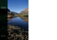
1. INTRODUCTION1.1 LOCATION AND EXTENT<strong>Golden</strong> <strong>Gate</strong> <strong>Highlands</strong> NP is situated in the north-eastern Free State between 28°27 ‟ S -28°37 ‟ S and 28°33 ‟ E - 28°42 ‟ E (Appendix 2: Map 1). The <strong>Park</strong> lies in the foothills of theMaloti Mountains in the Rooiberg range. The current extent of the <strong>Park</strong> is 32,690ha, includingthe QwaQwa <strong>National</strong> <strong>Park</strong> in the north and east, and to the south, bordering by Lesotho.The <strong>Park</strong> extends between the towns of Clarens (20 km) and Phuthaditjhaba (40 km) on theR712 provincial road that meanders through the middle of the <strong>Park</strong>. Other nearby towns isBethlehem (60 km), Fouriesburg (50 km), Kestell (60 km) and Harrismith (75 km).1.2 LOCAL AND REGIONAL PLANNING<strong>Golden</strong> <strong>Gate</strong> <strong>Highlands</strong> NP is situated in between the impoverished QwaQwa, which is aPresidential Nodal Point due to the high levels of poverty, unemployment and populationgrowth, and the affluent Clarens and environs, which is one of the highest rankingsustainable tourism growth points in South Africa. As such GGHNP can play a major role incontributing towards poverty alleviation in the region. In recent years the <strong>Park</strong> madeconsiderable contributions in this regard through SAN<strong>Park</strong>s‟ Expanded Public WorkProgramme (EPWP), Working for Water (WfW) Programme, Working on WetlandsProgramme and Working on Fire Programme. These new infrastructure developments andrehabilitation programmes in the <strong>Park</strong> created literally thousands of temporary and numerouspermanent employment opportunities in the <strong>Park</strong> and the region. Procurement for theseprojects also boosted the local economy considerably.<strong>Golden</strong> <strong>Gate</strong> <strong>Highlands</strong> NP falls under the Thaba Mofutsanyana District Municipality as theFSDMA19 District Management Area. The neighbouring local municipalities are DihlabengMunicipality and Maloti-a-Phofung Municipality. Thaba Mofutsanyana District Municipalityhas an Integrated Development Plan (IDP), with which GGHNP‟s management plan isaligned. All GGHNP‟s projects and initiatives are forwarded for reflection in the IDP. Inaddition, the <strong>Park</strong> management plan is aligned with the Maloti Drakensberg TFCAagreement, as well as its 20-year strategy and five year action planning processes.1.3 HISTORY<strong>Golden</strong> <strong>Gate</strong> <strong>Highlands</strong> NP represents a rich cultural history and diversity spanning the earlyStone Age people, San, Basotho and early European settlers, as well as the findings ofnumerous fossils in the <strong>Park</strong>. It is also an important Anglo-Boer war and rock art paintingsite.In 1962, the then Provincial Administration of the Orange Free State purchased land aroundthe popular picnic site at <strong>Golden</strong> <strong>Gate</strong> to support the creation of the first <strong>National</strong> <strong>Park</strong> in theFree State. With the transfer of this land to the control of the then <strong>National</strong> <strong>Park</strong>s Board, aninitial core area of 1,792ha, which included the farms Glen Reenen, Wodehouse andMelsetter, was proclaimed as the <strong>Golden</strong> <strong>Gate</strong> <strong>Highlands</strong> NP on 13 September 1963. The<strong>Park</strong> was proclaimed to preserve the mountain catchment area and its unique rockformations.During that same year the Glen Reenen rest camp was developed by utilising old farmbuildings as tourist accommodation. Thirteen rondavels and a camping area were soonadded. During 2003 and 2004 the Glen Reenen Rest Camp was expanded and upgraded toits present status of 31 economy and semi-luxury tourist accommodation units. During thelate sixties construction on the Brandwag Rest Camp, known as the Brandwag Hotel began.The Brandwag chalets, with 35 semi-luxury tourist accommodation units, were completed in1968 and the Brandwag main complex, with 35 luxury hotel rooms, was completed in 1972.The Brandwag main complex was upgraded and opened in 2010 as the new <strong>Golden</strong> <strong>Gate</strong>Hotel under SAN<strong>Park</strong>s administration which offers various facilities from hotel (55 luxury8
ooms) and chalet accommodation, a restaurant, snack lounge, sport bar, conference andbanqueting venues.In 1981 the <strong>Park</strong> was enlarged to 6,241ha when the farm Noord Brabant was proclaimed andadded to park. In 1982 the old Gladstone administration building and information centre wascompleted, but unfortunately the complex burned down as a result of lightning and in theprocess the entire <strong>Park</strong>‟s archives were destroyed. The new Gladstone administrationbuilding was completed in 1988. The Wilgenhof Environmental Education Centre wasopened in the early eighties and new dormitories were added in the late eighties. During1988 and 1989 the <strong>Park</strong> was further extended to 11,630ha, with the proclamation andaddition of another eight farms, which extended the park‟s boundaries to border QwaQwa<strong>National</strong> <strong>Park</strong> in the north and east, as well as the Kingdom of Lesotho in the south. During2003 and 2004 another two rest camps were added to GGHNP‟s tourism facilities, namelythe <strong>Highlands</strong> Mountain Retreat with eight luxury tourist accommodation units and theQwaQwa Rest Camp with 24 economy tourist accommodation units. On 21 November 2008the QwaQwa <strong>National</strong> <strong>Park</strong> (95 properties) were included in GGHNP increasing the park toits current size of 32,690ha.1.4 PHYSICAL ENVIRONMENT AND LAND USEAppendix 2: Map 2 details the physical features of GGHNP, while Map 3 lays out thesurrounding land use (including park expansion, discussed further down in this document).1.4.1 ClimateThe Maloti Drakensberg mountain range is one of only five areas in southern Africa whereannual rainfall exceeds evaporation rates. <strong>Golden</strong> <strong>Gate</strong> <strong>Highlands</strong> NP is characterized bysummer rainfall, temperate summers and cold winters. The rainfall season stretches fromSeptember to April with a mean annual rainfall ranging from 1,800 mm to 2,000 mm. CoolHighveld summers with the possibility of thunderstorms in the afternoons and cold winter withoccasional snow, which add to the scenic beauty of the area, prevail.1.4.2 Topography, geology and soilsTopographically the <strong>Park</strong> lies between 1892m and 2829m above sea level. The <strong>Park</strong> isunderlain by rock formations representing the upper part of the Karoo Sequence in SouthAfrica which is interrupted by dolerite dykes and sills. Recent alluvium and scree covers thevalley floors while scree also covers the mountain slopes. In addition, fossils are alsoassociated with these natural processes. The following sequences of geological formationsare visible, namely: Molteno Formation, Elliot Formation (mudstone), Clarens Formation(sandstone) and Drakensberg Formation (basalt) that dates back to 195-210 million yearsago.1.4.3 PalaeontologyAn important paleontological discovery dating back to the Late Triassic (200-230 millionyears ago) consisting of dinosaur fossils eggs with foetal skeletons inside were recentlydiscovered in GGHNP (Reisz et al. 2005). This put GGHNP in the international limelight andcan play an important role in the marketing strategy of the <strong>Park</strong>.1.4.4 Hydrology<strong>Golden</strong> <strong>Gate</strong> <strong>Highlands</strong> NP is situated on the watershed between the Vaal and the OrangeRiver systems, contributing quantity and quality water, via the Lesotho-<strong>Highlands</strong> WaterProject and the Tugela-Vaal transfer scheme, to the Gauteng region and into the OrangeRiver system. As such, the <strong>Park</strong> forms part of the most important water catchment inSouthern Africa, namely the Maloti Drakensberg Catchment Complex. Approximately 30% ofthe total water supply of Southern Africa is produced by this catchment complex. The LittleCaledon River, which drains towards the Orange River and Gariep Dam, and the KlerkspruitRiver, which drains towards the Wilge River and Vaal Dam, rise from GGHNP. Ground water,9
which is sourced by means of seven boreholes equipped with water pumps, is also utilisedfor domestic use by tourists and staff in the <strong>Park</strong>. Patches of high altitude wetlands exist inthe <strong>Park</strong> and the conservation thereof is of international importance.1.5 BIOLOGICAL ENVIRONMENT1.5.1 Vegetation<strong>Golden</strong> <strong>Gate</strong> <strong>Highlands</strong> NP and QwaQwa <strong>National</strong> <strong>Park</strong> falls in the Grassland Biome ofSouth Africa and represent the Drakensberg Grassland Bioregion and the Mesic HighlandGrassland Bioregion. Five vegetation types are recognised: (i) the Eastern Free State SandyGrassland, (ii) the Basotho Montane Shrubland, (iii) the Northern Drakensberg <strong>Highlands</strong>Grassland, (iv) the Drakensberg-Amathole Afromontane Fynbos, and (v) the LesothoHighland Basalt Grassland (Mucina & Rutherford, 2006). The Eastern Free State Grasslandis an endangered vegetation type and the Basotho Montane Shrubland vegetation type isclassified as vulnerable with only 2% of both these habitat types conserved in GGHNP,QwaQwa <strong>National</strong> <strong>Park</strong> as well as the Sterkfontein Dam Reserve.The largest plant families in the park are the Poaceae (55 genera) as well as the Asteraceae(51 genera). The grasslands in GGHNP are flat, slightly undulating terrain with streams andrivers and are dominated by Eragrostis species, Tristachya leucothrix and Themoda triandrawith an herb layer dominated by Asteraceae. The Northern Drakensberg <strong>Highlands</strong>Grassland is a mountainous region with steep slopes and broad valleys dominated by shortsour grasslands and patches of Protea woodland. The Afromontane fynbos are restricted tothe sheltered ravines and gorges where moisture level is maintained and the vegetation isprotected from fire. The plateaus high ridges of mountains are separated by deep valleyswith a Passerina montana dominated scrubland and smaller scrubs such as Chrysocomaciliate, Pentzia cooperi, Themeda triandra and Festuca caprina.1.5.2 FaunaThe checklist of mammals includes 12 species of mice, 12 carnivores, and 8 antelopespecies. A total of 171 species of birds have been recorded, 8 frog and toad species, and 21species of reptiles including the sungazer or also known as „ouvolk‟ (Cordylus giganteus) thatis endemic to the area and has been re-introduced in 1990. <strong>Golden</strong> <strong>Gate</strong> <strong>Highlands</strong> NP isalso a breeding site for vultures, especially the endangered (Anderson, 2000) beardedvulture (Gypaetus barbatus), the grass owl (Tyto capensis) and the Bald Ibis (Geronticuscalvus) is found in the <strong>Park</strong>. A relatively high number of 117 species of Coleopterarepresenting 35 families was recorded on above-ground portions of Leucosidea sericea. TheGrey rhebuck (Pelea capreolus) and mountain reedbuck (Redunca fulvorufula) were alreadypresent when the park was established whereas the eland (Tragelaphus oryx), blesbok(Damaliscus pygargus), black wildebeest (Connochaetes gnou), springbok (Antidorcasmarsupialis), zebra (Equus zebra) and oribi (Ourebia ourebi) were introduced.10
2. PROTECTED AREA AND MANAGEMENT PLANNING FRAMEWORKThe Protected Area Management Planning and Policy Framework that have been designedfor SAN<strong>Park</strong>s guides <strong>Park</strong> management in setting up a management plan, implementationthereof and the review of the plan. The essential feature of the system is the iterative way inwhich it will enable continual improvement in the management of the <strong>Park</strong> through annualand five-year review cycles. The first step in developing/revising a management plan is todevelop the desired state of the <strong>Park</strong>.2.1 DESIRED STATEIn order that the current and future extent of the <strong>Park</strong> be protected and managed effectively,the desired state has been developed to guide <strong>Park</strong> management in its daily operations. Thedevelopment of a desired state for GGHNP was guided by a stakeholder workshop held inJune 2009, during which a mission, vision and management objectives were formulated(GGHNP Adaptive Planning for a Desired State, Report 2009). The vision and missionstatements reflects the high-level essence of what GGHNP is aspiring towards, and ahierarchy of objectives translating these broad values into strategic, auditable managementoutcomes (Figure 2). This section of the plan details the setting of GGHNP‟s desired state,focusing on the determinants and threats to its vital attributes, and translating themaintenance of these determinants and overcoming of these threats from broad objectivesinto specific management actions.Specific programmes to achieve the desired state for GGHNP are detailed in the plan. Theseprogrammes are the core components of protected area management, categorized bySAN<strong>Park</strong>s under four broad headings: biodiversity conservation, sustainable tourism,building co-operation and effective <strong>Park</strong> management. Finally, the plan outlines how thevarious GGHNP objectives will be prioritized, integrated and operationalised, and whichfeedback mechanisms will be used to ensure compliance, auditability and maximum learning,as part of the adaptive management cycle.2.2 VISION OF THE PARKThe Vision of GGHNP is:“As an important part of a wider functional land-use mosaic which delivers sustainableecosystem services, to maintain the natural and cultural heritage of the park for the benefit ofall, especially local communities. Promote and participate in an environment whichemphasises opportunities for learning, and even acts as a motivational demonstration site formanaging the natural environment, and promotes sustainable use and collaborativeteamwork, in a changing world”.In order to achieve this Vision, GGHNP‟s Mission is:“To manage GGHNP in a collaborative learning environment as part of an ecologicallyfunctional and sustainable patchwork of different land uses in the region, and that ensuresthe persistence of the natural and cultural heritage for the benefit and enjoyment of all”.The vision and mission for GGHNP ensure that while the park‟s management objectives andstrategies (detailed further down in this management plan) conform to SAN<strong>Park</strong>s broad-levelobjectives, the specific high level objectives of GGHNP can ultimately be traced back to itsstakeholders‟ values.2.3 OPERATING PRINCIPLES<strong>Golden</strong> <strong>Gate</strong> <strong>Highlands</strong> NP takes its biodiversity values from the headline SAN<strong>Park</strong>sbiodiversity values:• We adopt a complex systems view of the world while striving to ensure the naturalfunctioning and long term persistence of the ecosystems under our care.11
• We aim at persistent achievement of biodiversity representivity andcomplementarity to promote resilience and ensure ecosystem integrity.• We can intervene in ecosystems responsibly and sustainably, but we focusmanagement on complementing natural processes under a "minimuminterference" philosophy.• We accept with humility the mandate of custodianship of biodiversity for futuregenerations while recognising that both natural and social systems change overtime.Although SAN<strong>Park</strong>s corporate and biodiversity values have been set, they need to besupplemented in GGHNP by operating principles that meet the specific needs of GGHNP‟sstakeholder values, particularly focusing on their desire for sustainable natural and culturalresource use. The operating principles below reflect the values of individuals in the GGHNPstakeholder group (particularly stemming from the June 2009 public participation workshop),including SAN<strong>Park</strong>s and GGHNP management:1. Biophysical and ecosystem functionality (including threatened species) is thefoundation on which all ecological, social and economic systems ultimately depend,whereas we recognise that the conservation sector has historically ignored socialissues to its detriment.2. Promoting livelihoods in, around and beyond the park is seen as cardinal toachievement of park goals. Target creation of a diversity of opportunities.3. Working in teams, building bridges and partnerships, building an overlapping (evensometimes fully shared) rationale, and learning-by-doing are also believed core to goalrealisation, even more so in the wider landscape context.4. Recognising and further understanding the various connections of people to the landwill assist us greatly in our mission5. Wilderness notions, „sense of place‟, re-finding our „roots in nature‟, „exploring thecreation‟, and recognising the restorative and healing qualities of natural landscapesare important values which should be maintained and could even be further developedin the “Expanded <strong>Golden</strong> <strong>Gate</strong>” context.6. Promotion of accountability, and the understanding of its appropriate usage in thecontext of uncertainty and hence humility and learning-by-doing, in the management ofsocial-ecological systems7. We recognise and promote the important interrelationships between the culturallandscape, history and heritage in GGHNP and it‟s linkages to livelihoods, biodiversityconservation and sense of place, wilderness character and spiritual connections to thelandscape.2.4 VITAL ATTRIBUTESListing the vital attributes of a park is an important step in the objective setting process as itidentifies the fundamental purpose(s) of conservation management for a particular park. Thefollowing vital attributes have been identified as making GGHNP unique, or at least veryspecial in its class. Each attribute is accompanied by important factors determining orthreatening the attribute. Using this information helps management to achieve the desiredstate by formulating park objectives that focus on maintaining the determinants of, and onovercoming the constraints and threats to, these vital attributes. In addition, in this way themanagement plan is customized in its fullest local extent, without detracting from some of itsmore generic SAN<strong>Park</strong>s functions. The vital attributes of GGHNP can be summarised asfollows:1. Strong cultural history/living culture.2. Strong geological, geomorphological and paleontological history with excellentlearning opportunities (dinosaur eggs, high rainfall and low temperature ecosystem).12
3. Key catchment position of the main river systems of South Africa and the associatedecosystem services.4. Capacitated MDTP node with strong potential as a learning and demonstration site inchanging times.5. Capacitated and promising education and awareness opportunities.6. Scenic beauty (including snow), wilderness/spiritual/aesthetic opportunities withfreedom to walk/hike.7. Valuable biodiversity site.8. Significant contribution to local economy and livelihoods (win-win with Clarens andrecognisable contribution to impoverished area to the east).9. Value as tourism/marketing hub (related especially to landscape and enablinginfrastructure and proximity to three urban centres).The general threats to maintaining GGHNP‟s desired state include a concern about safetyand security, vandalism, littering and crime situations as well as the current poor trends in thenational economy and the influence it will have on local economy, funding of projects and jobsecurity. Inappropriate development, poor land use, alien infestation and cultural heritageunfriendly practises were also listed as concerns. Although the MDTP is seen in a verypositive light changes in leadership, capacity, institutional culture and breakdowns ofrelationships and collaborations were listed as concerns.2.5 AN OBJECTIVE HIERARCY FOR GGHNPFollowing the adaptive planning process, these vital attributes were used to construct anobjectives hierarchy, with ten high level objectives cascading down to finer and finer levels ofdetail, ending with specific operational or management strategies. Figure 2 represents thehighest level objectives in GGHNP‟s objectives hierarchy, which form the basis forprioritisation of management issues, and are explicitly derived from the park‟s Mission andVision. The high level objectives focus first and foremost on sustainable ecosystem andcultural heritage management, and then on providing benefits to its users that do notnegatively impact on the parks resources. The final high level objective is an enablingobjective that makes the attainment of the other objectives possible through best practisemanagement of GGHNP‟s human resources. The breakdown of these objectives into moredetailed sub-objectives is given in Box 1 and the implementation programmes are describedin the next section.13
MISSIONTo manage GGHNP in a collaborative learning environment as part of an ecologically functional and sustainable patchworkof different land uses in the region, and that ensures the persistence of the natural and cultural heritage for the benefit andenjoyment of allCulturalheritage &benefitsobjective:Tocollaborativelyconserveand sustainthe culturalheritageassets andassociatedbenefits ofGGHNPGeologicaland paleontologicalobjective:To documentandappropriatelypromoteaccessibility inunderstandingandappreciationof the richgeological,geomorphologicalandpaleontologicalassetsof GGHNPandsurrounds.Waterresourceprotectionobjective:To collaborativelyensurethat GGHNPand theirneighboursare primeproducers ofgood qualitywater in thetwo catchmentareasRole in MDTPprocessobjective:To continueplaying animportant roleas the MDTP20 yearstrategyunfolds, alsoacrossprovincial andinternationalboundaries,serving as alearning sitepromotingsharing ofviewpointsand practicesScenic,spiritual &wildernessobjective:Tomaintainandpromotethe scenic,spiritualandwildernessqualities ofGGHNPwhichenable andenhancebenefitsandenjoymentthrough avariety ofcompatiblewaysEnvironmentalawareness &educationobjective:GGHNP tocontinuecollaborativedynamicimplementationofenvironmentalawarenessand educationprogrammesin order tostrengthennetworkingopportunitiesand promotetheimportance ofa holisticapproach toenvironmentalconservationinitiativesEcologicalintegrityobjective:To ensurepersistenceof ecologicalintegrity ofGGHNP andwherepossibleneighbouringareas, byenablingnaturalprocesses tocontinue andin doing soalso providefor learningand researchopportunitiesLocaleconomy &livelihoodsobjective:To strive toensure thatGGHNPcontinuesto be a keycontributorto the localeconomyandlivelihoodsTourismhubobjective:Tomaintain,grow andpromoteGGHNP asa safetourismhubofferingmemorablevalue-formoneyexperiencesthroughexcellentservicestandardsEffective<strong>Park</strong>ManagementObjectiveTo strive foreffectivemanagementandadministrative supportservicesenablingGGHNP toachieve itsobjectivesFigure 2 High level objective hierarchy for GGHNP14
Box 1A A summary of the cultural heritage and benefits high level objectives and sub-objectives forGGHNPCULTURAL HERITAGE AND BENEFITS OBJECTIVE: To collaboratively conserve and sustain thecultural heritage assets and associated benefits of GGHNPObjectiveSub-objectiveObjectiveSub-objectiveSub-objectiveSub-objectiveSub-objectiveObjectiveSub-objectiveObjectiveObjective1. To update the current data base into a comprehensive inventory of culturalheritage sites (tangible and intangible)1.1 To identify sites of national importance on the data base and have themformally declared.2. To effectively conserve the cultural heritage of the park through the developmentand implementation of a Cultural Heritage Management Plan.2.1 To address priority threats through specific management strategies that isinformed by relevant research.2.2 To prevent the destruction of priority sites and areas through land-useplanning and decision-making and other relevant regulatory mechanisms.2.3 To secure heritage resource priorities through the design and implementationof effective conservation and management mechanisms and processes.2.4 To ensure that the GGHNP cultural heritage management plan andprogrammes take cognisance of indigenous cultural heritage knowledgesystems.3. To promote and implement responsible tourism and other activities associatedwith cultural heritage at identified sites3.1 To provide opportunities for community benefits (monetary and nonmonetary)**Examples: use of initiation places, fertility caves, managed use ofmedicinal plants (Cross-reference with resource use objective)4. To promote research, education and awareness of the cultural heritagesignificance of the park5. To evaluate management decisions/actions on cultural heritage and monitor thecondition of cultural heritage resourcesCross-reference with geological and paleontological objective15
Box 1B A summary of the geological and paleontological objectives and sub-objectives in GGHNPGEOLOGICAL AND PALEONTOLOGICAL OBJECTIVE: To document and appropriately promoteaccessibility in understanding and appreciation of the rich geological, geomorphological andpaleontological assets of GGHNP and surrounds.1. To collate, review, update and encourage further documentation and research ofObjectivethe geological, geomorphological and paleontological assets, the significanceand threats to these features2. To identify sensitive and important sites of the unique geological,Objectivegeomorphological and paleontological features of the park3. To protect the unique geological, geomorphological and paleontological featuresObjectiveby providing appropriate access and facilities, and minimizing the effects ofinappropriate disturbances on natural processes4. To create appreciation and awareness of the unique geological,Objectivegeomorphological and paleontological features by visitors through providing adiverse range of opportunities to experience and interpret these features5. To evaluate and monitor effectiveness of management on the status of theObjectiveunique geological, geomorphological and paleontological features and howvisitors experience these featuresBox 1C A summary of the water resource protection objectives and sub-objectives in GGHNPWATER RESOURCE PROTECTION OBJECTIVE: To collaboratively ensure that GGHNP and theirneighbours are prime producers of good quality water in the two catchment areas1. To identify key threats, determine current status and evaluate consequences ofpollution, historical management, climate change and rainfall regimes on theObjectiveability of catchments to produce and maintain quality and quantity of water in thelong-term2. To identify the effects of ongoing management actions, infrastructureObjectivedevelopment and tourism activities on the ability of the park to maintain goodquality and quantity of water produced from catchments3. To ensure that ongoing management actions, infrastructure development andObjectivetourism activities impact minimally on the quality and quantity of water producedfrom catchments in the long-term4. To restore and enhance the ability of catchments to produce and maintain qualityObjectiveand quantity of water through restoring ecological processes impeded by humaninduceddisturbancesObjective 5. To create awareness and promote collaborative projects with neighbours by16
ObjectiveObjectiveacting as a catalyst for catchment management and thereby promotingsustainable water flows and quality in the long-term6. To support the MDTP-initiative focusing on appropriate economic mechanismsincluding incentive-based regulation and payment for environmental services7. To monitor and evaluate the effectiveness of management on water quality andquantity produced from catchments within the park and how the park influencesneighbours’ catchment activities and managementBox 1D A summary of the Maloti Drakensberg TFCA objectives for GGHNPMALOTI DRAKENSBERG TFCA: To continue playing an important role as the MDTP 20 yearstrategy unfolds, also across provincial and international boundaries, serving as a learning sitepromoting sharing of viewpoints and practicesObjective 1. To align the parks management plan with the MDTP strategy and action plans2. To sustain partnerships between agencies, government, adjacent communitiesObjectiveand other parties in a Maloti Drakensberg TFCA regional perspective3. To promote co-learning with partners through providing opportunities, sharingObjectiveexpertise and creating opportunities for learning4. To monitor progress and evaluate the parks contribution to the implementation ofObjectivethe MDTP action planThis high-level objective cross link with all other objectives in GGHNPBox 1E A summary of the scenic, spiritual and wilderness qualities objectives and sub-objectives inGGHNPSCENIC, SPIRITUAL AND WILDERNESS QUALITIES OBJECTIVE: To maintain and promote thescenic, spiritual and wilderness qualities of GGHNP which enable and enhance benefits andenjoyment through a variety of compatible waysObjectiveObjectiveSub-objectiveSub-objectiveObjective1. To document the variety of spiritual and wilderness qualities and experiencesprovided by the park to various stakeholders through evaluation of their needsand use (non-consumptive) of the space2. To maintain the diversity of qualities by sensitive planning and development andprovide appropriate access to the places and associated sense-of-place andspiritual qualities (Cross-reference with tourism, zonation plan)2.1 To promote the diversity of opportunities for a variety of experiences(Cross-reference with market transformation)2.2 To identify potential remote** and wilderness areas as part of the zonationprocess3. To restore, appropriately and where necessary, the sense of place and17
Sub-objectiveSub-objectiveObjectivewilderness character and remoteness of the landscape3.1 To minimise the impacts on those spiritual and remote experiences throughappropriate planning, zoning.3.2 To, where appropriate, proactively influence adjacent land-use planning4. To monitor and evaluate the experiences of users and visitors associated withthe landscape and its qualitiesBox 1F A summary of the environmental awareness and education objectives and sub-objectives ifGGHNPENVIRONMENTAL AWARENESS AND EDUCATION OBJECTIVE: GGHNP to continuecollaborative dynamic implementation of environmental awareness and education programmes inorder to strengthen networking opportunities and promote the importance of a holistic approach toenvironmental conservation initiativesObjectiveObjectiveSub-objectiveObjectiveSub-objectiveSub-objectiveObjectiveObjective1. To review existing programmes and identify new programmes that specificallycapitalize on the strengths and opportunities offered by the park2. To identify and strengthen network opportunities that will promote the holisticapproach to environmental conservation and education efforts relevant to keyelements of the park (incl. water resources)2.1 To create and implement awareness and outreach programmes and projectsto local communities and school children that emphasize and capture theimportance of catchments in producing water quality and quantity3. To sustain collaboration with various partners on projects and programmes tofurther a holistic approach to environmental conservation in support ofSAN<strong>Park</strong>s’ mandate, making use of the opportunities presented by the parkslandscape and resources3.1 To develop, sustain and enhance meaningful programmes that compliment thenational school curriculum3.2 To provide opportunities for tertiary education and co-learning, aligned with theparks information and knowledge needs4. To provide appropriate tourism-related education, awareness and interpretiveopportunities5. To evaluate the effectiveness of environmental awareness and educationprogrammes, specifically to the park (also around water production andconservation)Cross-reference with geological and paleontological objectiveCross-reference with water resource protection objectiveBox 1G A summary of the ecological integrity objectives and sub-objectives in GGHNP18
ECOLOGICAL INTEGRITY OBJECTIVE: To ensure persistence of ecological integrity of GGHNPand where possible neighbouring areas, by enabling natural processes to continue and in doing soalso provide for learning and research opportunities1. To identify and prioritize key biological features and processes of the park andObjectiveits surrounds, drivers of their dynamics and threats to the persistence ofecological integrity2. To improve information by promoting opportunities for collaborative research andObjectivelearning focusing on priority biological features and processes of the park and itssurrounds3. To expand and consolidate the park to include new and under-representedObjectivehabitats that enhance the persistence of the ecological integrity of the park andits surroundsSub-objective 3.1 To actively participate in the land restitution process4. To ensure the persistence of the parks ecosystems by maintaining and restoringObjectiveecological processes that sustain ecological integrity, heterogeneity and diversityin a matrix of different land-uses4.1 To mitigate the threats posed by invasive alien species, tracks and trails, fire,Sub-objective over-grazing, animal diseases and soil erosion through natural heritage bestpractice guidelines and management strategies.5. To ensure the persistence of rare and endangered species of concern to the parkand its surrounds, through enhancing processes that maintain populations whileObjectiveensuring the ecological integrity of the region, minimizing human-induced threatsand limiting effects of implementing other objectives5.1 To, where appropriate, coordinate with and align biodiversity managementSub-objective actions for the conservation of specific ecosystems and species with TFCAneighbours.6. To evaluate and monitor the effectiveness of management in maintaining theecological integrity and processes of the park and its surrounds, including theObjectivepersistence of identified rare and endangered species of concern, throughcollaborative monitoring and research programmesCross-reference with the water, tourism and MDTP planning objectives19
Box 1H A summary of the local economy and livelihoods objectives and sub-objectives in GGHNPLOCAL ECONOMY AND LIVELIHOODS OBJECTIVE: To strive to ensure that GGHNP continues tobe a key contributor to the local economy and livelihoodsObjective1. To identify and understand how the park currently provides livelihood andeconomic opportunitiesSub-objective 1.1 To ensure that extractive use of natural resources in the park is sustainable.Sub-objective1.2 To ensure that local communities have fair access to and benefit from thenatural resources of the park.Objective2. To contribute towards the formulation of appropriate livelihood strategies withinand around the park2.1 To identify any possible additional opportunities for improving and enhancingSub-objective livelihoods, also within the Maloti Drakensberg TFCA sustainable livelihoodsimperative, without imposing on the ability to meet other objectivesSub-objective2.2 To contribute to the developing Maloti Drakensberg TFCA SustainableLivelihood Information Management System.Objective3. To promote, support and advocate collaborative partnerships, work and learningopportunities that enhance livelihoods across several sectors of the economyObjective4. To continue to be a main contributor to local and regional economic growththrough promoting local business linkagesObjective5. To evaluate the effectiveness of the park in promoting, enhancing and supportinglivelihoods in contributing to the local and regional (Eastern Free State) economyBox 1I A summary of the tourism hub objectives for GGHNPTOURISM HUB OBJECTIVE: To maintain, grow and promote GGHNP as a safe tourism hub offeringmemorable, value-for-money experiences through excellent service standards1. To update and improve the understanding of visitors needs and expectations,Objectivesafety concerns and threats and align this with SAN<strong>Park</strong>s’ conservationimperatives2. To review and update the parks tourism strategy to provide a platform for valueObjectivefor money experiences2.1 To ensure that the implementation of a coherent strategy and spatialSub-objective framework for sustainable tourism supports the conservation anddevelopment priorities of the Maloti Drakensberg TFCA.2.2 To review the zonation plan to cater for a variety of tourism and experientialSub-objectiveneeds and experiencesSub-objective 2.3 To utilise the enabling mechanisms for development, investment and20
Sub-objectiveObjectiveObjectiveObjectiveObjectiveSub-objectiveObjectivemarketing to contribute to the optimal tourism development of the MalotiDrakensberg TFCA.2.4 To evaluate how tourism products influence other objectives(Cross-reference with the Biodiversity and Wilderness Objectives)3. To transform the tourism market for constituency-building and inclusivity byensuring marketing and other strategies also target the emerging markets(requires needs analysis, marketing, infrastructure development, wilderness,awareness, diversity of experiences and products)4. To manage and develop conservation-friendly tourism products in line with thetourism strategy5. To promote awareness of the variety of tourism experiences to a diversity ofusers and stakeholders through appropriate marketing approaches6. To ensure ongoing improvement in service excellence through training,mentorship and other targeted approaches and interventions6.1 To evaluate and monitor effectiveness of tourism products and services forongoing improvement in service delivery and standards7. To evaluate whether the tourism products are providing the experiences thatcapitalise on the special qualities and ambience of this park(Cross-reference with the wilderness, awareness, etc)Cross-reference with geological and paleontological objectiveCross-reference with local economy and livelihoods objectiveBox 1J A summary of the effective management objectives in GGHNPEFFECTIVE PARK MANAGEMENT OBJECTIVE: To strive for effective management andadministrative support services enabling GGHNP to achieve its objectives1. To follow the adaptive management process for all planning and implementationObjectiveactivities2. To ensure sufficient capacity to implement management objectives (humanObjectiveresources, finances, knowledge etc.)Objective 3. To manage park infrastructure efficientlyObjective 4. To manage and reduce impacts of operational activities on the ecosystem5. To provide a safety and security framework for all staff within GGHNP to takedecisive action in case of emergencies involving employees, visitors and anyObjectiveother individual whose situation can assisted by SAN<strong>Park</strong>s personnel (this incl.all security related incidents in respect of crimes perpetrated against staff,visitors and SAN<strong>Park</strong>s property as well as any wildlife crimesObjective 6. To develop sustained partnerships between conservation agencies, government,21
Sub-objectiveSub-objectiveSub-objectiveSub-objectiveObjectiveadjacent communities and other parties that enhance opportunities forconservation planning and funding on a regional perspective6.1 To identify, develop, enhance and nurture new and existing relationshipsbetween conservation agencies, government, adjacent communities andother parties using agreed mechanisms of representative and accountableparticipation in park management6.2 To plan strategically in collaboration with relevant local, provincial andnational authorities and stakeholders for any potential development within oraffecting the park6.3 To promote and enhance bioregional opportunities for conservation planningand funding through leveraging partnerships with conservation agencies,government, adjacent communities, non-government organizations and otherparties6.4 To evaluate stakeholder perceptions, attitudes and behaviour in response tomanagement of the park and informing partnerships on managing therelationships and building social capital7. To effectively manage the cost to income ratio2.6 THRESHOLDS OF POTENTIAL CONCERN AND OTHER EXACT CONSERVATION TARGETSIn the adaptive management of ongoing change in ecological systems, thresholds of potential concern(TPCs) are the upper and/or lower limits of flux allowed, explicitly specifying the boundaries of thedesired state of the park. If monitoring or predictive modelling indicate exceedances beyond these limits,then mandatory management options of the adaptive cycle are prompted. Considering the biophysicalobjectives stated above, the following TPCs are provisionally listed for GGHNP, but require developmentin consultation with scientific experts:The local decline/extinction of species such as the oribi population size, sungazer populations,vultures and threatened plant speciesChanges in vegetation due to herbivory (incl. alien species), fire, climate change, bushencroachmentInability to deliver water to catchments, degradation of wetlands, erosion, alien infestationInvasion of alien biota (fauna and flora)Threat of erosion due to infrastructure developmentPollution effects (air, light and littering)Extent of resource use (specific TPCs to ensure sustainable utilisation)The effects of tourism operations and facilities (and expectations) on cultural and biodiversityheritage22
These provisional TPCs will form part of particular programmes (below) to achieve the desired state, andwill require explicit monitoring to assess the potential exceedance of each TPC. This has critical capacityand funding implications for the future budgeting and resource requirements of the park. It is thereforecrucial to note at this point that the adaptive management cycle cannot be successfully implementedwithout the necessary capacity for monitoring. In addition, research should be solicited in conjunctionwith the monitoring to increase our understanding of the ecological processes in GGHNP. Research,too, should be explicitly linked to the issues in GGHNP‟s objective hierarchy.The above TPCs constitute the range believed to be necessary initially. If other issues arise (e.g. theneed for certain rare biota TPCs) these can be set from generic principles.23
3. CONSERVATION DEVELOPMENT FRAMEWORKThe primary objective of a park zoning plan is to establish a coherent spatial framework in and around apark to guide and co-ordinate conservation, tourism and visitor experience initiatives. A zoning planplays an important role in minimizing conflicts between different users of a park by separating potentiallyconflicting activities such as game viewing and day-visitor picnic areas whilst ensuring that activitieswhich do not conflict with the park‟s values and objectives (especially the conservation of the protectedarea‟s natural systems and its biodiversity) can continue in appropriate areas.The zoning of <strong>Golden</strong> <strong>Gate</strong> <strong>Highlands</strong> <strong>National</strong> <strong>Park</strong> was based on an analysis and mapping of thesensitivity and value of a park‟s biophysical (including detailed vegetation and soil mapping), heritageand scenic resources; an assessment of the regional context; and an assessment of the park‟s currentand planned infrastructure and tourist routes/products; all interpreted in the context of park objectives.Overview of the use zones of <strong>Golden</strong> <strong>Gate</strong> <strong>Highlands</strong> <strong>National</strong> <strong>Park</strong>:The summary of the use zoning plan for <strong>Golden</strong> <strong>Gate</strong> <strong>Highlands</strong> is shown in Map 4. Full details of theuse zones (including high resolution maps), the activities and facilities allowed in each zone, theconservation objectives of each zone, the zoning process, the <strong>Park</strong> Interface Zones (detailing parkinteraction with adjacent areas) and the underlying landscape analyses are included in Appendix One:<strong>Golden</strong> <strong>Gate</strong> <strong>Highlands</strong> <strong>National</strong> <strong>Park</strong> Zoning Plan.Remote Zone: This is an area retaining an intrinsically wild appearance and character, or capable ofbeing restored to such and which is undeveloped and roadless (although limited unimprovedmanagement tracks are allowed). There are no permanent improvements or any form of humanhabitation. It provides outstanding opportunities for solitude, with awe inspiring natural characteristicswith sight and sound of human habitation and activities barely discernable and at far distance. Theconservation objective is to maintain the zone in a natural state with no impact on biodiversity pattern orprocesses. Existing impacts on biodiversity either from historical usage or originating from outside thezone should be minimized. The aesthetic/recreational objectives for the zone specify that activities whichimpact on the intrinsically wild appearance and character of the area, or which impact on the wildernesscharacteristics of the area (solitude, remoteness, wildness, serenity, peace etc) will not be tolerated. In<strong>Golden</strong> <strong>Gate</strong> <strong>Highlands</strong> NP, Remote areas were designated in the rugged mountain areas in thewestern and south western areas of the park. The zones were designated to include landscapes withhigh environmental sensitivity and value.Primitive Zone: The prime characteristic of the zone is the experience of wilderness qualities withaccess controlled in terms of numbers, frequency and size of groups. The zone shares the wildernessqualities of the Remote zone, but with limited access roads, trails and the potential for basic small-scaleself-catering accommodation facilities such as small bushcamps. Views of human activities anddevelopment outside of the park may be visible from this zone. The conservation objective is to maintainthe zone in a generally natural state with little or no impact on biodiversity processes, and very limitedand site specific impacts on biodiversity pattern. Existing impacts on biodiversity either from historicalusage or originating from outside the zone should be minimized. The aesthetic/recreational objectivesfor the zone specify that activities which impact on the intrinsically wild appearance and character of thearea, or which impact on the wilderness characteristics of the area (solitude, remoteness, wildness,serenity, peace etc) should be restricted and impacts limited to the site of the facility. Ideally visitorsshould only be aware of the facility or infrastructure that they are using, and this infrastructure/facilityshould be designed to fit in with the environment within which it is located in order to avoid aestheticimpacts. In <strong>Golden</strong> <strong>Gate</strong> <strong>Highlands</strong> NP, Primitive areas were designated to buffer Remote areas fromhigher use areas and activities outside the park (especially on the southern boundary), as well as toprotect most of the remaining sensitive areas (such as large sections of what was QwaQwa <strong>National</strong><strong>Park</strong>) from high levels of tourist activity. Almost all highly and moderately sensitive environments thatwere not included within the Remote zone were included in this zone. Primitive areas were alsodesignated in valleys with relatively low environmental sensitivity to allow access to Remote areas aswell as to contain the infrastructure required for management and tourist activity in these areas (e.g. trailhuts and access roads).24
Quiet Zone: This zone is characterized by unaccompanied (or accompanied under somecircumstances) non-motorized access, where visitors can walk or cycle and experience nature withoutthe intrusion of any form of motorized transport. Visitor numbers and density are higher than in thePrimitive zone and contact between visitors is frequent. The conservation objective is to maintain thezone in a generally natural state, with the proviso that limited impacts on biodiversity patterns andprocesses are allowed in order to accommodate park recreational and tourism objectives. Theaesthetic/recreational objectives for the zone specify that activities which impact on the relatively naturalappearance and character of the area should be restricted, though the presence of larger numbers ofvisitors and the facilities they require, may impact on the feeling of “wildness” found in this zone. Themajor change in the 2009 zoning update has been the significant extension of Quiet areas to promoteadditional non-motorised access to areas around existing access points in the Glen Reenen, Brandwagand Mountain Retreat areas, as well as to allow for future development of non-motorised access toareas around the QwaQwa Cultural Village and day visitor site, as well as around the proposed AlmaRestcamp.Low Intensity Leisure Zone: The underlying characteristic of this zone is motorized self-drive accesswith the potential for self-catering accommodation units in small basic camps without facilities such asshops and restaurants. Facilities along roads are limited to basic self-catering picnic sites with toiletfacilities. The conservation objective is to mitigate the biodiversity impacts of the relatively high levels oftourism activity and infrastructure that are accommodated within this zone through careful planning andactive management, and to ensure that both the negative effects of the activities and infrastructure arerestricted to the zone, and that the zone is maintained in a generally natural state that is in keeping withthe character of a Protected Area. The aesthetic/recreational objectives for the zone specify thatalthough activities and facilities will impact on the wild appearance and reduction of the wildernesscharacteristics of the area (solitude, remoteness, wildness etc) is inevitable, these should be managedand limited to ensure that the area still provides a relatively natural outdoor experience. Low IntensityLeisure areas were designated in the current game viewing loops, around current accommodation andother associated infrastructure outside of the main camps, and along existing public access roads wherethey form part of the park road network. Provision was made for the expansion of game and landscapeviewing activities in lowland sections of the park by identifying four potential areas of low environmentalsensitivity and value which could contain future road networks. Provision has been made for a linkagebetween the Wilgerhof area of the park and “Little Serengeti” in order to facilitate a future circular routewithin the park. However, detailed feasibility studies would be required to determine if this is practicaland financially and ecologically viable. The major provincial road cutting through the park is in the LowIntensity Leisure zone, but its current intensity of use contradicts the nature and intent of the zone.High Intensity Leisure Zone: This zone is characterized by high density tourist development nodeswith amenities such as shops, restaurants and interpretive centres. This is the zone where moreconcentrated human activities are allowed, and is accessible by motorized transport on high volumetransport routes. The main focus is to ensure a high quality visitor experience, however the conservationobjectives still require that the high levels of tourism activity and infrastructure that are accommodatedwithin this zone are planned and managed to minimize the effect on the surrounding naturalenvironment, and that the zone must still retain a level of ecological integrity consistent with a protectedarea. The aesthetic/recreational objectives for the zone specify although the high visitor numbers,activities and facilities will impact on the wild appearance and reduction of the wilderness characteristicsof the area (solitude, remoteness, wildness etc) is inevitable, these should be managed and limited toensure that the area generally still provides a relatively natural outdoor experience. In <strong>Golden</strong> <strong>Gate</strong><strong>Highlands</strong> NP, High Intensity Leisure areas were designated around the Gladstone to Glen Reenensection of the park incorporating most of high density tourist and administrative facilities. Additional HighIntensity Leisure areas were designated at the QwaQwa Cultural Village and the Day Visitor site, as wellas at the proposed Alma Rest Camp site.25
Overview of the Special Management Overlays of <strong>Golden</strong> <strong>Gate</strong> <strong>Highlands</strong> <strong>National</strong> <strong>Park</strong>:Special management overlays which designate specific areas of the park that require specialmanagement interventions were identified. Three areas were designated:Special Conservation Areas – Olinia Podocarpus Forest, Plateau Grassland andWetland/Drainage line vegetation: These three sensitive habitat types were identified for specialprotection in order to reduce any potential loss and to prioritize rehabilitation work in these areas.Summary of the Buffer Zones around <strong>Golden</strong> <strong>Gate</strong> <strong>Highlands</strong> <strong>National</strong> <strong>Park</strong>:A <strong>National</strong> <strong>Park</strong> Buffer Zone is the identified area within which activities (e.g. landuse change) have aninfluence on the park (current and future extent). This section of the management plan is aligned withthe DEA Policy on Buffer Zones for <strong>National</strong> <strong>Park</strong>s and the SAN<strong>Park</strong>s Buffer Zone Policy. This sectionof the management plan formally identifies and defines the buffer zone.The <strong>Park</strong> Buffer Zones shows the areas within which landuse changes could affect a national park. Thezones, in combination with guidelines, will serve as a basis for a.) identifying the focus areas in whichpark management and scientists should respond to EIA‟s, b.) helping to identify the sort of impacts thatwould be important at a particular site, and most importantly c.) serving as the basis for integrating longterm protection of a national park into the spatial development plans of municipalities (SDF/IDP) andother local authorities. In terms of EIA response, the zones serve largely to raise red-flags and do notremove the need for carefully considering the exact impact of a proposed development. In particular,they do not address activities with broad regional aesthetic or biodiversity impacts.<strong>Golden</strong> <strong>Gate</strong> <strong>Highlands</strong> <strong>National</strong> <strong>Park</strong> has three Buffer Zone categories (Map 6). The first two aremutually exclusive, but the final visual/aesthetic category can overlay the others.Priority Natural Areas: These are key areas for both pattern and process that are required for thelong term persistence of biodiversity in and around the park. The zone also includes areas identified forfuture park expansion. Inappropriate development and negative land-use changes should be opposed inthis area. Developments and activities should be restricted to sites that are already transformed. Onlydevelopments that contribute to ensuring conservation friendly land-use should be viewed favorably.Catchment Protection Areas: These are areas important for maintaining key hydrological processeswithin the park. Inappropriate development (dam construction, loss of riparian vegetation etc.) should beopposed. Control of alien vegetation & soil erosion as well as appropriate land care should be promoted.Viewshed Protection Areas: These are areas where development is likely to impact on the aestheticquality of the visitor‟s experience in a park. Within these areas any development proposals should becarefully screened to ensure that they do not impact excessively on the aesthetics of the park. The areasidentified are only broadly indicative of sensitive areas, as at a fine scale many areas within this zonewould be perfectly suited for development. In addition, major projects with large scale regional impactsmay have to be considered even if they are outside the Viewshed Protection Zone.Current status and future improvements:The current park use zonation is based on the same biodiversity and landscape analyses undertaken fora Conservation Development Framework (CDF); however certain elements underlying the CDF such asa tourism market analysis are not be fully incorporated into the park use zonation. A full CDF will bedeveloped for <strong>Golden</strong> <strong>Gate</strong> <strong>Highlands</strong> <strong>National</strong> <strong>Park</strong> within the current update cycle. Remote areas willbe investigated for possible formal declaration as Wilderness Area in terms of Section 22 of the PAA.Additional special management overlays which designate specific areas of a park that require specialmanagement interventions (e.g. areas requiring rehabilitation and specific management from a culturalheritage perspective) will also be identified.26
4. GUIDELINESS AND PROGRAMMES TO ACHIEVE THE DESIRED STATEThis section deals with operational plans that often cross-linked programmes to address <strong>Park</strong> objectives.Together they represent the <strong>Park</strong>‟s best attempt to achieve the desired state as specified above. Insome cases the plans given below represent summaries of more detailed lower-level plans. Detailedlower-level plans or statements of intent exist but are not included in this plan. The SAN<strong>Park</strong>s PolicyFramework Governing Management Plans (SAN<strong>Park</strong>s, 2006a, accessible on the SAN<strong>Park</strong>s web site)provides guiding principles which will not be repeated here. Various programmes are detailed under fourcategories, namely Biodiversity, Sustainable Tourism, Building Co-operation and Heritage Management,and Effective <strong>Park</strong> Management.4.1 BIODIVERSITYThe aim of the Biodiversity Programme for GGHNP is to synthesize biodiversity managementdocuments and management practices to enable prioritization of management actions to maximizebiodiversity outcomes and cost effectiveness. The Biodiversity Programme encompasses threats andmanagement actions relevant to the <strong>Park</strong>‟s overall biodiversity, with a particular focus on water(catchment areas, rivers and wetlands) and grassland ecosystem drivers (i.e. fire). This approachenables holistic and cost-effective management of the <strong>Park</strong>‟s biodiversity. The Biodiversity programmealso constitutes the restoration of degraded systems and management of species of special concern andwildlife in the <strong>Park</strong>. As such it considers the conservation requirements of these species and identifiesthe actions to be taken to ensure the long-term viability of populations in the <strong>Park</strong> and the responsibilitywithin SAN<strong>Park</strong>s who will undertake these actions. The synthesis of documents may also indicate areasof conflicting management actions. All programmes relevant to the management of biodiversity inGGHNP, including a brief description of their contents and purpose, are listed below. Morecomprehensive lower level plans for these programmes are available.4.1.1 <strong>Park</strong> Expansion and Consolidation Programme<strong>Golden</strong> <strong>Gate</strong> <strong>Highlands</strong> NP is situated within the South Eastern Escarpment national conservationpriority area, as identified by the South African national conservation assessment (Driver et al. 2005). Assuch, its expansion remains important for SAN<strong>Park</strong>s in its attempt to establish a large protected arearepresentative of the mid- to-upper altitude northern grasslands landscape. This is particularly importantin the light of expected climate change, and its increasing threat towards the grasslands (Reyers & Tosh,2003), and also the <strong>Park</strong>s increasing role in national water conservation.The objective for the <strong>Park</strong> is to create a <strong>Park</strong> that is ecologically, economically and socially sustainable.The expansion programme is in full congruence with SAN<strong>Park</strong>s accepted biodiversity values(SAN<strong>Park</strong>s, 2006b) and follows the SAN<strong>Park</strong>s land acquisition framework (Knight et al. 2009). Theexpansion of the <strong>Park</strong> may impinge upon several national Acts, some of which would require particularattention to their potential social impacts, especially on the agricultural-labour sector. Although no parkspecific systematic conservation plan exists, the expansion vision for the <strong>Park</strong> has been highlighted bythe <strong>National</strong> Protected Areas Expansion Strategy (NPAES) (DEAT 2008) as one (namely the MalotiGrasslands) of the 42 nationally important expansion zones. In addition, the <strong>Park</strong> forms an importantpart of the larger Maloti Drakensberg Transfrontier Project. The desired state for the <strong>Park</strong> endeavours to: Consolidate an ecologically viable <strong>Park</strong> that encapsulates the altitudinal variation with itsassociated habitat types and wildlife species characteristic of the mid- to high altitudegrasslands, and their associated ecological processes, through a mosaic if international,private and communal cooperative conservation agreements, set in a diversity of land uses; Conserve a diversity of habitats in the face of expected climatic change; Restore and enhance the ability of the Orange-Vaal River catchments to produce andmaintain a sufficient supply of quality and quantity of water through restored ecologicalprocesses impeded by human-induced disturbances; Align with the Maloti Drakensberg Transfrontier Project strategy and action plans; Provide a diverse and sustainable eco-tourism engine for the region; Develop a <strong>Park</strong> that is socially sustainable.28
The 32,690ha large <strong>Park</strong> (inclusive of the former QwaQwa section) includes five grassland vegetationtypes, three of them (Basotho Montane Shrubland, Eastern Free State Sandy Grassland and LesothoHighland Basalt Grassland) considered to be poorly protected with a high conservation urgency rating(DEAT, 2008; Mucina & Rutherford, 2006). Expansion of the <strong>Park</strong> to its 113,000ha desired state wouldsee the addition of a further four vegetation types (Northern Afrotemperate Forest, DrakensbergAfroalpine Heathland, uKhahlamba Basalt Grassland and Eastern Free State Clay Grassland), with onlythe last one very poorly protected (
The Water in Landscape Programme aims to address the most important components that influencewater and hydrological regimes in GGHNP. This programme constitutes out of the following threesmaller programmes that are all closely interlinked i.e. (i) river management, (ii) restoration, and (iii) alienand invasive species eradication programmes.(i) River managementThe Little Caledon River, which drains towards the Orange River and Gariep Dam, and the KlerkspruitRiver, which drains towards the Wilge River and Vaal Dam, rise from GGHNP. The river systems aresituated in the upper catchment area which means that there are little external influences on the systemsin the <strong>Park</strong>, and that SAN<strong>Park</strong>s has the responsibility to manage the river responsible relating to bothwater quality and quantity.Concerns regarding river systems include: (i) Flow alteration with instream impoundments in the LittleCaledon River within the <strong>Park</strong>, (ii) Water quality, especially the occasional sewage spills from thetreatment plant servicing the <strong>Golden</strong> <strong>Gate</strong> Hotel and satellite accommodations into the Little CaledonRiver, (iii) Alien biota such as the rainbow trout (Oncorhynchus mykiss) invasion from downstreamhatcheries and alien plants such as the willow tree (Salix babylonica), and (iv) Developments and landuse that may lead to erosion in the drainage lines within the <strong>Park</strong> (Russel, 2009).The most common cause of degradation affecting wetlands in <strong>National</strong> <strong>Park</strong>s is interruption ofhydrological regime by current and past agricultural practices. This is mainly due to construction of waterreservoirs (dams), extraction of water for irrigation purposes and roads in unsuitable landscapepositions. Altering the natural hydrology of the ecosystem prevents natural flooding, resulting indisturbance of flow patterns and negatively affecting all functions and values commonly associated withthe wetland flow regime. Trampling by animals also result in wetland desiccation and erosion by creatingimpermeable soil zones that prevent groundwater recharge into the wetland, and also initiating gullies.(ii) RestorationVarious wetlands occur in the <strong>Park</strong>, which have the values of water purification, stream flow regulation,ground water recharge and discharge, erosion control and ecological value (biodiversity). However,GGHNP is characterized by exceptionally steep slopes and dispersive soils; making it susceptible toerosion. Erosion in wetlands results in disturbance of flow patterns and in turn negatively affecting allfunctions and values commonly associated with wetlands. The major erosion concern in the <strong>Park</strong> isalong the Klerkspruit, Brakvlei and Oribi Loop wetlands. These wetlands and their catchments arecurrently under conservation land use, and in addition, cattle, horse and sheep still graze within the<strong>Park</strong>. Cattle and horse paths created erosion channels that confine and concentrate water flow,eventually leading to headcut erosion. This, combined with the dispersive soils and the area‟s highrainfall, resulted in significant erosion. Within some wetlands, erosion gullies with active headcuts lowerthe water tables and caused sedimentation. Erosion accelerated by human activities is also evident andinclude exposed soil after alien clearing, inappropriate fire regime (especially accidental fires emanatingoutside the <strong>Park</strong>), and overgrazing. Deposition of sediments in wetlands is also of major concern in the<strong>Park</strong>.The disruption to water inputs and movement through the wetland has a significant impact on thevegetation of the wetland. Approximately a third of the wetland has undergone desiccation, allowingterrestrial plant species to predominate. Past farming activities have also altered the vegetation of asubstantial portion of the wetland through the complete removal of natural wetland vegetation. Grazingmanagement both past and present resulted in adverse effects on both fauna and flora in the wetlandecosystem. The IUCN red list species, the Grass owl (Tyto capensis) and Bald Ibis (Geronticus calvus)have been recorded in the GGHNP‟s wetlands and their habitat is currently threatened due to habitatdegradation. Restoration of these wetlands will ensure persistence of these species.Removal of dam walls is not always the best rehabilitation measure. In some instances the old damsplays an important role of capturing sediments, and rehabilitation can results in accelerated erosion ortotal change in undesirable wetland vegetation. For example the wetlands hydrological regime becomes30
altered, such that the change in the availability of water or the extent of wetland saturation (anaerobicconditions) facilitates conditions amenable for undesirable species guilds (i.e. colonisation by undesiredspecies).(iii) Alien and Invasive SpeciesThe management of invasive alien plants is implemented by the Invasive Species Control Unit (ISCU).The objective of this programme is to prevent entry and control invasive alien species in order to reducetheir distribution, abundance and impacts, thereby maintaining the integrity of the indigenous biodiversityof GGHNP. This programme strongly link with the ecological integrity objectives and the water andrestoration programmes in GGHNP.One of the core objectives for GGHNP is provision and maintenance of high volume and quality water,which feeds into the larger and heavily over-utilized river systems. However, about 7% of the annual flowof South Africa‟s rivers is lost due to the excessive use of water of invasive alien woody plants, over andabove the water used by natural vegetation (Hoffman et al, 1999).Alien plant clearing in GGHNP commenced in 1996 and was implemented by Rand Water. Rand Watercarried out the initial work until 2000. From 2000 to November 2003 there was no alien clearing workcarried out and therefore no follow-up control measures undertaken in the previously cleared areas. InNovember 2003 SAN<strong>Park</strong>s-ISCU initiated the current alien plant management programme, funded byWorking for Water. The focus of this work has been on follow-up control.According to the Annual Plan of Operation (APO) base line data for 2009 the total area (ha) invaded withalien plants is an estimated 4645.38ha with 1258.49ha under initial and 3386.89ha under follow-upcontrol. Although this plan refers largely to the management of invasive alien plants (Table 1), attentionneeds to be given to other alien species especially the large numbers of domestic animals in the <strong>Park</strong>(Table 2).Table 1 Detailed list of invasive alien plants recorded within the project boundary areaBotanical name Common name CARA status #Acacia dealbata Silver wattle 2Acacia decurrens Green wattle 2Acacia mearnsii Black wattle 2Acer negundo Box elder 3Agave americana American agave 2Ailanthus altissima Tree of heaven 3Anredera cordifolia Madeira vine 1Argemone mexicana Yellow-flowered Mexican poppy 1Arundo donax Giant reed 1Cirsium arvense Creeping thistle 1Cirsium vulgare Spear thistle 1Cotoneaster pannosus Silver leaf cotoneaster 3Datura inoxia Downy thorn apple 1Datura stramonium Common thorn apple 1Eucalyptus camaldulensis Red river gum 2Eucalyptus sp.Eucalyptus (species to be confirmed)Fraxinus Americana White ash 3Gleditsia triacanthos Sweet locust 2Ipomoea purpurea Morning glory 3Ligustrum lucidum Chinese wax-privet 3Melia azedarach Syringa 3Nicotiana glauca Wild tobacco 1Opuntia ficus-indica Sweet prickly-pear 1Pinus elliottii Slash pine 231
Pinus patula Patula pine 2Populus alba/canescens White poplar 2Populus deltoides Match poplar 2Populus nigra var. italica Lombardy poplar 2Populus x canescens Grey Poplar 2Prunus armeniacaApricotPyracantha angustifolia Yellow fire thorn 3Quercus robur English oak 3Robinia pseudoacacia Black Locust 2Rosa rubiginosa Sweetbriar 1Rubus fruticosus European black berry 2Salix babylonica Weeping willow 2Salix fragilis Brittle willow 2Sesbania punicea Red Sesbania 1Solanum mauritianum Bug weed 1Solanum pseudocapsicum Jerusalem cherry 3Ulmus parvifolia Chinese elm 3Xanthium spinosum Spiny cocklebur 1Xanthium strumarium Large cocklebur 1# CARA refers to species listed, by category, in the Conservation of Agricultural Resource Act (Act 43 of 1983), andregulations as amended in 2001Table 2 Alien species listed in GGHNP (excluding plants)SpeciesCommon nameAssumed severity ofimpactSalmo trutta Brown Trout UnknownOncorhynchus mykiss Rainbow trout LowAcridotheres tristis Indian myna LowDomestic animals and livestock: Cats UnknownCattleUnknownDogsUnknownDonkeysUnknownGeeseUnknownGoatsUnknownHorsesUnknownPigsUnknownSheepUnknownGuiding principles for alien clearing:1. The status of the aliens and invasive species are first considered before the eradicationprogramme begins (Table 1)2. The <strong>Park</strong> are divided into management units that are identified as easy and logical polygon unitsand buffer zones around important catchments that start in the <strong>Park</strong> and flow towards Clarens,Eerstegeluk and Phuthaditjhaba3. The general approach adopted in clearing is to give the highest priority to areas that have highrisk or threat to biodiversity as a result of the high density or abundance of alien species.Priority areas to consider for alien clearing in GGHNP: Conservation value – Noord Brabant, Brakvlei, Alma and Eerstegeluk were considered highpriority because they contain species that are highly sensitive to alien plants and rare in theGGHNP e.g. Protea species are of high conservation value within the <strong>Park</strong>. Tourist attraction – Areas around Gladstone, Brandwag, Glen Reneen, Basotho Cultural Villageand Wilgenhof were considered high priority because of their tourist value. This area receiveslarge amount of visitors from all over the country and needs to be continuously cleared tominimise potential spread.32
Glen ReneenWilgenhofSandownAlmaNoordBrabantBrakvleiEerstegelukGladstoneOther high risk areas – In the southern part of the <strong>Park</strong> (Hlatseng section), alien species suchas bluegum plantations in the communal land pose fire risk to the <strong>Park</strong>, whereas the blackwattles outcompete the herbaceous layer in the infested areas resulting in reduced herbaceouslayer.The general approach adopted is to work from the top of the water catchments down stream.Prioritisation is then given to areas that have high risk or threat to biodiversity as a result of the highdensity or abundance of alien species (see Table 3 for a summary).Table 3 Summary of the alien clearing strategySAN<strong>Park</strong>s priority X X X XBiodiversity threat X X X X X X XSource of infestation X XPriority X X X XFire threat X X X XTotal 3 2 2 4 3 3 3SAN<strong>Park</strong>s internal policies: Various corporate strategies and policies have been developed to providea framework for invasive species management across the SAN<strong>Park</strong>s estate. These include: SAN<strong>Park</strong>s Policy Framework on management of invasive alien species. GHNP currently does not have any areas where biocontrol is deemed necessary. Restoration Framework: This alien clearing plan will be carried out in conjunction with therehabilitation programme. This is largely related to the plants removed from wetlands, and onsoils which may erode. The rehabilitation programme provides details on which areas will needwhich methods of rehabilitation (i.e. sowing seeds, replanting, and gabions). Approach to plants in gardens and camps. Although there is no park specific policy forornamental plants, other guiding legislation and corporate policy provide the directive here.Eradication of alien species occurring in the staff village and administration building will beundertaken according to the threats they pose on biodiversity or infrastructure) (Table 4). <strong>Park</strong>management is committed to the following: Chinese wax privet and pine trees will be removedfrom picnic sites. Within the staff village, loquat and other fruit trees will not be removed, howeverno further planting is allowed due to attracting problem animals (baboons). Due to shadeprovided by willows at Meriting picnic site and pencil poplars at Glen Reenen it is not anticipatedto remove these aliens. Decisions on historical importance of trees need to be developed within the cultural resourcepolicy plan. All herbicides will be strictly managed according to the SAN<strong>Park</strong>s / ISCU herbicide managementpolicy (titled “WORKING FOR WATER. POLICY ON THE USE OF HERBICIDES FOR THE CONTROLOF ALIEN VEGETATION.”). Due to the importance of fire in GGHNP, the alien management programme will need to beamended accordingly (i.e. high fire danger days and risks to staff, fires stimulating germination ofwattle seeds which then require immediate follow-up). <strong>Park</strong>-specific regulations list the non-invasive alien species that may be permitted in the park, forexample such as dogs and horses. Cattle, goats and sheep are also found in the QwaQwasection and the policy need to be developed on how to address such issues.33
Table 4 Alien Invasive species found within the project boundarySpeciesCommon nameCARAstatusArea of infestationPriority2009-2013Anredera cordifolia Madeira vine 1 Staff village RemovalArgemone mexicanaCirsium arvenseYellow-floweredMexican poppyWild morninggloryCirsium vulgare Spear thisthle 1CotoneasterpannosusDatura innoxiaDatura stramoniumEucalyptuscamaldulensisLigustrum lucidumSilver leafcotoneasterDowny thornappleCommon thornapple1 Staff village & Alma Removal1 RemovalStaff village &Gladstone3 Camping site11Staff village & QwaQwa sectionStaff village, QwaQwa sectionRemovalFollow-uptreatmentRemovalRemovalRed river gum 2 Staff village RemovalChinese waxprivetPinus patula Patula pine 2Populus nigra var.italicaLombardy poplar 23 Staff village RemovalGladstone (nearRibbokspruit riverbank)Brandwag staffresidenceRemovalRemovalPopulus x canescens Grey Poplar 2 Gladstone RemovalSalix babylonicaWeeping willowBrandwag near theentranceQuercus robur English oak 3 Picnic siteRobiniapseudoacaciaRosa rubiginosaRemovalRemoval,(thatchedshadessuggested)Black Locust 2 Staff village RemovalSweetbriar 1 Staff village RemovalXanthium spinosum Spiny cocklebur 1 Staff village RemovalThreatExpanding in naturalhabitat, threat toindigenous floraExpanding in naturalhabitatExpanding in naturalhabitatWater extraction in theKlein CaledonExpanding in naturalhabitatExpanding in naturalhabitatWater extraction in theRibbokspruit.Possible seed dispersalby birdsWater extraction in theRibbokspruitWater extraction in theKlein CaledonWater extraction in theRibbokspruitWater extraction in thesmall wetland areaWater extraction alongthe Klein Caledon riverPossible dispersionwithin the parkPossible dispersionwithin the parkPossible dispersionwithin the parkMonitoring Long-term monitoring: No long-term (e.g. fixed site) alien vegetation monitoring is currently planned forGGHNP. SAN<strong>Park</strong>s is developing corporate monitoring programmes, which will then be cascadeddown to the park level. Programme/project assessment and basic monitoring: Project assessment or evaluation is done byISCU project managers throughout the operational phase. Progress is monitored and evaluatedaccording to the annual plan of operation (APO) and the standard operating procedures. These includethe hectares cleared, person days, training and financial expenditure. Other basic monitoring that should be done by the programme includes assessments on have treatedplants been killed, are there any missed plants, are plants re-sprouting, has there been over spray oreffects on non-target species, and any undesirable effects, such as erosion. The feedback will then betaken to the project manager and park manager for assessing and improving the project operations. TPCs: Currently only management TPCs (which may also be termed targets) have been proposed foralien species invasions (see Foxcroft 2009). These include TPCs for “Imminent external threat (a34
species on the park boundaries which is believed by most experts to be able to invade within 12months)” and a “first-ever record in the GGHNP” (Level 1 TPCs). These TPCs aim to providemanagement with information which will allow them to prevent and limit the spread of alien species intothe park. Level 2 TPCs deal with the spread of an alien species in the park. Should a TPC notificationbe tabled at the science-management forum, the cause, impact and management options need to beconsidered. Feedback on the management progress will then be given at subsequent meetings. Adaptive management cycle in relation to alien and invasive plants: Although there are a number ofgeneric adaptive management cycles figures, due to the nature of alien species management projects,careful integration of the project management cycle within the broader adaptive management cycle isrequired. The cycle indicates the adaptive management process for the park in general, the use of andreporting of TPCs, and then the management and feedback cycles. In general, the sciencemanagementforum plays the central role in the feedback and planning phase. CyberTracker data collection: CyberTracker training on both the hardware and software componentshas been completed for GGHNP. In collaboration with the park rangers, a number of alien plantspecies were added, and will be recorded during routine patrols. This data is essential in developing adatabase over time of the distribution of the different species. Unfortunately data collection on thedistribution of alien plants is a long term process (possibly three years), and should provide aninvaluable guide for future management.Broad Water and Landscape Programme ObjectivesThe objectives for the Water and Landscape Programme are broadly summarised as follows: To protect and conserve aquatic ecosystems in order to secure ecologically sustainable developmentand use of the relevant water resources To mitigate all the threats to water resources and restore wetlands and catchment areas in GGHNP To follow the guidelines for the design of national water resource quality monitoring programmesTable 5 Actions needed to develop the Water in Landscape ProgrammeAction Target Accountability EvaluationObjective 1: To protect and conserve aquatic ecosystems in order to secure ecologically sustainabledevelopment and use of the relevant water resourcesIntegrate available data on the riverflows and quality from existing databasis and determine current waterextraction for the <strong>Park</strong>To evaluate pressures and threats tothe water resource quality in GGNPMonitor the change in flow and qualityof water delivered as a result of thewetland restoration2013 CSD Scientists SOB20142013CSD Scientists,ISCUCSD Scientists<strong>Park</strong> managementSOBSOBOther LLPsReferencesSustainableand NaturalResourceUseProgrammeRestorationLLP, Invasiveand alienclearingRestorationLLPObjective 2: To mitigate all the threats to water resources and restore wetlands and catchment areas inGGHNPRestoration work on Klerkspruit andBrakvlei wetlands as well as Oribi loopReconnaissance survey and assemblyof plant communities in the wetlandsPopulation assessment and monitoringof identified species of special concern2010-2012Working forWetlands,<strong>Park</strong> management2010-2013 CSD ScientistsOngoingCSD Scientists,External researcherResearchreportRestorationLLP,RestorationLLPSpecies ofSpecialConcernProgrammeObjective 3: To follow the guidelines for the design of national water resource quality monitoring programmes35
Initialize the development of anadditional SAN<strong>Park</strong>s monitoringprogramme for quality and flow ofriversUpdate spatially distribution maps andevaluate alien vegetation clearing20152012CSD Scientists<strong>Park</strong> managementCSD ScientistsISCUSOB,ResearchReportISCU reportRestorationLLPRestorationLLP,FireProgramme4.1.4 Fire ProgrammeFire is one of the major ecosystem drivers and is vital for ecological processes that influence thelandscape. It is considered one of the tools that managers possess to actively influence the dynamics ofgrassland ecosystems. Fire is a natural phenomenon in the region, and the flora and fauna of the regionare adapted to a natural fire regime. What constitutes a natural fire regime, however, is debatable. Theshift from a natural fire regime to production-orientated fire regimes (intended to maximise livestockproduction, but often too frequent and at inappropriate times, thus impacting on natural heritage),including an increase in unplanned fires, has resulted in local extinction of species whose life-cycles areout of sync with the new fire regime. Ecosystem functioning, including hydrology, soil nutrient dynamics,and soil erosion are also sensitive to fire regime. Fire in the GGHNP is caused primarily by humans,either in a planned (management fires, arson fires) or unplanned (runaway planned fires) manner. Firesfrom lightning strikes do occur, but are generally localized and infrequent. The management of fire, bothplanned and unplanned, requires significant financial and human resource investment.36
The current fire policy for GGHNP was developed in 2006 and we are in the process of reviewing thisplan in light of new fire understanding and SAN<strong>Park</strong>s objectives. We are gathering as much historicalfire data records to develop a new and up-to-date fire plan and monitoring system for the <strong>Park</strong>, since firecan serve as a good management tool if properly used (Table 6).The Fire Management Programme will be guided by the <strong>Park</strong> specific management objects, especiallythe ecological integrity objective as well as a tool in the restoration programme. The main objective ofthe fire programme will be to apply an active fire management plan, in order to maintain the natural,cultural and biodiversity components of the ecosystem within the protected area, as specified in theparticular desired state, whilst protecting life and property within the <strong>Park</strong>.Broad fire principles and guidelines for GGHNP1. All firebreaks (boundary and around infrastructure) should be completed before the peak fire season2. Prescribe burning should be used as a management tool in the <strong>Park</strong> and there should be a revisionof the currently layout of the fire management blocks and develop and more reasonable, operationaland implementable fire action plan3. Fire application within the fire compartments/blocks will be objective driven and will take into accountcultural sites, forest patches, species of concern – small patches, autumn burns to get them throughthe winter, movement of animals into QwaQwa, wetlands and resource use (i.e. grass harvesting)4. Rotation of burning within the compartments/blocks will be based on time since last fire in the area,and the variation will be maintained by keeping the frequency the same and varying the season ofburn in each compartment/block5. The season and frequency of fire will be based on vegetation requirements within the designated firecompartment/block6. This fire plan needs to be flexible enough to allow for unplanned fires in order to reduce suppressionand work in collaboration with other stakeholders in the <strong>Park</strong>, Working on FireTable 6 Actions needed for the development of a Fire Management Programme in GGHNPAction Target Accountability EvaluationOther LLPsReferencesObtain the historical firerecordsDevelop a revised fire plan 2011Implement the fire monitoringprogramme for the <strong>Park</strong>2011 Fire Ecologist2011-2012Fire Ecologist,relevantstakeholders<strong>Park</strong>managementSOBAll Biodiversity LLPsEvaluation of the fire plan(develop fire TPC‟s)Develop research gaps andinitiate projects (i.e. effect offire on wetlands)20122013Fire Ecologist,relevantstakeholdersOutsource forresearchprojectsTPC analysisSOBSOBWater in theLandscapeProgramme,Restoration LLP37
4.1.5 Species of Special Concern ProgrammeThe aim of this programme is to prevent extinction of any species on the IUCN‟s (International Union forConservation of Nature) global critically endangered or endangered species list and to put in placeappropriate monitoring and conservation efforts of other species of special concern in the <strong>Park</strong>. In orderto conserve the biodiversity in the <strong>Park</strong> it is important to understand the species and habitats thatcontribute to the ecological integrity of the ecosystem. <strong>Golden</strong> <strong>Gate</strong> Highland NP has several speciesrestricted to the region, often with life history requirements extending beyond the boundary of the <strong>Park</strong>.In addition GGHNP has a history of several human induced disturbances (e.g. fire management andpoaching), that may impose significant threats to the persistence of many species of special concern.The Species of Special Concern program needs to be aligned with all other Biodiversity programmes.Habitat preference and fire tolerance for faunal and floral species (i.e. Ourebia ourebi (Oribi) and Proteaspecies) should be a key consideration when following the burning programme as fire can alter theirbiological and physical environment (Daemane, 2006). It is important to align GGHNP‟s Species ofSpecial Concern management programme with regional plans, as well as co-management andcontractual agreements by revisiting existing and establishing new agreements with stakeholders andaffected parties where appropriate.Table 7 Objectives and actions needed for the Species of Special Concern Programme in GGHNPAction Target Accountability EvaluationOther LLPsReferenceObjective 1: To define the conservation status of species of special concerns through evaluation ofdistributions, abundances and threats.Gather historical information; constructappropriate species lists and habitatrequirements.Extract abundance and demographicinformation where possible making use offormal and informal surveysDefine threats and TPCs to species ofspecial concerns by (i) collating relevantinformation, (ii) engaging with relevantexpertise2011-2013 CSD Scientists2013 CSD ScientistsOngoingCSD Scientists,<strong>Park</strong>managementScienceReportScienceReportScienceReportWildlifeManagementProgrammeWildlifeManagementProgrammeSpecies ofSpecial ConcernProgrammeObjective 2: To ensure the persistence of the species of special concern and improving their conservationstatus through reducing identified threats by advocate the needs of identified species in other biodiversityprogrammes.Collate common threats identified throughachieving Objective 1Align the specific species requirements tomanagement actions within the differentmanagement programmes2013 CSD ScientistsOngoingCSD Scientists,<strong>Park</strong>ManagementScienceReportAnnualReportAll BiodiversityLLPsObjective 3: To evaluate, inform and revise species of special concern management through collaborativeresearch and monitoring agreements.Develop an integrated monitoringprogramme which addresses theconservation status of species of specialconcernDevelop and implement an integratedresearch programme that address theconservation status of species of specialconcernInform and provide feedback to <strong>Park</strong>management, relevant stakeholders,research report and summarizedrecommendations4.1.6 Wildlife Management Programme2011CSD Scientists,<strong>Park</strong>Management2011 CSD ScientistsAnnualCSD ScientistsScienceReportScienceReportScienceReportAll BiodiversityLLPsSpecies ofSpecial ConcernProgramme38
Most large mammals that historically were resident in the GGHNP region are present. Some speciesare extra-limital such as springbok, and these should be removed. It is the policy of SAN<strong>Park</strong>s to as faras possible restore the diversity of species that were present in historical times, provided that habitatconditions have either remained adequate or can be rendered adequate through rehabilitationmeasures. <strong>Golden</strong> <strong>Gate</strong> <strong>Highlands</strong> NP does not require substantial restoration of large mammalcommunities. However, several species may be needed as sources for introductions to other areas inthe Transfrontier region.Two key aspects associate with human influences are the fire policies that will greatly affect wildlifespecies‟ dynamics, while illegal activities such as stock grazing (through interspecific competition) andpoaching (through increased mortality) may threat persistence of some species. Cascade effects ofother management actions such as wetland restoration and the provision of carcasses at vulturerestaurants may have undesirable consequences particularly for rare and specialized species. Wildlifemanagement thus needs to be strongly aligned with other management actions.Developments within the field of wildlife management have seen the adoption of a conservationparadigm that acknowledges the flux of nature and importance of spatio-temporal patchiness andhabitat heterogeneity. Consequently the shift away from the „carrying capacity‟ concept to one thatconsiders the dynamic equilibrium and change inherent within such complex systems is adopted inGGHNP in order to manage these ecosystems to meet biodiversity conservation objectives. This isparticularly relevant in GGHNP given that maintenance of constant levels of herbivore numbers on thelandscape is likely to lead to degradation of the vegetation communities. In the GGHNP case, wildlifemanagement will focus on mimicking ecological process, aligning wildlife management with othermanagement actions, record genetic integrity and contribute to regional persistence of species (Table8).Table 8 Management actions to achieve wildlife management objectives in GGHNPAction Target Accountability EvaluationOther LLPsReferenceObjective 1: To restore and maintain the wildlife species assemblages typical of the <strong>Golden</strong> <strong>Gate</strong> region bymimicking the ecological processes that were most likely playing out in an unconstraint landscape through:The process of species removals andintroductions following the Wildlifemanagement procedureRecording genetic integrity of selectedspecies2011CSD Scientists,<strong>Park</strong>Management2011 CSD ScientistsScienceReportScienceReportAll BiodiversityLLPsSpecies ofSpecial ConcernProgrammeObjective 2: To manage wildlife effects on biodiversity values through inducing spatial and temporal variation inwildlife use of landscapes by restoring the spatial limitations of the landscape on wildlife dynamics through:Align and minimise effects of differentprogrammes on wildlife management (e.g.fire, restoration, species of special concern)Consolidating land, removing fences and <strong>Park</strong>expansion20112016CSD Scientists,<strong>Park</strong>Management<strong>Park</strong> PlanningandDevelopmentScienceReportScienceReportAll BiodioversityLLPs<strong>Park</strong> ExpansionandConsolidationProgramme39
Objective 3: To manage lag- and spill-over effects of wildlife management on human-wildlife interactionsthrough implementing damage animal control pro-actively and re-actively.Identify, define and research mechanisms anddrivers of problem animal concerns as wellas response planProvide relevant and appropriate training,education and awareness on problem animalissues at all levelsOngoingOngoingCSD Scientists<strong>Park</strong>ManagementScienceReportAnnualReportEnvironmentalEducation,Stakeholdersand CooperationObjective 4: To align GGHNP’s wildlife management programme with regional plans and establishing newagreements with stakeholders and affected parties where appropriateEstablish wildlife management discussiongroups as part of <strong>Park</strong> Management ForumsAligning GGHNP‟s Wildlife ManagementProgramme with regional plans and otherstakeholders (i.e. MDTP)2011Annual<strong>Park</strong>ManagementCSD Scientists,<strong>Park</strong>ManagementAnnualReportAnnualReportStakeholdersand CooperationStakeholdersand CooperationObjective 5: To evaluate, inform and revise wildlife management through collaborative research and monitoringagreementsDevelop and implement an integratedmonitoring programme which addresseswildlife demography, impact, conflict andconsequences for stakeholdersDevelop and implement an integratedresearch programme which addresses wildlifedemography, impact, conflict andconsequences for stakeholders2013CSD Scientists,<strong>Park</strong>Management2011 CSD ScientistsScienceReportScienceReportAll BiodiversityLLPs4.1.7 Sustainable and Natural Resource Use Programme<strong>Golden</strong> <strong>Gate</strong> <strong>Highlands</strong> NP provides a variety of current and potential renewable and non-renewableresources to people. Certain uses are non-consumptive and provide cultural, spiritual, recreational,educational and aesthetic benefits to <strong>Park</strong> visitors. Appropriate tourism facilities and activities in the <strong>Park</strong>provide access to scenic, remote vistas and help maintain the associated sense of place with wide openspaces, high in the mountains, and untouched by human influences. Resources that are usedconsumptively in the <strong>Park</strong> include water, non-timber forest products such as thatching grass, medicinalplants and wood from the alien eradication of trees and pasture for livestock grazing. Therefore, theconservation of the <strong>Park</strong>‟s biodiversity, and maintenance or restoration of the ecological integrity of itsecosystems, is essential to maintain a sustainable flow of natural resources for human need.Different levels of sustainable natural resource use are identified (see LLP for more details):1. On national level GGHNP is significant in its position as key water catchment area for the mainriver systems in South Africa.2. Regionally GGHNP forms an integral part of the MDTP which promotes a complex of differentland uses along a gradient of decreasing intensity of use with increasing proximity to formalprotected areas.3. At the local scale, the <strong>Park</strong> is located within a presidential node that is earmarked for thepromotion of socio-economic development, poverty alleviation and improved human livelihoods.Consequently, sustainable resource use must be viewed within a broader livelihoods context thatexplores cross-sectoral linkages (such as with the MDTP), and makes concepts such as payment forecosystem services mainstream.Sustainable resource use in GGHNP is captured predominately under the local economy and livelihoodsobjective and sub-objectives. However, it also links to all other <strong>Park</strong> management objectives, especially40
cultural heritage management, water resource protection, the role of the MDTP process, scenic, spiritualand wilderness experiences, the maintenance and restoration of the ecological integrity of the <strong>Park</strong> andappropriate tourism development.The local economy and livelihoods objective entails identifying and understanding how the <strong>Park</strong>contributes to improved human livelihoods in the region (including the MDTP) through opportunities forsustainable use of natural and cultural heritage resources. These often serves an important cost savingor safety net function at the household level (Dovie, Witkowski & Shackleton, 2004; Shackleton &Shackleton, 2004), as well as other socio-economic opportunities, directly through the <strong>Park</strong>, orassociated with broader cross-sectoral programmes and initiatives such as the public worksprogrammes, Working for Water etc. Consequently, how natural resources are used and managedoutside of the <strong>Park</strong> carries implications for sustainable natural resource use within the <strong>Park</strong> boundaries.This summary serves as a statement of intent and the actions needed to develop a lower level plan forsustainable resource use in GGHNP are presented in Table 9.Table 9 Actions needed to develop a sustainable natural resource use LLP for GGHNPAction Target Accountability EvaluationTo identify all current forms of resourceuse in the <strong>Park</strong> while highlightingregional and national scale linkagesbetween sustainable resource use andother socio-economic developmentprocessesTo assess the sustainability of currentresource use in the <strong>Park</strong>To develop options for formalisingcurrent resource use in the <strong>Park</strong> that issustainable.To evaluate and develop the value ofcurrent sustainable resource use in the<strong>Park</strong>.To develop monitoring and evaluationsystems for current resource use in the<strong>Park</strong>To communicate and advocate thevalue of sustainable resource use inthe <strong>Park</strong>.To identify flagship resource useprojects to further inform policy20112011-20122012-20152011-20152012-10152013-20152013-2015CSD scientists, <strong>Park</strong>management,SAN<strong>Park</strong>s Policy Unit,Cultural heritagemanagerCSD scientists,Cultural heritagemanager, <strong>Park</strong>ManagementCSD scientists, <strong>Park</strong>managementCSD scientists,External researchersCSD scientists, <strong>Park</strong>management,SAN<strong>Park</strong>s Policy Unit,Cultural heritagemanager, SAN<strong>Park</strong>stourismCSD scientists, P&COfficerCSD scientists, <strong>Park</strong>managementResearchreportResearchreportResearchreportResearchreport,publicationsQuarterlyreportsBrochures,posters,conferences,popular articlesResearchreportOther LLPsReferencesCulturalHeritageCulturalHeritage,SustainableTourismCulturalHeritageStakeholderandCooperation4.1.8 Geological and Paleontological Programme<strong>Golden</strong> <strong>Gate</strong> <strong>Highlands</strong> NP has a very rich geological structure divided into five formations, consisting offour sedimentary formations (Tarkastad, Molteno, Elliot (mudstone) and Clarens (sandstone) formations)and one igneous formations (Drakensberg (basalt) formation) that dates back to 195-210 million yearsago. Especially the Elliot formation is rich in dinosaur fossils and researchers have discovered a clusterof six dinosaur eggs with embryonic skeletal material in the bottom halve of five of these eggs (Reisz etal. 2005).41
The objective of this programme is to document, conserve and appropriately promote accessibility inunderstanding and appreciation of the rich geological, geomorphological and paleontological assets ofGGHNP and its surroundings (Table 8).Table 10 Actions needed to develop a geological and paleontological programme in GGHNPAction Target Accountability EvaluationIdentify zones of geological andpaleontological importance, areas ofecological and social risk, and spatiallinkagesDevelop conservation guidelines forareas of high geological andpaleontological importanceProvide relevant and appropriateinformation, education and awarenesson palaeontology, with specificreference to the discovery of thedinosaur eggsEvaluate, inform and revise thegeological and paleontologicalprogramme through collaborativeresearch and monitoring agreements20122012-2013CSD Scientists,External researchersCSD Scientists,External researchers(specialists in thefield)ResearchreportResearchreportOngoing <strong>Park</strong> Management Annual reportAnnualCSD Scientists, <strong>Park</strong>ManagementAnnual reportOther LLPsReferencesEcologicalintegrityEcologicalintegrityEnvironmentalawarenessand educationprogramme,Tourismprogramme4.2 SUSTAINABLE TOURISM PROGRAMMEThe purpose of this programme is to find a balance between providing products and activities for theappropriate use, appreciation and enjoyment by visitors while having minimal impact on the conservationand biodiversity assets that make GGHNP special (Appendix 2, Map 4).The vision for sustainable tourism in the <strong>Park</strong> is to become a tourism destination within South Africa andthe Maloti Drakensberg Transfrontier Conservation Area context that provides for the needs of visitors,enhances the visitor experience and maintains a good balance between tourism, heritage andbiodiversity conservation.SAN<strong>Park</strong>s has embarked on tourism in GGHNP to generate income for the organisation in support ofthe conservation of biodiversity and cultural assets while affording tourists the opportunity to enjoy thenature based products and activities. Secondly SAN<strong>Park</strong>s wants to boost Local Economic Development,through providing jobs, contracting certain services thereby stimulating the establishment of small andmedium enterprises (SMME‟s).As a <strong>National</strong> <strong>Park</strong>, <strong>Golden</strong> <strong>Gate</strong> contains irreplaceable resources; unique but fragile ecosystems thathost a high concentration of endemic plant and grass species, important wetland systems that are avital source of freshwater and places of cultural significance. Therefore, any new tourism developmentmust be aligned with the product development strategy and conform to the limitations of the zonation.This will ensure responsible tourism practises that balance the conservation values against the need togenerate income. The effects of tourism must therefore be monitored to identify potential threats that canbe addressed in the management plan to avoid degradation of the <strong>Park</strong> and risk losing irreplaceableassets.Access and site managementTo manage access to the <strong>Park</strong> all visitors must check-in at the Glen Reenen or <strong>Golden</strong> <strong>Gate</strong> Hotelreception and be issued with an official entry permit. Before leaving the <strong>Park</strong>, overnight guests mustcheck out.42
Access by road: The majority of the visitors to the <strong>Park</strong> will arrive and travel within the <strong>Park</strong> by road.Access to the <strong>Park</strong> is via the Eastern gate (Phuthaditjhaba) and Western gate (Clarens). A gravel andtar road network totalling 120km provides tourists the opportunity to explore the <strong>Park</strong>.Access by air: The <strong>Park</strong> has no airstrip. The closest active runway is located 60km from the <strong>Park</strong> inBethlehem. Occasionally visitors access the <strong>Park</strong> by helicopter, the landing zone is in close proximity ofthe Hotel. However visitors who do intend using this method must get prior permission from parkmanagement. To balance the interest of visitors on the ground and visitors on scenic flights or any otherflight and to minimise the impact on cultural and biological assets, the Protected Areas Act prescribe theminimum altitude for aircraft over the <strong>Park</strong>. Aircraft are not allowed to fly lower than 1,500m above thehighest point in the <strong>Park</strong>. SAN<strong>Park</strong>s do make use of helicopters for management purposes.Appreciation, enjoyment and understanding of the <strong>Park</strong> are core to the vision for responsible andsustainable tourism in the <strong>Park</strong>. To achieve this there are areas within the <strong>Park</strong> that are not accessible tovisitors due to the limitations set by the zonation. These limitations are mainly due to the sensitive natureof cultural and natural sites. The <strong>Park</strong> reserves the right to close any area on a temporary or permanentbasis. Such management decisions could be based on climatic conditions, the negative impact oftourism activities on biodiversity and cultural sites or emergencies.Visitor safetyDue to the proximity of the international border with Lesotho and a provincial road traversing the <strong>Park</strong>,the <strong>Park</strong> realises it does have a responsibility in relation to visitor safety. The <strong>Park</strong> regulations aspromulgated, if adhere to, will ensure visitor safety. Furthermore the <strong>Park</strong> will manage visitor safety onan ongoing basis through the application of the risk management framework (see section 4.4.6).Visitor accommodationOvernight visitors to the <strong>Park</strong> have a range of tourism products to choose from. These accommodationoptions are set out below:<strong>Golden</strong> <strong>Gate</strong> Hotel and chalets, accommodating 246 people;Glen Reenen Rest Camp, accommodating 97 people;Noord Brabant house, accommodating 6 people;Camping facilities accommodating 120 people;<strong>Highlands</strong> Mountain Retreat, accommodating 24 people;Basotho Cultural Village Rest Camp, accommodating 48 people;Ribbok Hiking Trail, with a capacity for 18 people;Wilgenhof Environmental Education Centre, accommodating 92 people. This accommodation isonly available on special request and at the prerogative of <strong>Park</strong> management.In total the <strong>Park</strong> has 560 beds available and the average unit occupancy rate for 2009/2010 wasapproximately 37% (keeping in mind that the Hotel was not operational in 2009). All the camps are selfcateringwith the exception of the Hotel which has a restaurant, a snack lounge, a sports bar, curio shopand five conference venues. A petrol station and convenient store is located at the Glen Reenen RestCamp. The above figures are based on dedicated tourism products and do not include theEnvironmental Education Centre.Visitor activitiesThe <strong>Park</strong> provides a range of activities, self-guided or guided, that aims to support the vision ofresponsible and sustainable tourism. The options include: Self-guided game viewing and visit to various view points Bird watching The Vulture Restaurant Museum tour and Cultural route (Basotho Cultural Village)43
Self-guided walksRibbok overnight hiking trailCathedral Cave Guided WalkHorse ridingAbseilingCanoeingTennis courtsMeriting picnic spotVisitor information and interpretationInformation about the <strong>Park</strong> can be sourced from the SAN<strong>Park</strong>s website, <strong>Park</strong> brochures and informationbooklets (available at all reception desks and info centres). The quality of road signs in and around the<strong>Park</strong> requires urgent attention. All signs on the provincial R712 road are the property of the provincialgovernment and maintained by them. Improving the signage will impact positively on visitor informationand <strong>Park</strong> utilisation.Promotion and marketingStrategic and targeted promotion and marketing can influence visitor awareness, numbers and length ofstay. This is a vital component in attracting more visitors to visit, stay over and experience the <strong>Park</strong>.Secondary, promotion and marketing communicates the message of the conservation of cultural andbiodiversity assets to the broader public.The integration with existing tourism structures on a national and regional level could further boostpromotion and marketing opportunities. Tourism in the Eastern Free State is built around a number oftowns, features and products that include amongst others the following:The Maloti Drakensberg Route: a collaboration between South Africa and Lesotho to enhancetourism growth across international and national boundaries so as to bring together tourismoperators from both countries and increase benefits to the people of the region.The Clarens Conservancy is promoting activities in the region.Free State Tourism Authority has been mandated to promote and market tourism in theprovince.Local, district and provincial tourism initiatives are centred through GGHNP and its famousBrandwag Buttress as the attraction and emblem.Promotion and marketing of the <strong>Park</strong> is a regional responsibility and GGHNP is one of three parks in theNorthern Cluster, together with Marakele and Mapungubwe NP and Heritage Site. The regional officefocuses on a <strong>National</strong> and Provincial promotion and marketing strategy to maximise exposure to thecluster. This allows the <strong>Park</strong> to focus on local promotion and marketing.44
Into the futureThe <strong>Park</strong> envisages the development of a dinosaur interpretative centre within the next five years toenhance on Environmental Education and Tourism offerings. Marketing and exposure of this facility willattract an increasing number of visitors to the <strong>Park</strong> thus achieve the vision. It is not envisaged at thisstage, that the <strong>Park</strong> will be able to achieve financial sustainability in the next five to six years. Thecorporate entity will subsidise the shortfall.Table 11 Details of objectives and initiatives to address the Sustainable Tourism Programme inGGHNP.Other LLPsAction Target Accountability EvaluationReferencesHigh level Objective – Sustainable TourismSub objective – To update and improve the understanding of visitors needs and expectations, safetyconcerns and threats and align this with SAN<strong>Park</strong>s conservation imperatives.To carry out surveys andencourage usage of guestquestionnaires and electronicfeedback systemsTo improve awareness and keepup with latest trendsTo familiarise and update staff withall safety measures and threats inand around the areaImplement responsible tourismOngoingOngoingOngoingOngoing<strong>Park</strong>Management<strong>Park</strong>Management<strong>Park</strong>Management<strong>Park</strong>ManagementSafety andSecuritySub objective – To review and update the <strong>Park</strong>’s Tourism Strategy to provide a platform for value formoney experiences.The <strong>Park</strong>‟s Tourism Strategy to becontinually updated with <strong>National</strong>,Provincial and Community needsand requirementsTo continually assess and improveon Tourism products offeringswithin the <strong>Park</strong> to ensure value formoneyBiannuallyOngoing<strong>Park</strong>Management<strong>Park</strong>ManagementStakeholderandCooperationSub objective – To transform the Tourism market for constituency building and inclusivity by ensuringmarketing and other strategies also target emerging market.To ensure that the <strong>Park</strong> isaccessible to the surroundingcommunities and all people of SAand the worldTo grow the black visitation by 5%of the total visitors to the <strong>Park</strong>annuallyTo appoint a <strong>Park</strong> based marketerwho will ensure to market theactivities and facilities of GGHNPto the neighbouring communities,the region and the country at largeOngoingOngoing2011<strong>Park</strong>Management<strong>Park</strong>Management<strong>Park</strong>ManagementSub objective – To manage and develop Conservation friendly Tourism products in line with theTourism Strategy.Implement and manage<strong>Park</strong>Ecological2011-2012responsible tourismManagementIntegrityProvide a range of tourism<strong>Park</strong>EnvironmentalOngoingactivities i.e. guided walks, drivesManagementEducation45
etc.To sustain and improve on thescenic offerings within the <strong>Park</strong>Ongoing<strong>Park</strong>ManagementAllBiodiversityProgrammesTo buy vehicle suitable for game<strong>Park</strong>2011-2012drives and scenic viewingManagementTo employ qualified tour guides to<strong>Park</strong>Environmentalimpart environmental awareness 2011-2012ManagementEducationand improve <strong>Park</strong> experienceTrain staff to implement the<strong>Park</strong>tourism programme and deliver OngoingManagementquality products and servicesProvide reception, check in and<strong>Park</strong>Ongoingcleaning servicesManagementSub objective – To promote awareness of variety of Tourism experiences to a diversity of users andstakeholders through appropriate marketing approaches.To utilise local media covering adiversity of audience andstakeholders for awarenessprogramsTo collaborate with EnvironmentalEducation in exposing learners toTourism products and servicesPromote and market the overallmulti-dimensional GGHNPexperience in the Free State andthe Maloti Drakensberg Route(MDR) context2011-2012OngoingOngoing<strong>Park</strong>Management<strong>Park</strong>Management<strong>Park</strong>ManagementStakeholderandCooperationEnvironmentalEducationStakeholderandCooperationSub objective – To ensure ongoing improvement in service excellence through training, mentorshipand other targeted approaches and interventions.Train staff to implement thetourism programme and deliverquality products and servicesTo ensure consistent monitoringand evaluation of services andproductsTo allow the Industry trends topositively influence the practisesand offerings within the <strong>Park</strong>2011-2012Ongoing2011-2012<strong>Park</strong>Management<strong>Park</strong>Management<strong>Park</strong>ManagementSub objective – To evaluate whether the Tourism products are providing the experiences thatcapitalise on the special qualities and ambiance of the <strong>Park</strong>To device a product specific guestand public questionnaire to receivecomments and viewsOngoing<strong>Park</strong>Management4.3 BUILDING COOPERATION AND HERITAGE MANAGEMENT4.3.1 Cultural Resource ProgrammeThe purpose of this plan is to manage and sustain the significance, authenticity and integrity of thetangible and intangible cultural heritage resources for which SAN<strong>Park</strong>s is responsible, for the enjoymentand benefit of all South Africans and of the world.<strong>Golden</strong> <strong>Gate</strong> <strong>Highlands</strong> NP as a cultural landscape has a rich cultural heritage which complements theparks biodiversity and therefore offers a great conservation opportunity. The Cultural heritage of GGHNPis subject to the <strong>National</strong> Heritage Resources Act no 25 of 1999. The <strong>National</strong> Heritage Resources Actencourages the development of heritage management plans for proper management of heritage46
esources. This management plan has taken cognizance of the SAN<strong>Park</strong>s Draft Cultural Heritage Policy,Draft Guidelines on Development and Maintenance of Heritage Sites and the Draft Heritage ObjectsCollections Management Policy.Brief overview of the cultural values of the <strong>Park</strong>A survey and inventory of known cultural heritage resources in the park was done in 2004. The inventoryprovides GPS coordinates and descriptions of sites, identifies potential threats to particular sites,including old farm houses, shepherd‟s kraals, large stone kraals, stone houses, stone carvings, Anglo-Boer wars sites and associated heritage objects, a number of Basotho and farmer graves and gravesites, a number of rock art painting sites, evidence of plant and animal fossils and caves with Basothotraditional legends. The 64 cultural heritage sites recorded provide evidence that the park has beenoccupied by humans at different periods in history and prehistorically. Evidence of Basotho cultural andfarmer settlements reflect the park‟s rich cultural content and heritage. A clutch of Triassic dinosaur eggsand numerous smaller fossils has also been found.A conservation assessment of some of the sites identified in 2004 suggests an urgent need to providemanagement attention. In order to fully comply with all management requirements and processes forcultural heritage resources in the park a number of initiatives have been suggested and will beimplemented within the next five years (Table 12). SAN<strong>Park</strong>s legal obligations and managementprinciples regarding cultural heritage resources are included in the relevant section of the CoordinatedPolicy Framework document available on request or on the SAN<strong>Park</strong>s website.Research and monitoring: Research in the GGHNP is continuous. GGHNP has great researchsignificance for geology, palaeontology, archaeology and Indigenous Knowledge Systems.Risks to sites of cultural significance: Sites that are easily accessible may be damaged if visitors are not supervised There is a need to collect oral history for most identified sites before it is too late The park needs to find a way of protecting sites that are easily accessible to people passingthrough the park using the provincial road A lack of funding to implement the action listTable 12 Management actions required for cultural heritage management in GGHNPOther LLPsAction Target Accountability EvaluationReferencesObjective: To collaboratively conserve and sustain the cultural heritage assets and associatedbenefits of GGHNPSub-Objective – To update the current data base into a comprehensive inventory of cultural heritagesites (tangible and intangible)Continue the documentation ofnew sites and updating of theinventory to cover the whole parkand future expansion areasDevelop GIS maps indicating thelocation of cultural heritage sites2012-20142012-2014<strong>Park</strong>Management,CulturalHeritageManagerCSD Scientists,CulturalHeritageManager<strong>Park</strong> ExpansionProgramme47
Research and record the oralhistory of the GGHNPTo identify sites of nationalimportance on the data base andhave them formally declared2011-20132011-2013CulturalHeritageManager, CSDScientists,ExternalscientistsCulturalHeritageManagerStakeholder andCooperationSub-Objective – To effectively conserve the cultural heritage of the park through the development andimplementation of a Cultural Heritage ManagementTo formulate and implement aCultural Heritage ResourcesManagement Plan (CHRMP) forGGHNPIdentify vulnerable sites andaddress priority threats throughspecific site management plansthat are informed by relevantresearchTo secure heritage resourcepriorities through the design andimplementation of effectiveconservation and managementmechanisms and processesTo ensure that GGHNP culturalheritage management plan andprogrammes take cognisance ofindigenous cultural heritageknowledge systemsTo prevent the destruction ofpriority sites and areas throughland-use planning and decisionmakingand other relevantregulatory mechanisms2011-20142012-20142012-20142011-20132011-2013CulturalHeritageManagerCulturalHeritageManagerCulturalHeritageManagerCulturalHeritageManagerCulturalHeritageManager, <strong>Park</strong>ManagementAll BiodiversityProgrammesAll BiodiversityProgrammesConservationDevelopmentFramework(zonation)Sub objective – To promote and implement responsible tourism and other activities associated withcultural heritage at identified sitesIdentify sites that are suitable forcultural heritage tourismTo provide opportunities forcommunity benefits (monetary andnon-monetary) (i.e. visits toinitiation places, fertility caves,sustainable use of medicinalplants)Training of guides to enable themto give correct information tovisitorsDevelop an interpretation plan forcultural heritage sites that istourism related2011-20122011-2013<strong>Park</strong>Management,CulturalHeritageManager<strong>Park</strong>Management,CulturalHeritageManager2011-2012 <strong>Park</strong> Manager2013-2014<strong>Park</strong>ManagementSustainableTourismObjectiveSustainableResource UseProgrammeEnvironmentalEducationSustainableTourism48
Sub objective – To evaluate management decisions/actions on cultural heritage and monitor thecondition of cultural heritage resourcesTo train rangers and guides onmonitoring the condition of sitesand to identify early signs ofdeteriorationUpdate condition forms for sitesevery year and attaching photos asa monitoring toolCompile site sensitivity report(categorize sites as highlysensitive, less sensitive and stable)2011-20122011-20122011-2012<strong>Park</strong>Management,CulturalHeritageManager<strong>Park</strong>ManagementCulturalHeritageManagerSub objective – To promote research, education and awareness of the cultural heritage significanceof the parkTo forge and strengthen researchpartnerships with academicinstitutionsTo develop heritage educationprogrammes that support schoolcurriculum and promotes theheritage of GGHNP2011-20122011-2012CSD Scientists,CulturalHeritageManagerCulturalHeritageManager, P&COfficerStakeholder andCooperation,EnvironmentalEducationEnvironmentalEducation4.3.2 Land restitution ProgrammeSAN<strong>Park</strong>s supports the land restitution process governed by the Restitution of Land Rights Act, No.22 of1994 as amended. Currently land claims in Protected areas are being resolved in accordance with theCabinet memo of 2002 and the MoA between the then Departments of Land affairs and DEAT (now theDepartment of Rural Development and the Department of Environmental Affairs) on the resolution ofland claims within Protected Areas.In GGHNP of the 23 properties gazetted, 18 falls within the then QwaQwa <strong>National</strong> <strong>Park</strong> currentlyamalgamated with the GGHNP. SAN<strong>Park</strong>s is in the process of engaging with the Regional Land ClaimsCommission (RLCC) on the amicable resolution of the claim. SAN<strong>Park</strong>s acknowledges that the landclaim process maybe concluded within the effective years of the park management plan.4.3.3 Stakeholder Relationship Building ProgrammeThe stakeholder programme is a key strategy to achieve the overall desired state of the <strong>Park</strong>. Although ithas grown organically in response to various needs, the co-operative governance thrust in the SouthAfrican constitution is leading to its intensification.The purpose of the <strong>Park</strong> Forum is to provide a legitimate platform to communicate GGHNP andSAN<strong>Park</strong>s issues, to ensure participation of stakeholders and facilitate constructive interaction betweenGGHNP and surrounding communities and other stakeholders.The closest and most regular relationship is between the <strong>Park</strong> and the members of the <strong>Park</strong> Forumwhich meets on a quarterly basis. There is a <strong>Park</strong> Forum Terms of Reference that guides the existenceand activities of the <strong>Park</strong> Forum. The <strong>Park</strong>‟s links to planning structures such as Integrated DevelopmentPlans (IDPs) and Strategic Development Frameworks (SDFs) need more regular and deeperinvolvement to guide further cooperative institutional capacity and ensure regular positive interaction.Table 13 Actions and initiatives to address the stakeholder relationship management programme inGGHNP49
Action Target Accountability EvaluationTo identify, develop, enhance and nurturenew and existing relationships betweenconservation agencies, government,adjacent communities and other partiesusing agreed mechanisms ofrepresentative and accountableparticipation in park managementTo plan strategically in collaboration withrelevant local, provincial and nationalauthorities and stakeholders for anypotential development within or affectingthe <strong>Park</strong>To promote and enhance bioregionalopportunities for conservation planningand funding through leveragingpartnerships with conservation agencies,government, adjacent communities, nongovernmentorganizations and otherpartiesTo evaluate stakeholder perceptions,attitudes and behaviour in response tomanagement of the park and informingpartnerships on managing therelationships and building social capital2011-20142011-20142011-20142011-2014<strong>Park</strong>Management,P&C Officer<strong>Park</strong>Management,P&C Officer<strong>Park</strong>Management,P&C Officer<strong>Park</strong>Management,P&C OfficerReports,Minutes ofmeetingsReports,Minutes ofmeetingsActionsplansOther LLPsReferencesEffective<strong>Park</strong>ManagementEffective<strong>Park</strong>ManagementEffective<strong>Park</strong>ManagementEffective<strong>Park</strong>Management4.3.4 Local-socio economic development programmeThis programme aims at contributing effectively to local economic development, economicempowerment and social development in communities and neighbouring areas adjacent to the <strong>Park</strong>.The contribution of GGHNP to local socio-economic development will in turn contribute greatly to thecontinuous conservation and preservation of GGHNP for future generations. By doing so the localcommunities will be able to continue to take ownership of the <strong>Park</strong> and embrace its existence. The <strong>Park</strong>work together with Local Government to form part of the Integrated Development Plans (IDPs),participating in Government Programmes (WfW, EPWP etc.) that contribute to local skills development,supporting learnerships, implementing needs related training programmes and by creating businessopportunities.SAN<strong>Park</strong>s needs to keep up and expand its reputation as a reliable and meaningful vehicle for suchgovernment expenditure with major opportunities presenting themselves in the next 5 years beingrelated to alien plant clearing and infrastructure development. The establishment of appropriate andongoing monitoring indicators and criteria requires expansion beyond the EPWP projects and research.The intention is to sustain existing programmes and make adjustments as informed by the context of the<strong>Park</strong>. Important risks to this programme relate to a reliance on external funding.The poverty relief teams in GGHNP are responsible for: Working on Fire – Fire fighting teams deployed in park Infrastructure upgrade and development – Constructing new tourism facilities and maintenance Continuous training initiatives are undertaken for park employees as well as unemployedcommunity members in skills development training in the THETA registered career courses.Several small community businesses are supported by facilitation processes with other organisations forthe sake of encouraging and enhancing local economic empowerment: Support of small community businesses by linking them to exhibition opportunities, outlets andfurther development and establishment support in different partnerships e.g. the Thaba BlindsGrass Factory, adventure activity guides etc. Utilisation of small local businesses for catering, cultural group dancing, cultural instrument displays50
Support to Basotho Cultural Village that is a provincial managed initiative supporting communityinitiatives by utilising their expertise and products to promote the Basotho cultureIn adherence to SAN<strong>Park</strong>s‟ procurement policy, procurement for GGHNP is done locally, within theThabo Mofutsanyana District as far as possible, and focused on Broad Based Black EconomicEmpowerment.Table 14 Actions needed for the Socio-economic Development Programme in GGHNPOther LLPsActions Target Accountability EvaluationReferencesObjective: To strive to ensure that the park continues to be a key contributor to the local economy andlivelihoodsSub-objective 1: To identify and understand how GGHNP currently provides livelihood and economicopportunitiesTo ensure that extractive use of naturalresources in GGHNP is sustainableTo ensure that local communities havefair access to and benefit from the naturalresources of GGHNPOngoingOngoingCDS Scientists,<strong>Park</strong>Management<strong>Park</strong>ManagementSciencereportManagementreportLocal economyand livelihoodsLocal economyand livelihoodsSub-objective 2: To contribute towards the formulation of appropriate livelihood strategies within and aroundGGHNPTo identify any possible additionalopportunities for improving and enhancinglivelihoods, also within the MD-TFCAsustainable livelihoods imperative, withoutimposing on the ability to meet otherobjectivesTo contribute to the developing MDTFCASustainable Livelihood InformationManagement SystemOngoingOngoingCSD Scientists,<strong>Park</strong>ManagementCSD Scientists,<strong>Park</strong>ManagementSub objective 3: To promote, support and advocate collaborative partnerships, work and learningopportunities that enhance livelihoods across several sectors of the economy.Sub objective 4: To continue to be a main contributor to local and regional economic growth throughpromoting local business linkages.Sub objective 5: To evaluate the effectiveness of GGHNP in promoting, enhancing and supportinglivelihoods in contributing to the local and regional (Eastern Free State) economy.Local economyand livelihoodsLocal economyand livelihoods4.3.5 Environmental Education ProgrammeThe purpose of this programme is to build constituencies by knowledge transfer and awareness creationamongst people in support of SAN<strong>Park</strong>s‟ conservation endeavours by playing a significant, targeted andeffective role in promoting a variety of educational opportunities and initiatives. The People andConservation Department within GGHNP will continue to focus attention on youth development andenvironmental education in order to build a conservation constituency for the future.Being a <strong>National</strong> <strong>Park</strong> that should be preserved for future generations, all issues pertaining to the corebusiness of the park in relation to environmental education should be researched on a continuous basis.This will include the capacitating and training of staff within the specialist areas of the variety of theprogrammes. External evaluation of the EE programmes that are presented in the park will be done bymeans of an evaluation feedback form that will be supplied to all groups.The People and Conservation Department currently consists of four permanent staff members. TheDepartment has a People and Conservation Manager‟s position, two Senior People and ConservationOfficers, one managing Environmental Education and the other Community Based Conservation. Theother two permanent staff members in the department are greatly involved in the execution of all theenvironmental interpretation and education programmes. The permanent staff members are supportedby a professionally qualified volunteer who joins the park for a six month or year contract period, as well51
nature conservation students busy with their experiential training year who join the P&C Department fora six month period of their training year. All the Environmental Interpretation and Education programmesand activities are coordinated and planned on a weekly basis to enable the implementation of the varietyof programmes to be implemented and executed in an organised way.In GGHNP there are a range of Environmental Education (EE) and Awareness programmes, activitiesand initiatives that contribute to local and other educational development. There is an intention to sustainthe listed activities and where necessary adjustments will made as informed by contextual changes. The Wilgenhof EE Centre is a 92 bed facility where 2 to 5 day overnight EE programmes arepresented. The themes of the programmes are built around Lenses on a Highland environment andare all strongly linked to the national school curriculum. The programmes are supplemented byoutdoor activities like abseiling, dam canoeing, guided walks and horse riding. The special partnership programme Kids in <strong>Park</strong>s is hosted in the park on an annual basis wherepresently 500 children and 20 teachers per annum, from previously disadvantaged areas around thepark, visit the park. The international Eco Schools programme is implemented in all schools that have participated in theKids in <strong>Park</strong>s programme as a follow-up programme for continuity. The national Morula Kids Art Competition is presented by the park on an annual basis. Calendar Day events are celebrated annually together with schools, communities and other relevantdepartments to enhance and strengthen the awareness of people on the environment. Educational day programmes for school groups and other special interest groups are designedaccording to the need of groups and presented on a regular basis. Teacher development by means of one day workshops where park resources are introduced in aid ofstrengthening and enhancing OBE programmes in schools in terms of the environment, by linking thecurriculum with biodiversity conservation and available park resources, as well as supporting thedevelopment of simple, but effective hands-on resources. Youth Development programmes are strengthened by involving unemployed youth in skillsdevelopment programmes and learnership programmes in guiding and adventure activities that createemployment possibilities. A further initiative in this respect is the deployment of the Imbewuprogramme in the park. An environmental education and conservation awareness outreach programme for the MalotiDrakensberg Transfrontier Project is being rolled out into the project area. Coordination and presentation of activities in the park for visitors by means of guided walks, abseilingand canoeing. Compilation of Interpretive material and displays informing visitors on different aspects of the <strong>Park</strong>. Contributing to the development of staff-kids by making a media centre with computers available tothem and designing a basic, step-by-step computer programme for them to become computer literate,as well as presenting a yearly sleep-over environmental education programme for the park kids at theWilgenhof EE Centre. Special interest groups e.g. University Students, Religious Groups, Clubs etc. make use of theWilgenhof facilities during which time is negotiated during the visit for an environmental awarenessinput.Table 15 Management actions for Environmental Education in GGHNPOther LLPsActions Target Accountability EvaluationReferencesObjective: To continue collaborative dynamic implementation of environmental awareness and educationprogrammes in order to strengthen networking opportunities and promote the importance of a holisticapproach to environmental conservation initiatives.Sub-objective 1: To review existing programmes and identify new programmes that specifically capitalize onthe strengths and opportunities offered by GGHNPPerform an annual monitoring andOngoing P&C Officerprocess in GGHNP with relation to EIE52
programmesSub-objective 2: To identify and strengthen network opportunities that will promote the holistic approach toenvironmental conservation and education efforts relevant to key elements of GGHNP (incl. water resources,IK systems)Create and implement awareness andoutreach programmes and projects tolocal communities and school childrenthat emphasize and capture theimportance of catchments in producingwater quality and quantityOngoingP&C OfficerWater in theLandscapeProgrammeSub-objective 3: To sustain collaboration with various partners on projects and programmes to further aholistic approach to environmental conservation in support of SAN<strong>Park</strong>s’ mandate, making use of theopportunities presented by the GGHNP landscape and resources.Develop, sustain and enhance meaningfulprogrammes that compliment the national Ongoing P&C Officerschool curriculumProvide opportunities for tertiaryeducation and co-learning, aligned withGGHNP information and knowledgeneedsOngoingP&C OfficerStakeholderandCooperationSub-objective 4: To provide appropriate tourism-related education, awareness and interpretive opportunitiesDevelop interpretive material to enhanceSustainableOngoing P&C Officerthe experience of tourists to the parkTourismSub-objective 5: To evaluate the effectiveness of environmental awareness and education programmes,specifically to GGHNP (also around water production and conservation)Review and critically reflect on relevanceand appropriateness of programmes on acontinuous basisOngoing P&C Officer4.4 EFFECTIVE PARK MANAGEMENT4.4.1 Environmental Management ProgrammeThe purpose of this programme is to set clear guidelines for the management of environmental impactsand resource use. Proper management of development and operational activities within the <strong>Park</strong> canonly be achieved through appropriate planning tools and effective controls. A number of managementtools are being used to develop and manage the <strong>Park</strong> in a manner consistent with the relevantlegislation and the SAN<strong>Park</strong>s policy framework. These key tools and controls used by the <strong>Park</strong> forms thebasis of an Environmental Management Framework and are presented below.Regarding new developments or upgrades the <strong>National</strong> Environmental Management Act and <strong>National</strong>Environmental Management: Protected Areas Act and Regulations provides guidance regarding anumber of activities that are either prohibited or require permits. Environmental impact assessments(EIAs) are viewed as another important management tool in identifying and managing environmentalimpacts associated with a particular activity. For certain activities, the <strong>National</strong> EnvironmentalManagement Act requires that environmental authorisation is obtained from the competent authority andthe process and listed activities requiring such authorisation are contained in the EIA Regulations.Depending in which list the activity falls, the environmental impact assessment will either be in the formof a Basic Assessment or Scoping and an Environmental Impact Assessment (which is more in-depththan a Basic Assessment). Where such authorisation is not legally required for activities within the <strong>Park</strong>,the minimum of which is the preparation of an Environmental Management Plan (EMP) will be required.Guiding principles Minimise or eliminate negative environmental impacts and use of natural resources. Incorporate best practice environmental management into management practices. Comply with all relevant legislation.53
Management actionsThe primary spatial planning tool is the zonation plan (Appendix 2, Map 4). Zonation provides for a fullspectrum for usage of the <strong>Park</strong>, ranging from high-density recreation to a true wilderness experience,while ensuring that the ecological integrity, cultural resources and „sense of place‟ of the <strong>Park</strong> aremaintained and/or enhanced. Therefore, zoning is an important strategic intervention to ensure theprotection of the <strong>Park</strong>s biodiversity, heritage and aesthetic values while allowing its optimal developmentas a tourism destination. On a broad scale the zonation plan will act as the first “filter” in determiningwhether a proposed development is compatible and/or complementary in a specific use zone.The <strong>Park</strong> will investigate the feasibility and practicability of implementing a system to manage theiroperational impacts. Special emphasis must be placed on water use, energy efficiency and wastemanagement. Such a system will provide the framework for the formulation and implementation ofproper impact management that are required for all activities in the <strong>Park</strong>. The system must be designedspecifically as a tool that achieves, improves and systematically controls environmental performancelevels. Such a system should focus on the following:Identification of environmental aspects and significant environmental impacts;Identification of relevant legislative and regulatory requirements;Identification of priorities, appropriate environmental objectives and targets.Establishment of a structured process to implement policy, achieve objectives and meet targets.Planning, control, monitoring and review of policy implementation for continuous improvement.4.4.2 Security and Safety ProgrammeThe purpose of this programme is to provide a safe and secure environment for both our visitors andSAN<strong>Park</strong>s employees, and to ensure that the area integrity of the natural and cultural resources ofGGHNP is maintained in a sustainable manner. At a broader level, the plan must ensure that touristperceptions are maintained in order to protect the brand and reputation of SAN<strong>Park</strong>s and SA Tourismindustry at large. Due to the interlinked nature of cross-border issues and broader safety and security,these components may be integrated into the Maloti Drakensberg TFCA safety and security programme.The programmes developed and stated in the Strategic Safety and Security Plan for GGHNP are guidedby various Acts including the following: <strong>National</strong> Environmental Management Act 107 of 1998, NEM:Protected Areas Act 57 of 2004, NEM: Biodiversity Act 10 of 2004, Criminal Procedure Act 51 of 1977,Occupational Health and Safety Act 85 of 1993, Basic Conditions of Employment Act 3 of 1997, <strong>National</strong>Veld and Forest Fire Act 101 of 1998.The following guiding principles are applicable: Enforce applicable legislation transparently, lawfully and fairly Resource allocation will be determined by the impact and severity of the environmental crime Optimise working relationships with relevant law enforcement agencies, interest groups or individuals Recognise that informed communities, neighbours, visitors and staff can assist in the protection ofthe environment and heritage assets Appropriate staff training will compliment and ensure effective law enforcementCurrent challengesThe following risks have been identified:1. The boundary fence: this fence is inadequate especially true for the newly incorporated QwaQwasection (see Infrastructure Programme)2. Criminal activities: the proximity of the international border with Lesotho poses a threat for illegalactivities (i.e. poaching, livestock and drug trafficking through the <strong>Park</strong>) and the free access dueto the provincial road R712 running through the <strong>Park</strong>.3. Anthropogenic fires: these arson fires can have a direct threat to human life and infrastructureand negatively influence biodiversity (see Fire Programme).54
PersonnelThe Designated Safety and Security Person (DSSP) is responsible to facilitate the implementation of thesafety and security plan. This person will act as the link between the <strong>Park</strong> and relevant securityinstitutions. All conservation staff are appointed as Environmental Management Inspectors (EMI) interms of section 31D(1) of the <strong>National</strong> Environmental Management Act (NEMA) to exercise the powersand functions in respect to the enforcement of the provisions of: The <strong>National</strong> Environmental Management Act 107 of 1998; The <strong>National</strong> Environmental Management: Protected Areas Act 57 of 2003; The <strong>National</strong> Environmental Management: Biodiversity Act 10 of 2004.Area integrity planningThe threat analysis (SWOT) of the <strong>Park</strong> and sections will be updated regularly to ensure that the securitymeasures implemented are current and ever changing in response to criminal threats. Informationgathered through various sources will be verified and used to plan patrols and other safety measures.Documentation such as Immediate Action Drills (IAD), Standard Operating Procedures (SOP) andEmergency Plans (EP) will be made available to staff to ensure they are fully informed, thereby ensuringdecisive actions in times of emergencies. Vital safety information/instructions and contact details willalso be made available to guests. All of the above documents will be updated on a regular basis. Thetopography of the <strong>Park</strong> poses a serious challenge for implementing effective area integrity management.The availability of adequate communication equipment will further strengthen this cause.Training and awarenessTraining is seen as an important tool to empower staff in the execution of their respective safety andsecurity duties. Tailor made training courses will focus on the following areas: Training and retraining of all staff with regards to tourist safetyConstant training of relevant staff in dealing with conflict situationsSpecialized training for relevant staff to ensure all actions taken are in line with the CriminalProcedure Act, e.g. executing an arrest, controlling a crime scene and proper handling ofevidenceEnvironmental Management Inspector training for relevant staffOngoing training of security personnel and updating of site instructions at key points to addressthreats from the criminal environmentProper and sufficient on-going training of tourism staff in terms of Visitor <strong>Gate</strong>way Management,general awareness of criminal activity trends and the correct action in case of criminal activitytaking placeSafety and security must be seen within the broader context of the Eastern Free State. The success ofthe Safety and Security Program lays in the co-operation and stakeholder participation from variousdepartments and parties both within SAN<strong>Park</strong>s (ECI, Nature Conservation, Technical Services andTourism) and external departments (South African Police Service, Border Police, local and ProvincialTraffic Departments). Through combined operations with the various law enforcement bodies there is across pollination of ideas, techniques and information which enables continue adaptive safety andsecurity planning and implementation. The <strong>Park</strong> will focus on: Raising awareness of tourism within local law enforcement structures to ensure support andquick reaction times when necessary Raising awareness of environmental crime with relevant judiciaries and law enforcementdepartments Raising awareness of safety and security at park management meetingsMonitoringTo ensure the <strong>Park</strong> stays focused on implementing this programme the following monitoringinterventions will be implemented:55
The <strong>Park</strong> will participate in the State of Area Integrity Management (SoAIM) assessment (a toolin measuring the effectiveness of current safety program)The relevant heads of departments (HOD‟s) will undertake regular audits to manage allirregularitiesTable 16 Actions to achieve safety and security objectives across departments in GGHNPAction Target Accountability EvaluationTraining and retraining of theconservation staff in Area IntegrityManagement and ConservationGuardianshipDevelop and implement a radiocommunications system (hardware andprocedures) for proper informationfeedbackEnsure levels of readiness of field rangersare adequate to perform their functionsImplement the Safety and SecurityProgrammes as and when neededOngoingOngoingOngoingOngoing<strong>Park</strong>Management<strong>Park</strong>Management<strong>Park</strong>Management<strong>Park</strong>ManagementSafety andsecurityreportSafety andsecurityreportSafety andsecurityreportSafety andsecurityreportOther LLPsReferencesAllAllAllAll4.4.3 Infrastructure ProgrammeThe focus of this programme over the next five to six years will be on the upgrading and maintenance(day to day and scheduled) of existing infrastructure. Infrastructure in the <strong>Park</strong> consists of facilities insupport of conservation (such as management roads and tracks, office facilities, staff housing, fences,bulk services, workshops and stores) and tourism (such as tourist roads and tracks, walking trails, officefacilities, staff housing, bulk services, lookout points, hides, picnic site, and tourism accommodation).These facilities enable staff to execute the respective duties towards achieving the <strong>Park</strong>s objectives andproviding a tourism product at the best possible standard.Guiding principles The product development strategy, applicable legislation and limitations of the zonation shallguide new infrastructure development Infrastructure must be developed and maintained in accordance with all applicable legislation,policies, standards and codes Maintenance must be undertaken in a cost effective manner New developments and infrastructure maintenance must:o As far as practicable incorporate good, cost effective environmental design;o As far as practicable use low maintenance designs and material;o As far as possible utilise existing roads and tracks and disturbed sites and to limit greenfield developments.Road access to the <strong>Park</strong> is via the R712 provincial road that runs through the <strong>Park</strong>. A check point islocated at the eastern gate (Phuthaditjhaba) and western gate (Clarens). A tar, cement, paved andgravel tourist road network that totals 24.5km is spread out within the <strong>Park</strong>. These include roads to theBasotho Cultural Village, <strong>Highlands</strong> Mountain Retreat, Noord Brabant Guest House, Wilgenhofeducation centre, Oribi and Blesbok loops. Certain sections of the tourist roads are in urgent need ofmaintenance or mayor upgrade. One of the constraints in the <strong>Park</strong> is the limited number of tourist roadsaccessible by sedan vehicles. In addition management roads in the <strong>Park</strong> total about 174km. Theseroads are designated restricted access roads, indicated by no entry signs, and are not open to thepublic. The S22 is a provincial road that stretches for 16km through the <strong>Park</strong> toward Kestel.Communication infrastructure56
Two repeater systems with supporting power supply (the <strong>Park</strong>‟s two way radio and a system maintainedby the South African Defence Force) are located near the Brandwag. Two cell phone towers are locatedabove the Glen Reenen rest camp and are maintained by the relevant cell phone companies.Furthermore, several TELKOM overhead landlines traverse the <strong>Park</strong> and are maintained by the serviceprovider.Tourism accommodation and related infrastructureThe majority of the tourism accommodation was constructed or upgraded between 2003 and 2009 andis relatively new and in good condition. The exception is the chalets located next to the Hotel that is inurgent need of maintenance. Various hiking trails totalling 54km (Mushroom Rock, Brandwag, Echo Ravine, Ribbok, Boskloof,Holkrans and Wodehouse) must also be maintained periodically The Ribbok over night hiking trail can accommodate up to 18 hikers at a time The Meriting Picnic Site is a day visitor‟s area that could accommodate up to 300 people. The stables at the Gladstone premises host close to 70 horsesManagement and support infrastructure The <strong>Park</strong> Administration building located at the Gladstone premises with various offices andboardroom facilities. The <strong>Park</strong> has a number of workshop and store buildings. These need to be renovated such that theyare safe for storing fuels, oils, herbicides, gas etc. Little work required to maintain workshops.Staff accommodationThe majority of the staff stays in the <strong>Park</strong> and is accommodated at the following sites: Gladstone,Wilgenhof, Glen Reenen, <strong>Highlands</strong> Mountain Retreat, Basotho Cultural Village, Kgotsong, Brandwagand Thabong.Bulk Services Water: The <strong>Park</strong> receive its water from boreholes, water from Langtoon dam and the Basotho CulturalVillage gets water from the Maluti Apofong Municipality. Most of the water pipelines are old and burstpipes are a common occurrence. A water purification plant has been installed in 2008 that supplywater for Glen Reenen Rest camp, the Brandwag chalets and the <strong>Golden</strong> <strong>Gate</strong> Hotel. Power: All facilities and rest camps in the <strong>Park</strong> except Annashoop Rangers house are serviced byESKOM power. Two of the camps have a step/up step/down electrical supply which can be veryunstable in the case of lightning. Three of the large rest camps have back-up generators in the case ofa power failure. The ideal would be to install a generator at the Gladstone Administration complex andone at the Basotho Cultural Village rest camp.Sewerage:Phase 1 of the bulk services upgrade project was completed in 2008. A four kilometre sewerage linewas installed from the Brandwag premises to the Western checkpoint in order to route all the seweragefrom the <strong>Park</strong> to one central point and do away with all the individual septic tanks. Existing evaporationponds are located at Brandwag and Thabong. The Basotho Cultural Village and <strong>Highlands</strong> MountainRetreat make use of a „bio filter‟ system to purify the sewerageNew developments or major upgrades needed Replace certain sections of the boundary fence Erect a new fence on the northern boundary of the <strong>Park</strong> New paving at the Glen Reenen rest camp Develop the new dinosaur centre Develop the new Klerksvlei living cultural museum Implement phase two of the sewerage upgrade project57
The long term goal is to have the road proclaimed so it can form part of the <strong>Park</strong> and one can havecontrolled access to the <strong>Park</strong>It is estimated that a further R264,500,000 is needed to implement the above projects. These projectswill be funded through the capital works, expanded poverty relief or integrated development projectprogrammes.4.4.4 Staff Capacity Building ProgrammeThe aim of the administration and staff capacity building programme is to ensure that the <strong>Park</strong> issupported by an adequate human resources function, in order to provide effective conservation, visitorand supporting services. SAN<strong>Park</strong>s has developed corporate human resources policies, guidelines andprocedures. These documents guide the <strong>Park</strong> and its workforce to be an effective organisationalstructure with focused operations. Some of the more important policies and procedures are the:Code of conductConditions of serviceDisciplinary code, procedure and directivesJob evaluation policyRecruitment procedureRemuneration policyBy adhering to these policies, guidelines and procedures the <strong>Park</strong> will ensure that competent staff isappointed, and that current staff will be managed in an effective manner to keep them positive, proactiveand committed to their tasks and responsibilities. This will also ensure that human resourcemanagement will comply with the relevant national legislation.The following guiding principles are applicable: Effective administrative support is critical to ensure the implementation of this management plan The continuous development of skills at all levels through both formal and in-house training is apriority Proper management of staff and departmental structures is essential to minimize and prevent bigstaff turnoverThe administration department manages on a monthly basis the administration around deaths, newappointments, attendant registers, overtime claims, leave etc. From this a salary instruction is prepared,and then sent through to Head Office for processing and preparation of the monthly salaries.The <strong>Park</strong> will review on an annual basis the training needs analyses. This is then submitted toSAN<strong>Park</strong>s Head Office for authorization. Upon approval the <strong>Park</strong> will budget accordingly. To compile thetraining needs it starts off with the Individual Development Plans which is done per staff member, andthen get finalized with the performance appraisal exercise. Management also on an ongoing basisencourages and analyses all staff to improve their levels of skills and qualifications in their relevant fieldof expertise. An important aspect of staff management is to maintain and manage an effectivedisciplinary policy and procedureThe Balance Scorecard approach to strategy execution must be followed to ensure a performancedriven organization. The SAN<strong>Park</strong>s Strategy Map is an overview of the key strategic objectives that arenecessary for the effective and efficient delivery of the organization‟s mandate. This corporate strategyensures that the performance and improving of staff are monitored and managed in an effective andcontrolled manner.Table 17 Management actions to achieve effective staff capacity building in GGHNP58
Action Target Accountability EvaluationOther LLPsReferencesObjective: To manage the process of Staff Capacity Building in a manner that ensure the essential complimentary functionof park effectiveness is maintaining adequate human resources to achieve the goalTo understand the human behaviour andqualities under all circumstances, to reach thegoal of having a competent, loyal, motivated Ongoing <strong>Park</strong> Management All other LLPsand efficient staff complementary, to ensure thepark reaches its goalsTo manage and maintain the staff anddepartment structures effectively to minimize Ongoing <strong>Park</strong> Managementand prevent big staff turnover statisticsEncourage and analyse all staff to improvetheir levels of skills and qualifications in theirrelevant field of expertise, to ensure aOngoing <strong>Park</strong> Managementcompetent workforceReview the training needs analyses annually,after authorization, budget accordinglyOngoing <strong>Park</strong> ManagementPerform the following administration tasks on amonthly basis, namely: leave administration,attendance registers, overtime, HR statistics Ongoing <strong>Park</strong> Managementand reporting, updating of the establishmenttable etc.Perform the following administration tasksquarterly, namely: equal employment report, Ongoing <strong>Park</strong> ManagementHR statistics, CE‟s reportThe following administration tasks annually,namely: HR Budget, equal employmentstatistics, CE‟s report, ordering of new uniformetc.Ongoing <strong>Park</strong> Management4.4.5 Financial Sustainability ProgrammeThe <strong>Park</strong> is in the process of an extensive costing exercise to develop a <strong>Park</strong> budget that incorporatesall the different programmes as presented in this plan. This will be presented in the final managementplan.4.4.6 Risk Management ProgrammeThe management of business risk is regarded by SAN<strong>Park</strong>s as an integral part of management acrossall business operations. In line with corporate governance best practices and as per PFMArequirements, the Board of SAN<strong>Park</strong>s has formalised the risk management processes by adopting aCorporate Risk Management Framework.As its foundation, the risk management framework has an enterprise-wide risk identification andassessment process, based on thorough understanding of the environment in which the organisationoperates and the strategic corporate objectives it intends to deliver on.The main aim of the Corporate Risk Management Framework is to instil a culture of corporate riskmanagement and risk ownership being practised as the responsibility of all. This will provide SAN<strong>Park</strong>swith a comprehensive understanding of all identified risks and their potential impact on the achievementof objectives - thereby creating a good basis for the effective management of those risks that areassessed as exceeding the risk appetite of the organisation.Acknowledging that all activities occurring at different levels within the organisation are exposed tovarious types of risks, the focus of SAN<strong>Park</strong>s‟ risk management framework is to shift the attention of theorganisation towards a philosophy of optimising the balance between potential risks and the potentialrewards that may emanate from both pro-active and conscious risk oriented actions. As such SAN<strong>Park</strong>smaintains a corporate risk profile of the identified key strategic risks the organisation faces. This profile iscommunicated to the Board and is reviewed on an ongoing basis. The risk profile reflects among othersthe risks identified, how each is addressed and or monitored,59
At individual park level the <strong>Park</strong> Manager is responsible for risk management. Being the link between theoperational activities and its environment on the one hand, and the corporate support and managementstructure on the other, the <strong>Park</strong> Manager is many instances responsible for implementation of corporateinitiatives, programmes, management plans and others that form part of the SAN<strong>Park</strong>s strategy toaddress or mitigate issues of risk. Similarly, the <strong>Park</strong> Manager needs to ensure that emerging issues ofrisk, that can jeopardise the achievement of park (and SAN<strong>Park</strong>s‟ corporate) objectives, are timelyidentified and assessed in terms of possible severity. In consultation with the corporate support structuresuch issues are either assessed to be within the management capacity of the park and its existingresources, or the matter is elevated to a corporate level, where a specific risk management strategy isagreed upon, resources allocated where applicable, and a risk management or monitoring plan isimplemented.60
5. HIGH LEVEL BUDGET AND COSTING PROGRAMMEIn line with the requirement to cost the implementation of this management plan to move towardsachieving the desired state, a costing has been developed for GGHNP.Guiding principles Responsibly manage the allocation of budget, revenue raising activities and expenditure; Ensure solid financial management support the achievement of the objectives of this plan; Compliance to the Public Finance Management Act as well as SAN<strong>Park</strong>s financial policy andprocedures.Using the zero based budgeting approach a funding estimate was derived based upon the activities inthis Management Plan. The biodiversity costs are a summary of the costs link to biodiversity andcultural heritage management, people and conservation and technical services. When estimating thebudget the following items were considered:Those costs and associated resources which could be allocated to specific activities and whichwere of a recurring nature;Those costs and associated resources which could be allocated to specific activities but whichwere of a once-off nature;Unallocated fixed costs (water, electricity, phones, bank fees etc);Maintenance of infrastructure;Provision for replacement of minor assets, (furniture, electronic equipment, vehicles, etc.); andAny income.61
6. ADAPTIVE AND INTEGRATIVE STRATEGIES TO SUSTAIN THE DESIRED STATESection 2 has dealt with the desired state for GGHNP and Section 4 with all the specific programmesthat are necessary to achieve the desired state. However, the desired state cannot be effectivelymaintained without explicit attention being given to prioritization, integration, operationalisation, andabove all, reflection and adaptation in accordance with adaptive management principles (SAN<strong>Park</strong>s,2006a).The formulation of a high-level objectives hierarchy for GGHNP assisted in prioritising managementactions and goals for the <strong>Park</strong> for the next five year cycle. By means of an objectives hierarchy, thesehigh level objectives have been broken down into finer level objectives and sub-objectives and finallyinto operational actions needed to attain these objectives. In this way decision-making, even at theoperational level, can be traced all the way back to the core values of stakeholders, upon which theyhave been based.With the amalgamation of GGHNP and QwaQwa <strong>National</strong> <strong>Park</strong> a wide range of management issueshas surfaced and needs to be addressed, such as the functioning of the <strong>Park</strong> Forum, theoperationalising of the Basotho Cultural Village Rest Camp, game capture, people residing in QwaQwa<strong>National</strong> <strong>Park</strong>, counter poaching measures, protecting fence integrity, the black wildebeest hybridizationthreat, poverty relief projects in QwaQwa <strong>National</strong> <strong>Park</strong> and harvesting permits. In terms of the objectiveof offering an outstanding tourism product, the <strong>Golden</strong> <strong>Gate</strong> Hotel has recently been upgraded, howevermajor maintenance is required on the non-incoming generating facilities such as the environmentaleducation centre, the Gladstone offices and staff houses. Removal of internal fences to allow wildlife todisperse across the landscape should be completed as soon as possible. Removal of alien mammalspecies, including domestic livestock, is a high priority in the park. A major challenge facing GGHNP isthe provincial road running through the park, and this will have to be addressed as a matter of urgencyin the next five year cycle. In terms of the park‟s benefits objective, the new poverty relief projects mustbe finalised and initiated.Ongoing Adaptive Management and Evaluation InterventionsLack of informative and effective feedback, which should stimulate proper reflection by managers, is theprimary cause of failure of adaptive management, and hence of reaching the desired outcomes we setfor <strong>Park</strong>s. The hallmark of adaptive management is ongoing learning, and this only results if users applytheir minds to the adaptive cycle. Generic procedures are needed by which the integrity of thesefeedbacks, and hence learning, will be guaranteed. These procedures are described in the SAN<strong>Park</strong>sPolicy Framework Governing Management Plans (SAN<strong>Park</strong>s, 2006a).Feedback that the management action as decided upon and specified, is carried out as such:-This responsibility lies with line-function management, and will be reported on via SAN<strong>Park</strong>sregional reporting structures to the Executive Director: <strong>Park</strong>s. <strong>Park</strong>-specific and individualBalanced Scorecards provide an explicit mechanism to ensure that this feedback takes place.Feedback whenever a TPC specifying the endpoints of any biodiversity objective is violated, or iscredibly predicted to be violated in the future:- This requires that a disciplined monitoringprogramme be put in place, that the custodian of the particular programme duly reports theexceedance to a competent, preferably formally constituted, joint science-management forum,which includes the <strong>Park</strong> Manager. This must lead to a documented management response,recognising that the “do nothing response” may also be a specific justifiable response. The suiteof biophysical TPCs suggested for GGHNP require explicit formulation and quantification. Wideexperience shows it is far better to have roughly defined preliminary TPCs for these themes (andimprove these later, something which then tends to happen automatically) than wait years forperfect ones to be developed.Feedback that the predicted outcome of a management intervention, in response to theexceedance of a TPC, is achieved, or what materialised instead in its place:- This is usually62
directly measurable by checking whether that same TPC returned to within its acceptable limitsafter management action was initiated. In GGHNP this follow-up should be formally done through(at least) a quarterly meeting of a science-management forum where the best adaptive decisionmust be taken in the light of this evaluation. Outcomes that are likely to be of particular learningvalue in GGHNP are the herbivore-vegetation interactions under the minimum interferencephilosophy to be undertaken, as well as the success of various control methods on the removalof invasive alien plants, and continued learning about the effects of the park‟s burning regime onvegetation structure and composition. Additional issues requiring such feedback, but for which noformal TPCs are set, relate to the level of success of GGHNP‟s partnerships and benefitsobjectives and particularly the outcomes of the environmental education programme.Feedback to SAN<strong>Park</strong>s Head Office of the overall performance of GGHNP relative to its statedobjectives:- This will be done via an annual State of Biodiversity report and other incidentalreporting for GGHNP. It is likely that GGHNP may, for several key themes, take many years toprogress towards the desired state (e.g. social upliftment, rehabilitation, park expansion), or mayeven require “fine-tuning” as our knowledge of the system increases or societal values change. Itis important in these cases to track progress by achievement of intermediate steps towards thedesired state, or to document the reasons for any changes in the mechanisms of achieving thedesired state.Feedback as to whether organizational or societal acceptance of the consequence of anintervention is still, as agreed on previously, acceptable:- This is a longer-term adaptiveevaluation, and if expectations are roughly met, can be dealt with at the time of the five-yearlypublic meeting held to review the management plan. If, however, significant unintendedconsequences materialized that have shorter-term impacts, it will be the responsibility of thescience-management forum above, to sense this, reflect on it, and make an appropriaterecommendation to the <strong>Park</strong> Manager. The areas in which this may occur are sustainableresource use, park expansion and possibly the fire policy of leaving lightning fires to burn in thepark.Feedback as to whether the monitoring programme and list of TPCs is manageable/achievableand effective:- This is the responsibility of the scientific custodians involved, but overallresponsibility for the programme as a whole rests with the science management forums. It isbroadly challenged during each 5-yearly revision cycle. The explicit use of adaptivemanagement, using TPCs to make management decisions, and evaluating the state of GGHNPalong a trajectory of change away from its desired state by means of a monitoring programme,will be a new endeavour for GGHNP. There may thus initially be feelings that the task isoverwhelming, and these should be countered by referring to the objectives hierarchy forprioritisation of the various initiatives and strategies required. Manageable, achievable andeffective monitoring and feedback will require complete buy-in and co-operation of the jointscience management forum, and careful consideration of the choice of a small and realistic list ofTPCs that indicate the condition of essential ecosystem processes as far as possible.Feedback as to whether objectives need adjustment in the longer-term:- This is dealt witheffectively at the five-yearly review step. However, in the case of perceived “emergencies” the<strong>Park</strong> Manager is constrained within the limits of agreement. In GGHNP, the most likely issue thatmay stir debate over the longer term is sustainable resource use, and possibly park expansion.However, these issues should make use of the objectives hierarchy, which flows directly from thejointly agreed upon Vision and Mission for GGHNP, as guidance during conflict resolution.Feedback regarding, or at least latent preparation for surprises:- By definition these cannot bepredicted. It will however, be an explicit obligation of the <strong>Park</strong> Manager to take responsibility tostimulate contingency and risk management assessments. From an ecosystem perspective,such surprises are best dealt with by generating scenarios. <strong>Golden</strong> <strong>Gate</strong> <strong>Highlands</strong> NP‟s joint63
science management should aim to conduct at least one structured scenario planning sessionper five year cycle. In GGHNP, appropriate scenarios could include natural resource use in a lowsocio-economic climate, fires that burn extensive areas unintentionally, and a breakdown in theMaloti Drakensberg Transfrontier partnership.If these obligatory feedbacks are effectively honoured, it is believed that GGHNP will be practicing asound level of adaptive management, and in accordance with our overarching values around complexsocio-ecological systems, will have the best chance of achieving the desired state in a sustainableway.64
7. CONCLUSIONThis plan hopes to emphasize the importance of expansion and consolidation of GGHNP in the largerMDTP setting to conserve and secure the region‟s biological, cultural heritage and tourism potential soas to continue to contribute to the health and wellbeing of the people of the region and beyond. The <strong>Park</strong>is part of the most important water catchment in Southern Africa and the conservation and protection ofthe ecosystems and drivers are addressed within the different programmes designed for the <strong>Park</strong>.<strong>Golden</strong> <strong>Gate</strong> <strong>Highlands</strong> NP strives to invest in conservation and socio-economic upliftment programsthrough its sustainable tourism and environmental education activities. Increased constructiveinvolvement with its associated stakeholders is seen as a fundamental activity to meet the parkobjectives.65
8. REFERENCESAnderson, M.D. (2000). Bearded Vulture. The Eskom Red Data Book of Birds in southern Africa,Lesotho and Swaziland. K.N. Barnes (eds). Johannesburg, BirdLife South Africa.Biggs, H., Du Toit, D., Etienne, M., Jones, N., Leitch, A., Lynam, T., Pollard, S. & Jovicich, S.S. (2007).Eliciting perspectives, attitudes and beliefs about river flow from key stakeholder groups: The CrocodileRiver Catchment, online at www.award.org.zaCowan, G. (2006). Management Plan Framework: Guidance for the Development of Management Plansin Terms of the <strong>National</strong> Environmental Management Protected Areas Act (Act 57 of 2003). Dept.Environmental Affairs and Tourism, Pretoria.Daemane (2006). <strong>Golden</strong> <strong>Gate</strong> <strong>Highlands</strong> NP Rehabilitation Management Programme. UnpublishedSAN<strong>Park</strong>s Internal Report.Dovie, D.B.K., Witkowski, E.T.F. & Shackleton, C.M. (2004). The fuelwood crisis in southern Africa –relating fuelwood use to livelihoods in a rural village. GeoJournal 60: 123-133.Driver, A., Maze, K., Rouget, M., Lombard, A.T., Nel, J., Turpie, J.K., Cowling, R.M., Desmet, P.,Goodman, P., Harris, J., Jonas, Z., Reyers, B., Sink, K. & Strauss, T. (2005). <strong>National</strong> SpatialBiodiversity Assessment 2004: Priorities for biodiversity in South Africa. Strelitzia 17. South African<strong>National</strong> Biodiversity Institute, Pretoria.Friedmann, Y. & Daly, B. (Eds.) (2004). Red Data Book of the Mammals of South Africa: AConservation Assessment. CBSG Southern Africa, Conservation Breeding Specialist Group(SSC/IUCN), Endangered Wildlife Trust. South Africa. 722pp.Foxcroft, L.C. (2009). Developing thresholds of potential concern for invasive alien Species: hypothesesand concepts. Koedoe 50(1), Art. #157, 6 pages. DOI:10.4102/koedoe.v51i1.157Hansen, A.J. & R. DeFries. (2007). Ecological mechanisms linking protected areas to surrounding lands.Ecological Applications 17: 974–988.Hoffman, M.T., Todd, S., Ntshona, Z. & Turner, S. (1999). Land degradation in South Africa. Departmentof Environmental Affairs and Tourism, Pretoria. Published Report.Knight, M.H., Holness, S., Smart, R. & Gordon, J. (2009). South African <strong>National</strong> <strong>Park</strong>s: A land inclusionframework for park expansion & regional linkages. Unpublished document, Scientific Services,SAN<strong>Park</strong>s, Port Elizabeth. 20 pp.McGeoch M, et al. (submitted) A Strategic Framework For Biodiversity Monitoring. In: SAN<strong>Park</strong>s Koedoe(special issue).Moffett, R.O. (1997). Grasses of the Eastern Free State, their description and uses. QwaQwa campus ofthe University of the North.Mucina, L. & Rutherford, M.C. (2006). The Vegetation of South Africa, Lesotho and Swaziland. Strelitzia19. South African <strong>National</strong> Biodiversity Institute, Pretoria.NBSAP. (2005). South Africa‟s <strong>National</strong> Biodiversity Strategy and Action Plan. Department ofEnvironmental Affairs & Tourism, Pretoria. 108 pp.Novellie, P.A. & Knight, M.H. (1994). Repatriation and translocation of ungulates into South Africannational parks: an assessment of past attempts. Koedoe 37: 115-119.66
Reisz, R.R., Scott, D., Sues, H., Evans, D.C. & Raath, M.A. (2005). Embryos of an early JurassicProsauropod dinosaur and their evolutionary significance. Science 309: 761-764.Reyers, B. & Tosh, C. (2003). <strong>National</strong> Grassland Initiative: concept document. Gauteng Department ofAgriculture Conservation & Land Affairs, Johannesburg.Rogers, K. (2003). A Biodiversity Custodianship Framework for SAN<strong>Park</strong>s. Unpublished document,SAN<strong>Park</strong>s, Pretoria.Russel (2009). Issues of concern in aquatic ecosystems in national parks in South Africa. UnpublishedSAN<strong>Park</strong>s Report.SAN<strong>Park</strong>s (2006a). Policy Framework Governing <strong>Park</strong> Management Plans. Unpublished Document,SAN<strong>Park</strong>s, Pretoria.SAN<strong>Park</strong>s. (2006b). SAN<strong>Park</strong>s policy framework. Scientific Services, Unpublished SAN<strong>Park</strong>s, Pretoria.SAN<strong>Park</strong>s (2009). GGHNP Adaptive Planning for a Desired State ReportShackleton, S. & Shackleton, C. (2004). “Everyday resources are valuable enough for community-basednatural resource management programme support: evidence from South Africa,” in Rights, resourcesand rural development: community-based natural resource management in Southern Africa, C.Fabricius, E. Koch, H. Magome & S. Turner (eds.) Earthscan, London, pp. 135-146.Spenceley, A. (2006). Tourism in the Great Limpopo Transfrontier <strong>Park</strong>, Development Southern Africa23(5): 649-667.Thabo Mofutsanyana District Municipality (2002). Integrated Local Economic Development Programme2002/2005.67
APPENDIX 1 GOLDEN GATE HIGHLANDS NATIONAL PARK ZONING PLAN1. INTRODUCTIONThe primary objective of a park zoning plan is to establish a coherent spatial framework in and around apark to guide and co-ordinate conservation, tourism and visitor experience initiatives. A zoning planplays an important role in minimizing conflicts between different users of a park by separating potentiallyconflicting activities such as game viewing and day-visitor picnic areas whilst ensuring that activitieswhich do not conflict with the park‟s values and objectives (especially the conservation of the protectedarea‟s natural systems and its biodiversity) can continue in appropriate areas. A zoning plan is also alegislated requirement of the Protected Areas Act, which stipulates that the management plan, which isto be approved by the Minister, must contain “a zoning of the area indicating what activities may takeplace in different sections of the area and the conservation objectives of those sections”.The zoning of <strong>Golden</strong> <strong>Gate</strong> <strong>Highlands</strong> <strong>National</strong> <strong>Park</strong> was based on an analysis and mapping of thesensitivity and value of the park‟s biophysical ((including detailed vegetation and soil mapping), heritageand scenic resources; an assessment of its regional context; and an assessment of the park‟s currentand planned infrastructure and tourist routes/products; all interpreted in the context of park objectives.This was undertaken in an iterative and consultative process. This document sets out the rationale foruse zones, describes the zones, and provides management guidelines for each of the zones.2. RATIONALE FOR USE ZONESThe prime function of a protected area is to conserve biodiversity. Other functions such as the need toensure that visitors have access to the park, and that adjoining communities and local economies derivebenefits from the area, potentially conflict with and compromise this primary function. Use zoning is theprimary tool to ensure that visitors can have a wide range of quality experiences without comprising theintegrity of the environment.Further, people visit a park with differing expectations and recreational objectives. Some people arevisiting a park purely to see wildlife as well as natural landscapes. Others wish to experience intangibleattributes such as solitude, remoteness, wildness, and serenity (which can be grouped as wildernessqualities), while some visit to engage in a range of nature-based recreational activities, or to socialize inrest camps. Different people have different accommodation requirements ranging from extreme roughingit, up to luxury catered accommodation. There is often conflict between the requirements different usersand different activities. Appropriate use zoning serves to minimizing conflicts between different users ofa park by separating potentially conflicting activities, such as game viewing and day-visitor picnic areas,whilst ensuring that activities which do not conflict with the park‟s values and objectives (especially theconservation of the protected area‟s natural systems and its biodiversity) can continue in appropriateareas. Use zones serve to ensure that high intensity facilities and activities are placed in areas that arerobust enough to tolerate intensive use, as well as to protect more sensitive areas of the park from overutilization.68
3. PARK USE ZONATION SYSTEMThe zoning systemSAN<strong>Park</strong>s has adopted a dual zoning system for its parks. The system comprises:a) Visitor use zones covering the entire park, andb) Special management overlays, which designate specific areas of a park that require specialmanagement interventions.The zoning of <strong>Golden</strong> <strong>Gate</strong> <strong>Highlands</strong> <strong>National</strong> <strong>Park</strong> is shown in Map 4, and summarised in Table One.The Zoning process and its linkage to the underlying environmental analysisThe park use zonation plan is a lean version of the Conservation Development Framework (CDF). Thepark use zonation is based on the same biodiversity and landscape analyses undertaken for a CDF.However, certain elements underlying the CDF may not be fully incorporated into the park use zonation.In particular, the park use zonation plan will usually not incorporate elements such as a full tourismmarket analysis. Typically the park use zonation approach is applied in smaller and developing parkssuch as <strong>Golden</strong> <strong>Gate</strong> <strong>Highlands</strong> <strong>National</strong> <strong>Park</strong>, though the long term objective is to have a full CDF forall parks.The zoning for <strong>Golden</strong> <strong>Gate</strong> <strong>Highlands</strong> <strong>National</strong> <strong>Park</strong> was underpinned by an analysis and mapping ofthe sensitivity and value of a park‟s biophysical, heritage and scenic resources. This analysis examinedthe biophysical attributes of the park including habitat value linked to detailed vegetation mapping (inparticular the contribution to national conservation objectives), special habitat value (the value of thearea to rare and endangered species), hydrological sensitivity (areas vulnerable to disruption ofhydrological processes such as floodplains and wetlands), topographic sensitivity (steep slopes), soilsensitivity (soils that are vulnerable to erosion) and vegetation vulnerability to physical disturbance. Inaddition, the heritage value and sensitivity of sites was examined (including archaeological, historicaland current cultural aspects). The visual sensitivity of the landscape was also examined in order toidentify sites where infrastructure development could have a strong aesthetic impact. This analysis wasused to inform the appropriate use of different areas of the park, as well as to help define the boundariesbetween zones. The zoning was also informed by the park‟s current infrastructure and tourism products,as well as the regional context (especially linkages to neighbouring areas and impacts from activitiesoutside the reserve). Planned infrastructure and tourism products were also accommodated where thesewere compatible with the environmental informants. These were all interpreted in the context of the parkobjectives. This was undertaken in an iterative and consultative process.Map 5 shows the relationship between the use zoning and the summary products of the biodiversity andlandscape sensitivity-value analysis. This indicates that in this park it was possible to include most of theenvironmentally sensitive and valuable areas into zones that are strongly orientated towards resourceconservation rather than tourist use. Table 2 summarises the percentage area of the park covered byeach zone, as well as the percentage of the highly environmentally sensitive and valuable areas (definedas areas with values in the top quartile of the sensitivity value analysis) that are in each zone.Approximately 75% of the park is covered by zones that are strongly conservation orientated in terms oftheir objectives (i.e. Remote, Primitive and Quiet), with just under 24% being in the most stronglyconservation orientated zone (Remote). The correlation between the spatial distribution ofenvironmentally sensitive habitats and the conservation orientated zones is strong in this park, with theRemote zone containing 44% of the highly sensitive habitats even though it covers around 24% of thesurface area. Conversely, the strongly tourist orientated High Intensity and Low Intensity Leisure zonescover approximately a quarter of the park yet contain less than 7% of the most sensitive habitats.69
Table 1: Summary of Use Zone CharacteristicsZoneGeneral CharacteristicsExperentialQualitiesInteractionbetweenusersType of Access Type of activities Type of Facilities Conservation ObjectivesLimits of acceptable change:BiophysicalLimits of acceptable change: Aestheticsand recreationalREMOTE*Retains an intrinsicallywild appearance andcharacter, or capable ofbeing restored to such.Solitude and aweinspiring naturalcharacteristicsNone to verylowControlled access,only on footHiking in small groupsEstablished footpaths whereerosion may be a problem.Essentially undeveloped androadlessMaintain the zone in a natural state with noimpact on biodiversity pattern or processes.Existing impacts on biodiversity either fromhistorical usage or originating from outsidethe zone should be minimized.Deviation from a natural/pristine stateshould be minimized, and existingimpacts should be reducedActivities which impact on the intrinsicallywild appearance and character of the areawill not be tolerated.PRIMITIVEGenerally retainswilderness qualities, butwith basic self-cateringfacilities. Access iscontrolled. Providesaccess to the RemoteZone, and can serve as abuffer.ExperiencewildernessqualitiesLowControlled access.Accompanied orunaccompanied. Foot;4x4 vehiclesHiking; 4x4 drives;game viewing; horseridingSmall, basic, self-catering; orlimited concessions with limitednumbers; 4x4 trails; hiking trailsMaintain the zone in a generally naturalstate with little or no impact on biodiversityprocesses, and very limited and sitespecific impacts on biodiversity pattern.Existing impacts on biodiversity either fromhistorical usage or originating from outsidethe zone should be minimized.Deviation from a natural/pristine stateshould be small and limited torestricted impact footprints. Existingimpacts should be reduced.Activities which impact on the intrinsicallywild appearance and character of the areashould be restricted, and impacts limitedto the site of the facility.QUIETThis zone allows nonmotorisedaccess toareas which generallyretain a naturalappearance andcharacter. Access is notspecifically controlled.Wide range ofactivities;relaxation in anaturalenvironmentModerate tohighUnaccompanied nonmotorisedaccess.Mainly on foot, nonmotorisedaccess tospecific facilities.Hiking; walking; rockclimbing; bird watching;possibly mountainbiking and horse ridingHiking trails; footpaths;management tracks; bird hides.Ablution facilities may be providedin high use areas. Noaccommodation; and no touristaccess by vehicle.Maintain the zone in a generally naturalstate, with the proviso that limited impactson biodiversity patterns and processes areallowed in order to accommodate parkrecreational and tourism objectives.Some deviation from a natural/pristinestate is allowed, but care should betaken to restrict the developmentfootprint. Infrastructure, especiallypaths and viewpoints should bedesigned to limit the impacts of largenumbers of visitors on the biophysicalenvironmentActivities which impact on the relativelynatural appearance and character of thearea should be restricted, though thepresence of larger numbers of visitors andthe facilities they require, may impact onthe feeling of wildness found in this zoneLOWINTENSITYLEISUREThe underlyingcharacteristic of this zoneis motorised self-driveaccess with basic selfcateringfacilities. Thenumbers of visitors arehigher than in theRemote and PrimitiveZones. Camps arewithout modern facilitiessuch as shops andrestaurants.Comfortablefacilities in arelatively naturalenvironment.Moderate tohighMotorised self-driveaccess.Motorised self-drivegame viewing,picnicking, walking,cycling; rock climbing;hiking; adventureactivities.Facilities limited to basic selfcateringpicnic sites; ablutionfacilities; information/educationcentres; parking areas. Small tomedium self-catering (incl.camping) rest camps with ablutionfacilities, but not shops orrestaurants. Low spec access roadsto provide a more wild experience.Mitigate the biodiversity impacts of therelatively high levels of tourism activity andinfrastructure that are accommodated withinthis zone through careful planning andactive management, and to ensure thatboth the negative effects of the activitiesand infrastructure are restricted to the zone,and that the zone is maintained in agenerally natural state that is in keepingwith the character of a Protected Area.Deviation from a natural/pristine stateshould be minimized and limited torestricted impact footprints as far aspossible. However, it is accepted thatsome damage to the biophysicalenvironment associated with touristactivities and facilities will beinevitableAlthough it is inevitable that activities andfacilities will impact on the wildappearance and reduce the wildernesscharacteristics of the area, these shouldbe managed and limited to ensure that thearea still provides a relatively naturaloutdoor experienceHIGHINTENSITYLEISUREThe main characteristicis that of a high densitytourist developmentnode, with modernamenities, where moreconcentrated humanactivities are allowed.Comfortable andsophisticatedfacilities whileretaining a naturalambianceHighAccessible bymotorised transport(car/bus) on highvolume transportroutes, includingdelivery vehicles.As above. Additionalsophisticatedinfrastructure. Larger,organised adventureactivities (orienteering,fun runs). Dining atrestaurants.High density tourist camps withmodern amenities. Footpaths,transport systems, accommodation,restaurants, curio and refreshmentstalls; education centres. Highvolume roads.Ensure that the high levels of tourismactivity and infrastructure that areaccommodated within this zone have aminimal effect on the surrounding naturalenvironment.Although it is inevitable that the highThe greatest level of deviation from a visitor numbers, activities and facilities willnatural/pristine state is allowed in this impact on the wild appearance and reducezone, and it is accepted that damage the wilderness characteristics of the area,to the biophysical environment these should be managed and limited toassociated with tourist activities and ensure that the area generally stillfacilities will be inevitable. provides a relatively natural outdoorexperience appropriate for a national park.*Wilderness areas need to be investigated and officially designated.70
Table 2: Summary of the percentage area of the park covered by each zone, as well as thepercentage of the highly environmentally sensitive and valuable areas (defined as areas withvalues in the top quartile of the sensitivity value analysis) that are in each zone.Zone as a percentageof park areaPercentage of highly sensitiveareas that are in the zone<strong>Golden</strong> <strong>Gate</strong> <strong>Highlands</strong> <strong>National</strong> <strong>Park</strong>Conservation Remote 20.8 42.5orientated zones Primitive 54.6 48.9Tourism orientatedzonesQuiet 0.9 2.1Low Intensity Leisure 17.8 3.4High Intensity Leisure 6.0 3.1Remote Zone:Characteristics:This is an area retaining an intrinsically wild appearance and character, or capable of beingrestored to such, and is undeveloped and roadless. There are no permanent improvementsor any form of human habitation. It provides outstanding opportunities for solitude with aweinspiring natural characteristics. If present at all, sight and sound of human habitation andactivities are barely discernable and at far distance. The zone also serves to protect sensitiveenvironments from development impacts and tourism pressure.Visitor activities and experience:Activities: Access is strictly controlled and on foot. Groups must be small, and can either beaccompanied by a guide or unaccompanied. Several groups may be in area at the sametime, but if necessary densities and routes should be defined so that no signs can be seen orheard between the groups. The principles of “Pack it in Pack it out” must be applied.Interaction with other users: There is no interaction between groups. The numbers of groupswithin the area will be determined by the ability to ensure that there is no interaction betweengroups.Conservation objectives of the zone (Limits of acceptable change):The conservation objective is to maintain the zone in a natural state with no impact onbiodiversity pattern or processes. Existing impacts on biodiversity either from historical usageor originating from outside the zone should be minimized. The zone should be managedwithin the following Limits of Acceptable Change:Biophysical environment: Deviation from a natural/pristine state should be minimized, andexisting impacts should be reduced.Aesthetics and recreational environment: Activities which impact on the intrinsically wildappearance and character of the area, or which impact on the wilderness characteristics ofthe area (solitude, remoteness, wildness, serenity, peace etc) will not be tolerated.71
Facilities:Type and size: No facilities are provided. Should overnight facilities be required to serve thiszone, these should be placed in the adjoining zones.Sophistication of facilities: No facilities except self carried portable tents. Guidelines forwashing, ablution and cooking must be defined according to the “Pack it in Pack” it outprinciples. Camping is permitted only at designated sites.Audible equipment and communication structures: None.Access and roads: Public access is non-motorized. Vehicular access and parking is providedin the adjoining Primitive zone. Established footpaths may be provided where erosion risksoccur. Where necessary, unimproved management tracks are allowed within this zone.Location in <strong>Park</strong>:In <strong>Golden</strong> <strong>Gate</strong> <strong>Highlands</strong> NP, Remote areas were designated in the rugged mountain areasin the western and south western areas of the park. The zones were designated to includelandscapes with high environmental sensitivity and value.Primitive Zone:Characteristics:The prime characteristic of the zone is the experience of wilderness qualities with the accenton controlled access. Access is controlled in terms of numbers, frequency and size ofgroups. The zone shares the wilderness qualities of Wilderness Areas and Remote Zones,but with the provision of basic self-catering facilities and access. It also provides access tothe Remote Zone and Wilderness Area. Views of human activities and development outsideof the park may be visible from this zone.This zone has the following functions: It provides the basic facilities and access to serve Wilderness Areas and Remotezones. It contains concession sites and other facilities, where impacts are managed throughstrict control of the movement and numbers of tourists, for example if all tourists are inconcession safari vehicles. It serves as a buffer to the fringe of the park and other zones, in particular Wildernessand Remote Zones. It serves to protect sensitive environments from high levels of development.Visitor activities and experience:Activities: Access is controlled in terms of numbers, frequency and size of groups. Activitiesinclude hiking, 4x4 drives and game viewing. Access is controlled either through onlyallowing access to those with bookings for specific facilities, or alternatively through aspecific booking or permit for a particular hiking trail or 4x4 route. Several groups may be inarea at the same time, but access should be managed to minimize interaction betweengroups if necessary.Interaction with other users: Interaction between groups of users is low, and care must betaken in determining the number and nature of facilities located in the area in order tominimize these interactions.72
Conservation objectives of the zone (Limits of acceptable change):The conservation objective is to maintain the zone in a generally natural state with little or noimpact on biodiversity processes, and very limited and site specific impacts on biodiversitypattern. Existing impacts on biodiversity either from historical usage or originating fromoutside the zone should be minimized. The zone should be managed within the followingLimits of Acceptable Change:Biophysical environment: Deviation from a natural/pristine state should be small and limitedto restricted impact footprints. Existing impacts should be reduced. Any facilities constructedin these areas, and activities undertaken here should be done in a way that limitsenvironmental impacts. Road and infrastructure specifications should be designed to limitimpacts.Aesthetics and recreational environment: Activities which impact on the intrinsically wildappearance and character of the area, or which impact on the wilderness characteristics ofthe area (solitude, remoteness, wildness, serenity, peace etc) should be restricted andimpacts limited to the site of the facility. Ideally visitors should only be aware of the facility orinfrastructure that they are using, and this infrastructure/facility should be designed to fit inwith the environment within which it is located in order to avoid aesthetic impacts.Facilities:Type and size: Facilities are small, often very basic, and are distributed to avoid contactbetween users. Alternatively, facilities designed for high levels of luxury, but limited visitornumbers can be accommodated here (e.g. controlled access private camps or concessionsites).Sophistication of facilities: Generally facilities are small, basic and self-catering, thoughconcession facilities may be significantly more sophisticated.Audible equipment and communication structures: None.Access and roads: Vehicular access to facilities is limited to low-spec roads, often 4x4 only.Tourist and game viewing roads are 4x4 only. Established footpaths are provided to avoiderosion and braiding.Location in <strong>Park</strong>:In <strong>Golden</strong> <strong>Gate</strong> <strong>Highlands</strong> NP, Primitive areas were designated to buffer Remote areas fromhigher use areas and activities outside the park (especially on the southern boundary), aswell as to protect most of the remaining sensitive areas (such as large sections of what wasQwaQwa <strong>National</strong> <strong>Park</strong>) from high levels of tourist activity. Almost all highly and moderatelysensitive environments that were not included within the Remote zone were included in thiszone. Primitive areas were also designated in valleys with relatively low environmentalsensitivity to allow access to Remote areas, as well as to contain the infrastructure requiredfor management and tourist activity in these areas (e.g. trail huts and access roads).Quiet Zone:Characteristics:This zone is characterized by unaccompanied non-motorized access without specific accesscontrol and permits. Visitors are allowed unaccompanied (or accompanied) access, mainlyon foot, for a wide range of experiences. The main accent is on unaccompanied nonmotorized access. Larger numbers of visitors are allowed here than in the Primitive zone,and contact between visitors is frequent. It is important to note that this zone may havedifferent interpretations in different parks, and the CDF documentation for each park should73
specify the objectives for that park. Thus, in some instances horses and mountain bikescould be accommodated. This zone can also provide non motorized access within Low andHigh Intensity Leisure zones, away from vehicular access roads.Visitor activities and experience:Activities: Hiking, rock climbing, bird watching, self guided constructed trails and walks.Interaction with other users: Interaction between groups of users is frequent.Conservation objectives of the zone (Limits of acceptable change):The conservation objective is to maintain the zone in a generally natural state, with theproviso that limited impacts on biodiversity patterns and processes are allowed in order toaccommodate park recreational and tourism objectives. The zone should be managed withinthe following Limits of Acceptable Change:Biophysical environment: Some deviation from a natural/pristine state is allowed, but careshould be taken to restrict the development footprint. Infrastructure, especially paths andviewpoints should be designed to limit the impacts of large numbers of visitors on thebiophysical environment.Aesthetics and recreational environment: Activities which impact on the relatively naturalappearance and character of the area should be restricted, though the presence of largernumbers of visitors and the facilities they require, may impact on the feeling of “wildness”found in this zone.Facilities:Type and size: Hiking trails, footpaths, bird hides. No accommodation. Ablution facilities maybe provided in high use areas. Heritage structures may be used for recreation purposes.Sophistication of facilities: Where provided these should be basic.Audible equipment and communication structures: Allowed, but should be managed to retaina relative level of solitude.Access and roads: Essentially pedestrian access, but in certain parks, horse and Mountainbikes can be accommodated. Pedestrian only, or in some cases cycles. No access fortourists by vehicle. The only roads are two wheeled management tracks.Location in <strong>Park</strong>:The major change in the 2009 zoning update has been the significant extension of Quietareas to promote additional non-motorised access to areas around existing access points inthe Glen Reenen, Brandwag and Mountain Retreat areas, as well as to allow for futuredevelopment of non-motorised access to areas around the QwaQwa Cultural Village and dayvisitor site, as well as around the proposed Alma Restcamp.Low Intensity Leisure Zone:Characteristics:The underlying characteristic of this zone is motorized self-drive access with basic selfcateringfacilities. The numbers of visitors are higher than in the Remote and Primitive zones.These camps are without modern facilities such as shops and restaurants. Relativelycomfortable facilities are positioned in the landscape retaining the inherent natural and visualquality which enhances the visitor experience of a more natural and self providingexperience. Access roads are low key, preferably gravel roads and/or tracks to provide a74
more wild experience. Facilities along roads are limited to basic self-catering picnic sites withtoilet facilities. In some parks, large busses and open safari vehicles are not permitted.Visitor activities and experience:Activities: Self drive motorized game viewing, picnicking, walking, cycling, rock climbing,hiking, adventure activities.Interaction with other users: Moderate to highConservation objectives of the zone (Limits of acceptable change):The conservation objective is to mitigate the biodiversity impacts of the relatively high levelsof tourism activity and infrastructure that are accommodated within this zone through carefulplanning and active management, and to ensure that both the negative effects of theactivities and infrastructure are restricted to the zone, and that the zone is maintained in agenerally natural state that is in keeping with the character of a Protected Area. The zoneshould be managed within the following Limits of Acceptable Change:Biophysical environment: Deviation from a natural/pristine state should be minimized andlimited to restricted impact footprints as far as possible. However, it is accepted that somedamage to the biophysical environment associated with tourist activities and facilities will beinevitable.Aesthetics and recreational environment: Although it is inevitable that activities and facilitieswill impact on the wild appearance and reduce the wilderness characteristics of the area(solitude, remoteness, wildness etc), these should be managed and limited to ensure that thearea still provides a relatively natural outdoor experience.Facilities:Type and size: Picnic sites, view sites, information centres, ablution facilities, parking areas,education centres etc. Small self-catering (including camping) camps of low to mediumdensity 25-35 beds. Additional facilities can include swimming pools. Trails for 4x4 trails canalso be provided. Day visitor site are not placed within the camps. Day visitor sites mustrelate to the general self-catering characteristic of the zone.Sophistication of facilities: Self contained self-catering units with bathroom facilities. Campsites will include ablution facilities. These camps are without modern facilities such as shopsand restaurants.Audible equipment and communication structures: Cell phone coverage in vicinity of camps.Code of use for cell phones and radios required to retain relative level of solitude.Access and roads: Motorized self drive sedan car access (traditional game viewing) ondesignated routes which are preferably gravel roads. In some parks, large busses and opensafari vehicles are not permitted. When busses are permitted, some roads should bedesignated as accessible to self drive only. Roads are secondary gravel tourist roads orminor game viewing roads.Location in <strong>Park</strong>:Low Intensity Leisure areas were designated in the current game viewing loops, aroundcurrent accommodation and other associated infrastructure outside of the main camps (suchas Mountain Retreat), and along existing public access roads where they form part of thepark road network. Provision was made for the expansion of game and landscape viewingactivities in under-developed lowland sections of the park by identifying four potential areas75
of low environmental sensitivity and value which could contain future road networks, withoutcompromising the conservation mandate of the park. Provision has been made for a linkagebetween the Wilgerhof area of the park and “Little Serengeti” in order to facilitate a futurecircular route within the park (rather than requiring visitors to return back along the sameroute). However, detailed feasibility studies would be required to determine if this is practicaland financially and ecologically viable. The major provincial road cutting through the park hasbeen moved from High Intensity Leisure to Low Intensity Leisure in order to avoid linearzoning. However, while it remains a public through-road it is likely that the useage will remaincloser to “High Intensity” than to “Low Intensity” in nature, and will contradict the nature andintent of the zone.High Intensity Leisure Zone:Characteristics:The main characteristic is that of a high density tourist development node with modernamenities such as restaurants and shops. This is the zone where more concentrated humanactivities are allowed. As impacts and particularly cumulative impacts are higher, suchfacilities should be placed on the periphery of the park. Staff not directly associated withtourism facilities should be accommodated outside of the park if possible. All industrial typefacilities such as laundries, abattoirs, maintenance depots and workshops should ideally belocated outside of the park within suitably zoned adjoining urban or rural areas. Accessibleby motorized transport (Car/bus) on high volume transport routes. More concentratedactivities occur than in than Low Intensity leisure.Visitor activities and experience:Activities: Traditional game viewing routes with associated more sophisticated infrastructure,sight seeing at tourist destinations, picnicking, walking, cycling, rock climbing, hiking,adventure activities (orienteering, fun runs), activities associated with amenities, such asdining in restaurants.Interaction with other users: HighConservation objectives of the zone (Limits of acceptable change):The conservation objective is to ensure that the high levels of tourism activity andinfrastructure that are accommodated within this zone have a minimal effect on thesurrounding natural environment. The zone should be managed within the following Limits ofAcceptable Change:Biophysical environment: The greatest level of deviation from a natural/pristine state isallowed in this zone, and it is accepted that damage to the biophysical environmentassociated with tourist activities and facilities will be inevitable. However, care must be takento ensure that the zone still retains a level of ecological integrity consistent with a protectedarea.Aesthetics and recreational environment: Although it is inevitable that the high visitornumbers, activities and facilities will impact on the wild appearance and reduce thewilderness characteristics of the area (solitude, remoteness, wildness etc), these should bemanaged and limited to ensure that the area generally still provides a relatively naturaloutdoor experience.Facilities:Type and size: High density camps providing tourist accommodation with modern amenities.Restaurants, shops, education centres, botanical gardens. Day visitor sites are providedoutside of the main camps. Day visitor sites or picnic sites may provide catered facilities and76
kiosks. In some parks it may be necessary to provide high density recreational sites with awide range of intensive activities (edutainment centres) close to the periphery of the park.Infrastructure may include picnic sites, view sites, information centres, ablution facilities,parking areas, education centres etc. Staff villages and administrative centres within the parkshould be restricted to core staff.Sophistication of facilities: Moderate to high density facilities. Self catering and catered.These camps have modern facilities such as shops and restaurants.Audible equipment and communication structures: Cell phone coverage in vicinity of camps.Code of use for cell phones and radios required to retain relative level of solitude.Access and roads: The zone is highly motorized including busses and delivery vehicles ondesignated routes which are often tarred. Care must be taken to distinguish between roadsthat serve as high access delivery routes to camps, link roads between camps, and gameviewing roads to minimize conflict between users.Location in <strong>Park</strong>:In <strong>Golden</strong> <strong>Gate</strong> <strong>Highlands</strong> NP, High Intensity Leisure areas were designated around theGladstone to Glen Reenen section of the park incorporating most of high density tourist andadministrative facilities (Glen Reenen rest camp and campsite, Brandwag Hotel, WilgerhofEE Centre, Gladstone Administrative centre). Additional High Intensity Leisure areas weredesignated at the QwaQwa Cultural Village and the Day Visitor site, as well as at theproposed Alma Rest Camp site. The major provincial road cutting through the park has beenremoved from High Intensity Leisure in order to avoid linear zoning. However, while itremains a public through-road it is likely that the useage will remain closer to “High Intensity”than to “Low Intensity” in nature, and will contradict the nature and intent of the zone.Overview of the Special Management Overlays of <strong>Golden</strong> <strong>Gate</strong> <strong>Highlands</strong><strong>National</strong> <strong>Park</strong>:Special management overlays which designate specific areas of the park that require specialmanagement interventions were identified. Three areas were designated (Map 4):Special Conservation Areas – Olinia Podocarpus Forest, Plateau Grassland andWetland/Drainage line vegetation: These three sensitive habitat types were identified forspecial protection in order to reduce any potential loss and to prioritize rehabilitation work inthese areas.4. THE PARK BUFFER ZONEA <strong>National</strong> <strong>Park</strong> Buffer Zone is the identified area within which activities (e.g. landusechange) have an influence on the park (current and future extent). This section of themanagement plan is aligned with the DEA Policy on Buffer Zones for <strong>National</strong> <strong>Park</strong>s and theSAN<strong>Park</strong>s Buffer Zone Policy. This section of the management plan formally identifies anddefines the buffer zone.The <strong>Park</strong> Buffer Zones shows the areas within which landuse changes could affect a nationalpark. The zones, in combination with guidelines, will serve as a basis for a.) identifying thefocus areas in which park management and scientists should respond to EIA‟s, b.) helping toidentify the sort of impacts that would be important at a particular site, and most importantlyc.) serving as the basis for integrating long term protection of a national park into the spatialdevelopment plans of municipalities (SDF/IDP) and other local authorities. In terms of EIAresponse, the zones serve largely to raise red-flags and do not remove the need for carefullyconsidering the exact impact of a proposed development. In particular, they do not addressactivities with broad regional aesthetic or biodiversity impacts.77
The <strong>Golden</strong> <strong>Gate</strong> <strong>Highlands</strong> <strong>National</strong> <strong>Park</strong> has three Buffer Zone categories (Map 6). Thefirst two are mutually exclusive, but the final visual/aesthetic category can overlay the others.Priority Natural Areas:This zone aims to ensure the long term persistence of biodiversity, within and around thepark, by identifying the key areas on which the long term survival of the park depends. Thisincludes areas important to both biodiversity pattern (especially reasonably intact high prioritynatural habitats) and processes (ecological linkages, catchments, intact hydrologicalsystems, etc.). This does not imply any loss of existing rights (e.g. current agriculturalactivities or legal extractive biodiversity use such as fishing), but rather aims to ensure theparks survival in a living landscape.Priority natural areas include areas identified for future park expansion as well as reasonablynatural areas of high biodiversity value which are critical for the long-term persistence ofbiodiversity within the park. These include adjacent natural areas (especially high priorityhabitats) which function as an ecologically integrated unit with the park, as well as areascritical for maintaining ecological links and connectivity with the broader landscape.Development guidelines:Inappropriate developments and negative land use changes (such as additional ploughing ofnatural veld, development beyond existing transformation footprints, urban expansion,intensification of landuse through golf estates etc) should be opposed within this area.Developments with site specific impacts (e.g. a lodge on a game farm) should be favourablyviewed if they contribute to ensuring conservation friendly land use within a broader area.Guidelines applicable for the Catchment Protection Section would also apply to these areas.Catchment Protection:These are areas important for maintaining key hydrological processes (surface andgroundwater) within the park.Development guidelines:Within these areas inappropriate development such as dam construction, loss of riparianvegetation and excessive aquifer exploitation should be opposed. In addition, the control ofalien vegetation, the control of soil erosion, and appropriate land care (e.g. appropriatestocking rates) should be promoted.Viewshed protection:These are areas where developments could impact on the aesthetic quality of a visitorsexperience in a park. This zone is particularly concerned with visual impacts (both day andnight), but could also include sound pollution.Development guidelines:Within these areas any development proposals should be carefully screened to ensure thatthey do not impact excessively on the aesthetics of the park. The areas identified are onlybroadly indicative of sensitive areas, as at a fine scale many areas within this zone would beperfectly suited for development. In addition, major projects with large scale regional impactsmay have to be considered even if they are outside the Viewshed Protection Zone.5. CURRENT STATUS AND FUTURE IMPROVEMENTS:The current park use zonation is based on the same biodiversity and landscape analysesundertaken for a Conservation Development Framework (CDF); however certain elementsunderlying the CDF such as a tourism market analysis are not be fully incorporated into thepark use zonation. A full CDF will be developed for <strong>Golden</strong> <strong>Gate</strong> <strong>Highlands</strong> <strong>National</strong> <strong>Park</strong>within the current update cycle. Remote areas will be investigated for possible formaldeclaration as Wilderness Area in terms of Section 22 of the PAA. Additional special78
management overlays which designate specific areas of a park that require specialmanagement interventions (e.g. areas requiring rehabilitation and specific management froma cultural heritage perspective) will also be identified.6. REFERENCESDepartment of Environmental Affairs and Tourism. 2003. <strong>National</strong> EnvironmentalManagement: Protected Areas Act (Act 57 of 2003). Department of Environmental Affairsand Tourism, Pretoria.SAN<strong>Park</strong>s. September 2005. Sensitivity-Value analysis Manual. Unpublished. SAN<strong>Park</strong>s ,Pretoria.SAN<strong>Park</strong>s. November 2005. CDF Planning Manual. Unpublished. SAN<strong>Park</strong>s , Pretoria.79
APPENDIX 2 MAPS OF GGHNPMap 1Regional Map80
Map 2Physical features of the <strong>Park</strong>81
Map 3Land tenure and park expansion82
Map 4Zoning Map83
Map 5Zoning with sensitivity84
Map 6Buffer areas of interface zones85
Map 7Infrastructure and development86