PLANET EARTH - American Museum of Natural History
PLANET EARTH - American Museum of Natural History
PLANET EARTH - American Museum of Natural History
- No tags were found...

Create successful ePaper yourself
Turn your PDF publications into a flip-book with our unique Google optimized e-Paper software.
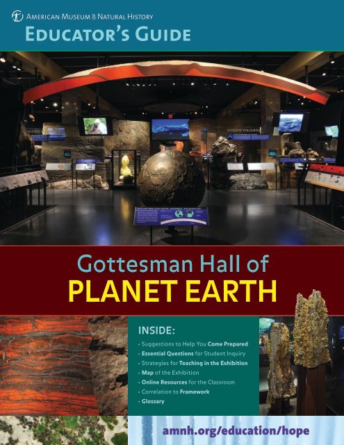
Educator’s GuideGottesman Hall <strong>of</strong><strong>PLANET</strong> <strong>EARTH</strong>INSIDE:• Suggestions to Help You Come Prepared• Essential Questions for Student Inquiry• Strategies for Teaching in the Exhibition• Map <strong>of</strong> the Exhibition• Online Resources for the Classroom• Correlation to Framework• Glossaryamnh.org/education/hope
ESSENTIAL questionsThe hall poses five essential questions. Use them to connect the hall’s themes to your curriculum.How has Earth evolved?Four and a half billion years ago our solar systemformed. Along with all the other planets, Earth wascreated from clouds <strong>of</strong> dust orbiting our infant Sun.Molten at first, the planet differentiated into a molteniron core and a silicate outer layer — within a few tens <strong>of</strong>millions <strong>of</strong> years. Shortly thereafter the Moon formed,possibly from material ejected when a Mars-sizedobject smashed into early Earth. As Earth’s surfacecooled enough for a new crust to solidify, water vaporand other gases were driven from the interior to forman ocean and atmosphere. By at least 3.5 billion yearsago, photosynthetic bacteria had evolved and beganintroducing oxygen into the ocean and atmosphere.After approximately 1.8 billion years, the atmosphereand ocean were saturated with oxygen.Why are there ocean basins, mountains,and continents?Earth’s solid mantle ceaselessly churns. Convectiontransports heat from the deep interior to the surfaceas hot, buoyant rock rises and cooler rock sinks. Thischurning drives plate tectonics (the movement <strong>of</strong> rockyplates that make up the solid shell <strong>of</strong> the planet), whichforms ocean basins, shifts continents, pushes up mountains,and causes volcanoes to erupt. Most earthquakesoccur along the margins <strong>of</strong> these plates. Wind and wateralso shape Earth’s surface. Over millions <strong>of</strong> years theywear down mountains and redeposit them as sediments,carving the landscapes we live in.How do scientists read the rocks?All over the world, from ocean trenches to roadsideoutcrops and from riverbeds to mountaintops, geologistscollect rocks. They observe their mineralogy andtexture, and measure their composition to find outwhere and how the rocks formed. To determine theirrelative age, they observe sequences <strong>of</strong> layered rocks,and identity the fossils found in sedimentary rocks.Some rocks can be dated radiometrically, which givestheir absolute age. All this information, combined withgeologists’ observations <strong>of</strong> processes operating today,makes it possible for them to reconstruct geologichistory in order to deduce what happened long ago.What causes climate and climate change?The Sun’s energy drives climate. Because Earth is asphere, more heat falls on equatorial regions than onthe poles. This uneven distribution drives winds andocean currents that transport heat from the tropicsto the poles. Many components <strong>of</strong> the Earth system(amount <strong>of</strong> sunlight, composition <strong>of</strong> the atmosphere,ocean composition and circulation, location <strong>of</strong> continents,extent <strong>of</strong> ice sheets, and life itself) interact toregulate climate. Scientists study the record <strong>of</strong> pastclimate, which is preserved in glaciers, in land andocean sediments, in corals and trees, and, for the distantpast, in rocks. This record tells us that climate haschanged throughout Earth’s long history, sometimessuddenly and sometimes gradually. Human activity,particularly burning fossil fuels, is now causing atmosphericCO 2content and global average temperaturesto rise at a rapid pace. The effects on climate includemore intense weather events, such as droughts andstorms, and rising sea levels.Why is Earth habitable?Life on Earth is possible because it is the right distancefrom the Sun for liquid water to exist on its surface.Early life, which may have begun in the ocean, evolvedwith the planet over huge stretches <strong>of</strong> time. Energyand the elements necessary for life circulate throughthe biosphere (the living portion <strong>of</strong> our planet), theatmosphere, the ocean, and the solid Earth. Keybiogeochemical cycles include the water cycle, carboncycle, and rock cycle. Because <strong>of</strong> this cycling, thereis oxygen in the air to breathe, an ozone layer to helpblock ultraviolet radiation, and a surface temperaturemuch lower than it would otherwise be.The GrandCanyon tells astory <strong>of</strong> erosionby water andwind, withsteep walls<strong>of</strong> hard rockand slopes <strong>of</strong>s<strong>of</strong>ter, moreeasily erodedsedimentaryrock.
Creating the GottesmanHall <strong>of</strong> Planet EarthIt took three years, dozens <strong>of</strong> reconnaissancetrips, and 28 expeditions to collect the spectacularrocks on display in this hall. Scientificteams have many responsibilities, from figuringout where to look for specific kinds <strong>of</strong> geologicevidence to transporting specimens acrossdeserts and glaciers, through customs, and safelyback to the <strong>Museum</strong>. The teams returned with atotal <strong>of</strong> 172,000 pounds <strong>of</strong> rock from as far awayas Antarctica and as close as New York’s CentralPark, from high in the Alps to the Pacific Ocean’sJuan de Fuca Ridge.The youngest is a chunk <strong>of</strong> sulfur collected justdays after it solidified on Indonesia’s activeKawah Ijen volcano by scientists wearing masksto protect them from poisonous gases. The oldestis a zircon crystal from Jack Hills, Australia, whichat 4.3 billion years is almost as ancient as Earthitself. Some samples were pried loose with a rockhammer, while massive boulders required boomtrucks, helicopters, or ocean submersibles.Come PreparedPlan your visit. For information about reservations, transportation,and lunchrooms, visit amnh.org/education/plan.Read the Essential Questions in this guide to see howthemes in the hall connect to your curriculum. Identify thekey points that you’d like your students to learn.Review the Teaching in the Exhibition section <strong>of</strong> this guidefor an advance look at the models, specimens, and interactivesthat you and your class will be encountering.Download activities and student worksheets atamnh.org/resources/rfl/pdf/hope_activities.pdf. Designedfor use before, during, and after your visit, these activitiesfocus on themes that correlate to the New York StateScience Core Curriculum.Decide how your students will explore the Gottesman Hall<strong>of</strong> Planet Earth. Suggestions include:• You and your chaperones can facilitate the visit using theTeaching in the Exhibition section <strong>of</strong> this guide.• Your students can use the student worksheets to explorethe exhibition on their own or in small groups.• Students, individually or in groups, can use copies <strong>of</strong> themap to choose their own paths.Correlations to Framework forK–12 Science EducationYour visit to the Gottesman Hall <strong>of</strong> Planet Earth can becorrelated to the new Framework for K–12 ScienceEducation from the National Research Council.Kawah Ijen volcano, IndonesiaThen came the labor-intensive process <strong>of</strong> preparing,mounting, and installing the specimens, someweighing several tons: 168 rock samples andeleven full-scale models <strong>of</strong> outcroppings from 25countries, including Australia, Indonesia, Italy,Kazakhstan, Mauritania, Switzerland, and Venezuela— and five regions <strong>of</strong> the ocean floor. Theirstories combine to tell that <strong>of</strong> our dynamic planet.Science PracticesAsking questions; Developing and using models;Analyzing and interpreting data; Obtaining, evaluating,and communicating informationCrosscutting ConceptsPatterns; Scale, proportion, and quantity; Systems andsystem models; Stability and changeCore IdeasEarth’s Place in the Universe: ESS1.C: The history <strong>of</strong>planet Earth; ESS2.B: Plate tectonics and large-scale systeminteractions; ESS3.B: <strong>Natural</strong> hazards; ESS3.D: Globalclimate change
teaching in the EXHIBITIONThis hall uses specimens, videos, models, and interactives to investigate the history and composition<strong>of</strong> Earth and the ongoing processes that shape it. The guided explorations are designed around fivethemes. The first four themes are below; the fifth is on the insert. (Answers are in italics.) The numbers (#)correspond to the specimens. Refer to the map for locations.HOW <strong>EARTH</strong> FORMED1 2ABCMeteorites (#1–3): The most important clues to thecomposition <strong>of</strong> the early solar system come frommeteorites. Have students observe these three anddiscuss the evidence about Earth’s formation thatthey contain.Four Density Blocks (#4-7): When Earth was forming,heavier materials like iron sank to the centerto form the core and lighter ones like silicates roseto the surface. Have students take turns lifting thesamples and exploringthe diagrams. Ask themto connect this experimentto how Earth’slayers are organized.Banded Iron (#23, 15) and Stromatolite (#14): Rockscan contain important clues about the atmosphere.In early Earth, metals like iron were released into theocean from hot springs but remained in solution inthe water. When photosynthetic organisms beganproducing oxygen, it reactedwith the iron in the seawaterand precipitated as ironoxide to form the bandediron formation. Eventually,oxygen began to accumulatein the atmosphere. Havestudents observe both banded iron formations andthe stromatolite (the fossilized remains <strong>of</strong> earlyoxygen-producing microbes). Ask them to use the“How Do We Know About the Early Atmosphere?”diagram to explore the way these two rocks formedand what this tells us about the early atmosphere. D Sulfide Chimney (#28) and Banded Ore (#26):Chimneys form today when iron and other metalsfrom underwater hot springs react with seawaterand precipitate, in this case as sulfide minerals.Walk past the Dynamic Earth Sphere to observe thechimneys at the other end <strong>of</strong> the hall. Have studentsexamine the “Deep-Sea Vents and Ore Deposits”panel and discuss the way these two very differentore deposits formed.A B CTHE ROCK RECORDCast <strong>of</strong> Rock Outcrop from Scotland: One way geologistslearn about Earth’s history is to interpret thestructure <strong>of</strong> rock formations. In general, sedimentaryrocks are deposited in horizontal layers, and youngerbeds lie atop older ones. Have students examine thiscast. Ask: What two main types <strong>of</strong> rock do you see?What do you observe about each section? (Top sectionis dark red, and made <strong>of</strong> horizontal beds <strong>of</strong> sandstone.Bottom section is blocky gray slate in vertically-orientedlayers.) Ask: What do you think this tells us abouthow this part <strong>of</strong> Earth’s crust formed? (The gray slate,which had been deposited in water, must have beenuplifted, tilted, eroded, and submerged again. The redsandstone layers were deposited above the slate. Thisdiscontinuity reflects processes that occurred over longperiods <strong>of</strong> time.)Dike in Granite (#3): Dikes are planar bodies <strong>of</strong>once-molten rock that intruded across the layering <strong>of</strong>older rocks. Have students examine this sample andidentify which rock formed first. (The lighter one, thegranite, is older than the gray-black basaltic rock.)Three Types <strong>of</strong> Rocks (#4-12): Geologists usedifferent characteristics to categorize rocks. Havestudents read about sedimentary, igneous, andmetamorphic rocks on the panel and connect thesecharacteristics to what they observe about therocks on display.BThe dike in granite [B] and three types <strong>of</strong> rocks [C] aresilhouetted against a cast <strong>of</strong> the famous Scottish outcrop [A]known as Hutton’s Unconformity.AC
D EF 3 A BGabbro and Vials (#16): Geologists can date somerocks radiometrically by chemically analyzing themin the lab. Have studentsexamine the mineral grainsin the vials and the relatedpanel to learn about halflifeand radioactive datingtechniques.Grand Canyon Section: Geologists construct maps tounderstand how the Grand Canyon and other Earthfeatures formed. Have students look at the largegeologic map on the left. Ask them to examine thecross-section views on the right to explore what theytell us about rock formations and age. Then have studentsobserve the rocks (#18-22) and correlate themto the cross-sections in the “Building the Canyon’sLayers” diagram. Help them infer that the location <strong>of</strong>different types <strong>of</strong> rocks and structures can reveal thestory <strong>of</strong> the Grand Canyon’s formation.Granite (#15), Claystone (#16), Gneiss (#17), andRock Cycle Diagram: Rocks form and transform,some many times over vast expanses <strong>of</strong> geologictime. Help students connect the characteristics <strong>of</strong>the three types <strong>of</strong> rocks (see 2C) to processes atwork in the rock cycle.CLIMATE & CLIMATE CHANGEWeather and Climate Section: The complex interaction<strong>of</strong> many factors — the amount <strong>of</strong> sunlight, thecondition <strong>of</strong> the atmosphere, the ocean, the solidEarth, the ice sheets, and life itself — regulatesclimate and causes it to change. Have studentsexplore the area to learn about the relationshipsbetween the atmosphere, ocean, climate, andweather. Then have them investigate greenhousegases and the role <strong>of</strong> carbon in the climate system.Ice Core, Deep-Sea Sediment Core (#8), and TreeRing Section (#13): Climate changes over time. Thisrecord is preserved in glaciers, in lake and oceansediments, in corals and trees, and in rocks. Afterwatching the video, have students explore howscientists use different types <strong>of</strong> evidence to learnabout past climate. Encourage students to use theice core interactiveto furtherinvestigate theclimate record.ice ice core core C 4 A BCCarbon Cycle Diagram and Fossil Fuel Interactive:The amount <strong>of</strong> CO 2in the atmosphere strongly influencesclimate. Have students explore how carbonmoves through Earth and describe the different roles<strong>of</strong> short- and long-term reservoirs (e.g. the oceanversus the mantle and crust).NATURAL RESOURCESGroundwater Video: One <strong>of</strong> the most importantprocesses in the formation <strong>of</strong> Earth’s resources —from oil and gas to metal ores and freshwater — isthe flow <strong>of</strong> fluids through rock. Have students watchthe videos tolearn why andhow scientistsmodel groundwaterflow.Ore Specimens(#1-8, 18-25):Have studentsexplore thisgroup <strong>of</strong>specimens, which Ore samples [B] loom above the groundwatervideo [A] and line the passagewayillustrates howores form. Ask to the right.students to selectone specimen and explain what resource it provides.Water Cycle Diagram: Water is part <strong>of</strong> Earth, itsatmosphere, and all <strong>of</strong> its living organisms. Havestudents identify groundwater and discuss its role increating Earth’s resources.Our Dynamic Earth Today• Dynamic Earth Sphere: Suspended from the ceiling,it recreates a view <strong>of</strong> Earth from space. Watch thelayers <strong>of</strong> clouds, vegetation, ice, and ocean peelaway to reveal the underlying rocky surface.• Earth Bulletins: The large video screen andcomputer kiosks describe recent earthquakes,volcanic eruptions, and major storms, and presentcurrent Earth science research.• Bronze Earth Globe: This is an accurate model<strong>of</strong> the solid Earth, with vertical measurementsexaggerated by a factor <strong>of</strong> 22.5.
ONLINEresourcesGottesman Hall <strong>of</strong> Planet Earthamnh.org/rose/hope/The <strong>Museum</strong>’s detailed website about the hall. Includesscientist pr<strong>of</strong>iles, fun facts, and extensive resources.Earth OLogyamnh.org/ology/earthHands-on activities and interactives for kids 7 and up,including “If Rocks Could Talk” and “Edible Earth.”Science Bulletins: Earthamnh.org/sciencebulletins/Videos, essays, and data visualizations about currentresearch in Earth Science.Earth: Inside & Outamnh.org/resources/rfl/web/essaybooks/earth/Fifteen lively case studies, from historic figures togeologists at work today.Discover the Hall <strong>of</strong> Planet Earthamnh.org/resources/rfl/pdf/discover_earth.pdfA two-page printable activity sheet designed to becompleted by kids with a chaperone during a visit.Grand Canyon Geology Lesson Plansnps.gov/grca/forteachers/upload/Geology-3.pdfComprehensive lesson plans created by the National ParkService. Topics range from rock identification to makingfossils and creating a Grand Canyon geologic timeline.Water Cycle Gameresponse.restoration.noaa.gov/watercyclegameStudents role-play the complex journey <strong>of</strong> a watermolecule as it travels through the water cycle.Investigating El Niño Using Real Datadataintheclassroom.org/content/el-nino/Five activities that use real data from NOAA.NASA: Earthwww.nasa.gov/topics/earthImages, video, and stories from the Earth-observingsatellite, the ISS, the Atmospheric Infrared Sounder andother NASA instruments that monitor our planet.Visible Earthvisibleearth.nasa.govNASA’scatalog <strong>of</strong>images andanimations <strong>of</strong>our planet.NOAAnoaa.gov/The National Oceanic and Atmospheric Administrationcharts seas and skies, monitors weather, and guidesstewardship <strong>of</strong> marine and coastal resources.National Earthquake Information Centerearthquake.usgs.gov/regional/neic/Run by the USGS, this site assesses the location and size<strong>of</strong> all destructive earthquakes worldwide and maintains apublic database dating back to the year 856.IRIS Seismic Monitoriris.edu/seismonMonitor global earthquakes in near real-time, visitseismic stations around the world, and search the web forearthquake- or region-related information.Learn About U.S. Volcanoesvolcanoes.usgs.gov/about/Extensive resources published by the USGS. Activitiesinclude Wegener’s Puzzling Evidence Exercise and PlateTectonics Tennis Ball Globe.CREDITSFunding for the Educator’s Guide has been provided throughthe generous support <strong>of</strong> The Louis Calder Foundation.© 2012 <strong>American</strong> <strong>Museum</strong> <strong>of</strong> <strong>Natural</strong> <strong>History</strong>. All rights reserved.Photo CreditsCover: All photos, © D.Finnin/AMNH. Essential Questions: Grand Canyon, © Ashton Applewhite; Kawah Ijen Volcano, © D.Finnin/AMNH; deformed conglomerate, © D.Finnin/AMNH. Teaching in the Exhibition: All photos, © D.Finnin/AMNH. Online Resources:The Blue Marble, © NASA Goddard Space Flight Center Image by Reto Stöckli (land surface, shallow water, clouds). Enhancementsby Robert Simmon (ocean color, compositing, 3D globes, animation). Data and technical support: MODIS Land Group; MODIS ScienceData Support Team; MODIS Atmosphere Group; MODIS Ocean Group Additional data: USGS EROS Data Center (topography);USGS Terrestrial Remote Sensing Flagstaff Field Center (Antarctica); Defense Meteorological Satellite Program (city lights).Plate Tectonics Insert: All Ilustrations by Eric Hamilton.XX%Cert o. n XXX-XXX-XXXX
Gottesman Hall <strong>of</strong> Planet EarthMAP2D5G5F5H5I5J2E2C2B2A3A3B5E5B5C5A1Denter5D1C1C4A3C4C2F4B1B1AenterEssential QuestionsHow has Earth evolved?Why are there ocean basins, mountains,and continents?How do scientists read the rocks?What causes climate and climate change?Why is Earth habitable?Teaching in the Exhibition1How EarthFormed2 The Rock3 Climate &4 <strong>Natural</strong>5RecordClimate Change ResourcesA MeteoritesA Cast <strong>of</strong> RockA Weather andA GroundwaterAOutcrop fromClimate SectionVideoB Four Density BlocksScotlandB Ice Core, Deep-Sea B Ore SpecimensBC Banded Iron and B Dike in GraniteSediment, and TreeStromatoliteCCRingsWater CycleC Three Types <strong>of</strong>DiagramD Sulfide ChimneyCDRocksCarbon Cycleand Banded OreDiagram and FossilD Gabbro and VialsFuel InteractiveEE Grand CanyonFSectionGF Granite, Claystone,Gneiss, and RockHCycle DiagramIJPlateTectonicsBronze Globe andSlice <strong>of</strong> CrustChurning EarthModel <strong>of</strong> CollisionExplosive VolcanismMountain FormationModel <strong>of</strong> SlipEarthquakes SectionModel <strong>of</strong> SeparationBasaltsHawaiian Hot Spots© 2012 <strong>American</strong> <strong>Museum</strong> <strong>of</strong> <strong>Natural</strong> <strong>History</strong>. All rights reserved.
GLOSSARYatmosphere: the mixture <strong>of</strong> gases (78% nitrogen, 21%oxygen, 0.9% argon, and 0.03% carbon dioxide, byvolume) that surrounds the Earthcarbon cycle: the continuous flow <strong>of</strong> carbon throughliving things (biosphere), the solid Earth (geosphere),the oceans (hydrosphere), and the atmosphereclimate: the weather (including extremes) in a particularregion averaged over a number <strong>of</strong> yearsconvection: the process by which hotter, less densematerial rises and is replaced by colder and densermaterialcontinent: one <strong>of</strong> Earth’s large land massescore: the mass <strong>of</strong> metallic iron and nickel at the center<strong>of</strong> the Earth. The fluid outer core begins at 5100 kmbelow the surface and the solid inner core at 2900 km.crust: Earth’s outermost solid layer, consisting <strong>of</strong> acontinental crust averaging 45 km thick and an oceaniccrust averaging 8 km thickearthquake: a shaking <strong>of</strong> the ground caused by theabrupt release <strong>of</strong> accumulated strain when a faultruptureserosion: the processes that wear down rocks andtransport the loosened sedimentfossil fuels: coal, oil, and natural gas, which formedfrom the remains <strong>of</strong> organisms that lived millions <strong>of</strong>years agogeologist: a scientist who studies Earth, e.g. its history,composition, structure, and the processes that shape itglacier: a large, semi-permanent, slowly flowing river <strong>of</strong>ice formed from compacted snowigneous rock: rock formed when magma (molten rock)solidifiesmantle: the layer between the core and the crust <strong>of</strong>the planet Its properties, such as density and viscosity(resistance to flow), change with depth.metamoprhic rock: rock formed when sedimentary,igneous, or other metamorphic rocks recrystallize intonew rock forms, typically under the influence <strong>of</strong> heatand pressuremineral: any naturally occurring, inorganic solid witha specific composition and an orderly crystallinestructureoutcrop: bedrock exposed at Earth’s surfaceozone layer: the region <strong>of</strong> the upper atmosphere thatcontains about ninety percent <strong>of</strong> Earth’s ozone (moleculesmade up <strong>of</strong> 3 atoms <strong>of</strong> oxygen)plates: the blocks that make up Earth’s rigid, cold,outermost shell, averaging 100 km thick and consisting<strong>of</strong> crust and uppermost mantleradiometric dating: a technique for measuring theage <strong>of</strong> geologic materials based on the decay <strong>of</strong>naturally-occurring radioactive isotopesrock: a naturally occurring aggregate <strong>of</strong> one ormore mineralsrock cycle: the cycle in which sedimentary, igneous,and metamorphic rocks are transformed into other rocktypes through processes such as melting, crystallization,erosion, deposition, lithification (the processby which sediments are turned into rock), andrecrystallizationsedimentary rock: rock formed when sedimentsaccumulate and lithify, or when minerals precipitatedirectly from watervolcano: a vent in Earth’s surface through whichmagma and associated gases and ash erupt. The ejectedmaterials <strong>of</strong>ten form a conical structure.weather: the state <strong>of</strong> the atmosphere at a specific placeand time, characterized by temperature, barometricpressure, wind velocity, humidity, cloud state andprecipitationweathering: the physical and chemical processes thatdiscolor, s<strong>of</strong>ten, and break down rocks exposed to air,water, and organic materialwater vapor: the gaseous state <strong>of</strong> waterwater cycle: the cycling <strong>of</strong> water among oceans andlakes, land, living organisms, and the atmosphere© 2012 <strong>American</strong> <strong>Museum</strong> <strong>of</strong> <strong>Natural</strong> <strong>History</strong>. All rights reserved.
teaching inthe exhibition5PLATE TECTONICSWhat is Plate Tectonics? A BBronze Globe & Slice <strong>of</strong> Crust Model: This globeis a model <strong>of</strong> the solid Earth: Earth without water.(To help students understand the term “solidEarth,” have them watch the Dynamic Earth sphereoverhead and see the liquid slowly drained awayfrom the rocky surface). Have students compare thefamiliar topography <strong>of</strong> the continents with the lessfamiliar topography <strong>of</strong> the ocean basins. Point outthe “slice <strong>of</strong> crust” model hanging overhead. Invitestudents to use the diagram below to find the regionon the globe that’s represented in the model above.Tell them that they’re going to be exploring theways in which plate tectonics shapes the solid Earth.Churning Earth Section: Convection is the main wayin which heat is lost from the interior <strong>of</strong> the Earth.It’s the force that drives the movement <strong>of</strong> tectonicplates. Have student go to the video kiosk in thecircular table and watch scientific models <strong>of</strong> how theEarth’s core and mantle convect.When Plates Collide C D EModel <strong>of</strong> Collision:When an oceanic platemeets a continentalplate, the oceanic platedescends, or subducts,beneath the continentalplate and sinks intothe mantle. Have students explore the model anduse their hands to simulate this interaction.model showing an oceanic plate (r)subducting under a continental plate (l)Explosive Volcanism Section: Most explosiveeruptions occur in volcanoes above subductionzones, where one plate dives beneath another. Havestudents watch the video and explore samples fromMedicine Lake Volcano, California (#5-10).Mountain Formation Section: When two continentalplates meet, one is thrust over the other to formmountain ranges like the Alps and the Himalayas.Have students watch the video and examine thesand model, and discuss how the model helpsscientists understand the way plates interact t<strong>of</strong>orm mountain ranges. Then have them observe therock samples (#1-7) that illustrate the processes(uplifting, folding, crustal thickening, and faulting).When Plates Move Past Each Other F GModel <strong>of</strong> Slip: When oceanic or continental platesslide past each other in opposite directions, ormove in the same direction but at different speeds,a fault forms. Have students explore the model andsimulate this interaction with their hands.Earthquakes Section: Earthquakes occur along faultlines (cracks near plate boundaries where the cruston opposites sides moves). Have students explorethe earthquake video kiosk and associated textpanels. Ask: Why do we monitor them? (Monitoringhelps scientists estimate the odds <strong>of</strong> an earthquaketaking place within a certain period <strong>of</strong> time.) Then havestudents find the faults on the two large casts andthe samples (#1-2) and describe what they tell us.When Plates Separate H IModel <strong>of</strong> Separation: Most spreading plateboundaries are found in ocean basins. Have studentsexplore the model and use their hands to simulatehow plates separate.Basalts: Most volcanoes erupt basalt, a fluid lavafrom the mantle that forms flows. Most basalterupts from cracks in the seafloor, but some basalticlava flows occur on continental crust. Have studentscompare the shapes <strong>of</strong> the underwater (#9-17) andflood basalts (#18), and discuss their formation.When Plates Move JHawaiian Hot Spots: Basaltic lava also erupts athot spots, where molten rock, or magma, forms inplumes <strong>of</strong> hot rock that rise from deep in Earth topenetrate a moving plate above. Have studentswatch the video and explore the various specimens.Ask: What does the pattern <strong>of</strong> the Hawaiian islandchain reveal about how the Pacific plate is moving?(The plate is moving slowly over a stationary hot spot inthe mantle. The bend records a shift in the movement<strong>of</strong> the plate 43 million years ago.)Wrap Up: Revisit the Bronze Globe and ask studentsto connect specific specimens to places on the globeand to the tectonic processes at work behind them.(Examples: Collide – Andes and Himalayas; Separate —Mid-Atlantic Ridge; Slip — San Andreas fault)© 2012 <strong>American</strong> <strong>Museum</strong> <strong>of</strong> <strong>Natural</strong> <strong>History</strong>. All rights reserved.
plate TECTONICSEarth’s surface may seem perfectly still, but it’s actually in constant motion. The planet’s thin outer shellis broken into large blocks called tectonic plates, which fit together like a puzzle. They float on Earth’smantle, a really thick layer <strong>of</strong> hot flowing rock. This flow causes the plates to move in different directions.Even though these massive plates move very slowly (about as fast as your fingernails grow), theirmotion has a huge effect on Earth. The process <strong>of</strong> plate tectonics forms oceans, continents, and mountains.It also helps us understand why and where most earthquakes and most volcanic eruptions occur.When plates meet, four things can happen:Sliptwo plates slide past each otherSpreadingtwo plates move apart from each otherAs one plate slides against another, the rocks bendagainst each other at the fault. When they finallybreak loose and snap back to their original shapes,the energy is released as an enormous shock wave.That is an earthquake.As two plates slowly move apart, earthquakesoccur and magma rises up from the mantle below.The magma erupts from volcanoes that form betweenthe plates, and cools to form new crust.Collisiontwo plates run into each other and fold upSubductionone plate sinks below the otherWhen two continental plates meet, pieces <strong>of</strong> crustpile atop each other, creating complex patterns<strong>of</strong> folds and faults. Earthquakes happen and greatmountain ranges form.When a more dense oceanic plate collides with a lessdense continental plate, it sinks below the continentalplate into the mantle. Earthquakes occur and magmaforms and rises to Earth’s surface to cause volcaniceruptions.© 2012 <strong>American</strong> <strong>Museum</strong> <strong>of</strong> <strong>Natural</strong> <strong>History</strong>. All rights reserved.