Quarterly Status on Projects and Programs - Sonoma County ...
Quarterly Status on Projects and Programs - Sonoma County ...
Quarterly Status on Projects and Programs - Sonoma County ...

You also want an ePaper? Increase the reach of your titles
YUMPU automatically turns print PDFs into web optimized ePapers that Google loves.
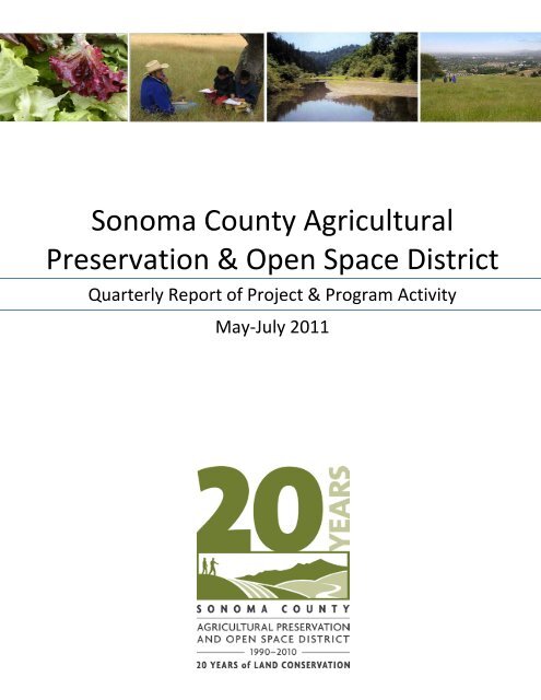
S<strong>on</strong>oma <strong>County</strong> AgriculturalPreservati<strong>on</strong> & Open Space District<str<strong>on</strong>g>Quarterly</str<strong>on</strong>g> Report of Project & Program ActivityMay-July 2011
Bordessa RanchProject Locati<strong>on</strong>: Highway 1Supervisorial District: 5 thProject Manager: Marta Puente, 565-7261Estimated Project Budget: $1,000,000Project Completi<strong>on</strong>: 2011Partners: State Coastal C<strong>on</strong>servancyAcquisiti<strong>on</strong> Plan Categories: Water,Wildlife <strong>and</strong> Natural AreasProject Overview: Bordessa Ranch c<strong>on</strong>sists of 500 acres located <strong>on</strong> Highway 1, west of ValleyFord. The Estero Americano makes up the 1 mile southern boundary of the property. TheDistrict’s natural resource c<strong>on</strong>servati<strong>on</strong> easement would permanently protect the property’sresources. There are two streams that run through the property to the Estero. The l<strong>and</strong>ownershave agreed to protect these creeks with riparian fencing <strong>and</strong> install native riparian plants withinthe riparian corridor. The c<strong>on</strong>servati<strong>on</strong> easement identifies 138 acres as ‘forever wild’ forprotecti<strong>on</strong> of burrowing owls <strong>and</strong> badger habitat.Habitats <strong>on</strong> the property include coastal prairie, coastal scrub, <strong>and</strong> riparian. The propertyc<strong>on</strong>tains habitat for California red-legged frog. There are numerous active American badgerburrows, which provide habitat for burrowing owls. The property provides resources for otherspecies of birds, including raptors <strong>and</strong> sea birds. The estuary is located in the heart of the PacificFlyway. The mudflats, open water <strong>and</strong> extensive marsh area of the estuary provide seas<strong>on</strong>allyimportant foraging habitat for migratory waterfowl <strong>and</strong> shorebirds, <strong>and</strong> resident l<strong>on</strong>g-leggedwading birds. Itprovides potentialrearing habitat fortwo federally listedendangered fishspecies, thetidewater goby <strong>and</strong>winter-run steelheadtrout. The project iscurrently beingappraised.
Calabazas Creek Open Space PreserveManagement PlanProject Locati<strong>on</strong>: Glen EllenSupervisorial District: 1 stProject Manager: Leslie Lew, 565-7367Estimated Project Budget: $350,000Project Completi<strong>on</strong>: to be determinedPartners: State Department of Parks <strong>and</strong>Recreati<strong>on</strong>, Bay Area Ridge Trail Council, CaliforniaDepartment of Fish <strong>and</strong> GameC<strong>on</strong>tractor: S<strong>on</strong>oma Ecology CenterAcquisiti<strong>on</strong> Plan Categories: Greenbelts <strong>and</strong> Scenic Hillsides; Water, Wildlife <strong>and</strong> Natural Areas;Recreati<strong>on</strong> <strong>and</strong> Educati<strong>on</strong>Project Overview:The 1,280-acre Calabazas Creek Open Space Preserve (Preserve) was purchased by the District in2004 <strong>and</strong> is located off Highway 12 between Santa Rosa <strong>and</strong> Glen Ellen. The Preserve is <strong>on</strong>e ofthe few properties that extend from the S<strong>on</strong>oma/Napa county line at the top of the ridge downnearly to Highway 12 <strong>on</strong> the valley floor.The l<strong>and</strong> includes a diversity of soil, vegetati<strong>on</strong>, <strong>and</strong> topographic features which provide habitatfor a wide range of important plant <strong>and</strong> animal species. Calabazas Creek is a tributary of S<strong>on</strong>omaCreek <strong>and</strong> is also a designated critical habitat area which supports endangered steelhead. Theproperty also provides habitat for many species including mountain li<strong>on</strong>, deer, fox, <strong>and</strong>potentially, bear.Activities complete last quarter include roadrepair, illegal Cannabis cleanup <strong>and</strong> weedmanagement activities. The <strong>on</strong>going weedmanagement program addressed yellowstar thistle, a noxious weed species. Amanagement plan is underway <strong>and</strong> willinclude recommendati<strong>on</strong>s for stewardshipof this unique property. Public access isprovided <strong>on</strong> Calabazas by S<strong>on</strong>oma EcologyCenter through the District’s outings <strong>and</strong>educati<strong>on</strong> programs. The Volunteer Patrolis run completely by volunteers. The Districthas applied for a State Coastal C<strong>on</strong>servancygrant to help fund planning efforts for theBay Area Ridge Trail segments through thePreserve.
Carringt<strong>on</strong> Coast RanchTransfer to State Department of Parks <strong>and</strong> Recreati<strong>on</strong>Project Locati<strong>on</strong>: Highway 1Supervisorial District: 5 thProject Manager: Marta Puente, 565-7261Estimated Project Budget: $200,000 for futureoperati<strong>on</strong>s <strong>and</strong> maintenanceProject Completi<strong>on</strong>: to be determined – <strong>on</strong> holdby request of State ParksPartners: CA Department of Parks <strong>and</strong> Recreati<strong>on</strong>,L<strong>and</strong>Paths, State Coastal C<strong>on</strong>servancyC<strong>on</strong>tractors: Advanced Geo Envir<strong>on</strong>mental <strong>and</strong> W-TransAcquisiti<strong>on</strong> Plan Categories: Recreati<strong>on</strong> <strong>and</strong>Educati<strong>on</strong>; Water, Wildlife <strong>and</strong> Natural Areas;Greenbelts <strong>and</strong> Scenic HillsidesProject Overview:• The District acquired the 335-acreCarringt<strong>on</strong> Coast Ranch property in2003 for transfer to State Parks due toits locati<strong>on</strong>, scenic vistas, naturalresources <strong>and</strong> potential forrecreati<strong>on</strong>al access. The District <strong>and</strong>State Parks have finalized thec<strong>on</strong>servati<strong>on</strong> easement that will be in place at the time of transfer. State Parkscompleted its Immediate Public Use Facilities Plan for the property which addresses thenatural, cultural, <strong>and</strong> scenic values as well as recreati<strong>on</strong>al needs, including trails, parking,restrooms, picnic sites, <strong>and</strong> interpretive facilities.• Through a grant provided by the CoastalC<strong>on</strong>servancy, the District, L<strong>and</strong>Paths <strong>and</strong>State Parks have worked <strong>on</strong> site clean-up<strong>and</strong> planning for recreati<strong>on</strong>al uses. TheDistrict has opened the l<strong>and</strong> for publicguided tours managed by L<strong>and</strong>Paths.• Transfer of the property has been put <strong>on</strong>hold until further notice at the request ofState Park.
Clover SpringsTransfer to City of CloverdaleProject Locati<strong>on</strong>: City of Cloverdale, west ofHighway 101 <strong>and</strong> adjacent to the Del WebbcommunitySupervisorial District: 4 thProject Manager: Marta Puente, 565-7261Estimated Project Budget: An endowmentof $275,000 was d<strong>on</strong>ated by the previous l<strong>and</strong>owners to provide for development, management<strong>and</strong> restorati<strong>on</strong> of the property as a park <strong>and</strong> open space preserve.Project Completi<strong>on</strong>: Transfer completed <strong>on</strong>June 30, 2011Partners: City of Cloverdale, S<strong>on</strong>oma <strong>County</strong>Regi<strong>on</strong>al ParksAcquisiti<strong>on</strong> Plan Categories: Greenbelts <strong>and</strong>Scenic Hillsides; Water, Wildlife <strong>and</strong> NaturalAreas; Recreati<strong>on</strong> <strong>and</strong> Educati<strong>on</strong>Project Overview:• The District acquired fee title to the250-acre Clover Springs property in 2007 for transfer to the City of Cloverdale for a park<strong>and</strong> open space preserve. The City anticipates c<strong>on</strong>tracting with a recreati<strong>on</strong>al partner forthe planning <strong>and</strong> development of the Preserve. The rolling hills of the property are partof the western backdrop to the City. The property is a mosaic of upl<strong>and</strong> oak woodl<strong>and</strong>,mixed evergreen forest, grassl<strong>and</strong>s, <strong>and</strong> chaparral. Porterfield Creek traverses the site<strong>and</strong> provides spawning habitat for the Central California Coast steelhead. Many otherspecies of animals, birds, <strong>and</strong> fish usethe property for habitat <strong>and</strong> as awildlife corridor.• Transfer of the Clover Springsproperty was approved by theDistrict’s Board of Directors <strong>on</strong> May17, 2011.• The District closed escrow <strong>on</strong> June 30,2011. The c<strong>on</strong>servati<strong>on</strong> easementprotects the sensitive biotic resources<strong>and</strong> natural habitats of the property,while providing for recreati<strong>on</strong>alopportunities for local residents <strong>and</strong>visitors to the <strong>County</strong>.
Cresta IIProject Locati<strong>on</strong>: Porter CreekRoad, north of Santa Rosa al<strong>on</strong>gMark West CreekSupervisorial District: 1 stProject Manager: Stuart Martin,565-7362Estimated Project Budget: to bedetermined; $150,000 provided tothe Regi<strong>on</strong>al Parks Foundati<strong>on</strong>through the McCullough charitabled<strong>on</strong>ati<strong>on</strong>.Project Completi<strong>on</strong>: 2012 pendingpartnership fundingPartners: S<strong>on</strong>oma <strong>County</strong> Regi<strong>on</strong>al Parks, S<strong>on</strong>oma <strong>County</strong> Regi<strong>on</strong>al Parks Foundati<strong>on</strong>, S<strong>on</strong>omaL<strong>and</strong> TrustAcquisiti<strong>on</strong> Plan Categories: Water, Wildlife <strong>and</strong> Natural Areas; Greenbelts <strong>and</strong> Scenic Hillsides;Farms <strong>and</strong> RanchesProject Overview: The District isproposing to purchase the 67.9-acreCresta II parcel in fee as an additi<strong>on</strong> tothe future regi<strong>on</strong>al park.• The District previouslypurchased the Cresta <strong>and</strong>McCullough Phase Oneproperties as part of the futurepark.• The property straddles MarkWest Creek, <strong>and</strong> would providea trail c<strong>on</strong>necti<strong>on</strong> to the futurepark, as well as c<strong>on</strong>nect then<strong>on</strong>c<strong>on</strong>tiguous secti<strong>on</strong>s of Mark West Creek.• The property provides potential ranger residences <strong>and</strong> horse facilities, including acovered arena, stalls, <strong>and</strong> an outdoor arena.• The property would be transferred to S<strong>on</strong>oma <strong>County</strong> Regi<strong>on</strong>al Parks together with theother assembled properties.• The District has made an offer. Negotiati<strong>on</strong>s are starting.• S<strong>on</strong>oma <strong>County</strong> Regi<strong>on</strong>al Parks, in partnership with the S<strong>on</strong>oma L<strong>and</strong> Trust <strong>and</strong> theDistrict, are fundraising for the acquisiti<strong>on</strong>.
Elliott RanchProject Locati<strong>on</strong>: 3150 S<strong>on</strong>oma Mountain Road,PetalumaSupervisorial District: 1 st <strong>and</strong> 2 ndProject Manager: Sara Press, 565-7368Estimated Project Budget: to be determinedProject Completi<strong>on</strong>: 2012Acquisiti<strong>on</strong> Plan Categories: Farms <strong>and</strong> Ranches;Greenbelts <strong>and</strong> Scenic Hillsides; Water, Wildlife<strong>and</strong> Natural AreasProject Overview: The District is working with thetrustees of the estate to develop a c<strong>on</strong>servati<strong>on</strong>easement that will encompass the entire 1,112-acre ranch. The proposed c<strong>on</strong>servati<strong>on</strong>easement will prohibit future subdivisi<strong>on</strong> <strong>and</strong> limit residential development. The propertyc<strong>on</strong>tains some of the most diverse oak woodl<strong>and</strong> <strong>on</strong> S<strong>on</strong>oma Mountain. The property c<strong>on</strong>sists ofoak savanna <strong>and</strong> annual grassl<strong>and</strong>s, <strong>and</strong> it forms the complete headwaters to Carriger Creek, apriority riparian corridor that c<strong>on</strong>tains steelhead.
Graywood RanchProject Locati<strong>on</strong>: Highway 12 east of Santa Rosa, west of KenwoodSupervisorial District: 1 stProject Manager: Stuart Martin,565-7362Estimated Project Budget: to bedeterminedProject Completi<strong>on</strong>: to bedeterminedPartners: unknownAcquisiti<strong>on</strong> Plan Categories: Water,Wildlife <strong>and</strong> Natural Areas;Greenbelts <strong>and</strong> Scenic Hillsides;Farms <strong>and</strong> RanchesProject Overview: The District is developing a project structure for potential purchase of ac<strong>on</strong>servati<strong>on</strong> easement, <strong>and</strong> possibly a porti<strong>on</strong> in fee, <strong>on</strong> the Graywood Ranch property. Theproperty is highly visible al<strong>on</strong>g Highway 12 in the S<strong>on</strong>oma Valley. A wide variety of habitats,including large Valley oaks, mixed Douglas fir/oak forest, chaparral, wetl<strong>and</strong>s, <strong>and</strong> riparian areasal<strong>on</strong>g the streams are present <strong>on</strong> the property. The valley floor is a prime agricultural area.District staff is working with the l<strong>and</strong>owner representative to finalize the project structure.
Healdsburg Ridge Open Space PreserveProject Locati<strong>on</strong>: Parkl<strong>and</strong> Farms Boulevard <strong>and</strong>Bridle Path, HealdsburgSupervisorial District: 4 thProject Manager: Kim Batchelder, 565-7355Estimated Project Budget: $200,000Project Completi<strong>on</strong>: Spring 2012Partners: City of Healdsburg, L<strong>and</strong>PathsC<strong>on</strong>tractors: Regi<strong>on</strong>al Parks, Bay Area Ridge TrailCouncil, C<strong>on</strong>servati<strong>on</strong> Corps North BayAcquisiti<strong>on</strong> Plan Categories: Greenbelts <strong>and</strong> Scenic Hillsides; Recreati<strong>on</strong> <strong>and</strong> Educati<strong>on</strong>Project Overview: The 152-acre Healdsburg Ridge Open Space Preserve comprises twoproperties acquired by the District to protect the scenic hillsides of Healdsburg. The propertyformally opened to the public for outdoor recreati<strong>on</strong> in November 2008. The preserverepresents a unique partnership with the City of Healdsburg <strong>and</strong> L<strong>and</strong>Paths to ensure c<strong>on</strong>sistentoperati<strong>on</strong>s <strong>and</strong> maintenance of the l<strong>and</strong> <strong>and</strong> protecti<strong>on</strong> of the natural resources. The District isresp<strong>on</strong>sible for completing all capital improvements prior to transferring this property to theCity of Healdsburg in 2013. The District entered into a c<strong>on</strong>tract with the City of Healdsburg tomaintain the property <strong>and</strong> manage it for public access.Current <str<strong>on</strong>g>Status</str<strong>on</strong>g>: Heading into the summer seas<strong>on</strong>, the All-the-Oaks trail was opened to thepublic, leading visitors through the beautiful oak woodl<strong>and</strong> <strong>and</strong> creekside forest.Progress c<strong>on</strong>tinues <strong>on</strong> the c<strong>on</strong>structi<strong>on</strong> ofthe remaining trail network improvements.Vegetati<strong>on</strong> has been removed al<strong>on</strong>g thetrail corridor for the Nancy’s Hill trailthrough the northern grassl<strong>and</strong>s of thePreserve <strong>and</strong> for the redesign of the Ridgetrail to the Russian River Overlook. Siltfencing <strong>and</strong> other erosi<strong>on</strong> c<strong>on</strong>trol measureshave been installed in preparati<strong>on</strong> of trailtread c<strong>on</strong>structi<strong>on</strong>.Regi<strong>on</strong>al Parks has published the bidspecificati<strong>on</strong>s <strong>and</strong> the District hopes toaward the bid in August to beginc<strong>on</strong>structi<strong>on</strong> in September 2011.
KleskoProject Locati<strong>on</strong>: 9701 Geysers Road, CloverdaleSupervisorial District: 4 thProject Manager: Sara Press, 565-7368Estimated Project Cost: $1,766,000Project Completi<strong>on</strong>: First phase of escrow closedin August, 2011; sec<strong>on</strong>d phase closing expected inFall 2011 up<strong>on</strong> receipt of approved HCF grant.Partners: The Nature C<strong>on</strong>servancy, CaliforniaHabitat C<strong>on</strong>servati<strong>on</strong> Fund Program (HCF)Deer/Mountain Li<strong>on</strong> Habitat grantAcquisiti<strong>on</strong> Plan Category: Water, Wildlife <strong>and</strong> Natural AreasProject Overview: This c<strong>on</strong>servati<strong>on</strong> easement acquisiti<strong>on</strong>, approved by the Board of Directors<strong>on</strong> February 8, is a rare opportunity to preserve <strong>and</strong> protect a regi<strong>on</strong>ally-significant habitat-richarea of S<strong>on</strong>oma <strong>County</strong>. Due to its size, locati<strong>on</strong>, visibility, water resources <strong>and</strong> habitatcharacteristics, this project provides a str<strong>on</strong>g foothold for c<strong>on</strong>servati<strong>on</strong> efforts in the core areaof the central Mayacamas Mountains.Natural Resource Protecti<strong>on</strong> - the c<strong>on</strong>servati<strong>on</strong> easement willprotect:• A large, intact natural area with a significant number ofhabitats, including oak woodl<strong>and</strong>s, c<strong>on</strong>iferous forests, chaparral,grassl<strong>and</strong>, cypress forest <strong>and</strong> rock outcroppings.• An area c<strong>on</strong>taining serpentine soils <strong>and</strong> associated endemicflora, including the rare (CNPS List 1B) Socrates Mine jewel flower(Streptanthus brachiatus ssp. Brachiatus).• More than 1,500 acres of District-identified Species-Rich Area,including habitat for foothill yellow-legged frog (Rana boylii), aCalifornia Species of Special C<strong>on</strong>cern.• Tributaries that drain to a District-identified Priority RiparianCorridor, Big Sulphur Creek, which c<strong>on</strong>tains the federallythreatenedsteelhead - central California coast ESU(Oncorhynchus mykiss irideus), <strong>and</strong> to the North Branch of LittleSulphur Creek, which also c<strong>on</strong>tains the threatened steelhead.Open Space Protecti<strong>on</strong> – the c<strong>on</strong>servati<strong>on</strong> easement will:• Significantly reduce threat of fragmentati<strong>on</strong> of the 12thlargest n<strong>on</strong>-commercial private holding in the county.• Protect <strong>on</strong>e of the largest roadless patches of natural l<strong>and</strong> inthe <strong>County</strong>.
Laguna de Santa Rosa Trails Plan, Phase 1Project Locati<strong>on</strong>: east of the Laguna de Santa Rosa <strong>and</strong> the City of Sebastopol, north of Highway12, south of Occidental RoadSupervisorial District: 5 thProject Manager: Sara Press, 565-7368Estimated Project Budget: $1.3 milli<strong>on</strong> for c<strong>on</strong>structi<strong>on</strong><strong>and</strong> c<strong>on</strong>structi<strong>on</strong> administrati<strong>on</strong> by Regi<strong>on</strong>al ParksPartners: S<strong>on</strong>oma <strong>County</strong> Regi<strong>on</strong>al Parks, State CoastalC<strong>on</strong>servancy, Cities of Santa Rosa <strong>and</strong> SebastopolC<strong>on</strong>tractor: Cats 4U, Inc.Project Completi<strong>on</strong>/<str<strong>on</strong>g>Status</str<strong>on</strong>g>: C<strong>on</strong>structi<strong>on</strong> of Phase 1 to becompleted in 2012Acquisiti<strong>on</strong> Plan Categories: Recreati<strong>on</strong> <strong>and</strong> Educati<strong>on</strong>;Greenbelts <strong>and</strong> Scenic HillsidesProject Overview: In 2006, the Board approved the Laguna de Santa RosaProtected L<strong>and</strong>s Trails Plan (Trails Plan), which c<strong>on</strong>sists of proposed trails<strong>on</strong> five properties – four farm properties owned by the City of Santa Rosa<strong>and</strong> the privately-owned Balletto property (now owned by the <strong>County</strong>).The goal of the Trails Plan is to balance recreati<strong>on</strong> with the protecti<strong>on</strong> <strong>and</strong>preservati<strong>on</strong> of sensitive natural <strong>and</strong> cultural resources, while creatingpublic trails that allow users a variety of experiences in the Laguna deSanta Rosa, <strong>and</strong> the opportunity to appreciate its diverse ecological <strong>and</strong>scenic resources. The Trails Plan sets forth trail alignments, public access<strong>and</strong> interpretive facilities to accommodate various users, including hikers,bicyclists, <strong>and</strong> equestrians. The trails <strong>and</strong> overlooks are sited <strong>and</strong> designedto provide ADA access, avoid sensitive habitat areas, <strong>and</strong> respect existingagricultural <strong>and</strong> other uses. The trail alignments also take into accountpotential linkages to other surrounding public l<strong>and</strong>s, rights-of-way, <strong>and</strong>c<strong>on</strong>servati<strong>on</strong> easements around the Laguna de Santa Rosa.As part of the Trails Plan, a subset of the trails <strong>and</strong> associated improvements were selected to be thefirst phase of project implementati<strong>on</strong>. This Phase 1 of the Trails Plan includes approximately 2.4miles of trails over Kelly Farm <strong>and</strong> the Balletto property, an overlook from Kelly Marsh, <strong>and</strong> twostaging areas - <strong>on</strong>e off Highway 12 <strong>and</strong> <strong>on</strong>e off Occidental Road.The Open Space Authority <strong>and</strong> District Board of Directors approved the purchase of mitigati<strong>on</strong>credits for potential impacts to wetl<strong>and</strong>s <strong>and</strong> California Tiger Salam<strong>and</strong>er from the proposedc<strong>on</strong>structi<strong>on</strong>, <strong>and</strong> an agreement with Regi<strong>on</strong>al Parks to administer the c<strong>on</strong>structi<strong>on</strong> c<strong>on</strong>tract inFebruary <strong>and</strong> March 2010, respectively. C<strong>on</strong>structi<strong>on</strong> is currently underway, expected to becompleted in 2012.
MaxProject Locati<strong>on</strong>: Mill Creek Road <strong>and</strong>Sweetwater Springs Road, west ofDry Creek near HealdsburgSupervisorial District: 4 thProject Manager: Stuart Martin, 565-7362Estimated Project Budget: to bedeterminedProject Completi<strong>on</strong>: to bedeterminedPartners: On behalf of thel<strong>and</strong>owner, the S<strong>on</strong>oma L<strong>and</strong> Trusthas applied for a CA ForestC<strong>on</strong>servati<strong>on</strong> Program grant throughthe Wildlife C<strong>on</strong>servati<strong>on</strong> Board to fund 50% of the acquisiti<strong>on</strong> cost.Acquisiti<strong>on</strong> Plan Category: Water, Wildlife <strong>and</strong> Natural AreasProject Overview: The District is proposing to purchase a 2,322-acre c<strong>on</strong>servati<strong>on</strong> easement toprotect the property’s natural resources, including oak woodl<strong>and</strong>, <strong>and</strong> many riparian areaswhich support endangered salm<strong>on</strong> <strong>and</strong> steelhead. The property is <strong>on</strong>e of the largest in the area<strong>and</strong> is adjacent to the Pryor property, for which a c<strong>on</strong>servati<strong>on</strong> easement with a forestrycomp<strong>on</strong>ent is pending. Protecti<strong>on</strong> of the Max <strong>and</strong> Pryor properties would protect a large habitatwith compatible <strong>and</strong> sustainable forestry resources in the area. The Max property owners are inthe process of obtaining a n<strong>on</strong>-industrial timber management plan, so timber harvesting will beincorporated into the c<strong>on</strong>servati<strong>on</strong> easement provisi<strong>on</strong>s. Negotiati<strong>on</strong>s are <strong>on</strong> hold at the requestof the l<strong>and</strong>owner pending completi<strong>on</strong> of restorati<strong>on</strong> work.
McClell<strong>and</strong> DairySupervisorial District: 2 ndProject Locati<strong>on</strong>: Two Rock Valley,Bodega Avenue, west of PetalumaProject Manager: Marta Puente, 565-7261Estimated Project Budget: to bedeterminedProject Completi<strong>on</strong>: TBD – project iscurrently <strong>on</strong> hold at the request of thel<strong>and</strong>ownerAcquisiti<strong>on</strong> Plan Categories: Farms <strong>and</strong> Ranches; Water, Wildlife <strong>and</strong> Natural AreasProject Overview:• The proposed c<strong>on</strong>servati<strong>on</strong> easement over the 338-acre McClell<strong>and</strong> Dairy will protect asignificant organic dairy in S<strong>on</strong>oma <strong>County</strong>. The dairy has been operated by threegenerati<strong>on</strong>s of the McClell<strong>and</strong> family. Jana McClell<strong>and</strong> is currently making organic buttersold in local stores.• The McClell<strong>and</strong> family is negotiating the purchase of a neighboring ranch to exp<strong>and</strong> itsoperati<strong>on</strong>s <strong>and</strong> is waiting to begin the appraisal process until the purchase c<strong>on</strong>tract isexecuted. The proposed c<strong>on</strong>servati<strong>on</strong> easement limits residential structures <strong>and</strong> includesa riparian setback to protect a tributary of Stemple Creek.• The McClell<strong>and</strong> family is exploring opti<strong>on</strong>s for exp<strong>and</strong>ing its agricultural tourismopportunities. Currently the dairy offers periodic tours to school children to experience‘life <strong>on</strong> the farm.’
McCullough-Phase IIProject Locati<strong>on</strong>: Cresta Roadoff Mark West Springs Road,northeast of Santa RosaSupervisorial District: 1 stProject Manager: StuartMartin, 565-7362Estimated Project Budget: tobe determinedProject Completi<strong>on</strong>: BySeptember, 2012 pendingpartnership funding.Partners: S<strong>on</strong>oma <strong>County</strong>Regi<strong>on</strong>al Parks; S<strong>on</strong>oma L<strong>and</strong> Trust; potential funding sources include the California Departmentof Fish <strong>and</strong> Game through the Wildlife C<strong>on</strong>servati<strong>on</strong> Board <strong>and</strong> the State Coastal C<strong>on</strong>servancy, aswell as other public agencies, private foundati<strong>on</strong>s, <strong>and</strong> d<strong>on</strong>ors.Acquisiti<strong>on</strong> Plan Categories: Recreati<strong>on</strong> <strong>and</strong> Educati<strong>on</strong>; Water, Wildlife <strong>and</strong> Natural Areas;Greenbelts <strong>and</strong> Scenic HillsidesProject Overview: The District is proposing to purchase a 275+ acre porti<strong>on</strong> of the McCulloughproperty to add to a future Regi<strong>on</strong>al Park. The property c<strong>on</strong>tains the main home, barns, <strong>and</strong> al<strong>on</strong>g stretch of Mill Creek.It is adjacent to the 461-acreMcCullough-Phase Oneproperty purchased by theDistrict in 2009 <strong>and</strong> the 340-acre Cresta propertypurchased in 2007. S<strong>on</strong>oma<strong>County</strong> Regi<strong>on</strong>al Parks, inpartnership with the S<strong>on</strong>omaL<strong>and</strong> Trust <strong>and</strong> the District, arefundraising for the acquisiti<strong>on</strong>.
M<strong>on</strong>tini Open SpacePreserve TrailProject Locati<strong>on</strong>: S<strong>on</strong>omaSupervisorial District: 1 stProject Manager: Leslie Lew, 565-7367Project Budget: $400,000Project Completi<strong>on</strong>: Fall 2013Partners: City of S<strong>on</strong>oma, CaliforniaDepartment of Parks <strong>and</strong> Recreati<strong>on</strong>,S<strong>on</strong>oma Overlook Trail Task ForceC<strong>on</strong>tractors: Tom Origer Associates, W-trans, Lucy Macmillan, Napa Botanical, S<strong>on</strong>oma EcologyCenter, Nancy DakinAcquisiti<strong>on</strong> Plan Categories: Greenbelts <strong>and</strong> Scenic Hillsides; Water, Wildlife <strong>and</strong> Natural AreasProject Overview: The project will result in 1.8 miles of trail, through meadows, quarries, <strong>and</strong>oak woodl<strong>and</strong>s <strong>on</strong> the M<strong>on</strong>tini Open Space Preserve. The trail will c<strong>on</strong>nect to the S<strong>on</strong>omaOverlook Trail to the east, providing hikers with an opti<strong>on</strong> to extend their wilderness experience.Background: In 2005, the District protected 151 acres of the hillside, 53 acres through ac<strong>on</strong>servati<strong>on</strong> easement <strong>and</strong> 98 acres in fee that now forms the M<strong>on</strong>tini Open Space Preserve.The c<strong>on</strong>servati<strong>on</strong> purpose of this Preserve is to protect wildlife habitat <strong>and</strong> public access tothese l<strong>and</strong>s in their natural c<strong>on</strong>diti<strong>on</strong>. A management plan for this Preserve was approved by theBoard of Directors in 2009.Current <str<strong>on</strong>g>Status</str<strong>on</strong>g>: The City of S<strong>on</strong>oma has expressed its intent to take ownership of the Preservethrough a resoluti<strong>on</strong> of the City Council.The District c<strong>on</strong>tinues to work with the City <strong>on</strong>refining a proposed maintenance schedule <strong>and</strong>a transfer document to transfer ownership ofthe Preserve to the City.The District has submitted a grant request tothe California Department of Parks <strong>and</strong>Recreati<strong>on</strong> through its Regi<strong>on</strong>al Trails Program(RTP) Grant Program for a porti<strong>on</strong> of the$395,751 needed for trail c<strong>on</strong>structi<strong>on</strong>. TheRTP representative visited the Preserve inApril. Funding for this grant is c<strong>on</strong>tingent <strong>on</strong>the renewal or c<strong>on</strong>tinuing resoluti<strong>on</strong> for the federal Safe, Accountable, Flexible, <strong>and</strong> EfficientTransportati<strong>on</strong> Equity Act: A Legacy for Users of 2005.
North Slope S<strong>on</strong>oma Mountain Ridge TrailProject Locati<strong>on</strong>: 5297 S<strong>on</strong>oma Mountain Road, Santa RosaSupervisorial District: 1 stProject Manager: Kim Batchelder, 565-7355Estimated Project Budget: $1.89 milli<strong>on</strong>Project Completi<strong>on</strong>: Summer 2012Partners: S<strong>on</strong>oma <strong>County</strong> Regi<strong>on</strong>al Parks, Bay Area RidgeTrail Council, CA Department of Parks <strong>and</strong> Recreati<strong>on</strong>, StateCoastal C<strong>on</strong>servancyC<strong>on</strong>tractors: Regi<strong>on</strong>al Parks, Alta Planning & Design, BayArea Ridge Trail Council, C<strong>on</strong>servati<strong>on</strong> Corps North Bay,Tom Origer & Associates, Northwest General EngineeringAcquisiti<strong>on</strong> Plan Categories: Greenbelts <strong>and</strong> Scenic Hillsides; Recreati<strong>on</strong> <strong>and</strong> Educati<strong>on</strong>Project Overview: The North Slope S<strong>on</strong>oma Mountain Ridge Trail project aims to c<strong>on</strong>nect five propertiesal<strong>on</strong>g the S<strong>on</strong>oma Mountain to Jack L<strong>on</strong>d<strong>on</strong> State Historic Park with a 4.25-mile multi-use trail. Atrailhead with parking facilities, access for people with disabilities such as restrooms <strong>and</strong> parking, <strong>and</strong>equestrian amenities will be created at Jacobs Ranch off S<strong>on</strong>oma Mountain Road south of Bennett Valley.An access road will be improved to ensure safe public access to the trailhead.Background: From 2003 to 2005, the District acquired four properties, for a total investment of $12milli<strong>on</strong>, al<strong>on</strong>g the north slope of S<strong>on</strong>oma Mountain to create a trail corridor for future public access. In2005, the District worked with c<strong>on</strong>sultants, a technical advisory team, <strong>and</strong> the public to develop a trailplan for protected l<strong>and</strong>s al<strong>on</strong>g this corridor including improvements to the access road <strong>and</strong> thedevelopment of a trailhead <strong>and</strong> parking area. On March 18, 2008, the District Board of Directorsapproved the Trails Plan <strong>and</strong> the Initial Study/Mitigated Negative Declarati<strong>on</strong>. The District received aState Coastal C<strong>on</strong>servancy c<strong>on</strong>structi<strong>on</strong> grant for $575,000 for the project.Current <str<strong>on</strong>g>Status</str<strong>on</strong>g>: All access road improvements <strong>and</strong>trailhead development <strong>on</strong> Jacobs Ranch have beencompleted, except for the replacement of the vehicularbridge. The installati<strong>on</strong> of the pedestrian bridge isespecially gratifying as it represents the gateway to theNorth Slope S<strong>on</strong>oma Mountain Ridge Trail.The bid specificati<strong>on</strong>s have been finalized with anexpected bid award in September. C<strong>on</strong>structi<strong>on</strong> will startin mid September. Ideally, the wet crossings will becompleted this fall followed by the finishing touches tothe trail, with an official opening in the spring.
Poff RanchManagement PlanProject Locati<strong>on</strong>: S<strong>on</strong>oma Coast,Highway 1, north of Bodega BaySupervisorial District: 5 thProject Manager: Kathleen Marsh,565-7262Estimated Project Budget: $121,570Project Completi<strong>on</strong>: Management planexpected to be completed in 2012.Partners: State Coastal C<strong>on</strong>servancyC<strong>on</strong>tractor: Gold Ridge Resource C<strong>on</strong>servati<strong>on</strong> DistrictAcquisiti<strong>on</strong> Plan Categories: Recreati<strong>on</strong> <strong>and</strong> Educati<strong>on</strong>; Farms <strong>and</strong> Ranches; Water, Wildlife, <strong>and</strong>Natural AreasProject Overview:The District acquired the 1,235-acre Poff Ranch property in September 2007 for $4,850,000;$750,000 of which was c<strong>on</strong>tributed by the State Coastal C<strong>on</strong>servancy. This acquisiti<strong>on</strong> protectedhighly visible <strong>and</strong> scenic l<strong>and</strong>s that c<strong>on</strong>tribute to the <strong>County</strong>’s rural character, as well as thepreservati<strong>on</strong> of diverse plant species <strong>and</strong> wildlife habitat. The property is adjacent to the Red Hillproperty <strong>and</strong> the Willow Creek property, both of which are part of the S<strong>on</strong>oma Coast State Park.The acquisiti<strong>on</strong> of the Poff Ranch property provided a potential additi<strong>on</strong> to S<strong>on</strong>oma Coast StatePark with public trail access, expansive coastal views <strong>and</strong> historical interpretati<strong>on</strong> opportunities.The District entered into a c<strong>on</strong>tract with Gold Ridge Resource C<strong>on</strong>servati<strong>on</strong> District to develop acomprehensive resource management plan for the Poff Ranch property. Work commencedimmediately <strong>and</strong> a number of sub-c<strong>on</strong>tractors were hired to address road erosi<strong>on</strong> <strong>and</strong> sedimentdelivery, natural resources inventory, rangel<strong>and</strong> c<strong>on</strong>diti<strong>on</strong>s <strong>and</strong> grazing potential, <strong>and</strong> humanusepatterns.The District is currently reviewingthe draft of the managementplan. Envir<strong>on</strong>mental review <strong>and</strong> apublic participati<strong>on</strong> process willoccur prior to plan finalizati<strong>on</strong>.Phased implementati<strong>on</strong> of theplan will follow.
Pryor RanchProject Locati<strong>on</strong>: SweetwaterSprings Road, Healdsburg, westof Dry CreekSupervisorial District: 4 thProject Manager: Stuart Martin,565-7362Estimated Project Budget:$2,400,000Project Completi<strong>on</strong>: 2011/2012Acquisiti<strong>on</strong> Plan Categories:Water, Wildlife <strong>and</strong> NaturalAreas; Farms <strong>and</strong> RanchesProject Overview: The District has reached agreement to purchase a 1,507-acre c<strong>on</strong>servati<strong>on</strong>easement to preserve the property’snatural resources including extensiveDouglas fir/oak woodl<strong>and</strong>, redwoodforest, open grassl<strong>and</strong>s, <strong>and</strong> riparianareas. The property c<strong>on</strong>tains asignificant length of four streamswhich flow into Porter Creek,providing habitat for endangeredsalm<strong>on</strong> <strong>and</strong> steelhead. The propertyis <strong>on</strong>e of the first Districtc<strong>on</strong>servati<strong>on</strong> easements with aworking forest comp<strong>on</strong>ent. Theowners received approval for a N<strong>on</strong>-Industrial Timber Harvest Plan in2003 which covers approximatelyhalf of the property.The Open Space Authority approved expenditure for the acquisiti<strong>on</strong> <strong>on</strong> March 18, 2010.
Saddle Mountain Open Space PreserveManagement PlanProject Locati<strong>on</strong>: Santa RosaSupervisorial District: 1 stProject Manager: Kathleen Marsh 565-7262Estimated Project Budget: $187,250Project Completi<strong>on</strong>: Management Planexpected to be completed in 2012.Partners: State Coastal C<strong>on</strong>servancyC<strong>on</strong>tractor: Katherine Gledhill C<strong>on</strong>sultingAcquisiti<strong>on</strong> Plan Categories: Water, Wildlife, <strong>and</strong> Natural Areas; Recreati<strong>on</strong> <strong>and</strong> Educati<strong>on</strong>Project Overview:The District acquired the 970-acre Saddle Mountain property in August 2006 for $8,700,000. Thisacquisiti<strong>on</strong> provided permanent protecti<strong>on</strong> of scenic Saddle Mountain, which is visible from allover the Santa Rosa Plain, <strong>and</strong> is a key viewshed from both Annadel State Park <strong>and</strong> Spring LakeRegi<strong>on</strong>al Park. As part of this acquisiti<strong>on</strong>, the State Coastal C<strong>on</strong>servancy c<strong>on</strong>tributed $200,000for the development of a resource management plan for the property.In March 2008, the District entered into a c<strong>on</strong>tract with West Coast Watershed <strong>and</strong>,subsequently, Katherine Gledhill C<strong>on</strong>sulting, for the development of a management plan for theSaddle Mountain property. Work commenced immediately <strong>and</strong> a number of sub-c<strong>on</strong>tractorswere hired to address road erosi<strong>on</strong> <strong>and</strong> sediment delivery, natural resources inventory,rangel<strong>and</strong> c<strong>on</strong>diti<strong>on</strong>s <strong>and</strong> grazing potential, <strong>and</strong> human-use patterns.In Spring 2009, a federally listed endangered plant was found <strong>on</strong> the property: Astragalusclaranus or Clara Hunt’s milk-vetch. The District is currently working with the US Fish <strong>and</strong>Wildlife Service, who has jurisdicti<strong>on</strong> over this area, to better underst<strong>and</strong> the opportunities <strong>and</strong>c<strong>on</strong>straints presented by the discovery of this listed plant <strong>on</strong> the property.The District is reviewing the draftmanagement plan, <strong>and</strong> plans to hold publicmeetings to ensure participati<strong>on</strong> in thedevelopment <strong>and</strong> completi<strong>on</strong> of a finalmanagement plan in 2012.
Stewarts Point RanchSupervisorial District: 5 thProject Locati<strong>on</strong>: Highway 1 <strong>and</strong> Stewarts PointSkaggs Springs RoadProject Manager: Sara Press, 565-7368Estimated Project Budget: to be determinedProject Completi<strong>on</strong>: to be determinedPartners: Save the Redwoods League, State CoastalC<strong>on</strong>servancy, Wildlife C<strong>on</strong>servati<strong>on</strong> Board, Moore Foundati<strong>on</strong>, <strong>and</strong> the Packard Foundati<strong>on</strong>Acquisiti<strong>on</strong> Plan Categories: Water, Wildlife<strong>and</strong> Natural Areas; Recreati<strong>on</strong> <strong>and</strong> Educati<strong>on</strong>;Farms <strong>and</strong> RanchesProject Overview: Stewarts Point Ranch islocated <strong>on</strong> the northern S<strong>on</strong>oma Coast nearSalt Point State Park. The property hassignificant timber st<strong>and</strong>s, important wildlifehabitat, potential coastal <strong>and</strong> Gualala riveraccess, <strong>and</strong> high carb<strong>on</strong> sequestrati<strong>on</strong>potential. C<strong>on</strong>servati<strong>on</strong> of the ranch could potentially provide public access to both theimpressive coastal bluffs <strong>and</strong> the Gualala River.The ranch stretches from the ocean to the South Fork of the Gualala River. Approximately 120acres are in coastal meadows <strong>and</strong> grassl<strong>and</strong>, <strong>and</strong> 750 acres in timberl<strong>and</strong>. Management of thetimber <strong>on</strong> the ranch has been c<strong>on</strong>servative for the last century <strong>and</strong> timber harvests have beenlight. Coastal fr<strong>on</strong>tage is close to <strong>on</strong>e mile, as is the extent of the riparian corridor <strong>on</strong> the SouthFork of the Gualala River.The property was under a purchase c<strong>on</strong>tract when the State b<strong>on</strong>d funding was frozen.Fortunatley, Save the Redwoods League was able to provide funding <strong>and</strong> secure title to theproperty <strong>on</strong> June 30, 2010 with theunderst<strong>and</strong>ing that they would potentiallyhold title to the l<strong>and</strong> for up to three years.State funding partners are now ready tomake c<strong>on</strong>tributi<strong>on</strong>s towards the proteci<strong>on</strong>of the property as orginally planned.However, now those c<strong>on</strong>tributi<strong>on</strong>s will bemade towards the purchase of ac<strong>on</strong>servati<strong>on</strong> easement that the Districtwould hold.
Sullivan RanchProject Locati<strong>on</strong>: Highway 128, Alex<strong>and</strong>erValley <strong>and</strong> Knights ValleySupervisorial District: 4 thProject Manager: Marta Puente, 565-7261Estimated Project Budget: to be determinedProject Completi<strong>on</strong>: 2011/2012Acquisiti<strong>on</strong> Plan Categories: Water, Wildlife <strong>and</strong>Natural Areas; Farms <strong>and</strong> RanchesProject OverviewThe proposed c<strong>on</strong>servati<strong>on</strong> easement over the210-acre Sullivan Ranch will protect extensive oakwoodl<strong>and</strong> <strong>on</strong> the property as well as a tributary toMaacama Creek, which provides significantnatural habitats <strong>and</strong> a wildlife corridor for avariety of species of birds, fish, amphibians,reptiles <strong>and</strong> mammals. Maacama Creek is part ofthe greater Russian River watershed. Theproperty borders Scenic Highway 128 <strong>and</strong> isvisible from many vantage points, includingMount St. Helena <strong>and</strong> Fitch Mountain. The c<strong>on</strong>servati<strong>on</strong> easement will provide for livestockgrazing <strong>and</strong> associated barns, prohibit subdivisi<strong>on</strong>, <strong>and</strong> limit residential development. Theappraisal has been completed.
Taylor Mountain Regi<strong>on</strong>al Park <strong>and</strong> Open SpacePreserveProject Locati<strong>on</strong>: Terminus of Kawana Terrace, southeastof Santa RosaSupervisorial Districts: 1 st <strong>and</strong> 3 rdProject Manager: Sara Press, 565-7368Estimated Project Budget: $500,000 for Master PlanprocessPartners: S<strong>on</strong>oma <strong>County</strong> Regi<strong>on</strong>al Parks, L<strong>and</strong>Paths, City of Santa RosaProject Completi<strong>on</strong>: Master Plan expected to be completed by summer of 2012Acquisiti<strong>on</strong> Plan Categories: Greenbelts <strong>and</strong> Scenic Hillsides; Recreati<strong>on</strong> <strong>and</strong> Educati<strong>on</strong>; Water,Wildlife <strong>and</strong> Natural AreasProject Overview: Between 1995 <strong>and</strong> 2005, the District acquired four c<strong>on</strong>tiguous properties insoutheast Santa Rosa: the Russell, Nunes, Bath/Watt <strong>and</strong> Matteri properties, which comprise the1,100-acre Taylor Mountain property. A process is underway to develop a master plan inpartnership with Regi<strong>on</strong>al Parks for a future Taylor Mountain Regi<strong>on</strong>al Park <strong>and</strong> Open SpacePreserve.On October 20, 2009, the Board approved the TaylorMountain Interim Public Access Permit Program,adopted the Initial Study/Mitigated NegativeDeclarati<strong>on</strong>, <strong>and</strong> authorized an agreement betweenthe District <strong>and</strong> Regi<strong>on</strong>al Parks for operati<strong>on</strong>s <strong>and</strong>maintenance of the property. Beginning in 2010, theDistrict began offering an Interim Public Access PermitProgram for Taylor Mountain, which allows limitedpedestrian, bicyclist, <strong>and</strong> equestrian public access <strong>on</strong>toTaylor Mountain during the master-planning process toplan for l<strong>on</strong>g-term use of the property.The Board approved a c<strong>on</strong>tract with RRM Design Group <strong>on</strong> April 6, 2010 to develop a c<strong>on</strong>ceptualmaster plan, resource management plan <strong>and</strong> envir<strong>on</strong>mental document for this major newregi<strong>on</strong>al park <strong>and</strong> open space preserve. The District is also c<strong>on</strong>tracting with Lisa Bush, a certifiedrangel<strong>and</strong> manager, to develop a grazing plan for theproperty, <strong>and</strong> with L<strong>and</strong>Paths, a n<strong>on</strong>-profit partner, toassist with community outreach to ensure robust <strong>and</strong>comprehensive public participati<strong>on</strong>.A series of community meetings to provide input <strong>on</strong> themaster plan for Taylor Mountain began in Summer2010. The next meeting will be in Winter 2011/12.
Wright Preservati<strong>on</strong> Bank TransferProject Locati<strong>on</strong>: Occidental Road just west of Fult<strong>on</strong> RoadSupervisorial District: 5 thProject Manager: Stuart Martin, 565-7362Estimated Project Budget: N/AProject Completi<strong>on</strong>: unknown; dependent up<strong>on</strong> theState satisfying the c<strong>on</strong>diti<strong>on</strong>s of transfer.Partners: State of California Wildlife C<strong>on</strong>servati<strong>on</strong>Board (owns a 50% undivided fee interest inproperty)Acquisiti<strong>on</strong> Plan Categories: Water, Wildlife <strong>and</strong> Natural Areas; Greenbelts <strong>and</strong> Scenic HillsidesProject Overview: In 1998, the District <strong>and</strong> the State of California Wildlife C<strong>on</strong>servati<strong>on</strong> Boardpurchased the 172-acre property for a habitat preservati<strong>on</strong> bank, <strong>and</strong> jointly hold the property.The property is a large open meadow with vernal pools <strong>and</strong> scattered Valley oaks. It c<strong>on</strong>tains avariety of endangered plants <strong>and</strong> habitat associated with the pools. It is highly visible fromHighway 12 <strong>and</strong> Occidental Road, providing open space <strong>on</strong> the edge of Santa Rosa. Thepreservati<strong>on</strong> credits have now been sold for mitigati<strong>on</strong>. The District is ready to transfer itsundivided 50% feeinterest to the State ofCalifornia pursuant to anexisting agreement whichwas signed at closing. Ac<strong>on</strong>servati<strong>on</strong> easementwould be held by theDistrict up<strong>on</strong> transfer aswell as a trail easementfor public recreati<strong>on</strong>.
Matching Grant ProjectProject: Bayer Neighborhood Park <strong>and</strong> Garden-Site Developmentfor Public AccessProject Locati<strong>on</strong>: West Avenue, Southwest Santa RosaSupervisorial District: 5 thProject Manager: DeAnna Kamber, 565-7266Year Accepted into Program: 2008 [Note: The City of SantaRosa’s 2007 matching grant request for $1,311,229 towardacquisiti<strong>on</strong> of this property (purchase price $5,250,000) wasawarded at close of escrow <strong>on</strong> May 6, 2010]Anticipated Timeline: Matching Grant award to L<strong>and</strong>Paths forsite development expected to occur in 2011.Project Applicant: L<strong>and</strong>PathsPartners: Community Foundati<strong>on</strong>, HEAL (Healthy Eating, Active Living), Ohrbach Foundati<strong>on</strong>, inkind c<strong>on</strong>tributi<strong>on</strong>s from the City of Santa Rosa <strong>and</strong> the Trust for Public L<strong>and</strong>Type of Project: site development (primarily for agricultural uses)District’s c<strong>on</strong>tributi<strong>on</strong> <strong>and</strong> Applicant match: District: $215,000. L<strong>and</strong>Paths’ matching fundsrepresent organizati<strong>on</strong>al funds, grants, in-kind c<strong>on</strong>tributi<strong>on</strong>s <strong>and</strong> services <strong>and</strong> public <strong>and</strong> privated<strong>on</strong>ati<strong>on</strong>s.Acquisiti<strong>on</strong> Plan Categories: Recreati<strong>on</strong> <strong>and</strong> Educati<strong>on</strong>; Farms <strong>and</strong> RanchesProject Overview: The District provided a matching grant toward the purchase of the BayerProperty in order to provide for parkl<strong>and</strong> within an underserved area of Santa Rosa. The Citypurchased the property in 2008. A draft Park Master Plan for the site has been prepared asresult of a community basedplanning process which awaitsc<strong>on</strong>siderati<strong>on</strong> by the City Council.Since the acquisiti<strong>on</strong> of the Bayerproperty, L<strong>and</strong>Paths has workedin partnership with the City ofSanta to provide forimprovements, programming,events <strong>and</strong> activities whichfacilitate access to <strong>and</strong> enjoymentof the site. Currently L<strong>and</strong>Pathscoordinates robust agricultural,envir<strong>on</strong>mental <strong>and</strong> recreati<strong>on</strong>al programs <strong>and</strong> events for the community of southwest SantaRosa. The District’s matching grant for development is intended to support improvements thatenhance the current agricultural uses, public access to the site, pedestrian c<strong>on</strong>nectivity withinthe area, <strong>and</strong> recreati<strong>on</strong>al uses c<strong>on</strong>sistent with the City’s Master Plan.
Matching Grant ProjectProject: Colgan Creek Park <strong>and</strong> PreserveProject Locati<strong>on</strong>: 3000 Dutt<strong>on</strong> Meadow atBellevue Avenue, Santa RosaSupervisorial District: 3 rdProject Manager: Sara Press, 565-7368Year Accepted into Program: 2004Anticipated Timeline: Matching Grant awardto City of Santa Rosa for acquisiti<strong>on</strong> expectedto occur in 2011/2012.Project Applicant(s): City of Santa RosaPartners: N/AType of Project: acquisiti<strong>on</strong> of a 1.61-acre parcelDistrict’s c<strong>on</strong>tributi<strong>on</strong> <strong>and</strong> Applicant match: District: $336,940. City of Santa Rosa: $174,560<strong>and</strong> additi<strong>on</strong>al funds from park fees <strong>and</strong> water quality-related creek restorati<strong>on</strong> funds.Acquisiti<strong>on</strong> Plan Categories: Water, Wildlife <strong>and</strong> Natural Areas; Recreati<strong>on</strong> <strong>and</strong> Educati<strong>on</strong>Project Overview: The City of Santa Rosa adopted the Lower Colgan Creek Restorati<strong>on</strong> Plan inNovember of 2002. The creati<strong>on</strong> of the Colgan Creek Park <strong>and</strong> Preserve implements the Plan.The Preserve envisi<strong>on</strong>s the restorati<strong>on</strong> of a secti<strong>on</strong> of Colgan Creek at Dutt<strong>on</strong> Meadow <strong>and</strong>Bellevue Avenue, enhancing the natural setting <strong>and</strong> creating a neighborhood park. The Districtwill retain a c<strong>on</strong>servati<strong>on</strong>easement over the ColganCreek property to perpetuallypreserve its open space,natural resource <strong>and</strong>recreati<strong>on</strong>al values. The Citywill be resp<strong>on</strong>sible for habitatrestorati<strong>on</strong>, pathways <strong>and</strong>bikeways <strong>and</strong> other parkimprovements, <strong>and</strong> operatingthe property for recreati<strong>on</strong>aluse. The District’s Board ofDirectors approved the project<strong>on</strong> January 29, 2008.
Matching Grant ProjectProject: Colgan Creek Park <strong>and</strong> Preserve Restorati<strong>on</strong> Project, Phase IIProject Locati<strong>on</strong>: Dutt<strong>on</strong> Meadow at Bellevue Avenue,Santa RosaSupervisorial District: 3 rdProject Manager: Sara Press, 565-7368Year Accepted into Program: 2007Anticipated Timeline: Matching Grant award to City ofSanta Rosa for acquisiti<strong>on</strong> of porti<strong>on</strong>s of the ColganCreek restorati<strong>on</strong> project which is expected to occur in2011/2012.Project Applicant: City of Santa RosaType of Project: porti<strong>on</strong>s of two parcels acquired by the City of Santa Rosa totalingapproximately 1.51 acres for restorati<strong>on</strong> of a porti<strong>on</strong> of Colgan Creek from Dutt<strong>on</strong> MeadowAvenue to Burgess DriveDistrict’s c<strong>on</strong>tributi<strong>on</strong> <strong>and</strong> Applicant match: District: $2,000,000. City of Santa Rosa: $1,962,000<strong>and</strong> additi<strong>on</strong>al funds from park fees <strong>and</strong> water quality-related creek restorati<strong>on</strong> fundsAcquisiti<strong>on</strong> Plan Categories: Water, Wildlife <strong>and</strong> Natural Areas; Recreati<strong>on</strong> <strong>and</strong> Educati<strong>on</strong>Project Overview: The Colgan Creek Park <strong>and</strong> Restorati<strong>on</strong> Project is the sec<strong>on</strong>d phase of theColgan Creek Park <strong>and</strong> Preserve project located in southwest Santa Rosa. The first phaseincluded acquisiti<strong>on</strong> of 1.61 acres for a small neighborhood park <strong>and</strong> a porti<strong>on</strong> of a plannedcreek restorati<strong>on</strong>. Part of the sec<strong>on</strong>d phase of the project was the purchase by the City of SantaRosa of porti<strong>on</strong>s of two parcels, totalingapproximately 1.51 acres, from Dutt<strong>on</strong>Meadow Avenue to Burgess Drive tofacilitate restorati<strong>on</strong> of a porti<strong>on</strong> of theproject. Updated appraisals for the1.51 acres will be completed by the Cityof Santa Rosa. In March of 2007 theSanta Rosa City Council adopted theCity wide Creek Master Plan, whichincludes the Colgan Creek Park <strong>and</strong>Preserve restorati<strong>on</strong> project.
Matching Grant ProjectProject: Crane Creek Regi<strong>on</strong>al TrailProject Locati<strong>on</strong>: S<strong>on</strong>oma StateUniversity across Petaluma Hill Roadto Crane Creek Regi<strong>on</strong>al ParkSupervisorial Districts: 1 st <strong>and</strong> 3 rdProject Manager: Marta Puente,565-7261Year Accepted into Program: 2007Anticipated Timeline: 2012Project Applicant: City of RohnertParkPartners: S<strong>on</strong>oma State University, S<strong>on</strong>oma <strong>County</strong> Regi<strong>on</strong>al Parks, S<strong>on</strong>oma <strong>County</strong> Departmentof Public WorksType of Project: Trail project, c<strong>on</strong>necting Copel<strong>and</strong> Creek trail to Crane Creek Regi<strong>on</strong>al ParkDistrict’s c<strong>on</strong>tributi<strong>on</strong> <strong>and</strong> Applicant match: District: $711,270. City of Rohnert Park:$705,342.Acquisiti<strong>on</strong> Plan Category: Recreati<strong>on</strong> <strong>and</strong>Educati<strong>on</strong>Project Overview: The Crane Creek Regi<strong>on</strong>al Trailproject is a collaborative effort am<strong>on</strong>g the City ofRohnert Park, S<strong>on</strong>oma State University <strong>and</strong> the<strong>County</strong> of S<strong>on</strong>oma to create an eastwardextensi<strong>on</strong> of the existing Copel<strong>and</strong> Creek trailfrom S<strong>on</strong>oma State University to Crane CreekRegi<strong>on</strong>al Park.
Matching Grant ProjectProject: East Washingt<strong>on</strong> ParkProject Locati<strong>on</strong>: East Washingt<strong>on</strong> Street, PetalumaSupervisorial District: 2 ndProject Manager: DeAnnaKamber, 565-7266Year Accepted into Program:2007Anticipated Timeline: 2012Project Applicant: City ofPetalumaType of Project: developmentof l<strong>and</strong> into active recreati<strong>on</strong>al ballfieldsDistrict’s c<strong>on</strong>tributi<strong>on</strong> <strong>and</strong> Applicant match: District: $2,000,000 toward development of thepark, specifically Phase 1 improvements; the City’s match represents the additi<strong>on</strong>al costsassociated with completing Phase 1 improvements.Acquisiti<strong>on</strong> Plan Category: Recreati<strong>on</strong> <strong>and</strong> Educati<strong>on</strong>Project Overview: The East Washingt<strong>on</strong> Park site comprises 24.88 acres of open l<strong>and</strong> located <strong>on</strong>East Washingt<strong>on</strong> Street. The goal of the project, as identified in the City’s 2025 General PlanUpdate, is to develop a community park with all weather playing fields to meet the City’sgrowing dem<strong>and</strong> for youth <strong>and</strong> community sports facilities <strong>and</strong> to c<strong>on</strong>tinue development of theCity’s urban separator trail. The City <strong>and</strong> a community fundraising group established specificallyfor the park have been actively pursuing funds to develop the park. Due to funding c<strong>on</strong>straints,the City will c<strong>on</strong>struct the project in phases. The District’s recommended matching grant fundswill be applied to Phase 1 c<strong>on</strong>structi<strong>on</strong> costs, <strong>and</strong> as such, the proposed c<strong>on</strong>servati<strong>on</strong> easementwill cover the Phase 1 area. The City Council has established this project as a priority capitalproject within Petaluma <strong>and</strong> intends to implement the plan as funding becomes available.
Matching Grant ProjectProject: Giorgi Park, Phase 2Project Locati<strong>on</strong>: University Avenue,HealdsburgSupervisorial District: 4 thProject Manager: DeAnna Kamber, 565-7266Year Accepted into Program: 2009/2010(Note: The City of Healdsburg’s 2008 Phase 1matching grant request for $500,000 toward acquisiti<strong>on</strong> of l<strong>and</strong> to exp<strong>and</strong> the park was awardedat close of escrow <strong>on</strong> June 30, 2010.)Anticipated Timeline: The District’s Board of Directors approved matching grant funds towardthe project <strong>on</strong> June 14, 2011. The close of escrow for the acquisiti<strong>on</strong> of the property by the City<strong>and</strong> the c<strong>on</strong>servati<strong>on</strong> easement by the District occurred <strong>on</strong> June 30, 2011.Project Applicant: City of HealdsburgType of Project: reimbursement toward acquisiti<strong>on</strong>District’s c<strong>on</strong>tributi<strong>on</strong> <strong>and</strong> Applicant match: District will partially reimburse the City ofHealdsburg in the amount of $270,000 for acquisiti<strong>on</strong> of property to exp<strong>and</strong> existing park. TheCity’s matching c<strong>on</strong>tributi<strong>on</strong> includes funds spent toward acquisiti<strong>on</strong>.Acquisiti<strong>on</strong> Plan Category: Recreati<strong>on</strong> <strong>and</strong> Educati<strong>on</strong>Project Overview: As a part of Phase 1 of the project, the District reimbursed the City through amatching grant for the acquisiti<strong>on</strong> of .34 acre to exp<strong>and</strong> the existing park. Similar to the Phase 1grant, the District’s funding for Phase 2 of theproject will be a reimbursement to the Cityfor its previous acquisiti<strong>on</strong> of property toexp<strong>and</strong> the park (approximately .17 acreadjacent to the .34 acre of Phase 1). Theexpansi<strong>on</strong> has been part of an overallrehabilitati<strong>on</strong> project to upgrade <strong>and</strong> enhanceexisting recreati<strong>on</strong>al amenities offered to thecommunity of Healdsburg <strong>and</strong> surroundingrural communities. In Spring of 2010, the Citycompleted Phase 1 improvements. Inexchange for the District’s Phase 1 fundingc<strong>on</strong>tributi<strong>on</strong>, the City c<strong>on</strong>veyed ac<strong>on</strong>servati<strong>on</strong> easement covering a large porti<strong>on</strong> of the park. In exchange for the District’s Phase2 funding c<strong>on</strong>tributi<strong>on</strong>, the District amended the existing easement to incorporate the Phase 2area <strong>and</strong> remainder of the park to protect the park’s open space <strong>and</strong> recreati<strong>on</strong>al values.
Matching Grant ProjectProject: La Cresta Ridge <strong>and</strong> RavineProject Locati<strong>on</strong>: south side of PetalumaSupervisorial District: 2 ndProject Manager: Stuart Martin, 565-7362Year Accepted into Program: 2008Anticipated Timeline: to be determinedType of Project: fee acquisiti<strong>on</strong>District’s c<strong>on</strong>tributi<strong>on</strong> <strong>and</strong> Applicant match: District $2,000,000 matching grant recommendedAcquisiti<strong>on</strong> Plan Categories: Water, Wildlife <strong>and</strong> Natural Areas; Greenbelts <strong>and</strong> Scenic Hillsides;Recreati<strong>on</strong> <strong>and</strong> Educati<strong>on</strong>Project Overview: The District has recommended grant funding toward acquisiti<strong>on</strong> of a 17.5-acre property southwest of Petaluma. The property would be held by the City of Petaluma forrecreati<strong>on</strong>al <strong>and</strong> open space purposes, with the District holding a c<strong>on</strong>servati<strong>on</strong> easement. Theappraisal was approved by the Open Space Authority <strong>on</strong> May 6, 2010. The Seller rejected apurchase offer by the City of Petaluma. Negotiati<strong>on</strong>s are c<strong>on</strong>tinuing.
Matching Grant ProjectProject: Paula Lane Open Space PreserveProject Locati<strong>on</strong>: 431 Paula Lane, PetalumaSupervisorial District: 2 ndProject Manager: Sara Press, 565-7368Year Accepted into Program: 2008Anticipated Timeline: 2012Project Applicants: City of Petaluma <strong>and</strong> Paula Lane Acti<strong>on</strong> Network (P.L.A.N.)Type of Project: Acquisiti<strong>on</strong> for open space preserveDistrict’s c<strong>on</strong>tributi<strong>on</strong> <strong>and</strong> Applicant match: District: $1,000,000; Applicants’ match: $1,800,000Acquisiti<strong>on</strong> Plan Categories: Recreati<strong>on</strong> <strong>and</strong> Educati<strong>on</strong>; Greenbelts <strong>and</strong> Scenic Hillsides; Water,Wildlife <strong>and</strong> Natural AreasProject Overview: The Paula Lane Open Space Preserve would provide multiple benefits,including public access, habitat preservati<strong>on</strong>, a community garden <strong>and</strong> a variety of outdooreducati<strong>on</strong>al programs. There is broad community support for the project. An appraisal has beencompleted <strong>and</strong> accepted by the Open Space Authority. The District will work with the applicantsto negotiate the terms of the c<strong>on</strong>servati<strong>on</strong> easement <strong>and</strong> matching grant agreement.
Matching Grant ProjectProject: Riverfr<strong>on</strong>t Regi<strong>on</strong>al Park, Phase 3Project Locati<strong>on</strong>: 7821 Eastside Road, west of WindsorSupervisorial District: 4 thProject Manager: Sara Press, 565-7360Year Accepted into Program: 2008Anticipated Completi<strong>on</strong>: 2012Project Applicant: S<strong>on</strong>oma <strong>County</strong> Regi<strong>on</strong>al ParksType of Project: DevelopmentDistrict’s c<strong>on</strong>tributi<strong>on</strong> <strong>and</strong> Applicant match: District: $252,000. <strong>County</strong>: has secured $53,300from a Boating <strong>and</strong> Waterway Trails State grant <strong>and</strong> additi<strong>on</strong>al match funding is pendingAcquisiti<strong>on</strong> Plan Category: Recreati<strong>on</strong> <strong>and</strong> Educati<strong>on</strong>Project Overview: In 2002, the District, S<strong>on</strong>oma <strong>County</strong> Water Agency <strong>and</strong> Regi<strong>on</strong>al ParksDepartment collaborated to acquire 305 acres al<strong>on</strong>g the middle reach of the Russian River for aregi<strong>on</strong>al park. Since that time, Regi<strong>on</strong>al Parks has been c<strong>on</strong>structing phased public access <strong>and</strong>recreati<strong>on</strong>al improvements <strong>on</strong> the property. Phase 3 of the 2004 Riverfr<strong>on</strong>t Park Project MasterPlan includes trails <strong>and</strong> boat portages, picnic areas, drinking fountains <strong>and</strong> restroom enclosures,<strong>and</strong> extensi<strong>on</strong> of the park driveway <strong>and</strong> additi<strong>on</strong>al parking.
Matching Grant ProjectProject: S<strong>on</strong>oma Garden Park Community AccessProject Locati<strong>on</strong>: 7 th Street East, City of S<strong>on</strong>omaSupervisorial District: 1 stProject Manager: Marta Puente, 565-7261Year Accepted into Program: 2009/2010Anticipated Timeline: 2011/2012Project Applicant: S<strong>on</strong>oma Ecology Center (SEC)Partner: City of S<strong>on</strong>omaType of Project: DevelopmentDistrict’s c<strong>on</strong>tributi<strong>on</strong> <strong>and</strong> Applicant match: District:$119,763. SEC’s match of $119,763 includes funds fromthe C<strong>on</strong>servati<strong>on</strong> Corps North Bay, S<strong>on</strong>oma ValleyRotary, Scarlet Oak Foundati<strong>on</strong>, California RiverParkways, City of S<strong>on</strong>oma, <strong>and</strong> SECAcquisiti<strong>on</strong> Plan Categories: Farms <strong>and</strong> Ranches; Recreati<strong>on</strong> <strong>and</strong> Educati<strong>on</strong>Project Overview: The S<strong>on</strong>oma Garden Park is a city-owned 6.1-acre community garden <strong>and</strong>farm, managed by SEC since 1993. S<strong>on</strong>oma Garden Park’s missi<strong>on</strong> is to dem<strong>on</strong>strate ecologicallysound practices, create a beautiful park, <strong>and</strong> inspire the spirit of community.The purpose of the S<strong>on</strong>oma Garden Park Community Access Project is to increase public accessat the Park for recreati<strong>on</strong>al, educati<strong>on</strong>al, restorati<strong>on</strong>, <strong>and</strong> agricultural purposes. The matchinggrant will allow SEC to make needed site upgrades, which will result in increased access <strong>and</strong>enjoyment by the community. The projects included in the matching grant include an ADA &public access pathway, rustic parking lot, native <strong>and</strong> drought tolerant dem<strong>on</strong>strati<strong>on</strong> garden,new entrance gate <strong>and</strong> fencing, shade structure, picnic tables <strong>and</strong> drinking fountains.The Park serves a diverse community representative of S<strong>on</strong>oma Valley. SEC has developed anumber of educati<strong>on</strong>al programs for the Park including the Growing Discovery module whichserves eleven 4 th grade classes in S<strong>on</strong>oma each school year. This h<strong>and</strong>s-<strong>on</strong> science educati<strong>on</strong>program teaches students about the relati<strong>on</strong>ships between insects <strong>and</strong> plants, <strong>and</strong> theidentificati<strong>on</strong> of flowers <strong>and</strong> food crops. SEC offers a summer Garden Camp for children wherethey spend a week at the Park, work with SEC staff <strong>and</strong> Master Gardeners, <strong>and</strong> learn about thebasics of gardening. The Enviro-Leader Internship teaches approximately 40 high school studentsa year, giving them practical job skills <strong>and</strong> introduces them to the envir<strong>on</strong>mental field toencourage them to pursue further educati<strong>on</strong>. SEC staff have partnered with the Valley of theMo<strong>on</strong> Teen Center, Social Advocates for Youth, Hanna Boys Center, <strong>and</strong> the two alternative highschools in the community, Creekside <strong>and</strong> Gateway Community School, to provide at-risk youthwith this opportunity.
Matching Grant ProjectProject Middle Reach Restorati<strong>on</strong> Project: Meadowlark FieldProject Locati<strong>on</strong>: East edge of the City of Sebastopol, north of Highway 12Supervisorial District: 5 thProject Manager: Sara Press,565-7368Year Accepted into Program:2009/2010Anticipated Timeline: The District’sBoard of Directors approved thematching grant funds <strong>and</strong>c<strong>on</strong>servati<strong>on</strong> easement <strong>on</strong> August9, 2011.Project Applicant: Laguna de SantaRosa Foundati<strong>on</strong>Partner: City of SebastopolType of Project: Restorati<strong>on</strong>District’s c<strong>on</strong>tributi<strong>on</strong> <strong>and</strong> Applicant match: District: $203,643.The Laguna Foundati<strong>on</strong>’s match includes funds from the Wildlife C<strong>on</strong>servati<strong>on</strong> Board, CADepartment of Parks <strong>and</strong> Recreati<strong>on</strong>, the City of Sebastopol, the City of Santa Rosa, the S<strong>on</strong>omaState University Native Plant Program, <strong>and</strong> multiple volunteersAcquisiti<strong>on</strong> Plan Category: Water, Wildlife <strong>and</strong> Natural AreasProject Overview: Restorati<strong>on</strong> of Meadowlark Field, which is located within the City ofSebastopol’s Laguna Wetl<strong>and</strong>s Preserve, is part of the Laguna Foundati<strong>on</strong>’s Middle ReachRestorati<strong>on</strong> Project to restore the ecological functi<strong>on</strong> of 1.8 miles of the Laguna de Santa Rosa.The 55-acre Meadowlark Field is being restored in three phases; the District’s Matching Grantwill help fund restorati<strong>on</strong> of the final 28 acres <strong>and</strong> include planting 3,000 local, native oak trees,installing drip irrigati<strong>on</strong>, <strong>and</strong> m<strong>on</strong>itoring for three years.
Stewardship of C<strong>on</strong>servati<strong>on</strong> EasementsAn important part of the District’s missi<strong>on</strong> is the stewardship of its c<strong>on</strong>servati<strong>on</strong> easements which areheld in perpetuity. Stewardship includes site assessments of potential c<strong>on</strong>servati<strong>on</strong> easementproperties, <strong>and</strong> also a variety of tasks <strong>on</strong>ce a c<strong>on</strong>servati<strong>on</strong> easement is acquired. These includedeveloping baseline documentati<strong>on</strong> for easement properties, regular m<strong>on</strong>itoring of easementproperties, processing permitted use requests, <strong>and</strong> assisting l<strong>and</strong>owners with compliance with theeasement terms.Site Assessments <strong>and</strong> Baseline Documentati<strong>on</strong>From May – July 2011, District stewardship staff c<strong>on</strong>tracted with c<strong>on</strong>sultants for the development <strong>and</strong>completi<strong>on</strong> of four baseline documents that will be used during m<strong>on</strong>itoring visits to ensure compliancewith the easement terms.M<strong>on</strong>itoringRegular m<strong>on</strong>itoring of the District’s c<strong>on</strong>servati<strong>on</strong> easement properties is crucial to ensuring the c<strong>on</strong>tinuedprotecti<strong>on</strong> of the l<strong>and</strong>. M<strong>on</strong>itoring also gives the l<strong>and</strong>owner <strong>and</strong> stewardship staff an opportunity tomeet <strong>and</strong> discuss any c<strong>on</strong>cerns either may have. M<strong>on</strong>itoring involves an extensive review <strong>and</strong> tour of theproperty, documentati<strong>on</strong> of any changes <strong>on</strong> the l<strong>and</strong>, <strong>and</strong> follow-up with the l<strong>and</strong>owner. Stewardshipstaff c<strong>on</strong>ducted twelve m<strong>on</strong>itoring visits during the quarter.Permitted Use RequestsAnother key resp<strong>on</strong>sibility of stewardship is processing permitted use requests. These are requests fromeasement l<strong>and</strong>owners to undertake activities permitted by the easement that require prior Districtapproval. This process provides an opportunity for the l<strong>and</strong>owner to interact with the District, explaintheir planned activities, <strong>and</strong> ask any questi<strong>on</strong>s. Stewardship staff received <strong>and</strong> processed six permitteduse requests this past quarter. These requests included approval for a park master plan in Rosel<strong>and</strong>, arestorati<strong>on</strong> <strong>and</strong> management plan al<strong>on</strong>g the Russian River, <strong>and</strong> c<strong>on</strong>structi<strong>on</strong> of a new residence <strong>and</strong>garage <strong>on</strong> a private ranch <strong>on</strong> S<strong>on</strong>oma Mountain. Permitted use requests often involve a visit bystewardship staff to the property to assess the proposed activity’s compliance with the easementprovisi<strong>on</strong>s.ComplianceStewardship works with l<strong>and</strong>owners to ensure compliance with easement terms. Often this involvesanswering questi<strong>on</strong>s <strong>and</strong> clarifying the easement provisi<strong>on</strong>s, <strong>and</strong> guiding the l<strong>and</strong>owner to take particularsteps to stay in compliance.
Featured C<strong>on</strong>servati<strong>on</strong> Easement:Maffia RanchProperty Locati<strong>on</strong>:Valley Ford Road, Valley FordL<strong>and</strong>owner: Eda MaffiaSupervisorial District: 2 ndProperty Overview:The 245-acre Maffia Ranchc<strong>on</strong>servati<strong>on</strong> easement straddlesValley Ford Road just west of theunincorporated town ofBloomfield. Running through theproperty is Americano Creek, theprimary freshwater tributary toEstero Americano. In order toprotect the creek <strong>and</strong> improve the c<strong>on</strong>diti<strong>on</strong> of the riparian corridor, a separate collateralagreement was enacted between the District <strong>and</strong> the Maffias, at the time of easementacquisiti<strong>on</strong>, in which the Maffias agreed to perform certain preservati<strong>on</strong> <strong>and</strong> restorati<strong>on</strong> workwithin a given time frame. Since then,the Maffias have worked with GoldRidge RCD to install livestock exclusi<strong>on</strong>fencing al<strong>on</strong>g the riparian corridors <strong>and</strong>revegetate the banks with riparianplants. The RCD will c<strong>on</strong>tinue tomaintain <strong>and</strong> m<strong>on</strong>itor this work forseveral years.Beginning of riparian restorati<strong>on</strong> project, 2008Maffia Family, 2005Riparian exclusi<strong>on</strong> fence installed <strong>and</strong> banks revegetated with riparian plants, 2011