landslide hazard zonation of lunglei town ... - Research Inventy
landslide hazard zonation of lunglei town ... - Research Inventy
landslide hazard zonation of lunglei town ... - Research Inventy
You also want an ePaper? Increase the reach of your titles
YUMPU automatically turns print PDFs into web optimized ePapers that Google loves.
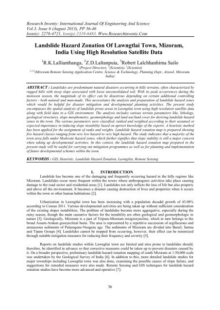
<strong>Research</strong> <strong>Inventy</strong>: International Journal Of Engineering And ScienceVol.3, Issue 6 (August 2013), PP 36-46Issn(e): 2278-4721, Issn(p):2319-6483, Www.<strong>Research</strong>inventy.ComLandslide Hazard Zonation Of Lawngtlai Town, Mizoram,India Using High Resolution Satellite Data1 R.K.Lallianthanga, 2 Z.D.Laltanpuia, 3 Robert Lalchhanhima Sailo1 (Project Director), 2 (Scientist), 3 (Scientist)1,2,3 (Mizoram Remote Sensing Application Centre, Science & Technology, Planning Dept., Aizawl, Mizoram,India)ABSTRACT : Landslides are predominant natural disasters occurring in hilly terrains, <strong>of</strong>ten characterized byrugged hills with steep slope associated with loose unconsolidated soil. With its peak occurrences during themonsoon season, the magnitude <strong>of</strong> its effect can be disastrous depending on certain additional controllingfactors - both natural and man-made. This necessitates the analysis and preparation <strong>of</strong> <strong>landslide</strong> <strong>hazard</strong> zoneswhich would be helpful for disaster mitigation and developmental planning activities. The present studyencompasses the spatial analysis <strong>of</strong> <strong>landslide</strong> prone areas in Lawngtlai <strong>town</strong> using high resolution satellite dataalong with field data in a GIS environment. The analysis includes various terrain parameters like, lithology,geological structures, slope morphometry, geomorphology and land use/land cover for deriving <strong>landslide</strong> <strong>hazard</strong>zones in the <strong>town</strong>. The various parameters were classified, ranked and weighted according to their assumed orexpected importance in inducing slope instability based on apriori knowledge <strong>of</strong> the experts. A heuristic methodhas been applied for the assignment <strong>of</strong> ranks and weights. Landslide <strong>hazard</strong> <strong>zonation</strong> map is prepared showingfive <strong>hazard</strong> classes ranging from very low <strong>hazard</strong> to very high <strong>hazard</strong>. The study indicates that a majority <strong>of</strong> the<strong>town</strong> area falls under Moderate <strong>hazard</strong> zones, which further signifies that slope stability is still a major concernwhen taking up developmental activities. In this context, the <strong>landslide</strong> <strong>hazard</strong> <strong>zonation</strong> map prepared in thepresent study will be useful for carrying out mitigation programmes as well as for planning and implementation<strong>of</strong> future developmental schemes within the <strong>town</strong>.KEYWORDS : GIS, Heuristic, Landslide Hazard Zonation, Lawngtlai, Remote SensingI. INTRODUCTIONLandslide has become one <strong>of</strong> the damaging and frequently occurring <strong>hazard</strong> in the hilly regions likeMizoram. Landslides occur more frequent within the <strong>town</strong>s where anthropogenic activities take place causingdamage to the road sector and residential areas [1]. Landslides not only inflicts the loss <strong>of</strong> life but also propertyand above all the environment. It becomes a disaster causing destruction <strong>of</strong> lives and properties when it occurswithin the <strong>town</strong> or other human habitations [2].Urbanization in Lawngtlai <strong>town</strong> has been increasing with a population decadal growth <strong>of</strong> 43.08%according to Census 2011. Various developmental activities are being taken up without sufficient consideration<strong>of</strong> the existing slopes instabilities. The problem <strong>of</strong> <strong>landslide</strong>s become more aggregative, especially during therainy season, though the main causative factors for the instability are <strong>of</strong>ten geological and geomorphologic innature [3]. Geologically, Mizoram is a part <strong>of</strong> Tripura-Mizoram miogeosyncline, which in turn belongs to thebroad Assam-Arakan geosynclinal basin. The area is represented by a repetitive succession <strong>of</strong> argillaceous andarenaceous sediments <strong>of</strong> Palaeogene-Neogene age. The sediments <strong>of</strong> Mizoram are divided into Barail, Surmaand Tipam Groups [4]. Landslides cannot be stopped from occurring, however, their effect can be minimizedthrough suitable mitigation measures for reducing their frequency and severity [5].Reports on <strong>landslide</strong> studies within Lawngtlai <strong>town</strong> are limited and sites prone to <strong>landslide</strong>s should,therefore, be identified in advance so that corrective measures could be taken up to prevent disasters caused byit. On a broader perspective, preliminary <strong>landslide</strong> <strong>hazard</strong> <strong>zonation</strong> mapping <strong>of</strong> south Mizoram at 1:50,000 scalewas undertaken by the Geological Survey <strong>of</strong> India [6]. In addition to this, more detailed <strong>landslide</strong> studies formajor <strong>town</strong>ships including Lawngtlai <strong>town</strong> was also done, examining the possible causes <strong>of</strong> slope failure, andsuggestions for remedial measures were also made. Remote Sensing and GIS techniques for <strong>landslide</strong> <strong>hazard</strong><strong>zonation</strong> studies have become more advanced and operative [7].36
Landslide Hazard Zonation Of Lawngtlai Town…These techniques have opened new perspectives for carrying out evaluation, management andmonitoring <strong>of</strong> natural <strong>hazard</strong>s with better results and more economical measures than is possible withconventional methods. Elsewhere, Landslide Hazard Zonation (LHZ) using Remote Sensing and GIS techniqueshave been conducted in Bhagirathi Valley [8], Uttaranchal and Himachal Pradesh [9], Darjeeling Himalaya [10],Sikkim Himalaya [11], Aizawl <strong>town</strong> [12], Dikrong river basin [13], Kohima <strong>town</strong> [7], Kullu District [2], SouthSinai, Egypt [14], Giri Valley [15], Nilgiri district [16], Serchhip <strong>town</strong> [17], Mamit <strong>town</strong> [18] and Lunglei <strong>town</strong>[19]. High resolution satellite data have proven to be useful for micro-level <strong>landslide</strong> <strong>hazard</strong> <strong>zonation</strong> in hillyareas. The present study focuses on mapping <strong>of</strong> <strong>landslide</strong> <strong>hazard</strong> zones in Lawngtlai <strong>town</strong> which would furtherbenefit activities concerned with mitigation measures, and identifying suitable areas for infrastructuredevelopment in the <strong>town</strong>.II. MATERIALS AND METHODS2.1 Study areaLawngtlai <strong>town</strong> is the administrative headquarters <strong>of</strong> Lawngtlai district with an area <strong>of</strong> 53.76 sq. km. Itis located between 92 o 51′ 40" E to 92 o 56′ 12" E longitudes and 22 o 28′ 20" N to 22 o 34′ 58" N latitudes. The<strong>town</strong> falls under Survey <strong>of</strong> India topo sheet No. 84B/14 and 84B/15. It is linked by National Highway 54 withAizawl, the state capital <strong>of</strong> Mizoram at a distance <strong>of</strong> 296 km. The <strong>town</strong> is situated towards the eastern fringe <strong>of</strong>Lawngtlai district (Fig.1) and shares the direct influence <strong>of</strong> south west monsoon, with average annual rainfall <strong>of</strong>2510.30 mm [20]. According to Census 2011, the total population <strong>of</strong> the urban <strong>town</strong> area is 20889, which in turnindicates an increased anthropogenic activities in the <strong>town</strong> under various socio-economic development schemes.Fig. 1. Location Map <strong>of</strong> Study area2.2 Data usedThe main data used for interpretation is Quick bird satellite imagery which has a spatial resolution <strong>of</strong>0.8 m. Cartosat-I stereo-paired data having spatial resolution <strong>of</strong> 2.5 m was also used to generate DigitalElevation Model (DEM) and contour maps <strong>of</strong> the study area. Survey <strong>of</strong> India (SOI) topographical maps andvarious ancillary data were also referred. Extensive ground truth surveys were conducted to verify maps andincorporate relevant ground information during the study.37
Landslide Hazard Zonation Of Lawngtlai Town…2.3 Thematic layersThe thematic layers required for preparing <strong>landslide</strong> <strong>hazard</strong> zones in the study area were generatedusing the interpretation and analysis techniques <strong>of</strong> Remote Sensing and GIS. These layers were also utilized asparameters for assigning weightage for different <strong>landslide</strong> <strong>hazard</strong> classes.2.3.1 Land use / land coverLand use / land cover is an indirect indication <strong>of</strong> stability <strong>of</strong> hill slopes because it controls the rate <strong>of</strong> weathering and erosion <strong>of</strong>the underlying rock formations. The study area is divided into six land use / land cover classes, viz., Heavy Vegetation, Light Vegetation,Built-up, Scrubland, Barren/No Vegetation and Water body. The areas covered by heavy vegetation are found to be least susceptible to<strong>landslide</strong>. Hence, Heavy Vegetation class is assigned low weightage value. Barren Land and Built-Up areas are more prone to <strong>landslide</strong> thanthose <strong>of</strong> other classes and are given high weightage values. The statistics <strong>of</strong> land use/land cover is shown in Table 1, and the map is shownin Fig. 2.Table 1. Land Use/ Land Cover StatisticsLand Use Class Area (in Sq. Km.) PercentageHeavy Vegetation 5.77 10.74Light Vegetation 17.14 31.87Built up 1.14 2.12Scrubland 27.90 51.90Barren/No Vegetation 1.66 3.09Water Body 0.15 0.28Grand Total 53.76 100.00Fig. 2. Land use/land cover map <strong>of</strong> the study area38
Landslide Hazard Zonation Of Lawngtlai Town…2.3.2 SlopeSlope plays an important role amongst the causative <strong>landslide</strong> factors as it represents the physicalterrain conditions. Landslides are more prevalent in the steep slope areas than in moderate and low slope areas[11]. The western aspects <strong>of</strong> the middle and the eastern parts, along Vengpui locality <strong>of</strong> the study area arecharacterized by very steep slope. Steep hillside slopes are also noticed in few places. The southern parts <strong>of</strong> thestudy area, around College Veng, on the other hand, are characterized by low and gentle slope. The slopes <strong>of</strong> thearea are represented in terms <strong>of</strong> degrees, and are divided into five slope facets, viz., 0-15, 15-25, 25-30, 30-35,35-40, 40-45, 45-60 and above 60 degrees. Weightage values are assigned in accordance with the steepness <strong>of</strong>the slope, where steeper slope has higher weightage value than gentler slope. The slope statistics is given inTable 2, and slope map is shown in Fig. 3.Table 2. Slope StatisticsDegree <strong>of</strong> Slope Area (in Sq. Km.) Percentage0-15 11.37 21.1615-25 17.33 32.2325-30 7.92 14.7230-35 6.74 12.5535-40 4.65 8.6540-45 2.34 4.3545-60 2.09 3.89>60 1.32 2.45Grand Total 53.76 100.00Fig. 3. Slope map <strong>of</strong> the study area39
Landslide Hazard Zonation Of Lawngtlai Town…2.3.3 GeomorphologyThe study area comprises <strong>of</strong> highly dissected, undulating and moderately sloping structural hill ranges.Some <strong>of</strong> the hillocks are highly dissected with sharp ridges and steep slopes, whereas some areas arecharacterized by gentle and low dissected hillocks. This indicates that the topography is immature. A few flatlands are mostly confined along the streams and between the spurs. Geomorphologically, the whole area isdivisible into Medium Structural Hill, Low Structural Hill and Valley Fill. High elevated areas are moresusceptible to <strong>landslide</strong> than low elevated areas. The statistics <strong>of</strong> geomorphology is given in Table 3 andgeomorphological map <strong>of</strong> the study area is shown in Fig. 4.Table 3. Geomorphology StatisticsFig. 4. Geomorphology map <strong>of</strong> the study area2.3.4 LithologyThe study area is composed <strong>of</strong> rocks <strong>of</strong> Middle Bhuban and Upper Bhuban Formation <strong>of</strong> Surma Group[8]. It exposes limited rock types, viz. sandstones, shales and siltstones, and their intermixtures in varyingproportions. The Middle Bhuban Formation is conformably underlain by the Upper Bhuban Formation withgradational and transitional contact. The Middle Bhuban Formation is mainly argillaceous with shale as thedominant rock type. It consists <strong>of</strong> assemblage <strong>of</strong> shale, siltstone, sandy shale and clayey bands with subordinateamount <strong>of</strong> sandstones. The Upper Bhuban Formation is mainly arenaceous with sandstone as the dominant rocktype. It comprises <strong>of</strong> sandstone with subordinate amount <strong>of</strong> shale, siltstone with occasional clay bands. Six lithounitshave been established for the study area purely based on the exposed rock types <strong>of</strong> the area. These arenamed as sandstone, shale-sandstone, siltstone-shale, shale-siltstone, crumpled shale and gravel-silt unit. It maybe noted that the demarcation and correlation <strong>of</strong> the two formations is extremely difficult owing to more or lessuniform lithological characters and absence <strong>of</strong> marker horizons and index fossils. The statistics <strong>of</strong> lithology isgiven in Table 4.40
Landslide Hazard Zonation Of Lawngtlai Town…Table 4. Lithological StatisticsRock Types Area (in Sq. Km.) PercentageSandstone 7.79 14.50Shale-Sandstone 1.39 2.58Siltstone-Shale 19.27 35.85Shale-Siltstone 24.22 45.05Crumpled Shale 0.60 1.10Gravel-Silt 0.34 0.64Water Body 0.15 0.28Grand Total 53.76 100.002.3.5 Geological StructureStructurally, the beds generally trend N-S to roughly NNW-SSE and dip on either side from 20 o to 65 owith local variations. Besides bedding planes, two to three sets <strong>of</strong> joints have been noted. The lineaments arewell distributed within the study area, and are oriented in various directions. Few faults <strong>of</strong> small magnitude havebeen identified which are mostly transverse/oblique in disposition. The geological map is shown in Fig. 5.Fig. 5. Geological map <strong>of</strong> the study area2.4 Data AnalysisThe heuristic method using simple ranking and weighting methods for <strong>landslide</strong> <strong>hazard</strong> <strong>zonation</strong> wasadopted in the present study. The different <strong>landslide</strong> <strong>hazard</strong> zones were identified and classified by ranking <strong>of</strong>various causative factors operative in a given area based on their influence in initiation <strong>of</strong> <strong>landslide</strong>s.41
Landslide Hazard Zonation Of Lawngtlai Town…The first step involves selection <strong>of</strong> causative factors <strong>of</strong> slope instability in the area <strong>of</strong> interest.Consequently, five causative factors viz., lithology, structure, slope morphometry, geomorphology and landuse/land cover were considered in the present study. Each causative factor was converted to a thematic map.Each parameter is carefully analysed so as to establish its relation to <strong>landslide</strong> susceptibility. The relativeimportance <strong>of</strong> each parameter for <strong>landslide</strong> is evaluated according to subjective opinion based on the aprioriknowledge <strong>of</strong> the experts. Accordingly, rank values were assigned to each parameter, starting from 1 to 100,with 1 and 100 being the least and the most important in inducing <strong>landslide</strong>s respectively. Among the variouscausative factors considered, slope is found to be the most influencing factor for slope instability. Hence, thehighest rank value was assigned to it. Similarly, different rank values were assigned to the remaining parametersbased on the relative importance towards <strong>landslide</strong> occurrence. The sum <strong>of</strong> the ranks <strong>of</strong> all parameters equals to100.Each parameter was classified into a number <strong>of</strong> classes based on the relative influence <strong>of</strong> slope instability.Each class was assigned an ordinal rating (weight) from 0 to 10. The weight values <strong>of</strong> each class within aparameter were attributed on the basis <strong>of</strong> its importance in causing mass movements. For example, in thelithology layer, the crumpled shale unit <strong>of</strong>fers more chance <strong>of</strong> slope failure than the hard and compact sandstoneunit. Similarly, areas located within the vicinity <strong>of</strong> fault zones and other geological structures are morevulnerable to <strong>landslide</strong>s and other mass movements. For this, areas <strong>of</strong> 50 m on both sides <strong>of</strong> all the lineamentsincluding faults are buffered. Likewise, due considerations are given for the relation between <strong>landslide</strong>s andother classes <strong>of</strong> a parameter, and different weight values were assigned accordingly. Summation <strong>of</strong> theseattribute value were then multiplied by the corresponding rank value to yield the different <strong>landslide</strong> <strong>hazard</strong>zones. The distribution <strong>of</strong> ranks and weights for different parameters and their classes are given in Table 5.Table 5. Parameters and their ranking in terms <strong>of</strong> their influence to LandslideParameter Rank Category WeightLand Use / LandCoverSlope Morphometry(in degrees)1535Heavy Vegetation 3Light Vegetation 5Built-up 8Scrubland 6Barren/No Vegetation 7Water Body 00-10 210-20 420-40 640-60 8> 60 5Moderate Structural Hill 3Geomorphology 10Lithology 25Geological Structure 15Low Structural Hill 2Valley Fill 0Flood Plain 0Water Body 0Sandstone Unit 4Shale-Sandstone Unit 6Siltstone-Shale Unit 8Shale-Siltstone Unit 9Crumpled Shale Unit 10Gravel-Silt Unit 7Water Body 0Length <strong>of</strong> Buffer distanceon either side8II.RESULTS AND DISCUSSIONThe final Landslide Hazard Zonation map prepared on the scale <strong>of</strong> 1:5,000 is prepared after analysing all the controllingparameter in GIS and by giving different weightage value for all the themes. The area statistics <strong>of</strong> the <strong>landslide</strong> <strong>hazard</strong> zones are given inTable 6 and the <strong>landslide</strong> <strong>hazard</strong> <strong>zonation</strong> map <strong>of</strong> the study area is shown in Fig. 7. The study area is categorised into 'Very High', 'High','Moderate', 'Low' and 'Very Low' <strong>hazard</strong> zones, and are described below:42
Landslide Hazard Zonation Of Lawngtlai Town…2.1 Very High Hazard ZoneThis zone is highly unstable, and is at a constant threat <strong>of</strong> <strong>landslide</strong>s, especially during and after heavyrain. This zone has steep slopes with loose, unconsolidated materials, and also include areas where active<strong>landslide</strong>s had occurred. This zone is dispersed in few places as found in Council Veng (Fig. 6), eastern side <strong>of</strong>Sobji Bazar and below LDFA Playground along Pakhawngmawng stream. It is also found scattered in smallpatches along Chanmari Veng, Bungtlang road and along AOC stream below AOC Filling Station. The Lowerpart <strong>of</strong> Lawngtlai III locality along Khurpui stream and part <strong>of</strong> Thingkah locality also falls within this zone. Italso include areas where unplanned quarrying, road cutting and other human activities are active. In addition, itis also found along the streams where toe-erosional activities are constantly taking place and also in other parts<strong>of</strong> the <strong>town</strong> area in small pockets. The vegetation in this zone is generally scarce. The rocks exposed arecharacterized by numerous bedding and joint planes which facilitate the chance <strong>of</strong> sliding down along the slope.This zone constitutes an area <strong>of</strong> 0.27 sq. km and forms 0.50% <strong>of</strong> the total study area. It is recommendedthat no human induced activity be undertaken in this zone. It will be difficult to develop economically andsocially acceptable remedial measures which can prevent recurrence <strong>of</strong> <strong>landslide</strong>. Hence, such areas have to beentirely avoided for settlement or other developmental purposes.Fig. 6. Massive <strong>landslide</strong> scar at Council Veng, Lawngtlai <strong>town</strong>2.2 High Hazard ZoneThis zone includes areas where the probability <strong>of</strong> sliding debris is at a high risk due to weathered rockand soil debris covering steep slopes which when disturbed are prone to <strong>landslide</strong>s. Many <strong>of</strong> the pre-existing<strong>landslide</strong>s occurred within this zone. Besides, this zone includes some areas where the dip direction and slopedirection, which are usually very steep, are the same. This rendered them susceptible to slide along the slope.Several lineaments, fractured zones and fault planes also traverse this zone. Areas which experience constanterosion by streams because <strong>of</strong> the s<strong>of</strong>t nature <strong>of</strong> the lithology and loose overlying burden, also fall under thiszone. The High Hazard Zone is distributed in many parts <strong>of</strong> the <strong>town</strong> area and is found to always surround theVery High Hazard Zone. This zone is found in Vengpui, College Veng, Chandmari, Council Veng, Thingkah,AOC Veng, etc. Vegetation is generally either absent or sparse. The High Hazard Zone is also found along theintersection <strong>of</strong> steep slope with road cutting. This zone occupies an area <strong>of</strong> 8.70 sq. km which is 16.18% <strong>of</strong> thetotal study area.Allocation and execution <strong>of</strong> major housing structures and other projects within this zone should bediscouraged. If unavoidable circumstances compel the execution <strong>of</strong> such activity, precaution should be taken inconsultation with the geological experts. Unless immediate action plans are implemented, this zone candeteriorate to critical situations.2.3 Moderate Hazard ZoneThis zone is generally considered stable, provided its present status is maintained. It comprises areasthat have moderately dense vegetation, moderate slope angle and relatively compact and hard rocks. Althoughthis zone may include areas that have steep slopes (more than 45 degree), the orientation <strong>of</strong> the rock bed or theabsence <strong>of</strong> overlying loose debris and human activity may make this zone less <strong>hazard</strong>ous. The Moderate HazardZone is distributed in various parts <strong>of</strong> the study area. Several parts <strong>of</strong> the human settlement also come under thiszone. This zone covers an area <strong>of</strong> 36.12 sq. km. and occupies 67.19% <strong>of</strong> the total study area.43
Landslide Hazard Zonation Of Lawngtlai Town…Although this zone is generally considered stable, it may contain some pockets <strong>of</strong> unstable areas. Suchareas need to be identified on the ground and suitable mitigation measures should be undertaken. It isrecommended that human activity that can destabilize the slope and trigger <strong>landslide</strong>s should not be undertakenwithin this zone. Although this zone comprises areas which are stable in the present condition, future land useactivity has to be properly planned so as to maintain its present status.2.4 Low Hazard ZoneThis zone includes areas where the combination <strong>of</strong> various controlling parameters is not having adverseinfluence on the stability <strong>of</strong> the slope. In other words, this zone comprises areas where the chance <strong>of</strong> slopefailure is low or unlikely to occur by virtue <strong>of</strong> its present environmental set up. Vegetation is relatively dense,except in some areas. Although some <strong>of</strong> the areas may be covered with s<strong>of</strong>t and unconsolidated sediments, theslope angles are generally low, about 30 degrees or below. Flat lands and areas having low degrees <strong>of</strong> slope fallunder this class. This zone is mainly confined to areas where anthropogenic activities are less or absent, and aremainly distributed along the periphery <strong>of</strong> the study area. This zone covers an area <strong>of</strong> 7.87 sq. km. and forms14.64% <strong>of</strong> the total study area.No evidence <strong>of</strong> slope instability is observed and mass movement is not expected within this zone.Therefore, developmental activities are considered safe to be carried out within this zone.3.5 Very Low Hazard ZoneThis zone generally comprises areas covered by dense vegetation and is mostly located away fromhuman settlement. In addition, it includes valley fill and other flat lands. Therefore, it is assumed that this zoneis free from the present and future <strong>landslide</strong>s. The dip direction <strong>of</strong> the rocks and slope angles are fairly low.Although the lithology may comprise <strong>of</strong> s<strong>of</strong>t rocks and overlying soil debris in some areas, the chance <strong>of</strong> slopefailure is minimized by low slope angle and vegetative cover. This zone covers an area <strong>of</strong> 0.65 sq. km., andforms 1.21% <strong>of</strong> the total study area. As far as slope instability is concerned, developmental activities can besafely carried out within this zone. Most <strong>of</strong> the areas within this zone can be allocate for major housingstructures.Fig. 7. LHZ map <strong>of</strong> the study area44
Table 6. LHZ StatisticsLandslide Hazard Zonation Of Lawngtlai Town…IV. CONCLUSIONThe existence <strong>of</strong> <strong>landslide</strong>s in the study area reveals the need to recognize the <strong>landslide</strong> characteristics,particularly in terms <strong>of</strong> its disastrous effect, mechanism and its spatial probability. It has been observed thatunplanned activities coupled with inherent natural elements like lithology, slope, geological structure, rainfall,etc. have caused some parts <strong>of</strong> the <strong>town</strong> highly prone to <strong>landslide</strong>s. Areas having spatial probability <strong>of</strong> <strong>landslide</strong>shave been identified through the <strong>hazard</strong> zone mapping done in the present study. The <strong>landslide</strong> <strong>hazard</strong> zonesprepared in this study represents an important basis for the assessment <strong>of</strong> potential <strong>hazard</strong> areas in the <strong>town</strong>.Further, mapping <strong>of</strong> these <strong>hazard</strong> zones can help decision-makers to have proper mitigation plans and forchoosing suitable locations for future planning.The use <strong>of</strong> Quickbird, Cartosat-I stereo data, supported by detailed ground truthing in a Remote sensingand GIS environment has proven the capacity <strong>of</strong> producing reliable large scale <strong>landslide</strong> <strong>hazard</strong> <strong>zonation</strong> mapwith high accuracy in the hilly areas. The heuristic method used in the study is an effective method for <strong>landslide</strong><strong>hazard</strong> <strong>zonation</strong> in the Himalayan region [21], due to its ease <strong>of</strong> use without the requirement <strong>of</strong> <strong>landslide</strong>inventory[3]. The selection <strong>of</strong> the causative <strong>landslide</strong> factors in the study relies upon the consideration <strong>of</strong>relevance and availability <strong>of</strong> these factors in the study area. Hence, the selection is relative and subjective, andhas scope for further replication in other hilly areas with improved flexible analysis in future studies.V. ACKNOWLEDGEMENTSThe authors are thankful to North Eastern Council (NEC), Shillong for providing fund for the presentstudy under Disaster Management System Project. The authors are also thankful to other colleagues <strong>of</strong>MIRSAC, Aizawl for their co-operation and support during the study.REFERENCES[1] B. Gurugnanam, M. Bagyaraj, S. Kumaravel, M. Vinoth and S. Vasudevan, GIS based weighted overlay analysis in <strong>landslide</strong><strong>hazard</strong> <strong>zonation</strong> for decision makers using spatial query builder in parts <strong>of</strong> Kodaikanal taluk, South India. Journal <strong>of</strong> Geomatics6(1), 2012, 49.[2] Chandel, B.S. Vishwa, Brar, Karanjot Kaur and Yashwant Chauhan, RS & GIS Based Landslide Hazard Zonation <strong>of</strong>Mountainous Terrains. A Study from Middle Himalayan Kullu District, Himachal Pradesh, India. International Journal <strong>of</strong>Geomatics and Geoscience 2(1), 2011, 121-132.[3] Parag Jyoti Dutta and Santanu Sarma, Landslide susceptibility zoning <strong>of</strong> the Kala-Pahar hill, Guwahati, Assam state, (India),using a GIS-based heuristic technique, International Journal <strong>of</strong> Remote Sensing & Geoscience, 2(2), 2013, 49.[4] GSI (2011), Geology and Mineral resources <strong>of</strong> Manipur, Mizoram, Nagaland and Tripura (Revised), Geological Survey <strong>of</strong> India,Misc. Publication No. 30 Part IV, Vol. 1(2), pp. 30-35.[5] G.S. Mehrotra, K. Mahadevaiah and D.P. Kanugo, Landslide Hazard Zonation – A guide for Future Planning andDevelopment<strong>of</strong> Himalaya (Abstr.). Proc. <strong>of</strong> the Indian Geological Congress, 1993, 103- 104.[6] M. Raju, V.K. Sharma, V.K. Khullar, S.A. Chore and R. Khan, A Comprehensive Report on Landslide Hazard Zonation <strong>of</strong> SouthMizoram. Progress Report for the Field Session 1997-1998, Geological Survey <strong>of</strong> India, North Eastern Region, Shillong, 1999.[7] Nesatalu Hiese and Jenita Mary Nongkynrih, Landslide Hazard Zonation Mapping <strong>of</strong> Kohima Town. Indian Landslides 3(2),2010, 41-46.[8] R.P. Gupta, A.K. Saha, M.K. Arora and A. Kumar, Landslide <strong>hazard</strong> <strong>zonation</strong> in a part <strong>of</strong> Bhagirathi Valley, GarhwalHimalayas, using integrated Remote sensing-GIS. Journal <strong>of</strong> Himalayan Geology 20(2), 1999, 71-85.[9] NRSC (2001), Landslide Hazard Zonation Mapping in the Himalayas <strong>of</strong> Uttaranchal and Himachal Pradesh States using RemoteSensing and GIS Techniques (Unpublished). National Remote Sensing Agency, Dept. <strong>of</strong> Space, Govt. <strong>of</strong> India, Hyderabad.45
Landslide Hazard Zonation Of Lawngtlai Town…[10] S. Sarkar and D.P. Kanungo, An integrated approach for Landslide Susceptibility Mapping using remote sensing and GIS.Photogrammetric Engineering and Remote Sensing 70(5), 2004, 617-625.[11] A.K. Sharma, Joshi, Varun and K. Kumar, Landslide <strong>hazard</strong> <strong>zonation</strong> <strong>of</strong> Gangtok area, Sikkim Himalaya using remotesensing and GIS techniques. Journal <strong>of</strong> Geomatics 5(2), 2011, 87-88.[12] R.K. Lallianthanga and Z.D. Laltanpuia, Landslide Hazard Zonation <strong>of</strong> Aizawl Town using Remote Sensing and GIS Techniques– A qualitative approach. Bulletin <strong>of</strong> National Natural Resources Management System, Dept. <strong>of</strong> Space, Govt. <strong>of</strong> India,Bangalore. (B)-32, 2008, pp. 47-55,[13] A. Pandey, P.P. Dabral, V.M. Chowdary and N.K. Yadav, Landslide Hazard Zonation using Remote Sensing and GIS: a casestudy <strong>of</strong> Dikrong river basin, Arunachal Pradesh, India. Environmental Geology 54(7), 2008, 1517-1529.[14] Mohamed O Arnous, Integrated remote sensing and GIS techniques for <strong>landslide</strong> <strong>hazard</strong> <strong>zonation</strong>: A case study Wadi Watierarea, South Sinai, Egypt. Journal <strong>of</strong> Coastal Conservation 15(4), 2011, 477-497.[15] R.S. Negi, M.K. Parmar, Zubair A. Malik and M. Godiyal, Landslide Hazard Zonation using Remote Sensing and GIS: A CaseStudy <strong>of</strong> Giri Valley, District Sirmaur, Himachal Pradesh. International Journal <strong>of</strong> Environmental Science 1(1), 2012, 26-39.[16] Evany S. Nithya and Rajesh P. Prasanna, An integrated Approach with GIS and Remote Sensing Technique for Landslide HazardZonation. International Journal <strong>of</strong> Geomatics & Geosciences, 1(1), 2010, 66-75.[17] R.K. Lallianthanga and F. Lalbiakmawia, Micro-level Landslide Hazard Zonation <strong>of</strong> Serchhip <strong>town</strong>, Mizoram, India using highresolution satellite data. Science Vision, 13(1), 2013, 14-23.[18] R.K. Lallianthanga , F. Lalbiakmawia and F. Lalramchuana, Landslide Hazard Zonation <strong>of</strong> Mamit <strong>town</strong>, Mizoram, India usingRemote Sensing and GIS Techniques. International Journal <strong>of</strong> Geology, Earth and Environmental Sciences, 3(1), 2013, 148-194.[19] R.K. Lallianthanga and Z.D. Laltanpuia, Landslide Hazard Zonation <strong>of</strong> Lunglei <strong>town</strong>, Mizoram, India using High ResolutionSatellite data. International Journal <strong>of</strong> Advanced Remote Sensing and GIS, 2(1), 2013, 148-159.[20] MIRSAC (2012), Meteorological Data <strong>of</strong> Mizoram. Mizoram Remote Sensing Application Centre, Aizawl, Mizoram, pp. 4345.[21] A.K. Saha, R.P. Gupta and M.K. Arora, GIS-based Landslide <strong>hazard</strong> <strong>zonation</strong> in the Bhairathi (Ganga) valley,Himalayas, International Journal <strong>of</strong> Remote Sensing, 23(2), 2002, 357-36946


