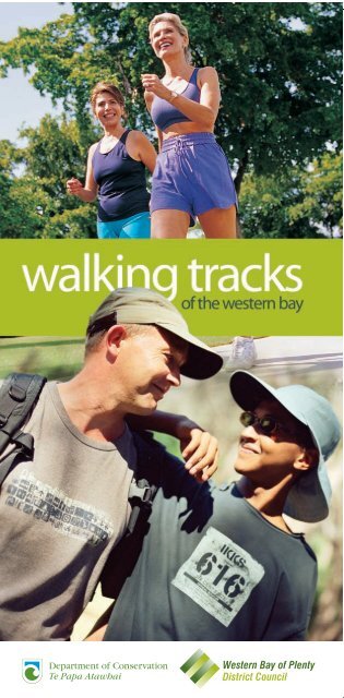
WBOPDC_walking tracks 08.indd - Western Bay of Plenty District ...
WBOPDC_walking tracks 08.indd - Western Bay of Plenty District ...
WBOPDC_walking tracks 08.indd - Western Bay of Plenty District ...

You also want an ePaper? Increase the reach of your titles
YUMPU automatically turns print PDFs into web optimized ePapers that Google loves.
What a great place toenjoy <strong>walking</strong>!THERE’S no easier or more pleasurable way to enjoy the greatoutdoors <strong>of</strong> the western <strong>Bay</strong> <strong>of</strong> <strong>Plenty</strong> than to step out for aleisurely walk.Soothing for the soul, and good for your health, an outing ona <strong>walking</strong> track is an excellent opportunity to embrace andappreciate the beauty <strong>of</strong> the environment around you.In this booklet we feature 21 popular <strong>tracks</strong>.From short, easy coastal strolls to up-hill-and-down-daletramps to testing bush trails, there’s something for everyone.Although many <strong>of</strong> these walks are in <strong>WBOPDC</strong> parks andreserves; some <strong>of</strong> the walks are managed by the Department<strong>of</strong> Conservation (DOC). You can find out more informationon these walks, marked with the DOC logo by contacting theTauranga DOC <strong>of</strong>fice.Department <strong>of</strong> Conservation253 Chadwick RoadTaurangaPh: 07 578 7677www.doc.govt.nzAll <strong>of</strong> the walks have been created for your pleasure.Please enjoy and respect them.DogsAs an owner, it is your responsibility to keep your dogunder proper control at all times. Please refer to specificsites where dogs are not allowed at any time.Produced by <strong>Western</strong> <strong>Bay</strong> <strong>of</strong> <strong>Plenty</strong> <strong>District</strong> Council, March 2008.1
Key to walks1. Orokawa Scenic Reserve Page 52. Bowentown Domain Page 73. Athenree Village Page 84. Tanners Point Page 95. Tuapiro Point Page 106. Kauri Point Historic Reserve Page 117. Uretara Stream Walkway Page 138. Tuahu Kauri Page 149. Aongatete Lodge Tracks Page 1710. Gerald Crapp Historic Reserve Page 19& Omokoroa Peninsula2
11. Te Puna Quarry Park Page 2112. I’Anson Bush Reserve Page 2213. Minden Scenic Reserve Page 2314. Puketoki Scenic Reserve Page 2515. Rapurapu Track Page 2616. Omanawa Falls Page 2717. Te Rerekawau (Kaiate Falls) Page 2918. Raparapahoe Stream Page 3019. Otawa Scenic Reserve Page 3320. Otanewainuku Page 3521. Papamoa Hills Cultural Page 37Heritage Regional Park3
Homunga <strong>Bay</strong>Ngatitangata RoadOrokawa StramWilliam Wright FallsOrokawa <strong>Bay</strong>Old ReservoirPohutukawa ParkBeach RoadWaihi BeachThe Esplanade4
1Orokawa Scenic ReserveWhere: Start at the northern end <strong>of</strong> Waihi Beach.Walking timesWaihi Beach to Orokawa <strong>Bay</strong>45 minutes one way.Orokawa <strong>Bay</strong> to William Wright Falls1 hour return.Orokawa <strong>Bay</strong> to Homunga <strong>Bay</strong>60 minutes one way.Homunga <strong>Bay</strong> to Ngatitangata Road45-60 minutes one way.Pohutukawa Park Track45 minutes return.THIS spectacular coastal reserve embraces panoramic oceanviews, mature forest, pohutukawa-fringed bays, good rockfishing and picnic spots. There are several historic pa sites, aswell as old gold-mine tunnels.The Orokawa <strong>Bay</strong> walk begins at the northern end <strong>of</strong> WaihiBeach. (Occasionally you may have to delay your start due tohigh tides and a strong swell.)A gently rising track skirts the headland before descendinginto stunning, pohutukawa-clad Orokawa <strong>Bay</strong>. The beachhere gets deep very quickly and is not considered safe forswimming.At the northern end <strong>of</strong> the beach, the track to William WrightFalls begins. On your way to these 30-metre-high falls you willhave to make several stream crossings.The track to Homunga <strong>Bay</strong> continues along the coastline,skirting headlands and cliffs.Return to Waihi Beach via the same route. An option is to parkyour car at Ngatitangata Road and clamber across farm landdown to the track. It’s not difficult, but coming back up is aseriously steep climb.The Pohutukawa Park Track is a short walk through maturenative bush, giving you an opportunity to explore the oldWaihi Beach water supply reservoir behind the town. Today thereservoir abounds in waterfowl. There are some lovely picnicspots here.No dogs or fires are allowed within the reserve.5
Seaforth RoadShelly<strong>Bay</strong>Anzac <strong>Bay</strong>MotorCampTe Ho PaTe Kura a MaiaCave <strong>Bay</strong>6
2Bowentown DomainWhere: Northern end <strong>of</strong> Tauranga Harbour.Walking timesAnzac <strong>Bay</strong> to Shelly <strong>Bay</strong>30 minutes one way.Headland car park to Te Ho pa site30 minutes one way.Anzac <strong>Bay</strong> to Shelly <strong>Bay</strong>90 minutes return.LOCATED on a rocky headland at the northern entranceto Tauranga Harbour, this 128-hectare reserve contains anumber <strong>of</strong> pa sites dating back several hundred years.It separates the harbour from the sandy ocean foreshorewhich stretches 8 kilometres from Bowentown to WaihiBeach.Anzac <strong>Bay</strong> <strong>of</strong>fers safe swimming, picnic sites and toiletsand there is camping at the Bowentown Holiday Parkadjacent to the ocean beach.A series <strong>of</strong> <strong>tracks</strong> through the Domain give you a variety<strong>of</strong> <strong>walking</strong> choices.From the Te Ho pa site, which is easily reached, thereare magnificent views <strong>of</strong> the harbour and the coast. Toget here, follow the <strong>tracks</strong> from the motor camp or fromthe headland car park. From the car park you can dropsteeply down to Cave <strong>Bay</strong>, a small beach at the harbourentrance, or you can walk to Te Kura a Maia pa site on thesouthern headland.From Anzac <strong>Bay</strong> a wide grassy track leads westward up toan area where several <strong>tracks</strong> meet.Straight ahead leads to Shelly <strong>Bay</strong>, a sheltered and safeswimming spot. Left takes you to a popular fishing area.Turning right leads to the summit. Another track dropsdown to the entrance <strong>of</strong> the Domain. The loop trackcontinues on around the top <strong>of</strong> the headland and downto the northern end <strong>of</strong> Shelly <strong>Bay</strong>.Stunning views <strong>of</strong> the upper harbour, Kaimai Rangesand the ocean coastline are your reward when you walkthese <strong>tracks</strong>.7
Pohutukawa DriveEstuaryRoretana DriveAthenree RoadWaione Avenue3Athenree VillageWhere: Northern end <strong>of</strong> Tauranga Harbour.Walking times30 minutes one way.THIS is an easy, pleasant stroll through Athenree Villageon the shores <strong>of</strong> Tauranga Harbour.The walkway starts from the children’s playgroundon Waione Avenue. It wends its way along the grassyforeshore, passing beneath old pohutukawa trees, and<strong>of</strong>fers views across the estuary to Bowentown.Near the end <strong>of</strong> your walk you will need to skirt a smalltidal inlet in the vicinity <strong>of</strong> Dr North Memorial Reserve.Return the same way or come back via PohutukawaDrive and Athenree Road.8
BeachMoana DriveGiles WayTanners Point RoadJettyTannersPointReserveBoat ramp4Tanners PointWhere: Off Tanners Point Road, 7 minutes drive north<strong>of</strong> Katikati.Walking time30 minutes return.A MOST enjoyable outing, this short walk leads youthrough a picturesque harbourside reserve.The setting, plus picnic tables and toilets, makes it idealfor quiet family outings.Start your walk near the jetty, continue along thepohutukawa-fringed track that follows the harbour’sedge around to Moana Drive, then down to a sandybeach.Return the same route or via Moana Drive.9
TrackTuapiro Road5Tuapiro PointWhere: Off Tuapiro Point Road, 6 minutes drive north<strong>of</strong> Katikati.Walking time60 minutes return.TUAPIRO Point is a small sandspit across the channel fromTanners Point.A track takes you onto the esplanade reserve and runsalong the spit to a fence. When you get to the fence, stepon to the beach and continue to the end <strong>of</strong> the sandspitfor some great views <strong>of</strong> the inner harbour.At certain times <strong>of</strong> the year, a lot <strong>of</strong> seabirds gather here.Please take care not to disturb them, or any other estuarywildlife.Retrace your steps or take a short detour and explore thegrove <strong>of</strong> landmark pine trees on your return journey.10
To Ongare PointChelmsford StreetPa SiteEsplanade RoadKauri Point RoadPa SiteJetty6Kauri Point HistoricReserveWhere: Off Kauri Point Road, 5 minutes drive north <strong>of</strong> Katikati.Walking time80 minutes return.THREE features in particular attract people to this reserve:• The magnificent specimens <strong>of</strong> pohutukawa which line theshore;• A long, wooden jetty that extends 200 metres out into theharbour (highly popular for fishing);• Several pa fortification sites.To get to this reserve go to the end <strong>of</strong> Kauri Point Road, turnright and drive down to the car park.The walkway starts here. It takes you along the harbour’sedge and around the point into paddocks where it is easyto see evidence <strong>of</strong> old pa fortifications and trenches. (Pleasetreat this area with respect.)From here, cross to Esplanade Road or follow the fencelineadjacent to the harbour, taking care to close gates and avoidelectric fences.At the northern end <strong>of</strong> the point drop down to OngarePoint (10 minutes walk) or continue back to the car park viaChelmsford Street.11
HarbourUretaraStreamPark RoadBeach RoadSH212More Katikati walksThere are other <strong>walking</strong> opportunities in andaround Katikati. These are detailed in a brochureavailable from the Visitor Information Centre inthe Council <strong>of</strong>fice in Katikati’s main street.
7Uretara Stream Walkway& Katikati Town CentreUretara Stream WalkwayWalking time45 minutes one way.THIS popular walk starts at Beach Road in Katikati andfollows the Uretara Stream out to the edge <strong>of</strong> theharbour.It begins at the site <strong>of</strong> the Uretara Landing which playeda key role in the early settlement days. (A very realisticmural on the wall next to the BNZ in the main streetshows what life was like around the Landing in itsheyday, circa 1900.)The walkway meanders along the esplanade reserve,downstream past farm land and private gardens, as wellas estuary wetlands, before ending at Park Road Reserve.Return the same way or via residential streets.The walkway can also be accessed <strong>of</strong>f Levley Lane.Katikati Town CentreWalking time40+ minutes return.FOR those who appreciate art in the landscape this ismore <strong>of</strong> an experience than a brisk walk. The journeystarts at the car park in Haiku Park where there is amplescope to wander various pathways and appreciate thehaiku verse carved into the boulders and pavement.The Uretara Stream runs through the park. The mainpath leads over a footbridge, then downstream to thehighway and the Uretara Landing.From the Landing, stroll up the main street to appreciatethe murals and other works <strong>of</strong> art throughout the towncentre. Rest at a cafe, or at the replica kauri dam waterfeature in Diggleman Park, before crossing the road andreturning to your car.13
Hot Springs RoadTuahu Kauri8Tuahu KauriWhere: Off Hot Springs Road, south <strong>of</strong> Katikati.Walking time20 minutes one way.A MAGNIFICENT kauri tree - one <strong>of</strong> the largest in the<strong>Bay</strong> <strong>of</strong> <strong>Plenty</strong> - awaits you on this walk.The kauri is known as Tuahu, named after its location on anold Maori route that was used as a bridle track in the 1890s.Today’s track starts at the end <strong>of</strong> Hot Springs Road.It is well-benched and graded and takes you into theKaimai Mamaku Forest Park, through regenerating nativeforest where young kauri and rimu are thriving.Beyond the Tuaha kauri, adventurous walkers may chooseto explore other day walks and more challenging <strong>tracks</strong> inthe Kaimai Mamaku Forest Park.No dogs or fires are allowed in the park without a permit.14
Wright RoadRiver TrackNatureTrailLodgeShort LoopAongatete RiverLong Loop16
9Aongatete Lodge TracksWhere: At the end <strong>of</strong> Wright Road, south <strong>of</strong> Katikati.Walking timeNature Trail Loop15 minutes return.Short Loop60 minutes return.Long LoopApprox 3½ hours.Aongatete River30 minutes one way.SEVERAL outstanding walks start and end at theAongatete Outdoor Education Lodge in the KaimaiMamaku Forest Park.This lodge is set in an attractive bush environment- mainly lowland podocarps and native trees.To get here, drive to the end <strong>of</strong> Wright Road.There is a car park area before the gate to the lodge and itis advisable to leave your vehicle here as the gate may belocked at any time.The main <strong>walking</strong> track starts behind the lodge ablutionblock and takes you to a junction where the short NatureTrail Loop branches to the right.Continuing along the main track you reach a left-handbranch. The Long Loop continues straight ahead. (This is amore difficult walk; there are stream crossings and bootsare recommended.)Turning left takes you around the easier Short Loop. Atthe next junction, turn left again and soon you’ll reach theedge <strong>of</strong> the bush. A stile crosses the fence into a paddock,and you return to the car park.The walk to the Aongatete River starts on the western side<strong>of</strong> the lodge. In damp conditions the track can be slippery,so please be careful. After about 15 minutes, it branchesleft and leads to some attractive swimming holes.No dogs or fires are allowed in the park without a permit.17
Gerald Crapp Historic ReserveJettyOmokoroa RoadThe EsplanadeHamurana RoadMargaret PlaceAnderley AvenueGolf CourseOmokoroa Road<strong>Western</strong> Avenue18Kayelene Place
10Gerald Crapp HistoricReserve & OmokoroaPeninsulaWhere: Omokoroa PeninsulaWalking timeDomain to Bramley Drive via Historic Reserve40 minutes one way.Omokoroa PeninsulaUp to 2½ hours.ON the picturesque Omokoroa peninsula there are anumber <strong>of</strong> easy, pleasant walks.The most popular is a 40-minute walk that takes you roundthe tip <strong>of</strong> the peninsula and through the Gerald CrappHistoric Reserve.From this reserve, which covers about 2 hectares, youget spectacular tree-framed views <strong>of</strong> the harbour andMatakana Island. The magnificent variety <strong>of</strong> mature trees -including a giant Moreton <strong>Bay</strong> fig - were mostly planted bythe Crapp’s, one <strong>of</strong> the first pioneering families in the area.The reserve is also the site <strong>of</strong> the Wai Huri pa.The walk starts from Omokoroa Beach Domain, at the end<strong>of</strong> The Esplanade. Head along the beach and up into thereserve. Carry on around the point and along the clifftopesplanade reserve, in front <strong>of</strong> many attractively gardenedhomes, and take in the views up Tauranga Harbour as youmake your way to Bramley Drive.From here, return the same way or via residential streets.Another very popular, but longer, walk takes in much more<strong>of</strong> the peninsula.As well as from The Domain, there are accesses <strong>of</strong>fWaterview Terrace and from the southern end <strong>of</strong> HamuranaRoad. This walk takes you along the western foreshore pastthe golf course and on to Kayelene Place.On the eastern side <strong>of</strong> the peninsula, Cooneys Reserve,on Margaret Place, leads down to the harbour. Followthe shoreline northwards and this will bring you to thesouthern end <strong>of</strong> The Esplanade.DogsPlease refer to signage for prohibited and restricted areas.19
AmphitheatrePicnicCar parkPicnicTe PunaQuarry Park RoadMain TrackMinor Tracks20
11Te Puna Quarry ParkWhere: 10 minutes north <strong>of</strong> Tauranga, at the end <strong>of</strong> TePuna Quarry Park Road (<strong>of</strong>f State Highway 2).Walking timeMain track45-60 minutes return.Secondary <strong>tracks</strong>Various options.THIS park is one <strong>of</strong> the most popular walks in our<strong>District</strong>.Covering about 32 hectares, it is a myriad <strong>of</strong> <strong>walking</strong><strong>tracks</strong>, waterways, native and exotic gardens, gardenart and restful picnic areas. From the higher pointsthere are stunning coastal views, extending from theCoromandel ranges to the eastern <strong>Bay</strong>.The park is a disused quarry, which produced rockfrom 1911 to 1970, mainly for building roads andreclamations throughout the <strong>Bay</strong> <strong>of</strong> <strong>Plenty</strong>. After itwas closed it was neglected until 1993 when the TePuna Quarry Park Society was formed by a group <strong>of</strong>local residents with a vision to turn it into a premierwilderness garden and artistic retreat.Granted reserve status in 1996, every year it gets betterand better.21
Armstrong RoadLoop RoadState Highway 212I'Anson BushReserveWhere: Loop Road, <strong>of</strong>f State Highway 2 just north<strong>of</strong> Te Puna.Walking timeUp to 45 minutes return.THIS reserve is on land that was gifted to the QE IINational Trust in 1987 by Keith and Takiko I’Anson.Over the years it has been turned from pasture tonative bush and a small lake - Lake Taki - has beenformed by damming the Waikaraka Stream.There are occasional clearings - ideal for a quiet picnic.From the car park, <strong>tracks</strong> go around the lake and thenyou pass through groves <strong>of</strong> native trees. Continuedownstream to Armstrong Road, then make yourway back.22
Ainsworth RoadGate13Minden ScenicReserveWhere: Ainsworth Road, <strong>of</strong>f State Highway 2 just north<strong>of</strong> Te Puna.Walking time15 minutes return.IF you like your walks short and sweet, you’ll love this one!Near the entrance to the reserve there are two picnictables where you can sit and watch waterfowl at play in anearby pond.Beyond a gate, across a grassy field, the track leads youinto the bush where you follow a small stream throughregenerating forest dominated by rewarewa and mamakutree ferns.After crossing the stream, the track doubles back thenclimbs to a pleasant open area that returns you to whereyou started from.23
Whakamarama RoadLeyland Road24
14Puketoki ScenicReserveWhere: 20 minutes north <strong>of</strong> Tauranga, on Leyland Road(<strong>of</strong>f Whakamarama Road).Walking timeShort Loop20 minutes return.Long Loop60 minutes return.THIS reserve - one <strong>of</strong> the oldest in our <strong>District</strong> - hasbeen a popular bush walk and picnic spot for almost80 years.Native bush, including mature tawa and the occasionalrimu, dominates the reserve and the Te Puna Streamwends its way quietly through it.The land was donated in 1926 by H. H. Sharplin asgeneral manager <strong>of</strong> the Whakamarama Land andTimber Company. An old tramline, which forms part <strong>of</strong>the track system, is evidence <strong>of</strong> the early activities <strong>of</strong>this enterprise.Both <strong>tracks</strong> are well developed and there are bridgesacross the streams. A short side-track <strong>of</strong>f the LongLoop leads to a very large rimu and is well worth theshort detour.Adjacent to the parking area is a pleasant picnic spot,bounded by a rocky stream.Toilets are provided.25
SH29Kaimai MamakuForest ParkRapurapu StreamKauri TreesRapurapuEcologicalArea15Rapurapu TrackWhere: Off State Highway 29, on the left about 4 kilometres onthe Waikato side <strong>of</strong> the Kaimai summit.Walking time75 minutes one way.THREE majestic kauri trees in a mature native forest setting, and apristine stream with safe swimming holes, are the main drawcards forthis walk which is particularly popular in summer.The whole area is an ecological reserve within the Kaimai MamakuForest Park, and the walk starts from the gravel car park just <strong>of</strong>f StateHighway 29, west <strong>of</strong> the summit.For the first 600 metres you go through a previously grazed area thatis being re-vegetated with radiata pine and tree lucerne as nurserycrops. The track then enters a terrace <strong>of</strong> tawa forest and drops down tothe Rapurapu Stream. Follow the stream and soon you will come to aboardwalk at the base <strong>of</strong> the kauri trees.The largest tree is 1.79 metres in diameter and 14 metres to the firstbranch. All three kauri can be seen at once, from the rocks in the middle<strong>of</strong> the stream, just before climbing the boardwalk steps.No dogs or fires are allowed in the Park without a permitCAUTION: There are numerous stream crossings, so we advise against<strong>walking</strong> this track after heavy rain. Sturdy footwear should be worn.26
Omanawa RoadOmanawa RiverOmanawa Falls16Omanawa FallsWhere: Off Omanawa Road (via State Highway 29).Walking time30 minutes return.THIS walk takes you to the edge <strong>of</strong> the spectacularOmanawa Falls.Drive up Omanawa Road for 11 kilometres and youwill see the start <strong>of</strong> the track sign-posted on the left.It follows an old access route which was used in theconstruction <strong>of</strong> the Omanawa Falls hydro powerstation, commissioned in 1920.The track leads down to the edge <strong>of</strong> the ruggedHidden Gorge Scenic Reserve, then sidles along aledge carved into the rocky cliffs. There are hand-railsto assist you.The scenery here is something special, with the fallscascading into a large pool in the Omanawa River farbelow.The track ends abruptly at a locked steel door, to keeppeople out <strong>of</strong> the old underground power stationwhich is no longer in use.27
LowerFallsUpper FallsKaiate Falls RoadKaiate Stream28
17Te Rerekawau(Kaiate Falls)Where: Off Kaiate Falls RoadWalking time60 minutes return.IN a pretty, bush-filled ravine where the Kaiate Streamdrops over ignimbrite bluffs, a series <strong>of</strong> cascades andwaterfalls combine to create the magic which is TeRerekawau Falls.They are sign-posted from Welcome <strong>Bay</strong> Road as“Kaiate Falls”.Drive up Waitao Road and after about 4.9 kilometresturn left at Kaiate Falls Road. The scenic reservecontaining the falls is a further 1 kilometre and avehicle track leads to the car park. The road beyond thereserve continues on to Te Puke.Above the car park a picnic area, with tables and atoilet, <strong>of</strong>fers good views towards Mount Maunganuiand the Port <strong>of</strong> Tauranga.The <strong>walking</strong> <strong>tracks</strong> are well formed, although quitesteep with steps in some places. The main track leadsto the top, and then to the base <strong>of</strong> the upper series <strong>of</strong>falls (pictured).From there it crosses the stream and continuesdown to the base <strong>of</strong> the lower falls, where there is apopular swimming hole. Crossing the stream again thetrack loops back up past some lovely big puriri andkohekohe trees. A short side track leads back to thebase <strong>of</strong> the upper falls, or you may continue on theuphill track back to the car park, with a great view <strong>of</strong>the falls on the way.There is another track to the left, just below the carpark, which follows the stream back to the road bridge.29
No.4 RoadRaparapahoeStreamWaterfall18Raparapahoe StreamWhere: 7 kilometres from Te Puke, <strong>of</strong>f No 4 Road.Walking time60 minutes return.THIS trail takes you down to the picturesque RaparapahoeStream, running through a narrow, densely-bushed gorge.The descent from the road and the climb back up are verysteep in places, so only those who are fit and agile shouldattempt this walk.To get to the starting point, drive up No. 3 Road and turninto No. 4 Road. Cross the bridge, turn immediately leftand drive for 2.4 kilometres where there is a sign-postedroadside parking bay.The track, which was developed in 1987 by the Te PukeLions Club, drops steeply through mature tawa forest.When it reaches the bottom <strong>of</strong> the gorge it continuesupstream to a large pool at the base <strong>of</strong> a 3-metre waterfall- perfect for a refreshing dip on a hot summer’s day beforetackling the climb back up to the road.30
Upper Papamoa RoadWharetetarakehoManoeka RoadOtawaDamTo Otanewainuku32
19Otawa Scenic ReserveWhere: In the Papamoa Hills.Walking timeTe Puke Quarry Road to Manoeka Road4 hours one way .Manoeka Road to reservoir15 minutes one way .THIS reserve, located in the Papamoa hills, is largelylowland forest dominated by tawa and rewarewa.There are two walks - a short one which takes you to anold dam which was Te Puke’s original water reservoir anda half-day one which takes you across more hilly terrain.If you want to walk to the dam, drive to the end <strong>of</strong>Manoeka Road.From the turn-<strong>of</strong>f on State Highway 2, it is 5.5 kilometresto the reserve entrance, where there is a grassy parkingand picnic area. The last 1.6 kilometres <strong>of</strong> road is gravel.A well-defined track crosses the Kirikiri Stream into thereserve and takes you through a lovely puriri grove to asmall clearing beside the reservoir. You can cross thestream several times to get there.To do the longer walk, drive to the top <strong>of</strong> Te Puke QuarryRoad. You will need to cross private farm land to enter thereserve, where the track takes you to the Wharetetarakehotrig. There are awesome coastal views from here.Entering the forest, the track follows the gently undulatingridgeline to Otawa trig (2 hours). From here, you can goback the way you came or continue along the track, whichdescends steeply to meet the reservoir track at the end <strong>of</strong>Manoeka Road (another 2 hours).For the super-fit, 400 metres past the Otawa trig, a branch tothe right leads to Otanewainuku. If you want to walk there, itis about 16 kilometres (8 hours) to Mountain Road.A detailed map <strong>of</strong> this track is available from theDepartment <strong>of</strong> Conservation in Tauranga, at 253 ChadwickRoad, Greerton.No dogs or fires are allowed in the Park without a permit.33
To OtawaWaterfallWhataroa StreamMountain RoadNo. 2 RoadOtanewainukuMangatoi Road34
20OtanewainukuWhere: 25 minutes drive from Tauranga, on Mountain Road(<strong>of</strong>f Oropi Road).Walking timeSummit track90 minutes return.Rimu Loop Track30 minutes return.Mountain Road to Whataroa Waterfall60 minutes one way.AT 640 metres above sea level, Mount Otanewainuku <strong>of</strong>fers somespectacular views.Much <strong>of</strong> the mountain is covered in virgin forest and bird life isprolific. Podocarps, especially rimu, are common and tawa, kamahiand rewarewa form the canopy.Maori legend says Tutanekai, lover <strong>of</strong> Hinemoa, leapt from thesummit to escape his Rotorua enemies.All three walks start at the small car park, where there is also ashelter, toilet and picnic area.The summit track is reasonably steep in parts, but the breathtakingview from the top is worth the climb. A tower built by ArmyTerritorials <strong>of</strong>fers panoramic views from East Cape to MountTarawera and Rotorua, and across the Mamaku Plateau to MountRuapehu.The Rimu Loop Track starts from the opposite side <strong>of</strong> the road nearthe car park. It is a gently graded walk, with some impressively largerimu and tawa.If you’d like to turn this into a longer walk a well-marked routebranches <strong>of</strong>f the Rimu Loop Track after 15 minutes and undulatesthrough the forest to the Whataroa Falls. Explore this pristine stream,with its cascades and pools, before returning the same way.For the seriously-fit, beyond the waterfall a track continues northto the main ridge track which leads to Otawa Scenic Reserve. Fromhere it is around 18.5 kilometres (9 hours) to Te Puke Quarry Road.A detailed map <strong>of</strong> this track is available from the Department <strong>of</strong>Conservation in Tauranga, at 253 Chadwick Road, Greerton.The Otanewainuku Kiwi Trust is working with the Department<strong>of</strong> Conservation to restore a healthy kiwi population to theOtanewainuku forest. Dogs pose a real threat to kiwi.No dogs or fires are allowed in the Park without a permit.35
KarangaumuPa SitePa SitePa SitePa SitePatangataPa SiteSummitSH2Car parkPoplar Lane36
21Papamoa Hills CulturalHeritage Regional ParkWhere: 10 minutes west <strong>of</strong> Te Puke - start at the car park<strong>of</strong>f Poplar Lane (<strong>of</strong>f State Highway 2).Walking time60 minutes return.THERE are many cultural features in this park that dateback to the earliest days <strong>of</strong> Maori settlement. It is one <strong>of</strong>the most historic landmarks in the <strong>Bay</strong> <strong>of</strong> <strong>Plenty</strong> and theviews from the summit are absolutely breathtaking!On a clear day you can see the Mount and Tauranga to thewest, far beyond the Te Puke area to the south-east andMount Ngongotaha to the south. Mayor, Motiti and Whiteislands also come into the picture.Opened in 2004, and now owned by the Regional Council,the park is a unique mix <strong>of</strong> ancient pa sites, pockets <strong>of</strong>native forest and farm land. In total it covers 108 hectares.To appreciate it fully, you need to walk to the summit.There and back requires a reasonable level <strong>of</strong> fitness -some parts <strong>of</strong> the track are quite steep - and will takeyou about 60 minutes.You can wander freely throughout the park, but pleasestay inside the boundaries which are identified by whitefence posts. Please try not to disturb grazing sheep andcattle.The park has a full-time ranger and there are publictoilets at the car park.37
devcich design wb0308