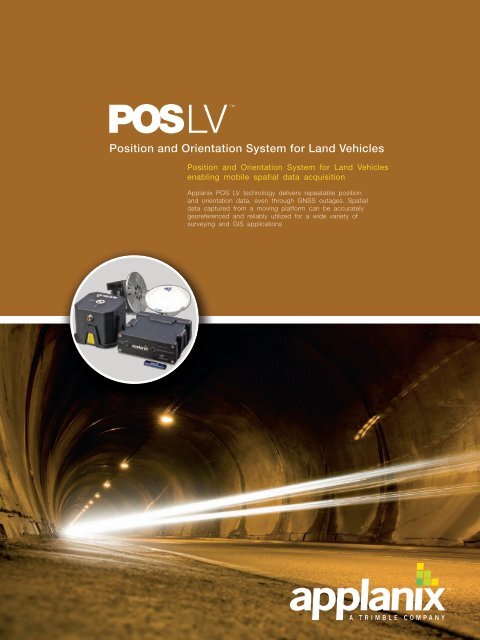
Brochure - Applanix
Brochure - Applanix
Brochure - Applanix

You also want an ePaper? Increase the reach of your titles
YUMPU automatically turns print PDFs into web optimized ePapers that Google loves.
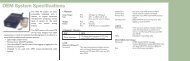
Simplified Post-Processing with POSPAC MMSImprove productivity, data accuracy, and output reliability witheasy to learn and apply processing software…POSPac MMS (Mobile Mapping Suite) post-processingsoftware is designed to maximize the accuracy potentialof the POS LV system. From project planning through tocompletion, POSPac MMS software simplifies missionscheduling, utilizes smart time-saving features includingpre-planning and batch processing resources, and offerscustomizable options with powerful quality control and dataanalysis tools. Easy to apply differential GNSS techniques andother advanced smoothing algorithms combine with batchprocessingfeatures to shorten user operation time and improveoverall production levels.Precision Positioning - IMU Meets GNSSMobile GNSS performance with position and orientation timetaggedfor speed and accuracy generate consistently reliabledata captures…<strong>Applanix</strong> uses only the highest quality selection of GNSS receiversin the industry, providing complete flexibility for optimalaccuracy combined with the latest in high performance dualfrequency receiver technology. GNSS receivers are dedicatedto supporting the POS LV Inertial Measurement Unit (IMU), theheart of the POS LV system. More than just a positioning system,the POS LV IMU uses three accelerometers and three gyroscopesto measure accelerations and angular velocities necessary forcomputing all aspects of vehicle motion, including position,speed, acceleration, orientation, and rotation rates.By combining easy sensor system integration (lasers...) withtime-tagged position and orientation data logged at up to200 Hz, POS LV sustains highly consistent an reliable datacapture. POS LV filters raw GNSS so that only well-foundedsignals are incorporated into the results. Robust positioninghelps eliminate need for data reacquisition, saving operatorcosts and allowing more efficient data collection.Derived quantities such as lateral shift, radius of curvature,and slip angle are computed with an unmatched high degreeof accuracy. Precise timing, an added benefit of GNSS, allowsthese measurements to be synchronized with all manners ofremote sensing equipment.With the option of utilizing OmniSTAR VBS, XP, and HPservices, POS LV delivers varying levels of GNSS performanceright down to the sub-decimeter level, even without the useof a base station (reducing cost, setup time, and base stationtheft risk).Ruggedized Processing with the PCSSolid-state engineering for uninterrupted productivity withaccuracy, yet simple enough for solo-user operation…If the IMU is the heart of the POS LV then the POS ComputerSystem (PCS) is the brain. The PCS enables raw GNSS datafrom as few as one satellite to be processed directlyinto the system in order to compute accurate positionalinformation in areas of intermittent or even absent GNSSreception. Ruggedized, power efficient, and light-weight,the <strong>Applanix</strong> PCS offers built-in logging features in a spaceefficient unit that includes an embedded state-of-theartsurvey grade GNSS receiver. This central processingcomputer houses the USB Logging drive, implementsall data processing orders, and serves as the powerdistribution hub for all POS LV components.Another standard feature within POS LV and an importantlink to the POS computer, the LV POSView Controller offersan effective interface for monitoring of performance andcritical control system functions. This component reducesoperator workload and training time, while making itpossible for only one person to operate the entire system.The PCS and LV POSView Controller are built to comfortablysupport a system with a conventionally high data rateand low system latency in order to provide better overallsystem integration while ensuring that position andorientation data is continuously captured in a fast, reliable,and uninterrupted process.4/5
The 2007 DARPA Urban Challenge Winner, the TartanRacing Team from Carnegie Mellon University, whoutilized POS LV to cross the finish line first.POSPac MMSPOSPac Mobile Mapping Suite (MMS) is <strong>Applanix</strong>’next generation, industry-leading software for DirectGeoreferencing of mobile mapping sensors using GNSS andinertial technology. Compatible with a variety of mappingsensors, this smart software solution achieves both maximumaccuracy and maximum efficiency for Direct Georeferencing.GAMSGAMS (GNSS Azimuth Measurement Subsystem) integratesan IMU with a 2-antenna heading measurement system. Byutilizing a carrier phase differential GNSS algorithm to measurethe relative position vector between the two antennas, GAMScontinuously calibrates the IMU and ensures that azimuthdoes not drift (as long as there is GNSS coverage).POS LV COMPUTER SYSTEM (PCS)The POS LV Computer System, is the central processingcomputer that houses the GNSS receivers, USB loggingdrive, data processing, and power distribution units for allcomponents of the POS LV.
AIRBORNE LAND MARINEProducts and Solutions for Mobile Mapping and Positioning. Capture Everything.www.applanix.com85 Leek Crescent Richmond Hill Ontario Canada L4B 3B3Telephone: 1-905-709-4600 Facsimile: 1-905-709-6027© 2010 <strong>Applanix</strong>, A Trimble Company. All rights reserved. <strong>Applanix</strong>, and the <strong>Applanix</strong> logo are trademarksof <strong>Applanix</strong> Corporation registered in the Canadian Patent and Trademark Office and other countries. POS LV,POSPac MMS are registered trademarks of <strong>Applanix</strong> Corporation. All other trademarks are the property of theirrespective owners. Information is subject to change without notice. August, 2010.