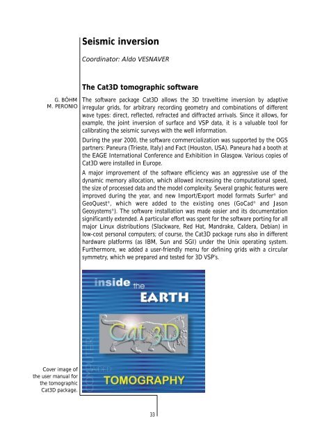
Seismic inversionCoordinator: Aldo VESNAVERThe Cat3D tomographic softwareG. BÖHMM. PERONIOThe software package Cat3D allows the 3D traveltime inversion by adaptiveirregular grids, for arbitrary recording geometry and combinations of differentwave types: direct, reflected, refracted and diffracted arrivals. Since it allows, forexample, the joint inversion of surface and VSP <strong>data</strong>, it is a valuable tool forcalibrating the seismic surveys with the well information.During the year 2000, the software commercialization was supported by the <strong>OGS</strong>partners: Paneura (Trieste, Italy) and Fact (Houston, USA). Paneura had a booth atthe EAGE International Conference and Exhibition in Glasgow. Various copies ofCat3D were installed in Europe.A major improvement of the software efficiency was an aggressive use of thedynamic memory allocation, which allowed increasing the computational speed,the size of processed <strong>data</strong> and the model complexity. Several graphic features wereimproved during the year, and new Import/Export model formats Surfer ® andGeoQuest ® , which were added to the existing ones (GoCad ® and JasonGeosystems ® ). The software installation was made easier and its documentationsignificantly extended. A particular effort was spent for the software porting for allmajor Linux distributions (Slackware, Red Hat, Mandrake, Caldera, Debian) inlow-cost personal computers; of course, the Cat3D package runs also in differenthardware platforms (as IBM, Sun and SGI) under the Unix operating system.Furthermore, we added a user-friendly menu for defining grids with a circularsymmetry, which we prepared and tested for 3D VSP’s.Cover image ofthe user manual forthe tomographicCat3D package.33
Joint 3D inversion of P, S and converted wavesA. VESNAVERG. ROSSIDuring the last few years, ocean-bottom cables (OBC) were used at a large scale for3D marine surveys for recording the three components of the particle velocity andthe pressure waves. Also on land surface surveys and in VSP’s this technology isexpanding, since it allows detect and separate P, S and converted waves. P and Svelocity and, in particular, their ratio, are important lithological parameters toreconstruct porosity and pore pressure in the rocks. This information is importantto delineate boundaries and preferential migration paths both in hydrocarbonreservoirs and in shallow water-saturated rocks.In most cases, rock interfaces reflect both P and S waves, and convert part of theirenergy from one wave type into the other one. When these events are observableand can be reliably picked, we can enhance a lot the 3D lithological description ofthe Earth, because of the <strong>data</strong> redundancy with respect to the estimatedparameters. In fact, the unknowns describing the interfaces do not increase, andthose ones for the velocities just double; viceversa, if P, S, P-S and S-P waves areavailable, including both reflected and head waves, the traveltime <strong>data</strong> increase bya factor much larger than two. Thus, the Earth model is much better constrainedby the experimental <strong>data</strong>, and more robust with respect to errors in thetraveltimes.The joint inversion of P, S and converted waves has an additional advantage. Thesought velocity fields of P and S waves are almost decoupled, when consideringpure P and S arrivals: their only connection are the possible common reflectinginterfaces in the Earth. Converted waves provide new equations in the tomographyinversion, which directly relates the two velocity fields.We set up a software prototype for the elastic inversion by generalizing ourprevious acoustic code. The ray tracing algorithm is based on the Fermat’sprinciple, and determines the ray path for a given ray signature by a bending typeapproach. For example, in a P-S converted wave, we use the P velocities up to theconversion point, where we switch to the S field, for computing and minimizingthe traveltime along the ray path. The P and S velocities are estimated by an ART,SIRT or weighted SIRT algorithm.Time-lapse 3D tomographyA. VESNAVERF. ACCAINOG. DAL MOROG. MADRUSSANIG. ROSSIThe response in a seismic survey over a producing hydrocarbon reservoir changesduring the years, due to the different pressure conditions of gas and themovements of the gas/oil/water interfaces. This information is crucial foroptimizing the hydrocarbon production, locating the new wells in the unsweptareas, and where the hydraulic conductivity is expected to be adequate, as infractured or permeable formations. The 4D-TAIL Project is aimed at detectingthese variations of lithologic parameters by Amplitude Versus Offset (AVO) analysisand 3D tomographic imaging. The <strong>OGS</strong> partners are two oil companies, i.e.TotalFinaElf UK and Norsk Hydro, and the University of Milan. This project issupported by the European Union in the Thermie Programme.34
- Page 2 and 3: Istituto Nazionaledi Oceanografia e
- Page 4: ContentsIntroduction . . . . . . .
- Page 7 and 8: Sea, close to the Antarctic Peninsu
- Page 10 and 11: Measurements while drilling (data a
- Page 12 and 13: Vallazza research well: 3D-RVSP sei
- Page 14 and 15: Therefore, having beside a high ele
- Page 16 and 17: • Standard 20’ container modifi
- Page 18 and 19: • Offshore gravimetric survey “
- Page 20 and 21: The GPR instruments.Integrated meth
- Page 22 and 23: Seismic data processingCoordinator:
- Page 24 and 25: allow for the different spatial sam
- Page 26 and 27: Results of applicationof the static
- Page 28 and 29: Measurements while drilling (R & D)
- Page 30 and 31: Wave modelingCoordinator: Géza SER
- Page 32 and 33: Phase velocitiesof the five wavemod
- Page 34 and 35: (SPEM) and the Wavenumber Integrati
- Page 36 and 37: The Marche Microzonation Project is
- Page 40 and 41: The joint inversion ofdirect, refle
- Page 42 and 43: Transferring technology from the oi
- Page 44 and 45: At the end of the year, we started
- Page 46 and 47: ODP Leg 178 - Site LocationSite 109
- Page 48 and 49: Core 1165B-14HComposite diagram sho
- Page 50 and 51: Cenozoic Evolution of the South Ork
- Page 52: Magallanes-Fagnanomaster faultTWT (
- Page 55 and 56: three wells in the Blake Ridge, off
- Page 57 and 58: Backstripping modelling in the fram
- Page 59 and 60: The purpose is to merge the land an
- Page 61 and 62: AdministrationCoordinator: Dario Co
- Page 63 and 64: CARCIONE, J. M., AND HERMAN, G., AN
- Page 65 and 66: FERRACIOLI, F., COREN, F., BOZZO, E
- Page 67 and 68: Presentations at meetings and conve
- Page 69 and 70: ROSSI, G., BÖHM, G., MADRUSSANI, G
- Page 71 and 72: Book reviewsVESNAVER, A., 2000, Rev
- Page 73 and 74: Fred DAVEY (Institute of Geological
- Page 75 and 76: Trieste and scienceTrieste is also
- Page 77: 72TRIESTE