Observatory - Ecole Nationale Supérieure d'Architecture de Paris ...
Observatory - Ecole Nationale Supérieure d'Architecture de Paris ...
Observatory - Ecole Nationale Supérieure d'Architecture de Paris ...
- No tags were found...

You also want an ePaper? Increase the reach of your titles
YUMPU automatically turns print PDFs into web optimized ePapers that Google loves.
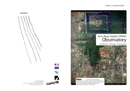
ContentsSiem Reap/Angkor urban <strong>Observatory</strong> EditorialIntroducingTime and spaceGeographical backgroundThe Angkor territory: a site for the Khmer capitalsHistory and urban changeWorkshopsResearch<strong>Observatory</strong> team ResearchHeritageThe ZEMP and the Angkor site boundariesMaps and plansArchitectural and urban formsCurriculumArchitecture workshop Siem Reap/AngkorActivities - NewsBibliography - Degrees and stu<strong>de</strong>nt worksWorkshopsStudy day“World Heritage and large sites:Asia and Europe mirroring”On October 26, 2007, a study day onworld heritage sites was organised atthe ENSA of <strong>Paris</strong>-Belleville with anemphasis on large sites, outstandingeither because of their size or theirvalue. Assessed by their symbolic valueand the resulting number of visitorsattracted by them, they generate complexmanagement issues. The <strong>Observatory</strong> teamin October 2008. graphic <strong>de</strong>sign : association : à table!
Degrees andstu<strong>de</strong>nt worksSiem Reap/Angkor urban<strong>Observatory</strong>Editorial Les saisons <strong>de</strong> l’eauà Siem Reap-Angkor. Tourisme, patrimoineet développement dans un milieurégi par la logique <strong>de</strong> l’eau Aménagement territorial<strong>de</strong> la zone <strong>de</strong> développement RunTa Ek : métissage <strong>de</strong>s formes. Entre citérurale et ville végétale Histoire au pays <strong>de</strong> l’eau Formes architecturaleset urbaines du commerceExpansion urbaine aux abordsdu Psar Leu Siem Reap-Angkor,une région du Nord-Cambodge en voie <strong>de</strong>mutationL’accès à l’eau dans laville <strong>de</strong> Siem Reap au Cambodge: <strong>de</strong>man<strong>de</strong><strong>de</strong>s ménages et gestion <strong>de</strong>s services d’eau Un musée commeamorce d’un nouvel élan touristique eturbain dans le centre ville <strong>de</strong> Siem Reapau CambodgeSiem Reap town is the inevitable gateway to the prestigious site of Angkor; it acts asits entrance, backstage, and proscenium. As all of us know, Angkor is more than justa series of prestigious monuments, but rather a gathering of capital-cities relocatedthrough the centuries over a huge territory. Before becoming an archaeologicalPark, Angkor was a series of successive cities, with the irst foundation dating from802, which were abandoned during the XV th century. In line with this logic, this longtermhistory, we think that Siem Reap must also be outstanding for its quality of lifeand architectural, urbanistic, landscaping and environmental values. Étu<strong>de</strong> <strong>de</strong> l’eau dans lacité <strong>de</strong> Siem Reap
Les Leçonsd’Angkor : dix ans <strong>de</strong> coopération internationaledans la région <strong>de</strong> Siem Reap/Angkor Développement et patrimoine :formes et mutations <strong>de</strong> la ville <strong>de</strong> SiemReap à l’ombre d’Angkor (1907-2007), Siem Reap – Inventionset constitution d’un lieu <strong>de</strong> tourisme auxportes d’Angkor Pierre ClémentBibliography Angkor, passé,présent et avenir Ville <strong>de</strong> Siem Reap - Angkor.Plan d’Urbanisme <strong>de</strong> référence et projetsprioritaires Siem Reap/Angkor. Plan d’Urbanisme <strong>de</strong>référence et projets prioritaires. Étu<strong>de</strong>touristique Mission d’étu<strong>de</strong> tourisme. Angkor/SiemReap. Mission d’étu<strong>de</strong> tourisme. Angkor/SiemReap Activities/News Les leçons d’Angkor : dixans <strong>de</strong> coopération internationale dansla région <strong>de</strong> Siem Reap Angkor Mémoire et i<strong>de</strong>ntitékhmères Mémoire et i<strong>de</strong>ntité khmères I<strong>de</strong>ntiication et protectiondu patrimoine architectural eturbain <strong>de</strong> la ville <strong>de</strong> Siem Reap (Cambodge) Carte archéologique<strong>de</strong> la région d’Angkor - Zone sud Project. Zoning andEnvironnemental management plan forthe Angkor Area (ZEMP). Urban <strong>de</strong>velopment Zoning and environnementalmanagement of Angkor within theSiem Reap region A joint cooperation APUR - IPRAUSregarding Phnom Penh heritage was carriedout and managed by Christiane Blancotand Aline Hétreau-Pottier; see StarkmannNathan, Blancot Christiane (ed.), Phnom Penh.Développement urbain et patrimoine, ministère<strong>de</strong> la Culture, Atelier parisien durbanisme,<strong>Paris</strong>, 1997, 160 p.Frédéric Mauret, I<strong>de</strong>ntification et protectiondu patrimoine architectural et urbain <strong>de</strong> la ville<strong>de</strong> Siem Reap, final report, Ipraus/Ministry ofCulture/Apsara, 1996.Emmanuelle Gay, Etu<strong>de</strong> <strong>de</strong> l’eau dans la cité<strong>de</strong> Siem Reap, thesis of the École dArchitecture<strong>de</strong> <strong>Paris</strong>-Belleville, 1998. Inès Gaulis, Les Leçons d'Angkor : dix ans<strong>de</strong> coopération internationale dans la région<strong>de</strong> Siem Reap/Angkor, research report, postdoctoralproject financed by the Région Île<strong>de</strong>-France,CNRS, UMR 7136 AUS, IPRAUS, July2007, 142 p. The volume Autrement : Angkor VIII e –XXI e siècle. Mémoire et i<strong>de</strong>ntité khmère, February2008, steered by Hugues Tertrais echoes InèsGaulis work, «Aménagement du territoire : lezonage, limite ou frontière ? » pp.168-181, andof Aline Hétreau-Pottier, « Siem Reap bouleversé: dynamique touristique et urbanisation» pp.182-203.
Housing complexCoralie Buchart (2006/2007) IntroducingDespite being a small provincial capital, Siem Reap has acquired internationalstatus due to its function as the gateway to Angkor. Since the country’s reopeningin the early 90, the town has been un<strong>de</strong>rgoing rapid urban <strong>de</strong>velopment caused bytourism and the resulting opening to international conditions.This trend raises infrastructural, urban management, heritage awareness and environmentalissues for the archaeological site and for the town. Moreover, Siem Reap’seconomic <strong>de</strong>velopment <strong>de</strong>pends mainly on tourism. The architectural, urban andnatural heritage is therefore a major asset: harmonious and sustainable urban<strong>de</strong>velopment represents a real strategic issue.The Siem Reap/Angkor <strong>Observatory</strong>’s ambition is to focus on architectural andurban changes caused by this sud<strong>de</strong>n urban sprawl with, in the background, thecontrast between a major archaeological site and a mo<strong>de</strong>rn town which must adaptto and transform through the strong growth of tourism low and accompanyinginvestments.Siem Reap/Angkor urban<strong>Observatory</strong>Study site Siem Reap Inès GaulisNathalie LancretAlmost two million visitors in 2007
A study session, organised by IPRAUS and the École Française d’Extrême-Orient was held on March 9, 2005 inSiem Reap at the EFEO with the aim of relecting on the establishment of such an observatory. This session <strong>de</strong>inedthe observatory’s mission, goals and programmes.Phum Tmey school extensionMaria Inès Costa (2006/2007)Goals, mission and programmesThe Siem Reap Angkor <strong>Observatory</strong> is a research structure, related to IPRAUS/ENSAPB and to the École Française d’Extrême-Orient, located in Siem Reapwithin the EFEO premises. It works in cooperation with APSARA.Research mission - Mappinginventory—plangatheringandCDRom burning associated with IPRAUS’ Asiantown mapping programme..- Documents gathered in a collectionbelonging to the <strong>Observatory</strong> (EFEO libraryin Siem Reap) are available to researchers. - The town’s representation through mapsand plans, analysis of the relationshipbetween the archaeological site and thetown;- Tourism and urban <strong>de</strong>velopment;- Un<strong>de</strong>rstanding the operation tools;- Observation of the architectural and urbanchanges in Siem Reap and its surroundingregion (i<strong>de</strong>ntification, listing and typologyof new architectural forms, i<strong>de</strong>ntification,listing and typology of urban extensions);- Urban and land dynamics;- Landscape, urban and territorial heritage. Scientific teamScientific authority:Pierre ClémentNathalie LancretCharles GoldblumChristophe Pottier ENSAPB/IPRAUSscientific coordinationInès GaulisSiem Reap <strong>Observatory</strong>supervisorAline Hétreau-PottierChargés <strong>de</strong> missionAdèle EspositoCyril RosLisa Ros
Creation of an experimental agricultural centrePablo Valcarcel (2006/2007)A stratified hydraulic network allows for maximisation of production.Surface water is essential all-year-round.Composting sitea mesh of articulated bamboo allows forkeeping <strong>de</strong>composing organic matter. This enables goodventilation, a necessity during the first stages of the process.It is also a visual barrier. Bamboo’s physical properties, itsflexibility and lightness facilitate its installation and provi<strong>de</strong>svery good tensile strength. composting station light and mobile main building Geographical backgroundTime and spaceMonuments and remains constituting the Angkor site (IX th – XV th centuries) arespread all over the Siem Reap region located in the north-west of present day Cambodia.This territory is bor<strong>de</strong>red to the north-east by the Phnom Kulen (498m)mountain chain. The major rivers travelling through and irrigating the Angkorplain (Roluos, Siem Reap and Puok rivers) are sourced from this massif. It thereforeconstitutes the “water tower” for this territory, where the <strong>de</strong>ep water tables of theregion also recharge. Satelliteit is a resting area, a vital componentin a larger than 50ha park. It protects fromthe sun and the rain. Its lightness means it ismobile and can be moved and transported toother locations easily. building Self-help housingeach family will build thewalls using materials such as bamboo. The landlordhas the liberty to <strong>de</strong>ci<strong>de</strong> the aspect of thefirst floor rooms. The name Tonle Sap inclu<strong>de</strong>s the hydrologicalsystem of the lake and its natural outletconnecting it to the Mekong.
Urban <strong>de</strong>velopment in Psar leuAdèle Esposito, Kanitha Tan (2004/2005) Time and spaceThe Angkor territory : a site for the Khmer capitalsThe history of Angkor as reconstituted by a century of epigraphic and monumentalresearch, starts sometime in the late VIII th century with the peregrinations of ayoung prince who unites a divi<strong>de</strong>d country. Consecrated “Universal Sovereign” ontop of the Phnom Kulen in 802 A.D., he reigned with the name of Jayavarman II andspent his last years in the city of Hariharâlaya, located in the Roluos region, aroundten kilometres to the east of present-day Siem Reap.Jayavarman II appears not only to be the “supreme King” reigning in the Angkorregion but also—or rather perhaps—the creator of the angkorian Kingdom, of itstitulature and of some of its cults which lasted un<strong>de</strong>r the following dynasties. Theangkorian period starts oficially with Jayavarman II. Apart from a brief 20 yearsof ini<strong>de</strong>lity in the X th century, all his successors will remain in the region until itsabandonment sometime in the XV th century. They all took part in establishing thehuge complex that inally became Angkor. Psar Leu.
—— - baray Christophe PottierSenior lecturer atthe École française d’Extrême-OrientOld Market interventionMarine Camps, Justine Thibault (2004/2005) Wat
CuricculumArchitecture workshop Siem Reap / AngkorCyril Ros, Architect and lecturer ENSAPBHistory and urban changeTime and spaceFollowing the teaching programme carried out in Phnom Penh and Siem Reapfrom 1991 to 1994, a DPEA MAP workshop was organised in Siem Reap/Angkorfor 2004-2005. This was the result of a cooperation between the Authority for theProtection of the Site and The Development of the Angkor Region (APSARA), and theÉcole Française d’Extrême-Orient (EFEO), with the moral support of UNESCO andthe Amis d’Angkor Association. It has been exten<strong>de</strong>d since 2006/2007 as a masterstudio of the <strong>Paris</strong> Belleville ENSA.Siem Reap / AngkorHeritage/tourism, contemporaneousness/<strong>de</strong>velopmentThe workshop is divi<strong>de</strong>d into two complementary sessions,the Town plan workshop and the Project workshop.The Town Plan workshop is to approach the town based on a cartographic analysis. It aims at<strong>de</strong>ciphering information and at acquiring knowledge of the town by un<strong>de</strong>rstanding maps andplans on a scale ranging in size from the territory to the neighbourhood.The Project workshop favours the stu<strong>de</strong>nts individual processes and approaches. It has threestages: firstly the work carried out in <strong>Paris</strong> (the frame), then the encounter with the place onsite (study stay in Siem Reap), then its finalization with the presentation of an architecturalproject (the project).The frame theancient angkorian canals and the pondsscattered throughout the town frameframeincentiveWith a population of 80,000, Siem Reap is the seat of the eponymous province, locatedive kilometres from Angkor Wat at the junction of two perpendicular routes,the Siem Reap stung (river) and National road N°6 (NR6). In Cambodia the cityis consi<strong>de</strong>red unique, as beyond its administrative, business and resi<strong>de</strong>ntial functions,its proximity to the Angkor site has converted it into an international tourismhub. This status has been reinforced since 1992 and the inscription of Angkor on theWorld Heritage List. Within less than 15 years, the country’s economic <strong>de</strong>velopment,the <strong>de</strong>mographic boom and the tourism increase (two million visitors expected in2008) drew Siem Reap into a cycle of farreaching and rapid changes with majorimplications for its urban landscape.On site frame The project Stu<strong>de</strong>nt work exhibition Les Aventuriers du mon<strong>de</strong> ——
Old Market shop-house Woo<strong>de</strong>n shop-house
Informal habitat on water (© Google earth, 2005)(© Google earth, 2005)(© Google earth, 2005)Informal habitat Aline Hétreau-Pottier
Research<strong>Observatory</strong> teamLes leçons d’Angkor : dix ans <strong>de</strong> coopération internationaledans la région <strong>de</strong> Siem Reap/AngkorThe lessons of Angkor: ten years of International cooperation in the Siem Reap/Angkor region)This research focused on analysing numerousprojects in the ield of internationalcooperation in the Angkor/Siem Reapregion. Several bodies and architecturalofices or consultancies drafted projectswhen Cambodia opened up in the early90s. Post Ph.D. research: Inès GaulisScientific tutor: Pierre ClémentThe Région Île-<strong>de</strong>-France finances this researchvia a post doctoral research subsidy.(IPRAUS/UMR 7136 A.U.S-CNRS) Red Cross Catholic Church
Architectural forms Physician’s house Woo<strong>de</strong>n houses Développement et patrimoine :formes et mutations <strong>de</strong> la ville <strong>de</strong> Siem Reapà l’ombre d’Angkor (1907-2007).Development and heritage: forms and changes of Siem Reap town in the shadow of Angkor .After the country reopened and Angkorwas inscribed on the World Heritage Listin 1992, Siem Reap faced several transformationscaused by <strong>de</strong>mographic growthand economic <strong>de</strong>velopment supported byinternational aid and exponential tourism<strong>de</strong>velopment. This secondary Cambodiantown is being recomposed and un<strong>de</strong>rgoingmeaningful architectural and urban changesin its centre and peripheries. Its areaincreased tenfold within ten years, almostencroaching onto the temple area. Ph.D. research:Aline Hétreau-PottierTutor and co-tutor:Pierre Clément, Nathalie LancretTown and Environment Ph.D. , Doctoral school,ENPC, ENSAPB. These reflections justify an analysisacross several criteria - heritage and its representations (characterisation,evolution, paradoxal relationshipbetween the city and Angkor,discourse and reality);- national and international stakes, thestakehol<strong>de</strong>rs and the strategic tools(public authorities, private investors,international organizations, local population,experts);- urban and architectural productions,concept and production (situation, operation,strategy, consequence).This research follows a methodologybased on three complementaryapproaches, putting into perspectivethe historical and spatial knowledgeof these urban facts, of its referentsand of its representation mo<strong>de</strong>s :- historical representation of types, of exogenous,endogenous, combined urban andarchitectural configurations, including theones coming from new dynamics (layout,plans research, historical reconstructionif necessary, genesis and analysis of thetransformations);- to establish a diachronic mapping anda comparative analysis of a corpus coveringmore than a century of maps, plans“layout” and “projects” , aerial photography,satellite images (integrated in a GIS);- A series of case studies on some stakehol<strong>de</strong>rsrepresentative of the phenomena(chronology, logic and project mo<strong>de</strong>ls).
Siem Reap - Invention et constitutiond’un lieu <strong>de</strong> tourisme aux portes d’AngkorSiem Reap – Invention and constitution of a tourism locationon the doorsteps of AngkorTourism <strong>de</strong>velopment outlooks followingthe inscription of Angkor on the WorldHeritage list gave rise to land-use planningof the territory for tourism purposes.Tourism became a tool of the economicrevival of the country but also of its opennessto foreigners. As Angkor is subjectedto strict regulations, <strong>de</strong>velopers favourSiem Reap. ex nihilo Ph.D. research: Adèle EspositoTutor and co-tutor: Pierre Clément, Charles GoldblumTown and Environment Ph.D. centre, ENPC, ENSAPB. The National Road 6 was laid out duringthe colonial era. Bypassing the lake itconnects Siem Reap with Thailand to thewest and Phnom Penh to the east. Whencrossing the river, the road <strong>de</strong>lineatesthe town as a cross. During the XX th century,it <strong>de</strong>termined a linear urbanisation,not overly <strong>de</strong>nse or thick, which passedthrough different stages.The period between 1940 and 1970 wasthe start of a slow process with villagesgetting closer to the main communicationaxis with the core concentrated near theriver. The built environment is ma<strong>de</strong> ofwoo<strong>de</strong>n houses, set back from the axis andaccessed by dirt roads Mo<strong>de</strong>ls of the cityNational Road 6 boeung See, Ministry of Planning, First <strong>de</strong>velopmentplan in Cambodia 1996.See. Ministry of Tourism, Report on recapitulationof Tourism Year 1998-2002, 2003. See. Urry, J. (2002), The tourist gaze,London, Sage Publications; Hol<strong>de</strong>n, A. (2005),Tourism studies and the social sciences, Routledge.See. Mouhot, H. (1872), Voyage dansles royaumes <strong>de</strong> Siam <strong>de</strong> Cambodge, <strong>de</strong> Laoset autres parties centrales <strong>de</strong> l’Indochine, Genève,Olizane ; Loti, P. (1912), Un pèlerin d’Angkor,<strong>Paris</strong>, Calmann-Lévy Editeurs. Regarding the consi<strong>de</strong>ration of heritagefor tourism use, one of the focuses of thisresearch, see the article published in thisbulletin. See. Equipe MIT (2005), Tourismes 1, LieuxCommuns, Belin, <strong>Paris</strong>.
Following a request from the Cambodian government in the early 90s, the project tosafeguard the Angkor site was established. It was rapidly associated with the projectto inscribe Angkor on the UNESCO World Heritage list. This focused the attention ofthe international community on the Angkor Siem Reap region, which then supportedthe protection of the site, often with the assistance of UNESCO.Zone1 the monumental site (historicalmonuments and archaeological sites fromthe national estate);Zone2 the protected archaeologicalreserve (the buffer zone around the monumentalsite); Royal <strong>de</strong>cree, May 28, 1994 (001/NS)Concerning only zones 1 and 2. For someas the zoning covers the whole region,they should be consi<strong>de</strong>red as globally inscribedon the World Heritage list.ResearchHeritage handbookThe ZEMP and the Angkor site boundariesZone3 the protected cultural landscape(environment presenting man-ma<strong>de</strong>intervention over time);Zone4archaeological, anthropologic orhistoric landmarks (sites located or to belocated which value can only be assertedafter studies on site);Zone5 Socio-economic and cultural<strong>de</strong>velopment perimeter of the Siem ReapAngkor region. A <strong>de</strong>cree crowned this study, dividingthe region into five distinct zones,consistent with the different protection<strong>de</strong>grees:Wat Bo street was laid out during thecolonial period on a former village site.The neighbourhood adopted the nameof the pagoda located to the east. Thisreligious site is ancient and althoughthere is no information on its foundingdate, one can ascertain that it datesback to before the XIX th century. A fabricof cross alleyways connects the street tothe west and terminates in the fields tothe east. Plots are <strong>de</strong>signed with a lowbuilt environment and village featuresare kept. Mo<strong>de</strong>ls of the city Wat Bo
Following the fall of the Khmer Rougeand the return of the population tothe towns, the Psar Chas in Siem Reapremain unused during the entire periodof Vietnamese occupation, while newmarkets were being built on the town’speriphery: Psar Leu to the east, alongNational Road 6 and Psar Krom to thesouth. Mo<strong>de</strong>ls of the cityPsar Leu C. Goldblum studied similar processes inSouth-east Asian cities, with a reflow ofthe dwelling forms from village systemstowards the town. He called it the urban village.Although the context here is different,his research is the theoretical reference forthe Psar Leu neighbourhood analysis (see.Goldblum, C. (1987), Métropoles dAsie du Sud-Est Stratégies urbaines et politiques du logement,<strong>Paris</strong>, LHarmattan). non aedificandi Landscapes and networks:a transitional heritageDuring the early 1990s, the authors ofthe region’s different study reports werepraising, among the numerous valuesof Angkor the unique features of SiemReap town. They speciically mentionedits paddy-ield environment, the charmof the river and the vegetal case envelopingthe string of traditional villageswith their pagodas, or the urban, spatialand landscape qualities of the towncentre. Experts advocated a respectfulapproach to the town’s <strong>de</strong>velopment.It is with this objective that, as earlyas 1994, the royal <strong>de</strong>cree on the zoningand the protection of the Angkor region,inclu<strong>de</strong>d the entire rural fabric of villagesand the urban centre within a protected“cultural landscape” area, fromthe Angkor Park to the Tonle Sap. Legalinstruments and zone managementwere then to be ixed. Inès Gaulis
The original mo<strong>de</strong>rn urban centreof Siem Reap was created un<strong>de</strong>r theFrench protectorate. Located to thewest of the river it is composed to thesouth of the commercial area of PsarChas (the “old market”) and to the northof an administrative neighbourhood.Thus, the two functions are separated,located in two adjoining areas. The firstplanning activity was the backfilling ofthe area occupied by the centre and thestreet layout bor<strong>de</strong>ring it (1920-1930).Despite its small scale in comparisonwith other east Asian colonial towns,some conceptions and forms pertainingto the town planning of these towns aresimilar: functional specificity, hierarchyof the networks, gridiron plans, a neighbourhoodcontaining large planted plotsdotted with administrative buildingsand the use of neo classical language. Mo<strong>de</strong>ls of the cityOld Market XIXth-XXth centuries explorers <strong>de</strong>scribeSiem Reap as the new, the mo<strong>de</strong>rn seat.Colonial neighbourhood construction was like anew foundation for this small burgh of houseson stilts. See Mouhot, H. (1863); Bouillevaux,C.E. (1874). Regarding South-east Asiantowns in the colonial period, see Culot, M. etThieveaud, J.M (1995). As for shop houses,see Goldblum, C. (1985), Capitales d’Asiedu Sud-Est Stratégies urbaines et politiques dulogement, <strong>Paris</strong>, GRASE, 365 p. ; Viaro. A (1992),« Le compartiment chinois est-il chinois? » inLes cahiers <strong>de</strong> la recherche architecturale, n.27/28/1992, pp. 139-150.
Adèle EspositoThe villages spread out along the riverconstitute the origins of Siem Reap.They are ma<strong>de</strong> up of thin strips of housesburied in vegetation, in close relationto water and the fields. Usually they areaccessed by dirt roads. Those clusters of<strong>de</strong>nse vegetation where water dominates,which are ma<strong>de</strong> of natural materials,are accessed by dirt roads and inclu<strong>de</strong>ancient hydraulic infrastructures maybe called “vegetal towns”. Graduallyeaten up by urban <strong>de</strong>velopment duringthe XX th century, their traces are stillvisible in the town, especially aroundpagodas. These building complexes dotthe river landscape, are surroun<strong>de</strong>d byfences and often inclu<strong>de</strong> a school. ResearchArchitectural and urban formsMo<strong>de</strong>ls of the cityVegetal town “” Aline Hétreau-PottierPlan d’urbanisme <strong>de</strong> référence et projets prioritairesTourism awareness of urban heritageDuring the first years of tourism <strong>de</strong>velopment,associated with the first national<strong>de</strong>velopment plan (1996-2000), the will toprepare the Siem Reap/Angkor territoryto welcome tourists by building infrastructureand improving access was paramountfor a country emerging from a long periodof war.
Cf. Ministry of Planning, First Socio-EconomicDevelopment Plan 1996-2000, Phnom Penh,february 1996. Cf. Ministry of Tourism, Report of TourismYear 1998-2002 and Action Plan 2003, and<strong>de</strong>velopment plans 1996-2010. References are ma<strong>de</strong> here to the papers<strong>de</strong>livered during the International Co-ordinatingCommittee for the safeguarding and<strong>de</strong>velopment of the Site of Angkor, as wellas from the study drafted for the Siem Reap,JICA Master Plan (2006). See. Seminar proceedings on The preservationof Urban Heritage in Cambodia, January per seAdèle Esposito16-17, 2006 and an interview with Mr. T. Jinnai,UNESCO Representative in Cambodia, 2007. On this subject, see, Equipe MIT, Knafou(dir.), (2005), Tourismes 2. Moments <strong>de</strong> Lieux,Belin, <strong>Paris</strong> Source:HYPERLINK «http://www.apsara.org»www.apsara.org lacunae Aline Hétreau-Pottier
Siemréap Architectural heritage at risk: 1953-1970 Public buildingsIn the years following in<strong>de</strong>pen<strong>de</strong>ncea will at the national level transpiredto mo<strong>de</strong>rnise the country’s image.While the focus was on Phnom Penhfor urban planning <strong>de</strong>velopment, SiemReap showed only a few signs of thisnew input. Nevertheless, some buildingsillustrate this trend for mo<strong>de</strong>rnstylearchitecture. For example: thetribunal (1958, Seng Suntheng), theprince’s villa (1963, Laurent Mon<strong>de</strong>t),the “Preah Vihear” stadium, severalschools including Suryavarman II Highschool(1959), the International airportterminal (1963, Vann Molyvann). 60sarchitecture and the predominance ofconcrete gave a new proile to Khmerarchitecture. There was a reinterpretationof the cultural tradition and a metamorphosisinto a more mo<strong>de</strong>rn architecture,adapting the ancient architecturalgrammar to the climatic stresses of thecountry, associating natural ventilation(stilts, length imposts, through rooms,cold/hot draughts) with rain/sun sheltering<strong>de</strong>vices. This exogenous architectureit well with the country landscapeand climatic environment. The constructionfeatures simple architectural lines,ma<strong>de</strong> of roof-terraces and of functionaland minimalist ornamentations. Toexperiment with the volume, transparencyand screen organisation presentedclimatic solutions. Components suchas sun breakers, canopies and openwork<strong>de</strong>sign of screen walls of different heightscontributed to the architecturalcomposition of the faca<strong>de</strong>s, punctuatedby large sections of stone walls.“Tropical mo<strong>de</strong>rnism” inluenced theyears following in<strong>de</strong>pen<strong>de</strong>nce.
Rehabilitation and conversionWhen the country opened up to tourism,Siem Reap naturally rediscovered its roleas the gateway to the prestigious siteof Angkor. The town already possessedsome assets to facilitate the necessarychanges arising with tourism flow. Thischange seemed to be compatible withthe town’s history and landscape whilepreventing the numerous <strong>de</strong>velopment“mishaps” of its regional neighbours. Anun<strong>de</strong>rstanding and awareness of its ownnon-monumental and fragile heritagewas vital. With the competition of thegrandiose angkorian temple heritageand its world heritage status, there waslimited but genuine space to enhancethe cultural, religious and natural heritageof this small town. service géographique <strong>de</strong> l’Indochine
Mapping representations of Siem Reapand its surrounding area are an invaluablesource for analysing the constructionand urban transformations of thetown. Map analysis is carried out byanalysing iconographic documents,and aerial and satellite pictures. Goingback in time, it enables the monitoringof the historical and urban planningbackground and the i<strong>de</strong>ntification ofcomponents on an urban, architecturaland territorial scale. The inventory of the maps and plans is inthe framework of the <strong>Observatory</strong> (IPRAUSdatabank) and of my thesis (private collectionsand archives).ResearchMaps and plans Les ruines d’Angkor Siemp-réap Cambodge Siamois Aline Hétreau-Pottier
adaptation Aline Hétreau-Pottier from© JICA, APSARA, 2005, original scale 1: 25,000e.Time and space History and urban change