Ready for INSPIRE - con terra GmbH
Ready for INSPIRE - con terra GmbH
Ready for INSPIRE - con terra GmbH

You also want an ePaper? Increase the reach of your titles
YUMPU automatically turns print PDFs into web optimized ePapers that Google loves.
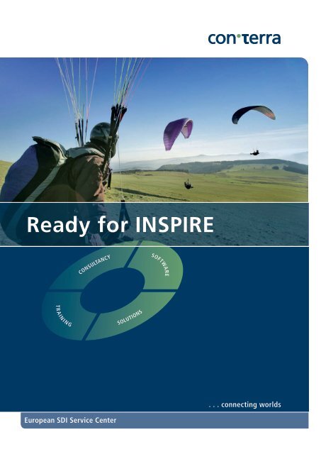
<strong>Ready</strong> <strong>for</strong> <strong>INSPIRE</strong>ConsultancySOFTWARET r ai ni n gSolutions. . . <strong>con</strong>necting worldsEuropean SDI Service Center
Increasing Added Valuewith <strong>INSPIRE</strong> and SDI Components<strong>INSPIRE</strong>In 2007, the European Commission issued directive2007/2/EC, which deals with the establishmentof an “Infrastructure <strong>for</strong> Spatial In<strong>for</strong>mationin Europe“, or <strong>INSPIRE</strong>, <strong>for</strong> short. Its purpose isto create a uni<strong>for</strong>m spatial database <strong>for</strong> Europe,that can be accessed via geoservices. To thisend, member states are obligated to provide, instages, interoperable, environmentally relevantspatial data, along with the attendant metain<strong>for</strong>mation.The aim is to simplify the cross-borderutilisation of spatial data in Europe and to createa basis <strong>for</strong> political decision making in Europe.T r ai ni n gConsultancySolutionsSOFTWARE<strong>INSPIRE</strong> has gone on to develop over and beyondits original purpose into an integral component ofe-government, with the positive effect that administrativeprocesses are becoming simpler, more efficient andcloser to the public. Above all, <strong>INSPIRE</strong> supports theminimisation of transactional costs associated withthe provision, refinement and use of spatial data, whichwill lead to a <strong>con</strong>siderably more intensive use of spatialin<strong>for</strong>mation, the volume of which has grown extremelyrapidly in recent years.<strong>con</strong> <strong>terra</strong> has played a central role in developing <strong>INSPIRE</strong>,and it is one of Europe’s leading suppliers of <strong>INSPIRE</strong>specifictechnologies and services. The company seesitself as a European SDI Service Centre and pursues thephilosophy that legal obligation should not be viewed inisolation, but that <strong>INSPIRE</strong> and SDI components shouldbe integrated beneficially within value chains, thus maximisingtheir added value.Consultancy – customer-oriented,competent and holisticGovernment bodies to which <strong>INSPIRE</strong> is addressed arefaced with the challenge of identifying and implementingobligatory <strong>INSPIRE</strong> requirements. To this end, <strong>con</strong> <strong>terra</strong>has developed a special <strong>con</strong>sultancy package to supportcustomers in this process.<strong>INSPIRE</strong> Quick Check & ImplementationRecommendations• Determination of customer-specific <strong>INSPIRE</strong> requirementsand identification of areas in which action isneeded, based on a gap analysis,• Outline technical <strong>con</strong>cept of the necessary <strong>INSPIRE</strong>components taking into account IT, organisationaland business framework <strong>con</strong>ditions.Technology and Architecture Consultancy• Customer-specific solution design in an <strong>INSPIRE</strong> orSDI environment (e.g. securing geoservices, setting upe-commerce solutions, and trans<strong>for</strong>ming data).Strategic Consultancy• Support in the area of strategic decision makingprocesses, e.g. in the development of SDI roadmaps,project design or setting up coordination and organisationalunits.
Software – high per<strong>for</strong>mance,scalable and <strong>INSPIRE</strong>-compliant<strong>con</strong> <strong>terra</strong> supplies comprehensive, highly scalable andfuture-proof tools <strong>for</strong> use in the field of SDI and <strong>INSPIRE</strong>.FME, ArcGIS and sdi.suite technologies support the userin:• Trans<strong>for</strong>ming existing spatial datasets into given<strong>INSPIRE</strong> data structures,• Publishing homogenised spatial data via <strong>INSPIRE</strong>services,• Securing quality requirements <strong>for</strong> services,• Implementing access-protection and e-commercerequirements.logic and functions to FME technology, which supportsand <strong>con</strong>siderably simplifies the mapping process.• Template workbenches <strong>for</strong> the available annex themes,including an <strong>INSPIRE</strong> tutorial with practical referencemapping,• Direct access to the <strong>INSPIRE</strong> specification as well asannex descriptions from within the FME Workbench,• More than 100 additional <strong>INSPIRE</strong> trans<strong>for</strong>mers supportingschema mapping and <strong>INSPIRE</strong>-specific functions,• Addition of <strong>INSPIRE</strong>-specific detailed in<strong>for</strong>mation to theFME Workbench help file,• Optimised <strong>for</strong> filling the ArcGIS <strong>for</strong> <strong>INSPIRE</strong> geodatabase.<strong>INSPIRE</strong> Solution Pack <strong>for</strong> FMEIn many cases, fulfilling the <strong>INSPIRE</strong> guideline necessitatesper<strong>for</strong>ming data trans<strong>for</strong>mations and schema mappingfrom existing datasets or databases into <strong>INSPIRE</strong> datamodels. Now, <strong>con</strong> <strong>terra</strong> has developed the <strong>INSPIRE</strong>Solution Pack <strong>for</strong> FME, to simplify the generally complexprocess of schema mapping. This adds <strong>INSPIRE</strong>-specificArcGIS <strong>for</strong> <strong>INSPIRE</strong>ArcGIS <strong>for</strong> <strong>INSPIRE</strong> covers the core <strong>INSPIRE</strong> requirements,by adding <strong>INSPIRE</strong> view services, download services,discovery services and <strong>INSPIRE</strong> data models to the ArcGISbase technology. ArcGIS <strong>for</strong> <strong>INSPIRE</strong> supports the rapidTechnologies that support an optimum workflow<strong>INSPIRE</strong> Solution Pack <strong>for</strong> FME ArcGIS <strong>for</strong> <strong>INSPIRE</strong> sdi.suiteGeoportalETLEuropean SDIInternal In<strong>for</strong>mation-/Data Management Systems<strong>INSPIRE</strong> Data Model & ServicesUser• <strong>INSPIRE</strong> Solution Pack <strong>for</strong> FME processes existing data into ArcGIS <strong>for</strong> <strong>INSPIRE</strong> data models• ArcGIS <strong>for</strong> <strong>INSPIRE</strong> is the central component with which data is published• sdi.suite offers additional functions <strong>for</strong> special tasks
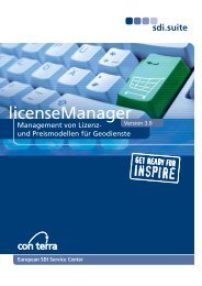
Solutions – individual, integratedand process-orientedand timely <strong>con</strong>struction of <strong>INSPIRE</strong>-compliant services,without having to abandon established workflows.• Creation and maintenance of <strong>INSPIRE</strong>-compliant spatialdata and metadata in ArcGIS Desktop using <strong>INSPIRE</strong>geodatabase templates and an <strong>INSPIRE</strong> metadataeditor,• Publication of <strong>INSPIRE</strong>-compliant view and downloadservices using <strong>INSPIRE</strong> Service Extension <strong>for</strong> ArcGISServer,• Support <strong>for</strong> the process of providing existing datathrough <strong>INSPIRE</strong> geodatabase templates (e.g. <strong>INSPIRE</strong>Solution Pack <strong>for</strong> FME),• Cataloguing, indexing and publishing <strong>INSPIRE</strong>compliantmetadata using the open source-licensedEsri Geoportal Server and its <strong>INSPIRE</strong>-compliantdiscovery services.<strong>INSPIRE</strong> places new challenges on public administrations.The additional data preparation and datarelease requirements often necessitate new, modifiedtechnologies. The best solution is oriented towards theobligations that have to be fulfilled in accordance with<strong>INSPIRE</strong>, the structure of the organisation, establishedworkflows, responsibilities, system environment andother aspects which need to be taken into <strong>con</strong>siderationwhen an efficient spatial data management system iscreated.Individual requirements necessitate individual solutions:these can range from the addition of matched componentsto existing systems to a comprehensive, all-roundsolution. This is exactly where <strong>con</strong> <strong>terra</strong> provides itssupport, based on its many years of experience in therealisation of customer-specific solutions in Europe.sdi.suiteBeyond the publication of homogenised spatial data andmetadata, <strong>INSPIRE</strong> also regulates further aspects of theestablishment of a European SDI, <strong>for</strong> example, in the fieldsof data exchange, access <strong>con</strong>trol, licensing, monitoringand reporting. The practice-proven sdi.suite componentscomprise fitting solutions which are optimised <strong>for</strong> interactingwith ArcGIS <strong>for</strong> <strong>INSPIRE</strong>.• securityManager: offers user management andsingle sign-on functions as well as security of <strong>INSPIRE</strong>data, services, resources and extended logging,• licenseManager: <strong>for</strong> licensing and e-commerce with<strong>INSPIRE</strong> data, services and applications (supports the<strong>INSPIRE</strong> Basic License and Specific License) includinginvoicing functions,• serviceMonitor: monitors service quality in accordancewith the specifications of <strong>INSPIRE</strong> networkservices, and extensive use logging to support <strong>INSPIRE</strong>reporting.Training – systematic, qualifiedand practicalFor <strong>con</strong> <strong>terra</strong>, training success means systematically puttinglearned material into practice. The range of training opportunitiesoffered covers both the teaching of fundamentalSDI and <strong>INSPIRE</strong> knowledge and specific product-relatedand thematic training units.Our qualified and certified trainers possess many years ofproject experience in the field of designing and buildingspatial data infrastructures. Course material is regularlymodified and optimised in close cooperation with participantsand <strong>con</strong> <strong>terra</strong>’s SDI experts, <strong>for</strong> example, from the<strong>INSPIRE</strong> drafting teams.In addition to standard training <strong>con</strong>ducted at seven sitesthroughout Germany, as well as online training, <strong>con</strong> <strong>terra</strong>offers, the chance to benefit from individually <strong>con</strong>figuredtraining, even on-site, if so desired.
<strong>Ready</strong> <strong>for</strong> <strong>INSPIRE</strong>Future-proof product range<strong>con</strong> <strong>terra</strong> has had a <strong>con</strong>siderable impact on the developmentswith <strong>INSPIRE</strong> in recent years and is one of theleading solution providers in Europe in the field ofSDI & <strong>INSPIRE</strong>.In its alliance with Esri Germany and as a close cooperationpartner of Safe Software, <strong>con</strong> <strong>terra</strong> has direct accessto the world’s leading technology providers in the fieldsof GIS and Spatial ETL.For <strong>con</strong> <strong>terra</strong>, “<strong>Ready</strong> <strong>for</strong> <strong>INSPIRE</strong>“ is a complete, futureproofproduct and service package, which minimises theexpense of implementing <strong>INSPIRE</strong>. As a European SDIService Center, <strong>con</strong> <strong>terra</strong> supports throughout all phasesof the <strong>INSPIRE</strong> implementation process. Special focus isplaced on the beneficial integration of <strong>INSPIRE</strong> componentsin customers’ value chains.Selected references• EUROSTAT, <strong>INSPIRE</strong>@EC: <strong>con</strong>ceptual design andimplementation of the internal geoportal and <strong>INSPIRE</strong>compliantservices <strong>for</strong> the European Commission‘sSpatial Data Infrastructure• State Geodetic Administration, Croatia: support in the<strong>con</strong>ceptual design and implementation of the SGAGeoportal• Centre <strong>for</strong> Ecology and Hydrology, UK: support in theestablishment of the CEH In<strong>for</strong>mation Gateway• German Federal Environment Agency in Berlin: plan <strong>for</strong>modifying and orienting the agency’s SDI in line with<strong>INSPIRE</strong>• Federal Maritime and Hydrographic Agency, Germany:<strong>con</strong>ceptual design and implementation of the agency’sgeoportal• GDI-DE Architecture: support <strong>for</strong> the GDI-DE Architectureworking group in compiling a draft architecture<strong>for</strong> the GDI-DE• In<strong>for</strong>mation and Technology North Rhine-Westphalia:<strong>con</strong>ceptual design and implementation of theagency‘s geoportal• Surveying Agency of Saxony: <strong>con</strong>ceptual study <strong>for</strong> theestablishment of central components of the Saxony SDI• City of Cologne: <strong>con</strong>ceptual design and implementationof the geoportal <strong>for</strong> the City of Cologne• Rural District of Oberhavel: <strong>con</strong>ceptual design andimplementation of an <strong>INSPIRE</strong>-infrastructure node <strong>for</strong>the Rural District of Oberhavel
<strong>con</strong> <strong>terra</strong> – your partner <strong>for</strong> Geo-IT solutions<strong>con</strong> <strong>terra</strong> offers <strong>con</strong>sultancy, products, training andindividual Geo-IT solutions at a high level. Years ofexperience, industry expertise and innovative power<strong>for</strong>m the basis of the company’s daily activities. <strong>con</strong> <strong>terra</strong>attaches great importance to the cost-effectivenessand sustainability of its solutions. For this reason,<strong>con</strong> <strong>terra</strong> believes in supporting efficient work processes,maximum interoperability, and international standards.The partner-based relationships with customers havealways been an essential factor.By participating in R&D projects and standardisationprocedures and taking an active role in committeesand working groups <strong>for</strong> the GDI-DE, OGC, and <strong>INSPIRE</strong>etc., <strong>con</strong> <strong>terra</strong> is able to detect future trends at an earlystage, which allows <strong>con</strong> <strong>terra</strong> to exercise an impactearly on, and to be involved in the planning andrealisation of IT solutions.The <strong>con</strong>ceptual design and implementation of spatialdata infrastructures and web portals are one of<strong>con</strong> <strong>terra</strong>’s main fields of activity. The company hasmany positive references on both national and internationallevels.Gesellschaft für AngewandteIn<strong>for</strong>mationstechnologie mbHMartin-Luther-King-Weg 24, 48155 Muenster, GermanyPhone +49 251 74745 0, Fax +49 251 74745 2111<strong>con</strong><strong>terra</strong>@<strong>con</strong><strong>terra</strong>.de, www.<strong>con</strong><strong>terra</strong>.de