Investigating the use of Landsat thematic mapper data for estimation ...
Investigating the use of Landsat thematic mapper data for estimation ...
Investigating the use of Landsat thematic mapper data for estimation ...

You also want an ePaper? Increase the reach of your titles
YUMPU automatically turns print PDFs into web optimized ePapers that Google loves.
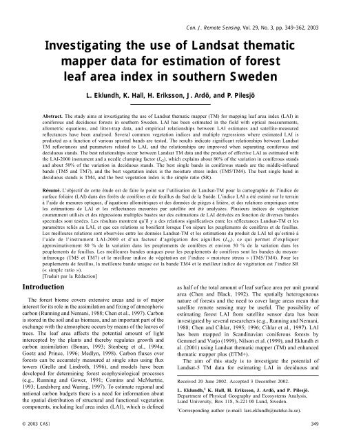
Can. J. Remote Sensing, Vol. 29, No. 3, pp. 349–362, 2003<strong>Investigating</strong> <strong>the</strong> <strong>use</strong> <strong>of</strong> <strong>Landsat</strong> <strong>the</strong>matic<strong>mapper</strong> <strong>data</strong> <strong>for</strong> <strong>estimation</strong> <strong>of</strong> <strong>for</strong>estleaf area index in sou<strong>the</strong>rn SwedenL. Eklundh, K. Hall, H. Eriksson, J. Ardö, and P. PilesjöAbstract. The study aims at investigating <strong>the</strong> <strong>use</strong> <strong>of</strong> <strong>Landsat</strong> <strong>the</strong>matic <strong>mapper</strong> (TM) <strong>for</strong> mapping leaf area index (LAI) inconiferous and deciduous <strong>for</strong>ests in sou<strong>the</strong>rn Sweden. LAI has been estimated in <strong>the</strong> field with optical measurements,allometric equations, and litter-trap <strong>data</strong>, and empirical relationships between LAI estimates and satellite-measuredreflectances have been analysed. Several common vegetation indices and multiple regressions where estimated LAI ispredicted as a function <strong>of</strong> various spectral bands are tested. The results indicate significant relationships between <strong>Landsat</strong>TM reflectances and parameters related to LAI, and <strong>the</strong> relationships are improved when separating coniferous anddeciduous stands. The best relationships occur between <strong>Landsat</strong> TM <strong>data</strong> and <strong>the</strong> product <strong>of</strong> effective LAI as estimated with<strong>the</strong> LAI-2000 instrument and a needle clumping factor (L G ), which explains about 80% <strong>of</strong> <strong>the</strong> variation in coniferous standsand about 50% <strong>of</strong> <strong>the</strong> variation in deciduous stands. The best single bands in coniferous stands are <strong>the</strong> middle-infraredbands (TM5 and TM7), and <strong>the</strong> best vegetation index is <strong>the</strong> moisture stress index (TM5/TM4). The best single band indeciduous stands is TM4, and <strong>the</strong> best vegetation index is <strong>the</strong> simple ratio (SR).Résumé. L’objectif de cette étude est de faire le point sur l’utilisation de <strong>Landsat</strong>-TM pour la cartographie de l’indice desurface foliaire (LAI) dans des <strong>for</strong>êts de conifères et de feuillus du Sud de la Suède. L’indice LAI a été estimé sur le terrainà l’aide de mesures optiques, d’équations allométriques et des données de pièges à litière, et des relations empiriques entreles <strong>estimation</strong>s de LAI et les réflectances mesurées par satellite ont été analysées. Plusieurs indices de végétationcouramment utilisés et des régressions multiples basées sur des <strong>estimation</strong>s de LAI dérivées en fonction de diverses bandesspectrales sont testées. Les résultats montrent qu’il y a des relations significatives entre les réflectances <strong>Landsat</strong>-TM et lesparamètres reliés au LAI, et que ces relations se bonifient lorsque l’on sépare les peuplements de conifères et de feuillus.Les meilleures relations sont observées entre les données <strong>Landsat</strong>-TM et les <strong>estimation</strong>s du produit de LAI tel qu’estimé àl’aide de l’instrument LAI-2000 et d’un facteur d’agrégation des aiguilles (L G ), ce qui permet d’expliquerapproximativement 80 % de la variation dans les peuplements de conifères et environ 50 % de la variation dans lespeuplements de feuillus. Les meilleures bandes uniques pour les peuplements de conifères sont les bandes du moyeninfrarouge(TM5 et TM7) et le meilleur indice de végétation est l’indice « moisture stress » (TM5/TM4). Pour lespeuplements de feuillus, la meilleure bande unique est la bande TM4 et le meilleur indice de végétation est l’indice SR(« simple ratio »).[Traduit par la Rédaction]Introduction362The <strong>for</strong>est biome covers extensive areas and is <strong>of</strong> majorinterest <strong>for</strong> its role in <strong>the</strong> assimilation and fixing <strong>of</strong> atmosphericcarbon (Running and Nemani, 1988; Chen et al., 1997). Carbonis stored in <strong>the</strong> soil and as biomass, and an important part <strong>of</strong> <strong>the</strong>exchange with <strong>the</strong> atmosphere occurs by means <strong>of</strong> <strong>the</strong> leaves <strong>of</strong>trees. The leaf area affects <strong>the</strong> potential amount <strong>of</strong> lightintercepted by <strong>the</strong> plants and <strong>the</strong>reby regulates growth andcarbon assimilation (Bonan, 1993; Stenberg et al., 1994a;Goetz and Prince, 1996; Medlyn, 1998). Carbon fluxes over<strong>for</strong>ests can be accurately measured at single sites using fluxtowers (Grelle and Lindroth, 1996), and models have beendeveloped <strong>for</strong> determining <strong>for</strong>est ecophysiological processes(e.g., Running and Gower, 1991; Comins and McMurtrie,1993; Landsberg and Waring, 1997). To estimate regional andnational carbon budgets <strong>the</strong>re is a need <strong>for</strong> in<strong>for</strong>mation about<strong>the</strong> spatial distribution <strong>of</strong> structural and functional vegetationcomponents, including leaf area index (LAI), which is definedas half <strong>of</strong> <strong>the</strong> total amount <strong>of</strong> leaf surface area per unit groundarea (Chen and Black, 1992). The spatially heterogeneousnature <strong>of</strong> <strong>for</strong>ests and <strong>the</strong> need to cover large areas mean thatsatellite remote sensing may be <strong>use</strong>ful. The possibility <strong>of</strong>estimating <strong>for</strong>est LAI from satellite sensor <strong>data</strong> has beeninvestigated by several researchers (e.g., Running and Nemani,1988; Chen and Cihlar, 1995; 1996; Cihlar et al., 1997). LAIhas been mapped in Scandinavian coniferous <strong>for</strong>ests byGemmel and Varjo (1999), Nilson et al. (1999), and Eklundh etal. (2001) using <strong>Landsat</strong> <strong>the</strong>matic <strong>mapper</strong> (TM) and enhanced<strong>the</strong>matic <strong>mapper</strong> plus (ETM+).The aim <strong>of</strong> this study is to investigate <strong>the</strong> potential <strong>of</strong><strong>Landsat</strong>-5 TM <strong>data</strong> <strong>for</strong> estimating LAI in deciduous andReceived 20 June 2002. Accepted 3 December 2002.L. Eklundh, 1 K. Hall, H. Eriksson, J. Ardö, and P. Pilesjö.Department <strong>of</strong> Physical Geography and Ecosystems Analysis,Lund University, Box 118, S-221 00 Lund, Sweden.1 Corresponding author (e-mail: lars.eklundh@nateko.lu.se).© 2003 CASI 349
Vol. 29, No. 3, June/juin 2003coniferous <strong>for</strong>ests in sou<strong>the</strong>rn Sweden. Various estimates <strong>of</strong>LAI have been made in coniferous and deciduous <strong>for</strong>est stands,and <strong>the</strong> statistical relationships with satellite-derivedreflectances are investigated. The current study is made within<strong>the</strong> framework <strong>of</strong> a research programme concerning <strong>the</strong> carbonbalance in Swedish <strong>for</strong>ests, in which <strong>the</strong>re is a need <strong>for</strong> largeareacollection <strong>of</strong> in<strong>for</strong>mation on coniferous and deciduous<strong>for</strong>est LAI.BackgroundRemotely sensed <strong>data</strong> and leaf area index (LAI)Reflected radiation from homogeneous vegetation canopiesis related to LAI (Tucker and Sellers, 1986). Relationshipsbetween LAI estimates and vegetation indices such as <strong>the</strong>normalized difference vegetation index (NDVI) derived fromsatellite sensor <strong>data</strong> have been observed in several studies (e.g.,Spanner et al., 1990a; 1990b; Curran et al., 1992; Nemani et al.,1993; Chen and Cihlar, 1996; Turner et al., 1999; Boyd et al.,2000; Gupta et al., 2000, Chen et al., 2002). The relationshipsare affected by various factors, including canopy closure,understorey vegetation and soil reflectance (Spanner et al.,1990a), and variations in shadow patterns (Peddle et al., 1999).Relationships between LAI and middle infrared (MIR)reflectance have been found <strong>for</strong> boreal <strong>for</strong>ests using <strong>Landsat</strong>TM and National Oceanic and Atmospheric Administration(NOAA) advanced very high resolution radiometer (AVHRR)<strong>data</strong> (Nemani et al., 1993; Nilson et al., 1999; Boyd et al., 2000;Brown et al., 2000; Eklundh et al., 2001). Reflectances in <strong>the</strong>MIR wavelengths decrease with increased leaf area, as aconsequence <strong>of</strong> increased absorption due to water in <strong>the</strong>canopies. Boyd et al. (2000) <strong>for</strong>mulated a variation <strong>of</strong> <strong>the</strong>NDVI, named VI3, in which <strong>the</strong> red band <strong>of</strong> <strong>the</strong> NDVI wasreplaced with <strong>the</strong> MIR band <strong>of</strong> <strong>the</strong> AVHRR sensor. To account<strong>for</strong> differences in understorey and canopy closure, Nemani etal. (1993) applied a different type <strong>of</strong> MIR modification to <strong>the</strong>NDVI. The modification was also applied to <strong>the</strong> simple ratio(SR = NIR/red, where NIR is near-infrared reflectance) byBrown et al. (2000). MIR in<strong>for</strong>mation is also <strong>use</strong>d in <strong>the</strong>moisture stress index (MSI = TM5/TM4, where TM4 and TM5are reflectances in TM bands 4 and 5), which has been <strong>use</strong>d <strong>for</strong>detection and mapping <strong>of</strong> <strong>for</strong>est decline and defoliation, both indeciduous and coniferous <strong>for</strong>ests (Vogelmann, 1990). The MSIis thought to measure not one but several, largely inseparable,vegetation properties such as biomass, damage, and watercontent. The inverse relationship between MIR reflectance andbiomass (Ardö, 1992), canopy closure (Butera, 1986), andvegetation density (Horler and Ahern, 1986) indicates that <strong>the</strong>MSI may also be <strong>use</strong>ful <strong>for</strong> estimating LAI.We have quoted several studies relating remotely sensed <strong>data</strong>with LAI; however, it should be pointed out that <strong>the</strong>se are <strong>of</strong>tenbased on different methods <strong>for</strong> estimating LAI in <strong>the</strong> field thatmay not always be comparable. Some <strong>of</strong> <strong>the</strong>se methods arementioned in <strong>the</strong> next section.Field-based LAI-<strong>estimation</strong> techniquesEstimating LAI using destructive field measurements islabour intensive. Empirical relationships between needlebiomass and stand parameters have been established <strong>for</strong> pine(Pinus sylvestris) and spruce (Picea abies) in Sweden(Marklund, 1988) but are not generally available <strong>for</strong> deciduoustrees. For deciduous <strong>for</strong>est stands it is possible to capture <strong>the</strong>leaves in litter traps (Fassnacht et al., 1997) and utilizeempirical relationships between dry weight and leaf area toestimate <strong>the</strong> total stand leaf area.Indirect LAI <strong>estimation</strong> based on light-interceptionmeasurements can also be <strong>use</strong>d. This method is nondestructiveand considerably more rapid and can be <strong>use</strong>d <strong>for</strong> following <strong>the</strong>phenological development throughout <strong>the</strong> season. Thetechnique is based on <strong>the</strong> relationship between transmitted lightand LAI. Simultaneous measurements <strong>of</strong> light are made belowand above <strong>the</strong> canopy, and a relationship based on Millers<strong>the</strong>orem can be <strong>use</strong>d (Miller, 1967; Welles, 1990; Chen andBlack, 1991):Leπ/2∫= 2 −ln[ T( θ)]cos( θ) sin( θ)dθ, (1)0where L e is an estimate <strong>of</strong> <strong>the</strong> effective LAI (<strong>the</strong> product <strong>of</strong> LAIand a foliage clumping index; Black et al., 1991), T(θ) is<strong>the</strong>transmitted non-intercepted radiation, and θ is <strong>the</strong> view zenithangle (<strong>the</strong> expression assumes that transmission is independent<strong>of</strong> azimuth). Measurements based on this principle have beenmade in boreal <strong>for</strong>ests by several authors (Stenberg et al.,1994b; Smolander and Stenberg, 1996; Chen et al., 1997;Kucharik et al., 1998).The effective LAI is only indirectly related to true LAIbeca<strong>use</strong> <strong>of</strong> various levels <strong>of</strong> foliage clumping in <strong>the</strong> stand. Inconifers, needles are clustered, <strong>for</strong>ming shoots, ra<strong>the</strong>r thanrandomly distributed in <strong>the</strong> canopy (Gower and Norman, 1991;Stenberg et al., 1994b). It is recommended that <strong>the</strong> L e values bemultiplied by a conversion factor to account <strong>for</strong> this effect(Gower and Norman, 1991; LI-COR, Inc., 1992). In bothdeciduous and coniferous stands foliage clumping due tobranches and irregular tree distribution also occurs (Nilson,1971; Ross, 1981; Chen et al., 1997). Light transmissionmeasurements are not only affected by photosyn<strong>the</strong>ticallyactive biomass, but also by stems, branches, and dead tissue in<strong>the</strong> canopy. In dense canopies, however, most <strong>of</strong> <strong>the</strong> stems,branches, and dead tissue are shaded by <strong>the</strong> live needles, and<strong>the</strong> influence <strong>of</strong> this material on <strong>the</strong> light transmissionmeasurements may be limited (Gower et al., 1999). Methods<strong>for</strong> converting from L e to LAI have been developed by Chen(1996) and Kucharik et al. (1998) (see <strong>the</strong> Methodologysection).350 © 2003 CASI
Canadian Journal <strong>of</strong> Remote Sensing / Journal canadien de télédétectionStudy sites and <strong>data</strong>Study sitesThe study area is located in Skåne, sou<strong>the</strong>rn Sweden, atabout 55°45′N, 13°30′E, where 67 <strong>for</strong>est stands (coniferous,deciduous, and mixed) distributed over an area <strong>of</strong>approximately 60 × 60 km were sampled during <strong>the</strong> growingseason <strong>of</strong> 2000. The dominant tree species in <strong>the</strong> study area areNorway spruce (Picea abies), beech (Fagus sylvatica), oak(Quercus robur), birch (Betula spp.), and ash (Fraxin<strong>use</strong>xcelsior). The ground vegetation is dominated by herbs andgrasses in <strong>the</strong> deciduous stands, very sparse mosses in <strong>the</strong>spruce stands, and sparse grasses in <strong>the</strong> pine stands.Remotely sensed <strong>data</strong>Only one fairly cloud-free <strong>Landsat</strong> image could be identified<strong>for</strong> <strong>the</strong> growing season <strong>of</strong> 2000, recorded on June 10. This<strong>Landsat</strong>-5 image was geometrically corrected against a digitaltopographic map at a scale <strong>of</strong> 1 : 50 000, with a standard error<strong>of</strong> about one pixel (30 m). A radiometric correction andcomputation <strong>of</strong> at-satellite reflectances was done according to<strong>the</strong> methodology in Markham and Barker (1987), and withcalibration coefficients from <strong>the</strong> <strong>Landsat</strong> <strong>data</strong> header <strong>of</strong> <strong>the</strong>image. The study area is generally flat, and no topographiccorrection was made to <strong>the</strong> <strong>data</strong>. Bandwidths <strong>of</strong> <strong>the</strong> TM sensorare given in Kramer (1996). Mean at-satellite spectralreflectances <strong>for</strong> <strong>the</strong> reflective channels <strong>of</strong> <strong>the</strong> TM sensor werecomputed as averages <strong>of</strong> 3×3pixelscentred over <strong>the</strong> studied<strong>for</strong>est plots. The averages were <strong>the</strong>n adjusted <strong>for</strong> atmosphericeffects using <strong>the</strong> 6S radiative transfer model (Vermote et al.,1997). Values <strong>of</strong> water vapour, ozone, and optical thicknesswere obtained from <strong>the</strong> Swedish Meteorological andHydrological Institute (SMHI). Optical thickness wascomputed from pyrheliometer <strong>data</strong> from Lund, which is locatedat a maximum distance <strong>of</strong> about 50 km from <strong>the</strong> field area. Amodified computer implementation <strong>of</strong> <strong>the</strong> 6S code was <strong>use</strong>d(Antunes, 2001). Atmospheric input <strong>data</strong> are given in Table 1.Parts <strong>of</strong> <strong>the</strong> satellite scene were affected by clouds and cloudshadows, but plots in <strong>the</strong>se areas were eliminated from <strong>the</strong>analysis.MethodologyOptically based <strong>estimation</strong> <strong>of</strong> LAIThe main <strong>data</strong> set <strong>for</strong> comparing optically based LAIestimates with <strong>Landsat</strong> TM <strong>data</strong> was collected during a fieldcampaign. Sampling was carried out during <strong>the</strong> peak <strong>of</strong> <strong>the</strong>growing period <strong>of</strong> 2000 (late July) in all 67 stands. All plotswere 100 × 100 m, and about 75 evenly distributed LAI-2000measurements were made in each plot. In addition, basic standparameters, such as tree density, species distribution, treeheight, breast-height diameter (D bh ), crown radius, and crownheight, were sampled in subplots (100–400 m 2 depending on<strong>the</strong> tree density) in <strong>the</strong> centre <strong>of</strong> each plot. A summary <strong>of</strong> <strong>the</strong><strong>for</strong>est stand <strong>data</strong> is given in Table 2.Effective LAI was estimated using <strong>the</strong> LI-COR, Inc. LAI-2000 instrument and <strong>the</strong> C2000 processing s<strong>of</strong>tware (Welles,1990; LI-COR, Inc., 1992). Optical measurements were carriedout with two instruments, one with an open-sky view, and onebelow <strong>the</strong> canopy. Three methods were <strong>use</strong>d to estimate onesidedLAI (L) from <strong>the</strong>se measurements. The first method is asimple correction <strong>for</strong> needle clumping according to Gower andNorman (1991):LTable 1. Parameters <strong>use</strong>d <strong>for</strong> <strong>the</strong> 6Satmospheric correction.Water content 1.96 g·cm –2Ozone content0.30 cm·atmVisibility31.9 kmOptical thickness at 550 nm 0.174Aerosol modelMaritimeSolar zenith angle 36.1°Solar azimuth angle 147.0°= L γ (2)G e ewhere L G is one-sided LAI 2 , L e is <strong>the</strong> effective LAI as estimatedby <strong>the</strong> LAI-2000 using a discrete approximation to Equation(1), and γ e is <strong>the</strong> ratio <strong>of</strong> needle area to shoot area accounting<strong>for</strong> <strong>the</strong> fact that needles are clumped in conifer shoots. Forbroadleaf species, L G equals L e .Table 2. Statistics <strong>for</strong> <strong>the</strong> analysed plots.Deciduous Coniferous Mixed AllNo. <strong>of</strong> plots 42 19 6 67Tree density (trees·ha –1 ) 1005 (95–6000) 840 (64–1601) 700 (254–1400) 928 (64–6000)Breast-height diameter, D bh (cm) 25 (7–58) 26 (18–39) 22 (12–36) 25 (7–58)Tree height (m) 17 (5–35) 21 (15–27) 16 (6–28) 18 (5–35)Crown height (m) 10.5 (2.4–25.1) 9.3 (3.8–13.5) 8.5 (3.7–19.7) 10.0 (2.4–25.1)Crown diameter (m) 5.7 (1.3–11.5) 3.6 (2.6–4.4) 3.7 (2.8–5.7) 5.0 (1.3–11.5)Note: The values in <strong>the</strong> table are averages, with ranges in paren<strong>the</strong>ses.2 Symbols <strong>use</strong>d in Equations (2)–(4) differ somewhat from those <strong>use</strong>d in <strong>the</strong> original articles (see also Table 3).© 2003 CASI 351
Vol. 29, No. 3, June/juin 2003The second method follows Chen (1996) and estimates <strong>the</strong>one-sided LAI <strong>of</strong> <strong>the</strong> canopy asLC( 1 − α)L=eγΩeewhere L C is one-sided LAI, α is <strong>the</strong> ratio <strong>of</strong> woody area to totalplant area (W/L t ), and Ω e is <strong>the</strong> element clumping indexquantifying <strong>the</strong> effect <strong>of</strong> foliage clumping at scales larger than<strong>the</strong> shoot (i.e., branches and trees).The third method follows Kucharik et al. (1998). LAI isestimated with <strong>the</strong> following equation:LK{ Le( θ) − δ( fL) B[ Ω=b( 35)] γe}− SΩ ( 35)ewhere L K is one-sided LAI; L e (θ) is <strong>the</strong> effective LAI asmeasured by <strong>the</strong> LAI-2000 at angle θ; δ(f L ) is <strong>the</strong> fraction <strong>of</strong> <strong>the</strong>branch hemi-surface area index that is exposed to gaps, and<strong>the</strong>re<strong>for</strong>e intercepts light in <strong>the</strong> canopy; B is <strong>the</strong> hemi-surfacearea index <strong>of</strong> branches; Ω b (35) is <strong>the</strong> nonrandomness correctionfactor <strong>for</strong> branches obtained with a mean zenith view angle <strong>of</strong>35° (approximately <strong>the</strong> average LAI-2000 view angle 3 ); Ω e (35)is <strong>the</strong> nonrandomness correction factor <strong>for</strong> shoots obtained witha mean zenith view angle <strong>of</strong> 35°; and S is <strong>the</strong> hemi-surface areaindex <strong>of</strong> tree stems.Data on needle-to-shoot relationships <strong>for</strong> pine and spruce(γ e ) were taken from Stenberg (1996), and <strong>data</strong> on branch areaindex (B) were taken from Nilson (1999). For mixed plots, γ ewas weighted according to <strong>the</strong> volume <strong>of</strong> tree crowns (crownheight × crown area × number <strong>of</strong> crowns) <strong>of</strong> different species.The two latter correction methods (Equations (3) and (4)) relyon <strong>data</strong> from o<strong>the</strong>r optical instruments <strong>for</strong> assessing <strong>the</strong>clumping effects, such as <strong>the</strong> tracing radiation and architecture<strong>of</strong> canopies (TRAC) (Chen and Cihlar, 1995), or <strong>the</strong> multibandvegetation imager (MVI) (Kucharik et al., 1998). Since suchmeasurements were not available, a simplified approach <strong>for</strong>assessing <strong>the</strong> clumping index was <strong>use</strong>d according to Kuchariket al. (1999). The method involves <strong>the</strong> <strong>use</strong> <strong>of</strong> LAI-2000(3)(4)readings from <strong>the</strong> central optical ring, looking towards <strong>the</strong>zenith, toge<strong>the</strong>r with basic stand <strong>data</strong> such as stem density andstem diameter.Allometric relationships <strong>for</strong> estimating LAILeaf area index was estimated from allometric relationshipsin pine and spruce stands. Needle biomass was estimated frommultiple regressions based on stem diameter, tree height, crownheight, and geographical location (pine only) (Marklund,1988). To convert to LAI, values on specific leaf area (SLA,area per mass <strong>of</strong> dry leaves) <strong>of</strong> 4.5 mm 2·mg –1 <strong>for</strong> spruce and7.3 mm 2·mg –1 <strong>for</strong> pine were <strong>use</strong>d (Lagergren and Lindroth,2002). Un<strong>for</strong>tunately, <strong>data</strong> on allometric relationships <strong>for</strong> <strong>the</strong>deciduous species in our study were not available.Different symbols are <strong>use</strong>d <strong>for</strong> one-sided LAI to distinguishbetween <strong>the</strong> various estimates (Table 3).Litter-fall collectionLitter fall was collected in five deciduous stands as anindependent <strong>data</strong> set <strong>for</strong> testing <strong>the</strong> various optically based LAImeasures. This process is time-consuming and <strong>the</strong>re<strong>for</strong>e couldonly be done in <strong>the</strong> stands listed in Table 4. These deciduousstands are situated within <strong>the</strong> main study area and weresampled during 2000 and 2001. The stands were selected inhomogeneous and flat areas, and with one dominating treespecies. Ten litter traps per plot were installed in 2000 inrandom locations, about 1 m above <strong>the</strong> ground. The traps arenearly circular with a diameter <strong>of</strong> about 50 cm. In 2001 <strong>the</strong>number <strong>of</strong> traps was increased to 15–20 per plot. Specific leafarea was calculated <strong>for</strong> each plot by harvesting leaves <strong>of</strong>various sizes from various heights in <strong>the</strong> canopies. The freshleaf area was measured, and <strong>the</strong> leaves were weighted afterdrying at 75°C <strong>for</strong> 24 h. Means and standard deviations <strong>of</strong> SLAare given in Table 4. To prevent disturbance and minimizereduction by decomposition (Búrques et al., 1999), <strong>the</strong> littertraps were emptied and <strong>the</strong> leaves were dried and weighed atseveral occasions during <strong>the</strong> growing seasons. The total LAIwas <strong>the</strong>n calculated through <strong>the</strong> mass <strong>of</strong> <strong>the</strong> collected leaves,<strong>the</strong> SLA, and <strong>the</strong> litter-trap areas (Fassnacht et al., 1997). TheTable 3. Symbols <strong>use</strong>d in <strong>the</strong> text <strong>for</strong> variables related to LAI.Symbol Definition ReferenceL Half <strong>the</strong> total leaf surface area per unit ground area Chen and Black, 1992L e Effective LAI, i.e., <strong>the</strong> product <strong>of</strong> L and a foliage clumping index Black et al., 1991L G L estimated by correcting L e <strong>for</strong> needle clumping in conifers; Equation (2) Gower and Norman, 1991L C L estimated by correcting L e <strong>for</strong> needle clumping, tree–branch distribution, Chen, 1996and nonleafy material; Equation (3)L K L estimated by correcting L e <strong>for</strong> needle clumping, tree–branch distribution, Kucharik et al., 1998and nonleafy material; Equation (4)L M L estimated with allometric equations in conifers Marklund, 1988;Lagergren and Lindroth, 20023 Using 35° may introduce a bias, since <strong>the</strong> weighted average gap fraction over <strong>the</strong> view field <strong>of</strong> <strong>the</strong> LAI-2000 is not equal to that at <strong>the</strong>average view angle. The bias varies with canopy characteristics, <strong>the</strong> instrument weighting <strong>of</strong> <strong>the</strong> view angles, and <strong>the</strong> discrete approximationto Equation (1).352 © 2003 CASI
Canadian Journal <strong>of</strong> Remote Sensing / Journal canadien de télédétectionresult should be regarded as <strong>the</strong> maximum LAI value <strong>of</strong> <strong>the</strong>season, since <strong>the</strong> leaf mass was summed <strong>for</strong> <strong>the</strong> whole season.Vegetation indicesVarious vegetation indices were computed from <strong>the</strong>atmospherically corrected TM sensor <strong>data</strong> <strong>for</strong> testing againstestimated in situ LAI (Table 5). In addition, multipleregressions were computed between all single wavelengthbands and <strong>the</strong> LAI estimates. The bands to be included in <strong>the</strong>final relationships were selected according to a stepwiseprocedure where only a small number <strong>of</strong> statistically significantbands were retained (Berenson et al., 1983).In <strong>the</strong> statistical testing, mostly linear relationships wereanalysed, but nonlinear models were also tested <strong>for</strong> a few <strong>of</strong> <strong>the</strong>best relationships in each category (coniferous, deciduous, etc.).Table 4. Statistics <strong>for</strong> leaf litter collection plots L1–L6.L1 L2 L4 L5 L6SpeciesAsh(Fraxinus excelsior)Oak(Quercus robur)Birch(Betula pubescens)Beech(Fagus sylvatica)Oak(Quercus robur)Plot size (m 2 ) 5 000 7 000 10 000 10 000 10 000Tree density (trees·ha –1 ) 725 417 322 88 244Crown diameter (m) 4.35 3.94 3.36 11.61 6.75Crown height (m) 5.20 4.53 6.06 13.41 6.59Specific leaf area (SLA; mm 2·mg –1 )Mean 27.6 20.8 14.8 25.3 17.4Standard deviation 2.28 1.78 0.97 1.76 1.83Table 5. Summary <strong>of</strong> vegetation indices tested in <strong>the</strong> study.Index Equation ReferenceSRTM4TM3Jordan, 1969NDVI TM4 − TM3TM4 + TM3Ro<strong>use</strong> et al., 1974SAVIOSAVITM4 − TM3(1 + L)TM4 + TM3 + L ; L was set to 0.5 Huete, 1988TM4 − TM3(1 + L)TM4 − TM3 + L ; L was set to 0.16 Rondeaux et al., 1996ARVI TM4 − RB; RB = TM3 – γ(TM1 – TM3); γ was set to 1.0TM4 + RBKaufman and Tanré, 1992GEMI2 2TM3− 0.125 2( TM4 − TM3 ) + 15 . TM4 + 0.5TM3η( 1−025 . η) −; η=1 − TM3TM4+TM3+0.5Pinty and Verstraete, 1992NDVI 4,7 TM4 − TM7TM4 + TM7NDVI c TM4 − TM3 ⎛ TM5 − TM5min⎞⎜1 −⎟; TM5 min and TM5 max are MIR valuesTM4 + TM3 ⎝ TM5max− TM5min⎠<strong>for</strong> completely closed and open canopies, respectivelyModified VI3 index fromKaufman and Remer, 1994Nemani et al., 1993RSRTM4 ⎛ TM5 TM5⎜TM3 ⎝1 − TM5−− TM5maxminmin⎞Brown et al., 2000⎟; TM5 min and TM5 max are defined as in NDVI c⎠MSITM5TM4Vogelmann, 1990© 2003 CASI 353
Vol. 29, No. 3, June/juin 2003ResultsTable 6. Correlation matrices <strong>for</strong> LAIestimates.(A) All stands (n = 63)L GL C 0.38Relationships between different LAI estimatesCorrelation coefficients (r) were computed <strong>for</strong> <strong>the</strong>relationships between <strong>the</strong> different estimates L G , L C , L K , and L M(see Table 3 <strong>for</strong> explanation <strong>of</strong> symbols) <strong>for</strong> all stands and <strong>for</strong>coniferous and deciduous stands separately (Table 6). The twoestimates L C and L K both depend on <strong>the</strong> <strong>estimation</strong> <strong>of</strong> <strong>the</strong>clumping factor Ω e using <strong>the</strong> method in Kucharik et al. (1999),and <strong>the</strong>se estimates are strongly correlated with each o<strong>the</strong>r. Theestimates L G and L M (<strong>the</strong> latter variable only exists <strong>for</strong>coniferous stands) are only weakly correlated with each o<strong>the</strong>r,and correlations with <strong>the</strong> estimates L C and L K are negative.Relationships between TM <strong>data</strong> and LAI estimatesTables 7–9 list correlation coefficients <strong>for</strong> <strong>the</strong> relationshipbetween various estimates <strong>of</strong> LAI and single band reflectanceand vegetation indices. Table 7 describes all plots (including<strong>the</strong> mixed plots <strong>of</strong> Table 2), whereas Table 8 is restricted toconiferous plots and Table 9 to deciduous plots. In all <strong>the</strong> tables<strong>the</strong> correlation patterns are similar <strong>for</strong> L K and L C . This is due to<strong>the</strong> strong influence <strong>of</strong> <strong>the</strong> clumping factor Ω e , computed in <strong>the</strong>same way <strong>for</strong> both estimates according to <strong>the</strong> method <strong>of</strong>Kucharik et al. (1999).TM4, TM5, and TM7 are significantly correlated with <strong>the</strong>LAI estimates L K and L C <strong>for</strong> all stands (Table 7). Of <strong>the</strong> 10vegetation indices analysed, seven are significantly related toL K and L C . GEMI is <strong>the</strong> index with <strong>the</strong> strongest relationship(r = –0.44). Correlations with L G are generally stronger thanthose with L K and L C . A plot <strong>of</strong> TM4 versus L G displays clearlyseparated clusters <strong>for</strong> coniferous and deciduous stands(Figure 1). The strongest correlation is with TM7 (Figure 2);L CL K 0.37 1(B) Coniferous stands (n = 17)L C –0.09L G L C L KL K –0.10 1L M 0.4 –0.46 –0.46(C) Deciduous stands (n = 40)L GL C 0.57L CL K 0.56 1Note: Correlation coefficients in bold arestatistically significant (p = 0.05).Table 7. Correlation coefficients (r) and root mean square errors(s) <strong>for</strong> linear relationships between L K , L C , L G , and <strong>Landsat</strong> TMreflectances and vegetation indices <strong>for</strong> all plots.L K L C L GBand or index r s r s r sTM1 –0.12 6.1 –0.13 4.6 –0.46 1.9TM2 –0.22 6.0 –0.24 4.5 –0.48 1.8TM3 –0.10 6.2 –0.10 4.6 –0.51 1.8TM4 –0.43 5.6 –0.44 4.2 –0.30 2.0TM5 –0.34 5.8 –0.35 4.4 –0.61 1.7TM7 –0.25 6.0 –0.26 4.2 –0.66 1.6Multiple regression –0.43 a 5.6 0.44 a 4.2 –0.66 b 1.6SR –0.26 6.0 –0.27 4.5 0.01 2.1NDVI –0.25 6.0 –0.25 4.5 0.06 2.1SAVI –0.43 5.6 –0.43 4.2 –0.25 2.0OSAVI –0.43 5.6 –0.44 4.1 –0.30 2.0ARVI –0.21 6.0 –0.21 4.6 0.12 2.1GEMI –0.44 5.6 –0.44 4.2 –0.30 2.0NDVI 4,7 –0.16 6.1 –0.16 4.6 0.31 2.0NDVI c 0.35 5.8 0.36 4.3 0.62 1.6RSR 0.33 5.8 0.34 4.4 0.61 1.7MSI 0.14 6.1 0.14 4.6 –0.44 1.9n c 63 64 67Note: Correlation coefficients in bold are statistically significant (p = 0.05).a TM4.b TM7.c Sample sizes vary due to lack <strong>of</strong> <strong>data</strong> required <strong>for</strong> <strong>the</strong> corrections insome plots.however, it is also evident <strong>for</strong> TM7 that deciduous andconiferous species <strong>for</strong>m different clusters. Of <strong>the</strong> vegetationindices, SR and NDVI per<strong>for</strong>m poorly, whereas NDVI c andRSR are <strong>the</strong> best. A plot <strong>of</strong> NDVI c versus L G is shown inFigure 3, and it displays different clusters <strong>for</strong> coniferous anddeciduous species.When restricting <strong>the</strong> analysis to coniferous stands (Table 8),no statistically significant correlation coefficients are observed<strong>for</strong> L K and L C . The visible bands (TM1–TM3), however, aresignificantly related to L M , and all bands except TM4 aresignificantly related to L G . The strongest single bandrelationships are with TM5 (Figure 4) and TM7. A logarithmicrelationship improves <strong>the</strong> correlation slightly (not significantly)compared with <strong>the</strong> linear coefficient given in Table 8. Sevenvegetation indices are significantly correlated to L G , and <strong>the</strong>seconsistently give <strong>the</strong> highest correlations <strong>for</strong> L M as well. Thestrongest correlated vegetation index is MSI (Figure 5), and <strong>the</strong>strongest overall correlation coefficient is generated with amultiple regression between L G and TM4 and TM5 (Figure 6).In deciduous <strong>for</strong>est stands (Table 9), TM3 and TM4 are <strong>the</strong>only single bands that express significant relationships with L Kand L C . Eight out <strong>of</strong> 10 indices are significantly correlated, and<strong>the</strong> strongest correlation is observed with <strong>the</strong> simple index SR.The overall strongest relationship is generated with a multipleregression <strong>of</strong> TM1, TM3, and TM4 (Figure 7).Relationships between TM <strong>data</strong> and <strong>the</strong> LAI estimates L Cand L K are fairly similar to those with L G with respect topositive and negative relationships and <strong>the</strong> number <strong>of</strong>354 © 2003 CASI
Canadian Journal <strong>of</strong> Remote Sensing / Journal canadien de télédétectionTable 8. Correlation coefficients (r) and root mean square errors (s) <strong>for</strong> linear relationships between L K , L C , L G ,L M , and <strong>Landsat</strong> TM reflectances and vegetation indices <strong>for</strong> <strong>the</strong> coniferous plots.L K L C L G L MBand or index r s r s r s r sTM1 0.06 8.86 0.05 6.67 –0.63 1.96 –0.46 1.80TM2 0.06 8.86 0.05 6.67 –0.62 1.99 –0.49 1.77TM3 0.02 8.88 0.01 6.67 –0.74 1.71 –0.49 1.77TM4 0.32 8.42 0.32 6.33 –0.12 2.53 –0.19 1.99TM5 0.21 8.68 0.20 6.54 –0.80 1.53 –0.41 1.85TM7 0.10 8.84 0.09 6.65 –0.80 1.53 –0.44 1.82Multiple regression — — — — 0.89 a 1.18 0.49 b 1.77SR 0.21 8.71 0.20 6.53 0.60 2.02 0.40 1.85NDVI 0.18 8.75 0.18 6.57 0.71 1.79 0.42 1.84SAVI 0.32 8.43 0.32 6.33 0.33 2.40 0.11 2.01OSAVI 0.32 8.42 0.32 6.32 0.17 2.51 –0.00 2.03ARVI 0.18 8.74 0.18 6.56 0.74 1.72 0.42 1.84GEMI 0.31 8.45 0.31 6.35 0.07 2.54 –0.06 2.02NDVI 4,7 0.06 8.87 0.07 6.66 0.78 1.58 0.42 1.88NDVI c –0.15 8.78 –0.14 6.61 0.80 1.51 0.43 1.83RSR –0.01 8.82 –0.00 6.67 0.75 1.68 0.44 1.81MSI 0.02 8.81 0.01 6.78 –0.86 1.28 –0.36 1.90n 17 17 19 18Note: Correlation coefficients in bold are statistically significant (p = 0.05).a TM4, TM5.b TM3.Table 9. Correlation coefficients (r) and root mean square errors(s) <strong>for</strong> linear relationships between L K , L C , L G , and <strong>Landsat</strong> TMreflectances and vegetation indices <strong>for</strong> <strong>the</strong> deciduous plots.L K L C L GBand or index r s r s r sTM1 –0.05 1.99 –0.06 1.51 –0.09 1.31TM2 –0.12 1.98 –0.11 1.50 –0.04 1.32TM3 –0.32 1.88 –0.32 1.43 –0.35 1.24TM4 0.37 1.86 0.36 1.41 0.54 1.11TM5 –0.14 1.97 –0.12 1.50 –0.16 1.30TM7 –0.10 1.98 –0.10 1.50 –0.18 1.30Multiple regression 0.65 a 1.56 0.64 a 1.19 0.72 b 0.94SR 0.51 1.71 0.50 1.31 0.66 0.98NDVI 0.50 1.72 0.49 1.32 0.62 1.03SAVI 0.42 1.81 0.41 1.34 0.58 1.07OSAVI 0.38 1.84 0.38 1.40 0.53 1.12ARVI 0.48 1.65 0.55 1.26 0.64 1.02GEMI 0.39 1.83 0.38 1.40 0.55 1.10NDVI 4,7 0.41 1.81 0.41 1.38 0.60 1.05NDVI c –0.10 1.98 –0.08 1.51 –0.12 1.31RSR 0.09 1.98 0.10 1.50 0.10 1.31MSI –0.41 1.81 –0.42 1.37 –0.62 1.22n 40 41 42Note: Correlation coefficients in bold are statistically significant (p =0.05).a TM1, TM3, TM4.b TM3, TM4, TM5.statistically significant correlation coefficients <strong>for</strong> deciduousstands. However, <strong>the</strong> correlation coefficients are consistentlylarger <strong>for</strong> L G than <strong>for</strong> <strong>the</strong> o<strong>the</strong>r estimates. Among <strong>the</strong> singlebands, TM4 is <strong>the</strong> band that is best related to L G , whereas SR isFigure 1. Relationship between L G and TM4 reflectance <strong>for</strong> all 67plots.<strong>the</strong> vegetation index that is best related to L G (Figure 8). Thestrongest overall relationship <strong>for</strong> deciduous stands is observedwhen L G is predicted with a regression equation with TM3,TM4, and TM5 (Figure 9).Six <strong>of</strong> <strong>the</strong> stands in <strong>the</strong> study belong to <strong>the</strong> class “mixed”,i.e., <strong>the</strong>y contain both broadleaf and coniferous trees. No© 2003 CASI 355
Vol. 29, No. 3, June/juin 2003Figure 2. Relationship between L G and TM7 reflectance <strong>for</strong> all 67plots.Figure 4. Relationship between L G and TM5 reflectance <strong>for</strong> <strong>the</strong>coniferous plots (n = 19).Figure 3. Relationship between L G and NDVI c <strong>for</strong> all 67 plots.separate statistics have been presented <strong>for</strong> <strong>the</strong>se few stands.When studying <strong>the</strong> proportions <strong>of</strong> broadleaf and coniferoustrees in <strong>the</strong> stands, however, it is clear that <strong>the</strong>se proportionsdetermine to which cluster <strong>the</strong> stands belong. A mixed standwith a high proportion <strong>of</strong> coniferous trees is located in <strong>the</strong>lower cluster <strong>of</strong> Figure 1, whereas a mixed stand with highproportion <strong>of</strong> deciduous trees is located in <strong>the</strong> upper cluster <strong>of</strong>Figure 1.Figure 5. Relationship between L G and MSI <strong>for</strong> <strong>the</strong> coniferousplots (n = 19).Litter-trap <strong>data</strong>Results from <strong>the</strong> litter-trap analysis are summarized inFigure 10. There is good correspondence between litter-trapLAI (L litter ) <strong>for</strong> both 2000 and 2001 (r = 0.95), and generally<strong>the</strong>re is a tendency <strong>for</strong> LAI to increase from 2000 to 2001,except in one (L1) <strong>of</strong> <strong>the</strong> five plots.356 © 2003 CASI
Canadian Journal <strong>of</strong> Remote Sensing / Journal canadien de télédétectionFigure 6. Relationship between L G and predicted values <strong>for</strong> <strong>the</strong>regression y = 5.5 + 47.1(TM4) – 92.5(TM5) <strong>for</strong> <strong>the</strong> coniferousplots (n = 19).Figure 8. Relationship between L G and SR <strong>for</strong> <strong>the</strong> deciduous plots(n = 42).Figure 7. Relationship between L K and predicted values <strong>for</strong> <strong>the</strong>regression y = 2.1 + 246(TM1) – 319(TM3) + 12(TM4) <strong>for</strong> <strong>the</strong>deciduous plots. Note <strong>the</strong> outlier generated by an abnormally highL K value (excluded from <strong>the</strong> regression) (n = 40).Observed litter-trap LAI has been compared with <strong>the</strong> opticalLAI estimates in Figure 11. In three stands, L G is lower thanL litter , and in two stands it is higher. L K and L C are lower thanFigure 9. Relationship between L G and predicted values <strong>for</strong> <strong>the</strong>regression y = 2.8 – 102(TM3) + 28(TM4) – 41(TM5) <strong>for</strong> <strong>the</strong>deciduous plots (n = 42).L litter in two stands and higher in three stands. In stand L4,which is sparse birch, L K and L C are clearly overestimated. Theroot mean squared (RMS) difference is 0.5 <strong>for</strong> L G , 2.5 <strong>for</strong> L K ,and 2.0 <strong>for</strong> L C (<strong>the</strong> latter two values exclude stand L4).© 2003 CASI 357
Vol. 29, No. 3, June/juin 2003Figure 10. Means and 95% confidence intervals <strong>for</strong> leaf littercollected during 2000 (thick lines) and 2001 (thin lines).Figure 11. Comparison <strong>of</strong> litter-fall LAI and optical LAI estimates<strong>for</strong> 2000. See Table 3 <strong>for</strong> an explanation <strong>of</strong> <strong>the</strong> four different LAIsymbols.DiscussionThis study has investigated <strong>the</strong> <strong>use</strong> <strong>of</strong> <strong>Landsat</strong> TM <strong>for</strong>estimating LAI. The presented results should be viewed with<strong>the</strong> limitations <strong>of</strong> such an empirical study in mind: <strong>the</strong> samplesize is limited due to practical considerations, and <strong>the</strong>relationships have only been tested on a single <strong>Landsat</strong> TMscene. To assess <strong>the</strong> validity <strong>of</strong> <strong>the</strong> results it is thus necessary tocompare <strong>the</strong>se results with those obtained by o<strong>the</strong>r authors.In coniferous stands <strong>the</strong> visible bands TM1–TM3 aresignificantly related to L G and L M , with a strong relationshipobserved <strong>for</strong> TM3 (Table 8). This result is corroborated byEklundh et al. (2001), Peterson et al. (1987), and Spanner et al.(1990a). On <strong>the</strong> o<strong>the</strong>r hand, Fassnacht et al. (1997) observedpoor per<strong>for</strong>mance <strong>of</strong> <strong>the</strong> red band and identified <strong>the</strong> green bandas <strong>the</strong> most important in <strong>the</strong> visible range. In <strong>the</strong> NIR band,statistically significant relationships are not obtained <strong>for</strong> <strong>the</strong>coniferous plots. This is in agreement with reflectancemodelling results by Eklundh et al. and is also confirmed byPeterson et al. and Spanner et al. According to Peterson et al.,<strong>the</strong> poor correlation may be explained by <strong>the</strong> structure and <strong>the</strong>position <strong>of</strong> <strong>the</strong> conifer needles. Spanner et al. observed a strongrelationship in closed stands, but a weak relationship in openstands and argue that canopy closure is an important factor.Strong relationships are obtained between L G and <strong>the</strong> MIRbands (TM5 and TM7) <strong>for</strong> coniferous plots, which is inagreement with Nilsson et al. (1999) and Eklundh et al. Severalvegetation indices are strongly correlated with L G in coniferousplots (Table 8). An exception is SAVI, which was found <strong>use</strong>ful<strong>for</strong> estimating LAI by some o<strong>the</strong>r authors (Turner et al., 1999;Broge and Leblanc, 2001; Elvidge and Zhikang, 1995).Including an MIR band, by modifying NDVI to NDVI 4,7 ,improves <strong>the</strong> relationship somewhat (not significantly) inconiferous plots. This confirms <strong>the</strong> results by Boyd et al.(2000), who showed that <strong>the</strong> relationship between LAI and <strong>the</strong>VI3 vegetation index was stronger than that between LAI andNDVI. Somewhat stronger relationships are also found whenincluding an MIR scaling to <strong>the</strong> SR and to <strong>the</strong> NDVI, which isin agreement with <strong>the</strong> results <strong>of</strong> Brown et al. (2000), Chen et al.(2002), and Nemani et al. (1993). Among <strong>the</strong> vegetationindices, <strong>the</strong> highest correlation coefficient is generated with <strong>the</strong>MSI, which explains about 75% <strong>of</strong> <strong>the</strong> variation in L G(Figure 5). Overall, <strong>the</strong> strongest relationship <strong>for</strong> conifers,explaining 80% <strong>of</strong> <strong>the</strong> variation in L G , is obtained when L G ispredicted as a function <strong>of</strong> TM4 and TM5 (Figure 6). It shouldbe noted that <strong>the</strong> MIR channels are sensitive to surface moisturevariation that may affect relationships (Brown et al., 2000).This effect was not tested in our study.In deciduous stands, only <strong>the</strong> single bands TM3 and TM4 arestatistically related to <strong>the</strong> LAI estimates, whereas eight <strong>of</strong> <strong>the</strong>10 vegetation indices tested are statistically significant(Table 9). Blackburn (1999) found only weak positiverelationships between visible wavelength reflectance andbroadleaf LAI and concluded that, due to variations in leafsenescence, deciduous LAI may not be related to chlorophyllconcentration per unit ground area and <strong>the</strong>re<strong>for</strong>e may not be358 © 2003 CASI
Canadian Journal <strong>of</strong> Remote Sensing / Journal canadien de télédétectionrelated to visible-band reflectance. At <strong>the</strong> <strong>Landsat</strong> acquisitiondate <strong>of</strong> our study (June 10) <strong>the</strong>re may be certain phenologicaldifferences among <strong>the</strong> dominant deciduous tree species, since<strong>the</strong> leaves may not all be fully developed. The strongestrelationships among <strong>the</strong> vegetation indices are observed <strong>for</strong> SRand MSI in deciduous stands, <strong>the</strong> <strong>for</strong>mer explaining 44% <strong>of</strong> <strong>the</strong>variation in L G (Figure 8). The RSR per<strong>for</strong>ms poorly, which iscontrary to observations by Chen et al. (2002), who found thatRSR explained 62% <strong>of</strong> <strong>the</strong> variation in LAI. Overall, <strong>the</strong>strongest relationships <strong>for</strong> deciduous stands are obtained whenL K and L C are predicted as a function <strong>of</strong> TM1, TM3, and TM4(explaining 42% <strong>of</strong> <strong>the</strong> variation) and when L G is predicted as afunction <strong>of</strong> TM3, TM4, and TM5 (explaining 51% <strong>of</strong> <strong>the</strong>variation; Figure 9).In our study area, <strong>the</strong> level <strong>of</strong> explanation <strong>of</strong> <strong>the</strong> variation <strong>of</strong>L G is about 30% higher <strong>for</strong> coniferous stands than <strong>for</strong>deciduous stands. Chen et al. (2002) found a similar differencein <strong>the</strong> <strong>estimation</strong> <strong>of</strong> actual LAI <strong>of</strong> about 10%. There are severalpossible ca<strong>use</strong>s <strong>of</strong> <strong>the</strong> weaker relationships in deciduous stands.First, <strong>the</strong>re is a basis <strong>for</strong> suspecting that <strong>the</strong> amount and type <strong>of</strong>ground vegetation in deciduous stands affect <strong>the</strong> relationshipsmore than in coniferous stands, since ground vegetation isgenerally very sparse in coniferous stands in sou<strong>the</strong>rn Swedenbut may be abundant in deciduous stands. A second explanationmay be related to <strong>the</strong> fact that <strong>the</strong> coniferous stands mostlyconsist <strong>of</strong> a single species (P. abies), whereas <strong>the</strong> deciduousstands consist <strong>of</strong> several species (F. sylvatica, Q. robur, Betulaspp., F. excelsior, etc.), all with individual anatomy andbiochemical leaf composition. Variations in pigmentconcentration per unit leaf area and differences in internalstructure would result in differing light-scattering abilities. Theconiferous stands are less affected by such differences. Aspointed out by Blackburn (1999), spectral vegetation indicesare likely to have restricted <strong>use</strong> <strong>for</strong> <strong>estimation</strong> <strong>of</strong> canopy LAIwhen <strong>the</strong> leaves have differing chlorophyll concentrations perunit leaf area. Third, <strong>the</strong>re may be a difference in <strong>the</strong> level atwhich reflectance saturates between deciduous and coniferousspecies. Chen et al. found that multiple scattering increasesrapidly with increasing LAI in deciduous species, causingsaturation already at low levels, LAI values <strong>of</strong> about 2–3. Sincemost mature deciduous <strong>for</strong>ests have LAI values above 2,satellite remote sensing <strong>of</strong> <strong>the</strong>se <strong>for</strong>ests would clearly belimited. Our <strong>data</strong> have few observations below an LAI value <strong>of</strong>2, and no conclusions regarding any saturation effect can bedrawn.The correlation coefficients are lower overall when all plotsare analysed toge<strong>the</strong>r than when separating between coniferousand deciduous plots (Table 7). Some authors (Brown et al.,2000; Chen et al., 2002) have found that <strong>the</strong> RSR index mayserve to unify mixed <strong>for</strong>est species, suggesting that LAI<strong>estimation</strong>s may not require cover-type stratifications. In ourstudy, RSR and NDVI c are highly correlated with L G , whereasSR and NDVI are not correlated with L G at all. This supports<strong>the</strong> hypo<strong>the</strong>sis that inclusion <strong>of</strong> an MIR band may have aunifying effect on samples from mixed stands. Never<strong>the</strong>less,<strong>the</strong> clear clustering <strong>of</strong> <strong>data</strong> according to tree type (Figure 3)suggests that a better strategy in our study area is to separatebetween coniferous and deciduous stands. This argument isstreng<strong>the</strong>ned by <strong>the</strong> fact that mixed stands fall in differentclusters depending on <strong>the</strong> proportions <strong>of</strong> deciduous andconiferous trees.There is good correspondence between litter-trap LAI <strong>for</strong> <strong>the</strong>two consecutive years, even though <strong>the</strong> number <strong>of</strong> traps wasincreased by 50–100% <strong>the</strong> second year, which supports <strong>the</strong>validity <strong>of</strong> <strong>the</strong> litter-trap estimates (Figure 10). The slightincrease observed in four <strong>of</strong> <strong>the</strong> stands is expected beca<strong>use</strong> <strong>of</strong><strong>the</strong> tree growth in <strong>the</strong> stands. There is only weakcorrespondence between litter-trap LAI and <strong>the</strong> opticalmeasurements, and <strong>the</strong> conversion <strong>of</strong> L G into L K and L C yieldsvery large outliers in one <strong>of</strong> <strong>the</strong> plots (Figure 10). The RMSdifference between litter-fall LAI and optical measurements issmaller <strong>for</strong> L G than <strong>for</strong> L K and L C . Considering <strong>the</strong> low number<strong>of</strong> litter-trap stands, covering a limited range in LAI, <strong>the</strong>seresults must be interpreted with caution.In most cases <strong>the</strong> relationship with <strong>Landsat</strong> TM <strong>data</strong> isstronger <strong>for</strong> <strong>the</strong> simple estimate L G than <strong>for</strong> L K and L C . Severaloutliers <strong>of</strong> improbable L K and L C values affect <strong>the</strong> relationshipswith reflectance <strong>data</strong>. In deciduous plots, <strong>the</strong> number and size<strong>of</strong> outliers are lower, and <strong>the</strong> correspondence with L G is better.Fur<strong>the</strong>rmore, in coniferous stands relationships between TM<strong>data</strong> and <strong>the</strong> allometric estimate L M are more similar torelationships between TM <strong>data</strong> and L G than to those betweenTM <strong>data</strong> and L K or L C (Table 8). There is only weak correlation(not significant) between L M and L G , and <strong>the</strong> negativecorrelations between L M and L K or L C are counterintuitive(Table 6). Correlation coefficients <strong>for</strong> <strong>the</strong> relationshipsbetween TM <strong>data</strong> and L M are generally low, and <strong>the</strong>serelationships are most likely influenced by errors due to sitespecificdivergence from <strong>the</strong> general empirical relationships<strong>use</strong>d (Gower et al., 1999).The generally low correlations observed with L K and L C and<strong>the</strong> unrealistic LAI values in litter-trap plot L4 appear to berelated to an over<strong>estimation</strong> <strong>of</strong> <strong>the</strong> clumping effect in <strong>the</strong>simplified procedure <strong>of</strong> Kucharik et al. (1999). The method isgeneral in nature, but it contains several empirical calibrationsthat may not be well suited to our study area. Althoughrelationships between <strong>Landsat</strong> TM <strong>data</strong> and L G are better thanthose with L K and L C , it must be emphasised that L G onlyconsists <strong>of</strong> a simple correction <strong>for</strong> needle clumping in conifersand is equal to L e in deciduous plots.Several methods <strong>for</strong> calculating LAI from light transmissionmeasurements have been tested in <strong>the</strong> study. Although LAI-2000 estimates <strong>of</strong> light transmission are comparatively easy tocarry out, <strong>the</strong> ensuing <strong>estimation</strong> <strong>of</strong> LAI is problematic due todifficulties in measuring reliable in situ values required <strong>for</strong> <strong>the</strong>conversion. The low correlations obtained between <strong>the</strong>different estimates (Table 6) show that <strong>the</strong> sensitivity <strong>of</strong> <strong>the</strong>estimates to different conversion factors is very high,particularly to <strong>the</strong> clumping factor Ω e .The observed relationships between <strong>Landsat</strong> TM and L Gexplain close to 80% <strong>of</strong> <strong>the</strong> variation in coniferous plots andclose to 50% <strong>of</strong> <strong>the</strong> variation in deciduous plots. However, <strong>the</strong>© 2003 CASI 359
Vol. 29, No. 3, June/juin 2003degree to which true LAI can be estimated with <strong>Landsat</strong> TMalso depends on <strong>the</strong> effect <strong>of</strong> branch- and tree-level clumping in<strong>the</strong> stands. Thus, <strong>the</strong> results <strong>of</strong> <strong>the</strong> study allow <strong>for</strong> twoalternative interpretations: (i) TM <strong>data</strong> are well correlated withL G and, since L G is a parameter related to LAI, <strong>the</strong>re is a strongpotential <strong>of</strong> <strong>Landsat</strong> TM <strong>data</strong> <strong>for</strong> mapping LAI; or (ii) althoughTM <strong>data</strong> and L G are well correlated, L G is not adequatelycorrected <strong>for</strong> clumping, and <strong>the</strong> good relationships observedmay be due to some factor o<strong>the</strong>r than LAI that affects standreflectances. To test <strong>the</strong>se interpretations, measurements <strong>of</strong> gapdistribution to determine <strong>the</strong> clumping effect would be needed.Examples <strong>of</strong> o<strong>the</strong>r important issues that need to be addressed infuture studies are <strong>the</strong> influence <strong>of</strong> <strong>the</strong> understorey vegetation,saturation <strong>of</strong> <strong>the</strong> LAI–reflectance relationships, robustness tosurface moisture status, and species-specific variations. Dataon <strong>the</strong>se factors will allow <strong>for</strong> more confidence in establishing<strong>the</strong> true relationships between LAI and satellite reflectance.Summary and conclusionsLAI is an important structural variable in biogeochemicaland hydrological modelling, and remote sensing may be a<strong>use</strong>ful tool <strong>for</strong> its <strong>estimation</strong> over large areas. However, it isimportant to know <strong>the</strong> fidelity with which we can make <strong>the</strong>estimates. In this study we have analysed <strong>Landsat</strong> TM 30 ×30 m resolution <strong>data</strong> over <strong>for</strong>est areas in sou<strong>the</strong>rn Sweden, witha mixture <strong>of</strong> deciduous and coniferous species. We have testedparameters that are related to LAI and <strong>the</strong>ir relation withsatellite-derived reflectances. The results can be summarized asfollows:(1) Branch- and tree-level clumping strongly affects opticalfield estimates <strong>of</strong> LAI. Calculations <strong>of</strong> clumping factorsdepend on values that are difficult to estimate in situ.(2) Optical field estimates <strong>of</strong> LAI are only weakly correlatedwith estimates based on allometric relationships inconiferous stands (not tested <strong>for</strong> deciduous species).(3) Significant relationships are observed between <strong>Landsat</strong>TM reflectances and parameters that are related to LAI.(4) Correlations between estimated LAI and <strong>Landsat</strong> TMreflectances are increased when separating coniferousand deciduous stands, compared with analysing <strong>the</strong> tw<strong>of</strong>orest types toge<strong>the</strong>r.(5) The relationship between <strong>Landsat</strong> TM <strong>data</strong> and <strong>the</strong> LAIestimate L G explains about 80% <strong>of</strong> <strong>the</strong> variation inconiferous stands and about 50% <strong>of</strong> <strong>the</strong> variance indeciduous stands. The degree to which true LAI can beestimated, however, also depends on <strong>the</strong> amount <strong>of</strong>branch- and tree-level clumping in <strong>the</strong> stands.(6) Multiple regressions, where estimated LAI is predicted asa function <strong>of</strong> various spectral bands, generate <strong>the</strong>strongest relationships.(7) The best single bands <strong>for</strong> LAI <strong>estimation</strong> in coniferousstands are <strong>the</strong> middle-infrared bands, and <strong>the</strong> bestvegetation index is <strong>the</strong> moisture stress index (MSI =TM5/TM4). MSI is also one <strong>of</strong> <strong>the</strong> best indices <strong>for</strong>deciduous <strong>for</strong>ests.(8) The best single band <strong>for</strong> LAI <strong>estimation</strong> in deciduousstands is TM4, and <strong>the</strong> best index is <strong>the</strong> simple ratio(SR).AcknowledgmentsThe study was financed by <strong>the</strong> Swedish National SpaceBoard (SNSB). We are grateful to Richard Stenström andPontus Ol<strong>of</strong>sson <strong>for</strong> help with <strong>the</strong> field <strong>data</strong> collection, and toChris Kucharik <strong>for</strong> commenting on our LAI computations. Wewould also like to thank Thomas Persson at <strong>the</strong> SwedishMeteorological and Hydrological Institute (SMHI) <strong>for</strong>providing us with meteorological <strong>data</strong> <strong>for</strong> <strong>the</strong> atmosphericcorrection.ReferencesAntunes, M. 2001. Downloading <strong>the</strong> 6s model adapted <strong>for</strong> atmosphericcorrections <strong>of</strong> binary images. Available from [cited 5 Mar. 2001].Ardö, J. 1992. Volume quantification <strong>of</strong> coniferous <strong>for</strong>est compartments usingspectral radiance recorded by <strong>Landsat</strong> Thematic Mapper. InternationalJournal <strong>of</strong> Remote Sensing, Vol. 13, pp. 1779–1786.Berenson, M.L., Levine, D.M., and Goldstein, M. 1983. Intermediatestatistical methods and applications. Prentice-Hall Inc., Englewood Cliffs,N.J.Black, T.A., Chen, J.-M., Lee, X., and Sagar, R.M. 1991. Characteristics <strong>of</strong>shortwave and longwave irradiances under a Douglas-fir <strong>for</strong>est stand.Canadian Journal <strong>of</strong> Forest Research, Vol. 21, pp. 1020–1028.Blackburn, G.A. 1999. Relationship between spectral reflectance and pigmentconcentrations in stacks <strong>of</strong> deciduous broadleaves. Remote Sensing <strong>of</strong>Environment, Vol. 70, pp. 224–237.Bonan, G.B. 1993. Importance <strong>of</strong> leaf area index and <strong>for</strong>est type whenestimating photosyn<strong>the</strong>sis in boreal <strong>for</strong>ests. Remote Sensing <strong>of</strong>Environment, Vol. 43, pp. 303–314.Boyd, D.S., Wicks, T.E., and Curran, P.J. 2000. Use <strong>of</strong> middle infraredradiation to estimate <strong>the</strong> leaf area index <strong>of</strong> a boreal <strong>for</strong>est. Tree Physiology,Vol. 20, pp. 755–760.Broge, N.H., and Leblanc, E. 2001. Comparing prediction power and stability<strong>of</strong> broadband and hyperspectral vegetation indices <strong>for</strong> <strong>estimation</strong> <strong>of</strong> greenleaf area index and canopy chlorophyll density. Remote Sensing <strong>of</strong>Environment, Vol. 76, pp. 156–172.Brown, L., Chen, J-M., Leblanc, S.G., and Cihlar, J. 2000. A shortwaveinfrared modification to <strong>the</strong> simple ratio <strong>for</strong> LAI retrieval in boreal <strong>for</strong>ests:an image and model analysis. Remote Sensing <strong>of</strong> Environment, Vol. 71,pp. 16–25.Búrques, A., Martínez-Yrízar, A., and Núñez, S. 1999. Sonoran Desertproductivity and <strong>the</strong> effect <strong>of</strong> trap size on litterfall estimates in drylandvegetation. Journal <strong>of</strong> Arid Environments, Vol. 43, pp. 459–465.360 © 2003 CASI
Canadian Journal <strong>of</strong> Remote Sensing / Journal canadien de télédétectionButera, M.K. 1986. A correlation and regression analysis <strong>of</strong> percent canopyclosure versus TMS spectral response <strong>for</strong> selected <strong>for</strong>est sites in <strong>the</strong> SanJuan National Forest, Colorado. IEEE Transactions on Geoscience andRemote Sensing, Vol. 24, pp. 122–129.Chen, J.M. 1996. Optically-based methods <strong>for</strong> measuring seasonal variation <strong>of</strong>leaf area index in boreal conifer stands. Agricultural and ForestMeteorology, Vol. 80, pp. 135–163.Chen, J.M., and Black, T.A. 1991. Measuring leaf area index <strong>of</strong> plant canopieswith branch architecture. Agricultural and Forest Meteorology, Vol. 57,pp. 1–12.Chen, J.M., and Black, T.A. 1992. Defining leaf area index <strong>for</strong> non-flat leaves.Plant, Cell and Environment, Vol. 15, pp. 421–429.Chen, J.M., and Cihlar, J. 1995. Plant canopy gap-size analysis <strong>the</strong>ory <strong>for</strong>improving optical measurements <strong>of</strong> leaf-area index. Applied Optics,Vol. 34, pp. 6211–6222.Chen, J.M., and Cihlar, J. 1996. Retrieving leaf area index <strong>of</strong> boreal conifer<strong>for</strong>ests using <strong>Landsat</strong> TM images. Remote Sensing <strong>of</strong> Environment, Vol. 55,pp. 153–162.Chen, J.M., Rich, P.M., Gower, S.T., Norman, J.M., and Plummer, S. 1997.Leaf area index <strong>of</strong> boreal <strong>for</strong>ests: <strong>the</strong>ory, techniques, and measurements.Journal <strong>of</strong> Geophysical Research, Vol. 102, pp. 29 429 – 29 443.Chen, J.M., Pavlic, G., Brown, L., Cihlar, J., Leblanc, S.G., White, H.P., Hall,R.J., Peddle, D.R., King, D.J., Tr<strong>of</strong>ymow, J.A., Swift, E., Van der Sanden,J., and Pellikka, P.K.E. 2002. Derivation and validation <strong>of</strong> Canada-widecoarse-resolution leaf area index maps using high-resolution satelliteimagery and ground measurements. Remote Sensing <strong>of</strong> Environment,Vol. 80, pp. 165–184.Cihlar, J., Chen, J., and Li, Z. 1997. Seasonal AVHRR multichannel <strong>data</strong> setsand products <strong>for</strong> studies <strong>of</strong> surface-atmosphere interactions. Journal <strong>of</strong>Geophysical Research, Vol. 102, pp. 29 625 – 29 640.Comins, H.N., and McMurtrie, R.E. 1993. Long-term response <strong>of</strong> nutrientlimited<strong>for</strong>ests to CO 2 enrichment; equilibrium behavior <strong>of</strong> plant–soilmodels. Ecological Applications, Vol. 3, pp. 666–681.Curran, P.J., Dungan, J.L., and Gholtz, H.L. 1992. Seasonal LAI in Slash Pineestimated with <strong>Landsat</strong> TM. Remote Sensing <strong>of</strong> Environment, Vol. 39,pp. 3–13.Eklundh, L., Harrie, L., and Kuusk, A. 2001. <strong>Investigating</strong> relationshipsbetween <strong>Landsat</strong> ETM+ sensor <strong>data</strong> and leaf area index in a boreal conifer<strong>for</strong>est. Remote Sensing <strong>of</strong> Environment, Vol. 78, pp. 239–251.Elvidge, C.D., and Zhikang, C. 1995. Comparison <strong>of</strong> broad-band and narrowbandred and near-infrared vegetation indices. Remote Sensing <strong>of</strong>Environment, Vol. 54, pp. 38–48.Fassnacht, K.S., Gower, S.T., MacKenzie, M.D., Nordheim, E.V., andLillesand, T.M. 1997. Estimating <strong>the</strong> leaf area index <strong>of</strong> north-centralWisconsin <strong>for</strong>ests using <strong>the</strong> <strong>Landsat</strong> <strong>the</strong>matic <strong>mapper</strong>. Remote Sensing <strong>of</strong>Environment, Vol. 61, pp. 229–245.Gemmel, F., and Varjo, J. 1999. Utility <strong>of</strong> reflectance model inversion versustwo spectral indices <strong>for</strong> estimating biophysical characteristics in a boreal<strong>for</strong>est test site. Remote Sensing <strong>of</strong> Environment, Vol. 68, pp. 95–111.Goetz, S.J., and Prince, S.D. 1996. Remote sensing <strong>of</strong> net primary productionin boreal <strong>for</strong>est stands. Agricultural and Forest Meteorology, Vol. 78,pp. 149–179.Gower, S.T., and Norman, J.M. 1991. Rapid <strong>estimation</strong> <strong>of</strong> leaf area index inconifer and broad-leaf plantations. Ecology, Vol. 72, pp. 1896–1900.Gower, S.T., Kucharik, C.J., and Norman, J.M. 1999. Direct and indirect<strong>estimation</strong> <strong>of</strong> leaf area index, f APAR and net primary production <strong>of</strong>terrestrial ecosystems. Remote Sensing <strong>of</strong> Environment, Vol. 70, pp. 29–51.Grelle, A., and Lindroth, A. 1996. Eddy-correlation system <strong>for</strong> long termmonitoring <strong>of</strong> fluxes <strong>of</strong> heat, water vapour, and CO 2 . Global ChangeBiology, Vol. 2, pp. 297–307.Gupta, R.K., Prasad, T.S., and Vijayan, D. 2000. Relationship between LAIand NDVI <strong>for</strong> IRS LISS and LANDSAT TM bands. Advances in SpaceResearch, Vol. 26, pp. 1047–1050.Horler, D.N., and Ahern, F.J. 1986. Forestry in<strong>for</strong>mation content <strong>of</strong> <strong>the</strong>matic<strong>mapper</strong> <strong>data</strong>. International Journal <strong>of</strong> Remote Sensing, Vol. 7, pp. 405–428.Huete, A.R. 1988. A soil-adjusted vegetation index (SAVI). Remote Sensing <strong>of</strong>Environment, Vol. 25, pp. 295–309.Jordan, C.F. 1969. Derivation <strong>of</strong> leaf-area index from quality <strong>of</strong> light on <strong>the</strong><strong>for</strong>est floor. Ecology, Vol. 50, pp. 663–666.Kaufman, Y.J., and Remer, L.A. 1994. Detection <strong>of</strong> <strong>for</strong>ests using mid-IRreflectance: an application <strong>for</strong> aerosol studies. IEEE Transactions onGeoscience and Remote Sensing, Vol. 32, pp. 672–683.Kaufman, Y.J., and Tanré, D. 1992. Atmospherically resistant vegetation index(ARVI) <strong>for</strong> EOS-MODIS. IEEE Transactions on Geoscience and RemoteSensing, Vol. 30, pp. 261–270.Kramer, H.J. (Editor). 1996. Observation <strong>of</strong> <strong>the</strong> Earth and its environment.Survey <strong>of</strong> missions and sensors. Springer-Verlag, Berlin. 960 pp.Kucharik, C.J., Norman, J.M., and Gower, S.T. 1998. Measurements <strong>of</strong> brancharea and adjusting leaf area index indirect measurements. Agricultural andForest Meteorology, Vol. 91, pp. 69–88.Kucharik, C.J., Norman, J.M., and Gower, S.T. 1999. Characterization <strong>of</strong>radiation regimes in nonrandom <strong>for</strong>est canopies: <strong>the</strong>ory, measurements, anda simplified modeling approach. Tree Physiology, Vol. 19, pp. 695–707.Lagergren, F., and Lindroth, A. 2002. Transpiration response to soil moisturein pine and spruce trees in Sweden. Agricultural and Forest Meteorology,Vol. 112, pp. 67–85.Landsberg, J.J., and Waring, R.H. 1997. A generalized model <strong>of</strong> <strong>for</strong>estproductivity using simplified concepts <strong>of</strong> radiation-<strong>use</strong> efficiency, carbonbalance and partitioning. Forest Ecology and Management, Vol. 95,pp. 209–228.LI-COR, Inc. 1992. LAI-2000 plant canopy analyzer operating manual. LI-COR, Inc., Lincoln, Nebr.Markham, B.L., and Barker, J.L. 1987. Thematic Mapper bandpass solarexoatmospheric irradiances. International Journal <strong>of</strong> Remote Sensing,Vol. 3, pp. 517–523.Marklund, L.G. 1988. Biomassafunktioner för tall, gran och björk i Sverige.Institutionen för skogstaxering, Sveriges Lantbruksuniversitet, Umeå,Sweden, Rapport 45.Medlyn, B.E. 1998. Physiological basis <strong>of</strong> <strong>the</strong> light <strong>use</strong> efficiency model. TreePhysiology, Vol. 18, pp. 167–176.Miller, J.B. 1967. A <strong>for</strong>mula <strong>for</strong> average foliage density. Australian Journal <strong>of</strong>Botany, Vol. 15, pp. 141–144.Nemani, R., Pierce, L., Running, S., and Band, L. 1993. Forest ecosystemprocesses at <strong>the</strong> watershed scale: sensitivity to remotely-sensed leaf areaindex estimates. International Journal <strong>of</strong> Remote Sensing, Vol. 14,pp. 2519–2534.© 2003 CASI 361
Vol. 29, No. 3, June/juin 2003Nilson, T. 1971. A <strong>the</strong>oretical analysis <strong>of</strong> <strong>the</strong> frequency <strong>of</strong> gaps in plant stands.Agricultural Meteorology, Vol. 8, pp. 5–24.Nilson, T. 1999. Inversion <strong>of</strong> gap frequency <strong>data</strong> in <strong>for</strong>est stands. Agriculturaland Forest Meteorology, Vol. 98–99, pp. 437–448.Nilson, T., Anniste, J., Lang, M., and Praks, J. 1999. Determination <strong>of</strong> needlearea indices <strong>of</strong> coniferous <strong>for</strong>est canopies in <strong>the</strong> NOPEX region by groundbasedoptical measurements and satellite images. Agricultural and ForestMeteorology, Vol. 98–99, pp. 449–462.Peddle, D.R., Hall, F.G., and LeDrew, E.F. 1999. Spectral mixture analysis andgeometric-optical reflectance modeling <strong>of</strong> boreal <strong>for</strong>est biophysicalstructure. Remote Sensing <strong>of</strong> Environment, Vol. 67, pp. 288–297.Peterson, D.L., Spanner, M.A., Running, S.W., and Teuber, K.B. 1987.Relationship <strong>of</strong> Thematic Mapper simulator <strong>data</strong> to leaf area index <strong>of</strong>temperate coniferous <strong>for</strong>ests. Remote Sensing <strong>of</strong> Environment, Vol. 22,pp. 323–341.Pinty, B., and Verstraete, M.M. 1992. GEMI: a non-linear index to monitorglobal vegetation from satellites. Vegetatio, Vol. 101, pp. 15–21.Tucker, C.J., and Sellers, P.J. 1986. Satellite remote sensing <strong>of</strong> primaryproduction. International Journal <strong>of</strong> Remote Sensing, Vol. 7, pp. 1395–1416.Turner, D.P., Cohen, W.B., Kennedy, R.E., Fassnacht, K.S., and Briggs, J.M.1999. Relationships between leaf area index and <strong>Landsat</strong> TM spectralvegetation indices across three temperate zone sites. Remote Sensing <strong>of</strong>Environment, Vol. 70, pp. 52–68.Vermote, E.F., Tanre, D., Deuze, J.L., Herman, M., and Morcrette, J.J. 1997.Second simulation <strong>of</strong> <strong>the</strong> satellite signal in <strong>the</strong> solar spectrum, 6S — anoverview. IEEE Transactions on Geoscience and Remote Sensing, Vol. 35,pp. 675–686.Vogelmann, J.E. 1990. Comparison between two vegetation indices <strong>for</strong>measuring different types <strong>of</strong> <strong>for</strong>est damage in <strong>the</strong> nor<strong>the</strong>astern UnitedStates. International Journal <strong>of</strong> Remote Sensing, Vol. 11, pp. 2281–2297.Welles, J.M. 1990. Some indirect methods <strong>of</strong> estimating canopy structure.Remote Sensing Reviews, Vol. 5, pp. 31–43.Rondeaux, G., Steven, M., and Baret, F. 1996. Optimization <strong>of</strong> soil-adjustedvegetation indices. Remote Sensing <strong>of</strong> Environment, Vol. 55, pp. 95–107.Ross, J. 1981. The radiation regime and architecture <strong>of</strong> plant stands. Dr. W.Junk Publishers, The Hague, The Ne<strong>the</strong>rlands.Ro<strong>use</strong>, J.W.J., Haas, R.H., Schell, J.A., and Deering, D.W. 1974. Monitoringvegetation systems in <strong>the</strong> Great Plains with ERTS. In Proceedings <strong>of</strong> <strong>the</strong>3rd Earth Resources Technology Satellite-1 Symposium, 10–14 Dec. 1973,Washington, D.C. Edited by S.C. Freden, E.P. Marcanti, and M.A. Becker.NASA SP-351, Scientific and Technical In<strong>for</strong>mation Office, NASA,Washington, D.C. pp. 309–317.Running, S.W., and Gower, S.T. 1991. FOREST-BGC, a general model <strong>of</strong><strong>for</strong>est ecosystem processes <strong>for</strong> regional applications II. Dynamic carbonallocation and nitrogen budgets. Tree Physiology, Vol. 9, pp. 147–160.Running, S.W., and Nemani, R.R. 1988. Relating seasonal patterns <strong>of</strong> <strong>the</strong>AVHRR vegetation index to simulated photosyn<strong>the</strong>sis and transpiration <strong>of</strong><strong>for</strong>ests in different climates. Remote Sensing <strong>of</strong> Environment, Vol. 24,pp. 347–367.Smolander, H., and Stenberg, P. 1996. Response <strong>of</strong> LAI-2000 estimates tochanges in plant surface area index in a Scots pine stand. Tree Physiology,Vol. 16, pp. 345–349.Spanner, M.A., Pierce, L.L., Peterson, D.L., and Running, S.W. 1990a.Remote sensing <strong>of</strong> temperate coniferous <strong>for</strong>est leaf area index. Theinfluence <strong>of</strong> canopy closure, understorey vegetation and backgroundreflectance. International Journal <strong>of</strong> Remote Sensing, Vol. 11, pp. 95–111.Spanner, M.A., Pierce, L.L., Running, S.W., and Peterson, D.L. 1990b. Theseasonality <strong>of</strong> AVHRR <strong>data</strong> <strong>of</strong> temperate coniferous <strong>for</strong>ests: relationshipwith leaf area index. Remote Sensing <strong>of</strong> Environment, Vol. 33, pp. 97–112.Stenberg, P. 1996. Simulations <strong>of</strong> <strong>the</strong> effects <strong>of</strong> shoot structure and orientationon vertical gradients in intercepted light by conifer canopies. TreePhysiology, Vol. 16, pp. 99–108.Stenberg, P., Kuuluvainen, S.K., Grace, J.C., Jokela, E.J., and Gholz, H.L.1994a. Crown structure, light interception and productivity <strong>of</strong> pine treesand stands. Ecological Bulletins, Vol. 43, pp. 20–34.Stenberg, P., Linder, S., Smolander, H., and Flower-Ellis, J. 1994b.Per<strong>for</strong>mance <strong>of</strong> <strong>the</strong> LAI-2000 plant canopy analyzer in estimating leaf areaindex <strong>of</strong> some Scots pine stands. Tree Physiology, Vol. 14, pp. 981–995.362 © 2003 CASI