VIKING UNST PROJECT: FIELD SEASON 2008 - Nabo
VIKING UNST PROJECT: FIELD SEASON 2008 - Nabo
VIKING UNST PROJECT: FIELD SEASON 2008 - Nabo
- No tags were found...

You also want an ePaper? Increase the reach of your titles
YUMPU automatically turns print PDFs into web optimized ePapers that Google loves.
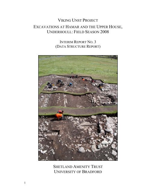
<strong>VIKING</strong> <strong>UNST</strong> <strong>PROJECT</strong>EXCAVATIONS AT HAMAR AND THE UPPER HOUSE,UNDERHOULL: <strong>FIELD</strong> <strong>SEASON</strong> <strong>2008</strong>INTERIM REPORT NO. 3(DATA STRUCTURE REPORT)SHETLAND AMENITY TRUSTUNIVERSITY OF BRADFORD1
<strong>VIKING</strong> <strong>UNST</strong> <strong>PROJECT</strong>: <strong>FIELD</strong> <strong>SEASON</strong> <strong>2008</strong>PART ONE:PART TWO:INTERIM REPORT NO. 3(DATA STRUCTURE REPORT)PART THREE: APPENDICESEXCAVATIONS AT HAMAR &THE UPPER HOUSE, UNDERHOULLPERSONNEL & RELATED RESEARCHJ.M. BOND, Z. OUTRAM & C.M. FREETHDepartment of Archaeological Sciences, University of Bradford, BD7 1DPWith contributions by D.J. Bashford, C.E. Batey, C.M. Batt, L.D. Brown, M. Church,J.E. Cussans, S.J. Dockrill, G. Gaunt, J.G. McDonnell, J. McKenzie, A.R.R. Mustchin,J.R. Summers, G.T. Swindles, and V.E. TurnerIllustrations by D.J. BashfordPhotographs by J.M. Bond & S.J. Dockrill<strong>2008</strong>(Bradford Archaeological Sciences Research 20)The Project is managed by Shetland Amenity TrustThe Excavations at Hamar and the Upper House, Underhoull are directedby J.M. BondThe Project is funded by: Heritage Lottery Fund, European Agricultural Guidance and GuaranteeFund (EAGGF), Shetland Development Trust, Shetland Enterprise Company, Shetland AmenityTrust, 2 Historic Scotland, Shetland Islands Council, NABO/IPY, NERC, and the University ofBradford.
This is a provisional report on the excavations at Hamar and the Upper House,Underhoull, and as such represents ideas and work in progress. The data, illustrativematerial and other information contained within it is made available on the understandingthat the reader will not reproduce or publish in any form either the whole or part of itwithout prior permission of the editors.3
CONTENTSPART ONE: THE EXCAVATIONS AT HAMAR & THE UPPERHOUSE, UNDERHOULL1. IntroductionJ.M. Bond, Z. Outram & C. Batey1.1 The Site of Hamar 81.2 The Site of Underhoull 111.3 The Research Agenda 122. The Research Excavations at Hamar and the Upper House,Underhoull in <strong>2008</strong>J.M. Bond, J.E. Cussans, D.J. Bashford & A.R.R. Mustchin2.1 Introduction 162.2 The Excavations at Hamar 162.3 The Excavations at The Upper House, Underhoull 223. Summary of Finds from the <strong>2008</strong> Season31J.M. Bond, C. Batey, D.J. Bashford, L.D. Brown, G. Gaunt,J.G. McDonnell, & Z. Outram3.1 Introduction & Overview 313.2 Worked Stone 313.3 Pottery & Fired Clay 443.4 Metal Artefacts 453.5 Glass 483.6 Small finds catalogue and illustrations 484. Environmental Evidence50J.M. Bond, Z. Outram, M. Church, J.E. Cussans, J.McKenzie &J.R. Summers4.1 Bioarchaeological Sampling 504.2 Palaeobotanical remains from Hamar and the Upper House,51Underhoull4.3 Mammal Bone 564.4 Fish bone 574.5 Soil Micromorphology 574.6 A Geoarchaeological Assessment of the Deposits at Hamar and theUpper House, Underhoull605. Dating at Hamar and The Upper House, Underhoull64Z. Outram, C.M. Batt, G.T. Swindles & M. Church (Durham University)5.1 Objectives of the Dating Programme 645.2 AMS Radiocarbon Dating 645.3 Archaeomagnetic Dating 655.4 Tephrochronology 668164
PART TWO: PERSONNEL AND RELATED RESEARCH6. Project Outcomes 686.1 Research Projects 686.2 Presentations 706.3 Project related publications 716.4 Awarded grants 717. Personnel 727.1 Management Team 727.2 Excavation 727.3 Interpretation 737.4 Post-Excavation 738. Bibliography 759. Sponsors and Acknowledgements 829.1 Sponsors 829.2 Acknowledgements 82PART THREE: APPENDICESHamarI List of ContextsIIIIIIVVVIVIIList of Soil DescriptionsCatalogue of Plans, Sections and Elevations (listed by drawing number)Catalogue of Plans, Sections and Elevations (listed by context number)Catalogue of Photographic Archive: colour transparencies, black & whiteprintsSmall Finds ListSmall Finds Co-ordinatesVIII List of Environmental SamplesThe Upper House, UnderhoullIX List of ContextsX List of Soil DescriptionsXI Catalogue of Plans, Sections and Elevations (listed by drawing number)XII Catalogue of Plans, Sections and Elevations (listed by context number)XIII Catalogue of Photographic Archive: colour transparencies, black & whiteprintsXIV Small Finds ListXV Small Finds Co-ordinatesXVI List of Environmental Samples5
LIST OF FIGURES1.1 Location of the main Viking/Norse sites excavated to date in Unst 102.1 Plan of the excavated structure, House 1, at Hamar 182.2 Plan of the sunken floored structure, Hamar 212.3 Plan of the excavated structure within Area C, Hamar 212.4 Plan of the excavated structure of the Upper House, Underhoull 242.5 The south east annexe, the Upper House, Underhoull 272.6 The south west annexe, the Upper House, Underhoull 273.1 Illustrated artefacts from the <strong>2008</strong> excavation season 504.1 The graphical representation of the magnetic susceptibility survey ofthe lower room of House 1, Hamar, plotted using Golden SoftwareSurfer 8.63LIST OF TABLES3.1 Catalogue of the whetstones recovered from Hamar 353.2 Catalogue of the whetstones recovered from the Upper House, 36Underhoull3.3 Summary of the unworked steatite from the Upper House, 41Underhoull3.4 Summary of the preliminary assessment of the ferrous (Fe) and 45non-ferrous (Cu-alloy) material recovered from the Upper Houseat Underhoull3.5 Summary of the preliminary assessment of the ferrous (Fe) and 46non-ferrous (Cu-alloy) material recovered from Hamar3.6 Summary of the glass artefacts recovered from the excavations 48at Hamar (HMR) and the Upper House, Underhoull (UND)during the <strong>2008</strong> excavation season4.1 Summary of the samples collected from the excavation of the 58Upper House, Underhoull for assessment using soilmicromorphology4.2 Summary of the samples collected from Hamar for assessment 59using soil micromorphology5.1 Summary of the AMS radiocarbon dates produced for Hamar 65(HMR) and the Upper House, Underhoull (UND)5.2 Summary of the archaeomagnetic samples collected from Hamar 65(HMR) and the Upper House at Underhoull (UND)5.3 Summary of the monolith samples that will be used toinvestigate the presence of tephra within the deposits atUnderhoull, Area A.676
PART ONEEXCAVATIONS AT HAMAR &THE UPPER HOUSE, UNDERHOULL7
1. INTRODUCTIONJ.M. Bond, Z. Outram & C. BateyThe Viking Unst Project began in August 2005 with an integrated survey of key sites in theisland of Unst (Bond et al. 2006). Using a Penmap survey as well as simple annotatedplans, this initial investigation aimed to thoroughly record the sites in terms of survivingearthworks and the surrounding area. The first excavation season was carried out in July2006 and focused on the site of Hamar under the direction of Dr. Julie Bond, with work onthe site of Belmont being carried out under the direction of Stine Larsen of RoskildeSkibsmuseet.It has been suggested that Unst may have played an important role in the expansion of theViking/Norse populations, acting as a staging post between Norway, Britain and the landsfurther west (Ritchie 1996, 71; Graham-Campbell & Batey 1998, 67). Publishedexcavations include those undertaken at Underhoull (Small 1966), Sandwick (Bigelow1985), Framgord (RCAHMS 1946), and Norwick (Ballin Smith 2007). Small’s excavationsat Underhoull took place before the routine employment of sieving and sampling onarchaeological excavations and so little can be said about the economy of the site or aboutits chronology. A major aim of the Viking Unst Project is to excavate new sites in Unstemploying up-to-date methodology to address these key issues. This research will advanceour understanding not only of Unst’s past, but of Shetland as a whole.The sites investigated during the <strong>2008</strong> excavation season were Hamar (SMR site 3471, NatGrid Ref. HP 6463 0933), and a longhouse located adjacent to the broch at Underhoull(SMR site HP50SE13, Nat grid Ref. HP5734 0435), located in the Westing and referred tohere as the Upper House, Underhoull (figure 1.1).1.1 THE SITE OF HAMARThe archaeological investigations carried out at Hamar can be divided into two phases: Thefirst phase consisted of a trial excavation and a geophysical and standard archaeologicalsurvey (Stummann Hansen 1995b; Bray et al. 1997). The second phase included a surveywhich took advantage of recent developments in GIS (Geographical Information System),and a full open plan excavation directed by Dr Julie Bond.The First Phase of InvestigationThe site of Hamar was first recorded by Stummann Hansen (Stummann Hansen 1995a; ibid1995b; ibid 2000). He described it as a single (and possibly single-phase) longhouse almost24m long, with no associated outhouses or offsets, aligned down slope. In 1994 StummannHansen undertook a standard survey of the site (Stummann Hansen 1995b) which identifiedseveral features, such as the entrances within the interior of the structure, part of a potentialyard wall emerging from the upper end of the structure, and a circular feature interpreted asa hole used to collect the drain fluids from the byre (Stummann Hansen 1995b; StummannHansen 2000, 91).8
A geophysical survey of the site was also carried out by BUFAU (Birmingham UniversityField Archaeology Unit) using a Geoscan Research RM15 Resistivity Meter, operated witha twin-probe array and 0.5m mobile probe spacing, and processed using the Geoplotprogram, version 2 (Geoscan Research). The survey encompassed the site itself, as well asa substantial area around the structure (Bray et al. 1997). The results of this survey clearlyshowed the position of the structure, as well as the entrances mentioned in the reportsproduced by Stummann Hansen (1995b). However, the potential yard wall identified in thefield by Stummann Hansen (2000, Figure 5) was not recorded by the resistivity survey; itwas suggested that excavation was needed to determine the nature of this feature (Bray etal. 1997, 7).A trial excavation carried out by Stummann Hansen focused on a small trench, 60cm wide,which cut across the upper part of the structure. The excavations revealed a feature thatcould be interpreted as a bench setting running parallel to the outer walls. A floor surfacewas also identified at a depth of approximately 75cm below the level of the topsoil; thefeatures excavated indicated that the structure had a sunken floor. A fragment of steatitewas recovered from the floor surface, which “confirmed the dating of the structure to theScandinavian period” (Stummann Hansen 2000, 90-91).The Second Phase of InvestigationA second phase of archaeological investigation began with a survey carried out by Bond etal. (2006), which aimed to produce a Penmap survey of the site as well as the surroundingarea in order to assess its position within the landscape. This demonstrated the unusuallocation of House 1 within the landscape, being positioned on a platform halfway up thehill and backed by an increasingly steep slope (Bond et al. 2006, Figure 1.1). The structurewas aligned downslope with no obvious outbuildings or extensions. The trace of thepotential yard wall seemed to follow the line of the platform on which the house sits. Theback (upper and northern) wall of the structure appeared to be distinctively curved but onlyexcavation would clarify if this was intentional or an effect of tumble from the originalwalls.The survey did not highlight any areas of midden accumulation, nor could it identify thecircular drain feature recorded by Stummann Hansen (Bond et al. 2006, 3). It was notedthat the structure was suffering badly from rabbit damage, both internally and externally. Itwas suggested that excavation was necessary before any more of the valuable informationheld by the site was lost.Using the data collected during this survey, a Geographical Information System (GIS) plotwas produced by Maher which enhanced the site’s visible features (Maher 2006, 13 andfigure 2.4).In 2003 an additional (possibly later) structure was identified by Bond and Turner, higherup the slope. In the 2005 survey the original structure was referred to as ‘House 1’, and thesecond structure ‘House 2’ (Bond et al. 2006).9
10Figure 1.1: Location of the main Viking/Norse sites excavated to date in Unst
The 2006 & 2007 excavation seasonsThe excavation of the structure during the summer of 2006 revealed a sub-rectangularbuilding divided internally into an upper and lower room aligned roughly N-S downslopeon a small terrace, referred to as House 1. A remnant of double faced walling excavated onthe western wall was interpreted as part of a later addition to the structure. A fragment of awell carved steatite vessel was found within the core of this extension wall. A trench firstexcavated by Stummann Hansen (2000) that was positioned across the upper room was reexcavatedin order to view the stratigraphic sequence of deposits within this area.The 2007 excavation season focused on the excavation of the lower room and annexe of thestructure, as well as the external drainage gully that appeared to run parallel to the northernwall line of the upper room. The investigation of the lower room revealed a negative featurethat ran down the centre of the structure towards the southern door. A concentration of ashand steatite was recorded at the base of this feature, which may have related to a hearthdeposit. A hearth was also identified in the annexe, located against the remnant of doublefaced walling. This feature was left at this stage to be sampled for archaeomagnetic datingin the <strong>2008</strong> season.In addition to these excavations, two trenches (Areas C and D) were positioned over House2, which occupies a small platform in the landscape to the north west of House 1. Theexcavation of Area C revealed the infill of the structure, which was rich in organic remains,such as cereal grains, charcoal and peat ash, as well as producing a large number of steatiteartefacts. Excavation of Area C continued in the <strong>2008</strong> season.1.2 THE SITE OF UNDERHOULLThe excavation of the Upper House at Underhoull in 2007 focused on a site adjacent to theroad which was partially visible as raised, turf-covered foundations. Previous work in thearea can be divided into two main phases. The first relates to the excavation of a structurelocated down slope towards the beach at Underhoull, published by Alan Small in theProceedings of the Society of Antiquaries of Scotland (Small 1966), where he reported aNorse building which he assigned to the 10 th century in date, overlying an earlier Iron Agesettlement with a souterrain. Uphill from Small’s site lies a substantial broch structurewhich may well have influenced both the position of the Norse building(s) in the immediatelandscape as well as providing a potential quarry for building stone (Small 1966, 230-235).In more recent decades, revisions in our understanding of the dating of Small’s Norsestructure have been posited by Batey, Bigelow and Hansen and a Late Norse date wouldseem to be a better fit for both the structural form and the artefact assemblage (Graham-Campbell & Batey 1998, 181).The structural remains investigated by Small consisted of a longhouse aligned roughly E-W, being approximately 56ft (c.18m) in internal length and with a maximum centralbreadth of 15ft (c.4.5m). The long walls were slightly curved so that the western end of thebuilding was almost semicircular, giving the house an “almost boat-like shape” (Small1966, 237). The walls were constructed of drystone walling that was faced internally, witha turf and stone backing on the exterior face (Small 1966, 237). Several internal features11
were recorded within the structure, including upright stones that were interpreted aspossible bench settings, two post-holes located along the central line that may have acted assupports for the roof, and a small drain (Small 1966, 238). Small also believed that thewestern end of the structure had been utilised as a byre due to the wide doorway (beingapproximately 5ft: c.1.5m), and due to the presence of rough paving; other areas of thestructure were only paved in order to cover drains, with the remaining area having a beatenearth floor (Small 1966, 258).The second phase of work at Underhoull took place in May 2007, where a team carried outa thorough survey of the Upper House site to be excavated in the summer of that year. Thesurvey team was led by Robert Friel and produced a detailed contour survey of the featureand the surrounding area, highlighting the wall plan of the structure as well as possiblefield/yard boundaries.2007 excavation seasonThe structure excavated during the 2007 season is from here referred to as the UpperHouse, Underhoull to differentiate it from Small’s 1966 excavations (Small, 1966). Twotrenches, Areas A and B, were opened to assess the surviving archaeology, in preparationfor the full excavation planned for <strong>2008</strong>. One trench was positioned across the top of thestructure at its western end (Trench A: 12m x 6m) and a second across the middle of thestructure (Trench B: 16m x 6m) encompassing what appeared to be an annexe or extensionto the house.The excavation of Trenches A and B defined the limits of the structure, revealing asouthern double-faced wall line of the structure, although only a small fragment of thissurvived. The northern half of the structure was defined through the presence of a turf bankcontaining small gravel, although it was not clear at this stage if the stones of the wall hadbeen robbed. A rubble-filled annexe was identified in Trench B, from which a small steatitefigurine was recovered (SF No. 098; Bond et al. 2007, 51). The excavation of the externalarea around the structure revealed that part of the site was sealed by a substantial peatdeposit, which was sampled for palaeoenvironmental analysis and dating. Further work wascarried out in this area during the <strong>2008</strong> season.1.3 THE RESEARCH AGENDAThe excavation of Viking/Late Norse settlements on the most northerly of the British Islesforms the centre of the much larger multi-faceted ‘Viking Unst’ programme, whichincludes historical research, place name interpretation, landscape survey, environmentalhistory, heritage interpretation and community involvement and regeneration. Utilisingrecent developments in archaeological method and theory the maximum amount ofinformation will be gathered from these excavations in order to address the research issuesoutlined below.Little is understood about rural Scandinavian settlement in Britain and much of what we doknow is from sites in Orkney, such as Pool (Hunter et al. 2007), Skaill (Buteux 1997),Birsay (Hunter 1986), Buckquoy (Ritchie 1977) and Westness (Kaland 1995). All of these12
sites are multiperiod settlements situated on good land and often part of a long subsequentsettlement history. They are very different to many of the Unst sites, which appear to beshort lived single phase settlements, often on poorer land.One of the major questions addressed by these excavations is the reason for the apparentdifference in settlement pattern in Unst, and for the subsequent abandonment of these sitesin the Late Norse or medieval period. It is likely that the apparent distribution of sites hasbeen influenced by subsequent settlement; the very best locations are probably occupied bymodern farms, burying or obliterating the earlier settlement. However this does not explainthe distribution of apparently abandoned farms on land not subsequently used forsettlement or arable. Do these sites perhaps signal the next generation’s move away fromthe primary Scandinavian settlements? If so, their short lifespan still needs to be explained.Norse farms in these locations may have been environmentally vulnerable; the solifluctionstripes and mountain-tundra soils which can be seen on the Keen of Hamar, just 20m abovethe longhouse site, testify to its marginal location. It may be that several factors wereinvolved; for example, the poorer climate of the later Norse and Medieval periods and therise in the importance of fishing in the late Norse economy, as proposed by James Barrettand others (Barrett 2003), which may have led to the abandonment of more marginalagricultural settlements. It may be that some of the sites in upland locations are notabandoned farms, but shielings contemporary with settlements on better land which havesubsequently disappeared.Thus the main aim of the project is to understand this unusual settlement pattern byinvestigating its chronology, form, economic basis and landscape context, and tounderstand how this affected later settlement. The project also seeks to understand the dateand nature of the initial Viking settlement of Unst, and how this fits into the models ofViking expansion across the North Atlantic.1.3.1 Site development and chronologyThe production of detailed chronologies for the sites investigated is essential to theinterpretation of Viking settlement in Unst. The provision of an absolute chronology willfacilitate the dating of the structural and depositional sequence of the sites and will providea chronological framework for the interpretation and understanding of questionssurrounding the sites’ past inhabitants, economic development and cultural identity.The dating programme devised for the Viking Unst project is based upon the integration ofseveral techniques, focussing on the generation of research questions in the field asexcavation is carried out and requiring specific sampling during the excavation process.Three scientific dating methods have been selected for use; archaeomagnetic dating of insitu fired structures such as hearths, accelerator radiocarbon dating of carbonised plantremains (cereal grains) from secure depositional events and tephrochronology. It isnecessary to utilise a range of dating methods as the radiocarbon calibration curve isinsufficiently sensitive at crucial points to be used as the sole dating technique. Theapplication of these methods to targeted chronological problems has shown great potentialin not only the reinforcement of dates produced by a single method but perhaps moreimportantly by the use of Bayesian statistics on the integrated data (Buck et al. 1994). The13
establishment of an integrated absolute chronology for the Unst sites is essential in order toprovide a framework for the other findings from the excavations and interpretations of thesites’ economic development and cultural identity.The analysis of the artefacts recovered will be of enormous importance to the interpretationof the sites excavated over the course of the Viking Unst Project. The expertise of Dr.Colleen Batey will be utilised.1.3.2 The paleoeconomy of Viking and Norse UnstUnderstanding the past economic exploitation of the surrounding landscape, shore and sea(e.g. for arable agriculture, animal husbandry, fishing and other resources such as fuel) isvital to our understanding of the sustainability of these sites. Analysis of the economic datawill provide information regarding the subsistence base of the sites and the reasons for theirsuccess or failure. It was anticipated that most of the known sites in Unst (with theexception of those with a high windblown sand component) are unlikely to have good bonepreservation, though some is possible and this has proved to be the case with Hamar andUnderhoull. A few fragments of bone have been recovered, providing limited informationon food resources and technology (butchery, bone working). Sampling for plant remainswill allow the study of the nature of the arable contribution to the economy and what fuelresources were utilised, as well as providing material for AMS dating.1.3.3 Formation of the archaeological depositsAn integrated research programme examining magnetic signatures, carbonised andfossilised organic components, phosphate and soil micromorphology will enable anunderstanding of fuel exploitation, the identification of surfaces within structures, theformation and management of arable soils and provide evidence for deposits associatedwith ironworking. It was hoped to investigate the nature and extent of any yards or infieldsurrounding the settlement which is important in settling the 'farm or sheiling' question forthe sites in the higher areas. Work on this is ongoing in this area through the PhDs ofRobert Legg, University of Bradford (Muck, farmsteads and landscapes: Geochemical andgeophysical investigations of farmstead and landscape interaction on the isle of Unst,Shetland), and Val Turner, University of Stirling (Inherited landscape: the pre-historic fieldsystems of Shetland).1.3.4 Manufacture, trade and contactEvidence for manufacture, such as copper alloy casting and ironworking, together withimported cultural material, will provide evidence for both production and trade, which inturn provides further insight into the status of the sites and how this might have changedover time.1.3.5 Status and social hierarchies in Viking/Late Norse period Unst.Issues relating to the Viking/late Norse society in Unst will be addressed, and to this endinvestigation of the social status of the settlements will be important.The results of the ‘Penmap’ survey in August 2005 seemed to show that some of theassumed single-structure and single-phase sites, such as Hamar and Lund, may be much14
more complex; geophysics would be an obvious means of exploring this (Bond et al. 2006).It is hoped that the nature and extent of the yards or infields surrounding the settlementscould be looked at in order to settle the ‘farm or shieling’ question for the sites in the higherareas.15
2. THE RESEARCH EXCAVATIONS AT HAMAR AND THE UPPER HOUSE,UNDERHOULL IN <strong>2008</strong>J.M. Bond, S.J. Dockrill, J.E. Cussans, D.J. Bashford & A.R.R. Mustchin2.1 INTRODUCTIONThe excavations carried out in June and July in <strong>2008</strong> continued the excavation of Houses 1and 2 at Hamar. Excavations also continued at the Upper House, Underhoull, investigatingthe structure located adjacent to the broch, and upslope from the structure excavated bySmall (1966). A summary of the excavation season is provided here.2.2 EXCAVATIONS AT HAMAR2.2.1 House 1, Area A (Figure 2.1)Work on Hamar House 1 this year focussed on finishing the investigation of the upperroom, the western annexe, and a small amount of investigation around the lower doorwaywhere fill of the ash pit had been left in situ. Further sections of the gulley whichsurrounded the upper part of the house were also excavated, sampled and recorded.Excavations at House 1 showed that there were many more phases to the structure thansurveys and studies prior to full excavation had suggested (see e.g. Stummann Hansen2000, Bond et al. 2006). The latest (as yet undated) occupation seems to have utilised onlypart of the upper room, with a dividing wall and post setting forming a smaller space at thenorthern end.Upper roomThe double faced wall [243]/[244] was removed, which had formed part of the latest smallinner room along with post setting [284]. A stone setting and burning part way up the wallon the western side together with a small area of burning, [350], indicate a possible cornerhearth or oven in this phase. A patch of surface in the north west corner, [365], is alsolikely to be contemporary.Unfortunately the rabbit damage observed in previous seasons proved to be far moreextensive than at first thought, with channels running through the remaining earlyoccupation surfaces, along walls such as [243]/[244] and actually running into the brokenbedrock in places. This meant that such earlier occupation surfaces as were identifiablesurvived only in patches, making interpretation more difficult. These patches of occupationdeposits included early features such as an area of burning [422], a primary surfaceconsisting of burnt bedrock and ash, which was sealed by brown ash [421] itself sealed by alater ash surface [399] and a tertiary surface [389]/[356].Despite the rabbit damage it can be demonstrated that there were several occupationsurfaces in the upper room before the small inner room was constructed and that in theearliest of these phases an ashy floor lay directly over bedrock. Early indications are thatthis phase relates to the building of the secondary cross wall which created the upper room([017]/[073]/[064]/[250]) and that it dates to the Late Norse period. The finds from this16
floor surface included fragments of a pot with a gritty texture, a schist hone stone andfragments of steatite bake plate.Excavation this season showed that, surprisingly, this bedrock floor surface was not duginto the slope of the hill to form benches and a sunken floor, as earlier investigations basedon a small exploratory trench had suggested (Stummann Hansen 2000) but was mostlylevel with base of the walls. The subsequent occupation surfaces, specifically [402], [403],sealed the deposits encountered in those earlier excavations. Excavation this season provedthat the cuts assumed by Stummann Hansen to be the bench lines of a Norse building([091], [443]) were in fact the west and east sides of a sunken floored structure which layunder the cross wall of the extant building and on the same alignment as its long walls. Thesouthern part of the cut, to the south of cross wall [017]/[073]/[064]/[250], was numbered[405].The sunken floored structure is c.3x4m with settings for post pads at the centre of the northand south pit edges and possible evidence for smaller corner posts (figure 2.2). To the souththe pit is c.20cm deep whilst to the north it is dug into the bedrock to a depth of c.30cm.The finds from the deposits included a steatite line sinker and fragments of copper alloy.The later cross wall seals this feature and the infill of the pit, as do the floor surfaces of theupper room. The fill of the pit was a series of ashy layers; north of the cross wall, thesequence of layers starts with a black and orange surface [453] at the base of the pit, sealedby [449], [448], [431], [447] and finally [369], whilst south of the cross wall, surface [452]was sealed by a second surface [404], [242] and [444]. The cross wall itself was notremoved as it was required for later consolidation and display of the site, so a baulk wasleft to the north to protect the stability of this wall.No closely comparable sunken featured building has been found in Shetland, although thereare traces of a sunken structure at The Biggins, Papa Stour and the Hamar structure bears aclose resemblance to pit houses found in Norway from the ninth century and later(Crawford & Ballin Smith 1999, 208-213, Mårtensen 1997)AnnexeInvestigation of the remaining fragments of the western annexe continued and revealed ahearth ([307], [313]) set against inner wall face [079] and sealed by later flagging [254].Samples for archaeomagnetic dating were taken from this feature, which had scorched theface of the wall and in burning the bedrock beneath had inadvertently formed a bowlshapedfeature as the rock fractured and broke away. Very little else was found in thisannexe area although some shallow and rather faint negative linear features were found([437]/[440] running N-S and [438]/[441] running E-W) which may be traces of walls,though they are just as likely to be linear rabbit burrows. In their favour, a small alignmentof flat stones [439] seal [438] and are on the same alignment.17
18Figure 2.1: Plan of the excavated structure, House 1, at Hamar
Lower room & ash pitWork also concluded on investigations of the substantial ash pit running lengthwise downthe lower room and out under the end wall of the house ([040]/[039]/[374] to the west and[037]/[038]/[375] to the east). It is now confirmed that the pit is older than the end wallsand that the house must have been substantially shortened (or the position of the house as awhole shifted down slope) when the later end wall was rebuilt over the ash pit. The fill ofthe ash pit [378] was sealed by flags [291] and [338] which in turn were sealed by the endwall, suggesting a further phase when the pit went out of use but before the end wall wasrebuilt. Whether this ash pit formed part of a structure of the same or an earlier or laterphase as the sunken structure is not yet apparent.A lone post hole hard by the inner face of the western long wall of the house [031] consistsof cut [384], fill [385] and chocking stones or rubble [383], sealed by [324]. There is afragment of steatite bake plate at the base of its fill, which cannot have acted as a post padbeing too fragile, and so may be a later deposition when the post hole went out of use andwas infilled. The position of the feature, hard by the western wall, also suggests it belongsto an earlier phase or structure before this section of wall was built. There are no otherpostholes in the building which would correspond to this one, the holes found last yearbeing on different alignments and of less substantial size.Excavation of further sections of the gully were unable to follow its course south of theupper room; it may be that the feature continued only in more shallow soil deposits whichhave subsequently been lost, perhaps with scalping. What further excavation of this featurehas demonstrated is how close the back wall [048] comes to the gully, suggesting thepossibility that the gully is older than the surviving wall face. In places the wall has startedto collapse into the ditch, showing that in its present form it stands too close to it.These features suggest that rebuilding may have been more substantial than is obvious fromthe remaining deposits on this partially denuded and rabbit disturbed site, and that the siteitself was substantially longer lived than it might at first appear. Work continues on the postexcavation analysis, but the poor quality of survival of deposits and the amount of rabbitdisturbance means that we may never be able to fully phase these more isolated features.However it is hoped that radiocarbon and archaeomagnetic dating will at least give us broadphasing which can be refined by the archaeological results.2.2.2 House 2, Area C (Figure 2.3)The continued excavation of Area C began with the removal of the 2007 backfill. Oncecleaned and recorded the trench across House 2 was extended by one metre to the NW andSW. The principle aim of this year’s work was to investigate, record, and sample anyoccupation deposits sealed by the post-occupation ash midden infill of this structure, shownby radiocarbon dating of barley from the fill to be 15 th to 17 th century in date (see Outram etal., Chapter 5, this volume). In addition the extended excavation area, measuring some 10mx 2.5m, allowed a more detailed examination of exterior deposits on the building’s hillwardside.19
Removal of turf [1000] from the extended area exposed an uninterrupted blanket of siltyclay topsoil [1001]. Beneath this layer, the previously identified wall lines of House 2 werefound to continue along their anticipated course (approximately SW-NE). The buildingstyle observed in 2007 was evident once more, with each wall comprised of internal andexternal faces of large stones ([1006] and [1007] form part of the northern wall, and [1008and [1009] form part of the southern wall) around cores of earth and small irregular rubble([1018] & [1019] from the north and south walls respectively).Excavation of the internal deposits revealed a clear-cut sequence of ashy carbon-richmiddens ([1005], [1020], and [1021]). These contexts correspond to and are equal tocontexts [214] and [261] recorded in 2007. Collapsed stone and/or core material from bothwalls was found throughout this sequence ([1010], [1011], [1012], [1028], and [1034]).Below the uppermost contexts and associated collapse material within the structure(including previously unexcavated deposits against the NE baulk, [1022] and [1029]) asingle ash- and carbon-rich clay context, [1035] was identified extending across the wholeinternal area and butting inner wall faces [173/1007] and [175/1008]. This was equal to thestratigraphically earliest context recorded in 2007 ([305]), which has been dated toAD1440-1640 at 95% confidence levels (Lab. Code GU-16695, table 5.1 this volume).Due to time constraints, excavation of the interior of the structure was limited to a 1m-widesondage running between the inner wall faces against the SW baulk. Sampling and removalof [1035] revealed a moderately carbon-flecked silty clay [1043] that was similarly sampledand excavated. This layer comprised the primary abandonment or post-abandonment fill ofHouse 2, the removal of which exposed an intact floor surface containing flagstones [1049]and a small sub-circular ‘hearth’ [1044]. A ‘hearth’ [1044], comprising burnt red andyellow ashy clay within a loose arrangement of possible kerbstones, was foundapproximately 50cm from the internal SE wall face. After detailed recording this featurewas sampled for archaeomagnetic dating, any residual material being bulk sampled.The presumed floor surface chiefly comprised clay layers [1046], [1047], [1048], [1051]and [1052] but also contained a spread of ash and carbon flecks, [1045]. Clays [1048] and[1051] were both heavily burnt and also carbon-rich. A linear arrangement of possibleflagstones [1049] ran NE-SW in the NW floor area. One of these was lifted in order toinvestigate the possibility that they formed capping for a flue, drain, or similar. However,only a homogenous yellow clay [1050] was found to underlie this feature and wastentatively interpreted as natural subsoil. If this were the case it might suggest a singleoccupation phase for House 2 associated with the overlying floor.The external area down-slope of House 2 was not fully excavated this season. The rubblecollapse [246] identified in 2007 was found to continue into the extended trench area, andwas accordingly renumbered [1003]. Although successive layers of this material wererecorded and removed, the base of this ‘collapse’ was not reached and its primaryrelationship to the SE wall of House 2 remains unclear.Externally to the NW of the structure excavation revealed mixed colluvium and topsoil([1004], [1013] and [1017]) overlaying various ‘tips’ ([1014], [1016], [1025] and [1027])20
Figure 2.2: Plan of the sunken floored structure, HamarFigure 2.3: Plan of the excavated structure within Area C, Hamar21
and possible wall collapse material ([1015] and [1024]). Removal of these overlyingdeposits revealed two gravely, clay-rich layers ([1030] and [1032]), containing fine ashylenses. These deposits were interpreted as being equal to one another, separated by a ‘ditch’cut [1040] that ran NE-SW between the baulks. This cut truncated a further two underlyingdeposits ([1041] and [1042]), and contained three fairly sterile fills ([1031], [1037] and[1039]), corresponding to material recorded from a sondage the previous year (see Bond etal. 2007). Cut [1040] most likely represents a past attempt at diverting hillwash materialaway from the NW wall of House 2.Artefacts recovered in <strong>2008</strong> were broadly representative of a Nordic cultural package of theLate Norse/Medieval period. The post-abandonment fills within the structure containednumerous steatite artefacts, including a possible bakeplate fragment (SF1140) from layer[1035]. Ferrous objects (SF1111, SF1117, SF1118, & SF1119) and one piece of glass(SF1152) were also recovered from fills [1020], [1021] and [1035]. The primaryabandonment/post-abandonment fill of House 2 ([1043]) produced several finds including apossible bakestone fragment (SF1173), and a whetstone (SF1168).The walls and ‘collapse’ material produced several finds including a steatite fragment(SF1099) and ferrous object (SF1100) from core [1018], and steatite (SF1129 & SF1130)from rubble [1003].2.3 EXCAVATIONS AT THE UPPER HOUSE, UNDERHOULL (FIGURE 2.4)At the end of the 2007 excavation season two main trenches had been opened over the westend (Area A) and central part (Area B) of the main structure plus three small exploratorytrenches examining field boundaries and peat depth. It was revealed that the main structurehad both stone and turf elements to the walls which were seemingly very poorly preservedin some areas. There was also a stone built annexe to the south east, a drainage gully to thenorth and a paved area to the south west which was covered by a considerable layer of peatgrowth. A variety of steatite finds were recovered, the majority of which came from thewest (upslope) end of the structure. Outside of the structure to the north-west, a large areaof red ash and fuel ash slag was uncovered.The aim of this year’s excavation was to discover the full extent of the main structure andits annexes, to understand the construction of the walls, to fully excavate the internaloccupation deposits and to gain a better understanding of the peat formation to the south ofthe structure.Trench ExtensionsIn Area A, a small extension was made in the north-west corner in order to more fullyinvestigate the extent of the area of burning and fuel ash slag outside of the building. AreaB was greatly extended to the east, west and north to show the full extent of the mainstructure and its annexes. A further trench (Area F) was opened across a field boundary tothe south of the main excavation area to examine the relationship between the peatformation and the boundary.22
External DepositsA section was excavated through the fuel ash slag deposit in Area A, ([003], [093], [216])to examine its depth and horizontal extent and to collect further dating samples. Thematerial appeared to have been burnt in situ, [216] and [093] being the main burningepisodes. The area of burning was contained by a low stone boundary [119], which both[216] and [093] butted against. North of this boundary were peat layers [118] and [128]which were sterile of anthropogenic material.Immediately north of the structure, further investigation of the gully was made includingthe removal of the small north-south baulk that remained from last season’s excavations.Removal of this baulk revealed a number of peaty layers ([113], [115], [116]) sealing theremnant of the wall of the structure [007], the top of the fuel ash slag deposit [003] and therubble in the top of the gully fill [062]. The east end of this gully had been partiallyexcavated in the 2007 season; this involved the removal of rubble [061] (equal to [062])and fill [063] revealing cut [064]. As found in Area B in 2007 excavations this seasonrevealed this cut to be a later re-cut through earlier fill [184] which was removed andsampled. [184] proved to seal the primary fill, a greenish deposit [188] which sealed thebedrock.On the south side of the structure further investigations were made into the peat growthwhich had been found to be sealing flagging [029] in the 2007 season. A series of sampleswere taken from the peat sections in Area A, further details of which are given in section5.4, this volume. In addition a small (1x3m) trench was opened up over the field boundaryto the south of the main excavation area. This showed that the boundary predated the peatgrowth found on top of paving [029] and also most likely predated the longhouse structure.It is thought that the peat growth was triggered by the building of the longhouse, creating awet basin microclimate between the structure and surrounding field boundaries thusencouraging peat growth (M. Church & G. Swindles, pers. comm.).AnnexesThree structures, physically attached but external to the main structure, were identified. Thefirst of these, the south east annexe (figure 2.5), was partly excavated in the 2007 season;see Bond et al. (2007) for a description of the walls. At the end of the 2007 season thisstructure was left with its internal occupation deposits intact. [053], a greasy blackoccupation type deposit was excavated this season to reveal a hearth and other occupationdeposits. Removal of [053] revealed a light brown ashy deposit [172], which in turn sealed[174], a charcoal rich deposit with orange mottles. Removal of this revealed the full extentof a rectangular feature [166], probably a hearth, which sealed [177], another occupationdeposit. [166] was bounded by flags [176] which covered most of the interior of the annexeroom. This deposit contained the charred remains of complete ears of cereal, which wereremoved as a block sample SF894 for processing in the laboratory. External to this annexeand sealing the south wall [039], deposit [131], a dark peaty deposit with small stones wasremoved revealing that the annexe wall was built directly on top of the bedrock, indicatingthat it was likely associated with the main structure from its earliest occupation. Access intothe annexe appears to have been from the south along paving [038] which turns 90˚ to run23
24Figure 2.4: Plan of the excavated structure of the Upper House, Underhoull
along the north edge (open side) of the annexe; there does not appear to be any way ofaccessing this annexe from within the main structure.The second annexe, uncovered for the first time this year, was also on the south side of themain structure but to the west (figure 2.6). This south west annexe had two, thin, singlefaced stone walls [109] & [110] surviving two to three courses high and butted onto theexternal wall of the main structure [144], again without any direct access between the two.The stone walls were backed with turf banks [134] and [129] respectively, which wouldpresumably have provided both support and insulation for the annexe. A third wallingelement, forming the east wall to the annexe, [139] was one face of what appeared to be theremnants of an earlier wall with two faces [139] & [108] and a rubble core [132]. Accessinto this annexe appeared to be between the north end of this wall and the wall of the mainstructure [144] and possibly came again from the south over paving [038] although nodirect link was observed. After going out of use the annexe was filled with a rubble and soilmatrix ([105], [136] & [147]). Removal of this infill revealed a black and brown mottledpeaty material [187], thought to be the possible remains of a roof collapse. This in turnsealed [189], a black silty occupation deposit. [189] sealed flagging [198] and a rectangularstone setting [203]. [203] was originally thought to be a hearth setting; although thisrectangular feature was filled with a black/brown ashy material [202], when this wasremoved no evidence of in situ burning was found underneath, just more paving, [198].However to the north-east of [203], a further black ashy layer [204] was also found to besealed by [189]; removal of this revealed a hard baked orange/red ash layer interpreted as ahearth [214]. There was no formal surround for this hearth, but as with the hearth found inthe south-east annexe the material butted up against the surrounding flagging [198]. Inplaces the hearth material was situated over a void. Flagging [198] was taken to be theprimary floor of this annexe as some flag stones were sealed by walls [109] and [110].To the north east of the main structure a further enclosure was investigated. This enclosurewas visible as a low earthwork curving north and then east from the north wall of the mainstructure. Excavation showed the boundary to be very similar in nature to the fieldboundaries excavated in the previous season (Bond et al. 2007); this comprised of a peat orturf bank and medium, un-coursed stones [126]. This wall construction led to theinterpretation that this was an enclosed, external space such as a yard or small pen. To theexterior of the area an interesting deposit containing slag and some steatite [140] wasexcavated and sampled. Inside the ‘yard’ area, after removal of the turf-like, sterile material[101] ubiquitous to the site, a layer containing many small fragments of steatite and carbonflecking [170] was found. Very little else was found in this area except a possible piece ofsteatite oil lamp SF1753. Further excavation also revealed a possible post hole, indicatingthat this area may indeed have been roofed or covered in some manner. Access into thisarea appears to have been from the east where there is a gap in the boundary near to thenorth east corner of the main structure. A second possible entrance may be indicated byflagging [097] overlying the rubble filled gully [017] at the western end of the enclosure.The boundary is completed by rubble and turf bank [124] which butts onto this corner.25
Main StructureThe walls of the main longhouse structure are extremely enigmatic, the only substantialpiece of stone walling being at the west end [020]/ [044], identified in the 2007 season.Elsewhere the walls are seemingly much less substantial and appear to be composite wallsmade of turf and stone. In addition it seems that the composition of the walls varies downthe length of the structure. Both the northern and southern walls within the middle sectionof the building had clear, but less substantial structural elements than the western end of thestructure. The north wall has three main elements, a stone inner face [158], a peat or turfouter face [125] and a gritty infill or wall core [122], that was probably a mix of stones andturf. The south wall also has three elements, a stone inner face [211], a stone outer face[144] (possibly the same as [020]) and a gravel wall core [224]. The stone elements used inthe southern wall were larger than those used to form the northern wall. Also associatedwith the walls and peculiar to this mid section of the structure were lines of flags butting upagainst the interior of both the north and south walls, forming a ledge; these flags,[208]/[151] and [210]/[227] respectively, do not extend further into the interior but justalong the sides of the structure.At the east (lower) end of the building there was no clear structure to the walls and no flagslining the edges of the interior. Here the wall lines were marked by banks of rubble and agravel soil matrix ([091], [149]). On the exterior of the north wall a band of dark peatymaterial [127] was identified; this was almost identical in nature to context [125], thoughtto be a peat or turf outer face to the mid-section of wall. It seems likely then that [127]forms the outer face of this section of walling. On the southern wall, there are hints of stonework along the outer face although these do not run the full length; linear stonearrangements [078] and [165] appear to be faced structural elements and approximatelycorrespond in alignment to [144]. At the east end of [165] there is some evidence for apossible side entrance into the structure. At this point there is a short length of walling[156] running perpendicular to the south wall and faced on the west side. This was sealedby rubble wall collapse material [229] which, when removed, revealed a small patch ofashy occupation material between the east end of wall [165] and the west face of wall[156], however sampling and removal of this did not reveal any obvious threshold. Theother potential entrance into the house was located at the very east end of the structure. Thishad seemed very clear when examining the unexcavated earthworks and here there appearsto be some evidence of a more substantial structure. At the east end of the north wallroughly central to the structure there is a single coursed alignment of stones ([150] and[230]) that appear to mark one side of a possible drain.Internal DepositsLast season the majority of work carried out on the internal deposits was in Area A. Thisinvolved the removal of turf-like or peaty layers that were found to seal a black depositcontaining large amounts of steatite [070]. This deposit was found to continue in depth andwas renumbered [185] this season but essentially stayed the same in nature. [185] containedan enormous quantity of steatite, including large vessel fragments and some almostcomplete artefacts at least one of which is an unfinished item SF1931 (see Batey thisvolume). Removal of this deposit revealed a floor layer made up partly of flags [197] andpartly of bedrock. In the centre of the very west end of the structure was a small patch of26
Figure 2.5: The south east annexe, the Upper House, UnderhoullFigure 2.6: The south west annexe, the Upper House, Underhoull27
orange-brown ashy material overlaying paving [197] and sealed by [185], showing someevidence for a build up of occupation layers. This upper section of the building had by farthe highest concentration of artefacts anywhere on the site.In Area B in the middle and lower sections of the structure very little excavation had beencarried out on the internal deposits in the previous season, since it was intended to extendthe excavation area in <strong>2008</strong>. After removal of the turf and topsoil a grey turf-like layer withflecks of iron pan was uncovered [123]/[142]. At first this layer appeared to be completelysterile of anthropogenic material; there was no evidence of carbon flecking or ash and it didnot have the appearance of either a midden infill or an occupation deposit. Furtherexcavation however showed it to have a very few finds which were quite specific in theirnature. Other than a few small fragments of steatite four artefacts were found in this layer;one line sinker SF739, two loom weights SF762 & SF1174 and a spindle whorl SF1090.Further similar finds from the upper layers were a line sinker SF760 from [148] and a loomweight found in Area B in the 2007 season, SF480 from context [074] (Batey 2007, 63).One of the main points of interest regarding this group of artefacts was their positioningwithin the structure; they all seemed to be found down the mid line or along the very edgesnext to the wall lines: further analysis of the three-dimensional finds plots is needed toconfirm this. The presence of these artefacts and to some extent their positions led to thetentative interpretation of this layer as being the remains of post abandonment collapse of aturf roof and that the various weights may have been hanging (stored) in the roof at thetime.In light of what had been found in the upper part of the house in Area A it was originallyexpected that excavation of these turf-like upper deposits would begin to reveal occupationdeposits similar to those found in the annexes or in the upper part of the house. However insome places patches of bedrock and natural subsoil (e.g. [143]) began to appear withoutany sign of occupation deposits in between. This caused concern that the occupationdeposits may have been so badly degraded that they were beyond recognition. In the midsection of the building excavation of deposit [123] revealed a further fairly sterile deposit[173]. During excavation it became increasingly clear that particularly in this mid section ofthe building the internal deposits sloped quite steeply down from the flagged sides into thecentre of the structure. Removal of [173] revealed a very interesting deposit in the centre ofthe building. Context [207] was described having patches of charcoal and red ash and someburnt bedrock; it was also found in an ideal position for a central long-hearth yet due to itsdispersed, patchy nature had clearly not been burnt in situ. Excavation of this context,which rested directly on the bedrock, also supported the idea that although some very hotmaterial had been present in small amounts no hearth had been set immediately onto orabove the bedrock. Excavation of the upper deposits slightly further east in the structure, onthe eastern side of the narrow baulk and still within the area of flagging down the sides ofthe walls, revealed a further deposit [199] that appeared to contain a small ash component,but again did not appear to be a coherent occupation surface. This deposit was sealed by[168] which elsewhere had lain directly on the bedrock without any sign of an occupationdeposit.28
At the lower (easternmost) end of the structure, turf material [142] sealed [169], a turf layercontaining a loom weight, SF1784. [169] sealed [220], another almost sterile layer with noash or carbon inclusions, which sealed the bedrock. Along the northern side of the building,[169] sealed a thin strip of reddish ashy material [201], again with evidence of occupationmaterial but not a coherent occupation surface.In the centre of the building, approximately one quarter of the way up from the eastern end,the remains of a post [222] were found, during the 2007 season (see Bond et al. 2007) andleft in place until the end of this season. Excavation this year showed the post to be part ofa north-south alignment with two large flags, [163] to the south and [164] to the north. Itwas thought possible that these three elements were related and offered some kind ofstructural support. On excavation the post was found to be in a poor state of preservationwith no identifiable wood remaining; what remained had a hard crust-like texture on theexterior and was quite distinct from the surrounding deposit. The post sat on a series ofsmall flattish stones [233], which may have acted as a post pad although it is difficult toimagine them supporting any great weight; however given their close proximity to thebedrock perhaps this was all that was necessary.SummaryGiven the evidence discussed above it would seem that there were three distinct areas to themain part of the longhouse structure. The westernmost end of the building was the only partof the main structure that had a coherent paved area and may have made some use of thenatural bedrock. This area was covered with a deposit that was full of large pieces ofsteatite vessel, including at least one unfinished piece and was clearly not an occupationsurface but more likely the remains of a roof collapse where such items had been stored ona shelf or mezzanine level. It would seem that the boundary for this steatite rich deposit wasat or near the eastern trench edge for the former Area A; no steatite vessel fragments wereobserved in or removed from the trench section edge and given the concentration of suchartefacts in the trench, had this deposit continued eastwards they surely would have shownin the section.The mid section of the house appears to be characterised by three main factors; a turf layerover the top of the internal deposits containing very little anthropogenic material other thana series of weights, flagging down the sides of the interior and very little in the way ofoccupation deposits other than dispersed patches of ashy material. It is suggested that thissegment of the house would have had a raised wooden floor supported at the sides by theflags lining the walls with an airspace below to prevent the wood from rotting. This centralarea of the house is the most likely place for a central long hearth to be found and this mayhave been placed on the wooden platform on an area covered by a clay bed. The areacovered by context [207] may be evidence for such a hearth. Here small patches of red ashwere found near to but not on the central line of the building, suggesting they may haveresulted from ash rake-out from a hearth placed on a central clay bed falling betweenwooden flooring slats at the sides. If this was indeed the case no remains of a wooden flooror clay hearth bed have been recovered although it is possible that these may have beenremoved around the time of abandonment, given the scarcity of wood in Shetland. If thisinterpretation is correct and a wooden floor was present it is difficult to tell how far29
eastwards this may have extended. It is likely that in this part of the building it extendedonly as far as the eastern extent of the flags at the side of the walls but it is also possiblethat it extended as far as post [222] and flags [163] & [164] which may have formedsupport for the east end of the wooden platform.It is also possible that these features formed support for a second wooden platform at thefar east end of the house on a different (probably lower) level to that in the middle sectionof the building. If this was so no other structural evidence for a raised floor was recovered;however there is the matter of the lack of occupation deposits. There appears to be threepossible explanations for this phenomenon. Firstly that there was a raised floor, similar tothat in the centre of the house but without a hearth and hence the lack of any type of ashydeposits. Secondly that there was no raised floor and that this end of the house was not partof the living space but performed some other function, possibly as a barn or byre. Howeverthis seems unlikely as the only two putative entrance ways identified were both at this endof the house; that is not to say that there were not any other entrances as yet unidentified. Ifthis area was used as a byre it is hoped that the soil sample transects taken may help toresolve this matter. Finally this may have been part of the main living space and had noraised floor and for some taphonomic reason occupation surfaces were unidentifiable.Again this seems implausible as the deposits excavated came straight down on to ratheruneven bedrock which would make for an uncomfortable living space.In conclusion it is likely that the main structure had three distinct areas, at least one ofwhich had a raised floor. The walls of the structure were made of a composite of stone andturf, with a greater stone element being present on the southern side and the turf possiblybeing used as a means for insulating the building. Drainage in the area was clearly animportant issue as the drain along the north side of the house appears to have been cut atleast twice in its history; the need for drainage was also eminently clear during excavationas the trenches had to be bailed out on many occasions due to inclement weatherconditions. External to the building there were several additional structures including twoexternally accessed annexes to the south, an enclosed area to the north and a paved yard tothe south.30
3. SUMMARY OF FINDS FROM THE <strong>2008</strong> <strong>SEASON</strong>J.M. Bond, C. Batey, L.D. Brown, D.J. Bashford, G. Gaunt, J.G. McDonnell& Z. Outram3.1 INTRODUCTION & OVERVIEWJ.M. Bond & Z. OutramIn total, 134 small finds were recorded from the site of Hamar, and 957 small finds fromthe Upper House, Underhoull. Here, the term ‘small find’ refers to the single uniqueidentifier attributed to an individual artefact, or in some cases groups of an artefact typefound together, for example a group of pottery sherds. The exact location of each ‘smallfind’ is tagged and then three-dimensionally recorded using a total station linked to the‘Penmap’ survey package. This provides the potential for the analysis of the spatialdistribution of the assemblage. A programme of dry sieving of the deposits was alsoimplemented at the site of Hamar in order to maximise the information available from thesite. The reports presented here represent the preliminary assessment of the materialrecovered from the two sites.The artefacts recovered from the site of Hamar demonstrated a similar range of items asrecorded within the 2007 excavation season, with examples of steatite vessels and weights,schist bake plates, hones, and a number of objects of iron and copper alloy.The assemblage of artefacts recovered from the <strong>2008</strong> excavation season at the Upper Houseat Underhoull was dominated by the presence of steatite and worked stone, with asusbstantial number of fragments of pottery. This large assemblage will allow the materialcollected from both Hamar and the Upper House at Underhoull to be compared, as well asallowing the material to be compared to the assemblage recovered during the excavationscarried out by Small on the lower site (1966).3.2 WORKED STONEC. Batey & D. BashfordThe largest component of the worked stone assemblage related to the steatite recoveredfrom Underhoull, chiefly due to the many chips of unworked steatite which may perhapsrepresent finishing-off activities once partially worked steatite has been brought to the sitefrom nearby quarries. This material has been tabulated below (table 3.3) in an effort todetect concentrations within specific contexts, but little can be said beyond this.The overall stone assemblage is very varied and relatively substantial in numbers for theareas excavated in <strong>2008</strong>. The range of steatite vessels is certainly significant, as is the clearevidence for the finishing off of items on site, seen in the partially complete vessels as wellas perhaps in some of the distribution of the chips and possibly worked fragmentsrecovered from the Upper House, Underhoull. The presence of bake plates in both schistand steatite is noteworthy, although the finely made schist imports are not seen in the <strong>2008</strong>31
material. Items which have been brought from Norway, either as primary “tool kit” or asimports post-settlement include steatite vessels (which were precious even though localmaterial was available too, and this is seen in the reworking into smaller items from brokensherds) and whetstones. The increasing reliance on locally available stone types may beseen in the whetstone group but also in the inclusion of a siltstone vessel in thisassemblage.3.2.1 Coarse StoneThis category of material can be generally subdivided into schist and other stone. Artefactsclassified as ‘stone’ relate to a catch-all section which includes finds which are not steatiteor schist. It is likely that there is a large component of material which is locally derived, forexample the quartz stone, but detailed identification and indeed confirmation is requiredthrough geological examination in due course. The use of locally available material is agood indication of exploitation and familiarity with the immediate environment and theability to replace imported goods which are less available due to distance from source withthese newly available materials.THE ASSEMBLAGE FROM THE UPPER HOUSE, UNDERHOULLWhetstones/honesSeveral schist whetstones were recovered from the excavations at Underhoull. Theseinclude two of distinctive square section (SF1828 of context [199]; SF1969 of context[220]) and a further two which are haunched through extensive use (SF1504 of context[190]; SF1954 of context [154]). SF1504 has in addition signs of a perforation. Specificgeological examination of these is required to distinguish Scandinavian sources, but visualstudy indicates that they may have been imported to Shetland.A further two whetstones can be identified as Norwegian imports from the Eidsborgquarries: SF843 of context [148], and SF1223 of context [088] (pers comm. H Alsvik,Bergen). Of the remaining whetstones, two are very heavily worn: SF710 of context [133],and SF820 of context [074], and may also have an origin in Scandinavia. However, SF1112(context [105]) is a simple pebble which has been used for sharpening and is likely to be alocal product.WeightsTwo roughly shaped and perforated schist weights have been noted; SF762 (context 123)and SF1215 (context [141]). Local production is indicated and a use as fishing weight orindeed loomweight is likely. SF1664 (context [196]) is a much larger fragment of schistwith part of a notch remaining on one fractured side. This notch may have formed part of aperforation for a larger artefact, possibly for use as a roof/thatch weight. One large beachcobble fragment (SF1649 context [189]) with a small drilled hole is also included in theassemblage.In addition to the four coarse stone weights a fifth artefact should be noted here. SF858(context [152]) is a broken, coarse schist cobble (Length 108mm x Width 62.5mm x Depth32
46mm) with working marks on three sides. On one side a simple cross has been heavilyscored into one corner, a feature less well implemented but also seen on one example of thesteatite weights (SF1923). A small hole (1.5mm) has been placed to one side of the crosswith a second much larger (10.5mm) squared hole set above this. On one side a third holehas been placed. This consists of a 10.5mm hole that undercuts itself widening to 12mm ata depth of 5.5mm. Within this a smaller squared hole has been placed 6.5mm deep. Thethird side has a further two holes; an area of pecking with a small hole (3mm) and set abovethis a larger squared hole (7mm). All of the perforations are incomplete and several moremay be present but this may be natural pitting to the stone which is in a highly weatheredcondition.Spindle WhorlThere is a single find in this category, SF1597 from context [189]. It is conical in form andhas an expanded central perforation. It is obviously indicative of some scale of textilemaking activity, and if some of the simple stone weights can be also assigned to textileproduction rather than fishing, indicate domestic activities. Little further can be added atthis stage and its geological origin would be helpful to know, as it could represent part ofan original “tool kit” brought from Scandinavia.VesselSF763 from context [041] is a simple small stone vessel with tapering rim, possibly ofsiltstone, and is considered to be a local product and the expedient use of locally availablematerial. It is conceivable that it was originally from the nearby broch. This source mayalso have provided the stone tools and indeed tuyère noted below, but this is simply asuggestion at this stage.Quartz and flintThere are four finds of quartz; two tabular pieces which are unworked (SF784 context[101], and SF816 context [011]) and two pieces which may form a snapped blade (SF819context [119]) and a modified blade (SF1742 context [179] both of which need furtherdetailed study. A single find of flint, SF824 from context [114] may possibly be a struckfragment. These are not chronologically sensitive items.Worked DiscsThere are two examples of a worked stone disc (SF1117 from context [016] and SF1876from context [077]), possibly pot lids which are a ubiquitous find in the Northern Isles frommany periods.Miscellaneous stoneThere are 31 finds within the general category of ‘stone’, although this number includes thetwo pieces of unworked quartz mentioned above, and three finds which are possiblyworked but indeterminate. Amongst the rest of the group, there are individual examples ofa possible simple incised gaming board (SF 777 context [011], figure 3.1b, figure 3.1b) thatwould need more careful examination before it can be accurately assigned this designation,since there are clearly natural fault lines visible on each face. A single slate pencil, SF724(context [101]) must be considered a relatively recent loss.33
There is also a small group of simple stone tools which are hard to date specifically, sincethey can be found at many periods. These include hammerstone SF1940 (context [185]), asmall number of rubbers or burnishers, such as SF1650 (context [187]) and SF1677(context [141]). These may be related to industrial activity as indicated by the potentialtuyère SF789 (context [105]) and fire reddened stone SF703 (context [093]) or agricultural(as also suggested by the rotary quernstone SF2002 (context [197])).THE ASSEMBLAGE FROM HAMARThe worked coarse stone from Hamar is a relatively small assemblage of only 19 artefacts.The artefacts are discussed in terms of the different classes of items. The schist bakeplateshave been discussed within the steatite report due to their close links with this material.Whetstones/honesThere are five schist whetstone finds groups from the site; from Area A, SF 1162 (3 nonconjoining),SF 1167 and SF1330 and from Area C SF 1112 and SF 1168. They arescattered across as many contexts. All but SF1168 are noted as being haunched, implyingconsiderable usage prior to deposition and SF1168 is considered to be in an exceptionallyfriable condition. Specialist identification is ongoing, but an Eidsborg origin in Norwaywould seem likely (see discussion by Alsvik and Batey forthcoming) and is a commonorigin point for many of the whetstones from the Viking-age in the British Isles.PebblesThis group encompasses pebbles which have signs of being used as rubbers or burnishers,such as SF1110, SF1116 and SF1148 all from the single context [1021]. SF1151 fromcontext [1035] appears to have been used both as a polisher and as a hammer stone at somestage. This category of find was discussed by Bashford and Marshall in relation to the 2007assemblage from Hamar (2007, 54) in conjunction with pebbles which also displayed zonesof scratching.Miscellaneous StoneWithin this category are a number of items which suggest expedient use of locally availablematerials, selected for their suitability as polishers/burnishers/hammerstones, possiblewhetstones or gaming counters. Further work is required for the specifics of the geologicalidentification, but it is presumed they are locally collected pieces. For example, the twofinds suggested for use as gaming counters (SF1073 and SF1074 from context [1001]) havebeen totally unmodified and the identification as potential gaming pieces is notsubstantiated. Likewise, pebbles SF1139 from context [409] and SF1158 from context[369] are beach pebbles which may have score marks on them, and again the function isobscure. It is unclear whether the identification of graffiti on SF1158 is correct. Twopotential sharpening stones or whetstones need further detailed examination to locate anytrace analysis of use in sharpening metal tools (SF1063 from context [267] and SF1067from context [353]), but the use of locally available ad hoc materials is not unusual inNorthern Isles archaeology.34
3.2.2 A geological assessment of the whetstones recovered from Hamar and theUpper House, Underhoull: the 2006 to <strong>2008</strong> assemblagesG. GauntIntroductionThis report includes the whetstones from both Hamar and Underhoull, recovered over thelast three seasons of excavation. Nine hones from Hamar and eleven from Underhoull wereexamined, principally to see how many (if any) were made from Eidsborg Schist and fromPurple Phyllite, the two lithologies that are believed to indicate “Viking” contact in theBritish Isles. Seven of the Hamar hones and nine of those from Underhoull proved to be ofEidsborg Schist, but neither site yielded any of Purple Phyllite. The main features of bothof these hone types are well known, so require no repetition here, but some additionalgeological aspects that may be of interest are included elsewhere (Gaunt 2000, 2484-2485,wherein the Eidsborg Schist hones are referred to as by their former name of NorwegianRagstone). To avoid needless repetition in the catalogues, the Eidsborg Schist hones areabbreviated to ES. Two hones from each site are made of other metamorphic rock types.Their lithologies are summarised in the catalogues, with suggestions on their possiblesources within the Shetland Islands. In the Catalogues each hone is identified by its smallfindnumber.Catalogue (Hamar)SF Context Area Commentsnumber173 139 A (Numerous pieces) ES261 214 C ES421 002 A Phyllite, medium grey, ‘slaty’ (i.e. on grain size boundarybetween slate and phyllite), with moderate slaty cleavage. NotPurple Phyllite (too fine grained). There are several phylliticsequences in the Shetlands, notably in the Clift Hills PhylliticGroup and the Dunrossness Phyllite on the mainland, butpossibly a more likely source for this hone is the Muness Phyllite,which has a local occurrence on Unst and also a superficial‘woody texture’ (Mykura 1976, 37).928 261 C Metaquartzite, pale grey, highly compacted, with moderatelydeveloped lineation texture. The nearest outcrop of ‘quartzite’ toHamar appears to be a ‘lenticular’ mass which forms the highestground on Yell (Mykura 1976, 33). Other quartzites are presentin Shetland however, most notably in the Scatsta QuartziticGroup (Mykura 1976, 24-25; for outcrop location see plate IV).1112 1019 C ES1162 369 A (Three fragments) ES1167 432 A (Three fragments) ES1168 1043 C ES1330 449 A (Three fragments) ESTable 3.1: Catalogue of whetstones recovered from Hamar35
Catalogue (Underhoull)SF Context Area CommentsNumber129 016 B ES169 053 B ES415 050 B ES710 133 B ES820 074 B ES1112 105 B Schist, pale to medium grey, quartzitic, consisting mainlyof parallel lengths of fine to medium-grained quartzcrystals with only sparse minute micaceous minerals,producing a strongly lineated texture (similar to some rocksin the Grampians formerly known as ‘schistose grits’). Themost likely source in Shetland would appear to be in theScatsta Quartzitic Group (Mykura 1976, 24-25, plate IV)1504 196 B ES1533 190 A ES1831 199 B Schist, pale brownish grey, quartz-mica, with moderateschistosity, consisting mainly of medium to coarse-grainedlenticular, mutually parallel, quartz in a very fine-grainedmatrix of sub-parallel micaceous minerals, quartz andsparse indeterminate minerals. The lenticular texturesuggests a mylonitic source, i.e. due to shearing in one ofthe many fault or thrust zones in the Shetland Islands1969 154 B (Two fragments) ES1973 220 B ESTable 3.2: Catalogue of the whetstones recovered from the Upper House, UnderhoullCommentsSome of the Eidsborg Schist hones, particularly those from Hamar, have undergone postusagediscolouration, in effect bleaching, and small scale erosion. In certain hones theerosion has weakened the muscovite (white mica)-rich schistose laminae, causing splittingalong the hones, whereas in others it has produced minute hollows, presumably wherequartz grains have become loosened within the lithological matrix and ‘popped’ out. Ingeological environments bleaching (e.g. of red feldspars in granites) is normally due toacidic groundwater from overlying peat or other natural organic-rich deposits. This reactioncan apply also in archaeological environments but in these situations localised acidicgroundwater from cesspits and similar humanly induced accumulations can have the samebleaching effect. It is understood, however, that neither at the Hamar site nor theUnderhoull site are any natural organic deposits, cesspits or animal-waste deposits. Thenature of the bleaching agency, therefore, remains uncertain.The small-scale erosion affecting the hones, as referred to above, is even more inexplicable.Quartz, and to a lesser extent muscovite, are the main components of Eidsborg Schist. Both36
minerals are chemically stable in natural earth surface conditions, and both are commonconstituents of sedimentary rocks, having survived cycles of large scale denudation,transport and redeposition spanning many tens of millions of years. Three other mineralsare commonly present in the schist, but only in minute quantities. Biotite and chlorite arechemically stable in most natural conditions, although they do not normally survive thephysical rigours of the denudation-to-redeposition cycles. Calcite will dissolve in acidicgroundwater but it seems unlikely that there is sufficient calcite in Eidsborg Schist evenpartly to desegregate (i.e. loosen) the quartz and/or muscovite and so produce the smallscaleerosion observed.3.2.3 Steatite and related schist artefactsTHE ASSEMBLAGE FROM THE UPPER HOUSE, UNDERHOULLBake platesThere are three finds within this category made of schist, SF647 (context [185]), SF1799(context [189]) and SF1212 (context [053]). Of these, only SF1799 is definitely a bakeplate fragment, and it is large, measuring over 150mm across and just 9mm thick with toolmarks around the edge. Each of these finds does however lack the detailed grooving seenon one or both faces of the finds from Hamar <strong>2008</strong>. The type has been discussed in relationto the examples from Hamar <strong>2008</strong> (below) and commonly the stones identified as schist areusually considered to be Scandinavian imports, whereas the ones identified as steatite areconsidered to be from Shetland and of a slightly earlier date. In this case certainly thethickness would seem to support an origin within Shetland rather than it being an import.VesselsThere are 102 finds which have been identified as parts of vessels; around 20 of these areclearly worked pieces which are likely to be vessel sherds, but which survive in a formwhich is either too fragmentary or undiagnostic to be certain. Amongst the sherds whichcan be clearly distinguished, there is a variety of vessel forms to be seen. The morecommonly identified hemispherical form is represented for example in SF1529 (context[190]) and there is a variety of wall thicknesses to be seen throughout the assemblage inthis form (eg SF1415, (context [168]) has a thick wall measuring some 23mm whereasSF1092 (context [149]) mm is thin walled (only 8mm). Flat bottomed vessel forms areindicated by SF1063 and SF1064 (context [138]), and in some examples these are clearlyfrom squared vessels (such as SF831, context [074]) and the corner sherds SF1487 (context[169]) and SF1094 (context [123]). Other forms include more unusual examples of troughs,for example, SF1062 (context [074]), and SF867 (context [142]) is clearly oval in form andmay have been trimmed down slightly.There is a great variety in the thickness and indeed finishing treatment of the vessel walls.SF1965 (context [050]) is a large vessel of thick walling some 17mm across, and SF1957(context [185]) is slightly thinner at 12mm. This latter sherd has also very smooth inner andouter wall surfaces in contrast to SF1983 (context [213]) which is from a thick walled largevessel whose surfaces are deeply gouged. Very fine walled vessels are indicated by anumber of sherds, such as SF702 (context [074]) and SF803 (context [070]) and37
particularly SF1855 from context [185] which is well made. Some sherds show knifeparing, such as SF1179 (context [167]) and SF712 (context [135]), whilst others are verysmooth in the finish on either one or both faces (eg SF772 (context [179]), often withburning on both faces, such as SF772 (context [179])).There are relatively few rims noted in the assemblage here, with SF163 (context [041]) andSF1929 (context [185]) being good examples. There is a single perforated sherd, SF756(context [140]), which indicates suspension, presumed to be just below the rim line (asopposed to being a repair site lower down the vessel walling).There are two clear examples of vessels which were brought to the site to be finished fromquarries presumed to be on Unst. SF723 from context [132] shows a smooth exterior facewith an incompletely removed inner side and SF744 (context [011]) shows the opposite,with a smooth inner and very rough and incompletely worked exterior side.All these features and vessel types have been discussed previously in relation to theassemblages from Viking Unst project, and little further can be added at this point. It ishowever noteworthy that so many different vessel forms and finishes have been recognisedhere and this indicates a variety of functions for this versatile range of vessels (Batey2007).LampThree fragments SF1997, SF1858, SF1997 form a complete handled steatite lamp(161x100x22.5mm). The bowl is shallow (20mm) and finely carved with circular toolingmarks on its inner surface and a narrow 5mm rim. There are two handles on opposing sidesof the bowl; both are squared with a rounded base. A perforation has been added to both thehandles, set centrally and favouring the edge closest to the bowl. Both perforations have anoval outline on their upper surfaces; one tapers to a circular opening at its base whilst theother tapers to an irregular kidney-shaped opening.SF1986 from context [209] has been suggested as a lamp which has been refashioned froma very thick vessel sherd. This is a common reworking and can be seen in the assemblagefrom the Brough of Birsay in Orkney , where the full thickness of a curving vessel wall hasbeen utilised and hollowed out for use as a lamp (C D Morris pers. com.). SF1956, alsofrom context [209], conjoins to SF1986 and forms one side of a shallow bowl and the baseof a handle. From the same context SF1771 comprises of two fragments forming aperforated triangular lamp handle. The handle tapers inwards towards the bowl and has acentrally placed oval perforation. Although this does not conjoin to the other lampfragments the shape of the bowl and the type of steatite used are the same, suggesting theyare two sides to the same artefact.WeightsThere are 17 weights made from steatite in this part of the assemblage, including the use ofraw steatite lumps (eg SF757 context [141]), steatite pebbles (eg SF1174 context [123]),and reused vessel sherds (eg SF1465 context [169]). All are perforated through the use ofboth drilling and knife cutting and in a few examples both techniques have been used on38
the same stone. SF721 (context [117]) is a good example of a drilled perforation andSF1174 (context [123]) includes a perforation formed by knife cuts. In some cases, a singleperforation is located at one end of the weight, as in SF1921 (context [185]) and in othersthe perforation is centrally placed (e.g. SF721). Several of the weights (e.g. SF1058 context[160]) display a partially worked example coinciding with a still-usable perforation.Although often seen in schist and steatite examples, only one of the weights possiblydisplays a completed secondary perforation in replacement of a broken original. Thisexample, SF1998 from context [185], has a single perforation placed favouring one edge,the opposing end has been heavily worked and rounded and contains a centrally placednotch. The heavy working of this end suggests the notch may be an original feature thatwould have worked in conjunction with the perforation. It is also possible that this notchmay have been one of the original attempts at a perforation that failed and has been heavilyreworked after breaking. However none of the other weights that show signs of reworkingdisplay this amount of effort. Another attempt at perforating the stone is visible on onesurface of the weight. Six simple stone weights are to be found in this part of theassemblage. Of these, Large examples which are likely to be fishing weights includeSF1915 (context [218]) and SF1934 (context [185]).Two of the steatite weights have a slightly different form to the others within theassemblage. SF1078 from context [035] is a narrow (10x38x28mm) heavily workedperforated object slightly S-shaped in outline. The perforation, an irregular crudely workedoval, is set to one side and favours one end of the artefact. SF1607 from context [185] is anequally narrow fragment (61x46x18mm) displaying a central perforation.The reuse of vessel sherds which have been crudely trimmed is common in this group, e.g.SF1923 from context [185], which includes an incised cross on one face. This is a featurewhich was identified in the assemblage from this site in 2007 (Batey 2007: 63). Althoughthere are complete tear-form weights in the group, such as SF1507 (context [196]), thereare also examples of possible preforms for weights on this shape, such as SF1207 (context[088]), indicating an active production process as required. The finds of this category arescattered over several contexts and only layers [185] (with 5 examples), [149] (with three),and [123] (with two) have multiple examples.In addition to the 17 steatite weights there are two further examples that should be includedin this part of the assemblage. SF1599 from context [149] is a simple, unfinished tear dropshaped weight broken along the line of a failed knife-scored perforation. SF2003 is inoutline very similar to the oval and tear shaped weights although on a much larger scale(298x207x35mm). A considerable amount of effort has been put into shaping its edges andsurfaces where a lot of tooling marks are still in evidence. Unfortunately a fragment ismissing from the top of the artefact where a perforation would be expected if this were alarge possible roof weight.Line SinkersThree weights fall into the category of line sinkers. SF1084 from context [070] is a small(90x52x34mm) broken example that displays heavy working in shaping the artefact. Aperforation has been centrally drilled in combination with lateral grooving running from the39
perforation on both opposing surfaces. On one surface the groove runs through theperforation but damage has obscured whether this was repeated on the alternate side. SF739(figure 3.1a) from context [123] is a finely shaped complete example and is the largest ofthe three line sinkers (157.5x78x54mm). In outline the sinker is pear shaped taperingtowards one end. In profile the base of the weight is curved with a flat upper surface. Theperforation has been drilled slightly off centre and has been placed favouring the widerheavier end. The apical groove is a scored channel predominantly U-shaped although V-shaped in places. On the flat upper surface the channel is approximately 4mm deep but only2mm deep on the curved base. The groove at the wider end is irregular and appears to haveincorporated a basal plug hole. The worn nature of this area makes it difficult to discern ifthis was broken during use or the original working of the artefact. The first two line sinkerswere both carved from a very soft slightly coarse example of steatite, the third example,SF760 (figure 3.1a) from context [148], is made from a harder, finer grained material andmay possibly be imported. Although similar in outline to SF739, this example is smallerand narrower (138.5x54.5x39mm) and displays a greater refinement in its manufacture. Thecentral perforation has been partially knife cut and is situated slightly towards the narrowerend of the artefact. The channel has again been scored and knife cut, changing from U-shaped to V-shaped and 11.5mm to 4mm in depth on the flat upper surface. This channelruns into a basal hole set at a slight angle at the wider heavier end of the sinker. On thecurved lower surface the channel is V-shaped, 5.5mm deep and only runs from the narrowend to the central perforation. Unlike the other examples the channel on its upper surface issurrounded by a crude but decorative incised groove.Similar in outline but on a much smaller scale to the line sinkers is SF1053 from context[074]. The artefact is a small (48x21x12mm) slightly tapered rectangle of steatite with acentrally drilled perforation. Leading away from the perforation towards the narrower endis a faint groove forming a shallow notch at that end of the artefact and returning to thecentral perforation on the opposing side. At its wider end a second larger notch or theremains of another larger perforation is visible.Spindle whorlSF1090 from context [123] is a small steatite disc with a central perforation. Compared tothe example from the coarse stone assemblage this whorl is relatively crude. Theperforation is slightly off centre and as mentioned is oval rather than circular.Worked/Possibly Worked but of Indeterminate FunctionThere are 114 finds in this category. Most are in fact pieces which seem to have beentrimmed but which due to their incomplete nature do not allow fuller comment. It ispossible that some of this may be debris from the on-site trimming of vessel blanks, but thiscannot be confirmed.Finds in this general category include pieces which show grooving (e.g. SF1501 fromcontext [097]), perforations (eg SF1407 context [123]), smoothed faces (e.g. SF1999 andSF1822, both from context [185]) and tooling. There is a variety of tool marks on a numberof pieces, such as SF1981 (context [201]) and SF1584 (context [185]) but SF1675 from40
context [185] is a fine example of a thin piece which has good clear tool marks on one side,but its function is not clear.Steatite Chips (see table 3.3)There are 184 Small Finds in total comprising chips or otherwise unworked small pieces ofsteatite, spread across 36 contexts. There is a very limited number of contexts which haveover 10 finds (Area A: context [170] has 11, and context [185] has 65; Area B: context[035] has 14, context [168] has 11, and context [196] has 10). The obvious majorconcentration here is therefore context [185] in Area A and further study of these pieceswill be required, particularly to see if there are any specific dumps within the layer itself tocheck whether this was actually an area of working, trimming of larger pieces into finishedobjects, or an area where the steatite close by is actually rotted.Area Context Finds units TotalA 070 3088 9128 1185 67170 11 91B 011 535 1474 576 1101 2111 1120 1121 1122 1123 6140 1141 2144 1145 1149 5166 1168 11169 1171 2173 3179 1196 10201 1206 3207 2209 6220 1222 1 9041
F 182 2183 1 3Table 3.3: Summary of the unworked steatite from the Upper House, UnderhoullTHE ASSEMBLAGE FROM HAMARBake PlatesTwo schist finds are identified as bake plate fragments. From Area C, SF1140 (context[1035]), SF1173(context [1043]) are both pieces which have signs of parallel tool marks, orin the case of SF1173, herringbone groove marks.There are in addition a further 14 finds of bake plates which have been provisionallyidentified in the record as being made of steatite; they maybe a schistose form of steatitewhich has perhaps seen less heating but they are clearly the same type of object. Of these,some have clear tooling on one face (e.g. SF1130 from context [1003] and SF1185 fromcontext [453]) while another group has clear tooling on both flat sides, commonly in aparallel form (e.g. SF1190, context [453] and SF1421 context [432]). In the case of SF1599from context [449], the tooling of both sides is of different densities. Where it is possible todistinguish an overall form in this group, SF1106 has an arc-shaped edge and SF1426 fromcontext [453] appears to have been sub-rectangular, in common with SF1174 also fromcontext [453]. Two large examples from Area A (SF1177 and SF1178 from context [369])have tooling on both flat faces. SF1177 is over 150mm in diameter whilst SF1178 is closerto 400mm in diameter. Two of the bake plates show signs of perforations. SF1177 has asingle perforation along one broken edge whilst SF1147 has been reworked with twoincomplete perforations placed centrally and next to one edge.This category of object has already been noted from the 2007 season at Hamar, where fiveexamples were discussed (see Batey 2007) and it was noted that grooved schist plates havebeen identified within Norway and Shetland as griddle stones for the baking of thin,unleavened type breads or perhaps oatcakes. They are a common feature in Late Norsecontexts throughout parts of the Northern Isles (e.g. Quoygrew on Westray, Orkney (Bateyforthcoming); Da Biggins, Papa Stour, Shetland (Weber 1999)). In each case at Hamar thebake stones are coarsely chiselled. In terms of shape they seem to be more squared infinished form, whereas the Norwegian examples which have been studied are circular andmade of stronger schist which is carefully tooled on both faces (eg Weber op cit). Weberhas identified a Shetlandic origin for types of bake stones (Weber op cit, 134). Theexamples which have been noted as Scandinavian imports (eg Weber op cit) are thinnerthan the Shetlandic ones; presumably this is a function of the nature of the raw material,which in Shetland is commonly steatite unlike the fine-grained schist of Norway. Webernotes that the finds from Shetlandic materials can be up to 25mm in thickness and ofrectangular or sub-rectangular shape (op cit, 134). The Norwegian imports are between 5and 25mm in thickness, have a high schistosity, are grooved on both faces and of roundform between 300 and 600mm across. The examples recovered during the 2007 excavationseason at Hamar were between 8 and 11 mm in thickness and in the few cases whereoverall shape can be suggested, they are apparently rectangular. It is most likely that the42
close proximity of steatite outcrops in Unst, for example at Clibberswick would havefacilitated access to a more convenient local resource (Batey 2007).Steatite VesselsThere are 18 individual finds which have been identified as parts of steatite vessels. Threefinds (SF1101, SF1102 and SF1107 from context [1020]) are all from a single vessel whichis of a small square form with both interior and exterior smoothing. Examples of squarevessels of various sizes have been identified from Hamar House 2 in the 2007 assemblage(Batey 2007, 59) and a number of parallels were noted from Shetland site, such as Jarlshofand Kebister (Sharman 1999, 173). In the <strong>2008</strong> assemblage, SF1093 from context [1022] isalso from a squared vessel, forming the basal/wall junction. At least six sherds are fromheavy vessels, being thick and often with substantial internal and external tooling visible(eg SF1142 from context [404], SF1154 from context [387], SF1428 from context [449]and SF1129 from context [1003]). It is considered most likely that these are locallyproduced and seem to be generally of hemispherical vessel form. A single sherd mightindicate the presence of the tray-like form noted in 2007 from the site, SF1065 fromcontext [287] has a shallow curve, although there are traces of both internal and externalsooting. A limited number of sherds suggest the presence of smaller vessels, often withsmoothed surfaces, such as SF1089 from context [1021] and SF1135 from context [1036],but the vessel forms are not clear. A further two finds are classified as vessels, althoughwithout certainty (SF1108 and SF1109 from context [214]).WeightsThere were six possible weights in the Hamar assemblage. SF1091 from context [1035] issimilar to several of the examples from the Underhoull assemblage (e.g. SF1058).Alongside the weights perforation are two incomplete examples visible along one brokenedge. SF1156 from context [404] is a tear-shaped example similar to those seen in theassemblage from Jarlshof (Hamilton 1956, Figure 54 & 55). Two pieces of steatite vessel(SF1042, context [342] and SF1065, context [287]) have been reworked and perforated foruse as a weight. Two simple pebble weights, SF1104 from context [396] and SF1172 fromcontext [369], may have served either in a fishing context or for weighting a warp-weightedloom. The isolated nature of the finds does not really assist in resolving the identification.This object type is commonly noted from sites in the Northern Isles, and has been discussedby Clarke and Sharman in relation to Scalloway (1998, 147-149) and more widely by Batey(1987, 179).Line sinkerSF1427 (figure 3.1c) from context [453] is an intact, carefully worked grooved line sinker.It has close parallels from material excavated at Jarlshof in South Shetland (Hamilton 1956,plate XXXIV)Miscellaneous Worked and Unworked FragmentsThere are 13 finds which are scattered across 10 separate contexts which appear to showsigns of tooling. Context [1022] and context [246] have three and two finds respectively.All other contexts have single finds only. The tooling is simple and limited in all cases topossible flattening or smoothing and may be a simple result of extraction at the quarry.43
Eight indeterminate steatite fragments are identified as unworked steatite; six from Area Aand two from Area C. They are scattered across several different contexts.3.3 POTTERY & FIRED CLAYL.D. Brown3.3.1 UnderhoullThe pottery assemblage from the <strong>2008</strong> excavations at Underhoull stands in the region of400 individual sherds. The majority of the assemblage (85%) was recovered from thedeposits in Area A (north of the baulk), the remaining 15% from Area B (south of thebaulk). The pottery can be characterised as being made from a sandy, often dark grey claywith a high mica content and quartz grit inclusions. Occasional steatite, and unidentifieddark grits are present in some of the sherds. Although for the most part dark grey, thesherds range in colour and include buff, brown and dull orange (mostly on the exteriorsurface of the sherd). In terms of form, the vessel walls appear fairly straight and plain withthe tops of the rim being either rounded or squared. A small number of bases were notedwithin the assemblage, both round-angled and square-angled being recorded. Where sherdsretain the exterior surface, it is generally not well finished and has a bumpy, fingermouldedappearance.Of the assemblage from Area A, the pottery from context [185], an occupation-type depositin the centre of the structure (top room), accounts for 90% of the assemblage. This contextis sealed by [070] which in turn is sealed by [021], a deposit which yielded the majority ofthe pottery from Underhoull during the 2007 excavations. If the pottery recovered from[070] and [185] in <strong>2008</strong> is added together, it then accounts from 95% of the potteryassemblage from Area A. It is likely that many of the sherds from this context will fittogether; conjoining sherds will be investigated and an estimate of the number of vesselsrepresented will be produced. Of particular interest within context [185] are the following.Six sherds (two body and four fragments) from this context have an incised line on theexterior surface. In each case, the line is fairly crudely incised. It is possible that thesesherds are from the same vessel. A further body sherd (SF1573), again from [185], isdecorated on the exterior surface. Only a small amount of the design survives on the sherd,but it is clear that it is an incised zig-zag.Several fragments of white glazed pottery with a stamped blue/purple pattern were foundwithin the silty peat deposit in the gully to the north of the north wall of the structure inArea B. These sherds appear to be from the same vessel. A single rim sherd from a pipkinwas also found within Area B, from the same deposit (described above). This sherd is finered/orange clay with a brown glazed interior surface and a ridge decoration on the exterior(running around the circumference of the vessel rim).3.3.2 HamarA small assemblage of pottery was recovered from the excavations at Hamar; three bodysherds and several fragments from Area A, and 23 sherds from Area C. The pottery fromArea A (House 1) comes from a deposit overlying the bedrock in the west side of the upper44
oom. The three body sherds are fairly heavily abraded, have a wall thickness of c.13mmand have quartz grit inclusions within the gritty-textured clay matrix. In addition to thepottery, four amorphous pieces of fired clay were recovered from within several contexts inArea A; two from the upper room and two from the gully in the lower room.The material from Area C (House 2) comes from two deposits outside of the structure, oneto the north (consisting of one body sherd) and one to the south (consisting of three rimsherds and 19 fragments). The rim sherds, two of which conjoin, all have a squared top andare straight-walled. The wall of the rim sherds has an average thickness of 7.5mm. Bothsteatite and quartz grits are present within the sandy, dark grey clay. An amorphous pieceof clay was recovered from the north of the structure.A small amount of later pottery was recovered from the excavations at Hamar, mostnotably a clay pipe bowl fragment, SF1075, from the area to the north of the structure(House 2) in Area C. The bowl is a slender, tall type. The bowl is devoid of markings,however the base of the heel is marked, in relief, with ‘IP’. Above the letters is a crown.The letters ‘IP’ refers to a maker in London or Bristol in the 17 th century; furtherinvestigation is needed to narrow down the maker. A small round angled base fragment(SF1164) was found within the gravel deposit (context [369]) on the upper room of House1 in Area A. The sherd is a fine orange clay (redware) with a linear brown and yellow slipdecoration on the interior of the sherd. There is also a small perforation through the base atthe point of breakage.3.4 METAL FROM HAMAR & UNDERHOULLJ.G. McDonnell & Z. OutramFollowing the <strong>2008</strong> excavation season, a preliminary assessment of the ferrous and nonferrousmetal assemblage was carried out. The aims of the assessment were to identify themain types of evidence recovered from both Hamar and Underhoull, as well as assessingthe analytical techniques that could be applied. The assemblage has been summarised intables 3.4 and 3.5.Area SF Context Metal DescriptionnumberB 709 123 Fe Wire/nail shaft- 711 Unstrat. Fe Nail shaftB 769 141 Cu-alloy/Fe Copper alloy and Iron bimetallicobjectB 817 101 Fe Fe fragmentB 1061 074 Fe Nail shaftB 1088 167 Fe NailB 1187 140 Fe Fe objectB 1676 189 Fe Fe fragmentA 1811 185 Fe 4 Fe fragments – one may be anail headA 1868 185 Fe? Natural?45
B 1871 130 Silver RingB 1875 077 Fe Nail shaft & 3 Fe fragmentsA 1925 185 Fe NailA 2015 185 Fe HammerscaleA 2029 185 Fe HammerscaleB TRAY 011 Fe Fe fragment?B TRAY 101 Fe Fe fragments?B TRAY 123 Fe Fe objectTable 3.4: Summary of the preliminary assessment of the ferrous (Fe) and non-ferrous (Cualloy)material recovered from the Upper House at Underhoull.Area SF Context Metal DescriptionnumberA 1043 306 Fe Fe object and mineral preservedorganic materialA 1064 362 Fe Fe fragmentsC 1100 1018 Fe Bar or nailC 1111 1020 Fe Large nail, shaft approximately8mm 2C 1117 1020 Fe Bar/blade?C 1118 1020 Fe Nail shaftC 1119 1021 Fe Nail?A 1120 408 Fe Possible nail headA 1121 404 Fe NailA 1123 404 Fe Nail shaftA 1124 399 Fe RoveA 1141 242 Cu-alloy Fragments of copper alloy sheetA 1161 401 Fe Nail headA 1163 369 Fe Nail head1176 Fe Fe fragmentsTable 3.5: Summary of the preliminary assessment of the ferrous (Fe) and non-ferrous (Cualloy)material recovered from HamarThe preliminary assessment of the ferrous and non-ferrous objects recovered from Hamarand Underhoull highlighted that the assemblage was dominated by nails or rods. Some ofthese items could be more confidently identified as nails, bolts and rivets but others willrequire characterisation by X-radiography. An assessment of the microstructure of theseitems may provide information as to the function of some of these items.The presence of hammerscale from Underhoull suggests that metal working may have beencarried out on site. However, only two fragments have been recovered to date, both fromthe residue of bulk sample SF919. The sorting of the residues from the bulk samples is ongoing,and so it is possible that additional material will be recovered as the processing ofthese samples continues. Evidence of metal working on the site is important as it is inaccordance with the classic view of Viking farmsteads. For example, it has been noted in46
Greenland and Iceland that a number of the sites contain smithies (Vésteinsson 2000: 169).However, further work on the samples collected from the Upper House at Underhoull isrequired to investigate this further.It can be concluded following the initial assessment of the ferrous and non-ferrous objectsthat the assemblages are almost identical in the variety and type of objects recorded, withnothing to distinguish between the items from Hamar and Underhoull. The two fragmentsof hammerscale from Underhoull may provide information of metal working being carriedout on or near the site, but further work is needed to clarify this.In addition to metal objects, a significant quantity of ‘slag-like’ material was recoveredfrom the Upper House, Underhoull. The majority of the material has been identified as fuelash slag, a silica-rich non-diagnostic slag (McDonnell 2000; McDonnell et al. 2007); thelargest quantities being recovered from context [093] from the Upper House, Underhoull,located outside of the structure. A preliminary assessment demonstrated that the materialwas a light, silica-rich cinder fuel ash slag, similar to material found on sites such asWasperton, Warwickshire (McDonnell pers.comm) as well as the slag recovered from Pool(McDonnell & Berg 2007: 455). The similarity in the material from the site and the contextin which it was recovered suggests that it was formed through a single one-off event priorto deposition. However, the precise materials that were burnt to form this material, or theprocesses that were carried out to produce this quantity of the material are unclear. Furtherresearch on this material is essential. Firstly, all other major deposits of this material derivefrom the English Iron Age. Secondly, these examples are deposited in secondary/tertiarydeposits, such as pits and ditches, hence the primary and secondary context at Underhoull issignificant.It has been suggested that the reason that the material is found at all relates to the context ofdeposition: the slag is relatively friable and would break easily if trampled. The significantquantity recovered from Underhoull indicates that it was either deposited towards theperiphery of the site, away from the general movement areas around the settlement, it wasdeposited immediately prior to the abandonment of the site, or that it was deposited as asingle event and subsequently undisturbed. The excavation of context [093] during the<strong>2008</strong> season suggested that the material had been burnt in situ, contained by a low stoneboundary (context [119]). Further investigation of the slag will hopefully determine theprocesses that created these distinctive deposits at Underhoull.The Hamar and Underhoull metal and slag-like material assemblage provides an excellentopportunity to investigate aspects of Viking period pyrotechnology. Archaeometallurgicalanalysis of the iron artefacts would provide comparative data for the analysis of the Poolartefacts (McDonnell & Berg 2007) and Viking iron from Iceland and Scandinavia.Analysis of the slag-like material from Underhoull is essential to determine possible causesof the formation of this material.Silver ringA silver ring SF1871 was recovered from Area B at Underhoull, context [130]. It is plain indesign with a plano-convex cross section and approximately 4mm broad. The ring is rather47
distorted but originally had a diameter of approximately 20mm in diameter. The ring hasassay marks on its interior face indicating it was made in Birmingham in 1863 byG.Loveridge & Co. Silver pieces dating between 1784-1890 should also have a sovereign’shead mark to show that duty has been paid on them but curiously this piece has no suchmark.3.5 GLASSJ.M. Bond & Z. OutramThree small fragments of glass were recovered from the <strong>2008</strong> excavation season,summarised in table 3.6, bringing the total assemblage of glass fragments recovered to 14sherds (11 sherds from Hamar, and 3 sherds from the Upper House, Underhoull). All threefragments were collected from relatively secure deposits and so they do not appear torepresent contamination. There were no distinguishing features visible on the fragments ofglass, but further analysis will provide more information, such as the chemical compositionof the glass. The sherds will also be compared to the other fragments of glass recoveredfrom previous two seasons of excavation at Hamar and Underhoull.Site Area SF number Context Dimensions DescriptionUND B 1440 169 16.8 X10 X 1.1mm Pale green fragment with apronounced curve - probablya vessel fragmentHMR C 1146 1038 9.7 X 6.9 X 1.6mm Pale green fragment. Theglass is opaque/cloudy. Thereis a slight curve to thefragment suggesting that itmay be a vessel fragmentHMR C 1152 1035 9 X 7 X 1.6mm Pale green fragment. There isa slight curve to the fragmentsuggesting that it may be avessel fragmentTable 3.6: Summary of the glass artefacts recovered from the excavations at Hamar (HMR)and the Upper House, Underhoull (UND) during the <strong>2008</strong> excavation season3.6 SMALL FIND CATALOGUE AND ILLUSTRATIONSUND08SF739 [123] Area B Figure 3.1(a)A large steatite line sinker heavily shaped with a central perforation favouring the widerheavier end. A carved predominantly U-shaped channel runs through the perforation aroundthe weight’s longer alignment (157.5x78x54mm).SF760 [148] Area B Figure 3.1(a)A finely carved line sinker made from a high quality steatite, possibly imported. Theweight tapers significantly with the central perforation set closer to its narrower end. The48
channel changes from U-shaped to V-shaped and 11.5mm to 4mm in depth. This channelruns into a basal hole set at the wider, heavier end of the sinker. On the curved lowersurface the channel is V-shaped, 5.5mm deep and only runs from the narrow end to thecentral perforation. The channel on its upper surface is surrounded by a crude butdecorative incised groove (138.5x54.5x39mm).SF777 [011] Area B Figure 3.1(b)A small fragment of carved steatite, possibly representing part of a gaming board. Onesurface has been deeply scored with a roughly chequer board pattern but is otherwiseunmarked. The other surface contains similar although smaller designs as well as a numberof random incised and worn lines (80.5x32x11.5mm).HMR08SF1427 [453] Area A House 1 Figure 3.1(c)A large steatite line sinker finely carved but missing a large fragment from what wouldhave been the wider heavier end. The remaining fragment tapers down its length with acentrally set slightly biconical perforation. A U-shaped channel leads away from thisperforation on both sides of the artefact running down its length. Within the fractured endthe remains of a possible basal hole is still visible (114x69x37mm).49
Figure 3.1: Illustrated artefacts from the <strong>2008</strong> excavation season (a) SF739 and SF760, linesinkers from the Upper House, Underhoull, (b) SF777, possible fragment of a gamingboard from the Upper House, Underhoull, (c) SF1427, line sinker from House 1, Hamar.50
4. ENVIRONMENTAL EVIDENCEJ.M. Bond, Z. Outram, M. Church (Durham University), J.E. Cussans,J.T. McKenzie & J.R. Summers4.1 BIOARCHAEOLOGICAL SAMPLINGJ.M. Bond and Z. OutramThe environmental sampling programmes used at the two sites assessed during the <strong>2008</strong>excavation season were vital in addressing the research aims proposed at the start of theproject. In order to maximise the information available from some of the more delicatedeposits reached during the <strong>2008</strong> season, micromorphological samples were collected fromkey sections at Hamar and the Upper House, Underhoull. This work was carried out by Dr.M. Church of Durham University.Deposits from within the upper room of House 1 at Hamar and the deposits within House 2were extensively sampled for a range of standard environmental techniques. In addition tothis, deposits located within internal and external areas of Houses 1 and 2 were assessed. Itwas noted during the 2006 and 2007 seasons that the archaeology in many areas of the siteat Hamar was quite shallow, and so a strict sampling strategy was implemented to ensurethat the maximum amount of information was collected.The excavation of the Upper House, Underhoull began in 2007 and continued in the <strong>2008</strong>season, focusing on the internal and external deposits associated with the structure, as wellas investigating the boundaries to the site. Previous work at the Upper House, Underhoull,demonstrated the potential for the survival of uncarbonised plant macro- and micro-fossils,including pollen, due to a significant layer of peat sealing parts of the site. It was importantto focus the environmental programme on providing information relating to the conditionsof the archaeological deposits and the evidence that has survived. The sampling strategytherefore included the use of monolith tins to collect block samples, as well as samples torecover insect and plant remains.Bulk samples were taken from all significant contexts at both Hamar and from the UpperHouse, Underhoull, such as from middens and floor surfaces. The samples were processedin a flotation tank in Shetland and Bradford: the light fraction was collected in a 500µmmesh and the residue in a 1mm mesh. Bulk sample sizes ranged from 1-70 litres, themajority being between 20-40 litres. In total, 67 bulk samples were taken from Hamar,sampling material from 60 different contexts. The excavations of the Upper House,Underhoull produced 43 bulk samples from 34 different contexts.In addition to bulk samples, GBA (general biological analysis) samples were collected fromboth sites to assess the presence of insects and uncarbonised plant remains. A total of threeGBA samples from three contexts were collected from Hamar, while five GBA samplesfrom five contexts were collected from the Upper House at Underhoull. The samples willbe analysed in the laboratories in Bradford. Spot samples were also collected from discrete,significant deposits from both sites; 15 from Hamar and 10 from the Upper House,Underhoull.51
An extensive sampling programme for pH, phosphate, and magnetic susceptibility analysiswas implemented from key deposits at both Hamar and the Upper House, Underhoull,resulting in over 250 individual samples being collected. A number of these were collectedas part of doctoral work by Robert Legg (see section 6.1.1).The samples collected from the <strong>2008</strong> excavation season are in the process of beinginvestigated, providing evidence of mammal and fish bones, charred plant remains andmarine shells. The samples have been processed in part by trained volunteers from theUniversity of Bradford, and their analysis is ongoing.4.2 PALAEOBOTANICAL REMAINS FROM HAMAR AND THE UPPER HOUSE,UNDERHOULLJ.M. Bond, M. Church, J.R Summers & Z. OutramThe sampling programme implemented intensified for the final excavation season at thesites of Hamar and the Upper House, Underhoull, in order to maximise the informationobtained. Building upon the success of the sampling programme in the 2007 excavationseason, this year’s sampling and flotation programme maintained the momentum. Due tomore favourable circumstances, it was in fact possible to process much larger volumes ofsampled sediments than in previous seasons, reducing the backlog of samples. Samplingcontinued apace at both Hamar House 1 and House 2 as excavation reached a number ofinteresting hearth features and occupation levels. Sampling also intensified at the UpperHouse at Underhoull as the excavated area was increased and, as at Hamar, hearths andoccupation surfaces were encountered.Assessment of the 2007 samples is now complete and analysis of the <strong>2008</strong> material isongoing. For the purposes of this report, only identified macro-remains from theassemblages gathered in <strong>2008</strong> will be discussed since they have most relevance to the otherreports in this volume. Since analysis is ongoing, the results presented here are not fullyquantified, instead representing a qualitative assessment of the cultivated and wild plantsidentified to date. Full quantitative analysis of the material will be presented in laterpublications.4.2.1 Palaeobotanical remains from HamarHamar House 1:To date, five samples from House 1 at Hamar (Area A) have been assessed. One of these(SF1327, context [448]) is from the sunken-floored structure discovered at the end of the<strong>2008</strong> season. The others are from the fill and occupation of the upper room (SF1291 andSF1326 from context [402] and SF1325 from context [246]) and the area south of the crosswall (SF1314 from context [404]). The material identified to date shows the great potentialof these assemblages.52
The cereals recovered are hulled six-row barley (Hordeum vulgare) and oat (Avena sp.). Allsamples contained reasonable concentrations of grain. Two in particular, SF1325 fromcontext [246] and SF1327 from context [448], were quite rich, containing over 50 cerealgrains each and numerous other carbonised seeds and plant remains. This is greater thanany from the 2007 season.Unfortunately, no oat floret bases have yet been identified, which makes the determinationof the species present problematic. It is still, therefore, not possible to firmly state whetherthis cereal was being cultivated. However, the frequency with which it seems to beoccurring (four out of five samples) and the fact that many of the grains recovered arerelatively large suggests a domesticated rather than a wild variety and that oat was at leastin common usage at the site, if not being cultivated. The size ranges of the oat grainsrecovered from Hamar are comparable to those recovered from Pool, Orkney (Bond 2007,Table 7.1.5).The list of wild plant taxa identified to date is quite promising and includes: Ranunculusspp. (Buttercups); Chenopodium sp. (Goosefoot); Montia Fontana (Blinks); Stellaria media(Chickweed); Spergula arvensis (Corn Spurrey); Rumex spp. (Dockens); Brassica sp.(Cabbage family); Empetrum nigrum (Crowberry); Tripleurospermum maritimum (SeaMayweed); Plantago lanceolata (Ribwort Plantain); Potamogeton sp. (Pondweed); Carexspp. (Sedges); and Poa sp. (Meadow Grass).A number of the wild taxa include wetland and heathland plants, such as Sedges,Crowberry and Pondweed. Fairly large quantities of peat and the frequent occurrence ofheather (Calluna vulgaris) charcoal, leaves and flowers also combine to indicate thatheathland and boggy areas were probably exploited to this end. Numerous taxa, includingGoosefoot, Chickweed, Corn Spurrey, Ribwort Plantain and Meadow Grass can constituteweeds of cultivated land. They provide further evidence for the view that cereals werebeing cultivated locally to the site (see also Bond et al. 2007: 78-79). As well as heathlandand arable habitats being represented, the proximity of the site to coastal habitats isindicated by the quite common occurrence of Sea Mayweed in four of the five samples.Evidence of Brassica sp. (Cabbage family) seeds demonstrates that these potentiallyeconomically important plants were present in and around the site but it is problematic tomake any interpretations of their presence, especially at this stage, since the seeds are not areliable proxy for the presence of the leafy or other fleshy parts that are more likely torepresent a food resource. In addition to this, the seeds can be used as a flavouring,although it is dangerous to make such interpretations at this stage. Similarly ambiguous arethe Crowberry seeds, which could represent the gathering of berries as food or broughtfrom heathland areas in fuel supplies. Further analysis is needed to investigate all of theseissues in greater detail.Sample SF1327 from context [448], part of the sunken-floored structure, is of particularinterest. Over 50 cereal grains were recovered from this 38 litre sample and, although manywere abraded, numerous hulled barley and oat grains were recognised. The wild plantassemblage included numerous taxa that could be interpreted as weeds of cultivation. This53
can be used to suggest that cereal cultivation was taking place in the local area from someof the earlier phases of the settlement. Results of further analysis of material from thisfascinating feature are eagerly anticipated.Hamar House 2:House 2 (Area C) is also providing some interesting results, which will hopefullycomplement those from House 1. Although the radiocarbon dates indicate a later date forthis structure, it is still of great importance for understanding the settlement history of Unst.So far, four samples from the <strong>2008</strong> season have been assessed from contexts related to theoccupation of the interior of the structure. Three of these are quite small (2-3 litres), whichmay account for only two (SF1302 from context [1031] and SF 1316 from context [1045])containing cereal remains. Samples from the infill of the structure yielded a large numberof cereal grains, as outlined in the previous DSR (Bond et al. 2007: 79). As from House 1,the cereals are both hulled barley and oat, demonstrating that these crops continued to beimportant in the area at this time.The range of wild taxa is similar to that from House 1, including: Ranunculusacris/bulbosus (Meadow/Bulbous Buttercup); Montia Fontana (Blinks); Stellaria media(Chickweed); Spergula arvensis (Corn Spurrey); Rumex spp. (Dockens); cf. Brassica sp.(Cabbage family); Carex spp. (Sedges); and Poa sp. (Meadow Grass). Some of these, suchas the Sedges, are likely to have been incorporated with fuel resources, with peat andheather remains indicating continued exploitation of heathland and boggy areas for fuel.There are also a number of plants that can be considered weeds of cultivation (see above),which can be used to suggest that arable agriculture in the local area continued in thisperiod. This is of course subject to further analysis.Fragments of charcoal have been recovered from the samples, but further identification andanalysis of the charcoal material must be carried out to address questions of local woodresources and the potential identification of trade and driftwood4.2.2 Palaeobotanical remains from UnderhoullAs already stated, the <strong>2008</strong> saw the first results from intensive sampling and flotation ofdeposits from the excavations at the Upper House at Underhoull. To date, assessment of thecharred plant remains has focussed on hearth and occupation deposits.One of the most interesting finds was from sample 920 [170], a deposit rich in steatite inthe yard to the north of the structure. A flax seed (Linum usitatissimum) was discovered inthis assemblage, the first to be identified from any of the structures under investigation. Afull discussion of the importance of flax within the Northern Isles has been presented byBond (2007, 186). Needless to say, it is often considered an indicator of Viking and LateNorse activity and may have had important economic and potentially symbolic roles withinScandinavian societies of this period (ibid; Owen & Dalland 1999). However, it must bestressed that an individual seed does not serve as evidence of full cultivation and the wildplant taxa within this sample (Blinks and Sedges) cannot be considered weeds associatedwith flax cultivation. The sedge seeds are uncharred and may be intrusive. There were also54
five barley grains and a single oat grain from this assemblage, the barley being quite largeand plump.The other samples from this settlement are from the central area of the structure, the SWannexe and the SE annexe. Compared to some of the occupation surfaces and hearths fromHamar House 1, the Underhoull samples do not appear to be as rich. Concentrations ofcereal grains are relatively low but both hulled barley and oat have been identified. As atHamar, many of the grains are abraded and the oats are frequently better preserved than thebarley. The taphonomic implications of this are not yet clear but further work may offersome insights. Some of the grains show dimpled surfaces. This is a common feature ongrains recovered from sites in the Northern Isles (e.g. Bond 2007, 184-185) and may implyharvesting while the grains are immature, early germination (either in storage or asdeliberate malting) or fungal disease.As at Hamar, no oat floret bases have yet been identified. However, oat is present in five ofthe seven samples processed to date, compared to the occurrence of barley in six. Thiswould again imply that oat was in common usage at the site even if it cannot be used toimply cultivation, although the number of grains is generally lower than barley.The wild taxa, are similar to those from the houses at Hamar and many other sites in theregion (e.g. Bond 2007, 173-193; Dickson 1999, 113-117; Donaldson 1986, 216-219; Bond& Summers in press), include: Ranunculus spp. (Buttercups); Montia Fontana (Blinks);Stellaria media (Chickweed); Spergula arvensis (Corn Spurrey); Rumex spp. (Dockens);Empetrum nigrum (Crowberry); Plantago lanceolata (Ribwort Plantain); Potamogeton sp.(Pondweed); Carex spp. (Sedges); and Poa sp. (Meadow Grass). As at Hamar House 1 andHouse 2, heathland and boggy areas are represented along with likely weeds of cultivation.Large quantities of peat and the frequent remains of heather were also recovered from mostof the Underhoull samples, suggesting that similar environments were exploited in thesurrounding area for fuel resources, as at Hamar.4.2.3 Discussion and concluding remarksWith the relative absence of faunal remains from any of the three structures excavated,botanical remains represent our best opportunity to investigate their economies. In addition,cereal grains from these assemblages form the basis for the radiocarbon dating programme.A number of important dates have already been produced using cereal grains recoveredfrom samples taken in the 2007 season (Outram et al., Chapter 5, this volume).Societies in areas such as Unst, as in other parts of the Scottish Isles, are frequentlyperceived as marginal by modern eyes (e.g. Harding 2004: 12). In addition to the largenumbers of identified Viking and Norse homesteads (Bond et al. Chapter 1, this volume),these newly excavated datasets can perhaps also contribute to an argument against suchbiases. It has already been considered that a number of the wild plant taxa in theassemblages from Hamar represent crop weeds which would suggest local cultivation ofcereal crops rather than import from other parts of the archipelago (Bond et al. 2007: 78-79). The results to date from the <strong>2008</strong> season add further weight to this view and the earlyassessment of material from the Upper House at Underhoull is producing similar results. It55
may also be possible to add flax to the list of cultivars, although it is too early to make afirm judgement on current data. This might suggest the presence of successful mixedagricultural economies within Viking and Late Norse Unst, not just the more specialisedeconomies such as those indicated by Sandwick (Bigelow 1985:118-124). Further analysiswill clarify these results and allow firmer conclusions to be drawn. As previously stated(Bond et al. 2007: 79), these assemblages are very exciting since they represent the firstsystematically sampled deposits of their kind from Viking and Late Norse Unst.The environments and settings vary greatly between Hamar and Underhoull and soilconditions contrast significantly. The opportunity to compare detailed datasets from thesetwo quite different settlements will help add considerably to our understanding of howpeople in this period adapted to and exploited their local environments. Early evidenceindicates that there are similarities in terms of the cereals utilised and perhaps grown by theinhabitants of the settlements, as well as the types of environments exploited for fuel. Byintegrating results from detailed archaeobotanical analyses with other lines of economicand environmental evidence it will be possible to develop a more detailed understanding ofViking and Late Norse societies within Unst.4.3 MAMMAL BONESJ.E. Cussans4.3.1 HamarIn the 2007 season the Hamar site yielded two pieces of poorly preserved mammal bone(Cussans 2007). This year only one bone was recovered from Hamar but this time thepreservation was good. The bone was recovered from context [396] an orange-brown layerin the upper room of House 1 containing large angular rubble. The bone was a right sheeppelvis and was generally well preserved; it showed some signs of weathering with the bonesurface being flaky in some areas approximating to Behrensmeyer’s (1978) weatheringstage 2. No other signs of bone modification were noted.Examination of the various sexually dimorphic features of the pelvis based oncharacteristics determined by Boessneck (1969) and Hatting (1995) and the pubic indexdevised by West (1990) the specimen was determined to be that of a castrate. Theinterschiatic angle, the acetabulum and the pubis all had much more of a femalemorphology. However the dorsal angle of the ilium did not have a male or femaleappearance but was most similar to that of a weather castrated at one month old (Hatting1995). Finally measurements of the pubis (breadth and length, see West 1990) were takenand the pubic index (PBx100)/PL) was calculated giving a value of 28.6 falling just belowthe range for Soay males and right in the middle of the range for Soay castrates (ibid.).Hence it would seem that this particular specimen was castrated reasonably early in life,probably at about one month of age, allowing it to develop a morphology closer to that of afemale than a male.56
4.3.2 The Upper House, UnderhoullAs for the 2007 season no bone was recovered in the <strong>2008</strong> excavations due to the adversepreservation conditions for bone caused by the peat cover at the Underhoull site. Howeverevidence of animals being at the site was recovered this year. From within the south westannexe in context [189] a cattle horn was recovered in two pieces (SF1669). This was theactual keratinous horn sheath, (better suited to the preservation conditions encountered atUnderhoull) and not the bone horn core that is more commonly found.4.4 FISH BONESJ.E. Cussans4.4.1 HamarSorting of bulk sample light fractions has revealed the presence of a few fragments of fishbone. Bulk sample SF1321 [1051] from Area C contained three fragments of fish one ofwhich was burnt and all of which were badly degraded. Bulk sample SF1316 [1045], alsofrom Area C contained one very tiny fragment of fish bone. Finally Bulk sample SF1293[350] from Area A contained one possible fragment of fish bone. These remains show thatalthough bone preservation at the site is generally poor there is definite merit in searchingfor such remains in sieved samples.4.4.2 The Upper House, UnderhoullUnderhoull also yielded fish remains from one of the sieved samples examined so far,despite the complete lack of other bone remains at the site. Bulk sample SF903 [166]contained three fragments of calcined fish bone. No doubt that the burning of the bone andthe nature of the ashy matrix within which it was found contributed greatly to the bone’ssurvival.4.5 SOIL MICROMORPHOLOGYJ.T. McKenzie & M.J. ChurchThin section micromorphology is an established technique in archaeology and one which isincreasingly seen as an important extension to both field description and the interpretationof site stratigraphy (e.g. Davidson and Simpson 2001; Goldberg and Macphail 2006).Analysis of micromorphological soil features can not only identify elements relating tohuman activity which may not be identifiable during excavation, but also allow these to beset in context with both the natural pedogenetic and disturbance-related processes to whichan archaeological site is subject, both during and after its occupation. When coupled withmore traditional spatial and stratigraphic archaeological analyses, soil micromorphologycan therefore address key archaeological questions on, especially, the mechanics of siteformation and the nature of the soils and sediments - and therefore the wider environment -of the site in question. A key part of the 2007 Viking Unst excavation season was theselection for micromorphological analysis of a range of contexts at both the Hamar Houses1 and 2, and the Upper House, Underhoull sites. This approach was continued for the <strong>2008</strong>57
excavation season and a summary of the samples collected for analysis is provided in tables4.1 and 4.2.Sample number Context Description874 025/026 Pollen sequence through the purple/black peat layerswithin the southern extension of the site896 172/174/166 Sample through possible in situ orange-red ash fromthe putative hearth [166] in the southern annexe, andcontaining a concentration of barley grains907 181 Dark peaty material to the north of the fieldboundary, possibly relating to colluvium/an oldground surface abutting wall [182]909 183/186 Material associated with the field boundary, possiblyrelating to an old ground surface/amended soil,external to wall [182]Table 4.1: Summary of the samples collected from the excavation of the Upper House,Underhoull for assessment using soil micromorphologyThe collection of Kubiena samples from the Upper House at Underhoull sampled a range ofdeposits, including internal ashy layers and deposits associated with the field boundary tothe south of the main structure. All of the samples were collected by Dr M. Church. Thearea sampled during the 2007 season within the southernmost area of the site (McKenzie2007; 80), was reopened to allow further samples to be collected for dating andenvironmental analysis. A block sample SF874 was collected from contexts [025/026] toinvestigate the pollen sequence through the peat, and can be directly related to the samplesthat were collected in the previous season.A small trench was placed to the south of the site in order to investigate the chronologicalrelationship between the external deposits contemporary to the paving and the potentialprehistoric field boundary (Area F). Two Kubiena samples were collected (SF907 &SF909) from the base of the section in this trench. SF907 was taken from the basal layers of[141] that abutted against the possible prehistoric boundary on the side of the Norsestructure. The sample was taken to assess the formation processes of this deposit and toestablish if the deposit related to an amended old ground surface or a colluvial soilaccumulating against the boundary. SF909 was taken on the other side of the boundary,through the interface of the lowest layers of [183] and the more peaty [186]. Again, thesample was taken to assess the formation processes of the soils and to assess anyamendment strategies in place for the different soils.The final Kubiena sample (SF896) collected from Underhoull, related to the deposits withinthe southern annexe. An orange-red spread of ash and a putative hearth were recordedwithin this area. The ash appeared to contain in situ ears of barley, but it was not clear ifthis material could be classified as a surface or a dump of ash. Sample SF896 wascollected, which sampled contexts [172], [174] and [166] and related to the material sealingthe hearth/ash deposits, context [166]. The ash layers directly sealed an area of flagging,58
[176]. The identification of microlamination features caused by packing and trampling ofmaterial would confirm if this deposit was an occupation surface or an ash dump.Two Kubiena samples were collected from the excavations of House 1, Hamar during the<strong>2008</strong> season, summarised in table 4.2:Sample number Context Description1272 287/306 The upper and lower fills of the channelfeature within the southern doorway of thelower room1296 399/421/422/388 A sample through possible occupationsurfaces within the northern area of the upperroom.Table 4.2: Summary of the samples collected from Hamar for assessment using soilmicromorphologyIn the upper room at Hamar House 1, where a substantial depth of archaeology remained,micromorphological sampling focused on the presence of a possible occupation surface inthe northern area of the room. A rabbit burrow had cut through the deposits, exposing thesequence of deposits as well as the bedrock at the base of the burrow. This section wascleaned and sampled for soil micromorphology (SF1272). The deposits cut by the rabbitburrow included (from the top to the base of the sequence):• [399] - a mid brown layer containing large fragments of charcoal• [421] – a brown ashy layer• [422] – a red ash layer associated with burnt bedrock• [388] – the natural bedrock within this area of the site.The deposits from this area formed a coherent sequence of different ashy deposits that postdatedthe formation of context [422], a potential ashy occupation surface, which in turndirectly sealed the natural bedrock in this area. Microstructural analysis of these contexts,particularly the identification of microlamination features caused by packing and tramplingof material, may confirm the nature of context [422]. In addition, information can beobtained regarding the makeup of these deposits, and thus the nature of activity upon thesesurfaces.During the 2007 excavation season a number of Kubiena samples were collected from thelower room to investigate the generally homogeneous deposits that infilled the room.Samples were also collected from the channel feature that ran down the centre of thestructure and under the southern doorway (McKenzie 2007; 81). An addition sample wascollected from the infill of the channel feature during the <strong>2008</strong> season, sampling materialwithin the southern doorway that had not been removed during the previous season. Twocontexts were sampled and related to the ashy fills of the channel: contexts [287] and [306].Micromorphological samples were obtained from both contexts in order to investigate the59
nature of these infills and any information they may provide on the purpose and use of thegully and the overall use-history of the more severely truncated lower room.4.6 A GEOARCHAEOLOGICAL ASSESSMENT OF DEPOSITS AT HAMAR AND THE UPPERHOUSE, UNDERHOULLZ. Outram & M.J. ChurchA programme of geoarchaeological assessment of occupation deposits was carried out atHamar during the 2007 excavation season, and was continued at both sites in the <strong>2008</strong>season. It was hoped that any activity carried out on these deposits would be reflected in thechemical and magnetic signatures recorded by the samples. A number of techniques havebeen used to analyse the deposits with the aim of identifying evidence that relates to its use,including: magnetic susceptibility and viscosity, organic and inorganic phosphates, pH, andsoil lipid analysis. A multidisciplinary approach is advantageous as it allows theinformation produced by the different techniques to be compared, contrasted andcorrelated, providing a more detailed assessment of the processes that resulted in theformation of the sampled deposits.Samples were collected at regular intervals where possible, spaced 20cm apart from theupper room House 1 and at the Upper House, Underhoull. The exceptions to this relates tothe samples collected using the in situ magnetic susceptibility survey, which was carriedout using a 5cm grid. The deposits sampled at Hamar related to a potential occupationsurface defined by contexts: [369], [389], [401], [402], and [246]. The deposits sampledfrom the interior of the Upper House, Underhoull, collected material from a 2m widetransect through the centre of the structure, and sampling contexts: [070], [123], [143],[168], and [169].4.6.1 Magnetic Susceptibility & ViscosityThe background magnetism of a site is a measure of the concentration and composition ofthe magnetic minerals present, as well as the size and shape of the magnetic grains withinthese minerals. This largely reflects the underlying geology of the area, but the effects ofhuman and natural activities can enhance/alter these different parameters, such as throughheating/burning, fermentation and dehydration (Tite & Mullins 1971; 209; Thompson &Oldfield 1986; 75; Dearing 1999; 60). With this in mind, samples were collected forassessment using both magnetic susceptibility and magnetic viscosity in order to identifyany possible evidence of enhancement to the deposits.Magnetic susceptibility provides a measure of the ability of a material to becometemporarily magnetised when placed within a magnetic field, being dependent on themineralogy, size and concentration of the magnetic minerals present. Enhancement of themagnetic susceptibility of a deposit is largely related to processes of heating/burning,converting non-ferrimagnetic minerals to ferrimagentic minerals, such as magnetite(Thompson & Oldfield 1986; 75; Marwick 2005; 1359). In addition to heating,fermentation/decay processes of organic material within a deposit have been linked to theenhancement of magnetic susceptibility through the action of microbial, organic matter and60
iron within the soils (Gaffney & Gater 2003; 38; Tite & Mullins 1971; 209-210; Linford2004; 178). Both of these processes can occur in archaeological deposits. The patterns ofenhancement across the structure will therefore be useful in the interpretation of the site.In terms of the magnetic viscosity, this provides a measure of the ease of which magneticgrains become aligned with an external magnetic field. Materials with higher magneticviscosity values are dominated by larger magnetic grains, as these take longer/more energyto align with the magnetic field (Gaffney & Gater 2003; 46). It has been noted that therepeated heating and cooling of magnetic materials tends to reduce the size of the magneticgrains, corresponding to a decrease in the magnetic viscosity (Gaffney & Gater 2003; 46).An assessment of this parameter will therefore provide some indication as to the intensityof activity within the area, as well as the occurrence of industrial activities such as metalworking.In addition to the individual measurements of magnetic susceptibility and viscosity, thebenefits of combining the assessments have been demonstrated. By simply determining therelationship between these two parameters, Gaffney and Gater have shown that adistinction can be made between samples enhanced through industrial and domesticactivities, providing further information regarding the intensity of the activities carried outat Hamar and the Upper House, Underhoull (Gaffney & Gater 2003; Figure 157).The measurements of magnetic susceptibility and viscosity are carried out on 50g of driedand sieved samples. The assessment of magnetic susceptibility will be carried out using alow field A.C. susceptibility bridge (Evans & Heller 2003; 63), while the magneticviscosity will be assessed using a pulsed induction meter (P.I.M). In addition to thelaboratory measurements of magnetic susceptibility, in situ assessments were carried out inthe field using an Exploranium KT-9 Kappameter across a 5cm grid of the lower room ofHouse 1.The preliminary results from the use of the Exploranium meter have been very encouragingfor the measurements collected from the lower room of House 1 at Hamar during the 2007season. The background level of magnetic susceptibility was subtracted from the readingsbefore being plotted as a 2-dimensional contour map; higher values were represented as thedarker areas of the plot and therefore highlighted potential ‘hotspots’ of activity within thelower room. It was clear that there were two main areas of high magnetic susceptibilitymeasurements, corresponding to the area adjacent to the southern doorway, and a smallcircle within the upper area of the lower room, which appears to correspond to a small gullyfeature running down the centre towards the upper room (figure 4.1). It is not yet clear whatthese ‘hotspots’ relate as the other geoarchaeological techniques applied to the sampleshave not yet been completed.4.6.2 Phosphate analysisThe use of phosphate for geochemical prospection is a well documented technique (Bethell& Máté 1989). Phosphorus is abundant within soil systems, being present in both inorganicand organic forms, as well as in both soluble and insoluble forms. The use of this elementin prospection is based on the fact that different activities enhance the levels of phosphate61
within a deposit, such as disposal of refuse, the presence of manure, plant remains and ash,and the preparation of food (Terry et al. 2004; Guttmann et al. 2005; Bethell and Máté1989; 303; Middleton 2004; 53-54). The abundance and stability of this element within thearchaeological record therefore supports its use as an indicator of human activity. However,the fact that so many processes result in an enhancement of phosphate complicates thesignificance of the results, making it difficult to determine what an enhanced phosphatesignal specifically relates to for the site in question (Middleton 2004; 55).In terms of the assessment of the material from Hamar and Underhoull, the relativeconcentrations of both organic and inorganic phosphates will be compared, providing someindication of the source that dominates the phosphorus signal of the samples. The sampleswill be processed using the standard molybdenum blue colorimetry method using 0.1g ofdried and sieved material (Murphy and Riley 1962, in Holliday and Ganter 2007; 309). Apreliminary assessment of the potential of phosphate analysis has been carried out byRobert Legg from the lower room at Hamar (Legg 2007) and has produced some promisingresults. However, the assessment and interpretation of these samples is ongoing.4.6.3 Soil LipidsThe preservation of lipids within archaeological contexts has been frequently demonstratedwithin the literature (Copley et al. 2005; Heron et al. 1991; Bull et al. 1999; Simpson et al.1999; Heron 2001). It has been demonstrated that key lipid biomarkers can be used toidentify the activities that were occurring. Of importance to the assessment of the depositsat Hamar is the identification of lipids associated with manure. The main lipids of interestare 5β-stigmastanol and coprostanol, lipids frequently associated with herbivorous faecalremains. In addition, bile acids have also been shown to persist in archaeological soils, suchas deoxycholic and lithocholic acid, which are indicative of both human and cattle faecalremains (Simpson et al. 1999; 223; Simpson et al. 1998; 742; Heron 2001; 569). Thepresence of these key lipid biomarkers within the samples collected from Hamar wouldindicate the presence of faecal matter within the lower room of House 1. This in turn couldbe used to suggest whether the lower room was used as a byre during its final use.A total of six samples were collected for analysis from the lower room and prepared forassessment using gas chromatography-mass spectrometry (GC-MS). This technique is oneof the most effective methods of separating, detecting and identifying complex mixtures oflipids (Evershed 1993; 359). This work is in its preliminary phases at present, but will becrucial for the understanding of the function of House 1 within its later period of use.4.6.4 pH measurementsThe measurement of pH indicates the relative acidity or alkalinity for a given sample.Human activity on a site can influence the pH level of the local area through the addition ofcertain materials, such as ash, mortar, vegetation etc. In addition to this, the pH of a depositwill affect the preservation of certain types of materials, as well as the stability of certainelements, such as phosphorus within a deposit. pH measurements will therefore add vitalbackground information to the study of these deposits. Samples were processed using aJenway Model 3150 pH meter using 10-15ml of material.62
63Figure 4.1: The graphical representation of the magnetic susceptibility survey of the lower room of House 1, Hamar, plottedusing Golden Software Surfer 8. Image produced by Robert Friel (<strong>2008</strong>). The axis relate to the site grid points (x and y), withthe intensity scale relating to the strength of magnetic susceptibility recorded by the deposits, measured in SI units. Darkercolours correspond to higher values of magnetic susceptibility recorded at that location.
5. DATING AT HAMAR AND THE UPPER HOUSE, UNDERHOULLZ. Outram, C.M. Batt, G.T. Swindles, & M. Church5.1 OBJECTIVES OF THE DATING PROGRAMMEThe main aim of the dating programme of the Viking Unst Project is to provide a preciseabsolute chronology for the development of the sites under assessment. This is seen as anessential part of the overall research agenda and is particularly important given that thereare relatively few scientific dates produced for the North Atlantic during the Viking andNorse periods (Jansen 1972, 30; Fridriksson & Vésteinsson 2003). Dating these structuresis crucial for answering the research questions proposed as part of the Viking Unst Project.Without accurate dates we cannot begin to build a model for Scandinavian settlement andsociety on Unst or to relate it to other North Atlantic sites.In addition to the archaeological dating methods of stratigraphy and typology, threescientific dating techniques have been employed at the sites of Hamar and Underhoull;AMS radiocarbon dating, archaeomagnetic dating and tephrochronology.5.2 AMS RADIOCARBON DATINGAMS radiocarbon dating forms the major component of the dating strategy. Contexts fordating have been selected by J. Bond, Z. Outram, C. Batt, G. Swindles and M. Church.Decisions were based on the availability of suitable material, the integrity of the depositand the importance of its position within the stratigraphic sequence. It was noted that thedeposits excavated during the 2006 season at Hamar were heavily bioturbated, possiblycompromising the security of the contexts in terms of movement of residual/intrusivematerial through the sequence of deposits. It was concluded that the selection of materialfor radiocarbon dating should be weighted towards the deposits sampled during the 2007and <strong>2008</strong> season, with the exception of the deposits at the base of the trench first excavatedby Stummann Hansen (2000) and selection and preparation of samples is ongoing.The AMS technique allows small samples to be dated, reducing interpretive difficulties dueto contamination, delayed use and residual material. The main material which used ischarred barley grains due to the short-lived and seasonal nature of the grains. The grainshave been obtained by flotation of carefully excavated samples (see Section 4.1). Theresults of the radiocarbon dating are calibrated using the Oxford Radiocarbon Acceleratorunit programme OxCal v.3.10 (Bronk Ramsey 2005) that utilises the most recent Reimer etal. (2004) calibration curve (INTCAL04) and, where appropriate, Bayesian models will beused to interpret the results. The final results will be presented in appropriate academicpublications.A total of six radiocarbon dates have been produced to date, five from Hamar and one fromthe Upper House at Underhoull, summarised in table 5.1. There is a good agreementrecorded for the dates from the different areas sampled at Hamar, and they are broadly asexpected, but further dating evidence is required to enable questions regarding the length ofuse of the site to be investigated more fully.64
SitecodeSamplecodeContext SFnumberArea Uncalibrateddate (BP)Calibrated date(95% confidence)HMR GU-16692 089 075 A 950±30 AD1020-1160HMR GU-16693 165 350 A 945±30 AD1020-1160HMR GU-17734 306 864 A 900±30 AD1030-1220HMR GU-16694 261 849 C 310±30 AD1480-1650HMR GU-16695 305 841 C 365±30 AD1440-1530 (51.5%);AD1540-1640 (43.9%)UND GU-17733 026 994 A 970±30 AD1010-1160Table 5.1: Summary of the AMS radiocarbon dates produced for Hamar (HMR) and theUpper House, Underhoull (UND)The date produced from the Upper house, Underhoull samples Sphagnum leaves and stemscollected from the peat that directly seals the archaeological deposits in the west of Area A.The date therefore relates to the onset of peat development in this area, being an importantevent in the life of the site. However, this date should be regarded as preliminary untilfurther dating evidence can be produced to support it.5.3 ARCHAEOMAGNETIC DATINGThe method of archaeomagnetic dating assesses in situ burnt features in terms of the lastheating event recorded by the magnetic minerals within the clay.Standard sample collection methods were carried out by attaching a plastic referencemarker to the feature with fast-setting glue or the insertion of plastic tubes into soft deposits(Clark et al. 1988, 655-7). The samples were orientated in the present geomagnetic fieldusing a magnetic compass. Magnetic direction is determined in the laboratory using aspinner fluxgate magnetometer and the stability of the sample is assessed using alternatingfielddemagnetisation. The stable magnetic direction is calibrated using the UK calibrationcurve to give a calendar date at 95% confidence (Clark et al. 1988; Batt 1997) as well asthe most recent calibration curve, Rendate (Zananiri et al. 2007).A total of seven features were sampled for archaeomagnetic dating during the <strong>2008</strong> season;four from the Upper House at Underhoull and three from the structures at Hamar. Work isongoing but the samples are summarised in table 5.2:Site Sample Context SF No. Area DescriptioncodeUND AM148 216 1019 A Bright red ashy deposit sealed by [093],marking a possible burning event andcontaining a large quantity of fuel ash slagUND AM149 166 1365 B Putative hearth in south east annexe, reddishorange spread of burning containing manycarbon flecks.UND AM150 166 1367 B Putative hearth in south east annexe, reddishorange spread of burning containing manycarbon flecks65
UND AM151 214 1369 B Orange/red hard baked ashy deposit in southwestannexe.HMR AM152 345 1420 A Red ash hearth sealed by black ash [346] in theannexe, against wall face [009]/[079]HMR AM153 1044 1593 C Bright red area of burning within House 2,associated with areas of black/grey ash.HMR AM154 246 1595 A Area of possible burning on the west side of theupper room of House 1, associated with burntbedrock and fragments of charcoal.Table 5.2: Summary of the archaeomagnetic samples collected from Hamar (HMR) and theUpper House at Underhoull (UND).5.4 TEPHROCHRONOLOGYThe principles behind using volcanic ash (tephra) as a dating technique are based on thedistinctive geochemical properties of the material being specific to a volcanic system.During an eruption, material is ejected into the atmosphere; the majority of this materialwill settle relatively close to the source of the volcano, but fine particles of volcanic ash canbe rapidly dispersed across an extensive area through the atmosphere and formcharacteristic horizons (isochrons) wherever this material is deposited. These horizonsenable the correlation of different areas, linking spatially distinct areas to a common eventin time (Dugmore 1989, 168; Dugmore & Newton 1999, 70; Swindles et al., <strong>2008</strong>). Annualdates for the various tephra layers can be obtained through historical records, or wherethese are not available for prehistoric tephras, through complementary dating techniquessuch as radiocarbon or ice-core chronologies (Dugmore et al. 1995, 379; Wastegård et al.2003, 278). The precision of the associated radiocarbon dates have been greatly improvedin recent years through the application of wiggle-matching to the sequences of dates(Swindles et al. 2007, 667). It has been noted that some Holocene tephras can be dated witha decadal accuracy, which clearly exceeds the available precision associated withradiocarbon dating (Hall & Pilcher 2002, 229; Wastegård et al. 2003, 278).Dugmore (1989) was the first to identify the occurrence of tephra within Scotland, butdespite the potential of this technique to both the chronology and palaeoenvironmentalstudies, only limited work has been carried out within Shetland. An assessment of a lakecore from Catta Ness, Lunnasting was carried out by Bennet et al (1992), while aninvestigation of the deposits at Kebister was carried out by Dugmore and Newton (1999,70).A number of tephra layers may have been deposited on Shetland during the periods thatpre- and post-date the settlements at Hamar and Underhoull (Hall & Pilcher 2002, Table 2;Swindles et al., <strong>2008</strong>, Table 1.4). The identification of these tephras would constrain thechronological assessment of these sites, as well as allowing the evidence recorded at Hamarand Underhoull to be unambiguously linked to sites across the North Atlantic. Apreliminary assessment of samples collected from the layers of peat sealing the site ofUnderhoull collected during the 2007 excavation season has been carried out (details inOutram et al. 2007, Table 5.2). Analysis of samples SF238 and SF239 demonstrated the66
presence of tephra within the deposit. Further samples were collected during the <strong>2008</strong>season, summarised in table 5.3:Sample Context Section Descriptionnumber number991 001/025/026 N-facing section A purple-black well-humified peat withsome silt and clay, with successive layers ofwell-humified peat representing the preandpost-abandonment horizon of the site.The lower deposits are associated with alayer of paving (context [029]) and mayinclude some evidence for soil amendment.992 001/025/026 N-facing section A purple-black well-humified peat withsome silt and clay, with successive layers ofwell-humified peat representing the preandpost-abandonment horizon of the site.The lower deposits are associated with alayer of paving (context [029]) and mayinclude some evidence for soil amendment.993 001/025/026 N-facing section A purple-black well-humified peat withsome silt and clay, with successive layers ofwell-humified peat representing the preandpost-abandonment horizon of the site.The lower deposits are associated with alayer of paving (context [029]) and mayinclude some evidence for soil amendment.Table 5.3: Summary of the monolith samples that will be used to investigate the presenceof tephra within the deposits at Underhoull, Area A.The individual shards of tephra are generally 10-100µm in size, being contained within thematrix of the deposit so that they are not commonly visible with the naked eye, and arereferred to as crypto-tephra (Hall & Pilcher 2002, 224; Dugmore 1989, 169). The presenceof tephra within a deposit will therefore require the samples to be assessed using lightmicroscopy. The samples can then be geochemically assessed using electron microprobeanalysis with the hope of identifying the source, and therefore the date of the materialpresent (Pilcher & Hall 1996, 101). Funding has been obtained from the NaturalEnvironment Research Council (NERC) to use the Tephra Analytical Unit facilities, Schoolof Geosciences, University of Edinburgh in February 2009, where the samples will begeochemically assessed and characterised.67
6. <strong>PROJECT</strong> OUTCOMES6.1 RESEARCH <strong>PROJECT</strong>S6.1.1 PhD ResearchDepartment of Archaeological Sciences, University of BradfordTHE WESTWARD <strong>VIKING</strong> EXPANSION: A STUDY IN POPULATION RECONSTRUCTIONAntony RR MustchinThe principle aim of this research is to develop a straightforward model for calculatingViking Age population sizes from archaeological settlement data, namely, structuralremains. In so doing, this project builds upon the demographic/archaeologicalinvestigations of Naroll (1962) and others, but attempts to resolve the recognisedshortcomings of these earlier works.A fundamental yet largely unanswered question regarding the Viking Age is that ofnumbers. Although much has been done to explicate the archaeological timeframe andsocio-economic character of the Viking Age, little is certain regarding the number ofindividuals that formed the very essence of this diaspora. This question is linked inexorablyto the driving forces behind the Viking expansion, i.e. why people left Scandinavia in thefirst place, and the nature of Landnám or ‘land taking’ in each settlement region. Asarchaeologists, are we witnessing a large-scale or relatively small Nordic migration into theNorth Atlantic, and did this occur rapidly or over a prolonged or even staggered timeframe?Moreover, what were the population densities of each Nordic region and what could thisinformation tell us about the day-to-day lifeways of the Viking/Norse colonists?It is not the intention of this doctoral research, at least initially, to ‘reconstruct’ the size ofregional Viking Age populations. In fact, large-scale population size estimation via theinterpretation of settlement archaeology, the principle modus operandi of this research, maywell be restricted by the comparative lack of modern excavation within a North AtlanticViking context. What will be attempted however is the formulation of a straightforward andall-encompassing model to examine Viking settlement populations on a domestic scale.Specifically, a mathematical formula(s) that can be applied throughout the North Atlantic toestimate the size of Viking Age populations on a house-by-house level.Since Naroll’s groundbreaking essay (1962) numerous researchers have attempted toreliably reconstruct the size of past human populations from archaeological settlement data(Kardulias 1992, 276; Chamberlain 2006, 126). Although not the earliest study in this field,Naroll’s was the first to propose a formulaic approach to archaeological population‘reconstruction’. Through studying the dwellings of eighteen modern societies Narollconcluded that the population of a given prehistoric settlement could be estimated as “…ofthe order of one-tenth the floor area in square meters” (Naroll 1962, 587). More simplyput, Naroll proposed that each inhabitant of a dwelling requires 10m 2 of floor space(Chamberlain 2006, 126; Hassan 1978, 55). Although the premise of Naroll’s ‘Constant’68
has been widely criticised as too general to produce meaningful estimations of pastpopulation (Casselberry 1974, 117), later ethnographic studies have continued to producevariations on this method.Like previous studies, this PhD research employs ethnohistoric analogy as a basis formodelling past human populations. Principally, to calculate the size of domestic VikingAge populations this project utilises census and floor size data from the Crofting period inUnst (Shetland) and Fara (Orkney). The Crofting period provides a good comparison to theearlier Viking Age with geographical, environmental, and even social and economicsimilarities existing. Initial application of this approach has produced encouraging results, acase study of the ‘longhouse’ at Hamar (Unst) producing population figures of c.3-6individuals. Any knowledge of Viking/Norse populations, even on a domestic scale, willprovide archaeologists with a powerful interpretive tool. The re-peopling of theViking/Norse North Atlantic landscape will offer a fundamental foundation for social andeconomic modelling, as well as cast new light on previous research.MUCK, FARMSTEADS AND LANDSCAPES: GEOCHEMICAL AND GEOPHYSICAL INVESTIGATIONSOF FARMSTEAD AND LANDSCAPE INTERACTION ON THE ISLE OF <strong>UNST</strong> (SHETLAND)Robert M. LeggThis PhD intends through geochemical and geophysical analysis to model agricultural andsocial interaction of abandoned farmsteads and their landscapes on the island of Unst. Thestudy then intends to assess and explain differences between the different abandonedfarmsteads on the island. To answer these questions the project will aim to:• Identify geoarchaeological characteristics that can be associated with the differentparts of the agricultural activity• Identify different strategies for agricultural processes such as grazing and manuremanagement.• Assess how different strategies, such as different mucking out processes, affectedinteraction between the farmsteads and the landscape• Evaluate the traditional identification and interpretation of the byre, which is largelybased upon ethnographic studiesManuring and grazing practices historically would have been an integral part of botheconomic and social life on the farmstead and in the surrounding landscape. For exampleduring the nineteenth and early twentieth centuries, events such as the springtime muckingout of the byre and the movement of cattle to the shielings were important events in theagricultural calendar for the Northern and Western Isles (Fenton 1997; Holden 2004).Historically a wide range of materials such as seaweed, hearth ash and animal excrementwere used for sources of manure in the Northern Isles (Fenton 1997, 274-84). Use ofanimal manures would have required a combination of joint pastoral and arable agriculturewith animals being stalled for period time to enable the collection of manure (Simpson etal. 1998b, 123). Within the North Atlantic region cattle byres often provide evidence foranimal stalling on Viking period and later farmsteads.69
This thesis follows on from a masters’ dissertation that assessed whether the lower area ofHouse 1 at Hamar was possibly used as a byre (Legg 2007). This study will make use ofexisting and new soil samples from excavated byres and longhouses on Unst and surveysamples from the surrounding farmsteads and landscape. Analysis for the project willinclude:• Measurements of organic and inorganic phosphorus fractions.• Lipid analysis to be conducted on selected soil samples.• Geophysical surveys to study the layout of the farmsteads and also extending surveywork into the landscape.• Geographical information systems to spatially portray and integrate the differentdata sets.To date 55 samples have been collected from a hand auger survey surrounding house 2along with the 42 samples taken for the Masters dissertation. The survey samples will beanalysed for organic and inorganic phosphorus fractions, loss on ignition and soil pH. Ageophysical survey of area around House 1 and House 2 in intended, incorporating bothelectrical and magnetic techniques.School of Biological and Environmental Sciences, University of StirlingINHERITED LANDSCAPE: THE PRE-HISTORIC <strong>FIELD</strong> SYSTEMS OF SHETLANDVal E. Turner6.2 PRESENTATIONSBond, J M <strong>2008</strong>. Researching the Scandinavian settlement of northernmost Britain.Seminar, Division of Archaeological, Geographical and Environmental Sciences,University of Bradford, February <strong>2008</strong>.Bond J M <strong>2008</strong>. Participant and panel member in funding and research workshop:Pathways to the past: research approaches in genetics and linguistics in the study ofmigrant women and men in Viking Age Scotland and Iceland. University of Nottingham,June <strong>2008</strong>.Bond, J.M. <strong>2008</strong>. The Viking Unst Project: excavations at Hamar and Underhoull. UnstHeritage Centre. 8/07/08Bond, J.M. <strong>2008</strong>. The Viking Unst Project: excavations at Hamar and Underhoull. NABO08; Towards a research framework for the North Atlantic. University of Bradford, August<strong>2008</strong>.Bond, J.M, Dockrill S J, Turner V E <strong>2008</strong>. Researching the Scandinavian settlement ofnorthernmost Britain: Shetland in the Late Iron Age and Viking Age. Maritime Societies ofthe Viking and Medieval World. Kirkwall, Orkney 31st May-4 th June <strong>2008</strong>.Larsen, A.C. <strong>2008</strong>. Excavations at Belmont and the Norse settlement of Unst, Shetland.Unst Heritage Centre. 15/07/<strong>2008</strong>.70
Outram, Z., Cussans, J.E., Summers, J.S., Batt, C.M., Swindles, G.T., and Friel, R.F. TheScience of the Viking Unst Project. Unst Heritage Centre 01/07/08Outram, Z., Batt, C.M., Church, M.J., and Swindles, G.T. <strong>2008</strong>. Dating Vikings:Geochronology and Palaeoenvironments of Viking Unst, Shetland. Poster presented atNABO 08; Towards a research framework for the North Atlantic. University of Bradford27/08/08Poster presentation: Archaeological Research in the North Atlantic. University of BradfordResearch Day, February <strong>2008</strong>.6.3 <strong>PROJECT</strong> RELATED PUBLICATIONSBond, J.M., Larsen, A-C, and Turner, V.E. forthcoming. Viking Unst: Hamar and Belmont.In Turner, R. (ed.) Discovery and Excavation in Scotland. Edinburgh: the Council forScottish Archaeology.6.4 AWARDED GRANTS6.4.1 Student bursariesAntony R.R. Mustchin, PhD studentship awarded by the Division of AGES, University ofBradfordRobert Legg, PhD studentship awarded by the Division of AGES, University of BradfordSeth Brewington, travel bursary awarded by the International Polar Year for participation inthe Viking Unst excavations at Hamar and Belmont.Megan Hicks, travel bursary awarded by the International Polar Year for participation in theViking Unst excavations at Hamar and Belmont.6.4.2 Additional grantsNERC grant awarded for use of the Tephra Analytical Unit, Edinburgh71
7. PERSONNEL7.1 MANAGEMENT TEAMJimmy Moncrieff (Manager, Shetland Amenity Trust)Val Turner (Project Manager, Shetland Amenity Trust)Julie Bond (Excaavation director, University of Bradford/Shetland Amenity Trust)Robina Barton (Viking Unst Co-ordinator, Shetland Amenity Trust)Anne Christine Larsen (Roskilde Viking Ship Museum)7.2 EXCAVATIONExcavation DirectorJulie BondExcavation StaffDaniel BashfordAlan BrabyJulia CussansRobert FrielProject SpecialistsColleen BateyCathy BattMike ChurchStephen DockrillJoanne McKenziePlacement StudentsJames CoyneLauren HughesAmy JeffryAntonty MustchinZoe OutramJohn SummersGerry McDonnellRebecca NicholsonIan SimpsonGraeme SwindlesWilliam MarshallRuth NottageExperienced Volunteers, Local Volunteers, Postgraduate and Field School StudentsSuzy BlakeJoanne LathanSeth BrewingtonDavid LeaskLouise BrownIain LeaskHarry EdwardsRobert LeggJean EdwardsLisa McCaigTom FranklandLiam O’NeilRebeccca GouldingElizabeth PierceGlen HarrisonKeith ProsserMegan HicksJohn PulleyCliff HopkinsLaura WhiteMargaret HunterAndrew Thomson72
Level Two StudentsKirsty BennellJohnathan CarterJulie DoyleSinead FitzgeraldJoe FranceRobin PutlandPaul RennerTamra ShepherdSurvey Staff & SpecialistsIan SimpsonRobert FrielChris DyerLiam FraserChristopher HillKevin HorsleyVictoria LucasAdam MagerCharlotte StodartMatthew WebsterKevin EdwardsEileen Brooke Freeman7.3 INTERPRETATIONInterpretation ManagerVal TurnerInterpretation StaffKeith ProsserTony SherratJanet HoltViking Unst Co-ordinatorRobina BartonDerek JamiesonDavid LeaskMike Smith7.4 POST-EXCAVATIONPost-Excavation ManagerJulie BondPost-Excavation StaffDaniel BashfordJulia CussansProject SpecialistsColleen BateyCathy BattMike ChurchRebecca NicholsonAssistant Post-Excavation ManagerZoe OutramResearch AssistantChrissie FreethIllustratorArchaeozoological AssistantCarl HeronGerry McDonnellSonia O’ConnorGraeme Swindles73
Post-Excavation VolunteersCharlotte AlexanderWayne ArnoldSusannah BartindaleKirsty BennellJoe FranceLiam FraserAndrew HalfpennySam HarrisChristopher HillJohn KempVictoria A.L. LucasAdam MagerKayleigh OwenRobin E. PutlandCelise RichardsonTamra ShepherdMichael SiddallCharlotte StodartLaura TeivainenPeter TurnerOwein WellsBeth Whitaker74
8. BIBLIOGRAPHYAlsvik, H. and Batey, C.E. forthcoming. The Whetstones: Petrology and Provenance. InLucas, G. et al. (eds) Excavation of the Viking skali of Hofstađir, Myvatnsveit, NIceland.Ballin Smith, B. 2007. Norwick: Shetland’s first Viking settlement? In Ballin Smith, B.,Taylor, S., and Williams, G. (eds.) West over sea: studies in Scandinavian seabourneexpansion and settlement before 1300: 287-297. Leiden: BrillBarrett, J.H. 2003. Contact, continuity and collapse: the Norse colonization of the NorthAtlantic. Turnhout: Brepols.Bashford, D.J., and Marshall, W.S. 2007. Coarse Stone. In Bond, J.M., Outram, Z., andFeeth, C.M. (eds.) Viking Unst Project: excavations at Hamar and the UpperHouse, Underhoull: field season 2007. Interim Report No.2 (Data StructureReport): 52-57. Bradford Archaeological Sciences Research 19. University ofBradford/Shetland Amenity Trust.Batey, C.E. 1987. Freswick Links, Caithness. A re-appraisal of the Late Norse site in itscontext. British Archaeological Reports (British Series 179). Oxford: Archaeopress.Batey, C.E. 2007 Steatite and Related Schist Artefacts. In Bond, J.M., Outram, Z., andFeeth, C.M. (eds.) Viking Unst Project: excavations at Hamar and the UpperHouse, Underhoull: field season 2007. Interim Report No.2 (Data StructureReport): 57-64. Bradford Archaeological Sciences Research 19. University ofBradford/Shetland Amenity Trust.Batey, C.E. Forthcoming. The stone assemblage. In Barrett, J.H. (ed.) Excavations atQuoygrew, Westray.Batt, C.M. 1997. The British Archaeomagnetic calibration curve: an objective treatment.Archaeometry 39(1): 153-168.Behrensmeyer, A.K. 1978. Taphonomic and ecological information from bone weathering.Palaeobiology 4: 150-162.Bennet, K.D., Boreham, S., Sharp, M.J., and Switsur, V.R. 1992. Holocene history ofenvironment, vegetation and human settlement on Catta Ness, Lunnasting, Shetland.Journal of Ecology 80: 173-241.Bethell, P.H., and Máté, I. 1989. The use of soil phosphate analysis in archaeology: acritique. In Henderson, J. (ed.) Scientific analysis in archaeology: 1-29. Oxford:Monograph 19, Oxford University Committee for Archaeology.Bigelow, G.F. 1985. Sandwick, Unst and Late Norse Shetland Economy. In Smith, B. (ed)Shetland Archaeology: New Work in Shetland in the 1970s: 95-127. Lerwick:Shetland Times Ltd.Boessneck, J. 1969. Osteological differences between sheep (Ovis aries Linné) and goat(Capra hircus Linné). In Brothwell, D. and Higgs, E. (eds.) Science in Archaeology,a survey of progress and research. London: Thames & Hudson.Bond, J.M. 2007. The plant remains. In Hunter, J.R., Bond, J.M., and Smith, A.N. (eds.)Investigations in Sanday, Orkney. Vol 1: Excavations at Pool Sanday, a Multi-Period Settlement from Neolithic to Late Norse Times: 171-207. Kirkwall: TheOrcadian Ltd.Bond, J.M. and Summers, J.R. In press. Macrobotanical remains. In Dockrill, S.J., Bond,J.M., Brown, L.D., Turner, V.E., Bashford, D.J., Cussans, J.E., and Nicholson, R.A.75
(eds.) Excavations at Old Scatness, Shetland Volume 1: The Pictish Village andViking Settlement. Lerwick: Shetland Heritage Publications.Bond, J.M., Church, M. & Outram, Z. 2007. Palaeobotanical Remains from Hamar and theUpper House, Underhoull. In Bond, J.M., Outram, Z. & Freeth, C.M. (eds) VikingUnst Project: Field Season 2007. Interim Report No. 2 (Data Structure Report): 78-79. Bradford / Lerwick: University of Bradford / Shetland Amenity Trust.Bond, J.M., Maher, R., and Brown, L.D. 2006. Reports on Penmap surveys and GIS studiesof possible Viking/Norse house sites in Unst, Shetland. University of Bradford:Unpublished report for Shetland Amenity Trust.Bond, J.M., Outram, Z., and Feeth, C.M. 2007. Viking Unst Project: excavations at Hamarand the Upper House, Underhoull: field season 2007. Interim Report No.2 (DataStructure Report). Bradford Archaeological Sciences Research 19. University ofBradford/Shetland Amenity Trust.Bray, E., Hunter, J., and Joyce, T. 1997. Report on the geophysical surveys of proposedlonghouse sites on Unst, Shetland. Birmingham: Unpublished report for ShetlandAmenity Trust.Bronk Ramsey, C. 2005. The OxCal radiocarbon calibration software, version 3.10http://www.rlaha.ox.ac.uk/O/oxcal.php. Last accessed 30/11/06.Buck, C.E., Litton, C.D., and Scott, E.M. 1994. Making the most of radiocarbon dating:some statistical considerations. Antiquity 68: 252-263.Bull, I.D., Simpson, I.A., van Bergen, P.F., and Evershed, R.P. 1999. Muck ‘n’ molecules:organic geochemical methods for detecting ancient manuring. Antiquity 73: 86-96Buteux, S. 1997. Settlements at Skaill, Deerness, Orkney: excavations by Peter Gelling ofthe prehistoric, Pictish, Viking and later periods, 1963-1981. BAR (British Series260). Oxford: Archaeopress.Casselberry, S. E. 1974. Further refinement of formulae for determining population fromfloor area. World Archaeology 6 (1): 117-22.Chamberlain, A. 2006. Demography in Archaeology. Cambridge: Cambridge UniversityPress.Clark, A.J., Tarling, D.H., and Noel, M. 1988. Developments in archaeomagnetic dating inBritain. Journal of Archaeological Sciences 15: 645-667.Clarke, A. and Sharman, P. 1998. Weights. In Sharples, N. (ed.) Scalloway. A Broch, LateIron Age Settlement and Medieval Cemetery in Shetland. (Cardiff Studies inArchaeology). Oxford: Oxbow Monograph 82.Copley, M.S., Berstan, R., Dudd, S.N., Straker, V., Payne, S., and Evershed, R.P. 2005.Dairying in antiquity. I. Evidence from absorbed lipid residues dating to the BritishIron Age. Journal of Archaeological Science 32(4): 485-503.Crawford, B.E., and Ballin Smith, B. 1999. The Biggings, Papa Stour, Shetland: TheHistory and Excavation of a Royal Norwegian Farm. Edinburgh: The Society ofAntiquaries of Scotland.Crawford, G.M. 1983. Excavations at Wasperton: 3 rd interim report. West MidlandsArchaeology 26: 15-28.Cussans, J. E. 2007. Mammal Bone. In Bond, J.M., Outram, Z. & Freeth, C.M. Viking UnstProject: excavations at Hamar and the upper house Underhoull: Field Season2007: 79 Interim Report No. 2. Bradford Archaeological Sciences Research 19.University of Bradford/Shetland Amenity Trust.76
Davidson, D.A. and Simpson, I.A. 2001. Archaeology and soil micromorphology. InBrothwell, D.R. and Pollard, A.M., Handbook of Archaeological Sciences: 167-177.Chichester: John Wiley and Sons.Dearing, J. 1999. Magnetic susceptibility. In Walden, J., Oldfield, F., and Smith, J. (eds.)Environmental magnetism: a practical guide: 35-62. London: Quaternary ResearchAssociation, Technical Guide No. 6.Dickson, C. 1999. The plant remains. In Crawford, B.E., and Ballin Smith, B. (ed.). TheBiggings, Papa Stour, Shetland: The History and Excavation of a Royal NorwegianFarm: 125-139. Edinburgh: The Society of Antiquaries of Scotland.Donaldson, A.M. 1986. Carbonized seeds and grain. In Hunter, J.R. (ed.) RescueExcavations on the Brough of Birsay 1974-82: 216-219. Edinburgh: The Society ofAntiquaries of Scotland.Dugmore, A. 1989. Icelandic volcanic ash in Scotland. Scottish Geographical Magazine105 (3): 168-172.Dugmore, A., and Newton, A. 1999. Tephrochronology at Kebister. In Owen, O., andLowe, C. (eds.) Kebister: the four-thousand-year-old story of one Shetlandtownship: 70-74. Edinburgh: Society of Antiquaries of Scotland, Monograph SeriesNumber 14.Dugmore, A.J., Cook, G.T., Shore, J.S., Newton, A.J., Edwards, K.J., and Larsen, G. 1995.Radiocarbon dating tephra layers in Britain and Iceland. Radiocarbon 37(2): 379-388.Evans, M. E., and Heller, F. 2003. Environmental magnetism: principles and applicationsof environmagnetics. International Geophysics series 86. Amsterdam: AcademicPress.Evershed, R. P. 1993. Combined gas chromatography-mass spectrometry. In Baugh, P. J.(ed.). Gas chromatography: a practical approach: 359-391. Oxford: IRL Press atOxford University Press.Exploranium G.S. Ltd. 1997. User’s guide KT-9 Kappameter, Rev.1. Ontario, CanadaFenton, A. J. 1997. The Northern Isles: Orkney and Shetland. East Linton: Tuckwell PressFridriksson, A., and Vésteinsson, O. 2003. Creating a past: a historiography of thesettlement of Iceland. In Barrett, J.H. (ed.) Contact, continuity and collapse. TheNorse colonization in the North Atlantic: 139-161. Studies in the Early MedievalAges Volume 5. Turnout: Brepols Publishers.Gaffney, C., and Gater, J. 2003. Revealing the buried past: geophysics for archaeologists.Stroud: Tempus Publishing LtdGaunt, G.D. 2000. A contribution on the geology of the hones. In. Mainman, A.J. andRogers, N.S.H. (eds) Craft, industry and everyday life: finds from Anglo-Scandanavian York: 2484-2485: The Archaeology of York, vol.17, fascicule 14.York: Council for British Archaeology.Goldberg, P. and R.I. Macphail, 2006. Practical and theoretical geoarchaeology. Oxford:Blackwell Publishing.Graham-Campbell, J., and Batey, C.E. 1998. Vikings in Scotland: an archaeologicalsurvey. Edinburgh: Edinburgh University Press.Guttmann, E. B., Simpson, I. A. and Davidson, D. A. 2005. Manuring practices inantiquity: a review of the evidence. In Smith, D. N., Brickley, M. B. and Smith, W.77
Fertile ground: papers in honour of Susan Limbrey: 68-76. Symposia of theAssociation for Environmental Archaeology 22.Hall, V.A., and Pilcher, J.R. 2002. Late-Quaternary Icelandic tephras in Ireland and GreatBritain: detection, characterisation and usefulness. The Holocene 12(2): 223-230.Hamilton, J.R.C. 1956. Excavations at Jarlshof, Shetland. Ministry of WorksArchaeological Reports No 1. Edinburgh: HMSO.Harding, D.W. 2004. The Iron Age in Northern Britain: Celts and Romans, Natives andInvaders. London: Routledge.Hassan, F. 1978. Demographic Archaeology. In M. B. Schiffer (ed.) Advances inArchaeological Method and Theory 1: 49-103. London: Academic Press.Hatting, T. 1995. Sex-related characteristics in the pelvic bone of domestic sheep (Ovisaries L.) Archaeofauna 4: 71-76.Heron, C.P. 2001. Geochemical prospecting. In Brothwell, D.R., and Pollard, A.M. (eds.)Handbook of archaeological science: 565-573. Chichester: John Wiley & Sons LtdHeron, C.P., Evershed, R.P., and Goad, L.J. 1991. Effects of migration of soil lipids onorganic residues associated with buried potsherds. Journal of ArchaeologicalScience 18(6): 641-659.Holden, T. G. with Baker, L. M. 2004. Research Report: The Blackhouses of Arnol.Edinburgh: Historic ScotlandHolliday, V. T. and Gartner, W. G. 2007. Methods of soil P analysis in archaeology.Journal of Archaeological Science 41: 301-33Hunter, J., Bond, J.M., and Smith, A.N. 2007. Investigations in Sanday, Orkney. Vol 1:excavations at Pool, Sanday. a multi-period settlement from Neolithic to Late Norsetimes. Kirkwall: The Orcadian Ltd/Historic ScotlandHunter, J.R. 1986. Rescue excavations on the Brough of Birsay 1974-82. Edinburgh:Society of Antiquaries of ScotlandJansen, H.M. 1972. A critical account of the written and archaeological sources’ evidenceconcerning the Norse settlement in Greenland. Meddelelser om Grønland 182(4).Copenhagen: C.A. Reitzel Forlag.Kaland, S.H.H. 1995. The settlement at Westness, Rousay. In Batey, C.E., Jesch, J., andMorris, C.D. (eds.) the Viking Age in Caithness, Orkney, and the North Atlantic:308-317. Edinburgh: Edinburgh University Press.Kardulias, P. N. 1992. Estimating population at ancient military sites: the use of historicaland contemporary analogy. American Antiquity 57 (2): 276-87.Legg, R. M. 2007. Integrated chemical and magnetic analysis of Norse deposits fromHamar, Unst, Shetland. Unpublished Masters dissertation, University of BradfordLinford, N. T. 2004. Magnetic ghosts: mineral magnetic measurements on Roman andAnglo-Saxon graves. Archaeological Prospection. 11: 167-180Maher, R. 2006. GIS on Unst. In Bond, J.M., Maher, R., and Brown, L.D. (eds.). Reportson Penmap surveys and GIS studies of possible Viking/Norse house sites in Unst,Shetland. University of Bradford: Unpublished report for Shetland Amenity Trust.Mårtensen, M. 1997. For women only? Reflections on a Viking Age settlement at Stedje,Sogndal in Western Norway. Studien zur Sachsenforschung 10.Marwick, B. 2005. Element concentrations and magnetic susceptibility of anthrosols:indicators of prehistoric human occupation in the inland Pilbara, Western Australia.Journal of Archaeological Science 32(9): 1357-136878
McDonnell, J.G. 2000. Pyrotechnology. In Brothwell, D.R., and Pollard, A.M. (eds.)Handbook of archaeological science: 493-506. Chichester: John Wiley & Sons LtdMcDonnell, J.G., and Berg, S. 2007. Iron and iron-working. In Hunter, J., Bond, J.M., andSmith, A.N. (eds.) Investigations in Sanday, Orkney: Volume 1: excavations atPool, Sanday: a multi-period settlement from Neolithic to Late Norse times:.353-388.Kirkwall: The Orcadian Ltd/Historic ScotlandMcDonnell, J.G., Outram, Z., and Marshall, W. 2007. Metal from Hamar & Underhoull:the 2006 and 2007 assemblage. In Bond, J.M., Outram, Z., and Freeth, C.M. (eds.)Viking Unst Project: excavations at Hamar and the Upper House, Underhoull: fieldseason 2007. Interim Report No.2 (Data Structure Report): 68-71. BradfordArchaeological Sciences Research 19. University of Bradford/Shetland AmenityTrust.McKenzie, J.T. 2007. Soil micromorphology. In Bond, J.M., Outram, Z., and Freeth, C.M.(eds.) Viking Unst Project: excavations at Hamar and the Upper House,Underhoull: field season 2007. Interim Report No.2 (Data Structure Report): 80-83.Bradford Archaeological Sciences Research 19. University of Bradford/ShetlandAmenity Trust.Middleton, W.D. 2004. Identifying chemical activity residues on prehistoric house floors:a methodology and rationale for multi-elemental characterization of a mild acidextract of anthropogenic sediments. Archaeometry 46: 47-65Murphy, J. and Riley, J.P. 1962. A modified single solution method for determination ofphosphate in natural waters. Analytica Chimica Acta 27: 31-36Mykura, W. 1976. British Regional Geology: Orkney and Shetland. Institute of GeologicalSciences. Edinburgh: HMSONaroll, R. 1962. Floor area and settlement population. American Antiquity 27 (4): 587-89.Outram, Z., Batt, C.M., Swindles, G.T., and Church, M.J. 2007. Dating at Hamar and theUpper House, Underhoull. In Bond, J.M., Outram, Z., and Freeth, C.M. (eds.)Viking Unst Project: excavations at Hamar and the Upper House, Underhoull: fieldseason 2007. Interim Report No.2 (Data Structure Report): 91-94. BradfordArchaeological Sciences Research 19. University of Bradford/Shetland AmenityTrust.Owen, O., and Dalland, M. 1999. Scar. A Viking Boat Burial on Sanday, Orkney. EastLinton: Historic Scotland and Tuckwell press.Pilcher, J.R., and Hall, V.A. 1996. Tephrochronological studies in Northern England. TheHolocene 6(1): 100-105.RCAHMS 1946. Twelfth report with an inventory of the ancient monuments of Orkney andShetland. Edinburgh: H.M.S.OReimer, P.J., Baille, M.G.L., Bard, E., Bayliss, A., Beck, J.W., Bertrand, C.J.H., Blackwell,P.G., Buck, C.E., Burr, G.S., Cutler, K.B., Damon, P.E., Edwards, R.L., Fairbanks,R.G., Friedrich, M., Guilderson, T.P., Hogg, A.G., Hughen, K.A., Kromer, B.,McCormac, G., Manning, S., Ramsey, C., Reimer, R.W., Remmele, S., Southon,J.R., Stuiver, M., Talamo, S., Taylor, F.W., van der Plicht, J., Weyhenmeyer, C.E.2004. IntCal04 terrestrial Radiocarbon age calibration, 0-26 Cal Kyr BP.Radiocarbon 46(3): 1029-1058.Ritchie, A. 1977. Excavation of Pictish and Viking-age farmsteads at Buckquoy, Orkney.Proceedings of the Society of Antiquaries of Scotland 108: 174-227.79
Ritchie, A. 1996. Viking Scotland. London: BT Batsford Ltd/Historic Scotland.Sharman, P.M. 1999. The Steatite. In Owen, O., and Lowe, C. (eds.) Kebister: the fourthousand-year-oldStory of one Shetland Township: 168-178. Edinburgh: Society ofAntiquaries of Scotland, Monograph Series 14.Simpson, I. A., Dockrill, S. J. and Lancaster, S. J. 1998a. Making arable soils:anthropogenic soil formation in a multi-period landscape. In Nicholson, R. A. andDockrill, S. J. (eds). Old Scatness Broch, Shetland: Retrospect and Prospect.Bradford Archaeological Sciences research 5. North Atlantic BioculturalOrganisation monograh 2. Bradford: Department of Archaeological Sciences,University of Bradford. 111-26Simpson, I.A., Dockrill, S.J., and Bull, I.D. 1998b. Early anthropogenic soil formation atTofts Ness, Sanday, Orkney. Journal of Archaeological Science 25: 729-746.Simpson, I.A., van Bergen, P., Perret, V., Elhmmali, M.M., Roberts, D.J., and Evershed,R.P. 1999. Lipid biomarkers of manuring practice in relict anthropogenic soils. TheHolocene 9(2): 223-229.Small A. 1966. Excavations at Underhoull, Unst, Shetland. Proceedings of the Society ofAntiquaries of Scotland 98: 225-248.Stummann Hansen, S. 1990. Toftanes: A Faroese Viking age farmstead from the 9th–10thcenturies A.D. Acta Archaeologica 61: 44–53.Stummann Hansen, S. 1995a. Scandinavian settlement in Shetland in the Viking and LateNorse period. A preliminary report on surveys carried out in Unst in 1994. Reportfor Shetland Amenity Trust, Copenhagen, January 1995.Stummann Hansen, S. 1995b. Scandinavian Settlement in Shetland in the Viking and LateNorse period. Final report on surveys and trial excavations carried out in Unst.Report for Shetland Amenity Trust, Copenhagen, May 1995.Stummann Hansen, S. 2000. Viking settlement in Shetland. Acta Archaeologica 71: 87-103.Swindles, G.T., Plunket, G., and Roe, H.M. 2007. A multiproxy climate record from araised bog in County Fermanagh, Northern Ireland: a critical examination of thelink between bog surface wetness and solar variability. Journal of QuaternaryScience 22(7): 667-679.Swindles, G.T., Plunkett, G. and Hall, V.A. <strong>2008</strong>. Late Quaternary tephrochronology of theNorth of Ireland. In Whitehouse, N.J., Roe, H.M., McCarron, S. and Knight, J.(eds.) North of Ireland: Field Guide: 41-45. Quaternary Research Association.London. 41-45.Terry, R.E., Fernández, F.G., Parnell, J.J., and Inomata, T. 2004. The story in the floors:chemical signatures of ancient and modern Maya activities at Aguatec, Guatemala.Journal of Archaeological Science 31: 1237-1250.Thompson, R. and Oldfield, F. 1986. Environmental Magnetism. London: Allen and UnwinTite, M.S., and Mullins, C. 1971. Enhancement of the magnetic susceptibility of soils onarchaeological sites. Archaeometry 13(2): 209-219.Vésteinsson, O. 2000. The archaeology of Landnám: early settlement in Iceland. InFitzhugh, W.W., and Ward, E.I. (eds.) Vikings: the North Atlantic saga: 164-174.London: Smithsonian Institution Press Wastegård, S., Hall, V.A., Hannon, G.E., vanden Bogaard, C., Pilcher, J.R., Sigurgeirsson, M.Á., and Hermanns-Auðardóttir, M.2003. Rhyolitic tephra horizons in northwestern Europe and Iceland from the AD80
700s-800s: a potential alternative for dating first human impact. The Holocene13(2): 277-283.Wastegård, S., Hall, V.A., Hannon, G.E., van den Bogaard, C., Pilcher, J.R., Sigurgeirsson,M.Á., and Hermanns-Auðardóttir, M. 2003. Rhyolitic tephra horizons innorthwestern Europe and Iceland from the AD 700s-800s: a potential alternative fordating first human impact. The Holocene 13(2): 277-283.Weber, B. 1999. Bakestones. In Crawford, B.E., and Ballin Smith, B. (eds.) The Biggings,Papa Stour, Shetland. The History and Archaeology of a Royal Norwegian Farm:134-139. Edinburgh: Society of Antiquaries of Scotland Monograph Series Number15.West, B. 1990. A tale of two innominates. Circaea 6(2):107-114Zananiri, I., Batt, C.M., Lanos, Ph., Tarling, D.H., and Linford, P. 2007. Archaeomagneticsecular variation in the UK during the past 4000 years and its application toarchaeomagnetic dating. Physics of the Earth and Planetary Interiors 160(2): 97-107.81
9. SPONSORS AND ACKNOWLEDGEMENTS9.1 SPONSORSHeritage Lottery Fund, European Agricultural Guidance and Guarantee Fund (EAGGF),Shetland Development Trust, Shetland Enterprise Company, Shetland Amenity Trust,Historic Scotland, Shetland Islands Council, NABO/IPY, NERC, and the University ofBradford.9.2 ACKNOWLEDGEMENTSThe team wish to thank Saxa Vord Resort for help with accommodation, Jack Barclay, theShetland Amenity Trust North Isles construction squad and the North Isles Muck andBruck squad, Charlie Priest, and Peter Peterson and Drew Thompson for access to the siteand other assistance. We would also like to thank Louise Brown for invaluable advice. Notleast, we would like to thank the people of Unst for their hospitality.82