

Skáholt 2002 - Nabo
Skáholt 2002 - Nabo
Skáholt 2002 - Nabo

You also want an ePaper? Increase the reach of your titles
YUMPU automatically turns print PDFs into web optimized ePapers that Google loves.
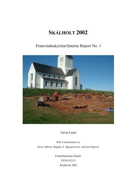
SKÁLHOLT <strong>2002</strong><br />
Framvinduskýrslur/Interim Report No. 1<br />
Gavin Lucas<br />
With Contributions by<br />
Oscar Aldred, Magnús Á. Sigurgeirsson, and Ian Simpson<br />
Fornleifastofnun Íslands<br />
FS191-02131<br />
Reykjavík <strong>2002</strong>
© Fornleifastofnun Íslands<br />
Bárugötu 3<br />
101 Reykjavík<br />
Sími: 551 1033<br />
Fax: 551 1047<br />
ii
TABLE OF CONTENTS<br />
1. Introduction ......................................................................................................................1<br />
Background to the Project................................................................................................1<br />
Aims and Methods ...........................................................................................................2<br />
Contributors and Acknowledgements ..............................................................................5<br />
2. Fieldwork Results ............................................................................................................7<br />
Topographic Survey.........................................................................................................7<br />
Objectives.....................................................................................................................7<br />
Methodology................................................................................................................7<br />
Results ..........................................................................................................................9<br />
Gjóskulagarannsókn (Tephra Analysis).........................................................................10<br />
Fyrri rannsóknir..........................................................................................................10<br />
Niðurstöður ................................................................................................................13<br />
Geoarchaeological Investigations ..................................................................................14<br />
Objectives and research design ..................................................................................14<br />
Preliminary soil assessment.......................................................................................15<br />
Conclusions ................................................................................................................16<br />
Excavation......................................................................................................................18<br />
The Farm Mound (Bæjarhóll) [163] ..........................................................................18<br />
The ‘Torch’ Mound (Kyndluhóll) [200] ...................................................................40<br />
3. Finds...............................................................................................................................44<br />
Organic...........................................................................................................................44<br />
Ceramic ..........................................................................................................................46<br />
Pottery........................................................................................................................46<br />
Clay Pipes .................................................................................................................50<br />
Ceramic Building Material.........................................................................................52<br />
Glass...............................................................................................................................52<br />
Glass Vessels..............................................................................................................52<br />
Glass Beads ...............................................................................................................55<br />
Window Glass............................................................................................................56<br />
Metal..............................................................................................................................57<br />
Lead and Lead alloy...................................................................................................57<br />
Copper alloy...............................................................................................................57<br />
Iron.............................................................................................................................57<br />
Other...........................................................................................................................58<br />
Metalworking debris ..................................................................................................58<br />
Stone/Mineral.................................................................................................................58<br />
Other...............................................................................................................................61<br />
Discussion......................................................................................................................61<br />
4. Discussion......................................................................................................................64<br />
The Archaeological Potential.........................................................................................64<br />
The Environmental Potential .........................................................................................65<br />
Future Work...................................................................................................................68<br />
5. Appendices.....................................................................................................................70<br />
Units...............................................................................................................................70<br />
iii
Samples ..........................................................................................................................75<br />
Finds...............................................................................................................................76<br />
6. References....................................................................................................................100<br />
LIST OF FIGURES<br />
Figure 1. 3D surface map of the homefield<br />
Figure 2. Contour Plan of the homefield showing the location of the excavations<br />
Figure 3. Tephra profiles<br />
Figure 4. Soil stratigraphy, enclosed infield, Skálholt, Iceland<br />
Figure 5. Site Plan showing main groups<br />
Figure 6. Phasing of School Rooms 80 & 81<br />
Figure 7. Section through the kyndluhóll<br />
Figure 8. Changing Proportions of Major Pottery Types<br />
Figure 9. Finds Distribution by Room<br />
LIST OF TABLES<br />
Tafla 1. Helstu gjóskulög í Skálholti og nágrenni<br />
Table 2. Soil chemical data, enclosed infield, Skálholt<br />
Table 3. Summary of finds quantities by phase (by weight in grammes)<br />
Table 4. Pottery wares by phase (by sherd count)<br />
Table 5. Quantity of main pottery types by room for phases 4-5 (fragment count)<br />
Table 6. Glass vessels by phase (by fragment count)<br />
Table 7. Quantity of main glass vessels by room for phases 4-5 (fragment count)<br />
Table 8. Summary of major find types by room for phases 4 & 5 (by fragment count).<br />
iv
LIST OF PLATES<br />
Plate I. View of the Site after excavation of the rooms<br />
Plate II. Western rooms under excavation<br />
Plate III. Corridor under excavation<br />
Plate IV School Room and Dormitory<br />
Plate V. Heating Duct in Room 81<br />
Plate VI. Fireplace [153]<br />
v
1. INTRODUCTION<br />
BACKGROUND TO THE PROJECT<br />
In 1785 after earthquakes had ravaged southern Iceland in the previous year, the school<br />
and episcopal see of Skálholt, which had been a cultural centre in the country for seven<br />
centuries, was abolished and moved to Reykjavík. Much of the farm was reported to have<br />
been severely damaged and was subsequently stripped of its timber, and while the last<br />
Bishop Hannes Finnsson remained at the farm until his death in 1796, the farm complex<br />
itself must have greatly diminished. Maps of the farm from 1784 just prior to the<br />
earthquake and then half a century later in 1836 show the change from a thriving, protourban<br />
settlement to a regular farmstead. How this transformation occurred is not well<br />
documented, but new archaeological work is already revealing that the old buildings<br />
continued in various uses after the earthquake and it may have been decades before the<br />
new farmstead was actually constructed.<br />
Archaeological investigations at Skálholt can be traced as far back as 1893 when<br />
Brynjúlfur Jónsson dug a few small test pits around the farm homefield and interviewed<br />
an old farmer Sigurður Pálsson who had been told about the layout of Skálholt by another<br />
farmer Jón Jónsson who remembered it as it was in the 1780s (Jónsson 1894). In 1902<br />
Brynjúlfur Jónsson later reported on the digging of deep foundations for a new haybarn<br />
just south of the church (Jónsson 1904). He describes in the Árbók the remains of the<br />
corridor (göng) and schoolhouse, including floor layers and a dump of clay pipes. He also<br />
reported that the cutting of a trackway and ditch in the same year, running westward<br />
which damaged St. Þorlákr’s well, including the removal of most of the stones. The barn<br />
was caught in a fire in 1952 (Björn Erlendsson, pers. comm.), and the ruins were infilled<br />
and the whole area of the farm leveled in 1958 where c. 0.5m of the upper soil horizon<br />
was truncated and pushed downslope (Eldjárn et al. 1988: 20).<br />
1
Between 1954 and 1958, the first proper excavations at Skálholt were conducted,<br />
primarily on the site of the church where foundations for two earlier cathedrals were<br />
uncovered, Gíslakirkja or the medieval cathedral which was the largest, and<br />
Brynjólfskirkja, the post-medieval cathedral. Excavations were carried out by Kristján<br />
Eldjárn, along with Håkon Christie, Gísli Gestsson and Jón Steffensen and reported in<br />
one of three volumes about Skálholt (Eldjárn et al. 1988) and also in a short paper<br />
(Eldjárn 1975). As well as the cathedral foundations, the passageway between the<br />
cathedral and the farm mound was excavated, again showing two phases of construction<br />
associated with the two cathedral foundations. Although unreported in detail, a small ruin<br />
known as Þorláksbúð just northeast of the church, was also investigated but nothing is<br />
known of what was found there (Eldjárn et al. 1988:14).<br />
Between 1983 and 1988, small scale excavation through hand-dug trenches was<br />
conducted over the whole site by Guðmundur Ólafsson for the National Museum with the<br />
intention of assessing the veracity of the 1784 plan of the farm layout with a possible<br />
view to reconstruction (Ólafsson <strong>2002</strong>). Although nothing came of this plan, interest in<br />
presenting the cultural heritage of Skálholt was renewed in 1998, when an archaeological<br />
field survey of the whole farm at Skálholt was commissioned by the see of Ská lholt and<br />
conducted by Fornleifastofnun Íslands (Adolf Friðriksson et al 1998) and later in 1999, a<br />
postgraduate student from the University of Bradford in Britain, Timothy Horsley,<br />
conducted a geophysical survey over part of the site (Horsley 1999: 93-107). These latter<br />
projects can be seen as the prelude to the current work undertaken by Fornleifastofnun<br />
Íslands which started this year.<br />
AIMS AND METHODS<br />
The new archaeological investigations at Skálholt by Fornleifastofnun Íslands form a part<br />
of a five year project aimed at a full investigation of the 18 th century farm as it was prior<br />
to its abandonment and at the end of its cultural influence in Iceland. Issues of the long<br />
2
term development of the site and its origins will also be addressed but only generally, for<br />
two major reasons. As with any archaeological work, excavation involves partial or<br />
complete destruction of the remains in order to understand them and to look beneath the<br />
18 th century farm would necessitate its removal. Thus any work on earlier phases of the<br />
site will take place outside the area of the 18th century buildings or in areas already<br />
truncated – such as the 1902 haybarn (see below). Furthermore, since the site was<br />
occupied at least since the 11 th century based on historical documentation, the depth and<br />
expanse of archaeology is so great as would require a project closer to 25 years rather<br />
than 5, for its proper investigation. The 18 th century remains alone will more than occupy<br />
the 5 year plan of this project. For both these reasons, our understanding of earlier phases<br />
of the site will be limited; nevertheless, the archaeological work will provide key<br />
information about the material culture in the post-medieval period in Iceland, particularly<br />
offering a baseline study in wealth and status and how this was expressed in elite society<br />
in the country. Key themes include patterns of material consumption and the built<br />
environment and proto-urbanism.<br />
The primary method of investigation involves archaeological excavation, supplemented<br />
with non-intrusive field survey (both topographic and geophysical), and broader land use<br />
history through environmental work, in collaboration with the University of Stirling,<br />
Scotland. Documentary and archival research on Skálholt by Hörður Ágústsson will also<br />
be integrated into the project. Initially it was hoped that the geophysical survey conducted<br />
by Timothy Horsley in 1999 would be extended to cover a wider area, but due to<br />
unforeseen scheduling this had to be cancelled this season. A topographic survey was<br />
conducted however, to produce a surface contour map of the main area by Oscar Aldred<br />
(FSÍ). Ian Simpson of the University of Sterling conducting a preliminary assessment for<br />
a wider land use study and Magnús Sigurgeirsson provided an analysis of the tephra<br />
sequence for the area.<br />
Excavation this year began in the area of the school rooms and dormitory, and where the<br />
1902 haybarn was built, using a mechanical excavator with toothless bucket to remove<br />
the turf/topsoil and the concrete rubble fill of the 20 th century haybarn and associated<br />
3
structures. Thereafter, excavation proceeded by hand, the spoil tipped in a trailer which<br />
was periodically emptied off site. After stripping, a 5m site grid was established on the<br />
same alignment as the national grid (Hjörsey), us ing 4 base points provided by Vegagerð<br />
ríkisins, who also set three fixed station points around the site. For our internal site grid<br />
however, we used an independent, arbitrary numbering system, employing eastings and<br />
northings as the national grid points worked on a westings and northings system. The<br />
conversion is given below for two points:<br />
Nat. Grid (W/N)<br />
Site Grid (E/N)<br />
622998/404936 500/250<br />
622978/404936 520/250<br />
Excavation methodology employed a modified version of single-context/unit recording<br />
developed by Fornleifastofnun Íslands with a strategic sampling programme for<br />
environmental remains. Numbers in square brackets (e.g. [001]) in the text in this report<br />
refer to this unit index system. The main innovations to the recording system used at<br />
Skálholt were twofold: the first involved a single A3 permatrace record sheet with<br />
combined plan (5x5m square at 1:20) and unit description along one side. This decreased<br />
paperwork, made a separate graphics register redundant, and generally accelerated the<br />
recording process. The second change involved conceptual changes to the unit index – a<br />
two-level system was implemented with unit numbers either referring to discrete<br />
depositional/stratigraphic contexts as before (cuts or deposits) or amalgamations of such<br />
units (at any level of generalization, labeled as groups). As a supplement to the primary<br />
A3 record sheet, an A4 group sheet was employed for detailed discussion of such groups.<br />
The group context type was advantageous insofar as it encouraged greater scope for onsite<br />
interpretive recording and, in that it permits multiple hierarchies of grouping, it is<br />
infinitely flexible. In the unit register it was also decided to include our own and<br />
previous excavators actions, being also part of the history of the site; thus archaeological<br />
trenches/cuts and spoil/backfill were entered in the same index. Otherwise, all aspects of<br />
the system remained as used on other FSÍ sites – a photo register, sample register and<br />
4
finds register were all maintained. All retrieved material (a nimal bone, artifacts, etc.) was<br />
catalogued in the finds register.<br />
CONTRIBUTORS AND ACKNOWLEDGEMENTS<br />
The project would not be possible without the support and collaboration of a number of<br />
people. The Millennium Fund (Kristnihátíðarsjóður) provided the necessary financial<br />
support to conduct the work with its generous grant. Thanks must also go to the Bishop<br />
of Skálholt, Sigurður Sigurðarson, and the Rector Bernharður Guðmundsson for their<br />
tremendous support and help at all stages of the project. Also thanks to the farmer at<br />
Skálholt, Guttormur Bjarnason for making the day to day running of the excavation so<br />
much easier and smoother and all the staff at the hotel restaurant. Final thanks to<br />
Vegagerðin (Selfoss) for providing us with fixed survey points and the basis of our site<br />
grid, and to Benedikt Skúlason for the machining of topsoil and removal of rubble<br />
backfill from the haybarn during the first week of the project. The management of the<br />
research project was undertaken by Gavin Lucas, Mjöll Snæsdóttir and Orri Vésteinsson.<br />
The excavation team comprised Andrew Hall, Candy Hathaway, Birna Lárusdóttir, Gavin<br />
Lucas (Director), Elín Hreiðarsdóttir, Mjöll Snæsdóttir, Oddgeir Hansson, Orri<br />
Vésteinsson, Richard Turnbull, Sigríður Þorgeirsdóttir, Uggi Ævarsson. In addition,<br />
Oscar Aldred (FSÍ) produced the topographic survey using a differential GPS, Magnús<br />
Sigurgeirsson provided an evaluation of the tephra profile for the area, and Ian Simpson<br />
of the University of Sterling conducted an assessment of the homefield for a land-use and<br />
environment study. The finds were partially processed on site, but the main bulk of<br />
cleaning and cataloguing occurred after and was carried out by Gróa Másdóttir and<br />
Sigríður Þorgeirsdóttir. As a part of the project an extensive outreach programme has<br />
been initiated and this was managed by Barbara Guðnadóttir.<br />
5
The project is a cooperation between Fornleifastofnun Íslands and Þjóðminjasafn Íslands.<br />
On behalf of the museum Þóra Kristjánsdóttir has set up a small exhibition on previous<br />
excavations and conservator Jannie Ebsen has taken care of small finds conservation.<br />
6
2. FIELDWORK RESULTS<br />
TOPOGRAPHIC SURVEY<br />
Oscar Aldred, FSÍ<br />
A contour survey was carried out over 3 days, between 19th and 21st June, <strong>2002</strong> in the<br />
area immediately south and west of the main excavation area. The survey area covered c.<br />
17,520 square metres, with a perimeter of c. 0.65 km.<br />
Objectives<br />
The initial ground truthing of the survey area showed there to be several earthwork<br />
features, ranging in extent from 2-3 metres to over 100 metres in length. There was also<br />
28 metres range in the height; c. 59 metres to c. 77 metres. As a result it was decided to<br />
set the resolution of the survey at 5 metres. The objectives of the <strong>2002</strong> season were to:<br />
1. To obtain a coarse resolution contour survey of the area at approximately 5m<br />
resolution;<br />
2. To identify areas for targeted survey in the following season.<br />
Methodology<br />
The survey was carried out using 2 Trimble 4600LS GPS units to track GPS satellites on<br />
the L1 frequency. A TDC1 Survey Controller was used. A Base Station Receiver was set<br />
up over a free station point (i.e. not known) and was initialised with the Rover. The<br />
poisiton of the Base Station Receiver was calibrated. The accuracy of the survey x, y, z<br />
was to +-1 m.<br />
7
76 m<br />
75 m<br />
74 m<br />
73 m<br />
72 m<br />
71 m<br />
70 m<br />
69 m<br />
68 m<br />
67 m<br />
66 m<br />
65 m<br />
64 m<br />
63 m<br />
62 m<br />
61 m<br />
60 m<br />
0 m 50 m 100 m<br />
Figure 1. 3D surface map of the homefield<br />
Once the baseline was established a Kinematic Survey, using both stop-and-go and<br />
continuous surveys, was undertaken of the survey area; continous was used to collect the<br />
majority of the survey data. Post survey processing was carried using GPSurvey 2.35 to<br />
calculate baselines and recalibration of the height with respect to the NKG96 Geoid<br />
Iceland. WGS84 datum and Geodetic format was used and converted to ISN93 local coordinate<br />
system. Image processing of the data was carried out in Surfer8. Nearest<br />
Neighbour interpolation was used to construct the 3D model using Anisotropy Ratio of 1<br />
and Anisotropy Angle of 0 and a spacing of 2.12 (Grid report can be found in the SKH02<br />
archive).<br />
The data collection was divided into 3, each area demarcating natural limits within the<br />
survey. The 1st area, East, covered 5,460 square metres was traversed in a systematic<br />
north-south direction at 5 metres transect intervals. The 2nd area, West, covered 4,350<br />
square metres in a systematic east-west direction at 5 metres transect intervals. The 3rd<br />
area, South-west, covered 7,710 square metres in a systematic east-west direction at 5<br />
metres transect intervals.<br />
8
Results<br />
The survey produced a 3D model of the survey area, and the placement of the excavation<br />
area and features into this. The survey showed several areas of earthworks that were<br />
identified during the ground truthing. The farm mound, hollow-ways, and a ridge running<br />
east to west with discrete features on it (Figures 1 & 2).<br />
STN2<br />
STN3<br />
Kirkja<br />
Kyndluhóll<br />
Trench [152]<br />
STN1<br />
Area of<br />
excavation [161]<br />
0 m 50 m 100 m<br />
Figure 2. Contour Plan of the homefield showing the location of the excavations<br />
On the basis of the <strong>2002</strong> GPS contour survey it is proposed that a survey is carried out in<br />
the area of the 2003 excavation, before trenching using the 4600LS GPS. A more detailed<br />
survey should be carried out over areas of the survey, to be decided on the basis of<br />
funding and excavation requirements. It is suggested that the farm mound and the ridge,<br />
including the area of hollow-ways immediately south-east of this is conducted in 2003. It<br />
9
is also suggested that a topographic survey, i.e. of the landscape features such as fences,<br />
buildings, car park areas is carried out using either, or both, the GPS and (or) the Total<br />
Station, so as to create a base map for the excavation and to orthorectify aerial<br />
photographs from different periods to understand the changes that have occurred at<br />
Skálholt.<br />
The results of the survey identified the significance and use of contour survey in relation<br />
to excavation. In several ways the results can be used to:<br />
1. provide a context for excavation results to sit within its wider environs;<br />
2. graphically support excavation results through 3D models and placement of CAD<br />
drawings;<br />
3. identify areas for future, more detailed targeted survey<br />
4. identify locations for potential excavation based on the survival of upstanding<br />
earthworks, both obvious to eye and those more subtle.<br />
GJÓSKULAGARANNSÓKN (TEPHRA ANALYSIS)<br />
Magnús Á. Sigurgeirsson, Fjallalind 123, IS-201 Kópavogur, netf.: masig@mmedia.is<br />
Fyrri rannsóknir<br />
Í skýrslunni er greint frá niðurstöðum gjóskulagaathugana sumarið <strong>2002</strong>, gerðar í<br />
tengslum við fornleifarannsóknir í Skálholti. Farnar voru tvær dagsferðir að Skálholti,<br />
dagana 7. júní og 13. júlí. Fyrri daginn var athyglinni einkum beint að uppgraftarsvæðinu<br />
og umhverfi þess en seinni daginn voru gjóskulög könnuð í nágrenni Skálholtsstaðar.<br />
Við greiningu gjóskulaganna var stuðst við fyrri rannsóknir í Skálholti og nágrenni.<br />
Gjóskulög voru könnuð í tengslum við fornleifarannsóknir í Skálholti á árunum 1954-<br />
1958 (Kristján Eldjárn o.fl. 1988). Fram kemur að Sigurður Þórarinsson hafi gert nokkra<br />
10
leit að öskulögum í sambandi við fornleifauppgröftinn, en um árangurinn er ekki fjallað.<br />
Forn garðlög í Biskupstungum, m.a. úr nágrenni Skálholts, hafa verið aldursgreind með<br />
hjálp gjóskulaga (Bryndís G. Róbertsdóttir og Haukur Jóhannesson 1986). Gjóskulög<br />
hafa verið nýtt við rannsóknir á gróðurfarssögu Skálholts og nágrennis (Þorleifur<br />
Einarsson 1962, Margrét Hallsdóttir 1987). Auk þessara rannsókna má nefna athuganir á<br />
útbreiðslu og aldri einstakra gjóskulaga (Sigurður Þórarinsson 1968, Guðrún Larsen<br />
1978, Guðrún Larsen 1984, Hafliði Hafliðason o.fl.1992).<br />
Í töflu 1 eru tekin saman þau gjóskulög frá sögulegum tíma sem búast má við að finna í<br />
Skálholti og næsta nágrenni.<br />
Tafla 1. Helstu gjóskulög í Skálholti og nágrenni<br />
Gjóskulag, gosár Þykkt, cm Einkenni<br />
K-1918 < 0,5 cm svart<br />
H-1766 < 0,2 cm dökkt<br />
K-1721 < 2 cm svart<br />
H-1693 < 0,5 cm dökkt<br />
H-1636 vottur dökkt<br />
H-1597 < 0,2 cm dökkt<br />
K-1500 ~ 1 cm svart<br />
H-1341 < 0,5 cm grátt<br />
H-1104 < 0,2 cm ljóst<br />
Eldgjá-1, ~934 < 0,5 cm svart<br />
K-R, ~920 < 0,5 cm svart<br />
Landnámslag,~870 um 2 cm tvílitt<br />
Nokkur áberandi forsöguleg gjóskulög eru í jarðvegi í Skálholti sem vert er að nefna hér.<br />
Skammt neðan Landnámslags er tvö ljósleit Heklulög, H-A, sem eru um 2500 ára gamalt,<br />
og H-B, sem er um 2800 ára gamalt (Bryndís G. Róbertsdóttir og Haukur Jóhannesson<br />
1986, Bryndís G. Róbertsdóttir 1992). Nokkru neðar er tvílita Heklulagið H-4, sem er um<br />
4500 ára gamalt (Guðrún Larsen og Sigurður Þórarinsson 1978).<br />
11
I I I I I I I V<br />
c m S k á l h o l t M o s f e l l<br />
V e g a t u n g a L a u g a r á s<br />
0<br />
1 0<br />
K - 1 9 1 8<br />
2 0<br />
K - 1 7 2 1<br />
H - 1 6 9 3<br />
3 0<br />
4 0<br />
5 0<br />
K ~ 1 5 0 0<br />
H - 1341 <br />
H - 1 04<br />
H - A<br />
1 0 0<br />
K v a r ð i 1 : 1 0<br />
H - B<br />
H - 4<br />
S K Ý R I N G A R<br />
d ö k k t g j ó s k u l a g<br />
l j ó s t g j ó s k u l a g<br />
l i t a s k i l í j a r ð v e g i<br />
G P S - h n i t s n i ð s t a ð a<br />
S n i ð I : N 6 4 0 7 . 6 2 5 , V 2 0 3 1 . 6 7 8<br />
S n i ð I I : N 6 4 0 8 . 1 9 0 , V 2 0 3 4 . 5 2 2<br />
S n i ð I I I : N 6 4 1 0 . 0 8 8 , V 2 0 3 1 . 1 7 7<br />
S n i ð I V : N 6 4 0 7 . 4 3 8 , V 2 0 3 0 . 0 8 5<br />
G j ó s k u l a g a s n i ð í S k á l h o l t i o g n á g r e n n i , m æ l d s u m a r i ð 2 0 0 2<br />
Figure 3. Tephra profiles<br />
12
Niðurstöður<br />
Mæld voru fjögur jarðvegssnið í tengslum við þessa rannsókn (mynd 3). Á Skálholtsstað<br />
reyndist örðugt að finna snið þar sem gjóskulög frá því eftir landnám eru varðveitt.<br />
Greinilegt er að mikil jarðyrkja hefur verið stunduð í Skálholti sem leitt hefur til þess að<br />
efsta jarðvegslagið er raskað og gjóskulög því illa varðveitt. Á þeim stöðum sem kannaðir<br />
voru, skurðbakkar suður og vestur af uppgraftarsvæði, eru einungis gjóskulög frá<br />
forsögulegum tíma varðveitt (snið I á mynd 3). Ágæt snið fundust hins vegar í nágrenni<br />
Skálholts, s.s. við Mosfell, Vegatungu og Laugarás (snið II-IV á mynd 3). Allir þessir<br />
sniðstaðir eru í framræsluskurðum í mómýrum. Mest áberandi gjóskulögin í sniðunum<br />
eru Landnámslagið, H-1693 og K-1721. Flest gjóskulög eru í Mosfellssniðinu, þar fannst<br />
m.a. ljósa gjóskulagið H-1104 (staðfest með smásjárskoðun), H-1341() og K~1500. Þó<br />
að þessi gjóskulög hafi ekki fundist á Skálholtsstað við fyrstu leit ættu þau öll að vera þar<br />
til staðar. Vafalítið væri hægt að finna þau með frekari vettvangskönnun.<br />
Nokkur leit var gerð að gjóskulögum á uppgraftarsvæðinu. Eins og vænta mátti fundust<br />
þar engin óröskuð gjóskulög, enda um samfelldar byggingaleifar að ræða þar sem grjót<br />
og torf er ráðandi. Slitrur af svörtu gjóskulagi voru áberandi í efsta torflaginu á NV-hluta<br />
svæðisins. Telja má víst að um Kötlugjósku sé að ræða og þá líklega K-1721. Hins vegar<br />
eru Kötlulög hver öðru lík og greining á gjóskuslitrum í torfi því vandasöm. Slitrur af<br />
gráleitu gjóskulagi sáust einnig í torfi, líklegast af Heklugjósku. Mikilvægt er að skoða<br />
nákvæmlega gjóskulög í neðri lögum bæjarhólsins eftir því sem uppgreftrinum vindur<br />
fram. Í mörgum tilvikum veita þau mikilvægar vísbendingar um aldur og upphleðslu<br />
mannvistarlaga.<br />
Vert er að benda á að gjóskulög varðveitast jafnan vel þar sem upphleðsla jarðlaga er<br />
hröð. Þannig aðstæður skapast gjarnan þar sem mannvistarlög hlaðast upp við bæi s.s. í<br />
sorphaugum og móöskubingjum, allmörg dæmi eru til um slíkt (Magnús. Á.<br />
Sigurgeirsson, óbirt gögn). Einnig eru gjóskulög oft vel varðveitt í jarðvegi næst undir<br />
tóftum, einkum torfveggjum, þar sem ekki hefur gætt uppblásturs og átroðnings.<br />
13
Þrátt fyrir að gjóskulög frá síðasta árþúsundi séu lítt áberandi í jarðvegi á Skálholtsstað<br />
verður að telja afar líklegt að þau hafi varðveist að einhverju leyti innan um eða í<br />
mannvistarlögum bæjarhólsins. Í hversu miklum mæli það er, munu rannsóknir komandi<br />
ára leiða í ljós.<br />
GEOARCHAEOLOGICAL INVES TIGATIONS<br />
Ian A. Simpson., Department of Environmental Science, University of Stirling, Stirling FK9 4LA,<br />
Scotland, U.K.<br />
Objectives and research design<br />
The primary objective of this research is to characterise enclosed land management<br />
practices associated with the Skálholt ecclesiastical site, and compare these<br />
characteristics against two other farm types of similar age in western Iceland to assess<br />
their distinctiveness. A soils-based approach will be adopted to achieve characterisation,<br />
based on the principle that soils are dynamic natural bodies whose properties reflects the<br />
environment in which they have been formed. In cultural landscapes, therefore, soil<br />
properties can reflect early land management practices, and this approach has been<br />
successfully applied to a number of early land management questions in the north<br />
Atlantic region, including Iceland (see for example Simpson, 1997; Simpson et al., 1998<br />
Simpson et al., <strong>2002</strong>). Temporal and spatial frameworks for the study will be provided<br />
using tephrochronology and by parallel soil survey, sampling and analyses at two other<br />
early farm locations (a staður site – representing a secondary ecclesiastical settlement,<br />
and a ‘standard’ farm site). Applying this approach to Skálholt permits two hypotheses<br />
can be tested as follows:<br />
Enclosed land management at Skálholt demonstrates manuring strategies that are<br />
more intensive and cropped (cereals and grass) than neighbouring farms. This<br />
would indicate that Skálholt adopted different approaches to land management<br />
and that the church adopted a strategy of intensive production as a means of<br />
14
ensuring local wealth; this may be further tested, by consideration of church<br />
cartularies. The alternative hypothesis is that Skálholt did not intensively manage<br />
land, preferring to rely on tithing (i.e. external income) to maintain wealth.<br />
If the first hypothesis is validated and intensity of land management at Skálholt is<br />
consistently high throughout the early ‘Christian’ period, then a second<br />
hypothesis is that crop productivity was high throughout this period, even during<br />
periods of climatic deterioration. This will, in part, reflect the significance of<br />
year-on-year improvement to land quality through manuring strategies.<br />
Soils survey will be undertaken by systematic ha nd augering and by exposure of selected<br />
profiles for sampling. Analyses of soils will be undertake using thin section<br />
micromorphology (Davidson and Simpson, 2001) and element analyses used in<br />
CENTURY soil organic carbon and productivity modelling (total carbon, total nitrogen<br />
and total phosphorus – Simpson et al., <strong>2002</strong>). The temporal and spatial framework of the<br />
study will allow statistical models and comparisons of soil properties and productivities<br />
to be made.<br />
Preliminary soil assessment<br />
A preliminary soil assessment has begun to indicate the validity of a soils-based approach<br />
to understanding early land management practices associated with the Skálholt<br />
ecclesiastical settlement. One exposure in a ditch section has demonstrated accumulating<br />
silt loam and sandy silt loam soils with colours ranging from 2.5YR 3/6 (dark red) to 10<br />
YR 3/1 (dark grey brown) (Figure 4). Prior to the landnám tephra of AD 871±2 there is<br />
no disturbance or amendment of soils. Post landnám there is evidence of cultivation<br />
ridges, with an earlier phase overlain by a later phase, that have a distance of<br />
approximately 120cm between the high points of the ridges. Based on colour<br />
characteristics, these cultivation ridges were created by overturning turves and exposing<br />
the soil. The occurrence of occasional fine charcoals and rare small bone fragments<br />
indicate that these soils were amended with a view to maintaining and enhancing soil<br />
15
productivity. Soil accumulation on top of the ridges suggests that cultivation was<br />
subsequently abandoned. However, the continuing amendment of these accumulating<br />
soils, again evidenced through the occurrence of small charcoal and bone fragments<br />
suggests that this area may have been used for intensive grassland production. Samples<br />
for thin section micromorphology and bulk chemical analyses have been collected to<br />
further test and refine the field observations; preliminary results of the chemical analyses<br />
are available (Table 2). Of particular significance are the total phosphorus values which<br />
have a range of 152 – 1159 mg / 100g, as enhanced levels of total phosphorus have been<br />
used in cultural landscape contexts to indicate amendment of soils with organic materials.<br />
Here the marked difference in total phosphorus values between pre- and post- landnám<br />
soils indicates significant levels of amendment, with a greater degree of amendment<br />
during the final phases of soil accumulation. Furthermore, the total phosphorus values<br />
from the amended soils at Skálholt are greater than those found in other early enclosed<br />
arable areas studied in Iceland where ranges of 242 – 303 mg /100g total phosphorus<br />
have been identified (Simpson et al, <strong>2002</strong>), implying a greater intensity of manuring at<br />
Skálholt.<br />
Conclusions<br />
Emerging evidence from Scotland is beginning to suggest that early, pre-Reformation,<br />
ecclesiastical settlements may have introduced new agricultural land management<br />
methods that contributed to substantial landscape change, with evidence for new ways of<br />
working the land retained as relict soil properties (see Discussion below). On these<br />
grounds, it is possible to advance the hypothesis that early ecclesiastical settlements also<br />
contributed new land management systems to Iceland. This project will define the nature<br />
of land management systems associated with Skálholt, using a soils-based approach that<br />
integrates historical and archaeological evidence, within a tephro-chronological<br />
framework and spatial framework that includes analyses of contrasting farm types.<br />
16
Figure 4. Soil stratigraphy, enclosed infield, Skálholt, Iceland<br />
Sample No. Organic matter<br />
% w/w<br />
Total Nitrogen<br />
% w/w<br />
Total Phosphorus<br />
mg/100g<br />
Total Carbon<br />
% w/w<br />
1 10.9 0.484 1159 7.03<br />
2 7.9 0.352 633 5.11<br />
3 9.9 0.411 586 6.24<br />
4 10.0 0.408 628 5.78<br />
5 5.3 0.196 173 2.79<br />
6 30.7 0.581 152 10.30<br />
Table 2. Soil chemical data, enclosed infield, Skálholt (see Figure 4 for sample<br />
locations).<br />
17
EXCAVATION<br />
Excavation occurred at two places on the site – the main area lay just south of the church<br />
on the site of farm ruins, the second on the west side of the ‘torch’ mound or Kyndluhóll.<br />
The first represents about one quarter of a large r area covered by the farm ruins which<br />
will be expanded in subsequent seasons, while the second trench was an attempt to assess<br />
the nature of the mound and may not involve further work. The excavations on the farm<br />
ruins revealed a deeply stratified site and a full stratigraphic matrix has been constructed<br />
for this area with preliminary phasing into six levels. Given the long-term and seasonal<br />
nature of the project, the preliminary phasing system employs a reverse sequence, so that<br />
phase 1 refers to the latest or uppermost level, phase 6 to the earliest encountered so far.<br />
The current phasing and corresponding dates are given below:<br />
Phase<br />
Date Range<br />
1 1958-<strong>2002</strong><br />
2 1902-1958<br />
3 c.1830-1902<br />
4 1784-c.1830<br />
5 c.1730-1784<br />
6 pre c.1730<br />
The results discussed below will refer to this phasing only broadly, but its main function<br />
at this stage is to provide a framework for finds analysis and stratigraphic control.<br />
The Farm Mound (Bæjarhóll) [163]<br />
The main excavation covered a 20 x 30m open area [161] established to encompass the<br />
northeastern quarter of the main farm mound and also the modern haybarn. Directly<br />
below the turf, an expansive disturbed layer [001] from 1958 when the farm mound was<br />
levelled was encountered; this layer infilled the 20 th century farm remains and also<br />
partially the upper part of the 18 th century structures. A large part of this layer was<br />
18
emoved by the machine, but some was also hand excavated, particularly in the southern<br />
half of the site where the deposit thickened as the ground surface sloped. Most of the<br />
finds from this layer were 20 th century – ceramics, glass and various ironwork fragments,<br />
and undoubtedly represent rubbish from the early 20 th century farm which lay to the west.<br />
The archaeology encountered in this area was primarily either early 20 th century or later<br />
18 th century in terms of structural remains; there were some 19 th century deposits, but<br />
these consisted either of re-use or abandonment layers in the 18 th century ruins. No<br />
structural evidence of the mid-later 19 th century farm was found, but it is suspected to lie<br />
further to the southwest. In the base of the cut for the haybarn, the remains of buildings<br />
below the 18 th century were visible and well preserved. No work was conducted on these<br />
remains this season, but loose pottery finds indicate these may be 16 th /17 th century levels.<br />
The total depth of the archaeology remains unknown, but the deepest truncation by<br />
modern building was a circular hay silo [006] which extended 1.7m below the 18 th<br />
century level, and still contained archaeology. A preliminary estimate might suggest the<br />
total depth of stratified deposits making up the farm mound to be c. 4m.<br />
The 18 th century Farm and early 19 th century Re-use (Phases 3-6)<br />
The layout of the rooms closely resembles the plan from 1784, although the proportions,<br />
sizes, angles and orientations are all highly schematic on the plan compared to our<br />
findings (Figure 5). Despite the earthquake of 1784, the rooms and walls of the 18 th<br />
century farm survived very well and more or less intact, but in general, the depth of<br />
survival increased to the south, the walls at the northern end standing only c. 0.10m,<br />
while at the southern end, 0.65m. The main corridor running north south [30] with an<br />
infirmary [100], schoolroom [81] and dormitory [80] on the east side and bishop’s<br />
quarters [15], library [55] and miller’s room [39] on the other side were all very clear.<br />
The edge of the whey store was also found, but not excavated this year. The only<br />
additional element was a room on the northern side at the corner of the passageway from<br />
the church [127] – this is not marked on the 1784 plan, and was certainly a later addition<br />
from an archaeological point of view. Kristján Eldjárn excavated partly into it in the<br />
1950s.<br />
19
The buildings basically consisted of dry-stone faced walls with a turf or soil core<br />
[107/130]. The walls were between 1 and 2m thick and surviving between 0.5 to over 1m<br />
high. Different phases of construction are evident, both in plan and from the depth of the<br />
walls, some of which stop at the level of excavation, some of which continue deeper. It is<br />
clear therefore that the plan as recovered archaeologically, is the product of different<br />
phases, and in particular, the main north-south walls of the corridor seem to be<br />
established fairly early and pre-date the rooms immediately adjacent to it. This explains<br />
the different alignments of the rooms and the corridor, and why the floor level of the<br />
corridor is so much lower than adjacent rooms. Further careful study of this is required as<br />
many aspects to the phasing may be understood without excavating the walls.<br />
Two of the rooms had wooden gable ends, the infirmary and the school, though the<br />
school gables were later re-built in turf and stone. No original floors were found in any of<br />
the rooms, as in all cases they appear to have had wooden floors which have been<br />
removed. These were probably stripped after the earthquake, when we know from<br />
documentary sources that much of the timber was auctioned off. The floor in the corridor<br />
is less clear as it has not been completely excavated yet, but it too may have had timber<br />
floors. The roof would have been of timber and turf with probably stone and birch branch<br />
cladding, though this did not survive except as collapsed material into the rooms. The<br />
roof would have been supported by upright posts resting on stone pads which were found<br />
in many cases. No interior furnishings or features were found except in the school room<br />
where there was an under-floor duct running upslope from a stone lined box set at the<br />
lower end (see below). Nevertheless, a wide range of loose fixtures and fittings and<br />
structural artifacts were recovered associated with several phases of building on the site –<br />
bricks, nails, door and window furniture, and candle -holders to name the most common.<br />
The buildings were heavily re-used after the earthquake, in almost all cases except the<br />
school room. The dormitory, the bishop’s room and library were all used as animal byres,<br />
as was the corridor which had been blocked off at three points. The earliest blockings are<br />
on the north and south ends of the corridor, and this was done when it was probably<br />
20
converted to use as an animal byre in the late 18 th /early 19 th century. Access here would<br />
have been through the eastern passage which led into the tunnel from the church and to<br />
the dormitory. Later on, the whole passageway was blocked in and no longer in use.<br />
Certainly these blockings indicate active maintenance of the buildings of some nature and<br />
they were not just left as ruins. The school room was not re-used at all but simply left as a<br />
ruin, and had probably completely collapsed in, while the infirmary seems to have been<br />
re-used, but not for keeping animals but perhaps as a store room. This had been paved<br />
over with loose flagstones, like the bishop’s room, but unlike that, did not have the same<br />
accumulation of animal dung.<br />
The only problematic aspect to this arrangement lies with the phasing of the school room<br />
and dormitory against the rest of the site. There were no stratigraphic links (as yet)<br />
between the eastern and western sides of the area because of truncation by the haybarn,<br />
and unlike the western side, all the finds in the occupation and abandonment deposits of<br />
the school rooms were exclusively 18 th century. One major consideration is that the<br />
upper/latest phases of the schoolrooms have been completely truncated and what was<br />
excavated was an earlier phase. Traces of later walls over the northern end of the school<br />
room may just be the remains of such later phase. Below are more detailed descriptions<br />
of each of the rooms and other components of the site; the initials of the main excavator<br />
are placed in the entitlement, as their notes and records provided the main source of<br />
interpretations presented here.<br />
Plate I. View of the Site after excavation of the rooms<br />
21
Room [15] (Bishop´s Inner Chambers; OV)<br />
Only a part/half of the room fell within the area of excavation, but it was at least 3m long<br />
(aligned north-west/south-east), and 3.8m wide originally. Lying at the northern edge of<br />
the area on the higher ground, it had suffered most from truncation and its walls only<br />
survived to a height of c. 0.30m at the south and 0.10m on the north. There was no access<br />
from this room to the corridor, to which it is skew, although there is possibly an access<br />
(blocked in) south to room [55] just on the edge of the excavation area. This should be<br />
resolved next season. A probable drain runs centrally along the length of the room (eastwest),<br />
marked by large flagstones, associated with a floor layer of smaller flagstones and<br />
decomposed organic matter/hay [145]. Neither of these were excavated and it is uncertain<br />
whether they represent a sub-(wooden) floor layer or later re-use – it was not a very<br />
compacted surface. Above this and fully excavated however, was a similarly unstable<br />
layer of slabs [101] with more decomposed organic material [093] having accumulated<br />
around and over them including hay, twigs and wood chips in three major lenses. It is<br />
possible these represent later re-use of the room as hay storage, with stones laid to keep<br />
the floor dry.<br />
Definite re-use is marked by a major alteration to the room by narrowing its width to<br />
2.8m (north-south) when a new northern wall is constructed [109]. The floor level<br />
associated with this modification was in many ways similar to those below: periodic<br />
laying of stone slabs [087] with accumulating organic matter [065], but this time<br />
primarily of decomposed animal dung and ash lenses. More compact than the earlier<br />
floors, at this time the room was almost certainly used to house livestock. Although the<br />
accumulating deposits differ between the two phases, the same methods of flooring seem<br />
to have been used: stone slabs. It is probable that the floor layers (or absence of them –<br />
see discussion of other rooms below) associated with the primary use of the room as the<br />
Bishop´s chambers lie below the unexcavated layer [145], which, with those layers<br />
above, represent initial re-use of the room as a hay store, and then, as the room is<br />
narrowed and the later floor layers testify, was converted to an animal byre.<br />
22
Figure 5. Site Plan showing main groups<br />
23
Abandonment of the building is marked by turf and stone collapse [018] and then ash<br />
midden dumps [014] into the ruin.<br />
Room [55] (Library; BL)<br />
As with room [15], only a part of the room extended into the excavation area but it was<br />
at least 4.1m long (aligned north-west/south-east) and 3.5m wide, its walls surviving to c.<br />
0.5m on the north and 0.6m on the south, although on the north side some truncation had<br />
been affected by one of Guðmundur Ólafsson´s trenches [013]. Apart from the already<br />
mentioned possible passage to room [15], there was no access to the main corridor. No<br />
primary floor was found associated with this room and it is presumed this had wooden<br />
floorboards which were removed. Excavation stopped above a dark organic layer [103]<br />
which continued beneath the walls and represents part of the next building phase below.<br />
Directly above this was a fairly compacted, iron panned layer of decomposed organic<br />
matter/animal dung [083], which represents the re-use of the room as an animal byre. A<br />
few flat stones close up against the wall were set in this layer and may represent post<br />
pads. Above this was turf and stone collapse [043] from the walls and roof marking the<br />
abandonment of the room, and over this, just on the eastern edge of excavation, an ash<br />
midden dump [068].<br />
Room [39] (Miller´s Chambers; EH)<br />
At the southern end of the excavation area this room was aligned close to north-south and<br />
skew to both the corridor and rooms [15] and [55]. Again, only a portion of the room fell<br />
within the limits of excavation, but it was at least 3.2m long (north-south) and 3.2m wide<br />
(east-west). It survived to a depth of c. 0.35m in the north and 0.65m in the south and as<br />
with room [55], no floor was found and it was presumed to have been floor-boarded.<br />
Excavation stopped above a similar organic layer [092] as in room [55], and with which it<br />
is probably continuous. Unlike rooms [15] and [55], there is no indication of re-use in<br />
this room and the primary layer preserved probably represents sub-floor leveling and<br />
24
occupation accumulation. This primary layer was an iron panned, turf deposit [090] with<br />
an upper lens of greyish silt probably representing the accumulation of material through<br />
the floorboards. Set in this layer and close to the centre of the room was a large stone c.<br />
0.5m square, worked on its sides and with its upper surface smoothed and concave . This<br />
stone may represent a large post-pad for a timber post supporting an upper storey, but it<br />
seems un-necessarily worked, unless it had been re-used. Its original use could have been<br />
as a work surface, perhaps for beating dried fish, but if it is in its primary position, it<br />
would have stood low on the ground, only about 0.25m above the floor.<br />
Assuming the floorboards were originally over this layer but since removed, the next<br />
deposit was primary roof/wall collapse [077], and contained the richest group of finds,<br />
most of which occurred along the eastern side of the room, while in the south-east corner<br />
was a discrete lens of charcoal. Above this was a further series of turf wall/roof collapse<br />
layers ([066], [049]) with some ashy lenses. The uppermost part of the room was filled<br />
with modern leveling [036], which had been pushed into the hollow of the room when it<br />
was a ruin.<br />
Plate II. Western rooms under excavation<br />
25
Room [127] (Unknown Annexe; MS)<br />
Unmarked on the 1784 plan, this room lies in the corner between the passage from the<br />
church and the side passage in the farm [106]. It was partially excavated by Kristján<br />
Eldjárn in 1952-54, his trench clipping the east side [160]; Guðmundur Ólafsson also dug<br />
into this room in 1984 [009]. Based on Eldjárn´s plan and our own, this room was<br />
probably aligned north-east/south-west, with access into it from the passageway to the<br />
church; it extended 1.6m (north-south) into our excavation area and was 2.9m wide (eastwest),<br />
its depth of survival c. 0.4-0.6m deep. Its primary associated floor was an iron<br />
panned, dark organic layer [139] with animal dung and wood chips indicating this was<br />
probably an animal byre/work shed, although the very basal part of the layer was cleaner,<br />
suggesting it may have had a different primary function. Over this floor was turf<br />
wall/roof collapse [128] representing the abandonment of the room. A possible later wall<br />
[070] had been built over this collapse which may be contemporary with wall [056],<br />
which runs alongside the northern edge of the haybarn (see discussion of the 20 th century<br />
Farm below).<br />
This annexe is clearly a later addition, both because it is not marked on the 1784 plan but<br />
also on stratigraphic grounds. While its western wall is part of an earlier feature –<br />
possibly the continuation of corridor, the southern and eastern walls are added and<br />
contemporary with the floor, as the layer beneath continues under them. However, traces<br />
of earlier walls lie behind these as seen from the surface; it is most evident on the<br />
southern side where one of Guðmundur Ólafsson´s trenches [009] is cut in the middle of<br />
the wall and exposes the back part of a stone facing for an earlier wall. There is also a lot<br />
of turf debris over these walls at this point ([047], [050], [058]) and also an ash dump<br />
from the 19 th century [044].<br />
26
Corridor [30] (Main Corridor; CH)<br />
The corridor was perhaps the most impressive space in the farm complex for its depth of<br />
walls; considerably deeper than any other of the rooms, it is possibly an old part of the<br />
farm retained through several centuries as a key architectural element. At the northern<br />
end it survived to a height of c. 0.55m, but at the southern limit of excavation, its walls<br />
reached 1.15m; although close to completion, primary floor level was not reached. Our<br />
excavations affectively covered its northern half, running north-south for c. 18m and<br />
1.2m wide. Its width seems remarkably narrow, especially with respect to the 1784 plan,<br />
but then this plan is rarely accurate on dimensions. Although the depth of survival was<br />
good, the walls of the corridor were robbed out in places, particularly the eastern wall.<br />
Along the central part of the east side, the upper courses of stones were missing at several<br />
points, but the major robbing occurred at the southern end of the eastern side. Initially<br />
causing much confusion dur ing excavation, the wall section adjacent to the whey store<br />
had been completely robbed of its stones down to a depth of c. 1m. While the northern<br />
side of the access from the corridor into the whey store appears fairly clear (although<br />
even here, there seems to be two possible phases), the southern side is much more<br />
ambiguous because of this robbing episode, and given that the full extent of the whey<br />
store has not been excavated yet, this part of the corridor may provide more surprises.<br />
The first floor level reached in the corridor was a dark organic layer composed primarily<br />
of animal dung [148] with occasional flat flagstones, especially along the eastern side and<br />
near the base [158] which may be part of the roof collapse. It suggests that the corridor,<br />
in its final stages at least, was used to shelter animals, but the layers below this have not,<br />
as yet been excavated. Above this animal floor surface were the primary series of<br />
roof/wall collapse deposits ([129], [140], [144], [155]) from the abandonment of the<br />
corridor, with occasional peat ash dumps [141] against the western side. Later episodes of<br />
turf collapse were represented by [133], [134], [119], [089], [091] and [076], with [119],<br />
[091] and [076] containing lenses of peat ash, with another major peat ash dump horizon<br />
marked by [079]. This series of collapse and peat-ash dumps suggests the ruin was<br />
27
sporadically used to dump hearth waste as it was collapsing, probably over the course of<br />
the 19 th century.<br />
Above these 19 th century abandonment deposits were early 20 th century deposits of<br />
similar nature, comprising further turf collapse ([072], [051]) over which, at the southern<br />
end, were a series of almost pure charcoal dumps with some smithying waste ([038],<br />
[042], [045]). Sealing the top of the corridor was the lower part of the 1958 leveling layer<br />
([031]/[022]), which as in room [39], had filled in the top of what had been the hollow of<br />
the ruin.<br />
Plate III. Corridor under excavation<br />
28
Significantly, the corridor had been blocke d at each end – both at the northern end by<br />
wall [110], and also at the southern limit of excavation (i.e. about halfway along the<br />
corridor). Both of these blockings extended down to the layer which was unexcavated,<br />
and the blockings themselves remained unexcavated this season. Since they predate or<br />
are at least contemporary with the final floor layers in the corridor associated with animal<br />
shelter, they suggest that access into the corridor for these animals could only be through<br />
the connecting corridor [106] (see below). Until they have been excavated, it is possible<br />
the two blockings may not be contemporary but certainly by the time both were in place,<br />
access could only come via [106]. These blockings clearly post-date the primary use of<br />
the corridor as human occupation and probably date to the latest 18 th or earliest 19 th<br />
century.<br />
Corridor [106] (Side Corridor; GL)<br />
Coming east off the main corridor [030] and connecting to the passageway up to the<br />
church was a short section of corridor, again well preserved to a depth of c. 0.55m, until<br />
its total truncation by the haybarn on the east side just before it turned to join the church<br />
passage. As in the main passage, the first floor layer encountered and at which excavation<br />
stopped, was the animal dung floor [148]. Above this lay the primary turf wall/roof<br />
collapse [147] upon which was built a blocking wall [111] in an L-form, both to block the<br />
corridor and the back of room [100], which originally opened out into the corridor. This<br />
blocking probably dates to the early-mid 19 th century. The space east of this blocking was<br />
filled with turf collapse included within [111], while to the west, turf collapse [129] from<br />
the main corridor [30] continued up to the blocking. Above these layers was the leveling<br />
layer [001].<br />
Room [100] (Infirmary; UÆ)<br />
The infirmary was, according to documentary sources, the latest room to be added to the<br />
complex. Constructed sometime between 1771 and 1781, it was originally built as the<br />
29
Rector´s chambers, and after 1781, converted to an infirmary. As excavated, the room<br />
was more or less complete except for truncation along its eastern wall by the haybarn.<br />
The room was aligned north-south, 4.9m long and 3.1m wide, its walls surviving only to<br />
a height of c. 0.2m. On its northern side, it opened directly onto the corridor, possibly<br />
with a wooden panel frame forming the northern wall with a doorway in it, while its<br />
southern side probably also had a wooden gable end, as there was only a single row of<br />
stones and no turf wall here. The basal layer associated with the room was a sub-floor<br />
leveling/disturbed layer [108], probably associated with wooden floorboards above it and<br />
represents the primary occupation for the room. At a later date, the room seems to have<br />
been re-arranged: the northern wall was blocked up with a full stone course [111], also<br />
effectively blocking the corridor [106] (see above). Associated with this was the laying<br />
down of loose flagstone paving inside the room [098], and on the outside of the southern<br />
gable end, large stone slabs marking an external porch and probably the new access into<br />
the room. The abandonment of the room is marked by turf and stone wall/roof collapse<br />
deposits ([078], [052]).<br />
It is tempting to see the changes to the room relating to its shift from rector´s quarters to<br />
infirmary, however both the artefactual and stratigraphic evidence suggest this change is<br />
much later, probably dating to the early-mid 19 th century. There is no indication of use<br />
for the later flagstone floor – it has none of the rich organic deposits seen in the other<br />
rooms, yet its floor was fairly poorly laid; it is likely to have been used as a dry store<br />
room of some sort. Early 20 th century records describe a drystore (skemma) just west of<br />
the haybarn and although this is probably not the same structure, it may have been rebuilt<br />
as the same in the late 19 th century when most of the farm buildings were re-built<br />
after the earthquake of 1896.<br />
Room [80] (Dormitory; AH)<br />
On the eastern side of the haybarn cut [004] and the most severely truncated by it was the<br />
room described in sources as the dormitory although the 1784 plan incorrectly labels this<br />
30
the schoolroom (and the schoolroom as the dormitory). Aligned northwest/southeast, only<br />
1.6m of its eastern end survived the truncation, but it was probably originally c. 9m long.<br />
At 3.5m wide, its walls survived to a height of c. 0.3-0.45m and along the sides of the<br />
wall at regular intervals at the base were large, flat-topped stone blocks interpreted as<br />
post pads. The room had a centrally placed opening 1.05m wide on its eastern side as<br />
access into the adjacent school room [81] (see below), and running from the threshold of<br />
this opening down through the centre of the room east-west was a stone-lined and capped<br />
drain [113]. The original cut of the drain [117] was 1m wide and 0.3m deep, lined with<br />
stone blocks [115] c.0.2m square and flat stone capping flags [114]. The stones had been<br />
disturbed and partially robbed out, probably during removal of the wooden floorboards.<br />
The fill of the drain [116] was almost waterlogged and organically rich, from which an<br />
environmental sample was taken (S9). The primary floor layers associated with the drain<br />
and the room, were dark, organic-rich layers with birch twigs and bark, some<br />
decomposed straw, and occasional flagstones ([102], [095]). It is likely these represent<br />
sub-floor deposits under the removed floorboards, as neither layer was particularly<br />
compact and showed signs of being disturbed.<br />
Abandonment of the room is marked by a thick deposit of turf and stone debris from<br />
wall/roof collapse [069] above the occupation layers. Secondary use of the room,<br />
sometime after abandonment is indicated by an accumulation of iron panned, dark,<br />
organic matter rich with ()horse hair and straw [059/054] suggestive of a stables or byre.<br />
Unlike other parts of the farm excavated this season where rooms had been re-used<br />
directly above the previous floor level, this room seems to have been either left<br />
abandoned or infilled before re-use. The room is certainly much lower down than the<br />
other rooms (c. 0.1m lower than room [81] and over 0.5m lower than room [100]), and it<br />
is possible therefore that the turf debris [069] indicated deliberate infilling to raise the<br />
level of the floor rather than gradual collapse. There is some suggestion of possib le rebuilding<br />
of the walls too, as a section of the northern wall [099] appeared to be of<br />
different phase to the main walls underneath ([130]). Alternatively this wall may be all<br />
that remains of a later structure (see discussion above). All the finds from the re-use of<br />
the building appear to be 18 th century suggesting this happened very soon after the<br />
31
earthquake and re-location of the school to Reykjavík. The final abandonment of the<br />
room is marked by further turf and stone wall/roof collapse [037] with some midden<br />
dumping into the room [029], which probably occurs no later than the early 19 th century<br />
on the basis of associated finds.<br />
Plate IV School Room and Dormitory<br />
Room [81] (School room; RT)<br />
At the eastern edge of the excavation area, just falling within its limits was the school<br />
room, aligned north-east/south-west and at a right-angle to the dormitory with which it<br />
shared a doorway and on the threshold of which was a large flat floor slab. The room was<br />
9.4m long and 2.88m wide, noticeably sloping down from the north by 0.25m, with stone<br />
blocks serving as pad stones placed regularly (c. 1.4m between each, at the centre point)<br />
along the sides of the walls. Its walls survived to a height of 0.55m in the north but only<br />
0.15m at the south, although the northern and southern walls were slightly different in<br />
construction. This is most clear at the northern end, where the wall is clearly a later<br />
addition (the southern end is more truncated and harder to interpret), and inserted in<br />
between the two north-south walls which continue beyond the limit of excavation.<br />
Possible upper parts of this wall were excavated ([064], [097]) , though these could also<br />
be remnants of a later structure, mostly truncated (see discussion above). This gable wall<br />
32
is also not as deep as the main walls, constructed on top of a layer of turf debris probably<br />
similar to/the same as [149] which covers the interior of the room as a sub-floor make-up<br />
layer during modification to the room. The main form of this modification was the<br />
construction of a stone and turf conduit running north-south through the centre - or rather<br />
just off centre to the east - of the room from a stone-lined pit/box set at the southern end<br />
of the room. This feature [154] was a single construction built on top of the turf ma ke-up<br />
layer, consisting of a 7.6m long and 0.5m wide conduit made with two sides of thin turf<br />
strips and stone slabs c. 0.1-0.2m wide and capped by stone flags [132]. The cavity inside<br />
was c. 0.2m wide and 0.1-0.15m deep. The box at the southern end was rectangular, 0.7m<br />
east-west and 0.3m north-south, and c. 0.25m deep, with stone and turf courses at the top<br />
and raised above the cut, and as it was excavated, large stone flags tipping into it which<br />
had probably once covered it.<br />
Plate V. Heating Duct in Room 81<br />
33
There is little doubt this feature could not have functioned as a drain – the conduit would<br />
have been water permeable, the fill [142] inside was simply clean turf/soil and not at all<br />
characteristic of a water lain deposit, and any water which could have run through the<br />
conduit would simply have collected in the box at the end. More plausibly, the feature is<br />
interpreted as an under-floor heating system, the slope of the ground used not to carry<br />
water down as in a drain, but hot air up as in a flue. The box at the southern end was the<br />
source of the heat, probably an iron stove sat on top of the capped box, maybe with a vent<br />
coming down into the box which fed the flue. No fuel residues were found in the box, but<br />
if an iron stove was used and set on top rather than in the box, this is perhaps not<br />
surprising. While its efficiency may be questioned, there is no reason to doubt it worked<br />
to some degree, and its installation at the same time as the northern end of the room is<br />
blocked with a new wall may be significant in the light of documentary evidence. We<br />
know the students complained of the cold and that the original school room had wooden<br />
gable ends which encouraged a draft through the room, causing the authorities to replace<br />
the gables with proper stone and turf walls. The inserted wall at the northern end is<br />
probably exactly this, while the heating system was an additional attempt to combat the<br />
cold.<br />
Above the heating system were a series of turf collapse deposits from the abandonment of<br />
the room ([094], [088], [085], [082], [075]), and covering these was a layer of slopewash<br />
[074], probably from the churchyard. Along with room [39], this is the only part of the<br />
farm complex excavated so far which did not exhibit later 18 th /19 th century re-use; why<br />
some were and some not is hard to say – it may relate to their condition after the<br />
earthquake, or it may be other factors. Certainly those rooms directly connected to the<br />
corridors and the corridor itself seem to have seen heavy use by animals.<br />
Although excavation stopped at the level of the heating system, beneath this and the<br />
gable end repair of the school room was a substantial occupation layer [159] associated<br />
with the primary use of the school room and contemporary with [095] in room [80]. This,<br />
as with room [80], may have been floor-boarded over, but certainly when the heating<br />
34
system was installed there were floor-boards over the room which were later, as<br />
elsewhere, dismantled and removed. Probably contemporary with this lower floor level<br />
was a fireplace set into the centre of the eastern wall (ónn), which was blocked in during<br />
the modification to the room. This fireplace [153] was stone-lined and inside had in situ<br />
hearth remains [143], capped by rubble collapse [136] and disturbed ashy soil [125]<br />
which had partly spilled through or under the blocking over the floor make up layer<br />
[149]. Pottery from the fireplace dates to the late 17 th /early 18 th century. More<br />
significantly, the eastern wall associated with this fireplace was originally set back from<br />
the visible wall as it appears with the later phase of this room.<br />
Plate VI. Fireplace [153]<br />
Quite when the eastern wall was brought closer in and the room subsequently narrowed is<br />
hard to determine – it does not seem to have happened at the same time as the gables<br />
were blocked and the heating duct laid, or even when the fireplace was blocked, but<br />
35
much earlier. Curiously though, the off-centre position of the heating duct would be quite<br />
central if the room was its original width before this wall was altered. Stratigraphically<br />
however, the heating duct cannot be contemporary with this earlier wall, and this<br />
symmetry may be fortuitous, or the product of aligning the duct to another feature which<br />
was contemporary with the original wall.<br />
Stone fireplaces set against a wall are rare. They have been seen as part of special rooms,<br />
the ónstofa, and in a survey from 1974, Hörður Águstsson cites one such from Skálholt<br />
mentioned in the 17 th century (Águstsson 1974: 38, table 4), although the one excavated<br />
need not be the same one referred to in the documentary sources. In most of Águstsson’s<br />
examples, the fireplace is standing proud (i.e. extending out) of the wall, but at Skálholt,<br />
it is recessed into the wall. Águstsson cites just one recessed example, at Gröf which<br />
dates no later than the 14 th century. Gröf was excavated by Gísli Gestsson and in a paper<br />
from 1976 he suggests it was a bath-house (baðstofa), citing two other examples he<br />
excavated, at Kúabót (late 14 th century) and Reyðarfell (mid 16 th century; Gestsson<br />
1976). The fireplace at Gröf is set into one corner of the room, but at Kúabót and<br />
Reyðarfell, they lie central and opposite the entrance, as at Skálholt. At Skálholt there are<br />
documentary references to a skólabaðstofa. Since both Gestsson’s and Águstsson´s<br />
papers, other excavated examples of stone fireplaces have come to light such as at Viðey<br />
and Stóraborg – at Stóraborg, there were several stone fireplaces found, recessed into the<br />
wall and placed centrally and opposite the doorway (M. Snæsdóttir, pers.comm.). These<br />
are dated to the late medieval/early post-medieval period, i.e. 15 th -17 th century.<br />
There remain many un-answered questions about rooms 80 and 81, but they certainly<br />
appear to be stratigraphically complex when compared to the rooms on the western side<br />
of the area. It seems certain that more modifications and re-buildings have occurred in<br />
this area over a similar span of time than elsewhere currently opened. The ground plan of<br />
earlier school rooms seems to have been preserved and re-built over time, whereas the<br />
rooms on the western side of the area started from scratch, save the corridor. It is also<br />
hard to be certain whether an upper, final phase of the school rooms has been truncated,<br />
surviving only as wall remnants or whether these are simply repairs, perhaps associated<br />
36
with the changes to the gables. Closer dating of the finds from these rooms may help to<br />
resolve this, but certainly the rooms as currently excavated belong broadly to the 18 th<br />
century. Hopefully further work next season will elucidate some of these issues.<br />
External Deposits (MS/SÞ)<br />
Two areas of the site were outside the main farm building complex – a large area in the<br />
southeast, which, apart from 20 th century deposits (see below), was unexcavated this<br />
season, and in the northwest, a small corner just outside the opening of the main corridor<br />
[30]. This latter was partially excavated down to the first surviving surface [126], which<br />
consisted of loose flagstones leading north from the doorway into the corridor and over<br />
which the blocking wall [110] had been constructed. To the west of this was a layer of<br />
charcoal, ash and bones [118] indicative of sheet midden. Both the flagstones and midden<br />
dump are probably early-mid 19 th century in date and are associated with the later re-use<br />
of the farm buildings. Above the flagstones were turf collapse deposits ([112], [104]) and<br />
over the midden, turf and substantial stone rubble, also probably wall collapse ([121],<br />
[105], [096]). Above all this area and the walls was the base of the 1958 leveling layer<br />
[086].<br />
The 20 th century Farm (Phases 1-2)<br />
While the 20 th century farm house lies to the northwest of the excavation area, associated<br />
farm buildings [002] – namely the haybarn and adjacent structures – did lie within our<br />
excavations. All had been largely truncated when the farm mound was leveled in 1958,<br />
and only traces were left of most buildings. The haybarn dating to 1902 was the most<br />
substantial, cutting deep into the farm mound; it comprised a nearly square foundation cut<br />
[004], measuring 9.5m east-west and 10.6m north-south, with an extant depth between<br />
1.7m in the north and 0.7m in the south. Its sides were lined with large stones (averaging<br />
c. 0.3-0.4m in size), and in the northeastern corner, the stones had been additionally faced<br />
with concrete and the floor also laid with concrete.<br />
37
Figure 6. Phasing of School Rooms 80 & 81<br />
38
On the mid 1950s plan of the ruins of these buildings, this corner is marked out as a<br />
separate compartment; presumably this concreting was a later modification to the barn.<br />
Attached – also probably a later addition - to the southeastern corner of the barn was a<br />
circular hay silo, 3.1-3.2m in diameter and 1.7m deep [006], lined on its sides and base<br />
with slightly smaller and more rounded stones and faced with concrete all over [005]. An<br />
associated access or foundation cut lay on its southern side, 2.9m long (east-west) and<br />
2.15m wide (north-south) and 0.4-0.9m deep. All these features were filled with the<br />
disturbed and mixed leveling layer [001] as well as collapsed material from their sides<br />
(i.e. stone rubble and concrete), and excavated with the machine.<br />
On the eastern side of the haybarn were the partial remains of another structure. Running<br />
east-west from the barn at one end and continuing beyond the limits of excavation was a<br />
much shallower cut [040] also lined on its sides and base with concrete, at c. 3m wide<br />
and surviving to a depth of c. 0.4m. This is all that remains of a building marked on a<br />
plan from the mid 1950s which is shown to have extended south as far as the hay barn,<br />
and described as a byre. Parts of its eastward limits can still be seen on the surface<br />
outside our excavation area. Another, smaller building is shown on the western side of<br />
the barn but this was obviously completely demolished as there was no indication of it in<br />
our excavations.<br />
A turf wall [056] ran east-west along the northern edge of the excavation area as far as<br />
the passageway into the church and on its eastern side as far as the haybarn extended. Its<br />
eastern limit was ambigious and indeed a few metres further east was a robber trench<br />
[053] on the same alignment which had some very large boulders in it as well as<br />
slopewash [046]. This cut may relate to the construction of the 20 th century farm<br />
buildings, particularly [040]. Whether the wall forms part of the back/northern wall of<br />
these buildings or pre-dates them is ambiguous, but it clearly post-dates the early-mid<br />
19 th century re-use of the 18 th century farm complex. On the other side of the passage<br />
and cut by Eldjárn´s trench, a similar type of wall was found on the same alignment<br />
[070]. The two walls were at quite different heights, the latter about 0.5m lower, but this<br />
in itself does not preclude their association.<br />
39
On the southern side of the haybarn and silo, a number of features were hand excavated<br />
which are contemporary with these buildings. A stone-lined and capped drain ran northsouth<br />
from the hay barn; 0.5m wide and 0.2m deep [024], it had clearly been<br />
disturbed/damaged by the 1958 leveling event and had flat stones laid on edge along the<br />
sides or tipping into it. It was not completely excavated, the last metre or so before the<br />
hay barn was left, and this was where it was best preserved. Another shallow drainage<br />
channel [021] ran northwest-southeast, c. 0.3m wide and 0.07m deep. Apart from these<br />
drains, the remaining in situ deposits were midden tips from building [40], which fanned<br />
out down slope from the edge of where the southern building limit originally was ([032],<br />
[025], [019]). The greater majority of 20 th century finds occurred in the leveling layer<br />
[001], and there were noticeably greater densities on the western then eastern side. This<br />
probably reflects the original location of late 19 th and early 20 th century farm middens<br />
and other features, indeed there was far more such material in the abandonment deposits<br />
in rooms on the western than those on the eastern side.<br />
The ‘Torch’ Mound (Kyndluhóll) [200]<br />
Guðmundur Ólafsson cut a trench close to the top of this impressive mound in 1988 and<br />
this was re-opened in order to examine his section. It was hoped that this would be the<br />
rubbish tip for the farm, but upon cleaning back the section, it was clear that the mound,<br />
though anthropogenic and with rubbish material incorporated into it, was no deeply<br />
stratified midden as hoped. As a double check and to investigate the lower levels of the<br />
mound (Guðmundur Ólafsson´s trench extended only 1.3m deep from the surface), a new<br />
trench [152] was cut on the back, western side where there had already been some<br />
truncation in recent years (probably by a machine). This new trench (6.6m long and 0.8m<br />
wide) cut to a depth of 3.4m from the top, in a stepped fashion to reveal essentially a<br />
similar sequence of anthropogenic deposits (Figure 7). Two column samples were taken<br />
at strategic points in order to assess the micromorphology of the mound, and from which<br />
pollen and other sub-samples may be taken. In addition, 5 bulk samples were taken from<br />
40
selected layers for flotation of plant remains (Units [203], [213], [224], [226] and [228]).<br />
These samples will hopefully resolve aspects of its composition.<br />
On the basis of the field inspection of the layers, 4 major phases of activity were<br />
distinguished. The uppermost layers ([201]-[206], [217]) appear to date to the 19 th<br />
century, and consist of thick deposits of ashy dumps sandwiched between probable turf<br />
collapse. A single sherd of a late drab coloured stoneware (from a bottle) dates to the late<br />
19 th or even early 20 th century and came from layer [203]. It is known from documentary<br />
sources that during the 19 th century, stables were built on top of the mound and these<br />
layers probably relate to this. The second phase is distinctly different – much thinner<br />
layers and lenses of more mixed ash and turf debris occur ([207]-[214]), with some larger<br />
stones. Although different, the nature of the layers suggests there is an earlier phase of<br />
building or structural activity here. The next phase is marked by a couple of thick, turf<br />
debris deposits, capping several thinner layers of mixed turf and ash, including a probable<br />
pit filled with stone rubble and an organic layer on the base ([215]-[216], [218]-[223],<br />
[229]). It suggests yet another earlier phase of building. The lowermost layers excavated<br />
– but not the base of the mound which was at least another 1-2m lower down – comprised<br />
thicker deposits of turf collapse and debris ([224]-[228]), no doubt again deriving from a<br />
structure. A sherd of probable Frechen stoneware came from [224], and an internally<br />
green-glazed redware cooking pot rim came from [226], both probably dating to the 17 th<br />
century.<br />
Although clearly not a midden mound, excavation of the Kyndluhóll has thrown up the<br />
question of what it is and why it has been built up in such a fashion. The evidence of our<br />
trench suggests the mound is a ‘mini’ version of a farm mound, i.e. it is simply the<br />
successive accumulation of construction and leveling events of one or more turf<br />
structures on the same location. The presence of ash dumps throughout the sequence<br />
probably attests to the presence of a hearth or other fire in or nearby these structures.<br />
Quite why this location should have seen successive buildings of similar size and extent<br />
on the same spot is not immediately apparent. The fact that the latest documented<br />
buildings are stables is not necessarily of any use either, as re-use of old ruins for animal<br />
41
shelters in the 19 th century seems to have been widespread on this site (as on many<br />
others).<br />
We do know that an ironworking forge or smithy was the only other building in the<br />
vicinity from the 1784 plan, where it is shown to the south of the Kyndluhóll, with<br />
Þorlák’s well lying between. Guðmundur Ólafsson´s trenches through this structure<br />
found no evidence of metalworking however (Ólafsson <strong>2002</strong>). Curiously, on an older<br />
perspectival plan of Skálholt , the smithy is shown north of Þorlák’s well, and there is no<br />
reference on this map to the Kyndluhóll which would be where the smithy is marked. Of<br />
course this earlier plan is by no means to be accepted as accurate yet the anomaly is<br />
interesting and it may not be inconceivable that the Kyndluhóll is the site of earlier<br />
smithies. Both its name and the location – far from the main farmstead, close to the well<br />
and in a position where a later smithy is at least sited - might suggest this is currently the<br />
most plausible interpretation of the mound. Hopefully, samples from our trench may<br />
provide some clues or information which could confirm or refute this idea.<br />
42
Figure 7. Section through the Kyndluhóll<br />
43
3. FINDS<br />
The amount of finds recovered from this season was substantial – over 136kg of pottery,<br />
glass, metal, stone and animal bone to name the most common categories (Table 3). 51%<br />
of this material came from the upper levels of the site (phases 1-3; later 19 th -20 th century),<br />
the remainder from 18 th and early 19 th century features. Only an assessment of the<br />
material is conducted here, full analysis will take place at a later date. Numbers in arrow<br />
brackets (e.g. ) in the text below indicate finds numbers as they occur in the<br />
catalogue.<br />
ORGANIC<br />
On the whole preservation was very good for all organic remains , especially lower down.<br />
Most of it comprised unworked animal bone, the waste of food remains. The larger part<br />
of the animal bone came from just one room (15 – the Bishop´s Inner Chamber), which<br />
accounted for over 10kg of material (nearly 60% of all bone from the site). This material<br />
was part of the re-use of the room as a midden dump and relates to the 19 th century farm.<br />
The faunal remains will be assessed before the next season and included in next years<br />
report. Apart from faunal remains, most other organic material was artefactual except for<br />
some cherry stones also found in Room 15 (). Wood was mostly structural –<br />
fragments of timber planking or furniture, but there was also a few smaller items<br />
including a complete butter pat or paddle also from Room 15 (), a number of<br />
wooden buttons from various deposits over the site (, ) and a wooden comb<br />
(). Apart from wood, there were also textile fragments (wool) and some leather,<br />
including a shoe from Room 55 (). A bone comb (>921>) and a bone nib ()<br />
were also recovered as well as a few small fragments of possible worked horn – these<br />
were thin, flat pieces, which may have come from drinking vessels or windows.<br />
44
20 th century 19 th century 18 th century<br />
1958-<strong>2002</strong><br />
1902-1958<br />
c.1830-1902<br />
1 2 3 4 5 6 Unph. Total<br />
Organic<br />
animal bone 86 738 6125 7325 12 158 3076 17520<br />
bone artefacts - - - 6 - - - 6<br />
wooden artefacts - - - 90 - - - 90<br />
other wood 4 4 26 824 - 21 2 881<br />
leather - 2 - 171 - 2 - 175<br />
textile - 5 - 201 - 117 - 323<br />
horn - - 2 - - - - 2<br />
fruit stone - - - 4 - - - 4<br />
indef.organic 2 1 2 - - - - 5<br />
Ceramic<br />
pottery 305 8669 1080 1494 261 229 359 12099<br />
clay pipes 22 133 47 625 217 48 20 1112<br />
building material 534 5021 4160 17669 1530 - 24 28938<br />
Glass<br />
vessels 356 8245 910 4044 324 107 - 13986<br />
window pane 42 808 237 626 27 8 12 1760<br />
other - - - 6 - - - 6<br />
Metal<br />
lead alloy objects - 182 - 14 6 - - 202<br />
lead objects - - 13 198 6 - - 217<br />
copper alloy objects 41 522 40 159 27 49 - 838<br />
iron tools - 1220 40 163 - - - 1423<br />
iron horse trappings 0 3879 159 658 0 0 100 4796<br />
structural ironwork 627 6491 721 811 117 6 65 8838<br />
other iron objects 484 4177 1398 1391 255 49 65 7819<br />
other metal objects - 38 - 28 74 17 - 157<br />
metalworking debris 8 44 637 4 - - - 693<br />
composite (metal/other) - 151 18 32 - - - 201<br />
Stone<br />
strike-a-lights 43 0 59 87 270 7 - 466<br />
whetstones 32 1152 980 362 103 20 - 2649<br />
quernstones - 4750 - 10000 - - - 14750<br />
other 121 1365 208 11434 499 26 17 13670<br />
Other<br />
building material - 3124 - 86 - - 52 3262<br />
plastic - 11 - - - - - 11<br />
sealing wax - - 2 2 - - - 4<br />
Grand Total 2709 50757 16864 58512 3728 864 3512 136946<br />
1784-c.1830<br />
c.1730-1784<br />
pre- c. 1730<br />
Table 3. Summary of finds quantities by phase (by weight in grammes)<br />
45
CERAMIC<br />
Pottery<br />
A rapid assessment of the ceramics was conducted which involved basic sorting and<br />
quantification by sherd count according to fabric type; notes on forms and decoration and<br />
other attributes were also made but a full analysis based on vessel counts will only be<br />
done at a later stage. Pottery comprised the principal category of ceramic finds, and the<br />
majority was late 19 th and early 20 th century industrial refined earthenwares , the<br />
frequencies decreasing backward in time (see Table 4). This later pottery was<br />
predominantly composed of whitewares, a large proportion of which were simply plain<br />
(c. 60%), though there was also a large number of decorated vessels. Three main types of<br />
decoration occurred – transfer prints were the most common (c. 40% of all decorated<br />
vessels), followed by sponge wares (21%) and banded wares (18%). The remaining types<br />
included slipwares, decal or lithograph prints, hand painted, and rare luster wares, but all<br />
in small proportions. Other industrial refined earthenwares included creamwares,<br />
pearlwares and yellow wares, as well as some 19 th century colour glazed vessels. Some<br />
late stonewares and also bone china porcelains were also present.<br />
Sourcing most of this material is near impossible without makers marks, but three<br />
factories were identified, all from England – Scott brothers of Southwick (Sunderland),<br />
Wedgwood & Co of Tunstall (Staffordshire) and Furnivals of Cobridge (Staffordshire).<br />
The latter were clearly a major exporter of the ‘Blue Fluted’ pattern which was also the<br />
most popular output of the Danish Royal Copenhagen factories – perhaps Furnivals<br />
provided a cheaper alternative geared specifically to the Scandinavian market, as the<br />
mark logo incorporates a Viking ship. This pattern formed the most common transfer<br />
printed design by far on the site. One base of a bone china vessel was marked as ‘Made<br />
in Czechoslovakia’, with a D under a crown; this can only date after 1918. No Czech<br />
factory mark could be correlated with this, and indeed the mark may refer to a decorator<br />
firm, Helena Wolfsohn in Dresden who used blanks from other factories (chiefly<br />
Meissen). Between 1882 and the 1930s, their mark was a D under a crown.<br />
46
Ware/Fabric Code PHASE 1 2 3 4 5 6 Unphased To tal<br />
Porcelains<br />
chinese porcelain CHPOR 3 14 11 101 10 7 - 146<br />
european porcelain EURPOR - - - 5 - - - 5<br />
bone china BONE 4 148 5 - - - - 157<br />
parian (unglazed bone china) PAR - 8 - - - - - 8<br />
Tin-glazed earthenwares<br />
Dutch tin -glazed earthenware TGE - 11 5 45 22 17 1 101<br />
Stonewares<br />
Rhenish stoneware RHSW - 2 4 25 9 21 1 62<br />
Westerwald WES - 1 1 2 1 - - 5<br />
brown salt glazed stoneware BSGS - 14 10 5 18 - 1 48<br />
grey saltgalzed stoneware GSGS - 3 1 1 - - - 5<br />
buff saltglaze stoneware BUFFSGS - - - - 1 - - 1<br />
grey dipglazed stoneware GDGS - - - - - - 1 1<br />
white salt glazed stoneware WSGS - 2 1 3 - - - 6<br />
Coarse Earthenwares<br />
blackware BGRE - 1 - 2 - - - 3<br />
brown-glazed white earthenware BWE - - - 1 - - - 1<br />
glazed grey earthenware GGE - 2 - - - 1 - 3<br />
green-glazed red ware with<br />
white/yellow slip GGSLIP - - 2 2 - - - 4<br />
green glazed orange/red<br />
earthenware GOE - - - 1 1 1 3<br />
glazed red earthenware GRE 2 4 5 15 3 18 47<br />
glazed yellow earthenware GYE - - - - - 2 - 2<br />
red bodied slipwares with<br />
white/yellow slip trail RBSLIP 2 4 2 28 1 - - 37<br />
slipcoated wares SLIPC - - - - 1 - - 1<br />
unglazed red earthenware URE - 8 - 2 - - - 10<br />
white slipped (internally) glazed<br />
red earthenware WSGRE - 2 - - - - - 2<br />
Industrial Refined<br />
Earthenwa res<br />
creamware CREAM - 1 2 15 - - - 18<br />
pearlware PEARL - - - 1 - - - 1<br />
whiteware WHITE 53 1621 140 39 1853<br />
ironstones IRON - 11 16 8 - - - 35<br />
yellow bodied earthenware YBE - 2 1 - - - - 3<br />
majolica MAJ - 3 - - - - - 3<br />
brown glazed earthenware BGE - 5 - - - - - 5<br />
Grand Total 64 1867 206 301 66 67 5 2576<br />
Table 4. Pottery wares by phase (by sherd count)<br />
Pottery from the earlier phases is more distinctive and include German stonewares from<br />
the Rhineland including Westerwald jugs and probably Frechen Bartmann jugs. Tin -<br />
47
glazed earthenwares (faience) were fairly common and these probably derive from the<br />
Netherlands. The most common were those in a pinkish or buff powdery fabric where the<br />
thick glaze tended to flake off, but there was one distinctly different type which occurred<br />
on just one example (, ) which had a thinner, more resilient glaze. The source<br />
of this is unknown. Most of the tin-glaze earthenwares were blue and white, but there<br />
were a few polychrome decorated vessels. There were various types of coarse glazed<br />
earthenwares, but the most common was a bright red or orange slipware, often with a<br />
greenish-yellow glaze, which is probably either Dutch or German. Of special note<br />
however is part of a green-glazed encrusted earthenware vessel () which probably<br />
dates from the 17 th century and comes from Germany; unfortunately it was unstratified<br />
and came from the hay silo [005]. Chinese porcelain formed a major component of fine<br />
tablewares, and all three major 18 th century types were present – brown, blue and white<br />
and enameled. In addition, some en griselle vessels were present. There were also some<br />
sherds of white saltglaze stoneware, almost certainly from Staffordshire in England. All<br />
this pottery is 18 th century and very early 19 th century and effectively associated with the<br />
18 th century farm.<br />
Looking at the changing composition of the assemblage through time by major categories<br />
of pottery type, shows a fairly expected pattern (Figure 8). Throughout the 18 th century,<br />
stonewares (mostly from the Rhineland), tin-glazed earthenwares (probably Dutch) and<br />
Chinese porcelain all increase at the expense of coarse earthenwares, and the trend seems<br />
to continue through the end of the century and into the next, except for a decline in<br />
stonewares. However, by the mid 19 th century, the whole ceramic repertoire has radically<br />
changed with the influx of Staffordshire industrial refined earthenwares. This may relate<br />
to the opening of direct trade between Iceland and England after 1854, though<br />
Staffordshire ceramics could have been imported via Denmark. The only comment I<br />
would make here is the occurrence of this change at such a late date; this ceramic<br />
revolution is generally seen much earlier (i.e. late 18 th /early 19 th century), and even<br />
though the date of the transition between phases 3 and 4 is not very tight at present, it still<br />
makes this transformation a delayed process compared to elsewhere. This really ties into<br />
one of the key issues in the study of modern ceramics in Iceland – its consumption in<br />
48
terms of availability, cost and also conservatism. As on most sites of this period in the<br />
country, vessel repair and re-use is extremely common, and it raises many questions in<br />
terms of both dating and consumption patterns.<br />
100%<br />
90%<br />
80%<br />
70%<br />
Industrial Refined Earthenwares<br />
Coarse Earthenwares<br />
Stonewares<br />
Tin-Glazed Earthenware<br />
European Porcelain<br />
Chinese Porcelain<br />
Sherd Count<br />
60%<br />
50%<br />
40%<br />
30%<br />
20%<br />
10%<br />
0%<br />
pre 1730 1730-1784 1784-1830 1830-1902 1902-1958 1958-<strong>2002</strong><br />
Figure 8. Changing Proportions of Major Pottery Types<br />
As a final look at the ceramics from the site, it is worth conducting a preliminary analysis<br />
of the distribution of pottery types between rooms; to avoid as much as possible problems<br />
of re-deposition and re-use, only pottery from the occupation and immediate<br />
abandonment phases (4-5) of the rooms have been included (Table 5). It shows a very<br />
interesting pattern; by far and away the rooms with the finest tablewares are the school<br />
room and dormitory – here Chinese export porcelain and tin-glazed earthenwares<br />
dominate the assemblages while most of the other rooms – particularly the infirmary,<br />
Bishop’s room and Miller’s room have proportionately much more stonewares and coarse<br />
earthenwares. The corridor, library and annexe all have very little ceramics,<br />
unsurprisingly.<br />
49
Bearing in mind that the rooms on the western side of the site have not been completely<br />
excavated, it is nevertheless a potentially interesting pattern and at first glance, suggests<br />
that the students were far better served with fine tablewares than the Bishop or Miller!<br />
This is undoubtedly a more complex picture than it appears though – in the first instance,<br />
particularly in the case of the Bishop´s rooms, so far only one half of a room of a whole<br />
suite of rooms have been excavated. Also the vessels from the school rooms and the<br />
dormitory may chiefly reflect the personal belongings of students rather than their<br />
everyday tableware, as there was a proper refectory (borðstofa) where they would have<br />
dined. It will be extremely interesting to examine the assemblage from this room when it<br />
is excavated. This preliminary analysis has however shown the potential of examining<br />
assemblage composition by room and the information it might yield.<br />
Chinese<br />
Porcelain<br />
European<br />
Porcelain<br />
Tin-Glazed<br />
Earthenware<br />
Stoneware<br />
Coarse<br />
Earthenware<br />
Refined Industrial<br />
Earthenware<br />
Bishops room (15) 3 1 8 9 33 16<br />
Library (55) 1 - 2 2 1 -<br />
Millers room (39) 6 4 11 8 15 9<br />
Corridor (30/106) - - 1 - - -<br />
Annexe (127) 2 - - - - -<br />
Infirmary (100) 5 - 1 20 1 33<br />
Dormitory (80) 43 - 16 9 - 1<br />
School room (81) 45 - 22 15 8 -<br />
Table 5. Quantity of main pottery types by room for phases 4-5 (fragment count)<br />
Clay Pipes 1<br />
After pottery, the next major ceramic class were the clay smoking pipes; these were most<br />
common in phase 4, belonging to the period immediately after the earthquake, though<br />
their primary use may have been in the previous phase. Both pipe stems and bowls<br />
occurred, and often as large fragments; quite a number were decorated and several were<br />
1 Natascha Mehler provided most of information discussed in this section.<br />
50
marked allowing identification, most of which belong to the 18 th century. A mark seen on<br />
more than one pipe (e.g. ) was the snake, a type found on Dutch Gouda pipes<br />
(slang), dated by Duco to 1733-1808, though the mark also appears on German pipes<br />
from Lower Saxony a little earlier (1698-1714). Another Gouda mark which occurred<br />
was the milkmaid which has a very broad span (melkmeisje, 1660-1940). One bowl with<br />
the number 18 under a crown was identified () , dated to 1725/35-1806 by Duco.<br />
More common were makers names or initials; on the base of the spur was one marked<br />
DIB or DIP which could be Jan de Bock (DIB) (1705-1828, Duco) or Jakob de Potter<br />
(DIP) (1736-1746, Duco; Meulen gives the same date; ). On the base of another<br />
spur was the initial CX or CK under a crown, as yet unidentified (). Two stems<br />
were stamped M.VERZYLS – possibly one of two Maarten Versijls, one operating from<br />
1731 to 1770, and Maarten the younger from 1763 to 1782 (, ). Another two<br />
stems were marked with the simple words IN GOUDA ().<br />
Apart from Dutch pipes, which probably formed the majority, there were also Danish<br />
types; one stem () was marked […] ROS[….] S. Fersl[…] (Alexander Ross and<br />
Severin Ferslew of Copenhagen; Alexander worked from 1753 to 1764, and in 1758<br />
Severin Ferslew joined him). Such pipes have also been found at Viðey and Aðalstræti<br />
(Reykjavík). A pipe bowl marked with an A and an R on opposed sides could be Johan<br />
Adolph Rømer who worked at Nørre Sundby, a town in Jutland opposite Aalborg<br />
(). He had the pipe monopoly for Denmark and Norway from 1773 onwards, and<br />
very often he marked his pipes with an A and R on each side of the heel. He died in 1822,<br />
but had stopped working already in 1815. Many pipe stems and bowls were decorated in<br />
a fluted pattern (e.g. ) which may also come from Denmark (Stubbekøbbing), but<br />
other sources are possible including Germany or the Netherlands.<br />
Ceramic Figurines<br />
Only a few fragments from figurines were recovered, both in unglazed porcelain or<br />
bisque and from the upper demolition layer (). One was a fragment of a Doll´s head<br />
51
with incomplete markings: Ger[many], R10/[...] on one piece and on another 37[…]<br />
A.M.[…]. This is undoubtedly from the factory of Armand Marseille in Köppelsdorf<br />
(Bavaria), the largest exporter of dolls between the 1890s and 1920s. Dolls were signed<br />
usually with his name or initials, followed by the mould number and ‘Germany’ or ‘Made<br />
in Germany’. The doll would probably have had a leather body and a mohair wig. The<br />
other fragments were unidentifiable, but could be long to an ornamental figurine.<br />
Ceramic Building Material<br />
The final category of ceramic finds are structural – bricks and drain pipes. Only a sample<br />
of such material was retained, at least in the upper disturbed layers so the quantities do<br />
not reflect absolute amounts and should be excluded from any statistical analysis. A<br />
number of bricks both complete and fragmentary were kept and will be compared to the<br />
type series from Aðalstræti which covers a similar period. Only one small brick fragment<br />
came from a layer pre-dating phase 4, and may be intrusive; it would seem at first glance<br />
then that bricks were not present until the 19 th century and from the surviving structural<br />
evidence, it certainly seems they were not used in any major way as building material,<br />
even then. The ceramic drains are all a typical late 19 th /early 20 th century type (saltglazed<br />
stoneware) and almost all were found in phase 2 dating to the first half of the 20 th<br />
century.<br />
GLASS<br />
Glas s Vessels<br />
Basic recording of glass vessels involved sorting and quantifying the fragments by colour<br />
and major type of vessel, with notes on forming method and any decoration; all measures<br />
are based on fragment count. A more detailed analysis by vessel will be conducted at a<br />
later date. A large number of vessel fragments were recovered, from a variety of vessel<br />
types, though bottles of one sort or another dominated the assemblages (Table 6). Bottles<br />
containing alcoholic drink – spirits, beer or wine – were the most frequent, and although<br />
52
not always easy to distinguish, on the whole beer bottles were more common in the later<br />
phases (19 th and early 20 th century) while wine and spirits dominate in the 18 th century.<br />
Much of this pattern is simply a reflection of storage or serving changes however, as beer<br />
bottles are generally only found from the 19 th century and after and there is no reason to<br />
doubt beer was consumed as much as wine or spirits in the 18 th century - it was merely<br />
stored differently (e.g. wooden barrels/casks) 2 . One fragment from a casement bottle had<br />
a seal mark, the letters […]UM 1700 (or 1760), around a crest (). Apart from<br />
alcohol, some of the bottles may also have been used to contain soft drinks such as soda,<br />
but there were no unequivocal examples of such bottles found on the site and it is more<br />
likely most if not all contained alcohol of some sort.<br />
PHASE 1 2 3 4 5 6 Unphased Total<br />
Vessel Type<br />
Alcohol Bottles<br />
wine/spirits/beer bottle 8 158 43 134 2 3 - 348<br />
beer bottle 4 144 - 1 - - - 149<br />
wine bottle - - 1 44 5 - - 50<br />
casement bottle 6 4 18 140 24 5 - 197<br />
Drinking Glasses<br />
beaker - - - - 2 3 - 5<br />
stemware 2 3 5 8 - 15 - 33<br />
jug - 1 - - - - - 1<br />
tumbler - 16 - 1 - - - 17<br />
Pharmaceutical Bottles<br />
medicine bottle - 13 - - - - - 13<br />
phial 1 42 7 14 1 - - 65<br />
Other<br />
unidentified bottle 11 62 34 187 21 29 - 344<br />
inkwell - 2 - - - - - 2<br />
thin vessel 3 23 6 58 6 8 1 105<br />
unidentified vessel 7 170 12 53 3 9 - 254<br />
flask 6 13 3 19 1 - - 42<br />
Total 48 651 129 659 65 72 1 1625<br />
Table 6. Glass vessels by phase (by fragment count)<br />
Pharmaceutical bottles formed the second major category of vessels, and while some<br />
were large medicine bottles, by far the majority were small cylindrical phials, either free-<br />
2<br />
Wine was also stored in casks and early wine bottles were often used simply as decanters rather than<br />
storage vessels as well, a practice which only developed toward the end of the 18 th century.<br />
53
lown as in the 18 th century examples or moulded in the later 19 th and 20 th century types.<br />
Two later types had embossed markings, one marked S.C. SCHOUS, KØBENHAVN,<br />
FABRIKER [..]IKE (), the other […]AISWKROHESSERZ (). All these<br />
phials would have contained small amounts of drugs and, certainly for the later phials,<br />
may have been equally for veterinary as human use. Some larger square bottles may be<br />
pharmaceutical, or they may have held condiments; one bottle was marked K & Q<br />
(). In this context, it is interesting to note that the regional physician lived at<br />
Skálholt in the early 20 th century and had a pharmacy (lyfjabúd) in part of his house.<br />
Glass table wares were rare, and not always easy to identify. Many of the thin-walled<br />
vessels classed under ‘other’ in Table 6 could be either beakers or phials for example.<br />
Nevertheless a number of drinking vessels were recorded, including beakers and<br />
stemware. A fine example of a 17 th century Dutch wafelbeker was found in clear glass<br />
(, ), while a number of wheel-engraved lead glass drinking vessels and a jug<br />
were also recorded, these latter possibly from England. There was also one fine example<br />
of an 18 th century opaque white beaker with rust red latticino swirls/marbling (),<br />
and several sherds from different units which may be from the same or several blue<br />
latticino vessels (, , , , , ). Finally there are several<br />
painted square flasks, both in clear and blue glass; these are probably Dutch or Rhenish<br />
and depict various decorative motifs – floral and human, as well as lettering. One near<br />
complete flask, though un-painted, does have spiral moulding on the body (). From<br />
the latest phases came several tumblers, some modern but also some may possibly be 18 th<br />
century. Two modern ones are marked, one as ‘Made in Belgium’, another as<br />
‘Rhurglas’ (both )<br />
Preliminary analysis of the distribution of glass vessels reveals some potentially<br />
interesting patterns, though they must be read with a degree of caution. Quantities of the<br />
main different vessel types were summarized for all the rooms using only those units<br />
which have been phased to the occupation (phase 5) and immediate abandonment (phase<br />
4) periods (Table 7). This should filter out most (but not all) of the material associated<br />
with the re-use of the rooms while still retaining a large enough group to work with.<br />
54
Bearing in mind these caveats, it is clear that most rooms contained a sizeable quantity of<br />
glassware except the corridor and the annexe, and that alcohol bottles dominated the<br />
assemblages, either as wine/spirit bottles or casement bottles. The room with by far and<br />
away the most amount of glassware is the dormitory – and its numbers must really be<br />
multiplied when we consider that only perhaps one quarter of the room survived<br />
compared against other rooms (although some of these remain to be fully excavated). The<br />
only other point to make is the variation between wine/spirit and casement bottles – the<br />
latter commonly associated with gin or perhaps other spirits. Wine bottles are much more<br />
popular in the dormitory and infirmary than casement bottles, while the opposite is true<br />
for the Bishops room and school room. Whether this reflects a predeliction for particular<br />
beverages or something else may be a subject for further enquiry.<br />
Wine/spirit bottle<br />
casement bottle<br />
drinking glass<br />
phial<br />
Bishops rooms (15) 7 17 1 1 1<br />
Library (55) 9 - - - 3<br />
Millers room (39) 20 29 2 - 1<br />
Corridor (30/106) 10 5 1 - -<br />
Annexe (127) - 5 - - -<br />
Infirmary (100) 22 9 1 1 1<br />
Dormitory (80) 103 28 6 5 7<br />
School room (81) 12 81 - 8 -<br />
flask<br />
Table 7. Quantity of main glass vessels by room for phases 4-5 (fragment count)<br />
Glass Beads 3<br />
A few glass beads were found, most of these were probably made in the Netherlands<br />
(Baart 1988; Karklins 1974). One blue monochrome, translucent tubular drawn bead<br />
(, Type Ia) has seams on each side and may have been subsequently moulded. A<br />
round, wound bead (, Type WIIIa) has a black opaque body with 3 yellow wavy<br />
3<br />
Elín Hreiðarsdóttir provided much of the information in this section. The typology employed refers to that<br />
of Kidd & Kidd 1970)<br />
55
lines. There was also a fine example of a translucent blue ‘raspberry’ bead (, Type<br />
WIId), wound and then moulded. Finally there were several smaller, tiny (probably<br />
embroidery) beads. These were monochrome circular beads, all drawn and Type IIa<br />
including an opaque yellow () and two opaque white and one translucent blue<br />
().<br />
Window Glass<br />
A large part of the glass fragments came from window panes associated with the farm<br />
buildings – both modern sheet glass and older blown green glass occurred. Most<br />
fragments are pale green blown glass and came from phase 4, the period of the<br />
abandonment of the 18 th century farm although this under-represents the amount of<br />
modern glass from the later levels (especially phase 2) as this was only sample retrieved.<br />
The older glass is sometimes hard to distinguish from casement bottle glass, but on the<br />
whole, most of the identifications are considered correct. This older window glass usually<br />
had cut edges, but occasionally some showed signs of being re-worked (‘re-touch’) while<br />
a few examples had the original smooth edge as manufactured. This older blown glass<br />
may be either crown glass or cylinder rolled glass, and further study may be able to<br />
distinguish the two types. One possible fragment of stained window glass occurred<br />
().<br />
Other<br />
The only other glass artifacts were a few ornamental items – three glass paste jewels, in<br />
blue (), clear () and red (uncatalogued at present - recovered from flotation)<br />
were found, all probably originally ring or other jewelry settings. Eight fragments of<br />
mirrored glass were also found, all from phase 4 levels and probably belong to the 18 th<br />
century farm; they were found in the Bishops room, the Millers room, the dormitory and<br />
the school room. Finally one fragment of a pressed glass ornament, possibly from a<br />
chandelier was found (), but in the upper levels.<br />
56
METAL<br />
Lead and Lead alloy<br />
Apart from a few lead dribbles, lead objects were rare – a net sinker or weight ()<br />
and possibly part of a window came () were all that were identified. More common<br />
were lead alloy artifacts, possibly in pewter, almost all of which were buttons and/or<br />
studs, and belonging to the 18 th century. These were in very poor condition and are<br />
currently undergoing conservation.<br />
Copper alloy<br />
Copper alloy objects were more common, and on the whole comprised dress and other<br />
fittings – especially buttons and studs, which as with the lead alloy buttons, were mainly<br />
18 th century. Other objects included two seal matrices, a book clasp, a thimble and nine<br />
coins, some of which were modern, but mostly 18 th century including a Frederick IV<br />
dating to 1704, and two Christian VII (1766-1808), one dated 1779 (). From the<br />
demolition layer came a fine copper bar (), probably used either as a weight or<br />
ingot.<br />
Iron<br />
The greater part of the iron objects came from late 19 th and 20 th century levels and<br />
consisted of structural ironwork – e.g. straps, nails, hinges, latches, hooks, cleats, pintles<br />
as well as a padlock and a key. A number of tools or implements occurred also, including<br />
knives, a fork, a pair of scissors, spanner, chisel, and a punch. Horse equipment formed a<br />
large category of the ironwork, mostly horseshoes but also a snaffle bit, buckle and a<br />
stirrup. Other iron items identified were possibly parts of a stove and/or cauldron, and a<br />
number of collars which may have been candle holders (cf. Eldjárn et al. 1988: 89-91,<br />
fig.47). Much fewer objects were associated with the 18 th century buildings, mostly nails.<br />
57
Other<br />
A few rarer metal types were also encountered and included an aluminium fitting from<br />
20 th century levels, a gold thread from the 18 th century drain in the Room 80 (>922>), and<br />
a possible silver leaf pendant () also from Room 80. The pendant is similar to one<br />
found in the 1950s excavations (Eldjárn et al. 1988: 80, fig.36, S286).<br />
Metalworking debris<br />
A small quantity of metalworking debris was recovered, chiefly slag but also a few lumps<br />
of possible iron ore. By far the greater majority of slag came from one deposit, ([45],<br />
), and represents a 19 th century smithying waste dump in the abandoned corridor<br />
30.<br />
STONE/MINERAL<br />
A variety of stone and mineral finds came from the site, but they can be grouped into<br />
three main types: lighters (flint/obsidian/opal/jasper), whetstones (schist) and quernstones<br />
(lavastone). Otherwise there were occasional other items such as graphite pencils from<br />
20 th century levels and two fragments of tomb or grave stones, found re-deposited in 19 th<br />
century contexts. Metalworking debris – ore and more commonly slag, was found but<br />
primarily in later levels and probably associated with 19 th century smithying in the<br />
vicinity.<br />
Strike-a-lights<br />
A large number of worked, fine grained mineral stones were recovered, all in the form of<br />
flakes or nodules, and would seem to be the raw material or waste products of strike-alights,<br />
used to ignite fires. The other potential use of these is the production of gunflints,<br />
but given the context of the site, this is unlikely. At least four types of mineral were used:<br />
58
flint, jasper, opal and obsidian, all of which are available in Iceland except flint which<br />
would have been imported. There is some ambiguity in the identification of the flint<br />
which may in fact be a variety of jasper. The flint was pale grey and opaque and very<br />
common, while jasper (red) and opal were rarer. Proper identification needs to be carried<br />
out on these flakes. More easily identifiable was the obsidian which usually was fine and<br />
smooth (hrafntinna), but a coarser type also occurred, which may in fact be pitchstone<br />
(biksteinn), although it is related. A number of substantial blocks of obsidian came from<br />
[90] (), which look like a cache of raw material for making strike-a-lights.<br />
Whetstones<br />
A large number of whetstones occurred, both in fragments and whole, and all were in<br />
schist. A full study will be conducted later, but there is a great deal of variety in size and<br />
shape, and they come from all levels. The only notable piece is one fragment which had<br />
the initials HA... scratched on one side, and on the other, a finely carved mould for a<br />
button or stud ().<br />
Quernstones<br />
Fragments from two rotary querns were found, one thick fragment from the general<br />
demolition layer () and an almost complete upper part of a quern from the Bishops<br />
Rooms (). Both are in basaltic lavastone (hraungrýti). The stone in the Bishop´s<br />
room was in the later re-use layers and was probably utilized as floor paving, and<br />
certainly does not reflect a secondary use of the room as a millhouse. The stone probably<br />
originally came from the millhouse however, which was situated to the east of the farm<br />
mound, down by the stream.<br />
Other<br />
Various other stone or mineral objects were recovered. Personal or dress items included a<br />
jasper bead, and jet buttons/fasterners. A fine, multi-faceted jasper bead was found<br />
59
() which has a flaw running almost around its circumference and on one end, there<br />
is an off-centre mark where the perforation was started but stopped with the completed<br />
perforation adjacent to it. A faceted jet button/clothes fastener occurred, but as a fragment<br />
broken in half (), while two round, polished black beads/fasteners were also found,<br />
which are probably also in jet.<br />
Other items included a large fragment of chalcedony () which came from the<br />
Miller’s room [77]; the purpose of this is enigmatic, but it may simply have been<br />
ornamental. One fragment of a soft, green mudstone or soapstone had been worked and<br />
its surface polished, and seemed to come from a vessel (). A fragment from one<br />
steatite vessel was found, (), but unfortunately this came from the top demolition<br />
layer. Three fragments of a fine grained grey-green mudstone or volcanic tuff were<br />
found, both worked as flakes ( & ); these may be chips from a larger<br />
stonework, perhaps a gravestone.<br />
Two fragments of gravestone were found ( & ), probably in basalt and with<br />
carved Icelandic lettering. One () was the top left hand corner of a gravestone with<br />
the text: ðe: s…./ i: v()…. The lettering style and border decoration is remarkably<br />
similar to the large fragments of gravestone recorded by Horður Ágústsson (Eldjárn &<br />
Ágústsson 1992: 280-1, no.9, fig. 131), which are written in fraktur type (fraktúruletur), a<br />
variety of blackletter or ‘old English’ typeface which dates from the later medieval<br />
period and after. The other fragment () is in identical lettering. A worked fragment<br />
of stone () may also be from a gravestone or building material.<br />
Five loomweights or weights of some sort (e.g. door-closers) were found in the Miller’s<br />
room () – these were simply unmodified, rounded basalt cobbles, but with<br />
holes for suspension. A fish hammer () was found in a demolition layer as were a<br />
number of graphite writing tools which were 20 th century, and finally, a number of small<br />
fragments of ‘coal’ (surtabrandur) occurred, which may have been used as fuel.<br />
60
OTHER<br />
The major other type of find was a few sticks and fragments of bright orange sealing<br />
wax; these are generally in poor condition and badly cracked. Sealing wax was originally<br />
made from a mixture of beeswax, Venetian turpentine (a coniferous tree resin) and a<br />
colourant (usually vermilion), though modern recipes substitute shellac from beeswax.<br />
The attribution of these objects as sealing wax seems most likely, and although they may<br />
be coloured (writing) chalk, one small fragment of this material was found with a seal<br />
stamp () on it suggesting sealing wax is the more likely identification. The only<br />
other types of find were modern, chiefly synthetic materials such as plastic, and in the<br />
form of hair combs () and a fake pearl (). Samples of modern concrete and<br />
mortar were also taken.<br />
DISCUSSION<br />
The finds assemblage from this first season is impressive and suggests enormous<br />
potential for analysis, both of temporal trends and spatial patterning. Certainly a more<br />
detailed examination is needed of all the finds categories, as this report is merely an<br />
assessment; but even so it has revealed a lot of insights into the nature of material culture<br />
on the site. Two things should perhaps be emphasized in the finds assemblage from<br />
Skálholt: first, the material retrieved is by no means all from midden or rubbish dumps,<br />
and although much is, especially the later phases, the 18 th century material is not.<br />
Location of the 18 th century midden, or indeed the farm midden as a whole, would greatly<br />
increase the quantities of material and thus the potential for analysis. Now it is known<br />
that the Kyndluhóll is not the farm midden, a focused search for its location should be a<br />
priority. Second, the finds that are occurring in the rooms, especially in occupation and<br />
immediate abandonment deposits, are fairly plentiful and this is perhaps more unusual<br />
than we might think. This must largely be due to the fact that the earthquake which<br />
damaged the farm buildings, must also have damaged many of the objects in these rooms<br />
and these may have simply been left as a result. Not quite a ‘Pompeii’, it nevertheless<br />
61
comes fairly close and is a rare situation to have on an archaeological site; it provides an<br />
excellent opportunity to study a much fuller range of objects which would have been in<br />
the room during its use than otherwise and it is an opportunity which should not be lost.<br />
Some preliminary breakdowns of pottery and glass types by room have already been<br />
done to some success, and a further look at general categories is equally informative<br />
(Table 8; Figure 9). The generally high numbers of finds in the school room and<br />
dormitory is confirmed and although this is probably a reflection of the number of people<br />
occupying these rooms compared with the others 4 , it is nonetheless interesting. In terms<br />
of the specific composition of the assemblages, a couple of things are worthy or remark.<br />
For example tobacco pipes are relatively uncommon in the Bishop’s room when taken as<br />
a proportion of the whole assemblage, while they form a very large part of the<br />
assemblages for the school room and annexe. Conversely, pottery forms a major part of<br />
the assemblage in the Bishops room and the Infirmary, while it is very rare in the Annexe<br />
and Corridor. Other patterns could be pointed out, but it seems clear that there is<br />
intelligible structure to the distribution of finds by room and this will be a major avenue<br />
of investigation in the final analysis.<br />
Dress items<br />
Lighters<br />
Tobacco pipes<br />
Pottery<br />
Glass vessels<br />
Bishops rooms (15) 0 7 12 70 83 0<br />
Library (55) 1 4 9 7 22 0<br />
Millers room (39) 4 11 22 50 80 1<br />
Corridor (30/106) 0 4 12 1 56 0<br />
Annexe (127) 0 6 18 2 27 0<br />
Infirmary (100) 3 14 35 64 44 0<br />
Dormitory (80) 35 29 119 70 299 3<br />
School room (81) 35 23 137 92 186 2<br />
Coins<br />
Table 8. Summary of major find types by room for phases 4 & 5 (by fragment count).<br />
4 The number of students at any one time would have been between 20 and 40, probably closer to 40.<br />
62
Figure 9. Finds Distribution by Room<br />
63
4. DISCUSSION<br />
THE ARCHAEOLOGICAL POTENTIAL<br />
There are two aspects to the archaeology of Skálholt which really stand out in terms of<br />
the potential for analysis: one is the survival of the architectural fabric and the other is the<br />
rich material culture assemblages. They suggest three key avenues of enquiry in the study<br />
of the settlement, all potentially supplemented by documentary sources:<br />
Living Conditions and Lifestyles<br />
At the most basic level, the archaeological remains can inform on varied living conditions<br />
within the community during the 18 th century – particularly how different sections of the<br />
community lived, and what differential access and usage they had to material culture.<br />
Such a study will require much more detailed analysis of the finds and a more careful<br />
consideration of context, specifically issues of re-deposition or disturbance. It should also<br />
include other sites as comparison, especially local farms at one end, and other elite<br />
residences at the other (e.g. Bessastaðir, Hólar, Viðey).<br />
Organization of Space<br />
More generally, the layout of the buildings on the site provides the opportunity to<br />
examine spatial organization and how this affected people’s movement and perception of<br />
space. More accurately than studying surviving plans and maps , the archaeological<br />
remains can help us to understand how movement was directed and access between<br />
rooms and spaces was controlled and how different sections of the community may have<br />
perceived the site in different ways. Such an approach can also consider the unique nature<br />
of the site in Iceland at this time in terms of the large population residing there, and to<br />
64
what extent it prefigured the first urban environment which subsequently developed in<br />
Reykjavík.<br />
Trade and Consumption<br />
Finally the material culture on the site can be compared in an international context, both<br />
to examine Skálholt´s position within wider trade networks and consumption patterns. If<br />
Skálholt was an elite residence by Icelandic standards, how did this express itself How<br />
much did the consumption of exotic or expensive commodities follow mainland<br />
European trends and how much was it a distinctly Icelandic articulation Is the range of<br />
imported goods simply a reflection of what was available or is there selection – and if so,<br />
on what criteria Does this consumption stimulate the production of new forms of goods<br />
within Iceland and have an impact on the domestic economy Such issues have larger<br />
implications in terms of the development of modern consumption patterns for Iceland,<br />
especially among elite society.<br />
THE ENVIRONMENTAL POTENTIAL<br />
Ian A. Simpson, Department of Environmental Science, University of Stirling, Stirling FK9 4LA, Scotland,<br />
U.K.<br />
Understanding the emergence and diffusion of innovative agricultural land management<br />
practices in the north Atlantic region is a key research arena within environmental<br />
history, and is an essential pre-requisite to discussions on a range of diverse topics<br />
including early trade, resource sustainability and landscape change. The contribution of<br />
early (pre-Reformation) ecclesiastical settlement to agricultural innovation is a little<br />
explored theme that is emerging as a key dimension within the north Atlantic region, and<br />
the commencement of excavations at Skálholt provides an outstanding opportunity to<br />
explore this relationship in an Icelandic context with wider, regional, implications.<br />
This summary first sets out emerging integrated historical, archaeological and soils-based<br />
evidence from Scotland suggesting that both Celtic missionaries and later monastic<br />
65
communities may have introduced new arable land management strategies, with traces of<br />
these activities left as relict properties in soils (Simpson and Guttmann, <strong>2002</strong>). This<br />
evidence allows the suggestion that early ecclesiastical settlement may also have been a<br />
major contributor to innovative land management practices in Iceland. Based on this<br />
rationale, the project, with Skálholt at its centre, will allow assessment of the role of<br />
Icelandic ecclesiastical settlement in agricultural land management innovation.<br />
Preliminary assessment of soils from Skálholt (see above) demonstrates the potential of<br />
soils-based approaches to understanding early land management systems in cultural<br />
landscape contexts.<br />
Evidence for ecclesiastical agricultural innovation in Scotland<br />
That the Celtic missionaries evangelising the Northern and Western Isles of Scotland<br />
were also practical agriculturalists living amongst the local populace is well attested in<br />
Adomnans Life of Columba (translation by Anderson and Anderson, 1961) 5 . References<br />
to manuring practice in the Irish Law tract Folda Tire, first transcribed by Celtic priests in<br />
the 7 th century, but probably originating as oral tradition before AD 500, meant that they<br />
would have been familiar with methods of maintaining arable land fertility (Conry and<br />
Mitchell, 1971). This practice may have expression in the formation of a comparatively<br />
extensive anthropogenic top-soil soil associated with the Iona Abbey, with very high<br />
phosphate values and developed independently of the underlying pedon (Barber, 1981).<br />
The introduction of this cultivated anthropogenic pedon to Iona could have been as early<br />
as the 7 th century. As a result of these observations, Barber (1981) has presented the<br />
working hypothesis that improved techniques of agriculture, including the use of<br />
introduced soils, came to the north-west Atlantic seaboard via the early Christian church.<br />
Cormac was probably the first Celtic missionary to reach Orkney around A.D. 580<br />
pioneering the way for the solid establishment of the Celtic church, well before the<br />
commencement of the Norse period (Radford, 1983; Cant, 1972). Hints of Christian<br />
activity within Pictish settlements is suggested by the finds of Christian objects at Burrian<br />
5<br />
This group were, therefore, a separate movement from the eremitic monastic communities established in<br />
remote locations during the same period (Lamb, 1973; Brady et al., 2000 Brady, <strong>2002</strong>).<br />
66
och, North Ronaldsay and the Celtic bell from the Saever Howe settlement mound,<br />
Birsay (Lamb, 1983). It would certainly seem possible that Cormac and his successors<br />
were aware of land management techniques and were integrated with the local<br />
population. Were their land management practices different from the practices they found<br />
in the Northern Isles and if so, did they introduce new methods that were adopted by the<br />
local population<br />
Later monastic communities have also been linked with new and more intensive<br />
agricultural land management methods. Monastic communities in Scotland, of many<br />
different orders, have been considered as major modifiers of landscape and innovators of<br />
agricultural development as a result of their rules of handiwork and agricultural<br />
endeavour (Coulton, 1933; Wilkinson, 1980). Gilbert (1983) and Romans and Robertson<br />
(1975) identify the role of the Scottish Borders monasteries in changing ‘waste’ land into<br />
arable and ‘improved’ grazing land, while Romans (pers. comm.) has identified extensive<br />
areas of anthropogenic soils associated with intesive arable production in the vicinity of<br />
Fearn Abbey, Easter Ross. Romans considers these soils to have commenced formation<br />
during the monastic period and argues that similar soils are found at Insch,<br />
Aberdeenshire, (Glentworth, 1944) and in Strathmore. Deep anthropogenic, cultivated,<br />
soils resulting from ‘plaggen’ manuring processes have also been identified in the West<br />
Mainland of Orkney, and dating from just after the founding of the monastery at Birsay<br />
during the late 1000s and early 1100s A.D (Lamb, 1983; Simpson, 1993). Adding weight<br />
to the link between the monastery at Birsay and the anthropogenic soils of West<br />
Mainland Orkney is the monastic connection of Birsay with Hamburg and Bremen, towns<br />
located in extensive areas of north-west European anthropogenic (plaggen) soil<br />
formation.<br />
Although clearly requiring further analyses, these observations are suggestive of major<br />
ecclesiastical contributions to innovative and intensive land management practices,<br />
certainly within a Scottish context. On this basis it is entirely possible that the various<br />
ecclesiastical settlements in Iceland also contributed innovative land management<br />
67
practices, a general hypothesis that can be tested through cross-disciplinary research that<br />
combines historical, archaeological, anthropological and soil science approaches.<br />
FUTURE WORK<br />
With four more planned seasons of fieldwork ahead, the general strategy of excavating as<br />
much of the 18 th century farm as possible remains the overall priority, in order to gain as<br />
complete picture as possible of the issues outlined above. However, in terms of the<br />
immediate aims for the forthcoming 2003 season, a number of specific objectives can be<br />
presented:<br />
Complete the excavation of the current area and expand its limits; this expansion<br />
will chiefly be to the west to find the western limit of the farm buildings, but also<br />
a little south to find the end of the Millers rooms (39) and the whey store<br />
(unexcavated). Certain structural components also need checking in terms of<br />
stratigraphy, chiefly the walls.<br />
Deeper excavation within the area of the modern haybarn to uncover at least a<br />
part of the earlier farm buildings; this may be complemented by deeper<br />
excavation in areas outside the buildings too, though this latter should perhaps be<br />
deferred to another season.<br />
Test pit/trenching down the southern slope behind the farm mound to locate the<br />
midden; this is the most practical place for the deposition of rubbish, being close<br />
to the farm buildings and yet out of sight.<br />
Development of a land utilization study of the homefield through test pitting; this<br />
will be conducted by Ian Simpson of the University of Sterling<br />
A more detailed topographic survey of the standing earthworks<br />
68
Supplementary test pitting on other farms in the locality to provide comparative<br />
material assemblages.<br />
How well all these objectives will be met is of course dependent on the amount of<br />
funding forthcoming, but it is hoped that at least most if not all can commence in the<br />
2003 season.<br />
69
5. APPENDICES<br />
UNITS<br />
No NoType GroupNo Description<br />
1 Deposit 0 1958 levelling layer/turf<br />
2 Group 0 20th c. Farm buildings<br />
3 Deposit 2 stone & concrete lining for 1902 haybarn<br />
4 Cut 2 foundation cut for 1902 haybarn<br />
5 Deposit 2 stone & concrete lining for 20th c. Silo<br />
6 Cut 2 cut for 20th c. Silo<br />
7 Group 0 Guðmundur Ólafsson´s T-1984:1 trenches<br />
8 Deposit 7 Guðmundur Ólafsson trench T-1984:1.1-2 (F)<br />
9 Cut 7 Guðmundur Ólafsson trench T-1984:1.1-2 (F)<br />
10 Deposit 7 Guðmundur Ólafsson trench T-1984:1.3 (E)<br />
11 Cut 7 Guðmundur Ólafsson trench T-1984:1.3 (E)<br />
12 Deposit 7 Guðmundur Ólafsson trench T-1984:1.4 (D)<br />
13 Cut 7 Guðmundur Ólafsson trench T-1984:1.4 (D)<br />
14 Deposit 15 19th c. Midden dump<br />
15 Group 163 Inner room of Bishops quarters<br />
16 Deposit 81 fill of 20th c. pit/disturbance<br />
17 Cut 81 20th c. cut/disturbance<br />
18 Deposit 15 roof collapse<br />
19 Deposit 2 20th c. ash midden<br />
20 Deposit 0 19th/20th c. Drain<br />
21 Cut 0 19th/20th c. Drain<br />
22 Deposit 30 19th/20th c. Infilling/levelling<br />
23 Deposit 2 20th c. Drain<br />
24 Cut 2 20th c. Drain<br />
25 Deposit 2 20th c. Ash midden<br />
26 Deposit 2 cleaning over wall 56<br />
27 Deposit 80 cleaning<br />
28 Deposit 0 cleaning over wall 33<br />
29 Deposit 80 18th c. Midden dump<br />
30 Group 163 central corridor<br />
31 Deposit 30 19th/20th c. Infilling/levelling<br />
32 Deposit 0 19th/20th c. slopewash/levelling<br />
33 Deposit 107 wall<br />
34 Deposit 0 19th/20th c. Levelling<br />
35 Deposit 39 cleaning<br />
36 Deposit 39 19th/20th c. Infilling/levelling<br />
37 Deposit 80 roof collapse<br />
38 Deposit 30 19th c. smithing waste dump<br />
70
No NoType GroupNo Description<br />
39 Group 163 Miller´s room<br />
40 Cut 2 foundation cut for building east of 1902 haybarn<br />
41 Deposit 55 cleaning<br />
42 Deposit 30 19th c. Ash dump<br />
43 Deposit 55 roof collapse<br />
44 Deposit 0 20th c. Ash dump<br />
45 Deposit 30 19th c. Smithing waste dump<br />
46 Deposit 0 19th/20th c. Slopewash/levelling<br />
47 Deposit 0 turf wall collapse<br />
48 0 VOID<br />
49 Deposit 39 roof/wall collapse<br />
50 Deposit 0 turf debris<br />
51 Deposit 30 compacted layer - surface<br />
52 Deposit 100 roof/wall collapse<br />
53 Cut 0 robber trench<br />
54 Deposit 80 base of roof/wall collapse<br />
55 Group 163 Library<br />
56 Deposit 2 20th c. turf wall<br />
57 Deposit 15 19th c. Ash dumps<br />
58 Deposit 0 turf debris from over wall 107<br />
59 Deposit 80 18th/19th c. dung floor<br />
60 Deposit 15 19th c. Ash dump in pit/depression<br />
61 Cut 15 cut/depression -posthole or postpad<br />
62 Deposit 15 19th c. Ash dump<br />
63 Deposit 81 cleaning<br />
64 Deposit 81 gable wall re -build<br />
65 Deposit 15 19th c. Dung floor<br />
66 Deposit 39 roof/wall collapse<br />
67 Deposit 127 turf roof/wall collapse<br />
68 Deposit 55 19th c. ash dump<br />
69 Deposit 80 roof/wall collapse<br />
70 Deposit 127 20th c. Turf wall, poss. Same as 56<br />
71 Deposit 30 cleaning<br />
72 Deposit 30 possible surface (same as 51)<br />
73 Deposit 0 turf debris over wall 107<br />
74 Deposit 0 slopewash<br />
75 Deposit 81 roof/wall collapse<br />
76 Deposit 30 mixture of collapse & peat ash<br />
77 Deposit 39 roof collapse<br />
78 Deposit 100 roof/wall collapse<br />
79 Deposit 30 19th c. Ash dump<br />
80 Group 163 School room<br />
81 Group 163 Dormitory<br />
71
No NoType GroupNo Description<br />
82 Deposit 81 roof collapse<br />
83 Deposit 55 dung floor<br />
84 Deposit 55 roof/wall collapse<br />
85 Deposit 81 roof/wall collapse<br />
86 Deposit 0 20th c. wall collapse - poss. Assoc. With 70<br />
87 Deposit 15 paved floor/surface<br />
88 Deposit 81 roof/wall collapse<br />
89 Deposit 30 roof/wall collapse<br />
90 Deposit 39 sub-floor layer with probable padstones<br />
91 Deposit 30 roof/wall collapse<br />
92 Deposit 39 unexc. levelling layer under room 39 (prob. Same as 103)<br />
93 Deposit 15 organic sub-floor layer of hay and birch twigs<br />
94 Deposit 81 roof/wall collapse<br />
95 Deposit 80 organic (sub-)floor layer<br />
96 Deposit 0 organic-rich cobble surface<br />
97 Deposit 81 wall re -build<br />
98 Deposit 100 flagstone floor/surface<br />
99 Deposit 80 wall (re -)build northern side of dormitory<br />
100 Group 163 Infirmary/rector´s room (built c. 1771-1781)<br />
101 Deposit 15 flagstone floor<br />
102 Deposit 80 organic (sub-)floor layer of birch twigs & bark<br />
103 Deposit 55 unexc. levelling layer under room 55 (prob. Same as 92)<br />
104 Deposit 0 roof/wall collapse<br />
105 Deposit 0 roof/wall collapse - prob. From room 15<br />
106 Group 163 east-west corridor<br />
107 Group 163 walls of 18th c. Farm (west of haybarn)<br />
108 Deposit 100 sub-floor layer<br />
109 Deposit 15 re-build of north wall of room 15<br />
110 Deposit 30 blocking wall at northern end of corridor 30<br />
111 Deposit 100 blocking wall at northern end of room 100, closing off access to corridor<br />
106<br />
112 Deposit 0 roof/wall collapse<br />
113 Group 80 drain through dormitory<br />
114 Deposit 113 capstones of drain<br />
115 Deposit 113 stone lining of drain<br />
116 Deposit 113 organic fill of drain<br />
117 Cut 113 cut for drain<br />
118 Deposit 0 unexc. organic midden layer/surface<br />
119 Deposit 30 roof/wall collapse<br />
120 Deposit 30 turf revetting associated with wall 110<br />
121 Deposit 0 roof/wall collapse<br />
122 Deposit 80 wall<br />
123 Deposit 100 unexc. Levelling layer under room 100<br />
72
No NoType GroupNo Description<br />
124 Deposit 153 turf & stone infill of fireplace<br />
125 Deposit 153 disturbed ashy fireplace deposits<br />
126 Deposit 0 external flagstone surface<br />
127 Group 163 additional room not on 1784 plan<br />
128 Deposit 127 roof/wall collapse<br />
129 Deposit 30 roof/wall collapse<br />
130 Group 163 walls of 18th c. Farm (east of haybarn)<br />
131 Deposit 30 roof/wall collapse<br />
132 Deposit 154 turf & stone underfloor heating duct and box<br />
133 Deposit 30 roof/wall collapse<br />
134 Deposit 30 roof/wall collapse<br />
135 Deposit 0 stone rubble pile<br />
136 Deposit 153 stone collapse and ashy fireplace deposits<br />
137 Deposit 107 turf debris from over walls between corridor 30 and room 100<br />
138 Deposit 30 roof/wall collapse<br />
139 Deposit 127 dung floor<br />
140 Deposit 30 roof/wall collapse<br />
141 Deposit 30 episodic ash dumps<br />
142 Deposit 154 fill of heating duct<br />
143 Deposit 153 primary, in situ hearth deposit<br />
144 Deposit 30 roof/wall collapse<br />
145 Deposit 15 unexc. Flagstone floor with organic layer<br />
146 Deposit 30 roof/wall collapse<br />
147 Deposit 106 roof/wall collapse<br />
148 Deposit 30 dung floor<br />
149 Deposit 81 sub-floor levelling layer<br />
150 Deposit 30 roof/wall collapse<br />
151 Deposit 30 roof/wall collapse<br />
152 Cut 0 Trench on west side of Kyndluhóll<br />
153 Group 81 blocked-in fireplace on east side of room 81<br />
154 Group 81 Underfloor heating system in room 81<br />
155 Deposit 30 roof/wall collapse<br />
156 Deposit 30 roof/wall collapse<br />
157 30 VOID<br />
158 Deposit 30 roof collapse<br />
159 Deposit 81 unexc. organic (sub-)floor layer<br />
160 Cut 0 Kristján Eldjárn trench from passage<br />
161 Cut 0 <strong>2002</strong> Excavation area<br />
162 Deposit 0 spoil from 161<br />
163 Group 0 Main farmstead complex from 18th c.<br />
200 Group 0 kyndluhóll<br />
201 Deposit 200 turf/topsoil<br />
202 Deposit 200 sterile soil - turf<br />
73
No NoType GroupNo Description<br />
203 Deposit 200 ashy layer<br />
204 Deposit 200 ashy layer<br />
205 Deposit 200 ashy layer<br />
206 Deposit 200 sterile soil - turf<br />
207 Deposit 200 ashy layer<br />
208 Deposit 200 sterile soil - turf<br />
209 Deposit 200 turf debris<br />
210 Deposit 200 mixed soil & ash layer<br />
211 Deposit 200 mixed soil & ash layer<br />
212 Deposit 200 mixed turf and ash<br />
213 Deposit 200 mixed turf and ash<br />
214 Deposit 200 ashy layer<br />
215 Deposit 200 mixed turf and ash<br />
216 Deposit 200 mixed soil and ash<br />
217 Deposit 200 enriched soil - slopewash<br />
218 Deposit 200 ashy layer<br />
219 Deposit 200 rubble fill of pit<br />
220 Deposit 200 mixed turf<br />
221 Deposit 200 black organic layer with grass/hay<br />
222 Deposit 200 ashy layer<br />
223 Deposit 200 turf debris<br />
224 Deposit 200 mixed turf and ash<br />
225 Deposit 200 enriched soil<br />
226 Deposit 200 mixed turf<br />
227 Deposit 200 turf<br />
228 Deposit 200 mixed turf and soil<br />
229 Cut 200 pit cut, filled by 219<br />
74
SAMPLES<br />
UnitNo SampleNo Volume (lit.) Description SampleType<br />
29 1 20 midden deposit Bulk<br />
38 2 20 charcoal deposit Bulk<br />
59 3 20 black deposit Bulk<br />
59 4 - black deposit Micromorph<br />
95 5 20 dark organic deposit Bulk<br />
95 7 2 dark organic deposit Chemical<br />
102 6 20 red-brown twiggy deposit Bulk<br />
102 8 2 red-brown twiggy deposit Chemical<br />
116 9 10 drain fill Bulk<br />
125 10 10 dark deposit Bulk<br />
125 11 - dark deposit Chemical<br />
143 12 30 bone & charcoal rich fill Bulk<br />
152 13 - units 206-216 Micromorph<br />
152 19 - units 224-228 Micromorph<br />
213 15 10 turf & ash layer Bulk<br />
214 14 10 ash layer Bulk<br />
224 16 10 turf & ash layer Bulk<br />
226 17 10 turf & charcoal Bulk<br />
228 18 10 turf & charcoal Bulk<br />
75
FINDS<br />
FindsNo UnitNo BoxNo Object Material Weight (g) Count<br />
1 85 10 Pottery Ceramic 40 6<br />
2 85 10 Pottery Ceramic 2 2<br />
3 10 10 Pottery Ceramic 139 34<br />
4 10 10 Pottery Ceramic 6 2<br />
5 22 16 Drain Pipe Ceramic 317 2<br />
6 108 10 Pottery Ceramic 162 22<br />
7 108 10 Pottery Ceramic 9 5<br />
8 20 10 Pottery Ceramic 76 23<br />
9 95 10 Pottery Ceramic 0 1<br />
10 69 10 Pottery Ceramic 1<br />
11 88 10 Pottery Ceramic 22 6<br />
12 88 10 Pottery Ceramic 6 3<br />
13 95 10 Pottery Ceramic 174 44<br />
14 95 10 Pottery Ceramic 9 7<br />
15 27 10 Pottery Ceramic 3 2<br />
16 27 10 Pottery Ceramic 5 3<br />
17 1 10 Pottery Ceramic 22 4<br />
18 77 10 Pottery Ceramic 105 24<br />
19 77 10 Pottery Ceramic 11 7<br />
20 22 10 Pottery Ceramic 218 51<br />
21 1 11 Pottery Ceramic 6950 1418<br />
22 1 11 Pottery Ceramic 134 61<br />
23 2 10 Pottery Ceramic 34 2<br />
24 8 10 Pottery Ceramic 90 14<br />
25 9 10 Pottery Ceramic 6 1<br />
26 12 10 Pottery Ceramic 42 8<br />
27 12 10 Pottery Ceramic 22 6<br />
28 14 10 Pottery Ceramic 9 7<br />
29 16 10 Pottery Ceramic 2 4<br />
30 18 10 Pottery Ceramic 106 11<br />
31 18 10 Pottery Ceramic 1 1<br />
32 19 10 Pottery Ceramic 49 9<br />
33 19 10 vessel Glass 3 1<br />
34 23 10 Pottery Ceramic 18 3<br />
35 23 10 Pottery Ceramic 7 1<br />
36 25 10 Pottery Ceramic 597 81<br />
37 26 10 Pottery Ceramic 34 10<br />
38 27 10 Pottery Ceramic 12 5<br />
39 27 10 Pottery Ceramic 6 9<br />
40 28 10 Pottery Ceramic 93 18<br />
76
FindsNo UnitNo BoxNo Object Material Weight (g) Count<br />
41 28 10 Vessel Glass 6 1<br />
42 29 10 Pottery Ceramic 36 16<br />
43 29 10 Pottery Ceramic 11 22<br />
44 31 10 Pottery Ceramic 2 2<br />
45 32 10 Pottery Ceramic 360 91<br />
46 32 10 Pottery Ceramic 26 7<br />
47 34 10 Pottery Ceramic 21 6<br />
48 35 10 Pottery Ceramic 82 16<br />
49 36 10 Pottery Ceramic 50 23<br />
50 37 10 Pottery Ceramic 4 1<br />
51 37 10 Pottery Ceramic 2 5<br />
52 38 10 Pottery Ceramic 0 1<br />
53 41 10 Pottery Ceramic 16 3<br />
54 43 10 Pottery Ceramic 15 1<br />
55 43 10 Vessel Glass 0 1<br />
56 44 10 Pottery Ceramic 48 15<br />
57 46 10 Pottery Ceramic 4 3<br />
58 49 10 Pottery Ceramic 44 2<br />
59 49 10 Pottery Ceramic 0 1<br />
60 50 10 Pottery Ceramic 1<br />
61 52 10 Pottery Ceramic 360 42<br />
62 58 10 Pottery Ceramic 34 8<br />
63 59 10 Pottery Ceramic 2 2<br />
64 59 10 Pottery Ceramic 2 4<br />
65 63 10 Pottery Ceramic 0 1<br />
66 64 10 Pottery Ceramic 2 1<br />
67 65 10 Pottery Ceramic 37 7<br />
68 66 10 Vessel Glass 0 1<br />
69 66 10 Pottery Ceramic 18 10<br />
70 67 10 Pottery Ceramic 1 1<br />
71 68 10 Pottery Ceramic 18 2<br />
72 72 10 Pottery Ceramic 2 1<br />
73 73 10 Pottery Ceramic 26 6<br />
74 74 10 Pottery Ceramic 8 2<br />
75 74 10 Pottery Ceramic 2 2<br />
76 75 10 Pottery Ceramic 1 1<br />
77 75 10 Pottery Ceramic 34 27<br />
78 76 10 Pottery Ceramic 6 1<br />
79 78 10 Pottery Ceramic 423 37<br />
80 79 10 Pottery Ceramic 54 9<br />
81 79 10 Pottery Ceramic 6 2<br />
82 82 10 Pottery Ceramic 2 3<br />
83 83 10 Pottery Ceramic 1 1<br />
77
FindsNo UnitNo BoxNo Object Material Weight (g) Count<br />
84 86 10 Pottery Ceramic 29 11<br />
85 87 10 Pottery Ceramic 32 2<br />
86 88 10 Pottery Ceramic 2 3<br />
87 90 10 Pottery Ceramic 0 1<br />
88 90 10 Pottery Ceramic 7 5<br />
89 91 10 Pottery Ceramic 283 45<br />
90 93 10 Pottery Ceramic 346 44<br />
91 93 10 Pottery Ceramic 2 2<br />
92 94 10 Pottery Ceramic 19 4<br />
93 96 10 Pottery Ceramic 1 1<br />
94 96 10 Pottery Ceramic 3 4<br />
95 101 10 Pottery Ceramic 74 3<br />
96 102 10 Pottery Ceramic 0 1<br />
97 103 10 Pottery Ceramic 4 1<br />
98 104 10 Pottery Ceramic 0 1<br />
99 105 10 Pottery Ceramic 12 3<br />
100 112 10 Pottery Ceramic 25 2<br />
101 112 10 Pottery Ceramic 3 2<br />
102 116 10 Pottery Ceramic 8 6<br />
103 118 10 Pottery Ceramic 2 1<br />
104 121 10 Pottery Ceramic 16 3<br />
105 121 10 Pottery Ceramic 1 2<br />
106 123 10 Pottery Ceramic 64 10<br />
107 123 10 Pottery Ceramic 3 2<br />
108 124 10 Pottery Ceramic 12 4<br />
109 125 10 Pottery Ceramic 12 2<br />
110 128 10 Pottery Ceramic 2 1<br />
111 136 10 Pottery Ceramic 12 2<br />
112 143 10 Pottery Ceramic 10 3<br />
113 149 10 Pottery Ceramic 69 28<br />
114 152 10 Pottery Ceramic 7 5<br />
115 155 10 Pottery Ceramic 1 1<br />
116 1 7 Vessel Glass 623 1<br />
117 1 7 Vessel Glass 6208 414<br />
118 1 7 Window Pane Glass 490 93<br />
119 8 8 Vessel Glass 40 8<br />
120 8 8 Window Pane Glass 14 7<br />
121 9 8 Vessel Glass 27 6<br />
122 10 8 Vessel Glass 233 47<br />
123 12 8 Vessel Glass 56 15<br />
124 12 8 Window Pane Glass 28 10<br />
125 14 8 Vessel Glass 11 5<br />
126 14 8 Window Pane Glass 14 4<br />
78
FindsNo UnitNo BoxNo Object Material Weight (g) Count<br />
127 16 8 Vessel Glass 26 8<br />
128 16 8 Window Pane Glass 24 13<br />
129 18 8 Vessel Glass 141 9<br />
130 18 8 Window Pane Glass 20 9<br />
131 18 8 Vessel Glass 1 1<br />
132 19 8 Vessel Glass 53 13<br />
133 20 8 Vessel Glass 72 4<br />
134 22 8 Vessel Glass 261 22<br />
135 25 8 Vessel Glass 127 38<br />
136 25 8 Window Pane Glass 18 7<br />
137 25 8 Vessel Glass 66 3<br />
138 26 8 Vessel Glass 167 10<br />
139 26 8 Window Pane Glass 10 6<br />
140 27 8 Vessel Glass 868 120<br />
141 27 8 Window Pane Glass 64 45<br />
142 28 8 Vessel Glass 71 10<br />
143 29 8 Vessel Glass 82 51<br />
144 31 8 Vessel Glass 12 2<br />
145 32 8 Vessel Glass 368 62<br />
146 32 8 Window Pane Glass 64 21<br />
147 33 8 Window Pane Glass 5 3<br />
148 34 8 Window Pane Glass 214 40<br />
149 34 8 Vessel Glass 49 4<br />
150 35 8 Vessel Glass 46 3<br />
151 36 8 Vessel Glass 50 8<br />
152 36 8 Window Pane Glass 8 1<br />
153 37 8 Window Pane Glass 1 2<br />
154 37 8 Vessel Glass 220 78<br />
155 38 8 Vessel Glass 4 4<br />
156 41 8 Window Pane Glass 3 1<br />
157 41 8 Vessel Glass 2 1<br />
158 42 8 Vessel Glass 3 1<br />
159 42 8 Window Pane Glass 36 2<br />
160 43 8 Vessel Glass 77 7<br />
161 43 8 Window Pane Glass 4 4<br />
162 46 8 Vessel Glass 5 1<br />
163 46 8 Window Pane Glass 5 3<br />
164 49 8 Vessel Glass 6 2<br />
165 50 8 Window Pane Glass 3 6<br />
166 52 8 Vessel Glass 6 5<br />
167 52 8 Window Pane Glass 25 6<br />
168 54 8 Vessel Glass 58 9<br />
169 54 8 Window Pane Glass 3 3<br />
79
FindsNo UnitNo BoxNo Object Material Weight (g) Count<br />
170 58 8 Window Pane Glass 4 1<br />
171 59 8 Vessel Glass 16 7<br />
172 59 8 Window Pane Glass 10 6<br />
173 63 8 Window Pane Glass 13 3<br />
174 63 8 Vessel Glass 8 2<br />
175 64 8 Window Pane Glass 2 2<br />
176 65 8 Vessel Glass 126 7<br />
177 65 8 Window Pane Glass 16 13<br />
178 66 8 Vessel Glass 50 5<br />
179 68 8 Window Pane Glass 8 3<br />
180 69 8 Vessel Glass 46 21<br />
181 70 8 Vessel Glass 44 7<br />
182 72 8 Vessel Glass 14 3<br />
183 73 8 Vessel Glass 34 4<br />
184 73 8 Window Pane Glass 3 3<br />
185 74 8 Window Pane Glass 6 4<br />
186 75 8 Window Pane Glass 135 50<br />
187 75 8 Vessel Glass 133 42<br />
188 76 8 Window Pane Glass 2 1<br />
189 76 8 Vessel Glass 4 1<br />
190 77 8 Vessel Glass 463 58<br />
191 78 8 Vessel Glass 74 5<br />
192 78 8 Window Pane Glass 11 1<br />
193 79 8 Vessel Glass 42 4<br />
194 79 8 Window Pane Glass 7 2<br />
195 82 9 Vessel Glass 97 28<br />
196 82 9 Window Pane Glass 48 31<br />
197 83 9 Vessel Glass 46 9<br />
198 83 9 Window Pane Glass 12 9<br />
199 84 9 Vessel Glass 2 1<br />
200 84 18 Stone 2 1<br />
201 85 9 Vessel Glass 82 43<br />
202 85 9 Window Pane Glass 2 1<br />
203 86 9 Vessel Glass 92 17<br />
204 86 9 Window Pane Glass 12 5<br />
205 87 9 Vessel Glass 76 2<br />
206 87 9 Window Pane Glass 8 2<br />
207 88 9 Vessel Glass 143 9<br />
208 88 9 Window Pane Glass 25 9<br />
209 90 9 Window Pane Glass 11<br />
210 90 9 Vessel Glass 112 10<br />
211 91 9 Vessel Glass 360 22<br />
212 91 9 Window Pane Glass 96 23<br />
80
FindsNo UnitNo BoxNo Object Material Weight (g) Count<br />
213 91 9 Vessel Glass 28 1<br />
214 93 9 Vessel Glass 217 31<br />
215 93 9 Window Pane Glass 126 57<br />
216 94 9 Vessel Glass 21 7<br />
217 94 9 Window Pane Glass 14 10<br />
218 95 9 Vessel Glass 46 33<br />
219 96 9 Vessel Glass 35 9<br />
220 96 9 Window Pane Glass 4 2<br />
221 98 9 Vessel Glass 252 24<br />
222 101 9 Window Pane Glass 18 5<br />
223 102 9 Vessel Glass 22 12<br />
224 102 9 Window Pane Glass 2 2<br />
225 103 9 Window Pane Glass 0 1<br />
226 103 9 Vessel Glass 0 1<br />
227 104 9 Vessel Glass 46 10<br />
228 104 9 Window Pane Glass 18 9<br />
229 105 9 Window Pane Glass 0 1<br />
230 108 9 Vessel Glass 96 13<br />
231 109 9 Window Pane Glass 17 10<br />
232 109 9 Vessel Glass 198 3<br />
233 112 9 Window Pane Glass 8 2<br />
234 112 9 Vessel Glass 16 2<br />
235 116 9 Window Pane Glass 6 6<br />
236 116 9 Vessel Glass 4 1<br />
237 119 9 Vessel Glass 19 3<br />
238 121 9 Vessel Glass 68 8<br />
239 121 9 Window Pane Glass 4 1<br />
240 123 9 Vessel Glass 42 24<br />
241 124 9 Vessel Glass 2 1<br />
242 125 9 Vessel Glass 8 6<br />
243 128 9 Vessel Glass 36 7<br />
244 128 9 Window Pane Glass 4 3<br />
245 129 9 Vessel Glass 8 1<br />
246 131 9 Vessel Glass 5 5<br />
247 131 9 Window Pane Glass 2 3<br />
248 135 9 Vessel Glass 22 3<br />
249 136 9 Vessel Glass 3 2<br />
250 138 9 Vessel Glass 6 3<br />
251 138 9 Window Pane Glass 4 5<br />
252 139 9 Vessel Glass 28 20<br />
253 1 9 Glass 25 5<br />
254 144 9 Vessel Glass 7 1<br />
255 145 9 Vessel Glass 26 24<br />
81
FindsNo UnitNo BoxNo Object Material Weight (g) Count<br />
256 145 9 Window Pane Glass 18 10<br />
257 147 9 Vessel Glass 14 1<br />
258 148 9 Vessel Glass 47 4<br />
259 148 9 Window Pane Glass 5 2<br />
260 149 9 Vessel Glass 107 40<br />
261 149 9 Window Pane Glass 14 9<br />
262 151 9 Vessel Glass 72 8<br />
263 152 9 Window Pane Glass 4 5<br />
264 155 9 Window Pane Glass 1 1<br />
265 155 9 Vessel Glass 4 1<br />
266 158 9 Vessel Glass 153 32<br />
267 1 3 Hook Iron 58 1<br />
268 1 3 Spanner Iron 24 1<br />
269 1 3 Knife Iron 31 3<br />
270 1 3 Punch Iron 68 1<br />
271 1 3 Buckle Iron 18 1<br />
272 1 3 Key Iron 10 1<br />
273 1 1 Spoon Copper alloy 12 1<br />
274 1 3 Scissors Iron 18 1<br />
275 1 1 File/Rasp Copper alloy 33 1<br />
276 1 3 Knife Iron 34 1<br />
277 1 3 Nail Iron 956 96<br />
278 1 3 Latch Iron 295 1<br />
279 1 3 Stirrup Iron 285 1<br />
280 1 3 Horseshoe Iron 810 9<br />
281 1 1 Fitting Aluminium 38 1<br />
282 1 3 Stove Iron 795 4<br />
283 1 3 Chisel Iron 68 1<br />
284 1 3 Snaffle Iron 68 1<br />
285 1 3 Lock Iron 106 1<br />
286 1 3 Padlock Iron 72 1<br />
287 1 3 Fork Composite 38 1<br />
288 1 3 Knife Composite 65 1<br />
289 1 1 Bell Lead alloy 182 1<br />
290 1 3 Punch Iron 67 1<br />
291 1 3 Chisel Iron 271 1<br />
292 1 3 Structural Fitting Iron 1054 24<br />
293 1 3 Nail Iron 29 5<br />
294 1 3 Iron 12 1<br />
295 1 3 Nail Iron 22 2<br />
296 1 3 Tool Iron 139 1<br />
297 1 3 Nail Iron 50 6<br />
298 1 3 Hinge Iron 455 3<br />
82
FindsNo UnitNo BoxNo Object Material Weight (g) Count<br />
299 1 3 Anvil Iron 390 1<br />
300 1 3 Latch Iron 136 2<br />
301 1 3 Latch Iron 183 1<br />
302 1 3 Cleat Iron 82 3<br />
303 1 3 Pintle Iron 301 5<br />
304 1 3 Candle holder Iron 368 7<br />
305 1 3 Structural Fitting Iron 458 4<br />
306 1 4 Horseshoe Iron 2552 30<br />
307 1 4 Latch Iron 357 11<br />
308 1 4 Stove Iron 810 2<br />
309 1 4 Nail Iron 1504 157<br />
310 8 4 Nail Iron 58 11<br />
311 8 4 Nail Iron 54 6<br />
312 8 4 Iron 31 2<br />
313 8 4 Iron 166 19<br />
314 9 4 Nail Iron 24 3<br />
315 9 4 Iron 18 1<br />
316 10 4 Structural Fitting Iron 415 30<br />
317 12 17 Metalworking Waste Slag 8 2<br />
318 12 4 Nail Iron 76 4<br />
319 12 4 Iron 269 3<br />
320 14 4 Iron 66 7<br />
321 14 4 Nail Iron 62 8<br />
322 14 1 Metalworking Waste Lead 7 1<br />
323 14 4 Nail Iron 38 4<br />
324 14 4 Iron 140 23<br />
325 16 4 Nail Iron 28 2<br />
326 18 4 Horseshoe Iron 202 1<br />
327 18 4 Nail Iron 11 1<br />
328 18 4 Iron 36 3<br />
329 18 4 Nail Iron 56 4<br />
330 19 4 Nail Iron 85 14<br />
331 19 4 Iron 84 1<br />
332 20 5 Iron 54 8<br />
333 22 5 Iron 17 1<br />
334 22 5 Iron 335 10<br />
335 23 5 Iron 31 1<br />
336 25 5 Iron 58 9<br />
337 25 5 Nail Iron 12 3<br />
338 25 5 Nail Iron 34 7<br />
339 25 5 Iron 4 1<br />
83
FindsNo UnitNo BoxNo Object Material Weight (g) Count<br />
340 25 5 Iron 45 3<br />
341 25 5 Horseshoe Iron 146 1<br />
342 25 5 Iron 113 2<br />
343 26 5 Nail Iron 62 2<br />
344 27 5 Iron 30 3<br />
345 27 5 Iron 108 5<br />
346 27 5 Nail Iron 56 6<br />
347 27 5 Iron 24 1<br />
348 28 5 Iron 260 9<br />
349 28 5 Nail Iron 88 9<br />
350 29 5 Nail Iron 16 2<br />
351 31 5 Iron 48 2<br />
352 32 5 Iron 454 37<br />
353 32 5 Nail Iron 84 11<br />
354 32 5 Iron 493 8<br />
355 33 5 Iron 65 4<br />
356 34 5 Iron 48 3<br />
357 35 5 Nail Iron 14 1<br />
358 35 5 Iron 33 2<br />
359 36 5 Nail Iron 66 7<br />
360 36 5 Iron 147 4<br />
361 36 5 Horseshoe Iron 159 2<br />
362 37 5 Iron 127 5<br />
363 37 1 Lead 2 1<br />
364 38 17 Metalworking Waste Slag 18 13<br />
365 42 5 Nail Iron 4 1<br />
366 43 5 Nail Iron 8 2<br />
367 43 5 Iron 28 1<br />
368 44 5 Nail Iron 50 3<br />
369 44 5 Iron 46 2<br />
370 49 5 Nail Iron 9 1<br />
371 52 5 Iron 48 3<br />
372 54 1 Clothing Fastener Composite 24 1<br />
373 54 1 Clothing Fastener Lead alloy 4 1<br />
374 57 5 Iron 10 1<br />
375 59 5 Iron 0 1<br />
376 59 5 Nail Iron 38 2<br />
377 62 5 Iron 2 1<br />
378 63 5 Nail Iron 28 1<br />
379 64 5 Nail Iron 21 1<br />
84
FindsNo UnitNo BoxNo Object Material Weight (g) Count<br />
380 65 5 Iron 34 4<br />
381 65 5 Nail Iron 21 2<br />
382 65 5 Nail Iron 34 3<br />
383 66 5 Nail Iron 12 3<br />
384 66 5 Iron 65 4<br />
385 68 5 Nail Iron 12 1<br />
386 68 5 Iron 24 1<br />
387 73 5 Nail Iron 8 1<br />
388 73 5 Iron 8 2<br />
389 72 5 Iron 4 1<br />
390 72 5 Nail Iron 16 1<br />
391 75 5 Nail Iron 20 2<br />
392 75 5 Nail Iron 16 1<br />
393 76 5 Iron 30 1<br />
394 77 5 Horseshoe Iron 456 18<br />
395 78 5 Nail Iron 11 1<br />
396 78 5 Iron 12 1<br />
397 79 5 Nail Iron 58 4<br />
398 79 5 Iron 32 2<br />
399 82 6 Nail Iron 36 3<br />
400 83 6 Iron 22 3<br />
401 85 6 Iron 92 5<br />
402 86 6 Hook Iron 8 1<br />
403 86 6 Nail Iron 6 1<br />
404 86 6 Nail Iron 28 1<br />
405 87 6 Nail Iron 20 2<br />
406 88 6 Iron 57 5<br />
407 90 6 Iron 68 1<br />
408 90 1 Metal 74 2<br />
409 90 6 Nail Iron 46 4<br />
410 90 6 Nail Iron 29 2<br />
411 91 6 Nail Iron 168 17<br />
412 91 6 Nail Iron 17 1<br />
413 91 6 Iron 196 3<br />
414 93 6 Iron 4 1<br />
415 93 6 Nail Iron 45 4<br />
416 93 6 Nail Iron 8 1<br />
417 93 6 Iron 6 1<br />
418 93 6 Iron 50 4<br />
419 93 6 Nail Iron 16 2<br />
85
FindsNo UnitNo BoxNo Object Material Weight (g) Count<br />
420 93 6 Iron 242 3<br />
421 94 6 Nail Iron 41 2<br />
422 94 6 Iron 27 2<br />
423 95 6 Iron 49 2<br />
424 96 6 Iron 132 2<br />
425 96 6 Nail Iron 8 1<br />
426 96 6 Nail Iron 49 2<br />
427 98 6 Iron 146 7<br />
428 101 6 Key Iron 20 1<br />
429 101 6 Iron 16 1<br />
430 102 1 Metal 12 1<br />
431 103 6 Nail Iron 6 1<br />
432 104 6 Nail Iron 20 2<br />
433 108 6 Iron 187 10<br />
434 109 6 Nail Iron 4 1<br />
435 112 6 Iron 2 2<br />
436 119 6 Iron 18 1<br />
437 121 6 Nail Iron 14 1<br />
438 123 6 Nail Iron 18 1<br />
439 123 6 Iron 48 1<br />
440 123 6 Knife Iron 40 1<br />
441 128 6 Nail Iron 21 1<br />
442 128 17 Metalworking Waste Slag 4 1<br />
443 131 6 Iron 14 1<br />
444 131 6 Key Iron 62 1<br />
445 1 6 Iron 177 7<br />
446 138 6 Iron 26 2<br />
447 139 6 Iron 1<br />
448 139 6 Nail Iron 6 1<br />
449 139 1 Book clasp Copper alloy 3 1<br />
450 141 6 Iron 12 1<br />
451 145 6 Iron 28 2<br />
452 147 6 Iron 9 1<br />
453 149 1 Vessel Copper alloy 14 1<br />
454 149 6 Nail Iron 21 2<br />
455 151 6 Nail Iron 41 5<br />
456 151 6 Nail Iron 140 4<br />
457 152 6 Nail Iron 65 4<br />
458 152 6 Horseshoe Iron 100 1<br />
459 1 18 Tobacco Pipe Ceramic 102 50<br />
86
FindsNo UnitNo BoxNo Object Material Weight (g) Count<br />
460 8 18 Tobacco Pipe Ceramic 4 2<br />
461 9 18 Tobacco Pipe Ceramic 6 3<br />
462 10 18 Tobacco Pipe Ceramic 10 3<br />
463 12 18 Tobacco Pipe Ceramic 2 2<br />
464 16 18 Tobacco Pipe Ceramic 6 2<br />
465 27 18 Tobacco Pipe Ceramic 72 35<br />
466 28 18 Tobacco Pipe Ceramic 21 8<br />
467 29 18 Tobacco Pipe Ceramic 38 32<br />
468 33 18 Tobacco Pipe Ceramic 4 2<br />
469 35 18 Tobacco Pipe Ceramic 1 1<br />
470 37 18 Tobacco Pipe Ceramic 48 26<br />
471 43 18 Tobacco Pipe Ceramic 19 4<br />
472 46 18 Tobacco Pipe Ceramic 4 3<br />
473 49 18 Tobacco Pipe Ceramic 4 1<br />
474 52 18 Tobacco Pipe Ceramic 7 5<br />
475 54 18 Tobacco Pipe Ceramic 22 14<br />
476 59 18 Tobacco Pipe Ceramic 34 8<br />
477 63 18 Tobacco Pipe Ceramic 2 1<br />
478 66 18 Tobacco Pipe Ceramic 10 6<br />
479 69 18 Tobacco Pipe Ceramic 12 4<br />
480 70 18 Tobacco Pipe Ceramic 3 1<br />
481 72 18 Tobacco Pipe Ceramic 1 1<br />
482 73 18 Tobacco Pipe Ceramic 2 2<br />
483 74 18 Tobacco Pipe Ceramic 4 2<br />
484 75 18 Tobacco Pipe Ceramic 84 31<br />
485 77 18 Tobacco Pipe Ceramic 18 6<br />
486 78 18 Tobacco Pipe Ceramic 2 2<br />
487 79 18 Tobacco Pipe Ceramic 0 1<br />
488 82 18 Tobacco Pipe Ceramic 6 5<br />
489 83 18 Tobacco Pipe Ceramic 14 4<br />
490 84 18 Tobacco Pipe Ceramic 2 1<br />
491 85 18 Tobacco Pipe Ceramic 38 13<br />
492 88 18 Tobacco Pipe Ceramic 52 28<br />
493 90 18 Tobacco Pipe Ceramic 12 9<br />
494 91 18 Tobacco Pipe Ceramic 5 2<br />
495 93 18 Tobacco Pipe Ceramic 21 9<br />
496 94 18 Tobacco Pipe Ceramic 52 16<br />
497 95 18 Tobacco Pipe Ceramic 32 13<br />
498 96 18 Tobacco Pipe Ceramic 7 4<br />
499 102 18 Tobacco Pipe Ceramic 4 5<br />
500 104 18 Tobacco Pipe Ceramic 5 3<br />
501 108 18 Tobacco Pipe Ceramic 78 33<br />
502 116 18 Tobacco Pipe Ceramic 6 4<br />
87
FindsNo UnitNo BoxNo Object Material Weight (g) Count<br />
503 119 18 Tobacco Pipe Ceramic 5 2<br />
504 123 18 Tobacco Pipe Ceramic 12 10<br />
505 124 18 Tobacco Pipe Ceramic 3 1<br />
506 128 18 Tobacco Pipe Ceramic 15 7<br />
507 130 18 Tobacco Pipe Ceramic 4 2<br />
508 134 18 Tobacco Pipe Ceramic 3 2<br />
509 135 18 Tobacco Pipe Ceramic 1 1<br />
510 1 18 Tobacco Pipe Ceramic 3 1<br />
511 139 18 Tobacco Pipe Ceramic 14 11<br />
512 145 18 Tobacco Pipe Ceramic 4 3<br />
513 147 18 Tobacco Pipe Ceramic 6 3<br />
514 149 18 Tobacco Pipe Ceramic 120 41<br />
515 151 18 Tobacco Pipe Ceramic 8 5<br />
516 152 18 Tobacco Pipe Ceramic 16 4<br />
517 155 18 Tobacco Pipe Ceramic 7 4<br />
518 1 1 Copper alloy 2 2<br />
519 1 1 Ammunition Copper alloy 4 1<br />
520 1 1 Fitting Copper alloy 18 1<br />
521 1 1 Spoon Copper alloy 17 1<br />
522 1 1 Copper alloy 2 1<br />
523 1 1 Nail Copper alloy 4 2<br />
524 1 1 Key Copper alloy 26 1<br />
525 1 1 Wire Copper alloy 17 1<br />
526 1 1 Fitting Copper alloy 6 1<br />
527 1 1 Fitting Copper alloy 34 1<br />
528 1 1 Copper alloy 289 24<br />
529 1 1 Button Copper alloy 2 1<br />
530 2 1 Copper alloy 9 1<br />
531 8 1 Tack Copper alloy 3 2<br />
532 10 1 Button Copper alloy 10 2<br />
533 12 1 Copper alloy 28 2<br />
534 20 1 Clothing Fastener Copper alloy 2 3<br />
535 27 1 Button Copper alloy 14 7<br />
536 27 1 Copper alloy 1 2<br />
537 29 1 Button Copper alloy 0 1<br />
538 32 1 Copper alloy 17 1<br />
539 34 1 Button Copper alloy 0 1<br />
540 35 1 Nail Copper alloy 2 1<br />
541 37 1 Fitting Copper alloy 4 2<br />
542 37 1 Button Copper alloy 38 8<br />
543 37 1 Rivet/Rove Copper alloy 12 1<br />
544 37 1 Copper alloy 5 9<br />
88
FindsNo UnitNo BoxNo Object Material Weight (g) Count<br />
545 38 1 Copper alloy 1 1<br />
546 38 1 Button Copper alloy 0 1<br />
547 52 1 Button Copper alloy 2 1<br />
548 54 1 Button Copper alloy 4 2<br />
549 56 1 Copper alloy 3 1<br />
550 59 1 Button Copper alloy 2 1<br />
551 65 1 Copper alloy 4 1<br />
552 73 1 Button Copper alloy 6 1<br />
553 75 1 Button Copper alloy 10 11<br />
554 75 1 Copper alloy 4 2<br />
555 77 1 Clothing Fastener Copper alloy 4 1<br />
556 77 1 Copper alloy 2 4<br />
557 79 1 Button Copper alloy 5 1<br />
558 85 1 Button Copper alloy 9 3<br />
559 85 1 Copper alloy 2 2<br />
560 86 1 Copper alloy 0 1<br />
561 88 1 Button Copper alloy 23 5<br />
562 90 1 Button Copper alloy 4 3<br />
563 91 1 Copper alloy 2 1<br />
564 91 1 Thimble Copper alloy 0 2<br />
565 94 1 Button Copper alloy 4 1<br />
566 94 1 Button Copper alloy 9 6<br />
567 95 1 Button Copper alloy 11 6<br />
568 95 1 Button Copper alloy 8 3<br />
569 102 1 Button Copper alloy 8 4<br />
570 108 1 Button Copper alloy 6 3<br />
571 116 1 Button Copper alloy 3 2<br />
572 124 1 Button Copper alloy 1 1<br />
573 125 1 Nail Copper alloy 0 1<br />
574 130 1 Button Copper alloy 2 1<br />
575 136 1 Copper alloy 15 2<br />
576 143 1 Copper alloy 2 2<br />
577 149 1 Copper alloy 0 1<br />
578 1 19 Food waste Bone 7 1<br />
579 1 19 Food waste Bone 67 1<br />
580 8 19 Food waste Bone 76 2<br />
581 10 19 Food waste Bone 10 4<br />
582 14 19 Food waste Bone 3712<br />
583 18 20 Food waste Bone 534<br />
584 19 20 Food waste Bone 62 5<br />
585 20 20 Food waste Bone 17 5<br />
89
FindsNo UnitNo BoxNo Object Material Weight (g) Count<br />
586 25 20 Food waste Bone 316<br />
587 27 20 Food waste Bone 6 1<br />
588 28 20 Food waste Bone 0 1<br />
589 32 20 Food waste Bone 246<br />
590 38 20 Food waste Bone 2 3<br />
591 42 20 Food waste Bone 6 2<br />
592 45 20 Food waste Bone 42 1<br />
593 52 20 Food waste Bone 2 2<br />
594 57 20 Food waste Bone 103<br />
595 60 20 Food waste Bone 138<br />
596 62 20 Food waste Bone 11<br />
597 65 21 Food waste Bone 5770<br />
598 66 21 Food waste Bone 357 6<br />
599 75 21 Food waste Bone 44 5<br />
600 77 21 Food waste Bone 26 9<br />
601 79 21 Food waste Bone 2 2<br />
602 82 21 Food waste Bone 2 1<br />
603 83 21 Food waste Bone 149 9<br />
604 90 21 Food waste Bone 8 4<br />
605 91 21 Food waste Bone 2286<br />
606 94 21 Food waste Bone 4 1<br />
607 96 21 Food waste Bone 145<br />
608 102 22 Food waste Bone 1 1<br />
609 103 22 Food waste Bone 24 8<br />
610 104 22 Food waste Bone 2 1<br />
611 112 22 Food waste Bone 1 1<br />
612 118 22 Food waste Bone 68<br />
613 123 22 Food waste Bone 2 6<br />
614 125 22 Food waste Bone 20 37<br />
615 135 22 Food waste Bone 4 1<br />
616 136 22 Food waste Bone 61 28<br />
617 139 22 Food waste Bone 31 7<br />
618 143 22 Food waste Bone 52 20<br />
619 149 22 Food waste Bone 4 2<br />
620 151 22 Food waste Bone 5 2<br />
621 152 22 Food waste Bone 3076<br />
622 1 12 Whetstone Schist 913 30<br />
623 10 12 Whetstone Schist 32 1<br />
624 18 12 Whetstone Schist 87 1<br />
625 22 12 Whetstone Schist 123 1<br />
626 29 12 Whetstone Schist 6 2<br />
627 37 12 Whetstone Schist 72 5<br />
90
FindsNo UnitNo BoxNo Object Material Weight (g) Count<br />
628 45 12 Whetstone Schist 21 1<br />
629 54 12 Whetstone Schist 32 1<br />
630 69 12 Whetstone Schist 7 1<br />
631 77 12 Whetstone Schist 80 3<br />
632 85 12 Whetstone Schist 4 1<br />
633 88 12 Whetstone Schist 14 1<br />
634 95 12 Whetstone Schist 14 2<br />
635 108 12 Whetstone Schist 46 2<br />
636 149 12 Whetstone Schist 22 2<br />
637 2 12 Whetstone Schist 68 4<br />
638 28 2 Textile Wool 5 3<br />
639 49 2 Textile Wool 10 1<br />
640 65 2 Textile Wool 2 4<br />
641 83 2 Textile Wool 0 1<br />
642 145 2 Textile Wool 26 10<br />
643 1 6 Scissors Iron 18 1<br />
644 1 6 Knife Iron 26 1<br />
645 1 6 Knife Iron 56 1<br />
646 77 6 Blade Iron 58 1<br />
647 77 6 Knife Iron 23 1<br />
648 1 1 Coin Copper alloy 10 1<br />
649 19 1 Coin Copper alloy 4 1<br />
650 27 1 Coin Copper alloy 1 1<br />
651 29 1 Coin Copper alloy 0 1<br />
652 32 1 Coin Copper alloy 3 1<br />
653 44 1 Coin Copper alloy 2 1<br />
654 77 1 Coin Copper alloy 1<br />
655 85 1 Coin Copper alloy 0 1<br />
656 94 1 Coin Copper alloy 2 1<br />
657 14 1 Button Copper alloy 2 1<br />
658 14 1 Button Copper alloy 2 1<br />
659 19 2 Button Organic 1 1<br />
660 29 1 Clothing Fastener Metal 2 2<br />
661 37 1 Button Metal 1<br />
662 69 1 Button Metal 4 2<br />
663 83 18 Clothing Fastener Jet 1 1<br />
664 88 1 Button Metal 7 1<br />
665 88 1 Button Metal 6 1<br />
666 116 1 Button Metal 2 1<br />
667 123 2 Button Organic 2 1<br />
668 125 1 Button Metal 3 2<br />
669 149 1 Button Metal 0 1<br />
670 29 18 Bead Glass 1<br />
91
FindsNo UnitNo BoxNo Object Material Weight (g) Count<br />
671 58 18 Bead Plastic 1<br />
672 58 18 Bead Jasper 2 1<br />
673 59 18 Bead Glass 2 1<br />
674 59 18 Bead Glass 2 1<br />
675 85 18 Jewel Glass 2 1<br />
676 149 18 Bead Glass 3<br />
677 95 9 Vessel Glass 18 14<br />
678 1 9 Vessel Glass 8 1<br />
679 27 9 Vessel Glass 0 2<br />
680 29 9 Vessel Glass 8 3<br />
681 37 9 Vessel Glass 4 6<br />
682 82 9 Vessel Glass 19 4<br />
683 83 9 Vessel Glass 4 3<br />
684 85 9 Vessel Glass 0 1<br />
685 88 9 Vessel Glass 1<br />
686 90 9 Vessel Glass 1 1<br />
687 93 9 Vessel Glass 15 5<br />
688 98 9 Vessel Glass 3 1<br />
689 108 9 Vessel Glass 2 1<br />
690 123 9 Vessel Glass 0 1<br />
691 145 9 Vessel Glass 0 1<br />
692 1 18 Comb Plastic 11 4<br />
693 1 6 Vessel Iron 11 1<br />
694 1 12 Vessel Steatite 91 1<br />
695 27 12 Flake Quartz 2 1<br />
696 37 1 Pendant Silver 1 1<br />
697 52 12 Flake Coal 3 1<br />
698 83 12 Flake Coal 2 2<br />
699 95 2 Nib Bone 0 1<br />
700 99 18 Horn 2 1<br />
701 112 1 Seal Copper alloy 22 2<br />
702 139 1 Metal 6 1<br />
703 52 1 Lead 6 1<br />
704 149 1 Lead 6 1<br />
705 1 12 Roof Tile Slate 1 1<br />
706 149 12 Roof Tile Slate 1 1<br />
707 1 13 Brick Ceramic 1390 7<br />
708 1 13 Brick Ceramic 1<br />
709 1 16 Drain Pipe Ceramic 2855 25<br />
710 1 12 Flake Flint 2 2<br />
711 1 12 Flake Flint 8 1<br />
712 8 13 Brick Ceramic 2 1<br />
92
FindsNo UnitNo BoxNo Object Material Weight (g) Count<br />
713 8 12 Flake Pumice 5 2<br />
714 8 12 Flake Coal 34 7<br />
715 8 12 Pebble Stone 2 1<br />
716 8 12 Pebble Stone 27 2<br />
717 12 13 Brick Ceramic 2 2<br />
718 14 13 Brick Ceramic 33 5<br />
719 16 13 Brick Ceramic 10 1<br />
720 18 13 Brick Ceramic 176 1<br />
721 18 12 Flake Flint 1 1<br />
722 20 13 Brick Ceramic 78 3<br />
723 22 13 Brick Ceramic 181 19<br />
724 26 12 Flake Flint 3 1<br />
725 26 13 Brick Ceramic 3 1<br />
726 27 10 Vessel Ceramic 0 1<br />
727 27 12 Flake Flint 28 4<br />
728 28 13 Brick Ceramic 12 3<br />
729 29 12 Flake Flint 7 5<br />
730 31 13 Brick Ceramic 119 4<br />
731 33 13 Brick Ceramic 2 1<br />
732 35 12 Flake Coal 1 1<br />
733 35 13 Brick Ceramic 265 8<br />
734 36 13 Brick Ceramic 245 4<br />
735 36 13 Brick Ceramic 168 5<br />
736 37 12 Flake Flint 17 3<br />
737 37 12 Flake Flint 6 3<br />
738 38 13 Brick Ceramic 126 2<br />
739 42 13 Brick Ceramic 12 2<br />
740 43 17 Gravestone Stone 916 1<br />
741 43 13 Brick Ceramic 1002 1<br />
742 45 14 Brick Ceramic 1514 5<br />
743 49 14 Brick Ceramic 1281 2<br />
744 49 12 Flake Flint 5 2<br />
745 51 16 Drain Pipe Ceramic 232 2<br />
746 52 14 Brick Ceramic 30 1<br />
747 52 12 Flake Flint 9 1<br />
748 54 12 Flake Flint 3 1<br />
749 57 14 Brick Ceramic 794 1<br />
750 58 12 Pebble Stone 0 1<br />
751 59 12 Flake Flint 8 2<br />
752 59 12 Flake Stone 9 2<br />
753 65 14 Brick Ceramic 15 2<br />
754 65 12 Flake Flint 1 1<br />
755 66 14 Brick Ceramic 270 5<br />
93
FindsNo UnitNo BoxNo Object Material Weight (g) Count<br />
756 67 14 Brick Ceramic 529 1<br />
757 72 14 Brick Ceramic 7 3<br />
758 73 12 Fish Hammer Stone 1194 1<br />
759 75 12 Flake Flint 3 4<br />
760 75 12 Flake Flint 2 1<br />
761 77 17 Loomweight Stone 4570 3<br />
762 77 17 Loomweight Stone 2433 2<br />
763 78 12 Flake Flint 8 1<br />
764 78 14 Brick Ceramic 2 1<br />
765 78 12 Flake Stone 2 1<br />
766 78 16 Building Material Concrete 86 5<br />
767 79 16 Brick Stone 114 3<br />
768 77 12 Flake Flint 0 1<br />
769 77 9 Vessel Glass 14 1<br />
770 77 12 Pebble Stone 50 3<br />
771 77 14 Brick Ceramic 2079 4<br />
772 78 16 Brick Stone 2030 1<br />
773 83 14 Brick Ceramic 8 1<br />
774 83 12 Flake Flint 6 1<br />
775 83 15 Brick Ceramic 3033 2<br />
776 85 12 Flake Flint 28 6<br />
777 86 12 Flake Flint 15 2<br />
778 87 14 Brick Ceramic 179 2<br />
779 88 14 Brick Stone 17 1<br />
780 88 12 Flake Flint 13 5<br />
781 90 14 Brick Ceramic 1530 1<br />
782 90 12 Pebble Stone 18 3<br />
783 90 12 Flake Flint 21 1<br />
784 90 12 Flake Obsidian 253 5<br />
785 90 12 Flake Flint 4 1<br />
786 91 12 Flake Opal 0 1<br />
787 93 15 Brick Ceramic 2487 7<br />
788 93 15 Brick Ceramic 2243 3<br />
789 93 15 Brick Ceramic 904 2<br />
790 93 15 Brick Ceramic 361 2<br />
791 93 17 Gravestone Stone 1003 1<br />
792 93 12 Flake Coal 4 1<br />
793 93 12 Flake Flint 13 2<br />
794 94 12 Flake Opal 0 1<br />
795 94 12 Pebble Quartz 1 1<br />
796 95 12 Flake Flint 18 5<br />
797 95 12 Flake Obsidian 5 2<br />
798 95 12 Pebble Stone 3 1<br />
94
FindsNo UnitNo BoxNo Object Material Weight (g) Count<br />
799 96 12 Flake Jasper 45 1<br />
800 101 15 Brick Ceramic 18 2<br />
801 101 17 Quernstone Basalt 10000 5<br />
802 102 12 Flake Flint 5 1<br />
803 108 12 Flake Flint 60 9<br />
804 108 12 Flake Obsidian 9 1<br />
805 109 15 Brick Ceramic 174 1<br />
806 116 12 Flake Jasper 2 2<br />
807 119 15 Brick Ceramic 789 1<br />
808 121 15 Brick Ceramic 17 1<br />
809 123 12 Flake Obsidian 55 1<br />
810 123 12 Flake Flint 64 13<br />
811 128 12 Flake Flint 6 3<br />
812 129 16 Brick Ceramic 2433 2<br />
813 138 12 Flake Flint 9 1<br />
814 139 12 Flake Flint 0 2<br />
815 141 16 Brick Ceramic 151 4<br />
816 145 12 Flake Flint 6 2<br />
817 147 12 Flake Flint 15 1<br />
818 149 12 Flake Obsidian 8 4<br />
819 149 17 Ore Mineral 395 2<br />
820 151 12 Flake Flint 4 1<br />
821 152 16 Brick Ceramic 22 4<br />
822 152 12 Pebble Stone 12 1<br />
823 155 12 Flake Flint 29 2<br />
824 155 12 Pebble Stone 4 1<br />
825 161 16 Brick Ceramic 382 3<br />
826 1 17 Quernstone Basalt 4750 1<br />
827 2 16 Building Material Concrete 1585 3<br />
828 2 16 Building Material Concrete 1540 1<br />
829 152 12 Flake Flint 3 1<br />
830 1 12 Whetstone Schist 40 1<br />
831 25 12 Whetstone Schist 8 1<br />
832 75 12 Whetstone Schist 0 1<br />
833 82 12 Whetstone Schist 2 1<br />
834 94 12 Whetstone Schist 8 1<br />
835 91 12 Whetstone Schist 943 5<br />
836 101 12 Whetstone Schist 50 1<br />
837 116 12 Whetstone Schist 6 1<br />
838 123 12 Whetstone Schist 16 1<br />
839 149 12 Whetstone Schist 35 2<br />
840 78 1 Sinker Lead 196 1<br />
841 9 18 Writing implement Graphite 0 1<br />
95
FindsNo UnitNo BoxNo Object Material Weight (g) Count<br />
842 1 18 Writing implement Graphite 52 13<br />
843 36 18 Writing implement Graphite 4 1<br />
844 19 1 Nut Copper alloy 2 1<br />
845 152 16 Building Material Mortar 52 2<br />
846 60 6 Iron 8 2<br />
847 8 2 Clothing Fastener Organic 2 1<br />
848 27 1 Clothing Fastener Lead alloy 2 1<br />
849 116 18 Bead Glass 0 1<br />
850 128 18 Sealing wax Wax 1<br />
851 149 1 Clothing Fastener Lead alloy 6 2<br />
852 1 6 Machine Part Composite 48 1<br />
853 8 18 Food waste Gum 0 1<br />
854 43 18 Ore Sulphur 1 1<br />
855 37 18 Sealing wax Wax 1 1<br />
856 108 18 Sealing wax Wax 0 1<br />
857 112 18 Sealing wax Wax 2 1<br />
858 16 10 Pottery Ceramic 3 3<br />
859 66 16 Drain Pipe Ceramic 49 1<br />
860 139 10 Pottery Ceramic 0 1<br />
861 152 12 Flake Flint 2 1<br />
862 125 18 Tobacco Pipe Ceramic 2 1<br />
863 1 9 Vessel Glass 2 1<br />
864 2 9 Window Pane Glass 4 3<br />
865 2 9 Vessel Glass 22 2<br />
866 0 9 Window Pane Glass 3 1<br />
867 1 21 Human Bone 1 1<br />
868 20 21 Food waste Bone 19 5<br />
869 0 21 Human Bone 18 1<br />
870 65 2 Structural Timber Bark 1 1<br />
871 1 17 Metalworking Waste Slag 16 1<br />
872 22 17 Metalworking Waste Slag 28 2<br />
873 38 6 Nail Iron 86 4<br />
874 38 6 Iron 86 7<br />
875 45 6 Nail Iron 48 4<br />
876 45 17 Metalworking Waste Slag 619 8<br />
877 45 6 Iron 454 7<br />
878 8 2 Wood 2 1<br />
879 10 2 Wood 2 1<br />
880 18 2 Wood 16 1<br />
881 25 2 Wood 4 3<br />
882 33 2 Wood 2 1<br />
883 37 2 Comb Wood 18 1<br />
96
FindsNo UnitNo BoxNo Object Material Weight (g) Count<br />
884 38 2 Wood 0 4<br />
885 45 2 Composite 14 1<br />
886 45 2 Wood 11 2<br />
887 52 2 Composite 4 4<br />
888 65 2 Wood 6 5<br />
889 65 2 Wood 37 3<br />
890 65 2 Wood 191 1<br />
891 77 2 Composite 8 1<br />
892 79 2 Wood 15 1<br />
893 83 2 Wood 46 5<br />
894 93 2 Wood 25 1<br />
895 93 2 Wood 20 3<br />
896 93 2 Paddle/Pat Wood 72 1<br />
897 96 2 Wood 12 1<br />
898 96 2 Wood 74 2<br />
899 93 2 Wood 98 1<br />
900 101 2 Wood 225 2<br />
901 101 2 Wood 4 1<br />
902 102 2 Button Wood 0 1<br />
903 102 2 Wood 21 5<br />
904 105 2 Wood 20 1<br />
905 139 2 Wood 16 2<br />
906 145 2 Wood 33 5<br />
907 10 2 Leather 2 1<br />
908 29 2 Button Wood 0 2<br />
909 29 2 Leather 1 1<br />
910 95 2 Leather 2 3<br />
911 68 2 Footwear Leather 170 1<br />
912 93 2 Textile Wool 100 13<br />
913 43 2 Textile Wool 13 2<br />
914 83 2 Textile Wool 10 2<br />
915 93 2 Food waste Seed/Stone 4 10<br />
916 93 2 Textile Wool 21 1<br />
917 98 2 Textile Wool 4 2<br />
918 103 2 Textile Wool 117 8<br />
919 105 2 Textile Wool 15 1<br />
920 116 2 Textile Wool 1<br />
921 54 2 Comb Bone 6 1<br />
922 116 2 Twine Gold 1<br />
97
FindsNo UnitNo BoxNo Object Material Weight (g) Count<br />
923 139 18 Sealing wax Wax 1 1<br />
924 93 1 Window Came Lead alloy 8 1<br />
925 10 17 Ore Mineral 87 2<br />
926 226 10 Pottery Ceramic 42 1<br />
927 224 10 Pottery Ceramic 5 1<br />
928 203 10 Pottery Ceramic 7 1<br />
929 27 9 Vessel Glass 0 1<br />
930 29 9 Vessel Glass 3 1<br />
931 32 9 Vessel Glass 78 75<br />
932 36 9 Vessel Glass 0 1<br />
933 82 9 Vessel Glass 2 1<br />
934 90 9 Vessel Glass 4 2<br />
935 102 9 Vessel Glass 6 5<br />
936 123 9 Vessel Glass 3 1<br />
937 10 16 Drain Pipe Ceramic 148 2<br />
938 28 16 Drain Pipe Ceramic 39 2<br />
939 32 16 Drain Pipe Ceramic 146 1<br />
940 91 16 Drain Pipe Ceramic 74 1<br />
941 121 18 Tobacco Pipe Ceramic 5 1<br />
942 82 12 Flake Obsidian 2 1<br />
943 83 12 Flake Obsidian 6 1<br />
944 116 12 Flake Obsidian 0 1<br />
945 149 12 Flake Obsidian 0 1<br />
946 37 12 Flake Opal 0 1<br />
947 123 12 Flake Flint 0 1<br />
948 102 18 Horn 0 1<br />
949 1 18 Stone 14 2<br />
950 96 12 Flake Flint 11 1<br />
951 108 12 Flake Jasper 0 1<br />
952 37 12 Flake Slate 3 1<br />
953 59 12 Flake Obsidian 3 1<br />
954 95 18 Horn 0 1<br />
955 139 12 Flake Quartz 2 1<br />
956 29 12 Flake Opal 25 4<br />
957 10 12 Flake Coal 9 1<br />
958 54 12 Flake Jasper 0 1<br />
959 77 12 Flake Mineral 159 1<br />
960 14 0 Gravestone Stone 0 1<br />
961 1 0 Tobacco Pipe Ceramic 0 0<br />
962 1 0 Seal Copper alloy 0 1<br />
963 1 0 Vessel Stone 0 1<br />
964 1 0 Whetstone Schist 0 1<br />
965 1 0 Vessel Glass 0 1<br />
98
FindsNo UnitNo BoxNo Object Material Weight (g) Count<br />
966 27 0 Coin Silver 0 1<br />
967 1 0 Pottery Ceramic 0 1<br />
968 1 0 Weight Copper alloy 0 1<br />
99
6. REFERENCES<br />
Adderley, W.P., Simpson, I.A., Lockheart, M.J., Evershed,R.P. and Davidson, D.A.<br />
(2000). Modeling traditional manuring practice: soil organic matter sustainability of<br />
an early Shetland community Human Ecology 28: 415-431.<br />
Adomnans Life of Columba. Translated by A.O. Anderson and M.O. Anderson, 1961.<br />
Edinburgh: Nelson.<br />
Águstsson, H. (1974). ‘Meistari Brynjólfur byggir ónstofu’, Saga, Sögufélag, Reykjavík,<br />
pp.12-68.<br />
Baart, J. (1988). ‘Glass Bead Sites in Amsterdam’. Historical Archaeology 22: 67-75.<br />
Barber, J. W. (1981). Excavations on Iona, 1979. Proceedings of the Society of<br />
Antiquaries of Scotland 111: 282-380.<br />
Brady, K. (<strong>2002</strong>). Brei Holm, Papa Stour: in the footsteps of the papar In B. E.<br />
Crawford (ed.) The Papar in the North Atlantic: Environment and History. St<br />
Andrews: St John’s House papers No 10. pp. 69-82.<br />
Brady, K., Duncan, J.S., McHardy, I., and Morris, C.D. (2000). Brei Holm Survey and<br />
Excavations Papa Stour, Shetland. Glasgow: University of Glasgow / Historic<br />
Scotland.<br />
Bryndís G. Róbertsdóttir (1992). Þrjú forsöguleg gjóskulög frá Heklu, HA, HB og HC.<br />
Yfirlit og ágrip. Veggspjaldaráðstefna, Jarðfræðafélags Íslands, bls. 6-7.<br />
Bryndís G. Róbertsdóttir og Haukur Jóhannesson 1986: Þrælagarður í Biskupstungum.<br />
Náttúrufræðingurinn 56, bls. 213-234.<br />
Cant, R.G. (1972). The Church in Orkney and Shetland and its relations with Norway<br />
and Scotland in the Middle Ages. Northern Scotland 1: 1-18.<br />
Conry, M.J. and Mitchell, G.F. (1971). The age of plaggen soils. In D.H. Yaalon (ed.)<br />
Palaeopedology: Origin Nature and Dating of Palaeosols. Jerusalem: International<br />
Society for Soil Science and Israel Universities Press.<br />
Coulton, G.G. (1933). Scottish Abbeys and Social Life. Cambridge: Cambridge<br />
University Press.<br />
100
Davidson, D.A. and Simpson, I.A. (2001). Archaeology and soil micromorphology. In<br />
D.R. Brothwell and A.M. Pollard (eds.) Handbook of Archaeological Sciences.<br />
Chichester: Wiley. pp. 167-177.<br />
Eldjárn, K., & Ágústsson, H. (1992). Skálholt. Skrúdi og áhöld. Reykjavík.<br />
Eldjárn, K., (1975). ‘Undirgangurinn í Skálholti’, Afmælisrit Björns Sigfússonar ,<br />
Sögufélag, Reykjavík, pp.168-88<br />
Eldjárn, K., Christie, H., Steffensen, J. (1988). Skálholt. Fornleifarannsóknir 1954-1958,<br />
Reykjavík.<br />
Friðriksson, A., Gestsdóttir, H., Vésteinsson, O., (1998). Fornleifarannsóknir í Skálholti,<br />
FSÍ (FS083-98111), Reykjavík.<br />
Gilbert, J. (1983). The monastic record of a Border landscape. Scottish Geographical<br />
Magazine 99: 4-15.<br />
Gísli Gestsson (1976). ‘Fjórar Baðstofur’, Minjar og Menntir, Bókaútgáfa<br />
Menningarsjóðs, Reykjavík, bls.190-207.<br />
Glentworth, R. (1944). Studies on the soils developed on basic-igneous rocks in central<br />
Aberdeenshire. Transactions of the Royal Society of Edinburgh 61: 155-156.<br />
Grönvold, K., Óskarsson, N., Johnsen, S. J., Clausen, H. B., Hammer, C. U., Bond, G.,<br />
Bard, E. (1995). Express Letters. Ash layers from Iceland in the Greenland GRIP ice<br />
core correlated with oceanic and land sediments. Earth and Planetary Science Letters<br />
135, s. 149-155.<br />
Guðrún Larsen (1978). Gjóskulög í nágrenni Kötlu. Fjórða árs ritgerð við Háskóla<br />
Íslands, 66 bls.<br />
Guðrún Larsen (1984). Recent volcanic history of the Veidivötn fissure swarm, Southern<br />
Iceland – an approach to volcanic risk assessment. J Volcanol. Geotherm. Res. 22, s.<br />
33-58.<br />
Guðrún Larsen og Sigurður Þórarinsson (1978). H4 and other acid Hekla tephra layers.<br />
Jökull 27, bls. 28-46.<br />
Haflidason H., Larsen G. and Ólafsson, G. (1992). The sedimentation history of<br />
Thingvallavatn. Oikos 64: 80-95.<br />
101
Horsley, T., (1999). ‘A preliminary Assessment of the use of routine geophysical<br />
techniques for the location, characterization and interpretation of buried archaeology<br />
in Iceland’, Unpublished MA thesis, University of Bradford, UK.<br />
Jónsson, B., (1894). ´Skálholt’, Árbók hins Íslenzka Fornleifafélags 1894: 3-6.<br />
Jónsson, B., (1904). ´Fornleifafundir í Skálholti 1902´, Árbók hins Íslenzka<br />
Fornleifafélags 1904: 20-21<br />
Karklins, K. (1974). ‘Seventeenth Century Dutch Beads’. Historical Archaeology 8: 64-<br />
82.<br />
Kidd, K. & Kidd, M. (1970). A Classification System for Glass Beads for the Use of Field<br />
Archaeologists. Occasional Papers in Archaeology and History No. 1, Canadian<br />
Historic Sites.<br />
Lamb, R.G. (1973). Coastal settlements of the north. Scottish Archaeological Forum 5:<br />
76-98.<br />
Lamb, R.G. (1983). The cathedral and the monastery. Orkney Heritage 2: 26-45.<br />
Margrét Hallsdóttir 1987: Pollen analytical studies og human influence on vegetation in<br />
relation to the Landnám tephra layer in southwest Iceland. Lundqua thesis 18, 45 bls.<br />
Ólafsson, G., (<strong>2002</strong>). Skálholt. Rannsóknir á bæjarstæði 1983-1988, Þjóðminjasafn<br />
Íslands, Reykjavík.<br />
Radford, C.A. R. (1983). Birsay and the spread of Christianity to the north. Orkney<br />
Heritage 2: 13-35.<br />
Romans, J.C.C. and Robertson, L. (1975). Some general characteristics of the freely<br />
drained soils of the Ettrick Association in east Scotland. Geoderma 14: 297-317.<br />
Sigurður Þórarinsson (1955). Öskufall, svo að sporrækt var, og Kötlugosið 1721.<br />
Náttúrufræðinguinn 25, bls. 87-98.<br />
Sigurður Þórarinsson (1968). Heklueldar. Sögufélag, Reykjavík, 185 bls.<br />
Simpson, I.A. (1993). The chronology of anthropogenic soil formation in Orkney.<br />
Scottish Geographical Magazine 109: 4-11.<br />
Simpson, I.A. (1997). Relict properties of anthropogenic deep top soils as indicators of<br />
infield management in Marwick, West Mainland, Orkney. Journal of Archaeological<br />
Science 24: 365-380.<br />
102
Simpson, I.A. and Guttmann, E.B. (<strong>2002</strong>). Tansitions in early land management in the<br />
Northern isles – the papar as agricultural innovators In B. E. Crawford (ed.) The<br />
Papar in the North Atlantic: Environment and History. St Andrews: St John’s House<br />
papers No 10. pp. 59-67.<br />
Simpson, I.A., Adderley, W.P., Guðmundsson, Hallsdóttir, M., Sigurgeirsson, M. and<br />
Snæsdóttir, M. (<strong>2002</strong>). Soil limitations to agrarian land production in pre-modern<br />
Iceland. Human Ecology 30: 423-443.<br />
Simpson, I.A., Bryant, R.G. and Tveraabak, U. (1998). Relict soils and early land<br />
management in Lofoten, Norway. . Journal of Archaeological Science 25: 1185-1198.<br />
Þorleifur Einarsson (1962). Vitnisburður frjógreiningar um gróður, veðurfar og landnám<br />
á Íslandi. Saga, tímarit Sögufélags, rit 24 (1960-1963), bls. 444-469.<br />
Wilkinson, L. (1980). Earthkeeping: Christian stewardship of natural resources.<br />
Michigan: Eerdmans.<br />
103


