

Skáholt 2002 - Nabo
Skáholt 2002 - Nabo
Skáholt 2002 - Nabo

You also want an ePaper? Increase the reach of your titles
YUMPU automatically turns print PDFs into web optimized ePapers that Google loves.
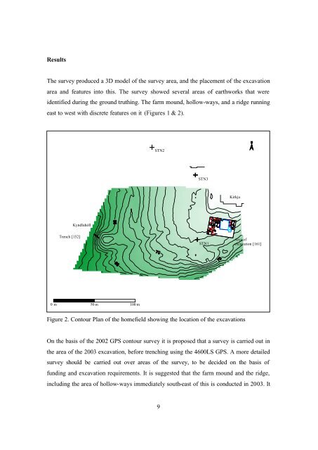
Results<br />
The survey produced a 3D model of the survey area, and the placement of the excavation<br />
area and features into this. The survey showed several areas of earthworks that were<br />
identified during the ground truthing. The farm mound, hollow-ways, and a ridge running<br />
east to west with discrete features on it (Figures 1 & 2).<br />
STN2<br />
STN3<br />
Kirkja<br />
Kyndluhóll<br />
Trench [152]<br />
STN1<br />
Area of<br />
excavation [161]<br />
0 m 50 m 100 m<br />
Figure 2. Contour Plan of the homefield showing the location of the excavations<br />
On the basis of the <strong>2002</strong> GPS contour survey it is proposed that a survey is carried out in<br />
the area of the 2003 excavation, before trenching using the 4600LS GPS. A more detailed<br />
survey should be carried out over areas of the survey, to be decided on the basis of<br />
funding and excavation requirements. It is suggested that the farm mound and the ridge,<br />
including the area of hollow-ways immediately south-east of this is conducted in 2003. It<br />
9


