Draft Helmsley Plan (June 2013) - North York Moors National Park
Draft Helmsley Plan (June 2013) - North York Moors National Park
Draft Helmsley Plan (June 2013) - North York Moors National Park

You also want an ePaper? Increase the reach of your titles
YUMPU automatically turns print PDFs into web optimized ePapers that Google loves.
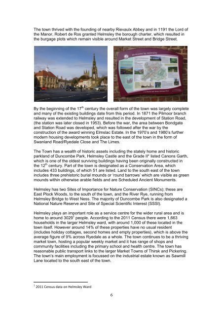
The town thrived with the founding of nearby Rievaulx Abbey and in 1191 the Lord ofthe Manor, Robert de Ros granted <strong>Helmsley</strong> the borough charter, which resulted inthe burgage plots which remain visible around Market Street and Bridge Street.By the beginning of the 17 th century the overall form of the town was largely completeand many of the existing buildings date from this period. In 1871 the Pilmoor branchrailway was extended to <strong>Helmsley</strong> and resulted in the development of Station Road,(the station was later closed in 1953). Before the war, the area between Bondgateand Station Road was developed, which was followed after the war by theconstruction of the award winning Elmslac Estate. In the 1970’s and 1980’s furthermodern housing developments took place to the east of the town in the form ofSwanland Road/Ryedale Close and The Limes.The Town has a wealth of historic assets including the stately home and historicparkland of Duncombe <strong>Park</strong>, <strong>Helmsley</strong> Castle and the Grade II* listed Canons Garth,which is one of the oldest surviving buildings having been originally constructed inthe 12 th century. Part of the town is designated as a Conservation Area, whichincludes 433 buildings, of which 51 are listed. Land to the south east of the townincludes three prehistoric burial mounds or ‘round barrows’ which are visible as greenmounds within otherwise arable fields and are Scheduled Ancient Monuments.<strong>Helmsley</strong> has two Sites of Importance for Nature Conservation (SINCs); these areEast Plock Woods, to the south of the town, and the River Rye, running from<strong>Helmsley</strong> Bridge to West Ness. The majority of Duncombe <strong>Park</strong> is also designated a<strong>National</strong> Nature Reserve and Site of Special Scientific Interest (SSSI).<strong>Helmsley</strong> plays an important role as a service centre for the wider rural area and ishome to around 3029 1 people. According to the 2011 Census there were 1,663households in the larger <strong>Helmsley</strong> ward, with around 1,000 of these located in thetown itself. However around 14% of these properties have no usual resident(includes holiday cottages, second homes and empty properties), which is above theaverage figure of 9% across Ryedale as a whole. The town continues to be a thrivingmarket town, hosting a popular weekly market and it has range of shops andcommunity facilities including the primary school and health centre. The town hasreasonable public transport links to the larger Market Towns of Thirsk and Pickering.The town’s main employment is focussed on the industrial estate known as SawmillLane located to the south east of the town.1 2011 Census data on <strong>Helmsley</strong> Ward6