Bog Brook/Riley Training Site
Bog Brook/Riley Training Site
Bog Brook/Riley Training Site
- No tags were found...

You also want an ePaper? Increase the reach of your titles
YUMPU automatically turns print PDFs into web optimized ePapers that Google loves.
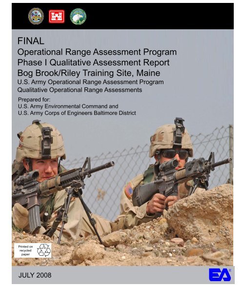
FINALOperational Range Assessment ProgramPhase I Qualitative Assessment Report<strong>Bog</strong> <strong>Brook</strong>/<strong>Riley</strong> <strong>Training</strong> <strong>Site</strong>, MaineU.S. Army Operational Range Assessment ProgramQualitative Operational Range AssessmentsPrepared for:U.S. Army Environmental Command andU.S. Army Corps of Engineers Baltimore DistrictPrinted onrecycledpaperJULY 2008®
Operational Range Assessment Program, Phase I Qualitative Assessment Report July 2008<strong>Bog</strong> <strong>Brook</strong>/<strong>Riley</strong> <strong>Training</strong> <strong>Site</strong>, MaineABBREVIATIONS/ACRONYMSARID-GEO Army Range Inventory Database-GeodatabaseBRACBase Realignment and ClosureCERCLA Comprehensive Environmental Response, Compensation, and Liability ActCSMConceptual <strong>Site</strong> ModelDoDDepartment of DefenseDODIDepartment of Defense InstructionEEcological receptors identified. (This refers to range grouping; pathwaydesignation always precedes E designation.)GWGroundwater pathway identified. (This refers to range grouping; Mdesignation always precedes GW designation.)HHuman receptors identified. (This refers to range grouping; pathwaydesignation always precedes H designation.)LSLimited Source.MMunitions used. (This refers to range grouping; M designation alwaysprecedes applicable pathway.)MCOCMunitions Constituents of ConcernMEARNG Maine Army National GuardMEDWP Maine Department of Environmental Health and Human Services, Divisionof Environmental Health, and Drinking Water ProgramMGSMaine Geological SurveyNOAANational Oceanic and Atmospheric AdministrationNRCSNatural Resources Conservation ServiceORAPOperational Range Assessment ProgramPUPathway unlikely or incomplete. (This refers to range grouping; Mdesignation always precedes PU designation.)RFMSSRange Facility Management Support SystemSWSurface water pathway identified. (This refers to range grouping; Mdesignation always precedes SW designation.)TS<strong>Training</strong> <strong>Site</strong>U.S.United StatesUSACEUnited States Army Corps of EngineersUSACHPPM United States Army Center for Health Promotion and Preventive MedicineUSAECUnited States Army Environmental CommandUSDAUnited States Department of AgricultureUSEPAUnited States Environmental Protection AgencyUSFSUnited States Forest ServiceUSFWSUnited States Fish and Wildlife ServiceUSGSUnited States Geological Survey°F Degrees FahrenheitEA Engineering, Science, and Technology, Inc.iv
Operational Range Assessment Program, Phase I Qualitative Assessment Report July 2008<strong>Bog</strong> <strong>Brook</strong>/<strong>Riley</strong> <strong>Training</strong> <strong>Site</strong>, MaineEXECUTIVE SUMMARYThe United States (U.S.) Army is conducting qualitative assessments at operational ranges to meet therequirements of Department of Defense policy and to support the U.S. Army Sustainable RangeProgram. The operational range qualitative assessment (hereinafter referred to as Phase IAssessment) is the first phase of the U.S. Army Operational Range Assessment Program (ORAP).This Phase I Assessment evaluates the operational range area at <strong>Bog</strong> <strong>Brook</strong>/<strong>Riley</strong> <strong>Training</strong> <strong>Site</strong> (TS)to assess whether further investigation is needed to determine if potential munitions constituents ofconcern (MCOC) are or could be migrating off-range at levels that may pose an unacceptable risk tohuman health or the environment. In conducting the Phase I Assessment, MCOC sources, potentialoff-range migration pathways, and potential off-range human and ecological receptors are evaluatedas appropriate.<strong>Bog</strong> <strong>Brook</strong>/<strong>Riley</strong> TS is an 806.74-acre facility consisting of two separate parcels: <strong>Bog</strong> <strong>Brook</strong> and<strong>Riley</strong> training sites. <strong>Bog</strong> <strong>Brook</strong> TS (212.14 acres) is located in the town of Gilead in southwesternMaine, approximately eight miles west of the town of Bethel and 3.5 miles east of the Maine andNew Hampshire border. <strong>Riley</strong> TS (594.16 acres) is located seven miles north of <strong>Bog</strong> <strong>Brook</strong> TS in thetown of <strong>Riley</strong>, Maine. Use of <strong>Bog</strong> <strong>Brook</strong>/<strong>Riley</strong> TS by the Maine Army National Guard (MEARNG)began in 1991.The Army Range Inventory Database-Geodatabase (2007) identifies 10 operational rangesencompassing 796.72 acres (including two firing ranges and seven maneuver and training areas at<strong>Bog</strong> <strong>Brook</strong> TS and one maneuver and training area at <strong>Riley</strong> TS). In addition, 10.02 acres of nonoperationalarea are located at <strong>Bog</strong> <strong>Brook</strong> TS.MEARNG personnel indicated that no live-fire training is being or has been conducted at <strong>Bog</strong><strong>Brook</strong>/<strong>Riley</strong> TS. Small caliber blanks and limited quantities of pyrotechnics/obscurants have beenused during training exercises at <strong>Bog</strong> <strong>Brook</strong> TS. <strong>Riley</strong> TS was last used 10 years ago as a non-livefiremaneuver and training area. Small arms blanks were the only munitions used during trainingexercises at <strong>Riley</strong>. Therefore, there is a limited potential MCOC source present at <strong>Bog</strong> <strong>Brook</strong>/<strong>Riley</strong>TS.The 10 operational ranges at <strong>Bog</strong> <strong>Brook</strong>/<strong>Riley</strong> TS are categorized as Unlikely.Unlikely – Five-Year ReviewThe 10 ranges at <strong>Bog</strong> <strong>Brook</strong>/<strong>Riley</strong> TS are categorized as Unlikely, totaling 796.72 acres. Theseranges consist of firing ranges and maneuver and training areas. Based upon a review of readilyavailable information, ranges where there is sufficient evidence to show that there are no knownreleases or source-receptor interactions off-range that could present an unacceptable risk to humanhealth or the environment are categorized as Unlikely. Ranges categorized as Unlikely are requiredto be re-evaluated at least every five years. Re-evaluation may occur sooner if significant changes(e.g., change in range operations or site conditions, regulatory changes) occur that affectdeterminations made during this Phase I Assessment.Table ES-1 summarizes the Phase I Assessment findings.EA Engineering, Science, and Technology, Inc.ES-1
Operational Range Assessment Program, Phase I Qualitative Assessment Report July 2008<strong>Bog</strong> <strong>Brook</strong>/<strong>Riley</strong> <strong>Training</strong> <strong>Site</strong>, MaineTable ES-1: Summary of Findings and Conclusions for <strong>Bog</strong> <strong>Brook</strong>/<strong>Riley</strong> <strong>Training</strong> <strong>Site</strong>CategoryUnlikelyTotal Number ofRanges and Acreage Source(s) Pathway(s)HumanReceptorsEcologicalReceptors10 operational ranges; No source—limited or no Not evaluated (no source identified)796.72 acresmilitary munitions useConclusions and RationaleRe-evaluate during the five-yearreview. No source was identified.EA Engineering, Science, and Technology, Inc. ES-2