WB3: Risk Management
WB3: Risk Management
WB3: Risk Management
- No tags were found...

Create successful ePaper yourself
Turn your PDF publications into a flip-book with our unique Google optimized e-Paper software.
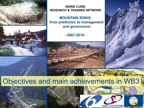
MARIE CURIERESEARCH & TRAINING NETWORKMountain <strong>Risk</strong>sResearch Training NetworkMOUNTAIN RISKS:from prediction to managementand governance- 2007-2010 -Objectives and …. main Welcome achievements to Paris! in <strong>WB3</strong>1MOUNTAIN RISKS: Mid-term Meeting, Diablerets, 26-27 June 2009
<strong>WB3</strong> –Landslide <strong>Risk</strong> <strong>Management</strong>Mountain <strong>Risk</strong>sResearch Training NetworkMOUNTAIN RISKS: Mid-term Meeting, Diablerets, 26-27 June 2009
<strong>WB3</strong> –Landslide <strong>Risk</strong> <strong>Management</strong>Mountain <strong>Risk</strong>sResearch Training Network<strong>Risk</strong> management takes the output from the risk assessment, and considers risk mitigation, whichmay include various alternatives: reducing the likelihood of an event, reducing the consequencese.g. by developing monitoring, warning and evacuation plans, and implementing regulatorycontrols. It may include monitoring of the risk outcomes, feedback and iteration when needed.Not only a technical issueFell et al. 2005MOUNTAIN RISKS: Mid-term Meeting, Diablerets, 26-27 June 2009
<strong>WB3</strong> –Landslide <strong>Risk</strong> <strong>Management</strong>Mountain <strong>Risk</strong>sResearch Training Network<strong>Risk</strong>evaluation<strong>Risk</strong> <strong>Management</strong> Actions:HazardPreventionHazard levelremains unchangedLand-useplanningBuilding codesMitigation plan<strong>Risk</strong>acceptabilityHazardReductionHazard level is loweredLandslideStabilizationMeasuresProtectivemeasures<strong>Risk</strong> Assessment<strong>Risk</strong>MitigationConsequences are reducedEmergencypreparednessEmergencyresponseRecoveryMOUNTAIN RISKS: Mid-term Meeting, Diablerets, 26-27 June 2009
<strong>WB3</strong> –Landslide <strong>Risk</strong> <strong>Management</strong>Mountain <strong>Risk</strong>sResearch Training NetworkTopic ActionsTA-11. Propose guidelines for sustainable development planning (land useoptions, protective and risk mitigation measures) at both local and regionalmapping scales, and for different end-users requirements.TA-12. Evaluate feasibility, effectiveness and performance of remedial(protective and preventive) measures to reduce the risk level, assess theirenvironmental and socio-economical constraints and assess the residual risksassociated with the protective works.TA-13. Formulate criteria for establishing warning systems and evacuationplans.TA-14. Provide a framework for cost/benefit analyses.MOUNTAIN RISKS: Mid-term Meeting, Diablerets, 26-27 June 2009
<strong>WB3</strong> –Landslide <strong>Risk</strong> <strong>Management</strong><strong>Risk</strong> <strong>Management</strong> Actions:Mountain <strong>Risk</strong>sResearch Training NetworkA process for state, local governments to identify policies, activities,and tools to implement mitigation actions. Mitigation is any sustainedaction taken to reduce or eliminate long-term risk to life and propertyfrom a hazard event.HazardPreventionHazard levelremains unchangedLand-useplanningBuilding codesMitigation planHazardReductionHazard level is loweredLandslideStabilizationMeasuresProtectivemeasuresTA-14. Cost-benefit analyses<strong>Risk</strong>MitigationConsequences are reducedEmergencypreparednessEmergencyresponseRecoveryMOUNTAIN RISKS: Mid-term Meeting, Diablerets, 26-27 June 2009
<strong>WB3</strong> –Landslide <strong>Risk</strong> <strong>Management</strong>Mountain <strong>Risk</strong>sResearch Training Network<strong>Risk</strong> <strong>Management</strong> Actions:HazardPreventionHazard levelremains unchangedLand-useplanningBuilding codesMitigation planHazardReductionHazard level is reducedLandslideStabilizationMeasuresProtectivemeasures<strong>Risk</strong>MitigationConsequences are reducedEmergencypreparednessEmergencyresponseRecoveryMOUNTAIN RISKS: Mid-term Meeting, Diablerets, 26-27 June 2009
<strong>WB3</strong> –Landslide <strong>Risk</strong> <strong>Management</strong>Mountain <strong>Risk</strong>sResearch Training NetworkPosition cancelledMOUNTAIN RISKS: Mid-term Meeting, Diablerets, 26-27 June 2009
<strong>WB3</strong> –Landslide <strong>Risk</strong> <strong>Management</strong>Mountain <strong>Risk</strong>sResearch Training NetworkMOUNTAIN RISKS: Mid-term Meeting, Diablerets, 26-27 June 2009
<strong>WB3</strong> –Landslide <strong>Risk</strong> <strong>Management</strong>Landslide Hazard PreventionMountain <strong>Risk</strong>sResearch Training NetworkGuidelines for sustainable development planning (land use options, protectiveand risk mitigation measures) at both local and regional scales, and for differentend-users requirementsIntensive course and Workshop on Quantitative <strong>Risk</strong> Assessment and<strong>Risk</strong> <strong>Management</strong> - Barcelona September, 2008MOUNTAIN RISKS: Mid-term Meeting, Diablerets, 26-27 June 2009
<strong>WB3</strong> –Landslide <strong>Risk</strong> <strong>Management</strong>Landslide Hazard PreventionMountain <strong>Risk</strong>sResearch Training NetworkGovernment administrative or regulatory actions or processes that influence the wayLand and buildings are developed and built. These actions also include publicactivities to reduce hazard losses. Examples include planning and zoning, buildingcodes, capital (FEMA-US)Rockfall mitigation plan –Andorra ESR-07ER-01 Societal perception ofrisk: acceptabilityMOUNTAIN RISKS: Mid-term Meeting, Diablerets, 26-27 June 2009
<strong>WB3</strong> –Landslide <strong>Risk</strong> <strong>Management</strong>Landslide Hazard PreventionMountain <strong>Risk</strong>sResearch Training NetworkEmergency plans for civil protection -Valtellina di Tirano – ESR-01MOUNTAIN RISKS: Mid-term Meeting, Diablerets, 26-27 June 2009
<strong>WB3</strong> –Landslide <strong>Risk</strong> <strong>Management</strong>Landslide Hazard ReductionMountain <strong>Risk</strong>sResearch Training NetworkStabilizationmeasuresBefore the eventSloperegradingSlopereinforcementProtectivemeasuresStructural measuresFences, wallsDiversiondykesMaintenanceCost-benefitanalysesDrainageNon-structuralSustainable measuresProtection forestScenariosMOUNTAIN RISKS: Mid-term Meeting, Diablerets, 26-27 June 2009
<strong>WB3</strong> –Landslide <strong>Risk</strong> <strong>Management</strong>Mountain <strong>Risk</strong>sResearch Training NetworkLandslide Hazard Reduction:Performance of protective worksESR-07 rockfall protection fences, AndorraNumericalsimulationsVulnerabilityfunctionsLandslide riskmitigationalternativesER-01 debris flows Valtellina- SelvettaMOUNTAIN RISKS: Mid-term Meeting, Diablerets, 26-27 June 2009
<strong>WB3</strong> –Landslide <strong>Risk</strong> <strong>Management</strong>Landslide <strong>Risk</strong> MitigationMountain <strong>Risk</strong>sResearch Training NetworkEmergencypreparednessRetrofittingbuildings &facilitiesEmergencyresponseSheltersEmergencyRecoveryBefore the event During the event After the eventRelocationAlert SystemsPublicawarenessGuidelines &TrainingCommunicationEvacuationPriority works(diversion dikes,drainage,…)ScenariosRescueFirst-aid(emergency food,water supply)Priority works(cleaning roads,landslide dams,…)<strong>Risk</strong>governanceMOUNTAIN RISKS: Mid-term Meeting, Diablerets, 26-27 June 2009
<strong>WB3</strong> –Landslide <strong>Risk</strong> <strong>Management</strong>Landslide <strong>Risk</strong> Mitigation: Early warningMountain <strong>Risk</strong>sResearch Training NetworkLandslides are complexphenomena:Different mechanisms involved (fall,sliding, flowage,...)Different triggers: rainfall,earthquakes, volcanic eruptions,erosion, etcDifferent stages of development:pre-failure, failure, post-failure &reactivationDifferent post failure behaviour:acceleration due to reduction of thesoil/rock strength (i.e. brittle soils,dilative soils) or stabilizationSource: USGSMOUNTAIN RISKS: Mid-term Meeting, Diablerets, 26-27 June 2009
Rainfall Intensity (mm/h)<strong>WB3</strong> –Landslide <strong>Risk</strong> <strong>Management</strong>Landslide <strong>Risk</strong> Mitigation: Early warningMountain <strong>Risk</strong>sResearch Training NetworkEmpirical60MonitoringExpert SystemModellingCaine 1980Indirect:i.e. rainfall (trigger)40 Direct:i.e. displacement(creep curves)Cancelli & Nova 1985Wieckzorek 1987Larsen & Simon 1993Physically-basedmodels: scenarios200Alert thresholds0 12 24 36 48Duration (hours)MOUNTAIN RISKS: Mid-term Meeting, Diablerets, 26-27 June 2009
<strong>WB3</strong> –Landslide <strong>Risk</strong> <strong>Management</strong>Landslide <strong>Risk</strong> Mitigation: Early warningMountain <strong>Risk</strong>sResearch Training NetworkKey parameter: slope displacements/velocitiesPre-failure stage: small strains (local failure) – Pre-alertphaseFailure stage: acceleration of displacements and completedevelopment of the surface of failure - Alert phaseMOUNTAIN RISKS: Mid-term Meeting, Diablerets, 26-27 June 2009
<strong>WB3</strong> –Landslide <strong>Risk</strong> <strong>Management</strong>Landslide <strong>Risk</strong> Mitigation: Early warningMountain <strong>Risk</strong>sResearch Training NetworkESR-12 GB-DInSAR, Continuous GPS, LIDARSo far, pre-alert phaseMOUNTAIN RISKS: Mid-term Meeting, Diablerets, 26-27 June 2009
Rainfall (mm in 24 h)Velocity (mm/day)Depth of groundwater table (m)<strong>WB3</strong> –Landslide <strong>Risk</strong> <strong>Management</strong>Landslide <strong>Risk</strong> Mitigation: Early warningMountain <strong>Risk</strong>sResearch Training NetworkPhysically-based models120100806040200201510501234567021-Nov-96 20-Jan-97 21-Mar-97 20-May-97 19-Jul-97 17-Sep-97ER-03 Slow-moving landslide, VallcebreESR-02 Slow-moving landslide, Super SauzeMOUNTAIN RISKS: Mid-term Meeting, Diablerets, 26-27 June 2009
Safety factor, F<strong>WB3</strong> –Landslide <strong>Risk</strong> <strong>Management</strong>Landslide <strong>Risk</strong> Mitigation: Early warningMountain <strong>Risk</strong>sResearch Training NetworkVallcebretorrentPhysically-based modelsBlock 1 Block 21.05W1/W2 (%)3.5 3.6 3.7 3.8 3.9 4.0 4.11.10Reference conditiongroundwater level0 50 mMass transfer fromBlock2 to Block 1' 2 ' dv dv vl sin cos c cos pwtan ma mdz dt zIncluding vicous component1.000.950.90GWL depth 6.2 m5.8 m5.4 m5.0 m4.6 m-8 -4 0 4 8W1/W1 (%)andErosion of Block 1toeER-03 Slow-moving landslide, VallcebreESR-02 Slow-moving landslide, Super SauzeMOUNTAIN RISKS: Mid-term Meeting, Diablerets, 26-27 June 2009
<strong>WB3</strong> –Landslide <strong>Risk</strong> <strong>Management</strong>Landslide <strong>Risk</strong> MitigationMountain <strong>Risk</strong>sResearch Training NetworkEmergencypreparednessRetrofittingbuildings &facilitiesEmergencyresponseSheltersEmergencyRecoveryBefore the event During the event After the eventRelocationAlert SystemsPublicawarenessGuidelines &TrainingCommunicationEvacuationPriority works(diversion dikes,drainage,…)ScenariosRescueFirst-aid(emergency food,water supply)Priority works(cleaning roads,landslide dams,…)<strong>Risk</strong>governanceMOUNTAIN RISKS: Mid-term Meeting, Diablerets, 26-27 June 2009
<strong>WB3</strong> –Landslide <strong>Risk</strong> <strong>Management</strong>Landslide <strong>Risk</strong> MitigationEmergency plans for civil protection -Valtellina di Tirano – ESR-01Mountain <strong>Risk</strong>sResearch Training NetworkMOUNTAIN RISKS: Mid-term Meeting, Diablerets, 26-27 June 2009
<strong>WB3</strong> –Landslide <strong>Risk</strong> <strong>Management</strong>Cost-benefit analysesMountain <strong>Risk</strong>sResearch Training NetworkESR-07 rockfall protection fences,AndorraESR-08 linear and surface elementsER-01 debris flows SelvettaCostbenefitScenario-1Scenario-2NumericalsimulationsVulnerabilityfunctionsLandslide riskmitigationalternativesScenario-nMOUNTAIN RISKS: Mid-term Meeting, Diablerets, 26-27 June 2009
<strong>WB3</strong> –Landslide <strong>Risk</strong> <strong>Management</strong>Cost-benefit analysesMountain <strong>Risk</strong>sResearch Training NetworkMOUNTAIN RISKS: Mid-term Meeting, Diablerets, 26-27 June 2009
<strong>WB3</strong> –Landslide <strong>Risk</strong> <strong>Management</strong>Cost-benefit analysesMountain <strong>Risk</strong>sResearch Training NetworkProtective workESR-08. event-tree analysis for evaluating the risk topersons in non-built areas.MOUNTAIN RISKS: Mid-term Meeting, Diablerets, 26-27 June 2009
MARIE CURIERESEARCH & TRAINING NETWORKMountain <strong>Risk</strong>sResearch Training NetworkMOUNTAIN RISKS:from prediction to managementand governance- 2007-2010 -Main research …. results Welcome gained to Paris! by ESR1227MOUNTAIN RISKS: Mid-term Meeting, Diablerets, 26-27 June 2009
Mountain <strong>Risk</strong>sResearch Training NetworkESR12<strong>Risk</strong> reduction: Development of early warning systemsand implementation of mitigation measuresMid-term meeting presentationAlexander DaehnePh.D. Fellow(06/2008-12/2010)University of Modena and Reggio E., Department of Earth SciencesAlexander.Daehne@unimore.itTutor:Dr. Alessandro Corsini – UNIMORE, ItalyCo-tutors:Prof. Doriano Castaldini – UNIMORE, ItalyDr. Jean-Philippe Malet – CNRS/EOST, FranceProf. Theo van Asch – UU, the NetherlandsMOUNTAIN RISKS: Mid-term Meeting, Diablerets, 26-27 June 2009
OverviewMountain <strong>Risk</strong>sResearch Training Network1. Main Contribution <strong>WB3</strong>A. ConceptsB. Scheme2. Landslide Monitoring – The Valoria Case StudyA. Site IntroductionB. Elements at <strong>Risk</strong>C. Monitoring SystemsIbis-LIntegrated Total Station/GPSD. Data AnalysisE. Current And Future Tasks29MOUNTAIN RISKS: Mid-term Meeting, Diablerets, 26-27 June 2009
1. Main Contributions to <strong>WB3</strong> - ConceptsMountain <strong>Risk</strong>sResearch Training NetworkTA 13Evaluate feasibility, effectiveness and performance of remedial(proactive and preventive) measures to reduce risk, assess theirenvironmental and socio- economical constraints and assess theresidual risks associated with the protective work.a. Formulate criteria for establishing warning systems and evacuation plans.b. Review, analyze and summarize in a schematized manner the characteristicsof the monitoring systems.c. Appraise the specific characteristics of monitoring systems with respect totheir potential usage with different landslide types.d. Develop simple decision support system for the selection of appropriatemitigation systems to applicable to specific landslide types.MOUNTAIN RISKS: Mid-term Meeting, Diablerets, 26-27 June 2009
1. Main Contribution to <strong>WB3</strong> - SchemeDisplacement [cm]2018161412108642Prism 4Prism 7Prism 14Prism 16Prism 20aPrism 22Prism 31Prism 27aPrism 28GPS B06/7/08 8/7/08 10/7/08 12/7/08 14/7/08 16/7/08 18/7/08 20/7/08 22/7/08 24/7/08 26/7/08Mountain <strong>Risk</strong>sResearch Training NetworkMonitoring IBIS-L Ground- SystemsBased InSARNear Real-TimeMonitoringDevelopBaseStructureof aDecisionSupportSystemforLandslidemonitoriLEGENDngINPUT DATAANALYSISData AnalysisReview,analyze,summarizecharacteristics of themonitoringsystems.Appraise thespecificcharacteristicsof monitoringsystemsFINALRESULTSPROCESSWHENIdentify Relationships:velocity & slope angle(during the reactive andactive phase)velocity & rainfall intensity /cumulated rainfall (during thereactive and active phase)velocity & pore waterpressure (during the reactiveand active phase)EventScenariosOf differentfailuresituationsElements at<strong>Risk</strong>:Gas pipelineand bridgeconstructionDefineTrigger andWHATDEFINE FailureTresholdsEstimation of time failure with theinverse velocity methodRunout(Saito, 1965; Fukuzono, 1985;Voight, 1988) MechanismFrom Fukuzono, 1990)MOUNTAIN RISKS: Mid-term Meeting, Diablerets, 26-27 June 2009
2. Landslide Monitoring – The Valoria Case StudyMountain <strong>Risk</strong>sResearch Training NetworkA. Site IntroductionBEDROCK:Flysh (A/P>1)ClaystonesMarlsLANDSLIDEWeak-rocks SlideEarth SlidesEarth flowsH max (m) 1350H min (m) 520dH (m) 830Slope (%) 24Lenght (m) 3500Depth max (m) 40Area (m2) 1.2Volume (Mm3) 20-30RECENT ACTIVITY HISTORY1985 –…- 2000 - 2001 – 2002 – 2003 – 2004 – 2005 – 2006 – 2007- 2008VELOCITY: cm/year to > 10 m/dayTotal ReactivationPartial ReactivationResidual generalized movementsor very localized movementsSuspendedDormantMOUNTAIN RISKS: Mid-term Meeting, Diablerets, 26-27 June 2009
TCARIGHT FLOWMountain <strong>Risk</strong>sResearch Training NetworkTOEMAIN FLOWLEFT FLOWCRESTNCROWNSOURCEAREACROWN ZONE SOURCE AREA LEFT FLOWRIGHT FLOW MAIN FLOWCRESTMACROAREEFebruary 2009MOUNTAIN RISKS: Mid-term Meeting, Diablerets, 26-27 June 2009
2. Landslide Monitoring – The Valoria Case StudyB. Elements at <strong>Risk</strong>Why is an E-W system needed?Mountain <strong>Risk</strong>sResearch Training NetworkMOUNTAIN RISKS: Mid-term Meeting, Diablerets, 26-27 June 2009
2B. Elements at <strong>Risk</strong>Why is an E-W system needed?03-03-2009Mountain <strong>Risk</strong>sResearch Training NetworkMain FlowMaterial AccumulationRemobilized Paleo Landslide(Displacement approx 5-10 m)Area in translationArea wherelandslidematerial damsDolo RiverRetrogressive ErosionMOUNTAIN RISKS: Mid-term Meeting, Diablerets, 26-27 June 2009
2B. Elements at <strong>Risk</strong>Mountain <strong>Risk</strong>sResearch Training NetworkTree as ReferenceWhy is an E-W system needed?Dolo River 10-02-2009VALORIALandslide ToeDolo RiverMOUNTAIN RISKS: Mid-term Meeting, Diablerets, 26-27 June 2009
2B. Elements at <strong>Risk</strong>Mountain <strong>Risk</strong>sResearch Training NetworkWhy is an E-W system needed?Dolo River 03-03-2009Tree as ReferenceTree as ReferenceVALORIAVALORIALandslideLandslideToeToeDolo RiverMOUNTAIN RISKS: Mid-term Meeting, Diablerets, 26-27 June 2009
2B. Elements at <strong>Risk</strong>Mountain <strong>Risk</strong>sResearch Training NetworkWhy is an E-W system needed?Dolo River 03-03-2009VALORIALandslide ToeMaximum Water level rise 1m during spring 2009Dolo RiverMOUNTAIN RISKS: Mid-term Meeting, Diablerets, 26-27 June 2009
2. Landslide MonitoringMountain <strong>Risk</strong>sResearch Training NetworkC. Monitoring Systems - IBIS-L Ground-based InSARTime of observation:23-25 February 2009Orientation and Installationfor Observation of upperlandslide bodyParameterConfigurationOBSERVATION DISTANCE [m] 450-1300HORIZONTAL APERTURE [gradi] 38RANGE RESOLUTION [m] 0.5CROSS-RANGE RESOLUTION [mrad] 4.5IBIS-LIBIS-LAQUISITIONS PER HOUR - 9DURATTION OF OBSERVATION [ore] 24MOUNTAIN RISKS: Mid-term Meeting, Diablerets, 26-27 June 2009
2C. Monitoring Systems - IBIS-L Ground-based InSARMountain <strong>Risk</strong>sResearch Training NetworkResults of observationof upper landslidebody (24 hours)MOUNTAIN RISKS: Mid-term Meeting, Diablerets, 26-27 June 2009
2C. Monitoring Systems - IBIS-L Ground-based InSAROrientation and Installation for Observation of lower landslide bodyMountain <strong>Risk</strong>sResearch Training NetworkOBSERVATION DISTANCE[m]300-1900HORIZONTAL APERTURE [degrees] 38RANGE RESOLUTION [m] 0.5CROSS-RANGE RESOLUTION [mrad] 4.5AQUISITIONS PER HOUR - 8DURATTION OF OBSERVATION [hours] 17ParameterConfigurationIBIS-LIBIS-LMOUNTAIN RISKS: Mid-term Meeting, Diablerets, 26-27 June 2009
2C. Monitoring Systems - IBIS-L Ground-based InSAR[mm]Mountain <strong>Risk</strong>sResearch Training NetworkResults of observationof lower landslidebody (17 hours)11001000900800700600500Line Of SightDisplacement TimeIntegral target displacementSeriesCUR-P-2CUR-P-3CUR-P-4CUR-P-5CUR-P-6CUR-P-7CUR-P-8CUR-P-10CUR-P-11CUR-P-12CUR-P-13CUR-P-14CUR-P-15CUR-P-18CUR-P-20400300200100016:48 19:12 21:36 00:00 02:24 04:48 07:12 09:36 12:00 14:24Acquisition timeMOUNTAIN RISKS: Mid-term Meeting, Diablerets, 26-27 June 2009
Displacement2C. Monitoring Systems - IBIS-L Ground-based InSARAdvantagesDisadvantages- Fast Setup- High Cost of OperationMountain <strong>Risk</strong>sResearch Training Network30,0025,0020,0015,0010,005,000,00True Prism 14App Prism 14PSge-9551PSge-9550PSge-9642-5,002/23/09 12:00 2/23/09 16:48 2/23/09 21:36 2/24/09 2:24 2/24/09 7:12 2/24/09 12:00 2/24/09 16:48Date-Rapid Acquisition ofLarge area- High SpatialCoverage-Remote Sensingtechnique = no directcontact with targetnecessary- Sub-millimeterAccuracy-ContinuousAutonomous OperationPossible-Restricted access tosystem necessary (e.g.Private Properties- Spatial Resolutiondecreases with distance(larger pixel size)- No discrete pointobservation =Onlyaverage displacementsper pixel- Only Line-of-SightDisplacement=noabsolute values for themovement of materials-Rapid processing withpossibility to see resultson site- Post-processing anddata correction necessaryMOUNTAIN RISKS: Mid-term Meeting, Diablerets, 26-27 June 2009
2. Landslide MonitoringC. Monitoring Systems – Integrated Total Station and GPSMountain <strong>Risk</strong>sResearch Training NetworkGPS-Master : Leica GMX902 GG (L1, L2)Total Station: Leica TCA 2003(> 2000 m range, Automatic TargetRecognition ATR. Ang. st.dev. 0.01 mgon,Dist. st. dev 1 mm + 1 ppm / 3.0 s)Clinometer: Leica Nivel 210(biaxial mrad, + temperature, sampling 300ms)Over 50 Prisms(5 reference stations)+ case with:- Industrial PC unit with:- GPRS modem- power supply 220 V- Battery in case of black-out),- W-LAN system3 GPS-Rover (L1 Leica GMX901 GG (12 CH.L1, 1Hz),+ case with: battery + solar panel, W-LANMOUNTAIN RISKS: Mid-term Meeting, Diablerets, 26-27 June 2009
2C. Monitoring Systems – Integrated Total Station and GPSMountain <strong>Risk</strong>sResearch Training NetworkTECHNICAL CONSTRAINS: Hardware> 1 month Set-up and Start-up phase neededTasks- Cope with large movements- Assure quick replacement- Cover “significant” areas- Find suitable location for Ref.- Easily accessible- panorama withininstruments range- Stable and Safe- Covered by GSM or GPRS-Possibly served by 220 V-battery needed-Accessibility and security-Accessibility duringevents for emergencyrecoverof hardware- Wireless visibility rovermasterPotential Problems- Loss / rotation of prisms- Vegetation growth- Line of sight not free(vegetation./morphology)- etc…- No such place available- Permissions required- Settlement in time if soilor weak rocks (loss of TCAleveling .i.e inclinometercontrol needed)- No such place available- Loss of Wirelessconnection due tovegetation growth orslope movements- etc…MOUNTAIN RISKS: Mid-term Meeting, Diablerets, 26-27 June 2009
2C. Monitoring Systems – Integrated Total Station and GPSMountain <strong>Risk</strong>sResearch Training NetworkPRISMS LOSS/ABATMENTTECHNICAL CONSTRAINS: Hardware> 1 month Set-up and Start-up phase neededGoodnews:someprisms inthe trackzone (earthsliding)remainedreadable fordisplacements up to 60m- 23 Oct. 2007 – 27March. Encountered 2008 problemsReplace needed for 12prisms(5 not recoverable)- 28 March 2008 to dateReplace needed for 3prisms-Lower slope not visible(1 not recoverable)- software keys conflictcaused system to crash 2times-Modem got stuck 3 timesbecause or incorrect remoteconnection shut down- Logistics- Battery crash 1 time inrover “A”- Ground cracks betweenGPS and Case after 1 metermovementSolutionsAvoid “fast”and too“muddy”sectorsFree LoS (cut trees – digearth)- change keys-Auto-reboot system- adopts strictdisconnection procedure- manual effort- remove vegetationMOUNTAIN RISKS: Mid-term Meeting, Diablerets, 26-27 June 2009
2. Landslide MonitoringDisplacement [m]Mountain <strong>Risk</strong>sResearch Training NetworkD. Data Analysis: SpatialExtend2827a0,50,450,40,350,30,250,20,150,10,050Sequential Downslope Downslope Activation at Voloria4Prism 4Prism 7Prism 14Prism 16Prism 20aPrism 22Prism 31Prism 27aPrism 286/7/08 11/7/08 16/7/08 21/7/08 26/7/08714Date1620a223182827a3120a +221614Where, Whenand HowMuch???=“thresholds”analysis47MOUNTAIN RISKS: Mid-term Meeting, Diablerets, 26-27 June 2009
2D Landslide Monitoring – Data Analysis: DisplacementSUMMER 2008 FALL 2008 WINTER-SPRING 2009Mountain <strong>Risk</strong>sResearch Training NetworkCumulative Displacement [m]Start ofMeasurment2008Hourly CumulativePresentationLEFT FLOWSOURCEAREAMAIN FLOWRIGHT FLOW1500 [mm]1000500MOUNTAIN RISKS: Mid-term Meeting, Diablerets, 26-27 June 2009
2D Landslide Monitoring – Data Analysis: VelocityMountain <strong>Risk</strong>sResearch Training NetworkVelocity [mm/hour ]Start ofMeasurment2008Hourly CumulativePresentationSOURCE AREALEFT FLOWRIGHT FLOWMAIN FLOWSUMMER 2008 FALL 2008 WINTER-SPRING 2009~60 days. >100 days1500 [mm]1000500DateMOUNTAIN RISKS: Mid-term Meeting, Diablerets, 26-27 June 2009
Mountain <strong>Risk</strong>sResearch Training Network2. Landslide MonitoringE. Current And Future TasksINVESTIGATE time of failure using the inverse velocity method in theCROWN ZONE (test it in other parts as well) (Saito, 1965; Fukuzono, 1985;Voight, 1988)(From Fukuzono, 19Definition of thevelocity thresholdsusing the monitoringdata collected insitu(example: Crosta &MOUNTAIN RISKS: Mid-term Meeting, Diablerets, 26-27 June 2009
2E Landslide Monitoring – Current and Future TasksINVESTIGATE relationship velocity & slope angle / slide surface (during thereactive and active phase)Mountain <strong>Risk</strong>sResearch Training NetworkINVESTIGATE relationship velocity & rainfall intensity / cumulated rainfall(during the reactive and active phase)1. DISPLACEMENT and VELOCITY patterns2. RAINFALL vs. MOVEMENTS relationships3. MECHANICAL EFFECTSLocationLocationCROWN zoneSOURCE areaTRACK zone: Right FlowTRACK zone: Main FlowTimeSUMMER:FALL/WINTER:SOURCE Area and Track Zone: RightFlowTRACK Zone: Main FlowPatternslow continuous movements: (10 -3 m/hour) with 4-5 daysacceleration/deceleration phases (1 x 10 -2 to 0.5x10 -1 m/hour)slow intermittent movements (10 -3 m/hour) with 4-5 daysacceleration phase (1-2 x10 -2 to 0.8 m/hour) and 4-5 daysdeceleration phaseslow to intermittent movements (10 -3 m/hour) with 1-2 daysacceleration phase progressive down-slope (0.5-0.8 x 10 -2 m/hour)and 15-30 days deceleration phaseslow continuous movements (10 -3 m/hour) with 5-6 days accelerationphase progressive down-slope (0.5 x 10 -2 m/hour) and 30-60 daysdeceleration phaseObserved Relationships15-30 days delay between rainfall event and maximum velocityphase3 to 5 days delay between rainfall event and maximum velocityphasePatterns2-3 days average time-gap between acceleration phasespossible down-slope mass transfer51MOUNTAIN RISKS: Mid-term Meeting, Diablerets, 26-27 June 2009
2E Landslide Monitoring – Current and Future TasksDEFINE KINEMATICALLY “HOMOGENEOUS” UNITSMountain <strong>Risk</strong>sResearch Training NetworkINVESTIGATE RELATIONSHIP VELOCITY & PORE WATER PRESSUREDEFINE TRIGGER AND RUN-OUT MECHANISMSCOMPARE ESTABLISHED RELATIONSHIPS AT VALORIA TO OTHERCOMPLEX LANDSLIDESSET-UP NUMERICAL MODELS (WB1) TO SIMULATE MASS TRANSFERAND DEVELOP EVENT SCENARIOSDEFINE “OBJECTIVE FUNCTIONS” TO IDENTIFY EARLY WARNINGRULESDEVELOP DECISION SUPPORT SYSTEM FOR THE IMPLEMENTATION OFMONITORING SYSTEMSMOUNTAIN RISKS: Mid-term Meeting, Diablerets, 26-27 June 2009
MARIE CURIERESEARCH & TRAINING NETWORKMountain <strong>Risk</strong>sResearch Training NetworkMOUNTAIN RISKS:from prediction to managementand governance- 2007-2010 -Main research …. results Welcome gained to Paris! by ESR0753MOUNTAIN RISKS: Mid-term Meeting, Diablerets, 26-27 June 2009
Departamento de Ingeniería del Terreno,Cartográfica y GeofísicaUNIVERSITAT POLITÈCNICA DE CATALUNYAMountain <strong>Risk</strong>sResearch Training NetworkESR07Quantitative Rockfall <strong>Risk</strong> Assessment and Rockfall <strong>Risk</strong> <strong>Management</strong>Mid-term meeting presentationOlga MavrouliPh.D. FellowUniversitat Politècnica de Catalunya, Barcelonaolga-christina.mavrouli@upc.eduPeriod: 01.09.07 - 31.08.10Tutor:Jordi Corominas - UPCCo-tutors:Jose Moya - UPCMichel Jaboyedoff- UNIL, Quanterra54MOUNTAIN RISKS: Mid-term Meeting, Diablerets, 26-27 June 2009
Mountain <strong>Risk</strong>sResearch Training NetworkRockfall <strong>Risk</strong> Mitigation Measuresin the Principality of AndorraO. Mavrouli, J. CorominasUPC-Technical University of Catalonia55MOUNTAIN RISKS: Mid-term Meeting, Diablerets, 26-27 June 2009
Rockfall <strong>Risk</strong> Mitigation Measuresin the Principality of Andorra – IntroductionMountain <strong>Risk</strong>sResearch Training Network• average elevation of 1830 m• Population: 25000• highest capital city in Europe with this population density56MOUNTAIN RISKS: Mid-term Meeting, Diablerets, 26-27 June 2009
Rockfall <strong>Risk</strong> Mitigation Measuresin the Principality of Andorra – IntroductionMountain <strong>Risk</strong>sResearch Training Network57MOUNTAIN RISKS: Mid-term Meeting, Diablerets, 26-27 June 2009
Rockfall <strong>Risk</strong> Mitigation Measuresin the Principality of Andorra – The first stepsMountain <strong>Risk</strong>sResearch Training Network19801987Consell General (Government Council of Andorra): hazardregulation for buildings(never applied due to the incomplete hazard inventory)rock slide of 50.000 m 3 on La Massana road.false tunnel, two new mountain roads1989prevention measure:landslide-flooding hazard map at 1:25 000 scale,(The map was used by the authorities for issuingbuilding permits)1994more detailed (1: 5000 scale) hazard zoningfor Andorra la Vellalack of the necessary studies about the spatial distribution of the phenomena!!!58MOUNTAIN RISKS: Mid-term Meeting, Diablerets, 26-27 June 2009
Rockfall <strong>Risk</strong> Mitigation Measuresin the Principality of Andorra – Recent EventsMountain <strong>Risk</strong>sResearch Training NetworkFoto source: Euroconsult & Eurogeotècnica(1983)(1997, 2008)59MOUNTAIN RISKS: Mid-term Meeting, Diablerets, 26-27 June 2009
Rockfall <strong>Risk</strong> Mitigation Measuresin the Principality of Andorra– Rockfall <strong>Risk</strong> <strong>Management</strong> PolicyMountain <strong>Risk</strong>sResearch Training Network…after the rockfall event of 1997:1. Master Plan Demarcation of areas where developmentcould be authorized and restriction ofdevelopment in high hazard areas.2. Mitigation PlanUse of structural measures for protectionagainst rockfalls.3. Surveillance PlanIdentification of possible future rockfallsand documentation of new rockfalls for theupdate of parameters used in pastsimulations.60MOUNTAIN RISKS: Mid-term Meeting, Diablerets, 26-27 June 2009
Rockfall <strong>Risk</strong> Mitigation Measuresin the Principality of Andorra– Rockfall <strong>Risk</strong> <strong>Management</strong> PolicyMountain <strong>Risk</strong>sResearch Training Network1. Master PlanZones established by the Master Plan, for the controlof development in rockfall threaten areas.61MOUNTAIN RISKS: Mid-term Meeting, Diablerets, 26-27 June 2009
Rockfall <strong>Risk</strong> Mitigation Measuresin the Principality of Andorra– Rockfall <strong>Risk</strong> <strong>Management</strong> PolicyMountain <strong>Risk</strong>sResearch Training Network2. Mitigation Plan62MOUNTAIN RISKS: Mid-term Meeting, Diablerets, 26-27 June 2009
Rockfall <strong>Risk</strong> Mitigation Measuresin the Principality of Andorra– Rockfall <strong>Risk</strong> <strong>Management</strong> PolicyMountain <strong>Risk</strong>sResearch Training Network3. Surveillance Plan• Back analysis of new rockfall events andcalibration of the involved parameters (i.e. soilrestitution factors)• Identification of possible rockfall sources usinghelicopters63MOUNTAIN RISKS: Mid-term Meeting, Diablerets, 26-27 June 2009
Rockfall <strong>Risk</strong> Mitigation Measuresin the Principality of Andorra– Rockfall <strong>Risk</strong> <strong>Management</strong> PolicyMountain <strong>Risk</strong>sResearch Training Networka. interception measures:high dissipative steel barriers64MOUNTAIN RISKS: Mid-term Meeting, Diablerets, 26-27 June 2009
Rockfall <strong>Risk</strong> Mitigation Measuresin the Principality of Andorra– Mitigation MeasuresMountain <strong>Risk</strong>sResearch Training Networkb. protection measures65MOUNTAIN RISKS: Mid-term Meeting, Diablerets, 26-27 June 2009
Rockfall <strong>Risk</strong> Mitigation Measuresin the Principality of Andorra– Rockfall <strong>Risk</strong> <strong>Management</strong> PolicyMountain <strong>Risk</strong>sResearch Training Networkc. reinforced concrete fences and ditches66MOUNTAIN RISKS: Mid-term Meeting, Diablerets, 26-27 June 2009
Rockfall <strong>Risk</strong> Mitigation Measuresin the Principality of Andorra– Rockfall <strong>Risk</strong> <strong>Management</strong> PolicyMountain <strong>Risk</strong>sResearch Training Networkd. structural design meters- minimization of architectural openings- concrete walls67MOUNTAIN RISKS: Mid-term Meeting, Diablerets, 26-27 June 2009
Rockfall <strong>Risk</strong> Mitigation Measuresin the Principality of Andorra– Future Research within the WBMountain <strong>Risk</strong>sResearch Training Network• Refinement of the risk map, taking into accounthazard and vulnerability evaluations• Evaluation of the efficiency of the existingmitigation measures for big volume events1. evaluation of the residual risk2. problematic and improvement of theapplied measures• Proposal of new mitigation measures1. protection measures2. structural design measures68MOUNTAIN RISKS: Mid-term Meeting, Diablerets, 26-27 June 2009
Rockfall <strong>Risk</strong> Mitigation Measuresin the Principality of Andorra– Future Research on mitigation measuresMountain <strong>Risk</strong>sResearch Training Network• Evaluation of the efficiency of the existingmitigation measures for big volume eventsproblematic and improvement of interception measures• excessive rotation• insufficient anchorage69MOUNTAIN RISKS: Mid-term Meeting, Diablerets, 26-27 June 2009
Rockfall <strong>Risk</strong> Mitigation Measuresin the Principality of Andorra– Future ResearchMountain <strong>Risk</strong>sResearch Training Network• Proposal and feasibility check of:1. new protection measures:• earth filled dams• ditches, sand cushions for the deceleration of rocks• vegetation702. new structural design measures:• minimization of the openings and of the length of the exposedfaçade• reinforcement of the basement with reinforced concrete walls• reinforcement of the exposed walls with concrete• creation of strong joints (reinforcement) above the exposedstructural members, for the formation of a bridge in case ofcollapse of a column• other …MOUNTAIN RISKS: Mid-term Meeting, Diablerets, 26-27 June 2009