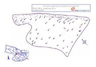
Flora of Connemara and the Burren - National Botanic Garden of ...
Flora of Connemara and the Burren - National Botanic Garden of ...
Flora of Connemara and the Burren - National Botanic Garden of ...

You also want an ePaper? Increase the reach of your titles
YUMPU automatically turns print PDFs into web optimized ePapers that Google loves.
12 M. J. P. Scannell & M. H. P. Jebb<br />
TR Tim Robinson CR Cilian Roden<br />
MS Mary (Maura) Scannell DAW David A. Webb<br />
SDW Sarah Webster MWJ Mike Wyse Jackson<br />
When records have been communicated or published using Imperial measurements, <strong>the</strong>se<br />
have deliberately not been converted to metric form, since in many cases <strong>the</strong> measures<br />
apply to <strong>the</strong> 1/2 inch to one mile (1:126,720) Ordnance Survey maps <strong>of</strong> Irel<strong>and</strong>. These maps<br />
have only recently (1993, 1995) been updated for <strong>the</strong> region with <strong>the</strong> Discovery Series<br />
maps based on a 1:50,000 scale. Historical accuracy is better served without uninformed<br />
conversions. Because <strong>of</strong> varying levels <strong>of</strong> precision, eastings <strong>and</strong> northings, when given,<br />
have been separated by a space for clarity. The previous anglicis ation <strong>of</strong> place names,<br />
followed by a recent revival <strong>and</strong> reversion to <strong>the</strong> Irish language (i.e. <strong>the</strong> maps published by<br />
Tim Robinson, 1977, 1980, 1997) means that many names have been used interchangeably<br />
(e.g. Inishméain <strong>and</strong> Inishmaan). No st<strong>and</strong>ard is maintained here, since usage is <strong>of</strong>ten <strong>of</strong><br />
significance in indicating which map source has been used.<br />
THE RECORDS<br />
Thalictrum alpinum L.<br />
7 By a small stream on Ben Lettery, August 1855, Isaac Carroll, The Phytologist 2<br />
(1857) 76.<br />
8 E. ridge, Corcoge Mtn., Maamturk Range, on damp broken rocky ground at 530 m<br />
on NE shoulder, 2 miles NW <strong>of</strong> Maam Cross, 5/07/1991, locally abundant on damp<br />
ledges <strong>and</strong> flushes (DBN) CB in litt. to MS 3/04/1992.<br />
Ranunculus aquatilis L.<br />
2 In a cattle-drinking pond excavated in drift on <strong>the</strong> S side <strong>of</strong> <strong>the</strong> road before it drops<br />
steeply into Cahergrillaun, 15/05/1983, R 259 988, JJM, in litt. to MS, 5/07/1983. E<br />
<strong>of</strong> Rockview House, W <strong>of</strong> Carran (Webb & Scannell, 1984). Large pond at <strong>Burren</strong><br />
village, M 28 11 (Preston et al., 1991).<br />
Reinstate district 2.<br />
Ranunculus baudotii Godr.<br />
3 Brackish ponds SW <strong>of</strong> Parkmore, Kinvarra Bay, M 33 12 (Preston et al., 1991).<br />
Add district 3.<br />
Ranunculus peltatus Schrank<br />
1 R. Fergus nr. Cor<strong>of</strong>in, R 265 890, 14/07/1984 (RNG). R. Fergus N <strong>of</strong> bridge above<br />
Inchiquin L., Killinaboy, R 26 91, 26/08/1988 (RNG), SDW.<br />
3 R Fergus, Ennis, R 346 780, 17/07/1984 (RNG), SDW.<br />
4 Mill Race, Galway, M 29 25, 15/07/1984 (RNG), SDW.<br />
In <strong>the</strong> <strong>Flora</strong>, R. peltatus was placed in square brackets (page 7) because <strong>the</strong>re were<br />
<strong>the</strong>n ‘... no firm records’. The above records, made chiefly by Dr. Sarah Webster,<br />
‘confirm <strong>the</strong> presence <strong>of</strong> R. peltatus in <strong>the</strong> <strong>Flora</strong> region ...[it] seems possible that<br />
some records <strong>of</strong> R. penicillatus published in <strong>the</strong> <strong>Flora</strong> could refer to R. peltatus ...’<br />
(Preston et al., 1991).<br />
Confirmed for <strong>the</strong> <strong>Flora</strong>.<br />
Ranunculus sceleratus L.<br />
3 Dried pond, by brackish ponds SW <strong>of</strong> Parkmore, M 33 12 (Preston et al., 1991).<br />
5 On a road, ‘... surfaced with s<strong>and</strong> overlain by granite shore gravel ... not subject to<br />
inundation’, Shannawonneen td. 3 km N <strong>of</strong> Spiddal, M 12 24, M. O’Connell, INJ 20<br />
(1982) 506.