Proposal to Establish Intensively Monitored Watersheds for ...
Proposal to Establish Intensively Monitored Watersheds for ...
Proposal to Establish Intensively Monitored Watersheds for ...
- No tags were found...
You also want an ePaper? Increase the reach of your titles
YUMPU automatically turns print PDFs into web optimized ePapers that Google loves.
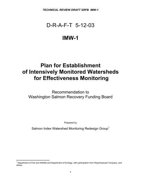
TECHNICAL REVIEW DRAFT SRFB IMW-1D-R-A-F-T 5-12-03IMW-1Plan <strong>for</strong> <strong>Establish</strong>men<strong>to</strong>f <strong>Intensively</strong> Moni<strong>to</strong>red <strong>Watersheds</strong><strong>for</strong> Effectiveness Moni<strong>to</strong>ringRecommendation <strong>to</strong>Washing<strong>to</strong>n Salmon Recovery Funding BoardPrepared bySalmon Index Watershed Moni<strong>to</strong>ring Redesign Group 11 Department of Fish and Wildlife and Department of Ecology, with participation from Weyerhaeuser Company, andothers.1
TECHNICAL REVIEW DRAFT SRFB IMW-1TABLE OF CONTENTSIntroduction ................................................................................................................................3Intensive Watershed Moni<strong>to</strong>ring................................................................................................3Experimental Design...................................................................................................................4Candidate Basins .......................................................................................................................5Basin Descriptions .....................................................................................................................9Big Beef/Seabeck Complex.....................................................................................................9Germany/Mill/Abernathy Complex ..........................................................................................9Fac<strong>to</strong>rs Limiting Freshwater Production ................................................................................11Big Beef/Seabeck Complex ..................................................................................................11Big Beef Creek ...............................................................................................................11Little Anderson Creek .....................................................................................................13Seabeck Creek ...............................................................................................................14Stavis Creek ....................................................................................................................15Germany/Mill/Abernathy Complex.........................................................................................15Implementation..........................................................................................................................16Example of an IMW Approach .................................................................................................19Project Phases and Tasks .......................................................................................................21Costs .........................................................................................................................................22Partners and Coopera<strong>to</strong>rs .......................................................................................................23References ................................................................................................................................232
TECHNICAL REVIEW DRAFT SRFB IMW-1IntroductionThe Salmon Recovery Funding Board (SRFB) and others have made substantial investmentsintended <strong>to</strong> benefit salmon and steelhead populations in the Pacific Northwest (SRFB 2002;GAO 2002). Although research has shown improvements in specific phases of their life his<strong>to</strong>rydue <strong>to</strong> management actions (see Appendix X, GAO 2002), ultimately, cause-effect relationshipsbetween management actions and salmon population response must be established <strong>to</strong> assessthe effectiveness of regula<strong>to</strong>ry and res<strong>to</strong>ration actions in res<strong>to</strong>ring salmon (Botkin et al. 2000;MDT 2001; IAC 2002; ISP 2002a, 2002b). Development of an approach using <strong>Intensively</strong>Moni<strong>to</strong>red <strong>Watersheds</strong> (IMWs), as described below and built upon the Salmon Index WatershedMoni<strong>to</strong>ring conducted by the Washing<strong>to</strong>n departments of Fish and Wildlife (WDFW) and Ecology(Summers 2001; Seiler et al. 2002), is one means of studying the linkages betweenmanagement actions and fish production. This project will begin <strong>to</strong> develop the infrastructure <strong>to</strong>enable the implementation of these experiments.Intensive Watershed Moni<strong>to</strong>ringThe basic premise of IMWs is that the complex relationships controlling salmon response <strong>to</strong>habitat conditions can best be unders<strong>to</strong>od by concentrating and integrating moni<strong>to</strong>ring andresearch ef<strong>for</strong>ts at a few locations. The types of data required <strong>to</strong> evaluate the response of fishpopulations <strong>to</strong> management actions that affect habitat quality or quantity are difficult andexpensive <strong>to</strong> collect. Focusing ef<strong>for</strong>ts on a relatively few locations enables enough data onphysical and biological attributes of a system <strong>to</strong> be collected <strong>to</strong> develop a comprehensiveunderstanding of the fac<strong>to</strong>rs affecting salmon production in freshwater.Intensive, watershed-scale research and moni<strong>to</strong>ring ef<strong>for</strong>ts have generated results that have beenvery influential in the development of environmental management strategies in North America.Some of the earliest intensive moni<strong>to</strong>ring ef<strong>for</strong>ts were instituted by the U.S. Forest Service in the1950s <strong>to</strong> better understand hydrologic responses <strong>to</strong> logging. Ef<strong>for</strong>ts at these sites expanded overtime <strong>to</strong> encompass chemical and biological responses as well. Changes in land use practicesnationwide have been based on studies conducted at experimental watersheds like the H.J.Andrews Experimental Forest in Oregon, the Hubbard Brook Experimental Forest in NewHampshire and the Coweeta Experimental Forest in North Carolina. The success of these ef<strong>for</strong>tsspawned a number of intensive, watershed-level research ef<strong>for</strong>ts in the Pacific Northwest <strong>to</strong>evaluate the response of salmon <strong>to</strong> <strong>for</strong>est practices. The Alsea Watershed Study, which wasinitiated in the 1960s, evaluated the response of coho salmon and cutthroat trout <strong>to</strong> variouslogging methods in a series of small watersheds on the Oregon coast. Results from this studyprovided much of the technical rationale <strong>for</strong> the measures <strong>to</strong> protect aquatic habitat incorporatedin<strong>to</strong> the <strong>for</strong>est practice regulations of Oregon and Washing<strong>to</strong>n in the early 1970s. In the 1970s anambitious watershed-level project was initiated at Carnation Creek on Vancouver Island, BritishColumbia that evaluated the response of coho and chum salmon <strong>to</strong> the logging of a previouslyunlogged watershed. The results of this study led <strong>to</strong> a revision of the <strong>for</strong>estry code <strong>for</strong> B.C. andalso influenced revisions <strong>to</strong> <strong>for</strong>est practice rules in other areas of the Pacific Northwest. Intensive,watershed-level studies such as these <strong>for</strong>m the foundation of our knowledge about the freshwaterhabitat requirements of salmonid fishes in the Pacific Northwest.IMW is an efficient method of achieving the level of sampling intensity necessary <strong>to</strong> determine theresponse of salmon <strong>to</strong> a set of management actions. Evaluating biological responses iscomplicated, requiring an understanding of how various management actions interact <strong>to</strong> affecthabitat conditions and how system biology responds <strong>to</strong> these habitat changes. The response of3
TECHNICAL REVIEW DRAFT SRFB IMW-1the fish is dependent on the relative availability of the habitat types it requires, which changesthrough the period of freshwater rearing (Table 1), and the manner in which these habitat typesare influenced by application of a management action. Further complicating the issue is the factthat the relative importance of each habitat type in determining fish survival changes from year-<strong>to</strong>yeardue <strong>to</strong> variations in weather and flow, the abundance of fish spawning within the watershedand other fac<strong>to</strong>rs. For example, smolt production can be dictated by spawning habitat availabilityand quality during years when flood flows occur during incubation and greatly decrease eggsurvival (Seiler et al. in prep). However, during years of more benign flow conditions during eggincubation, population per<strong>for</strong>mance may be more influenced by the availability of food duringspring and summer or adequate winter habitat. Untangling the various fac<strong>to</strong>rs that determineper<strong>for</strong>mance of the salmon and how these fac<strong>to</strong>rs respond <strong>to</strong> land use actions or res<strong>to</strong>rationef<strong>for</strong>ts can only be accomplished with an intensive moni<strong>to</strong>ring approach.Table 1. Habitat requirements of coho salmon during freshwater rearing. As outlined in thistable, the changing requirements of the fish stress the need <strong>to</strong> develop moni<strong>to</strong>ring designs thatevaluate responses at a spatial scale large enough <strong>to</strong> encompass the full range of habitat typesrequired by the fish <strong>to</strong> complete freshwater rearing.Life His<strong>to</strong>ry StageHabitatSpawning and egg incubation Gravel bedded riffles and pool tail outs in proximity of coversuitable <strong>for</strong> adult spawners (e.g., deep pools, undercutbanks, debris jams)Early fry rearingLow velocity areas with cover in close proximity <strong>to</strong> foodsource. Typically associated with shallow, channel marginhabitat with cover from wood and overhanging vegetationSummer rearingPool habitat with cover in close proximity <strong>to</strong> food source.Typically found in low gradient channels with apool/riffle morphologyWinter rearingLow velocity areas with cover. Often associated withoff-channel habitat on floodplains including low gradienttributaries, secondary channels and pondsExperimental DesignThe ultimate objective of most habitat res<strong>to</strong>ration ef<strong>for</strong>ts <strong>for</strong> salmon is <strong>to</strong> increase the abundanceof adult fish. As a result, the most meaningful measure of program effectiveness is the survivalof the fish from adult spawning through smolting of their offspring. Because salmon use multiplehabitat types during their freshwater residency, the spatial scale at which an evaluation isconducted should be large enough <strong>to</strong> encompass all the habitats required <strong>for</strong> the salmon <strong>to</strong>complete this phase of their life his<strong>to</strong>ry. The size of the area required <strong>to</strong> capture the full range ofhabitats needed <strong>to</strong> complete freshwater rearing will vary by species. The basins selected are ofsufficient size <strong>to</strong> encompass the habitat requirements <strong>for</strong> coho salmon, steelhead andanadromous cutthroat trout.A be<strong>for</strong>e-after/reference-treatment experimental design will be used <strong>to</strong> separate treatmentresponses from responses due <strong>to</strong> fac<strong>to</strong>rs unrelated <strong>to</strong> the treatments. This type of design is oftenis well suited <strong>to</strong> address many of questions amenable <strong>to</strong> IMW. It enhances the ability <strong>to</strong>differentiate treatment responses from responses due <strong>to</strong> variations in weather or other fac<strong>to</strong>rs.This approach also necessitates that IMW ef<strong>for</strong>ts must be clustered in groups of two or morebasins, with at least one serving as a reference site where no experimental treatments are4
TECHNICAL REVIEW DRAFT SRFB IMW-1implemented during the study. A calibration period prior <strong>to</strong> applying treatments is required <strong>to</strong>determine how the reference and treatment watershed compare in the key response variablesprior <strong>to</strong> any habitat manipulation. The length of time required <strong>to</strong> develop this baseline will varyamong watersheds. However, recent comparisons of adult salmon densities among multiple sitessuggest that relative abundance is fairly consistent (Pess et al. 2002; Feist et al. in press),indicating that <strong>for</strong> this attribute a fairly short calibration period may suffice. The calibration period<strong>for</strong> sites with existing in<strong>for</strong>mation on spawner abundance and smolt output would be much shorterthan <strong>for</strong> watersheds where these data have not been collected.Treated and untreated sites can be paired at a multiple spatial scales within the IMW design, thescale dependent on the question being addressed. In fact, reference sites <strong>for</strong> some reach-levelprojects could be within the basin designated <strong>for</strong> treatment. These reference sites would consis<strong>to</strong>f portions of the basin comparable in initial condition <strong>to</strong> the location where a res<strong>to</strong>ration actionis applied but where no habitat manipulation would occur during the period of evaluation.Questions that can be addressed at this finer scale include life-his<strong>to</strong>ry specific biologicalresponses or physical habitat responses <strong>to</strong> management actions. For evaluations of effects atthe scale of the entire basin, a comparison with a nearby basin that is not undergoing treatmentis required. There<strong>for</strong>e, the IMW approach does require sufficient management discipline <strong>to</strong>ensure that reference sites remain untreated through the duration of the study. This does notimply that any management activities in the reference watershed will compromise the integrity ofthe study. The validity of the study design will be maintained provided that the managementactivities not directly related <strong>to</strong> the res<strong>to</strong>ration actions being evaluated are comparable at thereference and treated locations. For example, the effectiveness of res<strong>to</strong>ration actions can beevaluated in watersheds being actively managed <strong>for</strong> wood production provided that the type andintensity of <strong>for</strong>est management activities in the treated and reference watersheds arecomparable.Candidate BasinsWDFW’s current long-term smolt moni<strong>to</strong>ring sites (Figure 1; Table 2) were used <strong>to</strong> identify initialcandidates IMWs. Drawing upon existing resources (smolt traps) will lower the costs andshorten the startup time immensely. The precision of the smolt production estimates is known<strong>for</strong> these sites, saving much ef<strong>for</strong>t in finding suitable locations, installing new traps, and verifyingthe accuracy of the estimates. In addition, most of the existing sites have had considerablehabitat work done in the watersheds which, combined with the knowledge of the biologistsworking there, will be invaluable in generating relevant, testable hypotheses on the fac<strong>to</strong>rsinfluencing smolt production.Each of the current long-term smolt moni<strong>to</strong>ring sites (Table 1) was evaluated based on thefollowing criteria:1. The basin is small enough that habitat may be effectively moni<strong>to</strong>red but large enough<strong>to</strong> encompass all freshwater life stages. Habitat moni<strong>to</strong>ring is very demanding andthe level of ef<strong>for</strong>t required is not feasible on a large scale.2. Current moni<strong>to</strong>ring provides a precise estimate of smolt production <strong>for</strong> the entirebasin above the trap.3. Estimates of returning adults are available or feasible with additional ef<strong>for</strong>t. Adult fishcan be especially difficult <strong>to</strong> estimate. Preference was given <strong>to</strong> sites where accurateadult counts are feasible, if not currently available.5
###TECHNICAL REVIEW DRAFT SRFB IMW-1Skagit RStavis CrSeabeck CrBig Beef CrLittle Anderson CrBear CrChiwawa RWenatchee RCedar RBingham CrGreen RDeschutes RUpper Chehalis RTucannon RKalama RAbernathy CrGermany CrMill CrWind RNCedar Cr10 0 10 20 MilesFigure 1. Map showing the watershed area above current WDFW long-term smolt traps.Skagit basin above Gorge Dam is not shown.4. Multiple, similar watersheds with contrasting land management are preferred. Whiletrue experimental ‘control’ watersheds may not be available, insight in<strong>to</strong> the relativeeffects of different land management or habitat res<strong>to</strong>ration strategies can beevaluated by comparing basins which are similar in all respects but the managementscenario.5. Long-term record of smolt production was preferred. Sites with longer data recordsenable us <strong>to</strong> construct a his<strong>to</strong>ry of changes in land use, climate, flow conditions, andother pertinent characteristics. This can be used with the smolt production records <strong>to</strong>build working hypotheses concerning the fac<strong>to</strong>rs affecting smolt production.Based on these criteria, seven basins in two different WRIAs in which smolts have been trappedwere identified (Table 3; Figures 1 and 2). The four basins <strong>for</strong>ming a Big Beef/Seabeck complex(BBS) are on the Kitsap Peninsula (WRIA 15), and a Germany/Mill/Abernathy complex (GMA) inthe Grays-Elochoman WRIA (25) is on the lower Columbia River.Big Beef Creek on the Kitsap peninsula has the longest data record, <strong>to</strong> the late 1970s, andincludes escapement estimates (Table 4). Smolt traps have been operated on Seabeck Creek,Little Anderson Creek, and Stavis Creek since the early 1990s. These basins are similargeologically, <strong>to</strong>pographically, and in land use his<strong>to</strong>ry, but differ in the degree of development andcurrent <strong>for</strong>est management. Because of this, suitable treatment-reference study designs arepossible.6
TECHNICAL REVIEW DRAFT SRFB IMW-1Table 2. Trap site location <strong>for</strong> currently moni<strong>to</strong>red wild anadromous salmonid smoltmoni<strong>to</strong>ring index watersheds.WRIATrapSite/WatershedArea(acres)Species03/04 Skagit R Skagit River 1223321 Chinook, coho, pink, steelhead, bull trout08 Cedar R Bear Creek 27886 Chinook, coho, steelhead, cutthroat,sockeye fryCedar River 109286 Chinook, coho, steelhead, cutthroat,sockeye fryO9Green River 207959 Chinook, coho, steelheadGreen/Duwamish13 Deschutes Deschutes 121876 CohoRiver15 KitsapBig Beef Creek 9044 Coho, steelheadLittle Anderson 3173 Coho, steelheadCr.Seabeck Creek 3471 Coho, steelheadStavis Creek 3872 Coho, steelhead22 Lower Chehalis Bingham Creek 22045 Coho, steelhead, cutthroat23 Upper Chehalis Chehalis River 611521 Coho25 GraysMill Creek 18648 Chinook, coho, steelhead, cutthroatElochoman Germany Creek 14471 Chinook, coho, steelhead, cutthroatAbernathy 18309 Chinook, coho, steelhead, cutthroatCreek27 Kalama R Kalama River 113793 ?Cedar Creek 33935 ?29 Wind R Wind River 135965 ?35 Middle Snake Tucannon River 310725 ?45 Wenatchee WenatcheeRiver234180 ?Chiwawa River 60575 ?Abernathy Creek, Germany Creek, and Mill Creek, tributaries <strong>to</strong> the lower Columbia River (RM53-56), were selected in spite of the short duration of smolt sampling (established in 2001).These basins provide good estimates of multiple species, have similar land use, but underdistinctly different land management schemes and a mix of large and small private owners andpublic lands (Tables 3 and 4).7
TECHNICAL REVIEW DRAFT SRFB IMW-1Table 3. Land cover, land management, and ownership percentages <strong>for</strong> each trap basinare shown below. Land cover is based on satellite imagery from the early 1990s. HCP area isbased on 2001 maps provided by U.S. Fish and Wildlife Service. The land under Forest andFish rules (FFR) is based on a map compiled <strong>for</strong> DNR and does not include small <strong>for</strong>estlandowners. Public ownership was based on the Major Public Lands map, remaining land wasassumed <strong>to</strong> be private.WRIA 15 KitsapSmolt trapBasinarea(acres)Land cover (%) Land mgt (%) Ownership (%)Forested Developed FFR HCP Public PrivateL. Anderson Cr 3173 87 8 6 4 12 88Big Beef Cr 9044 90 3 43 24 28 72Seabeck Cr 3471 91 2 25 20 19 81Stavis Cr 3872 83 2 37 39 17 83WRIA 25 Grays-ElochomanMill Cr 18648 94 0 23 55 61 39Germany Cr 18309 92 0 44 35 35 65Abernathy Cr 14471 85 0 83 0 0 100Table 4. Period of record and data collected at each smolt trap.WRIA 15 KitsapSmolt trapWatershedanalysis?JuvenilesAdultsSince Species Since SpeciesAnderson Cr Yes, 1998 1992 coho -Big Beef Cr Yes, 1998 1978 coho,cutthroat,steelheadSeabeck Cr Yes, 1998 1993 coho -Stavis Cr Yes, 1998 1993 coho -WRIA 25 Grays-ElochomanMill Cr No 2001 chinook,coho,cutthroat,steelheadGermany Cr No 2001 chinook,coho,cutthroat,steelheadAbernathy Cr No 2001 chinook,coho,cutthroat,steelhead1976 chinook,chum,coho---8
TECHNICAL REVIEW DRAFT SRFB IMW-1Basin DescriptionsBig Beef/Seabeck ComplexThese four basins, located on the west side of the Kitsap Peninsula, comprise a large portion ofthe West Kitsap Watershed Administrative Unit (WAU). This WAU is within the Puget Soundtrough, which has experienced considerable glacial activity in its geological his<strong>to</strong>ry. As a result,the West Kitsap WAU generally has a gently rolling upland of glacial till with steep-sided ravinesleading down <strong>to</strong> the river floodplains. The glacial till of the uplands is fairly resistant <strong>to</strong> erosion butthe loose sandy soil and layers of fine textured material comprising the ravine sideslopes is muchmore prone <strong>to</strong> erosion. In addition, layers of clay in the ravine walls can transport water laterallyand where this intersects a road cut, ground water can be expected <strong>to</strong> flow on<strong>to</strong> the road. Inputsof fine sediments were rated as a moderate <strong>to</strong> high hazard <strong>for</strong> all four creeks and roads adjacent<strong>to</strong> or draining in<strong>to</strong> streams were identified as the highest contribu<strong>to</strong>rs of fines <strong>to</strong> the streamnetwork (W Kitsap WSA 1998).Hood Canal###Little Anderson Cr#Seabeck CrBig Beef CrStavis Cr# Smolt trapNFigure 2. Location of four smolt traps in WRIA 15 (Kitsap) provides excellent estimates <strong>for</strong>coho and steelhead. Basin areas range from ~3200 <strong>to</strong> 9000 acres.Commercial logging of lowland areas was in practice by 1870 with the establishment of largesawmills. Extensive logging of the uplands began in the 1920s when a railroad network was built<strong>to</strong> transport the timber and continued in<strong>to</strong> the 1940s until few merchantable trees were left.Although <strong>for</strong>est practices have improved markedly, legacy effects may exist. Since the 1970srural residential development has increased and continues <strong>to</strong>day. Based on early 1990s satelliteimagery, over 80% of each basin is <strong>for</strong>ested and the proportion developed is low (Table 3).However, rural residential development has increased markedly since the 1970s and is likely9
TECHNICAL REVIEW DRAFT SRFB IMW-1degrading habitat through riparian vegetation removal, s<strong>to</strong>rmwater runoff, fish passage barriers,and high sediment loads (W Kitsap WSA 1998; Seiler et al. 2002)Germany/Mill/Abernathy ComplexThe GMA moni<strong>to</strong>ring complex is located on the Lower Columbia River downstream of Longview,Washing<strong>to</strong>n. Watershed areas above the smolt trap are similar (Table 3) ranging from 14,400 <strong>to</strong>18,700 acres. Abernathy and Germany Creeks drain steep basins with headwater elevations ofup <strong>to</strong> 806-m. Mill Creek is a lower elevation basin with headwater elevations of 555-m. Landcover is largely <strong>for</strong>ested with land use in all three basins focused on timber production.Abernathy and Germany Creeks are primarily comprised of private timberlands, whereas DNRowns a large share of the Mill Creek watershed. Residential and agricultural development islight and concentrated in the lower portion of all three basins. Juvenile chinook, and cohosalmon and cutthroat and steelhead trout are have trapped since 2001 but adult escapement isnot moni<strong>to</strong>red.# Smolt TrapGermany CrAbernathy CrMill Cr###NColumbia R1 0 1 2 MilesFigure 3. Location of traps on Germany, Mill, and Abernathy creeks provide very goodestimates <strong>for</strong> chinook, coho, cutthroat, and steelhead.10
TECHNICAL REVIEW DRAFT SRFB IMW-1Fac<strong>to</strong>rs Limiting Freshwater ProductionBig Beef/Seabeck ComplexBig Beef CreekOf the four streams, Big Beef Creek is the largest, draining a 36-km 2 basin (Table 5). Big BeefCreek is also unique in that it flows through a number of depressional wetland marshes in itsupper watershed. Wetland habitats are also found in the headwaters of Seabeck and StavisCreeks, but represent a much less prominent feature in these watersheds compared <strong>to</strong> Big BeefCreek.Big Beef Creek is also unique in that it flows through Lake Syming<strong>to</strong>n, a shallow, man-madereservoir surrounded by a housing development that is located in the middle of the basin. Afishway provides access <strong>for</strong> adult and juvenile coho, steelhead, and cutthroat above the dam.Downstream of the reservoir, Big Beef Creek cuts down through a canyon <strong>to</strong> reach Hood Canal.Anadromous salmonids spawning downstream of the dam include coho, chum, steelhead, andcutthroat, whereas only coho, steelhead, and cutthroat utilize the habitats above the dam.The University of Washing<strong>to</strong>n Big Beef Creek Research Station is located at the mouth of thestream. The facility includes a weir, where WDFW built and currently operates anupstream/downstream trapping facility <strong>to</strong> count salmon as ascending adults and the subsequentdownstream juvenile migration. The trapping facility has been operating since 1976.Big Beef Creek has been much studied over the years. Besides long-term freshwater productionmoni<strong>to</strong>ring, spawning ground surveys have been conducted <strong>to</strong> define the distribution of cohospawners and <strong>to</strong> recover coded wire tags. In addition, WDFW, the Point No Point TreatyCouncil, and the U.S. Fish and Wildlife Service have conducted habitat surveys in Big BeefCreek. From this work, project proponents from WDFW have developed a number ofhypotheses as <strong>to</strong> fac<strong>to</strong>rs that limit production of coho salmon in the basin. These fac<strong>to</strong>rs arediscussed <strong>for</strong> the three sections of Big Beef Creek: the upper watershed (above LakeSyming<strong>to</strong>n), Lake Syming<strong>to</strong>n, and lower Big Beef Creek.Upper Watershed Above Lake Syming<strong>to</strong>n, Big Beef Creek flows through a series ofdepressional wetland marshes. These wetland habitats provide year around rearing habitat <strong>for</strong>coho, steelhead, and cutthroat, and are extremely important <strong>for</strong> preserving the productivity ofcoho in the basin. Fall flows that limit spawner access in<strong>to</strong> the upper watershed reduce smoltproduction in the subsequent brood. In addition, the hydrologic functioning of the wetlands isthreatened by development in the upper watershed. Forested lands adjacent <strong>to</strong> the wetlandsare increasingly being converted <strong>to</strong> hobby farms. Increased runoff during the winter and nutrientenrichment from animal wastes resulting from conversion is degrading the suitability of thewetlands as coho habitat over time.11
TECHNICAL REVIEW DRAFT SRFB IMW-1Table 5. Average wild coho and steelhead smolt production and productivity <strong>for</strong> theBig Beef/Seabeck (BBS) complex (1992-2002) and Germany/Mill/Abernathy (GMA)complex (2001-2002).Average Smolt Watershed Average Smolts/km2ProductionStream Coho Steelhead Area (km 2 ) Coho SteelheadBBS ComplexBig Beef Creek 23,443 1,528 36.0 651 42Little Anderson263 43 12.0 22 4CreekSeabeck Creek 1,313 27 13.3 99 2Stavis Creek 5,239 74 13.1 400 6GMA ComplexGermany Creek 7,579 7,550 58.3 130 130Mill Creek 7,912 1,480 75.4 105 20Abernathy Creek 6,596 7,995 74.3 89 108Note: Coho and steelhead production estimates <strong>for</strong> the BBS complex, shown here,represent average smolt trap catches. The actual average production is slightly higherdue <strong>to</strong> unaccounted <strong>for</strong> migration occurring prior <strong>to</strong> and following trap operation.Estimates <strong>for</strong> GMA complex streams represent the average <strong>to</strong>tal migrations of coho andsteelhead smolts.Lake Syming<strong>to</strong>n Juvenile salmonids migrating out of the upper watershed must passthrough Lake Syming<strong>to</strong>n be<strong>for</strong>e reaching Hood Canal. The lake is also used <strong>for</strong> coho overwintering.Coho predation is likely considerable due <strong>to</strong> the population of large mouth bass thatinhabits the lake. Water temperatures in the lake limit salmonid use during the summer months.Stream temperatures just downstream from the dam have exceeded 26C during the summermonths. In 2001, water temperature exceeded the water quality standard of 16C over 44% ofthe time (Summers 2001). Elevated water temperature were noted <strong>for</strong> 2000’ below the lake,however, the watershed analysis (W Kitsap WSA, 1998) concluded that because of the relativelygood canopy cover and groundwater influence, high water temperature was not a widespreadproblem (Table 6).Lower Big Beef Creek Lower Big Beef Creek is approximately 8.5-km long. The streamflows through a confined canyon <strong>for</strong> approximately 3.5-km. Further downstream it becomes lessconfined and opens in<strong>to</strong> an alluvial valley in the lower 3-km of stream. Summer stream flow inlower Big Beef Creek is very low <strong>for</strong> a basin of its size. Summer low flows averageapproximately 3-cfs. Similar summer low flow levels were recorded in nearby Devil’s Hole Creekon the Bangor Navy Base, which is only 1/5 th its size (Volkhardt et al. 2000). Possible causes<strong>for</strong> the relatively low flow levels include:1. Evaporation from Lake Syming<strong>to</strong>n and the upper watershed marshes,2. Well withdrawals from development in the Big Beef Creek watershed andadjacent watersheds that are hydrologically connected,12
TECHNICAL REVIEW DRAFT SRFB IMW-13. The existence of a shallow impervious layer in the upper watershed that infiltrateslittle water <strong>to</strong> contribute <strong>to</strong> summer flows, and4. The excessive accumulation of coarse sediment in the lower Big Beef Creekchannel.Table 6. Percent riparian canopy closure estimate from aerial pho<strong>to</strong>s (fromTable D-1, W Kitsap WSA).Basin 90%Stavis Cr 8 43 50Seabeck Cr 20 55 25Big Beef Cr 34 40 26Little Anderson Creek 8 46 46Sediment recruitment <strong>to</strong> lower Big Beef Creek occurs from bank erosion and past logging/roadbuilding practices. Bank erosions rates average approximately 1.2-m 2 of eroded bank <strong>for</strong> everymeter of stream length in the first 4.4-km below the dam (WDFW unpublished data). Sedimentinputs from poor road construction practices are particularly noticeable on Kid Haven Road. Theroad was built down a right bank tributary of Big Beef Creek, <strong>for</strong>cing the tributary in<strong>to</strong> thedrainage ditch along the side of the road. The stream eroded the <strong>to</strong>e of the road cut duringsubsequent winter s<strong>to</strong>rms, sending thousands of yards of coarse material in<strong>to</strong> Big Beef Creek.Ames et al. (2000) describe the importance of flows during the spawning and incubation periods<strong>for</strong> the success of summer chum production. They attribute the inability of summer chumsalmon populations <strong>to</strong> recover from recent-year peak flow impacts as due <strong>to</strong> a loss of resiliencyin freshwater habitats that have resulted from poor land-use practices. Fac<strong>to</strong>rs contributing <strong>to</strong>the loss of habitat resiliency in Big Beef Creek include removal of large woody debris (LWD)from the stream, removal of streamside vegetation (Table 7), loss of floodplain connectedness,and water withdrawals.Little Anderson CreekLittle Anderson Creek is an independent tributary <strong>to</strong> Hood Canal located approximately 2-kmeast of Big Beef Creek in the adjacent watershed. The Little Anderson Creek watershed has anarea of approximately 12-km 2 . It is bordered on the east by the City of Silverdale and a part ofthe watershed is within the urban growth boundary of the city. Little Anderson Creek is primarilyused by coho, chum, and cutthroat. A few steelhead also spawn in the stream each year.Most of Little Anderson Creek and its tributaries are deeply incised in<strong>to</strong> the steep surroundinghills. The stream gradients within the fish-bearing portions of Little Anderson Creek are high,averaging 3.1% (WDFW unpublished data). Because of the steepness of the stream channeland surrounding hillslopes, the stream is sensitive <strong>to</strong> land-use activities that increase the rate ofwater input <strong>to</strong> the channel, such as the creation of impervious surfaces. These conditionsproduce substantial stream energy during s<strong>to</strong>rm flow events. Stream banks are largely intactwithin the Little Anderson Creek watershed. Bank erosion rates average less than 0.3-m 2 ofbank erosion per linear meter of stream. However, bed scour has resulted in the transport oflarge amounts of sediment downstream. Only low <strong>to</strong> moderate levels of instream wood areavailable <strong>to</strong> trap sediments and slow s<strong>to</strong>rm flows (WDFW unpublished data).13
TECHNICAL REVIEW DRAFT SRFB IMW-1intra-gravel bed flow. Other fac<strong>to</strong>rs may include increased withdrawal of groundwater as a resul<strong>to</strong>f development in the basin.Stavis CreekStavis Creek is a 13.1-km 2 watershed located approximately 2.4-km west of Seabeck Creek. Itssummer fish-bearing mainstem is nearly 8-km long (WDFW unpublished data). Additionalsummer fish-bearing habitat is found in South Fork Stavis Creek (2-km) and an unnamed leftbank tributary <strong>to</strong> the mainstem (0.4-m). Much of Stavis Creek and its tributaries are incisedwithin the steeply sloped surrounding hillside.Of the four watersheds, Stavis Creek is the least developed. Most of the lands within the basinare private or DNR timberlands. Some rural residential development has occurred along ridgesouth of SF Stavis Creek. Principal impacts <strong>to</strong> the stream are related <strong>to</strong> sediment depositionfrom bank and slope failures, primarily in the mainstem. One slope failure located mainstemapproximately 600-m upstream of the confluence of SF Stavis Creek is especially large. Theslide, which occurred during the winter of 1999, was located on a steep slope that had beenlogged about 10-15 years earlier (Neuhauser personal comm.). The erosion scar from this slidewas estimated at 550-m 2 (WDFW unpublished data). A tremendous amount of fine and coarsesediment was released in this slide which impacted spawning gravel down <strong>to</strong> the mouth of thestream, reduced rearing capacity, and affected benthic invertebrate (i.e., prey) populations.Although the greatest impacts occurred in the first two years following the slide, the finesediments are continuing <strong>to</strong> be transported, <strong>to</strong> impact gravel downstream.Germany/Mill/Abernathy ComplexSince smolt moni<strong>to</strong>ring only began in 2001, less in<strong>for</strong>mation regarding fac<strong>to</strong>rs that influencefreshwater anadromous production can be drawn from smolt production data. Nevertheless, bycomparing the smolt production levels in these streams with others moni<strong>to</strong>red in westernWashing<strong>to</strong>n, we assess their relative productivity. Wade (2002) describes a number of limitingfac<strong>to</strong>rs in the GMA moni<strong>to</strong>ring complex. Smolt moni<strong>to</strong>ring results can be used <strong>to</strong> evaluate thesefac<strong>to</strong>rs and help <strong>to</strong> prioritize their severity on juvenile production.Average coho smolt production per square kilometer watershed area in the three GMAmoni<strong>to</strong>ring complex streams ranged from 89 in Abernathy Creek <strong>to</strong> 130 in Germany Creek(Table 5). These levels are substantially lower than those found in Stavis Creek (489 cohosmolts/km 2 ) over the same two years. The low levels of coho production in the GMA streamslikely relate <strong>to</strong> their higher stream gradients, which favor steelhead production, and possibly <strong>to</strong>low coho escapements, which are currently not measured. Wild steelhead smolt production persquare kilometer of watershed averaged 20 in Mill Creek, 108 in Abernathy Creek, and 130 inGermany Creek. These levels are much higher than are observed in Stavis Creek over thesame two years (4 steelhead smolts/km 2 ), a much smaller and lower gradient stream.Wade (2002) identified a number of fac<strong>to</strong>rs that limit production of anadromous salmonids in theGMA moni<strong>to</strong>ring complex (Table 8). Fish passage at culverted stream crossings needs <strong>to</strong> beassessed throughout the basins. Splash damming his<strong>to</strong>rically occurred in the Mill andAbernathy drainages, which eroded channels, isolated the streams from their floodplains, andremoved large woody debris. Streamside road construction further isolated streams from theirfloodplains and limited opportunities <strong>for</strong> off-channel habitats. Mass wasting in the upperwatersheds has contributed substantial sediment loads <strong>to</strong> these channels resulting in the fillingof pools and in reduced spawning habitat suitability. Poor riparian habitat condition in the basinsmay result in stream temperatures that limit salmonid production and reduce large woody debrisrecruitment. Aluminum <strong>to</strong>xicity has been identified as a concern in Mill and Cameron Creeks.15
TECHNICAL REVIEW DRAFT SRFB IMW-1Given the steep nature of the Germany and Abernathy Creek watersheds, substantial hydraulicenergy develops in these streams during s<strong>to</strong>rm events. The loss of floodplain connectednessand channel complexity is of particular concern in these basins since intact floodplains, woodydebris, and other hydraulic controls would help <strong>to</strong> mitigate high flow impacts, stabilize coarsesediments, and provide additional rearing habitat. Removal of blockages may result in ameasurable increase in juvenile production if habitat upstream of blockages is substantial.ImplementationFundamental <strong>to</strong> the IWM approach is the establishment of a set of overarching objectives, whichprovide the context <strong>for</strong> the application of ecological res<strong>to</strong>ration and <strong>to</strong> which individual projectscan easily be related. As the goal of most habitat res<strong>to</strong>ration ef<strong>for</strong>ts <strong>for</strong> salmon and trout is <strong>to</strong>improve the survival of the fish through their entire period of freshwater residency, goals thatrelate <strong>to</strong> this outcome should be a component of the objectives. Individual res<strong>to</strong>ration projectsshould collectively contribute <strong>to</strong> the attainment of the watershed level objectives. To determinewhether this is occurring, projects applied at the reach scale should be nested within and related<strong>to</strong> the watershed-level objectives <strong>for</strong> habitat condition and fish populations. Such nestingcreates an interconnectedness among projects that is critical <strong>to</strong> assessing the ultimate efficacyof the res<strong>to</strong>ration ef<strong>for</strong>t. Following we provide an example of how such an ef<strong>for</strong>t could bestructured <strong>to</strong> determine salmon response <strong>to</strong> the application of a watershed-level habitatres<strong>to</strong>ration program.Table 8. Habitat indica<strong>to</strong>rs <strong>for</strong> riparian condition, LWD, and % pools are ranked “poor” inlarge portions of all basins (Wade 2002).Creek/habitat% of stream reachesindica<strong>to</strong>r Good Fair PoorMill CreekBank erosion 50 16 34Fine sediment 53 37 11Riparian condition 5 66 26LWD 8 3 89% Pool 0 11 89Germany CreekBank erosion 75 18 8Fine sediment 53 36 11Riparian condition 0 47 53LWD 4 18 78% Pool 0 1 99Abernathy CreekBank erosion 95 3 2Fine sediment 7 39 55Riparian condition 0 39 61LWD 0 21 79% Pool 1 8 9116
TECHNICAL REVIEW DRAFT SRFB IMW-1Implementation of an IMW ef<strong>for</strong>t should begin with an assessment of the current condition of thewatersheds <strong>to</strong> be moni<strong>to</strong>red. There are a number of <strong>to</strong>ols that are appropriate <strong>for</strong> this taskincluding the Washing<strong>to</strong>n Watershed Analysis pro<strong>to</strong>col. The in<strong>for</strong>mation generated by thisassessment will indicate the fac<strong>to</strong>rs that are likely limiting fish production in the watershed. Forexample, if the watershed analysis identifies a lack of large wood in the streams in the basin, thehypothesis could be posed that lack of pool habitat is limiting available rearing space. Anexperiment <strong>to</strong> evaluate this hypothesis might involve deliberate addition of wood <strong>to</strong> channelsegments and measurement of the change in pool habitat and summer and winter rearingpopulations at these sites relative <strong>to</strong> populations at untreated reaches (reach-level evaluation).However, even if this analysis indicates an increase in the number of fish rearing at treated sites,it does not provide in<strong>for</strong>mation about the effect that these projects have had on the overallproductivity of the fish population. In order <strong>to</strong> determine whether the wood addition has actuallychanged system productivity, rather than simply attracted fish <strong>to</strong> the treated reach that wouldhave reared elsewhere, measures of watershed-level productivity are required.In order <strong>to</strong> evaluate watershed-scale responses, the treatments (wood additions) need <strong>to</strong> beapplied at enough locations so that a population response can be detected. If the initialhypothesis proves correct and rearing habitat does have a controlling influence on fishproduction in the watershed, the number of smolts produced or survival rate from egg <strong>to</strong> smoltshould increase. The number of treatment sites required <strong>to</strong> detect a watershed-level responsecan be evaluated as wood-addition projects are successively implemented. Due <strong>to</strong> the expenseand labor involved in wood additions <strong>to</strong> channels, application of treatments will occur over aperiod of years. Small increases in density of rearing fish at the reach level would indicate thatwatershed-scale responses would only be discernible when a large number of sites had been sotreated. A very dramatic density response at the site level might suggest that changes inpopulation should be measurable with treatment of fewer sites.At a minimum, in<strong>for</strong>mation on number of spawning adult fish and smolt output are required <strong>to</strong>evaluate watershed-level responses. Counting fences or weirs at the downstream end of awatershed provide the most accurate measure of adult salmon returning <strong>to</strong> spawn. This methodis very accurate but labor intensive and provides no in<strong>for</strong>mation about spawner distributionwithin the watershed. Counts of fish on the spawning grounds or mark-recapture estimates ofspawning fish or carcasses conducted periodically during the time of spawning is not asaccurate as counts at weirs in determining <strong>to</strong>tal number of fish but does provide data ondistribution. The application of statistically valid techniques of reach selection and frequent,consistent surveys of each reach can improve the accuracy of estimates of spawner abundance.Such a method has been developed and implemented on the Oregon coast <strong>for</strong> coho salmon.Smolts leaving the WAU must be sampled by using some type of trap. Typical trap typesinclude fences or weirs that capture all smolts exiting the WAU (although fences may becomeinoperable at high flows), or scoop or screw traps that capture a portion of the fish. Partialsampling traps are easier <strong>to</strong> maintain and can be utilized in channels <strong>to</strong>o large <strong>for</strong> fences.However, these types of sampling devices require frequent calibration <strong>to</strong> determine theproportion of smolts being captured. With adult and smolt data it is possible <strong>to</strong> calculate thesurvival of the fish from spawning through smolting. The objective of nearly all salmon habitatres<strong>to</strong>ration ef<strong>for</strong>ts (although often unstated) is <strong>to</strong> increase this value. There<strong>for</strong>e, regardless ofthe methods selected <strong>to</strong> measure adult salmon and smolt abundance, these measures arecritical <strong>to</strong> any comprehensive ef<strong>for</strong>t <strong>to</strong> evaluate fish response <strong>to</strong> res<strong>to</strong>ration and must beincluded at all IMW sites.Augmenting the smolt and spawner data with in<strong>for</strong>mation on egg survival and the distribution,abundance and survival of juvenile salmon from emergence from the gravel through smolting17
TECHNICAL REVIEW DRAFT SRFB IMW-1can enable salmon response <strong>to</strong> individual res<strong>to</strong>ration projects <strong>to</strong> be linked with response at thescale of the whole watershed. Capturing fish seasonally (spring, late summer, winter) byelectrofishing, seining or trapping at multiple locations across the watershed would enable anestimate of fish distribution, abundance, growth rate, species, and age class composition. Analternative <strong>to</strong> capturing fish is a visual survey using an extensive sampling approach like Hankin-Reeves (Hankin and Reeves 1988) although this method does not provide in<strong>for</strong>mation on fishspecies and size that is as accurate as methods that involve capturing fish, it is rapid and wouldenable sampling of the entire stream network in a WAU-sized watershed. A combination of thetwo approaches, a complete survey coupled with subsamples at selected sites where the fishare captured and measured, would provide the most complete in<strong>for</strong>mation. The methodselected will depend on how critical the measurement is, the characteristics of the site, and theresources available <strong>to</strong> be dedicated <strong>to</strong> obtaining the measurement.Differential tagging of salmon captured during the sampling of different stream reaches andsubsequent capture at the smolt trap could provide additional in<strong>for</strong>mation on survival rates offish rearing in different areas of the watershed and the effectiveness of individual res<strong>to</strong>rationprojects. Differences in survival among reaches or habitat types may provide an indication ofkey mortality fac<strong>to</strong>rs operating in the river and aid in the identification of res<strong>to</strong>ration ef<strong>for</strong>ts likely<strong>to</strong> have the greatest effect on salmon populations. There are numerous tagging technologiesavailable. Passively induced transponder (PIT) tags, which are appropriate <strong>for</strong> larger fish(>70mm) have been used extensively on the Columbia River and enable individual identificationof fish. Visible implant (VI) tags also can be used <strong>to</strong> identify individual fish although reading thetags is more difficult than with PIT tags. The injection of colored dyes or polymers in<strong>to</strong> varioustransparent tissues of the fish enables determination of the location where a fish was tagged butcannot be used <strong>to</strong> identify individual fish. However, this type of tag may be very appropriate <strong>for</strong>addressing many of the questions related <strong>to</strong> res<strong>to</strong>ration effectiveness.The collection of data on fish populations must be coupled with in<strong>for</strong>mation on the habitatattributes and climatic conditions. As fish are very sensitive <strong>to</strong> variations in flow, temperatureand other fac<strong>to</strong>rs that might not be directly influenced by res<strong>to</strong>ration treatments, interpretation ofthe fish data can be enhanced by the collection of this in<strong>for</strong>mation. At a minimum, a recordingflow gauge is required at the mouth of the reference and treatment watersheds. In addition, ifsome of the res<strong>to</strong>ration ef<strong>for</strong>ts are attempting <strong>to</strong> alter flow patterns, secondary flow gaugesshould be installed at the locations where these ef<strong>for</strong>ts are undertaken. A weather stationcollecting data on precipitation and air temperature should be located near the downstream endof the watershed. Water temperature also should be recorded year round at each gaugingstation and at all sites where one of the purposes of a res<strong>to</strong>ration action is <strong>to</strong> alter watertemperature. Instruments <strong>to</strong> record flow, weather and water temperature in<strong>for</strong>mation data haveimproved dramatically in the last decade and costs have decreased. Thus, costs are reasonable<strong>for</strong> installing this equipment. However, maintaining the instruments and the database are laborintensive.Data on habitat can be collected concurrently with fish sampling. These data are especiallyimportant at sites where res<strong>to</strong>ration projects will be implemented. Habitat data can includephysical characteristics of the channel (e.g., pools, riffles etc.), riparian area condition, levels ofsediment deposited in pools and in spawning gravel, water quality (e.g., temperature,suspended sediment), nutrient levels and trophic productivity. The variables measured willdepend on the objectives of the res<strong>to</strong>ration actions. Projects designed <strong>to</strong> increase pool habitatwill focus on the physical attributes of the channel while measures of nutrient levels and trophicproduction would be the most appropriate measures of a salmon carcass addition project.18
TECHNICAL REVIEW DRAFT SRFB IMW-1The specifics of the biological, physical and habitat attributes measured in an IWM ef<strong>for</strong>t will varydepending on the questions being addressed. Regardless, the expense and ef<strong>for</strong>t required <strong>to</strong>obtain the necessary data <strong>to</strong> adequately evaluate the response of salmon <strong>to</strong> habitat res<strong>to</strong>rationsupports the notion of concentrating evaluation ef<strong>for</strong>ts in a relatively few locations. It will take anumber of fish generations <strong>to</strong> get definitive results about the effectiveness of habitat res<strong>to</strong>ration.However, by implementing these evaluations with clear objectives, careful consideration ofexperimental and statistical design, disciplined adherence <strong>to</strong> the experimental constraints at thetreatment and reference sites, and patience, results can be produced that will greatly improveour ability <strong>to</strong> promote salmon recovery.Example of an IMW ApproachThe following illustrates an IMW approach <strong>to</strong> assess the effectiveness of a particular type ofres<strong>to</strong>ration project. The example provides an indication of how evaluation ef<strong>for</strong>ts can be nestedat hierarchical spatial scales. This example details the elements required <strong>to</strong> assess a series ofprojects designed <strong>to</strong> reduce sediment input from a <strong>for</strong>est road system. Development of theevaluation approach requires four steps: (1) establishing objectives at each scale beingevaluated, (2) collection of pre-treatment data, (3) implementation of the treatment, and (4)collection of post-treatment data. Each of these steps is applied <strong>to</strong> a series of interconnectedexperiments applied at each of three spatial scales: reach or project level, tributary watershedlevel, and basin level.Objectives are required <strong>for</strong> each spatial scale from the reach level <strong>to</strong> the whole basin. Thesehypotheses should include both the physical habitat response and a related biological response.Road sediment can potentially affect salmon a variety of ways. Sediment settling on thestreambed can clog spawning gravel, reducing survival of incubating eggs and fill pools,reducing available rearing habitat. If a preliminary assessment of watershed conditions hasidentified sediment as a likely candidate <strong>to</strong> be limiting salmon productivity in the basin, thenaddressing this problem should result in increased survival of the fish from egg <strong>to</strong> smolting.Determining if the assessment is indeed correct requires that sediment delivery be changedsufficiently <strong>to</strong> produce a measurable response from the fish.Experimental treatments <strong>to</strong> address this question would occur in a number of tributarywatersheds within the treated basin. Initially, treatments would be concentrated in a singletributary watershed and the response compared with the untreated sites. Through time,treatments could progress from one tributary watershed <strong>to</strong> the next, provided that some of thetributary watersheds were maintained as references. Evaluations would occur at nested scales.At the reach level the effectiveness of individual projects on sediment production and proximatehabitat condition would be evaluated. Assessments at the tributary watershed scale wouldprovide an indication of the cumulative effect of the application of multiple treatments onsediment delivery and the resulting response of habitat condition and fish populations. Whetheror not reductions in sediment production in the treated tributary watershed actually contributed <strong>to</strong>an overall increase in the production of smolts would be addressed at the watershed scale. Thetypes of questions appropriate <strong>for</strong> each scale are summarized in Table 9.19
TECHNICAL REVIEW DRAFT SRFB IMW-1Table 9. Types of moni<strong>to</strong>ring questions and responses at appropriate spatial scales.ScaleReachTributaryWatershedResponse TypePhysical Response Habitat Response Biological ResponseDo individualtreatments reducesediment delivery <strong>to</strong>the channel?Does the applicationof multiple treatmentsresult in lowersuspended sedimentexport at the mouthof the treatedtributary?Does reduction insediment inputcorrespond <strong>to</strong> areduction in sedimentin streambed graveland/or a reduction indeposited sedimentin pools immediatelydownstream from theproject area?Is there an increasein the volume ofpools in the treatedwatershed?Does a reduction insediment in streambedgravel correspond <strong>to</strong>an increase in eggsurvival at the projectsite?Are there increases inthe density of rearingjuvenile salmon in thetreated watershed?Basin none none Is there an overallincrease in the numberof smolts produced oregg-<strong>to</strong>-smolt survivalrate followingapplication oftreatments?Pre-treatment data would be collected <strong>for</strong> a period of one or two years. No treatments would beapplied at any of the sites during this time. Pre-treatment data would be collected on sedimentproduction and delivery, habitat conditions in the stream and fish populations. Treatments wouldcommence in year 2 and could extend over a period of several years if the plan is <strong>to</strong> sequentiallytreat multiple tributary watersheds. Treatments might include reconfiguration of drainagesystems <strong>to</strong> divert ditch flow on<strong>to</strong> the <strong>for</strong>est floor, paving bridge approaches and utilization ofharder surfacing materials.Assessments implemented at the reach level would focus on the effect of sediment-reductionef<strong>for</strong>ts implemented at a single location on sediment production and input <strong>to</strong> the channel. Thesesite-specific assessments would not be conducted at every project site. Several representativeexamples of each project type would be assessed. Sediment input can be assessed withperiodic grab samples or pump samplers deployed above and below the treatment location. Thecorresponding habitat attribute of interest at this scale would be the level of fine sediment ingravel or the amount of sediment deposited in pools. Measurements of these attributes wouldbe taken annually at the project site and at a reference site in an untreated tributary watershed.There are numerous methods <strong>for</strong> determining fine sediment levels in streambed gravel.Residual pool depth or closely spaced cross sections at pools could be used <strong>to</strong> determinechanges in pool volume. The only relevant biological attribute at this scale would be the survival20
TECHNICAL REVIEW DRAFT SRFB IMW-1of eggs in the gravel be<strong>for</strong>e and after implementation of the sediment reduction measures andhow this value compares with a nearby, physically comparable but untreated reach. There are anumber of methods <strong>for</strong> measuring egg survival.The next relevant spatial scale <strong>for</strong> this analysis is the tributary watershed. At this scale, areduction in suspended sediment export at the mouth of the treated tributary would be thephysical attribute most sensitive <strong>to</strong> the application of multiple sediment reduction treatments.Suspended sediment can be measured with grab samples or pump samplers at the downstreamend of the tributary watershed. Changes in pool volume through time in the treated tributarywatershed would be compared with changes in pool volume in a reference tributary watershed.Various survey techniques have been developed that are appropriate <strong>for</strong> extensive assessmen<strong>to</strong>f pool volume. Increased pool habitat and increased survival of eggs in the gravel shouldcorrespond <strong>to</strong> an increase in the abundance of rearing salmon in the treated tributary watershed.This response can be addressed by conducting an extensive survey of fish abundance (e.g.,snorkel survey) in all areas supporting anadromous fish in the treated and reference tributarywatersheds.If sediment input <strong>to</strong> fish-bearing streams is truly a fac<strong>to</strong>r of consequence in determining thesurvival of salmon from spawning through smolting, an increase in smolt output should bedetectable, provided that a sufficiently large area of the basin is treated. Changes in smol<strong>to</strong>utput would be judged relative <strong>to</strong> smolt production from a reference basin. There are a numberof ways <strong>to</strong> evaluate smolt response. Change in the <strong>to</strong>tal number of smolts produced per unitarea or unit stream length from the basin where the treatments were applied relative <strong>to</strong> acorresponding measure from the reference basin is the most straight<strong>for</strong>ward approach. Withaccurate counts of spawning adults, the smolt data can be used <strong>to</strong> generate estimates of egg-<strong>to</strong>smoltsurvival. This measure may be more sensitive than simple smolt production as it doesprovide some ability <strong>to</strong> account <strong>for</strong> differences in the abundance of spawning adult salmon,which could be impacted by fac<strong>to</strong>rs other than sediment levels. If sediment input was correctlyidentified as a fac<strong>to</strong>r limiting the production of salmon in the treated watershed, an increase insurvival should become apparent as progressively larger areas of the basin undergo treatment.Comparable approaches could be used <strong>to</strong> assess other types of res<strong>to</strong>ration projects.Regardless of the type of res<strong>to</strong>ration approach being applied, treatments and assessments mustbe applied in integrated manner that allows biological and physical responses at each spatialscale <strong>to</strong> be connected.Project Phases and TasksWorking with local and other partners, the project proposes <strong>to</strong> use a phased, long-termapproach. Specific timeframes would result from moni<strong>to</strong>ring and experimental designs that willaddress stated hypotheses.Long term moni<strong>to</strong>ring of smolts and returning adults at IMW sites is an essential characteristic ofIMWs. Other IMW characteristics include the variety of habitat project types, land uses, andpotential <strong>for</strong> public/partner support.Be<strong>for</strong>e full implementation, a substantial scoping ef<strong>for</strong>t will be necessary. Three implementationphases are proposed, including:• Phase 1 (year 1): scoping and pre-design work in initial candidate IMWs• Phase 2 (year 2): final design development and initial startup• Phase 3 (year 3+): full implementation21
TECHNICAL REVIEW DRAFT SRFB IMW-1Phase 1 work would involve continuation of smolt sampling in two groups of initially proposedIMWs, which were sampled as part of the Index Watershed Moni<strong>to</strong>ring. In addition, a statewideanalysis of other candidates meeting IMW criteria would be per<strong>for</strong>med.Specific Phase 1 (2003-04) tasks include:1. Scoping and feasibility analysis in candidate IMWs• Secure continuance of long term fish (juvenile and adult) moni<strong>to</strong>ring in candidateIMWs.• In cooperation with local partners, assess habitat conditions, compile existing andcollect new in<strong>for</strong>mation as appropriate, identify linkages <strong>to</strong> past and potentialfuture SRFB project activities and types.• Install basic climate and flow moni<strong>to</strong>ring stations• Identify testable hypotheses, study design, linkages <strong>to</strong> project effectivenessmoni<strong>to</strong>ring, timeframes, and budget.2. Review and analysis of other IMW candidates and partnership opportunities inthe state3. Working with SRFB and other collabora<strong>to</strong>rs, recommend mechanism <strong>for</strong> longterm implementation and coordination of IMW moni<strong>to</strong>ring4. Provide joint report of findings and recommendationsProposed Phase 2 (2004) and 3 (2005+) activities include:Phase 2:1. Stage 1 implementation• Review and adjust implementation approach and details as appropriate based onresults from Phase 1 work.• Full implementation of long term experimental design plan in initial IMWs (datacollection)• Develop timeline <strong>for</strong> analysis and reporting at key checkpoints associated with theexperimental design2. Per<strong>for</strong>m scoping feasibility and design work <strong>for</strong> high priority additionalcandidate IMWs recommended in Phase 13. Provide joint report of findings and recommendationsPhase 3+:1. Stage 2 implementation• Full implementation of long term experimental design plan and timeline in initialand any additional candidate IMWsCosts (<strong>to</strong> be added)22
TECHNICAL REVIEW DRAFT SRFB IMW-1Partners and Coopera<strong>to</strong>rsCo-Leads:Washing<strong>to</strong>n Department of Fish and Wildlife and Washing<strong>to</strong>n Department of EcologyPartners:Weyerhaeuser CompanyNOAA Fisheries (Northwest Fisheries Science Center)Environmental Protection AgencyLower Columbia Fish Recovery Board Technical Advisory CommitteeHood Canal Coordination Council Technical Advisory CommitteeOlympic Natural Resources Center/University of Washing<strong>to</strong>n (?)ReferencesAmes, J., Graves, G., and C. Weller (Eds.). 2000. Summer chum salmon conservation initiative:an implementation plan <strong>to</strong> recover summer chum in the Hood Canal and Strait of Juan de FucaRegion. Washing<strong>to</strong>n Department of Fish and Wildlife and Point-No-Point Treaty Tribes. Olympia,WA.Botkin, D.B., D.L. Peterson, and J.M. Calhoun (technical edi<strong>to</strong>rs). 2000. The Scientific Basis <strong>for</strong>Validation Moni<strong>to</strong>ring of Salmon <strong>for</strong> Conservation and Res<strong>to</strong>ration Plans. Olympic NaturalResources Technical Report. University of Washing<strong>to</strong>n, Olympic Natural Resources Center,Forks, Washing<strong>to</strong>n, USA.Feist, B. et al. In pressGeneral Accounting Office (GAO). 2002.Hankin, D. and G. Reeves. 1988.Interagency Committee <strong>for</strong> Outdoor Recreation (IAC). 2002. Washing<strong>to</strong>n's ComprehensiveMoni<strong>to</strong>ring Strategy For Measuring Watershed Health and Salmon Recovery (ComprehensiveMoni<strong>to</strong>ring Strategy Volume 2). Interagency Committee <strong>for</strong> Outdoor Recreation. Olympia, WA.369p. http://www.iac.wa.gov/SalmonMoni<strong>to</strong>ring.htmIndependent Science Panel (ISP). 2000. Recommendations <strong>for</strong> Moni<strong>to</strong>ring Salmonid Recoveryin Washing<strong>to</strong>n State. ISP Report 2000-2. Olympia, WA.Independent Science Panel (ISP). 2002a. Responses of salmon and trout <strong>to</strong> habitat changes.ISP Technical Memorandum 2002-2. Olympia, WA.Independent Science Panel (ISP). 2002b. Memo from the Independent Science Panel <strong>to</strong> theMoni<strong>to</strong>ring Oversight Committee "Review of Comprehensive Moni<strong>to</strong>ring Strategy, Vol. III(Version 6, 8/21/02)" (September 13, 2002)23
TECHNICAL REVIEW DRAFT SRFB IMW-1Moni<strong>to</strong>ring Design Team (MDT). 2002. Moni<strong>to</strong>ring Design <strong>for</strong> the Forestry Module of theGovernor's Salmon Recovery Plan. Moni<strong>to</strong>ring Design Team. Draft July 18, 2002http://www.wfpa.org/draft-mdt-7-18-02.Neuhauser, S. Fish Biologist. Washing<strong>to</strong>n Department of Fish and Wildlife. Olympia, WA.Telephone conversation. November 26, 2002.Pess, G. et alSalmon Recovery Funding Board. 2002. 2002 Biennial Report. Interagency Committee <strong>for</strong>Outdoor Recreation. Olympia, WA.Seiler, D. et al In prep.Seiler, D., Volkhardt, G., Murdoch, A., Hawkins, S., Fuss, H., and W. Ehinger. 2002 IndexWatershed Salmon Recovery Moni<strong>to</strong>ring Report. Washing<strong>to</strong>n Department of Fish and Wildlifeand Washing<strong>to</strong>n Department of Ecology. Olympia, WA.Summers, J.H. 2001. Salmon recovery index watershed moni<strong>to</strong>ring program. Water quality indexreport, Oc<strong>to</strong>ber 2000-September 2001. Washing<strong>to</strong>n Department of Ecology Publication No. 01-03-046, Olympia, WA.Summers, J.H. and D. Serdar. 2001. Program <strong>for</strong> moni<strong>to</strong>ring salmon recovery in indexwatersheds: water quality and quantity quality assurance program plan. Washing<strong>to</strong>n Departmen<strong>to</strong>f Ecology. Environmental Assessment Program. Olympia, WA.Volkhardt, G., Topping, P., and D. Seiler. 2000. Assessment of fac<strong>to</strong>rs limiting salmonproduction in Devil’s Hole Creek: final report. Prepared <strong>for</strong> the Department of the NavySubmarine Base, Bangor, Washing<strong>to</strong>n. Washing<strong>to</strong>n Department of Fish and Wildlife. Olympia,WA. 65p.Wade, G. 2002. Salmon and steelhead habitat limiting fac<strong>to</strong>rs: Water Resource Inven<strong>to</strong>ry Area25.West Kitsap Watershed Analysis. 1998. Department of Natural Resources, South Puget SoundRegion, Enumclaw, WA.24


