Finding Aid. Robert E. Lee Mexican War Maps - Virginia Military ...
Finding Aid. Robert E. Lee Mexican War Maps - Virginia Military ...
Finding Aid. Robert E. Lee Mexican War Maps - Virginia Military ...
- No tags were found...
You also want an ePaper? Increase the reach of your titles
YUMPU automatically turns print PDFs into web optimized ePapers that Google loves.
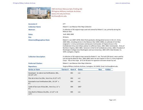
VMI Archives Manuscripts <strong>Finding</strong> <strong>Aid</strong>©<strong>Virginia</strong> <strong>Military</strong> Institute Archiveswww.vmi.edu/archivesArchives@vmi.eduAccession # 277Collection NameAbstract:Dates bulk 1846-1848SizeHistorical/Biographical Note<strong>Robert</strong> E. <strong>Lee</strong> <strong>Mexican</strong> <strong>War</strong> Map CollectionA collection of 30 original maps used and owned by <strong>Robert</strong> E. <strong>Lee</strong>, primarily during the<strong>Mexican</strong> <strong>War</strong>.30 items<strong>Robert</strong> E. <strong>Lee</strong> (1807-1870); West Point graduate; distinguished service in the U.S. Army,1829-1861, including service in the <strong>Mexican</strong> <strong>War</strong> (1846-1848); at outbreak of Civil <strong>War</strong>resigned U. S. Army commission and became Commander of <strong>Virginia</strong> forces in theConfederate Army and military advisor to Jefferson Davis, 1861-1862; Commander, Army ofNorthern <strong>Virginia</strong>, 1862-1865; General-in-Chief of all Confederate armies, 1865; President ofWashington College (now Washington and <strong>Lee</strong> University), 1865-1870. Died October 12,1870, Lexington, <strong>Virginia</strong>.Collection Description:Preferred Citation:Repository:Series or ItemA collection of 30 original maps owned by <strong>Robert</strong> E. <strong>Lee</strong>. The bulk (28 items) were used by<strong>Lee</strong> during the <strong>Mexican</strong> <strong>War</strong>, 1846-1848, when he was Captain in the U.S. Army EngineersCorps. Two of the maps (# 15 & 30) bear his signature and were drawn by <strong>Lee</strong>.<strong>Robert</strong> E. <strong>Lee</strong> <strong>Mexican</strong> <strong>War</strong> Map Collection<strong>Virginia</strong> <strong>Military</strong> Institute Archives. Lexington, VA 24450. Email: Archives@vmi.eduSeries #Item #DatesBoxFolderSevastopol. Sa rade et ses fortifications. [Ms.,10 1/4" x 8"]Plan de la Vera Cruz [Ms., Vera Cruz, 8 1/2" x 6"]Kronstadt et ses Fortifications [Ms., 10 1/4" x8"]Castle of San Juan d'Ulua [Ms., Vera Cruz, 11" x9"]Area North of Mexico City [Ms., 12 1/2" x 161/2"]001002003004005n.d.n.d.n.d.1847n.d.Page 1 of 3
Series or ItemSeries #Item #DatesBoxFolderDerroteros del Saltillo..Galveston, Tampico [Ms.,37" x 27"]006circa 1840Plan of the City of Monterey [Ms., 39 1/2" x 241/2"]0071847Plan of the Battle of Buena Vista by Bvt. Maj.Joseph Mansfield [Ms., 23" x 19"]0081847Plano del Puerto de Vera cruz [Ms., 23" x 18"] 009 1820Fuerte de Perote [Ms., 31" x 23"] 010 circa 1848Plan of the Citadel at Monterey…by William D.Fraser, Capt. Engrs. [Ms., 33" x 26"]Plan of the City and Country around Monterey[Ms., 35 1/2" x 23"]Sketch of the Battle Ground at Cerro Gordo[Ms., 19 1/2" x 14"]011012013184718471847Castle of San Juan de Ulua [Ms., 40" x 25"] 014 1844Sketch of the Country and Roads around theCity of Mexico. Signed by <strong>Lee</strong>. [Ms., 26" x 19"].Section MissingPlano de la Ciudad y Puerto de Veracruz [Ms.,35 1/2" x 25"]Map of the Valley of Mexico and SurroundingMountains [Lithograph, 22" x 17 1/2"]Sketch of the Roads and Country West ofPuebla [Ms., 19" x 26"]Battle of Mexico…drawn by Lt. Hardcastle [Ms.,34" x 27"]Estado Mayo del Ejercito de Operaciones delNorte [Ms., 22" x 15"]The 2nd Division of Regulars, as drawn up atCerro Gordo [Lithograph, 28" x 22"]Plano Topografico del Distrito Federal[Lithograph, 29" x 22"]0150160170180190200210221847circa 1840184718471847n.d.n.d.circa 1840Page 2 of 3
Series or ItemSeries #Item #DatesBoxFolderMap of Saltillo Valley…by Lt. J. P. McCown, 4thArty [Ms., 36" x 24"]0231847Environs of Puebla [Ms., 35" x 26"] 024 1847Same as # 22- Plano Topografico… 025Plano del Puerto del Ahorcado y Rancho delCapulin [Ms., 17" x 10 1/2"]Battle grounds of Contreras, SanAntonio…drawn by Julio Pinal [Ms., 24" x 19"]Croquis de la Posicion del Campo de CerroGordo [Lithograph, 25" x 19"]026027028n.d.18471847Northern Defenses, Mexico City [Ms., 49" x 17"] 029 1847Sketch of the Plan of the Town of Monclova,Coahuila, Mexico. Signed by <strong>Lee</strong>. [Ms., 22" x 171/2"]0301846Page 3 of 3


