Smiley Nava
Smiley Nava
Smiley Nava

You also want an ePaper? Increase the reach of your titles
YUMPU automatically turns print PDFs into web optimized ePapers that Google loves.
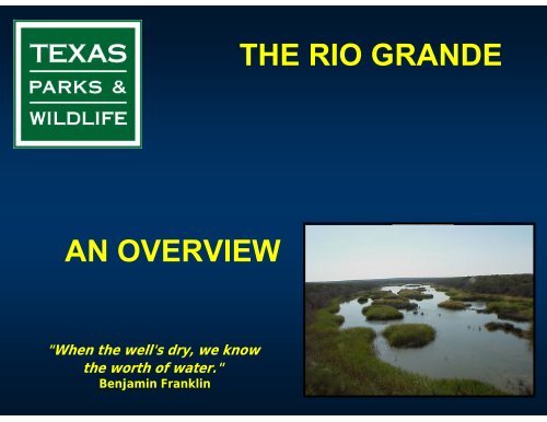
THE RIO GRANDEAN OVERVIEW"When the well's dry, we knowthe worth of water."Benjamin Franklin
BORDER RIVER• Serving over 500 thousand acres ofirrigated land• 1243 miles of the river forms the borderbetween Mexico and the United StatesCOLORADOMEXICOTEXASPECOS RIVERCHIHUAHUADEVIL’S RIVERCOAHUILARIO CONCHOSRIO GRANDEINTERNATIONALAMISTAD RESERVOIRNUEVOLEONTAMAULIPAS• Major tributaries: Conchos, Pecos• Arid/semi-arid region• Fragile ecologyINTERNATIONALFALCON RESERVOIR
CONSERVATION AREASALONG THE RIO GRANDEPECOS RIVERDEVIL’S RIVERCONCHOS RIVER16 Conservation areas onthe Texas side ofthe Rio Grande8 state conservation areas/complexes5 national conservation areas/complexes1 county conservation area1 city/non-profit private1 non-profit private
ECOTOURISM ALONG THE RIO GRANDE• Total economic contribution of avitouristsfor 1997 was $103.5 million in the LowerRio Grande Valley.• The Great Texas Coastal Birding Trail(Lower Texas Coast) offers more than 40birdwatching sites along the Lower RioGrande• Fishing in area reservoirs• Hunting• Paddling, raftingand kayaking
ONE OF NORTH AMERICA’S MOST ENDANGEREDRIVER SYSTEMS• Increase in border population: cities, colonias, maquiledoras• Persistent drought• Declines in water quantity• Declines in water quality• Declines in diversity of border species of fish & wildlifeAnzalduas DamRio Grande @ SalinenoRio Grande @ Roma Bluffs
BORDER POPULATIONPopulation increase in Texas/Mexico Border Area198019902000Border total(U.S. Side)1,211,820 11,535,823 1(27% increase)1,981,624 3(29% increase)Border total(Mexico Side)1,714,279 12,159,992 1(26% increase)3,044,897 2(41% increase)___________________________________________________________________________________Sources:1Office of the Governor of Texas, Interim Final Report on Texas: Mexico BorderNeeds (Summer 1993).2Texas/Mexico Borderland Information Center.3Census 2000
PERSISTENT DROUGHT• Drought persists on both sides of Texas-Mexico border• Annual average future drought damages for West Texaswere estimated at $ 8 million (direct economic value of damagescaused by the reduced streamflows to water users)The Lower Rio Grande Valleyhas been declared a disaster areaalmost every year since 1995.In 2001, Mexico declared 9 northernstates disaster areas, includingChihuahua.Rio Grande channel looking west at mouthMouth of the Rio Grande
Rio Grande – Big Bend area; two weeks ago, staff received a report thatflow on the river had stopped. Staff received information last week thatarea farmers (Mexico) dammed the river and diverted the water.
WATER QUANTITY• The forgotten river• The Rio Conchos contribution• Water in the Rio Grande is fully appropriated• Regulated releases from both Amistad and Falcon reservoirs• Drought, pumping, and invasive aquatic plant species play a majorrole in the water quantities of the Rio GrandeRock weir, near Brownsville, TexasReservoirsAmistadFalconNormalPool1,117 ft301.2 ftCurrentPool1,067 ft255.22 ftMouth of the Rio Grande before Nov. 2002
INVASIVE SPECIESHydrilla – Hydrilla verticillata• Spread in 85 water bodies in Texas• In the Rio Grande, it is found from Falcon Damdownstream to an area just west of BrownsvilleWater hyacinth – Eichhornia crassipes• Spread in at least 29 water bodies in Texas• West of Brownsville and upstream close to Progresso
TRIPLOID (STERILE) CARP• Suggested as one means to control hydrilla in the Rio Grande• Legalized, by permit, for vegetation control in Texas in 1992• Appears to be the only economically feasible control methodwith a reasonably high probability of success
• Rio Grande: Introduced Non-Native Fish Species•• Species Common name• 1 Colossoma macropomum black pacu• 2 Carassius auratus goldfish• 3 Cyprinus carpio common carp• 4 Ctenopharyngodon idella grass carp• 5 Notemigonus crysoleucas golden shiner• 6 Pimephales promelas fathead minnow• 7 Scardinius erythropthalmus rudd• 8 Noturus gyrinus tadpole madtom• 9 Hypostomus sp. armadillo del rio• 10 Platydorus costatus striped Raphael catfish• 11 Fundulus grandis gulf killifish• 12 Gambusia geiseri largespring gambusia• 13 Morone chrysops white bass• 14 Morone saxatilis striped bass• 15 Lepomis auritus redbreast sunfish• 16 Lepomis microlophus redear sunfish• 17 Micropterus dolomieu smallmouth bass• 18 Stizostedion vitreum walleye• 19 Oreochromis aureus blue tilapia• Rio Grande – Introduced ShellfishIntroduced fishes are defined as those that exist as reproducing populations or multiple individualswith long-term survival
Status of Native Freshwater Mussels• Tampico pearlymussel- unknown, probablynot good• Conchos disk –probably extinct• Yellow sandshell- only 3 documented• Washboard – extirpated in 1987, but smallpopulation found near Laredo• Texas hornshell – 28 specimens documentednear Laredo• Salina mucket –may be extinct• Bleufer – Populations reduced mostly foundin Amistad Reservoir• Giant Floater – Extirpated• Southern mapleleaf – most abundant in RG• False spike – Extinct in RG• Lilliput – not found alive in RG in over adecade• Texas lilliput- not found alive in many years• Mexican fawnsfoot – Not seen since 1972until 2 specimens found near Laredo in 12003• Pondhorn sp. – Probably extinct• Paper pondshell – scattered sites throughoutRGRio Grande – Introduced Non-nativeShellfish species• Red-rim melania• Channeled applesnail• Marbled aplexa• Asian clam• Brown mussel• Pacific white shrimp
Kills and Spills Investigations are conductedout of 5 regional officesBetween 200 and 300 fish kills and pollutioncomplaints are investigated each year by theregional staff
Fish Kill and Pollution Investigations - KASTSan Martin Lake FKHidalgo Co. DistrictDrainage Canal
Fish Kills in the 5 County LRGV AreaCounty Number of dead fishCameron 53939757Hidalgo 277Starr 0Webb 21Zapata 0
WATER QUALITY ISSUES• Salinity sources• Natural• Human activities• Nutrients and fecal coliform bacteria sources• Untreated/poorly treated wastewater• Improperly managed animal waste• Irrigation return• Heavy metals sources• Runoff• Industrial effluentRio Grande
Rules and RegsConservationLegislationSB-1 / SB-2Ecologically UniqueRiver and Stream Segments(31 TAC 357.8)TPW ManagementActivitiesOutreach
LOWER RIO GRANDE / RIO BRAVO BINATIONALECOSYSTEM GROUPMANAGEMENT PLAN• This document establishes a vision, objectives, strategies and specificactivities for the protection and restoration of native plants andanimals.• This working group integrates personnel from the United States Fishand Wildlife Service (USFWS), Texas Parks and Wildlife Department(TPWD), The Nature Conservancy, La Secretaria de Medio Ambientey Recursos Naturales (SEMARNAT), La Secretaria de DesarolloUrbano y Ecologia (SEDUE) – State of Tamaulipas, and PronaturaNoreste A.C.• The Lower Rio Grande/Rio Bravo Bi-national Ecosystem Core Grouphas set boundary limits (site specific to the Lower Rio Grande ValleyTamaulipan brush land habitat) from Falcon Dam to Boca Chica wherethe Rio Grande River enters the Gulf of Mexico. With the Rio Grandeits center the limits will be 65 miles (105 km) north and south of theRio Grande / Rio Bravo, including part of South Texas (Lower RioGrande Valley), and parts of the states of Tamaulipas and Nuevo Leon.
OBJECTIVES, STRATEGIES AND SPECIFICACTIONS• The objectives of the working group havebeen grouped into three large distinctivecategories:• Water Conservation• Species and Habitats• Education for Conservation
THE POLITICSOFWATERWhiskey is for drinking…..Water is for fightingMark Twain