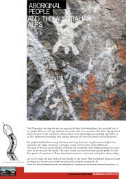
Cultural Landscape Management - Australian Alps National Parks
Cultural Landscape Management - Australian Alps National Parks
Cultural Landscape Management - Australian Alps National Parks

Create successful ePaper yourself
Turn your PDF publications into a flip-book with our unique Google optimized e-Paper software.
4.2 Analysing cultural landscapesAnalysing and interpreting what you see in the field basically involves relating features to local and wider historical themes,and ascribing features and evidence of themes to historic periods.The first step in analysis is to separate the complex range of documentary and physical evidence as it appears in the landscapeinto its component parts, on the basis of close examination in the field and documentary evidence. These components can thenbe ascribed to the themes and historic periods identified. This can be done, for instance, by linking physical evidence (such asthe age of features as identified in the use of materials, techniques or styles characteristic of a particular time), with historicperiods discovered through documentary research. Similarly, features can be ascribed to themes, on the basis of the uses towhich they were put. Sheep dips, for instance, obviously relate to the pastoral theme.Methods to assist in the process of analysis of the information include the following (McCann1994:133-134):• Chronological ordering of the place's history, reflecting the sequence of human occupation and the way in which thelandscape has evolved over time. This enables historical phases to be defined and linked to wider social and economicthemes. It may be useful to set this out graphically in the form of an historical time line, or chart.• Explanation of the spatial distribution of components, illustrating how clusters of individual features and sites interrelatewithin the broader landscape setting.• Examination of networks: networks and connections link landscape components and human systems, forging an integrated,coherent setting with a distinct cultural landscape character. Network links may remain visible over time, or may becomeindistinct through regeneration of vegetation or erosion.Information can be represented in a series of map overlays. For example, plotting sheep paddocks or runs over a topographicbase map may reveal that sheep grazing did not extend above a certain altitude; or plotting mining site relics over a geologicalmap could indicate the routes connecting mine sites, and how the distribution of geological formations and the search forpayable gold interacted to shape the landscape. Alternatively, the information could be plotted on a series of map overlays toshow successive or sequential uses and the resulting changes in the landscape over time. For example, a forest area could havebeen cleared and grazed, then abandoned; recolonised by forest, selectively logged, and finally reserved for conservation. Thesemap overlays can be stored in a Geographic Information System as computerised data to which other variables can be added forfurther analysis. They should also be held as hard copy maps.29