Largo Town Center - Prince George's County Planning Department
Largo Town Center - Prince George's County Planning Department
Largo Town Center - Prince George's County Planning Department

Create successful ePaper yourself
Turn your PDF publications into a flip-book with our unique Google optimized e-Paper software.
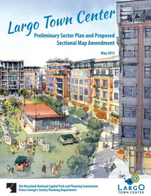
<strong>Largo</strong> <strong>Town</strong> <strong>Center</strong>Preliminary Sector Plan and ProposedSectional Map AmendmentMay 2013The Maryland-National Capital Park and <strong>Planning</strong> Commission<strong>Prince</strong> <strong>George's</strong> <strong>County</strong> <strong>Planning</strong> <strong>Department</strong>
AbstractTitle:Author:Subject:Preliminary <strong>Largo</strong> <strong>Town</strong> <strong>Center</strong> Sector Plan and Proposed Sectional Map AmendmentThe Maryland-National Capital Park and <strong>Planning</strong> CommissionPreliminary <strong>Largo</strong> <strong>Town</strong> <strong>Center</strong> Sector Plan and Proposed Sectional Map Amendment fora portion of <strong>Planning</strong> Area 73 in <strong>Prince</strong> George’s <strong>County</strong>Date: May 2013Source of Copies:The Maryland-National Capital Park and <strong>Planning</strong> Commission14741 Governor Oden Bowie DriveUpper Marlboro, Maryland 20772Series Number: 321132306Number of Pages: 178Abstract:This sector plan amends portions of the 2004 Approved Sector Plan and Sectional MapAmendment for the Morgan Boulevard and <strong>Largo</strong> <strong>Town</strong> <strong>Center</strong> Metro Areas and the1990<strong>Largo</strong>-Lottsford Approved Master Plan and Sectional Map Amendment for <strong>Planning</strong>Areas 73. Developed with the active participation of the community, property owners,developers, residents, and elected officials, this document recommends goals, policies,strategies, and actions designed to implement transit-oriented development (TOD) at the<strong>Largo</strong> <strong>Town</strong> <strong>Center</strong> Metro Station. The plan recommends placing the <strong>Largo</strong> <strong>Town</strong> <strong>Center</strong>sector plan area in the Developed Tier to incentivize TOD at the Metro station. The planalso builds upon the recommendations of the 2002 <strong>Prince</strong> George’s <strong>County</strong> ApprovedGeneral Plan for for centers and corridors in the Developed Tier, addresses sustainabledevelopment tied to existing and proposed mass transit options, and incorporatesrecommendations from functional area master plans such as the Approved <strong>County</strong>wideGreen Infrastructure Plan and the Approved <strong>County</strong>wide Master Plan of Transportation.The sectional map amendment proposes zoning changes to implement the land userecommendations of the sector plan.
<strong>Largo</strong> <strong>Town</strong> <strong>Center</strong>Preliminary Sector Plan andSectional Map AmendmentMay 2013The Maryland-National Capital Park and <strong>Planning</strong> Commission<strong>Prince</strong> <strong>George's</strong> <strong>County</strong> <strong>Planning</strong> <strong>Department</strong>
<strong>Largo</strong> <strong>Town</strong> <strong>Center</strong> Preliminary Sector Plan and SMAThe Maryland‐National Capital Park and <strong>Planning</strong> CommissionElizabeth M. Hewlett, ChairmanFrançoise Carrier, Vice ChairmanOfficers:Patricia Colihan Barney, Executive DirectorJoseph Zimmerman, Secretary-TreasurerAdrian R. Gardner, Esq., General CounselThe Maryland-National Capital Park and <strong>Planning</strong> Commission is a bicounty agency, created by the General Assemblyof Maryland in 1927. The Commission’s geographic authority extends to the great majority of Montgomery and <strong>Prince</strong>George’s Counties: the Maryland-Washington Regional District (M-NCPPC planning jurisdiction) comprises 1,001square miles, while the Metropolitan District (parks) comprises 919 square miles, in the two counties.The Commission has three major functions:• The preparation, adoption, and, from time to time, amendment or extension of the General Plan for the physicaldevelopment of the Maryland-Washington Regional District.• The acquisition, development, operation, and maintenance of a public park system.• In <strong>Prince</strong> George’s <strong>County</strong> only, the operation of the entire county public recreation program.The Commission operates in each county through a <strong>Planning</strong> Board appointed by and responsible to the countygovernment. All local plans, recommendations on zoning amendments, administration of subdivision regulations, andgeneral administration of parks are responsibilities of the <strong>Planning</strong> Boards.The <strong>Prince</strong> George’s <strong>County</strong> <strong>Department</strong> of <strong>Planning</strong> (M-NCPPC):• Our mission is to help preserve, protect, and manage the county’s resources by providing the highest quality planningservices and growth management guidance and by facilitating effective intergovernmental and citizen involvementthrough education and technical assistance.• Our vision is to be a model planning department of responsive and respected staff who provide superior planning andtechnical services and work cooperatively with decision-makers, citizens, and other agencies to continuously improvedevelopment quality and the environment and act as a catalyst for positive change.<strong>Prince</strong> George’s <strong>County</strong> <strong>Planning</strong> Board Montgomery <strong>County</strong> <strong>Planning</strong> BoardElizabeth M. Hewlett, ChairmanFrançoise Carrier, ChairmanDorothy F. BaileyCasey AndersonManuel R. GeraldoNorman DreyfussJohn P. ShoaffAmy PresleyA. Shuanise Washington Marye Wells-Harleyii
<strong>Prince</strong> George’s <strong>County</strong>Rushern L. Baker, III, <strong>County</strong> Executive<strong>County</strong> CouncilThe <strong>County</strong> Council has three main responsibilities in the planning process: (1) setting policy, (2) plan approval, and(3) plan implementation. Applicable policies are incorporated into area plans, functional plans, and the <strong>Prince</strong> George’s<strong>County</strong> Approved General Plan. The <strong>County</strong> Council, after holding a hearing on the plan adopted by the <strong>Planning</strong> Board,may approve the plan as adopted, approve the plan with amendments based on the public record, or disapprove the planand return it to the <strong>Planning</strong> Board for revision. Implementation is primarily through adoption of the annual CapitalImprovement Program, the annual budget, the water and sewer plan, and adoption of zoning map amendments.Council MembersMary A. Lehman, 1st DistrictWill Campos, 2nd DistrictEric Olson, 3rd District, Council Vice ChairIngrid M. Turner, 4th DistrictAndrea Harrison, 5th District, Council ChairDerrick Leon Davis, 6th DistrictKaren R. Toles, 7th DistrictObie Patterson, 8th DistrictMel Franklin, 9th DistrictClerk of the CouncilRedis C. Floydiii
<strong>Largo</strong> <strong>Town</strong> <strong>Center</strong> Preliminary Sector Plan and SMAContentsChapter 1: Introduction ....................................................1Sector Plan Area Boundary ...........................................1Regional Setting .............................................................1Plan Purpose .................................................................5Relationship to Other Plans ..........................................62002 <strong>Prince</strong> George’s <strong>County</strong> Approved General Plan ...61990 <strong>Largo</strong>-Lottsford Approved Master Plan andAdopted Sectional Map Amendment ......................62004 Approved Sector Plan and Sectional MapAmendment for the Morgan Boulevard and <strong>Largo</strong><strong>Town</strong> <strong>Center</strong> Metro Areas (MorLar) ........................62009 Approved <strong>County</strong>wide Master Plan ofTransportation (MPOT)............................................72008 Approved Public Safety Facilities Master Plan ......82005 Approved <strong>County</strong>wide Green Infrastructure Plan .82009 Smart, Green, and Growing Legislation ................8Maryland's Stormwater Management Act of 2007 .......81997 Smart Growth and NeighborhoodConservation Initiative ............................................9Subregion 4 (Central Avenue-Metro Blue LineCorridor) Transit-Oriented DevelopmentImplementation Project ..........................................9Background ......................................................................9Demographic Profile ......................................................9Development Pattern ....................................................9Development Potential ...............................................10Community Engagement .............................................12Chapter 2: The Vision for <strong>Largo</strong> <strong>Town</strong> <strong>Center</strong>Metro Station and Beyond ..........................................17Vision Elements ...........................................................17Chapter 3: <strong>Largo</strong> <strong>Town</strong> <strong>Center</strong> Today—Existing Conditions .....................................................23Economic-Market Forecast ..........................................23Environment ................................................................30Public Facilities ............................................................37Connectivity ...............................................................39Historic Resources, Culture, and Entertainment .........41<strong>Town</strong> <strong>Center</strong> Design Assessment .................................42Chapter 4: Recommendations for Future Development ..55Transforming <strong>Largo</strong> <strong>Town</strong> <strong>Center</strong> ................................55Goal: TOD-Compatible Development beyond theTOD Core ...............................................................61Urban Design and <strong>Planning</strong> Objectives .......................62Transit-Oriented Development Core ...........................62Development District Standards .................................62Street Network ............................................................64Street Types .................................................................65Open Space .................................................................65Development Tiers ......................................................66Environmental Recommendations ..............................73Public Facilities ............................................................74Transportation Demand Management ........................76Chapter 5: Implementation .............................................79Intergovernmental Coordination .................................79Public-Private Partnerships .........................................79Regulatory Improvements, Development,and Incentives .......................................................80Density ........................................................................81Mixed-Use ...................................................................81Design ..........................................................................82Applicable Program and Funding Sources ...................82Implementation Matrix ...............................................84Chapter 6: Recommendations for Future Development ..87Development District Overlay Zone Area—Zoning Recommendations ....................................87Chapter 7: <strong>Largo</strong> <strong>Town</strong> <strong>Center</strong> SectionalMap Amendment .......................................................93Sectional Map Amendment.........................................93Comprehensive Rezoning Implementation Policies ....93Comprehensive Rezoning Changes..............................94Proposed Rezoning .........................................................98Chapter 8: <strong>Largo</strong> <strong>Town</strong> <strong>Center</strong> DevelopmentDistrict Standards .....................................................111Intent .........................................................................111Definitions .................................................................111Subareas ....................................................................111Development District Overlay Zone Applicability ......111Exemptions from the DevelopmentDistrict Standards ................................................113Public Improvements ................................................114Site Plan Submittal Requirements .............................114Permitted and Prohibited Uses .................................115Modifications of the DevelopmentDistrict Standards ................................................116Development District Standards ...............................116Urban Design Criteria | Block Lengths ......................117Urban Design Criteria | Build-to Line ........................119Urban Design Criteria | Frontage ..............................121Urban Design Criteria | Other Setbacks ....................122Urban Design Criteria | Building Heights ..................124iv
Street Design Criteria | Complete Streets .................126Street Design Criteria | Street Types .........................131Street Design Criteria | Tree Zone .............................132Open Space Design Criteria |Open Space Types .......136Architectural Design Criteria |Building Form ............139Architectural Design Criteria |Storefronts.................143Architectural Design Criteria |Building Materialsand Elements .......................................................145Parking Design Criteria ..............................................148Signage Design Criteria ..............................................152<strong>Prince</strong> <strong>George's</strong> <strong>County</strong>, Maryland................................159Updated November 2010 .........................................159v
List of TablesTable 1. Existing Retail Demand for <strong>Largo</strong><strong>Town</strong> <strong>Center</strong> ..........................................................27Table 2. <strong>Largo</strong> <strong>Town</strong> <strong>Center</strong>’s Incremental GrowthRetail Demand Potential ........................................28Table 3. Watershed Information ..................................30Table 4. Impervious Surfaces and WaterQuality Ratings .....................................................31Table 5. Plan Area Forest Canopy Comparison—1938 to 2009 .........................................................31Table 6. Known Streams and Wetlands ......................31Table 7. Projected 65 dBA Noise Contours,Measured from the <strong>Center</strong>line ..............................36Table 8: School Facility Conditions: 2008 Parsons3DI Study ...............................................................37Table 9: School Facility Conditions ..............................39Table 10: Pupil Yield Rates (2008) ...............................75Table 11: School Enrollment and Capacity ..................75Table 12: Projected Enrollment Capacity at Buildoutfor Single-Family Attached Units ...........................75Table 13: Projected Enrollment Capacity at Buildoutfor Multifamily Units .............................................75Table 14. Cumulative Zoning Inventory .......................96List of FiguresFigure 1: Community Meeting Ballot Results ..............13Figure 2. Station Square Perspective Rendering ..........67Figure 3. Arena Green Perspective Rendering .............68Figure 4. Harry S Truman Gateway Rendering .............69Figure 5. Ashton South End .........................................82Figure 6. Block Lengths ..............................................117Figure 7. Build-to Line Diagram for ExistingRedevelopment ...................................................119Figure 8. Plan View of Build-to Line Placements .......120Figure 9: TOD Core Setback .......................................122Figure 10: SE, NE, NW Quad Setback ........................122Figure 11: Complete Streets Diagram .......................126Figure 12: Street Type—Arterial (Boulevard) ............128Figure 13: Street Type—Common Access Easement .129Figure 14: Street Type—Neighborhood Street A,2-Way ..................................................................130Figure 15: Street Type—Neighborhood Street B,2-Way ..................................................................130Figure 16: Street Type—Neighborhood Street C,1-Way ..................................................................131Figure 17: Rainwater Tree Pits ...................................132Figure 18: Rainwater Gardens ...................................133Figure 19: Rainwater Planters, Street Edge ...............134vii
<strong>Largo</strong> <strong>Town</strong> <strong>Center</strong> Preliminary Sector Plan and SMAviii
ForewordThe <strong>Prince</strong> George’s <strong>County</strong> <strong>Planning</strong> Board is pleased to make available for review and comment the Preliminary<strong>Largo</strong> <strong>Town</strong> <strong>Center</strong> Sector Plan and Proposed Sectional Map Amendment. This community-based plan and sectional mapamendment (SMA) provide a clear vision for the future of the <strong>Largo</strong> <strong>Town</strong> <strong>Center</strong> Metro Station Metropolitan <strong>Center</strong>.The proposed sector plan builds on the <strong>Largo</strong> <strong>Town</strong> <strong>Center</strong> area’s great public transit and regional highway access.Policy guidance for this plan came from the 2002 <strong>Prince</strong> George’s <strong>County</strong> Approved General Plan and county functionalarea master plans, including the 2005 Approved <strong>County</strong>wide Green Infrastructure Plan, 2008 Approved Public SafetyFacilities Master Plan, 2009 Approved <strong>County</strong>wide Master Plan of Transportation, 2010 Approved Historic Sites andDistricts Plan, and 2010 Approved Water Resources Functional Master Plan.The 2002 General Plan also designates the <strong>Largo</strong> <strong>Town</strong> <strong>Center</strong> Metro Metropolitan <strong>Center</strong> as a major destination foremployment and mixed-use development drawing from the metropolitan Washington, D.C. area. This metropolitancenter presents a unique opportunity to create a new walkable, bikable, and transit-friendly community at the Metrostation while simultaneously revitalizing and redeveloping existing office and retail development. The transit-orientedcommunity at <strong>Largo</strong> <strong>Town</strong> <strong>Center</strong> will incorporate natural features, active and passive open spaces, innovative energyand water conservation techniques, and high density mixed-use development in a regional and national model ofhow the man-made and natural environments can be integrated as a sustainable, cohesive community. Additionally,the potential exists at <strong>Largo</strong> <strong>Town</strong> <strong>Center</strong> for a major institutional use, potentially adding thousands of jobs to thelocal economy and fostering demand for supporting development and services such as new housing, retail, and officeopportunities.Community participation and input began in early 2012, culminating in a series of intensive community workshops infall 2012. Additional community input was solicited through a series of civic association and small stakeholder groupmeetings, worksessions with <strong>Prince</strong> George’s <strong>County</strong> agency staff, briefings of county elected officials, and informationgathering sessions.The preliminary sector plan establishes the vision for the area and contains recommendations for land use and urbandesign, environmental infrastructure and stewardship, the transportation network (including pedestrian and bicyclefacilities, transit, and roadways), health and wellness, public facilities, parks and recreation, economic development andrevitalization, and implementation. The sector plan focuses on transit-oriented development (TOD) implementationand seeks to incentivize TOD by placing the sector plan area within the Developed Tier.The proposed SMA includes zoning changes to facilitate implementation of the plan vision and land use concepts. Thepreliminary sector plan reflects a commitment to implement community desires and build on the 2002 General Planrecommendations for enhanced connectivity, multimodal accessibility, and safety for all residents, workers, and visitors.The <strong>Planning</strong> Board appreciates the contributions and active involvement of the community and stakeholders inthis innovative planning effort. We, along with the District Council, look forward to seeing you and hearing yourinput on the preliminary sector plan and proposed SMA during the Joint Public Hearing that has been scheduled for7:00 p.m. on Tuesday, July 16, 2013, at the <strong>County</strong> Administration Building, 14741 Governor Oden Bowie Drive,Upper Marlboro, Maryland 20772. Thank you for your consideration.Sincerely,Elizabeth M. HewlettChairman<strong>Prince</strong> <strong>George's</strong> <strong>County</strong> <strong>Planning</strong> Boardix
<strong>Largo</strong> <strong>Town</strong> <strong>Center</strong> Preliminary Sector Plan and SMAThis page intentionally left blankx