7.0 Geology and Geomorphology - Origin Energy
7.0 Geology and Geomorphology - Origin Energy
7.0 Geology and Geomorphology - Origin Energy

You also want an ePaper? Increase the reach of your titles
YUMPU automatically turns print PDFs into web optimized ePapers that Google loves.
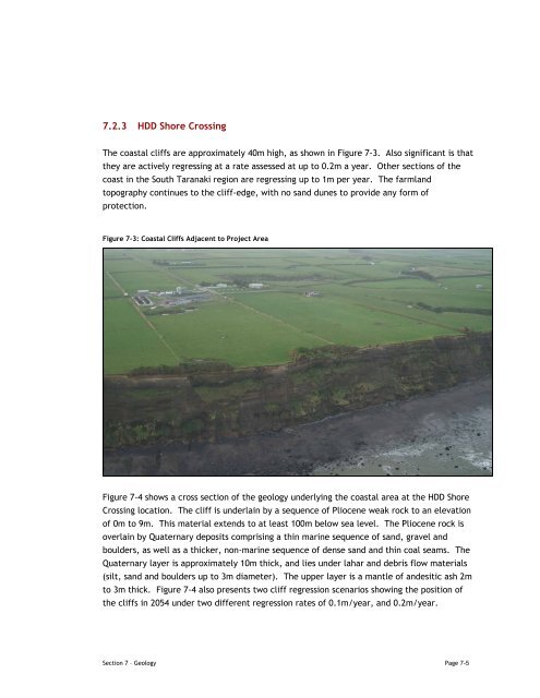
7.2.3 HDD Shore CrossingThe coastal cliffs are approximately 40m high, as shown in Figure 7-3. Also significant is thatthey are actively regressing at a rate assessed at up to 0.2m a year. Other sections of thecoast in the South Taranaki region are regressing up to 1m per year. The farml<strong>and</strong>topography continues to the cliff-edge, with no s<strong>and</strong> dunes to provide any form ofprotection.Figure 7-3: Coastal Cliffs Adjacent to Project AreaFigure 7-4 shows a cross section of the geology underlying the coastal area at the HDD ShoreCrossing location. The cliff is underlain by a sequence of Pliocene weak rock to an elevationof 0m to 9m. This material extends to at least 100m below sea level. The Pliocene rock isoverlain by Quaternary deposits comprising a thin marine sequence of s<strong>and</strong>, gravel <strong>and</strong>boulders, as well as a thicker, non-marine sequence of dense s<strong>and</strong> <strong>and</strong> thin coal seams. TheQuaternary layer is approximately 10m thick, <strong>and</strong> lies under lahar <strong>and</strong> debris flow materials(silt, s<strong>and</strong> <strong>and</strong> boulders up to 3m diameter). The upper layer is a mantle of <strong>and</strong>esitic ash 2mto 3m thick. Figure 7-4 also presents two cliff regression scenarios showing the position ofthe cliffs in 2054 under two different regression rates of 0.1m/year, <strong>and</strong> 0.2m/year.Section 7 – <strong>Geology</strong> Page 7-5