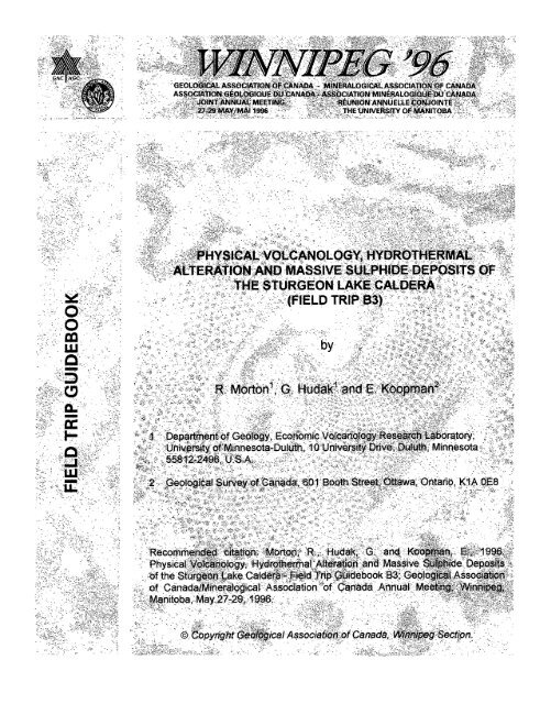
Physical Volcanology, Hydrothermal Alteration and Massive ...
Physical Volcanology, Hydrothermal Alteration and Massive ...
Physical Volcanology, Hydrothermal Alteration and Massive ...

You also want an ePaper? Increase the reach of your titles
YUMPU automatically turns print PDFs into web optimized ePapers that Google loves.
Electronic Capture, 2008The PDF file from which this document was printed was generated by scanning anoriginal copy of the publication. Because the capture method used was 'SearchableImage (Exact)', it was not possible to proofread the resulting file to remove errorsresulting from the capture process. Users should therefore verify critical informationin an original copy of the publication.© 1996:This book, or portions of it, may not be reproduced in any form without written permission oftheGeological Association of Canada, Winnipeg Section. Additional copies can be purchased fromthe Geological Association of Canada, Winnipeg Section. Details are given on the back cover.
TABLE OF CONTENTSINTRODUCTIONREGIONAL GEOLOGYPHYSICAL VOLCANOLOGY OF THE STURGEONLAKE CALDERA COMPLEXPrecaldera VolcanicsJackpot Lake SuccessionHigh Level Lake SuccessionTailings Lake SuccessionMattabi SuccessionL SuccessionSUMMARY OF THE VOLCANOLOGICAL HISTORY OFTHE STURGEON LAKE CALDERA COMPLEXHYDROTHERMAL ALTERATIONFIELD TRIP STOP DESCRIPTIONSF-Group AreaMattabi - Area "16"Area 17REFERENCES1377789101213172224263235LIST OF TABLES AND FIGURESTablesTable I.FiguresFigure 1.Figure 2.Grade <strong>and</strong> tonnage figures of oredeposits in the south Sturgeon Lake area.Location of the south Sturgeon Lake area.Generalized geological map illustratingthe regional extent of the Sturgeon LakeCaldera Complex.123
Figure 3.Figure 4.Figure 5.Figure 6.Figure 7.Figure 8.Figure 9.Figure 10.Simplified geological map of the SturgeonLake Caldera Complex. 6Stratigraphic correlations between theF-Group <strong>and</strong> Mattabi areas. 16Distribution of ore-forming alterationassemblages associated with the F-Group area. 20Distribution of ore-forming alterationassemblages associated with the Mattabi area. 21Geological plan map of the F-Group areawith field trip stop locations. 23Geological sketch map of the Higt"l LevelLake Succession outcrops south of the Mattabi Mine. 27Geological -plan map of the Mattabi area, withfield trip stop locations. 28Geological plan map in the vicinity of theLyon Lake - Creek Zone - Sturgeon Lake orebodies,with field trip stop locations. 33
INTRODUCTIONThe south Sturgeon Lake area of northwestern Ontario (Fig. 1) is underlain by awell preserved, though partially eroded, Archean submarine volcanic caldera. This calderais host to five massive sulphide deposits (Mattabi, F-Group, Sturgeon Lake Mine, CreekZone <strong>and</strong> Lyon Lake)(Fig. 2, Table I) as well as numerous subeconomic massive sulphideoccurrences. The Sturgeon Lake Mine, F-Group <strong>and</strong> Mattabi deposits were depleted ofreserves in 1981, 1984 <strong>and</strong> 1988 respectively, whereas production at the Lyon Lake <strong>and</strong>Creek Zone deposits ceased in 1991.Table I. Grade <strong>and</strong> tonnage figures of the ore deposits in the south Sturgeon Lake area.Deposit Tonnage . Zn Cu Pb Ag(10 6 tons) % % % oftMattabi 12.55 8.28 0.74 0.85 3.31F-Group 0.38 9.51 0.64 0.58 1.92Sturgeon Lake 3.95 6.53 1.24 0.63 3.42Lyon Lake &Creek Zone 3.17 8.67 1.26 0.99 4.50• Production grade <strong>and</strong> tonnage figures1
95°HudsonBaySioux~LOOkoutSturgeonLoke55°IgnaceI---~~~:'-"--liij",,Y /7o AitikokanEnglishRiver~JJj~,MilleLacNipigonHwy 11o 10 20 30 40 50 MilesI ' " Io io 4'0 80 100 KilometresN~ -"\ft\(e
STURGEON LAKEN/o POST -CALDERA VOLCANICS00 MASSIVE SULPHIDE DEPOSITS~ CALDERA RElA1ED VOLCANICS~ PRECALDERA VOLCANICSo lRONDHJEMITIC IN1RUSIVES1Zl FAULTSB CON1ACTSFigure 2. Generalized geological map illustrating the regionalextent of the sturgeon Lake Caldera Complex.The combination of well preserved volcanic textures, a variable 55 0 to 90 0 dip ofa north-facing, essentially homoclinal volcanic sequence <strong>and</strong> more than 600,000 m ofdiamond drilling over an apparent 4,500 m stratigraphic interval presents the opportunityto examine successive stages of caldera evolution. This includes initial subaerial-shallowsubaqueous collapse, subaqueous silicic explosive volcanism <strong>and</strong> ore formation, <strong>and</strong>terminal dome building with sedimentary <strong>and</strong> lava flow fill <strong>and</strong> burial.The main purpose of this field trip is to illustrate the physical volcanology of anancient, ore-hosting caldera <strong>and</strong> to stress the importance of volcanism <strong>and</strong> synvolcanicstructures in controlling the occurrence <strong>and</strong> location of hydrothermal alterationassemblages <strong>and</strong> volcanogenic massive sulphide deposits.REGIONAL GEOLOGYThe south Sturgeon Lake area is located within the Archean Wabigoon volcanosedimentarygreenstone belt within the Superior Province. The Wabigoon subprovince is3
ounded to the north by the English River Gneiss Belt <strong>and</strong> to the south by the QueticoGneiss Belt (Trowell <strong>and</strong> Johns, 1986). The volcanic <strong>and</strong> sedimentary rocks of the areahave been subjected to regional greenschist facies metamorphism with alm<strong>and</strong>ineamphiboliteassemblages found locally (Trowell, 1974).Detailed mapping of the volcanic rocks in the south Sturgeon Lake area coupledwith the relogging of 200,000 m of diamond drill core (with emphasis on the physicalvolcanology of the rocks) has led to the recognition <strong>and</strong> description of a well preservedArchean submarine caldera complex. This complex, which has been named the SturgeonLake Caldera (Morton et aI., 1988, 1989, 1990), is approximately 30 krn in strike length<strong>and</strong> contains up to 4500 m of caldera fill material. Five separate, major ash flow tuff unitshave been defined, <strong>and</strong> each can be traced for kilometers across the complex withindividual thicknesses ranging from 100 to more than 1200 m. Based on the stratigraphicdistribution <strong>and</strong> thickness of the five ash flow tuff units <strong>and</strong> associated debris flowdeposits, it is believed that the Sturgeon Lake Caldera consists of a series of smallernested or overlapping calderas <strong>and</strong> that each ash flow unit is associated with a collapseevent. This interpretation is supported by studies of more recent caldera complexes whichshow that major ash flow tuff units are related to individual collapse events <strong>and</strong> that nestedor overlapping calderas are common (Cas <strong>and</strong> Wright, 1987).Based on detailed stratigraphic mapping <strong>and</strong> core logging, numerous synvolcanicfaults have been defined. Synvolcanic faults with major stratigraphic displacement (>150m) may represent individual caldera boundaries. In general the eastern <strong>and</strong> westernmargin of the complex has been located <strong>and</strong> the back (northern) bounding wall has beenpartially defined. A series of late, north-south-trending dip-slip faults has broken thecomplex into a number of blocks that allow the caldera complex to be observed at differentstratigraphic levels. Individual volcanic <strong>and</strong> intrusive rock units are traceable across thefaults, but thicknesses change dramatically (Fig. 3). As well, late east-west- <strong>and</strong>northwest-trending faults coupled with an east-west folding event (part of the KenoranOrogeny?) have, along caldera margins, affected the upper part of the sequence causingminor displacement of the upper pyroclastic flow units <strong>and</strong> the Sturgeon Lake Mine, LyonLake <strong>and</strong> Creek Zone ore bodies. Although much of this deformation has been taken upby caldera fill sedimentary rocks, shear zones are common in the massive to amygdaloidallava flows located north <strong>and</strong> east of these ore bodies. Zircon ages of the ash flow tuff4
deposits <strong>and</strong> late caldera margin dome lavas yield a similar age of 2,735 m.y. ± 1.5 my(Davis et aI., 1985).A large, sill-like intrusion (Seidelman Say Complex) has a similar age to the felsicvolcanics <strong>and</strong> represents, in part, the magma chamber for the eruptive material. Thisintrusive body can be traced along strike for 20 km <strong>and</strong> has an average width of 2.5 km.Its composition varies from trondhjemite to quartz diorite with feldspar <strong>and</strong> quartz ±feldspar porphyry phases. The Seidelman Say intrusive complex also hosts minoroccurrences of porphyry copper-molybdenum type mineralization, <strong>and</strong> the upper portionslocally contain stringers of zinc-silver mineralization. A mafic (gabbroic-quartz dioritic)dyke- to sill-like intrusion occurs across the length of the caldera complex (Fig. 3) <strong>and</strong> mayrepresent a ring dyke complex.<strong>Hydrothermal</strong> alteration is widespread within the complex <strong>and</strong> in the upper part ofthe Seidelman Say intrusion. Discrete assemblages of alteration <strong>and</strong> metamorphosedalteration minerals form zones that are a) widespread <strong>and</strong> largely conformable to thevolcanic stratigraphy, b) locally lens- or pod-like beneath sulphide occurrences <strong>and</strong>deposits <strong>and</strong> c) narrow <strong>and</strong> elongate, cross-cut stratigraphy <strong>and</strong> are associated withsynvolcanic faults (Groves, 1984; Hudak, 1989; Jongewaard, 1989; Morton et aI., 1988;Morton <strong>and</strong> Franklin, 1987).5
(J)i~"l::.,,",,("'Q""oro Km[TI Late coldero fill 0 ~~~ol;~~~lci~~keScoleaI 7 I" L" Succession [TI ~~~~~~~io~Qkeo Mottobi Succession ~ Precoldero Volcanics[TI Toilings Lake Succession ~ ~~i~:;:eonC:~~lex/D ~ High Level Lake pyroclastic 0 !nt81"J'1:'ediote-mofic~ 5~L..::....Jllow depos;l. ,ntruSlve rocksS 4 4 ....... " O'O' 6 Synvolconic faults --4 Sell late N-S faults -----( ~ ~ 3 • 5 b 5 ~~ Uoss;"e sulph;de depos;(s_1-----4 U ~, 0 ~ ~- 0°00000- UO? -'" .....o Ou O 0 0 0 0'0°6OOOOOOOOOOOOOUOOOO C ·00000 °8eldlem~n Bay
mosaics. The ash-size matrix is composed of interlocking mosaics of quartz <strong>and</strong> feldsparwith a wide variety of secondary alteration minerals. Locally these deposits are separatedby thin debris flow units <strong>and</strong> associated fine grained sedimentary rocks indicating that theeruptions were episodic.High Level Lake Succession (Units 3 <strong>and</strong> 4, Figs. 3 <strong>and</strong> 4)The High Level Lake Succession has been subdivided into two units: a)mesobreccia <strong>and</strong> b) quartz crystal-rich <strong>and</strong> pumice-rich pyroclastic flow deposits.Precaldera volcanic rocks <strong>and</strong> the Jackpot Lake pyroclastic units are immediately overlainby coarse heterolithic breccias that are interlayered with, <strong>and</strong> grade upwards into, quartzcrystal ash flow tuff deposits. The breccias have a strike length of at least 22 km <strong>and</strong>exhibit rapid changes in thickness from 80 to more than 900 m.The breccia deposits (Unit 3) are composed of block-<strong>and</strong> lapilli-size clasts of mafic<strong>and</strong> felsic volcanic rocks which are mineralogically <strong>and</strong> chemically similar to underlyingprecaldera <strong>and</strong> Jackpot Lake pyroclastic units. Recognizable clasts are poorly sorted <strong>and</strong>vary from measurable blocks 70 m by 40 m down to matrix-size material; typical size is 3to 25 cm. Detailed mapping <strong>and</strong> core logging also indicates that there are large blocks ofthe Darkwater scoria-tuff cone deposits that are more than 1 km in length <strong>and</strong> 300 m inthickness. Matrix material to the clasts varies from abundant alteration <strong>and</strong>metamorphosed alteration minerals (chloritoid, iron carbonate, <strong>and</strong>alusite, pyrophyllite,sericite, chlorite) to a composition very similar to the interlayered <strong>and</strong> overlying ash flowtuffs. Overall the composition of this unit is basaltic-<strong>and</strong>esitic. In the upper 5-50 m thebreccias contain sparse quartz crystals <strong>and</strong> lapilli-size pumice.These breccia deposits are similar to heterolithic breccias (mega- <strong>and</strong>mesobreccias) described by Lipman (1976, 1989) from calderas in the San JuanMountains. In the Sturgeon Lake Caldera Complex these coarse heterolithic breccias arebelieved to represent debris derived from caldera walls as collapse occurred; collapse <strong>and</strong>breccia formation were simultaneous with eruption <strong>and</strong> deposition of the High Level Lakequartz crystal ash flow tuff. Thick deposits of mesobreccia have been related tocatastrophic caldera subsidence of a kilometer or more (Lipman, 1976, 1989). Suchcatastrophic collapse in the Sturgeon Lake area could readily have moved the floor of the8
Sturgeon Lake Caldera from an initial subaerial-shallow subaqueous environment to adeeper submarine environment.The High Level Lake ash flow tuff deposits (Unit 4) represent the second pyroclasticevent associated with the caldera complex <strong>and</strong> can be subdivided into two separate units:a) a lower quartz crystal-rich rhyolite (average Si0 2 of 74%) <strong>and</strong> b) an upper pumice-richdacite (average Si0 2 of 67%). The quartz crystal ash flow tuff forms lenses (up to 1000m in strike length by 100 m thick) within deposits of mesobreccia <strong>and</strong> an 80-300 m thickunit which overlies the mesobreccia. The contact between the mesobreccia <strong>and</strong> the quartzcrystal-rich rhyolite is gradational <strong>and</strong> is marked by a gradual upward increase in the size<strong>and</strong> percentage of quartz crystals <strong>and</strong> a marked decrease in the number of lithic clasts «5%). The ash flow deposits are composed of 3-25% broken <strong>and</strong> angular quartz crystals(.8-2 mm), which locally are enclosed by 0.1 to 0.8 mm thick recrystallized ash rims, <strong>and</strong>5-30% silicified <strong>and</strong>/or carbonated lapilli-size pumice. The ash rims surrounding the quartzcrystals suggest the presence of water in the eruptive environment.These quartz crystal-riCh ash flow tuffs grade upward into quartz-crystal poor,pumice-rich ash flows that vary from 50 to 370 m in thickness. These massive depositsare composed of 35-75% silicified <strong>and</strong>/or chloritoid-<strong>and</strong>alusite-pyrophyllite-rich lapilli-sizepumice <strong>and</strong> 5-25% mafic <strong>and</strong> chlorite-carbonate-rich lithic fragments set in a fine-grainedquartz-rich matrix. The upward change in composition from rhyolite to dacite, decreasein quartz crystals, massive nature of the deposits <strong>and</strong> the presence of abundant pumicecan be interpreted to represent rapid eruption of magma from a zoned or layered, gas-richmagma chamber.The quartz crystal unit can be traced for 20 km across the caldera, whereas thepumice-rich unit is not observed west of the major northeast-trending synvolcanic fault(Darkwater fault). This fault has an apparent offset of 400 m <strong>and</strong> forms one side of a majortopographic depression that hosts the ore lenses of the Mattabi massive sulphide deposit.The pumice flow ponded within but did not fill this depression.Tailings Lake Succession (Unit 5, Figs. 3 <strong>and</strong> 4)The High Level Lake pumice flows represent the end of the second explosive9
eruptive cycle <strong>and</strong> are overlain by 60-400 m of subaqueous debris flow deposits <strong>and</strong>bedded epiclastic rocks. Like the High Level Lake pumice flows, rocks of the Tailings LakeSuccession are not found west of the Darkwater fault; however, they can be tracedeastward from this structure for more than 10 km. The debris flow deposits are composedof thick (5-120 m) massive basal units overlain by well bedded sedimentary material whichmay exhibit grading. The debris flows are composed of clasts derived from the underlyingash flow tuffs <strong>and</strong> from the precaldera rocks. The size <strong>and</strong> percentage of clasts increaseswestward toward the Darkwater fault <strong>and</strong>, in deep drill holes, downdip toward the backmargin of the caldera. Locally the debris flow deposits <strong>and</strong> associated sedimentary rocksare separated by dacitic ash tuffs <strong>and</strong> by dacitic to <strong>and</strong>esitic lava flows; these units onlyrarely crop out <strong>and</strong> are primarily observed in drill core. The ash tuffs are aphyric <strong>and</strong> finegrained,have Si0 2 contents that range from 65 to 77% <strong>and</strong> TiOa contents that areconsistently greater than 0.6%; they have locally undergone intense hydrothermalalteration. These rocks range from 5 to 80 m in thickness <strong>and</strong> are the host rocks to the,Mattabi E ore lens. The lava flows range in thickness from 10 to 50 m <strong>and</strong> vary frommassive to amygdaloidal <strong>and</strong> brecciated; locally these rocks are feldspar-phyric.The debris flow deposits represent the periodic avalanching of material from calderawalls, whereas the ash tuffs indicate sporadic eruption of felsic material, most likely alongleaky ring(?) fractures. The uppermost debris flows are composed of more than 60%precaldera mafic volcanic <strong>and</strong> High Level Lake ash flow tuff clasts, <strong>and</strong> are interlayeredwith abundant ash deposits. These units appear to represent renewed activity at calderamargins which immediately preceded the eruption of the overlying Mattabi ash flow tuffs.Mattabi Succession (Unit 6, Figs. 3 <strong>and</strong> 4)The Mattabi Succession represents the third <strong>and</strong> most voluminous eruptive eventwithin the caldera, forming deposits that exceed 1200 m in thickness. The deposits canbe traced across the caldera complex for more than 20 km <strong>and</strong> directly overlie debris flowor ash deposits of the Tailings Lake Succession east of the synvolcanic Darkwater fault;they overlie the High Level Lake quartz-rich ash flow tuff <strong>and</strong> mesobreccia deposits westof this structure. East of the Darkwater fault the Mattabi ash flow tuffs range from 1501200 m thick; they thin rapidly west of this structure (with the notable exception of the FZone area), ranging in thickness from 20-80 m. It is believed that the Darkwater fault10
epresents one segment of the caldera wall for the Mattabi eruptive event <strong>and</strong> thatdeposits west of this structure represent outflow sheets. In the vicinity of the F-Zone oredeposit the Mattabi ash flow tuffs are 125-200 m thick <strong>and</strong> are believed to have pondedin, <strong>and</strong> filled, the fault-bounded basin which hosts this massive sulphide deposit (Hudak,1989).Based on flow morphology <strong>and</strong> composition, the Mattabi ash flow tuff successionmay be divided into two distinct units: a) a bedded quartz crystal-rich unit <strong>and</strong> b) a massiveto poorly-bedded ash unit. The bedded quartz-crystal rich unit varies from 150 to 1100 mthick east of the Darkwater fault <strong>and</strong> 20-75 m thick west of the fault. The bedded ash flowtuffs have an average Si0 2 content of 75%, always contain less than 0.5% N8z.0 <strong>and</strong>exhibit a pronounced cyclicity within individual bedded sections. Beds are subdivided intobasal quartz crystal- (5-35%) <strong>and</strong> pumice-rich (5-45%) lower sections overlain by beddedash deposits which contain sparse quartz crystals (1-3%) <strong>and</strong> rare pumice. The lapilli-sizepumice are well-vesiculated (40-70% amygdules) <strong>and</strong>, with subangular to irregular shapes,exhibit no evidence of flattening that might be indicative of welding. The lower units, incore from relatively deep diamond drill holes that approach the back wall <strong>and</strong> easternmargin of the caldera, contain up to 20% precaldera mafic <strong>and</strong> felsic volcanic clasts <strong>and</strong>possibly indicate mixing, close to caldera margins, with debris derived from caldera walls.Detailed core logging in the eastern part of the area (below the Sturgeon LakeMine) has defined 14 such flow units which vary in thickness from 15 to 180 m; the beddedash component is 1 to 14 m thick. More than 280 chemical analyses have been completedon these units with one sample collected for about every three meters of stratigraphy.Analyses of st<strong>and</strong>ard trace elements clearly <strong>and</strong> dramatically show that individual flows(bed sets) have high Zr (550-1025 ppm), Y (75-120 ppm) <strong>and</strong> Nb (30-80 ppm) at <strong>and</strong>/ornear their base, <strong>and</strong> that these elements gradually decrease upwards towards the ashbeds which have low Zr (80-230 ppm), Y (24-45 ppm) <strong>and</strong> Nb (1-4 ppm) contents; Ti0 2 <strong>and</strong>Ba appear to have opposite trends. This zoning pattern holds true a) whether the qauartzcrystals are normally or inversely graded; b) regardless of the size or percentage of quartzcrystals found in the basal beds; or c) regardless of the thickness of the beds. At Mattabithe flow units exhibit a similar thickness, composition <strong>and</strong> chemical zonation with the B,C <strong>and</strong> D massive sulphide ore lenses situated at breaks between quartz-rich beds in thehanging wall <strong>and</strong> ash beds in the footwall. Numerous other massive sulphide occurrences11
are found throughout the lateral <strong>and</strong> vertical extent of this unit, making it a primeexploration target.The bedded quartz-crystal deposits are overlain by massive, very fine-grained ashflow tuff deposits which vary from 20 to 150 m in thickness. These units are composed ofzero to 2% small « 1 mm), broken <strong>and</strong> sliver-like quartz crystals in a quartz-rich matrix;it is not uncommon for these units to be intensely silicified <strong>and</strong> iron metasomatized. Thismassive unit is overlain by 5-35 m of bedded, fine-grained ash material which iscompositionally <strong>and</strong> chemically similar to the underlying massive ash flow tuffs. Themassive unit contains no known massive sulphide mineralization <strong>and</strong> lacks the pronouncedgeochemical zoning exhibited by the bedded deposits. In morphology these units aresimilar to those described by Busby-Spera (1984) from the Mineral King roof pendant <strong>and</strong>by Morton <strong>and</strong> Nebel (1983) from the Wawa area, <strong>and</strong> represent flow units deposited ina relatively shallow subaqueous environment.L SuccessionThis is a complex succession of rocks which range from quartz- <strong>and</strong> quartzplagioclase-bearingpyroclastic flow deposits through plagioclase-phyric lava flows <strong>and</strong>domes to sedimentary sequences. The entire succession ranges from 250 to 1200 m thickwith the domes, lava flows <strong>and</strong> dome related sediments <strong>and</strong> debris flow deposits makingup the bulk of the stratigraphy. The pyroclastic flow deposits form two distinct units, eachof which may represent a major pyroclastic eruption (caldera forming ?). The distributionof these pyroclastic rocks <strong>and</strong> their physical volcanology <strong>and</strong> alteration is currently thesubject of a doctoral thesis (Hudak, in progress). Work completed so far shows that theash flows associated with the first eruptive event are quartz- <strong>and</strong> plagioclase-crystal richwhereas the ash flows associated with the second eruptive period were dominantly quartzcrystal-rich <strong>and</strong> contain traces to 5% of K-spar crystals with associated K-spar in thegroundmass. These quartz-rich pyroclastic flows are the host rocks for the Sturgeon LakeMine, Lyon Lake <strong>and</strong> Creek Zone massive sulphide deposits. Feldspar-bearing lava flows<strong>and</strong> domes (up to 400 m thick <strong>and</strong> 3 km long), along with a variety of dome-derivedvolcaniclastic rocks <strong>and</strong> debris flow deposits, overlie the pyroclastic flow units. The domesoccur close to caldera margins <strong>and</strong> are believed to represent the last felsic eruptiveproducts associated with caldera formation. Locally iron formation (b<strong>and</strong>ed magnetite-12
chert <strong>and</strong> iron carbonate) <strong>and</strong> graphitic sedimentary rocks are interlayered with domederivedvolcaniclastic rocks <strong>and</strong> represent relatively quiet sedimentation <strong>and</strong> lowtemperature hydrothermal activity in basins that formed between the growing domes <strong>and</strong>caldera walls.The L succession is overlain by extensive basaltic-<strong>and</strong>esitic lava flows which havebeen termed the No Name Lake Andesite (at Mattabi) <strong>and</strong> the Lyon Lake Andesite (at LyonLake). Previous workers believed that the No Name Lake Andesite separated the Mattabi<strong>and</strong> L pyroclastic rocks from what had been termed the NBU rhyolites. It was believed thatthe NBU rhyolites were the host rocks for the Lyon Lake <strong>and</strong> Creek Zone ore bodies, <strong>and</strong>that the Lyon Lake <strong>and</strong>esite stratigraphically overlaid these ore deposits (Mumin, 1988,Franklin et aI., 1977). Detailed volcanological facies mapping <strong>and</strong> core relogging, alongwith geochemical studies, now shows that No Name Lake <strong>and</strong> Lyon Lake Andesites arelaterally correlative, <strong>and</strong> the so called NBU rhyolite can be correlated with rocks formedby the second L pyroclastic eruptive event. The No Name Lake-Lyon Lake basalts <strong>and</strong><strong>and</strong>esites form amygdaloidal to massive flows, pillow lavas, hyaloclastites <strong>and</strong> scoriaceousrocks <strong>and</strong> bring an end to caldera pyroclastic activity.SUMMARY OF THE VOLCANOLOGICAL HISTORY OF THE STURGEON LAKECALDERA COMPLEX1) Subaerial basaltic shield volcanism.2) Subaerial-shallow subaqueous scoria <strong>and</strong> tuff cone formation as an end stage inthe development of the shield volcano.3) Formation of the ancestral Beidelman Bay silicic, high level magma chamber <strong>and</strong>initial eruption of the Jackpot Lake pyroclastic rocks along incipient ring(?)fractures.4) Major eruption of the Jackpot Lake pyroclastic flow <strong>and</strong> fall deposits, triggeringinstability <strong>and</strong> initiating the first caldera collapse event.5) Eruption of quartz crystal-rich ash flow tuffs along major ring(?) faults, coupledwith the avalancl"ling <strong>and</strong> sliding of precaldera material from growing calderawalls, to form the mega- <strong>and</strong> mesobreccia deposits <strong>and</strong> the mixed breccia <strong>and</strong>pyroclastic units.6) Continued eruption of pyroclastic material from a zoned magma chamber with a13
gradual change from rhyolitic quartz crystal-rich to dacitic pumice-rich material.7) High temperature hydrothermal activity <strong>and</strong> the formation of the F-Zone massivesulphide deposit with the High Level Lake quartz crystal units as the host rocks.8) Periodic movement along old <strong>and</strong> newly developed ring(?) fractures to form thedebris flows <strong>and</strong> associated bedded epiclastic rocks of the Tailings LakeSuccession. This was coupled with the periodic eruption of ash tuffs from thedeveloping ring(?) fracture system.9) Formation of the E ore lens at Mattabi.10) Major movement on newly developed ring(?) structures coupled with theeruption.11) PUlsating subaqueous eruptions to form the bedded Mattabi ash flowtuffs coupled with continuous intense hydrothermal activity <strong>and</strong> formation ofB, C <strong>and</strong> D ore lenses at Mattabi. The hydrothermal system was activeboth during <strong>and</strong> between eruptive pulses.12) Continuous, shallow subaqueous eruption of the massive Mattabi ash flow tuff<strong>and</strong> continued lower temperature hydrothermal alteration.13) Generation of <strong>and</strong>esitic lava flows <strong>and</strong> debris flows that separate theMattabi ash flow tuffs from the first pyroclastic event of the L Succession.14) Eruption of the lower L pyroclastic units, which are quartz- <strong>and</strong> plagioclasephyric<strong>and</strong> mark the first pyroclastic activity where plagioclase crystals arepresent. The formation of the subeconomic A zone at Mattabi was associatedwith this pyroclastic event.15) Deposition of plagioclase-phyric lava flows <strong>and</strong> volcaniclasticsediments derived from the L<strong>and</strong> Mattabi pyroclastic flows.16) Eruption of quartz crystal-rich, K-spar bearing pyroclastic material (second Lpyroclastic event) <strong>and</strong> renewed high temperature hydrothermal activity leadingto the formation of the Sturgeon Lake Mine, Lyon Lake <strong>and</strong> Creek Zone oredeposits. Block <strong>and</strong> ash flow deposits within the middle L succession indicatethat rhyolitic lava domes were present (possibly along a caldera margin faultto the east) during tl"lis stage of volcanism.17) Reworking of previously deposited volcanic units to form the upperL volcaniclastic sediments <strong>and</strong> numerous debris flow <strong>and</strong> turbidite deposits.18) Lava dome building <strong>and</strong> periodic dome collapse with reworking <strong>and</strong> erosion ofthe domes. Associated with dome formation were iron- <strong>and</strong> graphite-rich14
moat sediments that were related to the last stages of hydrothermal activityin the caldera.19) Final caldera fill by mafic lavas that represent the start of a new cycle of morequiescent volcanism.20) Late southeast to northwest shearing relocates the Lyon Lake <strong>and</strong> CreekZone ore bodies into their present locations.15
32003000280026002400220020001800FE 1600ET1400120010008006004002000LEGEND OF GEOLOGICAL UNITS( INTCf')No Nome Lake Success lotiL Sl,lGCe9S 101Upper L - Ouortz o~d ploQiocIQ'" crYS'ol ic breccia (t.4esobrecl;jo)(ULPYF)(LSED)(8RDL. 8RrL)(hlLPYF)(8ROL)(LLPyF.L .....T)(MT ..... )(MTC)( TLDFS)(TLA)(HLPyn~~t~~~Jackpot L(Jl
HYDROTHERMAL ALTERATION<strong>Hydrothermal</strong> solutions, both ore-forming <strong>and</strong> non-ore-forming, have altered thevolcanic rocks associated with the Sturgeon Lake Caldera Complex. Following alteration,these rocks were metamorphosed to greenschist facies. Therefore, the alteration mineralsnow present are, in part, metamorphosed equivalents of the alteration minerals formed inthe hydrothermal system.<strong>Hydrothermal</strong> fluids formed five distinct, mappable massive sulphide ore-associatedalteration assemblages in the area. From least- to most-altered, these assemblages are:a) widespread, semiconformable carbonatization <strong>and</strong> silicification; b) widespread,semiconformable iron carbonate ± iron chlorite; c) widespread, semiconformable chloritoid± iron carbonate <strong>and</strong>/or iron chlorite; d) lens- to pod-like, locally linear zones of aluminumsilicate (pyrophyllite, <strong>and</strong>alusite, <strong>and</strong>/or kyanite) + chloritoid; <strong>and</strong> e) linear cross-cutting,<strong>and</strong> stratiform zones of aluminum silicate.alteration locally overprints these five alteration assemblages.Late sericite <strong>and</strong>/or magnesium-rich chloriteIron formation-associatedalteration composed of patches to cross-cutting veinlets of iron carbonate + iron chlorite+ magnetite ± garnet ± grunerite is present in the uppermost sections of the L succession.Iron carbonate ± iron chlorite assemblage rocks contain at least 10% iron carbonate+ iron chlorite with less than 5% chloritoid or aluminum silicate minerals. Outcrops whichcontain abundant iron carbonate are easily identified by their orange to orange-brownstained, commonly pitted surfaces. Staining varies from irregular, lens-shaped patchesup to 15 cm in diameter, to veins <strong>and</strong> veinlets 1-15 mm in width that are aligned parallelto the foliation. Pumice that has been replaced by carbonate can be recognized asrounded to oval, orange-brown stained pits up to 5 cm in diameter which commonly containrounded to lens-shaped quartz-filled amygdules (10-60%). In thin section, thisassemblage contains iron carbonate ± iron chlorite (10-60%), sericite (up to 30%), Mg-richchlorite (0-50%), <strong>and</strong> locally, traces of chloritoid or aluminum silicate minerals.Chloritoid ± iron carbonate <strong>and</strong>/or iron chlorite assemblage rocks contain greaterthan 5% chloritoid, <strong>and</strong> are characterized by the presence of 1-3 mm dark green to blackchloritoid prisms <strong>and</strong> rosettes. The presence of the chloritoid commonly gives the rocksa "salt <strong>and</strong> pepper" appearance. Locally, chloritoid porphyroblasts occur with sericite (10-17
55%) in 1-5 mm wide grey-green veinlets which can be conformable to or cross-cut thestrata. Other minerals present include iron carbonate (up to 60%), iron chlorite (2-20%),magnesium chlorite (1-20%) <strong>and</strong> pyrite (0-12%).Aluminum silicate + chloritoid bearing rocks typically contain 1-3 mm chloritoidporphyroblasts (up to 33%) in a grey to grey-pink matrix composed of massive pyrophyllite(5-20%), 1-3 mm blocky pink <strong>and</strong>alusite (0-8%), <strong>and</strong>/or bluish tabular porphyroblasts ofkyanite (0-8%) up to 2 mm long. Chloritoid occurs as 1-3 mm prismatic crystals or rosettesdissementated throughout the rock, or in chloritoid-<strong>and</strong>alusite-rich veinlets up to 1 cm inwidth. In addition, iron chlorite (up to 7%), magnesium chlorite (up to 35%), iron carbonate(3-35%), pyrite (trace - 30%) <strong>and</strong> sphalerite (up to 5%) are also associated with thisalteration assemblage.Rocks containing greater than 5% aluminum silicate minerals (pyrophyllite,<strong>and</strong>alusite, <strong>and</strong>/or kyanite) or micaceous pseudomorphs of aluminum silicates with lessthan 5% chloritoid represent the aluminum silicate assemblage. Generally, rocks bearingthis alteration assemblage are light grey to pink in colour. Andalusite is the mostcommonly observed aluminum silicate mineral, <strong>and</strong> is present as 1-3 mm grey to pink,blocky to rounded porphyroblasts in micaceous domains. Kyanite occurs in three forms:a) as ragged grains in the matrix of strongly altered, <strong>and</strong>alusite-rich rocks; b) as subhedralto euhedral grains associated with pyrite, sphalerite, <strong>and</strong>/or chalcopyrite mineralization;<strong>and</strong> c) as euhedral, commonly bent blades up to 2 cm in length within or along the marginsof quartz ± carbonate veins <strong>and</strong> veinlets up to 3 cm in width. Other phases present withint~lis assemblage include quartz (10-80%), sericite (0-40%), iron carbonate (0-10%),chloritoid (0-4%), magnesium chlorite (0-30%), pyrite (trace - 15%), <strong>and</strong> sphalerite (locallyup to 7%).Figure 5 illustrates the distribution of the ore-forming alteration assemblages in theF-Group area. Iron carbonate ± iron chlorite assemblage rocks form a large,semiconformable zone along the southern, eastern, <strong>and</strong> northern boundaries of the area.Locally, pod-like areas (up to 50 m in diameter) of this assemblage occur within thechloritoid assemblage zone, which exists as a large, semiconformable zone up to 100meters thick in the hangingwall to the F-Group orebody, <strong>and</strong> is present as pipe-likealteration zones in the F-Group footwall. More proximal to the mineralization,18
semiconformable <strong>and</strong> locally pipe-like zones containing the aluminum-silicate ± chloritoidalteration assemblage are present. Aluminum silicate assemblage rocks are most closelyassociated with the mineralization at the F-Group deposit. These rocks are distributed intwo distinct patterns: a) in linear, 5-30 meter wide, pipe-like zones that trend NNE <strong>and</strong>cross-cut the stratigraphy; <strong>and</strong> b) in a broad, semiconformable zone (700 by 500 metersat surface) located both in the footwall <strong>and</strong> the hangingwall rocks to the F-Group massivesulphide deposit (Hudak, 1989).Figure 6 illustrates the distribution of ore-forming alteration at the Mattabi deposit.Semiconformable carbonatized <strong>and</strong> silicified rocks form a broad zone in the lower footwallrocks. This zone is cross-cut by several westward plunging tabular zones outwardly zonedwith an aluminum silicate-rich core <strong>and</strong> aluminum silicate + chloritoid margin. These zonescommonly surround synvolcanic fault zones which lead upward to <strong>and</strong> cross-cut a broadsemiconformable zone of aluminum silicate + chloritoid altered rocks, which crudelysurrounds the Mattabi deposit. The aluminum silicate-rich tabular zones, associated withthe synvolcanic faults, spread out into a semiconformable zone directly beneath <strong>and</strong> lateralto the deposit. Stratigraphically overlying the deposit is a semiconformable zone ofchloritoid ± Fe-carbonate ± Fe-chlorite up to 150 m thick (Walker, 1993).19
!Sturgeon LakeSCALE500....TLEGEND OF AL TERAl I ON ASSE~8LACESSYMBOLSI Corbonotlzotion ond SilicificationIron Carbonate -+/- IrO/l Ctllorite Asserob1oge~ <strong>Alteration</strong> Assemblage COlltoctt22Z22:d <strong>Massive</strong> Sulphide Deposit3 Chlort10i(f +/- Iron Corbonate +/- Iron Chlorite Assemblage~ $yn..,olcoll ic rOlllt4 Alum;(lum $i I icote + Chlor itoid Assemblage~ Lote F"oult5 Aluminum Silicate Assembloqe[Q] Outcrop Local. iOIlc:o:=J Buildingsczz::J RoodsFigure 5. Distribution of ore-formingassociated with the F-Group deposit.alteration assemblages20
::>"-2:2:§"-2:2:"-2:2:2:::>"-2:?2:2:::>"-2:2:2:::>"-2:0 2:2:::> "-2:2:~::>o (/ ~0High le",1lakE.'o 2'00UU'0010'LECEND OF AL lERAllON ASSEMBLAGES SYMBOLS1 Carbonotizatio/\ <strong>and</strong> 51 I icificatiollIron Corbonat~ +j- 1"00 Chlorite Assemblage.3 Chloritoid +j- Iron Carbonate +/- Iron Chlorite Assembloge4 Aluminum Si I icate + Ch lor itoid AS9f;'/IIbloge5 Aluminum Silicate As'semblager::::;;::] A I tel" ot i on ,4,5 semb I age COli tact~ l.Aas'S ive Su I ph ide Depos i t~ Synvolcon Ie Foult~ Late Fault[Q] Outcrop Locationr=o:::=J 8ui 1di'lqsCZZJ RoodsFigure 6. Distribution of ore-formingassociated with the Mattabi deposit.alteration assemblages21
FIELD TRIP STOP DESCRIPTIONSF-Group AreaThe F-Group volcanogenic massive sulphide deposit was discovered from airborne<strong>and</strong> ground geophysical surveys combined with exploration diamond drilling conducted byMattagami Lake Mines in 1969. The orebody was mined from 1981-1984 <strong>and</strong> yielded377,565 tons of ore which contained 0.64% Cu, 9.51 % Zn, 0.58% Pb, <strong>and</strong> 1.92 ozlt Ag (M.Patterson, personal communication, 1990).22
Aoo'3 STOP F-2~ C? 0 0{//t7< 22LLPYF2)'--INTQPHLMBX ")'--2.~TOP F-1/~~/~LO~latefault-
Stop F-1: High Level Lake Ash Flow Tuff And MesobrecciaAt this location (Figure 7), approximately 300 meters southwest of the F-Group pit,intensely altered High Level Lake ash flow tuff <strong>and</strong> mesobreccia deposits crop out. TheHigh Level Lake ash flow tuff deposits are the host rocks for the F-Group massive sulphideorebody. These rocks vary in colour from grey-green to greyish-pink <strong>and</strong> contain 5-20%1 mm quartz phenocrysts in a quartz-rich, locally chlorite-bearing recrystallized ash matrix.Light grey pumice fragments, from 3-20 mm in diameter, are subrounded to oval in shape,<strong>and</strong> are composed primarily of recrystallized quartz. These fragments typically contain 3050%
of the tuffs; <strong>and</strong> b) as pale blue blades (3-20 mm in legth) within white to red-brown quartzironcarbonate veins <strong>and</strong> veinlets That are up to several cm in width. Pyrophyllite iscommonly found along the margins of both the <strong>and</strong>alusite <strong>and</strong> kyanite porphyroblasts, <strong>and</strong>can also occur in veins up to several cm in width as soft, pale green radiating micaceousaggregates. Pyrophyllite is often present where quartz veins intersect kyanite veins.Minor amounts of chloritoid (generally
Stop F-3: Mesobreccia- High Level Lake Pyroclastic Flow ContactThe southern section of stop F-3 (Figure 7), wl-lich is located approximately 75meters southeast of the F-Group pit, is composed in part of heterolithic debris flowdeposits that contain a green chlorite-<strong>and</strong> sericite-rich matrix. These deposits comprisepart of the major mesobreccia unit on the regional geology map (Figure 3). Fragmentsmake up 30-70% of this outcrop <strong>and</strong> are of two types: a) easily recognizable, angular torounded light grey to pale white felsic lava flow <strong>and</strong> ash fragments; <strong>and</strong> b) green, difficultto recognize, lapilli-sized rounded to angular scoria <strong>and</strong> amygdaloidal basalt fragments.Both types of fragments are believed to have been derived from the underlying precalderaDarkwater Lake Succession rocks.To the northeast, the mesobreccia deposits become less fragmental, <strong>and</strong> 1 mmquartz phenocrysts can be observed in the matrix over a zone which varies from 1-5 m inwidth. This zone represents the gradational contact between the mesobreccia deposits<strong>and</strong> the overlying quartz-phyric pyroclastic flow deposits. This gradational contact isbelieved to have formed from mixing of these two units. The contact zone, combined withthe interlayering of the High Level Lake ash flow tuff <strong>and</strong> mesobreccia deposits, suggestssimultaneous deposition of these two units. Similar relationships have been documentedin mesobreccias that occur in the San Juan Mountains of Colorado (Lipman, 1976).The light grey quartz- <strong>and</strong> sericite-rich, recrystallized ash matrix of the High LevelLake ash flow tuffs contains 5-25% 1 mm quartz phenocrysts. Irregular patches <strong>and</strong>lenses of red-brown iron carbonate alteration vary from 1-10 cm in length <strong>and</strong> locallycomprise 10-15% of the outcrop. In thin section, many of the 1-2 cm carbonate patchesappear to be altered pumice.Mattabi - Area "16"The Mattabi volcanogenic massive sulphide deposit was discovered by MattagamiLake Mines in 1969 from follow-up diamond drilling of airborne geophysical anomalies.The upper sections of the orebody were mined from 1972 to 1980 using open pitmethods, <strong>and</strong> the deeper ore was mined using underground methods from 1980 until26
eserves were depleted in 1988. The deposit produced 12.55 million tons of ore grading8.28% ZI1, 0.74% Cu, 3.31 ozlton Ag <strong>and</strong> 0.85% Pb. The orebody comprised 5 stratiformlenses of massive sulphide ore separated by stringer mineralization or barren host rock.The lenses occurred within three distinct stratigraphic successions (Fig. 9).Stop M-1: High Level Lake Mesobreccia (HLMBX) Deposits And QuartzCrystal Ash Flow Tuffs (HLQAT)This series of outcrops is located approximately 500 m stratigraphically below thelower lens of the Mattabi orebody. The southern portion of these outcrops is composedof coarse heterolithic debris flow deposits, which are interpreted to be mesobrecciadeposits formed from caldera collapse (See Stop F-1). The far northeastern outcrops (Fig.8) comprise felsic quartz-phyric pyroclastic flow deposits, which overlie <strong>and</strong> areinterfingered with the mesobreccia deposits <strong>and</strong> are believed to represent the firstintercaldera pyroclastic material. Figure 8 shows the location of the outcrops describedbelow.SymbolsB outcrop numbers~ outcropm synvolcanic faultt;J geologic c ntaet...HLMBXNro1000 100 200 FeettiiiiW~~al~~!_~!Figure 8. Geological sketch map of the High Level Lake Successionoutcrops south of the Mattabi mine (stop M-l).27
BLSED8RDLHLPYFoStop M-1HLM8Xg ................... /711II/IIIIII:..-----IIHLQATC ~~~~=~~~~~f~~~~~~~~~~~=::=~:~:2~~;"--, --::~/ ....... __ .......-- '"::>1 TLDFS 2'.-:.=::::-=~----r:-,L.,~,-:.::::.:::=:=---.,.::::::::::-.er:::---- 2HLPYF------B'HLQATHLM8XHLPYF1)-----------§,----------------7 2Stratigraphic seetion/ 0 0 ~o (Figure 4.) / HLQAT 2~2/ 2/L ~;---------1-4-._---+------"""7 1 ::>1 1 ~1 1 (/ 01 I 01 IHLM8XHigh lev~lakeLEGEND OF GEOLOGICAL UNITS SYMBOLSIni:rusille rocks - Fine grained quartz dioriteNo Name Loke Success iOIl( INTOP)I, I~Ceological COlltac't (doshed where inferred)~<strong>Massive</strong> Sulphide DepositLSuccess ionUpper L - Quartz <strong>and</strong> plagioclase crystal ash flow tuffs- Volcan iclositc sedimentary rocksMiddle L - Oacitic lalla flows- Quartz cr)'sto I osh f low tuffLower L - Andesitic to docitic 10\10 flows- Quartz <strong>and</strong> plagioclase crystal ash flow tuffsMattob i Success ionMoss i .... e to bedded ash f low tuffBedded quartz crystal ash flow tuffToil In99 Lake SuccessionHeterol ithic debris flow depositsFelsic ash tuffHigh Level Lake SuccessionPumice-rich ash flow 'tuffQuartz crystal ash rlo'N tuffHeterol ithic breccia (MesObreccia)Jackpot Lake Success iOIlPrecaldero rocks(ULPYF)(LSED)(BRDL.8RFLl(MLPYF)(BRDL)ILLPYF.LA1)('HAl("'TO)( TLDFS)(1LA)(HLPYF)(HLDA1)(HU'8X)c::::::=:JSynvolcon ic Fault~Late Faultc=::Q:JOutcrap Locat ionCIT]Suildinqsc:::z:z::J RaadsFigure 9. Geological plan map of the Mattabi area, with field tripstop locations.28
Stop M-1a: Mesobreccia (HLMBX). These outcrops consist of coarse heterolithic lithic-rich breccia that contain up to50% 1-25 em light-coloured subangular felsic lithic fragments,
massive chloritic veining up to 50 cm wide occurs.This chloritic veining is probably the result of fresh seawater recharge into a hothydrothermal system causing abrupt increases in magnesium content <strong>and</strong> thus formingchlorite alteration. The quartz-filled tension fractures evident in this outcrop are probablydue to volume changes during hydrothermal alteration. Kyanite can be found in thesefracture-fillings on the south section of the outcrop. A 10-20 cm wide b<strong>and</strong> of silicifiedrock, striking N-S, bisects the outcrop. Samples from this b<strong>and</strong> contain 50% quartz, 15%chloritoid, 15% sericite or pyrophyllite (probably replacing <strong>and</strong>alusite), 8% Fe-richcarbonate, 7% chlorite, 2% relict <strong>and</strong>alusite, <strong>and</strong> 2% opaque minerals. This b<strong>and</strong> of moreintense alteration probably represents a conduit for upward high- temperature fluidmovement, which was later overprinted by sericite (+K) <strong>and</strong> chlorite (+Mg) alteration.Stop M-1d: Mesobreccia (HLMBX) And Synvolcanic Fault ZoneTI1is series of outcrops shows a definable, confined <strong>and</strong> symmetrically zonedincrease in alteration intensity through a synvolcanic fault structure within the HLMBX unit.The texture of the HLMBX unit near the synvolcanic fault is strongly overprinted but is stillrecognizable due to the abundance of relatively unaltered felsic lithic fragments. <strong>Alteration</strong>in the small outcrop on the road <strong>and</strong> immediately north of the road consists of 1-4 cm clotsof Fe-carbonate-rich material surrounded by anastomosing veinlets of quartz, chloritoid± <strong>and</strong>alusite. The dominant change in rock mineralogy from the previous outcrop (M-1 c)is an increase in the amount of Fe-rich carbonate <strong>and</strong> chloritoid.Stop M-2: Mattabi Ash Flow Tuffs (MTQ)This outcrop consists of Mattabi Succession quartz crystal ash flow tuff. Thisexposure contains 10-50% 5-30 mm rounded cherty juvenile felsic fragments, 5-15% 5-30mm rounded pumice, filled by quartz ± sulphide, <strong>and</strong> 2-7% 0.5-1.5 mm colourless quartzcrystals. The recrystallized altered ash matrix consists of fine quartz (40-50%), chloritoid(10-30%), sericite ± pyrophyllite (15-35%, after <strong>and</strong>alusite?), <strong>and</strong>alusite (0-5%) <strong>and</strong>opaque minerals (1-5%).Lithic fragments consist of quartz ± sericite ± pyrophyllite <strong>and</strong>the pumice are filled <strong>and</strong>/or replaced by quartz ± sulphide.30
The outcrop shows some alignment of pumice (weathering pits) striking 105 0dipping steeply to the north. This feature may indicate primary bedding.<strong>and</strong>Stop M-3: Tailings Lake Heterolithic Debris Flow Deposits (TLDFS)The Tailings Lake Succession consists dominantly of highly-variable heterolithicmafic debris flow deposits (TLDFS) <strong>and</strong> lesser bedded ash horizons (TLA). The debrisflow deposits vary in fragment composition, fragment abundance <strong>and</strong> beddingcharacteristics. Three fragment types are dominant: lithic mafic fragments, commonlyreplaced by chlorite <strong>and</strong> carbonate (0-50%); fine-grained cherty felsic fragments (0-30%);<strong>and</strong> rounded pumiceous fragments (0-20%). Bedding is uncommon, but where present,is usually defined by sorting of the various fragment types.In the outcrop exposure beside the mine ventilation shaft many of the characteristicsof the TLDFS unit are conspicuous. This exposure is atypical in its cross-sectional view<strong>and</strong> in the presence of bedding in the TLDFS unit. Here this unit contains 2-30 mm maficfragments (5-30% carbonate-replaced weathering pits) <strong>and</strong> 2-30 mm felsic lithic or pumicefragments (5-30%). In thin section, the matrix consists of 35% quartz, 20% carbonate <strong>and</strong>10% <strong>and</strong>alusite which has been overprinted by 20% Mg-chlorite <strong>and</strong> 10% sericite ±pyrophyllite. Bedding is defined by sorting of mafic vs. felsic fragments. It appears thatmafic fragments are normally-graded <strong>and</strong> felsic fragments (pumice) are reversely graded.Bedding trends approximately 100 0 <strong>and</strong> dips 60-70 0 to the north.Stop M-4: No Name Lake Andesite (NNL)The No Name Lake Succession consists of <strong>and</strong>esitic pillow lavas, pillow breccias,sheet flows <strong>and</strong> interl'low sedimentary rocks. Only the upper section of this succession isexposed in outcrop; the lower sections are observed only in drill core <strong>and</strong> appear toconsist dominantly of thick amygdaloidal flows.The first outcrop (behind the core racks) of this stop consists of thin (30-70 em thick)sheet flows with 5-25% oval-shaped carbonate-filled amygdules (2-30 mm in diameter)31
generally aligned in the strike direction. In thin section, these rocks are composed of 20%foliated (primary?) fine laths of plagioclase <strong>and</strong> 15% quartz in a secondary matrix of 40%chlorite, 10% biotite, <strong>and</strong> 2% epidote.Pillow breccia <strong>and</strong> hyaloclastite are exposed in the outcrop east of the water tower.These rocks consist of approximately 25% amygdaloidal pillow fragments (5-50 cm) in amatrix consisting of 30% hyaloclastite <strong>and</strong> 70% amygdaloidal flows. The pillow brecciafragments contain 10-20% carbonate filled amygdules (now weathering pits) which rangein size from 1-4 mm. The hyaloclastite portion of the matrix consists of 0.5-2 cmrecrystallized massive angular <strong>and</strong>esite fragments. The flow portion of the matrix consistsof vaguely defined amygdaloidal (20-50% amygdules) flows. Flows become the dominantrock type on the north portion of the outcrop.Pillowed flows are exposed in the outcrop north of the water tower. This rockconsists of well-formed 1-4 m (in the long dimension) amygdaloidal pillows with 25-30%,1-20 mm carbonate-filled amygdules. The amygdules show a bimodal size distribution;most amygules are 1-4 mm, with another distinct grouping at 5-20 mm. <strong>Massive</strong> pillowselvages vary from 5-15 cm thick.AREA "17"Stop 17-1: Upper "L" Dome Collapse BrecciaArea 17 is located immediately east of the Lyon Lake, Creek Zone, Sub-CreekZone, <strong>and</strong> Sturgeon Lake orebodies. The southern one-third of this area is composed ofHigh Level Lake Succession pyroclastic flow deposits, Tailings Lake Succession debrisflow deposits <strong>and</strong> associated sediments, <strong>and</strong> Mattabi Succession Pyroclastic flow deposits.The central one-third of the area is composed of a complex sequence of rhyolitic to dacitic"L" Succession pyroclastic flow deposits, volcaniclastic sedimentary rocks, <strong>and</strong> <strong>and</strong>esiticto dacitic lava flows. The northern one-third of the area is dominated by a dacitic lavadome which is capped by dome-derived debris flow deposits, volcaniclastic sedimentaryrocks, graphitic sedimentary deposits, <strong>and</strong> iron formation (see Figure 10).32
13LEGEND OF GEOLOGICAL UNITS SYMBOLS15 Andes it ic to Doc it ic Intrus ions14 Sodium Amphibole-rictl lotrusion13 Swamp Lake Success ion12 No Nome Lake/Lyon Lake Succession11 Lava Dome Assac iated Sed imen ts/Debr is F I ow Depos its10 Lyon Lake Dacitic Lava Dome Complex9 "L" VOICQO iclostic Sediments/Debris Flow Deposits8 "L" Lova Flows7Upper "L" Pyroclastic Deposits6 Midddle "L" Pyroclastic DepositsSLower "L" Pyroclastic Deposits4 Mottabi Success ion Pyroclastic Flow DepositsJ Toil ings Lake Succession2 High Level Lake Pyroclastic Flow Deposits1 High Level Lake Mesobreccio DepositsGeologicalContact (inFerred)<strong>Massive</strong> Sulfide DepositSynvolcon ic Feu ItLate FaultOutcrop LocationsRoodso 400FEET800NIFigure 10.Creek Zone,location.Geological plan map<strong>and</strong> sturgeon Lakein the vicinity of theorebodies, with fieldLyon Lake,trip stop33
This spectacular volcanic breccia is composed of 30-60% subangular to angular,1-35 cm diameter light grey felsic volcanic fragments which contain 1-5% 1 mm quartzphenocrysts. These fragments are alligned parellel to one another, <strong>and</strong> in many places,appear as if they can be placed back together with adjacent fragments. Rare sulfide-richfragments <strong>and</strong> iron-carbonate-rich fragments (pumice) up to 5 cm in diameter can also beobserved. The matrix of this rock is composed of fine grained quartz, iron-chlorite, ironcarbonate,<strong>and</strong> sericite.In thin section, the felsic lithic fragments from this outcrop are composed ofspherulitic quartz- <strong>and</strong> K-spar(?)-phyric lava. We believe that this breccia represents aproximal dome collapse breccia or block <strong>and</strong> ash flow deposit formed from a Middle "L"lava dome that may have been located to the east near the wall of the caldera. A late faultzone located along the northeastern margin of the Sturgeon Lake ore deposit precludesobservation of the "L" stratigraphy north <strong>and</strong> east of this fault.34
REFERENCESBusby - Spera, C., 1984, Large volume rhyolite ash flow tuff eruptions <strong>and</strong> submarinecaldera collapse in the lower Mesozoic Sierra Nevada, California: Journal of GeophysicalResearch, v. 89, p. 8417 - 8427.Cas, R. A. F., <strong>and</strong> Wright, J. V., 1987, Volcanic Successions, Modern <strong>and</strong> Ancient:London, Allen <strong>and</strong> Unwin Publishing, 528 p.Davis, D., Krogh, T. E., Hinzer, J., <strong>and</strong> Nakamura, E., 1985, Zircon dating of polycyclicvolcanism at Sturgeon Lake <strong>and</strong> implications for base metal mineralization: EconomicGeology, v. 80, p. 1942-1952.Franklin, J. M., Gibb, W., Poulsen, K. H., <strong>and</strong> Severin, P., 1977, Archean metallogeny <strong>and</strong>stratigraphy of the south Sturgeon Lake area: Mattabi Trip, 23rd Annual Institute on LakeSuperior Geology, 73 p.Groves, D. A., 1984, Stratigraphy <strong>and</strong> alteration of the footwall rocks beneath the ArcheanMattabi massive sulfide deposit, Sturgeon Lake, Ontario: Unpublished M. Sc. Thesis,University of Minnesota - Duluth, Duluth, MN, 115 p.Groves, D. A., Morton, R. L., <strong>and</strong> Franklin, J. M., 1988, <strong>Physical</strong> volcanology of thefootwall rocks near the Mattabi massive sulfide deposit, Sturgeon Lake, Ontario: CanadianJournal of Earth Sciences, v. 25, p. 280-291.Hudak, G. J., III, 1989, The physical volcanology <strong>and</strong> hydrothermal alteration associatedwith the F-Group Archean volcanogenic massive sulfide deposit, Sturgeon Lake,northwestern Ontario: Unpublished M. Sc. Thesis, University of Minnesota - Duluth,DUluth, MN, 172 p.Hudak, G. J., III, in progress, The physical volcanology <strong>and</strong> hydrothermal alterationassociated with late caldera volcanic <strong>and</strong> volcaniclastic rocks <strong>and</strong> volcanogenic massivesulfide deposits in the Sturgeon Lake Region of northwestern Ontario, Canada, Ph. D.Dissertation, University of Minnesota - Duluth, Duluth, MN.35
Jongewaard, P. K., 1989, <strong>Physical</strong> volcanology <strong>and</strong> hydrothermal alteration of thefootwall rocks to the Archean Sturgeon Lake massive sulfide deposit, northwesternOntario: Unpublished M. Sc. Thesis, University of Minnesota - Duluth, Duluth, MN,140 p.Lipman, P. W., 1976, Caldera - collapse breccias in the western San Juan Mountains,Colorado: Geological Society of America Bulletin, v. 87, p. 1397-1410.Lipman, P. W., 1989, Excursion 16B: Oligocene - Miocene San Juan volcanic field,Colorado: in Chapin, C. E., <strong>and</strong> Zidek, J., (eds.), Field excursions to volcanic terrains inthe western United States, Volume I: Southern Rocky Mountain region, New MexicoBureau of Mines & Mineral Resources Memoir 46, p. 303- 380.Morton, R L., <strong>and</strong> Franklin, J. M., 1987, Two-fold classification of Archean volcanogenicmassive sulfide deposits: Economic Geology, v. 82, p. 1057-1063.Morton, R L., Walker, J., <strong>and</strong> Hudak, G., 1988, Geology <strong>and</strong> metallogeny of the SouthSturgeon Lake Greenstone Belt (abs.): Geological Survey of Canada Current ActivitiesForum, Program with Abstracts, Ottawa, January, 1988.Morton, R L., Hudak, G. J., <strong>and</strong> Franklin, J. M., 1989, The Mattabi ash flow tuff <strong>and</strong> itsrelationship to the Mattabi massivesulphide deposit: IAVCEI abstracts, New Mexico Bureauof Mines& Mineral Resources Bulletin 131, p. 196.Morton, R L., Hudak, G. J., Walker, J. S., <strong>and</strong> Franklin, J. M., 1990, The volcanology ofthe south Sturgeon Lake area: Geological Survey of Canada Minerals Colloquium,Program with Abstracts, January 1990, p. 27.Morton, RL. <strong>and</strong> Gibson, H, <strong>Physical</strong> volcanology <strong>and</strong> hydrothermal alteration associatedwith volcanogenic massive sulfide deposits: Short Course Notes, Univ. Of Minn-Duluth,1993, p. 110Mumin, A. H., 1988, Tectonic <strong>and</strong> structural controls on massive sulfide deposition in thesouth Sturgeon Lake volcanic pile, northwestern Ontario, <strong>and</strong> <strong>Hydrothermal</strong>ly altered rocks36
associated with the Lyon Lake massive sulfide ore deposits, Sturgeon Lake, northwesternOntario: Unpublished M. A. S. Thesis, University of Toronto, Toronto, Ontario, 166 p.Nebel, M., 1982, Stratigraphy, depositional environment, <strong>and</strong> alteration of Archean felsicvolcanics, Wawa, Ontario: Unpublished M. Sc. Thesis, University of Minnesota - Duluth,Duluth, IVIN, 114 p.Severin, P. W. A., 1982.The geology of the Sturgeon Lake Cu-Zn-Pb-Ag-Au deposit:Canadian Institute of Mining <strong>and</strong> Metallurgy Bulletin, v. 75, p. 107-123.Trowell, N. F., 1974, Geology of the Bell Lake - Sturgeon Lake area, Districts of Kenora<strong>and</strong> Thunder Bay: Ontario Division of Mines, Geological Report G. R. 114.Trowell, N. F., <strong>and</strong> Johns, G. W., 1986, Stratigraphic correlation of tile western Wabigoonsubprovince, northwestern Ontario: in Wood, J., <strong>and</strong> Wallace, H., (eds.) <strong>Volcanology</strong> <strong>and</strong>Mineral Deposits, Ontario Geological Survey Misc. Paper 129. p. 50-61.Walker, J. S., 1993, The physical volcanology <strong>and</strong> hydrothermal alteration at theMatfabi volcanogenic massive sulfide deposit, Sturgeon Lake, northwestern Ontario,Unpublished M. Sc. Thesis, University of Minnesota - Duluth, Duluth, MN, 175 p.37
WINNIPEG'96 GUIDEBOOK ORDER FORMA1. Evolution of the Thompson Nickel Belt, Manitoba: Setting of Ni-CuDeposits in the Western Part of the Circum Superior Boundary ZoneW. Bleeker <strong>and</strong> J. Macek $12.00 x no. of copies: _A2. Late Holocene Environmental Changes in Southern ManitobaE. Nielsen, K. D. McLeod, E. Pip <strong>and</strong> J.C. Doering $8.00 x no. of copies: _A3. Petrology <strong>and</strong> Mineralization of the Tanco Rare-Element Pegmatite,Southeastern Manitoba.P. Cerny, S. Ercit <strong>and</strong> P. Vanstone $12.00 x no. of copies: _A4. Lithostratigraphic Assembly of the Eastern Rice Lake GreenstoneBelt <strong>and</strong> Structural Setting of Gold Mineralization at Bissett, Manitoba.K.H. Poulson, W. Weber, R. Brommecker <strong>and</strong> D.Seneshen. $13.00 x no. ofcopies: _A5/B6. Western Superior Transects: Wabigoon-Quetico-Sheb<strong>and</strong>owen<strong>and</strong> English River-Winnipeg River-WabigoonG. Beakhouse, G. Stott, C. Blackburn, F. W. Breaks, J. Ayer,D. Stone, C. Farrow <strong>and</strong> F. Corfu $13.00 x no. of copies: _B1. Tectonic Assembly of the Paleoproterozoic Flin Flon Belt <strong>and</strong> Settingof VMS DepositsE. Syme, A. Bai/es <strong>and</strong> S.Lucas $15.00 x no. ofcopies: _B2. Geomorphic <strong>and</strong> Sedimentological History of the Central LakeAgassiz Basin.J. Teller, H. Thorleifson <strong>and</strong> G. Mati/e $14.00 x no. of copies: _B3. <strong>Physical</strong> <strong>Volcanology</strong>, <strong>Hydrothermal</strong> <strong>Alteration</strong> <strong>and</strong> <strong>Massive</strong>Sulphide Deposits of the Sturgeon Lake CalderaR. Morton, G. Hudak <strong>and</strong> E. Koopman. $10.00 x no. of copies: _B4. Lower to Middle Paleozoic Stratigraphy of Southwestern ManitobaR. Bezys <strong>and</strong> H. R. McCabe $12.00 x no. of copies: _B5. Geology of the Lac du Bonnet Batholith, Inside <strong>and</strong> Out:AECL's Underground Research Laboratory, S. E. ManitobaR. Everitt, J. McMurry, C. Davison <strong>and</strong> A. Brown. $10.00 x no. of copies: _B7. Industrial Minerals of S.E.ManitobaB. Schmidtke <strong>and</strong> J. Bamburak $3.00 x no. ofcopies: _The entire set may be purchased for $95.00Subtotal:+GST (7%)+Postage <strong>and</strong> H<strong>and</strong>lingTOTALOrders should be sent to:Geological Association of Canada, Winnipeg Sectionc/o Geological Services Branch, Manitoba Energy <strong>and</strong> Mines1395 Ellice Ave., Suite 360Winnipeg, Manitoba R3G 3P2Make cheques or money orders payable to "GAC-MAC '96". Add $2.00 per book for postage <strong>and</strong>h<strong>and</strong>ling. For entire set add $10.00.