Trimble Business Center Software.pdf - Earth Vector Systems
Trimble Business Center Software.pdf - Earth Vector Systems
Trimble Business Center Software.pdf - Earth Vector Systems

You also want an ePaper? Increase the reach of your titles
YUMPU automatically turns print PDFs into web optimized ePapers that Google loves.
<strong>Trimble</strong> business CenTer sofTware<br />
trimble ® business <strong>Center</strong> software makes<br />
Processing Gnss survey data effortless<br />
<strong>Trimble</strong> <strong>Business</strong> <strong>Center</strong> software is powerful surveying office software<br />
designed to put the power of <strong>Trimble</strong> R-Track satellite-receiving technology<br />
on your desktop. With <strong>Trimble</strong> <strong>Business</strong> <strong>Center</strong> software you can effortlessly<br />
transfer GNSS and optical field data into the office for data processing. After<br />
processing, simply export your data to the third-party design software of choice.<br />
With its powerful design, <strong>Trimble</strong> <strong>Business</strong> <strong>Center</strong> software is the surveying<br />
office software for the 21st Century. Surveyors and engineers who work<br />
with GNSS data will appreciate the software’s power and ease of use. With<br />
numerous innovative and unique features, <strong>Trimble</strong> <strong>Business</strong> <strong>Center</strong> software<br />
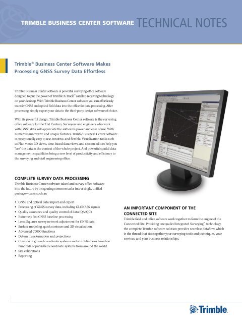
is exceptionally easy to use, intuitive, and flexible. Visualization tools such<br />
as Plan views, 3D views, time-based data views, and session editors help you<br />
“see” the data in the context of the whole project. And powerful spatial data<br />
management capabilities bring a new level of productivity and efficiency to<br />
the surveying and civil engineering office.<br />
ComPlete survey dAtA ProCessInG<br />
<strong>Trimble</strong> <strong>Business</strong> <strong>Center</strong> software takes land survey office software<br />
into the future by integrating common tasks into a single, unified<br />
package—tasks such as:<br />
• GNSS and optical data import and export<br />
• Processing of GNSS survey data, including GLONASS signals<br />
• Quality assurance and quality control of data (QA/QC)<br />
• Extremely fast GNSS baseline processing<br />
• Least Squares survey network adjustment for GNSS data<br />
Surface modeling, quick contours and 3D visualization<br />
• Advanced COGO functions<br />
• Datum transformation and projections<br />
• Creation of ground coordinate systems and site definitions based on<br />
• hundreds of published coordinate systems from around the world<br />
Site calibrations<br />
• Reporting<br />
•<br />
technical notes<br />
An ImPortAnt ComPonent of tHe<br />
ConneCted sIte<br />
<strong>Trimble</strong> field and office software work together to form the engine of the<br />
Connected Site. Providing unequalled Integrated Surveying technology,<br />
the complete <strong>Trimble</strong> software solution provides seamless dataflow, which<br />
is the thread that ties together your surveying tools and techniques, your<br />
services, and your business relationships.
An IntuItIve, eAsy-to-use And CustomIzAble InterfACe<br />
<strong>Trimble</strong> business CenTer sofTware technical notes<br />
<strong>Trimble</strong> <strong>Business</strong> <strong>Center</strong> software offers a modern and customizable user interface. Its flexibility and user-friendliness let you work the way you want:<br />
A Project Explorer “tree view” lets you locate and visualize your data.<br />
• A consistent Properties pane for all data types displays the details of<br />
• any data.<br />
Windows display in an easy-to-use “tabbed” layout, so you can easily<br />
• see multiple views at once, or select the view you want.<br />
Windows can also be placed into the familiar Windows mode, where<br />
• each window can be easily minimized, resized or positioned.<br />
• Spreadsheets can be “floated” away from the tabbed view layout.<br />
Surveyors with a dual monitor computer can take full advantage of all<br />
of that screen space.<br />
Put commands right<br />
where you need them<br />
for easy access with<br />
customizable menus<br />
and toolbars.<br />
Quickly navigate<br />
through your<br />
data with the<br />
Project Explorer.<br />
Customize the way<br />
you view data in the<br />
Time-based view.<br />
All toolbars and menus are fully customizable, using configuration tools<br />
• that are familiar to all Microsoft® Office users.<br />
Powerful spreadsheet views are available for point and vector data.<br />
• Familiar spreadsheet tools allow you to sort and view the data.<br />
A 3D view can display any data in a project. Data can be selected from<br />
• the 3D view, making it easy to quickly find and fix problems.<br />
Easily and quickly tab<br />
between windows.<br />
View the details of<br />
any object in the<br />
Properties pane.<br />
2
trImble busIness <strong>Center</strong> softWAre:<br />
totAl Control of your survey dAtA<br />
from stArt to fInIsH<br />
Bring in Data<br />
Importing survey data into office software has never been easier. That’s<br />
because <strong>Trimble</strong> <strong>Business</strong> <strong>Center</strong> automatically imports GNSS and optical<br />
data in the correct file format.<br />
To import data into <strong>Trimble</strong> <strong>Business</strong> <strong>Center</strong>, simply navigate to the<br />
appropriate file on your computer, where the smart <strong>Trimble</strong> <strong>Business</strong> <strong>Center</strong><br />
software analyzes the file to determine its type and how it needs to be<br />
processed.<br />
This exceptionally easy-to-use automated system also lets you drag-anddrop<br />
files from your directory directly into an open <strong>Trimble</strong> <strong>Business</strong> <strong>Center</strong><br />
project. After a few seconds your data is available.<br />
DownloaD Data from the internet<br />
Another way to import survey data into <strong>Trimble</strong> <strong>Business</strong> <strong>Center</strong> is via the<br />
Internet. This capability lets you import base station, precise ephemeris or<br />
NGS datasheet data in one easy step.<br />
<strong>Trimble</strong> <strong>Business</strong> <strong>Center</strong> can be configured so that the data you need is just<br />
a few clicks away: the software is smart enough to select the appropriate<br />
data, then unzip and import it all in one step. No more locating the data<br />
yourself and determining for which times you need the data before import.<br />
Internet<br />
download lets<br />
you keep a list of<br />
your reference<br />
stations within<br />
easy reach.<br />
Perform A netWork Adjustment<br />
In <strong>Trimble</strong> <strong>Business</strong> <strong>Center</strong> software the least-squares Network Adjustment<br />
module is powerful and extremely fast, but also very easy to use. With just a<br />
mouse-click you can:<br />
Include or exclude vectors from a network adjustment<br />
• Query or disable observations graphically<br />
•<br />
Fixing control points for the network adjustment enables you to achieve the<br />
high quality results you need…faster than ever before.<br />
After network adjustment, each station’s horizontal and vertical error ellipses<br />
are displayed in two locations: the Plan view and the results pane of the<br />
Network Adjustment command. You can thus quickly and easily inspect the<br />
network’s quality.<br />
<strong>Vector</strong>s and baselines are easily viewed in the <strong>Trimble</strong> <strong>Business</strong> <strong>Center</strong> window.<br />
ProCess bAselInes<br />
With the <strong>Trimble</strong> <strong>Business</strong> <strong>Center</strong> software, GNSS baseline processing and<br />
network adjustment are as simple or advanced as you want them to be.<br />
the right answers, right now<br />
In the <strong>Trimble</strong> <strong>Business</strong> <strong>Center</strong> software, baseline processing and network<br />
adjustment are designed to give you the information you need immediately.<br />
Intelligent default parameter values ensure that users who need to see the<br />
right answers quickly can do exactly that.<br />
more Control when You neeD it<br />
If you desire more control over your GNSS data processing, the baseline<br />
processing and network adjustment functions offer advanced commands.<br />
Of course, this task need only be completed once before your enhanced<br />
control is automated once more—the <strong>Trimble</strong> <strong>Business</strong> <strong>Center</strong> software<br />
allows you to save your advanced commands as a “style” for easy and<br />
immediate access in the future.<br />
QualitY assuranCe anD Control<br />
The <strong>Trimble</strong> <strong>Business</strong> <strong>Center</strong> software features extensive QC tools for fast<br />
and accurate assessment of data quality.<br />
3
AdvAnCed CoGo (CoordInAte Geometry) feAtures<br />
Any time <strong>Trimble</strong> <strong>Business</strong> <strong>Center</strong> prompts you for a coordinate, advanced COGO functions, the software also provides all the tools you need<br />
to compute the coordinate. These advanced COGO functions are only a mouse-click away whenever you need them. Available COGO functions<br />
include Bearing – Bearing Intersection, Bearing – Distance Intersection, and Distance – Distance Intersection.<br />
ensure quAlIty AssurAnCe And<br />
quAlIty Control<br />
Quality control of survey data is vital. That’s why <strong>Trimble</strong> <strong>Business</strong> <strong>Center</strong><br />
offers outstanding QA/QC capabilities to ensure your results always meet<br />
the high standards you and your clients expect.<br />
<strong>Trimble</strong> <strong>Business</strong> <strong>Center</strong> is full of features to help you maintain the highest<br />
standards of quality and quickly spot problem data:<br />
In the Plan view, red flags are automatically displayed to alert you to out-<br />
• of-tolerance data or other potential problems.<br />
• The Flags pane lists all warnings in one convenient list. Selecting a<br />
warning from the Flags pane takes you directly to the information you<br />
need to understand and resolve the problem, for example, a processed<br />
GNSS vector that does not meet the tolerance criteria set in the<br />
processing settings.<br />
• The Timeline window graphically displays observed data over time. Thus<br />
in one view you can see how your occupations fit together in time, plus<br />
the sessions that the <strong>Trimble</strong> <strong>Business</strong> <strong>Center</strong> software has created from<br />
these occupations.<br />
• To check the quality of a postprocessed network, simply use the Loop<br />
Closures report. <strong>Trimble</strong> <strong>Business</strong> <strong>Center</strong> can either report on the entire<br />
network or on a selected portion.<br />
Sort and find data quickly using spreadsheet views.<br />
• For each session a Session Editor view displays the data from each<br />
satellite. This view enables you to determine whether both of your<br />
occupations in a session were seeing the same satellites. It also allows you<br />
to identify if during the session either occupation experienced any lapses<br />
in satellite data.<br />
View satellite details using the Session Editor.<br />
CAlIbrAte A sIte<br />
If you need to perform a site calibration, it does not matter where you<br />
are: Calibrate the site in your <strong>Trimble</strong> field software or in <strong>Trimble</strong> <strong>Business</strong><br />
<strong>Center</strong> office software—you can seamlessly transfer the calibration<br />
between the two. This flexible convenience means anyone can perform the<br />
calibration…anywhere.<br />
When performing a site calibration in <strong>Trimble</strong> <strong>Business</strong> <strong>Center</strong> it is easy<br />
to assign pairs of GNSS coordinates to grid coordinates for each point you<br />
want to use to calibrate. After calibration is computed, the results of how<br />
each point varies from the solution are displayed both graphically and<br />
numerically, so you can easily see which points may not fit the calibration.<br />
You can then remove any point from the calibration to improve the solution.<br />
4
trImble busIness <strong>Center</strong> PACkAGes<br />
feature<br />
surfACe modelInG And<br />
3d vIsuAlIzAtIon<br />
Surface modeling of data enables you to visually identify<br />
problems using graphics rather than rows of numbers. So<br />
<strong>Trimble</strong> <strong>Business</strong> <strong>Center</strong> features surface modeling for<br />
quality assurance.<br />
You can take any 3D GNSS field data, or any CAD data<br />
with 3D information, and select it to form a surface. Once<br />
complete, you can view the surface in a 3D view, or see the<br />
contours of the surface on the screen.<br />
<strong>Trimble</strong> business CenTer sofTware technical notes<br />
trimble business <strong>Center</strong> software –<br />
without a dongle<br />
trimble business <strong>Center</strong> software –<br />
survey standard<br />
import data for postprocessing Yes Yes Yes<br />
edit raw data for postprocessing Yes Yes Yes<br />
import RtK data Yes Yes Yes<br />
edit RtK vectors no Yes Yes<br />
import total station data Yes Yes Yes<br />
edit total station data no Yes Yes<br />
import Dini ® level data Yes Yes Yes<br />
edit Dini level data no Yes Yes<br />
Postprocess 'l1-only' satellite data no Yes Yes<br />
Postprocess Gnss satellite data no no Yes<br />
loop closure on 'l1-only' satellite data no Yes Yes<br />
loop closure on Gnss satellite data no no no<br />
least squares network adjustment of 'l1-only'<br />
satellite data<br />
least squares network adjustment of Gnss<br />
satellite data<br />
least squares network adjustment of total<br />
station data<br />
least squares network adjustment of Dini<br />
level data<br />
no Yes Yes<br />
no no Yes<br />
no no Yes<br />
no no Yes<br />
level loop adjustment of Dini level data no Yes Yes<br />
Feature code processing no Yes Yes<br />
event Marker processing and export no no Yes<br />
trimble business <strong>Center</strong> software –<br />
survey Advanced<br />
View your data from any angle in 3D view. Elevation variances are easily visible.<br />
5
GenerAte rePorts<br />
Deliver your surveys to clients with professionally presented and easy-to-read reports. <strong>Trimble</strong> <strong>Business</strong> <strong>Center</strong> software generates reports in an<br />
HTML format that is easily displayed in word processing and Web browsing software.<br />
The reports you need are just a mouse-click away. They include:<br />
• Baseline Processing<br />
• Loop Closure<br />
Point Derivation<br />
Project Computation<br />
•<br />
<strong>Trimble</strong> <strong>Business</strong> <strong>Center</strong> reports contain hyperlinks back to the data being reported. If you are reviewing a report and wish to view the actual<br />
data, just click the link and you will be immediately taken to the data in the open project. This feature lets you quickly and easily review exactly<br />
the information you need.<br />
ConClusIon<br />
finish your survey jobs faster and deliver your clients data they can trust. trimble business <strong>Center</strong> software<br />
is advanced survey office software that takes the effort out of Gnss survey data processing. When you need<br />
immediate, hassle-free job completion and complete confidence in your results, trimble business <strong>Center</strong><br />
software delivers.<br />
reCommended HArdWAre<br />
requIrements<br />
The recommended requirements for the computer<br />
running the <strong>Trimble</strong> <strong>Business</strong> <strong>Center</strong> software are:<br />
Pentium IV-based computer, 2.8 GHz or faster with<br />
• 1 GB RAM<br />
A graphics card with 256 MB RAM will improve 3D<br />
• graphics<br />
Some commands in 3D view are more accessible with<br />
• a 3-button mouse<br />
© 2006–2008, <strong>Trimble</strong> Navigation Limited. All rights reserved. <strong>Trimble</strong>, the Globe & Triangle logo, and DiNi are trademarks of <strong>Trimble</strong><br />
Navigation Limited, registered in the United States and in other countries. Integrated Surveying and R-Track are trademarks of <strong>Trimble</strong><br />
Navigation Limited. Microsoft and Windows Mobile are either registered trademarks or trademarks of Microsoft Corporation in the<br />
United States and/or other countries. All other trademarks are the property of their respective owners. PN 022543-256A (09/08)<br />
<strong>Trimble</strong> auThorized disTribuTion ParTner<br />
•<br />
system requIrements<br />
Operating system: Any of these operating systems: Microsoft Windows®<br />
2000 Professional, Windows XP Home, Windows XP<br />
Professional or Windows Server 2003<br />
Processor: Pentium III 450 MHz minimum; Pentium IV 2.8 GHz<br />
recommended<br />
Random access Pentium III 450 MHz minimum; Pentium IV 2.8 GHz<br />
memory (RAM): recommended<br />
Hard disk capacity: 1 GB available hard-disk space prior to installation<br />
Graphics: For 3D View: DirectX 9 (or higher) compatible graphics<br />
card with 32 MB memory minimum;<br />
256 MB or greater recommended<br />
Monitor: 1024 x 768 or higher resolution with 256 colors (at 96 DPI)<br />
I/O ports: USB port for data synchronization with field devices<br />
Internet access: Internet access is required for the Internet Download<br />
command when running the program<br />
NORTH AMERICA<br />
<strong>Trimble</strong> Engineering &<br />
Construction Group<br />
5475 Kellenburger Road<br />
Dayton, Ohio 45424-1099 • USA<br />
800-538-7800 (Toll Free)<br />
+1-937-245-5154 Phone<br />
+1-937-233-9441 Fax<br />
Network Adjustment<br />
• Site Calibration<br />
•<br />
EUROPE<br />
<strong>Trimble</strong> GmbH<br />
Am Prime Parc 11<br />
65479 Raunheim • GERMANY<br />
+49-6142-2100-0 Phone<br />
+49-6142-2100-550 Fax<br />
ASIA-PACIFIC<br />
<strong>Trimble</strong> Navigation<br />
Singapore Pty Limited<br />
80 Marine Parade Road<br />
#22-06, Parkway Parade<br />
Singapore 449269 • SINGAPORE<br />
+65-6348-2212 Phone<br />
+65-6348-2232 Fax<br />
www.trimble.com