Colne - Lancashire County Council
Colne - Lancashire County Council
Colne - Lancashire County Council

Create successful ePaper yourself
Turn your PDF publications into a flip-book with our unique Google optimized e-Paper software.
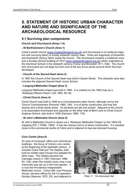
<strong>Lancashire</strong> Historic Town Survey<strong>Colne</strong>5. STATEMENT OF HISTORIC URBAN CHARACTERAND NATURE AND SIGNIFICANCE OF THEARCHAEOLOGICAL RESOURCE5.1 Surviving plan componentsChurch and Churchyard (Areas 1-5)- St Bartholomew’s Church (Area 1)<strong>Colne</strong>’s parish church (www.imagesofengland.org.uk) and churchyard is of medieval origin,but with surviving fabric of mostly sixteenth century date. There are fragments of thirteenthand fourteenth century fabric inside the church. The churchyard contains a medieval crossand a Sunday School building of 1812 (www.imagesofengland.org.uk) which originated asthe Grammar School in the sixteenth century (Farrer and Brownbill 1911, 536). The churchand churchyard are not large but form one of the key focus points around which the towndeveloped.- Church of the Sacred Heart (Area 2)In 1897 the Church of the Sacred Heart was built in Queen Street. The character area alsoincludes the adjacent Sacred Heart Junior School.- Langroyd Methodist Chapel (Area 3)Langroyd Methodist chapel was built in 1890. It is marked on the 1893 map as a‘Wesleyan Mission Room’ (OS 1893, 48.16).- Christ Church (Area 4)Christ Church was built in 1836 as a Commissioners style church, although not by theChurch Commissioners (Pevsner 1969, 106). It is of stone construction and has twostoreys and a three storey tower. Its windows are tall and arched. Adjacent to the churchis its associated churchyard and opposite on the other side of Bent Lane is Christ ChurchAnglican School, also built in 1836 (Harrison 1988, 118).- St John’s Methodist Church (Area 5)St John’s Methodist Church is shown as a ‘Wesleyan Methodist Chapel’ on the 1848 OSmapping (OS 1:10560, 1848). It has two storeys and is of stone construction. It is situatedclose to the commercial centre of <strong>Colne</strong> and is adjacent to bye-law terraced housing.Civic Centre (Area 6)An area of municipal, office and commercialbuildings - the focus of <strong>Colne</strong>’s civic centreat the beginning of the twentieth century. Itincludes <strong>Colne</strong> Hall and The Gables, bothbuilt as middle-class houses but adapted forother uses. The Gables became theCarnegie Library in 1907 (Harrison 1988,63, 124), when the market cross (now a warmemorial) was set up in the front garden. Itis now the Providence IndependentMethodist church. <strong>Colne</strong> Hall, now PrincessHouse, became offices for the Co-operativeSociety (Spencer 1972, 25), and adjacent isPlate 11: The Municipal Hall© <strong>Lancashire</strong> <strong>County</strong> <strong>Council</strong> 2005 27