GTK's new directions The digital mapping revolution International ...
GTK's new directions The digital mapping revolution International ...
GTK's new directions The digital mapping revolution International ...

You also want an ePaper? Increase the reach of your titles
YUMPU automatically turns print PDFs into web optimized ePapers that Google loves.
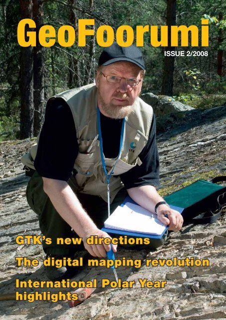
GeoFoorumi<br />
ISSUE 2/2008<br />
GTK’s <strong>new</strong> <strong>directions</strong><br />
<strong>The</strong> <strong>digital</strong> <strong>mapping</strong> <strong>revolution</strong><br />
<strong>International</strong> Polar Year<br />
highlights<br />
�������� GeoFoorumi 1
GeoFoorumi 2/2008<br />
Publisher: Geologian tutkimuskeskus<br />
Exchange operator: +358 20 550 11<br />
www.gtk.fi<br />
Guest Editor: Greg Moore<br />
Layout and design:<br />
Raija Sandqvist, Piccolo Oy<br />
Editorial board: Elias Ekdahl, Greg Moore,<br />
Hannu Idman, Keijo Nenonen, Pekka Nurmi,<br />
Marie-Louise Wiklund, Sini Autio<br />
Front cover: Research scientist<br />
Aimo Kuivamäki maps fractures and faults in<br />
the greater Tampere region. Photo: Jari<br />
Väätäinen, GTK<br />
Printed by: Vammalan Kirjapaino Oy<br />
ISSN 1796-1475<br />
GeoFoorumi, published three times a year,<br />
is the in-house magazine of the Geological<br />
Survey of Finland. Articles cover topics of<br />
interest to the geological community,<br />
stakeholders and the public at large.<br />
In 2008, issues 1 and 3 will be published in<br />
Finnish, and issue 2 in English. Subscription<br />
requests and change-of-address information<br />
can be submitted to viestinta@gtk.fi or<br />
http://en.gtk.fi/Media/Order/.<br />
gtk@gtk.fi<br />
Geological Survey of Finland<br />
Southern Finland Office<br />
Betonimiehenkuja 4<br />
P.O. Box 96, FI-02151 ESPOO<br />
Fax +358 20 550 12<br />
Eastern Finland Office<br />
Neulaniementie 5<br />
P.O. Box 1237, FI-70211 KUOPIO<br />
Fax +358 20 550 13<br />
Western Finland Office<br />
Vaasantie 6<br />
P.O. Box 97, FI-67101 KOKKOLA<br />
Fax +358 20 550 14<br />
Northern Finland Office<br />
Lähteentie 2<br />
P.O. Box 77, FI 96101 ROVANIEMI<br />
Fax +358 20 550 14<br />
Jari Väätäinen, GTK<br />
CONTENS<br />
3 Research director’s note<br />
4 <strong>The</strong> <strong>new</strong> language of geological resource accounting<br />
7 Digital <strong>mapping</strong> – GTK’s biggest <strong>revolution</strong><br />
10 Peat, carbon balance, and methane in a warming world<br />
12 GTK’s <strong>new</strong> <strong>directions</strong><br />
14 <strong>The</strong> ICI – Sharing the wealth<br />
15 Examples of GTK <strong>International</strong> Cooperation<br />
16 <strong>International</strong> Polar Year studies highlight climate issues<br />
19 Climate change adaptation at the local level<br />
20 Seismic sounding of ore belts continues<br />
21 New isotope lab offers broad research possibilities<br />
22 New publications<br />
23 Latest <strong>new</strong>s<br />
23 GTK online<br />
Lake sediment sampling at Lake Puruvesi, Kesälahti.
RESEARCH DIRECTOR’S NOTE<br />
GTK stands for sustainable growth<br />
GTK is one of the leading geoscientific research organizations in<br />
Europe. Our expertise is focused on the Precambrian geology of the<br />
Fennoscandian Shield, Quaternary geology of the repeatedly glaciated<br />
terrain and the natural earth resources in bedrock and soil.<br />
GTK employs some 300 experienced scientists (more than 70 PhDs)<br />
specialized in various aspects of geology, environmental research,<br />
geophysics, geochemistry and information technology. Our research<br />
staff is supported by in-house modern equipment and facilities, including<br />
the state-of-the-art Isotope Laboratory, Mineral Processing<br />
Laboratory, Drill Core Depot and experienced technical support for<br />
surveying. Altogether we are an institution of some 700 persons under<br />
the Ministry of Employment and the Economy.<br />
<strong>The</strong> geological resources of strategic and economic importance<br />
(precious and base metals, industrial minerals, groundwater, aggregates,<br />
dimensional stones and geological energy sources such as peat<br />
and thermal capacity of soil and bedrock) will remain at the core of<br />
GTK’s research mission. Future research priorities will also include<br />
environmental accounting of geological resources, life-cycle analyses,<br />
technologies for sustainable use of raw materials and advanced<br />
multidimensional geological modelling. Environmental issues and<br />
the acceptability of consuming non-re<strong>new</strong>able geological resources<br />
is today an object of active public discussion. Only transparent and<br />
objective information on geology and its technical applications can<br />
be the basis for assuring the politicians and the public that e.g. nuclear<br />
waste disposal deep in hard crystalline bedrock is safe enough<br />
for our nation. Our parliament made the decision in 2000 to go<br />
ahead with deep disposal plans based on thorough geological and<br />
technical studies from GTK. Fortunately, most of the tasks we face<br />
are less thorny than this one.<br />
We are working to further improve our databases. Our goal is<br />
to make more of our products and materials accessible online. Improved<br />
geological vector maps will soon be released for distribution.<br />
You can browse geological information in a GEOINFO map-server<br />
or search the catalogues of printed map series and FINGEO <strong>digital</strong><br />
publications. Our mission is to make Finnish geology readily understandable<br />
and easily accessible to the public, society and industry, as<br />
well as decision-makers at all levels. Welcome to the www.gtk.fi website<br />
and our exhibition stand at IGC 2008 in Oslo – and take some<br />
time to listen to the presentations of our specialists at the conference<br />
sessions.<br />
KEIJO NENONEN<br />
Research Director<br />
�������� GeoFoorumi 3<br />
Jari Väätäinen, GTK
<strong>The</strong> <strong>new</strong> language<br />
of geological resource<br />
accounting<br />
Just a decade ago, it was rare for<br />
policymakers and stakeholders to<br />
discuss land use and infrastructure<br />
issues with terms like “energy mix”,<br />
“ecological rucksack”, “material flow<br />
analysis”, “proportion ality”, or even<br />
“sustainability”. New balanced<br />
approaches to human modification<br />
of the geological environment are<br />
helping reduce red tape and save<br />
money in the long term.<br />
TEXT: SINI AUTIO<br />
PHOTOS: JARI VÄÄTÄINEN, GTK<br />
<strong>The</strong> Finnish Environment Institute ranks Finns among the<br />
most active consumers of natural resources in the world. Natural<br />
material flows are estimated at about 500 million tons<br />
a year, or around 100 tons per inhabitant. Over 90% of this<br />
figure involves the shifting of rock or soil for such purposes as<br />
road-building, mining, agriculture or underwater earthworks.<br />
Of this, about 100 million tons relates directly to quarrying or<br />
removal of minerals ranging from production of dimension<br />
stone to construction aggregates, as well as 22 million tons of<br />
commercially extracted minerals and metallic ores.<br />
4 GeoFoorumi ��������<br />
Senior scientist Saku Vuori wants to increase general awareness of<br />
natural material flow and life-cycle thinking as part of sustainable<br />
use policies.<br />
As geological resources lie at the heart of Finnish economic<br />
activity, their sustainable use has become a hot topic.<br />
GTK seeks to provide decision-makers with unbiased, accurate<br />
resource data so they can formulate solutions meeting<br />
the nation’s long-term environmental sustainability goals.<br />
This information is also useful to companies working with<br />
mineral resources and in promoting public awareness. <strong>The</strong><br />
EU wants national commitments to mineral use policies to<br />
reduce harmful environmental impacts.
True costs<br />
In his office at GTK, senior scientist Saku Vuori explains the<br />
conundrum of environmental and logistic issues arising from<br />
benign materials in vast quantities. “It may seem unexciting<br />
to think about rock chips at a granite quarry, but how should<br />
we think about them? Are they an intermediate byproduct or<br />
waste? Somebody has expended considerable energy to make<br />
materials that may be useful to someone else. <strong>The</strong> EU Court attempted<br />
to clarify this issue in the case of Palin Granit (2002),<br />
where it found “intent to discard” to be the critical characteris-<br />
How GTK promotes sustainable<br />
materials use<br />
● Inventories of metal-bearing ores, industrial<br />
minerals, natural stone, gravel, sand, soil,<br />
peat and groundwater.<br />
● Online access to spatial and statistical data<br />
on inventoried resources.<br />
● Development of a system of geological<br />
resource accounting and modeling that includes<br />
mineral byproducts and suitable substitutes.<br />
● Contributes to the discussion on what constitutes<br />
mineral waste.<br />
● Expansion of bioenergy accounting to cover<br />
peat reserves.<br />
�������� GeoFoorumi 5
tic of waste under EU law. Still, how does one form such intent<br />
if one is only waiting to identify a suitable use? <strong>The</strong> answer, I<br />
believe, lies in considering the entire value chain.”<br />
<strong>The</strong> first step is valuation of natural resources. Resource<br />
accounting should not only consider the volume and quality<br />
of a deposit, but also its location and potential users. This<br />
has changed the model of value. While traditional competitive<br />
bidding favors the lowest bidder, low pricing in resource<br />
services may give bad motivations to cut corners or shift costs<br />
onto others.<br />
“Two-thirds of rock materials and aggregates purchased<br />
in Finland are used by public agencies,” explains Vuori. “This<br />
Mine Closure Handbook now<br />
available in English<br />
<strong>The</strong> Green Net Mining (GNM) Group, a joint cooperation of<br />
GTK, VTT, Outokumpu Oyj, Jaakko Pöyry Infra and Destia<br />
Oy, has just released an updated English-language version<br />
of the original Finnish-language mine closure handbook<br />
published in 2005.<br />
<strong>The</strong> handbook is targeted at mine operators, public agencies,<br />
and third-party interest groups dealing with closure<br />
planning in the context of EU legislation and regulations.<br />
<strong>The</strong> handbook reviews regulatory requirements and trends,<br />
avoidance of potential negative impacts, risk management<br />
strategies, bonding and other economic considerations,<br />
best practices, as well as instructions on preparing a closure<br />
plan, implementation of closure, and post-closure issues.<br />
<strong>The</strong> closure-related R&D efforts at the Hitura nickel mine in<br />
western Finland illustrate an actual case and provide a rich<br />
source of reference material.<br />
A printed version is available from the GTK head office or by<br />
online order from http://en.gtk.fi/Geoinfo/Publications/Publicationsales.html.<br />
A PDF-version of the handbook may be downloaded<br />
from http://arkisto.gtk.fi/ej/ej74.pdf.<br />
� � GeoFoorumi ���� ��������<br />
puts the state in an excellent position to institute energy efficiency<br />
objectives via a material efficiency approach in public<br />
procurement. We can benchmark relative to the quality of the<br />
material to set a desired cost performance from the supplier.”<br />
Broader horizons<br />
An ecological rucksack comprises the total quantity of natural<br />
materials disturbed and expended to generate a product.<br />
This includes the transport of extracted, and possibly semirefined,<br />
materials from the site of the resource to the point it<br />
is delivered as a ready-to-use product, minus the weight of the<br />
product itself.<br />
A 2008 study by Germany’s Wuppertal Institute for Climate,<br />
Environment and Energy, considered whether it made<br />
better sense to bring copper concentrates from Chile to Germany,<br />
which has excellent, environmentally sound smelting<br />
facilities and electrolytic refining capacity, or make the copper<br />
in Chile, even with its less efficient smelters and refining,<br />
before bringing finished cathodes to Germany. By examining<br />
the major environmental pressure indicators (primary energy,<br />
material inputs, water consumption, solid waste, as well<br />
as emissions of greenhouse gases, sulfur and arsenic), copper<br />
refining in Chile was shown to be the wisest approach. This<br />
insight not only encourages the Chilean copper industry to<br />
develop its technology and supply chain, it also is to Germany’s<br />
environmental advantage to accept this global division of<br />
labor in materials production.<br />
Getting people to think with wider boundaries requires<br />
overcoming the not-in-my-back-yard (Nimby) phenomenon<br />
and political worries about material independence. <strong>The</strong> answer<br />
lies with rational approaches that bring together supply<br />
and demand in the most environmentally friendly way.<br />
Substitutes may be an answer<br />
“A number of quality issues attach to mineral use,” says Vuori.<br />
“It may be wasteful to use high-quality granite, for example,<br />
as filler material in a construction project when a poorer quality<br />
stone could be used. Substitute materials can save tremendous<br />
costs as long as it meets the rule of appropriate material<br />
for appropriate use.”<br />
GTK has made basic assessments of mineral resources by<br />
collecting data from over 10,000 bedrock sites. This information<br />
is useful in land planning and zoning, as well as optimization<br />
of quarry sites and as a basis for planning large infrastructure,<br />
construction projects and protected areas.<br />
“Geological resource data is valuable to the regional planner<br />
as such data are often determinative of land use. Urban<br />
expansion can take place smoothly if the needs of resource<br />
exploitation are anticipated. Oil and gas extraction, for example,<br />
has continued for nearly a century in the Los Angeles<br />
basin and along the California coast even as the population<br />
in that region grew to more 15 million people. I believe with<br />
the right approach we can secure the best uses of our mineral<br />
wealth for centuries to come without sacrificing our quality<br />
of life.” ●
Driven by technological change that allows greater information intensity, <strong>mapping</strong> is<br />
moving from conventional quadrangle <strong>mapping</strong> to demand-driven data capture and<br />
interpretation. After more than a century of work with traditional <strong>mapping</strong>, GTK is<br />
re-engineering all aspects of field data capture, storage, analysis and map formats.<br />
TEXT: GREG MOORE<br />
Digital <strong>mapping</strong> – GTK’s<br />
biggest <strong>revolution</strong><br />
Polish semanticist Alfred Korzybski liked to say “the map is<br />
not the territory.” His idea was that an abstract representation<br />
was not the thing itself – it merely stood for something and<br />
was by its nature incomplete. Of course, any mapmaker of his<br />
generation would have conceded this in a second; a very limited<br />
amount of information fits on a conventional paper map.<br />
Large quantities of useful information have to be left out.<br />
“<strong>The</strong> big change,” notes GTK’s Geological Mapping Program<br />
Director Hannu Idman, “is in how we work. We have<br />
to understand the various needs in the society, and focus the<br />
<strong>mapping</strong> accordingly.” A city planner, for example, designing<br />
a town plan, might want to know geological conditions<br />
of the area concerned. He will want many<br />
dense data points for that area – a feature<br />
of urban geology – and may want the<br />
site boundaries from adjacent plats<br />
listed in the land register in order<br />
to adjust for easements or subsidence.<br />
In the end, the city<br />
planner gets a tailor-made<br />
map on demand, a map<br />
that can be provided<br />
in two or three<br />
dimensions, with<br />
detailed information<br />
on clay types,<br />
bedrock characteristics<br />
and anything<br />
else useful<br />
to the builder.”<br />
Re<strong>new</strong>al process in full swing<br />
GTK is currently in the process of re<strong>new</strong>ing its <strong>mapping</strong><br />
strategies. Modern information technology attacks head-on<br />
one of the challenges of limited information availability. But<br />
there are other factors driving change at GTK, including pressures<br />
for greater responsiveness to stakeholders and a push<br />
for organizational efficiency. Web-based approaches make it<br />
possible to query and exchange geoscientific information internationally.<br />
An illustration of typical Finnish<br />
geological features.<br />
�������� GeoFoorumi 7<br />
Drawing: Harri Kutvonen, GTK
<strong>The</strong> big issues involve data models and architecture, data<br />
capture and acquisition, and the forms in which information<br />
is delivered. <strong>The</strong> process occupies considerable resources and<br />
demands a wide variety of skills. GTK has already expended<br />
some 200 person-years digitizing its legacy data. Its databases<br />
have also had to be divided into spatial and aspatial parts.<br />
To date, GTK has digitized all core datasets (surficial and<br />
bedrock geology data, exploration, aggregate resources, peat<br />
resources, etc.) and transferred existing <strong>digital</strong> data into its<br />
<strong>new</strong> databases. <strong>The</strong>se contain vast amounts of observation<br />
points, vector/raster maps, and exploration datasets that include<br />
claim reports, drilling sites and report maps. Remarks<br />
Idman, “<strong>The</strong> present focus is on careful analyses of work flows<br />
to modernize GTK’s <strong>mapping</strong> processes, designing seamless<br />
map databases for the country, map products at scales of 1:1<br />
million and 1:200,000, as well as finalizing national data models<br />
for Precambrian and Quaternary geology.”<br />
Find the right conceptual<br />
model – and then harmonize!<br />
Finland’s <strong>new</strong> geological data model<br />
largely follows the NADM (North<br />
American Data Model), which sets<br />
forth guidelines on classification rules<br />
and hierarchies, descriptors and symbols,<br />
and relationships. Since GTK has<br />
been amassing <strong>mapping</strong> data for more<br />
than a century, it is of little consolation<br />
that it does a good job in providing<br />
web-based services such as maps, index-based<br />
services and archive reports.<br />
Mountains of legacy information still<br />
� GeoFoorumi ��������<br />
DATA MODEL<br />
remain re in conventional formats awaiting editing,<br />
in digitization and harmonization.<br />
Finding ways to make numeric datasets accessible,<br />
ce relevant and easy to use by different audiences<br />
d must occur within the constraints of Europe’s<br />
ro interoperability requirements (INSPIRE)<br />
and an global agreements on normative conceptual<br />
data d models, classification systems and common<br />
geological ge terminology (OneGeology). GTK has<br />
begun b the long march to harmonized databases.<br />
<strong>The</strong>se T must largely comply with the recommendations<br />
d of the INSPIRE directive (GeoSciML).<br />
Three T teams (CGI, NADM and GeoSciML) coordinate<br />
o the harmonization process with international<br />
n developments.<br />
Despite harmonization, the database structure<br />
tu will inevitably be complex. For example,<br />
the th data model for bedrock observations covers<br />
all al sub-processes included in bedrock <strong>mapping</strong><br />
such su as basic <strong>mapping</strong>, exploration for metallic<br />
ores, o natural stone investigations, and detailed<br />
<strong>mapping</strong> ma for infrastructure projects.<br />
What kind of a map do you want?<br />
GTK has developed its own process software for map production<br />
and publishing. <strong>The</strong> system includes predefined product<br />
groups, symbol sets, colors and annotations. On-demand<br />
maps will be available online in formats that accommodate<br />
standard web browsers, GIS software and Open Geospatial<br />
Consortium interfaces.<br />
Concludes Idman, “Geological surveys traditionally served<br />
as producers of data. Today, they need to be part of society’s<br />
decision-making processes. This lifts our role from simply<br />
providing decision information to providing the tools for decision<br />
analysis. It’s <strong>new</strong> territory for all of us.” ●<br />
DATABASES<br />
PRODUCTS<br />
CLIENTS/<br />
STAKEHOLDERS
Kai Nyman, GTK<br />
National aerogeophysical <strong>mapping</strong><br />
programme now complete<br />
GTK has completed its programme of low-altitude airborne<br />
geophysical <strong>mapping</strong> of Finland. Systematic airborne measurement<br />
of the physical properties of the Earth’s crust in<br />
Finland (electrical conductivity, magnetic field variations and<br />
natural background radiation levels) began in 1972.<br />
Airborne geophysical <strong>mapping</strong> provides valuable subsoil<br />
data useful to user groups such as prospectors, officials<br />
involved in zoning, construction and environmental permitting,<br />
and those seeking to identify groundwater. GTK’s measurement<br />
package performs three types of geophysical measurement.<br />
Magnetic measurement gives information about<br />
bedrock fracture zone belts as well as the magnetic properties<br />
of various types of rock. Variations in electrical conductivity<br />
are detected with an electromagnetic method. Background<br />
radioactivity measurement provides clues of what lies beneath<br />
the ground. Measurement flights were made at 30 meters<br />
above the ground in long single-direction measurement<br />
lines, spaced 200 meters apart.<br />
During the programme, GTK’s flight team measured<br />
around two million line kilometers and logged over 15,000<br />
flight hours. <strong>The</strong> huge amount of measurement data collected<br />
has been stored in <strong>digital</strong> form. Where detailed data was<br />
requested, e.g. around gold deposits in Lapland, line spacing<br />
was narrowed.<br />
Geophysicist Maija Kurimo explains, “When low-altitude<br />
aerial <strong>mapping</strong> began in 1972, we focused on ore-critical<br />
areas. Over the years, however, we discovered <strong>new</strong> uses such<br />
as environmental and permafrost <strong>mapping</strong>. Our cooperation<br />
with British Geological Survey (BGS) in 2006−2007 offered<br />
both parties beneficial solutions and increased the pool of<br />
resources to develop and update the equipment. We expect<br />
to keep our emphasis on quality, state-of-the-art approaches<br />
and international cooperation.” ●<br />
�������� GeoFoorumi 9
Jari Väätäinen, GTK<br />
Peat, carbon balance,<br />
and methane in a<br />
warming world<br />
Field researchers use a closed chamber method to measure gas<br />
(CH 4 and CO 2 ) exchange.<br />
�� GeoFoorumi ��������<br />
Peatlands cover one third of Finland’s<br />
land area, so Finnish researchers have<br />
long studied their potential as energy<br />
sources, as well as their role in affecting<br />
climate change. Since the last glacial<br />
period, 200–450 billion tons of organic<br />
carbon have accumulated in peatlands<br />
in the northern hemisphere. At present,<br />
they constitute more than 30% of the<br />
global store of soil carbon. <strong>The</strong>ir sheer<br />
bulk makes them important environ-<br />
mental buffers.<br />
TEXT: MARKKU MÄKILÄ<br />
Peatlands both absorb and release greenhouse gases. At present,<br />
they are a major sink for carbon dioxide (CO 2 ) and a net<br />
contributor of methane (CH 4 ). <strong>The</strong> conversion of CO 2 to carbon<br />
is a very slow process. <strong>The</strong> plants at the surface initially<br />
take CO 2 from the air. Much of this CO 2 is simply returned<br />
to the air through plant respiration or when the plant dies.<br />
Although a relatively high proportion of the litter produced<br />
by mire plants is decomposed, a part of it accumulates as peat<br />
due to the wet conditions that restrict the decomposition<br />
processes. Decomposition continues even in anoxic conditions<br />
where a small proportion of the assimilated carbon is<br />
converted to CH 4 , which has a greenhouse effect 23 times that<br />
of CO 2 .
Dry and wet years<br />
In boreal mires, the annual balance of carbon uptake and release<br />
depends strongly on the growing season. Boreal mires<br />
turn into net carbon emitters in dry years when the summer<br />
water table falls below the long-term average level. Thus,<br />
mires may shift from acting as carbon sinks to carbon source<br />
if the frequency of summer droughts increases in the future.<br />
Presumably, the consequent lowering of the water table would<br />
decrease the methane (CH 4 ) fluxes from peat. If the melting<br />
of the world’s largest frozen peat bog area in Siberia is affected<br />
further by global warming and the bog area remains wet,<br />
methane will be released directly to the atmosphere, increasing<br />
the greenhouse effect. However, the predicted climate<br />
warming could also be a benefit rather than a threat for carbon<br />
sinks in northern wetlands because a warm spring and an<br />
early start to the growing season makes them more effective<br />
CO 2 sinks in the short term.<br />
<strong>The</strong> simulated 30-year CO 2 balances calculated annual<br />
carbon balances for pristine mires in south-eastern Finland<br />
ranged from –100 to +17 gCm 2 a year for a Sphagnum bog<br />
and from +36 to +91 gCm 2 a year for a sedge fen, with corresponding<br />
annual CH 4 effluxes of –7 to –9 gCm 2 and –17<br />
to –19 gCm 2 . Negative values indicate net efflux from the<br />
ecosystem. <strong>The</strong>se results indicate a higher net CO 2 uptake for<br />
fens than bogs. Numerous studies on CH 4 release show clearly<br />
that, on average, minerotrophic fens release more CH 4 than<br />
ombrotrophic bogs. In addition to high methane production,<br />
northern aapa mires also have lower carbon accumulation<br />
rates than more southern raised bogs. <strong>The</strong> general rule is that<br />
lower-lying areas such as hollows, pools and peatland margins<br />
have higher CH 4 emissions and lower CO 2 uptake than the<br />
adjacent raised areas such as hummocks, ridges and plateaus.<br />
As is obvious from the extent to which peatlands have formed<br />
over past millennia, the annual balances averaged over time<br />
form a long-term positive balance.<br />
Carbon accumulation rates vary<br />
Recent data from GTK senior scientist Markku Mäkilä and<br />
Polish radiocarbon specialist Tomasz Goslar suggest a steep<br />
decline in the apparent rate of carbon accumulation within<br />
the pre-peat of the surface layers. <strong>The</strong> actual average accumulation<br />
rates for 300-year-old layers amount to 17–36% of those<br />
in the uppermost organic matter and litter layers. <strong>The</strong> highest<br />
rates of carbon loss occur in the surface layers of aapa sedge<br />
fens. <strong>The</strong> average carbon accumulation rate in layers younger<br />
than 300 years is 33.8 gCm 2 a year in the aapa mire region,<br />
38.4 gCm 2 a year in the raised bog region, and 61.3 gCm 2 a<br />
year in young coastal mires. <strong>The</strong> long-term average carbon accumulation<br />
rates for entire peat deposits are 14.6 gCm 2 a year<br />
in the aapa mire region, 19.8 gCm 2 a year in the raised bog<br />
region and 43.0 gCm 2 a year in young coastal mires.<br />
<strong>The</strong> results indicate that, in order to set in perspective<br />
contemporary measurements of carbon flux between mires<br />
and the atmosphere, it is essential to understand the dynamics<br />
of carbon accumulation in both superficial and deep peat<br />
layers. It may anticipate relatively rapid cycling of a large part<br />
of the biomass − and thus carbon − within the surface layers<br />
of mires due to the intense decomposition that occurs as<br />
part of peat formation. <strong>The</strong> high carbon accumulation rate<br />
in the surface layers, although necessary for the development<br />
and maintenance of the mire, is temporary. <strong>The</strong> surface layer<br />
consists of living and dead biomass, which is slowly decomposing<br />
into peat. Rapid carbon accumulation and turnover<br />
of peat carbon occur in young surface layers (
Jari Väätäinen, GTK<br />
GTK’s <strong>new</strong> <strong>directions</strong><br />
Geofoorumi sat down with<br />
GTK Director General<br />
Elias Ekdahl to learn about<br />
current trends on the<br />
national geology scene.<br />
TEXT: MARIE-LOUISE WIKLUND<br />
What are the biggest challenges facing GTK?<br />
At the national level, it is raising our profile – getting people<br />
to understand how the work of the geological survey affects<br />
their lives. In part, we want to reach more people by providing<br />
information online in forms that are useful, easy-to-understand<br />
and well-organized.<br />
At the international level, our goal is to integrate with<br />
networks of international experts. Geologists everywhere<br />
work towards the same end of creating <strong>new</strong> knowledge for the<br />
benefit of the society.<br />
Could you give a brief overview of what’s happening on<br />
the <strong>mapping</strong> and applied geophysics front?<br />
Our <strong>mapping</strong> efforts have been redirected from conventional<br />
quadrangle <strong>mapping</strong> to focused investigations. <strong>The</strong> motivations<br />
for detailed <strong>mapping</strong> can come from the needs of an<br />
engineering project, promising ore samples or other indicators<br />
that justify study of an area.<br />
We have spent the past decade getting our <strong>mapping</strong> data<br />
into shape. Under the North American Data Model for geologic<br />
data, we are placing our data in central data banks to<br />
allow efficient management and production of maps that are<br />
internationally comparable. Data in standard formats makes<br />
the information easy to access over the Internet.<br />
3D modeling of crustal structures has also gained importance<br />
as they may be associated with ore deposits. This study<br />
also helps us understand and reconstruct bedrock formation<br />
processes. <strong>The</strong> Earth’s crust in Finland has an average thickness<br />
of about 50−55 km, so much of the work at present is<br />
basic research. However, our seismic sounding programme<br />
(HIRE) is currently studying over a dozen well-known ore areas.<br />
One remarkable aspect of this work is that we can identify<br />
structures that never break the surface, and yet lie just a few<br />
dozen meters below our feet.<br />
Part P of GTK’s mission is to support sustainable development<br />
strategies? Can you give some examples?<br />
I’d start with an example of what we call mineral balance<br />
assessment or resource accounting. We are studying<br />
the land in a 150-km radius around Helsinki to<br />
identify suitable mineral resources for, say, construction<br />
purposes. p p This includes determining<br />
the quality and quantity of<br />
the resource, associated
groundwater bodies, and if the resource lies in an environmentally<br />
protected areas. With this information, planners and<br />
developers can make informed decisions. A value can be to<br />
the mineral resource to help ascertain if it is worth exploiting<br />
and which method applies.<br />
Another example comes from our mineral process laboratory<br />
in Outokumpu, where our researchers are on the front<br />
lines in developing environmentally friendly mining methods.<br />
Even advanced methods, such as bioleaching introduced at the<br />
Talvivaara mine, continue to evolve. At present, bioleaching<br />
takes place in huge heaps on the surface. We envision mines<br />
of the future where metals removal will occur mostly in situ.<br />
Depth is not the issue, the bioleaching occurs underground.<br />
Let’s talk a little bit about the various kinds of user groups<br />
and how GTK helps them.<br />
We are getting <strong>new</strong> user groups all the time so it’s a bit hard<br />
to say. For example, our airborne geophysical measurement<br />
data has turned out to o<br />
be extremely useful in n<br />
environmental applica-<br />
tions. <strong>The</strong>se techniques s<br />
are now being applied d<br />
elsewhere in Europe e<br />
where these issues have e<br />
become quite acute.<br />
We have a tremen-<br />
dous amount of physi-<br />
cal material archived, ,<br />
including, for example,<br />
diamond drill cores stored at our national drill core depot in<br />
Loppi. This is regularly exploited by the international and domestic<br />
exploration companies.<br />
We are quite flexible in finding ways to cooperate. A client<br />
might be a local government agency, an international mining<br />
company, a road-builder, or a power company. <strong>The</strong>y come to<br />
us and we put together a team of researchers to study the matter<br />
that concerns them.<br />
Finland faced some complicated questions on nuclear<br />
waste disposal. What happened there?<br />
As I said at the beginning, our product is facts. <strong>The</strong>se become<br />
the basis of decisions by others. Perhaps nowhere is this better<br />
illustrated than our studies of the bedrock in the vicinity<br />
of the proposed nuclear waste storage site near Olkiluoto on<br />
the western coast of Finland. A thorough understanding of the<br />
bedrock structures improves the planner’s ability to anticipate<br />
risk. We have been involved in this process for over two decades,<br />
long before the final siting was decided in 2000. Now we<br />
are looking at faults, fractures, bedrock structures and groundwater<br />
percolation where the nuclear waste will be stored.<br />
Finland is probably the most advanced anywhere in the<br />
world in this process of nuclear waste siting and long-term<br />
storage. We have many inquiries about this.<br />
Could you give a brief overview of what is happening<br />
with cooperation in the EU and developing countries?<br />
GTK has a good reputation as a partner in international projects.<br />
Cooperation in Europe is quite tight. <strong>The</strong> EU INSPIRE<br />
project, for example, seeks to make spatial data available<br />
throughout Europe. GTK has actively participated in a number<br />
of EU projects focusing mainly on environmental issues,<br />
groundwater, gr<br />
climate<br />
change ch and the Baltic<br />
Sea. Se Russia has also<br />
been be a good partner in<br />
recent re years, providing<br />
unique u technical assistance<br />
si and research<br />
insights. in<br />
At the global level,<br />
the th UK is leading the<br />
charge ch with the One-<br />
Geology G initiative to<br />
get global geological information online. We actively participate<br />
in this project.<br />
GTK has been especially active in Africa, but we are also<br />
looking to projects in Central America and Southeast Asia.<br />
One <strong>new</strong> area has been institution-building. A great danger<br />
for countries blessed with great mineral wealth is that the elite<br />
in the country will profit at the expense of everybody else.<br />
We have worked closely with Finland’s foreign ministry in<br />
making a policy framework for development assistance in Africa,<br />
Eastern Europe and Asia.<br />
Finally, I would note that we have extensive exchange programmes,<br />
both short and long term. One of our main recruiting<br />
goals is to add more international experts onto our staff.<br />
●<br />
We see our job not so much as providing answers<br />
as providing the facts facts needed to make sure<br />
the right questions get asked.<br />
�������� GeoFoorumi 13
<strong>The</strong> ICI – Sharing the wealth<br />
Successful social development based on mineral wealth requires that wealth is<br />
transformed efficiently into other forms of capital, particularly human and physical<br />
capital. “<strong>The</strong> key”, explains GTK deputy director Pentti Noras, “is finding practical<br />
measures that improve quality of governance. It is the most important factor in<br />
translating minerals into economic growth and poverty reduction”.<br />
TEXT: GREG MOORE<br />
Transparency <strong>International</strong>’s Corruption Perception Index Rankings of 2007. Scale: dark green (least corrupt), dark mauve (most corrupt). In<br />
green countries, mineral resource allocation is handled institutionally. As redness increases, investors and decision-makers are more likely to decide<br />
resource allocation directly. Transparency <strong>International</strong> map redrawing by Lencer, Wikimedia Commons, 2007.<br />
Extractive industries globally represent a $5 trillion-a-year<br />
business. Understandably, countries find themselves dealing<br />
with both the economic benefits and corrosive effects of their<br />
mineral endowments. Many of the world’s advanced economies,<br />
including Finland, Sweden and Norway, were built on<br />
metal or hydrocarbon wealth.<br />
Considerable international effort lately has gone to creating<br />
initiatives for voluntarily improvements in governance<br />
and producer codes of conduct, yet the tragedies of poverty,<br />
corruption and resource wars continue. Serious international<br />
efforts such as the Extractive Industries Transparency Initiative<br />
(EITI) have yet to lead to binding regulatory regimes at the<br />
national level, and no-one can say how, e.g., China’s massive<br />
mineral needs will shape its business culture.<br />
Pentti Noras may have an answer. “Based on the <strong>new</strong> international<br />
cooperation policy of the Finnish Ministry for<br />
Foreign Affairs, our goal is to develop a Minerals Sector Institutional<br />
Cooperation Instrument (ICI) that recognizes what it<br />
actually takes to bring good governance to minerals management.<br />
Development programmes traditionally focus on technical<br />
assistance rather than the much-slower evolving aspect<br />
14 GeoFoorumi ��������<br />
of institution-building. Institutions matter, however. For example,<br />
the collegial decision-making tradition of Finland and<br />
Sweden dates back to 1766.”<br />
“Most mineral-rich countries have robust resource laws.<br />
<strong>The</strong> problem is that decision-makers prefer to negotiate directly<br />
with investors. This provides a motivation for circumventing<br />
the law and engaging in self-dealing. <strong>The</strong> last thing<br />
decision-makers in such countries want to talk about is good<br />
governance! In contrast, geologists around the world are professionals<br />
who rarely stray from their fiduciary obligations.<br />
Thus, geological surveys and other unitary organizations like<br />
national health institutes and central banks are perfect candidates<br />
as mentoring organizations in developing nation.”<br />
“<strong>The</strong> process of matching up organizations job-for-job is<br />
sometimes referred to as twinning. This type of work would<br />
be different from traditional contracting work in developing<br />
countries, where organized technical training is just a small<br />
part of the work. Under the ICI model, our people would spend<br />
time in the partner country and their people would spend time<br />
in Finland. We would match learning about functions. <strong>The</strong> ICI<br />
approach requires long-term commitment from both sides.” ●
Examples of GTK <strong>International</strong> Cooperation<br />
Scientific Cooperation and <strong>International</strong> Associations<br />
● HIRE (High Resolution Reflection Seismics in Ore Exploration)<br />
<strong>The</strong> project involves reflection seismic surveys of potential exploration<br />
and mining areas in Finland to produce useful structural<br />
and lithological information. <strong>The</strong> seismic contractor is the Russian<br />
company, Spetsgeofizika.<br />
● NORDSIM, Naturhistoriska Riksmuseet (Swedish Museum of<br />
Natural History) A Nordic facility based around a Cameca 1270 ion<br />
microprobe mass spectrometer that allows direct in situ measurement<br />
of isotopic and elemental composition in selected micrometer-sized<br />
sample areas.<br />
European Union R&D Programmes<br />
● ARMONIA (Applied Multi-Risk Mapping of Natural Hazards for<br />
Impact Assessment) <strong>The</strong> project seeks to provide the EU with<br />
harmonized methodologies for producing integrated risk maps to<br />
achieve more effective spatial planning procedures in areas prone<br />
to natural disasters in Europe.<br />
● Baltic Sea management – Nature conservation and sustainable<br />
development in the marine ecosystem through marine spatial<br />
planning (BALANCE) <strong>The</strong> project aimed to develop transnational<br />
marine spatial planning tools and an agreed template for marine<br />
management planning and decision-making. It was based on four<br />
transnational pilot areas demonstrating the economical and environmental<br />
value of habitat maps and marine spatial planning (exemplified<br />
through two zoning plans). <strong>The</strong> tools and zoning plans<br />
integrated biological, geological and oceanographic data with local<br />
knowledge from stakeholders.<br />
Data from recent airborne geophysical<br />
surveys carried out by GTK under<br />
technical assistance programmes<br />
are helping guide Tanzanian<br />
geologists to sites of potential<br />
mineralogical interest.<br />
● BIOSHALE (Search for a sustainable way of exploiting black<br />
shale ores using bio-technologies) <strong>The</strong> project examines biotechnologies<br />
that provide safe, clean beneficiation of black shale ores.<br />
● Joint Airborne-geoscience Capability (JAC) JAC is a cooperative<br />
system between two equal partners, Geological Survey of Finland<br />
(GTK) and British Geological Survey (BGS), mainly to provide<br />
airborne survey capability to both parties, and third party commissioned<br />
surveys throughout Europe, focussed on environmental issues.<br />
<strong>The</strong> primary purpose of the JAC is to provide both partners<br />
with a cost effective, state-of-the-art capability for acquiring highresolution<br />
airborne geophysical data for their respective national<br />
strategic science programmes.<br />
Developing Country Projects<br />
● Geological Mapping (LOT 2) in Mozambique Mapping of a<br />
168,000 km2 area in northern Mozambique. <strong>The</strong> project generated<br />
geological maps on the 1:250,000 and 1:50,000 scales and mineral<br />
resources maps on the 1:250,000 scale.<br />
● Geochemical and Geophysical Surveys in Tanzania Geological<br />
<strong>mapping</strong> (1:100,000), geochemical and geophysical surveys on five<br />
quarter-degree sheets, production of compilation maps from two<br />
blocs (1:500,000) for the west and southwestern part of Tanzania.<br />
Cross-Border Cooperation<br />
● Narva Groundwater Management Plan (Narva GMP) <strong>The</strong> project<br />
supports sustainable management of groundwater resources on the<br />
Russian-Estonian border by building Russian environmental administration<br />
and specialist capacity, and promoting public participation.<br />
�������� GeoFoorumi 15<br />
Seppo Lahti, GTK
Antti Ojala, GTK<br />
Finland’s <strong>International</strong> Polar Year (IPY) studies includes <strong>new</strong> methods for Holocene<br />
glaciology and studies of permafrost soils and bedrock. GTK will host an IPY confe-<br />
rence at its Espoo headquarters this November.<br />
TEXT: GREG MOORE<br />
IPY studies highlight<br />
climate issues<br />
Division manager Petri Lintinen strings line for EM <strong>mapping</strong> of the discontinuous mountian permafrost of the Halti fells. Finland’s geocryologists<br />
have adapted seismic, EM and ground radar techniques developed at Halti for use in other permafrost areas.<br />
�� GeoFoorumi ��������
IPY history<br />
<strong>The</strong> <strong>International</strong> Polar Year (IPY) is testimony to international<br />
geoscientific cooperation and an indicator of prevailing<br />
scientific concerns. <strong>The</strong> first IPY was the idea of German explorer<br />
Georg von Neumayer and the Austro-Hungarian naval<br />
officer Karl Weyprecht. <strong>The</strong> two spent seven years organizing<br />
the first IPY, which ran 1882–83. <strong>The</strong> twelve participant countries<br />
(including Finland) shared costs on getting information<br />
about the last unexplored frontier on earth (meteorology,<br />
geomagnetism, aurora borealis, currents, tides, ice structures<br />
and motion, atmospheric electricity, etc.).<br />
IPY2, held in 1932–33, emphasized advances in meteorological<br />
measurement. <strong>The</strong> number of member countries grew<br />
to 44. Some 70 countries in participated in an <strong>International</strong><br />
Geophysical World event of 1957–58, which commemorated<br />
the IPY and introduced advances in electronics, rockets and<br />
seismography.<br />
IPY3 (2007–08), now in progress, focuses on climate<br />
change effects in the polar regions. Finland’s contributions to<br />
IPY3 are coordinated by the Finnish National Board on Scientific<br />
Polar Research.<br />
Once there was a glacier…<br />
Senoir specialist Antti Ojala, head of Holocene climate change<br />
studies at GTK, explains where to go in Finland to find a recent<br />
glacier site: “You look for the coldest place, which is probably<br />
also the highest place”. That would be the Halti Fell (elevation<br />
1,328 meters above sea level), on the northwestern tip of Finland’s<br />
border with Norway. After the retreat of the continental<br />
ice sheet ten thousand years ago, a glacier remained in the<br />
Kovdajohtka valley below the Halti peak for 1,500 years. A series<br />
of well-defined moraine arches in the Kovdajohtka valley<br />
are indicators of these post-glacial advances. <strong>The</strong> glacial disappearance<br />
was driven by rising summer temperatures, only<br />
to be interrupted by a period of cooling about 6,000 years ago.<br />
During this time, the glacier grew for about 500 years.<br />
Observes Ojala, “Glaciers are like libraries, carrying a record<br />
of climate history. Even when they are gone, we still learn<br />
a lot by examining the remains. You might say I’m a glacial<br />
pathologist”. Ojala’s innovation was to correlate the mineralmagnetic<br />
trends in undisturbed clay sediment layers in the<br />
runoff lake below the glacier with the recession of moraines<br />
in the glacier valley. In other sites, the varved sediment curves<br />
provide correlation with climate history of the Holocene. <strong>The</strong><br />
climate record was also compared against the pollen record<br />
for July temperatures and a reconstruction of precipitation<br />
patterns back to the last ice age.<br />
Permafrost measurement in Komi<br />
Finland’s Halti region, because of the cold, is also one of the<br />
few places in Finland with a permafrost layer. Using electrical<br />
resistivity soundings and airborne electromagnetic (EM)<br />
data, GTK established an effective approach to permafrost<br />
<strong>mapping</strong> in Lapland fells over the past decade. <strong>The</strong>se techniques<br />
are now being adapted to the permafrost areas near<br />
Vorkuta, part of the Komi Republic in Russia.<br />
GTK’s Russian partner in the project is Mireko, the Mining<br />
Geological Joint-Stock Company of Komi. Mireko started<br />
the monitoring of permafrost temperatures in 1970’s. <strong>The</strong><br />
data indicate warming of the permafrost. In addition to the<br />
Temperature of permafrost at a depth of 14 meters in the Vorkuta<br />
study area in Komi, Russia. Data courtesy of Dr. Oberman and the<br />
Mireko monitoring programme.<br />
Electrical resistivity section over a temperature monitoring borehole. Vorkuta study area in Northern Komi, Russia.<br />
�������� GeoFoorumi 17<br />
Heikki Vanhala, GTK
Heikki Vanhala, GTK<br />
Antti Ojala, GTK<br />
<strong>The</strong> annually laminated lake sediments of Lake Nautajärvi provide a<br />
“master” regional record variation of geomagnetic field intensity and<br />
direction. Palaeomagnetic secular variation and palaeointensity master<br />
curves can give a good indication of behavior of the geomagnetic<br />
field as far back as 12,000 years.<br />
�� GeoFoorumi ��������<br />
undesired environmental impacts of permafrost thawing such<br />
as carbon dioxide and methane release, roads, railways, oil<br />
pipelines and buildings in permafrost areas are at risk of sinking<br />
into the mud. Finnish researchers found the Komi permafrost<br />
conditions quite different from that of the Lapland fells.<br />
Notes project leader Heikki Vanhala, “<strong>The</strong> southern part of<br />
the Komi permafrost is thin and largely discontinuous, while<br />
the northern part is continuous reaching a thickness of more<br />
than 300 meters near the Urals.<br />
“We were used to complicated structures and much higher<br />
resistivity values in the Ridnitsohkka permafrost in Finland<br />
than what we encountered in Vorkuta.” <strong>The</strong> unfamiliar situation<br />
gave the Finnish researchers an added challenge of extending<br />
the use of EM techniques. Work carried out in 2007<br />
established that the modified EM and electrical techniques<br />
provide accurate and reliable data about the permafrost layer<br />
(e.g. taliks, thickness and conditions in the active and frozen<br />
layers). <strong>The</strong> suitability of the area for airborne EM <strong>mapping</strong><br />
of permafrost is now under study.<br />
Digital image analysis records a seasonal-scale laminae thickness of<br />
the clastic-organic varves from Lake Nautajärvi, Central Finland.<br />
Polar Geoscience<br />
Conference in November<br />
As part of its contribution to IPY3, GTK is hosting a conference<br />
on Finnish geoscience studies in polar areas on 12–13<br />
November 2008. Topics include atmospheric science, glaciology,<br />
hydrology, marine research, geophysics, navigation, Arctic<br />
geology and geography. <strong>The</strong> closing date for abstract submissions<br />
is October 15. For more information, go to:<br />
http://projects.gtk.fi/polaarikokous/ENGLISH/. ●
Climate change adaptation<br />
at the local level<br />
<strong>The</strong> winter storm Gudrun caused flooding of the Helsinki market square in January 2005.<br />
<strong>The</strong> risks of climate change are usually portrayed in terms that have little<br />
significance to local decision-makers. Recent approaches co-financed by the<br />
European Regional Development Fund (ERDF) have supported countries in the<br />
Baltic Sea Region (BSR) to adopt climate change adaptation strategies.<br />
TEXT: GREG MOORE<br />
Adaptation, mitigation, vulnerability and risk<br />
Research scientist Philipp Schmidt-Thomé and a network of<br />
specialists throughout the Baltic Sea Region have developed a<br />
framework supporting local and regional decisions to implement<br />
strategies for adjustment. “My first advice is don’t panic.<br />
Decision makers need to promote two sorts of complementary<br />
actions, mitigation and, most importantly, adaptation. We<br />
need to learn to adapt to a changing climate.”<br />
Mitigation involves technical or behavioral modifications<br />
that reduce CO 2 emissions. Adaptation is the adjustment to a<br />
changing state or condition. Vulnerability comprises the potential<br />
losses, and is determined by many factors, including<br />
the geographic location (coastline or fault zone) and inadequate<br />
institutional response. Together, these factors contribute<br />
to the overall risk to economic, social and environmental<br />
conditions.<br />
Under the lead of GTK, the project “Developing policies<br />
and adaptation strategies to climate change in the Baltic Sea<br />
Region” (ASTRA) ran from June 2005 to December 2007. Participant<br />
countries were Germany, Poland, Latvia, Lithuania,<br />
Estonia and Finland. Several study findings are worth noting.<br />
● A “one-size-fits-all” approach to rising sea level is inappropriate.<br />
Dike construction in anticipation of a 100-year<br />
flood is warranted in Denmark, Germany and Latvia, while<br />
the costs of such measures are unjustified for Estonia, Finland<br />
and Lithuania.<br />
● <strong>The</strong> winter storm Gudrun in 2005 revealed the hidden<br />
economic benefit of coastal construction regulations.<br />
● Coastal erosion and impacts on estuary conditions will likely<br />
require an integrated approach to coastal and flood protection.<br />
● Traditional groundwater sites in low-lying areas are at<br />
risk.<br />
● Changes in the water-level regime of river basins in threaten<br />
loss as part of fish habitat and damage to local tourism.<br />
�������� GeoFoorumi 19<br />
Philipp Schmidt-Thomé, GTK
Seismic sounding<br />
of ore belts continues<br />
TEXT: GREG MOORE<br />
High resolution reflection seismic surveys in the Outokumpu<br />
Cu-Co-Zn ore belt revealed that strong reflectors are generated<br />
by the rock type family typically hosting ore deposits in the<br />
area. <strong>The</strong> geology of the uppermost reflector was confirmed by<br />
drilling a deep hole down to 2.5 km.<br />
GTK is currently engaged in a high-resolution seismic reflection<br />
imaging (HIRE) project to develop mineral exploration<br />
technology in Finland. HIRE applies high-resolution 2D and<br />
3D modeling approaches. <strong>The</strong> two-year project examines 15<br />
geological complexes with ore potential as well as already<br />
known economic deposits. Further, the structures of bedrock<br />
on the Olkiluoto island and surroundings on Finland’s western<br />
coast, the planned site of the national nuclear waste repository,<br />
will be surveyed.<br />
<strong>The</strong> HIRE surveys launched in September 2007 with<br />
soundings of the old massive sulfide zinc mining area in Vihanti,<br />
western Finland. From there, the project moved on to<br />
the massive sulfide Zn-Cu deposits in the Pyhäsalmi mining<br />
area in central Finland, and the Kevitsa Ni-Cu-PGE mafic intrusion<br />
in northern Finland. In 2008, field work has already<br />
been finished at the Suurikuusikko gold deposit and in the Fe-<br />
�� GeoFoorumi ��������<br />
Cu prospects in Kolari, both in<br />
northern Finland. Presently,<br />
measurement is underway<br />
in the Kemi Cr mining area.<br />
Measurements have proceeded<br />
smoothly and the data is of<br />
good technical quality.<br />
HIRE is the successor to<br />
the FIRE project completed<br />
in 2005. FIRE involved a national<br />
seismic <strong>mapping</strong> down<br />
to depths of about 80 km that<br />
provided an unprecedented look at crustal structures underlying<br />
Finland.<br />
<strong>The</strong> massive exercise in applying seismic soundings is<br />
the brainchild of the previous FIRE project, in which critical<br />
testing of the method was successfully done in ore provinces,<br />
such as the classical Outokumpu Cu-Co-Zn ore belt and the<br />
Suhanko mafic intrusion with PGE deposits. GTK Research<br />
professor Ilmo Kukkonen notes:<br />
“HIRE is one of the most interesting projects at GTK in<br />
recent years. From the experience gained in the FIRE project,<br />
it became obvious that reflection seismics can be a very powerful<br />
tool in mineral exploration. We are happy to cooperate<br />
in HIRE with a good number of mining and exploration<br />
companies, and at the end of the project we will be able to<br />
provide a comprehensive data set of high resolution seismic<br />
reflection data on the geologically and economically most important<br />
deposits in Finland.”<br />
“<strong>The</strong> HIRE survey in Olkiluoto nuclear waste site will<br />
naturally not focus on any ore potential, but the large scale<br />
structures of the disposal formation. This will provide a detailed<br />
view of the bedrock structures in the uppermost 10 km<br />
not obtainable otherwise.”<br />
Nearly half of HIRE’s funding comes out of a joint Russia-<br />
Finland project for settlement of Soviet-era debt. Measurement<br />
services in Finland are provided by the Russian state<br />
enterprise Vniigeofizika. Other participants are the Russian<br />
Machinexport, GTK, and international mining companies<br />
operating in Finland.<br />
<strong>The</strong> final products of HIRE are detailed <strong>mapping</strong>s and 3D<br />
models of critical ore complexes. ●
New isotope lab offers<br />
broad research possibilities<br />
Lab chieftains Hugh O’Brien and Yann Lahaye encourage colleagues to come up with interesting problems and research themes to take<br />
advantage of the Finland Isotope Geosciences Laboratory capabilities.<br />
<strong>The</strong> Finland Isotope Geosciences Laboratory (FIGL), a joint<br />
collaboration of Helsinki, Oulu and Turku Universities, Åbo<br />
Akademi, Helsinki University of Technology and GTK, is now<br />
available for analysis of the isotopic composition of nearly<br />
the entire periodic table of elements in all types of materials.<br />
Accurate determination of isotope ratios is useful in applications<br />
such as age-dating, fundamental research on earth’s<br />
evolution, radioactive waste monitoring, and environmental<br />
contaminant fingerprinting. <strong>The</strong> lab features a laser ablation<br />
multiple-collector inductively coupled plasma mass spectrometer<br />
(LA-MC-ICPMS) that provides high precision isotopic<br />
measurements of elements in samples introduced as solutions<br />
using the Nu Instruments desolvating nebulizer or as<br />
solids using the New Wave 193 nm deep UV solid-state laser.<br />
Mass spectroscopy is long-standing analytical technique<br />
that measures the mass-to-charge ratio of charged particles.<br />
<strong>The</strong> Nu instruments High Resolution mass spectrometer installed<br />
at FIGL consists of an argon plasma source running at<br />
8,000 º C – a temperature higher than the first ionization potential<br />
of most elements, an energy filter that brings all transmitted<br />
ions to the same energy level, a magnet that separates<br />
the ions based on their mass, and an analyzer equipped with<br />
12 Faraday detectors (for larger ion beams) and 3 ion counters<br />
(for tiny ion beams). Measuring ion beams on multiple collectors<br />
means near elimination of plasma instability-induced<br />
uncertainties and results in precise and accurate isotope ratio<br />
measurements.<br />
Other major advantages of the system include its speed<br />
and extremely low detection limits. For example this technique<br />
has been used to study: early earth core formation<br />
tracing 182 Hf- 182 W anomalies; extinct radionuclides as chronometers<br />
for terrestrial, lunar, and Martian samples to time<br />
metal segregation and silicate differentiation; paleo-environmental<br />
change using redox-sensitive stable isotopic systems<br />
within sediments; mantle-crust interactions and ore forming<br />
systems through Nd, Sr, Hf, Pb and Os isotopic analyses; the<br />
evolution of the earth’s atmosphere by means of Mg and Ca<br />
isotope variability in carbonates and barite; migration of Fe,<br />
Cu, Zn, Cr, Ni, Mo, Hg in <strong>mapping</strong> of anthropogenic sources;<br />
sediment loading in large river systems by monitoring 30Si<br />
variability; Pb bioavailability; radionuclide and airborne pollutant<br />
behavior; Sr, Pb isotope variability in groundwater to<br />
monitor its sources and quality; and human blood Fe isotope<br />
variability. ●<br />
�������� GeoFoorumi ��<br />
Jari Väätäinen, GTK
Photo: GTK<br />
NEW PUBLICATIONS<br />
Understanding tectonic evolution helps<br />
determine construction suitability of bedrock<br />
<strong>The</strong> tectonic structures formed during the Svecofennian<br />
orogeny determine the tectonic framework for orienting post-<br />
Svecofennian deformations. Deformation events are studied<br />
using field data and analyses of key structures on outcrops on<br />
ductile events, shear and fault zones and jointing. <strong>The</strong> main goal<br />
of the seven papers in the volume was to produce geological<br />
baseline information for different applications to meet the various<br />
demands of society.<br />
Pajunen, Matti (ed.) 2008. Tectonic evolution of the Svecofennian crust in<br />
southern Finland – a basis for characterizing bedrock technical properties.<br />
Geological Survey of Finland, Special Paper 47. An electronic version is available<br />
at http://arkisto.gtk.fi/sp/sp47.pdf.<br />
Pan-European geochemical atlas supports<br />
environmental protection<br />
Baltic seabed conditions in the eastern Gulf of Finland highlight<br />
ecosystem frailty<br />
GTK recently issued the results of the joint Finnish-Russian project “Sediment geochemistry<br />
and natural and anthropogenic hazards in the marine environment of the Gulf of Finland”<br />
(SAMAGOL). <strong>The</strong> research sought to clarify the seabed geology of the eastern Gulf of Finland<br />
and the impacts of human activity on seabed conditions. GTK implemented the project<br />
in cooperation with the VSEGEI Research Institute of St. Petersburg in 2004–2006.<br />
Vallius, Henry (ed.) 2007. Holocene sedimentary environment and sediment geochemistry of the eastern Gulf of<br />
Finland, Baltic Sea. Geological Survey of Finland, Special Paper 45 is available for €20 (incl. 8% VAT).<br />
An electronic version is available online at http://arkisto.gtk.fi/sp/sp45.pdf.<br />
Sediment sample from the seabed of the eastern Gulf of Finland.<br />
Geochemical atlas of Barents region<br />
<strong>The</strong> results of the extensive Russia-Finnish <strong>mapping</strong> project,<br />
Ecogeochemical Mapping of Eastern Barents Region –<br />
Barents Ecogeochemistry (1999–2004), are now compiled in<br />
atlas-form with over 200 maps. One aim of the project was<br />
assessment of anthropogenic impact in relation to baseline<br />
concentrations of heavy metals and other key elements in<br />
areas that area among the most pristine in Europe but also<br />
containing major industrial polluters.<br />
Salminen, R.; Chekushin, V.; Tenhola, M. et al. 2004. Geochemical Atlas<br />
of the Eastern Barents Region. Journal of Geochemical Exploration. 83:<br />
1−3. Elsevier, ISSN 0375-6742.<br />
Results of the extensive FOREGS Geochemical Baseline Mapping Program<br />
are now assembled in two volumes. Geochemical Atlas of Europe, Part 1<br />
includes some 360 maps. <strong>The</strong> work is the first to provide a comprehensive<br />
look at surface water quality and elemental concentrations in mineral and<br />
organic soils across Europe. Geochemical Atlas of Europe, Part 2 issued in<br />
2006 provides interpretations of geochemical maps, additional tables, figures,<br />
maps, and related publications, is also out now.<br />
<strong>The</strong> Atlas is available online and in print. <strong>The</strong> electronic version includes special features such<br />
as a photo archive of images from various sampling sites (http://www.gtk.fi/publ/foregsatlas/).<br />
Salminen, R. (ed.), Batista M.J., Bidovec M., Demetriades A. et al. 2005. Geochemical Atlas of<br />
Europe, Part 1, Background Information, Methodology and Maps. Geological Survey of Finland,<br />
Espoo. 526 pages (incl. 360 maps). ISBN: 951-690-921-3 (print) & 951-690-913-2 (electronic).<br />
Price �63.00 (incl. 8% VAT).<br />
De Vos W. and Tarvainen T. (eds.), Salminen R., Reeder S., De Vivo B., et al. 2006. Geochemical Atlas of Europe. Part 2 – Interpretation of Geochemical Maps,<br />
Additional Tables, Figures, Maps, and Related Publications. 690 s. ISBN: 951-690-956-6 (print) & 951-690-960-4 (electronic). Price �63.00 (incl. 8% VAT).<br />
Printed copies of the atlas are available at any GTK office or by online order (see below).<br />
<strong>The</strong> GTK books, publications and maps are available at any GTK office or by online order from http://en.gtk.fi/Geoinfo/<br />
Publications/Publicationsales.html.<br />
�� GeoFoorumi ��������
IN BRIEF<br />
World magnetic anomaly map now available<br />
<strong>The</strong> Commission for the Geological Map of the World (CGMW), with the help of UNESCO<br />
funding, recently released its first edition of the World Digital Magnetic Anomaly Map<br />
(WDMAM). <strong>The</strong> map was put together by five international working groups and assembled<br />
for final printing at GTK’s headquarters in Espoo.<br />
Highlights of the WDMAM project are posted at http://projects.gtk.fi/WDMAM/. Numeric data and map image<br />
files may be downloaded from http://ftp.gtk.fi/WDMAM2007/. <strong>The</strong> price is �8 (includes 22% VAT). <strong>International</strong><br />
distribution of the map is arranged from the GCMW office in Paris www.ccgm.org.<br />
Finland gets its first World Natural Heritage Site<br />
<strong>The</strong> Kvarken Archipelago, which features spectacular De Geer moraines formed by the<br />
retreating continental ice sheet at the end of the last ice age, has been deemed the world’s<br />
most representative site of uplift processes in flat and shallow moraine archipelagos. It is<br />
Finland’s first World Natural Heritage Site to be included UNESCO’s list of protected sites.<br />
<strong>The</strong> Kvarken Archipelago complements Sweden’s High Coast World Heritage Site.<br />
<strong>The</strong> Kvarken Archipelago is the most representative site in the world for the study of land uplift in<br />
moraine archipelagos. Photo: Seppo Lammi<br />
Fennoscandian ore deposit data now available online<br />
For the first time, a comprehensive numeric database on metallic mines, deposits and<br />
significant occurrences in Fennoscandia has been compiled in a joint project of the geological<br />
surveys of Finland, Norway, Russia and Sweden. <strong>The</strong> database contains information<br />
on over 900 mines, deposits and significant occurrences across the region (292 in<br />
Finland, 154 in Norway, 237 in Russia, and 259 in Sweden). Access the database from<br />
http://en.gtk.fi/ExplorationFinland/fodd/.<br />
GTK online<br />
Users can access a large body<br />
of GTK’s research materials<br />
and databases online. <strong>The</strong> data<br />
can be manipulated to suit user<br />
needs with a range of geological<br />
information system (GIS)<br />
software. Our website also provides<br />
a complete list of publications.<br />
Popular online exploration<br />
services include Active Map<br />
Explorer, as well as a variety<br />
of mineral databases and other<br />
useful and interesting information<br />
for extractive industries.<br />
Geology as basis for<br />
sustainable growth<br />
and welfare<br />
GTK’s mission is to produce<br />
and disseminate geological information<br />
for use in promoting<br />
the systematic and sustainable<br />
use of the national geological<br />
endowment. We study and map<br />
the Earth’s crust, perform inventory<br />
of mineral and ore resources,<br />
provide national geological<br />
information services, perform<br />
contract services for external<br />
clients and participate actively<br />
in international projects. It is<br />
our vision that geology provides<br />
a basis for sustainable growth,<br />
prosperity and well-being.<br />
Exploration opportunities:<br />
explor@gtk.fi<br />
Geodata: info@gtk.fi<br />
Services: services@gtk.fi<br />
www.gtk.fi<br />
�������� GeoFoorumi ��
GeoFoorumi ��� ����<br />
In 2007, GTK completed<br />
a 35-year programme<br />
of low-altitude aerogeophysical<br />
<strong>mapping</strong><br />
of the entire country.<br />
Kai Nyman, GTK