


Create successful ePaper yourself
Turn your PDF publications into a flip-book with our unique Google optimized e-Paper software.
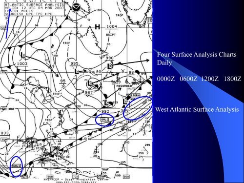
Four Surface Analysis ChartsDaily0000Z 0600Z 1200Z 1800ZWest Atlantic Surface Analysis


Turn your PDF publications into a flip-book with our unique Google optimized e-Paper software.
Four Surface Analysis ChartsDaily0000Z 0600Z 1200Z 1800ZWest Atlantic Surface Analysis
Hooray! Your file is uploaded and ready to be published.
Saved successfully!
Ooh no, something went wrong!