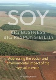
Download the report (PDF) - Both ENDS
Download the report (PDF) - Both ENDS
Download the report (PDF) - Both ENDS

Create successful ePaper yourself
Turn your PDF publications into a flip-book with our unique Google optimized e-Paper software.
Policy briefJune 2013Integrating community maps in spatial planningRecommendations for policy and practice in IndonesiaThe revised spatial planning law of Indonesia requires participation of communities inspatial planning procedures. Such participation should be more than just lip service. Toensure that <strong>the</strong> interests of local people are truly taken into account we recommend <strong>the</strong>integration of community maps in spatial planning.RecommendationsØ In line with <strong>the</strong> Articles 60-66 of <strong>the</strong>Indonesian Spatial Law (26/2007),district-level spatial planning shouldfacilitate participation bycommunities with a view to ensuringFree Prior and Informed Consent(FPIC) for land allocations.Ø District governments should verifyand subsequently formalisecommunity-level maps and producedistrict maps that clearly demarcatevillage land boundaries andcustomary lands.Ø District governments should not onlyissue land allocations to companies,but should also allocate lands forlocal agricultural activities, classifiedas ‘Rural Areas’ (Spatial Law, Article48 to 59).Ø Community maps can be used toidentify Strategic Rural Areas inspatial plans.Ø District governments should ensurethat local communities are fullyinformed about <strong>the</strong> consequences ofdeals with companies.What is community mapping?Over <strong>the</strong> past two decades, in response tounclear land rights and associatedconflicts, Indonesian NGOs have assistedhundreds of communities to map <strong>the</strong>irvillage boundaries through a process ofcommunity mapping. This essentiallymeans that villagers create a detailed andaccurate cartographic map of <strong>the</strong>ir villageor customary territory. Toge<strong>the</strong>r <strong>the</strong>ydocument <strong>the</strong> land boundaries and landuses, using simple Global PositioningSystem (GPS) technology andGeographical Information System (GIS)software. The boundaries betweenvillages are established in consultationwith neighbouring communities, whichhelps prevent and resolve land-relatedconflicts among <strong>the</strong>m. The map is basedon local people’s own concepts andunderstanding of land use, and <strong>the</strong>community’s history and land claims.Community maps enable local people tocommunicate <strong>the</strong>ir perceptions on landrights and resource management systemswith <strong>the</strong> government and o<strong>the</strong>r actors.Community maps can help improvedistrict-level planningDistrict governments issue plantationpermits to palm oil companies based ondistrict-level spatial plans. These arebased on official maps that do notcontain information about customaryboundaries. As a result, a company mayreceive a permit for lands that areconsidered customary lands and whichare used productively by localcommunities. It is <strong>the</strong>n up to <strong>the</strong>company to open negotiations with <strong>the</strong>communities and work out a deal, forexample by involving local people in asmallholder outgrower scheme.Communities are seldom fully aware ofall <strong>the</strong> consequences of such deals, forexample those related to tenure rights(see <strong>the</strong> textbox below). With a view toprotecting <strong>the</strong> interests of local farmersand reducing <strong>the</strong> potential for conflicts,district-level spatial plans should accountfor local land uses, customary land rightsand local aspirations. Official maps donot contain that type of information, butcommunity maps do. If <strong>the</strong> spatialplanning agency would integratecommunity maps in its formal planningprocedures, this could be used fordetailed spatial planning of <strong>the</strong> landscape,
ensuring a balanced mix of plantationdevelopment, food production andnatural areas, and contributing toimprovements in rural communities’welfare.The PLUP projectBetween 2010 and 2013, an alliance ofIndonesian and Dutch nongovernmentalorganisations anduniversities and an internationalresearch organisation carried out a pilotproject aiming to facilitate participatoryland-use planning (PLUP) in <strong>the</strong> districtof Sanggau in West-Kalimantan byintegrating community maps into <strong>the</strong>formal spatial planning procedure. Formore information about <strong>the</strong> activitiesand outcomes of <strong>the</strong> project see:Formalising participatory land-useplanning – Experiences from SanggauDistrict, West Kalimantan, Indonesia.URL: www.bo<strong>the</strong>nds.nl/nl/PublicatiesThe revised spatial planning lawThe revised spatial planning law of 2007– and <strong>the</strong> ensuing development of a newIndonesian spatial plan – provides <strong>the</strong>following two openings to address <strong>the</strong>land right concerns of communities.Firstly, Articles 60 to 66 state that civilsociety participation is required duringplanning, implementation and monitoring.There are however no clear guidelines onhow to do this, and most district-levelgovernments continue allocating lands tooil palm companies and o<strong>the</strong>r large-scaleconcessions without true consultation oflocal communities. Effective participationin land-use planning can be achievedthrough <strong>the</strong> integration of communitymaps in formal procedures.Secondly, Articles 48 to 59 introduce anew classification under <strong>the</strong> name of‘Rural Areas’. According to <strong>the</strong> law, aRural Area should contribute to (i) ruralcommunity economic empowerment, (ii)maintaining <strong>the</strong> quality of <strong>the</strong>environment, (iii) natural resourceconservation, (iv) cultural heritage. (v)food security, and (vi) maintaining abalance between rural and urban areas.Rural Areas are allocated to ruralcommunities and can <strong>the</strong>refore not beleased out to private plantationcompanies. The areas are to be identifiedthrough a process of ‘detailed spatialplanning’ at <strong>the</strong> district level. Todemarcate <strong>the</strong> Rural Areas, communitymapping is <strong>the</strong> most appropriate tool, asit will ensure that local interests andperceptions are taken into account.Fur<strong>the</strong>r reading• Momberg, F., Atok, K. and Sirait, M.1996. Drawing on Local Knowledge:A Community Mapping TrainingManual. WWF-Indonesia Programme.• Colchester M., Jiwan N., Andiko,Sirait M.T., Firdaus A.Y., Surambo A.and Pane H. 2006. Promised Land:Palm Oil and Land Acquisition inIndonesia – Implications for LocalCommunities and Indigenous Peoples.FPP, SW, HUMA, ICRAF-SEA.• Sirait, M. 2009. Indigenous Peoplesand Oil Palm Plantation Expansion inWest Kalimantan, Indonesia.Universiteit van Amsterdam andCordaid Memisa.• Kusters, K. et al. 2013. Formalisingparticipatory land-use planning –Experiences from Sanggau District,West Kalimantan, Indonesia. <strong>Both</strong><strong>ENDS</strong>. www.bo<strong>the</strong>nds.nl/nl/PublicatiesGeneral informationLeonie Wezendonk, <strong>Both</strong> <strong>ENDS</strong>(l.wezendonk@bo<strong>the</strong>nds.org)Martua Sirait, ICRAF-SEA(msirait@cgiar.org)Technical supportIndonesia: Kasmita Widodo, BRWA(kwidodo@gmail.com)Kalimantan: Ma<strong>the</strong>us Pilin, PPSDAK,Perkumpulan Pancur Kasih(victopline@yahoo.com.sg)Sanggau district: Sulaiman, YPSBK(Sulaiman_man14@yahoo.co.id)Film: ‘Mapping our future’(https://vimeo.com/61715444)This policy brief has been drafted in <strong>the</strong> context of <strong>the</strong> project "Participatory land-use planning (PLUP) to promote sustainable palm oilproduction", carried out by a consortium consisting of <strong>Both</strong> <strong>ENDS</strong>, ICRAF-SEA, YPSBK, LBBT, PPSDAK, University of Tanjungpura, UvA-AISSR, WUR-DLO, VU-CIS, Cordaid, Mekon Ecology and WiW – Global Research and Reporting. The project has been funded by FondsBiomassa Mondiaal, Agentschap NL and co-funded by <strong>the</strong> MFS II Ecosystem Alliance and <strong>the</strong> Ford Foundation.