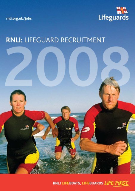
RNLI: LIFEGUARD REcRUItmEnt
RNLI: LIFEGUARD REcRUItmEnt
RNLI: LIFEGUARD REcRUItmEnt
- No tags were found...

Create successful ePaper yourself
Turn your PDF publications into a flip-book with our unique Google optimized e-Paper software.
each descriptions 2008Region 1: NorfolkThe Norfolk region ranges from popular, accessible family beaches to more isolated rural stretches.Its lifeguards are occupied with patrolling the beaches and attending to first aid cases. They also dealwith MEDEVACs, weever fish stings, lost children and incidents involving inflatables.1North norfolkThis area on the north east coastof England borders the NorfolkBroads to the east and The Washto the west. It comprises fivebeaches – Sheringham, Cromerwest and east, Mundesley and SeaPalling. Each has a distinctive feel– Sheringham is pebbley, Cromera sandy resort with a pier, whileMundesley and Sea Palling aremore rural, with soft sand.great yarmouthGreat Yarmouth, on the east coast of England, comprises three beaches –Great Yarmouth, Gorleston and Hemsby.With a wide, sandy beach that backs directly on to the town, Great Yarmouthis popular with tourists. Backed by a wide promenade, Gorleston beach is along, curved sandy beach that extends for several miles. It is popular withfamilies and is the busiest of the Great Yarmouth beaches. Hemsby is a wide,sandy, rural beach backed by dunes and two large holiday camps, whichmakes it a popular destination with families in the Summer.NORFOLKNorth Norfolk:Sheringham MCromer West PCromer East MMundesley MSea Palling MGreat Yarmouth:Hemsby PGreat Yarmouth MGorleston MThe north Norfolk beaches arepopular destinations for visitorswho come to surf, swim, bodyboard, windsurf and kitesurf.At Sea Palling, personal watercraftand dive boats are also popular.CromerPhoto: Deborah JohnsonSHERINGHAMCROMER WESTCROMER EASTNORTHNORFOLKMUNDESLEYSEA PALLINGHEMSBYNORFOLKGREATYARMOUTHGREAT YARMOUTHGORLESTON
2beach descriptions 2008Region 2: SOUTH DEVONThis is a popular tourist location that keeps the team of lifeguards extremely busy patrollingand attending to first aid cases. They also deal with MEDEVACs, weever fish stings, lost children,tidal cut-offs and call-outs from other beaches requiring the use of the inshore rescue boat.South Devon:South Hams:M ChallaboroughM Burgh IslandM Sedgewell CoveF BanthamP ThurlestoneP TorcrossP Blackpool SandssouthSOUTHDEVONSANDY BAY(Managed By REGION 5: dorset)SOUTHHAMSCHALLABOROUGH SEDGEWELL COVEBURGH ISLANDBANTHAMTHURLESTONEBLACKPOOL SANDSTORCROSShamsThe District of South Hams is onthe south Devon coast borderingPlymouth to the west and Torbay tothe east. It comprises seven beaches –Challaborough, Burgh Island, SedgewellCove, Bantham, Thurlestone, Torcross andBlackpool Sands. All are easily accessibleand were voted the best in the SouthWest in a recent poll by the BBC.Blackpool Sands is a private beach,backed by woods. With Blue Flagstatus, golden sand, extensive facilitiesand good car parking, it’s a populardestination in the Summer, mainlywith families.Torcross is a long stretch of steeplyshelving shingle backed by aspectacular freshwater lagoon.Thurlestone boasts fine shingle sandand sheltered waters while Banthamhas sand, rock pools and dunes. Bothare popular with families. The windsthat whip across Burgh Island beachmake it popular with surfers of alltypes. Sedgewell Cove has two sandybeaches at low tide, backed by goodfacilities and a car park. Challaboroughis a sheltered horse-shoe shaped covemade up of fine sand. A neighbouringholiday park ensures it’s a populardestination with families inthe Summer.BanthamBantham
4Region 4: cornwallWith most of these beaches popular for surfboard riding, body boards and swimming, lifeguards needa thorough knowledge of surf conditions and the necessary skills to deal with rescues in surf andstrong currents. They also have to deal with a variety of first aid incidents from weever fish stingsto the more serious, such as spinal and head injuries.beach descriptions 2008NORTH CORNWALL:P Crackington North cornwallM Trebarwith SANDS The nine beaches that fall underF Polzeaththe North Cornwall banner rangeF Harlynfrom busy family beachesM Trevoneto surfing destinations. TheyM Booby’scomprise Porthcothan, Treyarnon,M Constantine Constantine, Booby’s, Harlyn andM TreyarnonTrevone and, north of the CamelM Porthcothan Estuary, Polzeath, Trebarwith Sands,and Crackington Haven. With theRestormel:exception of the surfing beachof Polzeath, these are familyM Mawgan Porth friendly beaches.M Watergate BayM PorthF TowanM Great WesternM TolcarneF North FistralM South FistralM CrantockCarrick (North):M Holywell BayM Perran SandsF PerranporthM St. AgnesM Chapel PorthF PorthtowanpenwithKerrier (North):P PortreathPerranporthSt AgnesrestormelPenwith area offers a variety of beaches on the north, west andsouth coast. All west and north coast beaches enjoy surf of varyingsize, with Sennen Cove and Gwithian/Godrevy the busiest. The 3mile stretch at Hayle Towans offers smaller waves further down thebeach towards the Hayle River. Gwenver receives the largest surfand has very strong rips at most states of the tide. Of St Ives’ mainbeaches, Porthmeor receives the majority of surf. On the southcoast, Porthcurno can still get large surf. Marazion is generally anon-surf beach but prone to large swells in southerly winds.The Restormel area comprises nine beaches in and around Newquay on an11 mile stretch of the Atlantic-facing coast of Cornwall. From the west goingnorth, there are the surf beaches of Crantock and Fistral and then the moresheltered town beaches of Towan, Great Western and Tolcarne, all easily accessiblefrom Newquay town centre. Further north is Porth, the surf beaches of WatergateBay (the home of the Extreme Academy), and finally Mawgan Porth.carrickThe Carrick area includes the beaches of Holywell Bay, Perran Sands, Perranporth,St Agnes, Chapel Porth and Porthtowan – all sandy surf beaches located on thenorth Atlantic coast. They are almost all exposed to the prevailing south westerlywind with medium to large surf breaking through a tidal range of up to 8 miles.St Agnes is more north facing and protected from the south westerly windalthough it can still be exposed to sizeable surf.Gyllyngvase, near Falmouth, is steeply shelved with a smaller tidal range andnot known for its surf conditions. It is, however, more popular with windsurfers,swimmers and other water sports. The prevailing wind tends to be offshore andcan cause problems with inflatables.PORTHMEORGWENVERSENNENPORTHCURNOporthkidneyhayle towansmexico towansbeach viewupton towanspeter’s pointPORTHMINSTERCARBIS BAYPENWITHMARAZIONPRAA SANDSPORTHLEVENCHAPEL PORTHGODREVYGWITHIANGUNWALLOEPOLDHU COVEPOLURRIAN COVECRANHOLYWELPORPORTREAT(kerrierKerrier area encompasses Portreath Beach on the north coastand the more isolated beaches of Praa Sands, Porthleven,Poldhu, Gunwalloe, Polurrian and Kennack Sands on the LizardPeninsular. All these locations are valued as natural assets thatcontribute to the local community and economy alike, and theDistrict Council is actively seeking to develop beach awardsalong the coast.While Portreath and Praa Sands are larger and busier exposedbeaches that attract both the traditional holidaymaker andsurf sports enthusiasts, the Lizard beaches tend to be shelteredrural coves that are generally quieter. Each beach has thepotential to become extremely crowded during the peakSummer months depending on local weather.All Kerrier beaches, with the exception of Kennack Sands, areexposed to consistent swell and experience strong rips. It istherefore essential that lifeguards working at these sites havethorough knowledge, experience and ability in surf rescue.Kennack Sands is a newly lifeguarded beach for 2008 thatwill no doubt be subject to local publicity and scrutiny. Thebeach is located at the south east tip of the Lizard Peninsularand is a popular family beach adjoining a number of holidayparks. Although the beach has a reduced south west aspect, itis subject to strong currents and occasionally heavy surf dueto the exposed location and the need for competence in surfrescue is again important.
each descriptions 2008Swimmers, windsurfers and some surfers characterise the activity in this region.Lifeguards patrolling this area deal with sports injuries as well as minor first aid issues,MEDEVACs, missing persons and tidal cut-offs. They also monitor water activities.SANDYMEREWESTWARD HO!4TOCKL BAYTreyarnontowangreat westerntolcarnePERRAN SANDSPERRANPORTHST AGNESCARRICK (NORTH)THTOWANH KERRIER (NORTH)CARRICK(SOUTH)HARLYNTREVONEGYLLYNGVASEPOLZEATHMAWGAN PORTHWATERGATE BAYPORTH RESTORMELNORTH / SOUTH FISTRALCRACKINGTONBOOBY’SCONSTANTINETREYARNONPORTHCOTHANTREBARWITH SANDSNORTHCORNWALLCORNWALLCARADONTREGANTLESHARROWFREATHYTREGONHAWKEDEVONPENWITH:Godrevy MGwithian MPorthkidney PHayle Towans MMexico Towans MBeach View PUpton Towans MPeter’s Point PCarbis Bay PPorthminster MPorthmeor MGwenver MSennen MPorthcurno MMarazion PKerrier (South):Kennack sands PPraa Sands MPorthleven PGunwalloe PPoldhu Cove MPolurrian Cove PCarrick South:Gyllyngvase MCaradon:Tregantle PSharrow FFreathy PTregonhawke FKERRIERSOUTH)KENNACK sandscaradonGyllyngvaseFour rural beaches – Tregantle, Sharrow, Freathy and Tregonhawke – form thevery popular Whitsand Bay. The sweep of the bay and its sheltered nature hasproduced shallow shelving beaches and rocky coves that appeal to youngfamilies. The Caradon beaches are around 35 minutes from Plymouth, makingthem popular for all water sports. Common activities include personal watercraft, waterskiing, windsurfing, kitesurfing, sailing, powerboating, surfing,body boarding, scuba diving, fishing and sea kayaking. These activitiesall require a degree of management and regularly result inlifeguard assistance.Gunwalloe
5beach descriptions 2008Region 5: dorsetFrom the busy tourist beaches of Bournemouth, Poole and Weymouth to the more rural heritagecoastline of West Dorset, lifeguards are called on for a variety of tasks – minor first aid, MEDEVACs,lost children and injuries caused in watersport accidents.DorsetWest Dorset:P Sandy Bay(Managed byREGION 6: dorset;see SOUTH devon map)P Lyme RegisP CharmouthP West BayWeymouth:F WeymouthM GreenhillPoole:F SandbanksF Shore RoadF Canford CliffsF Branksome ChineBournemouth:F Alum ChineF Durley ChineF BournemouthF East CliffF BoscombeP Manor StepsF Fishermans WalkF SouthbourneSOMERSETBournemouth and PoolePoole Bay is a 7 mile stretchof coastline between Poole andChristchurch Harbour on the Dorsetcoast. Within the bay, there are 12separate beach areas (includingBournemouth, which sees up to100,000 visitors in peak season),all of which are very accessible.There are many powered craft inthe area due to its locationbetween the two harbours.The increasing numbersof jetskis, windsurfersand kitesurfers makethe management ofinshore water activitydiverse and, at times,complex – oftenintensified by the largenumber of people onthe beach.Bournemouthwestdorsetlyme regischarmouthWest baySANDY BAY(see SOUTH devon map)WEYMOUTHweymouthDORSETGreenhillweymouthWeymouth is a busy resort with 3 miles of beaches bordering a large sweeping bay.The main beach is sandy and stretches for about a mile. It gets very busy, reaching20,000 people during peak times. The sweep of the bay and its sheltered naturehas produced a shallow, shelving beach, ideal for young families. Weymouth beachis adjacent to a busy harbour and a popular area for water sports including jetskis,waterskiing, windsurfing, kitesurfing, sailing and power boating. Greenhill is a quieterbeach more favoured by locals with a steeper gradient shingle beach.WeymouthSandbanksShore RoadCanford CliffsBranksome ChineBOURNEMOUTHPOOLEAlum ChineDurley ChineBournemouthEast CliffBoscombeManor StepsFishermans WalkSouthbourneLyme Regiswest dorsetThe west Dorset coastline boasts breathtakingscenery, stunning beaches and many visitors.Lyme Regis main beach is a pebble bank whileCobb beach has a more gentle profile. Charmouthbeach is a mixture of sand, shingle, pebble androcks backed by clay cliffs. The beaches at WestBay are a mixture of sand, shingle and pebble bankbacked by cliffs. Sandy Bay, (see South Devon map)is a long stretch of sand backed by high cliffs inExmouth that becomes very busy duringthe Summer months.
contactsInformation on applying for a visa:www.ukvisas.gov.ukTax and National Insurance informationwww.hmrc.gov.uk0845 900 0404Surf Life Saving Great Britainwww.surflifesaving.org.uk08700 753911The Royal Life Saving Society UKwww.lifesavers.org.uk01789 773994International Life Saving Federationwww.ilsf.orgArea Guides:www.visitnorfolk.co.ukwww.norfolkcoast.co.ukwww.cornwallbeachguide.co.ukwww.discoverdevon.comwww.beautiful-devon.co.ukwww.dorsetonly.co.ukwww.dorsetbeaches.co.ukwww.visitpembrokeshire.comwww.goodbeachguide.co.uk<strong>RNLI</strong>:Human ResourcesThe Lifeboat Support CentreRoyal National Lifeboat InstitutionWest Quay RoadPooleBH15 1HZwww.rnli.org.uk/lifeguardslifeguards@rnli.org.ukFor application forms go to thewebsite or phone: 01202 663363A charity registered inEngland, Scotland andthe Republic of IrelandPhoto: Deborah Johnson