32nd IGC INFORMS 2 August 24, 2004 - IUGS
32nd IGC INFORMS 2 August 24, 2004 - IUGS
32nd IGC INFORMS 2 August 24, 2004 - IUGS

Create successful ePaper yourself
Turn your PDF publications into a flip-book with our unique Google optimized e-Paper software.
Events of the day<br />
Bid for the 34th <strong>IGC</strong>: The Minister of Energy<br />
and Mines of Kingdom of Morocco at the<br />
Moroccan Stand at 09:00.<br />
DWO 9: The Upper Triassic - Definition,<br />
Subdivisions and Correlation.<br />
Room 36, 09:00-15:45.<br />
DWO 18: Developments and perspectives<br />
professional geology in European and noneuropean<br />
countries.Room 32, 09:00-15:45.<br />
Plenary Lecture: Living with volcanic hazard.<br />
EuroArray. Open Meeting, Room 11, 17:30.<br />
Program Variations<br />
SESSION ORAL ROOM TIME<br />
G05.09(155)<br />
GT09.07(136)<br />
T17.04(137)<br />
T17.04(137)<br />
G09.01(140)<br />
G09.01(140)<br />
G09.01(140)<br />
T16.02(145)<br />
T16.02(145)<br />
G23.01(147)<br />
G23.01(147)<br />
T27.06(148)<br />
T36.01(153)<br />
T05.02(156)<br />
G<strong>24</strong>.02(162)<br />
G20.08(164)<br />
T25.01(175)<br />
G05.10(174)<br />
G05.10(174)<br />
G15.10(142)<br />
G23.01(147)<br />
G23.01(147)<br />
155-4<br />
136-3<br />
137-11<br />
137-14<br />
140-4<br />
140-6<br />
140-8<br />
145-3<br />
145-8<br />
147-6<br />
147-18<br />
148-2<br />
153-3<br />
156-13<br />
162-2<br />
164-7<br />
175-7<br />
NEW<br />
NEW<br />
<strong>24</strong>5-9<br />
147-14<br />
147-10<br />
22<br />
3<br />
4<br />
4<br />
7<br />
7<br />
7<br />
12<br />
12<br />
14<br />
14<br />
15<br />
20<br />
23<br />
29<br />
5<br />
<strong>24</strong><br />
22<br />
22<br />
9<br />
14<br />
14<br />
Oral Cancelled<br />
Oral New Entry<br />
Oral Time Change<br />
09.45<br />
09.30<br />
14.15<br />
15.00<br />
09.45<br />
10.30<br />
11.00<br />
06.45<br />
11.15<br />
10.30<br />
16.15<br />
09.15<br />
09.45<br />
15.00<br />
9.15<br />
14.30<br />
16.15<br />
15.15<br />
14.30<br />
14.45<br />
11.30<br />
15.00<br />
32 nd <strong>IGC</strong> <strong>INFORMS</strong><br />
The 32 nd <strong>IGC</strong> Congress Daily Free Press - n° 5- <strong>August</strong> <strong>24</strong>, <strong>2004</strong><br />
<strong>32nd</strong> <strong>IGC</strong> Informs : Chief Editor: Alessandro Colombetti Graphic - T. Mazzotti - Staff Editor - P. Armienti; M. Bergomi; P. Mazza; C. Mazzoli; T. Mazzotti<br />
Printed in <strong>August</strong> <strong>2004</strong> by Stabilimento Tipografico NuovaCesat Coop. a.r.l. - Firenze.<br />
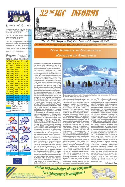
The Antarctic region is the last frontier of<br />
mankind on Earth. UNESCO has defined it<br />
“a common heritage of mankind, land of<br />
science and natural reserve”. In the 1980’s,<br />
the debate on exploration for mineral<br />
resources in Antarctica generated an<br />
increasing international interest towards this<br />
remote region. Many nations adhered to the<br />
Antarctic Treaty System. Italy entered in 1985<br />
with its first Antarctic expedition carried out<br />
by the Programma Nazionale di Ricerche in<br />
Antartide (PNRA).Geological research was<br />
then focused on reconnaissance mapping of<br />
the basement, the reconstruction of the<br />
Gondwana supercontinent, the definition of<br />
mineral provinces, and the singling out and<br />
exploitation of mineral and energy resources.<br />
The first geological programme of PNRA was<br />
called “Geology and primary resources”:<br />
geologists and geophysicists carried out<br />
surveys and collected rock samples along<br />
the Transantarctic Mountains, and the<br />
research vessel Explora collected kilometres<br />
of seismic lines in the peri-Antarctic seas.<br />
With the 19991 signing of the Madrid Protocol<br />
on Antarctic Environmental Protection, and<br />
its 50 year moratorium on resource<br />
exploration and exploitation, the research<br />
programmes were greatly reduced and<br />
opportunities for geological research declined.<br />
Nevertheless, the vast body of data already<br />
acquired contributed directly to the<br />
development of international cooperative<br />
programmes, such as ANTOSTRAT<br />
(Antarctic Offshore Stratigraphy), ANTALITH<br />
(Antarctic Lithospheric Exploration) and LIRA<br />
(Lithospheric Investigations in the Ross Sea<br />
Area). ANTALITH and LIRA gave fundamental<br />
contributions to basic knowledge of the<br />
geological formation of the continent and of<br />
its role during assembly and break-up of<br />
supercontinents.ANTOSTRAT produced a<br />
formidable data-set which is fundamental for<br />
planning the coring of sedimentary<br />
sequences at the Antarctic margins.<br />
International drilling projects of the Antarctic<br />
continental margins, with Italian participation,<br />
such as Cape Roberts Project, have<br />
recovered sedimentary material which allows<br />
to reconstruct the development of the<br />
Antarctic ice caps. At present the Antarctic<br />
ice caps contain 80% of the fresh water of<br />
the planet, equivalent to 60 m in average<br />
sea level rise if they melted completely. The<br />
sedimentary record reconstructed thanks to<br />
this project defined the history of Cenozoic<br />
fluctuations in the ice caps and in the sea<br />
level. Two new drilling projects in the Ross<br />
Sea will be accomplished by ANDRILL<br />
(Antarctic Drilling) in the next few years. This<br />
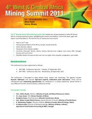
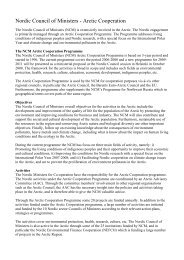
New frontiers in Geoscience:<br />
Research in Antarctica<br />
Emperor penguins looking at the Transantarctic Mountains and contemplating the future of...<br />
Geoscience research in Antarctica Mountains.<br />
topic was thoroughly discussed two days ago<br />
during the thematic session on Cenozoic<br />
Antarctic glacial history convened by Peter<br />
Barrett and Fabio Florindo.Other projects in<br />
which Italy is involved are ANTEC (Antarctic<br />
Neotectonics) and SALE (Subglacial<br />
Antarctic Lake Exploration). These<br />
programmes are designed to clarify important<br />
aspects of the Antarctic system. ANTEC<br />
studies the seismicity and the volcanism of<br />
the Antarctic plate, which is of particular<br />
interest being the only plate completely<br />
surrounded by mid-oceanic ridges. SALE<br />
coordinates the international efforts towards<br />
the exploration of the many lakes buried<br />
under thousand meters of ice. The subglacial<br />
lakes represent a unique environment on<br />
Earth which has generated interest among<br />
geologists, biologists, as well as<br />
astrobiologists in consideration of the<br />
similarities with extra-terrestrial settings.<br />
Subglacial lakes will be sampled only when<br />
absolutely non-contaminant technologies<br />
will be available. The ice in the Antarctic ice<br />
cap has preserved an accurate record of<br />
climatic variations in the last million year.<br />
These climatic changes are being studied<br />
by EPICA (European Project for Ice Coring<br />
in Antarctic). This project has recovered more<br />
than 3000 m of ice core at the drilling site<br />
near the French and Italian scientific station<br />
Concordia. The study of this core has revealed<br />
eight glacial-interglacial cycles, each<br />
approximately 100.000 years long. The first<br />
results were published in June issues of<br />
Nature. An important aspect of future<br />
Antarctic research will be directed to<br />
understanding how the continent and the<br />
surrounding oceans will respond to global<br />
warming. This involves improved measurements<br />
of the mass balance of the ice sheet,<br />
regional temperature trends and sea ice<br />
extent for contributing to climate modeling<br />
scenarios for future climate. It will also<br />
include the integration of geological data from<br />
outcrops and drill cores with palaeoclimate<br />
modeling studies. Each of these separate but<br />
complementary approaches from the earth<br />
and physical sciences community to<br />
concerns over global warming is being<br />
focused through two new programmes<br />
(Antarctica and the Global Climate System<br />
or AGCS, and Antarctic Climate Evolution or<br />
ACE) under consideration by the Scientific<br />
Committee on Antarctic Research. Their<br />
success will be crucial for a better informed<br />
international response to the consequences<br />
of global warming over the next few decades.<br />
The fourth International Polar Year (IPY) is<br />
planned for 2007-2008, in correspondence to<br />
the 50 th anniversary of the International<br />
Geophysical Year (1957-58). Several<br />
countries will participate and scientists are<br />
now requested to promote international<br />
cooperative research projects. These are<br />
expected to take an Earth Systems approach<br />
(interaction between lithosphere,<br />
atmosphere, cryosphere, hydrosphere and<br />
biosphere) and are also likely to involve “big<br />
science” for example the interaction between<br />
Arctic and Antarctic/Southern Ocean<br />
systems. This topic will be the focus of Joern<br />
Thiede’s talk in the session on “Big Science”<br />
in room 1 today. IPY will be the next<br />
milestone of international research in<br />
Antarctica. Geoscientists cannot miss this<br />
unique opportunity.<br />
Carlo Alberto Ricci
<strong>32nd</strong> 2 <strong>IGC</strong> <strong>INFORMS</strong><br />
<strong>August</strong> <strong>24</strong>, <strong>2004</strong><br />
The favourable impact of the 25-million scale “Maps of the<br />
world environments during the last two climatic extremes” (Last<br />
Glacial Maximum-LGM and Holocene Climatic Optimum-HCO)<br />
presented at the 31 st <strong>IGC</strong> in Rio de Janeiro 2000 together with<br />
the corresponding 1-million scale maps of France, both under<br />
the direction of Nicole Petit-Maire, prompted the idea of<br />
preparing similar kinds of maps of the Mediterranean area at<br />
an intermediate (4 to 5 million) scale, and large-scale (1 million)<br />
maps of Italy for presentation at the 32 nd <strong>IGC</strong> in Florence <strong>2004</strong>.<br />
Our aim was to check the quality level of the two large-scale<br />
maps largely based on the interpolation among a few validation<br />
points, and to improve the resolution of the maps by collecting<br />
a suitable amount of new data. The small-scale maps of this<br />
kind have a highly educational impact because they show the<br />
geographical changes that may derive from naturally caused<br />
climatic oscillations over short time intervals of a few hundred<br />
to a few thousand years. At large scale these maps may act<br />
as tools for land planning especially in coastal, low-plain and<br />
wetland transitional areas.Planning by the ENEA and Italian<br />
University teams, in co-operation with N. Petit-Maire, was not<br />
successful at the Mediterranean level and was not funded at<br />
the Italian level because of the present difficulties of domestic<br />
research institutions. In spite of this, we were able to produce<br />
a first version of the two maps, in partly digital and partly<br />
analogic format, which may act as a springboard for future<br />
whole digital development and improvements.We tried to keep<br />
the type of structure and legend characterizing the maps<br />
simple. Both the world and the French maps are<br />
palaeoenvironmental/palaeogeographic maps using mainly<br />
vegetation zones (biomes) plus geomorphological and<br />
lithological (loess/sand) units to infer palaeoenvironments.<br />
Bids for 33 rd <strong>IGC</strong>, 2008<br />
EGYPT’S BID FOR 2008<br />
Egypt’s bid for hosting the 33 rd <strong>IGC</strong> in 2008 was a chance to<br />
expose the world geologists to this geologically fascinating<br />
part of the world and a chance for young African and Middle<br />
Eastern Geologists to interact with the world community.<br />
Following the 31 st <strong>IGC</strong> meeting in Brazil, <strong>IUGS</strong> council<br />
members visited the country and expressed their feeling that<br />
Africa should be given a chance. A Steering Committee was<br />
preparing for presenting our bid but poor communications<br />
hindered the progress in that direction. Meanwhile. Norway<br />
and the Nordic Countries were steadily progressing to promote<br />
their bid and elegantly presented their credentials to the 32 nd<br />
<strong>IGC</strong> in Florence.We as representatives of the Egyptian National<br />
Committee of the Geological Sciences wish Norway and the<br />
Nordic Countries all the best and extend our hands to help.<br />
We are sure that they can produce a successful meeting in<br />
2008 as Italy did.<br />
M.Y. Zein El-Din, M.A. El-Sharkawi<br />
NORDIC COUNTRIES - OSLO FOR 2008<br />
International Geological Congresses were held in Norden twice<br />
during the last century, in Stockholm in 1910 and Copenhagen<br />
in 1960. The time is ripe for another Geo-Congress in this<br />
part of the world; its location, in Oslo, appropriately reflects<br />
the enterprise of Norwegian Earth Science today and the<br />
importance of geo-resources for society. Strong support from<br />
industry, academia and the Nordic geoscience community in<br />
general, is guaranteed; and there is an extra incentive - the<br />
Geological Survey of Norway celebrates its 150 th anniversary<br />
in 2008. The challenges facing the geo-resources industries<br />
today and the impact of resource exploitation on our<br />
environment are key issues for society and <strong>IGC</strong> 2008. The<br />
proposal to hold the World Geo-Congress 2008 in Oslo obtains<br />
its inspiration from the pioneering achievements of Nordic<br />
explorers and scientists. the discoveries of Greenland by Erik<br />
the Red and America by his son Leifur Eriksson the<br />
exploration, especially of the Polar Regions. At the time of<br />
the Copenhagen <strong>IGC</strong>, the potential of the continental shelves<br />
for hydrocarbons was, no more than a mirage on the horizon.<br />
In the late 1950’s and early 1960’s, marine geophysics was in<br />
its infancy, but growing fast. Sea-floor spreading had been<br />
conceived, but was not clearly understood until the marine<br />
magnetic anomalies over the mid-ocean ridges were defined<br />
and interpreted. Thereafter, sea-floor spreading and subduction<br />
provided plausible mechanisms for continental drift and opened<br />
the door for kinematic analysis of the constantly moving plates.<br />
In Norden today there are two vigorous developments.<br />
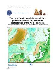
It was a Chilly Summer 20.000 Years ago in Florence<br />
Photo of the frontpage of “Lithopalaeoenvironmental maps of<br />
Italy during the last two climatic extremes”. 1:1,000,000<br />
G. B.Vai & L. Cantelli (eds)<br />
Concentrating on large-scale maps, we aimed at increasing<br />
the number of environments distinguished on the maps by<br />
The first is based on a recognition that small “sub-critical”<br />
neighbouring countries can benefit greatly from big science<br />
and technology by close cooperation. The Nordic Council of<br />
Ministers strongly promotes research and innovation with many<br />
new initiatives, not least by financing the establishment of<br />
Nordic research schools and internationally attractive centres<br />
of excellence. In parallel with this, there are national<br />
programmes to promote multidisciplinary research centres.<br />
Classical Earth Science, established on a foundation of maths,<br />
physics and chemistry, is expanding to embrace a wide range<br />
of other disciplines; industry is a strong partner. These trends<br />
will guide the Geo-Congress 2008 programme. The Earth<br />
Sciences have a prominent position in the overall scientific<br />
profile of the Nordic countries and the research is internationally<br />
recognised as being of high quality. This reflects economic<br />
dependence on natural resources and a long history of<br />
exploration. In this respect, classical Earth Science still has<br />
a stronghold in Norden; as will be amply demonstrated in the<br />
Congress Symposia and excursions. The most modern<br />
technologies characterize the scene today (for example, in<br />
Kiruna where much of the mining is remote-controlled).<br />
Industrial minerals experience a rapidly expanding market.<br />
Geothermal energy, long established as of paramount<br />
importance on Iceland, is now spreading everywhere in Norden.<br />
Hydroelectricity is a prime source of cheap electricity; nuclear<br />
power is widely used in Sweden and Finland, where it is<br />
expanding. And over the last forty years, oil and gas have<br />
come to dominate the Nordic realm. Now, as the off-shore<br />
targets become more difficult, the less accessible Arctic areas<br />
off the coasts of western and eastern Greenland and in the<br />
Barents Sea are attracting more attention. The wide high<br />
Arctic continental shelves, the logistics are difficult, but the<br />
resource potential vast. Understanding today’s climate<br />
variability and change can only be achieved against the<br />
backcloth of the historic and the pre-historic records that<br />
palaeoclimatologists are providing. The bathymetry Mapping<br />
of the Arctic basin is providing new insight into the Pleistocene<br />
glacial history. Evidence of glacial erosion and scouring is<br />
found on both the Arctic continental shelves and the shallow<br />
mid-oceanic ridges, indicating the extent and thickness of<br />
previous glacial maxima. Studying (from ice-cores and other<br />
proxies) the timing and velocity of Cenozoic change in<br />
temperature in the Arctic, with the growth and retreat icesheets,<br />
and comparison with the Antarctic record, is providing<br />
an essential platform for understanding what is happening to<br />
our climate today. And as our high Arctic science expands,<br />
we have new opportunities to assess the impact of industrial<br />
activity on the Arctic environment; the source and extent of<br />
androgenic pollution and the needs for mitigation. As Resource<br />
The Arctic will have an increasingly important role to play in<br />
the coming years of resource management on global scale,<br />
vital for world economy. High Arctic research is gathering<br />
momentum in all the main disciplines concerned with the<br />
introducing more geomorphological and more lithological units,<br />
thus obtaining maps showing closer relationships between<br />
environments and geology/bedrock. This was particularly<br />
effective for the LGM map, when the increased gradient and<br />
erosion combined with drier conditions largely reduced the<br />
extent of vegetated areas. The time slices (given in 14 C<br />
calibrated BP ages) adopted in this work differ slightly from<br />
the previous maps being set at ca 22,000 ± 2000 a cal BP for<br />
the LGM with an average surface air temperature about 4.5°C<br />
lower than today’s; ca 8,000 ± 1000 a BP for the HCO with an<br />
average surface air temperature about 2°C higher than today’s.<br />
The maps, co-authored by over 40 specialists, give an idea of<br />
the impressive changes that can affect the Earth’s surface as<br />
a consequence of purely natural causes. In spite of the low<br />
extent of the Apennine glaciation, 20 ka ago the desiccated<br />
Adriatic Sea together with the Po Plain became a periglacial<br />
loess-covered plain, the western lobe of the large Pannonian<br />
loess basin. Chilly winds extended beyond the Apennine divide<br />
invading the dried internal plains such as Florence . Sea level<br />
drops of about 150 and 13 m computed for the LGM and HCO,<br />
respectively, are consistent with the observations collected.<br />
Differences from present conditions in many environmental<br />
and climatic indicators are readly apparent for the LGM and<br />
also for some critical coastal areas of the HCO. An additional<br />
difference between the HCO and the present is an increase in<br />
today’s marine surface temperature of the Tyrrhenian and<br />
Ionian seas by 2 to 3 °C.Maps and Explanatory Notes are<br />
available at the booths 2 nd <strong>IGC</strong> Bologna 1881 (no. 151-152)<br />
and Litografia Artistico Cartografica s.r.l. of the GeoExpo <strong>2004</strong>.<br />
Claudio Margottini and Gian Battista Vai<br />
geosphere, biosphere and atmosphere. Major investigations<br />
of the Lomonosov Ridge will take place in <strong>2004</strong> (IODP’s<br />
ARMADA expedition drilling project near the North Pole);<br />
transects across the Arctic basin are planned for 2005.<br />
Preparations for the International Polar Year 2007-8 are<br />
underway, with ambitious projects for international cooperation.<br />
<strong>IGC</strong> 2008 in Oslo will provide an ideal forum for presentation<br />
of the results of all these activities. An Arctic Consortium is<br />
being established to plan the key Arctic components of <strong>IGC</strong><br />
2008 – symposia, workshops, short courses and excursions.<br />
Richard Sinding-Larsen,<br />
Chairman of the Nordic Bidding Commitee<br />
Bids for 34 th <strong>IGC</strong> 2012<br />
AUSTRALIA BID TO HOST 34 TH <strong>IGC</strong> “DOWN UNDER”<br />
The Oceania region – encompassing Australia, New Zealand,<br />
Papua New Guinea and the South Pacific island nations – is<br />
seeking your support for AUSTRALIA 2012, its bid to host<br />
the 34 th <strong>IGC</strong>. Oceania is exciting, scenically rich, geologically<br />
fascinating, and its cultures and heritage contrast with anything<br />
that can be experienced in the northern hemisphere.The theme<br />
of AUSTRALIA 2012, scheduled for Brisbane, Queensland,<br />
in <strong>August</strong> 2012, is Unearthing our Past and Future. This theme<br />
would carry forward <strong>IUGS</strong>’ Planet Earth initiative. The Congress<br />
would include a GeoExpo, and education outreach and Geohost<br />
support programs.The Oceania region’s geological record, from<br />
the most ancient to the modern, would be on offer through<br />
many field trips, covering the whole region.Underpinned by its<br />
diverse range of geological features and a major resources<br />
sector, Oceania has a strong and proactive geoscience<br />
community that is conducting innovative research across all<br />
disciplines of interest to <strong>IUGS</strong>, and is committed to delivering<br />
an outstanding <strong>IGC</strong>.Australia and New Zealand are safe and<br />
welcoming countries. Brisbane is the gateway to the Great<br />
Barrier Reef and the Aussie outback, and provides easy<br />
access to the region. It has superb sunny weather in <strong>August</strong>.<br />
AUSTRALIA 2012 would be held in the state-of-the-art<br />
Brisbane Convention & Exhibition Centre, a pleasant stroll<br />
across the river from city hotels.With good international<br />
access, discount airfares and low costs for quality<br />
accommodation, food and transport, the total cost for delegates<br />
coming from most northern hemisphere countries would not<br />
be any higher than for many meetings of similar duration closer<br />
to home. Yet AUSTRALIA 2012 would provide a once-in-alifetime<br />
opportunity to experience the geology, scenery and<br />
cultures of this magnificent region that has so far hosted only<br />
one <strong>IGC</strong>.Visit GeoExpo booths 112/113 for a preview of the<br />
possibilities on offer if the 34 th <strong>IGC</strong> is staged in Brisbane.
<strong>August</strong> <strong>24</strong>, <strong>2004</strong><br />
“The Carbon Cycle and Hydrology in the Paleo-Terrestrial<br />
Environments” symposium is dedicated to the memory of<br />
Professor Hugues FAURE (1928-2003)<br />
Hugues Faure is among the leading scientists who set up<br />
the bases of modern Quaternary research. While he was 21<br />
years old, he left Paris to discover Africa. His studies of the<br />
Quaternary lake deposits of Eastern Niger opened a new field<br />
of research. He was the first to show that southern Sahara<br />
was wet and covered by lakes between 9000 and 7000 years<br />
BP. He showed that water resources in this region are tied to<br />
Quaternary climate changes, highlighting the impacts of<br />
Milankovitch cycles on tropical climate. After his state<br />
doctorate in 1962, he became lecturer at the University of<br />
Dakar, and then in 1968 Professor at the Pierre and Marie<br />
Curie University of Paris. After 1968, his research work<br />
focused on the Afar region in collaboration with Haroun Tazieff<br />
(CNRS) and Georgio Marinelli (Pisa University). He proposed<br />
a geodynamic model of the Aden-Afar-Red Sea system. In<br />
1969, Hugues Faure was nominated President of the<br />
Technical Committee of Geology at ORSTOM (“Office de la<br />
Recherche Scientifique d’Outre-Mer”) and then in 1970 he<br />
became Director of the Laboratory for Quaternary Geology<br />
(LGQ). At this period, he drew a generation of French students<br />
towards Quaternary Geology. In 1982, he was elected<br />
President of the International Union for Quaternary Research<br />
(INQUA), where he served until 1987. As president of INQUA,<br />
he was involved in the development of the International<br />
Geosphere-Biosphere Programme. His later research work<br />
(1991-2003) was devoted to the study of the carbon cycle<br />
during the last glacial maximum and the Holocene in the<br />
framework of the <strong>IGC</strong>P 404 project and the INQUA Carbon<br />
Commission of which he has been President until his death<br />
INDIAN PROPOSAL TO HOST THE 34TH <strong>IGC</strong>,<br />
HYDERABAD,2012<br />
INDIA, a land with all its diverse, geographical, geological,<br />
racial and cultural trappings, caught in a technological vortex<br />
that has spun a mosaic of vibrant and colourful facets of<br />
Indian society.The Indian Proposal. It is proposed to hold the<br />
34 th <strong>IGC</strong> for 10 days from July 23-31, 2012 with the opening<br />
ceremony on July 22 nd , 2012. The scientific sessions will take<br />
place for 8 days and during the weekend delegates will have<br />
the opportunity to select from a range of short tours which will<br />
be offered. All organizations affiliated to <strong>IUGS</strong> will be invited<br />
to participate and contribute to the development of the<br />
scientific program. The organizing body of the <strong>IGC</strong> will be the<br />
National Geographical Research Institute (NGRI), Hyderabad,<br />
an outstanding scientific institution in geosciences with a staff<br />
of more than 800 scientists and technicians to support this<br />
event. The Institute is located in a campus extended over a<br />
170-acres with good infrastructure facilities adhering to the<br />
internationally set benchmarks. The institute also has proven<br />
capabilities for organizing national and international conclaves.<br />
Congress Theme The theme of the <strong>IGC</strong> in India will be<br />
“Geosciences for Sustainability”, which addresses the very<br />
basic question of human existence in view of the increase in<br />
world’s population and expanding urbanization. Program The<br />
following themes are likely to form the basic outline in<br />
formulating the scientific program into different categories:<br />
Geosciences – global concerns – Progress in International<br />
Geosciences Projects;Dynamic earth-continent-continent<br />
collision zones – Perspective-Natural Hazards and<br />
Mitigation;Geosphere-Biosphere interaction – Tectonics of the<br />
Indian Ocean;New concepts in Plate tectonics –<br />
Paleoclimatology – impact on present day climate; Mitigating<br />
the effects of waste pollution – Global climate change –<br />
Managing resources and sustaining the environment.<br />
Hyderabad – The capital city of Andhra Pradesh offers a<br />
fascinating panorama of the past, with a rich blend of cultural<br />
and historical traditions spanning over 400 years. Hyderabad<br />
ranks highest on all parameters that are the principal factors<br />
of an event like the <strong>IGC</strong>: affordable city, English language<br />
and cosmopolitan culture, cutting edge IT infrastructures and<br />
telecommunications, quality power and convenient<br />
transportation, good law enforcement, government incentives,<br />
stability and transparency.Hyderabad is well connected from<br />
all parts of the globe by air. The airport is located in the heart<br />
of the city. And many star hotels are situated within a range of<br />
10 km. The proposed <strong>IGC</strong> venue is about 12 km from the<br />
airport. The Exhibition & Convention Centre was inaugurated<br />
in January 2003 and is one of the most modern in the country,<br />
with magnificent facilities spreading over nearly 100 acres next<br />
to an information technology park area. Lived Coverage of<br />
Technical Sessions Selective sessions will be telecast live<br />
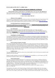
The curiosity of Hugues Faure (1928-2003)<br />
Hugues Faure<br />
“ As the first man on the first day of creation,<br />
he was innocent, full of wonder and curiosity “<br />
in 2003.The <strong>IGC</strong>P 459 project is rooted in the activities of the<br />
INQUA Carbon Commission (now a sub-commission) and the<br />
earlier 404 <strong>IGC</strong>P project led by Hugues Faure. The main<br />
objective of the <strong>IGC</strong>P 459 projects is to couple the water<br />
cycle and the carbon cycle to study the different terrestrial<br />
carbon reservoirs and the mass transfers between them, as<br />
through INSAT-2E, which is the fifth of the second generation<br />
INSAT-2 spacecraft designed and built in India by the Indian<br />
Space Research organization. The INSAT-2E footprint covers<br />
the Asia-Australia Land Mass Coverage (LMSS). This extends<br />
from Australia to Russia in the north-south direction and Japan<br />
to Central Europe in the east-west direction.<br />
BID FOR THE 34 th <strong>IGC</strong> “IRELAND 2012”<br />
Ireland a perfect place to meet. Ireland is an Atlantic island<br />
on the western margin of Europe. It is very accessible by air,<br />
being served by a wide range of airlines, with international<br />
leaders in cheap fares. Ireland has been a member of EU for<br />
30 years and has a population of 3.5 million. Ours is a<br />
knowledge-based entrepreneurial economy that has driven a<br />
fundamental change in the past decade from a net emigrant<br />
society. Ireland is now a cosmopolitan destination which still<br />
ménages to retain its cultural identity. In the period 1985 to<br />
2002 the number of overseas visitors climbed from less than<br />
2 to well over 6 millions. In finalizing a formal proposal to host<br />
the 34 th <strong>IGC</strong>, we would be seeking the scientific and the<br />
logistical support of coastal Atlantic States, with which Ireland<br />
has a long-standing tradition of endeavouring scientific<br />
collaboration.We have a diverse range of geological<br />
landscapes, from Precambrian to Pleistocene: the karst of<br />
the Burren and the columnar basalts of the Giant’s Causeway<br />
have long been major tourist attractions. Dublin – A city of<br />
character and culture Dublin, capital of Ireland, is on its<br />
east coast and its greater area has a population of over 1<br />
million. Its history extends back over 1000 years embracing<br />
Norse, Norman and English periods. Dublin is also a modern<br />
city whose centre has been thoroughly revitalised in the past<br />
twenty years. It is now an established and growing tourist<br />
destination which is regarded as very safe. June/July is the<br />
preferred time to hold this prestigious event – when the weather<br />
is mild (20°C) and the evenings long. It has an excellent range<br />
of hotels, but also guest houses, hostels and university<br />
accommodations. Dublin has a history of hosting large<br />
convections with flair and without fuss. Ireland is Englishspeaking<br />
and part of the Euro-zone, convenient factors for<br />
many visitors. The RDS –An outstanding congress venue<br />
The RDS – Royal Dublin Society – was founded in 1731 and it<br />
has long been a respected feature of the national landscape.<br />
It is now the premier convention centre in Ireland, used to<br />
hosting world-class events such as the <strong>IGC</strong>. The congress<br />
venue is located 1.5 km from the city centre in the business<br />
and embassy district, within easy reach of accommodation,<br />
hotels, pubs and entertainment.In making this bid we are<br />
confident of the full support of all relevant authorities and<br />
organizations: The Royal Irish Academy, the major learning<br />
society in Ireland and the affiliating body of <strong>IUGS</strong>/<strong>IGC</strong>; The<br />
national tourism and convention organisations; The city of<br />
Dublin and its Lord Major; The geoscience community,<br />
3<br />
32 nd <strong>IGC</strong> <strong>INFORMS</strong> 3<br />
well as between the terrestrial reservoirs and<br />
the atmospheric and oceanic reservoirs. The<br />
project is organised in six working groups: (1)<br />
biomes and vegetation, (2) soils and peats,<br />
(3) rivers, ground waters, lakes, rock<br />
weathering, (4) geological processes, (5)<br />
isotope tracing, and (6) modelling. The<br />
symposium was designed as really<br />
multidisciplinary, focusing both on carbon and<br />
water cycles and encompassing all geological<br />
timescales from the recent period to the<br />
Holocene, Pleistocene,Neogene and<br />
Paleogene, Phanerozoic and even Late<br />
Archean. The studied processes involve<br />
weathering and river transport of carbon,<br />
deposition of pedogenic carbonates, geological<br />
emission of carbon dioxide and methane,<br />
charcoal deposition, paleovegetation dynamics<br />
and climate-vegetation interactions. It<br />
integrates a wide range of data (geochemistry, isotopes, pollen<br />
and sedimentary deposits, etc), as well as modelling studies.<br />
Keynote speaker is J. Veizer (Ruhr University Bochum,<br />
University of Ottawa). Invited presentations will be given by<br />
Y.G. Ryskov (Institute of Physico-Chemical and Biological<br />
Problem in Soil Science, Russia), P. Smolka (University<br />
Muenster) and D. Jolly (University of Montpellier II). A joint<br />
publication of the symposium is planned.This topical<br />
symposium of the <strong>32nd</strong> International Geological Congress is<br />
organised in the framework of CHANGES - Carbon, Hydrology<br />
and Global Environmental Systems and more specifically the<br />
<strong>IGC</strong>P 459 project.<br />
L. François, L. Probst<br />
consisting of universities and research institutes, the<br />
Geological Survey of Ireland and the geological Survey of<br />
Northern Ireland, and private sector consultancies and<br />
companies; The government of Ireland has not yet been<br />
approached but can be expected to view the Congress very<br />
positively. Why Ireland? Twenty years ago Ireland could not<br />
have considered making this bid, even five years ago we would<br />
not have this confidence. But the time is now ripe for Ireland<br />
to do so: Ireland has a rich geological heritage, a vibrant<br />
geological community, collaborative links with Atlantic<br />
neighbours, and creative energy necessary to make a success<br />
of <strong>IGC</strong> 2012. Please give us the opportunity to prove it.<br />
MOROCCAN BID TO HOST 34 th <strong>IGC</strong> “UNDER THE<br />
AFRICAN SUN”<br />
Since the 1 st <strong>IGC</strong> in Paris in 1878, Africa organized only two<br />
<strong>IGC</strong>s: in 1929 in Pretoria (South Africa) and in 1952 in Alger<br />
(Algeria). Morocco is the geological crossroad between Africa,<br />
America and Europe: it represents a real memory of the Earth<br />
(paradise of geologists). Morocco is a country of tolerance,<br />
authenticity and modernity, renown for its hospitality. Morocco<br />
is open to the world and to universal cultures. Located at the<br />
extreme NW of Africa, neighbouring with Spain, Mauritania<br />
and Algeria, it has an area of 710,850 km 2 . Morocco has 28<br />
million inhabitants among which Islam coexists in harmony<br />
with other religions as Judaism and Christianity. The official<br />
language is Arab, but French, Spanish, and English are<br />
widespread together with the local Tamazight. Currency is<br />
Dirham (Dh) (1US Dollar =10 Dh). Morocco has a very long<br />
coast (3500 km) spanning from the Mediterranean Sea to the<br />
Atlantic, and joined by a mountain range (Toubqal, 4165 m in<br />
the High Atlas range, is the highest in the Maghreb region),<br />
plains, desert and oasis landscapes with a continental and<br />
Mediterranean climate.Morocco may be divided into three<br />
geological domains: Rif domain with Alpine mountain ranges<br />
includes Paleozoic, Mesozoic and Cenozoic formations; The<br />
Atlas domain and the Meseta. Meseta: epi-Variscan platform,<br />
Mesozoic and Cenozoic cover (phosphate mines). Atlas<br />
mountain ranges: Mesozoic and Cenozoic carbonate<br />
sedimentary rocks, Paleozoic basement; Sahara domain<br />
dominated by Archean in the SE covered by Paleozoic to the<br />
north and Cenozoic to the west. The city of congress would<br />
be Marrakech, the mystic imperial city founded in the IX century<br />
at the foot hills of high Atlas. Marrakech is near various<br />
geological outcrops (Archean to Quaternary) and is a privileged<br />
destination for tourists. The local geological community<br />
consists of more than 3000 people, organized in the Geological<br />
Survey of Morocco (geological infrastructure), 2 Public offices<br />
(ONHYM,OCP), 17 Universities, 2 Engineering schools, 2<br />
Institutes and affiliated associations (SGM, MAPG, GPPM).<br />
It represents the guarantee for a high standard of organization.
<strong>32nd</strong> 4 <strong>IGC</strong> <strong>INFORMS</strong><br />
<strong>August</strong> <strong>24</strong>, <strong>2004</strong><br />
Bookstore<br />
The publications prepared for the <strong>32nd</strong> <strong>IGC</strong> Florence <strong>2004</strong><br />
will be on sale at special price at the Booths # 151-152:<br />
G.B. Vai & L. Cantelli<br />
(eds)<br />
“Litho-palaeoenvironmental<br />
maps<br />
of Italy during the last<br />
two climatic<br />
extremes.”<br />
Two maps at<br />
1:1,000,000 scale<br />
and<br />
F. Antonioli &<br />
G.B. Vai (eds)<br />
“Explanatory Notes”<br />
LAC<br />
Firenze, <strong>2004</strong><br />
Euro 10.00<br />
Wine and Geology<br />
Which are the relationships between geology and wine? How<br />
do the composition of the substratum , weathering, soil<br />
development, climate and landscape influence the organoleptic<br />
characters of the wine? Has intensive viticulture negative effects<br />
on slope stability on steep slopes? This multidisciplinary<br />
subject is new for a large international geological congress<br />
and generated a lot of interest, as shown by the large<br />
attendance and by the quality and diversity of the presentations<br />
that included overviews of wine districts from various parts of<br />
the world (Italy, France, Germany, Austria, USA, Australia,<br />
South Africa, etc.) and more focussed contributions on slope<br />
stability, geochemical characters of the vineyards, influence<br />
of climate change on distribution of vinegrapes, and predictable<br />
northward extension in Europe of red cultivars. The poster<br />
session was followed by a very successful and crowded winetasting<br />
party: indeed, all the participants in the symposium<br />
were requested to bring one (or more) bottle of wine, so that a<br />
choice of good to extraordinary wines was offered. To mention<br />
just a few examples, there was an aged (1996) Sauterne offered<br />
by Robert Bourrouilh from his own property, a magnum of<br />
Franciacorta Brut offered by Sergio Chiesa, a red Empranillo<br />
from Oregon produced by Gregory Jones, a Chianti Classico<br />
of the Province of Siena. A competition for the best poster<br />
(however, no prize has been given, due to shortage of time)<br />
gave the following results: First prize: Poster 78-25 (booth<br />
481) “Franciacorta: from an old tradition to a modern success<br />
story”, by Sergio Chiesa and Roberto Ravelli; Second prize:<br />
Poster 78-21 (booth 477) “Valtellina (Sondrio, northern Italy),<br />
the second most important terroir for the Nebbiolo grape in<br />
the world”, by Guido Mazzolari, Barbara Aldighieri and seven<br />
more authors; Third prize: Poster 78-27 (booth 483) “Oltrepo<br />
Pavese (northern Italy), Geomorphology, training methods and<br />
UTB”, by Lamberto Laureti and Stefano Campagnolo.<br />
M.B. Cita<br />
WANTED MOVIE MAKER, 3D GLOBAL GRAPHICS<br />
PRODUCER OR PUBLISHER to illustrate my new concept of<br />
the mechanism and forces which caused our continental<br />
movements.<br />
Contact JOHN RUTHERFORD at the General Information<br />
Desk (near the Slide Centre) every day 11.50 – 11.55<br />
First International Earth Science Film Festival<br />
The Scientific Cinematography Department of CNR-IRPI of<br />
Cosenza attended <strong>IGC</strong> meetings for many years to promote,<br />
on behalf of the Italian scientific community, Earth Science<br />
knowledge to a vast public using audio-visual media. On the<br />
occasion of the 32 nd International Geological Congress held<br />
in Florence, the Scientific Cinematography Department and<br />
the OGS (Trieste) organised the First International Earth<br />
Science Film Festival, that will be officially presented to the<br />
press today at 11:30 a.m., and movies will be shown from<br />
<strong>August</strong> 25 to 27. The Festival is devoted to scientific, teachingaid<br />
videos and multimedia products in the field of Earth<br />
Sciences, and presents videos from the following countries:<br />
USA, Switzerland, Germany, UK, Italy, Russia, Iran, France,<br />
Soudi Arabia, Spain and Greece. This Congress is the natural<br />
seat to introduce the first edition of the International Earth<br />
Science Film Festival. The Cinematography Department and<br />
the National Institute of Oceanography and the Applied<br />
MEETINGS <strong>August</strong>, <strong>24</strong><br />
ROOM<br />
53rd <strong>IUGS</strong> Executive Committee<br />
Meeting with Affiliated Organizations 17:30 - 19:30 14<br />
AEGS Executive Committee 17:30 - 19:30 33<br />
Arab Geologists Association 17:30 - 19:30 21<br />
CCM (IMA Work. Group) 17:30 - 19:30 2<br />
CGI 14:00 - 19:30 31<br />
CGM (IMA Work. Group) 17:30 - 19:30 3<br />
CICA (IMA Work. Group) 17:30 - 19:30 4<br />
CMGIP (IMA Work. Group) 17:30 - 19:30 5<br />
CNMMN (IMA Work. Group) 17:30 - 19:30 6<br />
COM (IMA Work. Group)<br />
Commission on Coastal and<br />
Marine Processes Int. Union for<br />
17:30 - 19:30 7<br />
Quaternary Research 17:30 - 19:30 30<br />
CPM (IMA Work. Group) 17:30 - 19:30 8<br />
FOREGS and <strong>IUGS</strong>/IAGC 17:30 - 19:30 38<br />
IAEG (n°17) 17:30 - 19:30 12<br />
IIAEG (n°14) 17:30 - 19:30 32<br />
IAGOD Council Meeting 9:00 - 14:00 33<br />
IAMG Committee Meeting,<br />
Editorial Board 9:00 - 17:00 37<br />
<strong>IGC</strong>P 459 17:30 - 19:30 23<br />
<strong>IGC</strong>P 467 17:30 - 19:30 36<br />
INQUA Comm. on Terrestrial<br />
Processes 17:30 - 19.30 13<br />
<strong>IUGS</strong> Comm. on Geo indicators 17:30 - 19:30 37<br />
Meeting on Euroarray 17:30 - 19.30 11<br />
Ophiolites Meeting Group 17:30 - 19:30 15<br />
WGIM (IMA Work. Group) 17:30 - 19:30 9<br />
WGME (IMA Work. Group) 17:30 - 19:30 10<br />
Geophysics (OGS) jointly conceived and promoted this review<br />
that will take place every two years. The organizers hope to<br />
share their enthusiasm with the participants in the 32 nd <strong>IGC</strong><br />
and, through them, involve a larger public to the discovery and<br />
understanding of all the wonders of the planet we live in,<br />
informing about progress of Earth Sciences. The Earth Science<br />
Film Festival will assign prizes and awards to the best authors,<br />
film directors and productions in all geological disciplines. An<br />
international jury, composed by Mario Apice (Italy), Erns Lasse<br />
(Sweeden), Maurizio Parotto (Italy), Vincenzo Ricca (Italy),<br />
Beatrice Sonhuter (Germany), Elena Titova (Russia), Jan-<br />
Léonard Touadi (Congo), decided the nominations of the best<br />
films that will be shown in Teatrino Lorenese. The conclusive<br />
ceremony will be held in Trieste on October <strong>2004</strong>. Further<br />
information on the site : www.ogs.trieste.it/FilmFestival/<br />
filmfestival.htm.<br />
Teodoro Mercuri<br />
TIME<br />
10.00<br />
10.20<br />
10.50<br />
11.05<br />
11.30<br />
12.30<br />
15.00<br />
15.10<br />
15.25<br />
16.05<br />
16.25<br />
17.00<br />
THE STAFF<br />
SCIENCE TEATRE ROOM35<br />
PROGRAMME AUG. <strong>24</strong><br />
TITLE<br />
I vulcani dei Maya<br />
Le due Terre del Fuoco<br />
Morocco, memory of the Earth<br />
Ghiacciai Bulldozer<br />
1 st International Earth Science Film<br />
Festival - Presentation and Press<br />
BREAK<br />
The Plio-Quaternary Geological<br />
Evolution of the Firenze Basin<br />
Il Paradiso Rosso<br />
Why the Antarctic<br />
Un vulcano alla Vaniglia<br />
Il Mistero del lago Izabal<br />
The geological heritage of turkey<br />
Logistics at Work<br />
COUNTRY<br />
Italy<br />
Italy<br />
Morocco<br />
Italy<br />
Italy<br />
Italy<br />
Italy<br />
Italy<br />
Italy<br />
Turkey