
You also want an ePaper? Increase the reach of your titles
YUMPU automatically turns print PDFs into web optimized ePapers that Google loves.
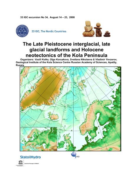
33 IGC excursion No 34, August 14 – 23, 2008<br />
The Late Pleistocene interglacial, late<br />
glacial landforms and Holocene<br />
neotectonics of the Kola Peninsula<br />
Organizers: Vasili Kolka, Olga Korsakova, Svetlana Nikolaeva & Vladimir Yevzerov,<br />
Geological Institute of the Kola Science Centre Russian Academy of Sciences, Apatity,<br />
Russia.
TABLE OF CONTENTS<br />
Abstract ……………………………………………………………………………………………3<br />
Logistics..................................................................................................................................3<br />
Dates and location....................................................................................................3<br />
Travel arrangements ................................................................................................3<br />
Accommodation ......................................................................................................3<br />
<strong>Field</strong> logistics............................................................................................................3<br />
General Introduction ..............................................................................................................5<br />
Quaternary stratigraphic records of Kola Region …………………………………………..5<br />
Excursion Route and Road Log.................................................................................... …..12<br />
Excursion Stops ......................................................................................................13<br />
Day 1 ........................................................................................................................13<br />
Museum of Geology and Mineralogy, Geological Institute KSC RAS………………………….13<br />
Day 2 ..................................................................................................................................... 15<br />
Excursion 1: Glacial landforms of N-W Lovozero Mountains………………………………….. 15<br />
Stop 1. Plateau‐like summit of the Alluaiv Mountain (1051 m a.s.l.)……18<br />
Excursion 2: Late Glacial ice-marginal formations in Lovozero area………..................... 22<br />
Stop 2. Marginal ridge to the north of the Lovozero Mountains……………..…24<br />
Stop 3. Dump moraine ridge - the inner band of Revdozerskii marginal belt. 25<br />
Stop 4. Dump moraine ridge bordered with the push ridge - the inner band<br />
of Revdozerskii marginal belt..............................................................28<br />
Stop 5. Push moraine ridge - outer band of marginal belt of Revdozerskii<br />
marginal belt......................................................................................... 31<br />
Day 3……………………………………………………………………………………. .33<br />
Excursion 3: Late Glacial ice-divide and ice-marginal formations on the<br />
White Sea coast……………………………………………………………………………………...33<br />
Stop 6. Glaciofluvial ridge in the valley of the Kolvitsa River………………….33<br />
Stop 7. Quarry opening the glaciofluvial ridge Vilasselga in the valley<br />
of the Kolvitsa River……………………………………………………...35<br />
Stop 8. Late Glacial ice-marginal formation - dump moraine of the inner<br />
band of Revdozerskii marginal belt………………………………………36<br />
Excursion 4. Late Glacial and Holocene evolution of Kandalaksha Bay<br />
recorded in bottom sediment lithostratigraphy of raised coastal lakes and shoreline<br />
features………………………………………………………………………………………………37<br />
Stop 9. Raised coastal features of Turii Peninsula and bottom sediment<br />
lithostratigraphy of Pridorozhnoye Lake………………………………………………………….40<br />
Stop 10. Holocene coastal landforms on the Korabl ridge slope……………..43<br />
Day 4……………………………………………………………………… 45<br />
Excursion 6. Upper Pleistocene marine sediments in the southern Kola Peninsula………...45<br />
Stop 11. Varzuga section of the Upper Pleistocene marine sediments……..48<br />
Excursion 7. Archeological monuments as a demonstration of the Holocene tectonics…….52<br />
Stop 12. Kandalaksha stone labyrinth……………………………………………..52<br />
Day 5……………………………………………………………………………………..54<br />
Excursion 8. Paleoseismic dislocations in the area of Imandra and Chunozero Lakes, central<br />
part of Kola region…………………………………………………………………………………..54<br />
Stop 13. Paleoseismic dislocation “Chuna”……………………………………..57<br />
Excursion 9. Late Glacial landforms on Southern Khibiny Mountains …………………………..59<br />
Stop 14. Marginal moraine ridge on which the city of Kirovsk is located……….63<br />
Stop 15. Top of marginal moraine ridge in the Malyi Vud'javr valley…..………..64<br />
Stop 16. The aqueoglacial plain in the valley with Malyi Vud'javr Lake………...65<br />
Stop 17. The Tachtarvumchorr cirques……………………………………………66<br />
References……………………………………………………………………………………70<br />
2
Abstract<br />
Partisipants will examine: well preserved push and damp marginal moraines, subglacial<br />
interlobate ridge, and their geological structures (western part of the Kola Peninsula);<br />
landforms resulted from the glacial activity and displaying long-term glacial-erosion features<br />
and smaller scale landforms which in great detail record the process of the deglaciation of<br />
the area, as the glacial cirques, marginal moraines, end moraines, hummocky moraines, De<br />
Geer moraines, lateral meltwater channels, spillways, troughs, delta formations, ice-dammed<br />
lake shoreline, tor-formations (Khibiny and Lovosero Mountains); features of the<br />
glaciotectonic rising of the Kola Peninsula in the form of the isostatically raised beach ridges<br />
(coast of the White sea) and the seismodislocations caused by the neotectonic activity of the<br />
Baltic Shield (area of the Lake Imandra); the well known in the region interglacial section of<br />
marine sediments, which bear the evidences of the glacio-eustatic marine transgression<br />
(valley of the Varzuga River).<br />
Logistics<br />
Dates and location<br />
Timing: August 15 –August 20<br />
Start location: Murmansk airport<br />
End location: Murmansk airport<br />
Travel arrangements<br />
The post-IGS excursion will start August 16 from Apatity. The Participants should arrive at<br />
the airport of Murmansk August 15 from where they will be taken to Apatity by bus (2.5<br />
hours). The following routes to Murmansk are being considered. (A) Fly to St.Petersburg or<br />
Moscow and then from St.Petersburg or Moscow directly to Murmansk (most preferable,<br />
flights daily); (B) fly Oslo to Murmansk or fly Oslo to Tromsø and then Tromsø to Murmansk<br />
(flights four time a week). (C) Alternative direct fly from Moscow or St. Petersburg to<br />
Apatity (flights twice a week). Departure to Oslo August 20 by (A) Fly to St.Petersburg and<br />
then from St.Petersburg to Oslo (most preferable, flights daily); (B) Fly from Murmansk to<br />
Oslo or Murmansk to Tromsø and then Tromsø to Oslo (4 flights a week).<br />
Accommodation<br />
Hotel accommodations are planned in Apatity and Kandalaksha. Blocks of single and double<br />
rooms will be reserved for participants, no additional arrangements needed. In Varsuga<br />
village accommodation is planned in a tourist camping on the beautiful Varzuga River shore.<br />
<strong>Field</strong> logistics<br />
Transport: In order to reach all geological objects situated 50 – 300 km far from Apatity, the<br />
trip will be run with 20-seat off-road bus-like truck with experienced geologist driver.<br />
Besides, such truck is the only vehicle available for the localities which we are going to visit<br />
during excursion. For trip from Murmansk Airport to Apatity (200 km from Apatity) and back<br />
we arranged comfortable bus.<br />
3
Breakfast and dinner are usually associated with overnight accommodation. Lunches are<br />
planned in the nice outcrops in the field and trip organizers will prepare all necessary lunch<br />
materials.<br />
Weather: Kola Peninsula is situated at the latitude of 68 degrees N behind the polar circle.<br />
Besides, Khibina and Lovozero massifs occupy mountainous area up to 1200 m above sea<br />
level. Because of these two factors temperature during excursion may vary dramatically from<br />
+25 o C near the Apatity town down to +10 o C at the top of the mountains. Weather in the middle<br />
of August on White Sea shore is usually mild and cloudy. Rains are quite often.<br />
4
General introduction<br />
Kola Peninsula is a key area for understanding of the glaciations evolution, especially at their<br />
final stages, of the development of glacioisostatic, eustatic and tectonic events during the Late<br />
Glacial and Interglacial time, and the character of interaction between the Ice Sheet and local<br />
mountain glaciations in high latitudes conditions.<br />
During the field trip we will examine: well preserved push and damp marginal moraines,<br />
subglacial interlobate ridge, and their geological structures (western part of the Kola<br />
Peninsula); landforms resulted from the glacial activity and displaying long-term glacialerosion<br />
features and smaller scale landforms which in great detail record the process of the<br />
deglaciation of the area, as the glacial cirques, marginal moraines, end moraines, hummocky<br />
moraines, De Geer moraines, lateral meltwater channels, spillways, troughs, delta formations,<br />
ice-dammed lake shoreline, tor-formations (Khibiny and Lovosero Mountains); features of the<br />
glaciotectonic rising of the Kola Peninsula in the form of the isostatically raised beach ridges<br />
(coast of the White sea) and the seismodislocations caused by the neotectonic activity of the<br />
Baltic Shield (area of the Imandra Lake); the well known in region interglacial section of<br />
marine sediments, which bear the evidences of the glacio-eustatic marine transgression<br />
(valley of the Varzuga River).<br />
Quaternary stratigraphic records of Kola Region<br />
Geological chronicle of the formation of unconsolidated cover on the Kola region begins with<br />
the Moscowian (Saalian) glacial horizon. It is overlaid by the Mikulinian (Eemian)<br />
Interglacial horizon and the Valdaian (Weichselian) glacial superhorizon.<br />
Moscowian (Saalian) glacial horizon (QBIIBms, MIS 6)<br />
Moscowian tills and melt-water deposits (gIIms, fIIms, lgIIms, gmIIms) overlie the basement<br />
rocks and eluvium and are located in the deepest depressions of the pre-glaciation relief and<br />
river valleys. They are found by same researchers in various times (Armand et al., 1969;<br />
Yevzerov, Koshechkin, 1980; Semjonova, 1998; Korsakova et al., 2004; and another) on<br />
western and central parts of Kola region (on the northeastern slopes of the Pechenga Tundra,<br />
in the area of the Kovdor alkaline-ultrabasic massif and Umbozero Lake), on the South and<br />
Northeast Kola Peninsula within the Terskii Coast of White Sea (at the lower parts of the<br />
Kamenka, Strel'na, Chapoma, Ust-Pyalka, Ponoi rivers, and at the valley of the Iokanga river<br />
and at the head part of the Svyatoj Nos Bay). There is an opinion (Armand et al., 1969), that<br />
in these cases the formation of the Moscowian (Saalian) Glaciation’ till came to the end in<br />
marine basin under the Dryas-like conditions (according to paleontological data).<br />
Judging from petrographic composition of the detrital material from the till horizon of the<br />
Moscowian (Saalian) Glaciation, ice flows moved towards the north-east in the north-western<br />
part of the region, and towards the south-east in the area of Kovdor massif and southern coast<br />
of the Kola Peninsula (Geology ..., 1995).<br />
Moskowian (Saalian) Glacial Horizon is overlaied by the Mikulinian (Eemian) or the<br />
Valdaian (Weichselian) Horizons in the all known sections.<br />
5
Mikulinian (Eemian) Interglacial Horizon (QBIIIBmk, MIS 5e)<br />
The Mikulinian (Eemian) Interglacial sediments are revealed in the peripheral parts of the<br />
Kola Peninsula and confined to the valleys of the rivers in the southern, eastern and northeastern<br />
coast. In the central part of the region, the sediments of the Mikulinian Interglacial<br />
were found only in one place.<br />
The marine sediments of that time in the Kola region are known as the Ponoi beds (mIIIpn) in<br />
Russian scientific publications. This unit, which is composed of compact clays, loams, sandy<br />
loams, and fine-grained sands of the littoral and sublittoral zones, crops out in the lower parts<br />
of the examined sections along the Varzuga, Strel'na, Chapoma, Ponoi, Kachkovka rivers, and<br />
at the front part of the Svyatoj Nos Bay. Paleoecological reconstructions (Lavrova, 1960,<br />
Grave et al., 1969, Gudina, Yevzerov, 1981) demonstrate that the sea basin, where these<br />
sediments accumulated, was characterized by a more favorable environment as compared<br />
with the modern one. The water salinity was close to the normal one, and its temperature was<br />
higher than that of the present-day White Sea, which is typical of the first optimum of the<br />
Mikulinian (Eemian) Interglacial and correlated presently with oxygen isotope substage<br />
(OISS) 5e. All the data unambiguously indicate the Mikulinian age of the Ponoi Beds, which<br />
accumulated during the Boreal transgression. The upper sea limit reached near 150 m a.s.l. at<br />
the time of a climatic optimum. The sea occupied a considerable area within the continent.<br />
The Barents Sea and the White Sea were connected by numerous straits. The Atlantic warm<br />
waters freely penetrated into the White Sea, where the boreal and boreal-lusitanian species of<br />
marine organisms started to extend.<br />
The ESR/OSL-age of the Ponoi Beds ranges from approximately 120--130 to 100--105 ka<br />
(Korsakova et al., 2004).<br />
The lacustrine and peat interglacial sediments are confined to the depressions of the basement<br />
relief in the stable tectonic areas of the central part of the Kola region. They were found on<br />
the northern slopes of the Lovozero Tundras.<br />
Most of the interglacial sections are confined to the areas of weak tectonic activity typical of<br />
the eastern Baltic Shield. The present-day absolute elevation of the roof varies from several<br />
meters up to 140 -150 m a.s.l. for the marine interglacial deposits, and reaches 210 m a.s.l. for<br />
the continental interglacial deposits.<br />
Podporozh'e (Early-Middle Weichselian) Glacial Horizon (QBIIIBpd, MIS 5d<br />
– MIS 4)<br />
The Podporozh'e horizon is credibly dated. Its position in the regional stratigraphy, the timing<br />
and the geological volume are still disputable (Semjonova, 1998, Yevzerov, Nikolaeva, 2000,<br />
Korsakova et al., 2004). At present the Podporozh'e horizon combines marine (mIIIst), glacial<br />
(gIIIpd), glaciomarine (gmIIIpd), glaciofluvial (fIIIpd), glaciolacustrine (lIIIpd) sediments of<br />
the Early-Middle Valdaian (Early-Middle Weichselian) age.<br />
The marine deposits (in Russian scientific publications known as the Strel'na beds (mIIIst))<br />
are mainly represented by marine and subsaline sediments of the up to 30-35 m thick littoral<br />
and sublittoral zones. Strel'na beds are composed of loams and sandy loams with mollusk<br />
shells, pebbles, boulders, and of fine- to medium-grained sands with lenses of coarse-grained<br />
varieties. The bedding conditions and structural--textural features of these marine sequences,<br />
6
ESR-age of subfossil mollusk shells, and OSL-age of host sediments (Korsakova et al., 2004)<br />
imply that they formed during low-amplitude transgression, interrupted by short-term<br />
regressions and erosion during interstadial coolings, and followed the Boreal transgression.<br />
This transgression is named Belomorian by M.A. Lavrova (1960) and Strel’nitskaya by V.Ya.<br />
Yevzerov (Gudina, Yevzerov, 1973). The early Valdaian sea appeared not earlier than 100--<br />
80 ka in the southern Kola Peninsula. Paleontological remains enclosed in these sediments<br />
indicate ecological conditions close to the modern one or colder (Grave at el., 1969, Lavrova,<br />
1960). The lower part of the Strel'na Beds composed of compact loam with abundant mollusk<br />
shells is exposed under glaciofluvial sands near the water level of the Chavan'ga River at the<br />
altitude of 29 masl or lower. The Strel'na Beds (loams and sandy loams with mollusk shells,<br />
pebbles, boulders, and fine- to medium-grained sands with lenses of coarse-grained varieties)<br />
sandwiched between glacial sediments are observed at 42--52 masl near the Ludyanoi Creek<br />
mouth. Similar sediments are also recorded along the Varzuga and Chapoma river valleys,<br />
where they overlie the eroded surface of the Ponoi Beds.<br />
However, Yezerov (2006) considers that in the Kola region as well as in the Arkhangelsk area<br />
(Grøsfjield et al., 2006; Jensen et al., 2006) two independent transgressions (Yevzerov, 2006)<br />
took place. One of them concerns to Miculinian interglacial (MIS 5e). The second<br />
transgression in the Kola region in accordance with the palinological characteristic is carried<br />
to the Early Valday (MIS 5a), and in the Arkhangelsk area according to OSL-dating only is<br />
carried - to the Middle Valday (Jensen et al., 2006).<br />
The deposits of the glacial paragenetic series of Podporozh'e horizon (till; glaciofluvial,<br />
glaciolacustrine, glaciomarine sand, clay, gravel, etc.) were revealed by studying boreholes<br />
and shafts in the central (Grave et al., 1964), south-western (Biske, 1959), north-western<br />
(Nikonov, 1964), and western (Yevzerov, Koshechkin, 1980) parts of the Kola region. The till<br />
(gIIIpd) is represented by rubble sandy loam and loam in the Western Kola region.<br />
Glaciofluvial sediments, such as inequigranular sand and sandy loam are known in the<br />
Kovdor area. The fixed thickness ranges from 1-2 to 22 m. Natural exposures of the deposits<br />
that can be related to the Podporozh'e glacial horizon have been established on the Terskii<br />
Coast of the White Sea (Gudina, Yevzerov, 1973, Korsakova et al., 2004). It is the till<br />
(boulder loam, (gIIIpd)) in the Kamenka section, probably glaciomarine (gmIIIpd) boulder<br />
sandy loam and sand in the Bol'shaya Kumzhevaya section, glaciofluvial (fIIIpd) and<br />
glaciolacustrine (lgIIIpd) sand and sandy loam in the Chavan'ga section.<br />
For the present, the available data are not enough to reconstruct the limits of the distribution<br />
of the Early – Middle Valdaian (Weichselian) glacier in the entire area of the Kola region.<br />
There is an opinion (Yevzerov, Koshechkin, 1980) that the Early Weichselian ice sheet,<br />
advancing to the Kola region from the west, assimilated mountain glaciers in the western and<br />
central parts of the Kola region. The ice flow occurred north-east and south- east of the ice<br />
divide zone. The ice divide zone stretched in sublatitudinal direction from the Lotta river head<br />
to the northern foothills Chibiny and Lovozero Mnts.<br />
According to computer modeling made by Swedish and American researchers, the eastern<br />
part of the Kola Peninsula was free of ice of the Scandinavian center until approximately 70<br />
ka (Näslund et al., 2003). The formation of the Podporozh'e glacial horizon in these areas was<br />
likely related to the development of the Kara glacier rather than the Scandinavian glacier, in<br />
this area during the early Pleniglacial (OIS 4). This assumption is indirectly supported by<br />
7
findings of carbonate rock pebbles and boulders that are unknown in the Kola Peninsula but<br />
typical of the Paleozoic rocks in the northern Russian Platform (Zozulya et al., 2004).<br />
The Podporozh'e horizon overlies the marine and continental sediments of the Mikulinian<br />
(Eemian) Interglacial or the Moscowian (Saalian) till or basement crystalline rocks.<br />
Leningrad (Middle Weichselian) Interstadial Horizon (QBIIIBln, MIS 3)<br />
The deposits of Leningrad Interstadial horizon are known in the central part of the Kola<br />
region from Imandra Lake to Pana Tundra, outcropped in more than ten localities (Lavrova,<br />
1960, Grave et al., 1964, Armand et al, 1969, ets.), in the south-western Murmansk region<br />
(Armand, 1969), in the Terskii Coast of the White Sea (Gudina, Yevzerov, 1981, Korsakova<br />
et al., 2004). As a rule, these deposits are placed between two horizons of Valdaian<br />
(Weichselian) sediments of glacial paragenetic series. They are represented by 2-20-m thick<br />
glaciolacustrine (lgIIIln) and melt-water (fIIIln) sediments (sandy loam, loam, inequigranular<br />
sand with pebble and boulder) in the central part of the Peninsula (Armand et al., 1969), and<br />
by marine (mIIIln), interstadial sediments (mainly by clay, loam, sandy loam with subfossil<br />
mollusk shells and other fossil remnants) with the thickness of 1 m and less in the area of the<br />
Kandalaksha Gulf (Armand et al., 1969; Armand, 1969) and of 2-6 m in the Terskii Coast<br />
(Korsakova et al., 2004). The latter ones were dated using the ESR- and OSL-methods, which<br />
made it possible to specify the geological--stratigraphic position of the interstadial marine<br />
sedimentary units. The obtained geochronological data (approximately 44 and 58 ka) indicate<br />
its Middle Pleniglacial age (MIS 3).<br />
There is an opinion (Yevzerov, Koshechkin, 1980) that the Valdaian (Weichselian) glacial<br />
superhorizon combines sediments of two stages of the glaciation separated by interstadial<br />
deposits. The first stage of the Scandinavian sheet glaciation took place in Early Valdaian<br />
(Weichselian) and corresponds to the MIS 5b, the second one – in Early (partly), Middle and<br />
Late Valdaian (Weichselian) (MIS 2-4). The interstadial warming corresponds to Early<br />
Valdaian (Weichselian) (MIS 5a) and in the Kola region the Middle Valdaian (Weichselian)<br />
interstadial deposits (MIS 3) are not found between horizons of the Scandinavian glaciation<br />
tills as is in the case in northern Finland (Helmens et al., 2000).<br />
Ostashkovian (Late Weichselian) Glacial Horizon (QBIIIBos, MIS 2)<br />
The last glaciation tills and melt-water sediments are the most common in the region. They<br />
are absent only in the Keivy Mnts. (eastern Kola Peninsula), and at the summits of the<br />
mountains and uplands in the central and western parts of the region. In most cases they form<br />
top-section rocks and are rarely overlain by latest lacustrine peat-bog, marine and deluvial<br />
deposits. Till is composed of the diamicton (rubbly silty sands, rubbly sandy loam and loam).<br />
The tills (gIIIos, gaIIIos, gkIIIos) of the Kola region are distinguished by the higher content of<br />
sandy fraction in all the facial varieties. The thickness ranges from tens of centimetres to 30 m<br />
(Armand et al., 1969). The glaciofluvial (fIIIos), glaciolacustrine (lgIIIos) deposits are<br />
throughout confined to the tills of the last glacier. The glaciolacustrine deposits are<br />
represented by varved clay, loam, sandy loam and sand, and the glaciofluvial deposits are<br />
represented by inequigranular sand, gravel and rubbly pebble-bed.<br />
Presently, there are three viewpoints on the evolution of the last glaciation and deglaciation in<br />
the region. According to the first viewpoint the Kola region experienced the Scandinavian icesheet<br />
composed of two flows and numerous lobes. During the late-glacial time the<br />
8
independent low active Ponoi Glacier existed in the eastern Kola Peninsula (Lavrova, 1960;<br />
Strelkov, 1976; Yevzerov, 1990).<br />
The Late Valdaian (Weichselian) Scandinavian Glacier moved from the west conformably to<br />
the relief of the basement and was broken down into two ice flows - Barents and Belomorian.<br />
The local glaciers and an independent ice dome in the Keivy Mnts. formed in the western,<br />
central and eastern parts of the Kola in the course of continental ice expansion. The local<br />
glaciers were assimilated by the Scandinavian ice-sheet and became active again during the<br />
deglaciation of the area.<br />
According to the overall gradient of the surface, the above-mentioned ice flows extended to<br />
the north-east and south-east. The Belomorian flow was split into the Belomorian depression<br />
complicated Khibina-Kolvitza and Umbozero lobes. The most active Belomorian lobe of the<br />
Belomorian flow occupied the sea basin and reached the White Sea Throat (Strelkov et al.,<br />
1976, Yevzerov, 1990). The front of the Khibina-Kolvitza lobe was placed in the lower<br />
streams of the Strel'na River. It was clamped between the Belomorian lobe and the Ponoi<br />
Glacier and was of low activity. The Umbozero lobe was also of low activity because of the<br />
same reason (Yevzerov, 1990). The Barents flow dipped into the sea shelf (Samoylovich,<br />
Kostin, 1992), and as the Belomorian one, came in contact with the Ponoi ice-sheet.<br />
According to the next view point, the Barents Sea ice-sheet invaded the Kola Peninsula from<br />
north in the Late Valdaian (Grosswald, Hughes, 2002). The theory has not been approved.<br />
The third approach suggests the occurrence of only the Scandinavian ice-sheet, invaded by the<br />
two flows. There was no Ponoi Ice Cap in late glacial time (Yevzerov, Nikolaeva, 2000,<br />
Hättestrand et al., 2003).<br />
The evolution of the glacial flows and lobes resulted in the generation of the marginal forms.<br />
The multiple marginal forms have been distinguished. Four generation of end moraines<br />
(terminal and recessional moraines) are distinguished in the Kola region (Yevzerov,<br />
Nikolaeva, 2000). At the last glacial maximum time (16-17 ka) the ice sheet covered the Kola<br />
Peninsula. The ice thickness amounted at 2500 m.<br />
The degradation stages of the Scandinavian ice sheet have been correlated to the Late Glacial<br />
climatic cycles in the Kola region. Extensive peripheral covers were cut off the active glacier<br />
and thick glaciofluvial deposits accumulated in the periglacial basins during the interstadial<br />
warmings. The glacier deformed the glaciofluvial deposits and built mainly push moraine<br />
ridges advancing during the interstadial coolings. Thus, each marginal belt formed during the<br />
interstadial-stadial cycle of the glacier activity and was made up of two bands of marginal<br />
ridges: the inner band - dump moraine (marginal esker), and the outer band - push moraine<br />
(Yevzerov, Nikolaeva, 2000). The formation of three outer bands of marginal ridges<br />
corresponds to the three final stages (Oldest, Older and Younger Dryas) of the glacier activity<br />
in the Kola region: Terskaya (13,5 ka), Revdozerskaya (12,5 ka), Kandalakshskaya (10--11<br />
ka). The total reduction of the glacier and its melting (i.e. the beginning of the deglaciation on<br />
the Kola region) is related to the glacier retreat from the marginal forms of Terskaya stage. Of<br />
note, the late glacial age of such forms is doubtful according to the recent studies. This ice<br />
marginal system, the Keiva moraine complex, has been formed before the ice sheet reached<br />
the thickness and extent that it could overrun the whole Kola Peninsula, which probably was<br />
during a time near the Late Glacial Maximum. Hence, it appears that the Keiva moraine is a<br />
pre-LGM feature (Hättestrand, Clark; in press).<br />
9
The termination of the deglaciation is related to the ice extinction in the western part of the<br />
region, about 9500 BP. Around 9500 years BP glaciomarine sediments were replaced by<br />
marine deposits in the Pechenga River valley (Bakhmutov et al., 1994).<br />
The Holocene (QBIVB, MIS 1)<br />
The Holocene sediments are everywhere represented by marine, lacustrine, alluvial, eluvialdeluvial,<br />
peaty and bog deposits, and by diatomite.<br />
10
Fig. 1. Quaternary deposits of the Kola region (extract from Niemelä et al., 1993)<br />
11
Excursion Route and Road Log<br />
Day 1 (August 15): Arrive at Apatity. Evening presentation on Quaternary geology and<br />
geomorphology of Kola region. Visit to Museum of Geology and Mineralogy, Geological<br />
Institute KSC RAS<br />
(Night in Apatity town).<br />
Day 2 (August 16): Excursion to Lovozero Mountains area. Start from Apatity at 8.00. Finish<br />
in Kandalaksha at 20.00. Total distance of transportation is 390 km. Maximum easy hiking at<br />
stops no more than 1500 m. (Night in Kandalaksha town).<br />
Day 3: (August 17) Excursion along the Terskii Coast of White Sea. Start from Kandalaksha<br />
at 8.00. Finish in Varzuga village. Total distance of transportation is 250 km. Maximum easy<br />
hiking at stops no more than 250 m. (Night in Varzuga village).<br />
Day 4 (August 18): Start from Varzuga village at 8.00. Finish in Kandalaksha at 20.00. Total<br />
transportation is 250km. Hiking at stop 11 about 1,5 km, at stop 12 - no more than 500 m.<br />
(Night in Kandalaksha town).<br />
Day 5 (August 19): Start from Kandalaksha at 8.00. Finish in Apatity. Total distance of<br />
transportation is 170 km. Maximum easy hiking at stops no more than 1500 m. (Night in<br />
Apatity town).<br />
12<br />
Day 6 (August 20) (20 th August): Departure from Apatity.<br />
Fig.2.Scheme of field localities visited during the excursion
EXCURSION STOPS<br />
Day 1:<br />
Arrive at Apatity. Evening presentation on Quaternary geology and geomorphology of the<br />
Kola region. Visit to Museum of Geology and Mineralogy, Geological Institute KSC RAS.<br />
(Night in Apatity).<br />
Museum of Geology and Mineralogy, Geological Institute KSC RAS<br />
The Museum of Geology and Mineralogy was founded in 1930-ies attached to the Khibiny<br />
Mining Station of the USSR Academy of Sciences, which was later reorganized into the Kola<br />
Science Centre RAS.<br />
The Museum and associated archives store over 9000 samples of the minerals, ores and rocks<br />
of the Kola Peninsula, and exhibit the following:<br />
- a systematic collection of minerals;<br />
- a collection of ores and other types of mineral resources;<br />
- a collection of rocks, and new minerals, discovered on the Kola Peninsula.<br />
The collections appear to be a most complete range of the Kola Peninsula minerals,<br />
including rare and new minerals, which are unique in habit, colour, size and assemblages that<br />
make the collections valuable and excite curiosity of the visitors.<br />
The systematic collection of minerals has over 1200 samples exhibited in the showcases<br />
grouped in native elements, sulphides, halogenides, carbonates, sulphates, oxides and<br />
hydroxides, phosphates, and silicates (fig.1.1.). The collection of the Khibiny and Lovozero<br />
minerals impresses with its appearance and diversity, especially because the most minerals<br />
are rare mineralogical specimens.<br />
Fig. 1.1. Systematic collection of minerals in the Museum of Geology and Mineralogy,<br />
Geological Institute KSC RAS.<br />
13
The Kola Peninsula is a mining area extremely rich in apatite, copper, nickel and cobalt, iron,<br />
rare metals, and micas, as well as in high-alumina ceramic and abrasive materials, and facing<br />
and decorative stones. Over 800 samples of different ores and minerals from these deposits<br />
are exhibited in the Museum.<br />
The petrography collection of igneous, metamorphic and sedimentary rocks from different<br />
massifs of the Kola Peninsula has over 900 samples.<br />
Over 130 new minerals of 210 first found on the Kola Peninsula, including 56 minerals<br />
discovered by the researchers of the Geological Institute, are to be admired in the exposition<br />
hall of the museum.<br />
14
Day 2<br />
Trip to the Lovozero Mountains area. Start from Apatity at 8.00. Finish in Kandalaksha at<br />
20.00. Total distance of transportation is 390 km. Maximum easy hiking at stops no more than<br />
750 m.<br />
Fig. 2.1. Satellite image of the Lovosero Mountain area and excursion stops situation.<br />
Excursion 1: Glacial landforms of N-W Lovozero Mountains<br />
Lovozero massif is one of the two major nepheline syenite plutons situated in the central part<br />
of the Kola Peninsula and stand today as elevated plateau with steep precipitous slopes and<br />
flat summits. The summit surfaces (1000-1119 m a.s.l. in the western part and 600-974 m<br />
a.s.l. in the eastern one) are elevated almost a kilometer above the surrounding hilly plain<br />
because of the active tectonic uplift. They probably are the Mesozoic past-peneplain. The<br />
Lovozero massif occupies a territory of 25x25 km between two Lakes Umbozero and<br />
Lovozero with Lake Seydozero nestling in the centre. The western contact is only 5 km away<br />
of the Khibiny. Whole rock and mineral Rb-Sr isochrons gave the ages of 370.4 ± 6.7 Ma for<br />
the main stage of igneous activity (Kramm and Kogarko, 1994).<br />
The massif intruded into the garnet-biotite gneisses of the Archean age. The zone of fenitized<br />
rocks extends for 50-200 m. Fenites are represented by eudialite-microcline and amphiboleoligoclase<br />
varieties. Numerous nepheline syenite veins and alkaline pegmatites penetrated the<br />
country rocks at the distance of more than 100 m from the contact.<br />
The Lovozero intrusive complex has the form of a laccolith with a broad base. Due to<br />
subhorizontal position of layers in the differentiated complex, the geological map of Lovozero<br />
appears as a topographic plan of the area, and the key layers follow the contour lines of the<br />
15
map (Fig. 2.2). The alkaline rocks forming the Lovozero massif are represented mainly by<br />
plutonic and less abundant subvolcanic and volcanic magma products. The plutonic<br />
derivatives can be grouped into the following principal components: 1). Poikilitic feldspathoid<br />
syenites; 2). Lujavrite-foyaite-urtite layered complex; 3). Eudialite nepheline syenite complex<br />
(Arzamastsev, 2002).<br />
The Lovozero massif is rich in landforms resulted from the glacial activity and displaying<br />
both long-term glacial-erosion features and smaller scale landforms, which in great detail<br />
record the process of the deglaciation of the area. Figure 1.2 shows main glacialgeomorphology<br />
features of the Khibiny and Lovozero Mountains: glacial cirques, glacial<br />
lineated forms (drumlins, flutings), marginal moraines, end moraines, hummocky moraines,<br />
De Geer moraines, lateral meltwater channels, spillways, eskers, delta formations, icedammed<br />
ake shoreline, tors.<br />
The main valleys are U-shaped with rivers and elongated lakes. The largest valleys are<br />
situated in the eastern (Chinglusuai, Chivruai, Seyd'iavriok Rivers with the tributaries and<br />
Seydozero Lake), northern (headstreams of Sergevan' River system) and western (Kitkuaiv,<br />
Tavajok, Sengisjok Rivers) parts of the massif.<br />
The main feature of the massif is that in late glacial when the glacier frontier was to the east<br />
of the massif, the most high summits were the nunataks. At time the frontier moved to the<br />
west of the massif, the local glaciers formed in the most of large cirques.<br />
U m b o z e r o l a k e<br />
Mt. Alluaiv<br />
16<br />
0 2 4 6 8 10 km<br />
Mt. Sengischorr<br />
Mt. Parguaiv<br />
Quaternary moraine<br />
Foyaite, foyaite-lujavrite<br />
Mt. Karnasurt<br />
Eudialite lujavrite, lovozeritemurmanite<br />
and porphyric lujavrite<br />
Ijolite with apatite and titanite<br />
Mt. Strashempahk<br />
Rhythmic lujavrite, foyaite, urtite<br />
layered sequence with loparite-bearing<br />
layers<br />
Mt. Selsurt<br />
Mt. Kuivchorr<br />
Seidozero lake<br />
Mt.Vavnbed<br />
Mt. Punkaruaiv<br />
Poikilitic nepheline-sodalite syenite<br />
Pegmatoid foyaite, lujavrite and<br />
alkaline syenite of the contact zone<br />
Phonolite porphyres, syenite porphyres<br />
Augite porphyres, alkaline picrites<br />
Precambrian basement<br />
Fig. 2.2. Geological map of the Lovozero massif (after Arzamastsev, 2002).<br />
L o v o z e r o l a k e
17<br />
Fig. 2.3. Geomorphological map of Khibiny and Lovozero Mountains.
Stop No 1. Plateau-like summit of the Alluaiv Mountain (1051 m a.s.l.)<br />
Alluaiv plateau-like summit (N-W Lovozero Mountains) is accessible by car up to the top of<br />
1000-1100 m a.s.l (Fig. 2.1, stop 1). Rocks of lujavrite-foyaite-urtite layered complex,<br />
eudialite nepheline and poikilitic feldspathoid syenites are exposed here.<br />
The signature of weathering. The summit surfaces of Alluaiv Mountain and another points<br />
display extensive signs of prolonged weathering, such as felsenmeers and tors (Fig. 2.4).<br />
The height of the tors reaches 8-10 m. These landforms occupy the top position of almost all<br />
summits of Lovozero Mountains; especially in the more elevated western part. The<br />
surrounding tors have adjacent areas of spacious felsenmeers with different size blocs. The<br />
rare erratic boulders are usual for such weathering landforms (Fig. 2.4).<br />
The top of Alluaiv Mountain is a tor surrounded by felsenmeers with single erratic boulders.<br />
Such landforms take a very long time to form, and they are easily eroded if subject to wetbased<br />
erosional ice flow. Hence, their presence indicates that these surfaces have escaped<br />
glacial erosion through multiple glacial cycles. However, shield erratics, which are commonly<br />
found all over these relict surfaces, indicate that the mountains were indeed completely<br />
overridden by Fennoscandian ice. However, the ice sheet over the mountain summits must<br />
have been cold-based; otherwise, the tors and felsenmeers would have been eroded away. It is<br />
likely that the ice over the plateau was frozen to the bed and slow-moving, protecting it from<br />
erosion.<br />
Glacial erosional landforms. The summit surfaces of Lovozero Mountains are dissected by<br />
st nd<br />
numerous glacial cirques and glacial troughs (U-shaped valleys). The 1 and 2 Raslaka<br />
Cirques, the cirque with Gornoe Lake, the U-shaped upper valleys of Sergevan' River system<br />
and Azimut River on N-W Lovozero Mountains are the forms of this kind (Fig. 2.5 - 2.6).<br />
The floors of the cirques are situated between 600-700m a.s.l. and the headwalls rise above<br />
the cirques up to 1000-1100 m a.s.l. The cirques are opened into U-shaped valleys with rivers<br />
and elongated lakes. Most of the valleys in the peripheral parts of the Lovozero Mountains<br />
show pure fluvial character.<br />
18<br />
Fig. 2.4. The tor and felsenmeers on the top of Alluaiv Mt., N-W Lovozero Mountains (a)
19<br />
Fig. 2.5. U-shaped valley with Sergevan' River<br />
st<br />
Fig. 2.6. 1 and 2 nd Raslaka Cirques on North slope of Lovozero Mountains.
No glaciers exist in the area with these large bedrock forms today, nor are there any signs of<br />
previous Holocene glaciation. If the Holocene is taken as the normal climatic conditions for<br />
interglacials, the conclusion would be that the cirques were formed during periods colder than<br />
today, but still not cold enough for ice sheet growth and overriding. Hence, these cirques and<br />
valleys likely represent the accumulated effect of cirque and valley glacier activity during<br />
many Quaternary interstadials.<br />
The ice-marginal features. End and lateral moraines, meltwater channels can be seen in N-W<br />
Lovozero Mountains, these forms and ice-contact deltas and ice dammed lake features – in its<br />
other parts. They are found on the surrounding slopes and valley sides inside the mountains.<br />
The 1 st and 2 nd Raslaka Cirques hold till (called "cirque infills") which seem to have been<br />
overridden by glacier ice and smeared out in the cirques (Fig. 2.6). The surfaces are<br />
hummocky and show no regular pattern, except occasionally faint flutings, for example in 1 st<br />
Raslaka Cirque. These landforms are seen on the map as large marginal moraine (Fig. 2.3).<br />
On the intermediate and lower slopes surrounding Lovozero Mountain and in U-shaped<br />
valleys small marginal moraine can be also found. They look as lateral moraines and arcuate<br />
end moraines.<br />
The lateral meltwater channels are the signals carring environment information. These forms can<br />
be found on the lower slopes of the N-W Lovozero Mountains (Fig. 2.7, a). As usual, the<br />
forms have asymmetric cross section with a steeper lower slope. The erratic boulders can be<br />
found at its bottom. The channels formed during several days. In the following they can be<br />
used for surface washing out. The channels’ deepth varies from a few tens of centimeters to<br />
several meters. They usually cross the slope surfaces across their dipping (Fig. 2.7, b) and<br />
indicate the predominant direction of the melt-waters washing out. Lateral meltwater channels<br />
encircle the summits. In the northern mountains they cross the southern part of the marginal<br />
ridge (Fig. 2.8).<br />
Notice that on the southern slopes of the Lovozero Mountains (area of Rayjavr Lake and<br />
Engporr Mountain) the one of the Europe largest meltwater channels’ fields is revealed.<br />
In some valleys of the Lovozero Mountains, well-developed end moraines indicate the<br />
deposition from local cirque glaciations. In the N-W Lovozero Mountains these arcuate end<br />
moraines are situated in U-shaped valleys. In some areas they overlap and cross-cut the<br />
marginal continental ice moraines extending into the valleys. Whether they are younger or<br />
older has not yet been unambiguously determined.<br />
20
a<br />
b<br />
Fig. 2.7. Lateral meltwater channels on lower slopes of Northern (a) and Southern (b)<br />
Lovozero Mountains.<br />
21
Fig. 2.8. Lateral meltwater channels crossing the southern part of moraine ridge on N-W<br />
Lovozero Mountains.<br />
Excursion 2: Late Glacial ice-marginal formations in Lovozero area<br />
Degradation of the Late Valdai ice sheet in the Kola region occurred in conditions of arctic<br />
climate with alternating phases of stadial falls of temperature and interstadial warming.<br />
External heat was not enough for the active ice margin to retreat (Yevzerov, 1996). In these<br />
environments, three belts of marginal ridges formed in the region (Fig. 2.9).<br />
The degradation stages of the ice sheet in the Kola region have been correlated to climatic<br />
cycles - Oldest, Older and Younger Dryas, and to the previous interstadial warmings. Note,<br />
each marginal belt was formed during the interstadial-stadial cycle of the glacier activity and<br />
was made up of two bands of marginal ridges: the inner band - dump moraine (marginal<br />
esker), and the outer band - a push moraine. The formation of three outer bands of marginal<br />
ridges corresponds to the three final stages (Oldest, Older and Younger Dryas) of the glacier<br />
activity in the Kola region: Terskaya (13,5 ka), Revdozerskaya (12,5 ka), Kandalakshskaya<br />
(10 - 11 ka).<br />
The inner band - dump moraine formed under interstadial conditions and the outer band -<br />
push moraine formed during followed stadial cooling. The all the belts of marginal ridges are<br />
named after stadial cooling - Terskii, Revdozerskii, Kandalakshskii. Most investigated of<br />
them are the recessive formations related to the Revdozerskaya stage of Scandinavian icesheet<br />
development. In one case (Ekman, Iljin, 1991), the marginal ridges north of Lovozero<br />
Mountains are related to the Younger Dryas (Salpausselka) stage, and south of Lovozero<br />
Mountains - to the Older Dryas (Neva stage). In next case (Yevzerov, 1996), the all the<br />
marginal ridge complexes consist of two bands of the marginal formations and are correlated<br />
to the Older Dryas (Neva) stage.<br />
22
Fig. 2.9. Kola recessive marginal belts: I – Kandalakshskii, II – Revdozerskii, III-<br />
Terskii.<br />
1- marginal and interlobate dump moraine ridges; 2 - marginal push moraine ridges;<br />
3 - marginal slopes; 4 - flutes; 5 - drumlins; 6 - ice striae; 7 - moraine complex; 8 - position<br />
of the ice front when dump moraine of marginal belts inner stripes were formed during<br />
interstadial warming; 9 - the same when push moraine ridges of marginal belts outer stripes<br />
were formed during stadial cooling. Closed contours showing the positions of ice front during<br />
different stages of deglaciation are in the central part of the Kola region around Khibiny (in<br />
the west) Lovozero (in the east) Mountains.<br />
Revdozerskii and Kandalakshskii marginal belts are crosscut by the road Olenegorsk -<br />
Lovozero (Fig. 2.10). Here, their formation is related to the degradation of Barents flow of the<br />
Late Weichselian Scandinavian ice sheet. Similar forms related to the degrading of<br />
Belomorian flow of the Scandinavian ice sheet will be presented in Excursion 3.<br />
23
Fig. 2.10. Position of marginal moraine ridges in Lovozero area. The stop numbers of<br />
Locality 2 are shown by figures in the circles.<br />
24<br />
Stop 2. Marginal ridge north of the Lovozero Mountains<br />
The marginal ridge is closed to the north foothills of the Lovozero Mnts. (Fig.2.1-2, 2.10-2). The<br />
height of the ridge is up to 15 m, the width at the base reaches 30-40 m. The slopes are steep (up to<br />
35 0 ). The south end of the ridge is cut by the lateral meltwater channels (Fig 2.11). The channels are<br />
well-developed on the northern slopes of the Lovozero massif. The ridge is composed of gravelpebble-sandy<br />
sediments with a large amount of boulders up to 1,5 m in diameter. The psephitic<br />
material is represented mainly by the local crystalline rocks (nepheline syenite), and by the erratics<br />
(gneiss-granite).<br />
Fig.2.11. Marginal meltwater channel cutting the ridge near the foothill of the Lovozero<br />
Mnts.
There are two opinions on the genesis of this marginal ridge: 1. This marginal esker marks the<br />
position of the glacier edge during the interstadial warming. It could be compared to the inner<br />
band of the Revdozerskii marginal belt (?). As the ridge is cut by the washout meltwater<br />
channels, traceable here and on the mountain slopes, the esker formed before the glacier has<br />
moved to the east and climbed to the mountains along the river valleys.<br />
2. This ridge is the marginal form of the local (mountain) glacier, moving from the Raslak<br />
Cirques (Yevzerov et al., 2007) (Fig.2.12.). The material composing the ridge is predominated<br />
by nepheline syenite of the Lovozero nepheline syenite pluton (from 64 up to 98 %) while the<br />
ridge being located outside the contact of Lovozero nepheline syenite pluton.<br />
Fig. 2.12. Position of the submountain glacial deposits and petrographic composition of their<br />
pebble fraction. 1 - ridges of marginal and medial moraines of submountain glacier, 2 -<br />
contact of the Lovozero massif, 3 - content of pebbles in the nepheline syenites of the<br />
Lovozero massif, 4 - content of pebbles in the acid and basic rocks of the basement.<br />
Stop 3. Dump moraine ridge - the inner band of Revdozerskii marginal belt.<br />
The marginal moraine complex is situated north-east of the settlement of Revda, in the area of<br />
the north-eastern extremity of Lake Revdozero, south of the road Olensgorsk-<br />
Lovozero(fig.2.1-3). The marginal complex has a complicated structure. It is represented bу а<br />
locally developed dump moraine ridge extending from the north-west to the south-east in the<br />
form of five fragments, and a small glaciofluvial delta (Fig. 2.13). Stop 3 is located in the<br />
former open-pit, outcropping the fragment 2. Some fragments of the dump moraine ridge<br />
(fragments 3 and 5 on Fig. 2.13) borders on the push ridge in the west.<br />
The fragments of the dump moraine ridge (Fig. 2.14) are up to 15-20 m high above the foot<br />
and up to 0,6 km long. Near the distal (eastern) side, a terrace-like bench takes place, likely<br />
formed by the flowage of the debris from the glacier takes plase.<br />
25
The dump ridge is built up of poorly sorted sand-gravel-pebble sediments with boulders.<br />
Fresh outcrops display laering.) (Fig. 2.15;) (Yevzerov, Kolka, 1993). Layers that contain<br />
abundant pebbles and boulders and dip to NE, E and SE, are interbedded with layers of coarse<br />
poorly sorted sand and pebble. Locally, in the section parts oriented across the ridge<br />
morphological axis, there are poorly developed folds.<br />
26<br />
Fig. 2.13. Structure of the marginal complex in Lovozero area.<br />
Legend: 1 - fragments of dump marginal ridge (1-5); 2 – dump moraine ridge bordered with<br />
the push ridge; 3 – hummocky moraines; 4 - esker; 5 - glaciofluvial delta; 6 - sandur; 7 - till<br />
plain, 8 – peat-bog glaciodepression; 9 – glaciodepression with cover moraine; 10 -<br />
crystalline rock outcrop; 11 - location of the studied sections.
Fig. 2.14. Fragment of the dump moraine ridge in Lovozero area, the view from the distal<br />
side.<br />
The sediments are poorly sorted, and this feature indicates that the clastic material slipped<br />
down the ice slope and was insignificantly redeposited by water. The orientation of the<br />
pebbles’ long axes along the ridge’s morphological axis is observed; the longer axis dips in<br />
proximal direction (Fig. 2.16). Such orientation of pebbles indicate that the sediments were<br />
pushed by the glacier.<br />
Fig. 2.15. Section of the dump moraine ridge (fragments 2 on Fig. 2.13) in the Lovozero area.<br />
Legend: 1 - boulders; 2 - pebbles; 3 - gravel; 4 - sand; 5 - sites where orientations of pebbles<br />
were measured.<br />
27
Fig. 2.16. Orientation diagrams for long axes of pebbles in the dump moraine ridge<br />
(fragments 2 on Fig. 2.13) in the Lovozero area. Sites where the measurements were<br />
conducted are shown in Fig. 2.14.<br />
Stop 4. Dump moraine ridge bordered with the push ridge - the inner band of<br />
Revdozerskii marginal belt<br />
Dump moraine ridge bordered with the push ridge (fragment 3 in Fig. 2.13) is located 300<br />
meters south of Stop 3. The inner structure of the ridge was studied in the fresh outcrops<br />
during the mining (Yevzerov, Kolka, 1993). The outcrop is oriented across the ridge strike<br />
(Fig. 2.13, fragment 3). It consist of poorly sorted sand-gravel-pebble sediments with<br />
boulders. Indistinct layering and poorly expressed folds were revealed (Fig. 2.17).<br />
The orientation of the pebbles’ long axes in this part of the dump moraine ridge (Fig. 2.18)<br />
confirms that the clastic material was removed from the glacier in the northeastern direction,<br />
across the ridge strike.<br />
Fig. 2.17. Section of the dump moraine ridge (fragments 3 on Fig 2.13).<br />
Legend: 1 - boulders; 2 - pebbles; 3- gravel; 4- sand; 5 - site where orientations of pebbles<br />
were measured.<br />
28
Fig. 2.18. Orientation diagrams for long axes of pebbles in the dump moraine ridge<br />
(fragments 3 in Fig. 2.4). Site where the measurements were conducted is shown in Fig. 2.8.<br />
The smaller push moraine ridge as the leaned terrace is adjacent to the dump moraine ridge<br />
(fragment 3) from the west (Fig. 2.19). Its surface is hummocky.<br />
Fig. 2.19 The push moraine ridge, adjacent as a terrace to the dump moraine ridge from the<br />
distal part.<br />
The push moraine ridge has the complicated inner structure of the thrust sheet character (Fig.<br />
2.20).<br />
29<br />
Fig. 2.20. Section of the push moraine ridge in Stop 4.
Legend: boundaries between thrust sheets (I – III): 1 - established; 2 - interred; 3 - boulders;<br />
4 - pebbles; 5 - gravel; 6 - sand; 7 - clay; 8 - greenish-grey till; 9 - brown till; tectonic faults:<br />
10 - established; 11 - inferred; 12 - foliation; 13 - sites where orientations of pebbles were<br />
measured.<br />
Thrust sheet I is stand out in the section in Fig. 2.20 speculatively and its border is inferred by<br />
the underground waters discharges. The thrust sheet II (Fig. 2.20) is represented by brown<br />
foliated till. The structures of the layering-plastic flow in the basal till, being a flow cleavage,<br />
always dip in the opposite direction of the ice movement (Lukashov, 1980). Relics of the<br />
early paragenesis structural elements are found in the section: a foliated structure dipping to<br />
180°-210° S at an angle of 10-20°. Late paragenesis elements were manifested in foliation<br />
bends resulting in the development of asymmetric folds (with a more gentle western limb); it<br />
is related to the deformation in high-density and high-viscosity rocks, which were almost<br />
frozen. The orientation of early and later paragenesis structural elements is shown on diagram<br />
A, Fig. 2.21. The averages hinge-line is oriented across the ridge morphological axis and<br />
plunges south-eastwards.<br />
Fig. 2.21. Orientations of glaciotectonic structures and pebbles (section of the push moraine<br />
ridge).<br />
Legend: diagram A: 1- maximum of foliation poles formed by shearing; 2 - averaged hinge<br />
line of folds formed by shearing; numbers on the diagram correspond to numbers of sites of<br />
measurements on the section (amount of measurements: in site 1 - 75, in sites 2-5 - 50), a -<br />
early paragenesis structural elements, (b) - later paragenesis elements; diagram B: 3 - poles<br />
of axial planes of folds that deform contacts and layering of the folds, 4 - poles of averaged<br />
hinge line of the folds; diagram С: 5 - poles of shear joints, 6 - their averaged planes, 7 -<br />
major normal stresses in the thrust sheet III; diagrams D and E: long and short axes of<br />
pebbles in site of measurements (site 6 on the section; amount of measurements – 50).<br />
The thrust sheet III (Fig. 2.20) is composed of glaciofluvial and glacial deposits. Its section<br />
illustrated both plicative and disjunctive dislocations. Tectonic faults cut the folds. The folds<br />
were found in the front of the thrust sheet III (Yevzerov, Kolka, 1993); they were of a<br />
complicated shape (Fig. 2.20, in a box) which is possibly due to the influx of material. In the<br />
middle part of thrust sheet III, folds deform the layering and the geological contacts. Axial<br />
poles of fold planes are scattered along the great-circle path, which is common for cylindrical<br />
folds (Kazakov, 1980). On the diagram B (Fig. 2.21), all the poles are practically within the<br />
same plane to indicate that the plicative structures develop in a single field of<br />
paleoglaciotectonic stresses.<br />
Earlier the disjunctive dislocations were investigated. They were represented by various<br />
generations of shear joints (Fig. 2.20). The sequence of joint development was determined by<br />
observations in places where the joints are cross-cutting. Assuming the shear joints to have<br />
30
een developed in a single field of paleoglaciotectonic stresses. The statistic of the<br />
measurements was calculated and a common system of the joint orientation was obtained<br />
(Fig. 2.20, diagram C). Most of them dip ENE at angles of about 50°. On the diagram, the<br />
same scattered points are noted. It is accounted for by the fact that in the till due to its<br />
anisotropy, the shearing could not be formed in straight lines, and in boulders the shear joints<br />
are developed mostly along weakened zones. The axis orientation for major normal stresses<br />
was reconstructed using the method of M.V. Gzovsky (1975).<br />
The latest were the subhorisontal shear joints, along which a slight eastward displacement of<br />
upper blocks was observed (Fig. 2.20). After the development of shear joints dipping to the<br />
northeast, sand, loam and till were pushed along some of them. The till wedge was observed<br />
in the section (Fig. 2.20, part 6). Pebble long axes measured in the wedge middle are scattered<br />
along the great-circle path (Fig. 2.21, diagram D). It witnesses the flattening of the sediments<br />
(Lukashov et al., 1981). In the opposite side of the quarry, in front of the wedge, glaciofluvial<br />
material was protrusively intruded along a shear joint with a similar orientation<br />
Stop 5. Push moraine ridge - outer band of marginal belt of Revdozerskii marginal belt.<br />
Recessive moraine ridge, corresponding to the outer band of Revdozerskii marginal belt, is<br />
located 6 km east of the marginal esker (Stops 2 and 3), south of the road Olensgorsk-<br />
Lovozero (Fig. 2.10). The ridge stands out morphologically against adjacent gentle-hillocky<br />
plane, covered by the forest and locally swamped. It strikes from the north to the south up to<br />
450 m. The relative height reaches 10-12 m, and the absolute levels are 205-209 m. As a rule,<br />
the western slope is longer and flat (Fig. 2.22). The interrupting terrace-like benches take<br />
place on the eastern slope. The numerous erratics of the gneiss-granites of up to 1.5 m in<br />
diameter occur on the ridge surface, and especially on its eastern slope.<br />
The ridge formation in this place was caused by the occurrence of the hard rock ledge in front<br />
of extending glacier. The ledge stands out presently as a hill of 240 m a.s.l. (Sergevan’<br />
Mountain).<br />
Of note, the age of the push moraine ridge of Revdozerskaya stage was determined beyond<br />
the Locality 2. The paleomagnetic study of the limnoglacial clay from the periglacial lake in<br />
the southern Kola Peninsula was performed (Fig. 2.9). It was established that the clay was<br />
deposited during Alleröd (Bakhmytov et al., 1993). It means that the push moraine ridges<br />
were formed during the Older Dryas reactivation of the glacier, becoming the dam for the<br />
periglacial lake.<br />
31
Fig. 2.22. Push moraine ridge - outer band of marginal belt of Revdozerskii marginal belt.<br />
32
Day 3:<br />
Trip along the Tersky Coast of White Sea. Start from Kandalaksha 8.00. Finish in Varzuga<br />
village. Total distance of transportations is 250 km. Maximum easy hiking at stops no more<br />
than 250 m.<br />
Excursion 3: Late Glacial ice-divide and ice-marginal formations on the<br />
White Sea coast.<br />
The marginal glacial forms are established on the Kandalaksha Bay shore and at the bottom of<br />
the White Sea Basin. These forms are compared with the three final stages of the regional<br />
deglaciation of the Scandinavian ice shield: Terskaya (13.5 ka), Revdozerskaya (12.5 ka) and<br />
Kandalakshskaya (10 - 11 ka) stages (Oldest, Older and Younger Dryas). According to the<br />
scheme presented in fig. 2.9, they are part of the recessive Belt III, II and I. The formation of<br />
these marginal forms here is connected with degradation of the Belomorian flow of the Late<br />
Weichselian Scandinavian glacier<br />
The derivation of the Belomorian ice flow and its discrete lobes (Belomorian and Khibinsko-<br />
Kolvitskaya) in the western part of the region took place as the ice-sheet has degraded and the<br />
position of the ice divides and glacier frontier has been changed.<br />
The dynamics of the Belomorian ice flow was complicated (especially during its degradation<br />
and breaking down to the lobes, different in activity), resulted in the complex of the marginal<br />
forms in the southern Kola region. These forms are known under the general name<br />
First/Marine Keiva (Lavrova, 1960). The separate parts of the Marine Keiva have its own<br />
local names. The westernmost part (from the Kolvitsa Bay to the Pilskaja Bay) is named<br />
Vilasselga, and it extents up to 65 km. It has the different interpretations: as the marginal<br />
eskers (Lavrova, 1960); as the ice-divide glaciofluvial ridges (Ekman, Iljin, 1993).<br />
Vilasselga ice marginal formation extents initially in sublatitudal direction along the<br />
depression between the Kandalaksha and Kolvitsa Mountains. There it is represented by the<br />
several ridges in the valleys of the Kolvitsa, Luven’ga and Tiksha Rivers. The Vilasselga<br />
turns to the south-east in the depression of Kolvitskoye Lake and extend up to the Pilskaja<br />
Bay. The thickest ridge is located in the valley of the Kolvitsa River. There it is abraded by<br />
the sea and partly overlain by the marine sediments.<br />
The road Umba-Varzuga crosses the inner band of Belt II. Similar regional forms of the<br />
Revdozerskii marginal belt formed at the degradation Barents lobe of the Late Weichselian<br />
Scandinavian Glacier have been shown within Excursion 2.<br />
Stop 6. Glaciofluvial ridge in the valley of the Kolvitsa River<br />
The southern ridge of the Vilasselga has the subparallel extension along the Kandalaksha Bay<br />
coast, the Kolvitsa River and Kolvitsa Lake depression (Fig. 3.1).<br />
33
34<br />
Fig. 3.1. Glacial geomorphological sketch map of Locality 3.<br />
There is a band of the 35 km extension and of 300 m width and of 30-40 m height. South-east<br />
of Kolvitsa Lake it joints to the northern ridges of the Vilasselga.<br />
The most part of the southern Vilasselga ridge is represented by the esker of the 70-80 m a.s.l.<br />
with steep (up to 30 0 ) slopes and wide crest (Fig. 3.2). The northern slope is steeper than the<br />
southern one. The boulder accumulations are usual in the ridge surface, especially on the<br />
southern slope and crest.<br />
Fig. 3.2 Glaciofluvial ridge Vilasselga to the west of Kolvitsa Lake (southern view).<br />
The gently inclined terraces are adjacent to the ridge both from the north and south. The<br />
southern slope is partly washed out.
Stop 7. Quarry opening the glaciofluvial ridge Vilasselga in the valley of theKolvitsa<br />
River<br />
The sea abraded esker ridge Vilasselga and adjacent marine terrace are opened by the quarry<br />
located 2 km from the Kolvitsa settlement. The ridge is opened in the eastern part of the<br />
quarry and the overlying marine sediments are in the southern and western parts.<br />
The ridge is composed of boulder-pebble material with loam and sandy loam. The boulders<br />
and pebbles are rounded and well rounded. The material is poorly sorted, particularly because<br />
of the rapidly changing energy conditions. In the outcrop, the vertical grain-size variations<br />
and badly developed stratification are seen (Fig. 3.3).<br />
The southern wall is mostly covered by the land slides that suggests the occurrence of the<br />
clayey layers in the section of the adjacent terrace. The subhorizontal beds of sand, sandy<br />
loam and gravel can be seen in outcrops. The sandy layers bear cross wave-like lamination.<br />
The sandy horizon with the pebble and boulder interlayers is outcropped in the western part of<br />
the quarry (Fig. 3.4).<br />
The layers bedding is inclined, dipping azimuth is 170-172 0 , angle of dip - 5-8 0 . The material<br />
is well washed out; the well-rounded pebbles are observed. This outcrop opens the sediments<br />
of the marine terrace. The absolute level of its surface is 55-57 m.<br />
Fig. 3.3. Structure of the northern flank of the esker ridge Vilasselga.<br />
35
Fig. 3.4. Outcrop showing the rocks of the Vilasselga ridge washed out by the sea.<br />
Stop 8. Late Glacial ice-marginal formation - dump moraine of the inner band of<br />
Revdozerskii marginal belt.<br />
Near the Moseevo village on the Kandalaksha Bay coast of the White Sea the well defined<br />
frontal terrace is presented.According to the scheme of the Kola recessive marginal belts (Fig.<br />
2.9) this landform is part of the inner band of the Revdozerskii marginal belt.<br />
Stretching from the north to the south within the limits of the Kola Peninsula, the<br />
Revdozerskii marginal belt changes here its strike and goes into the sea floor along the shore<br />
from the west to the east. In northeast, from the distal side, outwash plain adjoins the terrace.<br />
Bands of the layered sand with psephytic lenses of the uncnown thickness and strike are<br />
exposed along the terrace cusp (Fig. 3.5). At the top of the terrace cusp the non-sorted<br />
boulder-pebble-sandy rock (flow-till) outcrops. The height of the terrace cusp is 12-18 m.<br />
The upper part of the frontal terrace is made up of the ablation till. There are numerous sinks,<br />
swales, large boulder piles on the terrace surface. As a whole, the surface has a poorly convex<br />
shape, gently going down for distal direction and more abruptly - for proximal one.<br />
The detritus of the local bedrock, Terskii sandstones and granite porphyraceous,<br />
predominates in petrographical composition of the material. Rare pebbles and boulders of<br />
granulites removed by glacier from the area of the Kolvitskiye Tundra (it is located west of<br />
Moseevo) and pebbles of nipheline syenite of the Khibina and Lovozero Mountains (they are<br />
located to the North) are presented too. There are single pebbles of micaceous schists and<br />
arkose sandstones.<br />
36
Fig. 3.5.The outcrop of the damp moraine of inner band near the Moseevo village<br />
Excursion 4. Late Glacial and Holocene evolution of Kandalaksha Bay<br />
recorded in bottom sediment lithostratigraphy of raised coastal lakes<br />
and shoreline features<br />
Bottom sediment lithostratigraphy of raised coastal lakes and shoreline features in the White<br />
Sea depression reflect the sequence of the surface tectonic movements in the late- and postglacial<br />
time. At present the several isobase schemes of the late-glacial and Holocene crustal<br />
rises are developed. In one of them, the NE Baltic shield has undergone the glacio-isostatic<br />
doming with highest rise rate in the western part of the region (Lavrova, 1960). The next<br />
scheme represents the block-like rise of the whole Kola Peninsula with almost uniform rates<br />
(Koshechkin, 1979). The different conclusions are made concerning of the position of the<br />
upper shoreline. The accuracy of these reconstruction is, in general, limited by the fact that<br />
shorelines can rarely be dated directly and existing radiocarbon dates are mostly from marine<br />
shells and archaeological material, which normally provide only minimum and maximum<br />
constraints, respectively, on former relative sea-level (RSL) change.<br />
Recently the technique of the Norwegian scientists (Donner et al., 1977) was applied for the<br />
reconstruction of the RSL change of the Barents and White Seas. The investigation based on<br />
the method of identifying and dating the marine-lacustrine transition (isolating contact) in<br />
sediment cores from raised lake basins. The lakes situated at various elevations between the<br />
marine limit and present sea level, were cored, and the result were used to construct a RSL<br />
curve. Diatom analysis was used as an aid to identifying isolation contact and interpreting<br />
depositional environment.<br />
Reconstruction of sea-level change has been made for the White Sea coast using the relative<br />
sea-level curves (Kolka et al., 1998, 2000). The lithology and stratigraphy of raised coastal<br />
lake basins were studied in six areas (Fig. 3.6) in order to identify and date marine-lacustrine<br />
transitions (isolation contacts) and construct relative sea-level curves for the Late Weichselian<br />
and Holocene.<br />
37
Fig.3.6. Location map showing the study areas along The White Sea coast. Areas where<br />
raised coastal lake basins was studied: 1 –Lesozavod area; 2 – Umba area; 3 - Varzuga area;<br />
4 - Chapoma area; 5 – Likhodeevka area. The line of morphological profiles: K –<br />
Kandalaksha; T –Tury Peninsula, Kb – Korabl' Cape; P –Pulon'ga River<br />
Various facies types and facies sequences controlled by relative sea-level change and<br />
also by climatic factors are recognized in the cores. Facies types are: (I) glacial lake (nonlaminated<br />
clay), (II) mixed, lateglacial sea ingression, (silt and sand with plant detritus), (III)<br />
marine (mud silt, sand, shells/shell fragments), (IV) transitional (laminated or non laminated<br />
gyttja and silt), (V) lacustrine (gyttja, plant detritus).<br />
There were determined the diatom complexes corresponding to:<br />
- stage I, glacial lake (solitary freshwater species Aulacoseira islandica, Pinularia<br />
isostauron and fragments of marine ones);<br />
- stage II, lateglacial sea ingression (interbedded layers with predominance of<br />
mesogalobous Coscinodiscus lacustris var.septentrionalis and layers enriched by halophilous<br />
Rhopalodia gibba var.vantricosa);<br />
- stage III, marine (with predomination of polyhalobous and mesohalobous);<br />
- stage IV, transitional stage (mesohalobous and halophilous);<br />
- stage V, stage of contemporary freshwater lakes (with domination of indifferentes<br />
and halophodous).<br />
The position and the age of the shoreline of transgressing sea correspond to the position and<br />
age of the facies II sediments, and of regressing sea to the facies IV sediments (Fig. 3.7).<br />
Cores from different investigated areas show complicated facies sequences comprising either<br />
all facies types or only a few facies types. The factual evidence for the shorelines<br />
reconstruction in the Kandalaksha bay was obtained during the study of the lake basins in the<br />
Umba area (places 2 in Fig. 3.6).<br />
38
Fig. 3.7. Internal structure of facies II, III and stratigraphy of the transition between marine<br />
(facies III) and lacustrine (facies V) sediments.<br />
1-gyttja; 2 – mud, sandy mud; 3 – lamination; 4 – weak lamination; 5 – sharp contact; 6 –<br />
gradational contact; 7 – marine-freshwater diatom transition; 8 – isolation contact; 9 –<br />
diatoms: HB-halophobous; I – indifferent; HL – halophilous; M – mesohalobous; P –<br />
polihalobous.<br />
Umba area (66°41’, 34°28’)<br />
The Umba area is located near the Younger Dryas marginal moraine. Nine lakes with<br />
different threshold altitudes (from 12 m a.s.l. to 72 m a.s.l.) were cored (Fig. 3.8). No marine<br />
sediment was found in lakes having a threshold altitude more than 50 m a.s.l. (lakes 7, 8, 9 in<br />
Fig. 3.8, A, B). Here, gyttia (facies V) lies directly upon glaciofluvial sediments (sand, coarse<br />
silt). This is explained by the fact that the lake basins situated presently above 50 m a.s.l. were<br />
packed by the dead ice during the Late Glacial. The whole set of facies is established in the<br />
lakes situated between 30 and 40 m a.s.l. (lakes 1, 3, 4, Fig. 3.8, A). The sediments of the<br />
lowest-lying lakes (lakes 2, 5, 6, Fig. 3.8, A) are represented only by the regressive (from<br />
marine to freshwater) sequence. The transition sediments (from freshwater to marine) are<br />
dated in the sections 1, 3 and 4. Their ages are 9940, 11230 and 10560 yrs BP, respectively.<br />
Except, the transition sediments (from marine to freshwater) were dated in lakes 1-6. The ages<br />
range from 3300 to 9000 yrs BP (Fig. 3.8, B). The data indicate that the late glacial marine<br />
transgression started ca. 11000 yrs BP and followed by the regression at 10000 yrs BP.<br />
39
Fig.3.8. Location map of the cored lake sites (A), overview of the investigated lake basins (B),<br />
relative sea-level (RSL) curve for the Umba area (C).<br />
Analysis of the relative sea-level (RSL) curve for the Umba area shows that the regression<br />
rate was 1 cm/year. The insignificant transgression, correlated to the Tapes transgression,<br />
occurred during the time span of 8000-7000 yrs BP (Fig. 3.8, C).<br />
The altitude of raised coastal features (beach ridges and terraces) was measured at several<br />
localities. Four morphological profiles were constructed on the basis of this measurements<br />
(Fig. 3.6): K - Kandalaksha (67°09’,32°25’) , T - Turii Peninsula (66°35’,34°42’), Kb –<br />
Korabl' Cape (66°17’,36°34’)) and P - Pulon'ga River (66°18’,40°03’) (Fig. 3.9).<br />
The coastal features on Turii Peninsula и Korabl’ Mountain ridge as well as bottom sediment<br />
lithostratigraphy of raised coastal lakes (Pridorozhnoye Lake) will be shown at stops 9 and 10<br />
Stop 9. Raised coastal features of Turii Peninsula and bottom sediment<br />
lithostratigraphy of Pridorozhnoye Lake.<br />
A key area for understanding of the White Sea evolution is the Umba - Turii Peninsula area<br />
(area 2, profile T in Fig. 3.6), where lithostratigraphic and geomorphological data can be<br />
compared.<br />
40
On the Turii Peninsula profile (Fig. 3.9) it is seen that the numerous regular beach ridges up<br />
to 50 m a.s.l. were formed by the regressing sea in Holocene. When the periglacial lake<br />
existed in the White Sea depression irregular beach ridges of the upper part of profile formed<br />
(Fig. 3.9) and the varve clays deposited (sediments of facies I, interval 13.82 – 13. 53 m on<br />
Fig. 3.10). The salinization of the basin occurred ca. 11000 yrs BP, and the regression of the<br />
sea began. That time the beach ridges formed at 50 m a.s.l. (Fig. 3.9) and the sediment of the<br />
transition zone (interbedding of mud and organic material, facies II in Fig. 3.10) was<br />
deposited in the lake basin. The formation of the regular beach ridges below 50 m a.s.l. is<br />
related to the marine regression. During the Holocene regression marine sediments were<br />
deposited and they are presented in the section of the bottom sediments (facies III on Fig.<br />
3.10). The short-term Tapes transgression caused the prominent beach ridges to form at 30 m<br />
a.s.l. There are four prominent ridges at elevation of 30 m a.s.l. corresponding to the Tapes<br />
transgression (Fig. 3.9, 3.11). At that time the dark brown to black laminated muddy gyttja<br />
(facies IV in Fig. 3.10) began to deposit in the coastal lake depressions situated on the same<br />
altitude.<br />
Holocene marine regression continued into White Sea depression after the Tapes<br />
transgression and dark brown weakly laminated lacustrine gyttja started to accumulate in the<br />
coastal lake depressions.<br />
The drill core of the Pridorozhnoye Lake (lake3 with threshold of 30 m a.s.l in Fig. 3.8) will<br />
be presented during the excursion at the Stop 9.<br />
41<br />
Fig. 3.9. Geomorphological cross-section of Tuii Peninsula<br />
Morphological profiles allow two shore levels to be defined: High dasin line (HBL) and (with<br />
variable definition) the Tapes transgression limit. HBL represents the highest glacial lake<br />
during the Late Weichselian.
42<br />
7,5-7,69 - gyttja dark brown, weakly<br />
laminated.<br />
7,69-7,86 - dark brown to black laminated<br />
muddy gyttja.<br />
7,86-7,97 - brown laminated muddy gyttja.<br />
7,97-8,15 - laminated mud interrupted by a<br />
1 cm thick, organic-rich layer, in interval 8.07-8.08<br />
– shell fragments.<br />
8,15-8,46 - laminated mud with shell<br />
fragments.<br />
8,46-9,0 - mud weakly laminated.<br />
9,00-9,37 - massive mud.<br />
9,37-10,9 - dark green weakly laminated<br />
mud with more light impurities and shell<br />
fragments.<br />
10,9 -11,27 - dark green massive mud with<br />
muddy “concretions” more light colour.<br />
11,27-11,86 - dark green weakly laminated<br />
mud with more light impurities and shell fragments.<br />
11,86-12,28 - dark green massive mud with<br />
muddy “concretions” more light colour and rich<br />
shell fragments.<br />
12,28-12,75 - dark green weakly laminated<br />
mud with more light impurities and shell fragments.<br />
12,75-12,77 - brown layer of mud and<br />
organic material (organic material ~25%).<br />
12,77-13,53 - interbedding of mud and<br />
organic material (ratio of mud and organic material<br />
~55:45%).<br />
13,53-13,82 - blue laminated clay (varve<br />
clay).<br />
13,82-14,47 - sand laminated.<br />
Fig. 3.10. Bottom-sediments litothostratigraphy of Umba area, lake3 with threshold of 30 m<br />
a.s.l (Fig. 3.8).
Fig. 3.11. The prominent ridge(~30 m a.s.l.) on the Turii Peninsula related to Tapes<br />
transgression<br />
Stop 10. Holocene coastal landforms on the Korabl ridge slope.<br />
Holocene coastal landforms on the slope of Korabl’ Mountain ridge (Kb in Fig. 3.6) are presented by<br />
numerous regular beach ridges, swales and terraces up to 55 m a.s.l. (Fig. 3.12) that formed by the<br />
regressing sea in Holocene. They differ from the similar coastal landforms on the Turii Peninsula in<br />
that beach ridges on Korabl’ Mountain ridge are formed by the coarse pebbles and boulders of the red<br />
sandstones (Fig. 3.13).<br />
As Figure 3.12 suggests, the High Basin Line is situated at 55 m a.s.l. This level corresponds to the<br />
Late Weichselian periglacial lake. High marine limit is located at 38-40 m a.s.l.<br />
Fig. 3.12. Geomorphological cross-sections of the beach features on the slope of the Korabl’<br />
Mountain ridge.<br />
43
Fig.3.13. Сoastal landforms on the Korabl’ Mountain ridge: a – beach ridges, swales,<br />
terraces; b - the coarse pebbles and boulders of the red sandstones (Tapes beach ridge).<br />
44
Day 4. Start in Varzuga village at 8.00. Finish in Kandalaksha at 20.00. Total transportations<br />
250 km. Hiking at stop 11about 1,5 km, at stop 12 no more than 500 m.<br />
Excursion 6. Upper Pleistocene marine sediments in the southern Kola<br />
Peninsula<br />
Upper Pleistocene marine sediments are available to study in the western Terskii Coast of the<br />
White Sea (Fig. 4.1), where differently aged interglacial sediments are exposed along the<br />
steep slopes of river valleys.<br />
Fig. 4.1. Location of the studied area (A, B) and examined exposures (C) in the southern Kola<br />
Peninsula.<br />
Collected samples were dated using the electron spin resonance (ESR) and optically<br />
stimulated luminescence (OSL) method (Molod’kov, Yevzerov, 2004, Korsakova et al., 2004)<br />
which made it possible to specify the geological--stratigraphic position of interglacial marine<br />
sedimentary units.<br />
In various examined sections, marine sediments constitute three differently aged sequences<br />
separated by stratigraphic unconformities that suggest three Late Pleistocene transgressions<br />
(Fig. 4.2). The number and age of these transgressions recorded in sedimentary sequences of<br />
the Kola region remain debatable issues. Three glacial units correlated with the Moscovian<br />
glaciation and two Valdaian glaciations are also established. The stratigraphically lower<br />
marine sequence, previously called the Ponoi Beds (Gudina, Evzerov, 1973) is characterized<br />
by abundant macro- and microfaunal remains and diatoms.<br />
The ESR/OSL-age of the Ponoi Beds ranges from approximately 120-130 to 100-105 ka<br />
(Korsakova et al., 2004). This unit, which is composed of compact clays, loams, sandy loams,<br />
45
Fig.4.2. Geological structure and correlation of examined sections (A) and quaternary<br />
stratigraphic scheme of the Kola Peninsula (B). Section location is shown in Fig.4.1.<br />
1 - boulders; 2 - gravel and pebble; 3 - sand; 4 - sandy loam; 5- loam; 6 - clay; 7- shingle<br />
and grus; 8 - detritus and intact molluscan shells; 9 - (a) bed boundaries and (b) erosion<br />
surfaces; 10 - structures; 11 - soil; 12 - sampling sites for geochronological dating (numbers<br />
designate the sediment age); 13 - ferrugination; 14 pre-Quaternary sediments; (a) redcolored<br />
arkosic sandstones and (b) gneisses.<br />
46
and fine-grained sands, is exposed in the lower parts of the examined sections along the<br />
Varzuga, Strel'na, and Chapoma Rivers (Fig. 4.2A). It overlies the Moscovian till, which is<br />
exposed in the Chapoma River valley at an altitude of 5-7 m. In other sections, the base of this<br />
unit is not observed and its roof occurs at 35 masl (Strel'na section).<br />
Paleoecological reconstructions (Lavrova, 1960, Grave et al, 1969, Gudina, Evzerov, 1973)<br />
demonstrate that the sea basin, where this sequence accumulated, was characterized by a more<br />
favorable environment as compared with the modern one. The water salinity was close to the<br />
normal one, and its temperature was higher than that of the present-day White Sea, which is<br />
typical of the first optimum of the Mikulinian (Eemian) Interglacial now correlated with<br />
oxygen isotope substage (OISS) 5e. All the data unambiguously indicate the Mikulinian age<br />
of the Ponoi Beds, which accumulated during the Boreal transgression.<br />
Two stratigraphically higher marine sequences are depleted in organic remains and composed<br />
of shallow-water near-shore and coastal facies. It was previously thought that they form a<br />
single unit accumulated during the Middle Valdaian transgression (Gudina, Evzerov, 1973),<br />
which is correlated with oxygen isotopic stage (OIS) 3. The bedding conditions and<br />
structural--textural features of the upper marine sequences (Fig. 4.2A), ESR-age of subfossil<br />
molluscan shells, and OSL-age of host sediments (Molod’kov, Yevzerov, 2004, Korsakova et<br />
al., 2004) imply that they formed in the course of low-amplitude transgressions that followed<br />
the Boreal transgression.<br />
It is established that the middle marine sequence, traditionally called the Strel'na Beds<br />
(Gudina, Evzerov, 1973), corresponds to the early Valdai. In the southern Kola Peninsula, the<br />
early Valdaian sea appeared no less than 100--80 ka as a low-amplitude transgression<br />
interrupted by short-term regressions and erosion during interstadial coolings. The early<br />
Valdaian sea accumulated intricate sequences of mainly sand, loam, and sandy loam.<br />
Paleontological remains enclosed in these sediments indicate ecological conditions close to<br />
the modern ones or colder (Lavrova, 1960, Grave et al, 1969). The most complete section of<br />
the Strel'na Beds is exposed and studied in the eponymous river valley at the altitude of 35--<br />
60 m, where they rest upon the eroded surface of the Ponoi Beds (Fig. 4.2A). The lower part<br />
of the Strel'na Beds, composed of compact loam with abundant molluscan shells, is exposed<br />
under fluvioglacial sands near the water level of the Chavan'ga River at the altitude of 29 masl<br />
or lower. The Strel'na Beds (loams and sandy loams with molluscan shells, pebbles, boulders,<br />
and fine- to medium-grained sands with lenses of coarse-grained varieties) sandwiched<br />
between glacial sediments are observed at 42--52 masl near the Ludyanoi Creek mouth.<br />
Similar sediments are also recorded along the Varzuga and Chapoma river valleys, where they<br />
overlie the eroded surface of the Ponoi Beds (Fig. 4.2A).<br />
The data obtained correlate with the assumption of a new (Belomorian) transgression phase<br />
after a short-term regression of the Boreal sea and significant erosion of the relevant<br />
sediments. The geological position of the upper Valdaian marine sequence in the examined<br />
sections (Fig. 4.2A; Varzuga, Strel'na, Chapoma, and Ludyanoi sections) indicates that the<br />
marine regime in the White Sea existed during the entire period, which correlates with OIS 5.<br />
The maximal depth of the sea in the southern Kola Peninsula did not exceed a few tens of<br />
meters. The shoreline of the early Valdaian sea fluctuated within a depth range of<br />
approximately 50--100 m above the present-day sea level during transgressions and<br />
regressions.<br />
47
At present, the timing of the stratigraphical break separated the Ponoi and Strel'na Beds is<br />
being discussed.<br />
The beginning of the early Valdaian Pleniglacial (OIS 4) was marked by a distinct cooling,<br />
which is reflected in the sediments of the glacial paragenetic association in the Chavan'ga,<br />
Kamenka, and Bol'shaya Kumzhevaya sections (Fig. 4.2A). According to the available<br />
regional stratigraphic scheme, these sediments correspond to the Podporozh'e glacial horizon.<br />
Norwegian scientists (Lauritzen, 1995) established the existence of ice-free environments<br />
150-71 ka in the immediate vicinity of the Scandinavian glaciation center. According to<br />
computer-based modeling data of Swedish and American researchers, the eastern part of the<br />
Kola Peninsula was free of ice of the Scandinavian center until approximately 70 ka (Naslund<br />
et al., 2003). The formation of the Podporozh'e glacial horizon in the Terskii Coast of the<br />
White Sea was likely related to the development of the Kara glacier rather than the<br />
Scandinavian glacier, in this area during the early Pleniglacial (OIS 4). This assumption is<br />
indirectly supported by findings of carbonate rock pebbles and boulders that are unknown in<br />
the Kola Peninsula but typical of Paleozoic rocks in the northern Russian Platform.<br />
The Podporozh'e Horizon is overlain by the third marine sequence of interglacial origin<br />
(according to our geological data and subfossils therein (Grave et al, 1969, Gudina, Evzerov,<br />
1973)). The available geochronological data (Korsakova et al., 2004) point to its Middle<br />
Pleniglacial age (OIS 3). The sequence (sands, sandy loams, and loams) is overlain by marine<br />
or glaciomarine sediments (Fig. 6.2A) and correlated with the Leningrad Horizon (Fig. 6.2B).<br />
Thus, it is established that the geological-stratigraphic position of the Upper Pleistocene<br />
marine sediments in the southern Kola Peninsula was determined by the development of at<br />
least three transgressions. The last transgression predated the early Pleniglacial (OIS 4)<br />
continental glaciation. Geochronological data indicate the Mikulinian age of the first<br />
transgression, which correlates with the Boreal transgression in the northern East European<br />
Plain. This is indicated by the presence of the Ponoi marine beds (Fig. 4.2B). The second<br />
transgression, which correlates with the Strel'na marine beds, has an early Valdaian age (Fig.<br />
6.2B). The marine environment was interrupted by glaciation (OIS 4) in the southern Kola<br />
Peninsula, and the late Pleistocene transgression III 60-40 ka was referred to the middle<br />
Pleniglacial (OIS 3). The relevant marine sediments (Leningrad Horizon) are everywhere<br />
overlain by the Late Valdaian glacial sediments that make up the Ostashkovian Horizon (Fig.<br />
6.2B).<br />
Stop 11. Varzuga section of the Upper Pleistocene marine sediments<br />
The Varzuga outcrop (Fig. 4.3, 4.4) located on the south coast of the Kola Peninsula at about<br />
66.4°N and 36.6°E on the right bank of the Varzuga River where in the c. 700-m-long area<br />
upstream of the Kojtugov and Kletnoy rapids several exposures over 30 m high occur.<br />
48
Fig. 4.3. Sediment and landforms in the area of the lover reaches of Varzuga River.<br />
The lower part of the sections is represented by 6 to 10-m-thick shell-rich deposits of black to<br />
light grey sandy clays and clays (Ponoi marine beds) (Fig. 4.5). The erosion surface of the<br />
unit is overlain by about 10 to 12-m-thick dark olive sandy bed (Strel'na marine beds) (Fig.<br />
4.6) There follows a 1.5-m-thick sandy pebble unit which passes up into sandy clay and<br />
finally into pure sand.<br />
Early investigations of the Varzuga outcrop have shown the sandy Strel'na marine beds<br />
overlain by an up to 6-m-thick lens of greenish-grey and dark-grey sandy clay (Gudina,<br />
Evzerov, 1974, Molod’kov, Yevzerov, 2004). Erosional contact was observed between the<br />
lens of sandy clay and underlying sandy Strel'na marine beds (Fig. 4.7). The lens was traced<br />
for over 25m. At the present this part of the outcrop is covered by the landslips and is not<br />
been observed. Same abundant remains of marine shells in the delapsing landslides testify that<br />
the lens exists.<br />
The earlier investigation have shown that the Ponoi Beds and a pebble layer at the bottom of<br />
the lens contain boreal or mainly boreal species account for 39% of the total fauna, 39% are<br />
arcto-boreal and 22% are arctic and mainly arctic. The arctic forms Astarte borealis and A.<br />
crenata var. crebricostata dominate the assemblage. The composition of the fauna suggests a<br />
littoral or upper sublittoral origin for these deposits, under hydrobiologic conditions<br />
somewhat more favourable than those of the White Sea at the present time.<br />
49
Fig. 4.4. A view of Varzuga section that exposures of Upper Pleistocene marine sediments.<br />
Fig. 4.5. The shell-rich sandy clay (Ponoj marine beds) from lower part of Varsuga section.<br />
50
51<br />
Fig.4.6. Strel'na marine beds from the Varsuga section.<br />
Fig. 4.7. Sketch of the Varzuga section: I – Ponoj Bed; II – Strelna Bed; lens of sandy clay; IV<br />
– till of the last glaciation; V – postglacial deposits (after Molodkov, Yevzerov, 2004)<br />
The top of the section is represented by till composed of cherry-brown sandy clay with<br />
pebble, gravel and boulders and the bed composed of yellowish grey sand with some<br />
intercalations of pebble and grave.<br />
The Varzuga outcrop was studied by a number of researchers (M. A. Lavrova, A. D. Armand,<br />
R. M. Lebedeva, A. A. Nikonov, N. I. Apukhtin, V. Ya. Yevzeroy V. I. Gudina and others).<br />
Most of the investigators consider the lower marine sequence (Ponoi Beds) as Boreal in age.<br />
Accumulation of the next thick layer of marine deposits (Strel'na marine beds) is considered<br />
to have taken place during the Boreal transgression by some (e.g. Armand, Lebedeva 1966;
Grave et al., 1969), and the independent Middle Valdai Strel'ninian transgression by the<br />
others (Yevzerov, 1993). The deposits of the third and the most debatable interglacial<br />
transgression are revealed in the type section T-16 (Fig. 6.7), where they form a lens of fossilbearing<br />
sandy clay.<br />
Excursion 7. Archeological monuments as a demonstration of the Holocene tectonics.<br />
Eleven stone labyrinths are known on the Kola region. The native people call them<br />
“babylons”. The first description of the stone labyrinth was made by Academician K.M. Ber<br />
in 1844. He described the Ponoj labyrinths. The stone labyrinths represent sub-aerial<br />
structures, forming the oval or circle. The short axis of the labyrinth passes through the<br />
“entry” of the labyrinth. The labyrinths are built up of the rounded stones of 20-40 cm in<br />
diameter. The whale vertebra was found in the labyrinth near the Varzina River. The<br />
labyrinths are of two types: simple and complex. The simple labyrinths are composed of the<br />
single stone line and formed the concentric spirals. The complex labyrinths are composed of<br />
two or three stone lines. The stone labyrinths are found also in Northern Karelia, Arkhangelsk<br />
region, Norway, Denmark, Sweden, and most numerous labyrinth are found in Finland (more<br />
than fifty) (Gurina, 1982).<br />
The all known Kola labyrinths are located in the sea coast, on terraces and beach ridges. They<br />
are separated from the present sea level by the several beach ridges, marking the sea<br />
regression. Even the low altitude of the labyrinths (4-7 m a.s.l.), the archeologists argue that<br />
the labyrinths were never flood by the sea. The absence of marine sediments and of surf traces<br />
in the labyrinths support the point.<br />
There are several explanations for labyrinths’ construction. Most of investigators suggest<br />
religious character of the labyrinths. Another viewpoint is that the labyrinths are of fishery<br />
meaning. All of them are situated near the places rich in fish. It is suggested that the<br />
labyrinths are the drawings of the fishery tools or, probably, they mark the places rich in fish.<br />
From the present-day position of the labyrinths, built in ancient time along the shoreline, it is<br />
possible to assess the intensity of rise of the areas of their locations.<br />
Stop 12. Kandalaksha stone labyrinth<br />
The Kandalaksha labyrinth is located on the Pitkul’ Navolok Cape at 4 m a.s.l. It was found and<br />
firstly described by S.N.Durylin in 1913. The Kandalaksha labyrinth is of complex type with<br />
encircled central part (Fig. 4.8). Its short axis is of 6 meters. The age of a labyrinth is defined by<br />
archeologists in the second millennium B.C.<br />
52
53<br />
Fig.4.8. Overview and scheme of Kandalaksha labyrinth.<br />
From the position of the Kandalaksha labyrinth with respect to regressive sea it could be<br />
suggested that its age is significantly younger than 4000 yrs BP. According to the dating of the<br />
lake sediments of the Lesozavod area (Fig. 3.6), the shoreline was at elevation 7,6 m a.s.l. at<br />
2100 years BP. As the Kandalaksha labyrinth is at 4 m a.s.l. its age should be younger.<br />
Analyzing the RSL curve for the head of Kandalaksha Bay the age of the labyrinth is 1000-1200<br />
yrs. It is during this time span that the sea level was subsided on 4 meters.
Day 5.<br />
Start from Kandalaksha at 8.00. Finish in Apatity at 20.00. Total distance of transportations is<br />
170 km. Maximum easy hiking at stops no more than 1500 m<br />
Excursion 8. Paleoseismic dislocations in the area of Imandra and<br />
Chunozero Lakes, central part of Kola region<br />
Introduction. The Kola Peninsula, an element of the northwestern Baltic Shield, is not a<br />
high-seismicity region at present. The existing knowledge about seismicity of the region<br />
corresponds to the short-term period of instrumental and macroseismic observations. The<br />
instrumental measurements began to be registered here since 1956 with the start-up of the<br />
seismic station “Apatity”. For this period the territory of region was subjected to earthquakes<br />
with intensity 3 - 4, on the local parts - up to 5. Seismic activity zones are situated in the<br />
Kandalaksha Bay, on the Murmanskii Coast, especially in area of the Kola gulf, and in the<br />
Khibiny Mountains. The information about historical earthquakes is recorded in the archival<br />
documents, annals and newspaper publications. Such events are known on the Kola Peninsula<br />
since the 17 th century. The strongest historical earthquake has taken place in the Kandalaksha<br />
Bay in 1627 with intensity 8 in terms of the MSK-64 scale (Deep structure …, 2004).<br />
The traces of ancient strong earthquakes (paleoseismic dislocations) have been detected in the<br />
Kola region as a result of specific geological and geomorphological investigations<br />
(Nikolaeva, 2001). Paleoseismic dislocations (PSD) are expressed in topography as of seismic<br />
ditches, scarps, gorges, fractures in crystalline rocks and disturbance in Quaternary sediments<br />
bedding structures. The dislocations are accompanied by such phenomena as collapses, rock<br />
pillars, rock falls, empty niches (blocks displaced away) and other seismic signatures, which<br />
are not found outside seismogenous structures, and are confined to active fault zones.<br />
Deformations in incoherent sediments provoked by modern earthquakes are not known only<br />
in seismoactive regions, but also in territories of moderate seismicity, such as Canada,<br />
Sweden, Norway, Finland (Stewart et al., 2000; Firth & Stewart, 2000). Recently, special<br />
studies were carried out to define different types of deformations in Quaternary sediments<br />
exposed in quarries and natural outcrops along river banks in the northwestern Kola region<br />
and to discriminate them from those related to the glaciotectonicsructures. All paleoseismic<br />
dislocations were formed during the late-glacial and post-glacial periods. Previously, we<br />
established that strong earthquakes occurred in the Murmansk district about 8950±150 years<br />
BP (Geology…, 1995). This age value characterizes the initial stage of organic matter<br />
accumulation in the lake whose formation was related to the damming of a small creek valley<br />
by landslides after the earthquake. The similar age of seismic event - 8720±170 ca BP. was<br />
obtained in Finnish Lapland (Sutinen, 2005). The seismogenic deformations were found in<br />
postglacial marine sediments of the valley Pechenga River (Nikolaeva, 2006). The time of<br />
seismic event is determined by radiocarbon date of sea shells. The deformations formed<br />
earlier 8.5 - 8.7 ca BP. This period corresponds to the Boreal warm climatic phase, which<br />
excludes any influence of glaciers or cryogenic processes on the deformation of sediments.<br />
Thus, the available data indicate that at least two seismic events occurred in the Holocene.<br />
Observed features of the morphology, dimensions and characteristic types of the paleoseismic<br />
deformations allow us to infer the intensity of earthquakes (I) to be no less than 7 and<br />
possibly 8 or greater of the MSK-64 scale. The magnitude of ancient earthquakes was<br />
calculated near 7.5. Naturally, these are approximate values because it is unknown how many<br />
earthquakes were responsible for the formation of the paleoseismic dislocations in each<br />
specific locality. However, these values are similar to the estimate of the magnitude of<br />
54
possible earthquakes (6.5), obtained by S.Mijamura (Miyamura, 1963) on the basis of<br />
instrumental data on the modern earthquakes of the Fennoscandian Shield, and also to the<br />
estimate of the magnitude of ancient earthquakes in Russian Karelia (6.1 to 7.5), obtained<br />
from the study of PSD by A. Lukashov (Lukashov, 1995). It is possible to assume, that in the<br />
late and post-glacial period the seismicity of territory much more surpassed the present-day<br />
one.<br />
The scheme of ancient earthquake epicenters was made on the basis of geological data and<br />
aerial photograph interpretation (Fig. 5.1). Seismic dislocations are direct indications of<br />
residual tectonic deformations in the epicenter zones of ancient earthquakes.<br />
Largely, they are concentrated in the west and in the center of the Kola Peninsula. The<br />
epicenter of ancient earthquakes and the epicenters of most of historical and recent<br />
earthquakes coincide. This apparently testifies to the inherited nature of the historical and<br />
recent ones. The epicenters are concentrated in the area, which has been occupied by active<br />
ice during the Older and Younger Dryas (Yevzerov & Nikolaeva, 2003). Such distribution of<br />
dislocations is explained probably by fast deglaciation of the territory occupied by the<br />
Younger Dryas ice cover, and by the highest topographic gradient of the ice surface in some<br />
places of the area which was covered by active ice in the Older Dryas.<br />
Fig.5.1. Scheme showing the density of residual deformations, the epicenters of presentday<br />
earthquakes and the disposition of the edge of active ice in the northeastern Baltic Shield.<br />
Residual deformations density distribution scale (numerals indicate the number of residual<br />
deformations over an area of 15x15 km): 1 – 1-3; 2 – 3-5; 3 – 5-7; 4 >7; the epicenters of<br />
1542-2002 earthquakes, magnitude (M): 5 - ≥5.1; 6 -4.1-5.0; 7 - 3.1-4.0; 8 - ≤3. The<br />
disposition of the edge of active ice is shown on scheme 5.1 by dotted line (Younger Dryas)<br />
and continuous line (Older Dryas).<br />
55
Thus, it is possible to recognize that the northeast part of the Baltic shield is the area with<br />
rather high level tectonics of activity and seismic potential, than it was considered before. The<br />
wide development of newest dislocations and data on modern and ancient earthquakes testify<br />
the point.<br />
Fig. 5.2. Geological-geomorphological sketch map of Imandra and Сhunozero Lakes area.<br />
1 - outcrops of Pre-Quaternary bedrock; 2 - outcrops of Pre-Quaternary bedrock, covered<br />
glacial sediments; 3 - till; 4 - glaciofluvial deposits; 5 - alluvial deposits; 6 - peat deposits; 7<br />
- hills: covered glacial sediments (а), without till cover (b); 8 - slopes covered glacial<br />
sediments (a), rock steps (b); 9 - strike and dip of gneissousity; 10 - faults; 11 - gorges (а),<br />
scarps (b); 12 - meltwater channel (a), glacier movement direction (b).<br />
56
Stop 13. Paleoseismic dislocation “Chuna”<br />
Location. “Chuna” dislocation (32º 29`E; 67º 34`N) is located to the south of Chunozero Lake<br />
within the zone of active fault. The tectonic active zone strikes northeastward (5 - 25 º) for the<br />
distance of 5 km (Fig.5.2). PSD is expressed in a relief as a narrow gorge. The gorge disrupts<br />
the hill of absolute level 252.2 m a.s.l. (Fig. 5.2, 5.3 - A).<br />
Introduction. “Chuna” dislocation is situated in the southern part of the Kola Peninsula,<br />
approximately on the continuation of the Kandalaksha Bay, in the area of Imandra and<br />
Chunozero Lakes (Fig. 5.2). The area is located in Belomorian domain with the Late Archean<br />
dome-fold and complex-fold structures reworked in Early Proterozoic. For the most part the<br />
area is composed of granite-gneiss, migmatite and gneiss containing amphibolite lenses, and<br />
also small bodies of the Early Proterozoic intrusion (Geology …, 1995). The structural<br />
elements of system strike NW-SE (300°) and in sublatitudinal direction. The territory is<br />
characterized by the dissected topography. Relative elevation of the relief reaches tens of<br />
meters. The outcrops of crystalline rocks are numerous, however largely the surface is the<br />
low-thickness cover of colluvial, glacial, glaciofluvial sediments and bogs (Fig. 5.2). The<br />
direction of glacier movement predominantly coincides with the direction of structural<br />
elements.<br />
Interpretation of aerial photos has revealed on-land paleoseismogenic dislocations on the Kola<br />
Peninsula. They are expressed in topography as scarps, gorges, ditches and fractures.<br />
Morphology “Chuna” dislocation. The gorge strikes NNE for the distance of 0.4 km. The<br />
depth of the gorge is 27 m, and the width reaches 43 m in the central part, narrowing at the<br />
ends. The bottom of the gorge is filled with fresh sharp-edged blocks of different sizes up to 5<br />
m. The gorge has no drainage. The edges of the slopes are sharp. Numerous rockfalls, rock<br />
pillars, rock-slide, empty niches (blocks displaced away) belong to the zone of an active fault<br />
(Fig. 5.3, B-E). It is a normal fault. The maximum visible vertical displacement is 6 meters.<br />
The southeastern block is settled. Some more similar structures were revealed in this area.<br />
Genesis of “Chuna” dislocation. The gorge extents at an angle of 45° to the last direction of<br />
the ice-flow and on the continuation crosscuts the glaciofluvial fan (Fig. 5.2). It is not<br />
concordant with the trend of geological structures and relief. It seems unlikely, that the<br />
deformations could be formed by glacial processes or intensive weathering of crystalline rock.<br />
The dislocations are accompanied by such phenomena as rockfalls, pillars, empty niches<br />
(blocks displaced away) and other seismic signatures, which are not found outside<br />
seismogenous structures, and are confined to active fault zones. According to the<br />
classification developed by V.P. Solonenko (Solonenko, 1973) the following types of PSD are<br />
distinguished on the Kola Peninsula: local seismotectonic (fault scarps, seismotectonic<br />
depressions and gorges, fracturing and brecciation, grabens); gravitational-seismotectonic<br />
(displacement-related rockfalls, rock slides, blocks displaced from ledges, niches);<br />
seismogravitational (rockfalls of crystalline rocks, slumps and debris flow slides and<br />
deformations of sedimentary layering in unconsolidated Quaternary sediments) (Fig. 5.3, B -<br />
E). Local paleoseismic dislocations form paragenetic groups characterized by seismotectonic,<br />
gravitational-seismotectonic, seismogravitational formations. They are concentrated within<br />
restricted areas and correlate with distinct geological structures and faults that show<br />
indications of Holocene movements.<br />
It is essential to note, that the gorges of the similar forms of relief were formed as a result of<br />
catastrophic earthquakes with intensity 9 - 10 numbers in areas of high seismicity. At the<br />
57
present time, modern and historical earthquakes are known. So, seismic events took place in<br />
1912 and 1981 in the area of Lake Imandra. It seems likely, that the gorge was formed by<br />
strong ancient earthquake, affecting both relief and the bedrock.<br />
Fig. 5.3. View of seismic deformations of “Chuna” dislocation.<br />
Seismotectonic: fracture-gorge (A); seismogravitational: rockfalls of crystalline rocks (B),<br />
gravitational-seismotectonic: rock pillars (C, D), empty niches (blocks displaced away) (E).<br />
The age of “Chuna” dislocation. The Kola Peninsula belongs to the area affected by<br />
continental glaciation, followed by deglaciation occured at 13000 - 9000 years ago. Therefore,<br />
it is important to show that the dislocations were not caused by glacial processes or intensive<br />
physical weathering of crystalline rocks. Unconsolidated glaciogenic sediments are relatively<br />
thin, but also fill significant depressions in the preglacial relief. Buttresses of crystalline rocks<br />
with relative heights of 5 and more meters were exposed by active glacial erosion. All earlier<br />
weathering products and older sediments, as well as fragments of rocks in gravitationally<br />
unstable sites were transported to lower hypsometric levels. Therefore, in the areas where<br />
58
glacial formations occurred, positive topographical elements of the preglacial landscape have<br />
been exposed and consisted of crystalline rocks. As such areas were not subsequently<br />
weathered and were not covered by postglacial sediments, they were more susceptible to<br />
gravitational rockfall and landslides.<br />
The gorge must have formed after the last deglaciation of the region. The absence of till at the<br />
bottom of the gorge and also the absence of traces of glaciofluvial processes on the walls of<br />
the gorge testify to it. The fault crosscuts glaciofluvial deposits, indicating that at least the<br />
fragment of the fault is of Holocene age.<br />
The study of PSD has recently become an actively developing trend of seismogeological<br />
research. Although Fennoscandia is not the area of high present-day seismicity, many PSD<br />
are at present known and partially studied within the area (Lukashоv, 1995; Lagerback, 1990;<br />
Morner, 2003). At the present time there is little doubt that these disturbances were produced<br />
by ancient strong earthquakes which have hit on different areas of the Eastern Fennoscandia.<br />
Observed features as morphology, dimensions and characteristic types of the PSD allow us to<br />
infer the intensities of earthquakes to be not less than 7 and possibly 8 or greater in terms of<br />
the MSK-64 scale. Study of PSD and paleoearthquakes in Fennoscandia is of importance as a<br />
very serious problem and should be a subject of special research.<br />
Excursion 9. Late Glacial landforms in the Southern Khibiny Mountains<br />
The Khibiny Mountains are situated in the central part of the Kola Peninsula. Topographically, it<br />
is a dome-shaped mountain massif with the highest point at 1200 m a.s.l. (the highest point on<br />
the Kola Peninsula). The massif covers an area of 35x38 km (1330 km 2 ). The main orographic<br />
feature of the Khibiny Mountains is their table form shape. The largest river valley, Tul'jok<br />
River, is situated in the eastern Khibiny. Most valleys represent troughs, and the widest ones (for<br />
example Tul'jok, Belaja Rivers) have a box-like shape due to the flat floor. Large trough valleys<br />
of the Kunijok and Kukisjok Rivers and elongated lakes cross Khibiny from north to south. Deep<br />
canyons, U-shaped and wide river valleys cut through the massif. Some of the mountains are<br />
cupped with extensive plateaus, and encircled with cirques and steep slopes. The deepth of the<br />
large cirques reaches 400m. As large landforms in the Khibiny massif, some plateau-like<br />
summits and cutting valleys are formed by long-time interaction of endogenic and exogenic<br />
processes. Cutting valleys reach the 800 m inamplitude. The smaller landforms are of glacial and<br />
meltwater origin.<br />
The Khibiny Mountains is the world's biggest alkaline pluton. The massif is located in the<br />
contact of Archaean gneisses and Early Proterozoic Imandra-Varzuga palaeoriftogenic volcanicsedimentary<br />
complexes which form Lapland-Kola-Belomorian collisional structure. The Khibiny<br />
massif is a concentrically zoned multiphase intrusion composed of agpaitic nepheline syenites<br />
and to a lesser amount, of ultrabasic alkaline rocks (Fig. 5.4). From oldest to youngest the<br />
components are as follows: remnants of the alkaline volcanic complex; peridotites, pyroxenites,<br />
melilite-bearing rocks; nepheline syenites of the peripheral zone ("khibinites"); melteigite-ijoliteurtite<br />
layered complex; K-nepheline syenites ("rischorrites"), juvites, urtites and related apatitenepheline<br />
rocks; nepheline syenites of the central part of the massif (foyaites) and pulaskites;<br />
dykes of essexite, alkaline picrite, nephelinite, phonolite, trachyte; carbonatites; pegmatites and<br />
hydrothermal veins (Arzamastsev, 2002). Rb-Sr isochron dating give the age of the Khibiny<br />
nepheline syenites of 367.5 ± 5.5 Ma, foidolites and carbonatites yield the age of 366.6 ± 19.8<br />
Ma (Kramm and Kogarko, 1994).<br />
59
As in the case with the Lovozero Mountains, the Khibiny Mountains are also extraordinarily rich<br />
in glacial erosional features and landforms which record the course of deglaciation of the central<br />
area of the Kola region (Fig. 2.3).<br />
Most evidence of glacial activity is observed in the central part of the massif. (Fig. 5.5). The<br />
highest plateaus are surrounded by glacial cirques and steep slopes. Some of the plateaus have<br />
tor-formations. The summit surfaces are covered by felsenmeers of nepheline syenite, and few<br />
erratics are found on the plateaus comparing to the Lovozero Mountains. On the weathered<br />
bedrock no glacial striae is seen. Large areas of drumlins are present in the south of the Khibiny<br />
Mountains. These have size values of 300 m – 10 km in length, and 100–1000 m in width, and<br />
elongation ratios are between 3 and 10. The orientation of the drumlins suggests two main<br />
directions of ice movement – towards east-north-east and south-east (Yevzerov, 1993, and<br />
others).<br />
Extensive suites of ice-marginal features, such as end and lateral moraines, meltwater channels,<br />
ice-contact deltas and ice dammed lakes features are found on the surrounding slopes and on the<br />
valley sides inside the Khibiny Mountains.<br />
Marginal moraine ridges often appear in valleys as large end moraines, for example in trough<br />
valley of the Kunijok and Kukisjok Rivers. In rare cases they are represented by arcuate end<br />
moraines, for example, in the north-east part of the massif (Fig. 5.5). Marginal moraine ridges<br />
commonly include both till and glaciofluvial material.<br />
60
Fig. 5.4. Geological map of the Khibiny massif (after A. Arzamastsev, 2002).<br />
The upper layer of the till almost completely covers the ridge and locally is overlain by<br />
glaciofluvial, glaciolacustrine and lacustrine sediments. In the south-western part of the ridge, the<br />
till is underlain by an over 11 m-thick sequence of glaciolacustrine sediments. Varves are<br />
represented by line-grained grey sand and blue silt. There are 950 varves with the thickness<br />
ranging from 0,3 to 3,0 cm. To the north, near Bol'shoy Vud'javr Lake, the till is underlain by<br />
gravelly-pebbly diagonally bedded glaciofluvial sediments with boulders. The beds dip at the<br />
angles of 24-31° N, NE and NW. The sediments underlying the till are commonly deformed by<br />
the glacier. The glacier was rather sheet-like than local, that is confirmed by the high content (89<br />
– 95%) of the erratics in the till. The low content (12%) of the local rock boulders is also<br />
observed in the underlying glaciofluvial sediments. In the Kirovsk area, the ice sheet advanced<br />
from the south.<br />
61
Fig.5.5. Satellite image of Khibiny Mountain area and excursion stops position.<br />
The buried till also contains a great number of erratics (after N.L. Kheruvimova, who carried out<br />
geomorphological studies in the Bol'shoy Vud'javr valley in 1938). It was also formed by a<br />
glacier sheet. It is established, that in the Bol'shoy Vud'javr valley the thickness of the loose layer<br />
reaches 155 m.<br />
Widespread marginal landforms are lateral moraines.<br />
They are present in the whole massif,<br />
especially in the south-western part, at 300-700 m a.s.l., in the valley of the Tul'jok River<br />
(eastern Khibiny) – to 800 m a.s.l. These moraine ridges are a few meters high, 5 – 20 m wide<br />
and 20 – 300 m long.<br />
Lateral meltwater channels can be seen in the peripheral parts of the Khibiny Mountains. They<br />
are dry channels running on the slopes at an oblique angle to the contours. The direction of the<br />
channels hence follows the lateral margin of the former glacier or ice sheet that <strong>guide</strong>d the water<br />
course along the slope. They almost invariably occur in series, with 2–20 and more parallel<br />
channels on the slope. Spillways are commonly dry channels that normally run perpendicular to<br />
contours, on slopes or across cols. They indicate the discharge of meltwater during the drainage<br />
of ice dammed lakes or the meltwater drainage during the deglaciation of glaciers and ice sheets.<br />
Spillway channel and fossil shorelines on the mountainsides reveal the evidence for and icedammed<br />
lakes (Fig. 2.3). They appear on such mountainsides where the perquisites are favorable<br />
due to topography with the possibilities for an ice tongue to dam meltwater. The traces are very<br />
distinct. There is often the situation, the shorelines continue around the mountainside and where<br />
the shoreline disappears a lateral moraine emerges.<br />
62
Ice dammed lakes features are large glaciofluvial deltas in trough valley of the Kunijok and<br />
Kukisjok Rivers and in the southern foothills Khibiny Mountains (Lovchorr area), aqueoglacial<br />
plain in the valley of Malyi Vud'javr Lake.<br />
A sandur with meltwater channels running in a different direction than present channels covers<br />
the floor of largest fluvial valley of the Tul'jok River in the eastern part of the Khibiny<br />
Mountains (Fig. 2.3.). Fossil small deltas are present here. A few eskers are situated in the southeastern<br />
Khibiny piedmont.<br />
Landforms similar to De Geer moraines are found in several valleys and cirques, for example in<br />
the Tachtarvumchor area. They look as discrete ridges ranging from short and straight to long<br />
and undulating. The width of the ridges is about 15 m, the distance between them - 50-300 m,<br />
their height – a few meters. The ridges sometimes continue into the lateral moraine along the<br />
mountainside.<br />
Hummocky moraine areas can be seen in the eastern part of the massif and in the trough<br />
valley of the Kukisjok, Kunijok Rivers and elongated lakes; smaller areas are present over the<br />
Khibiny. The areas with hummocky moraine are found below 700 m a.s.l. Their size is 500x200<br />
– 5000x3000 m (Fig. 2.3).<br />
Stop 14. Marginal moraine ridge on which the city of Kirovsk is located.<br />
The town of Kirovsk is built on the Khibiny largest marginal moraine ridge (Fig. 5.6).<br />
Geological and geophysical data of V.I. Kotelnikov and D.P. Tsymplyakov (1937) show that the<br />
ridge consists of two, or maybe three moraine layers, that are separated by the sediments of<br />
varied granulometric composition. The uppermost part of the ridge section was studied in detail<br />
by A.D. Armand (1964).<br />
Fig. 5.6. The dump marginal moraine ridge on which is situated the Kiravsk.<br />
63
Stop 15. Top of marginal moraine ridge in the Malyi Vud'javr valley<br />
The floor of the Malyi Vud'javr valley represents the aqueoglacial plain. The south-eastern slope<br />
of the valley is formed by the thick marginal moraine ridge (large end moraine), Stop 16 is on its<br />
surface (Fig. 5.7). The relative height of the ridge reaches of 80 m, the width of the basement is<br />
400-500 m. Erratics are universally distributed on its surface. The large end moraine marks the<br />
position of the glacier lobe, invaded into the inner part of Khibiny from the south along the<br />
Belaya River valley and Bol’shoi Vud’javr Lake.<br />
Fig. 5.7. Overall view to the Malyi Vud'javr valley. Stop 16 is situated on the top of the end<br />
moraine ridge.<br />
The cirques of Tachtarvuwchorr and Kukisjok trough valley (Fig. 5.8.) in western part of Malyi<br />
Vud'javr valley can be seen from the stop 16.<br />
64
Fig. 5.8. Glaciofluvial delta and marginal moraine ridge in Kukisjok trough valley. View from<br />
the stop 16.<br />
Stop 16. The aqueoglacial plain in the valley with Malyi Vud'javr Lake<br />
The floor of the Malyi Vud'avr valley represents an aqueoglacial plain composed of pebble and<br />
gravel-pebble sediments with coarse-grained sand (Fig. 5.9). The lacustrine sediments began to<br />
deposit here at the time, when the valley was still occupied by the blocks of dead ice. The<br />
smaller erosion-accumulative terraces on the slopes of relief occupy higher hypsometric place<br />
(up to 480 m a.s.l.) than the surface of the marginal moraine ridges in the Malyi Vud'avr valley<br />
(Fig. 6.5). It means that the basin here was dammed by the glacier invaded along the trough<br />
valleys of the Kunijok and Kukisjok Rivers.<br />
It is likely that the periglacial basin formed initially along the mountain slopes between the<br />
depressing ice edge and slope surface. As the ice melted, the glaciolacustrine sediments were<br />
deposited at the floor of the valley. As the ice melted completely, the sediments of the periglacial<br />
lake covered the floor of the valley, forming the glaciolacustrine plain. The blocks of the dead ice<br />
preserved for the longest time in the floor depressions presently occupied by lakes.<br />
The sedimentation in the lake troughs begins in the early Holocene that is confirmed by the<br />
paleonthological study of the bottom sediments of Kupal’noe Lake and by the С 14 dating.<br />
According to the diatom analyses (Denisov, 2003) seven zones were marked in the sequence.<br />
They correspond to Holocene climatic periods.<br />
65
Fig. 5.9. Outcrop showing the sediments of the aqueoglacial plain in the Malyi Vud'javr valley.<br />
Stop 17. The Tachtarvumchorr cirques.<br />
The shorelines on the mountainsides reveal the evidence for ice-dammed lakes (Fig. 5.11). They<br />
appear on such mountainsides where the perquisites are favorable due to topography with the<br />
possibilities for an ice tongue to dam meltwater. The traces are very distinct. There is often the<br />
situation that the shorelines continue around the mountainside and where the shoreline<br />
disappears a lateral moraine emerges.<br />
Landforms similar to De Geer moraines are found in the Tachtarvumchor area. They look as<br />
discrete ridges ranging from short and straight to long and undulating. The width of the ridges is<br />
about 15 m, the distance between them - 50-300 m, their height – a few meters. The ridges<br />
sometimes continue into the lateral moraine along the mountainside.<br />
66
67<br />
Fig. 5.10. Cirques of Tachtarvumchor Mountain.<br />
Fig. 5.11. Periglacial lake shorelines on the western slope of Tachtarporr Mountain.<br />
Fig 5.12. De Geer moraine like ridges in the Tachtarvumchorr cirque.<br />
The location of glacial and -fluvioglacial forms (Fig. 5.6-5.9 and 5.11-5.14) are demonstrated in Fig.<br />
5.13. The reconstruction of the history of their formation is shown in Fig.5.14.
Fig.5.13. Scheme of glacial formations distribution in the southern part of the Khibiny massif.<br />
1 - ice sheet marginal moraines: a-dump moraine, b-push moraine, 2 - end and circus<br />
moraines of local glaciers (a), De Geer moraines (b); 3 - glaciofluvial delta deposits; 4 -<br />
sandur; 5 - shoreline of ice-dammed lake; 6 - profile line; 7 - content of pebbles of acid and<br />
basic basement rocks (a), and pebbles of the Khiniby nepheline syenites.<br />
68
Fig. 5.14. Scenario of the glacier and ice sheet evolution in the Late Pleistocene-<br />
Holocene.<br />
Bedrock: 1 - nepheline syenites of the Khibiny massif. Deposits of ice sheets: 2 - till<br />
and glaciofluvial deposits of the Older Dryas (?); 3 - glaciofluvial and glaciolacustrine<br />
deposits of the Allerød; 4 - till and glaciofluvial deposits of the Younger Dryas. Deposits of<br />
local glaciers: 5 - sandur of the Allerød; 6 - end moraines and De Geer moraines (?) of the<br />
Younger Dryas; 7 - glaciofluvial delta of the Early Holocene. Other signs: 8 - active and dead<br />
ice; 9 - water of modern and ice-dammed lakes.<br />
Figure 9.9 illustrates the evolution of the glaciers from the Allerød to the Early Holocene. The<br />
sedimentation in Lake Kupal’noe started ca. 9 thousand years ago (Denisov, 2005).<br />
69
References<br />
Additions to Russian Stpatigraphic Code, 2000. Saint-Petersburg: VSEGEI, (in Russian).<br />
Armand, A.D., 1964. Evolution of the relief of Khibiny and Prikhibin’e plain. Apatity, Geological Institute, Kola<br />
Science Centre, 244 p., (in Russian).<br />
Armand, A.D., 1969. Salpausselka stage and the lateglacial sea channels of SW Murmansk region // Main problems<br />
of the Anthropogenic geomorphology and stratigraphy of Kola Peninsula. Leningrad: Nauka, pp.86-95, (in<br />
Russian).<br />
Armand, A.D, Armand, N.N., Grave, M.K., Yevzerov, V.Ya., Lebedeva, R.M., 1969. Generalized scheme of<br />
Quaternary (Anthropogen) Deposits of the Kola Peninsula in the light of the new data. In: Main problems of<br />
geomorphology and anthropogenic stratigraphy of the Kola Peninsula. Leningrad: Nauka, pp.7-25, (in<br />
Russian).<br />
Armand, A.D. and Samsonova, L.Ya., 1969. Marine deposits and Holocene tectonic in the Kandalaksha area // Main<br />
problems of the geomorphology and anthropogenic stratigraphy of the Kola peninsula. Nauka, Leningrad,<br />
pp. 96-111, (In Russian).<br />
Arzamastsev, A.A., 2002. The Lovozero massif // Mitrofanov, F.P. and Zozulya, D.R., (eds): Major geological sights<br />
of the Kola Peninsula, Apatity, pp.117-125.<br />
Arzamastsev, A.A., 2002. The Khibiny massif // Mitrofanov, F.P. and Zozulya, D.R., (eds): Major geological<br />
sights of the Kola Peninsula, Apatity, pp.102-116.<br />
Bakhmutov, V.G., Yevzerov, V.Ya. & Kolka, V.V., 1993. Paleomagnetism and lithology of Late Weichselian<br />
deposits in Ust-Pjalka`s periglacial lake, south-east of the Kola Peninsula // Geologica Carpatica, 44, p.<br />
315-324.<br />
Bakhmutov, V., Yevzerov, V., Kolka, V., 1994. Geomagnetic secular variations of high-latitude glaciomarine<br />
sediments: data from the Kola Peninsula, northwestern Russia // Phys. Earth. Planet. Inter., v.85,<br />
pp.143-153.<br />
Biske, G.S., 1959. Quaternary deposits and geomorphology of Karelia. Petrozavodsk: Karelian Branch of AN<br />
USSR, 307p., (in Russian).<br />
Denisov D., 2003. Regularities of change in diatom assemblages structure under the long term climatic changes<br />
in the central Kola Peninsula // Book of abstracts of the ACSYS Final Science Conference "The FCSYS<br />
Decade and Beyond" (11-14 November 2003, St.Petersburg, Russia). AARI of Roshydromet,<br />
St.Petersburg, .25-27.<br />
Deep structure and seismisity of the Karelian region and its margins. 2004 / Sharov, N. (ed.), Petrozavodsk:<br />
Karelian S.C. of Russian Academy of Sciences, 353 p. (in Russian).<br />
Donner, J., Eronen, M. and Jungner, H., 1977. The dating of the Holocene relative sea-level changes in<br />
Finnmark, North Norway // Norsk geografisk Tidsskrift, 31, 103-128.<br />
Ekman, I.M., Iljin V.A., 1991. Deglaciation, the Younger Dryas end moraines and their correlation in the<br />
Karelian A.S.S.R. and adjacent areas // H.Rainio and M.Saarnisto (eds.): Eastern Fennoscandian<br />
Younger Dryas end moraines, Excursion <strong>guide</strong>. Geological Survey of Finland, Espoo, pp.73-101.<br />
Firth C.R.& Stewart I.S. 2000. Postglacial tectonics of the Scottish glacio-isostatic uplift centre. Quaternary<br />
Science Reviews 19. 1469-1493<br />
Geology of the Kola Peninsula (Baltic Sheald), 1995 / Mitrofanov, F.P., Pozhilenko, V.I., Smolkin, V.E. et al.<br />
Apatity, 145p., (in Russian).<br />
Grave, M. K., Gunova, V. S., Devyatova, E. I., et al., 1969. Mikulino Interglacial in the South-East of the Kola<br />
Peninsula // Main Problems of geomorphology and anthropogenic stratigraphy of the Kola Peninsula.<br />
Leningrad: Nauka, pp. 25-56, (in Russian).<br />
Grave, M.K, Yevzerov, V.Ya., Likhachev, A.B., Spicin, A.G., 1964. New data on detrital deposits and relief<br />
formation of Seydozero area (Lovozero Tundra) // Relief and geological structure of the sedimentary<br />
cover of the Kola Peninsula. Moscow-Leningrad: Nauka, pp.5-48, (in Russian).<br />
Grosswald, M.G. and Hughes, T.J., 2002. The Russian component of an Arctic Ice Sheet during Last Glacial<br />
Maximum // Quaternary Science Reviews, 21, 121-146.<br />
Grøsfjield K., Funder S., Seidenkrantz M.-S., Glaister Ch. Last Interglacial marine environments in the White<br />
Sea region, northwestern Russia// Boreas, 2006, vol. 35, no 6, 493-520.<br />
Gudina, V.I., Yevzerov, V.Ya., 1981. The stratigraphy and foraminifer of the Upper Pleistocene in the Kola<br />
Peninsula. The British Library Lending Division, 153p.<br />
Gurina N.N., 1982. Time, entrenched into the stone. Murmansk Book Press, Murmansk, 120p., (in Russian).<br />
Gzovsky, M.V., 1975. Basic aspects of tectonophysics. Moscow: Nauka, 536 p, (in Russian).<br />
Hättestrand, C. and. Clark, Ch. D. The glacial geomorphology of Kola Peninsula and adjacent areas in<br />
Murmansk Region, Russia // in press.<br />
70
Helmens, K.F., Räsänen, M.E., Jochansson, P.W., Junger, H., Korjonen, K., 2000. The Last Interglacial-Glacial<br />
cycle in NE Fennoscandia: a nearly continuous record from Sokli (Finnish Lapland) // Quaternary<br />
Science Reviews, 19, 1605-1623.<br />
Hromovskih, V.S., 1965. Seismogeology of Transbaikalia. M.: Nauka, 121p., (in Russian).<br />
Jensen M., Larsen E., Demidov I. N., Funder S., Kjær H. Depositional environments and sea-level changes<br />
deduced from Middle Weichselian tidally influenced sediments, Arkhangelsk region, northwestern<br />
Russia// Boreas, 2006, vol. 35, no 6,. 521-538.<br />
Juozapavichus, G.A., Jurgaitis, A.A., Zimkute, J.Z., 1981. Peculiarities of lithogenesis of marginal glaciofluvial<br />
ridge deposits and implications for paleogeographic studies // Pleistocene geology of the north-west of<br />
the USSR. Apatity, pp. 23-30, (in Russian).<br />
Jurgaitis, A.A. 1984. Lithogenesis of glaciofluvial deposits in the area of last continental glaciation. Moscow:<br />
Nedra, 184 p., (in Russian).<br />
Kazakov, A.N., 1980. Geometric analysis of fold structures with the use of stereograms // Geological survey of<br />
strongly dislocated sequences. Leningrad: Nedra, pp.28-48, (in Russian).<br />
Kolka, V.V., Yevzerov, V Ya., Møller, J.J. and Corner, G.D., 1998. Postglacial sea-level change at Umba, Kola<br />
Peninsula, Northern Russia // Abstract of Fourth Quaternary Environment of the Eurasian North<br />
(QUEEN) workshop, S.-Petersburg, Russia, 5-8 February 1998, p.27.<br />
Kolka, V.V., Yevzerov, V.Ya., Møller, J.J. and Corner, G.D., 2000. Environmental history and postglacial<br />
relative sea -level change in the White sea basin, northwest Russia // Abstract of Fourth Quaternary<br />
Environment of the Eurasian North (QUEEN) workshop, Lund, Sweden, 7-10 April 2000, p.24.<br />
Korsakova, O.P., Molod'kov, A.N., Kol'ka, V.V., 2004. Geological-stratigraphic position of Upper Pleistocene<br />
marine sediments in the Southern Kola Peninsula: evidence from geochronological and geological data<br />
// Doklady Akademii Nauk, v.398, №2,. 218-222, (in Russian).<br />
Koshechkin, B.I., 1979. The Holocene tectonics of the Eastern part of the Baltic Shield. Leningrad: Nauka, 160<br />
p., (in Russian).<br />
Kotelnikov, V.I. and Tsymplyakov, D.P., 1937. Geological-exploration and geophysical studies from<br />
construction places of the bridges across Belaya river near 16 and 19 kilometer of the railroad of the<br />
“Apatit” Co. Report, “Apatit” Co.<br />
Kramm, U. and Kogarko, L.N., 1994. Nd and Sr Isotope Signatures of the Khibina and Lovozero Agpaitic<br />
Centres, Kola Alkaline Province, Russia // Lithos, vol. 32, 225-242.<br />
Lagerback, R. 1990. Late Quaternary faulting and paleoseismicity in northern Fennoscandia, with particular<br />
reference to the Lansjarv area, northern Sweden // Geologiska Foreningens i Stockholm Forhandingar,<br />
v.112, № 4, .333-354.<br />
Lavrova, M.A., 1960. Quaternary geology of the Kola Peninsula. Moscow-Leningrad: Publ.of Acad.Sc.of USSR,<br />
233 p., (in Rusian).<br />
Lavrushin, Yu. A., Geptner, A.R., Golubev, Yu.K., 1986. Glacial type of sedimentary and lithologic genesis.<br />
Moscow: Nauka, 156 p., (in Russian).<br />
Lintinen, P. and Nenonen, J., 1997. Glacial History of the Vestfjella and Heimefrontfjella Nunatak Ranges in<br />
Western Dronning Maud Land, Antarctica // C.A. Ricci (ed.): The Antarctic Region: Geological<br />
Evolution and Processes, . 845-852.<br />
Lukashov, A. D., 1980. The study of orientations of pebbles and structures aimed at establishing the conditions<br />
of formation of some accumulative glacial formations // <strong>Field</strong> and laboratory methods of investigation<br />
of glacial deposits. Tallinn, pp.87-89, (in Russian).<br />
Lukashov, A.D., 1995. Paleoseismotectonics in the Northern part of Lake Onega (Zaonezhskij peninsula,<br />
Russian Karelia). Nuclear Waste Disposal Rec. Peport YST-90. Geol. Survey of Finland, Espoo, 36p.<br />
Lukashov, A.D., Iljin, V.A., Ekman, I.M., 1981. Marginal glacial formations of the Salpausselka stage in Soviet<br />
Karelia // Glacial deposits and glacial history in Eastern Fennoscandia. Apatity, pp.128-139.<br />
Miyamura. S., 1963. A note on Fennoscandian seismicity // Geophysica, v.7, №4, Helsinki, p.21.<br />
Molodkov,A., Yevzerov,V. 2004. ESR/OSL ages of long-debated subtill fossil-bearing marine deposits from the<br />
southern Kola Peninsula: stratigraphic implications. Boreas, Vol.33, pp.123-131.<br />
Mörner, N.A., 1995. Paleoseismisity - the Swedish Case // Quaternary International, v.25, .75-80.<br />
Morner N.-A. Paleoseismisity of Sweden. Stockholm, 2003. 300p.<br />
Näslund, J. O., Rodhe, L., Fastook, J. L., Holmlund, P., 2003. New ways of studying ice sheet flow directions<br />
and glacial erosion by computer modeling-examples from Fennoscandia // Quaternary Science Reviews,<br />
22, .245–258.<br />
Nikolaeva, S.B. 2001: Paleoseismic dislocations of the north-eastern part of the Baltic shield and their<br />
geological-tectonical position. Geomorphology 4, 66-74 (in Russian).<br />
Nikolaeva, S.B. 2006: Seismogenic Deformations in Early Holocene Sediments of the Pechenga River Terrace<br />
(Kola Peninsula). Doklady Earth Sciences 406, 4-7.<br />
71
Nikonov, A. A., 1964. Relief development and paleogeorgaphy of Anthropogene in the west Kola Peninsula.<br />
Moscow-Leningrad: Nauka, 183p., (in Russian).<br />
Samoylovich, Yu.G., Kostin, D.A., 1992. The marginal glacial formation on the Kola shelf on the Barents Sea //<br />
Geology of quaternary deposits and geotectonic of the glaciated areas of Western Europe. Apatity:<br />
Publ.of KSC RAS, p.9, (in Russian).<br />
Semyonova, L.R., 1998. Subdividing of the Upper Pleistocene (Kola Peninsula) // RGA, Scince-and-techniques<br />
information bulletin. S-Petersburg, pp.18-23, (in Russian).<br />
Deep structure and seismisity of the Karelian region and its margins, 2004 / Sharov, N. (ed.), Petrozavodsk:<br />
Karelian S.C. of Russian Academy of Sciences, 353p., (in Russian).<br />
Solonenko, V.P., 1973. Paleoseismology // Physics of Earth, №9, pp.3-16, (in Russian).<br />
Stewart, I.S., Sauber, J.& Rose, J. 2000. Glacio-seismotectonics: ice sheets, crustal deformation and seismicity.<br />
Quaternary Science Reviews 19. 1367-1389.<br />
Strelkov, S.A., Yevzerov, V.Ya, Koshechkin, B.I., 1976. The history of the relief and unconsolidated deposits<br />
formation NE Baltic Shield. Leningrad: Nauka, 164p., (in Russian).<br />
Sutinen, R. 2005: Timing of early Holocene landslides in Kittilä, Finnish Lapland. In: Antti E.K. Ojala (Ed.)<br />
Quaternary studies in the northern and Arctic regions of Finland. Geological Survey of Finland, Special<br />
Paper 40, 53-58.<br />
Tarnogradskii, V.D., Kapljanskaja, F.A., 1992. Global changes in last time // Sovietskaia geology, №6, .3-11, (in<br />
Russian).<br />
Yevzerov, V.Ya., 1990. Deglaciation of the NE Baltic Shield // Quaternary period: methods of investigation,<br />
stratigraphy and lithology. Tallinn, pp.192-193.<br />
Yevzerov, V.Ya., 1996. Formation of marginal ridges of the Late Valdai ice sheet in conditions of Arctic climate<br />
// Geomorphology, № 2, pp., (in Russian).<br />
Yevzerov, V.Ya., Khomutova, V.I., Møller, J.J,. 1998. Evolution of the last surface glaciation on the data of the<br />
lakes sediment study // History of Pleistocene lakes of the East European Plain. St.Petersburg: Nauka,<br />
pp. 47-54, (in Russian).<br />
Yevzerov, V.Ya, Kolka, V.V., 1993. End moraines of Younger Dryas and deglaciation of northen and central<br />
Kola Peninsula // V.Yevzerov (ed.): Eastern Fennoscandian Younger Dryas End Moraines and<br />
Deglaciation, Excursion <strong>guide</strong>, Apatity, . 5-38.<br />
Yevzerov, V.Ya., Koshechkin, B.I., 1980. Paleogeography of the Pleistocene on the western Kola Peninsula.<br />
Leningrad: Nauka, 105p., (in Russian).<br />
Yevzerov, V.Ya., Nikolaeva, S.B., 2000. Marginal belts of the Kola region // Geomorphology, № 1, 61-73, (in<br />
Russian).<br />
Yevzerov V. Ya., Nikolaeva S.B., 2003. Seismotectonic consequences of the Quaternary ice sheets development<br />
in the Kola region // Geomorphology, №2, .61-64, (in Russian).<br />
Yevzerov, V.Ya., Strelkov, S.A., 1969. About relationship between Scandinavian ice covers and local mountain<br />
glaciers of Lovozerskije Tundry // Nature and Economy in the Northe, 2, pp.5-8, (in Russian).<br />
Yevzerov V.Ya. Late Pleistocene marine transgression in the Kola region//Abstracts volume of International<br />
Workshop “Correlation of Pleistocene Events in the Russian North”, December 4-6, 2006, St.<br />
Petersburg. P. 108.<br />
Zozulya D.R., Chickiryov I.V., Gavrilenko B.V., 2003. Some data for transgression of the Kara ice sheet on the<br />
Kola region // Excursion Guide and Abstracts, Int. Symp. “Human Impact and Geological Heritage”,<br />
12-17 May 2003, Tallinn, Estonia. Tallinn, pp.141-142.<br />
72