SOIL SURVEY IN ALBANIA - European Soil Portal
SOIL SURVEY IN ALBANIA - European Soil Portal
SOIL SURVEY IN ALBANIA - European Soil Portal

Create successful ePaper yourself
Turn your PDF publications into a flip-book with our unique Google optimized e-Paper software.
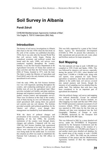
EUROPEAN <strong>SOIL</strong> BUREAU ⎯ RESEARCH REPORT NO. 9<br />
<strong>Soil</strong> Survey in Albania<br />
Pandi Zdruli<br />
CIHEAM-Mediterranean Agronomic Institute of Bari<br />
Via Ceglie 9, 70010 Valenzano (BA) Italy<br />
Introduction<br />
The history of soil survey investigations in Albania<br />
dates back to the late 1930s when the first book on<br />
the soils of the country was published (Zavalani,<br />
1938), but it was only after the Second World War<br />
that soil surveys really began. During the<br />
centralised economic and political system that<br />
lasted until the early 1990s, soil surveys were<br />
conducted regularly throughout the country.<br />
Initially, it was the <strong>Soil</strong> Science Department at the<br />
Agricultural University of Tirana that carried out<br />
these activities and then the <strong>Soil</strong> Science Institute<br />
(SSI) of Tirana, founded in 1971, took the lead.<br />
The latter is under the Ministry of Agriculture and<br />
Food (MAF) and is the only Institute in the country<br />
specialised in soil science.<br />
Until the early 1990s, the <strong>Soil</strong> Science Institute<br />
was very well organised, operating throughout the<br />
country, and conducting pedological surveys and<br />
fertility tests all over the agricultural land. Other<br />
activities included soil fertility and plant nutrition,<br />
drainage and irrigation research, soil microbiology<br />
studies, erosion control, and topographic surveys.<br />
There were 26 districts at this time in the country,<br />
each of them having its own soil laboratory and a<br />
small specialised staff, among them one general<br />
soil scientist and one soil chemist. The Institute<br />
provided scientific and technical guidelines for the<br />
‘district soil offices’, even though their<br />
management was handled by local administration.<br />
With the dawn of political changes and<br />
privatisation of the economy, commencing at the<br />
beginning of the last 1990s, the scientific<br />
institutions of the country went through drastic<br />
changes and setbacks. Compared with the year<br />
1990 the <strong>Soil</strong> Science Institute had experienced<br />
almost 70% reduction of its staff. The district soil<br />
offices were non-existent and few soil analyses<br />
were being made for the arable land. To overcome<br />
this situation an effort was made to rehabilitate the<br />
National <strong>Soil</strong> Laboratory at the SSI offices in<br />
Tirana.<br />
This was fully supported by a grant of the United<br />
States Agency for International Development<br />
(USAID) in 1998. At present this Laboratory is<br />
fully operational and can provide soil, water, plant<br />
and fertiliser analyses for major properties.<br />
<strong>Soil</strong> Mapping<br />
<strong>Soil</strong> Survey in Albania. Pandi Zdruli<br />
The first national soil map at scale 1:200,000 was<br />
compiled in 1958 (Veshi and Spaho, 1988). This<br />
was followed by intensive soil surveys, especially<br />
during the period 1971-1991, when detailed soil<br />
maps from 1:10,000 to 1:50,000 scale, along with<br />
soil reports, were prepared for each former<br />
agriculture co-operative, state farm and district. In<br />
addition to the arable land, soil surveys covered<br />
also natural pastures and forests, though the<br />
intensity of soil sampling was less detailed than the<br />
arable land. This indicates that soils have long<br />
been considered to be an important part of<br />
agricultural development.<br />
After the political change, soil survey and mapping<br />
was reduced drastically. Except for minimal<br />
surveys made by the <strong>Soil</strong> Science Institute, no<br />
other mapping was made until the mid 1990s when<br />
the USAID sponsored a national assessment of soil<br />
resources (Zdruli, 1997a). Another achievement<br />
was reported in 1998 when for the first time an<br />
Albanian soil data were introduced into the <strong>Soil</strong><br />
Geographic Database of Europe at scale<br />
1:1,000,000, sponsored by the <strong>European</strong> <strong>Soil</strong><br />
Bureau (ESB) at DG-JRC Ispra.<br />
This was followed in 2001 by a more detailed soil<br />
survey, under the <strong>IN</strong>TERREG II Programme<br />
sponsored by the <strong>European</strong> Commission and the<br />
Italian Government, aiming at the creation of a<br />
national soil database at 1:250,000 scale (Figure 1)<br />
and another much more detailed soil database for<br />
the coastal areas of the country at scale 1:50,000<br />
(Zdruli et al., 2003). The ESB was the technical<br />
coordinator of this project and the Mediterranean<br />
Agronomic Institute of Bari the implementing<br />
institution.<br />
39
EUROPEAN <strong>SOIL</strong> BUREAU ⎯ RESEARCH REPORT NO. 9<br />
Figure 1: <strong>Soil</strong> map of Albania at scale 1:250,000 according to WRB<br />
This greatly advanced soil surveys in Albania and<br />
put the country at a high <strong>European</strong> standard, being<br />
the only one in Europe at that moment to have<br />
completed a national soil database according to the<br />
‘Georeferenced <strong>Soil</strong> Database for Europe’ Manual<br />
of Procedures-Version 1.1. (ESB, 1998, 2000)<br />
prepared by the Scientific Committee of the ESB.<br />
<strong>Soil</strong> Classification<br />
The national soil classification system and<br />
methods of soil resource inventory in Albania were<br />
developed locally with minimal inputs from the<br />
outside world. The system itself was a surrogate of<br />
the Russian system of soil classification. Due to<br />
the size of the country and particularly, to the<br />
40<br />
<strong>Soil</strong> Survey in Albania. Pandi Zdruli<br />
extent of arable land, the Albanian system served<br />
its purpose. It provided the first assessment of land<br />
resources and helped to make decisions on<br />
fertiliser use and land reclamation projects.<br />
However, modern soil science concepts were not<br />
used and the translation to other systems, such as<br />
the FAO Legend (FAO-UNESCO, 1974), World<br />
Reference Base for <strong>Soil</strong> Resources – WRB –<br />
(FAO, ISRIC and ISSS. 1998), and USDA <strong>Soil</strong><br />
Taxonomy (<strong>Soil</strong> Survey Staff, 1998) proved<br />
difficult.<br />
The first attempt to convert the national system of<br />
soil classification into other well-known systems<br />
was undertaken between 1994 and 1997. Zdruli
EUROPEAN <strong>SOIL</strong> BUREAU ⎯ RESEARCH REPORT NO. 9<br />
(1997a) provides the following soil orders of <strong>Soil</strong> Taxonomy for Albania (Table 1).<br />
The second major study (Zdruli et al., 2003)<br />
conducted in 2001 revealed the distribution of soils<br />
according to the WRB (Figure 2). The Albanian<br />
pedological landscape is very diverse and complex.<br />
The lower coastal area of the western part of the<br />
country was mainly formed during the Quaternary<br />
period by the fluvial activity of several rivers<br />
flowing to the Adriatic and Ionian Seas. The<br />
dominant soils are Cambisols, Luvisols, Fluvisols,<br />
and Phaeozems, associated with Vertisols,<br />
Solonchaks, Gleysols, Arenosols, Histosols and<br />
Calcisols.<br />
On the eastern side of the coastal flatlands extends<br />
the hilly area covered by Mediterranean shrubs,<br />
typically Macchia Mediterranea with cultivation of<br />
olive groves, vineyards, and fruit trees. <strong>Soil</strong>s are<br />
moderately deep, but highly eroded and<br />
mismanaged, particularly by overgrazing.<br />
Luvisols, Cambisols, and Calcisols are the most<br />
extensive. Mountains are spread throughout<br />
Albania from the Alps in the north to the central<br />
and southern areas. At lower altitudes, pine, beech,<br />
and oak forests predominate whereas the highest<br />
elevations are mainly just bare rock. Above<br />
2,000m a.s.l. alpine meadows occur.<br />
Table 1. Classification of the soils of Albania according to USDA <strong>Soil</strong> Taxonomy<br />
<strong>Soil</strong> Taxonomy orders ha %<br />
Histosols 3,978 0.5<br />
Vertisols 58,542 2.0<br />
Mollisols 208,402 7.0<br />
Alfisols 498,670 17.0<br />
Inceptisols 1,015,951 35.0<br />
Entisols 164,613 6.0<br />
Miscellaneous 924,640 32.5<br />
Total land and water area 2,874,796 100<br />
(photo: P. Zdruli, 2000)<br />
Photo 1: Typical landscape of the interior valleys in Central Albania.<br />
In the foreground the deep alluvial/colluvial soils formed by fluvial and erosion activity are seen. In the<br />
background, hills and mountains with shallow eroded soils occur. The upper elevations are almost bare of<br />
any vegetation.<br />
<strong>Soil</strong> Survey in Albania. Pandi Zdruli<br />
41
LUVISOLS<br />
25.3%<br />
CALCISOLS<br />
0.8%<br />
PHAEOZEMS<br />
10.5%<br />
KASTANOZEMS<br />
0.1%<br />
GLEYSOLS<br />
0.5%<br />
SOLONCHAKS<br />
0.4%<br />
FLUVSOLS<br />
5.5%<br />
VERTISOLS<br />
0.5%<br />
EUROPEAN <strong>SOIL</strong> BUREAU ⎯ RESEARCH REPORT NO. 9<br />
LEPTOSOLS<br />
8.8%<br />
HISTOSOLS<br />
0.1%<br />
Figure 2: Distribution of soils according to the WRB<br />
Use of Existing <strong>Soil</strong> Data<br />
Land evaluation of agricultural<br />
potentials<br />
Based upon the soil data accumulated during the<br />
period 1970-1988, the <strong>Soil</strong> Science Institute in<br />
Tirana began in 1988 a Physical Land Evaluation<br />
Study for all the agricultural land of the country.<br />
The main soil characteristics used for this land<br />
evaluation exercise were soil depth, thickness of<br />
the humus horizon, organic matter content at 50cm<br />
depth, available phosphorus, texture, and available<br />
moisture content of the topsoil. <strong>Soil</strong> acidity,<br />
alkalinity, salinity and the presence of stones are<br />
main soil constraints in Albania. Relief is a<br />
determining factor for agriculture; therefore slope<br />
threshold values were an important part of the<br />
evaluation process. Finally, climate determined the<br />
ultimate value of the land. Socio-economic factors<br />
were not considered in this study.<br />
At the end of the study all the agricultural land was<br />
divided into ten classes. Land class 1 is the best for<br />
agriculture crops while class 10 is the worst.<br />
Integral parts of this study were the preparation of<br />
several land evaluation maps, which show the<br />
classes of land for each farm, district and the entire<br />
country. The western coastal field areas, occupying<br />
42<br />
Ci ties<br />
0.1%<br />
<strong>Soil</strong> Survey in Albania. Pandi Zdruli<br />
CAMBISOLS<br />
30.6%<br />
ARENOSOLS<br />
2.0%<br />
REGOSOLS<br />
13.2%<br />
Water bodi es<br />
1.3%<br />
Rock Outcr ops<br />
about 250,000ha, have been identified with the<br />
best land classes, which have good potential for<br />
intensive agriculture. Classes 1 to 4 occupy nearly<br />
75% of this area. Factors of soil formation,<br />
physical landscape and generally similar climatic<br />
conditions are the main factors influencing the<br />
high land values. Hilly areas occupy roughly<br />
220,000ha. These areas, along with the interior<br />
valleys, belong to a variety of land classes, though<br />
classes 4, 5 and 6 are dominant. The main reason<br />
for the decreasing land values in the hilly zone is<br />
slope. Mountain areas covering about 80,000ha<br />
include the lowest ranking land classes due to<br />
steep slopes and severe climatic conditions<br />
(Kaleshi et al., 1992).<br />
The most important soil constraints, such as<br />
salinity (about 10,000ha), textural class, soil depth,<br />
alkalinity (about 60,000ha) in the western coastal<br />
area, and acidity in about 70,000ha mostly in the<br />
north-eastern part of the country, were also<br />
identified. Possible interventions to mitigate the<br />
negative effects of these constraints may increase<br />
the land values by one or two classes.<br />
0.5%<br />
Land use assessment<br />
A first attempt to prepare maps for actual land use<br />
and potential land use planning was done by Zdruli<br />
(1997b). This was followed by two EU
EUROPEAN <strong>SOIL</strong> BUREAU ⎯ RESEARCH REPORT NO. 9<br />
sponsored projects in 1997 and one in 2003. The<br />
latter is still in progress and the results are still to<br />
be reported.<br />
Zdruli (1997b) reports the distribution of arable<br />
crops mainly in the coastal area and the interior<br />
valleys; fruit trees, olive groves and vineyards in<br />
the hills; and pastures along with forest at the<br />
higher elevations.<br />
Under the current conditions, because agricultural<br />
land in Albania is high fragmented, the<br />
implementation of large-scale projects on land<br />
management is almost impossible. One approach<br />
to the issue of land consolidation, and sustainable<br />
land use planning, is the development of land use<br />
policies for single or similar groups of crops to be<br />
cultivated in suitable agro-ecological regions.<br />
These methods, in a sense, will overcome the<br />
obstacle of small land holdings because it will be<br />
one or few crops to unify large areas and thousands<br />
of farmers. This depends though, on investments<br />
and particularly on local and regional markets.<br />
Fertiliser use<br />
The history of fertiliser use in Albania began in the<br />
early 1970's with the construction of two factories,<br />
one for nitrogen and another for phosphate<br />
fertilisers. The impact on agricultural production<br />
was immediate and was reflected in the doubling<br />
of the yields of major crops over a short period.<br />
The main fertilisers used were ammonium nitrate,<br />
urea, single super phosphate and potassium<br />
chloride and sulphate. Fertiliser use was rather<br />
stable during the period 1985-1990 but declined<br />
notably in 1991 to about 33% (Thompson and Xia,<br />
1992) of the average consumption during the<br />
previous six years. These declines resulted from<br />
the break-up of agricultural cooperatives and state<br />
farms, disruption of fertiliser distribution, lack of<br />
credit for fertiliser purchases, and relatively slow<br />
land reform.<br />
The US-based non-profit International Centre for<br />
<strong>Soil</strong> Fertility and Agricultural Development<br />
(IFDC) is assisting Albania in restructuring its<br />
fertiliser production and input markets through the<br />
support for local dealers that replaced the<br />
governmental controlled enterprises of agricultural<br />
inputs operating during the old regime. Since 1995<br />
fertiliser imports along with other inputs have<br />
increased greatly and continue to provide the<br />
greatest stimulus to the increase of agricultural<br />
production. It is important to emphasize that the<br />
efficiency of fertiliser use has improved<br />
significantly since the collapse of the centrally<br />
planned economic system. In addition, soil data<br />
play a crucial role when establishing the nutrient<br />
balance of soils, crop yields and the need for<br />
fertilisers.<br />
Natural resources<br />
conservation and<br />
management<br />
<strong>Soil</strong> Survey in Albania. Pandi Zdruli<br />
It is estimated that in Albania, in only one year,<br />
erosion washes away 1.2 million tons of organic<br />
carbon, 100,000 tons of nitrate salts, 60,000 tons of<br />
phosphates, and 16,000 tons of potassium salts<br />
(Laze and Kovaçi, 1996), while the total amount of<br />
fertilisers imported or produced by local industry is<br />
far less. Other studies (Qilimi, 1996) show that soil<br />
fertility is decreasing mainly because of reductions<br />
in organic matter content, nitrogen, and potassium<br />
compared to 20 years ago, resulting in nutrient<br />
mining of the soils.<br />
Zdruli and Lushaj (2000) report accelerated soil<br />
erosion, deforestation, overgrazing, soil pollution,<br />
re-salinisation, acidification, water logging,<br />
flooding, urbanisation and soil sealing, nutrient<br />
mining, and loss of soil fertility as perhaps the<br />
most alarming environmental problems in Albania.<br />
The basis for making these assessments remain the<br />
old and recent soil data supported by the use of a<br />
Geographic Information System (GIS) and<br />
fieldwork.<br />
While the legal status and institutional<br />
strengthening for the conservation of natural<br />
resources is making progress, the most<br />
constraining problem remains law implementation<br />
and enforcement. Deterioration of the forests and<br />
natural pastures is the most visible example of<br />
such effects. The agricultural land in Albania is a<br />
finite resource and there are no areas remaining<br />
where the cropland could expand. Many mistakes<br />
were made in the past by converting natural<br />
pastures and forests to cropland and the negative<br />
results of such actions are well known throughout<br />
the country. (Zdruli et al., 1997b; 1998).<br />
Future Perspectives<br />
The most striking process that happened in<br />
Albanian agriculture after the political upheaval<br />
was the change in land ownership. There were<br />
about 550 agricultural co-operatives and state<br />
farms until 1990 managing all the agricultural land<br />
(about 700,000ha) of the country. The picture in<br />
2001 shows the agricultural land being distributed<br />
among about 450,000 farm families averaging 1,3<br />
hectares per farm or 0,25ha per person distributed<br />
in 1.8 million parcels, often far from each other<br />
(Civici, 2001).<br />
43
EUROPEAN <strong>SOIL</strong> BUREAU ⎯ RESEARCH REPORT NO. 9<br />
This is the greatest ‘revolution’ in the modern<br />
times of Albania with respect to private land<br />
ownership. The process has gone on (and is still<br />
going on) with controversies on the way in which<br />
this privatisation was implemented.<br />
From the soils’ prospective, the change in land<br />
ownership has brought to difficult times in keeping<br />
the link between the thousands of newly created<br />
farmers and the corresponding governmental<br />
institutions. Even though many farmers recognise<br />
for instance, the importance of soil fertility and<br />
land conservation, few of them would consider<br />
paying for a soil survey investigation on their land.<br />
Consequently, the opinion of the governmental<br />
structures remains that public funds or<br />
international donors should sponsor soil survey<br />
programmes. This becomes a priority especially<br />
with the pace of increase in land degradation and<br />
environmental damage of Albania’s natural<br />
resources.<br />
In many areas, Albania is blessed with fertile soils,<br />
but the total amount of arable land is finite and<br />
may not be able to support the increase in<br />
population expected in the coming years. At<br />
present, the country relies heavily on agricultural<br />
imports, which could make it vulnerable to local or<br />
regional crises, putting food security at risk. To<br />
References<br />
Civici. A. (2001). Country report Albania 2001. In:<br />
Développement et politiques agro-alimentaires<br />
dans la region méditerranéenne. Centre<br />
International de Hautes Etudes Agronomiques<br />
Mediterranéennes (CIHEAM). Paris, France.<br />
ESB (1998, 2000). Georeferenced <strong>Soil</strong> Database<br />
for Europe. Manual of Procedures, version 1.1.<br />
<strong>European</strong> <strong>Soil</strong> Bureau Research Report No.. 5,<br />
EUR 18092 EN, 184pp. Office for the Official<br />
Publications of the <strong>European</strong> Communities,<br />
Luxembourg.<br />
FAO-UNESCO. (1974). <strong>Soil</strong> map of the World,<br />
1:5,000,000. 10 Volumes. Food and<br />
Agriculture Organization of the United<br />
Nations, Rome, Italy.<br />
FAO, ISRIC and ISSS. (1998). World Reference<br />
Base for <strong>Soil</strong> Resources: World <strong>Soil</strong> Resources<br />
Report 84, Rome, 88 pp<br />
Kaleshi, V., Dubali, A. and Zdruli, P. (1992). Land<br />
evaluation of Albania. Results and<br />
perspectives. AGRONOMIA. No. 1 (In<br />
Albanian).<br />
Laze, P. and Kovaçi, V. (1996). <strong>Soil</strong> erosion and<br />
physico-chemical nature of eroded materials.<br />
9th Conference of the International <strong>Soil</strong><br />
Conservation Organization (ISCO), Bonn,<br />
Germany. Extended Abstracts.<br />
44<br />
reduce the misuse of land and enhance sustainable<br />
land use and management in Albania, a soil<br />
protection policy should be developed and<br />
implemented, addressing the following:<br />
1. Detailed land resource assessments;<br />
2. Monitoring of land and water quality;<br />
3. Awareness among land users regarding<br />
environmental protection;<br />
4. Support (extension) services to assist land<br />
owners and users;<br />
5. Implementation of sustainable land use and<br />
management practices;<br />
6. Drafting a national natural resource<br />
management and land use policy.<br />
Acknowledgement<br />
<strong>Soil</strong> Survey in Albania. Pandi Zdruli<br />
The assistance of Prof. Dr. Sherif Lushaj and the<br />
staff of the <strong>Soil</strong> Science Institute in Tirana,<br />
Albania, is greatly appreciated in the preparation of<br />
this report.<br />
Qilimi, B. (1996). Appraisal of soil fertility in<br />
Albania. PhD thesis. 155pp.<br />
<strong>Soil</strong> Survey Staff. (1998). Keys to <strong>Soil</strong> Taxonomy.<br />
Eighth Edition. 326pp. US Department of<br />
Agriculture Natural Resource Conservation<br />
Service, Washington DC.<br />
Thompson, T. and Xia, Wan. (1992). The Socioeconomic<br />
dimensions of agricultural<br />
production in Albania. A national survey.<br />
International Fertilizer Development Centre.<br />
31pp.<br />
Veshi, L. and Spaho, Sh. (1988). Pedology.<br />
Agricultural University of Tirana. Tirana,<br />
Albania. 574pp.<br />
Zavalani, D. (1938). Die landwirtschaftlichen<br />
Verhaltnnisse Albaniens. Doctorial<br />
dissertation. Berlin, Germany<br />
Zdruli, P. Benchmark soils of Albania. (1997a).<br />
Internal monograph of the USDA Natural<br />
Resources Conservation Service (NRCS),<br />
Washington DC and the International Fertilizer<br />
Development Centre (IFDC), Muscle Shoals,<br />
Alabama. 2 Volumes. 293pp.<br />
Zdruli, P., H. Eswaran, R. Almaraz, and P. Reich.<br />
1997b. Developing the prerequisites for<br />
sustainable land use in Albania. <strong>Soil</strong> Use and<br />
Management. 13, 48-55.
EUROPEAN <strong>SOIL</strong> BUREAU ⎯ RESEARCH REPORT NO. 9<br />
Zdruli, P., Almaraz, R. and Eswaran, H. (1998).<br />
Developing land resource information for<br />
sustainable land use in Albania. 9 th Conference<br />
of the International <strong>Soil</strong> Conservation<br />
Organization (ISCO), Bonn, Germany.<br />
CATENA VERLAG, 35447 Reiskirchen,<br />
Advances in GeoEcology 31, 153-159.<br />
Zdruli, P. and Lushaj, Sh. (2000). Status of soil<br />
degradation in Albania. In: <strong>Soil</strong> in Central and<br />
Eastern <strong>European</strong> countries, in the New<br />
Independent States, in Central Asian countries<br />
and in Mongolia. <strong>European</strong> Commission, Joint<br />
Research Centre (Lahmar, R., Dosso, M.,<br />
Ruellan, A. and Montanarella, L. (eds). EUR<br />
19732 EN.p.53-63<br />
<strong>Soil</strong> Survey in Albania. Pandi Zdruli<br />
Zdruli, P., Lushaj, Sh., Pezzuto, A., Fanelli, D.,<br />
D’Amico, O., Filomeno, O., De Santis, S.,<br />
Todorovic, M., Nerilli, E., Dedaj, K. and<br />
Seferi, B. (2003). Preparing a georeferenced<br />
soil database for Albania at scale 1:250,000<br />
using the <strong>European</strong> <strong>Soil</strong> Bureau Manual of<br />
Procedures 1.1. In: OPTIONS<br />
Méditerranéennes. SERIE A: Mediterranean<br />
Seminars, Volume A 54. Selected papers of the<br />
7 th International Meeting on <strong>Soil</strong>s with<br />
Mediterranean Type of Climate- (Zdruli, P.,<br />
Steduto, P. and Kapur, S. (eds). Centre<br />
International de Hautes Etudes Agronomiques<br />
Mediterranéennes (CIHEAM). Paris, France.<br />
ISBN: 2-853552-261-X<br />
45