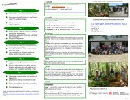
ELC Training In Southern Ontario: 2012 - Conservation Ontario
ELC Training In Southern Ontario: 2012 - Conservation Ontario
ELC Training In Southern Ontario: 2012 - Conservation Ontario

Create successful ePaper yourself
Turn your PDF publications into a flip-book with our unique Google optimized e-Paper software.
OMNR sponsored<br />
<strong>ELC</strong> <strong>Training</strong> courses *<br />
There is a need for consistent and standardized natural heritage<br />
information and mapping among the many planning authorities<br />
and their partner organizations, across southern <strong>Ontario</strong>.<br />
To address issues concerning wetlands, species at risk,<br />
and resource management and planning, field data is often<br />
collected. Broad scale modeling, mapping, and interpretation<br />
initiatives also require field samples to verify and confirm ecosystem<br />
types, boundaries, and descriptions. Ultimately, this<br />
field sampling provides the information needed to make planning<br />
and management decisions. Our goal is to deliver the<br />
training requested by resource professionals, to describe,<br />
identify, name and map ecological communities, according to<br />
<strong>ELC</strong>.<br />
The Ecological Land Classification <strong>Training</strong> Course has been<br />
delivered across southern <strong>Ontario</strong> for 13 years now. It has<br />
come to be respected amongst resource managers and planners,<br />
and is required by many agencies as a jobs prerequisite.<br />
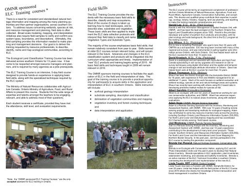
The <strong>ELC</strong> <strong>Training</strong> Course is an intensive, 5-day field course<br />
designed to provide hands-on experience in applying basic<br />
field skills, along with the specialized techniques required by<br />
the <strong>ELC</strong> system.<br />
The Ministry of Natural Resources collaborates with Agriculture<br />
Canada, <strong>Ontario</strong> Ministry of Agriculture, Food, and Rural<br />
Affairs to present this course. Students find the wide range of<br />
expertise and talents amongst the teachers to be engaging,<br />
relevant, and able to address most of their questions.<br />
Each student receives a certificate, provided they have met<br />
the attendance, skill level, and evaluation requirements.<br />
*Note: the “OMNR sponsored <strong>ELC</strong> <strong>Training</strong> Courses “ are the only<br />
accepted standard for <strong>ELC</strong> training in <strong>Ontario</strong>.<br />
Field Skills<br />
The <strong>ELC</strong> <strong>Training</strong> Course provides the students<br />
with the necessary basic field skills to<br />
describe, classify and map ecosystems.<br />
Most of the course (5 days) is taken up<br />
learning how to read landscapes, and to<br />
describe sites, substrates and vegetation.<br />
These basic skills are then applied to implement<br />
the <strong>ELC</strong> data collection protocols and<br />
interpret their field data to classify and name<br />
Vegetation Types and Substrate Types.<br />
The majority of the course emphasizes basic field skills, that<br />
remain relatively consistent from year to year. Skills learned<br />
at older <strong>ELC</strong> courses remain relevant today, and will remain<br />
relevant in the future. Advances and changes in the <strong>ELC</strong><br />
classification system and products will be integrated into the<br />
curriculum when appropriate and timely. Implementation of<br />
“new” <strong>ELC</strong> products and training begins spring of 2010. All<br />
basic field skills and techniques taught in 2009 will remain<br />
relevant in 2010.<br />
The OMNR sponsors training courses to facilitate the application<br />
of <strong>ELC</strong> in the field and interpretation of data. The<br />
goal of the training course is to provide a practical opportunity<br />
for participants to acquire skills in the application and<br />
interpretation of <strong>ELC</strong> in southern <strong>Ontario</strong>. Skills instruction<br />
will include:<br />
• surficial geology interpretation<br />
• substrate sampling, description and classification<br />
• delineation of vegetation communities and mapping<br />
• vegetation inventory and forest cruising techniques<br />
and<br />
• data interpretation and application<br />
<strong>In</strong>structors<br />
The <strong>ELC</strong> course will be led by an experienced complement of professionals<br />
from <strong>Ontario</strong> Ministries of Natural Resources, Agriculture, Food and<br />
Rural Affairs, Agriculture Canada, <strong>Conservation</strong> Authorities, and consultants.<br />
This diverse and qualified group contribute their expertise in pedology,<br />
ecology, botany, forestry, mapping, land use planning, and teaching<br />
to make the training materials comprehensive and robust.<br />
Harold Lee, B.Sc., M.Sc. (Plant Ecology)<br />
Harold is with the <strong>In</strong>formation Management & Spatial Analysis Unit, with<br />
OMNR, and has been the lead ecologist on the <strong>Southern</strong> <strong>Ontario</strong> Ecological<br />
Land Classification program since 1992. Harold is the principal<br />
developer and author of southern <strong>ELC</strong> products and provides, with his<br />
plant ecology and soils background, the direct link to the <strong>ELC</strong> program at<br />
the training courses.<br />
Eric Wilson, B.Sc. (Pedologist)<br />
Eric is now a consulting Pedologist, who spent more than 30 years with<br />
OMFRA as a soil specialist. Eric has long been involved with many of the<br />
regional soil surveys, and was instrumental in pulling together soils information<br />
across <strong>Ontario</strong>, with Soils <strong>Ontario</strong>. Eric has helped teach soils at<br />
the <strong>ELC</strong> courses for more than 10 years now.<br />
David Kroetsch, M.Sc., P.Ag. (Pedologist)<br />
David is a pedologist and soil specialist with Agriculture and Agri-Food<br />
Canada specializing in soil survey upgrades and research on soil resurvey<br />
techniques using digital information and the spatial and temporal<br />
change in soil and landscape attribute information in <strong>Ontario</strong>. Dave has<br />
helped teach soils at the <strong>ELC</strong> courses for more than 10 years.<br />
Shaun Thompson, B.Sc. (Biology)<br />
Shaun has been the District Ecologist with the Kemptville District OMNR<br />
for 18 years, with experience in Fish and Wildlife management for an<br />
additional 11 years. Much of his work focuses on wetland evaluation and<br />
wetland ecology, species at risk and natural heritage areas and systems.<br />
Shaun has recently been working with others using <strong>ELC</strong> based data in<br />
developing predictive habitat models for species at risk.<br />
Albert Garofalo (Consulting Ecologist)<br />
Albert is an ecologist, with over ten years of experience working for various<br />
conservation authorities, and OMNR. Albert has extensive experience<br />
applying the <strong>ELC</strong> to natural areas inventories, along with wetland<br />
evaluations.<br />
Adam Hogg (OMNR: Remote Sensing Specialist)<br />
Adam is a Remote Sensing Specialist with the <strong>In</strong>ventory, Monitoring and<br />
Assessment Section, with OMNR. With over 10 years of leading remote<br />
sensing projects and developing methods for ecological mapping, Adam<br />
has contributed to some key resource inventory tools across the province,<br />
including <strong>Southern</strong> <strong>Ontario</strong> Land Resource <strong>In</strong>formation System (SOLRIS),<br />
Far North Land Cover and Disturbance mapping and has coordinated<br />
<strong>ELC</strong> themed remote sensing / field based courses.<br />
Joel Mostoway (OMNR: Remote Sensing Specialist)<br />
Joel is a Remote Sensing Analyst with the <strong>In</strong>ventory, Monitoring and<br />
Assessment Section with OMNR. Joel has over 10 years experience<br />
contributing to the development of many land cover products. These<br />
include: <strong>Southern</strong> <strong>Ontario</strong> Land Resources <strong>In</strong>formation System (SOLRIS),<br />
Far North Land Cover and the <strong>In</strong>ternational Land Cover Mapping for<br />
Northern Border Security. <strong>In</strong> the past year, Joel has participated in the<br />
<strong>ELC</strong> course by leading the geomatics component.<br />
Brenda Van Ryswyk (Natural Heritage Ecologist, <strong>Conservation</strong> Halton)<br />
Brenda is an Ecologist with <strong>Conservation</strong> Halton, applying <strong>ELC</strong> and Air<br />
Photo <strong>In</strong>terpretation skills over the past 6 years to develop their Natural<br />
Areas <strong>In</strong>ventory. Brenda specializes in <strong>ELC</strong> application, plant inventories,<br />
salamander monitoring, and odonata and butterfly inventories. Brenda is<br />
an active member of the <strong>ELC</strong> Technical Committee in southern <strong>Ontario</strong>,<br />
overseeing the development and implementation of the new <strong>ELC</strong>.<br />
Linda Touzin, RPF (OMNR: District Forester)<br />
Linda Touzin has been a Forester with OMNR, Kemptville District, for<br />
over 20 years. Linda has helped with the field portion of the <strong>ELC</strong> Course<br />
since 2010 where she shares her knowledge of forest mensuration and<br />
forest management in southern <strong>Ontario</strong>.