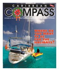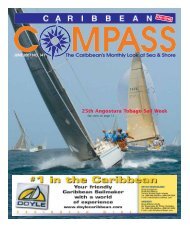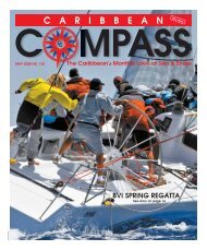
Bequia Easter Regatta 2008 - Caribbean Compass
Bequia Easter Regatta 2008 - Caribbean Compass
Bequia Easter Regatta 2008 - Caribbean Compass

Create successful ePaper yourself
Turn your PDF publications into a flip-book with our unique Google optimized e-Paper software.
ONE<br />
Since 1984<br />
would think that after a yacht<br />
has sailed to the <strong>Caribbean</strong> from<br />
North America or Europe, and<br />
has spent at least one winter cruising up and down the<br />
islands, insurance underwriters would see little risk of<br />
having to pay any claims for such a well-tried vessel’s<br />
subsequent trip back to the States or Europe, or<br />
onward to Panama.<br />
Nothing could be further from the truth. Boats leaving<br />
the <strong>Caribbean</strong> for Panama, North America and<br />
Europe cost underwriters large sums each year, in<br />
heavy-weather damage claims, groundings and abandonment/total<br />
losses. Almost invariably these losses<br />
are due to leaving the <strong>Caribbean</strong> at the wrong time<br />
of year.<br />
Timing is Important<br />
Skippers heading westward to Panama are often<br />
over-confident. They think this passage will be a nice,<br />
easy 900-mile downhill slide. But if they look at the US<br />
weather charts, they will note that for the period from<br />
December to the end of March, and for another period<br />
in July, there is a big red circle east of Panama denoting<br />
expected wave heights of 12 feet or more. During<br />
the rest of the year, although the waves may not be<br />
expected to reach these heights, you’re still likely to<br />
encounter rough conditions near the end of the trip<br />
where there is a counter-current of up to one knot<br />
running against 15 to 25-knot tradewinds.<br />
Boats leaving the <strong>Caribbean</strong> for Florida often find<br />
themselves in trouble if they leave before mid-April.<br />
They run into a “norther” — a northwest wind, dead on<br />
the nose. This wind then clocks to the north and then<br />
northeast, making the Silver Bank and the Bahamas a<br />
dead lee (deadly) shore! Boats heading farther north<br />
up the US East Coast also frequently run into trouble<br />
with a late-season northwesterly, blasting them with<br />
high winds and a severe temperature drop. But by late<br />
April, the northers that force their way down to Florida<br />
are not too strong.<br />
Boats heading northwest to Charleston, Morehead/<br />
Beaufort, or the Chesapeake should wait till mid- or<br />
late May, as they are traversing an area where subtropical<br />
hurricanes can crop up through April and<br />
possibly later. These small, intense subtropical hurricanes<br />
were only spotted in recent years when weather<br />
information was gathered from satellites. Prior to this,<br />
since they were small and in an area where big ships<br />
seldom go, there were not enough reports of these<br />
storms to show up on the weather charts.<br />
Heading to Panama<br />
Heading west to Panama, you can island-hop or<br />
cruise coastally (check www.safetyandsecuritynet.com<br />
for any current crime hotspots) or stay offshore.<br />
If heading to Panama direct, rig for down wind. Hoist<br />
two headsails on the roller-furling headstay. If the luff<br />
lengths are not the same, add a pennant to the shorter<br />
headsail. The windward headsail’s sheet goes through<br />
the end of the spinnaker pole. The leeward headsail is<br />
trimmed through a block on the end of the main boom,<br />
forward to another block, thence back to a winch.<br />
If the wind is on the quarter, the main can be left up,<br />
vanged down hard and held forward by a foreguy (preventer)<br />
led from the end of the boom to the stemhead.<br />
If the main is blanketing the lee headsail, douse the<br />
main but leave the boom out to act as an outrigger to<br />
correctly trim the lee headsail.<br />
As you progress westward, the wind and sea will<br />
both increase. Keep your boat speed down to l.2 or l.3<br />
times the square root of the waterline length. If speed<br />
gets above this, slow down by starting to roll up the<br />
headsails one on top of the other.<br />
The seas around Cabo de Vela are always rough;<br />
SAILING DIRECTIONS BY DON STREET<br />
stay well offshore when passing it. Also, the outflow at<br />
the mouth of the Rio Magdalena creates a really bad<br />
sea and, at certain times of the year, a tremendous<br />
amount of logs, trees and other flotsam comes pouring<br />
out of the river.<br />
Approaching Panama<br />
Approaching Panama for the last 200 or 300 miles,<br />
you can expect to meet a counter-current and a hard<br />
blow. The increasing wind velocity combined with the<br />
bad sea conditions mean that the autopilot or windvane<br />
should be disconnected and you should hand<br />
steer. The electronic autopilot will only steer according<br />
to the compass; it will not take into account the wind<br />
and sea conditions. A windvane will only help steer in<br />
relation to the wind, so when you surf down a wave<br />
and the apparent wind goes forward, the windvane will<br />
cause the boat to bear off and possibly broach.<br />
Moreover, a modern light-displacement yacht with a<br />
fin keel really will get up and surf. Surfing down the<br />
face of a wave at 12 or 13 knots in a 45-foot boat is<br />
thrilling but dangerous, as you are traveling at almost<br />
the same speed as the wave. Because there is little or<br />
no water flowing over the rudder, you have no steerage<br />
and are therefore on the edge of disaster. A broach in<br />
these conditions is all too possible.<br />
For passages such as this, where you may have heavy<br />
weather while running dead down wind, I feel that a<br />
worthwhile investment is a drogue. This, once streamed,<br />
will tend to keep the stern square to the waves and<br />
thus minimize or eliminate the chances of broaching.<br />
Whenever running down wind, rig an anti-gybe preventer<br />
on the main boom.<br />
Finally, make sure of a daylight arrival! If necessary,<br />
slow down and wait for sunrise. The San Blas Islands<br />
are low-lying and surrounded by reefs, and you’ll want<br />
good light for eyeball navigation if you make landfall<br />
there. The Panama Canal’s entrance is well buoyed<br />
and well lit, but the many lights ashore can be very<br />
confusing. More than one boat has missed the channel<br />
at night and ended up high and dry on the beach, or<br />
worse yet, on the breakwater.<br />
The relevant Imray-Iolaire charts show the location<br />
and capacity of all hauling facilities in Venezuela and<br />
the ABC islands. Colombian HO charts are excellent,<br />
but only available in Cartagena. However CMap and<br />
possibly other electronic chart manufacturers do cover<br />
the Colombian coast using the Colombian HO office<br />
info. If using electronic charts, ascertain if they are<br />
Leaving the <strong>Caribbean</strong><br />
Part One: To Panama or the East Coast<br />
using US or BA info, as only the electronic charts<br />
based on the Colombian HO info will give detailed info<br />
on yacht anchorages. Zydler’s The Panama Guide is<br />
also excellent.<br />
The Traditional Route to Florida<br />
The traditional route to the Miami or Fort Lauderdale<br />
area departs from St. Thomas or Puerto Rico, taking a<br />
course of roughly northwest, skirting the northern<br />
edge of Muchoir and Silver Banks and the northeastern<br />
edge of the Bahamas, until you reach the northeast<br />
Providence Channel. Then swing west, through<br />
the northeast/north/west Providence Channel and on<br />
to Florida. On this route you should be broad reaching,<br />
or sailing dead downwind before the Trades. [See<br />
downwind rig described above.]<br />
This trip should be duck soup, but unfortunately it<br />
has proven to be a great problem for insurance underwriters.<br />
I think the reason such a great number of<br />
boats are lost off the Bahamas is that they are coming<br />
from an area of high islands with, in most cases, deep<br />
water right up to the shore, then transiting an area of<br />
low islands with off-lying reefs and shoals extending<br />
two, three or even four miles offshore. I always say, “If<br />
you see a Bahamian island, you are two miles too<br />
close!” The only things you should see when sailing<br />
from the <strong>Easter</strong>n <strong>Caribbean</strong> to Miami are the tops of<br />
the lighthouses on San Salvador and at the northern<br />
end of Eleuthera, and the top of the light marking the<br />
south end of the northwest Providence Channel.<br />
It is useful to carry a guidebook to the Bahamas. If<br />
you have a breakdown and must stop there, with aid of<br />
a guidebook you can find your way into a harbor of<br />
refuge — entering in daylight only, of course. (Twice it<br />
has been necessary for me to do this on delivery trips.)<br />
When crossing the Gulf Stream to Florida, lay your<br />
course well to the south of your landfall, as the Stream<br />
(which can run as strong as three knots) will carry<br />
you northwards.<br />
—Continued on next page<br />
Barefoot Yacht Charters & Marine Centre<br />
BAREBOAT CHARTERS - FULLY CREWED CHARTERS - ASA SAILING SCHOOL<br />
• Doyle Sail Loft & Canvas Shop • Raymarine Electronics • Refrigeration Work<br />
• Mechanical & Electrical Repairs • Fibreglass Repairs • Laundry<br />
• Vehicle Rentals • Showers • Air Travel<br />
• Ice & Water • Diesel & Propane • Moorings<br />
• Island Tours • Surftech Surf Shop • Hotel Reservations<br />
• Quiksilver Surf wear • Restaurant & Bar • Boutique<br />
• On-site Accommodation • Wi-Fi / Internet Café • Book Exchange<br />
PO Box 39, Blue Lagoon, St Vincent, West Indies<br />
Tel. 1-784-456-9526 / 9334 / 9144 Fax. 1-784-456-9238<br />
barebum@caribsurf.com www.barefootyachts.com<br />
APRIL <strong>2008</strong> CARIBBEAN COMPASS PAGE 35