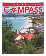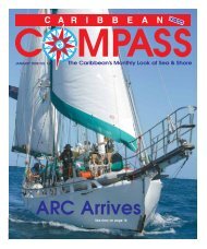
Bequia Easter Regatta 2008 - Caribbean Compass
Bequia Easter Regatta 2008 - Caribbean Compass
Bequia Easter Regatta 2008 - Caribbean Compass

Create successful ePaper yourself
Turn your PDF publications into a flip-book with our unique Google optimized e-Paper software.
APRIL <strong>2008</strong> CARIBBEAN COMPASS PAGE 36<br />
frangipani<br />
the<br />
<strong>Bequia</strong><br />
HOTEL • RESTAURANT • BAR<br />
Don’t miss<br />
our famous barbecue and<br />
jump up Thursday nights!<br />
Tel: (784) 458-3255 Fax: (784) 458-3824<br />
E-mail: reservations@frangipanibequia.com Website: www.frangipanibequia.com<br />
— Continued from previous page<br />
It can be most discouraging, after your long trip from<br />
the <strong>Caribbean</strong>, to discover you are north of your<br />
entrance and have to beat to windward against the<br />
prevailing southwesterlies and a two to three-knot<br />
north-running current.<br />
A faster route with fewer navigational dangers is to<br />
head west from St. Thomas, skirt the north coasts of<br />
Puerto Rico and Hispanola, then sail through the Old<br />
Bahama Channel favoring the Cuban side (it is better<br />
marked and has deeper water close to shore). Then<br />
head north to the Miami/Fort Lauderdale area.<br />
To the Carolinas<br />
The best routing is subject to much debate. I favor<br />
leaving from St. Thomas and heading roughly northwest,<br />
using the same route as one takes to the Fort<br />
Lauderdale/Miami area, passing north of the Muchoir<br />
and Silver Banks, and via the Bahamas. But instead of<br />
going through the Providence Channel, pass north of<br />
Grand Bahama, run over to the Gulf Stream, pick up<br />
the Stream and head northwards. With luck you will<br />
carry the Trades all the way up to the Gulf Stream, then<br />
with the Stream underneath you will be wearing seven<br />
league boots. If a northwest front is predicted you can<br />
duck into Charleston and either wait it out or continue<br />
north via the ICW. If there is no norther predicted, ride<br />
the Stream right up to Morehead City/Beaufort.<br />
Alternately, leave St. Thomas and take a rhumb line<br />
course northwest about 1,200 miles to Charleston.<br />
This is considerably shorter than the route described<br />
above but you will rapidly sail out of the Trades into<br />
an area of calm or variable wind. Only boats that sail<br />
well and have crews willing to do a lot of sail changes,<br />
or have considerable range under power, should use<br />
this route.<br />
To the Chesapeake<br />
If you can’t negotiate the ICW (your mast must be<br />
able to pass under the 65-foot high bridge just south<br />
of Norfolk, and your keel must draw less than nine<br />
feet), sail a rhumb line from the <strong>Easter</strong>n <strong>Caribbean</strong> to<br />
a point 100 miles east of Norfolk, Virginia. Norfolk is at<br />
the mouth of the Chesapeake Bay. When you approach<br />
the latitude of Norfolk, turn west.<br />
Cape Hatteras, just below the Chesapeake, has been<br />
known as a graveyard for ships for over 500 years.<br />
Many people feel that the only way to pass Cape<br />
Hatteras is to either have it 30 miles to the east of you<br />
(i.e. be in the ICW), or 200 miles to the west of you.<br />
Imagine a boat riding the Gulf Stream northward up<br />
the coast near Cape Hatteras. If a northwester comes<br />
in, the wind switches north and then northeast, giving<br />
20, 30 or even 40 knots of wind against the three-knot<br />
Stream. The resulting sea conditions are such that no<br />
progress can be made. Once the wind goes northeast,<br />
Cape Hatteras and the coast north of it become dead<br />
lee shores.<br />
Most yachts will be able to obtain warnings of<br />
approaching northwesterly winds. But when a northwester<br />
blows through, not only are you beating to<br />
windward but the temperature drops — sometimes to<br />
freezing. Every single member of the crew must be fully<br />
outfitted for severely cold, wet weather.<br />
The Bermuda Route<br />
Heading north via Bermuda, the first part of the trip<br />
is usually a wonderful sail. Leave the <strong>Easter</strong>n <strong>Caribbean</strong><br />
and aim for the North Star. The wind should be on the<br />
beam, giving a good fast reach. If the wind is north of<br />
east, don’t worry about staying on the rhumb line, just<br />
trim the sails and adjust the course so that you are<br />
going as quickly and comfortably as possible. Even if<br />
you are driven below the rhumb line, at about latitude<br />
27°N the wind will ease off and by latitude 29° or 30°<br />
it will frequently die out altogether. Usually when you<br />
come out of the calm spell, the wind comes in from the<br />
southwest. If you are west of the rhumb line, ease<br />
sheets and head for Bermuda. The loom can be spotted<br />
30 or more miles off.<br />
When you arrive in Bermuda, entering St. George at<br />
night is not advisable. Although the channel is well lit,<br />
shore lights make it difficult to correctly pick out the<br />
navigation lights. Once you have entered, go alongside<br />
the Customs dock and clear.<br />
Boats heading for the States via Bermuda should be<br />
sufficiently provisioned and prepared to by-pass<br />
Bermuda if necessary. Bermuda attracts gales like a<br />
magnet, and entering the narrow St. George Channel<br />
in gale conditions is extremely dangerous.<br />
When leaving Bermuda to head for the States, wait<br />
until late May or early June. It is essential that you<br />
obtain a really good long-range weather forecast. It is<br />
pretty much a rhumb line course, but try to ascertain<br />
what the Gulf Stream is doing. Frequently there is a<br />
southeast meander, which will stop you almost dead.<br />
Back in 1975, when the Gulf Stream was not as well<br />
documented as it is today, Iolaire hit a southeast<br />
meander while heading northwest. After sailing hard<br />
for 24 hours, we discovered we had made only 40<br />
miles! As per previous warnings, watch out for a northwester.<br />
Being stuck in the middle of the Stream with a<br />
strong northwester blowing against the Stream is not<br />
something any seaman likes to contemplate.<br />
Next Month: Leaving the <strong>Caribbean</strong>,<br />
Part Two: To Europe.