Coupled WRF/Unified Noah LSM
Coupled WRF/Unified Noah LSM
Coupled WRF/Unified Noah LSM

Create successful ePaper yourself
Turn your PDF publications into a flip-book with our unique Google optimized e-Paper software.
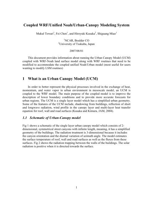
<strong>Coupled</strong> <strong>WRF</strong>/<strong>Unified</strong> <strong>Noah</strong>/Urban-Canopy Modeling System<br />
Mukul Tewari 1 , Fei Chen 1 , and Hiroyuki Kusaka 2 , Shiguang Miao 1<br />
1 NCAR, Boulder CO<br />
2 University of Tsukuba, Japan<br />
2007/08/01<br />
This document provides information about running the Urban Canopy Model (UCM)<br />
coupled with <strong>WRF</strong>-<strong>Noah</strong> land surface model along with <strong>WRF</strong> routines that need to be<br />
modified to accommodate the coupled unified <strong>Noah</strong>/Urban model (most useful for users<br />
wanting to modify <strong>LSM</strong> routines)<br />
1 What is an Urban Canopy Model (UCM)<br />
In order to better represent the physical processes involved in the exchange of heat,<br />
momentum, and water vapor in urban environment in mesoscale model, an UCM is<br />
coupled to the <strong>WRF</strong> model. The main purpose of the coupled model is to improve the<br />
description of lower boundary conditions and to provide more accurate forecasts for<br />
urban regions. The UCM is a single layer model which has a simplified urban geometry.<br />
Some of the features of the UCM include, shadowing from buildings, reflection of short<br />
and longwave radiation, wind profile in the canopy layer and multi-layer heat transfer<br />
equation for roof, wall and road surfaces (Kusaka and Kimura, JAM, 2004).<br />
1.1 Schematic of Urban-Canopy model<br />
Fig 1 shows a schematic of the single layer urban canopy model which consists of 2dimensional,<br />
symmetrical street canyons with infinite length, meaning, it has a simplified<br />
geometry of the buildings. The radiation treatment is 3-dimensional because it includes<br />
the canyon orientation and the diurnal variation of azimuth angle. The model estimates<br />
the surface temperature of roof, wall and road surfaces as well as the fluxes from these<br />
surfaces. Fig 2 shows the radiation trapping between the walls of the buildings. The solar<br />
radiation is positive when it is directed towards the surface.<br />
1
FIG. 1. Schematic of the single-layer urban canopy model: Ta is the air temperature at<br />
reference height za, TR is the building roof temperature, TW is the building wall<br />
temperature, TG is the road temperature, TS is the temperature defined at zT + d, H is the<br />
sensible heat exchange at the reference height, Ha is the sensible heat flux from the<br />
canyon space to the atmosphere, HW is that from wall to the canyon space, HG is that<br />
from road to the canyon space, and HR is that from roof to the atmosphere (From Kusaka<br />
and Kimura 2004).<br />
2
FIG. 2. Radiation of the single-layer urban canopy model; SD is the direct solar radiation<br />
incident on a horizontal surface, lroad is the normalized road width, hc is the normalized<br />
building height (lroof + lroad = 1), and lshadow is the normalized shadow length on the<br />
road (From Kusaka and Kimura 2004).<br />
2 How to Use UCM<br />
2.1 What is needed to run the UCM<br />
(i) If the user doesn’t have the detailed urban map of the region of their interest, they can<br />
still use the UCM with the default USGS (1993) landuse map, which has only one urban<br />
category.<br />
(ii) The UCM is coupled with the <strong>Noah</strong> Land Surface Model (option 2 in the<br />
sf_surface_physics option of the namelist.input file) and is available to run with the ARW<br />
core only for now.<br />
(iii) The user needs to add ‘h’ (meaning a history variable in the 8 th column) in the<br />
Registry.EM file in Registry/ in order to output the variables they need to see in the<br />
wrfout* files, e.g if they need to see the winds in the urban canopy, they need to add an<br />
“h” in the 8 th column of the state variable “UC_URB2D”.<br />
3
(iv) The user needs to set UCMCALL for every domain in the namelist.input file (0 off,<br />
1 on) and num_land_cat=33, if he/she has the detailed landuse map with 33 landuse<br />
categories.<br />
(v) It is preferable to use Urban land-use maps of the region of interest with the<br />
following three urban categories:<br />
31: Low Intensity residential: Includes areas with a mixture of constructed<br />
materials and vegetation. Constructed materials account for 30-80 percent of the cover.<br />
Vegetation may account for 20 to 70 percent of the cover. These areas most commonly<br />
include single-family housing units. Population densities will be lower than in high<br />
intensity residential areas.<br />
32: High Intensity residential: Includes highly developed areas where people<br />
reside in high numbers. Examples include apartment complexes and row houses.<br />
Vegetation accounts for less than 20 percent of the cover. Constructed materials account<br />
for 80 to100 percent of the cover.<br />
33: Commercial/Industrial/Transportation - Includes infrastructure (e.g. roads,<br />
railroads, etc.) and all highly developed areas not classified as High Intensity Residential.<br />
In order to use the NLCD (2001) which has following 4 urban categories instead of 3 as<br />
is the case with 1992 data,<br />
21. Developed, Open Space - Includes areas with a mixture of some constructed materials,<br />
but mostly vegetation in the form of lawn grasses. Impervious surfaces account for less<br />
than 20 percent of total cover. These areas most commonly include large-lot singlefamily<br />
housing units, parks, golf courses, and vegetation planted in developed settings for<br />
recreation, erosion control, or aesthetic purposes<br />
22. Developed, Low Intensity - Includes areas with a mixture of constructed materials<br />
and vegetation. Impervious surfaces account for 20-49 percent of total cover. These areas<br />
most commonly include single-family housing units.<br />
23. Developed, Medium Intensity - Includes areas with a mixture of constructed materials<br />
and vegetation. Impervious surfaces account for 50-79 percent of the total cover. These<br />
areas most commonly include single-family housing units.<br />
24. Developed, High Intensity - Includes highly developed areas where people reside or<br />
work in high numbers. Examples include apartment complexes, row houses and<br />
commercial/industrial. Impervious surfaces account for 80 to100 percent of the total<br />
cover.<br />
The following remapping procedure should be adopted,<br />
The land use categories 21 and 22 should be mapped to land use category 31,<br />
The land use category 23 should be mapped to 32, and<br />
The land use category 24 should be mapped to 33.<br />
4
The procedure to download the data and the source code to change the data to the<br />
compatible WPS format is described at<br />
http://www.mmm.ucar.edu/people/duda/files/how_to_hires.html<br />
There are 2 sample programs available at this site to process the NLCD (1992) data and<br />
the NLCD (2001) data.<br />
The following is recommended for users who had prior experience working with the<br />
urban models:<br />
(i) The users may want to modify the procedures to initialize the temperature profiles<br />
within roof (TR_URB2D, TRL_URB3D), wall (TB_URB2D, TBL_URB3D), and road<br />
(TG_URB2D, TGL_URB3D) in SUBROUTINE urban_var_init of the<br />
module_sf_urban.F.<br />
(ii) The user may want to adjust urban parameters in the urban_param.tbl (in run/) which<br />
are described later in this document.<br />
3 How to run UCM<br />
(i) Set namelist option: The user should set UCMCALL for every domain in the<br />
namelist option (0 off, 1 on) as 1 in order to run the coupled <strong>WRF</strong>-<strong>Noah</strong>-UCM.<br />
(ii) Bring urban map: If the user wants to bring in the urban area map of their<br />
study at the desired resolution he needs to follow format description of the WPS<br />
(<strong>WRF</strong> preprocessing system). It is recommended to refer the Input data format<br />
section of the WPS document<br />
(http://www.mmm.ucar.edu/people/duda/files/wps_files/users_guide_chap3.pdf)<br />
for a more detailed description about the input format of the urban data. The<br />
urban landuse data goes to the geogrid program of WPS in a binary format.<br />
Provided with this package is the Landuse map for the Houston region which is<br />
on a regular lat/lon grid. This file has the information about the urban types.<br />
Remap the urban information about the landuse types e.g. 21 (Low Intensity<br />
residential), 22 (High Intensity residential), 23 (Commerical/ Industrial/<br />
Transportation) which is a function of lat/lon, 31, 32, 33 respectively and process<br />
it through the WPS. The Houston map already has the categories 31, 32 and 33.<br />
(iii) Other urban regions of interest: If the user wants to study any other urban<br />
region, he needs to bring in his own urban data, follow the steps of the input data<br />
format and process it through the WPS in order to run the UCM with the new<br />
urban map.<br />
(iv) Fine tune parameters of urban table: The urban_param.tbl should be<br />
present in the run/ directory along with other tables such as LANDUSE.TBL etc.<br />
5
The user should carefully go through the description of the parameters in the<br />
urban_param.tbl and fine tune it according to the available information for the<br />
urban region of their study.<br />
4 Urban Canopy Model<br />
4.1 Urban State Variables<br />
TR_URB2D "URBAN ROOF SKIN TEMPERATURE" "K"<br />
TB_URB2D "URBAN WALL SKIN TEMPERATURE" "K"<br />
TG_URB2D "URBAN ROAD SKIN TEMPERATURE" "K"<br />
TC_URB2D "URBAN CANOPY TEMPERATURE" "K"<br />
UC_URB2D "URBAN CANOPY WIND SPEED" "K"<br />
QC_URB2D "URBAN CANOPY HUMIDITY" "kg kg{-1}"<br />
XXXR_URB2D "M-O LENGTH ABOVE URBAN ROOF" "dimensionless"<br />
XXXB_URB2D "M-O LENGTH ABOVE URBAN WALL" "dimensionless"<br />
XXXG_URB2D "M-O LENGTH ABOVE URBAN ROAD" "dimensionless"<br />
XXXC_URB2D "M-O LENGTH ABOVE URBAN CANOPY" "dimensionless"<br />
TRL_URB3D "ROOF LAYER TEMPERATURE" "K"<br />
TBL_URB3D "WALL LAYER TEMPERATURE" "K"<br />
TGL_URB3D "ROAD LAYER TEMPERATURE" "K"<br />
SH_URB2D "SENSIBLE HEAT FLUX FROM URBAN SFC" "W m{-2}"<br />
LH_URB2D "LATENT HEAT FLUX FROM URBAN SFC" "W m{-2}"<br />
G_URB2D "GROUND HEAT FLUX INTO URBAN" "W m{-2}"<br />
RN_URB2D "NET RADIATION ON URBAN SFC" "W m{-2}"<br />
COSZ_URB2D "COS of SOLAR ZENITH ANGLE" "dimensionless"<br />
OMG_URB2D "SOLAR HOUR ANGLE" "dimensionless"<br />
DECLIN_URB "SOLAR DECLINATION" "dimensionless"<br />
6
4.2 Table 1: Primary and Secondary UCM Variables<br />
Primary UCM Variables<br />
Symbol Name Unit Function<br />
ZR Building Height m Urban Type<br />
Z0C<br />
Z0HC<br />
ZDC<br />
Roughness length above<br />
canyon for momentum<br />
Roughness length above<br />
canyon for heat<br />
Zero plane displacement<br />
height<br />
m Urban Type<br />
m Urban Type<br />
m Urban Type<br />
R Building coverage ratio - Urban Type<br />
HGT<br />
CDS<br />
AS<br />
Normalized building<br />
height<br />
Drag coefficient by<br />
buildings<br />
Building volumetric<br />
parameter<br />
- Urban Type<br />
- Urban Type<br />
1/m Urban Type<br />
AH Anthropogenic heat W/m/m Urban Type<br />
BETR<br />
BETB<br />
BETG<br />
Moisture availability on<br />
roof<br />
Moisture availability on<br />
building wall<br />
Moisture availability on<br />
road<br />
- Urban Type<br />
- Urban Type<br />
- Urban Type<br />
FRC_URB Urban Fraction - Urban Type<br />
CAPR Heat capacity of roof Cal/cm/cm/cm/degC<br />
CAPB<br />
Heat capacity of<br />
building wall<br />
Cal/cm/cm/cm/degC<br />
CAPG Heat capacity of road Cal/cm/cm/cm/degC<br />
AKSR<br />
AKSB<br />
AKSG<br />
Thermal conductivity of<br />
roof<br />
Thermal conductivity of<br />
building wall<br />
Thermal conductivity of<br />
road<br />
7<br />
Cal/cm/sec/degC<br />
Cal/cm/sec/degC<br />
Cal/cm/sec/degC
Primary UCM Variables<br />
Symbol Name Unit Function<br />
ALBR Surface albedo of roof -<br />
ALBB<br />
ALBG<br />
EPSR<br />
EPSB<br />
EPSG<br />
Z0R<br />
Z0B<br />
Z0G<br />
Z0HR<br />
Z0HB<br />
Z0HG<br />
Surface albedo of<br />
building wall<br />
Surface albedo of<br />
ground<br />
Surface emissivity of<br />
roof<br />
Surface emissivity of<br />
building wall<br />
Surface emissivity of<br />
ground<br />
Roughness length for<br />
momentum of roof<br />
Roughness length for<br />
momentum of building<br />
wall<br />
Roughness length for<br />
momentum of ground<br />
Roughness length for<br />
heat of roof<br />
Roughness length for<br />
heat of building wall<br />
Roughness length for<br />
heat of ground<br />
Num_Roof_Layers Number of roof layers -<br />
Num_Wall_Layers Number of wall layers -<br />
Num_Road_Layers Number of road layers -<br />
DZR<br />
DZB<br />
DZG<br />
Thickness of each roof<br />
layer<br />
Thickness of each<br />
building wall layer<br />
Thickness of each<br />
ground layer<br />
8<br />
-<br />
-<br />
-<br />
-<br />
-<br />
m<br />
m<br />
m<br />
m<br />
m<br />
m<br />
cm<br />
cm<br />
cm
Secondary UCM Variables<br />
Symbol Name Unit Function<br />
SVF Sky View Factor - Building height,<br />
Building coverage<br />
4.3 Urban_param.tbl<br />
Below is a sample of the table for urban parameters. The UCM is sensitive to these<br />
parameters. For best performance of the UCM, the user should set these parameters based<br />
on the observations/or from some authentic resources.<br />
Urban Parameters depending on Urban type<br />
USGS<br />
3, 'ZR[m] Z0C[m] Z0HC[m] ZDC[m] SVF R RW HGT CDS AS AH BETR BETB BETG<br />
FRC_URB UrbanType'<br />
1, 10., 1.0, 1.0, 2.0, 0.48, 0.50, 0.50, 0.50, 0.1, 0.4, 90.0, 0.0, 0.0, 0.0 0.95 'Commercial'<br />
2, 7.5, 0.75, 0.75, 1.5, 0.56, 0.50, 0.50, 0.40, 0.1, 0.3, 50.0, 0.0, 0.0, 0.0 0.9 'High Intensity Res'<br />
3, 5., 0.5, 0.5, 1.0, 0.62, 0.50, 0.50, 0.30, 0.1, 0.2, 20.0, 0.0, 0.0, 0.0 0.5 'Low Intensity Res'<br />
CAPR [cal/cm/cm/cm/degC]<br />
0.50<br />
CAPB [cal/cm/cm/cm/degC]<br />
0.50<br />
CAPG [cal/cm/cm/cm/degC]<br />
0.50<br />
AKSR [cal/cm/sec/degC]<br />
0.004<br />
AKSB [cal/cm/sec/degC]<br />
0.004<br />
AKSG [cal/cm/sec/degC]<br />
0.004<br />
ALBR [-]<br />
0.10<br />
ALBB [-]<br />
0.10<br />
ALBG [-]<br />
0.10<br />
EPSR [-]<br />
0.97<br />
EPSB [-]<br />
0.97<br />
EPSG [-]<br />
0.97<br />
Z0R [m]<br />
0.1<br />
Z0B [m]<br />
0.1<br />
Z0G [m]<br />
0.1<br />
Z0HR [m]<br />
9
0.1<br />
Z0HB [m]<br />
0.1<br />
Z0HG [m]<br />
0.1<br />
Num_Roof_Layers [-]<br />
4<br />
Num_Wall_Layers [-]<br />
4<br />
Num_Road_Layers [-]<br />
4<br />
DDZR(1) [cm]<br />
5.<br />
DDZR(2) [cm]<br />
5.<br />
DDZR(3) [cm]<br />
5.<br />
DDZR(4) [cm]<br />
5.<br />
DDZB(1) [cm]<br />
5.<br />
DDZB(2) [cm]<br />
5.<br />
DDZB(3) [cm]<br />
5.<br />
DDZB(4) [cm]<br />
5.<br />
DDZG(1) [cm]<br />
5.<br />
DDZG(2) [cm]<br />
25.<br />
DDZG(3) [cm]<br />
50.<br />
DDZG(4) [cm]<br />
75.<br />
Lower Boundary Condition for Roof Layer Temp [1: Zero-Flux, 2: T = Constant]<br />
1<br />
Lower Boundary Condition for Wall Layer Temp [1: Zero-Flux, 2: T = Constant]<br />
1<br />
Lower Boundary Condition for Road Layer Temp [1: Zero-Flux, 2: T = Constant]<br />
1<br />
TRLEND [K]<br />
300.15<br />
TBLEND [K]<br />
300.15<br />
TGLEND [K]<br />
300.15<br />
Ch of Wall and Road [1: M-O Similarity Theory, 2: Empirical Form (recommend)]<br />
2<br />
Surface and Layer Temperatures [1: 4-layer model, 2: Force-Restore method]<br />
1<br />
ahoption [0: no ah, 1: add ah to FLXTH]<br />
1<br />
AH Diurnal profile (tloc from 1~12 and 13~24) :<br />
0.16 0.13 0.08 0.07 0.08 0.26 0.67 0.99 0.89 0.79 0.74 0.73<br />
0.75 0.76 0.82 0.90 1.00 0.95 0.68 0.61 0.53 0.35 0.21 0.18<br />
10
5 Implementation of UCM in <strong>WRF</strong><br />
5.1 General information about the Urban-Canopy model (UCM)<br />
Flowchart of Urban model: subroutine urban<br />
(1) Get atmospheric variables of the <strong>WRF</strong> and state variables of the urban canopy model<br />
wind speed, air temperature, humidity, downward short wave radiation, downward long<br />
wave radiation, air density, cosine of solar zenith angle, solar declination, height of the<br />
first atmospheric level, roof surface temperature, wall surface temperature, road surface<br />
temperature, roof layer temperature, wall layer temperature, road layer temperature,<br />
Monin-Obkhov stability length above roof, wall, and road.<br />
(2) Get urban parameters<br />
(3) Convert unit<br />
(4) Calculate wind profile within the urban canopy layer<br />
(5) Calculate net short wave radiation on the roof, wall, and road<br />
(6) Calculate Monnin-Obkhov stability length above the roof by the Newton-Rapson<br />
method: Solving non-liner equation. First guess is the same as the stability length at the<br />
previous step.<br />
(7) Calculate CH, CD and moisture availability of the roof<br />
(8) Calculate Rn, H, lE, and G from the roof surface<br />
(9) Calculate roof surface temperature<br />
(10) Iteration of (7) and (8) by the Newton-Rapson method: Solving non-liner equation<br />
(11) New roof surface temperature<br />
(12) New Rn, H, lE, and G using new roof surface temperature<br />
(13) New roof layer temperature using new roof surface temperature: Solving 4-layers<br />
heat equation model<br />
(14) Calculate CH of the wall and road by the Jurges formula and moisture availability<br />
(15) Calculate Rn, H, lE, and G from the wall and road surfaces<br />
(16) Calculate wall and road surface temperature<br />
(17) Iteration of (15) and (16) by the Newton-Rapson method: Solving non-linear<br />
simultaneous two equations<br />
(18) New wall and road surface temperatures<br />
(19) New Rn, H, lE, and G using new wall and road surface temperature<br />
(20) New wall and road layer temperatures using new wall and road surface<br />
temperatures: Solving 4-layers heat equation model<br />
(21) Calculate Monnin-Obkhov stability length above the urban canopy by the Newton-<br />
Rapson method: Solving non-liner equation. First guess is the same as the stability length<br />
at the previous step.<br />
(22) Calculate CH, CD of the urban canopy<br />
(23) Calculate Rn, H, lE, and G from the urban canopy<br />
(24) Calculate new canopy air temperature and humidity using heat fluxes from canopy,<br />
wall, and road<br />
11
(25) Calculate new total heat and momentum fluxes from the urban canopy layer<br />
including the roof<br />
(26) Convert unit<br />
Calling structure of the subroutine urban<br />
Call read param: to read urban parameters<br />
Call mos: to calculate Monin-Obkhov stability length above the roof<br />
Call mos: to calculate new Monin-Obkhov stability length above the roof<br />
Call multi-layer: to solve the 4-layers heat equation model for the roof<br />
Call multi-layer: to solve the 4-layers heat equation model for the wall and road<br />
Call mos: to calculate new Monin-Obkhov stability length above the urban canopy<br />
Parameter tables<br />
Urban type,<br />
building height, ZR<br />
roughness for momentum above the urban canopy layer, Z0C<br />
roughness for heat above the urban canopy layer Z0HC<br />
zero-displacement height above the urban canopy layer, ZDC<br />
percentage of urban canopy, PUC<br />
sky view factor, SVF<br />
building coverage ratio (roof area ratio), R<br />
normalized building height, HGT<br />
drag coefficient by buildings, CDS<br />
buildings volumetric parameter, AS<br />
anthropogenic heat, AH<br />
heat capacity of the roof, wall, and road<br />
heat conductivity of the roof, wall, and road<br />
albedo of the roof, wall, and road<br />
emissivity of the roof, wall, and road<br />
roughness length for momentum of the roof, wall, and road<br />
roughness length for heat of the roof, wall, and road<br />
number of roof layers ( = number of soil layers)<br />
number of wall layers ( = number of soil layers)<br />
number of road layers ( = number of soil layers)<br />
layer thickness of the roof<br />
layer thickness of the wall<br />
layer thickness of the road<br />
option to surface layer scheme (Louis or M-O theory iteration)<br />
option to lower boundary condition for roof (zero-flux or constant temperature)<br />
option to lower boundary condition for wall (zero-flux or constant temperature)<br />
option to lower boundary condition for road (zero-flux or constant temperature)<br />
12
5.2 <strong>WRF</strong> physics calling order<br />
5.2.1 SOLVER<br />
1. Set up<br />
Set leapfrog or runge-kutta solver (2nd or 3rd order)<br />
CALL get_ijk_from_grid<br />
Compute these starting and stopping locations for each tile and number of tiles<br />
CALL set_tile<br />
2. Physics<br />
CALL radiation_driver (calculate T tendency)<br />
CALL surface_driver ( call surface layer and <strong>LSM</strong> to calculate surface<br />
fluxes and skin temperature, update soil moisture,<br />
temperature, snow, <strong>LSM</strong> calls sflx and urban)<br />
CALL pbl_driver (calculate T,q tendency)<br />
CALL cumulus_driver (calculate T,q tendency)<br />
CALL calculate_phy_ten (sum up all tendencies)<br />
3. Dynamics<br />
Updates dry dynamic variables (u,v,theta,geopot. height, W)<br />
Update scalers (qv, qc, TKE)<br />
Advection, working on updated variables, to update everything<br />
CALL update_phy_ten<br />
CALL vertical_diffusion<br />
CALL horizontal_diffusion<br />
CALL rk_tendenc<br />
4. Microphysics<br />
CALL microphysics_driver<br />
5.3 Modified Routines for <strong>Noah</strong>/Urban <strong>LSM</strong><br />
5.3.1 Physics routines<br />
/main:<br />
wrf.F (no <strong>LSM</strong>/Urban related change)<br />
USE module_wrf_top<br />
/share:<br />
USE module_integrate ((no <strong>LSM</strong>/Urban related change)<br />
13
frame:<br />
/share:<br />
/dyn_em:<br />
module_integrate.F (no <strong>LSM</strong>/Urban related change)<br />
Call solve_interface<br />
solve_interface.F (no <strong>LSM</strong>/Urban related change)<br />
solve_em.F<br />
CALL solve_em<br />
CALL solve_nmm<br />
CALL radiation_driver (add<br />
& ,DECLIN_URB=declin_urb ,COSZ_URB2D=cosz_urb2d & !urban<br />
& ,OMG_URB2D=omg_urb2d<br />
)<br />
/phys:<br />
CALL surface_driver (lots of changes to accommodate prognostic<br />
variables for the urban-canopy model)<br />
module_radiation_driver.F<br />
SUBROUTINE radiation_driver (add<br />
,declin_urb,COSZ_URB2D, omg_urb2d & !urban<br />
)<br />
module_surface_driver.F<br />
SUBROUTINE surface_driver (add<br />
& ,declin_urb,cosz_urb2d,omg_urb2d,xlat_urb2d & !I urban<br />
& ,num_roof_layers, num_wall_layers & !I urban<br />
& ,num_road_layers, dzr, dzb, dzg & !I urban<br />
& ,tr_urb2d,tb_urb2d,tg_urb2d,tc_urb2d,qc_urb2d & !H urban<br />
& , uc_urb2d & !H urban<br />
& ,xxxr_urb2d,xxxb_urb2d,xxxg_urb2d,xxxc_urb2d & !H urban<br />
& ,trl_urb3d,tbl_urb3d,tgl_urb3d & !H urban<br />
14
& ,sh_urb2d,lh_urb2d,g_urb2d,rn_urb2d,ucmcall & !H urban<br />
)<br />
CALL lsm (add<br />
ucmcall &<br />
!Optional urban<br />
,tr_urb2d,tb_urb2d,tg_urb2d,tc_urb2d,qc_urb2d, & !H urban<br />
uc_urb2d, & !H urban<br />
xxxr_urb2d,xxxb_urb2d,xxxg_urb2d,xxxc_urb2d, & !H urban<br />
trl_urb3d,tbl_urb3d,tgl_urb3d, & !H urban<br />
sh_urb2d,lh_urb2d,g_urb2d,rn_urb2d,ts_urb2d, & !H urban<br />
psim_urb2d,psih_urb2d,u10_urb2d,v10_urb2d, & !O urban<br />
GZ1OZ0_urb2d, AKMS_URB2D, & !O urban<br />
th2_urb2d,q2_urb2d,ust_urb2d, & !O urban<br />
declin_urb,cosz_urb2d,omg_urb2d, & !I urban<br />
xlat_urb2d, & !I urban<br />
num_roof_layers, num_wall_layers, & !I urban<br />
num_road_layers, DZR, DZB, DZG, & !I urban<br />
FRC_URB2D, UTYPE_URB2D & ! urban<br />
..)<br />
/phys:<br />
urban<br />
urban<br />
module_physics_init.F<br />
SUBROUTINE phy_init (add<br />
DZR, DZB, DZG, & !Optional urban<br />
TR_URB2D,TB_URB2D,TG_URB2D,TC_URB2D, & !Optional<br />
QC_URB2D, XXXR_URB2D,XXXB_URB2D, & !Optional urban<br />
XXXG_URB2D, XXXC_URB2D, & !Optional urban<br />
TRL_URB3D, TBL_URB3D, TGL_URB3D, & !Optional urban<br />
SH_URB2D, LH_URB2D, G_URB2D, RN_URB2D, & !Optional<br />
)<br />
CALL bl_init (add<br />
DZR, DZB, DZG, & !Optional urban<br />
TR_URB2D,TB_URB2D,TG_URB2D,TC_URB2D,QC_URB2D,<br />
& !Optional urban<br />
XXXR_URB2D,XXXB_URB2D,XXXG_URB2D,XXXC_URB2D,<br />
& !Optional urban<br />
TRL_URB3D, TBL_URB3D, TGL_URB3D, & !Optional urban<br />
15
urban<br />
SH_URB2D, LH_URB2D, G_URB2D, RN_URB2D, & !Optional urban<br />
TS_URB2D, FRC_URB2D, UTYPE_URB2D, UCMCALL, & !Optional<br />
)<br />
SUBROUTINE bl_init (add<br />
DZR, DZB, DZG, & !Optional urban<br />
TR_URB2D,TB_URB2D,TG_URB2D,TC_URB2D,QC_URB2D,<br />
& !Optional urban<br />
XXXR_URB2D,XXXB_URB2D,XXXG_URB2D,XXXC_URB2D,<br />
& !Optional urban<br />
TRL_URB3D, TBL_URB3D, TGL_URB3D, & !Optional urban<br />
SH_URB2D,LH_URB2D,G_URB2D,RN_URB2D, & !Optional urban<br />
TS_URB2D, FRC_URB2D, UTYPE_URB2D,UCMCALL, & !Optional<br />
urban<br />
add:<br />
!URBAN<br />
IF(UCMCALL.eq.1) THEN<br />
)<br />
IF ( PRESENT( FRC_URB2D ) .AND. PRESENT( UTYPE_URB2D )) THEN<br />
CALL urban_param_init(DZR,DZB,DZG,num_soil_layers<br />
& !urban<br />
)<br />
! num_roof_layers,num_wall_layers,road_soil_layers) !urban<br />
CALL urban_var_init(TSK,TSLB,TMN,IVGTYP, & !urban<br />
ims,ime,jms,jme,num_soil_layers, & !urban<br />
! num_roof_layers,num_wall_layers,num_road_layers, & !urban<br />
XXXR_URB2D,XXXB_URB2D,XXXG_URB2D,XXXC_URB2D,<br />
& !urban<br />
TR_URB2D,TB_URB2D,TG_URB2D,TC_URB2D,QC_URB2D,<br />
& !urban<br />
TRL_URB3D,TBL_URB3D,TGL_URB3D, & !urban<br />
SH_URB2D,LH_URB2D,G_URB2D,RN_URB2D, TS_URB2D,<br />
& ! urban<br />
FRC_URB2D, UTYPE_URB2D) !urban<br />
ELSE<br />
CALL wrf_error_fatal ( 'arguments not present for calling urban model' )<br />
ENDIF<br />
ENDIF<br />
16
phys:<br />
module_ra_gfdleta.F<br />
SUBROUTINE ETARA (add<br />
& COSZ_URB2D,OMG_URB2D & !urban<br />
)<br />
CALL RADTN (add<br />
& COSZ_URB2D,OMG_URB2D, & !urban<br />
)<br />
SUBROUTINE RADTN (add<br />
& COSZ_URB2D,OMG_URB2D, & !urban<br />
)<br />
/phys:<br />
/phys:<br />
module_ra_gsfcsw.F<br />
SUBROUTINE GSFCSWRAD (add<br />
,cosz_urb2d,omg_urb2d & !urban<br />
)<br />
module_ra_sw.F<br />
SUBROUTINE SWRAD (add<br />
cosz_urb2d,omg_urb2d, & !urban<br />
COSZ2D)<br />
CALL SWPARA (add<br />
COSZ, OMG, & !urban<br />
)<br />
SUBROUTINE SWPARA (add<br />
COSZ, OMG, & !urban<br />
)<br />
17
phys:<br />
module_sf_noahlsm.F<br />
Add: USE module_sf_urban<br />
CALL urban(LSOLAR_URB, num_roof_layers,<br />
num_wall_layers, num_road_layers, DZR, DZB, DZG,<br />
UTYPE_URB, TA_URB, QA_URB, UA_URB, SSG_URB,<br />
SSGD_URB, SSGQ_URB, LLG_URB, RAIN_URB,<br />
RHOO_URB, ZA,DECLIN_URB, COSZ_URB,<br />
XLAT_URB, DELT_URB, TR_URB, TB_URB, TG_URB,<br />
TC_URB, QC_URB, UC_URB,<br />
TRL_URB,TBL_URB,TGL_URB,<br />
XXXR_URB, XXXB_URB, XXXG_URB, XXXC_URB,<br />
TS_URB,SH_URB,LH_URB,LH_KINEMATIC_URB,<br />
TAU_URB, SW_URB, ALB_URB,LW_URB,G_URB)<br />
SUBROUTINE lsm (add<br />
ucmcall, &<br />
!Optional Urban<br />
TR_URB2D,TB_URB2D,TG_URB2D,TC_URB2D,QC_URB2D, & !H<br />
urban<br />
UC_URB2D, & !H urban<br />
XXXR_URB2D,XXXB_URB2D,XXXG_URB2D,XXXC_URB2D, & !H<br />
urban<br />
TRL_URB3D,TBL_URB3D,TGL_URB3D, & !H urban<br />
SH_URB2D,LH_URB2D,G_URB2D,RN_URB2D,TS_URB2D, & !H urban<br />
PSIM_URB2D,PSIH_URB2D,U10_URB2D,V10_URB2D, & !O urban<br />
GZ1OZ0_URB2D, AKMS_URB2D, & !O urban<br />
TH2_URB2D,Q2_URB2D, UST_URB2D, & !O urban<br />
DECLIN_URB,COSZ_URB2D,OMG_URB2D, & !I urban<br />
XLAT_URB2D, & !I urban<br />
num_roof_layers, num_wall_layers, & !I urban<br />
num_road_layers, DZR, DZB, DZG, & !I urban<br />
/phys:<br />
new module_sf_urban.F<br />
5.3.2 Initialization routines<br />
)<br />
18
dyn_em:<br />
start_em.F<br />
CALL phy_init (add<br />
grid%DZR, grid%DZB, grid%DZG, & !Optional urban<br />
grid%TR_URB2D,grid%TB_URB2D,grid%TG_URB2D,grid%TC_URB2D,<br />
& !Optional urban<br />
grid%QC_URB2D, grid%XXXR_URB2D,grid%XXXB_URB2D,<br />
& !Optional urban<br />
grid%XXXG_URB2D, grid%XXXC_URB2D, & !Optional<br />
urban<br />
grid%TRL_URB3D, grid%TBL_URB3D, grid%TGL_URB3D,<br />
& !Optional urban<br />
grid%SH_URB2D, grid%LH_URB2D, grid%G_URB2D,<br />
grid%RN_URB2D, & !Optional urban<br />
grid%TS_URB2D, grid%FRC_URB2D, grid%UTYPE_URB2D,<br />
& !Optional urban<br />
)<br />
5.3.3 Registry<br />
/Registry:<br />
Add:<br />
Registry.EM<br />
# urban model variables<br />
state real DZR l em - Z ir "DZR"<br />
"THICKNESSES OF ROOF LAYERS" "m"<br />
state real DZB l em - Z ir "DZB"<br />
"THICKNESSES OF WALL LAYERS" "m"<br />
state real DZG l em - Z ir "DZG"<br />
"THICKNESSES OF ROAD LAYERS" "m"<br />
# urban state variables<br />
state real TR_URB2D ij misc 1 -<br />
rhd=(interp_mask_land_field:lu_index)u=(copy_fcnm) "TR_URB"<br />
"URBAN ROOF SKIN TEMPERATURE" "K"<br />
state real TB_URB2D ij misc 1 -<br />
rhd=(interp_mask_land_field:lu_index)u=(copy_fcnm) "TB_URB"<br />
"URBAN WALL SKIN TEMPERATURE" "K"<br />
19
state real TG_URB2D ij misc 1 -<br />
rhd=(interp_mask_land_field:lu_index)u=(copy_fcnm) "TG_URB"<br />
"URBAN ROAD SKIN TEMPERATURE" "K"<br />
state real TC_URB2D ij misc 1 -<br />
rhd=(interp_mask_land_field:lu_index)u=(copy_fcnm) "TC_URB"<br />
"URBAN CANOPY TEMPERATURE" "K"<br />
state real UC_URB2D ij misc 1 -<br />
rhd=(interp_mask_land_field:lu_index)u=(copy_fcnm) "UC_URB"<br />
"URBAN CANOPY WIND" "m s{-1}"<br />
state real QC_URB2D ij misc 1 -<br />
rhd=(interp_mask_land_field:lu_index)u=(copy_fcnm) "QC_URB"<br />
"URBAN CANOPY HUMIDITY" "kg kg{-1}"<br />
state real XXXR_URB2D ij misc 1 -<br />
rhd=(interp_mask_land_field:lu_index)u=(copy_fcnm) "XXXR_URB" "M-O<br />
LENGTH ABOVE URBAN ROOF" "dimensionless"<br />
state real XXXB_URB2D ij misc 1 -<br />
rhd=(interp_mask_land_field:lu_index)u=(copy_fcnm) "XXXB_URB" "M-O<br />
LENGTH ABOVE URBAN WALL" "dimensionless"<br />
state real XXXG_URB2D ij misc 1 -<br />
rhd=(interp_mask_land_field:lu_index)u=(copy_fcnm) "XXXG_URB" "M-O<br />
LENGTH ABOVE URBAN ROAD" "dimensionless"<br />
state real XXXC_URB2D ij misc 1 -<br />
rhd=(interp_mask_land_field:lu_index)u=(copy_fcnm) "XXXC_URB" "M-O<br />
LENGTH ABOVE URBAN CANOPY" "dimensionless"<br />
state real TRL_URB3D ilj misc 1 Z<br />
rhd=(interp_mask_land_field:lu_index)u=(copy_fcnm) "TRL_URB" "ROOF LAYER<br />
TEMPERATURE" "K"<br />
state real TBL_URB3D ilj misc 1 Z<br />
rhd=(interp_mask_land_field:lu_index)u=(copy_fcnm) "TBL_URB" "WALL LAYER<br />
TEMPERATURE" "K"<br />
state real TGL_URB3D ilj misc 1 Z<br />
rhd=(interp_mask_land_field:lu_index)u=(copy_fcnm) "TGL_URB" "ROAD LAYER<br />
TEMPERATURE" "K"<br />
state real SH_URB2D ij misc 1 - rh "SH_URB" "SENSIBLE<br />
HEAT FLUX FROM URBAN SFC" "W m{-2}"<br />
state real LH_URB2D ij misc 1 - rh "LH_URB" "LATENT<br />
HEAT FLUX FROM URBAN SFC" "W m{-2}"<br />
state real G_URB2D ij misc 1 - rh "G_URB" "GROUND<br />
HEAT FLUX INTO URBAN" "W m{-2}"<br />
state real RN_URB2D ij misc 1 - rh "RN_URB" "NET<br />
RADIATION ON URBAN SFC" "W m{-2}"<br />
# urban variables from radiation scheme<br />
state real COSZ_URB2D ij misc 1 - r "COSZ_URB" "COS of<br />
SOLAR ZENITH ANGLE" "dimensionless"<br />
20
state real OMG_URB2D ij misc 1 - r "OMG_URB" "SOLAR<br />
HOUR ANGLE" "dimensionless"<br />
state real DECLIN_URB - misc 1 - r "DECLIN_URB"<br />
"SOLAR DECLINATION" "dimensionless"<br />
rconfig integer ucmcall namelist,physics max_domains 1 h<br />
"ucmcall" "activate urban model 0=no, 1=yes" ""<br />
5.3.4 Namelist<br />
/test/em_real<br />
5.3.5 Tables<br />
/run:<br />
Add:<br />
5.3.6 Makefile<br />
/phys:<br />
Makefile<br />
namelist.input<br />
urban_param.tbl<br />
UCMCALL = 0, 0, 0, (off)<br />
0, 0, 1, (on)<br />
num_land_cat =33<br />
References<br />
Chen, F., Y. Liu, H. Kusaka, M. Tewari, J-W Bao, C-F Lo, and K-H Lau, 2004:<br />
Challenge of Forecasting Urban Weather with NWP Models. 5 th MM5 and <strong>WRF</strong> Users<br />
Workshop, 21-25 June, Boulder, Colorado.<br />
Kusaka, H., H. Kondo, Y. Kikegawa, and F. Kimura, 2001: A simple single-layer urban<br />
canopy model for atmospheric models: Comparison with multi-layer and slab models.<br />
Bound.-Layer Meteorol., 101, 329-358.<br />
21
Kusaka, H. and F. Kimura, 2004: Coupling a single-layer urban canopy model with a<br />
simple atmospheric model: Impact on urban heat island simulation for an idealized case.<br />
Journal of the Meteorological Society of Japan, 82, 67-80.<br />
22