

Caribbean Compass Yachting Magazine January 2016
Welcome to Caribbean Compass, the most widely-read boating publication in the Caribbean! THE MOST NEWS YOU CAN USE - feature articles on cruising destinations, regattas, environment, events...
Welcome to Caribbean Compass, the most widely-read boating publication in the Caribbean! THE MOST NEWS YOU CAN USE - feature articles on cruising destinations, regattas, environment, events...

Create successful ePaper yourself
Turn your PDF publications into a flip-book with our unique Google optimized e-Paper software.
St. Kitts Marine Works<br />
BOAT YARD - Haul & Storage<br />
LOCATED AT NEW GUINEA, ST.KITTS Long 62º 50.1’ W Lat 17º 20.3’ N<br />
“QUALITY SERVICE AT A GREAT PRICE”<br />
NASA<br />
Selected On-Line<br />
Weather Sources<br />
“Red sky at night…” When was the last time you really<br />
looked at the sky during happy hour? For that matter, when<br />
was the last time you even tapped the barometer? Yet<br />
weather prediction occupies a large part of a <strong>Caribbean</strong> sailor’s attention.<br />
According to Wikipedia, it was not until the invention of the electric telegraph in<br />
1835 that the modern age of weather forecasting began. Before this time, it was not<br />
widely practicable to transport information about the current state of the weather<br />
any faster than a steam train (and the train also was a very new technology at that<br />
time). By the late 1840s, the telegraph allowed reports of weather conditions from a<br />
wide area to be received almost instantaneously, allowing forecasts to be made from<br />
knowledge of weather conditions farther upwind… In the United States, the first<br />
public radio forecasts were made in 1925 on WEEI, the Edison Electric Illuminating<br />
station in Boston. Television forecasts followed in Cincinnati in 1940 or 1947 on the<br />
DuMont Television Network. The Weather Channel is a 24-hour cable network that<br />
began broadcasting in 1982, and sailors have been known to cluster around<br />
<strong>Caribbean</strong> beach-bar TVs during hurricane season.<br />
Special - 5% discount for full payment. Haul and Launch $ 11 / ft.<br />
Storage $ 8 / ft / month. Beat the Hurricane season rush. Have access<br />
to your vessel to be launched at any time and not get stuck behind other boats.<br />
Tie down available ($3/ft), backhoe available ($100/hr) to dig hole to put keel down<br />
in etc. Pressure wash, Mechanics ($45/hr), Electricians ($45/hr), Welding and<br />
Carpenters available. Our 164 ton Travel Lift has ability to lift boats up to 35 ft<br />
wide and 120 feet long.<br />
MODERN MECHANICS<br />
JANUARY <strong>2016</strong> CARIBBEAN COMPASS PAGE 26<br />
We allow you to do your own work on your boat. No extra charge for Catamarans.<br />
Payments – Cash (EC or US$)<br />
Visa, Mastercard, Discover & travellers checks (must sign in front of us with ID)<br />
24 hr manned Security, completely fenced property with CCTV.<br />
Water and electricity available. FREE high speed Wifi.<br />
www.skmw.net<br />
E-mail: Bentels@hotmail.com<br />
Cell: 1 (869) 662 8930<br />
REGULAR HOURS FOR HAUL:<br />
Monday to Thurs 8am to 3pm, Fridays 8am to Noon<br />
Agents for:<br />
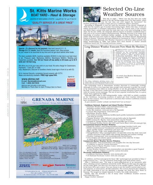
An article from Modern Mechanics<br />
magazine, 1932<br />
The technology used to disseminate weather forecasts is continually evolving.<br />
Although it’s been a very long time since people tried seriously to predict the weather<br />
by examining onion skins or seeing whether or not the groundhog went back in<br />
his hole, it has also been a while since mariners routinely listened to good old WWV<br />
radio for marine storm warnings. The use of once-popular weatherfax has, to a great<br />
extent, been replaced by GRIB.<br />
Although SSB radio is still indispensable, today, with WiFi so widely available<br />
in the <strong>Caribbean</strong>, increasing numbers of sailors get their weather information<br />
from on-line sources. Here we present a selection that various <strong>Caribbean</strong> cruisers<br />
have recommended.<br />
Is your favorite weather website not listed here? Let us know!<br />
<strong>Caribbean</strong> National, Regional and Island Weather Websites<br />
• Barbados Weather Radar: www.barbadosweather.org/<br />
barbados-weather-Radar-SABDriver.php<br />
• Cuba Met Institute: www.met.inf.cu (in Spanish)<br />
• Curaçao Met Department: www.meteo.an<br />
• Martinique Weather Radar:<br />
www.meteo.fr/temps/domtom/antilles/pack-public/animation/animMOSAIC<br />
_ant.html (in French)<br />
• Panama Weather: www.hidromet.com.pa/index.php (in Spanish)<br />
• SXM Cyclone/St. Martin: www.sxmcyclone.com (in French)<br />
• Trinidad & Tobago Weather Radar: www.metoffice.gov.tt/radar<br />
• US National Weather Service (for USVI and Puerto Rico): www.srh.noaa.gov/sju<br />
International/General Weather Websites<br />
• Desperate Sailors: www.desperatesailors.com/page/weather/carib_sxm<br />
• NOAA’s Environmental Visualization Laboratory: www.nnvl.noaa.gov<br />
(great satellite images, animations and more visual storm stuff)<br />
• Mike’s Weather Page: www.spaghettimodels.com<br />
• PassageWeather: http://passageweather.com (provides seven-day wind, wave and<br />
weather forecasts to help sailors with passage planning and weather routing)<br />
• Weather Underground: www.wunderground.com/hurricane<br />
• www.windyty.com (shows speed and direction of the wind for 14 days<br />
in about three-hour increments)<br />
Commercial Marine Weather Service Websites<br />
• Buoyweather: www.buoyweather.com (supplies free two-day forecasts<br />
in addition to paid-for custom forecasts)<br />
• Chris Parker’s Marine Weather Center: www.mwxc.com<br />
(paid-for custom forecasts)<br />
• Crown Weather Services: www.crownweather.com (provides a good Tropical<br />
Weather page in addition to paid-for custom forecasts)<br />
Hu rricane Information Websites<br />
• <strong>Caribbean</strong> Hurricane Network: www.stormcarib.com<br />
• US National Hurricane Center: www.nhc.noaa.gov<br />
In addition, surf forecasts (great for those “iffy” anchorages) are provided at http://<br />
magicseaweed.com — see the animated swell height and swell period charts.<br />
John J. Kettlewell says, “The map at earth.nullschool.net is an interactive pilot<br />
chart, showing current conditions around the world. When you first open the page you<br />
see the entire globe, but then you can zoom in to see smaller regions. Click on “Earth”<br />
in the lower left to get a menu. You can choose to see the world’s current wind or current<br />
patterns, or ocean waves, all with animation. The current charts for the <strong>Caribbean</strong><br />
are really interesting if you are planning a passage say from Key West down to<br />
Panama. The images are simply hypnotic to watch, but really informative.”<br />
Finally, this site includes a list of many other <strong>Caribbean</strong> weather sources:<br />
www.tropicalwx.com<br />
Happy weather windows!


