

Caribbean Compass Yachting Magazine September 2016
Welcome to Caribbean Compass, the most widely-read boating publication in the Caribbean! THE MOST NEWS YOU CAN USE - feature articles on cruising destinations, regattas, environment, events...
Welcome to Caribbean Compass, the most widely-read boating publication in the Caribbean! THE MOST NEWS YOU CAN USE - feature articles on cruising destinations, regattas, environment, events...

Create successful ePaper yourself
Turn your PDF publications into a flip-book with our unique Google optimized e-Paper software.
ALL ASHORE…<br />
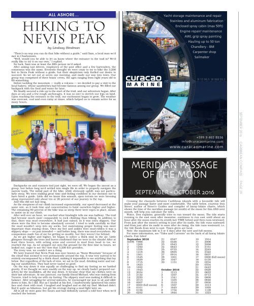
HIKING TO<br />
NEVIS PEAK<br />
by Lindsay Bindman<br />
“There’s no way you can do that hike without a guide,” said Sam, a local man we’d<br />
met in Charlestown.<br />
“Well, would you be able to let us know where the entrance to the trail is? We’d<br />
really like to try it on our own,” I replied.<br />
No luck. Sam was at least the fifth person we’d asked.<br />
After asking taxi drivers, employees of the post office and a few bartenders, the<br />
consensus was the same. Everyone thought we were crazy to try to hike the 3,200<br />
feet to Nevis Peak without a guide, but their skepticism only fuelled our desire to<br />
succeed. So we set out at seven one morning, and made our way into town. Our<br />
group was comprised of three boats’ crews, the ages ranging from eight years old to<br />
60-something.<br />
Before tackling the mountain — really a volcano — we decided to pay a visit to the<br />
local bakery, whose sandwiches had become famous among our group. We filled our<br />
backpack with the food and water for later.<br />
We finally secured a ride up to the start of the trail, and our adventure began. After<br />
days at sea and a few rough anchorages, it was so nice to stretch our legs on land.<br />
Upon reaching the entrance to the trail, our excitement began to grow. The weather<br />
was overcast, cool and even rainy at times, which helped us to remain active for so<br />
many hours.<br />
Backpacks on and runners tied just right, we were off. We began the ascent as a<br />
group, but before long we’d settled into single file in order to properly navigate the<br />
narrow trails. The initial part of the hike, while obviously uphill, was not particularly<br />
steep. We were making great time and feeling confident in our decision not to<br />
have hired a guide. Little did we know this smooth, open terrain we were breezing<br />
along represented only about ten or 20 percent of our journey to the top.<br />
And this did not last long.<br />
As the steepness of our climb increased exponentially, our speed decreased at the<br />
same rate, as it took time and concentration to hoist ourselves higher and higher.<br />
The remaining 80 percent of the hike was so steep there were ropes in place, meant<br />
to assist us in our climb.<br />
After well over an hour, we reached what hindsight tells me was halfway. The trail<br />
had become much more comparable to rock climbing than hiking. In addition to<br />
that, there was mud everywhere. It had just rained, so it was extra slippery. Our<br />
shoes were the first to become absolutely covered. I tried to walk carefully so that<br />
the mud wouldn’t seep into my socks, but maintaining proper footing was more<br />
important than staying clean. Once my feet and ankles were mud-ridden it was a<br />
slippery slope — no pun intended — and before long, there was mud everywhere. My<br />
companions made fun of me for getting so muddy, but they weren’t far behind.<br />
As we got higher and higher, we began to notice a thick mist in the air. Little<br />
glimpses through the trees and leaves confirmed that we were in the clouds! After at<br />
least three hours, with aching arms and covered in mud from head to toe, we<br />
reached the top. As we stepped out onto flat ground for the first time in hours, we<br />
looked out, eager to see the view that 3,200 feet provides.<br />
The irony was, we couldn’t see a thing.<br />
We later learned that Nevis Peak was once known as “Snow Mountain” because of<br />
the cloud that seemed to rest permanently around the top. It was very surreal to be<br />
entirely encompassed by a thick cloud, making it impossible to see anything that lay<br />
below. But regardless of the lack of view, we sat in the mud, drinking water and eating<br />
our sandwiches. They had never tasted so good.<br />
On the way down it was equally as challenging to find my footing as we battled<br />
gravity. If we thought we were muddy on the way up, we clearly hadn’t prepared ourselves<br />
for the mudslides, all the way down. It became clear that my clothes were on<br />
their last adventure. At one juncture, our family friend Michael, who was visiting from<br />
Toronto, tried to help me with my footing. The slippery mud was making it difficult to<br />
balance. After struggling for several minutes, he encouraged me just to sit and slide<br />
down to him. So I did. But as I landed at his feet, I inadvertently splattered his entire<br />
face and chest with mud. I laughed and laughed and so did my Dad. Michael didn’t<br />
find it quite as hilarious, but got his revenge during a mud fight later on.<br />
All in all we were gone five hours and had definitely earned a cold beer when we’d<br />
reached the bottom.<br />
MERIDIAN PASSAGE<br />
OF THE MOON<br />
SEPTEMBER - OCTOBER <strong>2016</strong><br />
Crossing the channels between <strong>Caribbean</strong> islands with a favorable tide will<br />
make your passage faster and more comfortable. The table below, courtesy Don<br />
Street, author of Street’s Guides and compiler of Imray-Iolaire charts, which<br />
shows the time of the meridian passage (or zenith) of the moon for this AND next<br />
month, will help you calculate the tides.<br />
Water, Don explains, generally tries to run toward the moon. The tide starts<br />
running to the east soon after moonrise, continues to run east until about an<br />
hour after the moon reaches its zenith (see TIME below) and then runs westward.<br />
From just after the moon’s setting to just after its nadir, the tide runs eastward;<br />
and from just after its nadir to soon after its rising, the tide runs westward; i.e.<br />
the tide floods from west to east. Times given are local.<br />
Note: the maximum tide is 3 or 4 days after the new and full moons.<br />
For more information, see “Tides and Currents” on the back of all Imray Iolaire<br />
charts. Fair tides!<br />
<strong>September</strong> <strong>2016</strong><br />
DATE TIME<br />
1 1205<br />
2 1250<br />
3 1335<br />
4 1418<br />
5 1501<br />
6 1545<br />
7 1629<br />
8 1715<br />
9 1823<br />
10 1852<br />
11 1943<br />
12 2034<br />
13 2122<br />
14 2220<br />
15 2313<br />
16 0007<br />
17 0000 (full moon)<br />
18 0101<br />
19 0156<br />
20 0252<br />
21 0347<br />
22 0446<br />
23 0543<br />
24 0643<br />
25 0733<br />
26 0825<br />
27 0914<br />
28 1001<br />
29 1047<br />
30 1131<br />
October <strong>2016</strong><br />
1 1213<br />
2 1257<br />
3 1341<br />
4 1425<br />
5 1510<br />
6 1557<br />
7 1645<br />
8 1734<br />
9 1844<br />
10 1914<br />
11 2006<br />
12 2058<br />
13 2151<br />
14 2245<br />
15 2340<br />
16 0037<br />
17 0000 (full moon)<br />
18 0135<br />
19 0234<br />
20 0334<br />
21 0442<br />
22 0528<br />
23 0622<br />
24 0712<br />
25 0800<br />
26 0846<br />
27 0930<br />
28 1013<br />
29 1055<br />
30 1139<br />
31 1223<br />
SEPTEMBER <strong>2016</strong> CARIBBEAN COMPASS PAGE 29


