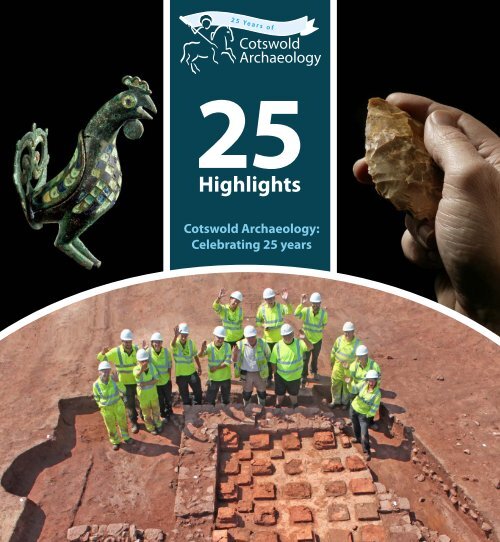
Cotswold Archaeology: Celebrating 25 years
Twenty-five years is a long time in archaeology! Much has changed since 1989 and Cotswold Archaeology has been in the vanguard of developments and done much to set the pace...
Twenty-five years is a long time in archaeology! Much has changed since 1989 and Cotswold Archaeology has been in the vanguard of developments and done much to set the pace...

Create successful ePaper yourself
Turn your PDF publications into a flip-book with our unique Google optimized e-Paper software.
2 5 Y e a r s o f<br />
<strong>Cotswold</strong><br />
<strong>Archaeology</strong><br />
<strong>25</strong><br />
Highlights<br />
<strong>Cotswold</strong> <strong>Archaeology</strong>:<br />
<strong>Celebrating</strong> <strong>25</strong> <strong>years</strong>
<strong>Cotswold</strong> <strong>Archaeology</strong> would like to thank the following clients, consultants and organisations who<br />
have funded, supported and contributed to the projects that formed our <strong>25</strong>th anniversary year<br />
highlights:<br />
Aggregates Levy Sustainability Fund<br />
Barratt Homes<br />
Bristol Alliance Limited Partnership<br />
Buckingham Group Consultancy Ltd<br />
CgMs Consulting (now part of RPS Group)<br />
Channel 4 Time Team<br />
Chris Howlett Consultancy<br />
Church Commissioners for England<br />
Crest Nicholson<br />
Curl La Tourelle Architects<br />
EDF Energy<br />
English Heritage<br />
Faccenda Property Ltd<br />
Fisher and Dean<br />
Gloucestershire County Council<br />
Groundwork <strong>Archaeology</strong><br />
Hanover Cube<br />
Henry Riley LLP<br />
J Sainsbury plc<br />
J S Bloor<br />
Mead Realisations<br />
Morgan Sindall<br />
NACAP Land & Marine<br />
National Grid<br />
Persimmon Homes<br />
PJO <strong>Archaeology</strong><br />
Prowting Homes<br />
Rhead Group<br />
RSK Environment<br />
South Northamptonshire Council<br />
St Georges Landowners Group<br />
St James’s Place Wealth Management<br />
Taylor Wimpey Southern Counties<br />
Tisdell King<br />
Wards Solicitors<br />
West Berkshire Council<br />
Westbury Homes
<strong>Celebrating</strong> <strong>25</strong> Years<br />
Twenty-five <strong>years</strong> is a long time in archaeology!<br />
Much has changed since 1989 and <strong>Cotswold</strong><br />
<strong>Archaeology</strong> has been in the vanguard of<br />
developments and done much to set the pace.<br />
The creation of <strong>Cotswold</strong> Archaeological Trust out of<br />
Cirencester Excavation Committee was a bold move,<br />
but it provided the platform upon which to build a<br />
commercially focused body able to perpetuate the<br />
best traditions of high-quality research. It was also<br />
very timely. On a European scale, the introduction of<br />
Environmental Impact Assessment was just beginning<br />
to make its mark on the development industry,<br />
and in 1990 the same principles underpinned new<br />
government guidance on archaeology and planning in<br />
England.<br />
From a handful of staff based in the former railway<br />
station building in central Cirencester, <strong>Cotswold</strong><br />
<strong>Archaeology</strong> has grown to a multi-disciplinary team<br />
of more than 120 now spread through four offices in<br />
Andover, Cirencester, Exeter and Milton Keynes.<br />
Our project portfolio has expanded from small-scale<br />
excavations and evaluations to participation in some<br />
of the largest archaeological programmes in Europe,<br />
such as major highway and railway schemes in<br />
England, Wales and Northern Ireland, and Hinkley<br />
Point nuclear power station in Somerset.<br />
<strong>Archaeology</strong>, and what motivates everyone in the<br />
company, is bringing new understandings of the<br />
past to ever wider audiences, keen to find out what<br />
lies beneath their feet and how such things can help<br />
shape and enrich all of our futures. To this end we<br />
are delighted to showcase <strong>25</strong> highlights from the last<br />
<strong>25</strong> <strong>years</strong>, which range from projects and individual<br />
finds to events and publications. This selection ably<br />
demonstrates the range of our activities over the last<br />
quarter-century, and the 26th highlight looks forward<br />
to the further discoveries that undoubtedly await us in<br />
the next <strong>25</strong> <strong>years</strong>.<br />
Timothy Darvill OBE<br />
Chairman of the Board of Trustees<br />
Our range of interests and skills has steadily grown<br />
to include, among other things, marine archaeology,<br />
historic buildings analysis, and landscape<br />
archaeology. Our geographical focus has also spread<br />
from Cirencester and the <strong>Cotswold</strong>s to include all<br />
parts of the UK and collaborations with partner<br />
organisations in other European countries.<br />
Throughout, the greatest achievement of <strong>Cotswold</strong>
Highlight 1<br />
Highlight 1<br />
The formation of <strong>Cotswold</strong> Archaeological<br />
Trust (CAT) in 1989 was a bold and far-sighted<br />
decision, but one which built on the achievements<br />
of the Cirencester Excavation Committee (CEC)<br />
over the preceding thirty <strong>years</strong>. The plan was that<br />
CEC would see through its existing commitments<br />
to produce reports on its excavations while the new<br />
entity, a registered charity, would take responsibility<br />
for all further fieldwork. The creation of CAT was<br />
directly linked to the changing state of British<br />
archaeology, and in particular the principle that<br />
developers should pay for archaeological work<br />
(which became formally enshrined in government<br />
planning policy the following year). From humble<br />
beginnings <strong>Cotswold</strong> <strong>Archaeology</strong> (as CAT was<br />
re-branded in 2002) has now grown to become one<br />
of the UK’s top four archaeological contracting<br />
organisations, employing over 100 professional<br />
archaeologists at offices in<br />
Cirencester, Andover<br />
and Milton<br />
The Formation of <strong>Cotswold</strong> <strong>Archaeology</strong> on 17 March 1989<br />
Keynes, with a new office opening in Exeter in 2015.<br />
A notable event occurred on 15 October 2008<br />
when we celebrated the 50th anniversary of the<br />
foundation of CEC with a lecture and reception.<br />
This was an opportunity to welcome back to<br />
Cirencester many people who had worked there<br />
over the preceding five decades. The photo shows<br />
(from the left) Professor Sheppard Frere, Chairman<br />
of CEC 1965-1989; Professor Timothy Darvill, a<br />
founder trustee of <strong>Cotswold</strong> <strong>Archaeology</strong> and its<br />
Chairman for the last 22 <strong>years</strong>; Alan McWhirr,<br />
Director of Excavations for CEC 1965-1989 and<br />
trustee of <strong>Cotswold</strong> <strong>Archaeology</strong> 1989-1997; and Neil<br />
Holbrook, Chief Executive of <strong>Cotswold</strong> <strong>Archaeology</strong><br />
Highlight 1
Highlight 1<br />
Highlight 2<br />
Highlight 2<br />
Handaxes are among the earliest tools made<br />
by humans, the oldest examples from<br />
Europe dating up to 900,000 <strong>years</strong> before present.<br />
They were multi-purpose implements, although<br />
undoubtedly a main use was for butchery to cut<br />
through the tough animal hide and sinew.<br />
Like all implements of this type, the Blenheim Farm<br />
axe was shaped from a single piece of flint, its maker<br />
probably using an antler ‘hammer’ to take flakes<br />
from each face to make a razor-sharp cutting edge.<br />
Flint ‘Handaxe’ from Blenheim Farm, Moreton-in-Marsh (2003)<br />
The ‘cordiform’ (heart-shaped) axe is relatively<br />
small, measuring only 90mm in length, and features<br />
some fine secondary working (retouch) to its edges.<br />
It probably dates to the Mousterian phase of the<br />
middle Palaeolithic, probably between 120,000<br />
and 30,000 <strong>years</strong> before present. In this period it is<br />
known that Moreton-in-Marsh marked the southern<br />
extent of a large freshwater lake that extended from<br />
Rugby in the east to Birmingham in the west and<br />
northwards to Leicester. This large body of water,<br />
referred to today as ‘Lake Harrison’ by geologists,<br />
would have attracted a range of large animals which<br />
might have included elephant and hippopotamus.<br />
Until the discovery of the Blenheim Farm axe,<br />
and of a second handaxe in the same area by<br />
our archaeologists in 2010, evidence for<br />
human activity at the lake margins was<br />
slight. The new finds are evidence that<br />
early humans were indeed present in<br />
this area and exploiting the rich food<br />
resource the lake and its visiting<br />
fauna would have provided.<br />
Highlight 2
Highlight 1 Highlight 3<br />
Highlight 2<br />
Highlight 3<br />
In 2003, we carried out an excavation at Hartshill<br />
Quarry in Upper Bucklebury, West Berkshire,<br />
uncovering evidence for a long sequence of<br />
occupation on the site and information about<br />
how the people lived and organised their<br />
environment, and the technology they used.<br />
A Late Bronze Age settlement dating to the 10th<br />
century BC was found, associated with long<br />
alignments of closely set posts. These appeared<br />
to provide a framework around which the use<br />
of the settlement was organised, with different<br />
activities in different parts of the site.<br />
Samples taken from the site yielded microscopic<br />
residues including iron hammerscale. The remarkable<br />
abundance and distribution of the hammerscale is<br />
seen as evidence for the earliest ironworking site<br />
yet recognised in Britain. More hammerscale was<br />
recovered from a subsequent settlement on the site,<br />
dating to the Early Iron Age (5th century BC), as<br />
were larger residues from both iron-smelting and<br />
iron-smithing. The identification of an iron-smelting<br />
site dating from so early is important in itself as there<br />
is only limited excavated evidence for ironworking<br />
in or before the 7th century BC in Wessex and<br />
the Thames Valley, and in Britain generally.<br />
Early Ironworking at Upper Buckleberry, West Berkshire (2003)<br />
The full report, Ironworking in the Bronze Age?<br />
Evidence from a 10th-century BC Settlement<br />
at Hartshill Copse, Upper Bucklebury, West<br />
Berkshire, can be found in the Proceedings<br />
of the Prehistoric Society, Vol. 72.<br />
Highlight 3
Highlight 1<br />
Highlight 3<br />
Highlight 2<br />
Highlight 4<br />
Highlight 4<br />
Clyst Honiton, Devon (2012)<br />
These curious-looking objects were among<br />
a group of sixteen found in the same pit.<br />
They are thought to have been baked clay<br />
‘loomweights’ for vertical (warp-weighted) looms,<br />
though they appear never to have been used.<br />
Radiocarbon dating of plant remains from the pit<br />
indicates that the objects were deposited between<br />
3800 and 3700 <strong>years</strong> BC, in the early Neolithic period.<br />
This means that they are among the earliest finds of<br />
this type from Europe. Only one other site in Britain<br />
has produced a similar find, a single weight from a<br />
Neolithic longhouse at Easington, County Durham.<br />
In comparison with loomweights known from the<br />
Bronze Age and later periods the Clyst Honiton<br />
weights are unusually heavy, weighing up to 1.5kg<br />
each. This may mean that they were intended for use<br />
with plant fibres such as flax or hemp, rather than<br />
with sheep wool.<br />
The pit in which the loomweights were found<br />
was also remarkable for the very large quantity<br />
of charred plant remains it produced. These<br />
continued<br />
Highlight 4
Highlight 1<br />
Highlight 3<br />
Highlight 2<br />
Highlight 4<br />
Highlight 4<br />
Clyst Honiton, Devon (2012) (cont.)<br />
included ‘wild foods’ consisting of hazelnuts,<br />
acorns, crab apples and strawberries, as well<br />
as grains of barley and emmer wheat.<br />
It is clear that wild foods were commonly used<br />
to supplement diet in the Neolithic period. The<br />
presence of acorns is unusual: although highly<br />
nutritious, acorns require processing to remove bitter<br />
tannins before being palatable. The limited evidence<br />
for acorns within the archaeological record in Britain<br />
is of interest and suggests that they were either not<br />
regularly exploited or that processing techniques<br />
rendered them unrecognisable when burnt.<br />
Acorns (Quercus sp.) Cereal grain Crab apple pips (Malus sylvestris)<br />
Crab apple stalks (Malus sylvestris) Hazelnut shells Whole and half carbonised<br />
crab apple (Malus sylvestris)<br />
Highlight 4
Highlight 1<br />
Highlight 5<br />
Highlight 3<br />
Highlight 2<br />
Highlight 4<br />
Highlight 5<br />
Llandough was one of the most important (and<br />
stressful!) excavations in our history. In 1994<br />
we commenced excavations on a housing scheme<br />
next to the church of St Dochdwy in Llandough,<br />
a small village on the outskirts of Cardiff. Initial<br />
expectations were not high as the area had<br />
previously been occupied by farm buildings.<br />
Much to our amazement, as the topsoil was stripped,<br />
human burials were revealed; at first just as few,<br />
but then as the development proceeded more and<br />
more. In the end just over 1,000 burials were<br />
excavated, and finds of imported pottery from<br />
the Mediterranean showed that these dated not<br />
to the post-medieval period as first thought, but<br />
to the post-Roman era (5th to 6th century AD).<br />
What was originally planned to be a three-week dig<br />
ended up taking six months, but the results were worth<br />
it. We had found the largest early Christian monastic<br />
cemetery in Wales. Radiocarbon dating showed that<br />
the cemetery carried on in use until the late 10th or<br />
11th century when we know from historical sources<br />
that the monastery, which was on the same site as the<br />
present church, was disbanded. Careful analysis of the<br />
human bones showed that women and children were<br />
well represented; this was therefore not a cemetery<br />
exclusively for the use of the monks, but may also<br />
have included their families (Welsh monks could<br />
marry at this time) as well some members of the lay<br />
aristocracy, who could be buried at a monastery if<br />
they paid money. The burials showed lower levels<br />
of disease and greater life expectancy than found<br />
at some other early medieval cemeteries, perhaps a<br />
reflection of a relatively high standard of living.<br />
The full report is available to read on our website,<br />
Llandough early medieval cemetery, Glamorgan (1994)<br />
and the burial information is in a database<br />
on the <strong>Archaeology</strong> Data Service. It is a site<br />
that all those involved will never forget.<br />
Highlight 5
Highlight 1<br />
Highlight 5<br />
Highlight 3<br />
Highlight 2<br />
Highlight 4<br />
Highlight 6<br />
Highlight 6<br />
This unusual find was made by our archaeologists<br />
working at Blackfriars, Gloucester, where much<br />
of the Dominican friary, founded in 1239, still<br />
survives. It is part of a limestone panel, sculpted in<br />
low relief and showing a seated male figure next to<br />
Gloucester Blackfriars stone panel fragment - ‘the drunk monk’ (2010)<br />
a barrel which is supported on a table. The figure<br />
would seem to be filling a foaming tankard from<br />
the tap at the base of the barrel. The stone was<br />
competently cut but not well detailed, particularly<br />
around the figure. Both edges are broken and this<br />
suggests that it was part of a larger decorative frieze,<br />
perhaps from above a fireplace. In its style and<br />
execution the stone panel looks to be late medieval<br />
or a little later, but is unlikely to be later than 1600.<br />
Later medieval church or secular carvings<br />
depicting monks or friars indulging in drink<br />
and other pleasures are relatively common and<br />
are often seen as a commentary on morally<br />
errant religious communities. Such an obvious<br />
statement from the friary itself would seem<br />
unusual and the likelihood is that the stone<br />
panel dates to the immediately postdissolution<br />
use of the site. The friary<br />
buildings were converted into a private<br />
house and later a manufactory after<br />
the dissolution. The stone panel<br />
might possibly relate to an unknown<br />
inn or hostelry located near the<br />
original friary buildings, making a<br />
reference to the former community.<br />
The still-standing, though recently<br />
closed, Blackfriars public house<br />
probably dates to the 19th century,<br />
although an earlier establishment<br />
may well have occupied the site.<br />
Highlight 6
Highlight 1<br />
Highlight 5<br />
Highlight 3<br />
Highlight 2<br />
Highlight 7<br />
Highlight 4<br />
Highlight 6<br />
Highlight 7<br />
Nestling in a small valley below the wooded<br />
slopes of Hawk Hill is the village of Nether<br />
Worton, Oxfordshire. A prominent building on<br />
the approach to the village from the north is the<br />
17th-century farmhouse of Manor Farm, a Grade<br />
II Listed building. Renovation of the farmhouse,<br />
conversion of outbuildings and landscaping<br />
of the grounds was undertaken in 2013.<br />
The dilapidated 19th-century wing on the north side<br />
of the farmhouse was demolished in 2013, and it was<br />
during the excavation of the foundation trenches<br />
for a new wing that four sections of wooden pipe<br />
were uncovered at a depth of c. 1m below ground<br />
level. The pipes sections, which were made from<br />
Nether Worton wooden pipes (2013)<br />
elm, were up to 6m long and were tapered at one<br />
end to fit into the bore in the adjoining section. The<br />
section nearest the house had a hole in its upper<br />
surface that would have held a wooden or lead pipe<br />
that probably supplied water to a hand pump.<br />
In Britain, wooden pipes have been used to convey<br />
water since the Roman period. The pipes at Nether<br />
Worton probably date to the 17th or18th century<br />
and were installed to supply water to the farmhouse.<br />
Wooden pipes, predominately made from the trunks<br />
of elms, were manufactured using a sectional pipe<br />
auger and a variety of bits and reamers to bore holes<br />
in trunks up to 6m long. The pipes from Manor Farm<br />
are fine examples of this type of wood technology.<br />
Highlight 7
Highlight 1<br />
Highlight 8<br />
Highlight 5<br />
Highlight 3<br />
Highlight 2<br />
Highlight 7<br />
Highlight 4<br />
Highlight 6<br />
Highlight 8<br />
In the early 1990s, there was renewed interest in<br />
how best to reconcile the economic imperative<br />
for new development within historic towns with<br />
the preservation and good management of the<br />
important archaeological remains that play such<br />
a crucial part in making these places so special.<br />
English Heritage therefore decided to commission<br />
a series of studies concerned with the archaeology<br />
of the most important historic towns in England.<br />
Their purpose was both to present an up-to-date<br />
Cirencester Town and Landscape (1994)<br />
account of what was known about these places,<br />
and also to help formulate strategies for managing<br />
the archaeological implications of development<br />
proposals. Cirencester was in the first wave of<br />
these new urban archaeological assessments<br />
and in 1994 was the first one to be published.<br />
Cirencester Town and Landscape was both groundbreaking<br />
and an important feather in the cap of<br />
<strong>Cotswold</strong> <strong>Archaeology</strong>. It showcased not only our<br />
expertise in the highly complex discipline of urban<br />
archaeology but also our ability to produce a highquality<br />
publication in a short period of time. It is<br />
telling that 20 <strong>years</strong> later some other assessment<br />
reports are only just appearing or are still awaited!<br />
The book was concerned with the whole history<br />
of Cirencester and its immediate environs, from<br />
early prehistory right up to the 19th century.<br />
The medieval and post-medieval periods in<br />
Cirencester are less well known or researched<br />
than the Roman town of Corinium Dobunnorum,<br />
yet the extant buildings of these later periods<br />
contribute significantly to the character of<br />
this quintessential <strong>Cotswold</strong> market town.<br />
It was a measure of the interest in the publication<br />
that it quickly sold out, a rarity indeed for<br />
archaeological books, but we have made a free<br />
pdf available to download on our website.<br />
Highlight 8
Highlight 8<br />
Highlight 5<br />
Highlight 1 Highlight 3<br />
Highlight 2<br />
Highlight 9<br />
Highlight 4<br />
Highlight 7<br />
Highlight 6<br />
Highlight 9<br />
These worked bone objects came to light<br />
during <strong>Cotswold</strong> <strong>Archaeology</strong>’s large-scale<br />
excavations close to Mildenhall ahead of the<br />
construction of a new town centre supermarket.<br />
The excavations revealed a very complex pattern<br />
of occupation at the site beginning in the Late<br />
Bronze Age (c. 1000 BC) and continuing into the<br />
Iron Age, Roman, Anglo-Saxon and medieval<br />
periods. The most spectacular archaeological<br />
features were a series of Iron Age defensive<br />
ditches, some of which were 5 metres deep.<br />
Most of the Iron Age finds were recovered<br />
from the many deep pits that had been dug<br />
into the chalk geology. Such pits are common<br />
from Iron Age sites and it is thought they were<br />
used for the storage of grain. After use, pits<br />
of this type were backfilled and often contain a<br />
range of artefacts. Some archaeologists believe<br />
Iron Age and Anglo-Saxon worked bone objects from Mildenhall ,Suffolk (2009<br />
objects such as those shown were deliberately<br />
placed in pits as part of a religious ritual.<br />
Objects 1 and 2 date to the Middle Iron Age,<br />
probably to the 3rd-1st centuries BC. They can tell<br />
us a lot about the activities which took place at the<br />
site in this period. The large fork-like bone object<br />
(no. 1) is a weaving comb used with a vertical warpweighted<br />
loom, probably to push down the woollen<br />
yarn or weft. It has been carefully carved from a horse<br />
longbone and is decorated with rows of punched or<br />
drilled rings. Object no. 2 is a ‘toggle’ fastener and is<br />
richly decorated with ring-and-dot motifs. Toggles<br />
were widely used in the Iron Age in place of buttons or<br />
buckles. Object no. 3 is a hair comb, which dates to<br />
the later Anglo-Saxon period (10th or 11th centuries<br />
AD). Combs were essential for the removal of lice<br />
and other parasites. This example was made from<br />
three pieces of bone held together with iron rivets.<br />
Object 1. Weaving comb Object 2. ‘Toggle’ fastener Object 3. Hair comb<br />
Highlight 9
Highlight 1<br />
Highlight 8<br />
Highlight 5<br />
Highlight 3<br />
Highlight 2<br />
Highlight 9<br />
Highlight 4<br />
Highlight 10<br />
Highlight 7<br />
Highlight 6<br />
Highlight 10<br />
In one of the most extensive excavations ever<br />
in the Northamptonshire town of Towcester<br />
(Roman Lactodurum), a substantial Roman stonefounded<br />
building came to light. It lay in a backplot<br />
of the Roman town, between Watling Street and<br />
the disturbed remains of its 2nd-century defences,<br />
about 40m away from the projected street frontage.<br />
The building and an adjacent metalled road were<br />
aligned at an angle to Watling Street, so it is<br />
possible that they respected another Roman road<br />
that may have run acutely to Watling Street.<br />
The stone-founded building was constructed in the<br />
later 2nd century AD, replacing<br />
an earlier phase of building on<br />
this plot of which little remained.<br />
It incorporated a cellar formed of<br />
a double thickness of limestone<br />
walling set in clean blue clay that<br />
The Towcester Roman building (2013)<br />
had been deposited between the double wall and<br />
outside of it. The floor also consisted of a layer of<br />
blue clay, 0.3m thick. The cellar had been made<br />
waterproof with a lining probably intended to<br />
keep it dry, although it equally enabled it to hold<br />
water, as demonstrated during the excavations.<br />
Demolition debris from the cellar included an<br />
unusual number of cattle skulls and at least six<br />
complete pottery vessels – mostly jars but also a<br />
dish that had been used for cooking – dating to<br />
the 3rd or 4th century AD. It is at present a matter<br />
for debate whether the vessels had been stored in<br />
the cellar, or whether they represent some form<br />
of closure deposit at the building’s demise.<br />
Highlight 10
Highlight 1<br />
Highlight 8<br />
Highlight 5<br />
Highlight 3<br />
Highlight 2<br />
Highlight 9<br />
Highlight 4<br />
Highlight 10<br />
Highlight 7<br />
Highlight 11<br />
Highlight 6<br />
Highlight 11<br />
This object was found during <strong>Cotswold</strong><br />
<strong>Archaeology</strong>’s excavations along the route of a<br />
major gas pipeline across southern Wales in 2006.<br />
It is remarkable in a number of respects; one of only<br />
64 such objects known from Britain and one of only<br />
two known from an archaeological excavation. The<br />
Trecastell halberd, which analysis confirms was<br />
made of copper, was found at the top of a pit located<br />
just off centre within a ring ditch. Ring ditches<br />
typically represent the remains of round barrows, the<br />
common method of burial in Britain during the late<br />
Neolithic and Bronze Age periods, c. <strong>25</strong>00–1500<br />
BC. No trace of a burial survived in the pit<br />
above which the Trecastell halberd had<br />
been placed, and some form of ‘ritual’<br />
deposition would seem likely.<br />
Halberds are a form of<br />
weapon, with a dagger-like<br />
blade mounted more or<br />
less perpendicularly to<br />
a long wooden shaft.<br />
Unusually in this<br />
instance, part<br />
of<br />
Chalcolithic (‘Copper Age’) halberd from Trecastell, Powys (2006)<br />
the wooden shaft survived and the orientation of<br />
the wood grain confirmed the method of hafting.<br />
Analysis of the wood indicates that this was of<br />
hawthorn, rowan or crab apple, a hard and resilient<br />
wood commonly used for implement handles in<br />
prehistory. Halberds are the most expertly-crafted<br />
metal objects of this period, the blade probably cast<br />
in a clay mould and fixed to its haft using separatelymade<br />
rivets made from thick rod.<br />
The Trecastell halberd has<br />
been studied by Dr Stuart<br />
Needham, an independent<br />
researcher, who considers it to be<br />
of a specifically Irish type which<br />
he has defined as Type Roscrea.<br />
The type is characterised by squat<br />
proportions, amongst other features,<br />
and is now thought to be early in<br />
the insular halberd sequence with<br />
support from a radiocarbon date from<br />
part of the wooden haft of 2470–2200<br />
cal. BC. As such, the Trecastell halberd<br />
is one of the earliest of this class of<br />
weapon to be found in Wales. It is also<br />
one of the very earliest scientificallydated<br />
metal objects from Britain.<br />
With grateful thank to Stuart Needham<br />
for commenting on the text and for<br />
the use of his image of the halberd.<br />
Highlight 11
Highlight 1<br />
Highlight 8<br />
Highlight 5<br />
Highlight 3<br />
Highlight 2<br />
Highlight 9<br />
Highlight 4<br />
Highlight 10<br />
Highlight 7<br />
Highlight 12<br />
Highlight 11<br />
Highlight 6<br />
Highlight 12<br />
<strong>Cotswold</strong> <strong>Archaeology</strong> played a crucial part<br />
in the first ever Time Team Live television<br />
programme which took place over the three days<br />
of the 1997 August Bank Holiday. The programme<br />
generated extraordinary levels of public interest<br />
and high viewing figures as we investigated a<br />
previously unknown Roman villa near Northleach<br />
in the <strong>Cotswold</strong>s. Chief Executive Neil Holbrook<br />
directed the excavation with Mick Aston as our staff<br />
dug evaluation trenches to test parchmarks visible<br />
in a pasture field. These marks had been spotted<br />
from a helicopter for the first time the previous<br />
year by local amateur archaeologist Roger Box. They<br />
showed with remarkable clarity the unmistakable<br />
outline of a large Roman villa composed of ranges<br />
of rooms set around three courtyards – in some<br />
places even the doorways were visible. It was a<br />
frenetic weekend, and with a certain inevitability<br />
Turkdean, Gloucestershire (1997)<br />
the fine weather of the preceding weeks broke on<br />
the Saturday morning as torrential downpours<br />
soaked archaeologists and film crew alike.<br />
The process of investigating an archaeological site<br />
live on national television was new to everyone<br />
– as soon as an interesting find was made work<br />
had to cease until the film crew arrived!<br />
While the project undoubtedly created huge public<br />
interest in archaeology, it also produced important<br />
information about the villa; the geophysical survey<br />
was particularly stunning. Neil Holbrook has<br />
published an account of the villa in the national<br />
journal Britannia, and you can download the<br />
report from our website. Given the importance of<br />
the discoveries it was no surprise when the site was<br />
subsequently designated a Scheduled Monument.<br />
Time Team’s<br />
Tony Robinson<br />
and Guy de<br />
la Bédoyère<br />
examining<br />
finds from the<br />
site<br />
Roman brooch with the inscription ‘VTERE FELIX’, which means ‘GOOD<br />
LUCK’<br />
Highlight 12
Highlight 1<br />
Highlight 8<br />
Highlight 5<br />
Highlight 3<br />
Highlight 2<br />
Highlight 9<br />
Highlight 4<br />
Highlight 10<br />
Highlight 7<br />
Highlight 12<br />
Highlight 11<br />
Highlight 6<br />
Highlight 13<br />
Pottery<br />
flagon<br />
Highlight 13<br />
Bridges Garage in Cirencester was<br />
known to be within the area of the<br />
Roman town’s western cemetery, but<br />
little in the way of archaeological<br />
remains was thought to have survived<br />
the construction of the 1960s<br />
garage, when archaeological<br />
salvage investigations<br />
recorded 46 cremations and<br />
8 inhumations. Nevertheless,<br />
redevelopment of the site in 2011<br />
revealed further Roman burials<br />
and by the end of fieldwork a further<br />
71 inhumations and 3 cremations had been<br />
recovered, making this the largest investigation<br />
of a Roman cemetery in Corinium for 40 <strong>years</strong>.<br />
Within the cemetery there was evidence for a<br />
square walled enclosure, possibly the remains of<br />
a mausoleum. The cemetery had been in use from<br />
(at least) the mid-2nd century to the 4th century<br />
AD, with most of graves from within the walled<br />
enclosure (and some of those adjacent) being of<br />
earlier Roman date,<br />
and with later<br />
Roman Cemetery at Bridges Garage, Cirencester (2011)<br />
Roman graves more evenly spread across the<br />
cemetery. Several of the burials had accompanying<br />
grave goods, of both earlier and later date.<br />
One of the earlier burials was of a young child,<br />
and contained a pottery tettine (or feeding cup)<br />
and an enamelled cockerel figurine. The cockerel<br />
is 1<strong>25</strong>mm in height, and is inlaid with enamel.<br />
Very few figurines of this type are known and this<br />
example is the only one to survive with its<br />
tail (see Highlight 14). The association<br />
of the cockerel with the god Mercury<br />
is well known and its presence here<br />
suggests adherence to the cult of<br />
Mercury, one function of whom<br />
was to accompany the souls of the<br />
recently deceased to the afterlife.<br />
Enamelled<br />
cockerel<br />
figurine<br />
Tettine –<br />
feeding cup<br />
Highlight 13
Highlight 1<br />
Highlight 8<br />
Highlight 5<br />
Highlight 3<br />
Highlight 2<br />
Highlight 10<br />
Highlight 7<br />
Highlight 9<br />
Highlight 4<br />
Highlight 12<br />
Highlight 14<br />
This exquisite enamelled bronze cockerel figurine<br />
was found by our archaeologists late in 2011<br />
during excavations at the site of Cirencester’s<br />
western cemetery. The find is believed to date<br />
to the middle decades of the 2nd century AD. It<br />
came from the grave of a child aged 2–3 <strong>years</strong>.<br />
The child had been buried in a nailed wooden<br />
coffin and also accompanied by his or her shoes,<br />
of which only the iron hobnails survived, and a<br />
pottery feeding cup or tettine (see Highlight 13).<br />
Only eight other finds of this type are known from<br />
the Roman world, from Britain, Germany and<br />
the Low Countries. It is believed these cockerel<br />
figurines, together with other richly-enamelled<br />
bronze vessels of high workmanship, were made in<br />
northern Britain and exported across the empire.<br />
The Cirencester cockerel is the only example to<br />
have survived with its openwork tail and the<br />
only one from Britain from a grave. When first<br />
made it would have been extremely colourful, the<br />
metal bright, and the wings, breast, eyes and tail<br />
with a pattern of red, blue and yellow enamels.<br />
Roman enamelled cockerel figurine. Bridges Garage, Cirencester (2011)<br />
To the Romans the cockerel held<br />
a special significance, linked<br />
as it is to the cult of Mercury.<br />
This association is thought<br />
to relate to Mercury’s role as<br />
a messenger to the gods and<br />
the cockerel announcing each<br />
new dawn. Surviving statues of<br />
Mercury, including an example<br />
from Cirencester, commonly feature<br />
a cockerel at the foot of the god.<br />
Mercury’s role as herdsman for the<br />
Highlight 11<br />
Highlight 6<br />
Highlight 13<br />
Highlight 14<br />
dead, accompanying the souls of the recently dead to<br />
the afterlife, may help to explain the presence of the<br />
Cirencester cockerel in a grave – an expression of a<br />
bereaved parent’s concern to ensure a safe journey.<br />
Highlight 14
Highlight 1<br />
Highlight 8<br />
Highlight 5<br />
Highlight 3<br />
Highlight 2<br />
Highlight 9<br />
Highlight 4<br />
Highlight 10<br />
Highlight 7<br />
Highlight 12<br />
Highlight 15<br />
Highlight 11<br />
Highlight 15<br />
Highlight 6<br />
Highlight 13<br />
Highlight 14<br />
A Neolithic causewayed enclosure and monument complex in<br />
Somerset (2006)<br />
The construction of a gas pipeline between<br />
Ilchester and Barrington in Somerset<br />
provided the context for the completely<br />
unexpected discovery of an Early Neolithic<br />
causewayed enclosure within a complex of later<br />
monuments including a Neolithic long enclosure,<br />
a Bronze Age U-shaped enclosure, and Bronze Age<br />
round barrows, enclosures and field boundaries<br />
(see map). The discovery was made at Netherfield<br />
Farm, South Petherton, and is the first of this type<br />
of monument complex to be found in Somerset.<br />
The archaeological work comprised the excavation<br />
of the causewayed enclosure and nearby features,<br />
together with the south-western end of the long<br />
enclosure to the north, as well as later, Bronze<br />
Age, ditches lying within the land-take of the<br />
pipeline. The causewayed enclosure was one of<br />
the smallest recorded so far, at 55m in diameter,<br />
and had discontinuous shallow ditches containing<br />
few finds. By contrast, the long enclosure, 50m<br />
long and of a form sometimes called a ‘mortuary<br />
enclosure’, had large ditches containing layers<br />
of charcoal and relatively large quantities of<br />
pottery and flintwork, particularly from the<br />
upper fills of the ditches. It appears that later<br />
activity at this site may have included food<br />
preparation and the manufacture of arrows.<br />
A series of radiocarbon dates from both<br />
monuments conform to chronologies found<br />
more widely, with the causewayed enclosure<br />
constructed around 3700 BC, and its use partly<br />
overlapping with the construction and use of<br />
continued<br />
Highlight 15
Highlight 1<br />
Highlight 8<br />
Highlight 5<br />
Highlight 3<br />
Highlight 2<br />
Highlight 9<br />
Highlight 4<br />
Highlight 10<br />
Highlight 7<br />
Highlight 12<br />
Highlight 15<br />
(cont.)<br />
the long enclosure, from about 3500 BC to 2900<br />
BC. Bayesian modelling of the dates has allowed<br />
a more precise estimation of the chronology of<br />
these monuments than would have been otherwise<br />
possible, and the long enclosure in particular is<br />
one of the most effectively dated in the country.<br />
The U-shaped enclosure was formed of five lengths of<br />
ditch of different form, and seems to have been partly<br />
palisaded. The imprecise dating is early to middle<br />
Bronze Age. It was probably partly contemporary<br />
with the ring ditches shown on the geophysics,<br />
and may have had a mortuary connection. The<br />
enclosures and boundary ditches further north<br />
may have been slightly later, forming aspects of<br />
settlement that followed the use of the site for burial.<br />
Highlight 11<br />
Highlight 15<br />
Highlight 6<br />
Highlight 13<br />
Highlight 14<br />
A Neolithic causewayed enclosure and monument complex<br />
in Somerset (2006)<br />
Another surprising discovery was the dating of<br />
several pits in and around the causewayed enclosure<br />
(some containing charred cereal remains) to the 5th<br />
to 6th centuries AD. These features were without<br />
pottery and were only datable by radiocarbon. The<br />
L-shaped enclosure next to the causewayed enclosure<br />
was of a 7th to 8th-century date and together these<br />
features indicate an enigmatic early medieval<br />
occupation of this site. The causewayed enclosure<br />
and the monuments that followed are remarkable<br />
for their inconspicuous siting, not located like<br />
many prehistoric monuments on a hilltop or a<br />
natural route-way. The area lacks topographic<br />
distinctiveness, but nonetheless seems to<br />
have been the focus for ritual practices<br />
over a period of a thousand <strong>years</strong> or more,<br />
and was later used opportunistically<br />
for settlement in post-Roman times.<br />
Flint tools found<br />
during excavation<br />
Highlight 15<br />
Section<br />
through one<br />
of the ditches<br />
of the Long<br />
Enclosure<br />
showing traces<br />
of burning<br />
and charcoal<br />
interleaved<br />
with the<br />
sediment infill
Highlight 1<br />
Highlight 8<br />
Highlight 5<br />
Highlight 16<br />
Highlight 3<br />
Highlight 2<br />
Highlight 9<br />
Highlight 4<br />
Highlight 10<br />
Highlight 7<br />
Highlight 12<br />
Highlight 16<br />
This remarkable artefact was recovered by our<br />
archaeologists in 2001. It came from the grave<br />
of a woman aged 26–35 <strong>years</strong> who was laid to rest<br />
in Roman Gloucester’s South Gate cemetery.<br />
The glass flask, which stands approximately<br />
Highlight 11<br />
Highlight 15<br />
Highlight 6<br />
Highlight 13<br />
Highlight 14<br />
Roman glass flask from Parliament Street, Gloucester (2001)<br />
83mm high, dates to c. AD 200 and is an<br />
import from the area of Cologne in Germany.<br />
The coloured glass decoration is an example<br />
of the ‘snakes-thread’ style, where a colourless<br />
ground is enlivened by polychrome trails.<br />
Although it looks complete, the object would<br />
originally have formed a miniature inside a much<br />
larger vessel in the manner of a ‘ship in a bottle’.<br />
The enclosing flasklike vessel would have joined<br />
the inner part at the top edge of the base. After<br />
breakage, the remnants of the outer vessel were<br />
carefully trimmed away and it is possible that the<br />
remaining portion was then used as a perfume flask.<br />
Similar vessels represent the very peak of the<br />
Roman glassmakers’ art, requiring great skill and<br />
doubtless highly valued. Although fragments of<br />
the snakes-thread style are known from sites, as<br />
grave goods they were previously unknown from<br />
Roman Britain. It may be that this object was<br />
the personal possession of a wealthy individual<br />
acquired via a personal connection with the<br />
Rhineland. It is hoped that future isotopic analysis<br />
of the human bone will determine from where she<br />
originated. Her exquisite glass flask is on display<br />
in Gloucester’s City Museum and Art Gallery.<br />
With many thanks to Hilary Cool for<br />
information on the decorated glass flask.<br />
Highlight 16
Highlight 1<br />
Highlight 8<br />
Highlight 5<br />
Highlight 16<br />
Highlight 3<br />
Highlight 2<br />
Highlight 9<br />
Highlight 4<br />
Highlight 10<br />
Highlight 7<br />
Highlight 12<br />
Highlight 11<br />
Highlight 15<br />
Highlight 17<br />
Highlight 6<br />
Highlight 13<br />
Highlight 14<br />
Highlight 17<br />
An excavation along the Milford Haven<br />
to Aberdulais gas pipeline revealed the<br />
remains of a henge near<br />
Vaynor Farm, Llanddowror,<br />
Carmarthenshire. Located on<br />
a ridge near the confluences of<br />
the Rivers Taf, Cynin and Dewi<br />
Fawr, the henge was initially<br />
identified during a geophysical<br />
survey undertaken ahead of<br />
the pipeline construction.<br />
Excavation showed that the<br />
henge comprised two ditch<br />
segments enclosing an oval area<br />
18.5m long and 13m wide, with opposed entrances.<br />
The ditches were rock-cut, 8m wide and up to 2.5m<br />
deep, and 13 postholes within the henge interior may<br />
have supported timber or stone uprights. Both henge<br />
ditches had filled gradually and artefactual material<br />
was largely absent, aside from two concentrations<br />
A Henge Monument at Vaynor Farm, Llanddowror (2006)<br />
of Beaker and Bronze Age pottery and a firedclay<br />
marble. Palaeoenvironmental material was<br />
similarly sparse. Although most<br />
henges are poorly dated, they are<br />
usually seen as Late Neolithic/<br />
Early Bronze Age monuments and<br />
Bayesian Analysis of radiocarbon<br />
dates from the current example<br />
will investigate this theory.<br />
Following its abandonment,<br />
the henge survived as a shallow<br />
earthwork into the Early Roman<br />
period, at which point the surviving<br />
hollows were deliberately infilled<br />
with dark deposits containing Early Roman pottery,<br />
fired clay and burnt bone (not identified to species).<br />
Following this, a four-post structure was built above<br />
one of the infilled ditches. Also cut into the infilled<br />
ditch was a small pit containing butchered and<br />
burnt sheep/goat bones and charred cereal grains.<br />
A second small pit contained Early Roman pottery<br />
and a rich assemblage of charcoal, presumably used<br />
as fuel. The nature of this Early Roman occupation<br />
is enigmatic, but possibly represents renewed ritual<br />
re-use of the site. The remains of butchered and<br />
cremated animals could indicate feasting, whilst<br />
the four-post structure potentially had a funerary<br />
use, perhaps to support excarnated remains.<br />
The presence of a Middle Bronze Age cremation<br />
cemetery found along the pipeline route in the<br />
field immediately east of the henge indicates that<br />
this activity occurred within a landscape with<br />
a long tradition of ritual and funerary use.<br />
Highlight 17
Highlight 1<br />
Highlight 8<br />
Highlight 5<br />
Highlight 16<br />
Highlight 3<br />
Highlight 2<br />
Highlight 9<br />
Highlight 18<br />
Highlight 10<br />
Highlight 7<br />
Highlight 4<br />
Highlight 12<br />
Highlight 18<br />
This object was among the more recent discoveries<br />
from our excavation at the site of the medieval<br />
and later Zouch Manor, Tidworth, Wiltshire.<br />
The medal survives in excellent condition, though<br />
misses its ribbon attachment bar. The name of the<br />
medal’s original owner, ‘J.W. Hanstock’, together<br />
with his service number (232654) and rank/regiment<br />
(a driver in the Royal horse artillery) is marked<br />
along the medals edge. The town of Tidworth has a<br />
long association with the British army and remains<br />
the home of the Royal Horse Artillery today.<br />
Over six million medals of this type were awarded<br />
after the end of the First World War to members<br />
Highlight 11<br />
Highlight 15<br />
Highlight 17<br />
Highlight 6<br />
Highlight 13<br />
Highlight 14<br />
Silver (1914-1918) British War Medal from Tidworth, Wiltshire (2014)<br />
of the armed forces who served overseas during<br />
the conflict. This example is an extremely rare<br />
and possibly unique find from an archaeological<br />
site and it seems particularly apposite that it was<br />
found in the year marking the centenary of the<br />
start of the First World War. Little else is known<br />
so far about the medal’s original owner or how<br />
it came to be lost. The medal card, stored at the<br />
record office at Kew, records his Christian name<br />
as John. Many First World War British army<br />
service records were destroyed by bombing in the<br />
Second World War, and no further information<br />
relating to this young man has come to light.<br />
Highlight 18
Highlight 1<br />
Highlight 8<br />
Highlight 5<br />
Highlight 16<br />
Highlight 3<br />
Highlight 2<br />
Highlight 18<br />
Highlight 19<br />
Highlight 10<br />
Highlight 9 Highlight 7<br />
Highlight 4<br />
Highlight 12<br />
Highlight 19<br />
This impressively large glass bead (28mm<br />
in diameter) was found in 2010 during<br />
excavation near Upper Hawling, Gloucestershire.<br />
The dark-coloured (appearing black) opaque<br />
glass ground is set with six ‘eyes’ of opaque<br />
yellow rings. Further decoration is provided by<br />
zig-zag trails of opaque grey/white and opaque<br />
turquoise-coloured glass applied after the white.<br />
The overall effect of the trails produces a diagonal<br />
cross between each setting and, viewed from<br />
the upper and lower faces, a six pointed star.<br />
The small number of beads of this type that<br />
are known all come from sites in the west of<br />
England, mainly from the Gloucestershire<br />
<strong>Cotswold</strong>s. They are a distinctively Late Roman<br />
or early post-Roman type, dating probably to<br />
the very late 4th or early 5th centuries AD. As<br />
such they are a rare example of a class of artefact<br />
specific to this important period of transition.<br />
Highlight 11<br />
Highlight 15<br />
Highlight 17<br />
Highlight 6<br />
Highlight 13<br />
Highlight 14<br />
Glass bead, Upper Hawling, Gloucestershire (2010)<br />
This example came from a pit which also contained<br />
coins of the 360s-370s AD, fragments of metal,<br />
glass and pottery vessels, a lead weight and most<br />
unusually, a bronze pin of a type which was at<br />
least 500 <strong>years</strong> old when it was deposited. Some<br />
of the items from the pit appeared to have been<br />
deliberately broken and it is thought likely that this<br />
is a ‘special’ deposit associated with a ritual act.<br />
With many thanks to Hilary Cool for the<br />
information about this lovely find.<br />
Highlight 19
Highlight 1<br />
Highlight 8<br />
Highlight 5<br />
Highlight 16<br />
Highlight 20<br />
Highlight 3<br />
Highlight 2<br />
Highlight 18<br />
Highlight 19<br />
Highlight 10<br />
Highlight 9 Highlight 7<br />
Highlight 4<br />
Highlight 12<br />
Highlight 20<br />
Highlight 11<br />
Highlight 15<br />
Highlight 17<br />
Highlight 6<br />
Highlight 13<br />
Highlight 14<br />
Excavations at Cabot Circus, Bristol (2005-2008)<br />
View of the<br />
Cabot Circus<br />
development,<br />
looking north<br />
over Bristol from<br />
Castlemead<br />
Tower<br />
The development of Cabot Circus shopping<br />
centre in 2005-2008 presented us with<br />
the rare opportunity to investigate a large<br />
part of an urban landscape: the Broadmead<br />
suburb of Bristol. Both fieldwork and postexcavation<br />
on this project were undertaken in<br />
partnership with Pre-Construct <strong>Archaeology</strong>.<br />
The former presence of a Dominican Friary and<br />
later Friends’ Meeting House at Broadmead were<br />
already well known, and surviving buildings of both<br />
are features of a large open piazza in the the new<br />
commercial complex. Further elements of the friary,<br />
including remains of its church and two cloisters,<br />
were revealed in various trenches within the area<br />
of the former precinct, enabling a reconstruction<br />
of the precinct and its environs to be made.<br />
The project also shed light on other aspects of the<br />
suburb’s past. Borehole investigations allowed the<br />
prehistoric environment of Bristol’s Frome valley to<br />
be characterised, with evidence for small-scale tree<br />
clearance from the surrounding slopes during the<br />
later Neolithic and early Bronze Age, and for the<br />
floodplain then remaining as mud flats until the<br />
development of the suburb in the 12th century, and<br />
the arrival of the Dominicans in the 13th century.<br />
River access and the presence of flowing water<br />
were important assets for the industrial medieval<br />
and later suburb, which was home to tanning,<br />
leatherworking, ironworking and cloth industries.<br />
The Dissolution saw the demolition of parts of the<br />
friary, and by the later 17th century the surviving<br />
claustral buildings were occupied by trade guilds and<br />
the Quakers had built their first Meeting House.<br />
A row of five 18th-century tanning pits,<br />
part of the industrial heritage of the<br />
Broadmead suburb<br />
continued<br />
Highlight 20
Highlight 1<br />
Highlight 8<br />
Highlight 5<br />
Highlight 16<br />
Highlight 20<br />
Highlight 3<br />
Highlight 2<br />
Highlight 18<br />
Highlight 19<br />
Highlight 10<br />
Highlight 9 Highlight 7<br />
Highlight 4<br />
Highlight 12<br />
Highlight 20<br />
Highlight 11<br />
Highlight 15<br />
Highlight 17<br />
Highlight 6<br />
Highlight 13<br />
Highlight 14<br />
Excavations at Cabot Circus, Bristol (2005-2008) (cont.)<br />
The 18th and 19th centuries were times of enormous<br />
growth for Bristol, and large-scale development<br />
expanded the suburb to the north and east of the<br />
former friary. These new developments included<br />
industrial premises and religious buildings alongside<br />
terraces and courts of domestic dwellings. The<br />
recovery of a significant assemblage of tobacco pipe<br />
bowls and kiln wasters from these investigations<br />
has enabled the development of new typology for<br />
Bristol, which should prove invaluable in dating<br />
future assemblages recovered from the city.<br />
Full details of the project can be found in the<br />
published account of the excavations: Friars, Quakers,<br />
Industry and Urbanisation: the archaeology of the Broadmead<br />
Expansion Project, Cabot Circus, Bristol, 2005–2008.<br />
Some of the many clay tobacco pipes<br />
recovered from the Cabot Circus excavations,<br />
including fragments of ‘muffle’ from a pipe<br />
manufacturer’s kiln<br />
Reconstruction<br />
of the<br />
Dominican<br />
Friary and<br />
surrounding<br />
area as it may<br />
have appeared<br />
in late<br />
medieval times<br />
(by Jake Lunt)<br />
Highlight 20
Highlight 1<br />
Highlight 8<br />
Highlight 5<br />
Highlight 16<br />
Highlight 3<br />
Highlight 2<br />
Highlight 20<br />
Highlight 18<br />
Highlight 19<br />
Highlight 10<br />
Highlight 9 Highlight 7<br />
Highlight 4<br />
Highlight 12<br />
Highlight 21<br />
Highlight 21<br />
These intriguing objects were found by our<br />
archaeologists working at St Georges, near<br />
Weston-super-Mare, in 2001. ‘Briquetage’ is a term<br />
for containers and other material crudely made<br />
from clay, fired until hard and associated with<br />
production and transportation of salt. Salt was an<br />
extremely important commodity in ancient times,<br />
vital for the preservation and flavouring<br />
of meats. Briquetage<br />
pedestals were used to<br />
support evaporation<br />
brine pans or troughs<br />
heated within large oven<br />
structures. Crystalline<br />
salt formed within the<br />
pans and was collected<br />
for use and transport.<br />
No in situ evidence for<br />
oven structures was found<br />
at the St Georges site, the<br />
briquetage and other debris<br />
having been dumped in<br />
large pits and other features.<br />
The St Georges site appears<br />
to have been used for salt production over a long<br />
period. There was some evidence for production<br />
dating to the late Iron Age, utilising small pedestals<br />
and clay troughs. The very large pedestals relate to<br />
the latest phase of production, possibly around the<br />
second half of the 1st century AD, although the<br />
precise date of this activity could not be determined.<br />
Two forms were recorded: a plain, square-sectioned<br />
type, and a faceted form. The latter, which are unique<br />
from Roman Britain, were probably made using a<br />
Highlight 11<br />
Highlight 15<br />
Highlight 17<br />
Highlight 6<br />
Highlight 13<br />
Highlight 14<br />
Roman ‘briquetage’ pedestals from St Georges, North Somerset (2001)<br />
wooden ‘paddle’. The massive size of the pedestals,<br />
the largest examples standing over 50cm in height<br />
and weighing 5kg, is unusual and only one other<br />
site, at Middleton, Norfolk, has produced similar<br />
finds, where the large pedestals were associated<br />
with pottery and other finds dating<br />
to the later 3rd to 4th centuries<br />
AD. However, the saltmarsh<br />
at St Georges seems to have<br />
been drained and embanked<br />
between the mid 2nd and<br />
mid 3rd centuries AD, and<br />
a freshwater environment<br />
created, so a significantly<br />
earlier date for these<br />
large pedestals from St<br />
Georges seems likely.<br />
An absence of briquetage<br />
containers and the overall<br />
scarcity of pottery suggests<br />
that salt was transported<br />
from the site in containers<br />
in other vessels, most<br />
likely wooden barrels.<br />
The volume of material<br />
from St Georges (in excess of 170kg), probably the<br />
largest assemblage known from Roman Britain,<br />
suggests a large and well-organised operation.<br />
As a location, St Georges was well sited to serve<br />
the relatively populous Gloucestershire/North<br />
Somerset region, and with good access to supplies<br />
of lead (for the pans) from the Mendip Hills.<br />
We are grateful to Elaine Morris for examining<br />
and reporting on the briquetage.<br />
Highlight 21
Highlight 1<br />
Highlight 8<br />
Highlight 5<br />
Highlight 16<br />
Highlight 20<br />
Highlight 3<br />
Highlight 2<br />
Highlight 19 Highlight 18<br />
Highlight 22 Highlight 10<br />
Highlight 7<br />
Highlight 9<br />
Highlight 4<br />
Highlight 12<br />
Highlight 21<br />
Leather shoes<br />
Highlight 22<br />
Amongst the many great sites <strong>Cotswold</strong><br />
<strong>Archaeology</strong> has excavated, 1–2 Redcliff<br />
Street must be one of the best. Situated in<br />
Redcliffe in the heart of Bristol, the excavation<br />
uncovered a large portion of at least six<br />
tenements, with well-preserved structural and<br />
industrial remains dating from the 12th century<br />
through to the later post-medieval period.<br />
In addition to a complex sequence of building,<br />
which included both domestic and industrial<br />
Highlight 11<br />
Highlight 15<br />
Highlight 17<br />
Highlight 6<br />
Highlight 13<br />
Highlight 14<br />
Excavations at 1 - 2 Redcliff Street, Redcliffe, Bristol (2007 - 2008)<br />
features, the site produced a rich assemblage of<br />
pottery, bone and metalwork, telling us much about<br />
everyday lives of those who lived, ate and worked<br />
there. More unusually the assemblage also included<br />
clay-mould fragments from copper casting, and<br />
the debris and products of a clay-pipe kiln.<br />
But what made the excavation particulary exciting<br />
and informative was the wealth of organic material,<br />
including leather, wood, plant remains and insects<br />
preserved in the fills of pits and drains, thanks to<br />
the prevailing damp and anaeorobic soil conditions.<br />
The first buildings were constructed of timber;<br />
surviving in situ posts provided opportunities<br />
to date the structures by dendrochronology to a<br />
period shortly after the documented foundation<br />
of the Redcliffe suburb in the early 12th century.<br />
Little St Thomas<br />
Lane<br />
Highlight 22
To the rear of the plots were over 30 sub-rectangular<br />
pits associated with the production of dyes.<br />
Waterlogged plant remains suggest areas of the<br />
site specialised in specific colours. Cloth-dyeing<br />
was a widespread industry along the Redcliffe<br />
waterfront, with supplies of raw materials and<br />
exports trafficked via the series of wharves along<br />
the river frontage. The waterlogged deposits also<br />
contained enough worn-out leather shoes and<br />
off-cuts to suggest a cobbler’s workshop nearby.<br />
Stone buildings replaced the timber structures<br />
in the late 13th century, with circular stone<br />
dye hearths to the rear, and a lane providing<br />
access to the rear of the properties.<br />
The mid 14th century saw the development of a<br />
completely new industry represented by a large<br />
circular furnace and associated evidence in the<br />
form of mould fragments for the casting of leadbronze<br />
cauldrons or posnets. The fragment shown<br />
here comes from the mould of a chafing dish.<br />
This enterprise was developed in the mid 14th to<br />
early 15th century, with the construction of one<br />
of the earliest examples of a reverberatory furnace<br />
found in Britain, and candlesticks and chafing<br />
dishes were added to the repertoire of product.<br />
One of the<br />
medieval stone<br />
buildings<br />
Mould fragment<br />
of a chafing dish<br />
Highlight 22
Highlight 1<br />
Highlight 8<br />
Highlight 5<br />
Highlight 16<br />
Highlight 20<br />
Highlight 3<br />
Highlight 2 Highlight 22<br />
Highlight 23<br />
Highlight 19 Highlight 18<br />
Highlight 9<br />
Highlight 10<br />
Highlight 7<br />
Highlight 4<br />
Highlight 12<br />
Highlight 21<br />
Finds<br />
recovered from<br />
the wreck:<br />
top left -<br />
bevelled glass;<br />
top right - clay<br />
pipe; bottom<br />
- leather shoe<br />
sole<br />
Highlight 23<br />
The wreck of The London (2014)<br />
One of our most exciting projects was the dive<br />
to survey and evaluate the remains of the<br />
wreck of The London, just off the coast of Southend.<br />
The London was a ‘second-rate’ ship of the<br />
line that was built at Chatham in 1656 for the<br />
Commonwealth Government under the Lord<br />
Protector Oliver Cromwell. In May 1660 she was<br />
part of the fleet that transported King Charles II to<br />
England during the restoration of the Monarchy.<br />
In 1665, at the beginning of the second Anglo-<br />
Dutch War, The London was appointed as flagship<br />
of the Red Squadron and was en route to Gravesend<br />
when she was torn apart by a massive explosion.<br />
The event was seen by Samuel Pepys<br />
and rewwwwcorded in his diary<br />
Highlight 11<br />
Highlight 15<br />
Highlight 17<br />
Highlight 6<br />
Highlight 13<br />
Highlight 14<br />
entry for March 8th 1665.<br />
During the summer of 2014, as well as<br />
archaeological evaluation of the site, a large<br />
number of loose finds were collected by the dive<br />
team, led by Site Licensee Steve Ellis. Volunteers<br />
organised by Southend Museum oversaw initial<br />
processing and care of the finds as they arrived<br />
on shore. A large number of leather shoes have<br />
been recovered in remarkable condition and<br />
the finds are now being conserved at English<br />
Heritage’s laboratory at Fort Cumberland.<br />
Finds photos copyright Luke Mair/Chaos<br />
Photographic<br />
Highlight 23
Highlight 1<br />
Highlight 8<br />
Highlight 5<br />
Highlight 16<br />
Highlight 20<br />
Highlight 10<br />
Highlight 3<br />
Highlight 19 Highlight 7<br />
Highlight 2<br />
Highlight 22<br />
Highlight 9 Highlight 24<br />
Highlight 23<br />
Highlight 4<br />
Highlight 18<br />
Highlight 12<br />
Highlight 21<br />
Highlight 11<br />
Highlight 15<br />
Highlight 17<br />
Highlight 6<br />
Highlight 13<br />
Highlight 14<br />
Highlight 24<br />
This highlight was chosen not for its architectural<br />
quality, but as an example of the historical and<br />
social importance that can be inherent in a building<br />
and how research can rescue that importance. The<br />
Ashley Down orphanage was the first purposebuilt,<br />
non-fee-paying home for abandoned or<br />
orphaned children in England. It was the result of<br />
the pioneering vision of Georg Müller, a German<br />
missionary to England who had worked at a longestablished,<br />
similar institution in Germany. He had<br />
opened a smaller orphanage a few <strong>years</strong> before in a<br />
rented house in Bristol, but within a few <strong>years</strong> had<br />
raised funds, found a site and found a distinguished<br />
local architect (Thomas Foster) willing to work for<br />
nothing. The “Orphan House”, was built between<br />
1847 and 1849. It housed 300 children. Unlike its<br />
alternative, the Workhouse, the Müller establishment<br />
was a pioneering social experiment providing, for<br />
Allen House, Ashley Down, Bristol. England’s first free orphanage (2012)<br />
the time, an enlightened programme of health care<br />
and education/training for the children. Such was<br />
its success that the next twenty <strong>years</strong> saw four more<br />
large orphan houses built at Ashley Down. The<br />
original became No. 1. Müller’s work provided a<br />
model for later orphanages, particularly Barnados.<br />
The building was laid out as three parallel<br />
wings linked by a central cross wing, the central<br />
intersection of which rose up as an octagonal tower<br />
with a large lantern. The building was designed<br />
in a simple Italianate classicism, but being built of<br />
Pennant stone rubble with plain oolite dressings,<br />
was rather severe. In this, it took as models<br />
other charitable and utilitarian structures of the<br />
time, such as workhouses, prisons and hospitals.<br />
Internally little survives, but what does shows that<br />
the inside was equally plain. The original architect’s<br />
drawings survive and, although they were varied<br />
in execution, have allowed<br />
the functional layout of the<br />
orphanage to be understood.<br />
The advent of the welfare<br />
state led to the closure of the<br />
orphanages, which became part<br />
of Bristol Technical College,<br />
opening in 1954. Its specific use<br />
as the Faculty of Construction<br />
for Bristol City College led to<br />
continued<br />
The entrance<br />
yard to Allen<br />
House, c. 1900<br />
Highlight 24
Highlight 1<br />
Highlight 8<br />
Highlight 5<br />
Highlight 16<br />
Highlight 20<br />
Highlight 3<br />
Highlight 19<br />
Highlight 2<br />
Highlight 22<br />
Highlight 9 Highlight 24<br />
Highlight 4<br />
Highlight 10<br />
Highlight 7<br />
Highlight 23<br />
Highlight 18<br />
Highlight 12<br />
Highlight 21<br />
Highlight 24<br />
Highlight 11<br />
Highlight 15<br />
Highlight 17<br />
Highlight 6<br />
Highlight 13<br />
Highlight 14<br />
Allen House, Ashley Down, Bristol. England’s first free orphanage (2012) (cont.)<br />
its renaming as Allen House, after the 18th-century<br />
owner of the stone mines at Bath. Alterations since<br />
1954 meant that the building had lost much of the<br />
limited architectural interest it originally possessed.<br />
However, the historical and social significance<br />
of what remains is very high, reinforced by the<br />
survival of the original designs. The existing<br />
Allen House In<br />
2012<br />
building has been converted into residential<br />
accommodation, and, prior to this, <strong>Cotswold</strong><br />
<strong>Archaeology</strong> assessed the buildings importance<br />
and made recommendations on converting the<br />
buildings in such a way as to safeguard and better<br />
reveal the building’s heritage significance.<br />
The south<br />
elevation as<br />
designed by<br />
Foster. Minor<br />
changes were<br />
made plus a<br />
large lantern<br />
over the<br />
central tower<br />
Highlight 24
Highlight 1<br />
Highlight 8<br />
Highlight 5<br />
Highlight 16<br />
Highlight 20<br />
Highlight 3<br />
Highlight 19 Highlight 10<br />
Highlight 7<br />
Highlight 2 Highlight 22<br />
Highlight <strong>25</strong><br />
Highlight 9 Highlight 24 Highlight 23<br />
Highlight 4 Highlight 18<br />
Highlight 12<br />
Highlight 21<br />
Highlight <strong>25</strong><br />
Highlight 11<br />
Highlight 15<br />
Highlight 17<br />
New Visions of the Roman Countryside (2012)<br />
Highlight 6<br />
Highlight 13<br />
Highlight 14<br />
published in conventional journals or books. Ours<br />
is the first project to systematically engage with this<br />
considerable yet still largely untapped evidence. As<br />
a consequence we will be able to produce a radically<br />
new vision of the Romano-British countryside.<br />
Roman<br />
building<br />
under<br />
excavation.<br />
Near<br />
Cannington,<br />
Somerset<br />
Over the last five <strong>years</strong> <strong>Cotswold</strong> <strong>Archaeology</strong><br />
has been collaborating with the Department<br />
of <strong>Archaeology</strong> at the University of Reading and<br />
the <strong>Archaeology</strong> Data Service at the University<br />
of York on a major national project examining<br />
regional and chronological variation in Roman<br />
rural settlement through analysis of farm<br />
layouts, domestic architecture, agricultural<br />
practice, artefacts and burial traditions.<br />
This is our first national project and it has been<br />
described as a ‘soar-away success’ by English Heritage,<br />
joint project funders with the Leverhulme Trust. The<br />
partnership between a professional archaeological<br />
organisation and university-based academics has been<br />
both innovative and mutually invigorating, and it is a<br />
collaboration which we hope to build on in the future.<br />
Further information on the project<br />
is available on our website.<br />
A small<br />
Roman<br />
bath-house<br />
associated<br />
with a villa at<br />
Cannington,<br />
Somerset<br />
This will allow us to produce a new characterisation<br />
of the Romano-British countryside. The project<br />
places special emphasis on the ways in which<br />
commercial archaeological work in advance<br />
of development, and in particular that only<br />
reported in grey literature, changes our picture<br />
of the countryside of Roman Britain. Grey<br />
literature comprises reports on developer-funded<br />
archaeological investigations which do not get<br />
Highlight <strong>25</strong>
Highlight 26<br />
Looking forward to the next <strong>25</strong> <strong>years</strong><br />
As all the previous highlights have shown,<br />
we have discovered and learnt so much<br />
since our founding in 1989. But the process of<br />
archaeology is a dynamic one and every day there<br />
is something new to find out about the past. As<br />
<strong>Cotswold</strong> <strong>Archaeology</strong> enters its 26th year there<br />
is plenty to look forward to. We continue to grow<br />
and develop as a company, and are about to open<br />
our fourth office in Exeter. We firmly believe that<br />
a local presence is crucial to delivering value to<br />
clients and fostering close relationships with local<br />
stakeholders. Our network of offices across southern<br />
and central Britain provides a strong base for us to<br />
get involved in many exciting projects in the future.<br />
<strong>Archaeology</strong> continues to<br />
fascinate and its draw<br />
on the popular<br />
imagination is<br />
undiminished. This was demonstrated powerfully by<br />
our discovery of an inscribed Roman tombstone in<br />
Cirencester as our <strong>25</strong>th year drew to a close. When<br />
we found a large slab of stone, face downwards,<br />
in an excavation of part of a Roman cemetery we<br />
hoped, but could not be sure, that this would be a<br />
tombstone. We therefore made a conscious decision<br />
to share the moment of discovery – one of the most<br />
powerful attractions of field archaeology – with the<br />
public. We arranged for the BBC to be on site as<br />
we turned the slab over, with the event broadcast<br />
live on radio. The response was overwhelming. Not<br />
only did the tombstone exceed all our expectations,<br />
it generated a level of world-wide interest we could<br />
barely have imagined. In a single day we received<br />
24,000 visits to our website, and received enquiries<br />
from as far away as Australia and the USA.<br />
It helped, of course, that the tombstone is a lovely<br />
object. It has a finely sculptured pediment containing<br />
the head of Oceanus – in the Greek and Roman<br />
worlds the divine personification of the sea. The<br />
figure of Oceanus would seem to be previously<br />
unknown from Roman tombstones from Britain<br />
– the marine imagery may be an allusion to the<br />
watery voyage to the afterlife. Pedimented tombs<br />
such as this were doubtless intended to represent<br />
much grander temple tombs or mausolea where<br />
the dead might reside. The stone was perhaps<br />
originally set in the wall of a funerary enclosure<br />
where annual or seasonal feasting took place.<br />
The inscription reads ‘To the spirits of the departed,<br />
Bodicacia (my) faithful wife, died aged 27’. Bodicacia<br />
is a previously unknown name, but derives<br />
from a common Celtic root (Bodica) meaning<br />
victory. So here we have a woman with an overtly<br />
Celtic name living in 2nd-century Cirencester<br />
and buried in a distinctly Roman fashion.<br />
Without doubt this is our 26th Highlight and a<br />
fine way to round off our anniversary year.
ANDOVER<br />
Stanley House<br />
Walworth<br />
Road<br />
Andover<br />
Hampshire<br />
SP10 5LH<br />
T: 01264 347630<br />
CIRENCESTER<br />
Building 11<br />
Kemble Enterprise<br />
Park<br />
Cirencester<br />
Gloucestershire<br />
GL7 6BQ<br />
T: 01285 771022<br />
EXETER<br />
Unit 8<br />
Basepoint<br />
Business Centre<br />
Yeoford Way<br />
Exeter<br />
EX2 8LB<br />
T:01392 826185<br />
MILTON KEYNES<br />
41 Burners Lane<br />
South<br />
Kiln Farm<br />
Milton Keynes<br />
Buckinghamshire<br />
MK11 3HA<br />
T: 01908 564660<br />
www.cotswoldarchaeology.co.uk