Ammonite of Madi Chitwan

You also want an ePaper? Increase the reach of your titles
YUMPU automatically turns print PDFs into web optimized ePapers that Google loves.
0<br />
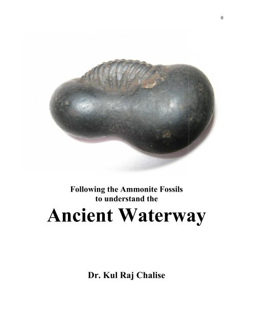
Following the <strong>Ammonite</strong> Fossils<br />
to understand the<br />
Ancient Waterway<br />
Dr. Kul Raj Chalise
1<br />
<strong>Madi</strong> on Ancient Waterway <strong>of</strong> Krishnagandaki<br />
Dr.Kul Raj Chalise<br />
Abstract<br />
Mountain geography <strong>of</strong> Nepal is shaped by tectonic uplift and erosion induced by<br />
river system. Katan (erosion) and Patan (deposition) are terminology, which are<br />
used to describe geographical development <strong>of</strong> mountain valleys. Chitawan is one<br />
such valley developed by sediments mostly deposited by tributaries <strong>of</strong> Narayani.<br />
Shaligramsheela, commonly known as ammonite fossil are marine evidences<br />
uplifted to Himalaya along with tectonic uplift <strong>of</strong> submerged surface <strong>of</strong> lost ocean<br />
Tethys. Scientists did the series <strong>of</strong> stratigraphical researches on this fact since<br />
1960 s , but most <strong>of</strong> them concentrated at Mustang. Researcher could not found<br />
report did on Shaligramsheela available at Magwai River <strong>of</strong> <strong>Madi</strong>. Local priest<br />
group had tried to explore them, but it is not enough to attract the scientific<br />
researchers. At the same time senior spiritual leader dominating the established<br />
pilgrim sites were misguiding the people to maintain the sacred value <strong>of</strong> their own<br />
site. Geographical structure, archeological evidences and words used on Hindu<br />
spiritual texts indicating existence <strong>of</strong> water reservoir in chitwan, whose southern<br />
edge was Someswor mountain <strong>of</strong> <strong>Madi</strong>. Abundant number <strong>of</strong> Shaligramsheela<br />
available on river basin <strong>of</strong> Magwai on natural condition and eight faced Gaddhak<br />
Shivalinga <strong>of</strong> Gardi indicate that ancient Gajendramokshyadham was at <strong>Madi</strong><br />
area. In latter period water reservoir opened the mouth at southwestern corner <strong>of</strong><br />
"Devhrad". Narayani was shifted toward west after opening the mouth. Evidences<br />
indicate that ancient waterway <strong>of</strong> Krishnagandaki was at <strong>Madi</strong> area <strong>of</strong> <strong>Chitwan</strong>,<br />
which was shifted about 35 km west from original waterway. This report is<br />
product <strong>of</strong> shallow observation matching with information mentioned on spiritual<br />
text. Verification <strong>of</strong> such assumption by advance paleontological research is<br />
needed to increase the tourism and academic value <strong>of</strong> <strong>Madi</strong>. This could be a core<br />
product well suited for buffer zone <strong>of</strong> <strong>Chitwan</strong> National Park listed on UNESCO<br />
world heritage site. We hope this report will draw the attention <strong>of</strong> geological,<br />
archeological, geographical and social science experts to involve on advance<br />
research based on ammonite fossils available at northward flowing Magwai River<br />
<strong>of</strong> <strong>Madi</strong><br />
Keywords: Shaligramsheela, <strong>Ammonite</strong> fossils, Stratigraphical research
2<br />
Introduction<br />
Research on tectonic uplift <strong>of</strong> central Nepal based on natural availability <strong>of</strong> Shaligramsheela was<br />
started from decade <strong>of</strong> 1960 (Garzanti & Frettee, 1991). Raymond Enay published a monograph<br />
on the Bazrakit from the Spiti Shales Formation <strong>of</strong> the Thakkhola area in central Nepal (Docum.<br />
Lab. Geol. Lyon, No.166, 2009), based on new data (Mallikarjuna, 2010). We are hearing the<br />
information that a team <strong>of</strong> Chinese academicians are now active on sediment research <strong>of</strong><br />
Krishnagandaki from Mustang to Hanjipur <strong>of</strong> Bihar. We are hoping to read their report in near<br />
future. Most <strong>of</strong> the previous research works were concentrated at Mustang district. Ongoing<br />
research <strong>of</strong> Chinese academicians may investigate deposition area too. But we still are doubtful,<br />
whether they cover the Shaligramsheela <strong>of</strong> <strong>Madi</strong> or not. Because texts are not mentioned about<br />
<strong>Madi</strong> on direct language and researchers are misguided to identify the ancient waterway <strong>of</strong><br />
Krishnagandaki. This report is trying to cover <strong>Madi</strong> as the ancient waterway <strong>of</strong> Krishnagandaki.<br />
Table 1: Mesozoic Lithostratigraphy <strong>of</strong> the northwestern and central Himalaya<br />
Source: Garzanti & Frettee (1991)<br />
Geography <strong>of</strong> Nepal is shaped by tectonic uplift and erosion enforced by river. Uplifted<br />
mountains received atmospheric water drops from cloud and drained them to lower elevation as<br />
rivers. Such rivers carry the soil particles and coagulating chemicals along with drain water.<br />
Churning <strong>of</strong> such suspended material along with river current will produce gravels <strong>of</strong> different<br />
size. Such gravels will deposits to bottom hill as river current will decrease at plain area. Katan<br />
and Patan are local terminology used to describe such erosion and deposition process. Due to<br />
combined effect rivers may changed own waterway on certain years interval. In such process<br />
some river will lose their existence if change on waterway took place at head water source.<br />
Disappeared river Saraswati <strong>of</strong> west India (Giosan et al, 2012) is the example <strong>of</strong> such change.<br />
Flow direction may changed opposite to previous direction on extreme condition like northward<br />
flowing Krishnagandaki was started to flow southward after tectonic uplift <strong>of</strong> Muktinathkshetra.
3<br />
This is not only the content story <strong>of</strong> Varahanarayan. A report presented by a group <strong>of</strong> scientists<br />
had proved this fact after intensive paleogeographic research (Gradstein et al 1989). Following is<br />
concluding remarks <strong>of</strong> their research work.<br />
This observation, coupled with resemblance <strong>of</strong> the Mesozoic facies trends to Atlantic<br />
margin sequences, the affinities <strong>of</strong> the ammonite and foraminiferal assemblages to other<br />
Asian or Atlantic faunas, and the northward sediment transport trends observed in two<br />
formations, strongly suggests that the Thakkhola Himalayan region was part <strong>of</strong> a<br />
continental margin, facing an ocean. From current paleogeographic reconstructions we<br />
conclude that this ocean represented Tethys, and that Thakkhola, Nepal, harbours<br />
extensive evidence <strong>of</strong> this great "lost ocean", that lapped the northern Gondwanan shores.<br />
(Gradstein et al, 1989, P.98)<br />
Their research work was concentrated at Thakkhola area <strong>of</strong> Muktikshetra leaving the questions<br />
related to deposition <strong>of</strong> Shaligramsheela ( <strong>Ammonite</strong> fossils) <strong>of</strong> Rampur and Chitawan valley.<br />
Availability <strong>of</strong> such index fossils more on upland rather than river bed at Rampur Valley<br />
indicates the deposition during flash flood which had occurred on different period. Terraces that<br />
we can observe on different layer indicate the series <strong>of</strong> flash flood on Krishnagandaki (Chalise,<br />
2014). We can predict this fact after observation <strong>of</strong> cross section at bottom hill as shown on<br />
photo 1. Laboratory based dating <strong>of</strong> sample collected from these areas may give tentative date <strong>of</strong><br />
flash flood's waterways <strong>of</strong> that period, which is beyond capacity <strong>of</strong> this research work.<br />
"Hrada" and "Bhimband" are two word used on Hindu spiritual texts. The mountains which were<br />
blocked the waterway are "Bhimband" and reservoir developed after such block are known as<br />
"Hrada". Devhrad is such example frequently used by Nalaraj Shastri (Shastri 2065 BS). Such<br />
reservoir will drain out as an impact <strong>of</strong> tectonic impact or when water pressure increase to break<br />
the "Bhimband". This is primary phenomena which developed the mountain valley after drain<br />
out <strong>of</strong> lake water. When waterway receive fragile surface and if debris carried by river deposited<br />
to bending edge <strong>of</strong> river, waterway may change to some other direction. We can predict such<br />
symptom at Mirmy portion <strong>of</strong> Krishnagandaki. Before Krishnagandaki had made waterpass from<br />
Mirmi to Rudrabeni, geography indicate that Krishnagandaki was overflowed directly to Beltari<br />
instead <strong>of</strong> rotating Lasargha hill (Chalise, 2014). Oldest Puran Skandapuran is silent to speak<br />
about Ridirikheswor, where as youngest Puran Varahapuran has spoken more about this pilgrim<br />
site (Gurung , 2067 BS). Differences on Puranic message indicate that Krishnagandaki had<br />
changed the waterway to rotate Lasargha after period <strong>of</strong> Skandapuran writting. We can predict<br />
such change on waterway simply by observing the Devisfalls and underground river <strong>of</strong><br />
Gupteswor cave <strong>of</strong> Pokhara too.
4<br />
Photo 1: Sediment layer <strong>of</strong> bottom hill <strong>of</strong> Krishnagandaki basin at Ramjakot Tanahun<br />
Shaligramsheela as index fossils<br />
The shila or shaligram is a fossil concretion from the Krishnagandaki River in Nepal, <strong>of</strong>ten with<br />
prominent ammonites. They are typically black in color but pyrite inclusions may make them<br />
golden. The fossil patterns are believed to represent sacred symbols like the attributes <strong>of</strong> Vishnu,<br />
especially his chakra. An interpretation <strong>of</strong> the snake like ammonites found inside. The stones are<br />
traditionally used for devotion (Enter the Earth, n.d.). There are five stories associated with<br />
origin <strong>of</strong> Shaligramsheela. Though they are written on story like pattern, hidden messages are<br />
some else. Such stories can help us to predict site specific and material specific information.<br />
1. Meditating Vishnu and Vajrakit Bisowkarma (Varahapuran 144:225)<br />
2. Brinda and Jalandhar (Skandapuran, Himavatkhanda 44:61)<br />
3. Tulasi and Shankhachuda (Brahmavaibartapuran 2:21:24)<br />
4. Gaja and Graha salvation (Bhagavatmahapuran 8:2,3 & 4)<br />
5. Shalankayan Meditation (Varahapuran 144:256)<br />
The story <strong>of</strong> meditating Vishnu and carving <strong>of</strong> Shaligram idols by Vajrakit incarnation <strong>of</strong><br />
Bisowkarma indicate the upper Muktinath site specific message as primary source <strong>of</strong><br />
Shaligramsheela. Stories <strong>of</strong> Brinda, Tulasi, Jalandhar and Shankhachuda are associated with<br />
water purification. The story <strong>of</strong> Gaja and Graha is related to indicate relationship <strong>of</strong> soil and<br />
water as Gaja represent the earth and Graha represent the Ganga. Krishnagandaki is older than
5<br />
Himalaya and existence <strong>of</strong> Shaligramsheela was there from the beginning <strong>of</strong> creation. Saint<br />
Shalankayan had identified the importance <strong>of</strong> these fossils to predict the secret <strong>of</strong> Himalayan<br />
system. Due to his name such fossils had got the name Shaligramsheela (Chalise, 2016). These<br />
stories are related with southern Muktinath, where Krishnagandaki had deposited the fossils<br />
during ancient flash flood.<br />
Shaligramsheela are not only important for Hindu societies. It is equally important for other's<br />
too, though their perception is as sacred gemstone or ammonite. The word ammonite references a<br />
historic name for the fossil. The first century CE Roman naturalist Pliny the Elder called them<br />
hammonis cornu, meaning “the horns <strong>of</strong> Ammon”. Ammon is the Latinized version <strong>of</strong> the name<br />
Amun, the ancient Egyptian god <strong>of</strong> creation, later interpreted as a form <strong>of</strong> Zeus by the Greeks.<br />
Amun was depicted as a ram, a man with the head or horns <strong>of</strong> a ram, or a ram headed sphinx<br />
(Enter the Earth, n.d.).<br />
The Ammonoidea or ammonites are an extinct group <strong>of</strong> shelled cephalopods that lived around<br />
400 to 65 million years ago. The name may specifically refer to one branch <strong>of</strong> them, the<br />
Ammonoida that lived about 200 to 65 million years ago. Their living relatives include the<br />
octopus, squid, and nautilus (Enter the Earth, n.d.).<br />
Research question<br />
Whatever, we termed as Shaligramsheela or <strong>Ammonite</strong> fossil and whenever, we percept as<br />
sacred idol or ornamental gemstone, these are Marin product reached to High Mountain along<br />
with tectonic uplift <strong>of</strong> earth surface submerged on lost ocean. These are index fossils to predict<br />
the flow characteristics <strong>of</strong> Krishnagandaki. Our purpose to take this information is to prove<br />
ancient waterway <strong>of</strong> Krishnagandaki which was passed from <strong>Madi</strong> <strong>of</strong> <strong>Chitwan</strong>, and shifted west<br />
after Narayani had opened the new route at Tribeni site <strong>of</strong> Nawalparasi.<br />
Methodology<br />
Site observation and matching the physical evidences with Shaligramsheela related stories <strong>of</strong><br />
Purans is simple method used on this research work. To verify the logic presented here, we need<br />
to conduct advance research <strong>of</strong> carbon dating and sediment pattern investigation. We have not<br />
interred into such cost intensive and laboratory based research at this moment.<br />
Discussion<br />
1 Observation <strong>of</strong> Google map and site observation from Maulakalika demonstrate the<br />
many branches <strong>of</strong> Narayani after Narayanghat Bridge. Water volumes on those branches<br />
are not equal. Branches having higher water volume made deeper branches than having<br />
lower volume. We can observe that some branch <strong>of</strong> <strong>Chitwan</strong> edge is converting into<br />
terrace. Bending <strong>of</strong> Narayani on "C" shape at Tribeni portion indicate that Narayani is
6<br />
shifting to west. Advance sedimentological research <strong>of</strong> Magwai river basin may give<br />
concrete idea <strong>of</strong> this logic.<br />
Photo 2: Google map <strong>of</strong> Narayani<br />
Photo 3: Photograph taken from Maulakalika<br />
2 Availability <strong>of</strong> Shaligramsheela on natural condition indicates the ancient waterway <strong>of</strong><br />
Krishnagandaki. At the bottom Hill <strong>of</strong> Someswor Mountain, Shaligramsheela are<br />
available only on River basin <strong>of</strong> Magwai. Most <strong>of</strong> them are bigger, flatter and brown in<br />
color than Shaligramsheela <strong>of</strong> Krishnagandaki. The cause behind is soil temperature <strong>of</strong><br />
upland, which had induced broken them. By observing the symptom we can predict that<br />
those Shaligramsheela were transported by Krishnagandaki in ancient period. To predict<br />
the tentative time frame, we need to go for carbon dating <strong>of</strong> those samples. Sedimentary<br />
pattern <strong>of</strong> those fossils may give clear idea to identify the flow direction.<br />
3 Eight faced Gaddhak Shivalinga <strong>of</strong> Gardi is different than many other Shivaling <strong>of</strong><br />
present days. Yogi Naraharinath had said that eight faced Shivalinga was culture <strong>of</strong><br />
Mahabharat age ( Subedi, 2071 BS). Situating the Gaddhak temple at west bank <strong>of</strong><br />
Magwai indicate the spiritual value <strong>of</strong> that river. Carbon dating again is very important to<br />
identify the tentative date <strong>of</strong> Gaddhak Shivalinga.<br />
4 Laxmikanta Sapkota had reported the big tree <strong>of</strong> Shorea robusta on structured stone<br />
platform at about 200 m south east <strong>of</strong> ancient Someswor temple. Intensive investigation<br />
<strong>of</strong> those areas may help to find information <strong>of</strong> Shalankayan age.<br />
5 With the reference <strong>of</strong> "Adhunik Nepalko Itihas" <strong>of</strong> Devilal Sharma, Sapkota had reported<br />
that there was fort established by King Pratap Singh after win over the Sen Kingship<br />
under leadership <strong>of</strong> Abhiman Singh and Swarup Singh at 1877 to protect the territory
7<br />
from Ramnagar <strong>of</strong> India (Sapkota, 2054 BS). Older citizen <strong>of</strong> <strong>Madi</strong> says that Thori was<br />
the main gateway to inter into the central Nepal before the construction <strong>of</strong> East West<br />
highway. Ancient tradition was to follow waterway to use as trekking route. Those facts<br />
also indicate that Krishnagandaki had flowed from Magwai basin.<br />
6 Varahapuran had given higher importance on Devhrad ( Varahapuran 145:75). Literal<br />
meaning <strong>of</strong> 'Hrad" is water reservoir. Now there is only the confluence at Devghat, not a<br />
crear "Devhrad". Where was that "Devhrad"?. Observation <strong>of</strong> height <strong>of</strong> Someswor<br />
mountain, can give idea to identify the water reservoir. There was water reservoir in west<br />
<strong>Chitwan</strong> portion, which was drain out after opening the mouth near to present<br />
Gajendramokshyadham. Another word evidence <strong>of</strong> spiritual text is hymn 9:55 <strong>of</strong><br />
Himavatkhanda, where Varundev had told about water reservoir formation where<br />
Sudarsanchakra had fall down to provide the salvation to sacred crocodile.<br />
7 Presence <strong>of</strong> Shaligramsheela on natural position near to Krishnagandaki is necessary to<br />
prove the Gajendramokshyadham. We could not found such evidence at present location.<br />
Therefore ancient Gajendramokshyadham should be at <strong>Madi</strong> area.<br />
8 Development <strong>of</strong> Ashram on west bank is general practice to faced the idol toward east<br />
and holy river in front, on Hindu tradition. But Valmiki Ashram is situating in east and on<br />
distance from Narayani. We could not believe that sage like Valmiki was selected east<br />
bank to develop the Ashram, where Goddess Sita had given birth to Lava and Kusha.<br />
Present position <strong>of</strong> Valmiki Ashram also indicates that ancient waterway was at east than<br />
present waterway.<br />
9 Geography <strong>of</strong> Bharatpur height could be additional evidence that Krishnagandaki had<br />
taken the way from east to south west. Before that swampland <strong>of</strong> Grondrang could be<br />
ancient waterway <strong>of</strong> Krishnagandaki to pass from <strong>Madi</strong> area. But nobody had reported<br />
the Shaligramsheela available on natural condition at these sites. To prove the waterway<br />
we need to go through sediment pattern investigation starting from <strong>Madi</strong>.<br />
Conclusion and Recommendation<br />
Pilgrim site backed by spiritual texts, bearing physical evidences always remains on apex <strong>of</strong><br />
sacred value. Magwai River <strong>of</strong> <strong>Madi</strong> is such sacred site to prove the Gajendramokshyadham,<br />
Meditation site <strong>of</strong> Shalankayan and Devhrad. But intentional interpretation <strong>of</strong> spiritual leader<br />
associated with Devghatdham and Trivenidham had put this sacred area on shadow. Situating at<br />
buffer zone <strong>of</strong> <strong>Chitwan</strong> National Park, <strong>Madi</strong> is on back position in comparison to Bharatpur,<br />
Devghat and Triveni. Exposing the truth associated with sacred value <strong>of</strong> <strong>Madi</strong> could be core<br />
product to generate alternative employment for local inhabitants on spiritual tourism.<br />
Shaligramsheela are fossils <strong>of</strong> marine biota, which were disappeared on ancient period.<br />
Researcher is recommending for establishment <strong>of</strong> Shaligramsheela museum under ownership <strong>of</strong><br />
<strong>Madi</strong> Municipality with help <strong>of</strong> National Park. Such museum could help us to develop <strong>Madi</strong>
8<br />
region as Southern Muktikshetra. We have experiences that Sanskrit Gurukul gives priority to<br />
position the spiritual value <strong>of</strong> their site. In such effort wrong interpretation <strong>of</strong> spiritual hymn and<br />
modification on original hymn <strong>of</strong> spiritual texts may take place. To control the language<br />
pollution blended approach <strong>of</strong> Sanskrit Gurukul with modern science could be one alternative.<br />
We will recommend establishing a modified Gurukul at <strong>Madi</strong> with affiliation on Agriculture and<br />
forest university <strong>of</strong> Nepal.<br />
Note:<br />
Acknowledgement:<br />
Researcher is thankful to Priest Laxmikanta Sapkota, Laxmi Prasad Parajuli, Sudarsan Subedi for<br />
interpretation <strong>of</strong> spiritual texts related with Gaddhak, Charchare and Someswor Mountain.<br />
Researcher is grateful to Hon. Tirtha Bhusal, who had demonstrated the collected<br />
Shaligramsheela at his temple. Researcher is equally grateful to Yedu Adhikari, Bhaktiram<br />
Paudel, Devendra Paudel for their cooperation. Finally Researcher is thankful with Mayor<br />
Thakur Prasad Dhakal for his better words to implement the finding <strong>of</strong> this research on public<br />
discussion. Thank you Anku and Anup, you had supported on note keeping work.
9<br />
Photo 5: Sample <strong>of</strong> Shaligramsheela worshiped by local inhabitant<br />
Photo 6: Sample <strong>of</strong> Shaligramsheela collected by Hon. Tirtha Bhusal
10<br />
References:<br />
Adhikari,T.R.(2055 BS). Gaṇḍakī–Māhātmyam (Nepali Translation <strong>of</strong> Gandaki Mahatmya)<br />
Dang, Nepal :Mahendra Saṃskṛta Viśvavidhyālaya.<br />
Chalise, K. R. (2014). Scope <strong>of</strong> Srikrishnagandaki Basin in Context to Field-museum <strong>of</strong> Nepalese<br />
Water Culture, Dissertation submitted to Nepal Sanskrit University: Unpublished<br />
Enter the Earth (n.d.) The Metaphysical Properties <strong>of</strong> <strong>Ammonite</strong>s and Ammolite, Article series<br />
<strong>of</strong> enter the earth: http://www.entertheearth.com, Asheville, North Carolina. retrieved<br />
2/7/2017<br />
Garzanti E. & Frettee M. P. (1991). Stratigraphic Succession <strong>of</strong> Thakkhola Region (Central<br />
Nepal) – Comparison with Northwestern Tethys Himalaya, Riv. It. Paleont.Strat. V. 97, N<br />
1, pp 3-26: Maggio 1991<br />
Giosan, L. et al (2012). Researchers conclude that climate change led to collapse <strong>of</strong> ancient<br />
Indus civilization: www. Phys.org . retrieved 1/07/2017<br />
Gitapress (2010 a ). Saṃkṣipta Vārāhapurāṇa- Hindi, 7 th reprint 2069 BS: Gitapress<br />
Gitapress (2010 b ). Saṃkṣipta Brahmavaivartapurāṇa-Hindi, 13 th reprint 2069: Gitapress<br />
Gitapress (1997). Śrīmadabhāgavata Māhāpuran. part 1: Gitapress,<br />
Gradstein, F.M., Gibling, M.R., Jansa, L.F., Kaminiski, M.A., Ogg, J.G., Sarti, M., ...<br />
Wastermann G.E.G et al (1989). Mesozoic Stratigraphy <strong>of</strong> Thakkhola, Central Nepal<br />
(Lost Ocean Expedition), Canada: Centre for Marine Geology, Dalhousie University.<br />
Gurung, J.M.(2067 B.S.). Gaṇḍakī Prasavaṇakśetrako Sāṃskṝtika Sampadā: (Cultural<br />
heritages <strong>of</strong> Gandaki basin), Kathmandu, Nepal : Paścimāñcal Vikās Mañca.<br />
Mallikarjuna U. B. (2010). <strong>Ammonite</strong> Biostratigraphy <strong>of</strong> the Spiti Shales Formation:<br />
www.geosocindia.org , retrieved 2/07/2017<br />
Sapkota L.(2054 BS). Village Pr<strong>of</strong>ile <strong>of</strong> Gardi VDC, A Report presented to NDS, TU:<br />
Unpublished<br />
Shastri, N. (2065 BS). Devaghāṭa tīrtha māhātmya, Devaghāṭadhāma : Manimukungeśvara<br />
cakravartī Āśrama<br />
Subedi S. (2071 BS). Samkshipta <strong>Madi</strong> Parichaya: Baidic Dharma Yuba Parisad, Nepal<br />
Yogi N. et al (2013 BS). Himavatakhaṇḍa, Skandapurāṇamadhya , Kāśī :Gorakṣatilla