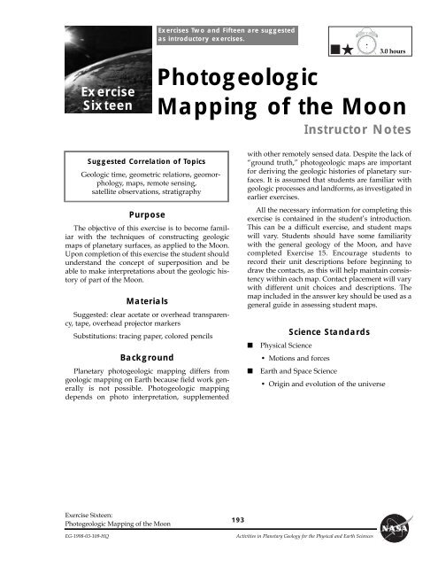
Photogeologic Mapping of the Moon - Solar System Exploration
Photogeologic Mapping of the Moon - Solar System Exploration
Photogeologic Mapping of the Moon - Solar System Exploration

You also want an ePaper? Increase the reach of your titles
YUMPU automatically turns print PDFs into web optimized ePapers that Google loves.
Exercise<br />
Sixteen<br />
Suggested Correlation <strong>of</strong> Topics<br />
Geologic time, geometric relations, geomorphology,<br />
maps, remote sensing,<br />
satellite observations, stratigraphy<br />
Purpose<br />
The objective <strong>of</strong> this exercise is to become familiar<br />
with <strong>the</strong> techniques <strong>of</strong> constructing geologic<br />
maps <strong>of</strong> planetary surfaces, as applied to <strong>the</strong> <strong>Moon</strong>.<br />
Upon completion <strong>of</strong> this exercise <strong>the</strong> student should<br />
understand <strong>the</strong> concept <strong>of</strong> superposition and be<br />
able to make interpretations about <strong>the</strong> geologic history<br />
<strong>of</strong> part <strong>of</strong> <strong>the</strong> <strong>Moon</strong>.<br />
Materials<br />
Suggested: clear acetate or overhead transparency,<br />
tape, overhead projector markers<br />
Substitutions: tracing paper, colored pencils<br />
Background<br />
Planetary photogeologic mapping differs from<br />
geologic mapping on Earth because field work generally<br />
is not possible. <strong>Photogeologic</strong> mapping<br />
depends on photo interpretation, supplemented<br />
Exercise Sixteen:<br />
<strong>Photogeologic</strong> <strong>Mapping</strong> <strong>of</strong> <strong>the</strong> <strong>Moon</strong><br />
Exercises Two and Fifteen are suggested<br />
as introductory exercises.<br />
<strong>Photogeologic</strong><br />
<strong>Mapping</strong> <strong>of</strong> <strong>the</strong> <strong>Moon</strong><br />
Instructor Notes<br />
193<br />
with o<strong>the</strong>r remotely sensed data. Despite <strong>the</strong> lack <strong>of</strong><br />
Òground truth,Ó photogeologic maps are important<br />
for deriving <strong>the</strong> geologic histories <strong>of</strong> planetary surfaces.<br />
It is assumed that students are familiar with<br />
geologic processes and landforms, as investigated in<br />
earlier exercises.<br />
All <strong>the</strong> necessary information for completing this<br />
exercise is contained in <strong>the</strong> studentÕs introduction.<br />
This can be a difficult exercise, and student maps<br />
will vary. Students should have some familiarity<br />
with <strong>the</strong> general geology <strong>of</strong> <strong>the</strong> <strong>Moon</strong>, and have<br />
completed Exercise 15. Encourage students to<br />
record <strong>the</strong>ir unit descriptions before beginning to<br />
draw <strong>the</strong> contacts, as this will help maintain consistency<br />
within each map. Contact placement will vary<br />
with different unit choices and descriptions. The<br />
map included in <strong>the</strong> answer key should be used as a<br />
general guide in assessing student maps.<br />
Science Standards<br />
■ Physical Science<br />
¥ Motions and forces<br />
■ Earth and Space Science<br />
¥ Origin and evolution <strong>of</strong> <strong>the</strong> universe<br />
EG-1998-03-109-HQ Activities in Planetary Geology for <strong>the</strong> Physical and Earth Sciences<br />
3.0 hours
Part A<br />
1. Contacts are sharp; transition from plains to<br />
mountains is abrupt; hills appear as islands in<br />
smooth plains; relief <strong>of</strong> hills is variable; sinuous<br />
rilles appear to be controlled by hill<br />
topography (hills predate rilles); <strong>the</strong>re are<br />
more craters on plains than on hills.<br />
2. Smooth plains appear to be more heavily<br />
cratered than hills; explained as function <strong>of</strong> :<br />
1) areal exposure <strong>of</strong> plains emphasizes number<br />
<strong>of</strong> craters; 2) hard to preserve craters on<br />
steep slopes <strong>of</strong> hills; 3) craters difficult to see<br />
in shadows and bright hill slopes.<br />
3. Mountainous terrain pre-dates (is older than)<br />
smooth plains.<br />
4. A smooth, gently undulating surface; contains<br />
numerous sinuous rilles. One rille lies on a<br />
topographic crest and is <strong>the</strong>refore unlikely to<br />
be an erosional channel. The unit is probably<br />
volcanic in origin, emplaced in part by <strong>the</strong> sinuous<br />
rilles (lava tubes/channels).<br />
5. The hills are part <strong>of</strong> <strong>the</strong> system that surrounds<br />
Mare Imbrium and are probably related<br />
to one or more <strong>of</strong> <strong>the</strong> highly degraded and<br />
flooded multi-ring basins. Hence, <strong>the</strong>y are<br />
analogous to crater deposits around smaller<br />
structures.<br />
6. Presence <strong>of</strong> possible flow scarp. Numerous<br />
channels (rilles), some with leveed sides<br />
(Note: channel network does not interconnect<br />
and is <strong>the</strong>refore unlikely to be a fluvial<br />
ÒdrainageÓ system, analogous to terrestrial<br />
watershedsÑ<strong>the</strong> rilles are probably lava<br />
channels).<br />
Answer Key<br />
194<br />
7. Clusters <strong>of</strong> irregular, overlapping cratersÑ<br />
herringbone pattern points to south-sou<strong>the</strong>ast.<br />
All are younger than smooth plains.<br />
8. Secondary crater clusters from a large primary<br />
outside <strong>the</strong> field <strong>of</strong> view (somewhere to<br />
<strong>the</strong> south-sou<strong>the</strong>ast).<br />
9. Hummocky, irregular topography associated<br />
with inner facies; radial and concentric texture<br />
in outer facies.<br />
10. The topography is a result <strong>of</strong> ejecta from <strong>the</strong><br />
Euler impact event. The inner facies represents<br />
continuous deposits, modified by postimpact<br />
slumping; <strong>the</strong> outer facies is a result <strong>of</strong><br />
secondary cratering processes.<br />
11. NW 33 km; NE 64 km; SE 31 km; SW 23 km.<br />
Note: distances may vary somewhat, depending<br />
upon where contact is drawn.<br />
12. Presence <strong>of</strong> numerous sinuous rilles around<br />
regions <strong>of</strong> <strong>the</strong> west and south show that some<br />
Euler ejecta deposits have been covered by<br />
emplacement <strong>of</strong> late-stage mare lava.<br />
13. Parts <strong>of</strong> <strong>the</strong> smooth unit post-date Euler,<br />
o<strong>the</strong>r parts seem to have faint texture associated<br />
with outer ejecta facies <strong>of</strong> Euler and are<br />
pre-Euler.<br />
14. Crater clusters post-date Euler (are superposed<br />
on Euler ejecta), clusters post-date all<br />
mare deposits.<br />
15. The clusters are probably secondary craters<br />
from some primary crater located to <strong>the</strong><br />
south-sou<strong>the</strong>ast.<br />
Exercise Sixteen:<br />
<strong>Photogeologic</strong> <strong>Mapping</strong> <strong>of</strong> <strong>the</strong> <strong>Moon</strong><br />
Activities in Planetary Geology for <strong>the</strong> Physical and Earth Sciences EG-1998-03-109-HQ
Part B<br />
Answer Key, continued<br />
Unit Name Observation Interpretation<br />
ce1 (continuous<br />
ejecta; pre-mare<br />
craters)<br />
ce2 (continous<br />
eject; post-mare<br />
craters)<br />
de (discontinuous<br />
crater ejecta)<br />
cc (crater cluster)<br />
mt (mountainous<br />
terrain)<br />
m1 (old mare)<br />
m2 (young mare)<br />
Exercise Sixteen:<br />
<strong>Photogeologic</strong> <strong>Mapping</strong> <strong>of</strong> <strong>the</strong> <strong>Moon</strong><br />
inner facies (crater rim materials) <strong>of</strong><br />
pre-mare craters; arranged<br />
concentrically to crater depression<br />
rough hummocky inner facies <strong>of</strong><br />
post-mare craters; arranged<br />
concentrically to crater depression<br />
radial and sub-radial texture at<br />
distal end <strong>of</strong> rim materials -<br />
herringbone structure; at Euler,<br />
gradational with secondaries - not<br />
related to irregular crater clusters<br />
groups <strong>of</strong> large, irregular craters; vshape<br />
pointing SSE; occur<br />
predominantly in SE corner - one<br />
group superposed on Euler ce2<br />
large isolated massif structures in<br />
W and SW <strong>of</strong> map area; not<br />
continuous - appear to proturde<br />
through mare (smooth plains)<br />
rough textured mare underlying<br />
Euler ejecta; pre-Euler mare with<br />
most primary structure degraded<br />
or destroyed<br />
smooth mare plains overlying<br />
Euler ejecta; contains large number<br />
<strong>of</strong> channel-like structures (sinuous<br />
rilles)<br />
EG-1998-03-109-HQ Activities in Planetary Geology for <strong>the</strong> Physical and Earth Sciences<br />
195<br />
pre-mare crater material; <strong>of</strong><br />
early Eratos<strong>the</strong>nian age<br />
crater materials; <strong>of</strong><br />
Eratos<strong>the</strong>nian age<br />
crater materials; <strong>of</strong><br />
Eratos<strong>the</strong>nian age<br />
secondary craters from a large<br />
primary located to <strong>the</strong> SSW; <strong>of</strong><br />
Copernican age<br />
basin and large crater ejecta<br />
fromed in pre-mare times; <strong>of</strong><br />
Imbrium age<br />
pre-Euler mare flows; <strong>of</strong><br />
Eratos<strong>the</strong>nian age<br />
flows emplaced primarily by<br />
sinuous rilles (volcanic origin);<br />
<strong>of</strong> Eratos<strong>the</strong>nian age
Geologic History<br />
Youngest<br />
Youngest<br />
Unit mt is rim and ejecta material formed by a<br />
massive impact, or series <strong>of</strong> impacts related to <strong>the</strong><br />
formation <strong>of</strong> <strong>the</strong> Imbrium Basin and is <strong>the</strong> oldest<br />
unit in this region. Cratering continued with <strong>the</strong><br />
formation <strong>of</strong> <strong>the</strong> ce1 craters. The smooth plains<br />
(m1) were emplaced by volcanic activity prior to<br />
Answer Key, continued<br />
Geologic Unit Structural Event Age<br />
cc Copernican<br />
ce2,de Channels Eratos<strong>the</strong>nian<br />
m2<br />
m1 Euler impact<br />
ce1 Eratos<strong>the</strong>nian<br />
Oldest Oldest mt Imbrian<br />
196<br />
<strong>the</strong> impact and formation <strong>of</strong> Euler crater. After<br />
Euler was formed, volcanic activity continued<br />
with <strong>the</strong> formation <strong>of</strong> <strong>the</strong> m2 flows. Cratering continued<br />
with <strong>the</strong> formation <strong>of</strong> <strong>the</strong> ce2 craters. The<br />
youngest craters in <strong>the</strong> area are <strong>the</strong> cc secondary<br />
craters from a large impact outside <strong>the</strong> map area.<br />
Exercise Sixteen:<br />
<strong>Photogeologic</strong> <strong>Mapping</strong> <strong>of</strong> <strong>the</strong> <strong>Moon</strong><br />
Activities in Planetary Geology for <strong>the</strong> Physical and Earth Sciences EG-1998-03-109-HQ
mt<br />
ce2<br />
mt<br />
mt<br />
mt<br />
ce2<br />
m2<br />
cc<br />
de<br />
m1<br />
mt<br />
mt<br />
m2<br />
mt<br />
mt<br />
mt<br />
ce1<br />
mt<br />
ce2<br />
cc<br />
mt<br />
ce1<br />
Euler<br />
ce2<br />
mt<br />
mt<br />
Exercise Sixteen:<br />
<strong>Photogeologic</strong> <strong>Mapping</strong> <strong>of</strong> <strong>the</strong> <strong>Moon</strong><br />
Answer Key, continued<br />
mt<br />
mt<br />
mt mt<br />
ce2<br />
cc<br />
mt<br />
cc<br />
mt<br />
mt<br />
mt<br />
de<br />
cc<br />
cc<br />
mt<br />
cc<br />
mt<br />
mt<br />
m2<br />
cc<br />
ce2<br />
Euler<br />
m1<br />
cc<br />
cc<br />
cc<br />
cc<br />
mt<br />
ce2<br />
cc<br />
ce2<br />
cc<br />
de<br />
m2<br />
cc<br />
cc<br />
cc<br />
m1<br />
cc<br />
cc ce2<br />
mt<br />
cc<br />
cc<br />
EG-1998-03-109-HQ Activities in Planetary Geology for <strong>the</strong> Physical and Earth Sciences<br />
197<br />
ce2<br />
m1<br />
cc
Exercise<br />
Sixteen<br />
Purpose<br />
Through observation and analysis <strong>of</strong> photographs<br />
<strong>of</strong> <strong>the</strong> <strong>Moon</strong> you will become familiar with<br />
<strong>the</strong> techniques <strong>of</strong> constructing geologic maps <strong>of</strong><br />
planetary surfaces.<br />
Materials<br />
Tape, clear acetate or overhead transparency,<br />
overhead projector markers (or tracing paper and<br />
colored pencils)<br />
Introduction<br />
A geologic map is a graphic portrayal <strong>of</strong> <strong>the</strong> distribution<br />
and age <strong>of</strong> rock types, structural features<br />
such as folds and faults, and o<strong>the</strong>r geologic information.<br />
Such a map allows geologists to link observations<br />
made at different localities into a unified<br />
form and to represent those observations in a form<br />
that can be easily understood by o<strong>the</strong>rs. One <strong>of</strong> <strong>the</strong><br />
first tasks in preparing a geologic map is <strong>the</strong> identification<br />
<strong>of</strong> units. By definition, a unit is a threedimensional<br />
body <strong>of</strong> rock <strong>of</strong> essentially uniform<br />
composition formed during a specified interval <strong>of</strong><br />
time and that is large enough to be shown on a conventional<br />
map. Thus, <strong>the</strong> making <strong>of</strong> geologic maps<br />
involves subdividing surface and near-surface rocks<br />
into different units according to <strong>the</strong>ir type and age.<br />
On Earth, this involves a combination <strong>of</strong> field work,<br />
laboratory studies, and analyses <strong>of</strong> aerial photographs.<br />
In planetary geology, geologic mapping<br />
must be done primarily by remote sensing methods,<br />
commonly <strong>the</strong> interpretation <strong>of</strong> photographs. Units<br />
are identified on photographs by <strong>the</strong>ir surface<br />
appearance (morphologyÑsmooth, rugged, hilly,<br />
etc.), <strong>the</strong>ir albedo (how <strong>the</strong>y reflect sunlightÑlight<br />
to dark), <strong>the</strong>ir state <strong>of</strong> surface preservation (degree<br />
<strong>of</strong> erosion), and o<strong>the</strong>r properties. In some cases<br />
remote sensing <strong>of</strong> chemical compositions permits<br />
refinements <strong>of</strong> photogeologic units.<br />
Three decades <strong>of</strong> planetary exploration have<br />
Exercise Sixteen:<br />
<strong>Photogeologic</strong> <strong>Mapping</strong> <strong>of</strong> <strong>the</strong> <strong>Moon</strong><br />
Name<br />
<strong>Photogeologic</strong><br />
<strong>Mapping</strong> <strong>of</strong> <strong>the</strong> <strong>Moon</strong><br />
199<br />
shown that <strong>the</strong> solid-surface planets and satellites<br />
have been subjected to <strong>the</strong> same basic geologic<br />
processes: volcanism, tectonism, gradation, and<br />
impact cratering. The relative importance <strong>of</strong> each<br />
process in shaping <strong>the</strong> surface differs from body to<br />
body, depending on <strong>the</strong> local environment (presence<br />
<strong>of</strong> an atmosphere, running water, etc.). All four<br />
<strong>of</strong> <strong>the</strong>se processes have worked to shape <strong>the</strong> surface<br />
<strong>of</strong> <strong>the</strong> <strong>Moon</strong> and have produced landforms and rock<br />
units that can be recognized and mapped. An<br />
important part <strong>of</strong> preparing a geologic map, once<br />
<strong>the</strong> units are identified, is interpreting <strong>the</strong> geologic<br />
process(es) responsible for <strong>the</strong> formation <strong>of</strong> each<br />
map unit. When preparing a planetary photogeologic<br />
map, unit descriptions are divided into two<br />
parts: <strong>the</strong> observation (what you see) and <strong>the</strong> interpretation<br />
(how you believe it formed).<br />
After identifying <strong>the</strong> units and interpreting <strong>the</strong>ir<br />
mode <strong>of</strong> formation, <strong>the</strong> next task in preparing a photogeologic<br />
map is to determine <strong>the</strong> stratigraphic<br />
(age) relation among all <strong>the</strong> units. Stratigraphic relations<br />
are determined using: (a) <strong>the</strong> Principle <strong>of</strong><br />
Superposition, (b) <strong>the</strong> law <strong>of</strong> cross-cutting relations,<br />
(c) embayment, and (d) impact crater distributions.<br />
The Principle <strong>of</strong> Superposition states that rock units<br />
are laid down one on top <strong>of</strong> <strong>the</strong> o<strong>the</strong>r, with <strong>the</strong> oldest<br />
(first formed) on <strong>the</strong> bottom and <strong>the</strong> youngest on<br />
<strong>the</strong> top. The law <strong>of</strong> cross-cutting relations states that<br />
for a rock unit to be modified (impacted, faulted,<br />
eroded, etc.) it must first exist as a unit. In o<strong>the</strong>r<br />
words, for a rock unit that is faulted, <strong>the</strong> rock is<br />
older than <strong>the</strong> faulting event. Embayment states that<br />
a unit Òflooding intoÓ (embaying) ano<strong>the</strong>r unit must<br />
be younger. On planetary surfaces, impact crater<br />
frequency is also used in determining stratigraphic<br />
relations. In general, older units show more craters,<br />
larger craters, and more degraded (eroded) craters<br />
than younger units.<br />
Once <strong>the</strong> stratigraphic relations have been determined,<br />
<strong>the</strong> units are listed on <strong>the</strong> map in order from<br />
oldest (at <strong>the</strong> bottom) to youngest (at <strong>the</strong> top). This is<br />
called <strong>the</strong> stratigraphic column. The final task, and<br />
<strong>the</strong> primary objective in preparing <strong>the</strong> photogeologic<br />
EG-1998-03-109-HQ Activities in Planetary Geology for <strong>the</strong> Physical and Earth Sciences
map, is to derive a general geologic history <strong>of</strong> <strong>the</strong><br />
region being mapped. The geologic history syn<strong>the</strong>sizes,<br />
in written format, <strong>the</strong> events that formed <strong>the</strong><br />
surface seen in <strong>the</strong> photoÑincluding interpretation<br />
<strong>of</strong> <strong>the</strong> processes in <strong>the</strong> formation <strong>of</strong> rock units and<br />
events that have modified <strong>the</strong> unitsÑand is presented<br />
in chronological order from oldest to<br />
youngest.<br />
Figure 16.1 shows a sample geologic map, including<br />
its unit descriptions and stratigraphic column.<br />
The relative ages were determined in <strong>the</strong> following<br />
manner: The cratered terrain has more (and larger)<br />
craters than <strong>the</strong> smooth plains unitÑindicating that<br />
<strong>the</strong> cratered terrain unit is older. In addition, fault 1<br />
cuts across <strong>the</strong> cratered terrain, but does not continue<br />
across <strong>the</strong> smooth plains. Faulting occurred after<br />
<strong>the</strong> formation <strong>of</strong> <strong>the</strong> cratered terrain and prior to <strong>the</strong><br />
formation <strong>of</strong> <strong>the</strong> smooth plainsÑindicating that <strong>the</strong><br />
smooth plains unit is younger than <strong>the</strong> cratered terrain<br />
and fault 1. The crater and its ejecta unit occurs<br />
on top <strong>of</strong> <strong>the</strong> smooth plains unit, and thus is<br />
younger. Finally, fault 2 cuts across all <strong>the</strong> units,<br />
including <strong>the</strong> crater and its ejecta unit, and is thus<br />
<strong>the</strong> youngest event in <strong>the</strong> region. The geologic history<br />
that could be derived from this map would be<br />
similar to <strong>the</strong> following:<br />
ÒThis region was cratered and <strong>the</strong>n faulted by<br />
tectonic activity. After <strong>the</strong> tectonic activity, a plains<br />
unit was emplaced. Cratering continued after <strong>the</strong><br />
emplacement <strong>of</strong> <strong>the</strong> smooth plains unit, as seen by<br />
<strong>the</strong> craters superposed on <strong>the</strong> smooth plains and <strong>the</strong><br />
large, young crater mapped as its own unit. Finally,<br />
<strong>the</strong>re has been a continuation (or reactivation) <strong>of</strong><br />
tectonic activity, indicated by <strong>the</strong> major fault which<br />
postdates <strong>the</strong> young crater. Ò<br />
The geologic mapping principles listed above<br />
have been applied to <strong>the</strong> <strong>Moon</strong> as a whole and a<br />
generalized geologic time scale has been derived<br />
(Figure 16.2). Two important units on <strong>the</strong> <strong>Moon</strong> are<br />
<strong>the</strong> Fra Mauro Formation and <strong>the</strong> Janssen<br />
Formation, ejecta deposits from <strong>the</strong> Imbrium and<br />
Nectaris impact basins, respectively. These are<br />
Procedure and Questions<br />
200<br />
widespread units that were formed in <strong>the</strong> hours following<br />
<strong>the</strong> gigantic impacts that excavated <strong>the</strong><br />
basins, and hence are excellent datum planes. Rock<br />
samples returned from several localities on <strong>the</strong><br />
<strong>Moon</strong> enable radiometric dates to be placed on <strong>the</strong><br />
generalized time scale.<br />
Geologic mapping <strong>of</strong> impact crater-related<br />
deposits requires some knowledge <strong>of</strong> <strong>the</strong> impact<br />
process. When one planetary object such as meteoroid,<br />
strikes ano<strong>the</strong>r <strong>the</strong>re is a transfer <strong>of</strong> energy<br />
that causes <strong>the</strong> crater to form by having material<br />
excavated from <strong>the</strong> ÒtargetÓ surface. Most <strong>of</strong> <strong>the</strong><br />
incoming object is destroyed by fragmentation,<br />
melting, and vaporization. Figure 16.3 is a diagram<br />
showing typical impact crater deposits. Extending<br />
about one crater diameter outward from <strong>the</strong> rim is a<br />
zone <strong>of</strong> continuous ejecta deposits consisting <strong>of</strong><br />
material thrown out from <strong>the</strong> crater (called ejecta)<br />
and local material churned up by <strong>the</strong> ejecta.<br />
Extending far<strong>the</strong>r outward is a zone <strong>of</strong> discontinuous<br />
ejecta deposits; unlike <strong>the</strong> zone <strong>of</strong> continuous<br />
ejecta deposits, <strong>the</strong>se are surfaces that have been<br />
affected only locally by <strong>the</strong> impact. Bright, wispy<br />
rays extend beyond <strong>the</strong> zone <strong>of</strong> discontinuous ejecta<br />
deposits. Distinctive secondary craters formed by<br />
blocks <strong>of</strong> ejecta occur in singlets, doublets, triplets,<br />
chains and clusters. They <strong>of</strong>ten form a ÒherringboneÓ<br />
ridge pattern, <strong>the</strong> apex <strong>of</strong> which points<br />
toward <strong>the</strong> primary, or parent crater.<br />
On <strong>the</strong> <strong>Moon</strong> and Mercury, geologic mapping<br />
involves distinguishing various deposits related to<br />
impact craters. In addition, most <strong>of</strong> <strong>the</strong> terrestrial<br />
planets have experienced volcanism that produced<br />
vast basaltic lava flows. Samples returned by <strong>the</strong><br />
Apollo astronauts show that <strong>the</strong> dark, smooth areas<br />
<strong>of</strong> <strong>the</strong> <strong>Moon</strong>, named maria, are basalt flows. Some <strong>of</strong><br />
<strong>the</strong>se basalt flows were generated as enormous<br />
ÒfloodsÓ <strong>of</strong> lava, similar to <strong>the</strong> Columbia River<br />
Plateau <strong>of</strong> <strong>the</strong> northwest United States; o<strong>the</strong>rs were<br />
produced as thin sheets that were fed by rivers <strong>of</strong><br />
lava, visible today as sinuous rilles (Figure 16.4).<br />
The area you will be mapping is <strong>the</strong> Euler (pronounced ÔoilerÕ) crater region on <strong>the</strong> <strong>Moon</strong>. Euler is an impact<br />
crater, 28 km in diameter, located at 23¡20'N, 29¡10'W, placing it on <strong>the</strong> rim <strong>of</strong> <strong>the</strong> Imbrium basin on <strong>the</strong> near<br />
side <strong>of</strong> <strong>the</strong> <strong>Moon</strong>(see Figure 16.5). It is about 450 km northwest <strong>of</strong> <strong>the</strong> 93 km-diameter Copernicus impact<br />
crater. The photograph (Figure 16.6) was obtained with a mapping camera on board <strong>the</strong> Apollo 17 service<br />
module from an altitude <strong>of</strong> about 117 km. The photograph is 180 km on a side; <strong>the</strong> sun elevation angle at its<br />
center is about 6.5¡.<br />
Exercise Sixteen:<br />
<strong>Photogeologic</strong> <strong>Mapping</strong> <strong>of</strong> <strong>the</strong> <strong>Moon</strong><br />
Activities in Planetary Geology for <strong>the</strong> Physical and Earth Sciences EG-1998-03-109-HQ
To establish age relations and interpret <strong>the</strong> mode <strong>of</strong> formation <strong>of</strong> <strong>the</strong> rock units in <strong>the</strong> area it is best to examine<br />
<strong>the</strong> area in detail. Enlargements <strong>of</strong> Figure 16.6 will be used for this purpose.<br />
Part A<br />
1. Study Figure 16.7 (an enlargement <strong>of</strong> <strong>the</strong> southwest quadrant <strong>of</strong> Figure 16.6) in detail and list observations<br />
and evidence which might establish <strong>the</strong> relative age <strong>of</strong> <strong>the</strong> rugged clusters <strong>of</strong> hills and <strong>the</strong> intervening<br />
smooth regions.<br />
2. List possible reasons why craters are more readily apparent on <strong>the</strong> smooth regions (vs. <strong>the</strong> hills).<br />
3. Indicate your conclusion about <strong>the</strong> relative age <strong>of</strong> <strong>the</strong> two terrains (which is older).<br />
4. List <strong>the</strong> characteristics <strong>of</strong> <strong>the</strong> smooth unit which might bear on its mode <strong>of</strong> formation; suggest a possible<br />
origin(s) for this unit.<br />
5. List <strong>the</strong> characteristics <strong>of</strong> <strong>the</strong> rugged hills and suggest possible origins. Interpretations should be preliminary<br />
pending examination <strong>of</strong> <strong>the</strong> o<strong>the</strong>r quadrant enlargements (see also Figure 16.5).<br />
6. Study Figure 16.8 (an enlargement <strong>of</strong> <strong>the</strong> northwest quadrant <strong>of</strong> Figure 16.6). List any additional characteristics<br />
associated with <strong>the</strong> smooth region which might bear on its mode <strong>of</strong> origin.<br />
7. Briefly describe <strong>the</strong> several clusters <strong>of</strong> craters visible in Figure 16.8. What is <strong>the</strong>ir age in relation to <strong>the</strong><br />
smooth region?<br />
8. Propose a tentative mode <strong>of</strong> origin for <strong>the</strong>se crater clusters, including any possible directional information.<br />
9. Study Figure 16.9 (an enlargement <strong>of</strong> <strong>the</strong> nor<strong>the</strong>ast quadrant <strong>of</strong> Figure 16.6). Briefly describe <strong>the</strong> various<br />
characteristics <strong>of</strong> <strong>the</strong> topography surrounding and associated with <strong>the</strong> crater Euler.<br />
10. Propose an origin for <strong>the</strong> topography <strong>of</strong> <strong>the</strong> material at crater Euler.<br />
11. Study <strong>the</strong> outer boundary <strong>of</strong> <strong>the</strong> unit which includes Euler and its associated crater materials (recall<br />
Figure 16.3). Using Figures 16.6, 16.7, 16.8, 16.9, 16.10 measure and record <strong>the</strong> distance from <strong>the</strong> rim<br />
crest <strong>of</strong> Euler to <strong>the</strong> outer boundary <strong>of</strong> <strong>the</strong> crater materials in a NW, NE, SE, and SW direction.<br />
Exercise Sixteen:<br />
<strong>Photogeologic</strong> <strong>Mapping</strong> <strong>of</strong> <strong>the</strong> <strong>Moon</strong><br />
201<br />
EG-1998-03-109-HQ Activities in Planetary Geology for <strong>the</strong> Physical and Earth Sciences
Asymmetry in deposits surrounding a crater can result from several factors including: (1) oblique<br />
impact <strong>of</strong> projectile, (2) fractures in bedrock causing asymmetric ejection <strong>of</strong> material, (3) strong prevailing<br />
winds (on Earth and Mars), (4) later events modifying parts <strong>of</strong> <strong>the</strong> deposits, (5) topographic effects<br />
on flow <strong>of</strong> material from craters (on Venus), (6) a combination <strong>of</strong> <strong>the</strong> above.<br />
12. Study <strong>the</strong> stratigraphic relations around <strong>the</strong> Euler deposit and list evidence to account for <strong>the</strong> observed<br />
deposit asymmetry.<br />
13. Study Figure 16.10 (an enlargement <strong>of</strong> <strong>the</strong> sou<strong>the</strong>ast quadrant <strong>of</strong> Figure 16.6) and Figures 16.7, 16.8, and<br />
16.9. What is <strong>the</strong> age relation <strong>of</strong> <strong>the</strong> deposit surrounding Euler and <strong>the</strong> smooth unit. Present evidence for<br />
your conclusions.<br />
14. Describe <strong>the</strong> large crater clusters in Figure 16.9 (craters larger than about 500 meters). What is <strong>the</strong>ir age<br />
in relation to Euler? What is <strong>the</strong>ir age in relation to <strong>the</strong> mare deposits (smooth unit)?<br />
15. Describe <strong>the</strong> mode <strong>of</strong> origin <strong>of</strong> <strong>the</strong>se clusters and include any directional information concerning <strong>the</strong>ir source.<br />
Part B<br />
Examine Figure 16.6 in detail (as well as <strong>the</strong> enlargements <strong>of</strong> <strong>the</strong> four quadrants) and classify <strong>the</strong> terrain<br />
into geologic units based on surface morphology, albedo, crater frequency, and o<strong>the</strong>r characteristics. There are<br />
at least 3 major geologic units in <strong>the</strong> region. Tape <strong>the</strong> acetate or tracing paper over <strong>the</strong> photo (Figure 16.6). If<br />
you are using tracing paper, tape it at <strong>the</strong> top only so that <strong>the</strong> paper can be flipped up to see <strong>the</strong> photograph.<br />
Make reference marks in <strong>the</strong> four corners, in case <strong>the</strong> acetate or paper shifts while you are working on it , and<br />
also to help in overlaying with o<strong>the</strong>r maps for comparison. Draw preliminary contacts around <strong>the</strong> unitsÑDO<br />
NOT WRITE ON THE PHOTO. Label <strong>the</strong> units by writing <strong>the</strong> name, or letters symbolizing <strong>the</strong> name, within<br />
each unit. Areas <strong>of</strong> a unit need not be laterally continuous on <strong>the</strong> surface, but may exist as isolated patches.<br />
Use symbols for features such as faults, grabens, fractures, and crater rims (see symbols sheet, Figure 16.13).<br />
Tabulate <strong>the</strong> units on Figure 16.11 and describe <strong>the</strong>ir main characteristics. Names are <strong>of</strong> your choice, such as<br />
Òmountain unit,Ó Òsmooth plains.Ó Names should be based on observations, not interpretations <strong>of</strong> possible<br />
mode <strong>of</strong> origin (Òsmooth plainsÓ ra<strong>the</strong>r than Òvolcanic plainsÓ). If you are using tracing paper, color <strong>the</strong> map,<br />
using a different color for each unit.<br />
Using <strong>the</strong> stratigraphic relations and interpretations developed in part A compile a stratigraphic column<br />
and geologic history for <strong>the</strong> Euler region. Based on your observations, determine <strong>the</strong> stratigraphy <strong>of</strong> <strong>the</strong> units<br />
(<strong>the</strong> relative order <strong>of</strong> units from youngest to oldest). List <strong>the</strong> units in <strong>the</strong> column ÒGeologic UnitÓ in Figure<br />
16.12 in order from youngest at <strong>the</strong> top to oldest at <strong>the</strong> bottom. Place any structural information in <strong>the</strong> column<br />
ÒStructural EventsÓ. Use <strong>the</strong> lunar time scale to determine <strong>the</strong> age (e.g., Eratos<strong>the</strong>nian) in which <strong>the</strong> units<br />
formed and note this information on your stratigraphic column and in <strong>the</strong> geologic history.<br />
202<br />
Exercise Sixteen:<br />
<strong>Photogeologic</strong> <strong>Mapping</strong> <strong>of</strong> <strong>the</strong> <strong>Moon</strong><br />
Activities in Planetary Geology for <strong>the</strong> Physical and Earth Sciences EG-1998-03-109-HQ
Figure 16.1. Sample<br />
geologic map and<br />
derived stratigraphic<br />
column.<br />
Youngest<br />
Oldest<br />
Stratographic Column<br />
Geologic<br />
Unit<br />
Crater and<br />
Ejecta<br />
Smooth<br />
Plains<br />
Crater<br />
Terrain<br />
Exercise Sixteen:<br />
<strong>Photogeologic</strong> <strong>Mapping</strong> <strong>of</strong> <strong>the</strong> <strong>Moon</strong><br />
Structural<br />
Event<br />
Fault 2<br />
Fault 1<br />
Unit Name Observation<br />
Crater and<br />
Ejecta<br />
203<br />
Smooth<br />
Plains<br />
Crater<br />
Terrain<br />
Unit Descriptions<br />
rough, blocky<br />
surface, high<br />
albedo, surrounds<br />
and includes crater<br />
smooth plains, few<br />
craters, low albedo,<br />
lobate (rounded)<br />
margins<br />
rugged, heavily<br />
cratered plains,<br />
high albedo<br />
EG-1998-03-109-HQ Activities in Planetary Geology for <strong>the</strong> Physical and Earth Sciences<br />
Interpretation<br />
crater and ejecta<br />
formed by impact<br />
volcanic flow<br />
old unit, possibly <strong>of</strong><br />
volcanic origin, has<br />
had extensive<br />
cratering
Figure 16.2.<br />
Lunar Geologic Time Scale<br />
204<br />
(after Guest and Greely, 1977)<br />
Exercise Sixteen:<br />
<strong>Photogeologic</strong> <strong>Mapping</strong> <strong>of</strong> <strong>the</strong> <strong>Moon</strong><br />
Activities in Planetary Geology for <strong>the</strong> Physical and Earth Sciences EG-1998-03-109-HQ
Figure 16.3. Diagram <strong>of</strong> typical impact crater deposits.<br />
Figure 16.4. Diagram <strong>of</strong> a typical sinuous rille.<br />
Exercise Sixteen:<br />
<strong>Photogeologic</strong> <strong>Mapping</strong> <strong>of</strong> <strong>the</strong> <strong>Moon</strong><br />
205<br />
EG-1998-03-109-HQ Activities in Planetary Geology for <strong>the</strong> Physical and Earth Sciences
Figure 16.5. Photograph <strong>of</strong> <strong>the</strong> near side <strong>of</strong> <strong>the</strong> moon, showing <strong>the</strong> Imbrium Basin (indicated by arrows). North is to<br />
<strong>the</strong> top. (courtesy <strong>of</strong> Ewen A. Whitaker, Univ. <strong>of</strong> Arizona)<br />
206<br />
Exercise Sixteen:<br />
<strong>Photogeologic</strong> <strong>Mapping</strong> <strong>of</strong> <strong>the</strong> <strong>Moon</strong><br />
Activities in Planetary Geology for <strong>the</strong> Physical and Earth Sciences EG-1998-03-109-HQ
Exercise Sixteen:<br />
<strong>Photogeologic</strong> <strong>Mapping</strong> <strong>of</strong> <strong>the</strong> <strong>Moon</strong><br />
207<br />
20 km<br />
Figure 16.6. Photograph <strong>of</strong> <strong>the</strong> Euler crater region on <strong>the</strong> near side <strong>of</strong> <strong>the</strong> moon. North is to <strong>the</strong> top. Euler crater (<strong>the</strong><br />
large one) is 27 kilometers in diameter. Apollo 17 metric photo AS17 2730.<br />
EG-1998-03-109-HQ Activities in Planetary Geology for <strong>the</strong> Physical and Earth Sciences<br />
N
10 km<br />
Figure 16.7. Southwest quadrant <strong>of</strong> Euler region photo. North is to <strong>the</strong> top. Apollo 17 metric photo AS17 2730.<br />
208<br />
Exercise Sixteen:<br />
<strong>Photogeologic</strong> <strong>Mapping</strong> <strong>of</strong> <strong>the</strong> <strong>Moon</strong><br />
Activities in Planetary Geology for <strong>the</strong> Physical and Earth Sciences EG-1998-03-109-HQ
Figure 16.8. Northwest quadrant <strong>of</strong> Euler region photo. North is to <strong>the</strong> top. Scale is <strong>the</strong> same as for Figure 16.7. Apollo<br />
17 metric photo AS17 2730.<br />
Exercise Sixteen:<br />
<strong>Photogeologic</strong> <strong>Mapping</strong> <strong>of</strong> <strong>the</strong> <strong>Moon</strong><br />
209<br />
EG-1998-03-109-HQ Activities in Planetary Geology for <strong>the</strong> Physical and Earth Sciences
Figure 16.9. Nor<strong>the</strong>ast quadrant <strong>of</strong> Euler region photo. North is to <strong>the</strong> top. Scale is <strong>the</strong> same as for Figure 16.7. Apollo<br />
17 metric photo AS17 2730.<br />
210<br />
Exercise Sixteen:<br />
<strong>Photogeologic</strong> <strong>Mapping</strong> <strong>of</strong> <strong>the</strong> <strong>Moon</strong><br />
Activities in Planetary Geology for <strong>the</strong> Physical and Earth Sciences EG-1998-03-109-HQ
Figure 16.10. Sou<strong>the</strong>ast quadrant <strong>of</strong> Euler region photo. North is to <strong>the</strong> top. Scale is <strong>the</strong> same as for Figure 16.7.<br />
Apollo 17 metric photo AS17 2730.<br />
Exercise Sixteen:<br />
<strong>Photogeologic</strong> <strong>Mapping</strong> <strong>of</strong> <strong>the</strong> <strong>Moon</strong><br />
211<br />
EG-1998-03-109-HQ Activities in Planetary Geology for <strong>the</strong> Physical and Earth Sciences
Unit Name Observation Interpretation<br />
Figure 16.11. Unit descriptions.<br />
212<br />
Exercise Sixteen:<br />
<strong>Photogeologic</strong> <strong>Mapping</strong> <strong>of</strong> <strong>the</strong> <strong>Moon</strong><br />
Activities in Planetary Geology for <strong>the</strong> Physical and Earth Sciences EG-1998-03-109-HQ
Youngest Youngest<br />
Oldest<br />
Oldest<br />
Figure 16.12. Stratigraphic column.<br />
Geologic History:<br />
Exercise Sixteen:<br />
<strong>Photogeologic</strong> <strong>Mapping</strong> <strong>of</strong> <strong>the</strong> <strong>Moon</strong><br />
Geologic Unit Structural Event Age<br />
213<br />
EG-1998-03-109-HQ Activities in Planetary Geology for <strong>the</strong> Physical and Earth Sciences