The Highland Liability-V2 (Word)

You also want an ePaper? Increase the reach of your titles
YUMPU automatically turns print PDFs into web optimized ePapers that Google loves.
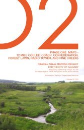
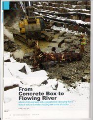
<strong>The</strong> True Story of the <strong>Highland</strong> Park Valley<br />
How an Environmental Crime was Committed on Private Property Using Calgary Taxpayers’ Money<br />
In this age of instant information the Public is under the misguided impression that we can discover our Community’s<br />
history with a simple Google search. This is not the case. <strong>The</strong> following history of <strong>Highland</strong> Park can only be discovered<br />
by researching the documents that are available at the City of Calgary Archives.<br />
In the mid 1950’s, construction of the suburbs to the NW end of Calgary were underway. Rental housing and boarding<br />
houses stretched from downtown along Centre St. N. <strong>The</strong> residents were mainly people with low incomes and people who<br />
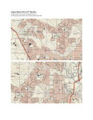
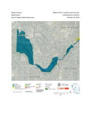
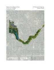
were new to the country. <strong>The</strong> <strong>Highland</strong> farm and valley were sold for development. <strong>The</strong> steep-sloped valley below the<br />
farmland was bought by Charles M. (Pat) Adderson and Adderson Holdings Ltd. <strong>The</strong> valley was subdivided into 6 parcels.<br />
Adderson’s construction company and his partners were tasked with building numerous suburbs including Brentwood and<br />
Cambrian Heights. <strong>The</strong>y understood that cities were trying to preserve open green space with golf courses and they<br />
needed a place to dump the mountains of fill that had been excavated from basements in the communities they were<br />
building. <strong>The</strong> fill was dumped all along the hills bordering the <strong>Highland</strong> valley, particularly along 4 th St N from 40 th Ave to<br />
McKnight, and along 44 th Ave from Centre St N. Beside the slopes they also dumped the fill in the valley, over artesian<br />
springs, wetlands and creeks that existed there since the ice age. Grass was seeded over the fill and the wetlands were<br />
molded into fairways.<br />
At the time McKnight Blvd was being constructed over a creek which drained into the valley. Another creek, between<br />
Trafford Dr. and Symons Rd NW, which also drained into the valley, was being vaulted to create space for further<br />
residential development in Thorncliffe and North Haven.<br />
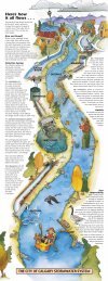
<strong>The</strong> city planners in the 50’s understood that the Nose Hill wildlife migrated along the creeks in the direction of the Bow<br />
River. So when they vaulted two creeks draining into the <strong>Highland</strong> valley they created an immense green-space,<br />
stretching from Nose Hill to Nose Creek, along the course of the water that the City had buried. <strong>The</strong> wildlife from Nose Hill<br />
continues to use this corridor to this day.<br />
On June 30, 1958 a Residential Development Agreement was signed by Adderson Construction Ltd. and the City to<br />
develop the <strong>Highland</strong> Park Subdivision including streets, roads and utilities. On December 23, 1959 a Memorandum of<br />
Agreement was signed between Adderson Holdings Ltd. and <strong>The</strong> City of Calgary to permit the development of a golf<br />
course on the valley floor, in agreement that the valley was low lying and unsuitable for development. Along the perimeter<br />
of the valley, on newly created square footage, Adderson and his partners constructed rental properties (duplexes and 4-<br />
plexes). Rental housing on a golf course ensured tenants, and a guaranteed source of income.<br />
In 1961 Confederation Creek under 4 th St at 40 th Ave NW was interred to create the James Fowler High School property.<br />
This had the effect (according to Adderson) of increasing the flow rate through the valley particularly after any rainfall. In<br />
1962-63 the historic creek bed (which remained open in the valley on private land) was enclosed in a 6’ X 8’duct from<br />
Centre St. east of the property to the main Nose Creek channel 1 km away. Every time it rained the <strong>Highland</strong> valley would<br />
flood, washing out fairways and bridges over the creek. <strong>The</strong> surrounding slopes were undermined.<br />
According to an April 2, 1971 letter from the City’s Engineering Department to the Commissioner of Operations and<br />
Development “On August 15, 1962, a detailed report was made to the Commissioners by this Department on the serious<br />
defects in this subdivision and it was indicated at the time that it would cost some $124,980 to bring the subdivision up to<br />
acceptable standards. Although every effort was made by this Department to have the Developer undertake the<br />
necessary works, he did not, and in consequence, this subdivision was never officially accepted and no final<br />
certificates either for concrete or asphalt works, were issued by the City.”<br />
In a report to the Commissioners dated September 1, 1970 from the Engineering Department “From early June 1963<br />
onward extensive correspondence was forwarded back and forth between the City and Adderson Construction Ltd. and<br />
numerous meetings appear to have been held, all aimed at getting C. M. Adderson, the President of Adderson<br />
Construction Ltd., to commit to the City sufficient of his personal assets to guarantee the performance by Adderson<br />
Construction Ltd. of its obligations pursuant to the Development Agreement, including negotiations between the City<br />
and C.M. Adderson for the acquisition by the City of <strong>Highland</strong> Golf Course. <strong>The</strong>se efforts however were not fruitful.”<br />
Around this time the Calgary North Veterinary Clinic bought the property on which they now reside from the Highwood<br />
Esso Station. <strong>The</strong> documents suggest that no remediation occurred, and perhaps was not required, after the purchase. It<br />
may be a possibility that the oil and gasoline reservoirs remain untouched and buried under the former <strong>Highland</strong> valley<br />
driving range land.<br />
In 1964 the 44th Ave NW roadway on the east side of the valley had a serious collapse. <strong>The</strong> City refused to repair it. In<br />
February 1965 the developer (Adderson Construction Ltd.) gave notice of bankruptcy. <strong>The</strong> bankruptcy did not apply to<br />
Adderson Holdings Ltd., which continued to own the valley and run the golf course. <strong>The</strong> City was left with a sub-par<br />
neighborhood and $10,500 proceeds from the bankruptcy with little further recourse.
In 1967-68 Eric Musgreave and <strong>The</strong> Centennial Ravine Park Society had the foresight and vision to protect the creek<br />
valley extending from Nose Hill to Queen’s Park Cemetery by imagining Centennial Park, now known as Confederation<br />
Park. This was also when the last duplexes were built on 44 th Ave, on the top of the steepest slope bordering the valley.<br />
Once those properties were built the City was forced to repair the road that was left unfinished since 1964 “because of the<br />
legal complications involved”. <strong>The</strong> City continued to refuse issuing final certificates along the perimeter of the <strong>Highland</strong><br />
valley for numerous reasons, including improper compaction and improper construction sloping toward the valley.<br />
Unfortunately the road on 44 th Ave NW collapsed again in 1970. Fifty yards of asphalt and sidewalk dropped 15 feet down<br />
the slope in front of those last duplexes on 44 th Ave, necessitating immediate action by the City to stabilize the slope.<br />
<strong>The</strong> Commissioners Report dated September 1, 1970 addressed to His Worship the Mayor and Members of Council<br />
clearly states that “All parties concerned agree on the causes of the slide which, briefly, may be described as follows: as<br />
the Ice Age glaciers melted, a water course with very steeply sloping sides was created in the valley of what is the<br />
<strong>Highland</strong> Golf Course. In the centuries that followed, these steeply sloping banks successively slumped, creating a<br />
number of slide planes which, unfortunately, are not self-healing. <strong>The</strong> bank eventually assumed a stable condition, and<br />
with the action of rain and weather over the centuries, all evidence of sliding disappeared from view. However, when the<br />
present residential subdivision was developed, the toe of the stabilized slope was disturbed, and the loading was changed<br />
on the upper portion of the slope, so that, in effect, the original condition of instability was once again created. Slippage is<br />
now occurring along at least one of these ancient slide planes. In evidence of this, as 44th Ave has dropped, the level of<br />
the water course at the toe of the slope has risen, clearly indicating a “rotation” of a large volume of earth.”<br />
“<strong>The</strong> consultants are agreed that the original slide planes exist beyond the present slide, so that perhaps a dozen<br />
residences could be affected if the hill slide is not stabilized”<br />
Finally, after 10 years of misadventure and hundreds of thousands of dollars of taxpayer money, the City decided to buy<br />
the valley property, or expropriate, in order to remediate the slopes of the <strong>Highland</strong> valley and protect the residents on the<br />
perimeter. <strong>The</strong> City expropriated the land on May 10, 1971 with Bylaw 8196. Adderson Holdings Ltd. sued the City and<br />
the Bylaw was quashed on a procedural technicality. <strong>The</strong> title was returned to Adderson Holdings Ltd. and the City was<br />
forced to spend even more taxpayer dollars on Adderson’s private property to enclose portions of the creek in an attempt<br />
to stop the hill slide and stabilize the perimeter properties.<br />
In a City of Calgary Engineering Department report dated August 22, 1972 it states that “Because of the large sums of<br />
money that have already been expended on this area and the potential problems and maintenance of the works already<br />
undertaken and the need for future and continued access to the Golf Course area, we would strongly recommend that this<br />
area be acquired for City purposes.” <strong>The</strong> report also indicated that there were 12 unstable areas within the Golf Course<br />
property itself. Again in 1973 a motion came before Council to expropriate, it was defeated.<br />
Throughout the 70s and 80s Adderson Holdings Ltd. continued to operate the golf course and the rental properties on the<br />
slopes. Water-sucking poplar trees were planted below the steepest and unstable slopes to hold the hill in place and<br />
absorb the storm water runoff. Trees were planted in the laneway behind the 4 duplexes at the tip of 44 th Ave., and at the<br />
base below where the creek used to run. Yet the City has had to repair and re-grade 44 th Ave. every 8 years or so<br />
because of continuing sinking and sliding.<br />
In 1993 C. M. Adderson passed away. <strong>The</strong> family sold off the income properties and continued to run the golf course. <strong>The</strong><br />
duplexes along 44 th Ave and along the east side of 4 th St were sold to individuals and investors who had no idea about the<br />
poor compaction and sliding problem or the contentious history of the valley. Around 1995, 3 duplexes on the west side of<br />
4th St were torn down and redeveloped into a condominium for elderly residents. <strong>The</strong> units encroached onto the laneway<br />
so the City issued a caveat for public access behind the property. That City laneway has now slipped into the valley and<br />
no remedial action has been implemented.<br />
In 2001 the family wanted to sell the valley to a developer. <strong>The</strong> City Council deemed the land undevelopable and passed<br />
a motion for an ARP for the area. Presumably there were still some high-ranking public servants who retained the<br />
“Institutional Memory” about the valley and spoke up. <strong>The</strong> ARP never came to pass however and <strong>Highland</strong> Park continues<br />
to have the lowest tax base of every district in Calgary.<br />
Around 2005 a golf ball on the driving range made it over the fence and hit a man in the parking lot of the City-owned<br />
subsidized housing along 40 th Ave N. A lawsuit was launched against the Golf Course and the City. Some settlement was<br />
made and the driving range was closed forever.<br />
In 2008 the valley was assessed in the “<strong>Highland</strong> Golf Course Site Stormwater Quality Retrofit Study” which states that<br />
the property is undevelopable. It has been rumored that the City was offered the site at that time for 1 million dollars and it<br />
was refused. <strong>The</strong> Nose Creek Water Management Plan recommended in 2008 that “internal drainage areas should<br />
remain isolated from the effective watershed areas as they play an important role in maintaining the hydrological regime,<br />
in particular for groundwater recharge and evapotranspiration processes.”
Due to the death and retirement of so many Department Supervisors within the City the “Institutional Memory” of this<br />
property has been lost. <strong>The</strong> valley’s intrinsic value as a watershed and wetland has been forgotten. <strong>The</strong> City’s liability<br />
issues are lost within an expensive labyrinth of FOIP requests.<br />
In May 2013, <strong>The</strong> West Nose Creek Watershed Partnership issued its Nose Creek Internal Drainage Areas Study Final<br />
Report, bearing the signatures of its City of Calgary and Alberta Provincial partners and multiple non-profit groups<br />
including Calgary River Valleys. It recommends investigation and reporting procedures and stormwater management<br />
considerations guiding future development in the Nose Creek catchment and internal drainage areas. In June of 2013 the<br />
great Calgary flood brought watershed issues to the front and center. In 2013 Maple Developments purchased the<br />
property for less than half the $11 million dollar asking price.<br />
I have lived near the end of 44 th Ave since 1994. I have noted multiple times in the past 23 years when the road bed and<br />
sidewalk have collapsed in front of my house, necessitating major roadwork and repaving and months of parking<br />
problems. <strong>The</strong>se properties are built into a steep hill, above a steep hill, and on uncertified subdivision land. <strong>The</strong> street<br />
and sidewalk was recently rebuilt in 2010 and it is again sinking about 1.5 feet in front of the storm sewers and the fire<br />
hydrant. Cars routinely have to be towed from the sinkhole every winter. <strong>The</strong> road is currently tilting into the valley and<br />
numerous fractures into the sidewalk and 44 th Ave are apparent.<br />
Since I have become aware of the imminent dangers that exist on these properties I have notified my immediate<br />
neighbors. I have driven around the perimeter of the valley through boundary laneways and noticed excessive slopes and<br />
slipping in the backyards all along 4 Street NW and in front of 44 th Ave. <strong>The</strong> condominiums, from 4506 to 4520 – 4 Street<br />
NW, are undergoing major foundational repairs to prevent the building from continuing to move off of its footings. In the<br />
valley below where that work is being done a deep sinkhole has developed inches beneath the surface over another<br />
buried creek.<br />
My questions are as follows:<br />
1. Who is liable (<strong>The</strong> City of Calgary or Maple Developments) if the construction and removal of mature trees on or<br />
below the perimeter and adjacent slopes of the valley causes settlement and slippage along the “ancient slide<br />
planes” or on the “12 areas of concern” identified on the site? What happens if a perimeter property slips or drops<br />
into the valley as a result of stripping, grading or filling and pounding?<br />
2. <strong>The</strong> developer proposes to remove 95% of the private trees on the site. How does this loss of stormwater and<br />
carbon absorption get calculated and who pays for the loss to the <strong>Highland</strong> property owners? <strong>The</strong> developer<br />
proposes to remove 86% of the City trees on the site. Does Bylaw 23M2002 (a bylaw to protect public trees) not<br />
apply in this situation?<br />
3. According to Section 664 of the MGA “a subdivision authority may require the owner of a parcel of land that is the<br />
subject of a proposed subdivision to provide part of that parcel of land as environmental reserve if it consists of:<br />
a) a swamp, gully, ravine, coulee or natural drainage course; or b) land that is subject to flooding, or is in the<br />
opinion of the subdivision authority, unstable; or c) a strip of land, not less than 6 meters in width, abutting the bed<br />
and shore of any lake, river or stream or any other body of water for the purpose of i) preventing pollution, or ii)<br />
providing public access to the bed and shore. Why can’t an Environmental or Municipal Reserve be taken on the<br />
site?<br />
4. Is the City trying to mitigate its liability to <strong>Highland</strong> Park residents on the perimeter by adding “public access<br />
greenspace” on the steep slopes to the developer’s plans?<br />
5. <strong>The</strong> developer proposes to build a wall along the perimeter of the valley. This will have the result of segregating<br />
the valley and not integrating into the community, as well as adding weight to unstable slopes. Does the<br />
developer understand the risks of that proposal?<br />
6. <strong>The</strong> wetlands on the site are being illegally drained which gives the false impression that they do not require<br />
protection by the Alberta government. Why can’t the provincial government do a complete Environmental Impact<br />
Assessment before more damage is done?<br />
7. This valley drains 5000 hectares of NW Calgary’s water and purifies storm water in the present for no cost, if<br />
development occurs in the valley how much more will taxpayers have to pay in water management and flooding<br />
liability? Can the new property owners get or afford flood insurance?<br />
8. Should the property owners at risk of losing land on the perimeter of the valley be notified?
I have walked through the valley property many times with a certified Master Arborist and he has assured me that both the<br />
naturalized and native trees on the property have more than 50 years of life left and have created a micro-climate that<br />
protects the surrounding areas from intense storms and lightning, in addition to being a mature carbon sink. Each tree’s<br />
canopy has the volume of 30 shrubs and each tree absorbs the equivalent of one car’s yearly carbon emissions. Each<br />
one of these mature tree’s root infrastructure absorbs thousands of liters of water during high water events.<br />
When will the City of Calgary pay attention to best practices based in science and accept the <strong>Highland</strong> valley for what it is<br />
right now? It is, and always was, a dynamic water and air purifier that is integral to the vitality and well-being of the original<br />
<strong>Highland</strong> Park subdivision and its residents.<br />
How ironic it is that when we celebrated the achievement of Confederation Park this year the destruction of that same<br />
valley goes unchecked only 10 blocks downstream.<br />
I trust that if the City Administration checks its own archives regarding the above history then it will agree that this valley is<br />
(as was determined in 2001 and 2008) far from suitable for development and should be reappraised.<br />
Trusting the process,<br />
J.M. Deere