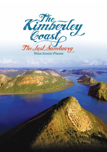
The Kimberley coast: nine iconic places - wwf - Australia
The Kimberley coast: nine iconic places - wwf - Australia
The Kimberley coast: nine iconic places - wwf - Australia

Create successful ePaper yourself
Turn your PDF publications into a flip-book with our unique Google optimized e-Paper software.
Nine Iconic Places
2<br />
Nine Iconic Places<br />
Oceanic Shoals<br />
Pages (22-23)<br />
Rowley Shoals<br />
Terminology<br />
L I K E N O W H E R E E L S E . O R G . A U<br />
9<br />
Port Hedland<br />
Scott Reef<br />
Dampier Peninsula<br />
Pages (10-11)<br />
Roebuck Bay<br />
Pages (8-9)<br />
1<br />
Browse Island<br />
Adele Island<br />
2<br />
3 4<br />
Broome<br />
Eighty Mile Beach<br />
Page (7)<br />
Marine Protected Area (MPA)<br />
– a collective term for marine conservation reserves with varying levels of protection.<br />
North <strong>Kimberley</strong><br />
Pages (20-21)<br />
Maret Island<br />
7<br />
5<br />
Holothurian Reefs<br />
6<br />
8<br />
Camden Sound and Montgomery Reef<br />
Talbot Bay and Collier Region<br />
Buccaneer Archipelago<br />
Derby<br />
King Sound and Fitzroy River<br />
Pages (12-13)<br />
Pages (16-17)<br />
Pages (14-15)<br />
Marine Park<br />
Unlike terrestrial ‘national parks’, marine parks generally contain different zones, many of which can allow for a<br />
range of extractive industries including commercial and/or recreational fishing, e.g. general use.<br />
Marine Sanctuary Zone<br />
– the highest level of protection afforded to marine environments in Western <strong>Australia</strong>; only non-extractive<br />
uses permitted (also referred to as ‘no take’ zones).<br />
Pages (18-19)<br />
Front cover Image<br />
<strong>The</strong> fringing reefs of Dugong Bay,<br />
in the Buccaneer Archipelago - Richard Costin
<strong>The</strong> <strong>Kimberley</strong> Marine Environment:<br />
A Natural Wonder of the World<br />
<strong>The</strong>re are few marine and <strong>coast</strong>al environments left on Earth that are as<br />
ecologically intact, stunningly beautiful and remote from destructive human<br />
pressures as the <strong>Kimberley</strong> region in northern Western <strong>Australia</strong>.<br />
<strong>The</strong> first global analysis of human impacts on marine<br />
ecosystems (Halpern et al, 2008) recognised northern<br />
<strong>Australia</strong>, including the <strong>Kimberley</strong>, as one of the world’s<br />
last, relatively undamaged <strong>coast</strong>al areas. <strong>The</strong> only other<br />
large marine areas identified in a similar condition were<br />
the remote reaches of the Polar regions. <strong>The</strong> <strong>Kimberley</strong><br />
is a global treasure of comparable importance to the<br />
World Heritage-listed Great Barrier Reef and Ningaloo<br />
Marine Parks and features similar internationally significant<br />
ecological, scientific and cultural values.<br />
<strong>The</strong> <strong>Kimberley</strong> has outstanding Indigenous cultural values<br />
- with Traditional Owners’ ancient connections to their<br />
country continuing strongly through to the present day.<br />
<strong>The</strong>se unique connections as well as intricate ecological<br />
and geographic knowledge of their lands, seas and biota<br />
has grown with them over thousands of years. It provides<br />
Traditional Owners with a highly valuable ‘cultural map’ of<br />
their country.<br />
<strong>The</strong> <strong>Kimberley</strong> marine environment is vast, extending north<br />
from Eighty Mile Beach and east to the Northern Territory<br />
border covering an area of 630,000 square kilometres.<br />
Unsurprisingly such an enormous seascape contains<br />
waters controlled by both the Western <strong>Australia</strong>n (WA) and<br />
Commonwealth Governments. This report documents the<br />
outstanding conservation values of the state waters of the<br />
<strong>Kimberley</strong> which extend from the shore out to three nautical<br />
miles and include several offshore islands, reefs and atolls<br />
under State jurisdiction.<br />
Fringing Reefs of Global Importance<br />
<strong>The</strong> <strong>Kimberley</strong>’s extensive fringing coral reefs with their<br />
extraordinary diversity are further evidence of the region’s<br />
global conservation significance. Together with its offshore<br />
atolls, the scale of reef development and the diversity of<br />
coral species recorded so far, the <strong>Kimberley</strong>’s coral reefs are<br />
of international importance (Wells et al., 1995; Masini et al.,<br />
2009). Indeed, the <strong>Kimberley</strong> region was highlighted as a<br />
core part of one of just 18 hotspots for coral reef diversity<br />
worldwide (Roberts et al., 2002).<br />
While our understanding of coral reefs in the <strong>Kimberley</strong><br />
<strong>coast</strong>al bioregion continues to develop, a total of 318<br />
species of reef-building hard corals have already been<br />
recorded from intertidal and subtidal coral reef habitats,<br />
pertaining to 74 genera (AIMS, 2011). As prominent marine<br />
scientist Dr Barry Wilson notes, this represents a “greater<br />
diversity of coral species in <strong>Kimberley</strong> reefs than in oceanic<br />
atolls or the Great Barrier Reef” (Science Network WA,<br />
2011). <strong>The</strong> reefs in the <strong>Kimberley</strong> are largely in excellent<br />
condition (Wood and Mills 2008; Masini et al., 2009) and their<br />
conservation significance is all the more outstanding given<br />
that more than half of the world’s coral reefs are threatened<br />
or already destroyed (Wilkinson, 2008).<br />
A Refuge for Threatened and Endangered Species<br />
<strong>The</strong> <strong>Kimberley</strong> is one of the last remaining large and healthy<br />
refuges in the world for many threatened and endangered<br />
marine species. For example, the region features critical<br />
habitats for a number of vulnerable, endangered or critically<br />
endangered shark species (DEWHA, 2008; Stevens et al.,<br />
2008). <strong>The</strong> <strong>Kimberley</strong> also supports six of the world’s seven<br />
species of marine turtle.<br />
In addition to healthy populations of various marine mammals,<br />
including dugongs and numerous species of whales and<br />
dolphins, the <strong>Kimberley</strong> includes the calving and nursery<br />
grounds of one of the largest humpback whale populations in<br />
the world. More than 20,000 humpback whales migrate to the<br />
<strong>Kimberley</strong> from Antarctica each year (Hedley et al., 2009).<br />
<strong>The</strong> <strong>Kimberley</strong>: Under Threat<br />
Up until now, the remoteness of this beautiful environment<br />
has protected it from the harmful impacts felt elsewhere in<br />
<strong>Australia</strong>. It has been spared the damages of habitat loss,<br />
pollution, land reclamation, overfishing, urbanisation and<br />
oil and gas industry development. However, just as the<br />
<strong>Kimberley</strong> is coming to national and indeed international<br />
prominence for its scientific, natural and cultural values,<br />
proposals for industrialisation and expanded natural<br />
resource extraction are gathering pace across the region.<br />
A wide range of projects are now being considered in<br />
the marine and <strong>coast</strong>al environments of the <strong>Kimberley</strong>.<br />
Individually and cumulatively, these could have profound and<br />
irreversible impacts on the natural and cultural values of the<br />
region. <strong>The</strong>se developments range from expanded mining<br />
in the Buccaneer Archipelago to proposed new industrial<br />
port infrastructure in King Sound and from liquefied natural<br />
gas (LNG) processing on the Dampier Peninsula to new<br />
trawling fisheries in waters off Ashmore Reef.<br />
An aerial view of the massive water movement at the Horizontal Falls in Talbot Bay<br />
- Annabelle Sandes<br />
THE KIMBERLEY COAST / THE LAST SANCTUARY / NINE ICONIC PLACES 3
4<br />
A New Hope – <strong>The</strong> Great <strong>Kimberley</strong> Marine Park<br />
Both the WA and the Commonwealth Governments have separate marine park planning<br />
processes for the <strong>Kimberley</strong> marine environment. <strong>The</strong> WA Government has committed to creating<br />
four marine parks in its <strong>coast</strong>al waters: Eighty Mile Beach; Roebuck Bay; Camden Sound and<br />
North <strong>Kimberley</strong>. With attention firmly now on the <strong>Kimberley</strong>, there is a real opportunity to ensure<br />
comprehensive protection for all state waters through the creation of a Great <strong>Kimberley</strong> Marine Park.<br />
<strong>The</strong> signatories to this document welcome the WA Premier<br />
Colin Barnett’s concept of creating the “Great <strong>Kimberley</strong><br />
Marine Park” (DPC, 2010).Such a park could rival the best<br />
MPAs in the world and in our region, including the Great<br />
Barrier Reef Marine Park.<br />
To fully realise this vision, the Great <strong>Kimberley</strong> Marine Park<br />
should encompass all <strong>Kimberley</strong> State waters within its<br />
boundaries, including the four parks already proposed. In<br />
doing so, the WA Government can deliver sound, sciencebased<br />
conservation outcomes and provide both long-term<br />
protection for the <strong>Kimberley</strong> marine environment and<br />
certainty for all stakeholders in the region. Such a visionary<br />
approach would be a welcome and timely departure from<br />
the current ad-hoc manner of planning and development<br />
in the <strong>Kimberley</strong>.<br />
<strong>The</strong> idea of protecting all State waters in the <strong>Kimberley</strong> in a<br />
marine park is not new. <strong>The</strong> WA Marine Parks and Reserves<br />
Authority recommended in its 2008/09 Annual Report that<br />
the WA Government:<br />
“…urgently protect the <strong>Kimberley</strong> through the<br />
establishment of a multiple use marine park over the<br />
whole of State waters in the <strong>Kimberley</strong> with the full<br />
reservation of currently identified <strong>iconic</strong> areas by an<br />
appropriate zoning system in the broader multiple<br />
use marine park” (MPRA, 2009).<br />
Aerial view of Turtle Reef in Talbot Bay on the <strong>Kimberley</strong> <strong>coast</strong> - Annabelle Sandes<br />
LIKENOWHEREELSE.ORG.AU<br />
Such a marine park should include a significant network<br />
of sanctuary zones. <strong>The</strong> Great Barrier Reef and Ningaloo<br />
Marine Parks have set a benchmark for sanctuary zones<br />
within <strong>Australia</strong>n MPAs: 33% of the Great Barrier Reef<br />
marine parks and 34% of Ningaloo Marine Park have been<br />
fully protected (GBRMPA, 2004; DEC, 2005). <strong>The</strong> vibrant<br />
tourism industries (including recreational fishing) in and<br />
around both these parks demonstrate that strong marine<br />
conservation can support healthy local economies built on<br />
sustainable nature and culture-based tourism.<br />
Current <strong>Kimberley</strong> Marine Sanctuary Protection<br />
<strong>The</strong> proposed level of marine sanctuary protection, including<br />
the new Camden Sound and Eighty Mile Beach Marine Parks<br />
announced so far, will be five per cent of all State waters in<br />
the <strong>Kimberley</strong> (Centre for Conservation Geography, Daniel<br />
Beaver, per comms.). <strong>The</strong> establishment of the Great<br />
<strong>Kimberley</strong> Marine Park with world class marine sancturaries<br />
would lift this level to a stronger science-driven benchmark.
<strong>The</strong> Case for Marine Sanctuaries<br />
Marine sanctuaries have been shown to<br />
dramatically increase the size, diversity and<br />
abundance of marine life compared with<br />
adjacent fished areas. A recent study of<br />
124 marine sanctuaries from both tropical and<br />
temperate waters around the world showed that<br />
on average the mass of marine life increased by<br />
450%, density by 170%, body size by 30% and<br />
number of species by 21% (Lester et al., 2009).<br />
Sanctuaries have also been shown to help<br />
protect threatened species like dugong and<br />
marine turtles (McCook et al., 2010).<br />
Why Do We Need Marine Sancturies?<br />
Just like national parks on land, a network of sanctuary<br />
zones is essential to protecting and conserving the diversity<br />
of our marine life and areas of high conservation value in<br />
our oceans. In addition, sanctuary zones help to insure<br />
against overfishing by providing a refuge where marine<br />
life can breed and mature undisturbed. <strong>The</strong>y also help<br />
us better understand the impacts of human activities like<br />
fishing by providing scientific reference areas free from<br />
direct interference.<br />
Fishing and Offshore Development in the<br />
<strong>Kimberley</strong><br />
<strong>The</strong> WA population is projected to grow dramatically over<br />
the next few decades from the current population level of<br />
2.35 million. (ABS, 2012). One ABS survey has suggested<br />
it could reach 4.3 million people by 2056. (ABS, 2008). <strong>The</strong><br />
Department of Fisheries (2010) has acknowledged that in<br />
key areas “….there is now considerable fishing pressure …<br />
out to the 200m isobath. This trend is due to the growth in<br />
ownership of larger, faster boats and people willing to travel<br />
greater distances to catch fish.”<br />
Whilst the <strong>Kimberley</strong> has so far escaped the fate of the<br />
southwest, where declining fish stocks have led to significant<br />
cuts to both commercial and recreational fishing, increasing<br />
resource development is bringing greater population<br />
and wealth to the region. Subsequently the pressure on<br />
fish stocks is expected to increase. Mining and oil and gas<br />
development is also growing dramatically in the <strong>Kimberley</strong>,<br />
including on islands and in <strong>coast</strong>al waters. This will put<br />
increased pressure on marine life. It is important that we<br />
put in place sanctuaries now to ensure the unique marine<br />
life of the region is preserved and fish breeding areas are<br />
protected.<br />
Recent studies show that sanctuary zones are not an<br />
impediment to continued enjoyment of recreational fishing.<br />
Recreational fishing continues to flourish in marine parks<br />
that include large sanctuary zones including at Ningaloo.<br />
(Northcote and Macbeth, 2006).<br />
Scientists Agree — Sanctuaries Work<br />
In 2009 more than 50 eminent <strong>Australia</strong>n marine scientists<br />
issued a consensus statement of criteria for marine<br />
protected area planning and design, outlining scientific<br />
‘Principles for Design of Marine Protected Areas in<br />
<strong>Australia</strong>’ (<strong>The</strong> Ecology Centre, UQ, 2009). <strong>The</strong> <strong>Australia</strong>n<br />
Marine Science Association has also supported a network<br />
of sanctuaries (AMSA, 2008). <strong>The</strong>re are also many<br />
international statements, including a ‘Scientific rationale<br />
for the designation of very large marine reserves’ (Global<br />
Ocean Legacy, 2010) signed by 271 leading international<br />
marine scientists.<br />
According to scientists, sound marine conservation<br />
planning requires that marine sanctuary zones must:<br />
• Be larger rather than smaller, and represent the full range<br />
of habitats in an area, including spawning, feeding and<br />
high density areas for ocean life;<br />
• Feature simple shapes for easy understanding by visitors<br />
and users to minimize edge effects;<br />
• Be close enough together to foster larval dispersal and<br />
connectivity of the ecosystem; and<br />
• Be integrated with other management systems, such as<br />
fisheries management, to minimize threats from beyond<br />
sanctuary boundaries.<br />
<strong>The</strong>re are numerous studies showing that existing<br />
sanctuaries in <strong>Australia</strong> are effective. <strong>The</strong>se findings include<br />
twice as many large fish on the Great Barrier Reef (McCook<br />
et al., 2010), up to eight times dhufish density at the Abrolhos<br />
Islands (Watson et al., 2007) and 50 times higher density of<br />
legal size western rock lobster at Rottnest Island (Babcok et<br />
al., 2007). <strong>The</strong>re are also benefits to large marine predators<br />
such as sharks that underpin some ocean ecosystems and<br />
protect threatened species (McCook et al., 2010).<br />
Can Sanctuaries Help Improve Fishing?<br />
Increasingly, scientific research is showing that sanctuaries<br />
benefit fishing. Examples of recent research include:<br />
• Tagging programs showing that fisheries have benefited<br />
from the spillover of juveniles, eggs and larvae in the Sea<br />
of Japan, Newfoundland, Kenya and New Zealand<br />
(Gelland and Roberts, 2003).<br />
• Research showing spillover has the potential to match the<br />
loss of catch from fisheries displaced by the creation of<br />
marine sanctuaries (Halpern and Warner, 2003).<br />
• A long term study of lobster in Spain showing that a<br />
marine sanctuary produced an annual net benefit of<br />
10% of catch by weight (Goñi et al., 2010).<br />
• A parallel study of the same sanctuary showed that<br />
although the reserve only covered 18% of local lobster<br />
habitat, it contributed 80% of local egg production<br />
(Diaz et al., 2009).<br />
THE KIMBERLEY COAST / THE LAST SANCTUARY / NINE ICONIC PLACES 5
6<br />
Opportunities for Co-management<br />
<strong>The</strong> <strong>Kimberley</strong> is one of the world’s last remaining cultural<br />
and natural landscapes not yet industrialised. Half the<br />
<strong>Kimberley</strong>’s population is of Indigenous descent and English<br />
is not the first language of many people from remote towns<br />
and communities. Traditional Owners retain strong ties<br />
to Aboriginal law, language and traditional country, all of<br />
which make up a vibrant and living cultural heritage. On<br />
the <strong>Kimberley</strong> <strong>coast</strong> – Saltwater Country – this living history<br />
stretches back at least 30,000 years (O’Connor, 1994) beyond<br />
the last Ice Age and before the time of marine flooding of the<br />
<strong>Kimberley</strong> region.<br />
An intricate ecological and geographic knowledge of<br />
their land and sea country provides Traditional Owners<br />
with a highly valuable ‘cultural map’. Indigenous Saltwater<br />
people live in <strong>coast</strong>al environments, with associated cultural<br />
responsibilities as custodians for the environment. ‘Country’ is<br />
a physical space, a place that provides food, water and shelter,<br />
a personal spiritual place and a site of spiritual connotations<br />
and history (Woolagoodja, 2011).<br />
Traditional Owners have repeatedly expressed their strong<br />
desire to continue this connection through engagement<br />
in contemporary land and sea management across the<br />
<strong>Kimberley</strong>.<br />
Traditional Owners are the principal land managers in<br />
the <strong>Kimberley</strong> and have an integral role to play in the<br />
management of the natural values of their country. This<br />
authority to fulfill management responsibilities must be<br />
reflected in planning, policy and legislation. A strong<br />
collaborative relationship through Indigenous Protected<br />
Areas (IPAs), joint management and other partnerships<br />
with Governments and private landholders, can deliver this<br />
management capacity. <strong>The</strong>se relationships provide significant<br />
benefits to Traditional Owners, Governments and the wider<br />
community (NRETAS, 2007).<br />
In 2009, a Saltwater Country Plan was developed by North<br />
<strong>Kimberley</strong> Traditional Owners to explain the cultural<br />
and natural values of the region and identify ways for<br />
Governments and other stakeholders to support the<br />
aspirations of Traditional Owners in looking after Country.<br />
L I K E N O W H E R E E L S E . O R G . A U<br />
In summary the plan’s priorities are:<br />
• Adequate consultation with Traditional Owners on<br />
all matters relating to their ancestral lands and seas.<br />
• Recognition of Traditional Owners’ aspirations arising<br />
from customary rights and duties.<br />
• Support for the development of sustainable Sea<br />
Ranger Units.<br />
• Technical support from stakeholders to look after<br />
Country using both Indigenous knowledge and Western<br />
scientific knowledge.<br />
(North <strong>Kimberley</strong> Saltwater Country Steering Committee, 2010).<br />
For Traditional Owners, caring for Country is about much more<br />
than conservation planning alone. As the Saltwater Plan North<br />
<strong>Kimberley</strong> Saltwater Country Steering Committee (2010) states,<br />
it’s a matter of survival: “Our marine resources, such as turtle,<br />
dugong, shellfish and fish have sustained us for thousands of<br />
years. Our future depends on how our Saltwater Country is used<br />
and managed by us and by others whose lives and livelihoods<br />
have come to depend on this region in recent times.”<br />
Co-management can provide significant and long term social<br />
and economic benefits for local communities. It can provide<br />
training programs and opportunities for existing indigenous<br />
ranger teams and create employment in the management of<br />
new marine parks and reserves. It is also another avenue for<br />
engaging indigenous youth.<br />
<strong>The</strong> <strong>Kimberley</strong> Land Council has developed a policy<br />
which clearly outlines what is required for successful comanagement.<br />
Fundamentally, all parties must be committed<br />
to the co-management relationship as an ongoing,<br />
evolving process rather than a static set of guidelines or<br />
legal procedures. Successful co-management requires,<br />
“committed, flexible approaches that match the capacity of<br />
the parties, provide adequate recurrent resources and operate<br />
within policy frameworks that are supported by legislative<br />
mechanisms” (<strong>Kimberley</strong> Land Council, 2010).<br />
<strong>The</strong> proposed new marine parks on the <strong>Kimberley</strong> <strong>coast</strong><br />
provide a real opportunity for the WA Government to deliver on<br />
its declared commitment of co-management with Traditional<br />
Owners. This would signal an exciting new era in flexible,<br />
adaptive and culturally appropriate models of management.<br />
Stunning colours in Talbot Bay on the <strong>Kimberley</strong> <strong>coast</strong> - Annabelle Sandes
1<br />
Eighty Mile Beach lies about half-way between the Port towns Hedland of Broome and<br />
Carnarvon<br />
Kalbarri<br />
Oceanic Shoals 9<br />
Rowley Shoals<br />
Scott Reef<br />
Roebuck Bay<br />
Browse Island<br />
Adele Island<br />
Dampier Peninsula 3 4<br />
North <strong>Kimberley</strong><br />
Maret Island<br />
Broome<br />
Eighty Mile Beach<br />
Port Hedland. It is a unique part of the <strong>coast</strong> where the Great Sandy Desert<br />
meets the Indian Ocean. This appeal makes it an outstanding example of<br />
a major beach with associated inter-tidal mud flats and <strong>coast</strong>al floodplain<br />
in the arid tropics (Lane et al., 1996; Bryant 2001;). Eighty Mile Beach forms<br />
part of the traditional lands of the Nyangumarta and Karajarri peoples.<br />
Eighty Mile Beach has extraordinary natural values and<br />
is recognised as one of the world’s richest tropical intertidal<br />
wetlands (Pearson, 2005). <strong>The</strong> very wide tidal range<br />
(greater than 10 metres) exposes enormous mudflats up<br />
to four kilometres wide at low tide (Pearson et al., 2005).<br />
<strong>The</strong>se mudflats are rich in invertebrates, and more than<br />
200 species of large invertebrates such as snails and<br />
burrowing sea anemones have been recorded here<br />
(Lavaleye et al., 2005).<br />
Eighty Mile Beach, with its rich benthic (mud-dwelling)<br />
food resource, is one of the most important migration<br />
stop-over areas for shorebirds on the East Asia-Australasia<br />
Flyway. It regularly supports more than 450,000 birds (Hale<br />
and Butcher, 2009) and is an essential landfall for birds<br />
that have migrated south from their breeding grounds<br />
15,000 kilometres away in Siberia and Alaska (Wade and<br />
Hickey, 2008). At times, Eighty Mile Beach can host many<br />
more birds: in February 2004 more than 2.5 million oriental<br />
pratincoles (Glareola maldivarum) were observed (Sitters<br />
et al., 2004). This number of shorebirds has not been<br />
exceeded elsewhere in <strong>Australia</strong>; in fact these are the<br />
highest counts for waders anywhere in the southern<br />
hemisphere (DCLM, 2003).<br />
Ninety-one bird species have been recorded at Eighty<br />
Mile Beach, including 41 species of shorebird (Pearson<br />
et al., 2005). <strong>The</strong>re are some species for which the beach<br />
is particularly important; in annual counts, more than half<br />
the world’s population of red knots (Calidris canutus) have<br />
been recorded there (Piersma et al., 2006). Some 1,750<br />
square kilometres of the beach, together with the adjacent<br />
mudflats Mandora Marsh, forms a recognised ‘Wetland of<br />
International Significance’ under the Ramsar Convention<br />
(DCLM, 2003), principally for its role in supporting so many<br />
species of resident and migratory birds.<br />
Eighty Mile Beach is also recognised as an important<br />
turtle nesting site. <strong>The</strong> flatback turtle (Natator depressus) is<br />
nationally listed as ‘vulnerable’, and initial surveys indicate<br />
that many hundreds of these turtles nest along the beach<br />
(Pendoley, 2005). Unlike all other marine turtle species,<br />
flatback hatchlings are not ocean-going, but remain within<br />
10-100 kilometres of their natal beaches and feed on<br />
invertebrates in low energy, shallow environments<br />
(DEC, 2008).<br />
Holothurian Reefs<br />
Derby<br />
King Sound and Fitzroy River<br />
THE KIMBERLEY COAST / THE LAST SANCTUARY / NINE ICONIC PLACES 7<br />
1<br />
2<br />
7<br />
5<br />
6<br />
8<br />
Camden Sound and<br />
Montgomery Reef<br />
Talbot Bay and Collier Region<br />
Buccaneer Archipelago<br />
In addition to its value as a migratory shorebird and turtle<br />
nesting site, Eighty Mile Beach is inhabited by dugongs,<br />
whales, dolphins and seabirds (Jenner et al., 2001; Marsh<br />
et al., 2002; Mustoe and Edmunds, 2008). All four species<br />
of <strong>Australia</strong>n sawfish are found there: the narrow sawfish<br />
(Anoxypristis cuspidata), green sawfish (Pristis zijsron),<br />
dwarf sawfish (Pristis clavata) and the freshwater sawfish<br />
(Pristis microdon) (DEC, 2011). All four sawfish species are<br />
protected in Western <strong>Australia</strong>n waters (DEC, 2011), and<br />
the three Pristis species are protected under the federal<br />
Environment Protection and Biodiversity Conservation<br />
(EPBC) Act (DSEWPAC, 2011).<br />
Flatback turtle nesting, Eighty Mile Beach - Jenita Enevoldsen
8<br />
2<br />
LIKENOWHEREELSE.ORG.AU<br />
Port Hedland<br />
Roebuck Bay is at the southern end of the Dampier Peninsula next to the<br />
Eight times the size of Sydney Harbour, Roebuck Bay is an<br />
enormous seascape with one of the largest tidal ranges on<br />
Earth. Spring tides, those with maximum range, expose<br />
almost half the bay, or about 190 square kilometres of<br />
mudflats.<br />
<strong>The</strong>se extraordinary mudflats are recognised as some of<br />
the most productive in the world (Pepping et al., 1999).<br />
Up to 500 species of benthic invertebrate have been<br />
recorded in the mud of the bay, in some instances living<br />
in communities of more than 1,200 individuals per square<br />
metre (Bennelongia, 2009). This benthic community in turn<br />
supports one of the largest aggregations of shorebirds<br />
found anywhere in the southern hemisphere (Watkins,<br />
1993). It is estimated that up to 300,000 birds forage on the<br />
mudflats annually.<br />
Described as the “Shorebird Capital of <strong>Australia</strong>”, Roebuck<br />
Bay is the first stop over for many birds undertaking the<br />
East-Asia Australasia Flyway. <strong>The</strong> birds migrate between<br />
<strong>Australia</strong> and their breeding grounds, which are located as<br />
far away as Alaska and Siberia (Lambert and Elix, 2004).<br />
Though Roebuck Bay is internationally renowned for its<br />
birds, the soft <strong>coast</strong>al mudflats, creeks, estuaries and<br />
mangrove forests of the bay support a number of marine<br />
species of high conservation significance. <strong>The</strong>se include<br />
dugongs and several turtle and sawfish species (Prince,<br />
1986; RBWG, 2011). Humpback whales are also sometimes<br />
seen in the bay on their northern migration to calving<br />
grounds further along the <strong>Kimberley</strong> <strong>coast</strong>.<br />
<strong>The</strong>re are three dolphin species known to inhabit the bay,<br />
including <strong>Australia</strong>’s only endemic dolphin, the <strong>Australia</strong>n<br />
snubfin dolphin (Orcaella heinsohni). This is the first new<br />
dolphin species to be recognised worldwide in over 50<br />
years (Beasley et al., 2005). Remarkably, the largest known<br />
aggregation of this EPBC-listed <strong>Australia</strong>n species is found<br />
in Roebuck Bay, with 154 individuals recorded to date<br />
(Thiele, 2010).<br />
Carnarvon<br />
Kalbarri<br />
Oceanic Shoals 9<br />
Rowley Shoals<br />
Scott Reef<br />
Roebuck Bay<br />
Browse Island<br />
Adele Island<br />
Dampier Peninsula 3 4<br />
1<br />
2<br />
North <strong>Kimberley</strong><br />
Maret Island<br />
Broome<br />
Eighty Mile Beach<br />
7<br />
5<br />
Holothurian Reefs<br />
popular tourist town of Broome. Roebuck Bay is part of the ancestral home<br />
of the Yawuru people. Yawuru have strong and enduring cultural, social and<br />
economic ties to their land and sea country. Roebuck Bay also has significant<br />
heritage values for many other Indigenous groups including the Karajarri,<br />
Mangala and Walmajarri peoples.<br />
6<br />
8<br />
Camden Sound and<br />
Montgomery Reef<br />
Talbot Bay and Collier Region<br />
Buccaneer Archipelago<br />
Derby<br />
King Sound and Fitzroy River<br />
An essential element of the Roebuck Bay ecosystem is the<br />
extensive mangrove community lining its shores. <strong>The</strong>se<br />
mangroves are an important nursery area for prawns, mud<br />
crabs and fish (RBWG, 2011). Along with the supratidal<br />
flats above the high tide line and plains behind them, the<br />
mangroves provide a significant proportion of the raw energy<br />
that fuels the food chain of the bay.<br />
Large sea grass communities found throughout Roebuck Bay<br />
are essential to its productivity. Sea grass is food for many<br />
species including dugongs, which eat up to 40 kilograms of<br />
sea grass a day (Mellors and McKenzie, 2009), green turtles<br />
(Chelonia mydas), snails, crustaceans and other invertebrates.<br />
Sea grass beds are also critical in providing habitat and shelter<br />
for many marine species, with significantly higher numbers<br />
of species recorded in sea grass meadows than in bare sand<br />
(RBWG, 2011).<br />
Ramsar Wetland<br />
In recognition of its international significance as a wetland,<br />
much of Roebuck Bay (360 square kilometres) has been<br />
listed as a Ramsar site. As a signatory to the Ramsar<br />
Convention (1971), <strong>Australia</strong> has committed to ensure that<br />
our internationally important wetlands are conserved. Since<br />
the bay was listed under the Ramsar Convention, further<br />
research has identified new dimensions to its ecological<br />
significance. Simply put, Roebuck Bay is one of the world’s<br />
most outstanding natural icons in terms of its biodiversity and<br />
productivity.<br />
<strong>Australia</strong>n Snubfin Dolphin - Simon Allen
An Eastern Reef Egret - Annabelle Sandes<br />
A flock of migratory shore birds rise at Crab Creek, south of Broome, near the<br />
Broome Bird Observatory. Crab Creek is on the shores of Roebuck Bay, one of the<br />
world’s great bird aggregation areas - Annabelle Sandes<br />
Wet season rain clouds cast dramatic shadows over Roebuck Plains in<br />
the <strong>Kimberley</strong> wet season. Water from the plains drains into Roebuck Bay,<br />
bringing an inundation of fresh water - Annabelle Sandes<br />
THE KIMBERLEY COAST / THE LAST SANCTUARY / NINE ICONIC PLACES 9
10<br />
3<br />
Quondong Point and James Price Point<br />
<strong>The</strong> waters off Quondong Point have been identified as<br />
one of the most important ecological sites of the Northwest<br />
marine region (DEWHA, 2008). A unique combination<br />
of sea floor ‘shape’ (bathymetry) and ocean movements<br />
(oceanography) appears to enhance Quondong’s biological<br />
productivity, but the underlying processes are unclear.<br />
Nevertheless, surrounding waters attract an abundance of<br />
baitfish, which in turn attracts aggregations of seabirds and<br />
other marine life, including large predatory fish, cetaceans,<br />
turtles and dugongs (DEWHA, 2008).<br />
A ‘snapshot’ study of the fish-habitat associations found in<br />
the vicinity of James Price Point identified 116 species of<br />
fishes, sharks, rays and sea snakes. Indeed, this survey found<br />
that the ichthyofauna (fish life) in the study area at James<br />
Price Point had a much higher diversity and abundance than<br />
equivalent areas of the Great Barrier Reef using comparable<br />
survey techniques (Cappo et al., 2011).<br />
Flatback turtles (Natator depressus) tagged as part of the<br />
2009 Chevron Barrow Island Turtle Management Plan were<br />
found to use Quondong as their most frequented foraging<br />
ground (Chevron, 2009). Quandong appears to be a calving<br />
nursery and a high-density area for northbound humpback<br />
whales (Megaptera novaeangliae), as well as false killer<br />
whales (Pseudorca crassidens), pygmy blue whales<br />
(Balaenoptera musculus brevicauda) and several resident<br />
dolphin species (DEWHA, 2008, DEH, 2005).<br />
<strong>The</strong> North-west is one of three hotspots for sponge<br />
biodiversity in <strong>Australia</strong>, with over 600 species recorded<br />
(Hooper et al., 2002, in Keesing et al., 2011). <strong>The</strong> Dampier<br />
Peninsula is particularly rich, with one survey recording<br />
275 species (Keesing et al., 2011).<br />
LIKENOWHEREELSE.ORG.AU<br />
Carnarvon<br />
Kalbarri<br />
Oceanic Shoals 9<br />
Rowley Shoals<br />
Port Hedland<br />
Scott Reef<br />
Roebuck Bay<br />
Browse Island<br />
Adele Island<br />
Dampier Peninsula 3 4<br />
1<br />
2<br />
North <strong>Kimberley</strong><br />
Maret Island<br />
Broome<br />
Eighty Mile Beach<br />
7<br />
5<br />
Local fish communities off James Price Point include a<br />
higher proportion of small pelagic baitfish and more<br />
Holothurian Reefs<br />
6<br />
8<br />
Camden Sound and<br />
Montgomery Reef<br />
Talbot Bay and Collier Region<br />
Buccaneer Archipelago<br />
Derby<br />
King Sound and Fitzroy River<br />
<strong>The</strong> Dampier Peninsula stretches 300 kilometres north from Broome to<br />
Cape Leveque with a <strong>coast</strong>line that has been described as “spectacular and fragile”<br />
(Taggart, 2009). This <strong>coast</strong>al habitat, based on sandstone with tidal creeks,<br />
is important for many marine species. <strong>The</strong> biological productivity of <strong>Kimberley</strong><br />
waters is driven by episodic injections of nutrients from terrestrial runoff following<br />
storms and re-suspension of sediments from the large tides and huge sub-sea<br />
waves (DEWHA, 2008).<br />
mobile predators, such as mackerel, than fish communities<br />
elsewhere at a similar latitude and distance from shore<br />
(Cappo et al., 2011).<br />
Seasonally abundant sea grass communities are patchily<br />
distributed across large areas along the Dampier<br />
Peninsula, from the lower intertidal zone, out to a depth<br />
of approximately 20 metres (Masini et al., 2009). <strong>The</strong>se sea<br />
grass meadows support a rich diversity of sea life including<br />
dugong (Dugong dugon) which have been reported<br />
feeding in the vicinity of James Price Point (Prince, 1986).<br />
Bays on the Peninsula<br />
<strong>The</strong> sheltered embayments along the west <strong>coast</strong> of<br />
Dampier Peninsula, particularly Carnot Bay, Beagle Bay<br />
and Pender Bay, support extensive mangrove systems<br />
(Kenneally, 1982), which are important fish nursery habitats.<br />
Beagle Bay and Pender Bay are also significant for<br />
bottlenose dolphins (Tursiops spp.), Indo-Pacific humpback<br />
dolphins (Sousa chinensis) and <strong>Australia</strong>n snubfin dolphins<br />
(Orcaella heinsohni) (DEWHA, 2008).<br />
Pender Bay is recognised as an important staging area for<br />
the southern migration of humpback whales, and more<br />
recent work has found that this deep embayment is likely<br />
to be significant for their calving, breeding and resting<br />
(McKay and Thiele, 2008; Double et al., 2010). Other recent<br />
cetacean survey work shows that the range of important<br />
habitat for this population is likely to extend from Gourdon<br />
Bay south of Broome to Camden Sound in the north (Costin<br />
and Sandes, 2009, 2010). Importantly, whales were surveyed<br />
calving between Broome and Cape Leveque on the<br />
Dampier Peninsula, as well as further north at Pender Bay<br />
and Camden Sound.
Whale tail, James Price Point - Jenita Enevoldsen<br />
Clown fish - Jenita Enevoldsen<br />
Pelagic Trevally schooling - Jenita Enevoldsen<br />
James Price Point - Adam Monk<br />
THE KIMBERLEY COAST / THE LAST SANCTUARY / NINE ICONIC PLACES 11
12<br />
4<br />
King Sound<br />
King Sound functions as a seasonal estuary and is the<br />
receiving basin for the Fitzroy, May and Meda Rivers<br />
(MPRSWG, 1994). <strong>The</strong> Fitzroy River delta has the largest<br />
tidal range of any tide-dominated delta in the World<br />
(Semeniuk and Brocx, 2011). Freshwater in the fractured<br />
bedrock discharges into the tidal zones of the region in<br />
the wet season and continues into the dry season. This is<br />
a globally significant process, controlling the occurrence<br />
and maintenance of mangroves in the high tidal zone<br />
(Cresswell and Semenuik, 2011).<br />
<strong>The</strong> tidal mudflats and mangroves provide nursery<br />
habitat for a wide variety of fish (Loneragan et al., 2002)<br />
and crustaceans, which are important prey for inshore<br />
dolphins. <strong>Australia</strong>n snubfin dolphins (Orcaella heinsohni)<br />
and the Indo-Pacific humpback dolphin (Sousa chinensis)<br />
use the tidal rivers, while bottlenose dolphins (Tursiops<br />
spp.) are found out in the embayment (Thiele, 2008).<br />
King Sound and the adjacent Fitzroy River are the<br />
only known nursery areas for freshwater sawfish (Pristis<br />
microdon) in the <strong>Kimberley</strong> and are a significant stronghold<br />
for this and other sawfish species worldwide (Thorborn<br />
and Morgan, 2005a, 2005b). <strong>The</strong> Fitzroy features four of<br />
the world’s most endangered fish: the freshwater sawfish<br />
(P. microdon), the dwarf sawfish (Pristis clavata) and the<br />
northern river shark (Glyphis garricki), all of which are listed<br />
as critically endangered by the IUCN. <strong>The</strong> fourth species,<br />
the freshwater whipray (Himantura chaophraya), is IUCNlisted<br />
as vulnerable (Morgan et al., 2004; Thorburn et al.,<br />
2004; Thorburn and Morgan, 2005a, 2005b; IUCN, 2011).<br />
<strong>The</strong>se may be some of the world’s only remaining viable<br />
populations of some of these species (Morgan et al., 2011).<br />
<strong>The</strong> organic mound-springs complex known as Big<br />
Springs, on the eastern shore of King Sound, provides<br />
a significant area of habitat and refuge. <strong>The</strong> complex<br />
includes dense wet rainforest species, dominated by<br />
forests (20 metres tall in some <strong>places</strong>) of Terminalia<br />
microcarpa, a species not otherwise known south of<br />
Walcott Inlet. Big Springs is a rare feature in this region<br />
and the best example of seepage rainforest in the<br />
Dampierland bioregion (May and McKenzie, 2002). It is<br />
listed on the National Directory of Important Wetlands.<br />
LIKENOWHEREELSE.ORG.AU<br />
Carnarvon<br />
Kalbarri<br />
Oceanic Shoals 9<br />
Rowley Shoals<br />
Port Hedland<br />
Scott Reef<br />
Roebuck Bay<br />
Browse Island<br />
Adele Island<br />
Dampier Peninsula 3 4<br />
1<br />
2<br />
North <strong>Kimberley</strong><br />
Maret Island<br />
Broome<br />
Eighty Mile Beach<br />
7<br />
5<br />
Holothurian Reefs<br />
6<br />
8<br />
Camden Sound and<br />
Montgomery Reef<br />
Talbot Bay and Collier Region<br />
Buccaneer Archipelago<br />
Derby<br />
King Sound and Fitzroy River<br />
King Sound, encompassing Stokes Bay and the tide-dominated delta of the<br />
Fitzroy River, is a globally singular system. Most of the Sound remains a wilderness<br />
set in a monsoonal, semi-arid climate. This large water body is fringed by broad<br />
tidal flats with low energy seas dominated by an extreme tidal regime.<br />
Mangrove Communities<br />
Mangroves are very well developed in the <strong>Kimberley</strong><br />
and noted internationally for their relatively pristine<br />
condition (IUCN, 1981). Unlike elsewhere in the world,<br />
they have not been subject to broad-scale deforestation<br />
nor fragmentation through <strong>coast</strong>al development and are<br />
noted for being a rare system of mangroves set in a tropical,<br />
largely macrotidal environment (Cresswell and Semenuik,<br />
2011). King Sound alone supports 13 mangrove species<br />
(Semeniuk, 1980); the mangrove habitats of King Sound are<br />
extensive, healthy, diverse and largely intact.<br />
<strong>The</strong> Fitzroy River<br />
Over 700 kilometres long, the Fitzroy River is the largest<br />
free-flowing river in WA. <strong>The</strong> Fitzroy has 20 tributaries<br />
within a catchment of over 95,000 square kilometres<br />
(DW, 2009). Its major floodplains meet Ramsar criteria<br />
for listing as an internationally important wetland (ATRG,<br />
2004). <strong>The</strong> ecological values of the Fitzroy River and its<br />
associated floodplains underpin significant cultural, social<br />
and economic values.<br />
<strong>The</strong> Fitzroy River supports a high level of fish diversity<br />
by <strong>Australia</strong>n standards (Doupe and Lenanton, 1998 in<br />
Storey, 2005; Morgan et al., 2004) and includes a number of<br />
endemic and threatened fish species. Twenty-<strong>nine</strong> species<br />
of freshwater fish are known in West <strong>Kimberley</strong> rivers,<br />
including the Fitzroy; a number equal to that found in the<br />
entire Murray Darling Basin (ATRG, 2004). <strong>The</strong> Fitzroy’s<br />
freshwater fish assemblages have been shown to be<br />
significantly different across the lower, middle and upper<br />
reaches of the river channel (Morgan et al., 2004).<br />
<strong>The</strong> lower reaches of the Fitzroy floodplain are an important<br />
site for waterbirds; 67 species of waterbirds have been<br />
previously recorded on the Camballin floodplain, a wetland<br />
designated as nationally significant (DEC, 2009). Nineteen<br />
of these bird species are listed on the international<br />
Japan-<strong>Australia</strong> Migratory Bird Agreement and China-<br />
<strong>Australia</strong> Migratory Bird Agreement treaties concerning<br />
migratory birds (DEH, 2007).
Flooding creates intricate patterns in the landscape- Annabelle Sandes<br />
An aerial view of the King Sound mud flats - Paul Gamblin<br />
Freshwater Sawfish - D. Morgan<br />
THE KIMBERLEY COAST / THE LAST SANCTUARY / NINE ICONIC PLACES 13
14<br />
5<br />
LIKENOWHEREELSE.ORG.AU<br />
Carnarvon<br />
Kalbarri<br />
Oceanic Shoals 9<br />
Rowley Shoals<br />
Port Hedland<br />
Scott Reef<br />
Roebuck Bay<br />
Browse Island<br />
Adele Island<br />
Dampier Peninsula 3 4<br />
1<br />
2<br />
North <strong>Kimberley</strong><br />
Maret Island<br />
Broome<br />
Eighty Mile Beach<br />
<strong>The</strong> stunning Buccaneer Archipelago consists of more than 900 rocky<br />
islands with small embayments and secluded white sandy beaches,<br />
scattered at the northern end of King Sound.<br />
<strong>The</strong> Buccaneer Archipelago’s marine environment is<br />
diverse, featuring rocky island shores, coral reefs, algal reef<br />
flats and shallow sandy banks with extensive sea grass beds.<br />
On land, each of the geological surfaces of the islands<br />
supports a different vegetation community, from low open<br />
eucalypt forests to shrublands, grasslands and mangrove<br />
communities (Burbidge et al., 1991).<br />
Outstanding Geo-Heritage<br />
<strong>The</strong> Buccaneer Archipelago is part of the world-class<br />
‘ria’ (submerged river valley) <strong>coast</strong>line of the <strong>Kimberley</strong><br />
and is outstanding in the global context for its size,<br />
extent, style of development and variability (Brocx and<br />
Semenuik, 2011). <strong>The</strong> Buccaneer Archipelago’s <strong>coast</strong>line,<br />
with its characteristic marine inundated ridge and basin<br />
topography is also among the most spectacular found<br />
in the whole of the <strong>Kimberley</strong>.<br />
<strong>The</strong> Buccaneer Archipelago features extensive fringing<br />
reefs, which support a high abundance and diversity of<br />
coral. Part of the archipelago is coming to be seen as a<br />
<strong>Kimberley</strong> coral province of global importance<br />
(Wells et al., 1995; Maisini et al., 2009).<br />
Supporting an Abundance of Marine Life<br />
and Fauna<br />
Sea snakes, sharks, swordfish and a great variety of tropical<br />
fish are found in the pristine waters and coral lagoons of the<br />
Archipelago. <strong>The</strong> estuarine crocodile (Crocodylus porosus),<br />
commonly known as the saltwater crocodile, is also found<br />
in the waters and mangrove fringes of this area. Across the<br />
Archipelago, 25 species of reptiles, as well as 19 species of<br />
native mammals are found, including the golden-backed<br />
tree-rat (Mesembriomys macrurus), ghost bat (Macroderma<br />
gigas) and the imaginatively named lesser warty-nosed<br />
horseshoe bat (Hipposideros stenotis)(Burbidge et al.,<br />
1991). <strong>The</strong> Archipelago also supports breeding populations<br />
of the crested tern (Sterna bergii); a species listed under the<br />
EPBC Act (DEWHA, 2008).<br />
Rich Cultural History<br />
In May 2011, the native title rights of the Wanjina Wunggurr<br />
Dambimangari were recognised across 27,932 square<br />
kilometres of land and sea Country (ATNS, 2011). <strong>The</strong> claim<br />
included much of the Buccaneer Archipelago. Traditional<br />
owners from several language groups have lived in the<br />
Archipelago for many thousands of years and maintain a rich<br />
cultural connection with this land and sea Country.<br />
7<br />
5<br />
Holothurian Reefs<br />
6<br />
8<br />
Camden Sound and<br />
Montgomery Reef<br />
Talbot Bay and Collier Region<br />
Buccaneer Archipelago<br />
Derby<br />
King Sound and Fitzroy River<br />
Traditional Owners’ use of rafts (made from mangrove<br />
logs) and canoes to travel between the islands has been<br />
recognised in the recent announcement of National Heritage<br />
values of the West <strong>Kimberley</strong> (AHC, 2011).<br />
Buccaneer Archipelago - Paul Gamblin<br />
Raft Point - Jenita Enevoldsen
Islands and reefs of the Buccaneer Archipelago - Annabelle Sandes<br />
Tawny Nurse Sharks - Jenita Enevoldsen<br />
THE KIMBERLEY COAST / THE LAST SANCTUARY / NINE ICONIC PLACES 15
16<br />
6<br />
Talbot Bay<br />
Talbot Bay is an almost landlocked bay with extreme<br />
macrotidal variation (greater than 10 metres), extensive reefs<br />
and rich, diverse corals. <strong>The</strong> geomorphology and extensive<br />
fringing reefs of Talbot Bay are, to date, little studied, but are<br />
thought to be unique in <strong>Australia</strong> (Wilson et al., 2011).<br />
Talbot Bay features the habitat of one of six known <strong>Kimberley</strong><br />
populations of Indo-Pacific humpback dolphins (Sousa<br />
chinensis) (DSEWPAC, 2011) and one of eight <strong>Kimberley</strong><br />
populations of <strong>Australia</strong>n snubfin dolphins (Orcaella<br />
heinsohni) (Thiele, 2008). Populations of each of these<br />
species in Talbot Bay are considered biologically important<br />
(DSEWPAC, 2011) and use the area for foraging, breeding<br />
and calving (Thiele, 2011). Talbot Bay supports known<br />
populations and habitat of dugong (Dugong dugon) and a<br />
number of turtle species (Mustoe and Edmonds, 2008).<br />
<strong>The</strong> important Talbot Bay estuary ecosystem, located south<br />
west of Montgomery Island, features bedrock, channel and<br />
tidal sandbanks. <strong>The</strong>se estuarine habitats are dominated<br />
by intertidal flat and mangrove habitats (Mustoe and<br />
Edmunds, 2008). Recent surveys of the coral reefs of Talbot<br />
Bay indicate there is a dynamic, interactive relationship<br />
between the massive mudbanks and the coral reefs found<br />
there. <strong>The</strong> processes of mud deposition and the connectivity<br />
and recruitment of coral communities are thought to be<br />
determined by the complex tidal currents of the bay<br />
(Wilson et al., 2011).<br />
Turtle Reef<br />
Located in Talbot Bay, Turtle Reef is a terracing algal reef of<br />
approximately 25 kilometres in size (Wilson et al., 2011) with<br />
open patches of sand and permanent pools of salt water.<br />
<strong>The</strong> reef is rich in marine life, with a mass of corals, including<br />
gorgonian fans, bryozoans, sponges, clam, rhodoliths and<br />
small mussels, crustaceans, crocodiles, sharks and turtles.<br />
<strong>The</strong>re are several deep blue holes in the reef, which are<br />
landlocked once the tide recedes.<br />
One of the most remarkable features of Turtle Reef is its<br />
ability to cope with turbid inter-tidal conditions. <strong>The</strong>se<br />
conditions challenge current scientific understanding that<br />
corals need clear oceanic waters to grow and prosper.<br />
Preliminary observations by marine scientists suggest further<br />
studies of Turtle Reef “are likely to reveal highly unusual reef<br />
building processes and dynamic interactions between mud<br />
deposition and coral reef development that are perhaps<br />
without parallels on the <strong>Australia</strong>n <strong>coast</strong>.” (Wilson et al.,<br />
2011) This is an exciting development and reflects one of the<br />
unique features of the <strong>Kimberley</strong> <strong>coast</strong>.<br />
LIKENOWHEREELSE.ORG.AU<br />
Carnarvon<br />
Kalbarri<br />
Oceanic Shoals 9<br />
Rowley Shoals<br />
Port Hedland<br />
Scott Reef<br />
Roebuck Bay<br />
Browse Island<br />
Adele Island<br />
Dampier Peninsula 3 4<br />
1<br />
2<br />
North <strong>Kimberley</strong><br />
Maret Island<br />
Broome<br />
Eighty Mile Beach<br />
Talbot Bay, Turtle Reef, Horizontal Falls,<br />
Walcott Inlet and Doubtful Bay<br />
7<br />
5<br />
Holothurian Reefs<br />
6<br />
8<br />
Camden Sound and<br />
Montgomery Reef<br />
Talbot Bay and Collier Region<br />
Buccaneer Archipelago<br />
Derby<br />
King Sound and Fitzroy River<br />
Horizontal Falls: A Natural Monument<br />
<strong>The</strong> Horizontal Falls are created by a very fast-moving tidal<br />
flow being forced between two narrow gorges of the McLarty<br />
Range in Talbot Bay. Massive tides create intense currents<br />
between these gorges and results in a waterfall effect that is<br />
horizontal rather than vertical. This waterfall phenomenon has<br />
been recognised by David Attenborough as one of the great<br />
natural wonders of the world (Ford, 2002).<br />
Doubtful Bay<br />
<strong>The</strong> estuaries of Doubtful Bay South and East provide<br />
globally significant critical habitats for many species. <strong>The</strong><br />
extensive mangrove systems found there are important for<br />
ecological processes, including the provision of vital nursery<br />
areas for a range of juvenile fish and crustaceans. Doubtful<br />
Bay is an important habitat and nesting site for saltwater<br />
crocodiles (Crocodylus porosus) (Mustoe and Edmonds,<br />
2008). <strong>The</strong> entire areas of Doubtful Bay and George Water<br />
were recommended for further study prior to reservation for<br />
conservation (MPRSWG, 1994).<br />
Walcott Inlet<br />
Walcott Inlet is a constricted bay on the <strong>Kimberley</strong> <strong>coast</strong>,<br />
featuring spectacular tidal currents and whirlpools, sandstone<br />
escarpments and gorges, floating fern banks, waterbird<br />
lagoons, rainforest patches and black soil plains (Burbidge<br />
et al., 1991). Walcott Inlet is a key estuarine environment in<br />
the region, likely to contain high numbers of unusual species<br />
and assemblages. It is one of only two known estuaries in the<br />
<strong>Kimberley</strong> bioregion to contain mapped flood- and ebb-tide<br />
deltas (Dyall et al., 2005).<br />
<strong>The</strong> tidal mudflats of Walcott Inlet are up to five kilometres<br />
wide, variably inundated by large tides with an effective range<br />
of 11 metres (Burbidge et al., 1991). This estuary features<br />
important mangrove habitats and the largest mapped areas<br />
of saltmarsh habitats found anywhere in the <strong>Kimberley</strong> (Dyall<br />
et al., 2005). <strong>The</strong>se saltmarsh habitats feature salt-tolerant<br />
vegetation, including significant mangroves, rainforests,<br />
savannas and sandbanks (Burbidge et al., 1991; Mustoe and<br />
Edmunds 2008). <strong>The</strong> area supports a rich and intact fauna,<br />
including a wide range of infaunal and epifaunal invertebrates<br />
and low-tide and high-tide visitors, such as fish and waterbirds<br />
(Gibson and Wellbelove, 2010).<br />
Walcott Inlet, like Talbot Bay, also has a population of<br />
<strong>Australia</strong>n snubfin dolphins (Nias et al., 2009). Both Walcott<br />
Inlet and Secure Bay were recommended for consideration for<br />
conservation in the Western <strong>Australia</strong>n Government’s Marine<br />
Areas of Conservation Interest Report (DEC, 2009).
Mangroves, Walcott Inlet - Jenita Enevoldsen<br />
Turtle on Turtle Reef, Talbot Bay - Annabelle Sandes<br />
Aerial view of the Horiztonal Waterfalls inTalbot Bay<br />
on the <strong>Kimberley</strong> <strong>coast</strong> - Richard Costin<br />
THE KIMBERLEY COAST / THE LAST SANCTUARY / NINE ICONIC PLACES 17
18<br />
7<br />
Camden Sound<br />
Camden Sound is now understood to be a principal calving<br />
nursery for the 25,000-strong Western <strong>Australia</strong>n population<br />
of humpback whales (Megaptera novaeangliae), and likely<br />
to be the largest humpback population in the world (Jenner<br />
et al., 2001). <strong>The</strong> whales visit the <strong>Kimberley</strong> <strong>coast</strong> each<br />
season after feeding in the waters of the Southern Ocean<br />
off Antartica (DEC, 2010).<br />
Besides its importance to <strong>iconic</strong> species like the humpback<br />
whale, Camden Sound should be recognised for its role in<br />
the ecological processes and biodiversity values for which<br />
the <strong>Kimberley</strong> marine environment as a whole is renowned<br />
(Halpern et al., 2008; Masini et al., 2009).<br />
Preliminary research by Thiele (2011) at Camden Sound<br />
has found the <strong>Australia</strong>n snubfin dolphin (Orcaella<br />
heinsohni) in low numbers, with widely separated resident<br />
groups. <strong>The</strong>re is a very strong association between<br />
mangrove embayment habitats and snubfin presence,<br />
residency and/or foraging, socialising and other biologically<br />
important dolphin behaviours. <strong>The</strong>se embayments tend<br />
to have high levels of nutrients and are high environmental<br />
flow areas (Thiele, 2011).<br />
<strong>The</strong> EPBC-listed Indo-Pacific humpback dolphin<br />
(Sousa chinensis) is also found here in widely scattered<br />
groups that have small home ranges and regular foraging<br />
tracks and areas (Mustoe and Edmunds, 2008). Preserving<br />
connectivity between key habitats is important in instances<br />
of small populations of snubfin and Indo-Pacific humpback<br />
dolphins spread over wide areas. Without protection, these<br />
populations may otherwise be vulnerable to decimation<br />
over a relatively short timeframe (Parra et al., 2006; WWF-<br />
<strong>Australia</strong>, 2010; Thiele, 2011).<br />
<strong>The</strong> Champagny Islands<br />
<strong>The</strong> Champagny Islands make up some of the 2,000 islands<br />
of the Bonaparte Archipelago and bound Camden Sound<br />
to the north. <strong>The</strong>se islands are known turtle nesting sites<br />
and feature a large fringing intertidal reef across a variable<br />
depth range on both the seaward and landward side of the<br />
islands. Scientists believe the intertidal and subtidal reef<br />
platforms of the Champagny Islands may reveal many coral<br />
and sponge species new to science (DEC, 2010).<br />
LIKENOWHEREELSE.ORG.AU<br />
Carnarvon<br />
Kalbarri<br />
Oceanic Shoals 9<br />
Rowley Shoals<br />
Port Hedland<br />
Scott Reef<br />
Roebuck Bay<br />
Browse Island<br />
Adele Island<br />
Dampier Peninsula 3 4<br />
1<br />
2<br />
North <strong>Kimberley</strong><br />
Maret Island<br />
Broome<br />
Eighty Mile Beach<br />
Despite being remote – 300 kilometres north of Broome – Camden<br />
Sound has gained public prominence in recent years for its stunning<br />
marine life.<br />
7<br />
5<br />
Holothurian Reefs<br />
6<br />
8<br />
Camden Sound and<br />
Montgomery Reef<br />
Talbot Bay and Collier Region<br />
Buccaneer Archipelago<br />
Derby<br />
King Sound and Fitzroy River<br />
Montgomery Reef - a Coral and Geological Wonder<br />
Montgomery Reef is recognised as one of the most<br />
significant geological marine environments of the <strong>Kimberley</strong><br />
bioregion. Research suggests the rock platform upon<br />
which these Holocene reefs have accreted may be up to 1.8<br />
billion years old, overlying ancient limestones rich in fossil<br />
stromatolites (Wilson and Blake, 2011). <strong>The</strong>se stromatolites<br />
belong to the taxon Conophyton and may prove to be an<br />
entirely new species in the west <strong>Kimberley</strong> (DEC, 2010).<br />
Montgomery Reef and the surrounding area are highly<br />
productive, with a wide diversity of habitats, including coral<br />
reefs, mangroves and tidal waterfalls (DEC, 2010). <strong>The</strong> 350<br />
square kilometres of lagoons and pools of the reef are a highly<br />
significant and extensive benthic primary production habitat,<br />
which may explain the abundance of green turtles (Chelonia<br />
mydas) and dugong (Dugong dugon) in the area (Wilson and<br />
Blake, 2011).<br />
Indeed, the area is brimming with marine life: large<br />
populations of fish, sea snakes, sharks and perhaps the<br />
largest saltwater crocodiles in the <strong>Kimberley</strong> are found at<br />
Montgomery Reef. Seabirds, including white-breasted sea<br />
eagles (Haliaeetus leucogaster), nest on the reef’s islands and<br />
forage on the reef-top and surrounding waters (DEC, 2010).<br />
Green-Turtle on Montgomery Reef - Jenita-Enevoldsen
Breaching whale, Wilson Point - Annabelle Sandes<br />
Montgomery Reef aerial - Annabelle Sandes<br />
Corals of Montgomery Reef - Jenita Enevoldsen<br />
THE KIMBERLEY COAST / THE LAST SANCTUARY / NINE ICONIC PLACES 19
20<br />
8<br />
LIKENOWHEREELSE.ORG.AU<br />
Carnarvon<br />
Kalbarri<br />
Oceanic Shoals 9<br />
Rowley Shoals<br />
Port Hedland<br />
Scott Reef<br />
Roebuck Bay<br />
Browse Island<br />
Adele Island<br />
Dampier Peninsula 3 4<br />
1<br />
2<br />
North <strong>Kimberley</strong><br />
Maret Island<br />
Broome<br />
Eighty Mile Beach<br />
<strong>The</strong> north <strong>Kimberley</strong> marine environment is spectacular, remote and in<br />
exceptionally good condition on a global scale (Halpern et al., 2008).<br />
<strong>The</strong> north <strong>Kimberley</strong> includes unique mangrove forests,<br />
fringing coral reef systems, hundreds of islands and a long,<br />
diverse <strong>coast</strong>line. Some of the major biogeographical<br />
features of the North <strong>Kimberley</strong> include Admiralty Gulf,<br />
Long Reef and Napier Broome Bay. Land and sea in the<br />
North <strong>Kimberley</strong> are intricately connected, with extreme<br />
tidal ranges of up to 11 metres and strong tidal currents of<br />
up to 10 knots. <strong>The</strong>se are some of the largest tides in the<br />
world and the largest tidal range experienced by any coral<br />
reef systems on the planet (KMRS, 2012).<br />
Islands like Bigge Island in the Bonaparte Archipelago are<br />
crucial refuges for endangered species including terrestrial<br />
mammals like the northern quoll (Dasyurus hallucatus),<br />
monjon (Petrogale burbidgei ), golden-backed tree<br />
rat (Mesembriomys macrurus) and scaly-tailed possum<br />
(Wyulda squamicaudata). <strong>The</strong>se species are in serious<br />
decline on the mainland (CCWA, 2010) and to date the<br />
north <strong>Kimberley</strong> has experienced no known plant or animal<br />
extinctions (DEC, 2009).<br />
<strong>The</strong> north <strong>Kimberley</strong> <strong>coast</strong>line contains a globally unique<br />
system of mangroves, which inhabit a wide range of <strong>coast</strong>al<br />
settings from rocky shores and beaches to large tidal flat<br />
expanses. <strong>The</strong>se mangroves belong to the ‘Old-world<br />
mangroves’, which are the most species-rich in the world<br />
(Cresswell and Semeniuk, 2011). <strong>The</strong> diversity of species<br />
generally increases with a trend towards the areas that have<br />
higher rainfall or are further north. It is for these reasons<br />
that these complex mangrove habitats are of<br />
“international conservation significance” (Cresswell and<br />
Semeniuk, 2011).<br />
A Place of New Discoveries<br />
Recent marine biodiversity surveys of the north<br />
<strong>Kimberley</strong> continue to reveal new and undescribed<br />
species, as well as new records for the <strong>Kimberley</strong> region.<br />
<strong>The</strong> latest discoveries include new sponges, soft corals,<br />
rolloliths and a particular species of algae which has<br />
been nicknamed ‘rasta weed’. Surveys have also found<br />
a new species of bearded velvet fish (Pseudopataceus<br />
sp.) and a new swimmer crab (Portunus spiniferus) (WA<br />
Museum, 2012).<br />
7<br />
5<br />
Holothurian Reefs<br />
6<br />
8<br />
Camden Sound and<br />
Montgomery Reef<br />
Talbot Bay and Collier Region<br />
Buccaneer Archipelago<br />
Derby<br />
King Sound and Fitzroy River<br />
Coastal Reefs and Islands<br />
<strong>The</strong>re are 2,633 <strong>Kimberley</strong> islands representing a third<br />
of <strong>Australia</strong>’s total number. From aerial surveys, signs of<br />
marine turtle nesting have been identified on the majority<br />
of the islands, which are also important breeding sites for<br />
sea- and shorebirds (KMRS, 2012). Only 12 small <strong>Kimberley</strong><br />
islands are currently protected or reserved for conservation,<br />
and some of these do not have the highest level of statutory<br />
protection extending to the low water mark (CCWA, 2010).<br />
<strong>The</strong> emergent and fringing coral reefs around <strong>coast</strong>al<br />
islands off the north <strong>Kimberley</strong> are particularly well<br />
developed and comprise some of the region’s most<br />
important marine ecosystems. Many species rely on coral<br />
reefs for sustinance and refuge at particular life stages,<br />
migrating between coral reefs and other habitats (Moberg<br />
and Folke, 1999).<br />
A recent survey of fringing reefs in the north <strong>Kimberley</strong><br />
identified over 280 species of coral from at least 55 genera<br />
recorded; making it the most coral-diverse area in WA<br />
(DEC, 2009).<br />
Historically, coral reefs are found in nutrient poor,<br />
clear waters, deriving the majority of their food via<br />
photosynthesis from the algae living within their tissues.<br />
However, studies of the fringing coral reefs in the north<br />
<strong>Kimberley</strong> have shown that the corals in this region not<br />
only survive, but thrive in the turbid nutrient-rich marine<br />
conditions.<br />
Traditional Owner Management<br />
<strong>The</strong> north <strong>Kimberley</strong> is home to the Wanjina Wunggurr<br />
Traditional Owners comprising several different nations<br />
including Wunambal and Gaambera, Dambimangarri<br />
and Willinggin. In 2011, a major new Commonwealth IPA,<br />
including marine and island environments, was negotiated<br />
between the Wunumbal Gambera people and the<br />
Commonwealth Government in the north <strong>Kimberley</strong>. This<br />
IPA, called Uunguu (‘Living home’), covers approximately<br />
340,000 hectares. It includes funding for Indigenous<br />
Rangers in a vast area which otherwise has little protection<br />
from unmanaged visitation and the resulting damage to<br />
natural and cultural values (Commonwealth of <strong>Australia</strong>,<br />
2011). This IPA is an important step, not just towards better<br />
protection of the natural values of this truly unique region<br />
but also in acknowledging the strong cultural connections<br />
between this region and Traditional owners.
<strong>The</strong> mangroves of Hunter River - Richard Costin<br />
Osprey, Hunter River - Annabelle Sandes<br />
<strong>Kimberley</strong> charter boat SPV Great Escape in Prince Frederick Harbour<br />
at the mouth of the Hunter River - Annabelle Sandes<br />
THE KIMBERLEY COAST / THE LAST SANCTUARY / NINE ICONIC PLACES 21
22<br />
9<br />
LIKENOWHEREELSE.ORG.AU<br />
Carnarvon<br />
Kalbarri<br />
Oceanic Shoals 9<br />
Rowley Shoals<br />
Port Hedland<br />
Scott Reef<br />
Roebuck Bay<br />
Rowley Shoals and Scott Reef<br />
Scott Reef<br />
Together with the adjacent Seringapatum Reef, Scott Reef,<br />
approximately 260 kilometres off the <strong>Kimberley</strong> mainland, is<br />
a coral-dominated reef regarded as a hotspot of fish diversity<br />
(AHPI, 2011). It supports a range of pelagic and benthic<br />
marine species and some of the species of fish, mollusc and<br />
echinoderm are found nowhere else in WA (DEWHA, 2008).<br />
Scott Reef is a significant component of a disjunct chain of<br />
shelf-edge reefs separated from Indonesia by the Timor<br />
Trough. <strong>The</strong> place is regionally significant both because of<br />
its high representation of species not found in <strong>coast</strong>al waters<br />
off WA and for the unusual nature of its fauna, which has<br />
affinities with the oceanic reef habitats of the<br />
Indo-West Pacific and the reefs of the Indonesian region<br />
(AHPI, 2011).<br />
A number of species at Scott Reef are at, or close to,<br />
the limits of their geographic ranges (DSEWPAC, 2011),<br />
including fish known previously only from Indonesian<br />
waters, such as truncate cardinalfish (Cheilodipterus<br />
singapurensis), azure damselfish (Chrysiptera hemicyanea),<br />
schroeder’s combtooth-blenny (Escenius schroederi) and<br />
several gobiids. In addition, some species of corals may be<br />
endemic to Scott Reef. <strong>The</strong> isolation and extent of the Reef<br />
may predispose it for the evolution of genetically distinct<br />
subspecies or endemic species. A number of species are<br />
only known from Scott Reef, including 51 species of fish, 14<br />
species of molluscs, six species of echinoderms and the sea<br />
grass Thalassia hemprichii (AHPI, 2011).<br />
<strong>The</strong> deep ocean canyons that fringe Scott Reef are likely<br />
to be an important driver of pelagic ecosystem processes,<br />
supporting primary productivity throughout the year. <strong>The</strong><br />
numerous cetacean species thought to frequent the waters<br />
of these reefs are indicators of this richness, including sperm<br />
whales (Physeter macrocephalus), cuvier’s beaked whale<br />
(Ziphius cavirostris) and other small toothed cetaceans<br />
(DSEWPAC, 2011). <strong>The</strong> largest known animal to have lived,<br />
the blue whale (Balaenoptera musculus), is found in these<br />
waters. Blue whales reportedly move between Scott Reef<br />
and Browse Island during July (northern migration) and again<br />
from October to November as part of a southern migration<br />
(DEWHA, 2008).<br />
Browse Island<br />
Adele Island<br />
Dampier Peninsula 3 4<br />
1<br />
2<br />
North <strong>Kimberley</strong><br />
Maret Island<br />
Broome<br />
Eighty Mile Beach<br />
7<br />
5<br />
Holothurian Reefs<br />
6<br />
8<br />
Camden Sound and<br />
Montgomery Reef<br />
Talbot Bay and Collier Region<br />
Buccaneer Archipelago<br />
Derby<br />
King Sound and Fitzroy River<br />
Scott Reef supports a small but genetically distinct breeding<br />
population of green turtles (Chelonia mydas) (Dethmers et<br />
al., 2006 in DEWHA, 2008) and is a major staging post for<br />
migratory shorebirds. A number of seabirds are thought to<br />
use Scott Reef for foraging, including roseate terns (Sterna<br />
dougallii), lesser frigatebirds (Fregata ariel), brown boobies<br />
(Sula leucogaster) and wedge-tailed shearwaters (Puffinus<br />
pacificus) (Donovan et al., 2008).<br />
Scott Reef also supports a number of species of seasnake,<br />
including the horned seasnake (Puffinus Acalyptophis<br />
peronii), dubois’ seasnake (Aipysurus duboisii), dusky<br />
seasnake (Aipysurus fuscus), turtle-headed seasnake<br />
(Emydocephalus annulatus) and the slender-necked<br />
seasnake (Hydrophis coggeri), to name a few. Although it<br />
is Ningaloo Reef to the south that is famous for its whale<br />
sharks (Rhincodon typus), – the world’s largest fish, – these<br />
impressive creatures are also known to migrate north-west to<br />
Scott Reef and the Rowley Shoals (DEWHA, 2008).<br />
<strong>The</strong> Rowley Shoals<br />
<strong>The</strong> Rowley Shoals are one of the key topographic features<br />
of the Northwest Transition Provincial Bioregion and are<br />
made up of the Mermaid, Clerke and Imperieuse Reefs.<br />
<strong>The</strong>y are of national and international significance for their<br />
near pristine character, geomorphological interest and<br />
diverse fauna (DEWHA, 2008).<br />
More than 680 species of fish, both small pelagic and<br />
tropical reef species, as well as groupers, emperors,<br />
dolphinfish, marlin and sailfish, tuna and sharks have been<br />
recorded at the Rowley Shoals. In addition, a rich diversity<br />
of coral is present, with 233 species recorded, including<br />
at least 28 species of staghorn coral (Commonwealth of<br />
<strong>Australia</strong>, 2003).<br />
Mermaid Reef features a diverse shark fauna, including grey<br />
reef sharks (Carcharhinus amblyrhynchos) and silvertip whaler<br />
sharks (Carcharhinus albimarginatus) (DEWHA, 2008).<br />
<strong>The</strong> reefs of the Rowley Shoals have been listed on the<br />
IUCN List of Coral Reefs of International Significance and<br />
are considered to be the best examples of shelf-edge<br />
oceanic reefs in <strong>Australia</strong>n waters (DEWHA, 2008).
“Cuddles” the Potato Cod poses for a photo at Cod Hole on Mermaid Reef - Annabelle Sandes<br />
Colourful corals underwater at the Rowley Shoals - Annabelle Sandes<br />
THE KIMBERLEY COAST / THE LAST SANCTUARY / NINE ICONIC PLACES<br />
23
24<br />
References<br />
<strong>The</strong> <strong>Kimberley</strong> Marine Environment<br />
– A Natural Wonder of the World<br />
<strong>Australia</strong>n Institute of Marine Science (2011) Coral Geographic.<br />
http://coral.aims.gov.au/speciesPages/html/key/coral-geo.html<br />
Accessed 11 January 2012.<br />
Department of Environment, Water, Heritage & the Arts (DEWHA)<br />
(2008) <strong>The</strong> Northwest Marine Bioregional Plan. DEWHA, Canberra.<br />
Halpern, B.S., Walbridge, S., Selkoe, K.A., Kappel, C.V., Micheli, F.,<br />
D’Agrosa, C., Bruno, J., Casey, K., Ebert, C., Fox, H., Fujita, R., Heinemann,<br />
D., Lenihan, H., Madin, E., Perry, M. T., Selig, E. R., Spalding, M., Steneck,<br />
R & Watson, R. (2008) A global map of human impact on marine<br />
ecosystems. Science 319: 948-952.<br />
Hedley, S.L., Bannister, J.L. and Dunlop, R.A. (2009) Group IV Humpback<br />
whales: abundance estimates from aerial and land-based surveys off<br />
Shark Bay, Western <strong>Australia</strong>, 2008. Paper submitted for consideration by<br />
the IWC Scientific Committee.<br />
Masini, R.J., Sim, C.B., & Simpson, C.J. (2009) Protecting the <strong>Kimberley</strong>.<br />
A synthesis of scientific knowledge to support conservation management<br />
in the <strong>Kimberley</strong> region of Western <strong>Australia</strong> Part A: Marine environments.<br />
Department of Environment and Conservation, Western <strong>Australia</strong>.<br />
Roberts, C.M, McLean, C.L, Veron, J.E.N, Hawkins, J.P, Allen, G.R,<br />
McAllister, D.E, Mittermeier, C.G, Schuler, F.W, Spalding, M., Wells, F.,<br />
Wynne, C., and Werner, T.B. (2002) Application of Ecological Criteria in<br />
Selecting Marine Reserves and Developing Reserve Networks.<br />
Ecological Applications 13(1).<br />
Science Network WA 2011. ‘Talbot Bay coral discovery defies<br />
conventional belief’. http://www.sciencewa.net.au/topics/fisheries-awater/item/1038-talbot-bay-coral-discovery-defies-conventional-belief.<br />
Accessed 8th February 2012.<br />
Stevens, J.D., McAuley, R.B., Simpfendorfer, C.A. & Pillans, R.D. (2008)<br />
Spatial distribution and habitat utilisation of sawfish (Pristis spp.) in<br />
relation to fishing in Northern <strong>Australia</strong>. A report to Department of<br />
Environment, Water, Heritage and the Arts.<br />
Wells FE, Hanley R and Walker DI (1995) Marine biological survey of the<br />
southern <strong>Kimberley</strong>, Western <strong>Australia</strong>. Western <strong>Australia</strong>n Museum,<br />
Perth.<br />
Wilkinson, C. (ed.) (2008) Status of Coral Reefs of the World: 2008. Global<br />
Coral Reef Monitoring Network, Townsville.<br />
Wood, M. & Mills, D. (2008). A turning of the tide: science for decisions<br />
in the <strong>Kimberley</strong>-Browse marine region. Report prepared for Western<br />
<strong>Australia</strong>n Marine Science Institution.<br />
A New Hope - <strong>The</strong> Great <strong>Kimberley</strong> Marine Park<br />
Department of Environment and Conservation (2005) Management<br />
plan for the Ningaloo marine park and the Muiron Islands marine<br />
management area. Management Plan Number 52. Western <strong>Australia</strong><br />
Department of Environment and Conservation, Perth.<br />
Department of Premier and Cabinet (2010) <strong>Kimberley</strong> Wilderness Parks<br />
Media statement, Premier Barnett. http://www.mediastatements.wa.gov.<br />
au/Pages/Results.aspx?ItemId=134133&search=kimberley+marine&ad<br />
min=&minister=&portfolio=®ion. Accessed 22 October 2010.<br />
Great Barrier Reef Marine Park Authority (2004) Area statement for the<br />
Great Barrier Reef Marine Park. http://www.gbrmpa.gov.au/__data/assets/<br />
pdf_file/0010/14122/area_statement_082010_updated_WebVersion.pdf<br />
Marine Parks and Reserves Authority (2009) Annual Report 1 July 2008 –<br />
30 June 2009. MPRA, Fremantle.<br />
L I K E N O W H E R E E L S E . O R G . A U<br />
<strong>The</strong> Case for Marine Sanctuaries<br />
<strong>Australia</strong>n Bureau of Statistics (2008) Report 3222.0 Population projections,<br />
<strong>Australia</strong>, 2006 to 2010. <strong>Australia</strong>n Bureau of Statistics, Canberra.<br />
<strong>Australia</strong>n Bureau of Statistics (2012) Regional Population Growth,<br />
<strong>Australia</strong>, 2010 - 2011. <strong>Australia</strong>n Bureau of Statistics, Canberra.<br />
<strong>Australia</strong>n Marine Science Assoication (AMSA) (2008) Position statement on<br />
marine protected areas. https://www.amsa.asn.au/PDF-files/Submissions/<br />
AMSA_MPA_2008_Statement.pdf. Accessed 11th January 2012.<br />
Babcock, R., Phillips, J., Lourey, M. and Clapin, G. (2007), ‘Increased<br />
density, biomass and egg production in an unfished population of<br />
western rock lobster (Panulirus cygnus) at Rottnest Island, Western<br />
<strong>Australia</strong>’, Marine and Freshwater Research, 58: 286-292<br />
Department of Fisheries (2010) Fisheries Management Paper 247<br />
Integrated Fisheries Management Report: West Coast Demersal<br />
Scalefish Resource.<br />
Diaz-Pulido, G., Laurence J., McCook, S.D., Berkelmans, R., Roff, G., Kline,<br />
D.I., Weeks, S., Evans, R.D., Williamson, D.H & Hoegh-Guldberg, O.<br />
(2009) Climate change, algal overgrowth and coral recovery. PLoS ONE<br />
4(4): e5239.<br />
Gell, F. & Roberts, C. (2003) ‘Benefits beyond boundaries: the fishery<br />
effects of marine reserves’, Trends in Ecology and Evolution 18(9): 448-455.<br />
Global Ocean Legacy,2010. “Scientific Rationale For <strong>The</strong> Designation<br />
Of Very Large Marine Reserves” http://www.globaloceanlegacy.org.<br />
Accessed 10th January 2012.<br />
Goni, R., Hilborn, R., Diaz, D., Mallol, S. & Adlerstein, S. (2010) Net<br />
contributions from a marine reserve to fishery catches. Marine Ecology<br />
Progress Series 400: 233-243<br />
Halpern, B. and Warner, R. (2003), ‘Matching marine reserve design to<br />
reserve objectives’, Proceedings Royal Society London, B (2003) 270,<br />
1871–1878<br />
Lester SE, Halpern BS, Grorud-Colvert K, Lubchenco J, Ruttenberg BI,<br />
Gaines SD, Airame S & Warner RR (2009) Biological effects within no-take<br />
marine reserves: a global synthesis. Marine Ecology Progress Series 384:<br />
33-46.<br />
McCook, L.J., Ayling, T., Cappo, M., Choat, H., Evans, R.D., de Freitas,<br />
D.M., Heupel, M., Hughes, T., Jones, G., Marsh, H., Mills, M., Molloy, F.J.,<br />
Pitcher, C.R., Pressey, R.L., Russ, G.R., Sutton. S., Sweatman, H., Tobin, R.,<br />
Wachenfeld, D.R. & Williamson, D.H (2010) Adaptive management of the<br />
Great Barrier Reef: A globally significant demonstration of the benefits of<br />
networks of marine reserves. Proceedings of the National Academy of the<br />
Sciences of the United States of America 107(43). http://www.pnas.org/<br />
content/107/43/18278.full Accessed 29 September 2011.<br />
Northcote, J. & Macbeth, J. (2006), Conceptualizing yield: Sustainable<br />
tourism management. Annals of Tourism Research 9(3): 228-242.<br />
<strong>The</strong> Ecology Centre, <strong>The</strong> University of Queensland (2009) Scientific<br />
Principles for Design of Marine Protected Areas in <strong>Australia</strong>: A<br />
Guidance Statement. 29pp. http://www.uq.edu.au/ecology/index.<br />
html?page=102441&pid=108450. Accessed 4 August 2011.<br />
Watson, D., Harvey, S., Kendrick, G., Nardi, K. & Anderson, M.<br />
(2007) Protection from fishing alters the species composition of fish<br />
assemblages in a temperate-tropical transition zone. Marine Biology<br />
152:1197–1206.<br />
Saltwater Country<br />
<strong>Kimberley</strong> Land Council (2010) Policy for co-management of conservation<br />
areas in <strong>Kimberley</strong> region. Published by the <strong>Kimberley</strong> Land Council.<br />
Natural Resources, Environment, the Arts & Sport (2007) Northern<br />
Territory Government webpage http://www.nt.gov.au/nreta/parks/<br />
manage/joint/index.html Accessed 3 August 2011.<br />
North <strong>Kimberley</strong> Saltwater Country Steering Committee (2010) North<br />
<strong>Kimberley</strong> Saltwater Country Plan. A plan for Coastal and Marine<br />
Management for the Saltwater Steering Committee and the Mayala,<br />
Dambimangari, Uunguu and Balanggarra Native Title Claim Groups they<br />
represent. Published by the <strong>Kimberley</strong> Land Council.<br />
O’Connor, S. (1994) A 6,700 B.P date for island use in the West <strong>Kimberley</strong>,<br />
Western <strong>Australia</strong>: new evidence from High Cliffy Island. <strong>Australia</strong>n<br />
Archaeology 39:102-107. In Wilson, B. & Blake, S. (2011), Notes on<br />
the origins and biogeomorphology of Montgomery Reef, <strong>Kimberley</strong>,<br />
Western <strong>Australia</strong>. Journal of the Royal Society of Western <strong>Australia</strong>.<br />
94:107-119<br />
Woolagoodja, D (2011) <strong>The</strong> <strong>Kimberley</strong> Coast – Saltwater Country – A<br />
Traditional Owner’s perspective. Journal of the Royal Society of Western<br />
<strong>Australia</strong>. 94:55-56.
Eighty Mile Beach<br />
Bryant, E. (2001) Tsunami: <strong>The</strong> Underrated Hazard. Cambridge University<br />
Press.<br />
Department of Conservation & Land Management (2003) Information<br />
Sheet on Ramsar Wetlands (RIS). Perth, Western <strong>Australia</strong>.<br />
Department of Environment & Conservation (2008) Draft Marine Turtle<br />
recovery plan for Western <strong>Australia</strong>. Wildlife Management Program No.<br />
45, Department of Environment and Conservation, Perth.<br />
Department of Environment & Conservation (2011) Proposed Eighty Mile<br />
Beach Marine Park indicative management plan 2011. Department of<br />
Environment and Conservation and Marine Parks and Reserves Authority.<br />
Government of Western <strong>Australia</strong>.<br />
Department of Sustainability, Environment, Water, Population and<br />
Communities (DSEWPaC) (2011) Sharks in <strong>Australia</strong>n Waters. http://www.<br />
environment.gov.au/<strong>coast</strong>s/species/sharks/sawfish/index.html. Accessed<br />
10 January 2012.<br />
Hale, J., & Butcher, R. (2009) Ecological Character Description of the<br />
Eighty Mile Beach Ramsar Site. A report to Department of Environment<br />
and Conservation.<br />
Jenner, K.C.S., Jenner, M.N.M & McCabe. K.A (2001) Geographical and<br />
temporal movements of Humpback Whales in Western <strong>Australia</strong>n waters.<br />
APPEA Journal 749-761.<br />
Lane, J., Jaensch, R. & Lynch, R. (1996) A Directory of Important Wetlands<br />
in <strong>Australia</strong>. Second edition. <strong>Australia</strong>n Nature Conservation Agency<br />
(ANCA), Canberra.<br />
Lavaleye, M., Honkoop, P., Marsh, L., Pearson, G., Piersma, T. & de Goeij,<br />
P. (2005) Atlas of the macrozoobenthic fauna. In <strong>The</strong> Long Mud benthos<br />
and shorebirds of the foreshore of Eighty-Mile Beach, Western <strong>Australia</strong>.<br />
Peirsma et al., (Eds.) Royal Netherlands Institute for Sea Research, Texel.<br />
NIOZ Report 20005/2.<br />
Marsh, H., Penrose H., Eros, C. & Hughes, J. (2002) Dugong: Status<br />
Reports and Action Plans for Countries and Territories. UNEP, United<br />
Nations Environment Program. Nairobi, Kenya.<br />
Mustoe, S. & Edmunds, M. (2008). Coastal and Marine Natural Values of<br />
the <strong>Kimberley</strong>. WWF <strong>Australia</strong>, Sydney, NSW.<br />
Pearson, G., Hickey, R. & Hoonkoop, P.J.C. (2005) General description of<br />
the Study area. In <strong>The</strong> long mud: benthos and shorebirds of the foreshore<br />
of Eighty-Mile Beach, Western <strong>Australia</strong> (Eds Piersma et al.,). Royal<br />
Netherlands Institute for Sea Research, Texel. NIOZ Report 2005/2.<br />
Pearson, G. (2005) Prologue. In <strong>The</strong> long mud: benthos and shorebirds<br />
of the foreshore of Eighty-Mile Beach, Western <strong>Australia</strong> (Eds Piersma<br />
et al.,). Royal Netherlands Institute for Sea Research, Texel. NIOZ Report<br />
20005/2.<br />
Pendoley, K. (2005) Sea turtles and the environmental management of<br />
industrial activities in north west Western <strong>Australia</strong>. PhD thesis, Murdoch<br />
University.<br />
Piersma T, Pearson, G, Hickey R, Dittmann S, Rogers D, Folmer E,<br />
Honkoop P, Drent, J, de Goeij P and Marsh L (2006). Roebuck Bay<br />
Invertebrate and Bird Mapping 2006. Research Report ROEBIM-06. June/<br />
July 2006<br />
Sitters, H, Minton, C.Collins, P., Etheridge, B., Hasell, C. and O’Conner, F.<br />
2004. Extraordinary numbers of Oriental Pratincole in NW <strong>Australia</strong>.<br />
<strong>The</strong> Stilt 45: 43-49.<br />
Wade, S & Hickey, R. (2008) Mapping Migratory Wading Bird Feeding<br />
Habitats using Satellite Imagery and Field Data, Eighty-Mile Beach,<br />
Western <strong>Australia</strong>. Journal of Coastal Research 24(3): 759 – 770.<br />
Roebuck Bay<br />
Beasley, I., Robertson, K.M and Arnold, P. (2005). Description of a<br />
new dolphin, the <strong>Australia</strong>n Snubfin dolphin Orcaella heinsohni sp.n.<br />
(Cetacea, Delphinidae). Marine Mammal Science 21(3): 365-400.<br />
Bennelongia Pty Ltd (2009), Ecological character description For Roebuck<br />
Bay. Report to the Department of Conservation and Land Management,<br />
Perth, Western <strong>Australia</strong>.<br />
Lambert, J. and Elix, J. (2004). Report on Roebuck Bay Values Mapping<br />
Project. Unpublished consultancy report prepared for WWF-<strong>Australia</strong> and<br />
the National Shorebird Conservation Project, by Community Solutions,<br />
Sydney.<br />
Mellors, J. & McKenzie, L. (2009) Seagrass watch: Seagrass monitoring<br />
guidelines for Torres Strait Communities. Department of Employment,<br />
Economic Development and Innovation, Brisbane.<br />
Pepping, M. Piersma, T., Pearson, G & M. Lavaleye. (1999). Intertidal<br />
sediments and benthic animals of Roebuck Bay, Western <strong>Australia</strong>.<br />
Report published for the Netherlands Institute for Sea Research (NIOZ),<br />
<strong>The</strong> Netherlands.<br />
Prince, R. (1986) Dugong in northern waters of Western <strong>Australia</strong>.<br />
Technical Report no.7. Department of Conservation and Land<br />
Management, Western <strong>Australia</strong>.<br />
RBWG (2011). Roebuck Bay Working Group website http://www.<br />
roebuckbay.org.au. Accessed 24 June 2011.<br />
<strong>The</strong>ile, D. (2010) Collision Course: Snubfin Dolphin injuries in Roebuck<br />
Bay. A report prepared for WWF <strong>Australia</strong>.<br />
Watkins, D. (1993). Roebuck Bay: Background information for the<br />
conservation of a wetland of international importance. A report to the<br />
Western <strong>Australia</strong>n Department of Conservation and Land Management,<br />
Perth.<br />
Dampier Peninsula<br />
Cappo, M., Stowar, M, Syms, C., Johansson, C., & Cooper, T. (2011) Fishhabitat<br />
associations in the region offshore from James Price Point – a rapid<br />
assessment using Baited Remote Underwater Video Stations (BRUVS).<br />
<strong>The</strong> Journal of the Royal Society of Western <strong>Australia</strong>. 94: 303-321.<br />
Chevron Pty Ltd (2009) Gorgon Gas Development and Jansz Feed Gas<br />
Pipeline- Long-term Marine Turtle Management Plan, September 2009 ©<br />
Chevron <strong>Australia</strong> Pty Ltd<br />
Costin, R. & Sandes, A. (2009) <strong>The</strong> 2009 <strong>Kimberley</strong> Cetacean Survey<br />
http://www.kimberleywhales.com.au<br />
Costin, R. & Sandes, A. (2010) <strong>The</strong> 2010 <strong>Kimberley</strong> Cetacean Survey<br />
http://www.kimberleywhales.com.au<br />
Department of Environment & Heritage (DEH) (2005) Humpback<br />
Whale recovery Plan 2005-2010. Canberra. www.environment.gov.au/<br />
biodiversity/threatened/publications/recoverym-novaeangliae/pubs/mnovaeangliae.pdf.<br />
Department of Environment, Water, Heritage & the Arts (DEWHA) (2008)<br />
<strong>The</strong> Northwest Marine Bioregional Plan. Canberra. www.environment.<br />
gov.au/<strong>coast</strong>s/mbp/north-west Accessed 4 July 2011.<br />
Double, M.C., Gales, N., Jenner, K.C. & Jenner, M.N (2010) Satellite<br />
tracking of south-bound female Humpback whales in the <strong>Kimberley</strong><br />
region of Western <strong>Australia</strong>. Final Report. <strong>Australia</strong>n Marine Mammal<br />
Centre, Tasmania.<br />
Hooper, J.N., Kennedy, J.A & Quinn, R. (2002) Biodiversity ‘hotspots’,<br />
patterns of richness and endemism, and taxonomic affinities of tropical<br />
<strong>Australia</strong>n sponges (Porifera). Biodiversity and Conservation 11:851-885.<br />
Keesing, J.K., Irvine, T.R., ALderslade, P., Clapin, G., Fromont, J., Hosie, A.,<br />
Huisman, J.M., Phillips, J.C., Naughton, K.M., Marsh, L.M., Slack-Smith,<br />
S.M., Thomson, D.P & Watson, J.E (2011) Marine benthic flora and fauna<br />
of Gourdon Bay and the Dampier Peninsula in the <strong>Kimberley</strong> region of<br />
north-western <strong>Australia</strong>. Journal of the Royal Society of Western <strong>Australia</strong><br />
94: 285-301.<br />
Kenneally K.F. (1982) Mangroves of Western <strong>Australia</strong> pp 95-110 in:<br />
Clough B.F. (ed) Mangrove Ecosystems in <strong>Australia</strong>. AIMS and ANU Press,<br />
Canberra.<br />
McKay, S., & Thiele, D. (2008) Northern Development Taskforce – Site<br />
Evaluation Report Part A and Part B, Public comment submission from<br />
Whale Ecology Group, School of Life and Environmental Sciences.<br />
Deakin University, Melbourne.<br />
Masini R.J., Sim, C.B. & Simpson, C.J. (2009) Protecting the <strong>Kimberley</strong>.<br />
A synthesis of scientific knowledge to support conservation management<br />
in the <strong>Kimberley</strong> region of Western <strong>Australia</strong> Part A: Marine environments.<br />
Department of Environment and Conservation, Western <strong>Australia</strong>, 47pp<br />
Prince RIT (1986). Dugong in northern waters of Western <strong>Australia</strong><br />
1984. Technical Report No.7, Department of Conservation and Land<br />
Management, Perth, WA.<br />
Taggart, D. (2009) Pristine, precious and threatened. Zoo Times (Royal<br />
Zoological Society of South <strong>Australia</strong>), March 2009: 14-15.<br />
THE KIMBERLEY COAST / THE LAST SANCTUARY / NINE ICONIC PLACES 25
26<br />
King Sound and Fitzroy River<br />
<strong>Australia</strong>n Tropical Rivers Group (2004) Securing the North: <strong>Australia</strong>’s<br />
Tropical Rivers. A Statement by the <strong>Australia</strong>n Tropical Rivers Group.<br />
Published by WWF <strong>Australia</strong>, Sydney. 4pp http://www.<strong>wwf</strong>.org.au/<br />
publications/securing_the_north/<br />
Cresswell, I.V. & Semenuik, V. (2011) Mangroves of the <strong>Kimberley</strong> region:<br />
ecological patterns in a tropical ria setting. In Brocx, M & Meney, K (eds),<br />
Symposium on <strong>Kimberley</strong> marine and <strong>coast</strong>al science. Journal of the<br />
Royal Society of Western <strong>Australia</strong> 94(2):161-169.<br />
Department of Environment and Conservation (2009) Resource<br />
Condition Report for a Significant Western <strong>Australia</strong>n Wetland. Le Lievre<br />
Swamp (Iljamalkarda) 2009. Government of Western <strong>Australia</strong>, Perth.<br />
Department of Environment and Heritage (2007) Register of the National<br />
Estate. <strong>Australia</strong>n Heritage Database. http://www.deh.gov.au/cgi-bin/<br />
ahdb/search.pl Accessed 10 May 2010.<br />
Department of Water (2009) Fitzroy Catchment subregion overview and<br />
future directions: <strong>Kimberley</strong> discussion paper. Government of Western<br />
<strong>Australia</strong>, Perth.<br />
Doupe, R. & Lenanton, R. (1998) Fishes of the Fitzroy River: diversity, life<br />
history and the effects of river regulation, In Storey, A.W. & Beesley, L.<br />
(eds) Limnology of the Fitzroy River, WA: A Technical Workshop.<br />
Proceedings of workshop, 18 February at Edith Cowan University,<br />
Claremont campus, WA.<br />
IUCN Working Group on Mangrove Ecosystems (1981) First report on<br />
the global status of mangrove ecosystems. Toowong, Qld.<br />
IUCN 2011. Red List of Threatened Species. Version 2011.1 www.<br />
iucnredlist.org Accessed 17 July 2011.<br />
Marine Parks and Reserves Selection Working Group (1994)<br />
A representative marine reserve system for Western <strong>Australia</strong>. Report of<br />
the Marine Parks and Reserves Selection Working Group. Department of<br />
Conservation and Land Management, Perth, WA.<br />
May, J.E. & McKenzie, N.L. (2002) (eds.) A Biodiversity Audit of Western<br />
<strong>Australia</strong>’s Biogeographical Sub-Regions. pp.179-182. Department of<br />
Conservation and Land Management.<br />
Morgan, D.L., Whitty, J.M., Phillips, N.M., Thorburn, D.C., Chaplin,<br />
J.A. & McAuley, R. (2011) North-Western <strong>Australia</strong> as a hotspot for<br />
endangered elasmobranchs with particular reference to sawfishes and<br />
the Northern River Shark. <strong>The</strong> Journal of the Royal Society of Western<br />
<strong>Australia</strong>. 94:345-358.<br />
Morgan, D., Allen, M., Bedford, P. & Horstman, M. (2004) Fish fauna of<br />
the Fitzroy River in the <strong>Kimberley</strong> region of Western <strong>Australia</strong> - including<br />
the Bunuba, Gooniyandi, Ngarinyin, Nyikina and Walmajarri Aboriginal<br />
names. Report to the Natural Heritage Trust. Project number<br />
003123, p.97.<br />
Semeniuk, V. (1980) Mangrove zonation along an eroding <strong>coast</strong>line in<br />
King Sound, north-western <strong>Australia</strong>. Journal of Ecology 68: 789-812.<br />
http://www.jstor.org/stable/2259456<br />
Semeniuk, V. & Brocx, M. (2011) King Sound and the tide-dominated<br />
delta of the Fitzroy River: their geoheritage values. Journal of the Royal<br />
Society of Western <strong>Australia</strong>. 94: 151-160.<br />
Thiele, D., (2008) Ecology of inshore and riverine dolphin species in<br />
northwestern <strong>Australia</strong>n waters: <strong>Kimberley</strong> <strong>coast</strong> Orcaella project, Draft<br />
Report, Deakin University and Marequus Pty Ltd.<br />
Thorburn D.C. & Morgan D.L. (2005a) Threatened fishes of the world:<br />
Pristis microdon Latham 1794 (Pristidae). Environmental Biology of Fishes<br />
72:465-466.<br />
Thorburn, D.C. & Morgan, D.L. (2005b) Threatened fishes of the world:<br />
Glyphis sp. C (Carcharhinidae). Environmental Biology of Fishes 73: 140.<br />
Thorburn, D., Morgan, D, Gill, H, Johnson, M., Wallace-Smith, H.,<br />
Vigilante, T., Croft, I & Fenton, J. (2004) Biology and cultural significance<br />
of the freshwater sawfish (Pristis microdon) in the Fitzroy River, <strong>Kimberley</strong>,<br />
Western <strong>Australia</strong>. Report to the Threatened Species Network.<br />
Buccaneer Archipelago<br />
Agreements, Treaties and Negotiated Settlements database (ATNS)<br />
(2011) http://www.atns.net.au/agreement.asp?EntityID=5443. Accessed<br />
20 December 2011.<br />
<strong>Australia</strong>n Heritage Council (2011) West <strong>Kimberley</strong> summary of<br />
preliminary heritage values. Draft values Fact Sheet.<br />
Brocx, M & Semeniuk, V. (2011) <strong>The</strong> global geoheritage significance of the<br />
<strong>Kimberley</strong> <strong>coast</strong>, Western <strong>Australia</strong>. Journal of the Royal Society of Western<br />
<strong>Australia</strong>, 94:57-88.<br />
Burbidge, A., McKenzie, N.L & Kenneally, K.F. (1991) Nature Conservation<br />
Reserves in the <strong>Kimberley</strong>, Western <strong>Australia</strong>. Department of Conservation<br />
and Land Management, Perth.<br />
Department of Environment, Water Heritage & the Arts (DEWHA)<br />
(2008) <strong>The</strong> Northwest Marine Bioregional Plan: Bioregional Profile. Kingston,<br />
TAS.<br />
Masini, R.J., Sim, C.B., & Simpson, C.J. (2009) Protecting the <strong>Kimberley</strong>. A<br />
synthesis of scientific knowledge to support conservation management<br />
in the <strong>Kimberley</strong> region of Western <strong>Australia</strong> Part A: Marine environments.<br />
Department of Environment and Conservation, Western <strong>Australia</strong>.<br />
Wells FE, Hanley R and Walker DI (1995) Marine biological survey of the<br />
southern <strong>Kimberley</strong>, Western <strong>Australia</strong>. Western <strong>Australia</strong>n Museum, Perth.<br />
Talbot Bay and Collier Region<br />
Burbidge, A.A., McKenzie, N.L, & Kenneally, K.F. (1991) Nature<br />
Conservation Reserves in the <strong>Kimberley</strong>, Western <strong>Australia</strong>. Department<br />
of Conservation and Land Management, Western <strong>Australia</strong>.<br />
Department of Sustainability, Environment, Water, Population &<br />
Communities (2011) Species group report card – cetaceans. Supporting<br />
the draft marine bioregional plan for the North-west Marine Region.<br />
Commonwealth of <strong>Australia</strong>, Canberra.<br />
Department of Environment and Conservation (2009) <strong>Kimberley</strong> - Marine<br />
Areas of Conservation Interest (Map B), Department of Environment and<br />
Conservation, WA, Perth.<br />
Dyall, A., Tobin, G., Galinec, V., Creasey, J., Gallagher, J., Ryan, D.A.,<br />
Heap, A.D. & Murray, E. (2005) Western <strong>Australia</strong> <strong>coast</strong>al waterways<br />
geomorphic habitat mapping, Version 2, 1:100 000 scale digital data.<br />
Canberra: Commonwealth of <strong>Australia</strong>, Geoscience <strong>Australia</strong>. http://<br />
www.ozestuaries.org<br />
Ford, Sarah Executive Producer, Great Natural Wonders of the World.<br />
BBC Video, 2002. DVD<br />
Gibson, L.E & Wellbelove, A.P. (2010) Protecting Critical Marine Habitats:<br />
<strong>The</strong> key to conserving our threatened marine species. A Humane Society<br />
International and WWF-<strong>Australia</strong> Report.<br />
Marine Parks and Reserves Selection Working Group (1994)<br />
A representative marine reserve system for Western <strong>Australia</strong>. Report of<br />
the Marine Parks and Reserves Selection Working Group. Department of<br />
Conservation and Land Management, Perth, WA, June 2004.<br />
Mustoe, S & Edmunds, M (2008) Coastal and marine natural values of<br />
the <strong>Kimberley</strong>. Produced for WWF-<strong>Australia</strong> by AES Applied Ecology<br />
Solutions Pty Ltd.<br />
Nias, R. C., Lawrence, A. and S. Mustoe (2009). Conserving <strong>Australia</strong>’s<br />
Unique Coastal Dolphins. http://www.<strong>wwf</strong>.org.au/news_resources/<br />
resource_library/?1867/Conserving-<strong>Australia</strong>s-Unique-Coastal-Dolphins.<br />
Accessed July 4 2012. WWF.<br />
Thiele, D. (2008) Ecology of inshore and riverine dolphin species in<br />
northwestern <strong>Australia</strong>n waters: <strong>Kimberley</strong> <strong>coast</strong> Orcaella project. Draft<br />
Report. Deakin University and Marequus Pty Ltd.<br />
Thiele, D. (2011) Inshore dolphin recommendations for proposed<br />
Camden Sound Marine Park Indicative Management Plan. Report to<br />
WWF-<strong>Australia</strong>, unpublished.<br />
Wilson B, Blake S, Ryan D & Hacker J, 2011. ‘Reconnaissance of speciesrich<br />
coral reefs a muddy, macro-tidal, enclosed embayment, – Talbot Bay,<br />
<strong>Kimberley</strong>, Western <strong>Australia</strong>’ In: M Brocx & K Meney (eds). Symposium<br />
on <strong>Kimberley</strong> Marine and Coastal Science. Journal of the Royal Society of<br />
Western <strong>Australia</strong> Issue 94(2): pp 251 – 266.
Camden Sound and Montgomery Reef<br />
Department of Environment & Conservation (2010) Proposed Camden<br />
Sound Marine Park indicative management plan. Published by the<br />
Department of Environment and Conservation ; Marine Parks and<br />
Reserves Authority WA. Government of Western <strong>Australia</strong>.<br />
Halpern, B.S., Walbridge, S., Selkoe, K.A., Kappel, C.V., Micheli, F.,<br />
D’Agrosa, C., Bruno, J., Casey, K., Ebert, C., Fox, H., Fujita, R., Heinemann,<br />
D., Lenihan, H., Madin, E., Perry, M. T., Selig, E. R., Spalding, M., Steneck,<br />
R & Watson, R. (2008) A global map of human impact on marine<br />
ecosystems. Science 319: 948-952.<br />
Jenner, K.C.S., Jenner, M.N & McCabe, K.A. (2001) Geographical and<br />
temporal movements of Humpback whales in Western <strong>Australia</strong>n waters<br />
APPEA Journal, Western <strong>Australia</strong>.<br />
Masini, R.J, Sim, C.B & Simpson, C.J (2009) Protecting the <strong>Kimberley</strong>. A<br />
synthesis of scientific knowledge to support conservation management<br />
in the <strong>Kimberley</strong> region of Western <strong>Australia</strong>. Department of Environment<br />
and Conservation, Perth.<br />
Mustoe, S & Edmunds, M (2008) Coastal and marine natural values of<br />
the <strong>Kimberley</strong>. Produced for WWF-<strong>Australia</strong> by AES Applied Ecology<br />
Solutions Pty Ltd.<br />
Parra G.J., Corkeron P.J. & Marsh, H. (2006) Population sizes, site fidelity<br />
and residence patterns of <strong>Australia</strong>n snubfin and Indo-Pacific Humpback<br />
dolphins: Implications for conservation. Biological Conservation 129:<br />
167-180<br />
Thiele, D. (2011) Inshore dolphin recommendations for proposed<br />
Camden Sound Marine Park Indicative Management Plan, Report to<br />
WWF-<strong>Australia</strong>, unpublished.<br />
Wilson, B. & Blake, S. (2011) Notes on the origins and biogeomorphology<br />
of Montgomery Reef, <strong>Kimberley</strong>, Western <strong>Australia</strong>. Journal of the Royal<br />
Society of Western <strong>Australia</strong>. 94:107-119<br />
WWF-<strong>Australia</strong> (2010) Collision course: snubfin dolphin injuries in<br />
Roebuck Bay. A report prepared by Dr Deb Thiele for WWF-<strong>Australia</strong>,<br />
July 2010.<br />
North <strong>Kimberley</strong><br />
Cresswell, I.D. & Semeniuk, V. (2011) Mangroves of the <strong>Kimberley</strong> <strong>coast</strong>:<br />
ecological patterns in a tropical ria <strong>coast</strong> setting. Journal of the Royal<br />
Society of Western <strong>Australia</strong>, 94:213-237<br />
Commonwealth of <strong>Australia</strong> (2011). Uunguu – <strong>Kimberley</strong>, Western<br />
<strong>Australia</strong> declared an Indigenous Protected Area.<br />
Conservation Commission of WA (2010) Status performance assessment:<br />
Biodiversity conservation on WA islands phase II –<strong>Kimberley</strong> islands. Final<br />
report.<br />
Department of Environment and Conservation (2009) Protecting the<br />
<strong>Kimberley</strong> – a synthesis of scientific knowledge. Government of Western<br />
<strong>Australia</strong>.<br />
Halpern, BS, et al (2008) A Global Map of Human Impact on Marine<br />
Ecosystems. Science 319:948.<br />
<strong>Kimberley</strong> Marine Research Station (2012). Climate and tides; http://<br />
www.kimberleymarineresearchstation.com.au/about/climate--tides/ (last<br />
accessed, 3/2/12)<br />
Moberg, F., and C. Folke. 1999. Ecological Goods and Services of Coral<br />
Reef Ecosystems. Ecological Economics 29, no. 2: 215-33.<br />
WA Museum (2012) Marine life of the <strong>Kimberley</strong> region > Discoveries,<br />
http://www.museum.wa.gov.au/kimberley/new-species (last accessed<br />
2/2/12)<br />
Oceanic Shoals<br />
<strong>Australia</strong>n Heritage Places Inventory (2011) http://www.heritage.gov.au/<br />
cgi-bin/ahpi/record.pl?RNE102517. Accessed 24 August 2011.<br />
Commonwealth of <strong>Australia</strong> (2003) Director of National Parks Annual<br />
Report 2002-2003. Department of Environment, Water, Heritage and the<br />
Arts, Canberra.<br />
Department of Environment, Water, Heritage & the Arts (DEWHA) (2008)<br />
<strong>The</strong> Northwest Marine Bioregional Plan. Canberra.<br />
See www.environment.gov.au/<strong>coast</strong>s/mbp/north-west Accessed<br />
4 July 2011<br />
Department of Sustainability, Environment, Water, Population &<br />
Communities (2011) Register of the National Estate: Scott Reef and<br />
Surrounds - Commonwealth Area, Timor Sea, EXT , <strong>Australia</strong>. http://www.<br />
environment.gov.au/cgi-bin/ahdb/search.pl?mode=place_detail;place_<br />
id=102517. Accessed 13 December 2011.<br />
Department of Sustainability, Environment, Water, Population &<br />
Communities (DSEWPAC) (2011) Species group report card – cetaceans.<br />
Supporting the draft marine bioregional plan for the North-west Marine<br />
Region. Commonwealth of <strong>Australia</strong>, Canberra.<br />
Donovan, A., Brewer, D., van der Velde, T., & Skewes, T., 2008, Scientific<br />
descriptions of four selected Key Ecological Features (KEFs) in the<br />
North-west Bioregion: DRAFT REPORT, a report to the Department of<br />
the Environment, Water, Heritage and the Arts by CSIRO Marine and<br />
Atmospheric Research, Cleveland.<br />
Frigate Bird - Jenita Enevoldsen Crab Creek - Annabelle Sandes<br />
THE KIMBERLEY COAST / THE LAST SANCTUARY / NINE ICONIC PLACES 27
This document is printed on 100% recycled stock.<br />
THE<br />
THE<br />
Centre for Conservation<br />
Geography<br />
Back Cover Image: Whale Breaching,<br />
<strong>Kimberley</strong> Coast - Annabelle Sandes<br />
Photos by kimberleymedia.com.au