Leica SmartNet Commercial RTK Network Solution
Leica SmartNet Commercial RTK Network Solution
Leica SmartNet Commercial RTK Network Solution
Create successful ePaper yourself
Turn your PDF publications into a flip-book with our unique Google optimized e-Paper software.
<strong>Leica</strong> <strong>SmartNet</strong><br />
<strong>Commercial</strong> <strong>RTK</strong><br />
<strong>Network</strong> <strong>Solution</strong>
One person, one GPS receiver,<br />
one precise network solution<br />
Work Smart, choose <strong>Leica</strong> <strong>SmartNet</strong><br />
<strong>Leica</strong> <strong>SmartNet</strong> is Britain and Ireland’s first<br />
commercial <strong>RTK</strong> <strong>Network</strong>. <strong>Leica</strong> <strong>SmartNet</strong><br />
provides an <strong>RTK</strong> and DGPS correction service<br />
for any professional with a GPS receiver that<br />
can accept <strong>RTK</strong> or DGPS corrections broadcast<br />
by GSM or GPRS. So whether you own a <strong>Leica</strong><br />
Geosystems GPS receiver or other make of<br />
GPS receiver you will have equal access to the<br />
service.<br />
With <strong>Leica</strong> <strong>SmartNet</strong> there is no setting-up time<br />
for a local reference station, no security issues in<br />
leaving the reference station, no transformations<br />
needed and no cost of a reference station and an<br />
employee to ensure security. Now, you can perform<br />
construction stakeout, topographic surveying,<br />
precision GIS data collection and machine control<br />
more effectively and quicker than ever before. Arrive<br />
on-site, switch on and start working!<br />
What makes <strong>Leica</strong> <strong>SmartNet</strong><br />
so smart?<br />
The most important part of any network is the<br />
reference station infrastructure and Ordnance<br />
Survey has entrusted <strong>Leica</strong> Geosystems to provide<br />
almost all of the receivers and antennas within its<br />
infrastructure. This has created a perfect synergy<br />
with the reference station network from Ordnance<br />
Survey and the network processing software from<br />
<strong>Leica</strong> Geosystems.<br />
<strong>Leica</strong> Geosystems has become the first company<br />
to acquire the raw data stream from Ordnance<br />
Survey’s network of reference stations around<br />
Great Britain and Ireland. This Ordnance Survey<br />
network is only available to its own surveyors<br />
as well as third party partners, including <strong>Leica</strong><br />
Geosystems. <strong>Leica</strong> <strong>SmartNet</strong> takes the raw data<br />
stream and calculates its own correction services<br />
for widespread commercial use for its customers.<br />
The <strong>SmartNet</strong> service is continually being developed<br />
and <strong>Leica</strong> Geosystems has joined forces with The<br />
Survey Association and other professional partners<br />
to install additional reference stations at key<br />
locations currently around Great Britain, helping<br />
to extend the existing network to a target of up<br />
to 150 stations. The extra stations will be used to<br />
give greater density, enhanced redundancy and<br />
the opportunity to use some stations as Quality<br />
Assurance monitoring sites.<br />
<strong>Leica</strong> Geosystems Sites<br />
OS Net Sites<br />
OSI/OSNI Sites<br />
OS Net<br />
Reference<br />
Stations
OS Net<br />
Data Feed<br />
Additional GPS & GLONASS<br />
stations by <strong>Leica</strong> Geosystems<br />
Site<br />
Servers<br />
<strong>Leica</strong> GNSS SpiderNet<br />
<strong>Leica</strong> <strong>SmartNet</strong> is driven by <strong>Leica</strong> Geosystems’ own network<br />
software, SpiderNet. SpiderNet’s advanced algorithms have<br />
the ability to calculate <strong>RTK</strong> corrections for all types of (<strong>RTK</strong>)<br />
receiver, old or new.<br />
Traditionally, corrections have been sent out in manufacturer-<br />
specific formats, which make a universal correction service<br />
impossible. The alternative industry standard ‘RTCM’<br />
corrections tend to be unwieldy due to the size of each<br />
message. <strong>Leica</strong> Geosystems’ developers have been at the<br />
forefront of developing a new standard, adopted by the RTCM<br />
commission in its version 3 form. RTCM version 3 supports<br />
<strong>Leica</strong>’s MAX and i-MAX protocols, which are unique in<br />
combining the best correction algorithms in a form that fully<br />
satisfies RTCM principles.<br />
SpiderNet also supplies data in RTCM version 2 to support<br />
legacy receivers eg. <strong>Leica</strong> SR530 receivers.<br />
The result? A correction service of high speed and integrity,<br />
delivered by GPRS or GSM phone, for use by any <strong>RTK</strong> receiver<br />
capable of picking up its corrections by this transmission media.<br />
<strong>Network</strong> Server<br />
& Cluster<br />
Secure<br />
Firewall<br />
Internet<br />
<strong>RTK</strong> Proxy<br />
Server<br />
GPRS Connections<br />
Access<br />
Router<br />
Ordnance Survey raw data is supplied as a single Internet data<br />
feed to <strong>Leica</strong> Geosystems’ SpiderNet Hub in London Docklands.<br />
Additional stations are managed directly over the Internet by<br />
Spider’s ‘Site Server’ facility. Users can connect to the correction<br />
service either by GPRS via the Internet, or directly by GSM comms.<br />
SpiderNet’s strategic firewall protection keeps the data safe.<br />
“We have been delighted with the success of<br />
<strong>SmartNet</strong> and the level of uptake that there<br />
has been. <strong>Network</strong>ed GPS has transformed<br />
surveying over the last year, bringing benefits<br />
across the community, as an Ordnance Survey<br />
Partner <strong>Leica</strong> Geosystems has been at the<br />
forefront of making this happen.”<br />
Mark Salter<br />
Head of Ordnance Survey’s<br />
Partner & Alliance Programme<br />
C
GSM<br />
<strong>SmartNet</strong> Website<br />
Connections<br />
<strong>Leica</strong> <strong>SmartNet</strong> Benefits<br />
Quality<br />
Same accuracy as a local base station<br />
High-speed initialisation for <strong>RTK</strong> solutions<br />
Redundancy – multiple reference stations, not just one<br />
Reliability – full mirroring of network services<br />
Quality assurance –<strong>Network</strong> integrity monitoring<br />
Productivity<br />
Performs 1-3cm <strong>RTK</strong> surveys with one rover<br />
Eliminates daily base station set-up & potential errors<br />
Reduces dependency on ground control monuments<br />
Far exceeds range of conventional <strong>RTK</strong> systems<br />
Convert your existing base station into a productive rover<br />
Availability<br />
“Always on” 24/7 monitored service<br />
Allows subscribers to easily work in various locations<br />
<strong>SmartNet</strong> Annual Subscription Packages<br />
<strong>RTK</strong> Unlimited Access<br />
<strong>RTK</strong> Limited Access (40hrs p/m)<br />
DGPS Unlimited Access<br />
DGPS Low Access (40hrs p/m)<br />
Extra GPS & GLONASS sites are available, including a<br />
specific London Olympic Games <strong>RTK</strong> correction service.<br />
Upgrade subscriptions, multiple user discounts and prices available<br />
on request or via the <strong>SmartNet</strong> website http://smartnet.leica-<br />
geosystems.co.uk. Direct debt and standing order schemes are also<br />
available.<br />
Flexible subscription plans can be arranged, with users<br />
not being restricted to one license per rover. In fact users<br />
in Britain can switch their single license between multiple<br />
users, as long as there is only one connection at a time.<br />
Just Register A SIM Card And You’re Away!<br />
To take out an annual subscription and begin real-time<br />
precision <strong>RTK</strong> GPS survey, simply register your SIM card via:<br />
Phone: 01908 246242<br />
Email: smart.net@leica-geosystems.com<br />
http://smartnet.leica-geosystems.co.uk<br />
In line with the continued added value services<br />
that <strong>Leica</strong> Geosystems is providing with <strong>SmartNet</strong>,<br />
it has recently launched a new version of<br />
SpiderWeb, the software that now powers the<br />
<strong>SmartNet</strong> website. Full network information is<br />
available along with FAQ’s, a <strong>Network</strong> <strong>RTK</strong> Status<br />
page, <strong>SmartNet</strong> News, as well as:<br />
FREE RINEX download facility with the ability to<br />
download all 1-30 sec RINEX data needed from<br />
OSNet and <strong>Leica</strong> Geosystems reference station<br />
sites<br />
Coordinate Generator Service for customers who<br />
do not have the facility for post processing<br />
GNSS QC software displays the results from GNSS<br />
QC for the station quality for all configured sites<br />
Interactive <strong>Network</strong> map that includes all operating<br />
and proposed OSNet and <strong>Leica</strong> Geosystems sites<br />
with full information, data quality, file availability<br />
and summary plots<br />
The <strong>SmartNet</strong> Hub<br />
The <strong>SmartNet</strong> Docklands hub is housed in a<br />
managed infrastructure, permanently manned<br />
by support technicians. London Docklands was<br />
chosen for its proven reputation as the UK<br />
centre for high-speed, high integrity, Internet<br />
communications - the first pan-European Internet<br />
Peering Point (IPP) is situated here.<br />
The site features:<br />
Security and surveillance 24/7<br />
Uninterruptible power supply with on-site diesel<br />
generator backup<br />
Emergency power for three days<br />
Dedicated, air-conditioned halls for server cabinets<br />
Redundant Internet connectivity with dedicated<br />
dual fibre ring operating at Gigabit Ethernet speeds<br />
Fire detection system with automated inert gas<br />
extinguisher system on each floor
Surveying the <strong>Leica</strong> <strong>SmartNet</strong> way is easy. Step out onto<br />
site and start collecting data at survey grade accuracy in<br />
no time, working in the coordinate system of choice. The<br />
corrections are sent already configured for OS grid, yet any<br />
local grid can be defined.<br />
SmartStation – Total Station with<br />
integrated GPS.<br />
A world first, TPS and GPS perfectly<br />
combined. High performance total station<br />
with powerful GPS receiver. No need for<br />
control points, long traverses or resections.<br />
Just set up SmartStation and let GPS<br />
determine the position. You survey easier,<br />
quicker and with fewer set ups.<br />
SmartStation position coordinates at the<br />
touch of a key. With SmartStation you<br />
don’t need to worry about control points,<br />
traverses and resections. Just set up<br />
wherever it’s convenient, touch the GPS<br />
key and let the SmartAntenna do the rest.<br />
By dialling-in to <strong>Leica</strong> <strong>SmartNet</strong>, a TPS user<br />
can have access to OS (and local) control<br />
without the knowledge of how to operate<br />
GPS, because there is no reference station<br />
to set up, and no post processing to<br />
complete.<br />
<strong>RTK</strong> determines the position to centimetre<br />
accuracy within a few seconds and at<br />
ranges up to 50 km from a reference<br />
station, or anywhere within the <strong>Leica</strong><br />
SpiderNet <strong>Network</strong>.<br />
Cable free, exceptionally lightweight<br />
and fully compatible with <strong>Leica</strong><br />
SmartStation and <strong>Leica</strong> <strong>SmartNet</strong>.<br />
<strong>Leica</strong> <strong>SmartNet</strong> is the latest addition to the Smart family<br />
of high accuracy solutions provided by <strong>Leica</strong> Geosystems.<br />
The range of Smart products work seamlessly with the <strong>Leica</strong><br />
<strong>SmartNet</strong> <strong>RTK</strong> correction service.<br />
SmartStation SmartRover System 1200<br />
The new <strong>RTK</strong> GPS <strong>Leica</strong> SmartRover presents<br />
itself as the ideal tool for modern surveying<br />
utilising the <strong>Leica</strong> <strong>SmartNet</strong> solution.<br />
SmartRover is the lightest cable-free<br />
<strong>RTK</strong> GPS system in the world and is fully<br />
compatible with <strong>Leica</strong> SmartStation, the<br />
world’s first total station with integrated<br />
GPS. Use SmartStation to position your<br />
total station and then transfer the<br />
SmartAntenna and continue <strong>RTK</strong> GPS<br />
surveying with the SmartRover. Enjoy<br />
outstanding performance at a fraction<br />
of the weight of current all-on-the-pole<br />
systems. Reduce operator fatigue and<br />
maximise productivity.<br />
The new <strong>Leica</strong> RX1250 Controller includes<br />
Windows CE and Bluetooth TM wireless<br />
technologies. This facilitates direct<br />
contact to the office via the Internet to<br />
upload/download data to enhance survey<br />
productivity. With its integrated CF-card,<br />
data can be seamlessly exchanged with<br />
<strong>Leica</strong> System 1200 instruments to provide<br />
full X-Function compatibility. Furthermore,<br />
<strong>Leica</strong> SmartRover includes the proven<br />
SmartTrack and SmartCheck technologies<br />
that deliver the best GPS results with<br />
speed and reliability.<br />
<strong>Leica</strong> System 1200 receivers provide all<br />
the flexibility, power and performance<br />
needed for every type of GPS<br />
application.<br />
Built to the toughest MIL specifications,<br />
they withstand extreme temperatures,<br />
the worst weather and the roughest site<br />
conditions. Ideally suited for use with the<br />
‘always on’ <strong>SmartNet</strong> <strong>RTK</strong> solution service.<br />
To acquire <strong>Leica</strong> <strong>SmartNet</strong> corrections,<br />
all variants of System 1200 GPS can use<br />
a dedicated, <strong>Leica</strong> MIL spec telephone<br />
modem. Alternatively, the user can dial in<br />
from their personal mobile phone, be it<br />
GSM or GPRS, via cable or Bluetooth.<br />
Save time by incorporating <strong>Leica</strong> SmartPole<br />
which allows set up on-the-fly and the<br />
ability to easily swap between GPS and TPS<br />
when needed.
<strong>Leica</strong> <strong>SmartNet</strong> Sales<br />
Tel: 01908 256500<br />
Fax: 01908 256509<br />
Email: smart.net@leica-geosystems.com<br />
http://smartnet.leica-geosystems.co.uk<br />
<strong>Leica</strong> Geosystems AG<br />
Heerbrugg, Switzerland<br />
www.leica-geosystems.co.uk<br />
Whether providing corrections from just a single reference station or a<br />
nationwide <strong>RTK</strong> network – the innovative reference station solutions<br />
from <strong>Leica</strong> Geosystems offer tailor-made yet scalable systems, designed<br />
for minimum operator interaction whilst providing maximum user benefit.<br />
In full compliance with international standards <strong>Leica</strong> Geosystems’ proven<br />
and reliable solutions are based on the latest technology offering<br />
industry leading precision, value and service.<br />
When it has to be right.<br />
Illustrations, descriptions and technical specifications are not binding and may change.<br />
Printed in UK – Copyright <strong>Leica</strong> Geosystems AG, Heerbrugg, Switzerland, 2006.<br />
8219533en – 1.06 - RDV<br />
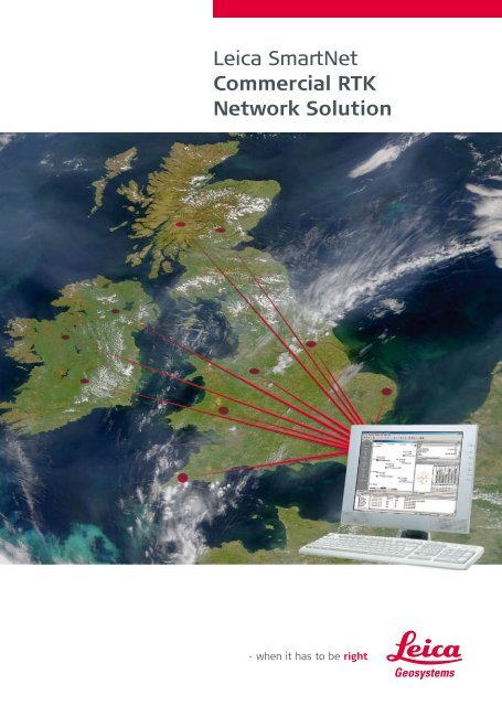
Cover satellite image courtesy of NASA<br />
SmartTrack and<br />
SmartCheck built<br />
in technologies


